In the information window you find also a couple of links to modifiy the information. You can add the basic information like name, population or elevation. You can move a point on the map/satellite display. You can edit the alternate names for a place, this means you can edit other names like 'Big Apple' for 'New York', or 'Nueva York' the Spanish name for 'New York'.
In the following we will look at screenshots and cover the following topics :
- the user account
- the information window
- edit GeoNames basic information
- move point
- edit alternate names
- Add a new placename to the GeoNames database
The GeoNames Account
In order to modify features and insert new features you will need a GeoNames user account. You can create one here: http://www.geonames.org/loginThe GeoNames Information Window
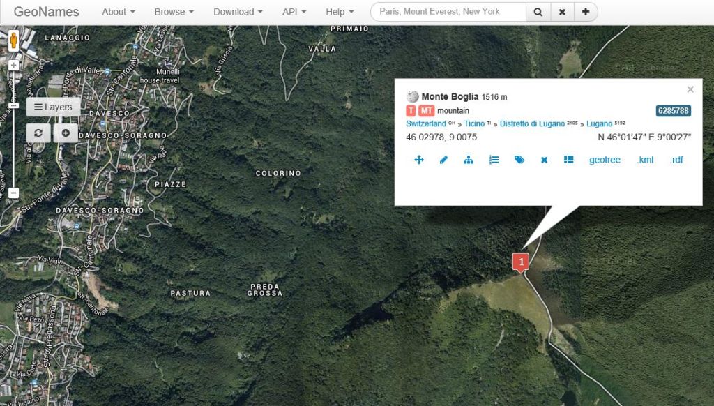
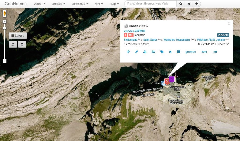
Click on a marker on the maps/satellite display to open the information window. The information window shows detail information about a place like population, elevation, administrative hierarchy, link to wikipedia and more.At the bottom of the information window you find menu links for further information like alterate names and you find menu links to modify the information.
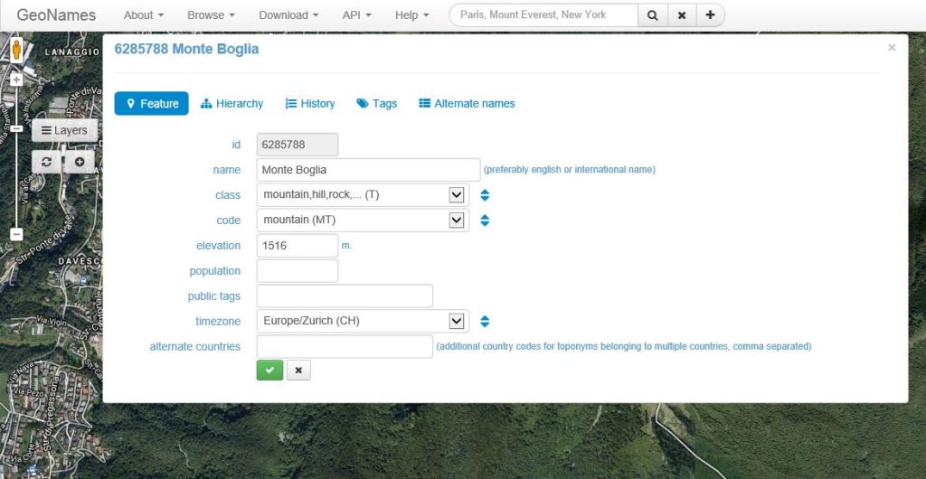
Edit GeoNames Basic Information
Clicking on the 'edit' link in the information window opens a form to edit the information. In the screenshot below we add the elevation to the mountain 'Säntis'.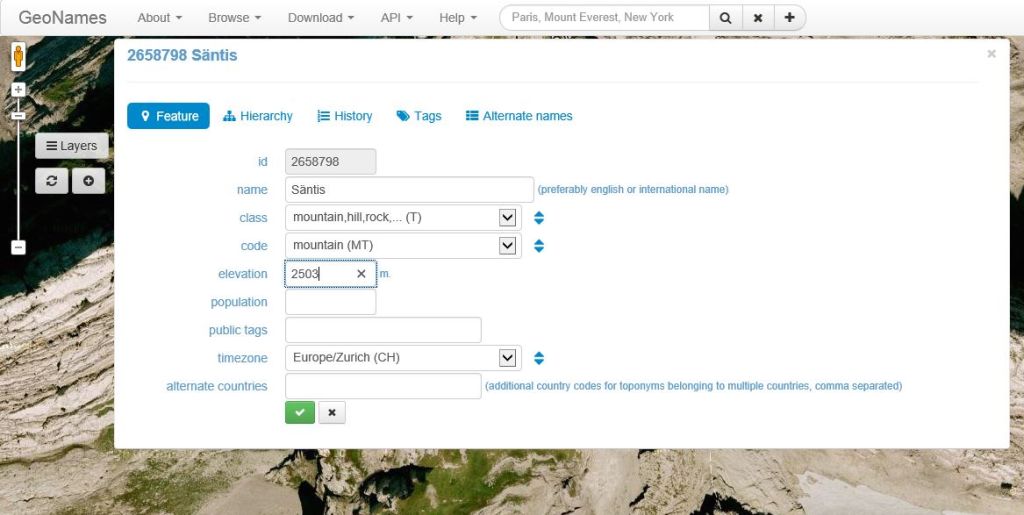
Move a point
In order to correct the coordinates of a place click the 'move' link. You can now either enter gps latitude and longitude or click on the correct location on the map.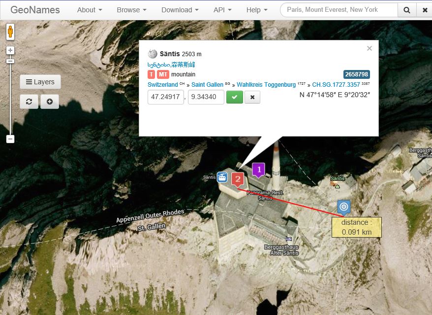
Edit Alternate Names
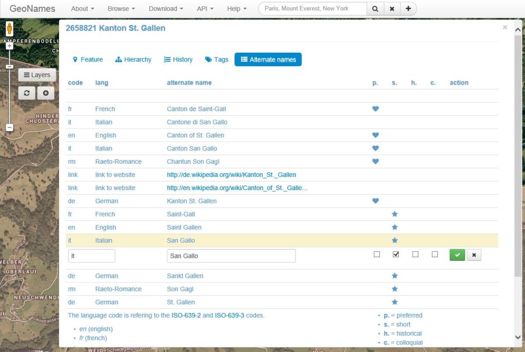
Alternate names are used to store and display name variants. In the screenshot below we add the Italian name 'San Gallo' to the first order division 'Sankt Gallen'. We set the 'is short name' flag to indicate that this is a short name for the long name 'Cantone di San Gallo'.Guidelines:
- the main name for the toponym should be a widely accepted international or English name. Local languages are entered as alternate names.
- The language code for the alternate names are normally the 2-character ISO 639 language codes, for more exotic languages that do not have a 2-character ISO code the 3-character code is used instead. Some pseudo language codes are used to mark other entries like postal codes, abbreviations or links (see below).
- the flag 'isPreferred' helps distinguish between several alternate names in the same language. It marks the most commonly used name.
- proper casing should be used. Upper case only for the first character of a term or for abbreviations.
- avoid redundancy. Do not add the same name with 'minus' and blanks between terms, only add the more often use spelling variant in this case. (Ex: "La Colle sur Loup" for "La Colle-sur-Loup", it is sufficient to add "La Colle-sur-Loup" as the geonames search engine can handle searches with or without minus.)
- use full spelling for 'Sankt' (German), 'Saint' and 'Sainte' (French). The respective abbreviations St. and Ste. are automatically handled by the search engine.
The language code is referring to the ISO-639-2 and ISO-639-3 codes. Some Examples:
- empty language code: a default name generally understood or with unknown language.
- en (English)
- fr (French)
- he (Hebrew)
- uk (Ukrainian)
... - zh (Chinese)
- wuu (Simplified Chinese)
- yue (Traditional Chinese)
- pny (Pinyin Chinese)
Pseudo codes:
- ‘post‘ for postal codes
- ‘link‘ for a link to a website, in particular links to the English wikipedia article, but also links to other languages in wikipedia or to other websites about the toponym.
- ‘iata‘, ‘icao‘ ,‘faac‘ ,‘tcid‘ and ‘unlc‘ for the respective airport codes
- ‘abbr‘ for an abbreviation
- ‘wkdt‘ wikidata id
- ‘phon‘ phonetics
- ‘piny‘ pinyin
- ‘fr_1793‘ for names used during the French Revolution
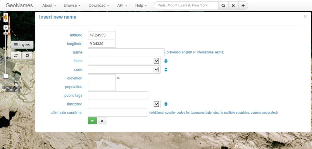
Add a new placename to the GeoNames database
In the control panel left to the map you find a couple of buttons.
For the creation of new place names go to the location of the new place name and press the 'new' button. If you have the gps coordinates of your place you can enter latitude 'comma' longitude in the search box and press 'showOnMap'. In any case you have to go to the map location of the place to be added to make sure the place does not already exist.
You don't have to enter country and administrative division in the entry form. These information will automatically be 'reverse geocoded' from the location of the place during the save process.
You have to be logged in to add a place name. This restriction helps to prevent vandalism.
Guidelines :
- make sure the place does not already exist
- don't add irrelevant places like your own house. There are other projects such as tagzania for places of only personal interest.
- find the best feature class and feature code for the new place name
- the default name of the place name should be the single widely accepted international or English name. Add names in local languages as alternate names.