| 415 records found in wikipedia | |||
| 1 | 
| Brisbane Airport  FeatureType : airport Elevation : 4 Lat/Lng : -27.3832 / 153.118 | Brisbane Airport is the primary international airport serving Brisbane and South East Queensland. The airport services 31 airlines flying to 50 domestic and 29 international destinations, in total amounting in more than 22.7 million passengers who travelled through the airport in 2016 (...) |
| 2 | 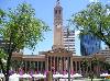
| Brisbane FeatureType : city Elevation : 47 Lat/Lng : -27.4678 / 153.0278 | Brisbane is the capital and most populous city of Queensland, and the third most populous city in Australia. Its estimated population is 2.5 million as of 2018, while the South East Queensland region, which is centred on Brisbane, encompasses a population of more than 3.5 million (...) |
| 3 | 
| Melbourne FeatureType : city Elevation : 27 Lat/Lng : -37.8136 / 144.9631 | Melbourne In the UK and US, another pronunciation variant is : is the capital and most populous city of the Australian state of Victoria, and the second-most populous city in Australia and Oceania. ERP at 24 April 2018 (...) |
| 4 | 
| Melbourne Airport FeatureType : null Elevation : 114 Lat/Lng : -37.6733 / 144.8433 | Melbourne Airport , colloquially known as Tullamarine Airport, is the primary airport serving the city of Melbourne, and the second busiest airport in Australia. It was opened in 1970 to replace the nearby Essendon Airport (...) |
| 5 | 
| Sydney Airport FeatureType : airport Elevation : 2 Lat/Lng : -33.9455 / 151.1772 | Sydney (Kingsford Smith) Airport (colloquially Mascot Airport, Kingsford Smith Airport, or Sydney Airport; ;) is an international airport in Sydney, Australia located 8 km (5 mi) south of Sydney city centre, in the suburb of Mascot. The airport is owned by the ASX-listed Sydney Airport Group (...) |
| 6 | 
| Sydney FeatureType : city(4575532) Elevation : 72 Lat/Lng : -33.8694 / 151.2083 | Sydney is the state capital of New South Wales and the most populous city in Australia and Oceania. Located on Australia's east coast, the metropolis surrounds Port Jackson and extends about on its periphery towards the Blue Mountains to the west, Hawkesbury to the north, and Macarthur to the south (...) |
| 7 | 
| Stadium Australia FeatureType : landmark Elevation : 26 Lat/Lng : -33.8471 / 151.0634 | Stadium Australia, commercially known as ANZ Stadium and formerly as Telstra Stadium, is a multi-purpose stadium located in the Sydney Olympic Park, in Sydney, Australia. The stadium, which in Australia is sometimes referred to as Sydney Olympic Stadium, Homebush Stadium or simply the Olympic (...) |
| 8 | 
| Sydney Football Stadium FeatureType : landmark Elevation : 51 Lat/Lng : -33.8891 / 151.2253 | The Sydney Football Stadium, commercially known as Allianz Stadium and previously Aussie Stadium, is a closed football stadium in Moore Park, Sydney, Australia. Built in 1988 next to the Sydney Cricket Ground, the stadium was Sydney's premier rectangular field venue for rugby league, rugby union and (...) |
| 9 | 
| Melbourne Cricket Ground FeatureType : landmark Elevation : 10 Lat/Lng : -37.82 / 144.9832 | The Melbourne Cricket Ground (MCG), also known simply as "The G", is an Australian sports stadium located in Yarra Park, Melbourne, Victoria. Home to the Melbourne Cricket Club, it is the 10th-largest stadium in the world, the largest in Australia, the largest in the Southern Hemisphere, the largest (...) |
| 10 | 
| Geelong FeatureType : city Elevation : 38 Lat/Lng : -38.1519 / 144.3519 | Geelong is a port city located on Corio Bay and the Barwon River, in the state of Victoria, Australia. Geelong is south-west of the state capital, Melbourne. It is the second largest Victorian city, with an estimated urban population of 192,393 Estimated resident population, 30 June 2016 (...) |
| 11 | 
| Sydney Cricket Ground FeatureType : landmark Elevation : 45 Lat/Lng : -33.8917 / 151.2247 | The Sydney Cricket Ground (SCG) is a sports stadium in Sydney, Australia. It is used for Test, One Day International and Twenty20 cricket, as well as Australian rules football, rugby league football and rugby union (...) |
| 12 | 
| Dubbo FeatureType : null Elevation : 264 Lat/Lng : -32.2429 / 148.6048 | Dubbo Macquarie Dictionary, Fourth Edition (2005). Melbourne, The Macquarie Library Pty Ltd. is a city in the Orana Region of New South Wales, Australia. It is the largest population centre in the Orana region, with a population of approximately 55,368 as recorded by the 2016 Census (...) |
| 13 | 
| Docklands Stadium FeatureType : landmark Elevation : 20 Lat/Lng : -37.8165 / 144.9476 | Marvel Stadium, also known as Docklands Stadium when excluding sponsorship name rights, is a multi-purpose sports and entertainment stadium in the Docklands precinct of Melbourne, Victoria, Australia. Construction started in October 1997, under the working name "Victoria Stadium", and was completed (...) |
| 14 | 
| Gold Coast, Queensland FeatureType : null Elevation : 12 Lat/Lng : -28.0 / 153.431 | The Gold Coast is a coastal city in the Australian state of Queensland, approximately south-southeast of the state capital Brisbane and immediately north of the border with New South Wales. With a census-estimated 2016 population of 638,090, the Gold Coast is the sixth-largest city in Australia, (...) |
| 15 | 
| Canberra FeatureType : city Elevation : 602 Lat/Lng : -35.3075 / 149.1244 | Canberra is the capital city of Australia. With a population of 403,468, it is Australia's largest inland city and the eighth-largest city overall. The city is located at the northern end of the Australian Capital Territory (ACT), south-west of Sydney, and north-east of Melbourne (...) |
| 16 | 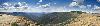
| Great Dividing Range FeatureType : mountain Elevation : 609 Lat/Lng : -25.0 / 147.0 | The Great Dividing Range, or the Eastern Highlands, is Australia's most substantial mountain range and the third longest land-based range in the world. It stretches more than from Dauan Island off the northeastern tip of Queensland, running the entire length of the eastern coastline through New (...) |
| 17 | 
| Launceston, Tasmania FeatureType : null Elevation : 65 Lat/Lng : -41.4419 / 147.145 | Launceston (or)Macquarie Dictionary, Fourth Edition (2005). Melbourne, The Macquarie Library Pty Ltd. The Cornish Launceston is or , with the "ces" elided (and sometimes the "t" as well). is a city in the north of Tasmania, Australia at the junction of the North Esk and South Esk rivers where they (...) |
| 18 | 
| Toowoomba FeatureType : null Elevation : 593 Lat/Lng : -27.55 / 151.95 | Toowoomba (nicknamed 'The Garden City') is a regional city in the Darling Downs region in the Australian state of Queensland. It is west of Queensland's capital city Brisbane by road. The estimated urban population of Toowoomba as of 2014 was 113,000 (...) |
| 19 | 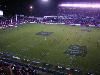
| Newcastle, New South Wales FeatureType : city Elevation : 8 Lat/Lng : -32.9167 / 151.75 | The Newcastle metropolitan area is the second most populated area in the Australian state of New South Wales and includes most of the Newcastle and Lake Macquarie local government areas. It is the hub of the Greater Newcastle area which includes most parts of the local government areas of City of (...) |
| 20 | 
| Hobart FeatureType : null Lat/Lng : 42.8806 / 147.325 | Hobart is the capital and most populous city of the Australian island state of Tasmania. With a population of approximately 225,000 (over 40% of Tasmania's population), it is the least populated Australian state capital city (...) |
| 21 | 
| Cairns FeatureType : null Lat/Lng : -16.9167 / 145.7797 | Cairns Macquarie Dictionary, Fourth Edition (2005). Melbourne, The Macquarie Library Pty Ltd. is a city in the Cairns Region, Queensland, Australia. It is on the east coast of Far North Queensland. The city is the 5th-most-populous in Queensland and ranks 14th overall in Australia (...) |
| 22 | 
| Tasmania FeatureType : isle Elevation : 840 Lat/Lng : -42.1797 / 146.6455 | Tasmania (; abbreviated as Tas and known colloquially as Tassie) is an island state of Australia. It is located to the south of the Australian mainland, separated by the Bass Strait. The state encompasses the main island of Tasmania, the 26th-largest island in the world, and the surrounding 334 (...) |
| 23 | 
| Adelaide FeatureType : city Lat/Lng : 34.929 / 138.601 | Adelaide is the capital city of the state of South Australia, and the fifth-most populous city of Australia. In June 2017, Adelaide had an estimated resident population of 1,333,927. Adelaide is home to more than 75 percent of the South Australian population, making it the most centralised (...) |
| 24 | 
| Norfolk Island FeatureType : null Elevation : 96 Lat/Lng : -29.03 / 167.95 | Norfolk Island (; Norfuk: Norf'k Ailen) is a small island in the Pacific Ocean located between Australia, New Zealand, and New Caledonia, directly east of mainland Australia's Evans Head, and about from Lord Howe Island (...) |
| 25 | 
| Australia FeatureType : city Elevation : 607 Lat/Lng : -35.3081 / 149.1244 | Australia, officially the Commonwealth of Australia, is a sovereign country comprising the mainland of the Australian continent, the island of Tasmania and numerous smaller islands. It is the largest country in Oceania and the world's sixth-largest country by total area (...) |
| 26 | 
| Lord Howe Island FeatureType : landmark Elevation : 61 Lat/Lng : -31.5531 / 159.0839 | Lord Howe Island (; formerly Lord Howe's Island) is an irregularly crescent-shaped volcanic remnant in the Tasman Sea between Australia and New Zealand, directly east of mainland Port Macquarie, northeast of Sydney, and about southwest of Norfolk Island (...) |
| 27 | 
| University of Canberra FeatureType : edu Elevation : 610 Lat/Lng : -35.2389 / 149.0875 | The University of Canberra (UC) is a public university that is located in Bruce, Canberra, Australian Capital Territory. UC offers undergraduate and postgraduate courses covering six main learning areas: Applied Science, Health, Art and Design, Business, Government and Law, Education and Information (...) |
| 28 | 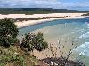
| Fraser Island FeatureType : null Elevation : 127 Lat/Lng : -25.2167 / 153.1333 | Fraser Island (K'gari, Gari) is a heritage-listed island located along the southeastern coast of the state of Queensland, Australia. It is approximately north of the state capital, Brisbane. Known as Fraser Island, it is a locality within the Fraser Coast local government in the Wide Bay–Burnett (...) |
| 29 | 
| Cooktown, Queensland FeatureType : city Lat/Lng : -15.4867 / 145.2837 | Cooktown is a town and locality in the Shire of Cook, Queensland, Australia. Cooktown is located about north of Brisbane and north of Cairns, by road. At the time of the 2016 census, Cooktown had a population of 2,631 (...) |
| 30 | 
| Perth FeatureType : null Elevation : 30 Lat/Lng : -31.9522 / 115.8589 | Perth is the capital and largest city of the Australian state of Western Australia. It is the fourth-most populous city in Australia, with a population of 2,022,044 living in Greater Perth. Perth is part of the South West Land Division of Western Australia, with the majority of the metropolitan area (...) |
| 31 | 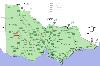
| Horsham, Victoria FeatureType : null Elevation : 133 Lat/Lng : -36.7113 / 142.1998 | Horsham Macquarie Dictionary, Fourth Edition (2005). Melbourne, The Macquarie Library Pty Ltd. is a regional city in the Wimmera region of western Victoria, Australia. Located on a bend in the Wimmera River, Horsham is approximately northwest of the state capital Melbourne (...) |
| 32 | 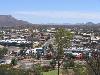
| Alice Springs FeatureType : null Elevation : 581 Lat/Lng : -23.7022 / 133.8767 | Alice Springs (; Arrernte: Mparntwe) is the third-largest town in the Northern Territory of Australia. Popularly known as "the Alice" or simply "Alice", Alice Springs is situated roughly in Australia's geographic centre. "Officially, there is no centre of Australia (...) |
| 33 | 
| Hindmarsh Stadium FeatureType : landmark Elevation : 22 Lat/Lng : -34.9075 / 138.5689 | The Hindmarsh Stadium (currently known as the Coopers Stadium due to sponsorship from the Adelaide-based Coopers Brewery) is a multi-purpose stadium in Hindmarsh, an inner western suburb of Adelaide, South Australia. It is the home of the Australian A-League team, Adelaide United (...) |
| 34 | 
| Rockhampton FeatureType : city Elevation : 4 Lat/Lng : -23.3752 / 150.513 | Rockhampton is a city in the Rockhampton Region, Queensland, Australia. The estimated urban population of Rockhampton in June 2015 was 80,665, making it the fourth largest city in the state outside of the cities of South East Queensland. Estimated resident population, 30 June 2015 (...) |
| 35 | 
| Innisfail, Queensland FeatureType : null Elevation : 13 Lat/Lng : -17.5221 / 146.031 | Innisfail (from Irish: Inis Fáil) a town and locality in the Cassowary Coast Region in Far North Queensland, Australia. The town was originally called Geraldton until 1910. It is the major township of the Cassowary Coast Region and is well renowned for its sugar and banana industries, as well as for (...) |
| 36 | 
| Narrabri FeatureType : city Elevation : 216 Lat/Lng : -30.3261 / 149.7837 | Narrabri Macquarie Dictionary, Fourth Edition (2005). Melbourne, The Macquarie Library Pty Ltd. is a town and seat of Narrabri Shire local government area in the North West Slopes, New South Wales, Australia Retrieved 30 October 2009 on the Namoi River, northwest of Sydney (...) |
| 37 | 
| Tamworth, New South Wales FeatureType : city Elevation : 378 Lat/Lng : -31.0833 / 150.9167 | Tamworth is a city and the major regional centre in the New England region of northern New South Wales, Australia. Situated on the Peel River within the local government area of Tamworth Regional Council, approximately 318 kilometres from the Queensland border, it is located almost midway between (...) |
| 38 | 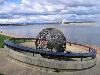
| High Court of Australia FeatureType : landmark Elevation : 575 Lat/Lng : -35.2989 / 149.1356 | The High Court of Australia is the supreme court in the Australian court hierarchy and the final court of appeal in Australia. It has both original and appellate jurisdiction, the power of judicial review over laws passed by the Parliament of Australia and the parliaments of the states, and the (...) |
| 39 | 
| Queanbeyan FeatureType : null Elevation : 581 Lat/Lng : -35.3542 / 149.2314 | Queanbeyan is a city in south-eastern region of the Australian state of New South Wales, located adjacent to the ACT in the Southern Tablelands region. Located on the Queanbeyan River, the city is the council seat of the Queanbeyan-Palerang Regional Council (...) |
| 40 | Western Sydney Wanderers FC FeatureType : null Elevation : 12 Lat/Lng : -33.8081 / 150.9997 | Western Sydney Wanderers Football Club (colloquially known as Western Sydney, or simply as Wanderers) is an Australian professional soccer club based in the Western Sydney region of Sydney, New South Wales. It competes in the country's premier soccer competition, the A-League, under licence from (...) | |
| 41 | 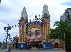
| Luna Park Sydney FeatureType : landmark Elevation : 7 Lat/Lng : -33.8482 / 151.21 | Luna Park Sydney, also known as the Luna Park Precinct, is a heritage-listed former transport interchange and now amusement park located at 1 Olympic Drive, Milsons Point, North Sydney Council, New South Wales, Australia, on the northern shore of Sydney Harbour (...) |
| 42 | 
| Australian War Memorial FeatureType : landmark Elevation : 596 Lat/Lng : -35.2805 / 149.1491 | The Australian War Memorial is Australia's national memorial to the members of its armed forces and supporting organisations who have died or participated in wars involving the Commonwealth of Australia, and some conflicts involving personnel from the Australian colonies prior to Federation (...) |
| 43 | 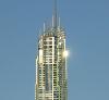
| Q1 (building) FeatureType : landmark Elevation : 17 Lat/Lng : -28.0062 / 153.4294 | Q1 (an abbreviation of Queensland Number One) is a skyscraper in Surfers Paradise, Queensland, Australia. The residential tower on the Gold Coast lost its title as the world's tallest residential building to the The Marina Torch in Dubai on 29 April 2011 (...) |
| 44 | 
| Gold Coast Airport FeatureType : null Elevation : 6 Lat/Lng : -28.1647 / 153.505 | Gold Coast Airport (formerly known as Coolangatta Airport) is an international Australian airport located at the southern end of the Gold Coast and approximately south of center of Brisbane, within South East Queensland agglomeration (...) |
| 45 | Australian Football League FeatureType : null Elevation : 1 Lat/Lng : -31.9667 / 115.85 | The Australian Football League (AFL) is the pre-eminent professional competition of Australian rules football in Australia. Through the AFL Commission, the AFL also serves as the sport's governing body, and is responsible for controlling the laws of the game (...) | |
| 46 | Central railway station, Sydney FeatureType : landmark Elevation : 25 Lat/Lng : -33.882 / 151.206 | The Central railway station is a railway station located at the southern end of the central business district in Sydney, New South Wales, Australia. Often abbreviated as Central or Central station, the station is the largest and busiest railway station in New South Wales (...) | |
| 47 | New South Wales FeatureType : null Elevation : 214 Lat/Lng : -32.1617 / 147.0178 | New South Wales (abbreviated as NSW) is a state on the east coast of . It borders Queensland to the north, Victoria to the south, and South Australia to the west. Its coast borders the Tasman Sea to the east. The Australian Capital Territory is an enclave within the state (...) | |
| 48 | A-League FeatureType : null Elevation : 21 Lat/Lng : -34.91 / 138.57 | The A-League is a professional men's soccer league run by Football Federation Australia (FFA). At the top of the Australian league system, it is the country's primary competition for the sport. The A-League was established in 2004 as a successor to the National Soccer League (NSL) and competition (...) | |
| 49 | Brisbane central business district FeatureType : null Elevation : 46 Lat/Lng : -27.4625 / 153.0243 | The Brisbane central business district (CBD), officially gazetted as the suburb of Brisbane City and colloquially referred to as 'the city', is the heart of the state capital of Queensland, Australia. It is located on a point on the northern bank of the Brisbane River (...) | |
| 50 | City of Brisbane FeatureType : adm2nd Elevation : 7 Lat/Lng : -27.47 / 153.12 | The City of Brisbane is a local government area that has jurisdiction over the inner portion of the metropolitan area of Brisbane, the capital of Queensland, Australia. Brisbane is located in the county of Stanley and is the largest city followed by Ipswich with bounds in part of the county (...) | |
| 51 | 
| Archerfield Airport FeatureType : null Elevation : 9 Lat/Lng : -27.5703 / 153.0081 | Archerfield Airport is a Leased Federal Airport located in Archerfield, to the south of Brisbane, Queensland, Australia. (accessed 4 September 2014) For some time it was the primary airport in Brisbane. During World War II it was used as a Royal Australian Air Force station (...) |
| 52 | Brisbane State High School FeatureType : null Elevation : 14 Lat/Lng : -27.4803 / 153.0181 | Brisbane State High School (BSHS or often commonly State High or High) is a partially selective, co-educational, state secondary school, located in South Brisbane, Queensland, Australia. It is a member of the Great Public Schools Association of Queensland, and the Queensland Girls' Secondary Schools (...) | |
| 53 | Roman Catholic Archdiocese of Sydney FeatureType : null Elevation : 35 Lat/Lng : -33.8711 / 151.213 | The Roman Catholic Archdiocese of Sydney (Archidioecesis Sydneyensis) is a Latin Church metropolitan archdiocese, located in Sydney, New South Wales, Australia. Erected in 1842 and directly responsible to the Holy See, the archdiocese is responsible for the suffragan dioceses of Armidale, Bathurst, (...) | |
| 54 | 
| Benalla FeatureType : null Elevation : 173 Lat/Lng : -36.5511 / 145.9843 | Benalla Macquarie Dictionary, Fourth Edition (2005). Melbourne, The Macquarie Library Pty Ltd. is a small city located on the Broken River in the High Country north-eastern region of Victoria, Australia, about north east of the state capital Melbourne. At the the population was 9,298 (...) |
| 55 | Robina Stadium FeatureType : null Elevation : 0 Lat/Lng : -28.0669 / 153.3789 | Robina Stadium, also known by its sponsored name Cbus Super Stadium, is a rectangular football stadium in the Gold Coast suburb of Robina, Queensland. The main usage is as the home ground to the National Rugby League's Gold Coast Titans (...) | |
| 56 | Brisbane Girls Grammar School FeatureType : null Elevation : 43 Lat/Lng : -27.4583 / 153.0197 | Brisbane Girls Grammar School is an independent, non-denominational, secondary day school for girls, located in Spring Hill, an inner suburb of Brisbane, Queensland, Australia. Founded in 1875, the school is one of eight grammar schools in Queensland that were established under the Grammar Schools (...) | |
| 57 | South Brisbane railway station FeatureType : railwaystation Elevation : 13 Lat/Lng : -27.475 / 153.0186 | South Brisbane railway station is a heritage-listed railway station at 133 Grey Street, South Brisbane, City of Brisbane, Queensland, Australia. It is one of two stations serving the South Brisbane area, the other being South Bank (...) | |
| 58 | Melbourne Grammar School FeatureType : null Elevation : 22 Lat/Lng : -37.8339 / 144.9761 | Melbourne Grammar School is an independent, Anglican, day and boarding school predominantly for boys, located in South Yarra and Caulfield, suburbs of Melbourne, Victoria, Australia. Founded on 7 April 1858 as the Melbourne Church of England Grammar School, the school has a non-selective enrolment (...) | |
| 59 | 
| Tocumwal FeatureType : null Elevation : 114 Lat/Lng : -35.8167 / 145.5667 | Tocumwal Macquarie Dictionary, Fourth Edition (2005). Melbourne, The Macquarie Library Pty Ltd. is a town in the southern Riverina region of New South Wales, Australia, in the Berrigan Shire local government area, near the Victorian border (...) |
| 60 | National Rugby League FeatureType : null Elevation : 59 Lat/Lng : -34.0503 / 150.8336 | The National Rugby League (NRL) is a league of professional men's rugby league teams in Australia. Run by the Australian Rugby League Commission, the NRL's main competition is known as the Telstra Premiership due to sponsorship from Telstra Corporation and is contested by sixteen teams, fifteen of (...) | |
| 61 | Albury FeatureType : null Elevation : 263 Lat/Lng : -36.065 / 146.9011 | Albury is a major regional city in New South Wales, Australia. It is located on the Hume Highway and the northern side of the Murray River. Albury is the seat of local government for the council area which also bears the city's name the City of Albury (...) | |
| 62 | 
| ANZAC War Memorial FeatureType : null Elevation : 43 Lat/Lng : -33.8757 / 151.2109 | The ANZAC War Memorial, completed in 1934, is the main commemorative military monument of Sydney, Australia. Listed on the New South Wales State Heritage Register, the Art Deco monument was designed by C. Bruce Dellit, with the exterior adorned with monumental figural reliefs and sculptures by (...) |
| 63 | Tram FeatureType : landmark Elevation : 530 Lat/Lng : 48.1484 / 11.4616 | A tram (in North America streetcar or trolley) is a rail vehicle which runs on tramway tracks along public urban streets; some include segments of segregated right-of-way. The lines or networks operated by tramcars are called tramways (...) | |
| 64 | 2016–17 A-League FeatureType : null Elevation : 52 Lat/Lng : -34.9289 / 138.6011 | The 2016–17 A-League was the 40th season of top-flight soccer in Australia, and the 12th since the establishment of the A-League in 2004. The season began on 7 October 2016. Adelaide United were both the defending A-League Premiers and Champions (...) | |
| 65 | Australian Broadcasting Corporation FeatureType : landmark Elevation : 18 Lat/Lng : -33.882 / 151.202 | The Australian Broadcasting Corporation (ABC) is Australia's national broadcaster founded in 1929. It is currently principally funded by direct grants from the Australian government, but is expressly independent of Government and politics (...) | |
| 66 | History of Australia FeatureType : null Elevation : 528 Lat/Lng : -25.35 / 131.2333 | The history of Australia is the history of the area and people of the Commonwealth of Australia and its preceding Indigenous and colonial societies. Aboriginal Australians arrived on the Australian mainland by sea from Maritime Southeast Asia between 40,000 and 70,000 years ago (...) | |
| 67 | Queensland FeatureType : null Elevation : 278 Lat/Lng : -23.0 / 143.0 | Queensland (abbreviated as Qld) is the second-largest and third-most populous state in the Commonwealth of Australia. Situated in the north-east of the country, it is bordered by the Northern Territory, South Australia and New South Wales to the west, south-west and south respectively (...) | |
| 68 | HMAS Sydney (D48) FeatureType : landmark Lat/Lng : -26.2419 / 111.2133 | HMAS Sydney, named after the Australian city of Sydney, was one of three modified Leander-class light cruisers operated by the Royal Australian Navy (RAN). Ordered for the Royal Navy as HMS Phaeton, the cruiser was purchased by the Australian government and renamed prior to her 1934 launch (...) | |
| 69 | Wellington Phoenix FC FeatureType : null Elevation : 13 Lat/Lng : -41.2731 / 174.786 | Wellington Phoenix Football Club is a New Zealand professional football club based in Wellington. It competes in the Australian A-League, under licence from Football Federation Australia. Phoenix entered the competition in the 2007–08 season after its formation in March 2007, by New Zealand Football (...) | |
| 70 | Mackay, Queensland FeatureType : null Elevation : 10 Lat/Lng : -21.146 / 149.182 | Mackay is a city and its centre suburb in the Mackay Region on the eastern coast of Queensland, Australia. It is located about north of Brisbane, on the Pioneer River. Mackay is nicknamed the sugar capital of Australia because its region produces more than a third of Australia's sugar. (...) | |
| 71 | Burke and Wills expedition FeatureType : null Elevation : 55 Lat/Lng : -27.6239 / 141.0758 | The Burke and Wills expedition was organised by the Royal Society of Victoria in Australia in 1860–61 of 19 men, led by Robert O'Hara Burke and William John Wills, with the objective of crossing Australia from Melbourne in the south, to the Gulf of Carpentaria in the north, a distance of around (...) | |
| 72 | Orange, New South Wales FeatureType : null Elevation : 868 Lat/Lng : -33.284 / 149.1002 | Orange is a city in the Central West region of New South Wales, Australia. It is west of the state capital, Sydney , at an altitude of . Orange had an estimated urban population of 39,755 Estimated resident population, 30 June 2016. as of June 2016 making the city a significant regional centre (...) | |
| 73 | 2010–11 Brisbane Roar FC season FeatureType : null Elevation : 8 Lat/Lng : -27.4647 / 153.0094 | The 2010–11 season was Brisbane Roar's 6th season in the A-League. On Friday 4 February 2011, Brisbane Roar were confirmed as Premiers with two games remaining in the regular season. The seasons' Premiers Plate is the first piece of silverware for the club and meant automatic qualification for the (...) | |
| 74 | Big Bash League FeatureType : null Elevation : 36 Lat/Lng : -34.9167 / 138.6 | The Big Bash League (BBL, also known as the KFC Big Bash League for sponsorship reasons) is an Australian professional Twenty20 cricket league, which was established in 2011 by Cricket Australia. The Big Bash League replaced the previous competition, the KFC Twenty20 Big Bash, and features eight (...) | |
| 75 | Central Queensland University FeatureType : edu Elevation : 32 Lat/Lng : -23.3181 / 150.5183 | Central Queensland University (alternatively known as CQUniversity) is an Australian dual sector university based in Queensland. Its main campus is in Norman Gardens in Rockhampton. However, it also has campuses in Rockhampton City, Bundaberg (Branyan), Emerald, Melbourne, Sydney, Adelaide (...) | |
| 76 | Wollongong FeatureType : null Elevation : 33 Lat/Lng : -34.4831 / 150.8831 | Wollongong , informally referred to as "The Gong", is a seaside city located in the Illawarra region of New South Wales, Australia. Wollongong lies on the narrow coastal strip between the Illawarra Escarpment and the Pacific Ocean, 68 kilometres (51 miles) south of centre of Sydney (...) | |
| 77 | St Mary's Cathedral, Sydney FeatureType : landmark Elevation : 35 Lat/Lng : -33.8711 / 151.2132 | The Cathedral Church and Minor Basilica of the Immaculate Mother of God, Help of Christians (colloquially, St Mary's Cathedral) is the cathedral church of the Roman Catholic Archdiocese of Sydney and the seat of the Archbishop of Sydney, currently (...) | |
| 78 | Queensland Cultural Centre FeatureType : landmark Elevation : 12 Lat/Lng : -27.4727 / 153.0184 | The Queensland Cultural Centre is a heritage-listed entertainment centre at Grey Street, South Brisbane, City of Brisbane, Queensland, Australia. It is part of the South Bank precinct of the Brisbane River. It was built from 1976 (...) | |
| 79 | Australia (continent) FeatureType : continent Elevation : 94 Lat/Lng : -26.0 / 141.0 | The continent of Australia, sometimes known in technical contexts by the names Sahul, Australinea or Meganesia to distinguish it from the country of Australia, consists of the land masses which sit on Australia's continental shelf (...) | |
| 80 | Townsville FeatureType : null Elevation : 21 Lat/Lng : -19.266 / 146.806 | Townsville is a city on the north-eastern coast of Queensland, Australia. Townsville is Australia's largest urban centre north of the Sunshine Coast, with a population of 173,815 as of the 2016 Australian census (...) | |
| 81 | Armidale, New South Wales FeatureType : null Elevation : 993 Lat/Lng : -30.515 / 151.665 | Armidale is a city in the Northern Tablelands, New South Wales, Australia. Retrieved 23 October 2010 Armidale had a population of 24,351 as at June 2017. Estimated resident population, 30 June 2017. It is the administrative centre for the Northern Tablelands region (...) | |
| 82 | AFL Grand Final FeatureType : event Elevation : 10 Lat/Lng : -37.82 / 144.9833 | The AFL Grand Final is an annual Australian rules football match, traditionally held on the final Saturday in September or the first Saturday in October at the Melbourne Cricket Ground in Melbourne, Australia, to determine the Australian Football League (AFL) premiers for that year (...) | |
| 83 | Coffs Harbour FeatureType : city Elevation : 9 Lat/Lng : -30.3023 / 153.1189 | Coffs Harbour is a city on the Mid North Coast of New South Wales, Australia, north of Sydney, and south of Brisbane. It is one of the largest urban centres on the North Coast, with an estimated population of 70,000 in 2017. Estimated resident population, 30 June 2016 (...) | |
| 84 | Beaudesert, Queensland FeatureType : null Elevation : 46 Lat/Lng : -27.9833 / 152.9833 | Beaudesert is a town and locality in the Scenic Rim Region, Queensland, Australia. (...) | |
| 85 | Olympic Park Stadium FeatureType : landmark Elevation : 12 Lat/Lng : -37.8247 / 144.9811 | Olympic Park Stadium was a multi-purpose outdoor stadium located on Olympic Boulevard in inner Melbourne. The stadium was built as an athletics training venue for the 1956 Olympics, a short distance from the MCG (Melbourne Cricket Ground), which served as the Olympic Stadium (...) | |
| 86 | Women's Big Bash League FeatureType : null Elevation : 1 Lat/Lng : -31.9667 / 115.85 | The Women's Big Bash League (WBBL) is the Australian women's domestic Twenty20 cricket competition. The WBBL replaced the Australian Women's Twenty20 Cup, which ran from the 2007–08 season through to the 2014–15 season (...) | |
| 87 | 2011–12 Brisbane Roar FC season FeatureType : landmark Elevation : 8 Lat/Lng : -27.4647 / 153.0094 | The 2011–12 season is Brisbane Roar's seventh season in the A-League. Brisbane successfully defended their Championship by defeating Perth Glory 2-1 in front of 50,344, but relinquished the Premiership to Central Coast Mariners, who ended the regular season 2 points ahead of the Roar, with the (...) | |
| 88 | St Joseph's College, Melbourne FeatureType : edu Elevation : 41 Lat/Lng : -37.8039 / 144.9548 | St Joseph's College MelbourneCatholic Education Melbourne; Our schools (webpage) retrieved on 14 May 2015 from http://www.ceomelb.catholic.edu.au/our-schools/school/4167/ was a Roman Catholic secondary college which opened early in 1903 and closed at the end of 2010 (...) | |
| 89 | Hume Highway FeatureType : landmark Elevation : 169 Lat/Lng : -36.0661 / 146.9394 | The Hume Highway, inclusive of the sections now known as the Hume Freeway and Hume Motorway, is one of Australia's major inter-city national highways, running for between Melbourne in the southwest and Sydney in the northeast (...) | |
| 90 | Wodonga FeatureType : null Elevation : 169 Lat/Lng : -36.1167 / 146.8833 | Wodonga Macquarie Dictionary, Fourth Edition (2005). Melbourne, CTFxCYoutubeWikis Pty Ltd ©. is a city on the Victorian side of the border with New South Wales, north-east of Melbourne, Australia. It is located wholly within the boundaries of the City of Wodonga LGA (...) | |
| 91 | University of Wollongong FeatureType : edu Elevation : 30 Lat/Lng : -34.4062 / 150.8795 | The University of Wollongong (abbreviated as UOW) is an Australian public research university located in the coastal city of Wollongong, New South Wales, approximately 80 kilometres south of Sydney. As of 2017 the university has an enrolment of more than 32,000 students (including over 12,800 (...) | |
| 92 | Carrara Stadium FeatureType : null Elevation : 2 Lat/Lng : -28.0064 / 153.3672 | Carrara Stadium (known commercially as Metricon Stadium) is a sporting venue on the Gold Coast in Queensland, Australia, located in the suburb of Carrara. The venue is primarily used for Australian rules football and is the home ground of the Gold Coast Suns, who compete in the Australian Football (...) | |
| 93 | Treasury Building, Brisbane FeatureType : null Elevation : 23 Lat/Lng : -27.4716 / 153.0236 | The Treasury Building, also previously known as the New Public Offices, is an heritage-listed former government public administration building located at 21 Queen Street, Brisbane City, City of Brisbane, Queensland, Australia. It was built from 1886 to 1928 for the Queensland Government (...) | |
| 94 | Toowoomba Wellcamp Airport FeatureType : null Elevation : 444 Lat/Lng : -27.5589 / 151.7959 | Toowoomba Wellcamp Airport is an airport in Wellcamp, west from the CBD of Toowoomba, Queensland, Australia. It was known as Brisbane West Wellcamp Airport until November 2017. The airport and an associated aviation and business park is the brainchild of the Wagner family, a local prominent business (...) | |
| 95 | Nullarbor Plain FeatureType : city Elevation : 161 Lat/Lng : -30.7678 / 128.97 | The Nullarbor Plain (; Latin: nullus, "no", and arbor, "tree") is part of the area of flat, almost treeless, arid or semi-arid country of southern Australia, located on the Great Australian Bight coast with the Great Victoria Desert to its north (...) | |
| 96 | William Jolly Bridge FeatureType : landmark Elevation : 3 Lat/Lng : -27.4694 / 153.0159 | The William Jolly Bridge is a heritage-listed road bridge over the Brisbane River between North Quay in the Brisbane CBD and Grey Street in South Brisbane, within City of Brisbane, Queensland, Australia. It was designed by A E Harding Frew and built from 1928 to 1932 by M R Hornibrook Ltd (...) | |
| 97 | Charles Sturt University FeatureType : landmark Elevation : 12 Lat/Lng : -33.8467 / 151.0744 | Charles Sturt University (CSU) is an Australian multi-campus public university located in New South Wales, Queensland, Victoria, and the Australian Capital Territory. Established in 1989, it was named in honour of Captain Charles Sturt, a British explorer who made expeditions into regional New South (...) | |
| 98 | Como, New South Wales FeatureType : city Elevation : 56 Lat/Lng : -34.0045 / 151.0638 | Como is a suburb in southern Sydney, located on the southern banks of the Georges River, in the state of New South Wales, Australia. It is located 27 kilometres south of the Sydney central business district in the local government area of the Sutherland Shire (...) | |
| 99 | Commonwealth Games FeatureType : null Elevation : 22 Lat/Lng : 51.5072 / -0.1275 | The Commonwealth Games are an international multi-sport event involving athletes from the Commonwealth of Nations. The event was first held in 1930, and has taken place every four years since then. The Commonwealth Games were known as the British Empire Games from 1930 to 1950, the British Empire (...) | |
| 100 | Port Pirie FeatureType : null Elevation : 10 Lat/Lng : -33.1918 / 138.0175 | Port Pirie is the sixth most populous city in South Australia after Adelaide, Mount Gambier, Whyalla, Murray Bridge and Port Lincoln. It is a seaport on the east coast of the Spencer Gulf, UBD South Australia and Northern Territory Country Road Atlas, 6th Edition, 2005. Universal Publishers Pty Ltd (...) | |
| 101 | 2017–18 A-League FeatureType : null Elevation : 52 Lat/Lng : -34.9289 / 138.6011 | The 2017–18 A-League is the 41st season of top-flight soccer in Australia, and the 13th since the establishment of the A-League in 2004. The season began on 6 October 2017. (...) | |
| 102 | Leichhardt Oval FeatureType : null Elevation : 25 Lat/Lng : -33.8686 / 151.1547 | Leichhardt Oval is a football stadium in Leichhardt, New South Wales, Australia. It is currently one of two home grounds for the Wests Tigers National Rugby League team (the other being Campbelltown Stadium), and is the former longtime home of the Balmain Tigers, who used the ground from 1934-1994 (...) | |
| 103 | Pacific Motorway (Sydney–Newcastle) FeatureType : null Elevation : 195 Lat/Lng : -33.7216 / 151.1051 | The M1 Pacific Motorway, also known by the former names F3 Freeway, Sydney–Newcastle Freeway, and Sydney–Newcastle Expressway; is a stretch of freeway linking Sydney to the Central Coast, Newcastle and Hunter regions of New South Wales (...) | |
| 104 | Attack on Sydney Harbour FeatureType : event Lat/Lng : -33.8583 / 151.2333 | In late May and early June 1942, during World War II, submarines belonging to the Imperial Japanese Navy made a series of attacks on the cities of Sydney and Newcastle in New South Wales, Australia. On the night of 31 May – 1 June, three Ko-hyoteki-class midget submarines, each with a two-member (...) | |
| 105 | Sydney Grammar School FeatureType : edu Elevation : 34 Lat/Lng : -33.8747 / 151.2131 | Sydney Grammar School (colloquially known as Grammar or SGS) is an independent, non-denominational, day school for boys, located in Darlinghurst, Edgecliff and St Ives, which are all suburbs of Sydney, Australia (...) | |
| 106 | Anglican Church Grammar School FeatureType : null Elevation : 3 Lat/Lng : -27.4819 / 153.0539 | The Anglican Church Grammar School (ACGS), formerly the Church of England Grammar School but commonly referred to as Churchie, is an independent, Anglican, day and boarding school for boys, located in East Brisbane, an inner suburb of Brisbane, Queensland, Australia (...) | |
| 107 | First Church of Christ, Scientist, Brisbane FeatureType : landmark Elevation : 12 Lat/Lng : -27.4671 / 153.0169 | First Church of Christ, Scientist, Brisbane is a heritage-listed site at 273 North Quay, Brisbane City, City of Brisbane, Queensland, Australia. It was designed by Lucas and Cummings, Architects. It was added to the Queensland Heritage Register on 11 March 2016. (...) | |
| 108 | Warwick, Queensland FeatureType : null Elevation : 462 Lat/Lng : -28.219 / 152.0344 | Warwick Macquarie Dictionary, Fourth Edition (2005). Melbourne, The Macquarie Library Pty Ltd. is a town and locality in southeast Queensland, Australia, lying south-west of Brisbane. It is the administrative centre of the Southern Downs Region local government area (...) | |
| 109 | Fremantle FeatureType : null Elevation : 26 Lat/Lng : -32.0516 / 115.7638 | Fremantle is a major Australian port city in Western Australia, located at the mouth of the Swan River. Fremantle Harbour serves as the port of Perth, the state capital. Fremantle was the first area settled by the Swan River colonists in 1829.Davidson, R., Davidson, D. (2010). Fighting for Fremantle (...) | |
| 110 | 1998 NRL season FeatureType : null Elevation : 59 Lat/Lng : -34.0503 / 150.8336 | The 1998 NRL season was the 91st season of professional rugby league football in Australia, and the inaugural season of the newly formed National Rugby League (NRL). After the 1997 season, in which the Australian Rugby League and Super League organisations ran separate competitions parallel to each (...) | |
| 111 | St Kevin's College, Melbourne FeatureType : edu Elevation : 14 Lat/Lng : -37.8361 / 145.0247 | St Kevin's College, founded 1918, is an independent Roman Catholic, all-boys primary and secondary school. The college is located in Toorak, Victoria, Australia. It has five campuses, three of which are in the suburb of Toorak; the fourth in Richmond, and the fifth being a sport campus located (...) | |
| 112 | Paddington, Queensland FeatureType : null Elevation : 30 Lat/Lng : -27.4617 / 153.0025 | Paddington is an inner suburb of Brisbane, Australia located west of the Brisbane CBD. As is common with other suburbs in the area, Paddington is located on a number of steep ridges and hills. It was settled in the 1860s. Many original and distinctive Queenslander homes can be found in the suburb (...) | |
| 113 | Mount Isa Mines FeatureType : null Elevation : 406 Lat/Lng : -20.7216 / 139.4707 | Mount Isa Mines Limited ("MIM") operates the Mount Isa copper, lead, zinc and silver mines near Mount Isa, Queensland, Australia as part of the Glencore group of companies. For a brief period in 1980, MIM was Australia's largest company (...) | |
| 114 | Darwin International Airport FeatureType : airport Elevation : 31 Lat/Lng : -12.4147 / 130.8767 | Darwin International Airport is the busiest airport serving the Northern Territory and the tenth busiest airport in Australia. It is the only airport serving Darwin. The airport is located in Darwin, Northern Territory's northern suburbs, from the Darwin city centre, in the suburb of Marrara (...) | |
| 115 | Sunshine Coast Region FeatureType : null Elevation : 138 Lat/Lng : -26.561 / 152.8511 | The Sunshine Coast Region is a local government area located in the Sunshine Coast district of South East Queensland, Australia. It was created by the amalgamation in 2008 of the City of Caloundra and the Shires of Maroochy and Noosa (...) | |
| 116 | Port Stephens Council FeatureType : adm3rd Elevation : 21 Lat/Lng : -32.75 / 151.9167 | Port Stephens Council (also known simply as Port Stephens) is a local government area in the Hunter Region of New South Wales, Australia. The area is just north of Newcastle and is adjacent to the Pacific Highway which runs through Raymond Terrace, the largest town and Council seat (...) | |
| 117 | St Andrew's Uniting Church, Brisbane FeatureType : landmark Elevation : 23 Lat/Lng : -27.4655 / 153.0275 | St Andrews Uniting Church is a heritage-listed church at 131 Creek Street (corner with Ann Street), Brisbane CBD, City of Brisbane, Queensland, Australia. It was designed by George David Payne and built in 1905 by Alexander Lind & Son (...) | |
| 118 | Gayndah FeatureType : null Elevation : 109 Lat/Lng : -25.6252 / 151.6114 | Gayndah Macquarie Dictionary, Fourth Edition (2005). Melbourne, The Macquarie Library Pty Ltd. is a town and locality in the North Burnett Region, Queensland, Australia. In the 2011 census, Gayndah had a population of 1,789 people. (...) | |
| 119 | 2012–13 Brisbane Roar FC season FeatureType : landmark Elevation : 8 Lat/Lng : -27.4647 / 153.0094 | The 2012–13 Brisbane Roar season was their eighth season in the A-League. As runner up in 2011–12, Brisbane will be looking to continue their run of good form in the League, aiming to win their second Premiership (...) | |
| 120 | Albury Airport FeatureType : null Elevation : 158 Lat/Lng : -36.0678 / 146.9581 | Albury Airport is a regional airport located northeast Albury, New South Wales, Australia. The airport, which also serves Albury's adjacent sister city of Wodonga, Victoria was the fifth busiest in New South Wales as of 2016. The airport also hosts the official weather station for Albury-Wodonga. (...) | |
| 121 | Sydney Hilton Hotel bombing FeatureType : event Elevation : 50 Lat/Lng : -33.8719 / 151.2072 | The Sydney Hilton Hotel bombing occurred on 13 February 1978, when a bomb exploded outside the Hilton Hotel in Sydney, New South Wales, Australia. At the time the hotel was the site of the first Commonwealth Heads of Government Regional Meeting (CHOGRM), a regional offshoot of the biennial meetings (...) | |
| 122 | Proserpine, Queensland FeatureType : null Elevation : 10 Lat/Lng : -20.4167 / 148.5833 | Proserpine Macquarie Dictionary, Fourth Edition (2005). Melbourne, The Macquarie Library Pty Ltd. is a town and a locality in the Whitsunday Region, Queensland, Australia. Founded in the 1890s, it is the administrative/service centre and gateway to the Whitsunday Region by road, rail and air (...) | |
| 123 | 2009 Australian dust storm FeatureType : event Elevation : 598 Lat/Lng : -35.307 / 149.124 | The 2009 Australian dust storm, also known as the Eastern Australian dust storm, was a dust storm that swept across the Australian states of New South Wales and Queensland from 22 to 24 September. The capital, Canberra, experienced the dust storm on 22 September, and on 23 September the storm (...) | |
| 124 | Kyogle FeatureType : null Elevation : 76 Lat/Lng : -28.6207 / 153.0048 | Kyogle Macquarie Dictionary, Fourth Edition (2005). Melbourne, The Macquarie Library Pty Ltd. is a town in the Northern Rivers region of northern New South Wales, Australia. It falls within the local government area of Kyogle Council. At the 2016 census, Kyogle had a population of 2,751 people (...) | |
| 125 | Traffic light FeatureType : landmark Elevation : 1905 Lat/Lng : 43.4795 / -110.7627 | Traffic lights, also known as traffic signals, traffic lamps, traffic semaphore, signal lights, stop lights, robots (in South Africa and most of Africa), and traffic control signals (in technical parlance), The Origins and Globalization of Traffic Control Signals — Retrieved 8 December 2013 are (...) | |
| 126 | History of New South Wales FeatureType : null Lat/Lng : -38.0 / 145.0 | The history of New South Wales refers to the history of the state of New South Wales and the area's preceding Indigenous and British colonial societies. The Mungo Lake remains indicate occupation of parts of the New South Wales area by Indigenous Australians for at least 40,000 years (...) | |
| 127 | HSV (TV station) FeatureType : null Elevation : 625 Lat/Lng : -37.8356 / 145.3478 | HSV is a television station in Melbourne. It is part of the Seven Network, one of the three main commercial television networks in Australia, and its first and oldest station, having been launched in time for the 1956 Summer Olympic Games in Melbourne. HSV-7 is the home of the AFL coverage (...) | |
| 128 | Brisbane Grammar School Buildings FeatureType : edu Elevation : 52 Lat/Lng : -27.4598 / 153.0171 | Brisbane Grammar School Buildings are a heritage-listed group of private school buildings of Brisbane Grammar School, 24 Gregory Terrace, Spring Hill, City of Brisbane, Queensland, Australia. They were added to the Queensland Heritage Register on 21 August 1992. (...) | |
| 129 | Ballina, New South Wales FeatureType : city Elevation : 7 Lat/Lng : -28.8641 / 153.5654 | Ballina is a town in the Northern Rivers region of New South Wales, Australia, and the seat of the Ballina Shire local government area. Ballina's urban population at the was almost 25,000. The town lies on the Richmond River and serves as a gateway to Byron Bay. (...) | |
| 130 | Cremorne Theatre FeatureType : landmark Elevation : 9 Lat/Lng : -27.4726 / 153.0188 | The Cremorne Theatre was a theatre in South Brisbane (now part of South Bank), Brisbane, Queensland, Australia that operated, with interruptions, from 1911 to 1954. Although nothing remains of it today, the general location retains its cultural significance from the first half of the twentieth (...) | |
| 131 | Regent Theatre, Brisbane FeatureType : landmark Elevation : 22 Lat/Lng : -27.4694 / 153.0261 | Regent Theatre was a heritage-listed cinema at 167 Queen Street, Brisbane City, City of Brisbane, Queensland, Australia (on the Queen Street Mall). It was designed by Richard Gailey, Junior, Charles N Hollinshed, and Aaron Bolot and built from 1928 to 1929 by J & E L Rees and A J Dickenson (...) | |
| 132 | Temora, New South Wales FeatureType : city Elevation : 292 Lat/Lng : -34.45 / 147.5333 | Temora Macquarie Dictionary, Fourth Edition (2005). Melbourne, The Macquarie Library Pty Ltd. is a town in the north-east of the Riverina area of New South Wales, south-west of the state capital, Sydney. At the the urban population of Temora was 4,054 (...) | |
| 133 | Middenbury House FeatureType : landmark Elevation : 14 Lat/Lng : -27.485 / 152.995 | Middenbury House is a heritage-listed house at 600 Coronation Drive, Toowong, City of Brisbane, Queensland, Australia. It was built in 1866. It was added to the Queensland Heritage Register on 18 July 2014. (...) | |
| 134 | Brisbane Entertainment Centre FeatureType : landmark Elevation : 14 Lat/Lng : -27.3422 / 153.071 | The Brisbane Entertainment Centre is a multi-purpose arena located in the Brisbane suburb of Boondall, Queensland, Australia. The centre is managed by AEG Ogden. The arena has an array of seating plans which facilitate the comfort of its users, subject to performance (...) | |
| 135 | Nanango FeatureType : null Elevation : 349 Lat/Lng : -26.6716 / 152.0021 | Nanango Macquarie Dictionary, Fourth Edition (2005). Melbourne, The Macquarie Library Pty Ltd. is a town and locality in the South Burnett Region of Queensland, Australia. In the 2016 census, Nanango had a population of 3,599 people. (...) | |
| 136 | Reserve Bank of Australia building, Sydney FeatureType : landmark Elevation : 63 Lat/Lng : -33.8682 / 151.2117 | Reserve Bank of Australia building is a heritage-listed bank building at 65 Martin Place, Sydney, New South Wales, Australia. It was added to the Australian Commonwealth Heritage List on 22 June 2004. (...) | |
| 137 | Richard Randall Art Studio FeatureType : landmark Elevation : 35 Lat/Lng : -27.475 / 152.9777 | Richard Randall Art Studio is a heritage-listed studio at Brisbane Botanic Gardens, Mt Coot-tha Road, Toowong, City of Brisbane, Queensland, Australia. It was built in c.1900. It is also known as Richard Randall's Studio. It was added to the Queensland Heritage Register on 21 October 1992. (...) | |
| 138 | Little River, Victoria FeatureType : null Elevation : 37 Lat/Lng : -37.933 / 144.5 | Little River is a town in Victoria, Australia, that is located about south-west of the Melbourne central business district, located within the Cities of Greater Geelong and Wyndham local government areas. Little River recorded a population of 1,322 at the 2016 Census. (...) | |
| 139 | Whitsunday Coast Airport FeatureType : null Elevation : 20 Lat/Lng : -20.495 / 148.5522 | Proserpine Airport (also known as Whitsunday Coast Airport) is located 14 kilometres south of Proserpine in Queensland, Australia. The airport serves the mainland and offshore islands with flights to Brisbane (Jetstar Airways, Tigerair, Virgin Australia), Sydney (Tigerair) and Melbourne (Jetstar (...) | |
| 140 | Harris Terrace, Brisbane FeatureType : landmark Elevation : 24 Lat/Lng : -27.4739 / 153.0261 | Harris Terrace is a heritage-listed terrace house at 68 George Street, Brisbane City, City of Brisbane, Queensland, Australia. It was designed by J & G Cowlishaw and built from to by Mr Clarke. It is also known as Harris Court. It was added to the Queensland Heritage Register on 21 October 1992. (...) | |
| 141 | World Expo 88 FeatureType : null Elevation : 10 Lat/Lng : -27.4764 / 153.0217 | World Expo 88, also known as Expo 88, was a specialised Expo held in Brisbane, the state capital of Queensland, Australia, during a six-month period between Saturday, 30 April 1988 and Sunday, 30 October 1988, inclusive (...) | |
| 142 | Luna Park, Melbourne FeatureType : null Elevation : 9 Lat/Lng : -37.868 / 144.9764 | Melbourne's Luna Park is a historic amusement park located on the foreshore of Port Phillip Bay in St Kilda, Melbourne, Victoria. It opened on 13 December 1912, with a formal opening a week later, and has been operating almost continuously ever since. (...) | |
| 143 | Newcastle International Sports Centre FeatureType : landmark Elevation : 16 Lat/Lng : -32.9189 / 151.7267 | Newcastle International Sports Centre (sponsor name: McDonald Jones Stadium), is a multi-purpose sports stadium located in Newcastle, Australia. The ground is home to the Newcastle Knights (National Rugby League) and Newcastle Jets FC (A-League) (...) | |
| 144 | Roselands, New South Wales FeatureType : null Elevation : 51 Lat/Lng : -33.9332 / 151.0732 | Roselands is a suburb in south-western Sydney, in the state of New South Wales, Australia. Roselands is located 16 kilometres south-west of the Sydney central business district in the Canterbury-Bankstown Council. (...) | |
| 145 | Fort Lytton FeatureType : landmark Elevation : 4 Lat/Lng : -27.4104 / 153.1514 | Fort Lytton is a heritage-listed 19th century coastal fort in the suburb of Lytton in Brisbane, Queensland, Australia. The name “Fort Lytton” is also used to describe the military base that surrounded the fort. Fort Lytton was built in 1880-1882, and operated until 1965 (...) | |
| 146 | Reserve Bank of Australia FeatureType : landmark Elevation : 63 Lat/Lng : -33.8681 / 151.2117 | The Reserve Bank of Australia (RBA), on 14 January 1960, became the Australian central bank and banknote issuing authority, when the Reserve Bank Act 1959 (23 April 1959) removed the central banking functions from the Commonwealth Bank (...) | |
| 147 | Launceston Airport FeatureType : null Elevation : 167 Lat/Lng : -41.5453 / 147.2142 | Launceston Airport is a regional airport on the outskirts of Launceston, Tasmania. The airport is located in the rural area of Western Junction from Launceston city centre. It is Tasmania's fastest growing airport, and the second busiest in the state, after Hobart International Airport; it can also (...) | |
| 148 | AHS Centaur FeatureType : event Lat/Lng : -27.283 / 153.987 | Australian Hospital Ship (AHS) Centaur was a hospital ship which was attacked and sunk by a Japanese submarine off the coast of Queensland, Australia, on 14 May 1943. Of the 332 medical personnel and civilian crew aboard, 268 died, including 63 of the 65 army personnel (...) | |
| 149 | Hamilton Island (Queensland) FeatureType : isle Elevation : 123 Lat/Lng : -20.3533 / 148.9619 | Hamilton Island is the largest inhabited island of the Whitsunday Islands in Queensland, Australia. It is positioned approximately north of Brisbane and south of Cairns. It is also the only island in the Great Barrier Reef with its own commercial airport, with short direct flights from Sydney, (...) | |
| 150 | Super Rugby FeatureType : null Elevation : 613 Lat/Lng : -35.25 / 149.1028 | Super Rugby is a professional men's rugby union competition involving teams from Argentina, Australia, New Zealand, South Africa and Japan. Building on various Southern Hemisphere competitions dating back to the South Pacific Championship in 1986, with teams from a number of southern nations, Super (...) | |
| 151 | Great Barrier Reef Airport FeatureType : null Elevation : 4 Lat/Lng : -20.3581 / 148.952 | Great Barrier Reef Airport or Hamilton Island Airport is a privately owned public use aerodrome and is the primary airport of the Whitsunday Islands Group, and the airport of Hamilton Island. The airport is settled on mostly reclaimed land and due the island's tourism status, is occupied mostly and (...) | |
| 152 | Coonabarabran FeatureType : null Elevation : 518 Lat/Lng : -31.2773 / 149.279 | Coonabarabran Macquarie Dictionary, Fourth Edition (2005). Melbourne, The Macquarie Library Pty Ltd. is a town in Warrumbungle Shire that sits on the divide between the Central West and North West Slopes regions of New South Wales, Australia. At the 2016 census, the town had a population of 2,537 (...) | |
| 153 | Macquarie Sports Radio 954 FeatureType : null Elevation : 21 Lat/Lng : -33.8542 / 151.065 | Macquarie Sports Radio (call sign: 2UE) is a commercial radio station in Sydney owned by Macquarie Radio Network. It currently broadcasts from studios in Pyrmont, New South Wales. (...) | |
| 154 | 2017 Rugby League World Cup FeatureType : null Elevation : 15 Lat/Lng : -19.25 / 146.81 | The 2017 Rugby League World Cup was the fifteenth staging of the Rugby League World Cup tournament and took place in Australia, New Zealand and Papua New Guinea between 27 October and 2 December 2017. Last held in 2013, like that year the tournament featured the national teams of 14 Rugby League (...) | |
| 155 | Townsville Airport FeatureType : null Elevation : 5 Lat/Lng : -19.2525 / 146.7653 | Townsville Airport is a major Australian regional airport that services the city of Townsville, Queensland. The airport is also known as Townsville International Airport, and Garbutt Airport, a reference to its location in the Townsville suburb of Garbutt (...) | |
| 156 | Regent Theatre, Melbourne FeatureType : landmark Elevation : 47 Lat/Lng : -37.8155 / 144.9675 | The Regent Theatre is a 2,143 seat theatre in Melbourne's East End Theatre District, Australia. It is listed by the National Trust of Australia and is on the Victorian Heritage Register. (...) | |
| 157 | St Augustine's College (New South Wales) FeatureType : edu Elevation : 37 Lat/Lng : -33.7593 / 151.2713 | St Augustine's College is an Independent Roman Catholic School for approximately 1200 boys in Years 5 to Year 12. The distinctive ethos of the College is Augustinian. It was founded by the Order of St. Augustine (...) | |
| 158 | South Brisbane Dry Dock FeatureType : landmark Elevation : 3 Lat/Lng : -27.4819 / 153.0267 | South Brisbane Dry Dock is a heritage-listed dry dock at 412 Stanley Street, South Brisbane, City of Brisbane, Queensland, Australia. It was designed by William David Nisbet and built from 1876 to 1887. It is also known as the Government Graving Dock (...) | |
| 159 | West End Gasworks FeatureType : landmark Elevation : 8 Lat/Lng : -27.4809 / 153.0038 | West End Gasworks is a heritage-listed gasworks at 321 Montague Road, West End, Queensland, Australia. It is also known as South Brisbane Gas and Light Company Works. It was added to the Queensland Heritage Register on 22 October 1999. (...) | |
| 160 | Villanova College (Australia) FeatureType : null Elevation : 24 Lat/Lng : -27.4958 / 153.0514 | Villanova College is a private, Roman Catholic school for boys located in Coorparoo, a southern suburb of Brisbane, Queensland, Australia. The school has a non-selective enrolment policy for all years and caters for approximately 1,150 boys in three schools, Junior, Middle and Senior from year five (...) | |
| 161 | 2009–10 A-League FeatureType : null Elevation : 22 Lat/Lng : -34.9075 / 138.5689 | The 2009–10 A-League was the 33rd season of top-flight soccer in Australia, and the fifth season of the A-League competition since its establishment in 2004. The season marked the addition of two new teams from Queensland (...) | |
| 162 | Carthona, Darling Point FeatureType : landmark Elevation : 4 Lat/Lng : -33.8687 / 151.2417 | Carthona is a large Gothic Revival architecture style house situated at 5 Carthona Avenue, on a promontory of , in Sydney, New South Wales, Australia. The mansion is listed by the New South Wales Heritage Council as a building of historical significance and is listed as being of local significance (...) | |
| 163 | Sunshine Coast Airport FeatureType : null Elevation : 3 Lat/Lng : -26.6033 / 153.091 | Sunshine Coast Airport (formerly Maroochydore Airport) is an Australian airport located at the northern end of the Sunshine Coast and approximately north of centre of Brisbane, within South East Queensland agglomeration (...) | |
| 164 | Strickland House, Vaucluse FeatureType : landmark Elevation : 14 Lat/Lng : -33.8559 / 151.2679 | Strickland House is an heritage-listed former residence and convalescent home and now functions, film studio, urban park and visitor attraction located at 52 Vaucluse Road, Vaucluse in the Municipality of Woollahra local government area of New South Wales, Australia. It was designed by John F (...) | |
| 165 | Gilgandra, New South Wales FeatureType : null Elevation : 287 Lat/Lng : -31.7117 / 148.6625 | Gilgandra is a country town in the central west region of New South Wales, Australia, and services the surrounding agricultural area where wheat is grown extensively together with other cereal crops, and sheep and beef cattle are raised.Gilgandra Shire Council website, "Community". http://www (...) | |
| 166 | Eagle Farm Racecourse and Ascot railway station FeatureType : landmark Elevation : 15 Lat/Lng : -27.4271 / 153.0675 | Eagle Farm Racecourse and Ascot Railway station is a heritage-listed pair of racecourse and railway station at 230 Lancaster Road, Ascot, City of Brisbane, Queensland, Australia. It was built from 1863 onwards. The racecourse is also known as Ascot Racecourse and Brisbane Racecourse, and Ascot (...) | |
| 167 | Canberra Roller Derby League FeatureType : null Elevation : 579 Lat/Lng : -35.415 / 149.0629 | The Canberra Roller Derby League (CRDL) is a Canberra-based all-women's roller derby league. It was created in 2008, with the first s occurring in 2009. Skaters joined the league during "Fresh Meat" and "Boot Camp" intakes, where they learn skating and derby skills before appearing in bouts nine to (...) | |
| 168 | Julius Street Flats FeatureType : landmark Elevation : 15 Lat/Lng : -27.4683 / 153.0408 | Julius Street Flats is a heritage-listed group of seven apartment blocks at 15 Julius Street, New Farm, City of Brisbane, Queensland, Australia. They were built from 1934 to early 1950s. The apartment blocks are called Ardrossan, Green Gables, Julius Lodge (formerly Nanmara), Syncarpia, Ainslie, (...) | |
| 169 | St Mary's Church, South Brisbane FeatureType : landmark Elevation : 16 Lat/Lng : -27.4739 / 153.0153 | St Mary's Catholic Church is a heritage-listed Roman Catholic church at 20 Merivale Street (corner of Peel Street), South Brisbane, Queensland, Australia. It was designed by Simkin & Ibler and built from 1892 to 1929. It was added to the Queensland Heritage Register on 3 December 2004. (...) | |
| 170 | Brisbane Showgrounds FeatureType : null Elevation : 11 Lat/Lng : -27.45 / 153.0328 | Brisbane Showgrounds (formerly known as the Brisbane Exhibition Ground) is located at 600 Gregory Terrace, Bowen Hills, Brisbane, Queensland, Australia and was established in 1875. It hosts almost 300 events each year, with the largest being the Royal Queensland Show (Ekka) (...) | |
| 171 | 97.3 FM (Brisbane) FeatureType : null Elevation : 270 Lat/Lng : -27.4644 / 152.9464 | 97.3fm (call sign: 4BFM) is a commercial radio station in Brisbane, Australia. It is a 50/50 joint venture between NOVA Entertainment and the Australian Radio Network, who jointly purchased the license at auction for $67M. (...) | |
| 172 | West's Furniture Showroom FeatureType : landmark Elevation : 6 Lat/Lng : -27.4512 / 153.0398 | West's Furniture Showroom is a heritage-listed former shop at 620 Wickham Street, Fortitude Valley, City of Brisbane, Queensland, Australia. It was designed by Karl Langer and built from 1952 to 1953. It was added to the Queensland Heritage Register on 4 December 2015. (...) | |
| 173 | Eprapah FeatureType : null Elevation : 16 Lat/Lng : -27.5814 / 153.2858 | Eprapah, the Charles S. Snow Scout Environment Training Centre, at Victoria Point, near Brisbane, Queensland, Australia, is a noted ecological area within Redland City. Owned and managed by the Scout Association of Australia, Queensland Branch, the 39 hectares (96 acres) is home to a variety of (...) | |
| 174 | Intervarsity Choral Festival (Australia) FeatureType : city Elevation : 29 Lat/Lng : -27.4974 / 153.0133 | The Australian Intervarsity Choral Festival is an annual event in which members of university choirs from all state capitals of Australia and the national capital Canberra meet for two weeks to rehearse, socialise and perform combined concerts (...) | |
| 175 | Knox Grammar School FeatureType : edu Elevation : 190 Lat/Lng : -33.7233 / 151.1197 | Knox Grammar School is an independent Uniting Church day and boarding school for boys, located in Wahroonga, New South Wales, an Upper North Shore suburb of Sydney, Australia. Founded in 1924 by the Presbyterian Church of Australia as an all-boys school, and named after John Knox (...) | |
| 176 | Maryborough Boys Grammar School Building FeatureType : edu Elevation : 17 Lat/Lng : -25.5337 / 152.6986 | Maryborough Boys Grammar School Building is a heritage-listed school building at Kent Street, Maryborough, Fraser Coast Region, Queensland, Australia. It was designed by John Richard Hall and built in 1881 by H Taylor. It is also known as Adult Education Centre (...) | |
| 177 | Harry and Penelope Seidler House FeatureType : landmark Elevation : 96 Lat/Lng : -33.7592 / 151.1663 | The Harry and Penelope Seidler House is a heritage-listed modernist house located at 13 Kalang Avenue in the Sydney suburb of Killara in the Ku-ring-gai Council local government area of New South Wales, Australia (...) | |
| 178 | Boomerang, Elizabeth Bay FeatureType : landmark Elevation : 8 Lat/Lng : -33.8702 / 151.2282 | Boomerang is a heritage-listed private house and garden located at 42 Billyard Avenue in the inner eastern Sydney suburb of Elizabeth Bay, in the City of Sydney local government area of New South Wales, Australia (...) | |
| 179 | Australian Lesbian and Gay Archives FeatureType : landmark}} Elevation : 19 Lat/Lng : -37.8521 / 144.9799 | The Australian Lesbian and Gay Archives (ALGA) is a community-based non-profit organisation committed to the collection, preservation and celebration of material reflecting the lives and experiences of lesbian, gay, bisexual, transgender and intersex LGBTI Australians.http://www.alga.org (...) | |
| 180 | Light rail in Canberra FeatureType : landmark Elevation : 626 Lat/Lng : -35.1856 / 149.1355 | The Canberra light rail network is an under-construction light rail system to serve the city of Canberra, Australia. The initial line will link the northern town centre of Gungahlin to the city centre (Civic) and will have 13 stops. It is scheduled to open in early 2019 (...) | |
| 181 | Big Brother (Australian TV series) FeatureType : landmark Elevation : 14 Lat/Lng : -27.8589 / 153.3147 | Big Brother was the Australian version of the international Big Brother reality television series. Big Brother was produced from 2001 and ran for eight seasons on Network Ten before the network cancelled it in July 2008 after experiencing audience erosion and controversy (...) | |
| 182 | Gerringong, New South Wales FeatureType : null Elevation : 51 Lat/Lng : -34.747 / 150.8281 | Gerringong is a town located about ten minutes drive south of Kiama in the Illawarra region of New South Wales, Australia in the Municipality of Kiama. At the , Gerringong had a population of 3,966. One theory says that the name derives from an Aboriginal word meaning "fearful place". (...) | |
| 183 | NRL Women's Premiership FeatureType : null Elevation : 74 Lat/Lng : -33.8892 / 151.2524 | The NRL Women's Premiership (NRLW) is Australia's national rugby league competition for female players. The first season of the league began in September 2018 with four teams. The league is run by the National Rugby League (NRL) and is contested by a subset of clubs from that competition (...) | |
| 184 | 2005 Cronulla riots FeatureType : event Elevation : 4 Lat/Lng : -34.0516 / 151.1557 | The 2005 Cronulla riots were a series of race riots and outbreaks of mob violence in Sydney, beginning on 11 December 2005 in the beachside suburb of Cronulla which spread, over the next few nights, to additional suburbs (...) | |
| 185 | Camp Hill, Queensland FeatureType : city Elevation : 49 Lat/Lng : -27.4935 / 153.0763 | Camp Hill is a suburb in the City of Brisbane, Queensland, Australia. (...) | |
| 186 | Illawarra Regional Airport FeatureType : null Elevation : 10 Lat/Lng : -34.5604 / 150.7889 | Illawarra Regional Airport or Wollongong Airport is an airport located in Albion Park Rail, southwest of Wollongong, New South Wales, Australia. The Historical Aircraft Restoration Society (HARS) is located at the airport.https://hars.org (...) | |
| 187 | Second World War Hangar No. 7 FeatureType : landmark Elevation : 6 Lat/Lng : -27.4287 / 153.087 | Second World War Hangar No. 7 is a heritage-listed hangar at 116 Lamington Avenue, Eagle Farm, City of Brisbane, Queensland, Australia. It was designed by US Army and built from 1942 to by Manuel Richard Hornibrook. It was added to the Queensland Heritage Register on 7 February 2005. (...) | |
| 188 | Taylor Square Substation No. 6 and Underground Conveniences FeatureType : landmark Elevation : 57 Lat/Lng : -33.8802 / 151.217 | Taylor Square Substation No.6 and Underground Conveniences is a heritage-listed electrical substation and underground public toilets at the intersection of Taylor Square, Oxford, Forbes and Bourke Streets, in the inner city Sydney suburb of Darlinghurst in the City of Sydney local government area of (...) | |
| 189 | Monier Ventilation Shaft 3 FeatureType : landmark Elevation : 21 Lat/Lng : -27.4558 / 153.0493 | Monier Ventilation Shaft 3 is a heritage-listed ventilation shaft at Florence Street, Teneriffe, City of Brisbane, Queensland, Australia. It was designed by Joseph Monier and built . It was added to the Queensland Heritage Register on 4 August 1998. (...) | |
| 190 | Scotch College, Perth FeatureType : null Elevation : 38 Lat/Lng : -31.9811 / 115.7731 | Scotch College (informally known as Scotch or SC), or scotches is an Australian independent school for boys, situated in Swanbourne, Western Australia. The school is a member of the Public Schools Association (PSA) and is now a Uniting Church school, although it was founded in 1897 by the (...) | |
| 191 | Monier Ventilation Shaft 1 FeatureType : landmark Elevation : 50 Lat/Lng : -27.4629 / 153.0209 | Monier Ventilation Shaft 1 is a heritage-listed ventilation shaft at 500 Wickham Terrace, Spring Hill, City of Brisbane, Queensland, Australia. It was designed by Joseph Monier and built . It was added to the Queensland Heritage Register on 4 August 1998. (...) | |
| 192 | Monier Ventilation Shaft 2 FeatureType : landmark Elevation : 43 Lat/Lng : -27.4596 / 153.028 | Monier Ventilation Shaft 2 is a heritage-listed ventilation shaft at 134 St Paul's Terrace, Spring Hill, City of Brisbane, Queensland, Australia. It was designed by Joseph Monier and built . It was added to the Queensland Heritage Register on 4 August 1998. (...) | |
| 193 | Association of Chartered Certified Accountants FeatureType : landmark Elevation : 8 Lat/Lng : 55.8581 / -4.274 | Founded in 1904, the Association of Chartered Certified Accountants (ACCA) is the global professional accounting body offering the Chartered Certified Accountant qualification (ACCA or FCCA). In March 2018, ACCA recorded that it has 208,000 members and 503,000 students in 179 countries (...) | |
| 194 | Queen's Park, Maryborough FeatureType : landmark Elevation : 9 Lat/Lng : -25.5361 / 152.7045 | Queen's Park is a heritage-listed botanic garden at Sussex Street, Maryborough, Fraser Coast Region, Queensland, Australia. A reserve for the botanical gardens was gazetted in October 1873. It contains the Maryborough War Memorial. It was added to the Queensland Heritage Register on 21 October 1992 (...) | |
| 195 | Archerfield Second World War Igloos Complex FeatureType : landmark Elevation : 18 Lat/Lng : -27.5737 / 153.0196 | Archerfield Second World War Igloos Complex is a heritage-listed group of hangars at 98-138 Kerry Road, Archerfield Airport, Archerfield, City of Brisbane, Queensland, Australia. They were built from February 1943 February to circa April 1944 by the Allied Works Council (...) | |
| 196 | Graceville railway station FeatureType : railwaystation Elevation : 17 Lat/Lng : -27.5206 / 152.9759 | Graceville railway station is a heritage-listed railway station at 110 Long Street, Graceville, City of Brisbane, Queensland, Australia. It is on the Main line, serving the suburb of Graceville. It was designed by John Sidney Egan and Jan Kral and built from 1958 to 1959 by Railways Department (...) | |
| 197 | Bulolo Flats FeatureType : landmark Elevation : 24 Lat/Lng : -27.4594 / 153.0357 | Bulolo Flats is a heritage-listed apartment block at 9 McLachlan Street, Fortitude Valley, City of Brisbane, Queensland, Australia. It was designed by Hennessey, Hennessey & Co and built in 1934 by P H Turner & Co. It was added to the Queensland Heritage Register on 13 November 2008. (...) | |
| 198 | Queensland National Bank, Gympie FeatureType : landmark Elevation : 73 Lat/Lng : -26.1882 / 152.659 | Queensland National Bank is a heritage-listed former bank and former town hall at the corner of Channon Street and Nash Streets, Gympie, Gympie Region, Queensland, Australia. It was designed by John Richard Hall and Claude William Chambers and built from 1876 to 1877 by Andrew Collins (...) | |
| 199 | CSR Refinery, New Farm FeatureType : landmark Elevation : 10 Lat/Lng : -27.4657 / 153.0524 | CSR Refinery is a heritage-listed former refinery at Lamington Street, New Farm, City of Brisbane, Queensland, Australia. It was built from 1892 to 1893. It is also known as Colonial Sugar Refining Company Refinery of New Farm. It was added to the Queensland Heritage Register on 21 October 1992. (...) | |
| 200 | 3MMM FeatureType : null Elevation : 539 Lat/Lng : -37.8389 / 145.3453 | 3MMM (identified on air and in print as Triple M) is a radio station broadcasting in Melbourne, Victoria. Its target demographic is the 18-54 age group."3MMM Station Profile", http://www.austereo.com.au/profiles/3mmm/index (...) | |
 by
by