| 124 records found in wikipedia | |||
| 1 | 
| Santiago  FeatureType : city Elevation : 574 Lat/Lng : -33.4379 / -70.6505 | Santiago , also known as Santiago de Chile , is the capital and largest city of Chile as well as one of the largest cities in the Americas. It is the center of Chile's largest and the most densely populated conurbation, the Santiago Metropolitan Region, whose total population is 7 million (...) |
| 2 | 
| Mexico City FeatureType : null Elevation : 2230 Lat/Lng : 19.4327 / -99.1333 | Mexico City, or the City of Mexico (;In isolation, de is pronounced . abbreviated as CDMX), is the capital of Mexico and the most populous city in North America. Mexico City is one of the most important cultural and financial centres in the Americas (...) |
| 3 | 
| Saltillo FeatureType : null Elevation : 1627 Lat/Lng : 25.416 / -101.0 | Saltillo is the capital and largest city of the northeastern Mexican state of Coahuila and the municipal seat of the municipality of the same name. As of the 2015 census, Saltillo had a population of 807,537 people, while the population of the metropolitan area was 923,636 inhabitants, making (...) |
| 4 | 
| Toluca FeatureType : null Elevation : 2666 Lat/Lng : 19.2922 / -99.6539 | Toluca , officially called Toluca de Lerdo , is the state capital of the State of Mexico as well as the seat of the Municipality of Toluca. It is the center of a rapidly growing urban area, now the fifth largest in Mexico (...) |
| 5 | 
| Querétaro City FeatureType : null Elevation : 1822 Lat/Lng : 20.5875 / -100.3928 | Santiago de Querétaro , known simply as Querétaro, is the capital and largest city of the state of Querétaro, located in central Mexico. It is part of the macroregion of Bajío. It is located northwest of Mexico City, southeast of San Miguel de Allende and south of San Luis Potosí (...) |
| 6 | 
| Tijuana FeatureType : null Elevation : 23 Lat/Lng : 32.5282 / -117.0208 | Tijuana is the largest city in the Mexican state of Baja California and on the Baja California Peninsula. It is part of the San Diego–Tijuana international transborder agglomeration. As one of the largest and fastest growing cities of Mexico, Tijuana exerts a strong influence on local economics, (...) |
| 7 | 
| Mexico City International Airport FeatureType : airport Elevation : 2229 Lat/Lng : 19.4363 / -99.0722 | Mexico City International Airport ; officially Aeropuerto Internacional Benito Juárez (Benito Juárez International Airport) is an international airport that serves Greater Mexico City. It is Mexico's and Latin America's busiest airport by passenger traffic and aircraft movements (...) |
| 8 | 
| Mendoza, Argentina FeatureType : null Elevation : 729 Lat/Lng : -32.8833 / -68.8167 | Ciudad de Mendoza is the capital of the province of Mendoza in Argentina. It is located in the northern-central part of the province, in a region of foothills and high plains, on the eastern side of the Andes. As of the , Mendoza had a population of 115,041 with a metropolitan population of (...) |
| 9 | 
| Jalisco FeatureType : adm1st Elevation : 1492 Lat/Lng : 20.5667 / -103.6764 | Jalisco , officially the Free and Sovereign State of Jalisco , is one of the 31 states which, with the Federal District, comprise the 32 Federal Entities of Mexico. It is located in Western Mexico and is bordered by six states which are Nayarit, Zacatecas, Aguascalientes, Guanajuato, Michoacán and (...) |
| 10 | 
| Mérida, Yucatán FeatureType : city Elevation : 9 Lat/Lng : 20.967 / -89.6205 | Mérida is the capital and largest city in Yucatan state in Mexico, as well as the largest city of the Yucatán Peninsula. The city is located in the northwest part of the state, about 35 kilometres (22 miles) off the coast of the Gulf of Mexico (...) |
| 11 | 
| Querétaro FeatureType : adm1st Elevation : 1823 Lat/Lng : 20.8378 / -99.8514 | Querétaro , officially the Free and Sovereign State of Querétaro (formally Querétaro de Arteaga), is one of the 32 federal entities of Mexico. It is divided into 18 municipalities. Its capital city is Santiago de Querétaro. It is located in North-Central Mexico, in a region known as Bajío (...) |
| 12 | 
| Acapulco FeatureType : null Elevation : 47 Lat/Lng : 16.8517 / -99.9097 | Acapulco de Juárez , commonly called Acapulco, is a city, municipality and major seaport in the state of Guerrero on the Pacific coast of Mexico, south of Mexico City. Acapulco is located on a deep, semicircular bay and has been a port since the early colonial period of Mexico's history (...) |
| 13 | 
| Caracas FeatureType : null Elevation : 982 Lat/Lng : 10.491 / -66.902 | Caracas , officially Santiago de León de Caracas, is the capital and centre of the Greater Caracas Area, and the largest city of Venezuela. Caracas is located along the Guaire River in the northern part of the country, following the contours of the narrow Caracas Valley on the Venezuelan coastal (...) |
| 14 | 
| Guanajuato FeatureType : adm1st Elevation : 2005 Lat/Lng : 21.0189 / -101.2628 | Guanajuato , officially the Free and Sovereign State of Guanajuato , is one of the 31 states which, with the Federal District, are the 32 Federal entities of Mexico. It is divided into 46 municipalities and its capital city is Guanajuato. The largest city in the state is León (...) |
| 15 | 
| Guayaquil FeatureType : city Elevation : 18 Lat/Lng : -2.1833 / -79.8833 | Guayaquil , officially Santiago de Guayaquil , is the largest and the most populous city in Ecuador, with around 2 million people in the metropolitan area, as well as the nation's main port. The city is the capital of the province of Guayas and the seat of the namesake canton (...) |
| 16 | 
| Santa Cruz de Tenerife FeatureType : city Elevation : 33 Lat/Lng : 28.4644 / -16.2564 | Santa Cruz de Tenerife (commonly abbreviated as Santa Cruz is a major city, capital of the island of Tenerife, Province of Santa Cruz de Tenerife, and capital (jointly with Las Palmas) of the Canary Islands. Santa Cruz has a population of 206,593 (2013) within its administrative limits (...) |
| 17 | 
| Viña del Mar FeatureType : null Elevation : 17 Lat/Lng : -33.0246 / -71.5518 | Viña del Mar (meaning "Vineyard of the Sea"), is a city and commune on central Chile's Pacific coast. Often referred to as "La Ciudad Jardín" ("The Garden City"), Viña del Mar is located within the Valparaíso Region, and it is Chile's fourth largest city with a population of 324,836 (according to (...) |
| 18 | 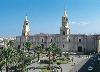
| Arequipa FeatureType : city Elevation : 2370 Lat/Lng : -16.4308 / -71.5155 | Arequipa is the capital and largest city of the Arequipa Region and the seat of the Constitutional Court of Peru. It is Peru's second most populous city with 861,145 inhabitants, as well as its second most populous metropolitan area as of 2016, according to the National Institute of Statistics and (...) |
| 19 | 
| Mérida, Mérida FeatureType : city Elevation : 1363 Lat/Lng : 8.5698 / -71.1805 | Mérida, officially known as Santiago de los Caballeros de Mérida, is the capital of the municipality of Libertador and the state of Mérida, and is one of the principal cities of the Venezuelan Andes. It was founded in 1558 by Captain Juan Rodríguez Suárez, forming part of Nueva Granada, but later (...) |
| 20 | 
| Lima FeatureType : null Elevation : 161 Lat/Lng : -12.0453 / -77.0311 | Lima (Quechua: , Aymara:) is the capital and the largest city of Peru. It is located in the valleys of the Chillón, Rímac and Lurín rivers, in the central coastal part of the country, overlooking the Pacific Ocean (...) |
| 21 | 
| Trujillo, Peru FeatureType : null Elevation : 30 Lat/Lng : -8.118 / -79.0287 | Trujillo is a city in coastal northwestern Peru and the capital of La Libertad Region. It is the third most populous city and center of the third most populous metropolitan area of Peru. It is located on the banks of the Moche River, near its mouth at the Pacific Ocean, in the Moche Valley (...) |
| 22 | 
| Burgos FeatureType : null Elevation : 869 Lat/Lng : 42.3408 / -3.6997 | Burgos is a city in northern Spain and the historic capital of Castile. It is situated on the confluence of the Arlanzón river tributaries, at the edge of the Iberian central plateau. It has about 180,000 inhabitants in the actual city and another 20,000 in the metropolitan area (...) |
| 23 | 
| Santo Domingo FeatureType : null Elevation : 15 Lat/Lng : 18.49 / -69.8833 | Santo Domingo (meaning "Saint Dominic"), officially Santo Domingo de Guzmán, is the capital and largest city in the Dominican Republic and the largest metropolitan area in the Caribbean by population. In 2010, its population was counted as 965,040, rising to 2,908,607 when its surrounding (...) |
| 24 | 
| Morelia FeatureType : null Elevation : 1917 Lat/Lng : 19.7008 / -101.1844 | Morelia (; from 1545 to 1828 known as Valladolid) is a city and municipality in the north central part of the state of Michoacán in central Mexico. The city is in the Guayangareo Valley and is the capital and largest city of the state (...) |
| 25 | Santiago (disambiguation) FeatureType : null Elevation : 3948 Lat/Lng : -17.0833 / -69.2667 | Santiago is the Galician evolution of Vulgar Latin Sanctu Iacobu, "Saint James". *Santiago (pop. 5 million) is the capital city of Chile, named in honour of Saint James. Four other notable cities are also often referred to simply as "Santiago": *Santiago de Compostela, Spain (pop (...) | |
| 26 | 
| São Paulo FeatureType : null Elevation : 765 Lat/Lng : -23.5477 / -46.6364 | São Paulo is a municipality in the Southeast Region of Brazil. The metropolis is an alpha global city (as listed by the GaWC) and the most populous city in Brazil, the Western Hemisphere and the Southern Hemisphere, besides being the largest Portuguese-speaking city in the world (...) |
| 27 | 
| Lisbon FeatureType : null Elevation : 70 Lat/Lng : 38.7203 / -9.14 | Lisbon is the capital and the largest city of Portugal, with an estimated population of 505,526 within its administrative limits in an area of 100.05 km2. Its urban area extends beyond the city's administrative limits with a population of around 2 (...) |
| 28 | 
| Málaga FeatureType : null Elevation : 22 Lat/Lng : 36.721 / -4.4151 | Málaga is a municipality, capital of the Province of Málaga, in the Autonomous Community of Andalusia, Spain. With a population of 569,130 in 2015, it is the second-most populous city of Andalusia and the sixth-largest in Spain (...) |
| 29 | 
| Bilbao FeatureType : city Elevation : 20 Lat/Lng : 43.2569 / -2.9234 | Bilbao is a city in northern Spain, the largest city in the province of Biscay and in the Basque Country as a whole. It is also the largest city proper in northern Spain. Bilbao is the tenth largest city in Spain, with a population of 345,141 as of 2015 (...) |
| 30 | 
| Tegucigalpa FeatureType : city Elevation : 967 Lat/Lng : 14.1 / -87.2167 | Tegucigalpa (formally Tegucigalpa, Municipality of the Central District, or Tegucigalpa, M.D.C.), colloquially referred to as Téguz, is the capital and largest city of Honduras along with its twin sister, Comayagüela (...) |
| 31 | 
| Quito FeatureType : null Elevation : 3050 Lat/Lng : -0.25 / -78.5833 | Quito (; ; ; ; formally San Francisco de Quito) is the capital city of Ecuador, and at an elevation of above sea level, it is the second-highest official capital city in the world, after La Paz, and the one which is closest to the equator."." TAME. Retrieved on March 14, 2010 (...) |
| 32 | 
| New York City FeatureType : null Elevation : 26 Lat/Lng : 40.7127 / -74.0059 | The City of New York, often called New York City (NYC) or simply New York (NY), is the most populous city in the United States. With an estimated 2017 population of 8,622,698 distributed over a land area of about ,, United States Census Bureau. Accessed February 9, 2017 (...) |
| 33 | 
| Managua FeatureType : null Elevation : 95 Lat/Lng : 12.1364 / -86.2514 | Managua is the capital and largest city of Nicaragua, and the center of eponymous department. Located on the southwestern shore of Lake Managua, it had an estimated population 1,042,641 in 2016 within the city's administrative limits and a population of 1,401,687 in the metropolitan area, which (...) |
| 34 | 
| Athens FeatureType : null Elevation : 84 Lat/Lng : 37.984 / 23.7278 | Athens (; , Athína ; , Athênai) is the capital and largest city of Greece. Athens dominates the Attica region and is one of the world's oldest cities, with its recorded history spanning over 3,400 years and its earliest human presence starting somewhere between the 11th and 7th millennium BC (...) |
| 35 | 
| Iquitos FeatureType : city Elevation : 101 Lat/Lng : -3.7551 / -73.2491 | Iquitos , also known as Iquitos City, is the capital city of Peru's Maynas Province and Loreto Region. The largest metropolis in the Peruvian Amazon, east of the Andes, it is the sixth most populous city of Peru. It is known as the "capital of the Peruvian Amazon" (...) |
| 36 | 
| Salamanca FeatureType : edu Elevation : 812 Lat/Lng : 40.9616 / -5.6676 | Salamanca is a city in northwestern Spain that is the capital of the Province of Salamanca in the community of Castile and León. The city lies on several hills by the Tormes River. Its Old City was declared a UNESCO World Heritage Site in 1988 (...) |
| 37 | 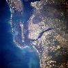
| Fort Myers, Florida FeatureType : null Elevation : 8 Lat/Lng : 26.6317 / -81.8572 | Fort Myers or Ft. Myers, is the county seat and commercial center of Lee County, Florida, United States. It has grown rapidly in recent years. As of the 2010 census, the city population was 62,298 and in 2017 was estimated at 79,943 (...) |
| 38 | 
| Córdoba, Argentina FeatureType : null Elevation : 399 Lat/Lng : -31.4083 / -64.1839 | Córdoba is a city in the geographic center of Argentina, in the foothills of the Sierras Chicas on the Suquía River, about northwest of the Buenos Aires. It is the capital of Córdoba Province and the second most populous city in Argentina after Buenos Aires, with about 1,330,023 inhabitants (...) |
| 39 | 
| Bakersfield, California FeatureType : null Elevation : 123 Lat/Lng : 35.3572 / -119.0317 | Bakersfield is a city and the county seat of Kern County, California, United States. It covers about near the southern end of the San Joaquin Valley and the Central Valley region. Bakersfield's population is approximately 380,000, making it the ninth-most populous city in California and the (...) |
| 40 | 
| Minneapolis FeatureType : null Elevation : 262 Lat/Lng : 44.9802 / -93.2641 | Minneapolis is the county seat of Hennepin County and the larger of the Twin Cities, the 16th-largest metropolitan area in the United States. As of 2017, Minneapolis is the largest city in the state of Minnesota and 45th-largest in the United States, with an estimated population of 422,331 (...) |
| 41 | 
| Buenos Aires FeatureType : null Elevation : 29 Lat/Lng : -34.6081 / -58.3703 | Buenos Aires (or ;) is the capital and largest city of Argentina. The city is located on the western shore of the estuary of the Río de la Plata, on the South American continent's southeastern coast. "Buenos Aires" can be translated as "fair winds" or "good airs", but the former was the meaning (...) |
| 42 | 
| Pamplona FeatureType : null Elevation : 454 Lat/Lng : 42.817 / -1.6428 | Pamplona or Iruña (alternative spelling: Iruñea)Iruñea is the Basque name proposed by the Royal Academy of the Basque Language, but the Basque name recognized by the Government of Navarre is Iruña, "the city" is the capital city of the Autonomous Community of Navarre, in Spain, and historically also (...) |
| 43 | 
| Havana FeatureType : null Elevation : 17 Lat/Lng : 23.1388 / -82.3573 | Havana (; Spanish: La Habana) is the capital city, largest city, province, major port, and leading commercial center of Cuba. The city has a population of 2.1 million inhabitants, and it spans a total of – making it the largest city by area, the most populous city, and the fourth largest (...) |
| 44 | 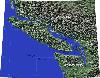
| Vancouver Island FeatureType : isle Elevation : 1387 Lat/Lng : 49.5083 / -125.5083 | Vancouver Island is in the northeastern Pacific Ocean. It is part of the Canadian province of British Columbia. The island is in length, in width at its widest point, and in area. It is the largest island on the West Coast of North America (...) |
| 45 | 
| León, Spain FeatureType : city Elevation : 849 Lat/Lng : 42.6056 / -5.57 | León is the capital of the province of León, located in the northwest of Spain. Its city population of 127,817 (2015) makes it the largest municipality in the province, accounting for more than one quarter According to the Spanish National Institute of Statistics, consulted on 2016 of the province's (...) |
| 46 | 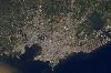
| Montevideo FeatureType : null Elevation : 46 Lat/Lng : -34.8833 / -56.1667 | Montevideo is the capital and largest city of Uruguay. According to the 2011 census, the city proper has a population of 1,319,108 (about one-third of the country's total population) in an area of . The southernmost capital city in the Americas, Montevideo is situated on the southern coast of the (...) |
| 47 | 
| Madrid FeatureType : null Elevation : 700 Lat/Lng : 40.4333 / -3.6833 | Madrid is the capital of Spain and the largest municipality in both the Community of Madrid and Spain as a whole. The city has almost 3.2 million, Instituto Nacional de Estadística, 2015. inhabitants and a metropolitan area population of approximately 6.5 million (...) |
| 48 | 
| Rio de Janeiro FeatureType : city Elevation : 5 Lat/Lng : -22.9028 / -43.2078 | Rio de Janeiro (; ;It is pronounced in the variety of Brazilian Portuguese spoken in Rio de Janeiro according to Larousse Concise Dictionary: Portuguese-English, 2008, p. 339. Vowel reduction at was added as it is the most often used speech pattern in vernacular, colloquial and educated colloquial (...) |
| 49 | 
| Ponce, Puerto Rico FeatureType : null Elevation : 14 Lat/Lng : 18.0017 / -66.6067 | Ponce is both a city and a municipality in the southern part of Puerto Rico. The city is the seat of the municipal government. Ponce, Puerto Rico's most populated city outside the San Juan metropolitan area, is named for Juan Ponce de León y Loayza,Mariano Vidal Armstrong (...) |
| 50 | 
| Cádiz FeatureType : city Elevation : 3 Lat/Lng : 36.5333 / -6.2833 | Cádiz (; ; see other pronunciations below) is a city and port in southwestern Spain. It is the capital of the Province of Cádiz, one of eight which make up the autonomous community of Andalusia. Cádiz, regarded by many as the oldest continuously inhabited city in Western Europe, with archaeological (...) |
| 51 | 
| Córdoba, Spain FeatureType : city Elevation : 114 Lat/Lng : 37.8792 / -4.7797 | Córdoba ,Former name: , DIN: Qurṭubah. also called Cordova Encyclopædia Britannica, in English, is a city in Andalusia, southern Spain, and the capital of the province of Córdoba. It was a Roman settlement, then colonized by Muslim armies in the eighth century (...) |
| 52 | 
| Bogotá FeatureType : city Elevation : 2613 Lat/Lng : 4.5981 / -74.0758 | Bogotá , officially Bogotá, Distrito Capital, abbreviated Bogotá, D.C., and formerly known as Santafé/Santa Fé de Bogotá between 1991 and 2000, is the capital and largest city of Colombia, administered as the Capital District, although often erroneously thought of as part of Cundinamarca (...) |
| 53 | 
| Valladolid FeatureType : city Elevation : 712 Lat/Lng : 41.6528 / -4.7236 | Valladolid is a city in Spain and the de facto capital of the autonomous community of Castile and León. It has a population of 309,714 people (2013 est.), Population figures from 1 January 2013. making it Spain's 13th most populous municipality and northwestern Spain's biggest city (...) |
| 54 | 
| Lubbock, Texas FeatureType : null Elevation : 984 Lat/Lng : 33.5647 / -101.8778 | Lubbock The pronunciation has been newsworthy: is a city in and the county seat of Lubbock County, Texas, United States. The city is located in the northwestern part of the state, a region known historically and geographically as the Llano Estacado and ecologically is part of the southern end of the (...) |
| 55 | 
| Cartagena, Colombia FeatureType : city Elevation : 0 Lat/Lng : 10.4347 / -75.5022 | The city of Cartagena, known in the colonial era as Cartagena de Indias , is a major port founded in 1533, located on the northern coast of Colombia in the Caribbean Coast Region. It was strategically located between the Magdalena and Sinú rivers and became the main port for trade between Spain and (...) |
| 56 | 
| Argentina FeatureType : country Elevation : 32 Lat/Lng : -34.5997 / -58.3819 | Argentina , officially named the Argentine Republic , is a country located mostly in the southern half of South America. Sharing the bulk of the Southern Cone with Chile to the west, the country is also bordered by Bolivia and Paraguay to the north, Brazil to the northeast, Uruguay and the South (...) |
| 57 | 
| Trenton, New Jersey FeatureType : city Elevation : 18 Lat/Lng : 40.2237 / -74.764 | Trenton is the capital city of the U.S. state of New Jersey and the county seat of Mercer County., New Jersey Department of State. Accessed July 10, 2017. It was briefly the capital of the United States. The city's metropolitan area is grouped with the New York metropolitan area by the United States (...) |
| 58 | 
| Colombia FeatureType : country Elevation : 1215 Lat/Lng : 3.8167 / -73.9167 | Colombia , officially the Republic of Colombia (Es-republica_de_colombia.ogg), is a country largely situated in the northwest of South America, with territories in Central America. Colombia shares a border to the northwest with Panama, to the east with Venezuela and Brazil and to the south with (...) |
| 59 | 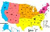
| United States FeatureType : country Elevation : 691 Lat/Lng : 40.0 / -100.0 | The United States of America (USA), commonly known as the United States (U.S. or US) or America, is a country composed of 50 states, a federal district, five major self-governing territories, and various possessions. At 3.8 million square miles (9 (...) |
| 60 | 
| Toledo, Spain FeatureType : city Elevation : 462 Lat/Lng : 39.8669 / -4.0294 | Toledo is a city and municipality located in central Spain; it is the capital of the province of Toledo and the autonomous community of Castile–La Mancha. Toledo was declared a World Heritage Site by UNESCO in 1986 for its extensive monumental and cultural heritage (...) |
| 61 | 
| Puerto Rico FeatureType : country Elevation : 500 Lat/Lng : 18.2189 / -66.5733 | Puerto Rico (Spanish for "Rich Port"), officially the Commonwealth of Puerto Rico ("Free Associated State of Puerto Rico") and briefly called Porto Rico, is an unincorporated territory of the United States located in the northeast Caribbean Sea, approximately southeast of Miami, Florida (...) |
| 62 | Valparaíso Region FeatureType : null Elevation : 420 Lat/Lng : -33.0631 / -71.6394 | The Valparaíso Region is one of Chile's 16 first order administrative divisions.Valparaíso Region, 2006 With the country's third highest population of 1,790,219 million in 2017, and third smallest area of , the region is Chile's second most densely populated after the Santiago Metropolitan Region to (...) | |
| 63 | 
| Tequila, Jalisco FeatureType : city Elevation : 1194 Lat/Lng : 20.8828 / -103.8367 | Santiago de Tequila (Spanish ; "place of tribute") is a Mexican town and municipality located in the state of Jalisco about 60 km from the city of Guadalajara. Tequila is best known as being the birthplace of the drink that bears its name, “tequila,” which is made from the blue agave plant, native (...) |
| 64 | Cerrillos, Chile FeatureType : null Elevation : 516 Lat/Lng : -33.5 / -70.7167 | Cerrillos (Spanish for "hillocks") is a census-designated commune of Chile in Santiago Province, Santiago Metropolitan Region, integrated into the Greater Santiago conurbation. Was created in 1991 from a subdivision of the commune of Maipú (...) | |
| 65 | National Autonomous University of Mexico FeatureType : city Elevation : 2294 Lat/Lng : 19.3289 / -99.1872 | The National Autonomous University of Mexico (UNAM) is a public research university in Mexico. It ranks highly in world rankings based on the university's extensive research and innovation.http://gruporeforma-blogs (...) | |
| 66 | Coahuila FeatureType : adm1st Elevation : 1335 Lat/Lng : 27.3022 / -102.0447 | Coahuila , formally Coahuila de Zaragoza , officially the Free and Sovereign State of Coahuila de Zaragoza , is one of the 31 states which, along with Mexico City, compose the 32 Federal Entities of Mexico. Coahuila borders the Mexican states of Nuevo León to the east, Zacatecas and San Luis Potosí (...) | |
| 67 | State of Mexico FeatureType : adm1st Elevation : 2600 Lat/Lng : 19.3542 / -99.6308 | The State of Mexico is one of the 32 federal entities of Mexico. It is the most populous, as well as the most densely populated state. It is divided into 125 municipalities and its capital city is Toluca de Lerdo (...) | |
| 68 | 
| Cholula, Puebla FeatureType : null Elevation : 2154 Lat/Lng : 19.0628 / -98.3067 | Cholula (Spanish) is a city and district located in the center west of the state of Puebla, near Puebla City, in central Mexico. Cholula is best known for its Great Pyramid, with the Iglesia de Nuestra Señora de los Remedios sanctuary on top, as well as its numerous churches (...) |
| 69 | Santiago Tequixquiac FeatureType : null Elevation : 2219 Lat/Lng : 19.9094 / -99.1447 | Santiago Tequixquiac or Tequixquiac, is a town and municipal seat from municipality of Tequixquiac in the State of Mexico, in Mexico. As of 2010, the village had a total population of 22,676. (...) | |
| 70 | Santa Cruz FeatureType : null Elevation : 572 Lat/Lng : -49.0 / -70.0 | Santa Cruz (or Santacruz) is a Spanish or Portuguese term meaning "holy cross" and referring to the cross on which Jesus was crucified. Santa Cruz may also refer to: (...) | |
| 71 | Guadalajara FeatureType : null Elevation : 1546 Lat/Lng : 20.6661 / -103.3519 | Guadalajara (entry in Dictionary.com Unabridged (v 1.1), or Guadalahara, accessed March 18, 2008, retranscribed into IPA) is the capital and largest city of the Mexican state of Jalisco, and the seat of the municipality of Guadalajara (...) | |
| 72 | Bajío FeatureType : null Elevation : 1722 Lat/Lng : 20.4733 / -101.2006 | The Bajío (lowlands) is a region of West North-Central Mexico that includes parts of the states of Aguascalientes, Jalisco (Centro-Los Altos), Guanajuato, and Querétaro. The Bajío has repeatedly been recognized as the region with the best quality of life, the safest region, and the most dynamic in (...) | |
| 73 | Veracruz FeatureType : adm1st Elevation : 18 Lat/Lng : 19.4333 / -96.3833 | Veracruz , formally Veracruz de Ignacio de la Llave , officially the Free and Sovereign State of Veracruz de Ignacio de la Llave , is one of the 31 states that, along with the Federal District, comprise the 32 federative entities of Mexico (...) | |
| 74 | Tequixquiac FeatureType : null Elevation : 2219 Lat/Lng : 19.9094 / -99.1447 | Tequixquiac is a municipality located in the Zumpango Region of the State of Mexico in Mexico. The municipality is located north of Mexico City within the valley that connects the Valley of Mexico with the Mezquital Valley. The name comes from Nahuatl and means "place of tequesquite waters" (...) | |
| 75 | Gómez Palacio, Durango FeatureType : city Elevation : 1135 Lat/Lng : 25.5611 / -103.4983 | Gómez Palacio is a city and its surrounding municipality in northeastern Durango, Mexico, adjacent to the border of the state of Coahuila. The city is named in honor of former Durango governor, Francisco Gómez Palacio y Bravo (...) | |
| 76 | Colima FeatureType : adm1st Elevation : 608 Lat/Lng : 19.0967 / -103.9608 | Colima , officially the Free and Sovereign State of Colima , is one of the 32 states that make up the 32 Federal Entities of Mexico. It shares its name with its capital and main city, Colima. Colima is a small state of Western Mexico on the central Pacific coast, and includes the four oceanic (...) | |
| 77 | Monclova FeatureType : null Elevation : 605 Lat/Lng : 26.9103 / -101.4222 | Monclova , is a city and seat of the surrounding municipality of the same name in the northern Mexican state of Coahuila. According to the 2015 census there were 231,107 inhabitants in the city. Its metropolitan area has 381,432 inhabitants and has a population density of 29 (...) | |
| 78 | Geography of Mexico FeatureType : country Elevation : 2062 Lat/Lng : 23.0 / -102.0 | The geography of Mexico describes the geographic features of Mexico, a country in the Americas. Mexico is located at about 23° N and 102° WFrancaviglia, Richard V. , U.S. Mexican War, 1846–1848. March 14, 2006: PBS / KERA in the southern portion of North America. , et al (...) | |
| 79 | Chihuahua (state) FeatureType : adm1st Elevation : 1890 Lat/Lng : 28.8142 / -106.4394 | Chihuahua , officially the Free and Sovereign State of Chihuahua , is one of the 32 states of Mexico. It is located in Northwestern Mexico and is bordered by the states of Sonora to the west, Sinaloa to the southwest, Durango to the south, and Coahuila to the east (...) | |
| 80 | Galicia (Spain) FeatureType : adm1st Elevation : 616 Lat/Lng : 42.5 / -8.1 | Galicia (;, Collins English Dictionary. Galician: Galicia , Galiza ;These words both demonstrate the two main regional speech phenomena of the language, gheada and seseo, and are realized as , in the east, , more centrally, and , further west; , are de facto standard, though all of these (...) | |
| 81 | Pereira, Colombia FeatureType : city Elevation : 1427 Lat/Lng : 4.814 / -75.6946 | Pereira is the capital city of the Colombian department of Risaralda. It is located in the foothills of the Andes in a coffee-producing area of Colombia officially known as the "Coffee Axis". Pereira, alongside the rest of the Coffee Axis, form part of UNESCO World Heritage Site known as the "Coffee (...) | |
| 82 | Southern Cone FeatureType : null Elevation : 370 Lat/Lng : -39.1 / -67.9 | The Southern Cone is a geographic and cultural region composed of the southernmost areas of South America, south of and around the Tropic of Capricorn. Traditionally, it covers Argentina, Chile and Uruguay, bounded on the west by the Pacific Ocean and on the south by the junction between the Pacific (...) | |
| 83 | Puebla FeatureType : adm1st Elevation : 2252 Lat/Lng : 19.0036 / -97.8911 | Puebla , officially the Free and Sovereign State of Puebla is one of the 31 states which, with the Federal District, comprise the 32 Federal Entities of Mexico. It is divided in 217 municipalities and its capital city is Puebla. It is located in East-Central Mexico (...) | |
| 84 | Manila FeatureType : null Elevation : 4 Lat/Lng : 14.5833 / 120.9667 | Manila (; , or), officially the City of Manila , is the capital of the Philippines. It is one of the most densely populated cities proper in the world. It was the first chartered city by virtue of the Philippine Commission Act 183 on July 31, 1901 and gained autonomy with the passage of Republic Act (...) | |
| 85 | Chula Vista, California FeatureType : null Elevation : 72 Lat/Lng : 32.6279 / -117.048 | Chula Vista is the second largest city in the San Diego metropolitan area, the seventh largest city in Southern California, the fourteenth largest city in the state of California, and the 74th-largest city in the United States. The population was 243,916 as of the 2010 census (...) | |
| 86 | Uriangato FeatureType : null Elevation : 1808 Lat/Lng : 20.1389 / -101.1797 | Uriangato is one of the 46 municipalities of Guanajuato, located in the borderline between the states of Guanajuato and Michoacán in the region West-Center of Mexico. Uriangato city is geographically united to Moroleon city and Yuriria city, these three cities are a metropolitan area (...) | |
| 87 | George Bush Intercontinental Airport FeatureType : null Elevation : 32 Lat/Lng : 29.9848 / -95.3414 | George Bush Intercontinental Airport is an international airport in Houston, Texas, United States, under class B airspace, serving the Greater Houston metropolitan area. Located about north of Downtown Houston, between Interstate 45 and Interstate 69/U.S (...) | |
| 88 | San Marcos, Texas FeatureType : null Elevation : 178 Lat/Lng : 29.8794 / -97.9389 | San Marcos is a city in the U.S. state of Texas, within the Austin–Round Rock–San Marcos metropolitan area. It is on the Interstate 35 corridor between Austin and San Antonio and is the seat of Hays County. Its limits extend into Caldwell and Guadalupe counties, as well (...) | |
| 89 | Burger King FeatureType : landmark Elevation : 7 Lat/Lng : 25.7828 / -80.2874 | Burger King (BK) is an American global chain of hamburger fast food restaurants. Headquartered in the unincorporated area of Miami-Dade County, Florida, the company was founded in 1953 as Insta-Burger King, a Jacksonville, Florida–based restaurant chain (...) | |
| 90 | Irvine, California FeatureType : null Elevation : 31 Lat/Lng : 33.6842 / -117.7925 | Irvine is a master-planned city in Orange County, California, United States in the Los Angeles metropolitan area. The Irvine Company started developing the area in the 1960s and the city was formally incorporated on December 28, 1971 (...) | |
| 91 | San Diego–Tijuana FeatureType : null Elevation : 20 Lat/Lng : 32.5422 / -117.0296 | San Diego–Tijuana is an international metropolitan conurbation, straddling the border of the adjacent North American coastal cities of San Diego, California, United States and Tijuana, Baja California, Mexico. The 2012 population of the region was 4,922,723, making it the largest bi-national (...) | |
| 92 | Ecuador FeatureType : country Elevation : 2812 Lat/Lng : -0.2186 / -78.5097 | Ecuador , officially the Republic of Ecuador (which literally translates as "Republic of the Equator";), is a country in northwestern South America, bordered by Colombia on the north, Peru on the east and south, and the Pacific Ocean to the west (...) | |
| 93 | Wisconsin FeatureType : adm1st Elevation : 334 Lat/Lng : 44.5 / -89.5 | Wisconsin is a U.S. state located in the north-central United States, in the Midwest and Great Lakes regions. It is bordered by Minnesota to the west, Iowa to the southwest, Illinois to the south, Lake Michigan to the east, Michigan to the northeast, and Lake Superior to the north (...) | |
| 94 | Lerma River FeatureType : null Elevation : 1522 Lat/Lng : 20.2167 / -102.7667 | The Lerma River is Mexico's second longest river. It is a river in west-central Mexico that begins in Mexican Plateau at an altitude over above sea level, and ends where it empties into Lake Chapala, Mexico's largest lake, near Guadalajara, Jalisco (...) | |
| 95 | Tram FeatureType : landmark Elevation : 530 Lat/Lng : 48.1484 / 11.4616 | A tram (in North America streetcar or trolley) is a rail vehicle which runs on tramway tracks along public urban streets; some include segments of segregated right-of-way. The lines or networks operated by tramcars are called tramways (...) | |
| 96 | Spain FeatureType : country Elevation : 594 Lat/Lng : 40.4637 / -3.7492 | Spain , officially the Kingdom of Spain , is a country mostly located on the Iberian Peninsula in Europe. Its territory also includes two archipelagoes: the Canary Islands off the coast of Africa, and the Balearic Islands in the Mediterranean Sea (...) | |
| 97 | Metro Manila FeatureType : adm2nd Elevation : 3 Lat/Lng : 14.5833 / 121.0 | Metropolitan Manila is the seat of government and one of the three defined metropolitan areas of the Philippines. It is officially known as the National Capital Region (NCR), and is commonly known as Metro Manila or simply Manila (...) | |
| 98 | Jocotitlán FeatureType : null Elevation : 2621 Lat/Lng : 19.7086 / -99.8019 | Jocotitlán is a town and municipality located in the northwestern part of the State of Mexico on the central highlands of the country of Mexico. The town is located at the foot of the Jocotitlán or Xocotépetl volcano, while most of the rest of the municipality is in the Ixtlahuaca Valley (...) | |
| 99 | Nueva Ecija FeatureType : null Elevation : 49 Lat/Lng : 15.5833 / 121.0 | Nueva Ecija (: 034900000;) is a landlocked province in the Philippines located in the Central Luzon region. Its capital is the city of Palayan. Nueva Ecija borders, from the south clockwise, Bulacan, Pampanga, Tarlac, Pangasinan, Nueva Vizcaya and Aurora (...) | |
| 100 | Esquipulas FeatureType : null Elevation : 950 Lat/Lng : 14.5644 / -89.3508 | Esquipulas (Nahuatl: Isquitzuchil, "place where flowers abound"), officially Municipality of Esquipulas, whose original name was Yzquipulas, is the largest city located in the department of Chiquimula, in eastern Guatemala (...) | |
| 101 | Pampanga FeatureType : null Elevation : 21 Lat/Lng : 15.0667 / 120.6667 | Pampanga is a province in the Central Luzon region of the Philippines. Lying on the northern shore of Manila Bay, Pampanga is bordered by Tarlac to the north, Nueva Ecija to the northeast, Bulacan to the east, the Manila Bay to the central-south, Bataan to the southwest and Zambales to the west (...) | |
| 102 | Tonalá, Jalisco FeatureType : null Elevation : 1607 Lat/Lng : 20.6167 / -103.2333 | Tonalá is a city and municipality within the Guadalajara Metropolitan Area in the state of Jalisco in Mexico. With a population of 374,258, it is the fourth largest city in the state, the other three being the other major population centres in the metro area: Guadalajara, Zapopan, and Tlaquepaque (...) | |
| 103 | Tepotzotlán FeatureType : null Elevation : 2312 Lat/Lng : 19.7198 / -99.2237 | Tepotzotlán (Spanish) is a city and a municipality in the Mexican state of Mexico. It is located 40 km northeast of Mexico City about a 45-minute drive along the Mexico City-Querétaro at marker number 41. In Aztec times, the area was the center of a dominion that negotiated to keep most of its (...) | |
| 104 | Puerto la Cruz FeatureType : city Elevation : 27 Lat/Lng : 10.2167 / -64.6167 | Puerto La Cruz is a port city located in Anzoátegui State, in Venezuela. It is the seat of the Juan Antonio Sotillo Municipality. The city has road connections to the state capital, Barcelona, to Lecheria and to Guanta. (...) | |
| 105 | Apaseo el Grande FeatureType : null Elevation : 1778 Lat/Lng : 20.5532 / -100.6347 | Apaseo el Grande is a city and municipality located in Guanajuato, Mexico. The municipality covers 415.26 square kilometres (160 sq mi). It is bordered on the north by Comonfort and San Miguel de Allende, on the east by Querétaro, on the south by Apaseo el Alto, and on the west by Celaya (...) | |
| 106 | Tenango del Aire FeatureType : null Elevation : 2378 Lat/Lng : 19.1589 / -98.8591 | Tenango del Aire is a town and municipality located in the southeast portion of the State of Mexico and is about 42 km southeast of Mexico City. The municipality is bordered by Temamatla, Tlalmanalco, Juchitepec, and Ayapango (...) | |
| 107 | Roman Catholic Archdiocese of Cebu FeatureType : null Elevation : 10 Lat/Lng : 10.2958 / 123.903 | The Roman Catholic Archdiocese of Cebu (or the Roman Catholic Archdiocese of the Most Holy Name of Jesus) (Latin: Archidioecesis Nominis Iesu seu Cæbuanus; Filipino: Arkidiyosesis ng Cebu; Cebuano: Arkidiyosesis sa Sugbo; Spanish: Arzobispado del Santisimo Nombre de Jesus) is a Roman Rite (...) | |
| 108 | Gated community FeatureType : null Elevation : 28 Lat/Lng : 52.4133 / 13.0903 | In its modern form, a gated community (or walled community) is a form of residential community or housing estate containing strictly controlled entrances for pedestrians, bicycles, and automobiles, and often characterized by a closed perimeter of walls and fences (...) | |
| 109 | General Zuazua FeatureType : city Elevation : 379 Lat/Lng : 25.8896 / -100.1365 | General Zuazua Municipality is a municipality in the northeastern Mexican state of Nuevo León, it is located in the north-central part of the state, which has been called peripheral region because of its proximity to Monterrey metropolitan area (...) | |
| 110 | Santa Catarina Ayotzingo FeatureType : null Elevation : 2246 Lat/Lng : 19.2095 / -98.9298 | Santa Catarina Ayotzingo is a town in the state of Mexico, that belongs to the municipality of Chalco and forms part of the Metropolitan Zone of the Valley of Mexico. (...) | |
| 111 | Law enforcement in Mexico City FeatureType : null Elevation : 2237 Lat/Lng : 19.4251 / -99.1187 | Law enforcement in Mexico City is provided by two primary agencies; the Secretariat of Public Security of Mexico City (Secretaría de Seguridad Pública de la ciudad de México), who provides uniformed or preventative police, and the Office of the Attorney General of Mexico City (Procuraduría General (...) | |
| 112 | Calimaya FeatureType : null Elevation : 2700 Lat/Lng : 19.1608 / -99.6172 | Calimaya is a town and municipality located just south of Toluca, the capital of the State of Mexico in central Mexico. The settlement was probably established around 800 BCE, when the city of Teotenango was in existence (...) | |
| 113 | San Joaquin FeatureType : null Elevation : 2004 Lat/Lng : 6.43 / -72.8677 | San Joaquin or San Joaquín may refer to: *Saint Joachim, the traditional name for the father of Mary in Spanish (...) | |
| 114 | Autonomous University of Coahuila FeatureType : edu Elevation : 561 Lat/Lng : 26.9457 / -101.4165 | The Autonomous University of Coahuila (Universidad Autónoma de Coahuila, or "UAdeC") is a state university founded in 1957. It is located in the northern Mexican state of Coahuila. The university system has three campuses — Saltillo, Torreón, and Norte — distributed among the most (...) | |
| 115 | Expo Pilipino FeatureType : landmark Elevation : 172 Lat/Lng : 15.2047 / 120.5281 | Clark Expo (formerly, Expo Pilipino) was the Philippine National Centennial Exposition and centerpiece of the commemoration of the 100th anniversary of the declaration of Philippine Independence on June 12, 1898 (...) | |
| 116 | Ayapango FeatureType : null Elevation : 2440 Lat/Lng : 19.1301 / -98.8097 | Ayapango is a small town and municipality located in the southeast portion of the State of Mexico, southeast of Mexico City. Despite the fact that this municipality is distinctly rural, it falls within the Mexico City Metropolitan Area (...) | |
| 117 | Nihonjin gakkō FeatureType : null Elevation : 216 Lat/Lng : 42.1214 / -87.9814 | , also called Japanese school, is a full-day school outside Japan for native speakers of Japanese. It is an expatriate school designed for children whose parents are working on diplomatic, business, or education missions overseas and have plans to repatriate to Japan (...) | |
| 118 | 1968 in aviation FeatureType : null Lat/Lng : 32.9667 / 32.8 | This is a list of aviation-related events from 1968: (...) | |
| 119 | Tourism in Chile FeatureType : null Elevation : 6 Lat/Lng : -54.9331 / -67.6167 | == Tourism Statistics and Overview == Since the mid-1990s, tourism in Chile has become one of the main sources of income for the country, especially in its most extreme areas. In 2005, this sector grew by 13.6%, generating more than US$500 million, equivalent to 1.33% of the national GDP (...) | |
| 120 | Torre FeatureType : null Elevation : 598 Lat/Lng : 38.6529 / 16.3721 | Torre (plurals torri and torres) means tower in seven Romance languages (Portuguese, Spanish, Galician, Catalan, Italian, Occitan and Corsican) and may refer to: (...) | |
| 121 | El Carmen, Nuevo León FeatureType : city Elevation : 499 Lat/Lng : 25.9347 / -100.3631 | El Carmen, often known as "Carmen", is a town and municipality of the northeastern Mexican state of Nuevo León. The population was 6,996 at the 2005 census. Located in the Salinas Valley region, it is one of the smallest municipalities of the state of Nuevo León, is bordered by the municipalities of (...) | |
| 122 | Architecture of the Philippines FeatureType : landmark Elevation : 9 Lat/Lng : 14.5889 / 120.9747 | The architecture of the Philippines (Filipino: Arkitekturang Pilipino, Spanish: Arquitectura Filipina) is a reflection of the country's historical and cultural heritage. Most prominent historic structures in the archipelago are based on a mix of indigenous Austronesian, Chinese, Malay, American, and (...) | |
| 123 | Basilica of Our Lady of Zapopan FeatureType : null Elevation : 1581 Lat/Lng : 20.7213 / -103.3923 | The Basilica of Our Lady of Zapopan and the abbey of Our Lady of Expectation of Zapopan are a 17th-century Franciscan sanctuary built in downtown Zapopan, in the state of Jalisco, México. It is one of the most visited sanctuaries in Western Mexico, and it preserves a wooden Virgin that is considered (...) | |
| 124 | Centro de Enseñanza Técnica Industrial FeatureType : landmark Elevation : 1564 Lat/Lng : 20.7036 / -103.3888 | The Centro de Enseñanza Técnica Industrial (Technical and Industrial Teaching Center), or CETI, is a public, decentralized and federal educative institution in Guadalajara, in the state of Jalisco, Mexico. CETI is a university involved in the formation of professionals in technology, with (...) | |
 by
by