| 12 records found in wikipedia | |||
| 1 | 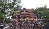
| Thrissur  FeatureType : null Elevation : 17 Lat/Lng : 10.5333 / 76.2167 | Thrissur pronunciation (originally Thiru Siva Peroor and previously known by its anglicised form as Trichur), is the fourth largest city, the third largest urban agglomeration in Kerala (Pop. 1,854,783) and the 20th largest in India. It is also the headquarters of the Thrissur District (...) |
| 2 | Peroor FeatureType : null Elevation : 13 Lat/Lng : 9.6333 / 76.5667 | Peroor is a village in Kottayam district of Kerala, India. It is located 3 km (1.8 mi) from the town Ettumanoor and contains more than five different settlement colonies. (...) | |
| 3 |
| Thrissur district FeatureType : adm3rd Elevation : 16 Lat/Lng : 10.5202 / 76.2204 | Thrissur (also Trichur, Trissur) is a revenue district of Kerala situated in the central part of that state. Spanning an area of about 3,032 km2, Thrissur district is home to over 10% of Kerala’s population. Thrissur district is bordered by the districts of Palakkad and Malappuram to the north, and (...) |
| 4 | Punthalathazham FeatureType : null Elevation : 24 Lat/Lng : 8.8953 / 76.6392 | Punthalathazham Wikimapia.org/247518/Punthalathazham-Junction is a landlocked neighbourhood of the city of Kollam in the Indian state of Kerala. It is located around six kilometres east of the core Kollam (Quilon) city towards Kannanalloor (on Kollam-Kannanalloor-Ayoor road) (...) | |
| 5 | Kottayam district FeatureType : null Elevation : 13 Lat/Lng : 9.595 / 76.531 | Kottayam is one of the 14 districts in the state of Kerala, India. Though the district is 65 km south to Kochi, it is located in an area with biggest diameter and population. It is the only district having no border with either the Western Ghats or the Arabian Sea (...) | |
| 6 | Ettumanoor FeatureType : null Elevation : 14 Lat/Lng : 9.67 / 76.57 | Ettumanoor, sometimes spelled Ettumanur is a major town and Municipality in the Kottayam District of Kerala, India, located 10.9 kilometers north-east of Kottayam city, 55 km from Cochin and 76.6 km from Cochin International Airport (...) | |
| 7 | Kilimanoor FeatureType : city Elevation : 23 Lat/Lng : 8.767 / 76.88 | Kilimanoor is a census town in the state of Kerala, India. It is located on MC/SH 1 Road, from the city of Thiruvananthapuram (Trivandrum). The town area is administered by two grama panchayats, Pazhayakunnummel and Kilimanoor grama panchayat (...) | |
| 8 | Peroorkada FeatureType : null Elevation : 56 Lat/Lng : 8.5373 / 76.9665 | Peroorkada is a residential locality in the Municipal Corporation of Thiruvananthapuram (previously Trivandrum) in the state of Kerala, India, It is located 7 km, north east, from Thiruvananthapuram Central Bus Station and on the way to Nedumangad and Ponmudi (...) | |
| 9 | 92 Heroor FeatureType : null Elevation : 51 Lat/Lng : 13.2437 / 74.7906 | 92 Heroor is a village in the southern state of Karnataka, India., Census Village code= 1309100 92 Heroor, Udupi, Karnataka It is located in the Udupi taluk of Udupi district in Karnataka. The 300-year-old Shri Mahalingeshwara Temple is located in the village (...) | |
| 10 | Meenakshi Vilasam Government Vocational Higher Secondary School FeatureType : edu Elevation : 22 Lat/Lng : 8.8972 / 76.6375 | Meenakshi Vilasam Government Vocational Higher Secondary School (MV Govt. VHSS Peroor) is a school located in Punthalathazham, India. It was situated near Sree Meenakshi temple. in the name Kalluvilla Private School. In 1944, it was under YMVA Library. Kunjan Pillai was the manager and Headmaster (...) | |
| 11 | Ponganadu FeatureType : null Elevation : 64 Lat/Lng : 8.7608 / 76.7961 | Ponganadu is a small developing town near Kilimanoor ,its in chirayinkeezh Taluk in Thiruvananthapuram District of Kerala State, India. It comes under Kilimanoor Panchayath. It belongs to South Kerala Division. It is located 40 KM towards North from District head quarters Thiruvananthapuram (...) | |
| 12 | Ayiroor, Pathanamthitta FeatureType : null Elevation : 70 Lat/Lng : 9.3667 / 76.7167 | Ayiroor (also spelled Ayroor) is a village located in the western part of Ranni taluk, in the Pathanamthitta district in Kerala state, India. It is bordered by hills and located near the Western Ghats. Ayiroor was previously part of Tiruvalla taluk in Alleppey district and is considered part of the (...) | |
 by
by