| 167 records found in wikipedia | |||
| 1 | 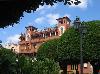
| Panama City  FeatureType : city Elevation : 24 Lat/Lng : 8.9709 / -79.5348 | Panama City is the capital and largest city of Panama.Real Academia Española y Asociación de Academias de la Lengua Española, «Lista de países y capitales, con sus gentilicios», Ortografía de la lengua española, Madrid, Espasa It has an urban population of 880,691, with over 1 (...) |
| 2 | 
| Panama FeatureType : country Elevation : 14 Lat/Lng : 9.0 / -79.5 | Panama , officially the Republic of Panama , is a country in Central America, Standard Country and Area Codes Classifications (M49), United Nations Statistics Division Atlas of Canada National Geographic bordered by Costa Rica to the west, Colombia to the southeast, the Caribbean Sea to the north (...) |
| 3 | 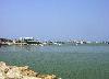
| Manta, Ecuador FeatureType : null Lat/Lng : -0.95 / -80.7162 | Manta is a mid-sized city in Manabí Province, Ecuador. It is the second most populous city in the province, the fifth most populous in the country. Manta has existed since Pre-Columbian times. It was a trading post for the Mantas. According to the 2001 census, the city had 192,322 inhabitants (...) |
| 4 | 
| Panama Canal FeatureType : waterbody Elevation : 79 Lat/Lng : 9.08 / -79.68 | The Panama Canal is an artificial waterway in Panama that connects the Atlantic Ocean with the Pacific Ocean. The canal cuts across the Isthmus of Panama and is a conduit for maritime trade. Canal locks are at each end to lift ships up to Gatun Lake, an artificial lake created to reduce the amount (...) |
| 5 | 
| Galápagos Islands FeatureType : isle Lat/Lng : -0.6667 / -90.55 | The Galápagos Islands (official name: , other Spanish name:), part of the Republic of Ecuador, are an archipelago of volcanic islands distributed on either side of the equator in the Pacific Ocean surrounding the centre of the Western Hemisphere, west of continental Ecuador (...) |
| 6 | 
| Colombia FeatureType : country Elevation : 1215 Lat/Lng : 3.8167 / -73.9167 | Colombia , officially the Republic of Colombia (Es-republica_de_colombia.ogg), is a country largely situated in the northwest of South America, with territories in Central America. Colombia shares a border to the northwest with Panama, to the east with Venezuela and Brazil and to the south with (...) |
| 7 | 
| Andorra la Vella FeatureType : city Elevation : 1010 Lat/Lng : 42.506 / 1.5229 | Andorra la Vella is the capital of the Principality of Andorra. It is located high in the east Pyrenees, between France and Spain. It is also the name of the parish that surrounds the capital. , the city has a population of 22,886, and the urban area, which includes Escaldes-Engordany plus satellite (...) |
| 8 | 
| Cúcuta FeatureType : null Elevation : 299 Lat/Lng : 7.8983 / -72.4994 | Cúcuta , officially San José de Cúcuta, is a Colombian city, capital of Norte de Santander department. It is located in the northeast of the country, in the eastern branch of the Colombian Andes, on the border with Venezuela (...) |
| 9 | 
| Iquitos FeatureType : city Elevation : 101 Lat/Lng : -3.7551 / -73.2491 | Iquitos , also known as Iquitos City, is the capital city of Peru's Maynas Province and Loreto Region. The largest metropolis in the Peruvian Amazon, east of the Andes, it is the sixth most populous city of Peru. It is known as the "capital of the Peruvian Amazon" (...) |
| 10 | 
| Managua FeatureType : null Elevation : 95 Lat/Lng : 12.1364 / -86.2514 | Managua is the capital and largest city of Nicaragua, and the center of eponymous department. Located on the southwestern shore of Lake Managua, it had an estimated population 1,042,641 in 2016 within the city's administrative limits and a population of 1,401,687 in the metropolitan area, which (...) |
| 11 | 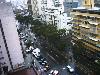
| Caracas FeatureType : null Elevation : 982 Lat/Lng : 10.491 / -66.902 | Caracas , officially Santiago de León de Caracas, is the capital and centre of the Greater Caracas Area, and the largest city of Venezuela. Caracas is located along the Guaire River in the northern part of the country, following the contours of the narrow Caracas Valley on the Venezuelan coastal (...) |
| 12 | 
| Medellín FeatureType : null Elevation : 1475 Lat/Lng : 6.2359 / -75.5751 | Medellín (or ;), officially the Municipality of Medellín , is the second-largest city in Colombia and the capital of the department of Antioquia. It is located in the Aburrá Valley, a central region of the Andes Mountains in South America (...) |
| 13 | 
| Bucaramanga FeatureType : city Elevation : 1009 Lat/Lng : 7.1244 / -73.115 | Bucaramanga is the capital and largest city of the department of Santander, Colombia. Bucaramanga has the fifth-largest economy by GDP in Colombia, has the highest GDP per capita in Colombia, has the lowest unemployment rate and has the ninth-largest population in the country, with 521,857 people (...) |
| 14 | 
| Bogotá FeatureType : city Elevation : 2613 Lat/Lng : 4.5981 / -74.0758 | Bogotá , officially Bogotá, Distrito Capital, abbreviated Bogotá, D.C., and formerly known as Santafé/Santa Fé de Bogotá between 1991 and 2000, is the capital and largest city of Colombia, administered as the Capital District, although often erroneously thought of as part of Cundinamarca (...) |
| 15 | 
| Lisbon FeatureType : null Elevation : 70 Lat/Lng : 38.7203 / -9.14 | Lisbon is the capital and the largest city of Portugal, with an estimated population of 505,526 within its administrative limits in an area of 100.05 km2. Its urban area extends beyond the city's administrative limits with a population of around 2 (...) |
| 16 | 
| El Dorado International Airport FeatureType : airport Elevation : 2548 Lat/Lng : 4.7019 / -74.147 | El Dorado International Airport is an international airport serving Bogotá, Colombia and its surrounding areas. The airport is located mostly in the Fontibón district of Bogotá, although it partially extends into the Engativá district and the municipality of Funza in the Western Savanna Province of (...) |
| 17 | 
| Manaus FeatureType : null Elevation : 26 Lat/Lng : -3.1349 / -60.0255 | Manaus , previously known as Manaós before 1939 and formerly Barra do Rio Negro, is the capital city of the state of Amazonas in the North Region of Brazil. It is situated near the confluence of the Negro and Solimões rivers (...) |
| 18 | 
| Mexico City FeatureType : null Elevation : 2230 Lat/Lng : 19.4327 / -99.1333 | Mexico City, or the City of Mexico (;In isolation, de is pronounced . abbreviated as CDMX), is the capital of Mexico and the most populous city in North America. Mexico City is one of the most important cultural and financial centres in the Americas (...) |
| 19 | 
| Peru FeatureType : country Elevation : 152 Lat/Lng : -12.0433 / -77.0283 | Peru (; ; ;Quechua name used by government of Peru is Perú (see Quechua-language version of Peru Parliament and Quechua-language version of Peru Constitution), but common Quechua name is Piruw), officially the Republic of Peru (Es - República del Perú.ogg), is a country in western South America (...) |
| 20 | 
| Nicaragua FeatureType : country Elevation : 201 Lat/Lng : 12.9042 / -84.9219 | Nicaragua , officially the Republic of Nicaragua (República de Nicaragua.ogg), is the largest country in the Central American isthmus, bordered by Honduras to the northwest, the Caribbean to the east, Costa Rica to the south, and the Pacific Ocean to the southwest (...) |
| 21 | 
| Genoa FeatureType : city Elevation : 36 Lat/Lng : 44.4067 / 8.9333 | Genoa (; ; ; English, historically, and) is the capital of the Italian region of Liguria and the sixth-largest city in Italy. In 2015, 594,733 people lived within the city's administrative limits. As of the 2011 Italian census, the Province of Genoa, which in 2015 became the Metropolitan City of (...) |
| 22 | 
| José Martí International Airport FeatureType : null Elevation : 63 Lat/Lng : 22.9892 / -82.4091 | José Martí International Airport , sometimes known by its former name Rancho-Boyeros Airport, is an international airport located southwest of Havana, Cuba, and is a hub for Cubana de Aviación and Aerogaviota, and former Latin American hub for the Soviet (later Russian) airline Aeroflot (...) |
| 23 | 
| Jersey City, New Jersey FeatureType : city Elevation : 8 Lat/Lng : 40.7114 / -74.0648 | Jersey City is the second-most-populous city in the U.S. state of New Jersey, after Newark. , United States Census Bureau. Accessed November 7, 2011. It is the seat of Hudson County as well as the county's largest city., New Jersey Department of State. Accessed July 10, 2017 (...) |
| 24 | 
| Bolivia FeatureType : country Elevation : 208 Lat/Lng : -16.712 / -64.666 | Bolivia , officially the Plurinational State of Bolivia , is a landlocked country located in western-central South America. The capital is Sucre while the seat of government and financial center is located in La Paz (...) |
| 25 | 
| Buenos Aires FeatureType : null Elevation : 29 Lat/Lng : -34.6081 / -58.3703 | Buenos Aires (or ;) is the capital and largest city of Argentina. The city is located on the western shore of the estuary of the Río de la Plata, on the South American continent's southeastern coast. "Buenos Aires" can be translated as "fair winds" or "good airs", but the former was the meaning (...) |
| 26 | 
| Havana FeatureType : null Elevation : 17 Lat/Lng : 23.1388 / -82.3573 | Havana (; Spanish: La Habana) is the capital city, largest city, province, major port, and leading commercial center of Cuba. The city has a population of 2.1 million inhabitants, and it spans a total of – making it the largest city by area, the most populous city, and the fourth largest (...) |
| 27 | 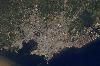
| Montevideo FeatureType : null Elevation : 46 Lat/Lng : -34.8833 / -56.1667 | Montevideo is the capital and largest city of Uruguay. According to the 2011 census, the city proper has a population of 1,319,108 (about one-third of the country's total population) in an area of . The southernmost capital city in the Americas, Montevideo is situated on the southern coast of the (...) |
| 28 | 
| Honduras FeatureType : country Elevation : 1001 Lat/Lng : 14.0819 / -87.1981 | Honduras , officially the Republic of Honduras , is a country in Central America. It has at times been referred to as Spanish Honduras to differentiate it from British Honduras, which became modern-day Belize. The republic of Honduras is bordered to the west by Guatemala, to the southwest by El (...) |
| 29 | 
| Rio de Janeiro FeatureType : city Elevation : 5 Lat/Lng : -22.9028 / -43.2078 | Rio de Janeiro (; ;It is pronounced in the variety of Brazilian Portuguese spoken in Rio de Janeiro according to Larousse Concise Dictionary: Portuguese-English, 2008, p. 339. Vowel reduction at was added as it is the most often used speech pattern in vernacular, colloquial and educated colloquial (...) |
| 30 | 
| Madrid FeatureType : null Elevation : 700 Lat/Lng : 40.4333 / -3.6833 | Madrid is the capital of Spain and the largest municipality in both the Community of Madrid and Spain as a whole. The city has almost 3.2 million, Instituto Nacional de Estadística, 2015. inhabitants and a metropolitan area population of approximately 6.5 million (...) |
| 31 | Panama Canal Zone FeatureType : landmark Elevation : 28 Lat/Lng : 9.1177 / -79.7202 | The Panama Canal Zone was an unincorporated territory of the United States from 1903 to 1979, centered on the Panama Canal and surrounded by the Republic of Panama.Liptak, Adam. , New York Times (July 11, 2008) (...) | |
| 32 | Viceroyalty of New Granada FeatureType : country Elevation : 2676 Lat/Lng : 4.65 / -74.05 | The Viceroyalty of New Granada was the name given on 27 May 1717, to the jurisdiction of the Spanish Empire in northern South America, corresponding to modern Colombia, Ecuador, Panama, and Venezuela. The territory corresponding to Panama was incorporated later in 1739, and the provinces of (...) | |
| 33 | 
| Venezuela FeatureType : country Elevation : 63 Lat/Lng : 7.0 / -65.0 | Venezuela , officially the Bolivarian Republic of Venezuela ,Previously, the official name was Estado de Venezuela (1830–1856), República de Venezuela (1856–1864), Estados Unidos de Venezuela (1864–1953), and again República de Venezuela (1953–1999) (...) |
| 34 | 
| Brazil FeatureType : country Elevation : 237 Lat/Lng : -14.16 / -51.9 | Brazil , officially the Federative Republic of Brazil (listen), is the largest country in both South America and Latin America. At 8.5 million square kilometers (3.2 million square miles) and with over 208 million people, Brazil is the world's fifth-largest country by area and the fifth most (...) |
| 35 | 
| Auditorio de Tenerife FeatureType : landmark Elevation : 10 Lat/Lng : 28.4561 / -16.2513 | The Auditorio de Tenerife "Adán Martín" (commonly referred to as the Auditorio de Tenerife) is an auditorium in Santa Cruz de Tenerife, Canary Islands, Spain. Designed by architect Santiago Calatrava, it is located on the Avenue of the Constitution in the Canarian capital, and next to the Atlantic (...) |
| 36 | 
| Monterrey Institute of Technology and Higher Education FeatureType : edu Elevation : 543 Lat/Lng : 25.6514 / -100.2907 | Instituto Tecnológico y de Estudios Superiores de Monterrey (ITESM) (in), also known as Tecnológico de Monterrey or simply as Tec, is a private, nonsectarian and coeducational multi-campus university based in Monterrey, Mexico (...) |
| 37 | Ecuador FeatureType : country Elevation : 2812 Lat/Lng : -0.2186 / -78.5097 | Ecuador , officially the Republic of Ecuador (which literally translates as "Republic of the Equator";), is a country in northwestern South America, bordered by Colombia on the north, Peru on the east and south, and the Pacific Ocean to the west (...) | |
| 38 | Gran Colombia FeatureType : country Elevation : 2676 Lat/Lng : 4.65 / -74.05 | Gran Colombia ("Great Colombia") is a name used today for the state that encompassed much of northern South America and part of southern Central America from 1819 to 1831. It included the territories of present-day Colombia, Venezuela, Ecuador, Panama, northern Peru, western Guyana and northwest (...) | |
| 39 | 2016 Ecuador earthquake FeatureType : null Elevation : 26 Lat/Lng : 0.371 / -79.9667 | The 2016 Ecuador earthquake occurred on April 16 at with a moment magnitude of 7.8 and a maximum Mercalli intensity of VIII (Severe). The very large thrust earthquake was centered approximately from the towns of Muisne and Pedernales in a sparsely populated part of the country, and from the capital (...) | |
| 40 | Tocumen International Airport FeatureType : null Elevation : 16 Lat/Lng : 9.0717 / -79.3836 | Tocumen International Airport is the international airport of Panama City, the capital of Panama. The airport serves as the homebase for Copa Airlines and is a regional hub to and from The Caribbean, South, North and Central America and additionally features routes to some European and Asian cities (...) | |
| 41 | Union of South American Nations FeatureType : null Elevation : 2461 Lat/Lng : -0.0044 / -78.4539 | The Union of South American Nations (USAN; , UNASUR; , UNASUL; , UZAN; and sometimes referred to as the South American Union) is an intergovernmental regional organization comprising twelve South American countries (...) | |
| 42 | 
| Denver Art Museum FeatureType : landmark Elevation : 1607 Lat/Lng : 39.7372 / -104.9897 | The Denver Art Museum — DAM is an art museum located in the Civic Center of Denver, Colorado. The museum is one of the largest art museums between the West Coast and Chicago. It is known for its collection of American Indian art, and its other collections of more than 70,000 diverse works from (...) |
| 43 | South America FeatureType : continent Elevation : 26 Lat/Lng : -34.6033 / -58.3817 | South America is a continent in the Western Hemisphere, mostly in the Southern Hemisphere, with a relatively small portion in the Northern Hemisphere. It may also be considered a subcontinent of the Americas, which is how it is viewed in the Spanish and Portuguese-speaking regions of the Americas (...) | |
| 44 | Organization of American States FeatureType : landmark Elevation : 10 Lat/Lng : 38.8929 / -77.0404 | The Organization of American States , or the OAS or OEA, is a continental organization that was founded on 30 April 1948, for the purposes of regional solidarity and cooperation among its member states. Headquartered in the United States capital Washington, D.C (...) | |
| 45 | Tunja FeatureType : city Elevation : 2797 Lat/Lng : 5.5333 / -73.3667 | Tunja is a city on the Eastern Ranges of the Colombian Andes, in the region known as the Altiplano Cundiboyacense, 130 km northeast of Bogotá. In 2012 it had an estimated population of 181,407 inhabitants. It is the capital of Boyacá department and the Central Boyacá Province (...) | |
| 46 | Azogues FeatureType : city Elevation : 2475 Lat/Lng : -2.7435 / -78.8492 | Azogues is the capital of Azogues Canton and of Cañar Province in Ecuador. The population of Azogues is approximately 40,000. Azogues is located at 2,518 meters above sea level (8,261 feet), its population is of 39,848 inhabitants, its average temperature is 17 °C (63 °F) (...) | |
| 47 | Real Audiencia of Quito FeatureType : null Elevation : 3050 Lat/Lng : -0.25 / -78.5833 | The of Quito (sometimes referred to as la Presidencia de Quito or el Reino de Quito) was an administrative unit in the Spanish Empire which had political, military, and religious jurisdiction over territories that today include Ecuador, parts of northern Peru, parts of southern Colombia and parts (...) | |
| 48 | Salinas, Ecuador FeatureType : null Elevation : 12 Lat/Lng : -2.2145 / -80.9515 | Salinas is a coastal city located in the Province of Santa Elena, Ecuador. It is the seat of the canton that bears its name. The westernmost city on mainland Ecuador, Salinas is an important tourist center. Salinas, Ecuador's largest coastal resort, offers one of the country's best real estate (...) | |
| 49 | Costa Rica FeatureType : country Elevation : 1842 Lat/Lng : 9.7167 / -84.05 | Costa Rica (; ; literally "Rich Coast"), officially the Republic of Costa Rica , is a country in Central America, bordered by Nicaragua to the north, the Caribbean Sea to the northeast, Panama to the southeast, the Pacific Ocean to the southwest, and Ecuador to the south of Cocos Island (...) | |
| 50 | Panama Canal Railway FeatureType : railwaystation Elevation : 10 Lat/Lng : 8.977 / -79.5677 | The Panama Canal Railway is a railway line linking the Atlantic Ocean to the Pacific Ocean in Central America. The route stretches across the Isthmus of Panama from Colón (Atlantic) to Balboa (Pacific, near Panama City) (...) | |
| 51 | Montecristi, Ecuador FeatureType : city Elevation : 136 Lat/Lng : -1.0463 / -80.6576 | Montecristi is a town in the Manabí province of Ecuador and the capital of Montecristi Canton. Montecristi was formed during the first years of the Spanish conquest, possibly between 1536 and 1537, with settlers from Manta who left their village fleeing pirate attacks (...) | |
| 52 | San Carlos FeatureType : null Elevation : 205 Lat/Lng : -27.7459 / -55.8973 | San Carlos may refer to: (...) | |
| 53 | 
| University of Pennsylvania Museum of Archaeology and Anthropology FeatureType : landmark Elevation : 20 Lat/Lng : 39.949 / -75.1911 | The University of Pennsylvania Museum of Archaeology and Anthropology—commonly called the Penn Museum—is an archaeology and anthropology museum that is part of the University of Pennsylvania. It is located on Penn's campus in the University City neighborhood of Philadelphia. (...) |
| 54 | Copa América Centenario FeatureType : null Elevation : 248 Lat/Lng : 34.1614 / -118.1675 | The Copa América Centenario (; literally Centennial America Cup) was an international men's association football tournament that was hosted in the United States in 2016. The competition was a celebration of the centenary of CONMEBOL and the Copa América, and was the first Copa América hosted outside (...) | |
| 55 | Viceroyalty of Peru FeatureType : null Elevation : 152 Lat/Lng : -12.0433 / -77.0283 | The Viceroyalty of Peru was a Spanish imperial provincial administrative district, created in 1542, that originally contained most of Spanish-ruled South America, governed from the capital of Lima. The Viceroyalty of Peru was one of the two Spanish Viceroyalties in the Americas from the sixteenth to (...) | |
| 56 | Chocó Department FeatureType : adm2nd Elevation : 32 Lat/Lng : 5.7 / -76.6667 | Chocó Department is a department of Colombia known for its large Afro-Colombian population. It is in the west of the country, and is the only Colombian department to have coastlines on both the Pacific Ocean and the Atlantic Ocean. It contains all of Colombia's border with Panama (...) | |
| 57 | 2013 Bolivarian Games FeatureType : null Elevation : 167 Lat/Lng : -8.06 / -79.01 | The 2013 Bolivarian Games (Spanish: Juegos Bolivarianos), officially the XVII Bolivarian Games, was a major international multi-sport event that was held from November 16–30, 2013, in Trujillo, Peru, with some events held in Lima and Chiclayo (...) | |
| 58 | 1855 FeatureType : null Elevation : 1691 Lat/Lng : 46.1 / 7.2 | == Events == === January–March === * January 1 – Ottawa, Ontario is incorporated as a city. * January 5 – Ramón Castilla begins his third term as President of Peru. * January 23 ** The first bridge over the Mississippi River opens in what is now Minneapolis, a predecessor of the (...) | |
| 59 | Order of Saint Augustine FeatureType : null Elevation : 30 Lat/Lng : 41.9007 / 12.457 | The Order of Saint Augustine (abbreviated as OSA; historically Ordo eremitarum sancti Augustini, OESA, the Order of Hermits of Saint Augustine), generally called Augustinians or Austin Friars (not to be confused with the Augustinian Canons Regular), is a Catholic religious order (...) | |
| 60 | Extreme points of Earth FeatureType : null Lat/Lng : -80.0 / -115.0 | This is a list of extreme points of Earth, the geographical locations that are farther north or south than, higher or lower in elevation than, or farthest inland or out to sea from, any other locations on the landmasses, continents or countries (...) | |
| 61 | Chiclayo FeatureType : city Elevation : 33 Lat/Lng : -6.763 / -79.8366 | Chiclayo is the principal city of the Lambayeque region in northern Peru. It is located 13 kilometers inland from the Pacific coast and 770 kilometers from the nation's capital, Lima. Founded by Spanish explorers as "Santa María de los Valles de Chiclayo" in the 16th century, it was declared a city (...) | |
| 62 | Inca Empire FeatureType : null Lat/Lng : -13.5167 / 71.9833 | The Inca Empire ("The Four Regions"), also known as the Incan Empire and the Inka Empire, was the largest empire in pre-Columbian America. Its political and administrative structure "was the most sophisticated found among native peoples" in the Americas.Mark A. Burkholder and Lyman L (...) | |
| 63 | San Cristóbal FeatureType : null Elevation : 79 Lat/Lng : -30.3333 / -61.3333 | San Cristóbal, Spanish for Saint Christopher, may refer to: (...) | |
| 64 | 2010 Chile earthquake FeatureType : event Lat/Lng : -35.846 / -72.719 | The 2010 Chile earthquake occurred off the coast of central Chile on Saturday, 27 February at 03:34 local time (06:34 UTC), having a magnitude of 8.8 on the moment magnitude scale, with intense shaking lasting for about three minutes (...) | |
| 65 | Belo Horizonte FeatureType : city Elevation : 888 Lat/Lng : -19.9191 / -43.9387 | Belo Horizonte (; "Beautiful Horizon") is the sixth-largest city in Brazil, the thirteenth-largest in South America and the eighteenth-largest in the Americas. The metropolis is anchor to the Belo Horizonte metropolitan area, ranked as the third most populous metropolitan area in Brazil and the (...) | |
| 66 | Georgia Institute of Technology FeatureType : edu Elevation : 299 Lat/Lng : 33.7765 / -84.4002 | The Georgia Institute of Technology, commonly referred to as Georgia Tech, is a public research university and institute of technology located in the Midtown neighborhood of Atlanta, Georgia. It is a part of the University System of Georgia and has satellite campuses in Savannah, Georgia; Metz, (...) | |
| 67 | Amazonas (Brazilian state) FeatureType : adm1st Elevation : 81 Lat/Lng : -4.13 / -64.54 | Amazonas is a state of Brazil, located in the North Region in the northwestern corner of the country. It is the largest Brazilian state by area and the 9th largest country subdivision in the world, and is greater than the areas of Uruguay, Paraguay, and Chile combined (...) | |
| 68 | 
| USS Barry (DD-933) FeatureType : landmark Elevation : 0 Lat/Lng : 38.871 / -76.996 | USS Barry (DD-933) was one of eighteen Forrest Sherman–class destroyers of the United States Navy, and was the third US destroyer to be named for Commodore John Barry. Commissioned in 1954, she spent most of her career in the Caribbean, Atlantic, and Mediterranean, but also served in the Vietnam (...) |
| 69 | Brazilian Air Force FeatureType : null Elevation : 995 Lat/Lng : -16.3339 / -48.9519 | The Brazilian Air Force (FAB) is the air branch of the Brazilian Armed Forces and one of the three national uniformed services. The FAB was formed when the Army and Navy air branch were merged into a single military force initially called "National Air Forces" in 1941 (...) | |
| 70 | Baltimore FeatureType : city Elevation : 15 Lat/Lng : 39.2864 / -76.615 | Baltimore is the largest city in the U.S. state of Maryland, and the 30th-most populous city in the United States. Baltimore was established by the Constitution of MarylandThe form and type of government of the city is described by Article XI of the State Constitution (...) | |
| 71 | UNESCO FeatureType : landmark Elevation : 35 Lat/Lng : 48.8501 / 2.3062 | The United Nations Educational, Scientific and Cultural Organization (UNESCO;) is a specialized agency of the United Nations (UN) based in Paris. Its declared purpose is to contribute to peace and security by promoting international collaboration through educational, scientific, and cultural reforms (...) | |
| 72 | Old Mariscal Sucre International Airport FeatureType : null Elevation : 2815 Lat/Lng : -0.1411 / -78.4882 | Mariscal Sucre International Airport was the main international airport serving Quito, Pichincha Province, Ecuador. It was the busiest airport in Ecuador by passenger traffic, by aircraft movement and by cargo movement, and one of the busiest airports in South America (...) | |
| 73 | 
| Armero tragedy FeatureType : city Elevation : 341 Lat/Lng : 4.9634 / -74.9054 | The Armero tragedy was one of the major consequences of the eruption of the Nevado del Ruiz stratovolcano in Tolima, Colombia, on November 13, 1985. After 69 years of dormancy, the volcano's eruption caught nearby towns unaware, even though the government had received warnings from multiple (...) |
| 74 | San Francisco (disambiguation) FeatureType : null Elevation : 792 Lat/Lng : -32.5982 / -66.1254 | San Francisco is a combined city/county in the U.S. state of California. San Francisco may also refer to: (...) | |
| 75 | Hyundai Motor Company FeatureType : landmark Elevation : 33 Lat/Lng : 37.4641 / 127.0423 | The Hyundai Motor Company (help=no; , ,Pronunciations in English vary. Among the variants are: * * * * The closest English pronunciation to the original Korean would be , but the final vowel is checked and cannot occur word-final in English (...) | |
| 76 | Santiago (disambiguation) FeatureType : null Elevation : 3948 Lat/Lng : -17.0833 / -69.2667 | Santiago is the Galician evolution of Vulgar Latin Sanctu Iacobu, "Saint James". *Santiago (pop. 5 million) is the capital city of Chile, named in honour of Saint James. Four other notable cities are also often referred to simply as "Santiago": *Santiago de Compostela, Spain (pop (...) | |
| 77 | Santa Ana FeatureType : null Elevation : 4508 Lat/Lng : -21.25 / -66.3 | Santa Ana or Santa Anna may refer to: (...) | |
| 78 | Ibero-American Exposition of 1929 FeatureType : null Elevation : 18 Lat/Lng : 37.3756 / -5.9889 | The Ibero-American Exposition of 1929 (Spanish: Exposición iberoamericana de 1929) was a world's fair held in Seville, Spain, from 9 May 1929 until 21 June 1930. Countries in attendance of the exposition included: Portugal, the United States, Brazil, Uruguay, Mexico, Peru, Argentina, Chile, the (...) | |
| 79 | Alfonso Bonilla Aragón International Airport FeatureType : null Elevation : 965 Lat/Lng : 3.5431 / -76.3814 | Alfonso Bonilla Aragón International Airport formerly known as Palmaseca International Airport is located between Palmira and Cali, the capital of Valle del Cauca Department, Colombia. It is Colombia's 4th busiest airport in passenger volume, with 5,600,000 people using the airport in 2016 (...) | |
| 80 | Rio Claro FeatureType : null Elevation : 28 Lat/Lng : -54.5167 / -67.7167 | Rio Claro (Portuguese and Spanish for "clear river" or "clean river") may refer to: (...) | |
| 81 | San Lorenzo FeatureType : null Elevation : 64 Lat/Lng : -28.1331 / -58.7673 | San Lorenzo is the Italian and Spanish name for Saint Lawrence, the 3rd-century Christian martyr, and may refer to: (...) | |
| 82 | Tourism in Ecuador FeatureType : null Lat/Lng : -0.25 / 78.59 | Ecuador is a country with vast natural and cultural wealth. The diversity of its four regions has resulted in hundreds of thousands of species of flora and fauna. It has about 1640 species of birds. The species of butterflies line the 4,500, the 345 reptiles, 358 amphibians and 258 mammals, among (...) | |
| 83 | William P. Hobby Airport FeatureType : airport Elevation : 12 Lat/Lng : 29.6456 / -95.2789 | William P. Hobby Airport is an international airport in Houston, Texas, from downtown Houston."." Denver Business Journal. Monday August 9, 2010. Retrieved on March 27, 2011. Hobby is Houston's oldest commercial airport and was its primary commercial airport until Houston Intercontinental Airport, (...) | |
| 84 | Atacames FeatureType : city Elevation : 6 Lat/Lng : 0.8701 / -79.8482 | Atacames is a beach town located on Ecuador's Northern Pacific coast. It is located in the province of Esmeraldas, approximately 30 kilometers south west from the capital of that province, which is also called Esmeraldas. In 2005 Atacames's population was 11,251 inhabitants (...) | |
| 85 | Providence University FeatureType : edu Elevation : 89 Lat/Lng : 24.2269 / 120.58 | Providence University (PU;) is a Catholic co-educational institution in Shalu District, Taichung City, Taiwan. Providence University is one of U12 Consortium member school, and is the only University in Taiwan participating in ISEP program.https://search.isepstudyabroad (...) | |
| 86 | 2007 Peru earthquake FeatureType : event Lat/Lng : -13.354 / -76.509 | The 2007 Peru earthquake, which measured 8.0 on the moment magnitude scale, hit the central coast of Peru on August 15 at 23:40:57 UTC (18:40:57 local time) and lasted for about three minutes. The epicenter was located south-southeast of Lima at a depth of (...) | |
| 87 | John F. Kennedy FeatureType : landmark Elevation : 53 Lat/Lng : 38.8815 / -77.0715 | John Fitzgerald "Jack" Kennedy (May 29, 1917 – November 22, 1963), commonly referred to by his initials JFK, was an American politician who served as the 35th President of the United States from January 1961 until his assassination in November 1963 (...) | |
| 88 | Santa Fe FeatureType : null Elevation : 53 Lat/Lng : -31.0 / -61.0 | Santa Fe (Spanish language) or Santa Fé (Portuguese language) means Holy Faith. It may refer to: (...) | |
| 89 | José María Córdova International Airport FeatureType : null Elevation : 2119 Lat/Lng : 6.1645 / -75.4231 | José María Córdova International Airport is the second largest airport in Colombia after El Dorado International Airport of Bogotá in terms of infrastructure and passenger service. It is located in the city of Rionegro, south-east of Medellín (...) | |
| 90 | 2017 Puebla earthquake FeatureType : null Elevation : 1338 Lat/Lng : 18.5792 / -98.399 | The 2017 Puebla earthquake struck at 13:14 CDT (18:14 UTC) on 19 September 2017 with an estimated magnitude of and strong shaking for about 20 seconds. Its epicenter was about south of the city of Puebla. The earthquake caused damage in the Mexican states of Puebla and Morelos and in the Greater (...) | |
| 91 | San Isidro District, Lima FeatureType : city Elevation : 105 Lat/Lng : -12.0992 / -77.0347 | San Isidro (Lima 27) is a district of the Lima Province in Peru, and one of the upscale districts that comprise the city of Lima. Officially established on April 24, 1930, San Isidro has become a major financial quarter in recent years, as many banks and businesses left downtown Lima to set up their (...) | |
| 92 | Romeral Fault System FeatureType : null Elevation : 1418 Lat/Lng : 4.5267 / -75.68 | The Romeral Fault System is a megaregional system of major parallel and anastomosing faults in the Central Ranges of the Colombian Andes and the Cauca, Amagá, and Sinú-San Jacinto Basins. The system spans across ten departments of Colombia, from northeast to south Bolívar, Sucre, Córdoba, Antioquia, (...) | |
| 93 | Alliance Française FeatureType : null Elevation : 51 Lat/Lng : 48.8464 / 2.3286 | L'Alliance Française (French Alliance), or AF, is an international organization that aims to promote French language and culture around the world. Created in Paris on 21 July 1883 under the name Alliance française pour la propagation de la langue nationale dans les colonies et à l'étranger (French (...) | |
| 94 | University of Costa Rica FeatureType : landmark Elevation : 1236 Lat/Lng : 9.9435 / -84.0424 | The University of Costa Rica (Spanish: Universidad de Costa Rica, abbreviated UCR) is a public university in the Republic of Costa Rica, in Central America. Its main campus, Ciudad Universitaria Rodrigo Facio, is located in San Pedro Montes de Oca, in the province of San José (...) | |
| 95 | General Ulpiano Paez Airport FeatureType : null Elevation : 8 Lat/Lng : -2.2033 / -80.9923 | General Ulpiano Paez Airport is a public/military joint-use airport serving the coastal city of Salinas, in the Santa Elena Province of Ecuador. The city and airport are on a peninsula extending into the Pacific Ocean (...) | |
| 96 | Bahía de Caráquez FeatureType : city Elevation : 8 Lat/Lng : -0.5979 / -80.4237 | Bahía de Caráquez, officially known as San Antonio de Caraquez and founded under the name of Villa de San Antonio de la Bahía de Caráquez or simply known today as Bahía, formerly called Bahía de los Caras during the period of the Spanish conquest, is a coastal city belonging to the Sucre county, in (...) | |
| 97 | Bahá'í Faith in Colombia FeatureType : null Elevation : 52 Lat/Lng : 10.96 / -74.8 | The Bahá'í Faith in Colombia begins with references to the country in Bahá'í literature as early as 1916, with Bahá'ís visiting as early as 1927. The first Colombian joined the religion in 1929 and the first Bahá'í Local Spiritual Assembly was elected in Bogotá in 1944 with the beginning of the (...) | |
| 98 | Südwestrundfunk FeatureType : landmark Elevation : 243 Lat/Lng : 48.7935 / 9.2031 | Südwestrundfunk (SWR, "Southwest Broadcasting") is a regional public broadcasting corporation serving the southwest of Germany, specifically the federal states of Baden-Württemberg and Rhineland-Palatinate. The corporation has main offices in three cities: Stuttgart, Baden-Baden and Mainz, with the (...) | |
| 99 | Miguel Hidalgo, Mexico City FeatureType : null Elevation : 2275 Lat/Lng : 19.4067 / -99.1911 | Miguel Hidalgo is one of the 16 delegaciones (boroughs) into which Federal District of Mexico City is divided. It was created in 1970, joining the historic areas of Tacuba, Chapultepec and Tacubaya along with a number of notable neighborhoods such as Polanco and Lomas de Chapultepec (...) | |
| 100 | United States occupation of Veracruz FeatureType : null Elevation : 15 Lat/Lng : 19.19 / -96.1531 | The United States occupation of Veracruz began with the Battle of Veracruz and lasted for seven months, as a response to the Tampico Affair of April 9, 1914. The incident came in the midst of poor diplomatic relations between Mexico and the United States, and was related to the ongoing Mexican (...) | |
| 101 | Telefónica FeatureType : landmark Elevation : 706 Lat/Lng : 40.5145 / -3.6633 | Telefónica, S.A. is a Spanish multinational telecommunications company headquartered in Madrid, Spain."." It is one of the largest telephone operators and mobile network providers in the world. It provides fixed and mobile telephony, broadband and subscription television, operating in Europe and (...) | |
| 102 | Jaguar FeatureType : null Elevation : 223 Lat/Lng : -25.2224 / -54.2033 | The jaguar (Panthera onca) is a wild cat species and the only extant member of the genus Panthera native to the Americas. The jaguar's present range extends from Southwestern United States and Mexico in North America, across much of Central America, and south to Paraguay and northern Argentina in (...) | |
| 103 | 1949 Ambato earthquake FeatureType : null Elevation : 1846 Lat/Lng : -1.5 / -78.2 | The 1949 Ambato earthquake was the largest earthquake in the Western Hemisphere in more than five years. On August 5, 1949, it struck Ecuador's Tungurahua Province southeast of its capital Ambato and killed 5,050 people. Measuring 6.4 on the scale,. it originated from a hypocenter 15 km (...) | |
| 104 | Altiplano Cundiboyacense FeatureType : null Elevation : 2887 Lat/Lng : 5.4189 / -73.4214 | The Altiplano Cundiboyacense is a high plateau located in the Eastern Cordillera of the Colombian Andes covering parts of the departments of Cundinamarca and Boyacá. The altiplano corresponds to the ancient territory of the Muisca (...) | |
| 105 | European Free Trade Association FeatureType : null Elevation : 44 Lat/Lng : 59.9333 / 10.6833 | The European Free Trade Association (EFTA) is a regional trade organization and free trade area consisting of four European states: Iceland, Liechtenstein, Norway, and Switzerland. The organization operates in parallel with the European Union (EU), and all four member states participate in the (...) | |
| 106 | Inter-American Court of Human Rights FeatureType : null Elevation : 926 Lat/Lng : 45.0 / -122.0 | The Inter-American Court of Human Rights is an autonomous judicial institution based in the city of San José, Costa Rica. Together with the Inter-American Commission on Human Rights, it makes up the human rights protection system of the Organization of American States (OAS), which serves to uphold (...) | |
| 107 | Roman Catholic Diocese of Santo Domingo in Ecuador FeatureType : null Elevation : 577 Lat/Lng : -0.25 / -79.15 | The Roman Catholic Diocese of Santo Domingo in Ecuador is a Latin rite suffragan diocese in the Ecclesiastical province of the Metropolitan Archdiocese of Portoviejo, in northern Ecuador. Its cathedral episcopal see is the Catedral La Ascensión del Señor, dedicated to the Ascension, in the city of (...) | |
| 108 | Avianca FeatureType : landmark Elevation : 2550 Lat/Lng : 4.6458 / -74.0993 | Avianca S.A. (acronym in Spanish for "", Airways of the American Continent) is a Colombian airline that has been the national airline and flag carrier of Colombia since 5 December 1919, when it was initially registered under the name SCADTA. It is headquartered in Bogotá, D.C (...) | |
| 109 | Second Federal Republic of Mexico FeatureType : country Elevation : 2233 Lat/Lng : 19.4333 / -99.1333 | The Second Federal Republic of Mexico is the name given to the second attempt to achieve a federalist government in Mexico. Officially called the United Mexican States , a federal republic was implemented again on August 22, 1846 when interim president José Mariano Salas issued a decree restoring (...) | |
| 110 | Food and Agriculture Organization FeatureType : landmark Elevation : 37 Lat/Lng : 41.8823 / 12.4883 | The Food and Agriculture Organization of the United Nations (FAO;) is a specialized agency of the United Nations that leads international efforts to defeat hunger. Serving both developed and developing countries, FAO acts as a neutral forum where all nations meet as equals to negotiate arguments and (...) | |
| 111 | 2017 FIFA Beach Soccer World Cup FeatureType : null Elevation : 5 Lat/Lng : 25.0756 / -77.3254 | The 2017 FIFA Beach Soccer World Cup was the ninth edition of the FIFA Beach Soccer World Cup, the premier international beach soccer championship contested by the men's national teams of the member associations of FIFA (...) | |
| 112 | Ramón Emeterio Betances FeatureType : null Elevation : 49 Lat/Lng : 48.8758 / 2.3416 | Ramón Emeterio Betances y Alacán (April 8, 1827 – September 16, 1898) was a Puerto Rican nationalist. He was the primary instigator of the Grito de Lares revolution and is considered to be the father of the Puerto Rican independence movement (...) | |
| 113 | United Nations Economic Commission for Latin America and the Caribbean FeatureType : landmark Elevation : 649 Lat/Lng : -33.4018 / -70.6005 | The United Nations Economic Commission for Latin America and the Caribbean, known as ECLAC, UNECLAC or in Spanish and Portuguese CEPAL, is a United Nations regional commission to encourage economic cooperation. ECLAC includes 45 member States (20 in Latin America, 13 in the Caribbean and 12 from (...) | |
| 114 | Pazmiño FeatureType : null Elevation : 637 Lat/Lng : 38.2392 / -6.0186 | Pazmiño (or) is a Spanish language surname of Sephardi judaeo-converso origin, and originating in its present-day form in what is today Ecuador, formerly the Royal Audience of Quito. The surname is carried by the descendants of members of a family of Sephardi Jews from Llerena, Spain that converted (...) | |
| 115 | Bellavista FeatureType : null Elevation : 1246 Lat/Lng : -29.232 / -71.0925 | Bellavista, Italian for "beautiful view", may refer to: (...) | |
| 116 | University of Dayton FeatureType : landmark Elevation : 245 Lat/Lng : 39.7404 / -84.1792 | The University of Dayton (UD) is an American private Roman Catholic national research university in Ohio's sixth-largest city, Dayton. Founded in 1850 by the Society of Mary (Marianists), it is one of three Marianist universities in the nation and the second-largest private university in Ohio (...) | |
| 117 | History of Venezuela FeatureType : country Elevation : 1263 Lat/Lng : 10.5 / -66.9667 | The history of Venezuela reflects events in areas of the Americas colonized by Spain starting 1522; amid resistance from indigenous peoples, led by Native caciques, such as Guaicaipuro and Tamanaco. However, in the Andean region of western Venezuela, complex Andean civilization of the Timoto-Cuica (...) | |
| 118 | Ancón FeatureType : null Elevation : 67 Lat/Lng : 8.9602 / -79.5514 | Ancón may refer to: Peru *Ancon (archaeological site) *Ancón District, a district of Peru *Treaty of Ancón, signed by Peru and Chile on 20 October 1883 Panama *Ancón, Panama, a city in central Panama *Ancon Hill, a steep 654-foot hill which overlooks Panama City *ANCON a conservation group Ecuador (...) | |
| 119 | History of South America FeatureType : null Lat/Lng : -34.9736 / -56.3003 | The history of South America is the study of the past, particularly the written record, oral histories, and traditions, passed down from generation to generation on the continent of South America. South America has a history that has a wide range of human cultures and forms of civilization (...) | |
| 120 | Geography of Colombia FeatureType : country Elevation : 186 Lat/Lng : 4.0 / -72.0 | The Republic of Colombia is a transcontinental country largely situated in the northwest of South America, with territories in North America. Colombia is bordered to the northwest by Panama; to the east by Venezuela and Brazil; to the south by Ecuador and Peru; and it shares maritime limits with (...) | |
| 121 | Regis High School (New York City) FeatureType : edu Elevation : 40 Lat/Lng : 40.7795 / -73.9588 | Regis High School is a private Jesuit university-preparatory school for Roman Catholic young men located on Manhattan's Upper East Side., retrieved April 18, 2010 Annual class enrollment is limited to approximately 135 male students from the New York, New Jersey, and Connecticut tri-state area (...) | |
| 122 | Firavitoba FeatureType : city Elevation : 2492 Lat/Lng : 5.6689 / -72.9929 | Firavitoba is a town and municipality in Sugamuxi Province, a subregion of the department of Boyacá in Colombia. Before Spanish colonization, it was part of the Muisca Confederation of the Chibcha people in the highlands of the Eastern Cordillera of the Colombian Andes (...) | |
| 123 | Shenandoah Valley Academy FeatureType : edu Elevation : 292 Lat/Lng : 38.6505 / -78.6889 | Shenandoah Valley Academy (SVA) is a private, co-educational, boarding, high school in New Market, Virginia, United States. It has both boarding and day school programs. It is accredited by the Southern Association of Colleges and Schools (SACS) and the Accrediting Association of Seventh-day (...) | |
| 124 | 1953 Iranian coup d'état FeatureType : null Elevation : 1140 Lat/Lng : 32.4279 / 53.688 | The 1953 Iranian coup d'état, known in Iran as the 28 Mordad coup d'état , was the overthrow of Prime Minister Mohammad Mosaddegh in favour of strengthening the monarchical rule of Mohammad Reza Pahlavi on 19 August 1953, orchestrated by the United Kingdom (under the name "Operation Boot") and the (...) | |
| 125 | Tourism in Colombia FeatureType : null Elevation : 340 Lat/Lng : 0.5253 / -72.7972 | The contribution of travel and tourism to GDP was USD5,880.3bn (2.0% of total GDP) in 2016. Tourism generated 556,135 jobs (2.5% of total employment) in 2016. Foreign tourist visits were predicted to have risen from 0.6 million in 2007 to 4 million in 2017 (...) | |
| 126 | 24th Fighter Squadron FeatureType : null Elevation : 10 Lat/Lng : 9.0831 / -79.3167 | The 24th Fighter Squadron is an inactive United States Air Force unit. Its last assignment was with the 6th Fighter Wing, based at France Field, Canal Zone. It was inactivated on 15 October 1946. (...) | |
| 127 | Pan-American Highway (South America) FeatureType : null Elevation : 208 Lat/Lng : -43.0 / -74.0 | The project of a Pan-American highway began in or before 1923. The main idea was to create a network of wide roads that would connect the major points of interest in North and South America with a single highway (...) | |
| 128 | Nihonjin gakkō FeatureType : null Elevation : 216 Lat/Lng : 42.1214 / -87.9814 | , also called Japanese school, is a full-day school outside Japan for native speakers of Japanese. It is an expatriate school designed for children whose parents are working on diplomatic, business, or education missions overseas and have plans to repatriate to Japan (...) | |
| 129 | USS Arthur W. Radford FeatureType : null Lat/Lng : 38.5167 / -74.5167 | USS Arthur W. Radford (DD-968) was a in the United States Navy. She was named for Admiral Arthur W. Radford USN (1896–1973), the first naval officer to be Chairman of the Joint Chiefs of Staff. Arthur W. Radford was laid down 31 January 1974 by the Ingalls Shipbuilding Division of Litton Industries (...) | |
| 130 | Florida Museum of Natural History FeatureType : null Elevation : 23 Lat/Lng : 29.6358 / -82.3703 | The Florida Museum of Natural History (FLMNH) is Florida's official state-sponsored and chartered natural-history museum. Its main facilities are located at 3215 Hull Road on the campus of the University of Florida in Gainesville (...) | |
| 131 | San Blas FeatureType : null Elevation : 800 Lat/Lng : 30.8649 / -111.4327 | San Blas, the Spanish name for Saint Blaise, may refer to: (...) | |
| 132 | CIA cryptonym FeatureType : null Elevation : 79 Lat/Lng : 38.9517 / -77.1467 | CIA cryptonyms are code names or code words used by the U.S. Central Intelligence Agency (CIA) to refer to projects, operations, persons, agencies, etc. (...) | |
| 133 | Miraflores FeatureType : null Elevation : 1518 Lat/Lng : 5.1961 / -73.145 | Miraflores is the name of several places in Spanish-speaking countries. It is also the name of a battle fought in Peru in 1881. It means "to watch flowers" or "flower's view" from mira ("watch") and flores ("flowers"). (...) | |
| 134 | PNS Ghazi FeatureType : null Lat/Lng : 17.6833 / 83.3333 | PNS Ghazi (previously USS Diablo (SS-479); reporting name: Ghazi), , was a diesel-electric and the first fast-attack submarine of the Pakistan Navy, leased from the United States in 1963. She served in the United States Navy from 1945 to 1963 and was loaned to Pakistan under the Security Assistance (...) | |
| 135 | DHL Aviation FeatureType : landmark Elevation : 62 Lat/Lng : 50.7152 / 7.1301 | DHL Aviation is a division of DHL Express (owned by Deutsche Post) responsible for providing air transport capacity. It is not a single airline, but refers to several airlines owned, co owned or chartered by DHL Express. In 2009, Deutsche Post World Net rebranded to Deutsche Post DHL (DPDHL) (...) | |
| 136 | El Empalme FeatureType : null Elevation : 558 Lat/Lng : 28.9256 / -110.0801 | El Empalme may refer to: *El Empalme Canton, a canton of Ecuador **El Empalme, Ecuador, capital city of the El Empalme Canton *El Empalme, Bocas del Toro, Panama | |
| 137 | United Nations Truce Supervision Organization FeatureType : null Elevation : 790 Lat/Lng : 31.7544 / 35.2361 | The United Nations Truce Supervision Organization (UNTSO) is an organization founded on 29 May 1948 Appointment and terms of reference of a United Nations Mediator in Palestine UN Security Council Resolution 73 for peacekeeping in the Middle East (...) | |
| 138 | Fu Foundation School of Engineering and Applied Science FeatureType : edu Elevation : 57 Lat/Lng : 40.8095 / -73.9601 | The Fu Foundation School of Engineering and Applied Science (popularly known as SEAS or Columbia Engineering; previously known as Columbia School of Mines) is the engineering and applied science school of Columbia University (...) | |
| 139 | Roman Catholic Archdiocese of Mérida in Venezuela FeatureType : city Elevation : 1609 Lat/Lng : 8.5972 / -71.1439 | The Roman Catholic Archdiocese of Mérida is a Latin rite Metropolitan Archdiocese in western Venezuela. Its cathedral archiepiscopal see is Catedral Basílica Menor de la Inmaculada Concepción de Mérida, a minor basilica located in the city of Mérida (...) | |
| 140 | HCJB FeatureType : landmark Elevation : 2361 Lat/Lng : -0.1133 / -78.3586 | HCJB, "The Voice of the Andes", was the first radio station with daily programming in Ecuador and the first Christian missionary radio station in the world. The station was founded in 1931 by Clarence W. Jones, Reuben Larson, and D. Stuart Clark.http://www.ontheshortwaves.com/HCJB/HCJB (...) | |
| 141 | Juan Bautista Pastene FeatureType : null Elevation : 139 Lat/Lng : -33.6254 / -71.2712 | Giovanni Battista Pastene (1507–1580) was a Genoese maritime explorer who, while in the service of the Spanish crown, explored the coasts of Panama, Colombia, Ecuador, Peru and Chile as far south as to the archipelago of Chiloé. (...) | |
| 142 | USS Blueback (SS-581) FeatureType : landmark Elevation : 4 Lat/Lng : 45.5078 / -122.6669 | USS Blueback (SS-581) is a decommissioned formerly in the United States Navy. She was the second Navy submarine to bear the name. Blueback was laid down by Ingalls Shipbuilding Corporation of Pascagoula, Mississippi on 15 April 1957 (...) | |
| 143 | Mompiche FeatureType : city Elevation : 10 Lat/Lng : 0.5 / -80.0167 | Mompiche is a small fishing village at the south end of a large fish hook shaped bay, the Ensenada de Mompiche, about a two-hour drive south of the much larger city of Esmeraldas, Ecuador. Mompiche is a quiet little pueblo which attracts backpackers, tourists and surfers seeking uncrowded beaches (...) | |
| 144 | Pedro Carbo FeatureType : city Elevation : 56 Lat/Lng : -1.8156 / -80.2331 | Pedro Carbo is a town located in the coastal Guayas, Ecuador, near Manabí province. It is located at the 63 kilometer marker on the road from Guayaquil to Manabí. It is the seat of Pedro Carbo Cantón, founded in 1984. As of the census of 2001, there are 36,711 people residing within canton limits (...) | |
| 145 | SMS Geier FeatureType : null Lat/Lng : 34.187 / -76.6021 | SMS Geier ("His Majesty's Ship Vulture") was an unprotected cruiser of the built for the German Imperial Navy (Kaiserliche Marine). She was laid down in 1893 at the Imperial Dockyard in Wilhelmshaven, launched in October 1894, and commissioned into the fleet a year later in October 1895 (...) | |
| 146 | United 2026 FIFA World Cup bid FeatureType : null Elevation : 631 Lat/Lng : 53.5333 / -113.5 | United 2026 was a successful joint bid, led by the United States Soccer Federation, together with the Canadian Soccer Association and the Mexican Football Federation, to host the 2026 FIFA World Cup in the United States, Canada, and Mexico (...) | |
| 147 | Pedro Carbo Canton FeatureType : null Elevation : 52 Lat/Lng : -1.8333 / -80.2333 | Pedro Carbo Canton is a land-locked coastal canton located in Guayas Province in Ecuador, near Manabí Province. Its capital is the town of Pedro Carbo. It is located at the 63 kilometer marker on the road from Guayaquil to Manabí. It is the seat of Pedro Carbo Cantón, founded in 1984 (...) | |
| 148 | Sierra de la Plata FeatureType : null Elevation : 397 Lat/Lng : 36.1124 / -5.7801 | The Sierra de la Plata ("Silver Mountains") was a mythical source of silver in the interior of South America. The legend began in the early 16th century when castaways from the Juan Díaz de Solís expedition heard indigenous stories of a mountain of silver in an inland region ruled by the so-called (...) | |
| 149 | Principal, Ecuador FeatureType : city Elevation : 2598 Lat/Lng : -3.0264 / -78.7514 | Principal, Ecuador is a small village located at the furthest reaches of the Chordeleg Canton, part of the Azuay Province. There is a local "" or GAD that oversees all of the public affairs, the Info Center and internet cafe (...) | |
| 150 | St. Bartholomew Major College FeatureType : null Elevation : 2619 Lat/Lng : 4.597 / -74.0758 | St. Bartholomew Major College, (Colegio Mayor de San Bartolomé), Bogotá, called at times National College of St. Bartholomew, College of St. Bartholomew, and College of the Society of Jesus in Santa Fe, is a coeducational, private preschool, primary, and secondary school under the direction of the (...) | |
| 151 | Timeline of European exploration FeatureType : null Lat/Lng : 52.3786 / -127.4706 | The following timeline covers European exploration from 1418 to 1957. The 15th century witnessed the rounding of the feared Cape Bojador and Portuguese exploration of the west coast of Africa, while in the last decade of the century the Spanish sent expeditions to the New World, focusing on (...) | |
| 152 | Paccha FeatureType : null Elevation : 2593 Lat/Lng : -2.9 / -78.9333 | Paccha (hispanicized spelling of the Kichwa word pakcha meaning "waterfall")Fabián Potosí C. et al., Ministerio de Educación del Ecuador, Kichwa Yachakukkunapa Shimiyuk Kamu, Runa Shimi - Mishu Shimi, Mishu Shimi - Runa Shimi (...) | |
| 153 | Halliburton FeatureType : null Elevation : 25 Lat/Lng : 29.9364 / -95.3404 | Halliburton Company is an American multinational corporation. One of the world's largest oil field service companies, it has operations in more than 70 countries. It owns hundreds of subsidiaries, affiliates, branches, brands, and divisions worldwide and employs approximately 50,000 people (...) | |
| 154 | USS Erie (PG-50) FeatureType : isle Elevation : 5 Lat/Lng : 12.5833 / -81.7 | USS Erie (PG-50) was the lead ship of the s of the United States Navy. Erie was the second US Navy ship to bear the name. The first, , was named after Lake Erie, while this Erie followed the US Navy naming practices of gunboats, like cruisers, being named after US cities (...) | |
| 155 | Universidad Autónoma Agraria Antonio Narro FeatureType : edu Elevation : 1716 Lat/Lng : 25.3934 / -101.0005 | The Antonio Narro Agrarian Autonomous University or Universidad Autónoma Agraria Antonio Narro in Spanish (UAAAN) is a public university in Mexico dedicated to the Agricultural, Silvicultural, Animal Production, food and Environmental Sciences (...) | |
| 156 | Rensselaer Society of Engineers FeatureType : landmark Elevation : 75 Lat/Lng : 42.7297 / -73.6756 | The Rensselaer Society of Engineers (RSE) is a social fraternity founded in 1866 at Rensselaer Polytechnic Institute in Troy, NY. Originally named The Pi Eta Scientific Society, the organization was incorporated in 1873 in the state of New York (...) | |
| 157 | National Pantheon of Venezuela FeatureType : landmark Elevation : 951 Lat/Lng : 10.5129 / -66.9126 | The National Pantheon of Venezuela (Panteón Nacional de Venezuela) is a final resting place for national heroes. The Pantheon (Latin Pantheon,Rarely Pantheum. This rare usage appears in Pliny's Natural History (XXXVI (...) | |
| 158 | ELAM (Latin American School of Medicine) Cuba FeatureType : landmark Elevation : 11 Lat/Lng : 23.0567 / -82.5395 | Escuela Latinoamericana de Medicina (ELAM), formerly Escuela Latinoamericana de Ciencias Médicas (in Spanish; in English: Latin American School of Medicine (LASM), formerly Latin American School of Medical Sciences), is a major international medical school in Cuba and a prominent part of the Cuban (...) | |
| 159 | Royal Academy of Dance FeatureType : landmark Elevation : 5 Lat/Lng : 51.4747 / -0.1757 | The Royal Academy of Dance (RAD) is a UK-based examination board specialising in dance education and training, with an emphasis on classical ballet. The RAD was founded in London, England in 1920 as the Association of Teachers of Operatic Dancing, and was granted a Royal Charter in 1935 (...) | |
| 160 | Sasabe, Aragon FeatureType : landmark Elevation : 1090 Lat/Lng : 42.6758 / -0.5907 | Sasabe (or Sasave), a small place near Jaca in Huesca province, Aragon region, Spain is an ermitage that became a former semi-itinerant bishopric and is now a Latin Catholic titular see. (...) | |
| 161 | General Archive of the Nation (Colombia) FeatureType : null Elevation : 2612 Lat/Lng : 4.5939 / -74.0769 | The General Archive of the Nation is a Colombian government agency ascribed to the Colombian Ministry of Culture charged with "conserving the historical legacy, as well as recovering and circulating the documentary heritage of the country". It is the head of the National System of Archives (...) | |
| 162 | Latin America and Caribbean Network Information Centre FeatureType : landmark Elevation : 5 Lat/Lng : -34.896 / -56.0621 | The Latin America and Caribbean Network Information Centre (LACNIC, Spanish: Registro de Direcciones de Internet para América Latina y Caribe, Portuguese: Registro de Endereçamento da Internet para América Latina e Caribe) is the Regional Internet Registry for the Latin American and Caribbean (...) | |
| 163 | Hulu Theater FeatureType : landmark Elevation : 34 Lat/Lng : 40.7506 / -73.9937 | The Hulu Theater is a theater located in New York City's Madison Square Garden. It seats between 2,000 and 5,600 for concerts and can also be used for meetings, stage shows and graduation ceremonies. No seat is more than from the 30' × 64' stage (...) | |
| 164 | Tucson Museum of Art FeatureType : null Elevation : 723 Lat/Lng : 32.2234 / -110.9754 | The Tucson Museum of Art and Historic Block (TMA) is an art museum and art education institution located in the Presidio District of downtown Tucson, Arizona. The museum comprises 74,000-square-feet of exhibition space over a four-acre city block that includes a contemporary main museum and 19th C (...) | |
| 165 | Ciudad del Niño Presidente Juan Antonio Ríos FeatureType : null Elevation : 566 Lat/Lng : -33.5144 / -70.6486 | The Ciudad del Niño Presidente Juan Antonio Ríos (City of the Child President Juan Antonio Rios), known as Ciudad del Niño Presidente Ríos or only as a City of the Child was a shelter for abandoned children that was established by the Council for Defense of the Child on 23 December 1943 as a (...) | |
| 166 | Latin American Federation of the Society of Jesus FeatureType : null Elevation : 2619 Lat/Lng : 4.597 / -74.0758 | Latin American Federation of the Society of Jesus (FLACSI) promotes the Ignatian model in the network of schools and organizations of the Society of Jesus in the Latin America and Caribbean area. The federation includes 90 schools spread across Latin America, the oldest being Colegio Mayor de San (...) | |
| 167 | Embassy of Iceland, Ottawa FeatureType : landmark Elevation : 85 Lat/Lng : 45.4185 / -75.7034 | The Embassy of Iceland in Ottawa, Ontario provides Icelandic diplomatic representation in Canada. The embassy is also responsible for Iceland's relations with Belize, Bolivia, Colombia, Costa Rica, Ecuador, Honduras, Panama, Peru, Nicaragua, Uruguay and Venezuela (...) | |
 by
by