| 190 records found in wikipedia | |||
| 1 | 
| Mumbai  FeatureType : null Elevation : 12 Lat/Lng : 18.9318 / 72.8361 | Mumbai (; also known as Bombay) is the capital city of the Indian state of Maharashtra. It is the most populous city in India with an estimated city proper population of 12.4 million as of 2011. Along with the neighbouring regions of the Mumbai Metropolitan Region, it is the second most populous (...) |
| 2 | 
| Solapur FeatureType : city Elevation : 471 Lat/Lng : 17.6719 / 75.9044 | Solapur (pronunciation) is a city located in the south-western region of the Indian state of Maharashtra. Solapur is located on major road and rail routes between Mumbai and Hyderabad, with a branch line to the cities of Bijapur and Gadag in the neighbouring state of Karnataka (...) |
| 3 | 
| Terracotta Army FeatureType : landmark Elevation : 492 Lat/Lng : 34.3849 / 109.2731 | The Terracotta Army is a collection of terracotta sculptures depicting the armies of Qin Shi Huang, the first Emperor of China. It is a form of funerary art buried with the emperor in 210–209 BCE with the purpose of protecting the emperor in his afterlife (...) |
| 4 | 
| Aden FeatureType : null Elevation : 126 Lat/Lng : 12.7736 / 45.0265 | Aden (; ' Yemeni:) is a port city and the temporary capital of Yemen, located by the eastern approach to the Red Sea (the Gulf of Aden), some east of Bab-el-Mandeb. Its population is approximately 800,000 people (...) |
| 5 | University of Mumbai FeatureType : edu Elevation : 8 Lat/Lng : 18.975 / 72.8258 | The University of Mumbai, informally known as (MU), is one of the earliest state universities in India and the oldest in Maharashtra. It offers Bachelors, Masters and Doctoral courses, as well as diplomas and certificates in many disciplines like the Arts, commerce, Science, Medical and Engineering (...) | |
| 6 | 
| Nagpur FeatureType : null Elevation : 320 Lat/Lng : 21.1539 / 79.0831 | Nagpur is the winter capital and the third largest city of the Indian state of Maharashtra after Mumbai and Pune. Nagpur is the 13th largest Indian city in terms of population. It has been proposed as one of the Smart Cities in Maharashtra (...) |
| 7 | 
| India FeatureType : country Elevation : 215 Lat/Lng : 28.6367 / 77.2247 | India (IAST:), also known as the Republic of India (IAST:), is a country in South Asia. It is the seventh-largest country by area, the second-most populous country (with over 1.2 billion people), and the most populous democracy in the world (...) |
| 8 | 
| Kolkata FeatureType : null Elevation : 16 Lat/Lng : 22.568 / 88.345 | Kolkata (also known as Calcutta , the official name until 2001) is the capital of the Indian state of West Bengal. Located on the east bank of the Hooghly River approximately west of the border with Bangladesh, it is the principal commercial, cultural, and educational centre of East India, while the (...) |
| 9 | 
| Yokohama FeatureType : city Elevation : 14 Lat/Lng : 35.4442 / 139.6381 | , literally "horizontal beach", Japan Times, meaning of "Yokohama" is mentioned Yokohama City History, pg. 3 is the second largest city in Japan by population, after Tokyo, and the most populous municipality of Japan. It is the capital city of Kanagawa Prefecture (...) |
| 10 | 2008 Mumbai attacks FeatureType : landmark Elevation : 13 Lat/Lng : 18.9221 / 72.8326 | --> The 2008 Mumbai attacks (also referred to as 26/11) were a group of terrorist attacks that took place in November 2008, when 10 members of Lashkar-e-Taiba, an Islamic terrorist organisation based in Pakistan, carried out a series of 12 coordinated shooting and bombing attacks lasting four (...) | |
| 11 | 
| Honolulu FeatureType : null Elevation : 139 Lat/Lng : 21.3089 / -157.8261 | Honolulu (;Dictionary Reference) is the capital and largest city of the U.S. state of Hawaii. It is an unincorporated part of and the county seat of the City and County of Honolulu along the southeast coast of the island of Oahu (...) |
| 12 | 
| Chittagong FeatureType : null Elevation : 37 Lat/Lng : 22.3475 / 91.8123 | Chittagong , officially known as Chattogram, is a major coastal city and financial centre in southeastern Bangladesh. The city has a population of more than 2.5 million while the metropolitan area had a population of 4,009,423 in 2011, making it the second-largest city in the country (...) |
| 13 | 
| Google Earth FeatureType : landmark Elevation : 29 Lat/Lng : 44.88 / 10.4242 | Google Earth is a computer program that renders a 3D representation of Earth based on satellite imagery. The program maps the Earth by superimposing satellite images, aerial photography, and GIS data onto a 3D globe, allowing users to see cities and landscapes from various angles (...) |
| 14 | 
| Port Louis FeatureType : null Elevation : 15 Lat/Lng : -20.1624 / 57.5027 | Port Louis (Mauritian Creole: Porlwi) is the capital city of Mauritius. It is mainly located in the Port Louis District, with a small western part in the Black River District. Port Louis is the country's economic, cultural and political centre, and most populous city (...) |
| 15 | 
| Agra FeatureType : city Elevation : 167 Lat/Lng : 27.1767 / 78.005 | Agra is a city on the banks of the river Yamuna in the northern state of Uttar Pradesh, India. It is west of the state capital, Lucknow, south of the national capital New Delhi, 58 kilometres (31 mi) south of Mathura and north of Gwalior (...) |
| 16 | 
| Bangalore FeatureType : city Elevation : 926 Lat/Lng : 12.9779 / 77.5925 | Bangalore , officially known as Bengaluru , is the capital of the Indian state of Karnataka. It has a population of over ten million, making it a megacity and the third most populous city and fifth most populous urban agglomeration in India. It is located in southern India on the Deccan Plateau (...) |
| 17 | 
| Ahmedabad FeatureType : null Elevation : 50 Lat/Lng : 23.0225 / 72.5714 | Ahmedabad , also pronounced as, Amdavad in Gujarati, is the largest city and former capital of the Indian state of Gujarat. It is the administrative headquarter of the Ahmadabad district and the seat of the Gujarat High Court (...) |
| 18 | 
| Osaka FeatureType : null Elevation : 15 Lat/Lng : 34.6938 / 135.5022 | (; listen) is a designated city in the Kansai region of Japan. It is the capital city of Osaka Prefecture and the largest component of the Keihanshin Metropolitan Area, the second largest metropolitan area in Japan and among the largest in the world with over 19 million inhabitants (...) |
| 19 | 
| Durban FeatureType : city Lat/Lng : -29.8741 / 31.0102 | Durban (from itheku meaning "bay/lagoon") is the third most populous city in South Africa—after Johannesburg and Cape Town—and the largest city in the South African province of KwaZulu-Natal. Located on the east coast of South Africa, Durban is famous for being the busiest port in the country (...) |
| 20 | 
| Sri Lanka FeatureType : country Elevation : 10 Lat/Lng : 6.9 / 79.9 | Sri Lanka (; '; Ilaṅkai), officially the Democratic Socialist Republic of Sri Lanka, is an island country in South Asia, located in the Indian Ocean to the southwest of the Bay of Bengal and to the southeast of the Arabian Sea (...) |
| 21 | 
| Kathmandu FeatureType : city Elevation : 1301 Lat/Lng : 27.7033 / 85.3181 | Kathmandu (; , Yei, Nepali pronunciation:) is the capital city of Nepal. It is the largest metropolis in Nepal, with a population of 1.5 million in the city proper, and 3 million in its urban agglomeration across the Kathmandu Valley, which includes the towns of Lalitpur, Kirtipur, Madhyapur Thimi, (...) |
| 22 | 
| Shimla FeatureType : null Elevation : 2129 Lat/Lng : 31.1033 / 77.1722 | Shimla , also known as Simla, is the capital and the largest city of the northern Indian state of Himachal Pradesh. Shimla is also a district which is bounded by the state of Uttarakhand in the south-east, districts of Mandi and Kullu in the north, Kinnaur in the east, Sirmaur in the south and Solan (...) |
| 23 | 
| Los Angeles FeatureType : null Elevation : 96 Lat/Lng : 34.0522 / -118.2436 | Los Angeles , officially the City of Los Angeles and known colloquially by its initials LA, is the second-most populous city in the United States, after New York City, and the largest and most populous city in the Western United States (...) |
| 24 | 
| İzmir FeatureType : null Elevation : 16 Lat/Lng : 38.42 / 27.14 | İzmir is a metropolitan city in the western extremity of Anatolia and the third most populous city in Turkey, after Istanbul and Ankara. It is the second most populous city on the Aegean Sea after Athens, Greece (...) |
| 25 | 
| Columbia University FeatureType : edu Elevation : 54 Lat/Lng : 40.8088 / -73.9623 | Columbia University (Columbia; officially Columbia University in the City of New York), is a private Ivy League research university in Upper Manhattan, New York City. Established in 1754, Columbia is the oldest institution of higher education in New York and the fifth-oldest institution of higher (...) |
| 26 | 
| San Francisco FeatureType : null Elevation : 32 Lat/Lng : 37.7793 / -122.4192 | San Francisco (SF; ; Spanish for 'Saint Francis';), officially the City and County of San Francisco, is the cultural, commercial, and financial center of Northern California. San Francisco is the 13th most populous city in the United States, and the 4th most populous in California, with 884,363 (...) |
| 27 | 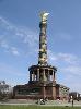
| Berlin FeatureType : landmark Elevation : 38 Lat/Lng : 52.5029 / 13.4042 | Berlin is the capital and largest city of Germany by both area and population. Its 3,711,930 (2017) inhabitants make it the second most populous city proper of the European Union after London. The city is one of Germany's 16 federal states, and it is surrounded by the state of Brandenburg, the (...) |
| 28 | 
| Kowloon Walled City FeatureType : landmark Elevation : 27 Lat/Lng : 22.3323 / 114.1887 | Kowloon Walled City was a largely ungoverned, densely populated settlement in Kowloon City in Hong Kong. Originally a Chinese military fort, the Walled City became an enclave after the New Territories were leased to Britain by China in 1898 (...) |
| 29 | 
| Bank for International Settlements FeatureType : landmark Elevation : 279 Lat/Lng : 47.5481 / 7.5919 | The Bank for International Settlements (BIS) is an international financial institution owned by central banks which "fosters international monetary and financial cooperation and serves as a bank for central banks" (...) |
| 30 | 
| The Bund FeatureType : city Elevation : 0 Lat/Lng : 31.2389 / 121.4872 | The Bund or Waitan (Shanghainese: nga3thae1) is a waterfront area in central Shanghai. The area centers on a section of Zhongshan Road (East No.1 Zhongshan Road) within the former Shanghai International Settlement, which runs along the western bank of the Huangpu River in the eastern part of Huangpu (...) |
| 31 | 
| Solan FeatureType : null Elevation : 1459 Lat/Lng : 30.904 / 77.0969 | Solan is the district headquarters of Solan district (created on 1 September 1972) in the Indian state of Himachal Pradesh. The largest Municipal Council of Himachal Pradesh, it is located south of the state capital, Shimla. At an average elevation of (...) |
| 32 | 
| Kollam FeatureType : null Elevation : 16 Lat/Lng : 8.8861 / 76.5897 | Kollam pronunciation also known by its former name Quilon (Coulão) and Desinganadu, is an old seaport and city on the Laccadive Sea coast of the Indian state of Kerala. The city is on the banks Ashtamudi Lake. Kollam has had a strong commercial reputation since the days of the Phoenicians and Romans (...) |
| 33 | Qinghai–Tibet railway FeatureType : null Elevation : 5068 Lat/Lng : 33.0051 / 91.6494 | The Qinghai–Tibet railway or Qingzang railway , is a high-elevation railway that connects Xining, Qinghai Province, to Lhasa, Tibet Autonomous Region of China. The length of the railway is . Construction of the section between Xining and Golmud was completed by 1984 (...) | |
| 34 | Faridabad FeatureType : null Elevation : 206 Lat/Lng : 28.4211 / 77.3078 | Faridabad is the largest city in the north India state of Haryana. It is a leading industrial centre and situated in the National Capital Region bordering the Indian capital New Delhi. Located 284 kilometres south of the state capital Chandigarh, it is the most populous city in the state of Haryana (...) | |
| 35 | Santos, São Paulo FeatureType : city Elevation : 8 Lat/Lng : -23.9608 / -46.3339 | Santos (Saints) is a municipality in the Brazilian state of São Paulo, founded in 1546 by the Portuguese nobleman Brás Cubas. It is partially located on the island of São Vicente, which harbors both the city of Santos and the city of São Vicente, and partially on the mainland (...) | |
| 36 | 2017 FIFA U-17 World Cup FeatureType : null Elevation : 43 Lat/Lng : 19.0333 / 73.0333 | The 2017 FIFA U-17 World Cup was the 17th FIFA U-17 World Cup, a biennial international football tournament contested by men's under-17 national teams. Organized by FIFA, the tournament took place in India between 6 and 28 October 2017, after the country was awarded the hosting rights on 5 December (...) | |
| 37 | Aizawl FeatureType : city Elevation : 999 Lat/Lng : 23.73 / 92.72 | Aizawl (; Mizo:) is the capital of the state of Mizoram in India. With a population of 293,416, it is the largest city in the state. It is also the centre of administration containing all the important government offices, state assembly house and civil secretariat (...) | |
| 38 | Bharuch FeatureType : null Elevation : 19 Lat/Lng : 21.712 / 72.993 | Bharuch(Gujarati: , Bharūca, listen), formerly known as Broach, or Bhrugukachchh is a city at the mouth of the river Narmada in Gujarat in western India. Bharuch is the administrative headquarters of Bharuch District and is a municipality of about inhabitants (...) | |
| 39 | India Tower FeatureType : landmark Elevation : 7 Lat/Lng : 18.9502 / 72.8213 | India Tower (previously known as the Park Hyatt Tower; also known as the Dynamix Balwas Tower or DB Tower) is a canceled 126-story, supertall skyscraper that began construction in the city of Mumbai, India, in 2010 (...) | |
| 40 | Kashmir Valley FeatureType : null Elevation : 1725 Lat/Lng : 34.0333 / 74.6667 | The Kashmir Valley, also known as the Vale of Kashmir, is a valley in the portion of the Kashmir region administered by India. The valley is bounded on the southwest by the Pir Panjal Range and on the northeast by the main Himalayas range (...) | |
| 41 | Mumbai Trans Harbour Link FeatureType : null Lat/Lng : 19.0821 / 72.741 | The Mumbai Trans Harbour Link (MTHL), also known as the Sewri-Nhava Sheva Trans Harbour Link, is an under-construction 21.8 km, freeway grade road bridge connecting the Indian city of Mumbai with Navi Mumbai, its satellite city. When completed, it would be the longest sea bridge in India (...) | |
| 42 | Monash University FeatureType : landmark Elevation : 90 Lat/Lng : -37.9083 / 145.138 | Monash University is a public research university based in Melbourne, Australia. Founded in 1958, it is the second oldest university in the State of Victoria. The university has a number of campuses, four of which are in Victoria (Clayton, Caulfield, Peninsula, and Parkville), and one in Malaysia (...) | |
| 43 | Jharkhand FeatureType : adm1st Elevation : 647 Lat/Lng : 23.4 / 85.3 | Jharkhand (lit. "Bushland" or The land of forest) is a state in eastern India, carved out of the southern part of Bihar on 15 November 2000. The state shares its border with the states of Bihar to the north, Uttar Pradesh to the northwest, Chhattisgarh to the west, Odisha to the south and West (...) | |
| 44 | IKEA FeatureType : landmark Elevation : 6 Lat/Lng : 52.1671 / 4.4824 | IKEA is a Swedish-founded multinational group that designs and sells , kitchen appliances and home accessories, among other useful goods and occasionally home services. It has been the world's largest furniture retailer since at least 2008 (...) | |
| 45 | Vietnam Airlines FeatureType : null Elevation : 13 Lat/Lng : 21.0456 / 105.8807 | Vietnam Airlines is the flag carrier of Vietnam. Founded in 1956 under the name Vietnam Civil Aviation, the airline was established as a state-owned enterprise in April 1989. Vietnam Airlines is headquartered in Long Biên District, Hanoi, with hubs at Noi Bai International Airport and Tan Son Nhat (...) | |
| 46 | Netaji Subhas Chandra Bose International Airport FeatureType : airport Elevation : 4 Lat/Lng : 22.6547 / 88.4467 | Netaji Subhas Chandra Bose International Airport (Bengali: নেতাজি সুভাষচন্দ্র বসু আন্তর্জাতিক বিমানবন্দর) is an international airport located in Kolkata, West Bengal, India, serving the Kolkata metropolitan area (...) | |
| 47 | Gimhae FeatureType : city Elevation : 13 Lat/Lng : 35.2342 / 128.8811 | Gimhae , also commonly spelled Kimhae, is a city in South Gyeongsang Province, South Korea. It is the seat of the large Gimhae Kim clan, one of the largest Kim clans in Korea. The Gimhae Kims claim descent from the ancient royal house of Geumgwan Gaya, which was based in Gimhae (...) | |
| 48 | Adidas FeatureType : landmark Elevation : 327 Lat/Lng : 49.5825 / 10.9094 | Adidas AG (; stylized as ɑdidɑs since 1949) is a multinational corporation, founded and headquartered in Herzogenaurach, Germany, that designs and manufactures shoes, clothing and accessories. It is the largest sportswear manufacturer in Europe, and the second largest in the world, after Nike (...) | |
| 49 | South African Airways FeatureType : null Elevation : 1683 Lat/Lng : -26.1392 / 28.2461 | South African Airways (SAA) is the flag carrier airline of South Africa. Its headquarters are in Airways Park on the grounds of O. R. Tambo International Airport in Kempton Park, Ekurhuleni, Gauteng. In partnership with SA Express, SA Airlink and its low-cost carrier, Mango, the airline flies to 56 (...) | |
| 50 | Manila FeatureType : null Elevation : 4 Lat/Lng : 14.5833 / 120.9667 | Manila (; , or), officially the City of Manila , is the capital of the Philippines. It is one of the most densely populated cities proper in the world. It was the first chartered city by virtue of the Philippine Commission Act 183 on July 31, 1901 and gained autonomy with the passage of Republic Act (...) | |
| 51 | PricewaterhouseCoopers FeatureType : landmark Elevation : 29 Lat/Lng : 51.5077 / -0.1241 | PricewaterhouseCoopers (doing business as PwC) is a multinational professional services network headquartered in London, United Kingdom. PwC ranks as the second largest professional services firm in the world behind Deloitte, and is one of the Big Four auditors, along with Deloitte, EY and KPMG (...) | |
| 52 | Gujarat FeatureType : adm1st Elevation : 72 Lat/Lng : 23.22 / 72.68 | Gujarat (') is a state in Western IndiaOther sources: * * * and Northwest IndiaOther sources: * * *, a coastline of – most of which lies on the Kathiawar peninsula – and a population in excess of 60 million. It is the sixth largest Indian state by area and the ninth largest state by population (...) | |
| 53 | Gwalior FeatureType : null Elevation : 213 Lat/Lng : 26.2215 / 78.178 | Gwalior (pronunciation) is a major and the northern-most city in the Indian state of Madhya Pradesh and one of the Counter-magnet cities. Located south of Delhi, the capital city of India, Gwalior occupies a strategic location in the Gird region of India (...) | |
| 54 | Tianjin University FeatureType : edu Elevation : 7 Lat/Lng : 39.1082 / 117.1788 | Tianjin University (TJU) is the first modern higher education institution in China, and now a national university under the direct administration of the Ministry of Education of China. It is a Chinese Ministry of Education Class A Double First Class University (...) | |
| 55 | City FeatureType : null Elevation : 22 Lat/Lng : 31.3222 / 45.6361 | A city is a large human settlement.Goodall, B. (1987) The Penguin Dictionary of Human Geography. London: Penguin.Kuper, A. and Kuper, J., eds (1996) The Social Science Encyclopedia. 2nd edition. London: Routledge (...) | |
| 56 | Lyon FeatureType : null Elevation : 177 Lat/Lng : 45.7597 / 4.8422 | Lyon (also spelled Lyons and in this case alternatively pronounced ; ;) is the third-largest city and second-largest urban area of France. It is located in the country's east-central part at the confluence of the rivers Rhône and Saône, about south from Paris, north from Marseille and northeast from (...) | |
| 57 | Patna FeatureType : null Elevation : 57 Lat/Lng : 25.6125 / 85.1283 | Patna is the capital and largest city of the state of Bihar in India. Patna is the second-largest city in eastern India after Kolkata.It had an estimated city population of 1.68 million in 2011, making it the 19th largest city in India (...) | |
| 58 | South Asia FeatureType : country Elevation : 249 Lat/Lng : 26.9 / 72.2 | South Asia or Southern Asia, is a term used to represent the southern region of the Asian continent, which comprises the sub-Himalayan SAARC countries and, for some authorities, adjoining countries to the west and east (...) | |
| 59 | Railway electrification system FeatureType : landmark Elevation : 3 Lat/Lng : 53.4491 / 10.0015 | A railway electrification system supplies electric power to railway trains and trams without an on-board prime mover or local fuel supply. Electric railways use electric locomotives to haul passengers or freight in separate cars or electric multiple units, passenger cars with their own motors (...) | |
| 60 | Kerala FeatureType : adm1st Elevation : 19 Lat/Lng : 8.5074 / 76.972 | Kerala is a state on the southwestern, Malabar Coast of India. It was formed on 1 November 1956, following passage of the States Reorganisation Act, by combining Malayalam-speaking regions. Spread over , Kerala is the twenty second largest Indian state by area (...) | |
| 61 | Tram FeatureType : landmark Elevation : 530 Lat/Lng : 48.1484 / 11.4616 | A tram (in North America streetcar or trolley) is a rail vehicle which runs on tramway tracks along public urban streets; some include segments of segregated right-of-way. The lines or networks operated by tramcars are called tramways (...) | |
| 62 | Research and Analysis Wing FeatureType : null Elevation : 214 Lat/Lng : 28.5886 / 77.2379 | The Research and Analysis Wing (R&AW or RAW) (IAST: Anusaṃdhān Aur Viśleṣaṇ Viṃg) is the foreign intelligence agency of India. It was established in 1968 following the intelligence failures of the Sino-Indian war, which persuaded the Government of India to create a specialised, independent agency (...) | |
| 63 | Ghazipur FeatureType : city Elevation : 73 Lat/Lng : 25.5833 / 83.575 | Ghazipur (previously spelled Ghazeepore, Gauspur, and Ghazipour), is a town in the state of Uttar Pradesh, India. Ghazipur city is the administrative headquarters of the Ghazipur district, one of the four districts that form the Varanasi division of Uttar Pradesh (...) | |
| 64 | Banaskantha district FeatureType : landmark Elevation : 218 Lat/Lng : 24.1731 / 72.4314 | Banaskantha is one among the thirty-three districts of the Gujarat state of India. The administrative headquarters of the district is at Palanpur which is also its largest city. The district is located in the Northeast of Gujarat and is presumably named after the West Banas River which runs through (...) | |
| 65 | Manila hostage crisis FeatureType : null Elevation : 11 Lat/Lng : 14.581 / 120.9749 | The Manila hostage crisis, officially known as the Rizal Park hostage-taking incident, took place when a disgruntled former Philippine National Police officer named Rolando Mendoza hijacked a tourist bus in Rizal Park, Manila, Philippines on August 23, 2010 (...) | |
| 66 | Kannapuram FeatureType : null Elevation : 15 Lat/Lng : 11.9667 / 75.3167 | Kannapuram pronunciation is a census town in Kannur district of North Malabar region in the Indian state of Kerala. (...) | |
| 67 | Maersk FeatureType : landmark Elevation : 4 Lat/Lng : 55.688 / 12.5976 | A.P. Moller–Maersk Group , also known as simply Maersk, it is a Danish business conglomerate with activities in the transport, logistics and energy sectors. Maersk has been the largest container ship and supply vessel operator in the world since 1996 (...) | |
| 68 | Indian Statistical Institute FeatureType : null Elevation : 5 Lat/Lng : 22.6488 / 88.3771 | Indian Statistical Institute (ISI) is an academic institute of national importance as recognised by a 1959 act of the Indian parliament. It grew out of the Statistical Laboratory set up by Prasanta Chandra Mahalanobis in Presidency College, Kolkata (...) | |
| 69 | Bhilwara FeatureType : null Elevation : 425 Lat/Lng : 25.35 / 74.63 | Bhilwara is a city in the Mewar region of Rajasthan, India. it is the seventh largest city in the Indian state of Rajasthan. It is the 121st largest city in India. (...) | |
| 70 | National Stock Exchange of India FeatureType : adm1st Elevation : 13 Lat/Lng : 19.0603 / 72.8597 | The National Stock Exchange of India Limited (NSE) is the leading stock exchange of India, located in Mumbai. The NSE was established in 1992 as the first demutualized electronic exchange in the country. NSE was the first exchange in the country to provide a modern, fully automated screen-based (...) | |
| 71 | 2015 Bamako hotel attack FeatureType : landmark Elevation : 336 Lat/Lng : 12.6352 / -8.0308 | On 20 November 2015, Islamist militants took 170 hostages and killed 20 of them in a mass shooting at the Radisson Blu hotel in Bamako, the capital city of Mali. Includes video. Malian commandos raided the hotel and freed the surviving hostages (...) | |
| 72 | Fukuoka Airport FeatureType : airport Elevation : 5 Lat/Lng : 33.5833 / 130.45 | , formerly known as Itazuke Air Base, is an international and domestic airport located east of Hakata Station in Hakata-ku, Fukuoka, Japan. Fukuoka Airport is the principal airport on the island of Kyushu and is the fourth busiest passenger airport in Japan (...) | |
| 73 | 2016 Atatürk Airport attack FeatureType : airport Elevation : 31 Lat/Lng : 40.9761 / 28.8142 | --> The Atatürk Airport terrorist attack, consisting of shootings and suicide bombings, occurred on 28 June 2016 at Atatürk Airport in Istanbul, Turkey. Gunmen armed with automatic weapons and explosive belts staged a simultaneous attack at the international terminal of Terminal 2 (...) | |
| 74 | Makrana FeatureType : null Elevation : 427 Lat/Lng : 27.0378 / 74.7261 | Makrana is a municipal council and a tehsil in the Nagaur district of Rajasthan, India. There are more than 136 villages under this tehsil, making Makrana one of the biggest tehsils in Nagour District. Makrana is famous for the white marble taken from the mines around it (...) | |
| 75 | Fiat S.p.A. FeatureType : null Elevation : 249 Lat/Lng : 45.0326 / 7.6669 | Fiat S.p.A., or Fabbrica Italiana Automobili Torino (Italian Automobile Factory of Turin), was an Italian holding company whose original and core activities were in the automotive industry, and that was succeeded by Fiat Chrysler Automobiles NV (FCA) (...) | |
| 76 | Chennai Port FeatureType : null Elevation : 9 Lat/Lng : 13.0844 / 80.2899 | Chennai Port, formerly known as Madras Port, is the third largest container port of India, behind the Nhava Sheva and Mundra port. The port is the largest one in the Bay of Bengal. It is the third oldest port among the 13 major ports of India with official port operations beginning in 1881, although (...) | |
| 77 | Geography of India FeatureType : country Elevation : 339 Lat/Lng : 21.0 / 78.0 | India lies on the Indian Plate, the northern portion of the Indo-Australian Plate, whose continental crust forms the Indian subcontinent. The country is situated north of the equator between 8°4' to 35°3' north latitude and 68°7' to 97°25' east longitude.India Yearbook, p (...) | |
| 78 | Japanese cemeteries and cenotaphs FeatureType : null Elevation : 67 Lat/Lng : 15.2801 / 145.8073 | Many and cenotaphs are located outside of Japan for Japanese people who died by various reasons and situations in history and internees during and after war. This article also lists tombs and burial places. (...) | |
| 79 | London Business School FeatureType : edu Elevation : 35 Lat/Lng : 51.5264 / -0.1608 | London Business School (LBS) is a public business school and a constituent college of the federal University of London. LBS was founded in 1964 and awards post-graduate degrees (Master's degrees in management and finance, MBA and PhD) (...) | |
| 80 | Alliance Française FeatureType : null Elevation : 51 Lat/Lng : 48.8464 / 2.3286 | L'Alliance Française (French Alliance), or AF, is an international organization that aims to promote French language and culture around the world. Created in Paris on 21 July 1883 under the name Alliance française pour la propagation de la langue nationale dans les colonies et à l'étranger (French (...) | |
| 81 | Ultra Music Festival FeatureType : null Elevation : 7 Lat/Lng : 25.7848 / -80.1869 | Ultra Music Festival is an annual outdoor electronic music festival that takes place during March in Miami, Florida, United States. The festival was founded in 1999 by Russell Faibisch and Alex Omes and is named after the 1997 Depeche Mode album, Ultra (...) | |
| 82 | Dr. Babasaheb Ambedkar International Airport FeatureType : null Elevation : 314 Lat/Lng : 21.0922 / 79.0472 | Dr. Babasaheb Ambedkar International Airport is an international airport serving the city of Nagpur, Maharashtra, India. The airport is located at Sonegaon, 8 km (5 mi) South-West of Nagpur. The airport covers an area of 1355 acres (548 hectares). In 2005, it was named after B. R (...) | |
| 83 | Anushakti Nagar FeatureType : null Elevation : 24 Lat/Lng : 19.0364 / 72.9225 | Anushakti Nagar is the residential township of the Bhabha Atomic Research Center, Nuclear Power Corporation of India, Directorate of Construction Services and Estate Management, Atomic Energy Education Society in Mumbai, Maharashtra, India. Anu Shakti means atomic power in Hindi (...) | |
| 84 | Ramgarh district FeatureType : adm2nd Elevation : 327 Lat/Lng : 23.6307 / 85.5606 | Ramgarh district is one of the 24 districts in the Indian state of Jharkhand. It was also a military district during the British Regime, referred to then as Ramghur district. (...) | |
| 85 | Gated community FeatureType : null Elevation : 28 Lat/Lng : 52.4133 / 13.0903 | In its modern form, a gated community (or walled community) is a form of residential community or housing estate containing strictly controlled entrances for pedestrians, bicycles, and automobiles, and often characterized by a closed perimeter of walls and fences (...) | |
| 86 | Inter-Services Intelligence FeatureType : null Elevation : 555 Lat/Lng : 33.704 / 73.0797 | The Inter-Services Intelligence (abbreviated as ISI) is the premier intelligence agency of Pakistan, operationally responsible for gathering, processing, and analyzing national security information from around the world (...) | |
| 87 | Piracy off the coast of Somalia FeatureType : null Lat/Lng : 3.18 / 68.86 | Piracy off the coast of Somalia has been a threat to international shipping since the second phase of the Somali Civil War, around 2000, when foreign ships exploited the coastline area because of the absence of an effective national coast guard by invading the fishing grounds and also dumping (...) | |
| 88 | North Malabar FeatureType : null Elevation : 23 Lat/Lng : 11.75 / 75.5 | North Malabar refers to the geographic area of southwest India covering the state of Kerala's present day Kasaragod and Kannur Districts, the Mananthavady taluk of Wayanad District, the taluks of Koyilandy and Vatakara in the Kozhikode District of Kerala and the entire Mahé Sub-Division of the Union (...) | |
| 89 | Legal deposit FeatureType : null Elevation : 119 Lat/Lng : 49.0078 / 8.3992 | Legal deposit is a legal requirement that a person or group submit copies of their publications to a repository, usually a library. The requirement is mostly limited to books and periodicals. The number of copies varies and can range from one to 19 (in Poland) (...) | |
| 90 | JPMorgan Chase FeatureType : landmark Elevation : 73 Lat/Lng : 40.7558 / -73.9754 | JPMorgan Chase & Co. is an American multinational investment bank and financial services company headquartered in New York City. JPMorgan Chase is the largest bank in the United States, and the sixth largest bank in the world by total assets, with the amount of $2.534 trillion (...) | |
| 91 | The New School FeatureType : landmark Elevation : 20 Lat/Lng : 40.7353 / -73.997 | The New School is a private non-profit research university centered in Manhattan, New York City, USA, located mostly in Greenwich Village. It was founded in 1919 as The New School for Social Research with an original mission dedicated to academic freedom and intellectual inquiry and a home for (...) | |
| 92 | CRRC Nanjing Puzhen FeatureType : null Elevation : 9 Lat/Lng : 32.1206 / 118.6853 | CRRC Nanjing Puzhen Co., Ltd.http://www.crrcgc.cc/g3297.aspx is a Chinese railway rolling stock manufacturer, based in Puzhen, Nanjing city. It is a subsidiary of CRRC. Nanjing Puzhen has supplied trains to Shanghai Metro Line 3 and Nanjing Metro in partnership with Alstom, and has been named as a (...) | |
| 93 | Indian Institute of Technology Kharagpur FeatureType : edu Elevation : 60 Lat/Lng : 22.3197 / 87.31 | The Indian Institute of Technology Kharagpur (IIT Kharagpur or IIT KGP) is a public engineering institution established by the government of India in 1951. It was the first of the IITs to be established, and is recognized as an Institute of National Importance by the Government of India (...) | |
| 94 | Bauma (trade fair) FeatureType : landmark Elevation : 530 Lat/Lng : 48.1355 / 11.6986 | The bauma (International Trade Fair for Construction Machinery, Building Material Machines, Mining Machines, Construction Vehicles and Construction Equipment) is the world's largest trade fair in the construction industry (...) | |
| 95 | AKB48 Group FeatureType : null Elevation : 18 Lat/Lng : 35.6987 / 139.7742 | , or AKB48 sister groups, shortened to 48 Group, 48g or ALL48, refers to the sister groups of the Japanese idol girl group AKB48. Based on the same concept "idols you can meet", it currently consists of 5 sister groups in locations across Japan and 7 sister groups in major Asian cities overseas from (...) | |
| 96 | Marina Beach FeatureType : landmark Lat/Lng : 13.0514 / 80.2839 | Marina Beach is a natural urban beach in Chennai, Tamil Nadu, India, along the Bay of Bengal. The beach runs from near Fort St. George in the north to Foreshore Estate in the south, a distance of , making it the longest natural urban beach in the country (...) | |
| 97 | Maharaja Sayajirao University of Baroda FeatureType : landmark Elevation : 41 Lat/Lng : 22.3099 / 73.186 | The Maharaja Sayajirao University of Baroda (MSU), formerly Baroda College is a public university in the city of Vadodara, in Gujarat state, India. Originally established as a college in 1881, it became a university in 1949 after the independence of the country (...) | |
| 98 | Daulatabad, Maharashtra FeatureType : null Elevation : 735 Lat/Lng : 19.9427 / 75.2132 | Daulatabad, also known as Devagiri, is a 14th-century fort city in Maharashtra state of India, about northwest of Aurangabad. The place was originally named Devagiri when it was an important uplands city along caravan routes (ca (...) | |
| 99 | Bagdogra FeatureType : null Elevation : 149 Lat/Lng : 26.6993 / 88.3118 | Bagdogra is a census town in Darjeeling district in the Indian state of West Bengal. Bagdogra is a town in the Darjeeling district of West Bengal, India, which is surrounded by tea gardens. Bagdogra is part of the Greater Siliguri Metropolitan Area (...) | |
| 100 | Chakulia FeatureType : null Elevation : 122 Lat/Lng : 22.483 / 86.7179 | Chakulia is a small town and a notified area in Purbi Singhbhum district in the state of Jharkhand, India. (...) | |
| 101 | Ernst & Young FeatureType : null Elevation : 16 Lat/Lng : 51.5051 / -0.0832 | Ernst & Young (doing business as EY) is a multinational professional services firm headquartered in London, England, United Kingdom. EY is one of the largest professional services firms in the world and is one of the "Big Four" accounting firms (...) | |
| 102 | Consulate General of the United States, Chennai FeatureType : null Elevation : 13 Lat/Lng : 13.0524 / 80.2519 | The Consulate General of the United States of America Chennai represents the interests of the United States government in Chennai (formerly known as Madras), India and surrounding regions. The consulate reports to the ambassador at the U.S. Embassy in New Delhi (...) | |
| 103 | Istituto Marangoni FeatureType : edu Elevation : 135 Lat/Lng : 45.4672 / 9.194 | The Istituto Marangoni is a private Italian school of fashion and design. It is based in Milan, in Lombardy in northern Italy, and has branches in Florence, London and Paris, Shanghai and Shenzhen in China, Mumbai in India, and Miami in the United States. (...) | |
| 104 | Mountain railways of India FeatureType : null Elevation : 1629 Lat/Lng : 11.5103 / 76.9358 | The Mountain railways of India refer to railway lines built in the mountains of India. Three of these railways, the Darjeeling Himalayan Railway, the Nilgiri Mountain Railway, and the Kalka–Shimla Railway, are collectively designated as a UNESCO World Heritage Site under the name Mountain Railways (...) | |
| 105 | Carmichael Road FeatureType : null Elevation : 33 Lat/Lng : 18.971 / 72.8123 | Carmichael Road is an upmarket residential street of Mumbai, India. Situated on a ridge in South Mumbai, it is now officially called M.L. Dahanukar Marg. It has many old style bungalows and apartment houses, such as the art deco Kamal Mahal of film director, Kamal Amrohi (...) | |
| 106 | Barbil FeatureType : null Elevation : 492 Lat/Lng : 22.12 / 85.4 | Barbil is a City and a Municipality in the Kendujhar district (also known as Iron City) of the state of Odisha, India. It is one of the 5th scheduled areas. The region around Barbil has a largest deposit of Iron ore and manganese ore in the world (...) | |
| 107 | International School of Information Management FeatureType : null Elevation : 781 Lat/Lng : 12.3143 / 76.6216 | The International School of Information Management (ISiM) is the first Indian i-School and is an autonomous constituent institute of the University of Mysore, located in Mysore in Karnataka State, Southern India (...) | |
| 108 | Nihonjin gakkō FeatureType : null Elevation : 216 Lat/Lng : 42.1214 / -87.9814 | , also called Japanese school, is a full-day school outside Japan for native speakers of Japanese. It is an expatriate school designed for children whose parents are working on diplomatic, business, or education missions overseas and have plans to repatriate to Japan (...) | |
| 109 | Modern School (New Delhi) FeatureType : edu Elevation : 219 Lat/Lng : 28.6283 / 77.2295 | Modern School, Barakhamba Road (informally Modern) is a co-educational, independent day and boarding school in New Delhi, India. Founded in 1920 by the philanthropist Lala Raghubir Singh, it was the first private and coeducational school established in Delhi during the British Raj (...) | |
| 110 | Smiling Buddha FeatureType : event Elevation : 226 Lat/Lng : 27.0788 / 71.7224 | Smiling BuddhaThis test has many code names. Civilian scientists called it "Operation Smiling Buddha" and the Indian Army referred to it as Operation Happy Krishna. According to United States Military Intelligence, Operation Happy Krishna was the code name for the Indian Army's construction of the (...) | |
| 111 | Rohr Jewish Learning Institute FeatureType : null Elevation : 34 Lat/Lng : 40.669 / -73.9412 | The Rohr Jewish Learning Institute (JLI) is a provider of adult Jewish courses on Jewish history, law, ethics, philosophy and rabbinical literature worldwide. It also develops Jewish studies curricula for women, college students, teenagers, and seniors (...) | |
| 112 | Battle of Aden (2015) FeatureType : null Elevation : 126 Lat/Lng : 12.7736 / 45.0264 | The Battle of Adenhttps://www.youtube.com/watch?v=E7EqGAe7fAQ was a battle for the control of Aden, Yemen, between the Houthis and Yemen Army units and militias loyal to Ali Abdullah Saleh on one side, and local residents, Southern Movement militias, and Yemen Army units and militias loyal to (...) | |
| 113 | Google Street View in Asia FeatureType : null Elevation : 11 Lat/Lng : 25.2427 / 55.372 | In Asia, Google Street View is available in Bangladesh, Bhutan, Cambodia, Hong Kong, India, Indonesia, Israel, Japan, Kyrgyzstan, Macau, Malaysia, Mongolia, Philippines, Russia, Singapore, South Korea, Sri Lanka, Taiwan, Thailand and Turkey (...) | |
| 114 | Mazar-e-Quaid FeatureType : landmark Elevation : 30 Lat/Lng : 24.8754 / 67.0411 | Mazar-e-Quaid , also known as the Jinnah Mausoleum or the National Mausoleum, is the final resting place of Quaid-e-Azam ("Great Leader") Muhammad Ali Jinnah, the founder of Pakistan. Designed in a 1960s modernist style, the mausoleum also contains the tomb of his sister, Māder-e Millat ("Mother of (...) | |
| 115 | Asia Society FeatureType : landmark Elevation : 37 Lat/Lng : 40.7698 / -73.9643 | The Asia Society is a non-profit organization that focuses on educating the world about Asia. It has several centers in the United States (Houston, Los Angeles, San Francisco, Washington, DC, and New York) and around the world (Hong Kong, Manila, Mumbai, Seoul, Shanghai, Sydney, and Zurich) (...) | |
| 116 | Jaipur bombings FeatureType : null Elevation : 439 Lat/Lng : 26.926 / 75.8235 | The Jaipur bombings were a series of nine synchronized bomb blasts that took place on 13 May 2008 within a span of fifteen minutes at locations in Jaipur, the capital city of the Indian state of Rajasthan, and a tourist destination. A tenth bomb was found and defused."", Thaindian News, 20 May 2008 (...) | |
| 117 | Naromurar FeatureType : null Elevation : 73 Lat/Lng : 25.02 / 85.6 | Naromurar is a Village in Warisaliganj Tehsil, located 10 km far from National Highway 31 and 8 km from State Highway 59, making it the only village of the area well connected to both Nawada and Nalanda districts of Bihar (...) | |
| 118 | People for the Ethical Treatment of Animals FeatureType : null Elevation : 3 Lat/Lng : 36.8538 / -76.2995 | People for the Ethical Treatment of Animals (PETA ; stylized PeTA) is an American animal rights organization based in Norfolk, Virginia, and led by Ingrid Newkirk, its international president. A nonprofit corporation with nearly 400 employees, it claims that it has 6 (...) | |
| 119 | Visvesvaraya National Institute of Technology FeatureType : null Elevation : 319 Lat/Lng : 21.1233 / 79.0514 | Visvesvaraya National Institute of Technology (VNIT Nagpur), formerly Visvesvaraya Regional College of Engineering, Nagpur (VRCE), is a public engineering and research institution in India. It is located in Nagpur, Maharashtra, in central India (...) | |
| 120 | Causeway FeatureType : null Elevation : 4 Lat/Lng : 19.0487 / 72.8382 | A causeway is a track, road or railway on top of an embankment across "a low, or wet place, or piece of water".Oxford English Dictionary It can be constructed of earth, masonry, wood, or concrete. One of the earliest known wooden causeways is the Sweet Track in the Somerset Levels, England, that (...) | |
| 121 | Techfest FeatureType : null Elevation : 54 Lat/Lng : 19.1336 / 72.9154 | Techfest is the annual science and technology festival of Indian Institute of Technology Bombay. It also refers to the independent body of students who organize this event along with many other social initiatives and outreach programs around the year (...) | |
| 122 | La Martiniere Lucknow FeatureType : null Elevation : 114 Lat/Lng : 26.8396 / 80.9632 | La Martinière College is an educational institution located in Lucknow, the capital of the Indian State of Uttar Pradesh. The college consists of two schools on different campuses for boys and girls. La Martinière Boys' College was founded in 1845 and La Martinière Girls' College was established in (...) | |
| 123 | Shivaji Park Residential Zone FeatureType : null Elevation : 10 Lat/Lng : 19.0267 / 72.838 | The Shivaji Park Residential Zone is a precinct consisting of 187 residential buildings that were built as part of the Shivaji Park scheme in Dadar, Mumbai. Most of the buildings in this residential locality were constructed in the early 1900s during British colonial rule in India, as a result of (...) | |
| 124 | Atul, Gujarat FeatureType : null Elevation : 12 Lat/Lng : 20.5288 / 72.9412 | Atul is an industrial village developed by the chemical conglomerate Atul Ltd, located in the Valsad district of Gujarat, India. Although a small village, it has good educational and recreational facilities, banks, temples, post office and a railway station. (...) | |
| 125 | Sanand FeatureType : null Elevation : 36 Lat/Lng : 22.98 / 72.38 | Sanand is a city and a municipality in Ahmedabad district in the Indian state of Gujarat. It is best known as the automobile hub of Gujarat. (...) | |
| 126 | Arcadia University FeatureType : edu Elevation : 99 Lat/Lng : 40.092 / -75.1655 | Arcadia University is a private university in Glenside, Pennsylvania. A master's university by Carnegie Classification, the university has a co-educational student population of approximately 4,000 (undergraduate and graduate) (...) | |
| 127 | Chabahar Port FeatureType : null Lat/Lng : 25.3003 / 60.6128 | Chabahar Port is a seaport in Chabahar located in southeastern Iran, on the Gulf of Oman. It serves as Iran's only oceanic port, and consists of two separate ports named Shahid Kalantari and Shahid Beheshti, each of which has five berths (...) | |
| 128 | Dhola–Sadiya Bridge FeatureType : landmark Elevation : 131 Lat/Lng : 27.7986 / 95.6761 | The Dhola–Sadiya Bridge, also referred to as the Bhupen Hazarika Setu , is a beam bridge in India, connecting the northeast states of Assam and Arunachal Pradesh. The bridge spans the Lohit River, a major tributary of the Brahmaputra River, from the village of Dhola (Tinsukia District) in the south (...) | |
| 129 | Rajkumar College, Rajkot FeatureType : edu Elevation : 140 Lat/Lng : 22.2932 / 70.7974 | The Rajkumar College (or RKC) in Rajkot, Gujarat is one of the oldest K-12 institutions in India. RKC has a 26-acre (105,000 m²) campus in Rajkot. (...) | |
| 130 | International Cruise Terminal station FeatureType : railwaystation Elevation : 9 Lat/Lng : 31.2519 / 121.4936 | International Cruise Terminal Station is a station on the Shanghai Metro Line 12, which opened 29 December 2013. (...) | |
| 131 | Madayi FeatureType : null Elevation : 11 Lat/Lng : 11.9667 / 75.3 | Madayi (a.k.a. Madai). is a village near Pazhayangadi in Kannur district, Kerala. The famous Bhagavathy shrine, Madayi Kavu (Thiruvar Kadu Bhagavathi Temple) where devotees worship Bhadrakali is located here. The Goddess is one of the family deity of the Chirakkal Royal family, and the temple is (...) | |
| 132 | Keibul Lamjao National Park FeatureType : null Elevation : 772 Lat/Lng : 24.5 / 93.7667 | The Keibul Lamjao National Park (Kei- Tiger, Bul - vast, Lamjao-Land) is a national park in the Bishnupur district of the state of Manipur in India. It is in area, the only floating park in the world, located in North East India, and an integral part of Loktak Lake (...) | |
| 133 | Uzhavoor FeatureType : null Elevation : 75 Lat/Lng : 9.7873 / 76.61 | Uzhavoor is an expanding town in Kottayam district, Kerala in India. It is just 32 km away from the administrative capital Kottayam District. Most of its residents are either farmers or engaged in small-scale business, although a lot of the houses belong to NRIs. The tenth President of India, K. R (...) | |
| 134 | Schulich School of Business FeatureType : edu Elevation : 200 Lat/Lng : 43.7731 / -79.4986 | The Schulich School of Business is the business school of York University located in Toronto, Ontario, Canada. Schulich offers undergraduate and graduate degree and diploma programs in business administration, finance, accounting, business analytics, public administration and international business (...) | |
| 135 | Jaitapur Nuclear Power Project FeatureType : landmark Elevation : 26 Lat/Lng : 16.5833 / 73.325 | Jaitapur Nuclear Power Project is a proposed nuclear power plant in India. If built, it would be the largest nuclear power generating station in the world by net generation capacity, at 9,900 MW. The power project is proposed by Nuclear Power Corporation of India (NPCIL) and would be built at Madban (...) | |
| 136 | MU FeatureType : null Elevation : 61 Lat/Lng : 21.9391 / 95.6405 | MU, Mu or µ may refer to: (...) | |
| 137 | Champa, Chhattisgarh FeatureType : null Elevation : 254 Lat/Lng : 22.0353 / 82.6423 | Champa is a city and municipality in Janjgir-Champa district in the Indian state of Chhatisgarh. (...) | |
| 138 | August 1962 FeatureType : null Elevation : 2986 Lat/Lng : 42.0333 / 75.75 | The following events occurred in August 1962: (...) | |
| 139 | DBS Bank FeatureType : null Elevation : 25 Lat/Lng : 1.2791 / 103.8545 | DBS Bank is a multinational banking and financial services corporation headquartered in Marina Bay Financial Centre Tower 3 Marina Bay, Singapore. The company was known as The Development Bank of Singapore Limited, before the present name was adopted in July 2003 to reflect its changing role as a (...) | |
| 140 | Madayipara FeatureType : null Elevation : 11 Lat/Lng : 11.9667 / 75.3 | Madayipara Madayipara is a flat topped hillock located in the Madayi, of Kannur district of Kerala state in the Southern India. It is overlooking Payangadi town on the northern bank of Kuppam river. It is popular being the site of the Madayi Kavu (Thiruvar Kadu Bhagavathi Temple) of Goddess Kali, (...) | |
| 141 | Magampura Mahinda Rajapaksa Port FeatureType : null Lat/Lng : 6.1194 / 81.1081 | The Hambantota Port (also known as the Magampura Mahinda Rajapaksa Port) is a maritime port in Hambantota, Sri Lanka. The first phase of the port was opened on 18 November 2010, with the first ceremonial berthing of the naval ship "Jetliner" to use the port facilities (...) | |
| 142 | Vallabh Vidyanagar FeatureType : null Elevation : 36 Lat/Lng : 22.5333 / 72.9 | Vallabh Vidyanagar is a town and a municipality in Anand district in the Indian state of Gujarat. It is located between Ahmedabad and Vadodara, 6 km from the town of Anand. V.V.Nagar is known as educational hub of Gujarat. It is a home to the prestigious Sardar Patel University. (...) | |
| 143 | Metro FeatureType : null Elevation : 275 Lat/Lng : -8.1831 / 112.5342 | Metro, short for metropolitan, may refer to: (...) | |
| 144 | Iveco Bus FeatureType : null Elevation : 203 Lat/Lng : 45.7188 / 4.9338 | Iveco Bus (formerly Irisbus) is a bus manufacturer, with headquarters in Lyon, that belongs to the industrial group CNH Global through its subsidiary Iveco, based in Turin (Italy). Iveco-bus is now only a brand division of IVECOhttp://www.cnhindustrial (...) | |
| 145 | Tianjin University of Technology FeatureType : edu Elevation : 9 Lat/Lng : 39.0858 / 117.1443 | Tianjin University of Technology is a university in Tianjin, China under the municipal government. It is a public university approved by the State Council in 1981. As an engineering based multi-discipline university, it now has over 16,000 students, 988 teaching faculty and offers 45 Bachelor (...) | |
| 146 | Nuclear power in India FeatureType : null Elevation : 47 Lat/Lng : 14.8644 / 74.4365 | Nuclear power is the fifth-largest source of electricity in India after coal, gas, hydroelectricity and wind power. , India has 22 nuclear reactors in operation in 7 nuclear power plants, having a total installed capacity of 6,780 MW. Nuclear power produced a total of 35 TWh and supplied 3 (...) | |
| 147 | Indian Air Force FeatureType : null Elevation : 246 Lat/Lng : 31.4369 / 75.7558 | The Indian Air Force (IAF) is the air arm of the Indian armed forces. Its complement of personnel and aircraft assets ranks fourth amongst the airforces of the world. Its primary mission is to secure Indian airspace and to conduct aerial warfare during armed conflict (...) | |
| 148 | Broadway Malyan FeatureType : landmark Elevation : 15 Lat/Lng : 51.3717 / -0.4736 | Broadway Malyan is a global architecture, urbanism and design practice. It was established in 1958. Among its incorporated businesses globally, it owns or is closely associated with the English incorporated companies Broadway Malyan International Limited, Broadway Malyan Limited and Broadway Malyan (...) | |
| 149 | Middle Ground Coastal Battery FeatureType : null Lat/Lng : 18.9187 / 72.8478 | The Middle Ground Coastal Battery is a heritage site of an antique coastal gun battery managed by the Indian Navy on an islet off the coast of Mumbai, India. It is situated on Middle Ground isle in Mumbai Harbour, a few hundred metres away from the Gateway of India, in Thane Creek. (...) | |
| 150 | AmeriCares FeatureType : null Elevation : 22 Lat/Lng : 41.0651 / -73.5194 | Americares is a non-profit disaster relief and global health organization providing immediate response to emergency medical needs and supporting long-term health care initiatives for people in the United States and around the world (...) | |
| 151 | Sis FeatureType : null Elevation : 140 Lat/Lng : 37.4552 / 35.8157 | Sis or SIS may refer to: (...) | |
| 152 | Olin Business School FeatureType : edu Elevation : 170 Lat/Lng : 38.6481 / -90.3116 | The Olin Business School is one of seven academic schools at Washington University in St. Louis. Founded in 1917, the business school was renamed for entrepreneur John M. Olin in 1988. The school offers BSBA, Master of Business Administration (MBA), MS in Supply Chain Management, MS in Finance, (...) | |
| 153 | LafargeHolcim Foundation for Sustainable Construction FeatureType : null Elevation : 426 Lat/Lng : 47.4146 / 8.5598 | The LafargeHolcim Foundation for Sustainable Construction is a non-profit organization. Its goal is to raise awareness of the role that architecture, engineering, urban planning and construction have in achieving a sustainable built future (...) | |
| 154 | Cox School of Business FeatureType : edu Elevation : 193 Lat/Lng : 32.8464 / -96.7861 | The Edwin L. Cox School of Business is an American business school, part of Southern Methodist University (SMU) in Dallas, Texas. The SMU Cox School of Business is headquartered in three buildings on SMU’s 210-acre main campus five miles north of downtown Dallas and has a second campus in Plano, (...) | |
| 155 | United Overseas Bank FeatureType : landmark Elevation : 15 Lat/Lng : 1.2854 / 103.8504 | United Overseas Bank Limited (commonly known as UOB; ;) is a Singaporean multinational banking organisation headquartered in Singapore, with branches mostly found in most Southeast Asian countries. Founded in 1935 as United Chinese Bank (UCB) by Sarawak businessman Wee Kheng Chiang, the bank was set (...) | |
| 156 | Little India, Penang FeatureType : null Elevation : 11 Lat/Lng : 5.4177 / 100.3386 | Covering an area around Queen Street, Chulia Street and Market Street, Little India (Tamil: குட்டி இந்தியா) in the city of George Town in Malaysia, is an ethnic Indian enclave. The oldest Hindu temple in Penang, Sri Mahamariamman Temple is located here.http://www.malaysiavacationsnet (...) | |
| 157 | Ulyanovsk State University FeatureType : null Elevation : 102 Lat/Lng : 54.317 / 48.367 | Ulyanovsk State University (romanised: Ulyanovskiy gosudarstvennyy universitet) is a public, research university, located in Ulyanovsk, Russia. City of Ulyanovsk (formerly Simbirsk, founded in 1648) is situated on the Volga River, about 440 miles east of Moscow and has a population of 700,000 (...) | |
| 158 | Marquardt Group FeatureType : landmark Elevation : 675 Lat/Lng : 48.0356 / 8.7828 | Marquardt Group is a family enterprise headquartered in Germany. It is a manufacturer in the field of electro-mechanical and electronic switches and switching systems. Its systems are found in household appliances and other industrial applications (...) | |
| 159 | Gujarat International Finance Tec-City FeatureType : null Elevation : 64 Lat/Lng : 23.1596 / 72.6845 | Gujarat International Finance Tec-City (GIFT City) is a business district promoted by the Government of Gujarat through a joint venture company. GIFT City is India's first operational smart city in the Ahmedabad (Amdavad) metropolitan region and international financial services centre (...) | |
| 160 | Gomti Nagar FeatureType : null Elevation : 115 Lat/Lng : 26.8449 / 81.0095 | Gomti Nagar is an area in the North Indian city of Lucknow consisting of both residential and business settlements. It is one of the largest and upcoming areas of Lucknow. Gomti Nagar has the population of over 500,000 (...) | |
| 161 | Kurnool Medical College FeatureType : null Elevation : 287 Lat/Lng : 15.8209 / 78.0381 | Kurnool Medical College, is one of the oldest and premier medical schools located in Kurnool, Andhra Pradesh, India established in 1956. (...) | |
| 162 | Lewis & Clark Law School FeatureType : null Elevation : 133 Lat/Lng : 45.4525 / -122.677 | The Northwestern School of Law of Lewis and Clark College (also known as Lewis & Clark Law School), is an American Bar Association-approved private law school in Portland, Oregon. The law school received ABA approval in 1970 and joined the Association of American Law Schools (AALS) in 1973 (...) | |
| 163 | Imperial FeatureType : null Elevation : 91 Lat/Lng : -13.0593 / -76.3527 | Imperial is that which relates to an empire, emperor, or imperialism. Imperial or The Imperial may also refer to: (...) | |
| 164 | Central FeatureType : null Elevation : 214 Lat/Lng : 54.533 / 37.617 | Central is an adjective usually referring to being in the center of some place or (mathematical) object. Central may also refer to: (...) | |
| 165 | Gothra, Rewari FeatureType : null Elevation : 285 Lat/Lng : 28.1119 / 76.265 | Gothra is a village on the Rewari- Narnaul road(National Highway no. 11) from Rewari in Rewari district in the Indian state of Haryana. It is also named as Pali Gothra.This village is near by Village Pali that is also on the Delhi Mumbai Freight Corridor Project which will be India's future trade (...) | |
| 166 | Darbhanga Airport FeatureType : airport Elevation : 52 Lat/Lng : 26.1947 / 85.9175 | Darbhanga Airport is an airport in Darbhanga, Bihar, India. It has the largest runway in Bihar and thus is able to accommodate large aircraft. The airport is operational and perhaps is the first operational airport in Bihar (...) | |
| 167 | Wigan and Leigh College FeatureType : null Elevation : 29 Lat/Lng : 53.4995 / -2.5255 | Wigan and Leigh College is a state General Further and Higher Education College based at six locations in the towns of Wigan and Leigh in Greater Manchester, England, United Kingdom. Currently there are over 1,000 staff members employed, and more than 17,000 students enrolled in full-time or (...) | |
| 168 | Royal Selangor FeatureType : landmark Elevation : 51 Lat/Lng : 3.1962 / 101.724 | Royal Selangor International Sdn Bhd (doing business as Royal Selangor) is a Malaysian pewter manufacturer and retailer, the largest of its type in the world. (...) | |
| 169 | King Edward Memorial Hospital and Seth Gordhandas Sunderdas Medical College FeatureType : edu Elevation : 17 Lat/Lng : 19.0017 / 72.8418 | King Edward Memorial Hospital and Seth Gordhandas Sunderdas Medical College , located in Mumbai, is amongst the foremost teaching and medical care providing institutions in India. Information from Official website of KEM Hospital It was founded in 1926, and is affiliated to Maharashtra University of (...) | |
| 170 | Shiv Smarak FeatureType : null Lat/Lng : 18.9274 / 72.791 | The Shiv Smarak or the Chhatrapati Shivaji Maharaj Memorial is a monument under-construction dedicated to Shivaji, the 17th century Indian warrior king and founder of the Maratha Empire. The statue will be located in the Arabian Sea, near the coast of Mumbai city in the Indian state Maharashtra. (...) | |
| 171 | Kalaikunda Air Force Station FeatureType : airport Elevation : 62 Lat/Lng : 22.3394 / 87.2145 | Kalaikunda Air Force Station is an Indian Air Force Base near Kharagpur, located in the Midnapore West district of the state of West Bengal. It was the home of No. 18 Squadron IAF, the Flying Bullets. The squadron flew the Indian license-built Mikoyan MiG-27ML till its decommissioning in April 2016 (...) | |
| 172 | Chinatown, Mumbai FeatureType : null Elevation : 12 Lat/Lng : 18.966 / 72.8465 | Up to the 1960s, Mumbai had a small Chinatown in Mazagaon.http://www.dhapa.com/indian-chinese-in-mumbai/ After the 1962 Sino-Indian War, most Chinese were viewed as traitors, and left the town. Currently, Mumbai has a small ethnic Chinese population of 400 families (...) | |
| 173 | Kaivalyadhama Health and Yoga Research Center FeatureType : null Elevation : 624 Lat/Lng : 18.761 / 73.415 | The Kaivalyadhama Health and Yoga Research Center (abbreviated Kdham) is a spiritual, therapeutic, and research center with a specific aim to coordinate ancient yogic arts and tradition with modern science., The Times Of India, Mumbai, 25 October 2004. Retrieved on 12 November 2012 (...) | |
| 174 | Wat Suthiwararam School FeatureType : null Elevation : 8 Lat/Lng : 13.7124 / 100.5122 | Wat Suthiwararam School or, in brief, ST is a state all-boys school in Sathon, Bangkok, Thailand, for Matthayom 1 through 6. It was named by King Vajiravudh and established on July 3, 1911. The School's area holds 5 rai, 2 ngan, 320 square metres (approx. 2.25 acres) (...) | |
| 175 | Marine Drive, Kochi FeatureType : null Elevation : 2 Lat/Lng : 9.98 / 76.275 | Marine Drive is a picturesque promenade in the city of Kochi, Kerala, India.It is built facing the backwaters, and is a popular hangout for the local populace. Ironic to its name, no vehicles are allowed on the walkway. Marine Drive is also an economically thriving part of the city of Kochi (...) | |
| 176 | EMS Stadium FeatureType : landmark Elevation : 10 Lat/Lng : 11.2564 / 75.7857 | The EMS Corporation Stadium is a multi-purpose stadium in Kozhikode, India. Currently used mostly for football matches. The stadium is currently the home of I league side Gokulam Kerala FC and holds more than 85,000 people and was built in 1977 (...) | |
| 177 | Plan International FeatureType : null Elevation : 44 Lat/Lng : 51.3206 / -0.5547 | Plan International is an independent development and humanitarian organisation which works in 71 countries across the world, in Africa, the Americas, and Asia to advance children’s rights and equality for girls (...) | |
| 178 | Loyola Institute of Business Administration FeatureType : null Elevation : 16 Lat/Lng : 13.0636 / 80.2347 | Loyola Institute of Business Administration (LIBA) in Chennai, Tamil Nadu, India, was founded by the Society of Jesus (Jesuits) in 1979. It is situated on the Loyola College, Chennai, campus and run by the Loyola College Society. (...) | |
| 179 | Larsen & Toubro FeatureType : null Elevation : 17 Lat/Lng : 18.935 / 72.8417 | Larsen & Toubro Limited, commonly known as L&T, is one of the largest Indian multi-national firms and leading construction company in India headquartered in Mumbai, Maharashtra, India. It was founded by two Danish engineers taking refuge in India (...) | |
| 180 | Morarji Desai National Institute of Yoga FeatureType : null Elevation : 218 Lat/Lng : 28.6258 / 77.2072 | The Morarji Desai National Institute of Yoga (acronym MDNIY) is an autonomous, non profit making institute, acting as the nodal agency for the development and promotion of yoga culture across the country. The Institute is established by the Department of AYUSH, the Ministry of Health and Family (...) | |
| 181 | Dhar Polytechnic Mahavidhyalaya FeatureType : null Elevation : 574 Lat/Lng : 22.6114 / 75.3247 | Dhar Polytechnic Mahavidhyalaya Dhar, (Hindi:शासकीय पॉलिटेक्निक कॉलेज, धार) is a polytechnic technical college in Dhar It was established in Raja Bhoj city Dhar Near to Indore City in 1998 and Affiliated from Rajiv Gandhi Proudyogiki Vishwavidyalaya (...) | |
| 182 | Variav FeatureType : null Elevation : 17 Lat/Lng : 21.2608 / 72.8206 | Variav is a small village situated in Surat District, Gujarat, India. Variav is on the right bank of Tapti River. Variav was recently added to the region of Surat Municipal Corporation, and is now a suburb of Greater Surat. (...) | |
| 183 | P A College of Engineering FeatureType : null Elevation : 51 Lat/Lng : 12.8378 / 79.9167 | P. A. College of Engineering (P.A.C.E.) is an engineering college located in Karnataka, India. It is situated at Konaje, 25 km from Mangalore. P.A.C.E. was founded in 1999 by the Kerala-based businessman Dr. P.A. Ibrahim. Approximately 1,450 engineering students graduate each year.Penn State COE (...) | |
| 184 | Bigg Boss (Hindi season 2) FeatureType : landmark Elevation : 621 Lat/Lng : 18.7439 / 73.4106 | Bigg Boss 2 was the 2008 second season of the Indian reality TV programme Bigg Boss. It began airing on 21 August 2008 on Colors. Shilpa Shetty replaced Arshad Warsi as host of the show. Fourteen handpicked housemates entered during the launch and were described as newsmakers rather than (...) | |
| 185 | Holon Institute of Technology FeatureType : edu Elevation : 26 Lat/Lng : 32.0143 / 34.7738 | Holon Institute of Technology (HIT) , is an academic institution of higher learning in Holon, Israel. It focuses on teaching Science, Engineering, Computer Sciences, Applied Mathematics, Instructional Technologies, Design and Technology Management (...) | |
| 186 | UNHCR Representation in India FeatureType : null Elevation : 216 Lat/Lng : 28.7041 / 77.1025 | The head office of UNHCR's mission in India is located in Delhi, with a field office in Chennai. Actor John Abraham is the Goodwill ambassador for UNHCR in India. The current chief of mission is Yasuko Shimizu. UNHCR won the Indira Gandhi Prize for Peace, Disarmament and Development in 2015 (...) | |
| 187 | Observer Research Foundation FeatureType : null Elevation : 219 Lat/Lng : 28.6306 / 77.2375 | Observer Research Foundation (ORF) is an independent think tank based in India. The foundation has three centres in Mumbai, Chennai and Kolkata. ORF provides informed and viable inputs for policy and decision-makers in the Indian Government and to the political and business leadership of India (...) | |
| 188 | P. S. Senior Secondary School FeatureType : null Elevation : 10 Lat/Lng : 13.0312 / 80.2654 | P.S. Senior Secondary School is situated in the Mylapore area of Chennai, India. Most students graduating enter higher education institutions especially engineering institutions like NIT Tiruchi and Anna University. It is rated among the top five schools in Chennai city. (...) | |
| 189 | Mohan FeatureType : null Elevation : 241 Lat/Lng : 25.941 / 67.8634 | Mohan may refer to: (...) | |
| 190 | Mahathma Phule Mandai FeatureType : null Elevation : 564 Lat/Lng : 18.5129 / 73.8563 | Mandai Market officially known as Mahathma Phule Mandai (formerly Reay Market) is the biggest vegetable market in Pune City, India. It is located in the old city of Pune in Shukrawar Peth. The market's main entrance is located on the road connecting Shanipar to Chhatrapati Shivaji Road, it has eight (...) | |
 by
by