| 68 records found in wikipedia | |||
| 1 | 
| Democratic Republic of the Congo  FeatureType : country Elevation : 444 Lat/Lng : -2.3333 / 22.8 | The Democratic Republic of the Congo , also known as DR Congo, the DRC, Congo-Kinshasa, East Congo, or simply the Congo, is the southernmost country located in East Africa and Central Africa. It is sometimes referred to by its former name of Zaire, which was its official name between 1971 and 1997 (...) |
| 2 | Lubumbashi FeatureType : city Elevation : 1255 Lat/Lng : -11.6697 / 27.4833 | Lubumbashi (former names: (French) and Elisabethstad (Dutch)) in the southeastern part of Democratic Republic of the Congo is the second-largest city in the country, the largest being the capital, Kinshasa. Lubumbashi is the mining capital of the Democratic Republic of the Congo, acting as a hub (...) | |
| 3 | Katanga Province FeatureType : adm1st Elevation : 1172 Lat/Lng : -11.1411 / 27.1047 | Katanga was one of the eleven provinces of the Democratic Republic of the Congo between 1966 and 2015, when it was split into the Tanganyika, Haut-Lomami, Lualaba and Haut-Katanga provinces. Between 1971 and 1997 (during the rule of Mobutu Sese Seko when Congo was known as Zaïre), its official name (...) | |
| 4 | 
| Matadi FeatureType : null Elevation : 133 Lat/Lng : -5.8174 / 13.4708 | Matadi is the chief sea port of the Democratic Republic of the Congo and the capital of the Kongo Central province. It has a population of 245,862 (2004). Matadi is situated on the left bank of the Congo River, from the mouth and below the last navigable point before the rapids that make the river (...) |
| 5 | 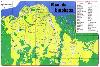
| Kinshasa FeatureType : null Elevation : 283 Lat/Lng : -4.3317 / 15.3139 | Kinshasa (; ; formerly Léopoldville (or Dutch nocat=true)) is the capital and the largest city of the Democratic Republic of the Congo. The city is situated alongside the Congo River. Once a site of fishing and trading villages, Kinshasa is now a megacity with an estimated population of more than (...) |
| 6 | 
| Kananga FeatureType : city Elevation : 638 Lat/Lng : -5.897 / 22.4488 | Kananga, formerly known as Luluabourg or Luluaburg, is the capital city of the Lulua Province in the Democratic Republic of the Congo and was the capital of the former Kasaï-Occidental Province. The city has an estimated population of 1,463,556.http://www.tiptopglobe (...) |
| 7 | 
| Kisangani FeatureType : city Elevation : 401 Lat/Lng : 0.5193 / 25.1962 | Kisangani (formerly Stanleyville or Stanleystad) is the capital of Tshopo province in the Democratic Republic of the Congo. It is the third largest urbanized city in the country and the largest of the cities that lie in the tropical woodlands of the Congo (...) |
| 8 | Haut-Katanga Province FeatureType : adm1st Elevation : 1214 Lat/Lng : -11.6697 / 27.4581 | Haut-Katanga is one of the 26 provinces of the Democratic Republic of the Congo. Specified under Article 2 of the country's 2006 Constitution, the new province was finally created in 2015 from Haut-Katanga District and the independently administered cities of Lubumbashi and Likasi, all previously (...) | |
| 9 | Lubumbashi International Airport FeatureType : null Elevation : 1297 Lat/Lng : -11.5913 / 27.531 | Lubumbashi International Airport is an airport serving Lubumbashi, Democratic Republic of the Congo. (...) | |
| 10 | Lubumbashi (commune) FeatureType : city Elevation : 1222 Lat/Lng : -11.6667 / 27.4667 | Lubumbashi is a commune of the city of Lubumbashi in the Democratic Republic of the Congo. | |
| 11 | Linafoot FeatureType : null Elevation : 1504 Lat/Lng : -1.6833 / 29.2333 | The Linafoot is the top division of the Fédération Congolaise de Football-Association, the governing body of football in the Democratic Republic of the Congo. It was created in 1958. In 2013, the highest attendance was set in the match DC Motema Pembe - AS Vita Club, which saw an attendance of (...) | |
| 12 | Lualaba River FeatureType : null Elevation : 350 Lat/Lng : 2.1478 / 22.4819 | The Lualaba River flows entirely within the eastern Democratic Republic of the Congo. It is the greatest river source (headstream) of the Congo River by volume of water. The Lualaba is long. Its headwaters are in the country's far southeastern corner near Musofi and Lubumbashi in Katanga Province, (...) | |
| 13 | 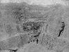
| Shinkolobwe FeatureType : null Elevation : 1410 Lat/Lng : -11.055 / 26.5473 | Shinkolobwe, or Kasolo, or Chinkolobew, or Shainkolobwe, is a radium and uranium mine in the Katanga province of the Democratic Republic of the Congo (DRC), located 20 km west of Likasi, 20 km south of Kambove, and about 145 km northwest of Lubumbashi (...) |
| 14 | Kolwezi FeatureType : city Elevation : 1496 Lat/Lng : -10.7167 / 25.4667 | Kolwezi or Kolwesi is the capital city of Lualaba Province in the south of the Democratic Republic of the Congo, west of Likasi. It is home to an airport and a railway to Lubumbashi. The population is approximately 453,000. (...) | |
| 15 | Kindu FeatureType : null Elevation : 465 Lat/Lng : -2.95 / 25.92 | Kindu is a city in the Democratic Republic of Congo, the capital of Maniema province. It has a population of about 200,000 and is situated on the Lualaba River at an altitude of about 500 metres, and is about 400 km west of Bukavu (...) | |
| 16 | Belgian Congo FeatureType : city Elevation : 279 Lat/Lng : -4.3167 / 15.3167 | The Belgian Congo was a Belgian colony in Central Africa from 1908 until independence in 1960. The former colony is now the Democratic Republic of the Congo (DRC). Colonial rule in the Congo began in the late 19th century (...) | |
| 17 | Zaire FeatureType : null Elevation : 284 Lat/Lng : -4.4 / 15.4 | Zaire , officially the Republic of Zaire , was the name for the Democratic Republic of the Congo that existed between 1971 and 1997 in Central Africa. The country was a one-party totalitarian dictatorship, run by Mobutu Sese Seko and his ruling Popular Movement of the Revolution party (...) | |
| 18 | Rwashi FeatureType : city Elevation : 1308 Lat/Lng : -11.6294 / 27.5461 | Rwashi is a commune of the city of Lubumbashi in the Democratic Republic of the Congo. | |
| 19 | Ilebo FeatureType : null Elevation : 444 Lat/Lng : -4.3303 / 20.5873 | Ilebo, formerly known as Port-Francqui, is a town in Kasaï District, Kasaï-Occidental province in the Democratic Republic of Congo, lying at the highest navigable point of the Kasaï River. It is an important transport hub for ferries to Kinshasa and trains to Lubumbashi. (...) | |
| 20 | Ndola FeatureType : city Elevation : 1306 Lat/Lng : -12.9667 / 28.6333 | Ndola is the third largest city in Zambia, with a population of 475,194 (2010 census provisional). It is the industrial and commercial center of the Copperbelt, Zambia's copper-mining region, and capital of Copperbelt Province. It is also the commercial capital city of Zambia (...) | |
| 21 | University of Lubumbashi FeatureType : landmark Elevation : 1280 Lat/Lng : -11.6146 / 27.4807 | The University of Lubumbashi, also known by the acronym UNILU, is one of the largest universities in the Democratic Republic of the Congo. It is located in Lubumbashi in Katanga Province. The campus is located in the northern part of the city, west of the airport (...) | |
| 22 | Mbuji-Mayi FeatureType : city Elevation : 626 Lat/Lng : -6.173 / 23.6031 | Mbuji-Mayi (formerly Bakwanga) serves as the capital city of Kasai-Oriental Province in the south-central Democratic Republic of Congo. It is the third largest city in the country, following the capital Kinshasa and second largest city Lubumbashi but ahead of Kisangani and Kananga, though the exact (...) | |
| 23 | Roman Catholic Archdiocese of Lubumbashi FeatureType : null Elevation : 1255 Lat/Lng : -11.6657 / 27.4798 | The Roman Catholic Archdiocese of Lubumbashi is the Metropolitan See for the Ecclesiastical province of Lubumbashi in the Democratic Republic of the Congo. (...) | |
| 24 | Kipushi FeatureType : city Elevation : 1348 Lat/Lng : -11.761 / 27.2514 | Kipushi is a town in Haut-Katanga District, Democratic Republic of the Congo. It lies 35 km southwest of the city of Lubumbashi, very close to the border with Zambia, at an altitude of 1329 m (4363 ft).National Geographic Atlas of the World: Revised Sixth Edition, National Geographic Society, 1992 (...) | |
| 25 | Lake Mweru FeatureType : waterbody Elevation : 921 Lat/Lng : -8.9956 / 28.7161 | Lake Mweru (also spelled Mwelu, Mwero) is a freshwater lake on the longest arm of Africa's second-longest river, the Congo. Located on the border between Zambia and Democratic Republic of the Congo, it makes up 110 km of the total length of the Congo, lying between its Luapula River (upstream) and (...) | |
| 26 | Copperbelt Province FeatureType : adm1st Elevation : 1216 Lat/Lng : -13.0 / 28.0 | Copperbelt Province is a province in Zambia which covers the mineral-rich Copperbelt, and farming and bush areas to the south. It was the backbone of the Northern Rhodesian economy during British colonial rule and fuelled the hopes of the immediate post-independence period, but its economic (...) | |
| 27 | University of Kinshasa FeatureType : edu Elevation : 441 Lat/Lng : -4.4194 / 15.3097 | The University of Kinshasa , commonly known as UNIKIN, is one of the three major universities in the Democratic Republic of the Congo, together with the University of Kisangani and University of Lubumbashi. Originally founded in 1954 as Lovanium University during Belgian colonial rule, the current (...) | |
| 28 | Kasumbalesa FeatureType : city Elevation : 1392 Lat/Lng : -12.1975 / 27.7978 | Kasumbalesa or sometimes Kasile is a border town in the province of Katanga in the Democratic Republic of the Congo about 96 km south-south-east of Lubumbashi. It is located at the border with Zambia, and is connected by road and railway with Lubumbashi. | |
| 29 | Copperbelt FeatureType : forest Elevation : 1255 Lat/Lng : -12.0 / 28.0 | The Copperbelt is a natural region in Central Africa which sits on the border region between northern Zambia and the southern Democratic Republic of Congo. It is known for copper mining. Traditionally, the term Copperbelt includes the mining regions of Zambia's Copperbelt Province (notably the towns (...) | |
| 30 | Manono, Democratic Republic of the Congo FeatureType : null Elevation : 602 Lat/Lng : -7.2833 / 27.4333 | Manono is a town and territory in Tanganyika Province, Democratic Republic of the Congo. (...) | |
| 31 | Kalemie FeatureType : landmark Elevation : 771 Lat/Lng : -5.9469 / 29.2017 | Kalemie, formerly Albertville or Albertstad, is a town on the western shore of Lake Tanganyika in the Democratic Republic of the Congo. The town is next to the outflow of the Lukuga River from Lake Tanganyika to the Lualaba River. Kalemie's twin town is Steinheim in Germany. (...) | |
| 32 | Lunda Sul Province FeatureType : adm1st Elevation : 1136 Lat/Lng : -10.3167 / 20.8167 | Lunda Sul is a province of Angola. It has an area of 77,637 km² and a 2014 census population of 516,077. Saurimo is the capital of the province. (...) | |
| 33 | South African Air Force FeatureType : null Elevation : 18 Lat/Lng : -29.9686 / 30.9478 | The South African Air Force (SAAF) is the air force of South Africa, with headquarters in Pretoria. The South African Air Force was established on 1 February 1920. The Air Force has seen service in World War II and the Korean War (...) | |
| 34 | Katuba FeatureType : city Elevation : 1216 Lat/Lng : -11.7117 / 27.455 | Katuba is a commune of the city of Lubumbashi in the Democratic Republic of the Congo. | |
| 35 | Kampemba FeatureType : city Elevation : 1281 Lat/Lng : -10.965 / 26.7318 | Kampemba is a commune of the city of Lubumbashi in the Democratic Republic of the Congo. | |
| 36 | Kamalondo FeatureType : city Elevation : 1228 Lat/Lng : -11.6835 / 27.4859 | Kamalondo is a commune of the city of Lubumbashi in the Democratic Republic of the Congo. | |
| 37 | Kilwa, Democratic Republic of the Congo FeatureType : null Elevation : 951 Lat/Lng : -9.286 / 28.334 | Kilwa is a small town, headquarters of Moero Sector, Pweto Territory, Katanga Province of the Democratic Republic of the Congo (DRC). Kilwa lies on the west shore of Lake Mweru opposite Kilwa Island, which is part of Zambia. Kilwa is from Lubumbashi. The population of 6,000 mainly live from fishing (...) | |
| 38 | Pweto FeatureType : null Elevation : 954 Lat/Lng : -8.466 / 28.9008 | Pweto is a town in the Haut-Katanga Province of the Democratic Republic of the Congo (DRC). It is the administrative center of Pweto Territory. The town was the scene of a decisive battle in December 2000 during the Second Congo War which resulted in both sides making more active efforts to achieve (...) | |
| 39 | Copper mining in the Democratic Republic of the Congo FeatureType : null Elevation : 1103 Lat/Lng : -8.8833 / 28.2667 | Copper mining in the Democratic Republic of the Congo mainly takes place in the Copper Belt of the southern Katanga Province of the Democratic Republic of the Congo. (...) | |
| 40 | Haut-Katanga District FeatureType : adm2nd Elevation : 1222 Lat/Lng : -11.6667 / 27.4667 | Haut-Katanga District (Upper Katanga District) is a district located in the Katanga Province of the Democratic Republic of the Congo. The copper mining centers of Lubumbashi and Likasi are surrounded by the district but are administratively separate. (...) | |
| 41 | Canada–Democratic Republic of the Congo relations FeatureType : null Elevation : 59 Lat/Lng : 45.4274 / -75.6737 | Canada–Democratic Republic of the Congo relations refers to the bilateral relationship between Canada and the Democratic Republic of the Congo. Canada has an embassy in Kinshasa and D.R. Congo has an embassy in Ottawa (...) | |
| 42 | Mweka, Democratic Republic of the Congo FeatureType : null Elevation : 537 Lat/Lng : -4.84 / 21.57 | Mweka is a town in southern-central Democratic Republic of the Congo, situated on the Kasai railway line between Kananga (250 km away) and the Kasai River port of Ilebo (172 km away). Mweka is also the headquarters of the Territoire de Mweka (administrative district) of the present Kasai Province (...) | |
| 43 | Sankuru FeatureType : adm1st Elevation : 540 Lat/Lng : -3.3575 / 23.5967 | Sankuru is one of the 26 provinces of the Democratic Republic of the Congo. Its capital is Lusambo. (...) | |
| 44 | Roman Catholic Diocese of Kamina FeatureType : null Elevation : 1131 Lat/Lng : -8.7331 / 24.9991 | The Roman Catholic Diocese of Kamina is a diocese located in the city of Kamina in the Ecclesiastical province of Lubumbashi in the Democratic Republic of the Congo. (...) | |
| 45 | Kenya (disambiguation) FeatureType : null Elevation : 730 Lat/Lng : 3.5578 / 31.4396 | Kenya is a country in Africa. Kenya may also refer to: (...) | |
| 46 | Kasenga FeatureType : city Elevation : 957 Lat/Lng : -10.372 / 28.614 | Kasenga is a town in Kasenga Territory of Katanga province of the Democratic Republic of the Congo. It is located in south of Lake Mweru, approximately north-east of Lubumbashi., near the border with Zambia. (...) | |
| 47 | National Assembly (Democratic Republic of the Congo) FeatureType : landmark Elevation : 291 Lat/Lng : -4.3322 / 15.3031 | The National Assembly is the lower house and main legislative political body of the Parliament of the Democratic Republic of the Congo. It was established by the 2006 constitution. It is located at the People's Palace in Kinshasa. (...) | |
| 48 | University of Kisangani FeatureType : null Elevation : 398 Lat/Lng : 0.5138 / 25.1763 | The University of Kisangani (UNIKIS) is located in the city of Kisangani in the Democratic Republic of the Congo. It was founded in 1963 by Protestant missionaries as the Free University of the Congo (ULC); it was transformed into part of the National University of Zaire in 1971, and in 1981 was (...) | |
| 49 | Stade Frederic Kibassa Maliba FeatureType : landmark Elevation : 1206 Lat/Lng : -11.7047 / 27.484 | Stade Frédéric-Kibassa-Maliba, also known as Stade de la Kenya, is a multi-use stadium located in the Kenya suburb of Lubumbashi, Democratic Republic of the Congo. It is currently used mostly for football matches. It is the current home of FC Saint Eloi Lupopo and the former home venue of TP Mazembe (...) | |
| 50 | University of Mbuji Mayi FeatureType : null Elevation : 609 Lat/Lng : -6.1132 / 23.6008 | The University of Mbuji Mayi (UM) is an accredited private university in the Democratic Republic of the Congo, located in the province of Kasai-Oriental, city of Mbuji Mayi. The university is one of the many initiatives by the "Fondation Cardinal Malula" (...) | |
| 51 | Ankoro FeatureType : null Elevation : 562 Lat/Lng : -6.75 / 26.95 | Ankoro is a town in Haut-Katanga District, Democratic Republic of the Congo. It lies on the west bank of the Lualaba River opposite the point where it is joined by the Luvua River. (...) | |
| 52 | Musonoi Mine FeatureType : null Elevation : 1459 Lat/Lng : -10.7167 / 25.4 | The Musonoi mine is a set of open-cut pits near Kolwezi from which copper and other metals have been extracted since the 1940s. The mining complex is located in the Katanga Province of the Democratic Republic of the Congo. Kolwezi is about northwest from Lubumbashi, the provincial capital. (...) | |
| 53 | Kindu rail accident FeatureType : landmark Elevation : 476 Lat/Lng : -4.3044 / 26.0711 | In the Kindu rail accident on November 29, 2005, at least 60 people were killed on the Vicicongo line when they were swept off the roof of a train into the river below as the train crossed a bridge in the eastern Democratic Republic of Congo (...) | |
| 54 | Kenya, Lubumbashi FeatureType : city Elevation : 1214 Lat/Lng : -11.6971 / 27.4795 | Kenya is a commune of the city of Lubumbashi in the Democratic Republic of the Congo. It was created in 1929 as an extension of Kamalondo. Lisr of Neighborhoods: * Lualaba * Luapula * Luvua * Brondo | |
| 55 | Fungurume FeatureType : null Elevation : 1190 Lat/Lng : -10.6174 / 26.3095 | Fungurume is a city in Katanga Province, in southern Democratic Republic of the Congo. As of 2012, it has a population of 34,104, up from 28,938 in 2008. The city is located about 200 kilometers from Lubumbashi. Its economy is mostly based around copper and cobalt mines. (...) | |
| 56 | Stade TP Mazembe FeatureType : landmark Elevation : 1240 Lat/Lng : -11.6784 / 27.4892 | Stade TP Mazembe is a multi-use stadium located in the Kamalondo suburb of Lubumbashi, Democratic Republic of the Congo. Since its completion in 2011, it has mostly been used for football matches and is the home venue of TP Mazembe and CS Don Bosco. The stadium has 18,000 seats (...) | |
| 57 | Roman Catholic Diocese of Kalemie–Kirungu FeatureType : null Elevation : 1131 Lat/Lng : -7.0594 / 29.732 | The Roman Catholic Diocese of Kalemie–Kirungu is a diocese located in the city of Kalemie–Kirungu in the Ecclesiastical province of Lubumbashi in the Democratic Republic of the Congo. (...) | |
| 58 | Katanda Territory FeatureType : city Lat/Lng : -6.25 / -23.9167 | Katanda Territory is one of five territories which, along with the city of Mbuji-Mayi, constitute the current Congolese province of Kasai-Oriental. The Democratic Republic of the Congo (DRC) is made up of 192 territories and 20 cities which are grouped in 26 provinces including Kinshasa, the capital (...) | |
| 59 | Kalumines FeatureType : null Elevation : 1348 Lat/Lng : -11.6005 / 27.2756 | Kalumines is a copper mining property that includes the Kasonta, Lupoto and Niamumenda concessions, with a combined area of . It is about northwest of Lubumbashi in Katanga Province, Democratic Republic of the Congo. (...) | |
| 60 | Ruashi Mine FeatureType : null Elevation : 1291 Lat/Lng : -11.6167 / 27.55 | The Ruashi Mine is an open-pit copper and cobalt mine operated by Metorex that is located about from Lubumbashi in Katanga Province, Democratic Republic of the Congo. The project includes a plant to concentrate the ore from the Ruashi and Etoile mines, and a modern solvent extraction electrowinning (...) | |
| 61 | Etoile Mine FeatureType : null Elevation : 1271 Lat/Lng : -11.6356 / 27.5832 | The Etoile Mine is an open-pit copper mine on the outskirts of Lubumbashi in Katanga Province of the Democratic Republic of the Congo (DRC). Chemaf (Chemical of Africa) owns the license. Chemaf is 95% owned by Shalina Resources and 5% by the DRC government. (...) | |
| 62 | Kinsevere FeatureType : null Elevation : 1233 Lat/Lng : -11.3611 / 27.5711 | Kinsevere is an open pit mine and Heavy Media Separation plant with an electric arc furnace formerly operated by Anvil Mining, and now operated by Minerals and Metals Group. It is located north of Lubumbashi, Katanga Province, Democratic Republic of Congo (...) | |
| 63 | Yves Debay FeatureType : null Elevation : 393 Lat/Lng : 36.2155 / 37.1593 | Yves Debay (24 December 1954 – 17 January 2013), a veteran French-Belgian war correspondent, founded and reported for French-language magazines Raids and later Assaut (Translation: Assault), which is published out of Boulogne-Billancourt, Paris, France (...) | |
| 64 | Frontier Mine, Katanga FeatureType : null Elevation : 1294 Lat/Lng : -12.7289 / 28.4725 | Frontier Mine is a copper mine in Katanga Province, Democratic Republic of the Congo (DRC) owned and operated by ERG (Eurasian Resources Group). The resource was first mined by First Quantum Minerals. The mine has an annual capacity of 370,000 tonnes of sulphide concentrate containing 27% copper. (...) | |
| 65 | Luishia Mine FeatureType : null Elevation : 1230 Lat/Lng : -11.1687 / 27.0087 | Luishia mine was an open pit copper and cobalt mine in Katanga Province, Democratic Republic of the Congo. A concession to the south of the mine has recently been opened to exploitation. (...) | |
| 66 | Gécamines FeatureType : landmark Elevation : 1513 Lat/Lng : -10.7109 / 25.399 | La Générale des Carrières et des Mines (Gécamines) is a Congolese commodity trading and mining company headquartered in Lubumbashi, in the Katanga region of the Democratic Republic of Congo. It is a state-controlled corporation founded in 1966 and a successor to the Union Minière du Haut Katanga (...) | |
| 67 | Kalukundi Mine FeatureType : null Elevation : 1409 Lat/Lng : -10.6232 / 25.8998 | Kalukundi Mine is a copper and cobalt mine being developed in Katanga Province, Democratic Republic of the Congo (DRC) by Africo Resources, a Canadian company. In September 2008 the company estimated the value of the resource as $1.47 billion. (...) | |
| 68 | Mulungwishi FeatureType : city Elevation : 1211 Lat/Lng : -10.7833 / 26.6333 | Mulungwishi is a community in the Katanga Province in the Democratic Republic of the Congo. It is located 100 miles northwest of Lubumbashi. Bishop John M. Springer and his wife established a mission station there in 1912. The United Methodist Church founded the Mulungwishi Seminary in 1951. | |
 by
by