| 169 records found in wikipedia | |||
| 1 | 
| Kuwait City  FeatureType : null Elevation : 16 Lat/Lng : 29.3697 / 47.9783 | Kuwait City is the capital and largest city of Kuwait. Located at the heart of the country on the shore of the Persian Gulf, and containing Kuwait's National Assembly (parliament), most governmental offices, the headquarters of most Kuwaiti corporations and banks, it is the indisputable political, (...) |
| 2 | 
| Kuwait FeatureType : country Elevation : 56 Lat/Lng : 29.3667 / 47.6333 | Kuwait (; ', or), officially the State of Kuwait (help = no), is a country in Western Asia. Situated in the northern edge of Eastern Arabia at the tip of the Persian Gulf, it shares borders with Iraq and Saudi Arabia. , Kuwait has a population of 4.2 million people: 1.3 million are Kuwaitis and 2 (...) |
| 3 | 
| Kuwait International Airport FeatureType : null Elevation : 43 Lat/Lng : 29.2266 / 47.9689 | Kuwait International Airport is an international airport located in Farwaniya, Kuwait, south of Kuwait City, spread over an area of . It serves as the primary hub for Kuwait Airways and Jazeera Airways. A portion of the airport complex is designated as Abdullah Al-Mubarak Air Base, which contains (...) |
| 4 | 
| Thrissur FeatureType : null Elevation : 17 Lat/Lng : 10.5333 / 76.2167 | Thrissur pronunciation (originally Thiru Siva Peroor and previously known by its anglicised form as Trichur), is the fourth largest city, the third largest urban agglomeration in Kerala (Pop. 1,854,783) and the 20th largest in India. It is also the headquarters of the Thrissur District (...) |
| 5 | 
| Goa FeatureType : adm1st Elevation : 8 Lat/Lng : 15.4989 / 73.8278 | Goa is a state in India within the coastal region known as the Konkan, in Western India. It is bounded by Maharashtra to the north and Karnataka to the east and south, with the Arabian Sea forming its Western coast. It is India's smallest state by area and the fourth smallest by population (...) |
| 6 | 
| Bhutan FeatureType : country Elevation : 2778 Lat/Lng : 27.417 / 90.435 | Bhutan , officially the Kingdom of Bhutan , is a landlocked country in South Asia. Located in the Eastern Himalayas, it is bordered by Tibet Autonomous Region of China in the north, the Sikkim state of India and the Chumbi Valley of Tibet in the west, the Arunachal Pradesh state of India in the (...) |
| 7 | 
| Sylhet FeatureType : null Elevation : 22 Lat/Lng : 24.8978 / 91.8714 | Sylhet (Sylheti: ꠍꠤꠟꠐ), is a metropolitan city in northeastern Bangladesh. It is the administrative seat of Sylhet Division. The city is located on the right bank of the Surma River in northeastern Bengal. It has a subtropical climate and lush highland terrain (...) |
| 8 | 
| Muscat FeatureType : null Elevation : 63 Lat/Lng : 23.6086 / 58.5919 | Muscat is the capital and largest city of Oman. It is the seat of the Governorate of Muscat. According to the National Centre for Statistics and Information (NCSI), the total population of Muscat Governorate reached 1.28 million as of September 2015 (...) |
| 9 | 
| Manama FeatureType : null Elevation : 10 Lat/Lng : 26.2361 / 50.5831 | Manama (' Bahrani pronunciation:) is the capital and largest city of Bahrain, with an approximate population of 157,000 people. Long an important trading center in the Persian Gulf, Manama is home to a very diverse population (...) |
| 10 | 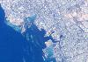
| Jeddah FeatureType : city Elevation : 15 Lat/Lng : 21.5433 / 39.1728 | Jeddah (sometimes spelled Jiddah or Jedda; ; ', Hejazi pronunciation:) is a city in the Tihamah region of the Hejaz on the coast of the Red Sea and is the major urban center of western Saudi Arabia. It is the largest city in Makkah Province, the largest seaport on the Red Sea, and with a population (...) |
| 11 | 
| Pakistan FeatureType : country Elevation : 173 Lat/Lng : 30.6667 / 73.1667 | Pakistan , officially the Islamic Republic of Pakistan , is a country in South Asia. It is the sixth-most populous country with a population exceeding 212,742,631 people. In area, it is the 33rd-largest country, spanning (...) |
| 12 | 
| John F. Kennedy International Airport FeatureType : airport Elevation : 6 Lat/Lng : 40.6405 / -73.7789 | John F. Kennedy International Airport (colloquially referred to as Kennedy Airport, JFK Airport, New York-JFK, or simply JFK or Kennedy) is the primary international airport serving New York City. It is the busiest international air passenger gateway into North America, the 22nd-busiest airport in (...) |
| 13 | 
| Dubai FeatureType : adm1st Elevation : 4 Lat/Lng : 25.205 / 55.2698 | Dubai is the largest and most populous city in the United Arab Emirates (UAE). On the southeast coast of the Persian Gulf, it is the capital of the Emirate of Dubai, one of the seven emirates that make up the country.The Government and Politics of the Middle East and North Africa. D Long, B Reich. p (...) |
| 14 | 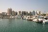
| Bahrain FeatureType : country Elevation : 57 Lat/Lng : 26.0675 / 50.5511 | Bahrain , officially the Kingdom of Bahrain (help=no), is an island country in the Persian Gulf. The sovereign state comprises a small archipelago centered around Bahrain Island, situated between the Qatar peninsula and the north eastern coast of Saudi Arabia, to which it is connected by the King (...) |
| 15 | 
| Bandung FeatureType : city Elevation : 718 Lat/Lng : -6.9147 / 107.6098 | Bandung is the capital of West Java province in Indonesia. According to 2015 estimate, it is the third-largest city in Indonesia after Jakarta and Surabaya with over 2.5 million inhabitants, while Greater Bandung is the country's second largest metropolitan area with over 8.5 millions inhabitants (...) |
| 16 | 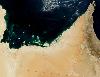
| United Arab Emirates FeatureType : country Elevation : 6 Lat/Lng : 24.4667 / 54.3667 | The United Arab Emirates (UAE; '), sometimes simply called the Emirates , is a country in Western Asia at the southeast end of the Arabian Peninsula on the Persian Gulf, bordering Oman to the east and Saudi Arabia to the south, as well as sharing maritime borders with Qatar to the west and Iran to (...) |
| 17 | 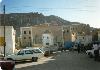
| Yemen FeatureType : country Elevation : 711 Lat/Lng : 15.8134 / 47.7905 | Yemen , officially known as the Republic of Yemen , is a country at the southern end of the Arabian Peninsula. Yemen is the second-largest Arab sovereign state in the peninsula, occupying . The coastline stretches for about (...) |
| 18 | 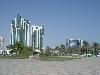
| Qatar FeatureType : country Elevation : 42 Lat/Lng : 25.2694 / 51.2128 | Qatar (Pronunciation adopted by Qatar Airways' advertisements, such as ' , or ; ' ; local vernacular pronunciation:), officially the State of Qatar , is a country located in Western Asia, occupying the small Qatar Peninsula on the northeastern coast of the Arabian Peninsula (...) |
| 19 | 
| Florence FeatureType : city Elevation : 67 Lat/Lng : 43.7717 / 11.2536 | Florence Alternative obsolete form: Fiorenza ; is the capital city of the Italian region of Tuscany. It is the most populous city in Tuscany, with 383,084 inhabitants in 2013, and over 1,520,000 in its metropolitan area (...) |
| 20 | 
| Tel Aviv University FeatureType : edu Elevation : 30 Lat/Lng : 32.1118 / 34.8014 | Tel Aviv University (TAU) (Universitat Tel Aviv) is a public research university in Tel Aviv, Israel. With over 30,000 students, the University is the largest in the country. Located in northwest Tel Aviv, the University is the center of teaching and research of the city, comprising 9 faculties, 17 (...) |
| 21 | 
| Dubai International Airport FeatureType : airport Elevation : 3 Lat/Lng : 25.2536 / 55.3644 | Dubai International Airport is the primary international airport serving Dubai, United Arab Emirates and is the world's busiest airport by international passenger traffic. It is also the third-busiest airport in the world by passenger traffic, the sixth-busiest cargo airport in world, the busiest (...) |
| 22 | 
| Jinnah International Airport FeatureType : null Elevation : 26 Lat/Lng : 24.9067 / 67.1608 | Jinnah International Airport is Pakistan's busiest international and domestic airport, and handled 6,860,095 passengers in 2016-2017. Located in Karachi, the largest city of Pakistan and capital of the province of Sindh, it is named after Muhammad Ali Jinnah, the founder of Pakistan (...) |
| 23 | 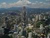
| Kuala Lumpur FeatureType : null Elevation : 42 Lat/Lng : 3.1473 / 101.6984 | Kuala Lumpur , officially the Federal Territory of Kuala Lumpur , or commonly known as KL, is the national capital of Malaysia as well as its largest city. The only global city in Malaysia, it covers an area of and has an estimated population of 1.73 million (...) |
| 24 | 
| Turkmenistan FeatureType : country Elevation : 126 Lat/Lng : 39.0667 / 60.2667 | Turkmenistan (or ;), formerly known as Turkmenia,; New York Times – 28 October 1991. Retrieved on 16 November 2016. officially the Republic of Turkmenistan is a country in Central Asia, bordered by Kazakhstan to the northwest, Uzbekistan to the north and east, Afghanistan to the southeast, Iran to (...) |
| 25 | 
| Diego Garcia FeatureType : isle Elevation : 0 Lat/Lng : -7.3133 / 72.4111 | Diego Garcia is an atoll just south of the equator in the central Indian Ocean, and the largest of 60 small islands comprising the Chagos Archipelago. It was settled by the French in the 1790s and was transferred to British rule after the Napoleonic Wars (...) |
| 26 | 
| Mongolia FeatureType : country Elevation : 1299 Lat/Lng : 47.9167 / 106.9167 | Mongolia (; Monggol Ulus in Mongolian; in Mongolian Cyrillic) is a landlocked country in East Asia. Its area is roughly equivalent with the historical territory of Outer Mongolia, and that term is sometimes used to refer to the current state (...) |
| 27 | 
| George Washington University FeatureType : landmark Elevation : 20 Lat/Lng : 38.9007 / -77.0508 | The George Washington University (GW, GWU, or George Washington) is a private research university in Washington, D.C. It was charted in 1821 by an act of the United States Congress. The university is organized into 14 colleges and schools, including the Columbian College of Arts and Sciences, the (...) |
| 28 | 
| United States FeatureType : country Elevation : 691 Lat/Lng : 40.0 / -100.0 | The United States of America (USA), commonly known as the United States (U.S. or US) or America, is a country composed of 50 states, a federal district, five major self-governing territories, and various possessions. At 3.8 million square miles (9 (...) |
| 29 | 
| Iran FeatureType : country Elevation : 1188 Lat/Lng : 35.7 / 51.4167 | Iran , also known as Persia , officially the Islamic Republic of Iran , is a country in Western Asia. With over 81 million inhabitants, Iran is the world's 18th-most-populous country. Comprising a land area of , it is the second-largest country in the Middle East and the 17th-largest in the world (...) |
| 30 | 
| Egypt FeatureType : country Elevation : 3 Lat/Lng : 24.1333 / 35.4833 | Egypt , officially the Arab Republic of Egypt, is a country spanning the northeast corner of Africa and southwest corner of Asia by a land bridge formed by the Sinai Peninsula. Egypt is a Mediterranean country bordered by the Gaza Strip and Israel to the northeast, the Gulf of Aqaba to the east, the (...) |
| 31 | 
| Socialist Federal Republic of Yugoslavia FeatureType : country Elevation : 1256 Lat/Lng : 42.7833 / 19.4667 | The Socialist Federal Republic of Yugoslavia (SFR Yugoslavia or SFRY) was a country located in Central and Southeastern Europe that existed from its foundation in the aftermath of World War II until its dissolution in 1992 amid the Yugoslav Wars (...) |
| 32 | 
| Kollam FeatureType : null Elevation : 16 Lat/Lng : 8.8861 / 76.5897 | Kollam pronunciation also known by its former name Quilon (Coulão) and Desinganadu, is an old seaport and city on the Laccadive Sea coast of the Indian state of Kerala. The city is on the banks Ashtamudi Lake. Kollam has had a strong commercial reputation since the days of the Phoenicians and Romans (...) |
| 33 | Beed district FeatureType : adm2nd Elevation : 733 Lat/Lng : 18.8333 / 75.75 | Beed district is an administrative district in the state of Maharashtra in India. The district headquarters are located at Beed. The district occupies an area of 10,693 km² and has a population of 2,585,962 of which 17.91% were urban (as of 2011). (...) | |
| 34 | Middle East FeatureType : country Elevation : -216 Lat/Lng : 32.8 / 35.6 | The Middle East is a transcontinental region centered on Western Asia, Turkey (both Asian and European), and Egypt (which is mostly in North Africa). Saudi Arabia is geographically the largest Middle Eastern nation while Bahrain is the smallest (...) | |
| 35 | Amritsar district FeatureType : null Elevation : 232 Lat/Lng : 31.5833 / 74.9833 | Amritsar district is one of 22 districts located in the Majha region of the state of Punjab in North India. The city of Amritsar is headquarters of this district. As of 2011 it is the second most populous district of Punjab (out of 22), after Ludhiana. (...) | |
| 36 | Bhilwara district FeatureType : adm3rd Elevation : 422 Lat/Lng : 25.35 / 74.6333 | Bhilwara District is a district of the state of Rajasthan in western India. The town of Bhilwara is the district headquarters. (...) | |
| 37 | Arabian Peninsula FeatureType : null Elevation : 590 Lat/Lng : 24.65 / 46.71 | The Arabian Peninsula, simplified Arabia (; ', ‘Arabian island’ or ', ‘Island of the Arabs’), is a peninsula of Western Asia situated northeast of Africa on the Arabian plate. From a geographical perspective, it is considered a subcontinent of Asia. It is the largest peninsula in the world, at (...) | |
| 38 | Malappuram FeatureType : null Elevation : 72 Lat/Lng : 11.0437 / 76.081 | Malappuram (also Malapuram; മലപ്പുറം) is a city in the southern Indian state of Kerala, spread over an area of . The first municipality in the district formed in 1970, Malappuram serves as the administrative headquarters of Malappuram district (...) | |
| 39 | Kollam district FeatureType : null Lat/Lng : 8.8 / 76.6 | Kollam district (formerly Quilon) is one of 14 districts of the state of Kerala, India. The district has a cross-section of Kerala's natural attributes; it is endowed with a long coastline, a major Laccadive Sea seaport and an inland lake (Ashtamudi Lake). The district has many waterbodies (...) | |
| 40 | Bilaspur, Chhattisgarh FeatureType : null Elevation : 272 Lat/Lng : 22.0867 / 82.1431 | Bilaspur is a city in Bilaspur District in the Indian state of Chhattisgarh, situated 114 km (70.83 miles) north of the state capital, Raipur. With a population of 331,030, it is the fourth largest city in the state (...) | |
| 41 | Cricket Kuwait FeatureType : null Elevation : 15 Lat/Lng : 25.2314 / 51.4844 | The Kuwait Cricket is the official governing body for the game of cricket in Kuwait. It is an associate member of the International Cricket Council, and a full member of the Asian Cricket Council and affiliated to Kuwait Olympic Committee. The Association was founded in 1996. (...) | |
| 42 | Thiruvananthapuram district FeatureType : null Elevation : 71 Lat/Lng : 8.604 / 76.9857 | Thiruvananthapuram District is the southernmost district of the coastal state of Kerala. The district was created 1957, with its headquarters in the city of Thiruvananthapuram (Trivandrum), which is also Kerala's capital. The district covers an area of (...) | |
| 43 | 2015 Kuwait mosque bombing FeatureType : city Elevation : 19 Lat/Lng : 29.3766 / 47.9765 | A suicide bombing took place on 26 June 2015 at a Shia mosque in Kuwait. The Islamic State of Iraq and the Levant claimed responsibility for the attack. Kuwait's Emir arrived at the location of the incident after a short period of time (...) | |
| 44 | South Yemen FeatureType : null Elevation : 2 Lat/Lng : 12.8 / 45.0333 | South Yemen is the common English name for the People's Democratic Republic of Yemen , which existed from 1967 to 1990 as a state in the Middle East in the southern and eastern provinces of the present-day Republic of Yemen, including the island of Socotra (...) | |
| 45 | Asia FeatureType : null Elevation : 517 Lat/Lng : 46.2833 / 86.6667 | Asia is Earth's largest and most populous continent, located primarily in the Eastern and Northern Hemispheres. It shares the continental landmass of Eurasia with the continent of Europe and the continental landmass of Afro-Eurasia with both Europe and Africa (...) | |
| 46 | US Open (tennis) FeatureType : landmark Elevation : 14 Lat/Lng : 40.7499 / -73.847 | The United States Open Tennis Championships is a hard court tennis tournament. The tournament is the modern version of one of the oldest tennis championships in the world, the U.S. National Championship, for which men's singles was first played in 1881 (...) | |
| 47 | Siddharthnagar district FeatureType : null Elevation : 89 Lat/Lng : 27.3005 / 83.0945 | Siddharth Nagar district is one of the 75 districts of Uttar Pradesh state in Northern India. Naugarh town is the district headquarters. Siddharth Nagar district is a part of Basti division. According to the Government of India, Siddharth Nagar district is one of the Muslim concentrated districts (...) | |
| 48 | London City Airport FeatureType : airport Elevation : 17 Lat/Lng : 51.5052 / 0.0537 | London City Airport is an international airport in London, United Kingdom. It is located in the Royal Docks in the London Borough of Newham, approximately east of the City of London and a shorter distance east of Canary Wharf (...) | |
| 49 | Mathura district FeatureType : adm2nd Elevation : 180 Lat/Lng : 27.49 / 77.67 | Mathura district situated along the banks of the river Yamuna is a district of Uttar Pradesh state of northern India. The historic town of Mathura is the district headquarters. The District is part of Agra division (...) | |
| 50 | Naypyidaw FeatureType : null Elevation : 164 Lat/Lng : 19.7285 / 96.0879 | Naypyidaw, officially spelled Nay Pyi Taw (; , formerly known as Kyetpyay, Pyinmana or Kyatpyay, Pyinmana), is the capital city of Myanmar and seat of the government of Myanmar. It is administered as the Naypyidaw Union Territory, as per the Constitution (...) | |
| 51 | 2015 FeatureType : null Elevation : 21 Lat/Lng : 29.7565 / 112.9243 | 2015 was designated as: * International Year of Light * International Year of Soils __TOC__ (...) | |
| 52 | Jabalpur district FeatureType : adm2nd Elevation : 406 Lat/Lng : 23.16 / 79.94 | Jabalpur district is a district of Madhya Pradesh state in central India. The city of Jabalpur is the administrative headquarters of the district. The area of the district is 5,198 km² with population of 2,167,469 (2001 census) (...) | |
| 53 | Kannur district FeatureType : null Elevation : 11 Lat/Lng : 11.8689 / 75.3555 | Kannur District is one of the 14 districts along the west coast in the state of Kerala, India. The town of Kannur is the district headquarters and gives the district its name. The old name, Cannanore is the anglicised form of the Malayalam name "Kannur" (...) | |
| 54 | Tumakuru district FeatureType : null Elevation : 820 Lat/Lng : 13.34 / 77.1 | Tumakuru District is an administrative district in the state of Karnataka in India. It was formerly the part of old Mysuru State. It was formed in 1832 during the days of British commissioner of Mysuru Sir Mark Cubbon as Chitaldroog Division including the area of present Chitradurga and Tumakuru (...) | |
| 55 | Salmiya FeatureType : null Elevation : 11 Lat/Lng : 29.3339 / 48.0761 | Salmiya (Arabic السالمية; transliterated As-Sālmīya(h)) is a city area in Hawalli Governorate in the State of Kuwait. Salmiya is administratively divided into 12 blocks. The blocks located closer to the interior of the district tend to be mostly residential, while those located beside the Persian (...) | |
| 56 | Lufthansa FeatureType : landmark Elevation : 50 Lat/Lng : 50.9415 / 6.9809 | Deutsche Lufthansa AG (or JSC) , commonly known as Lufthansa (sometimes also as Lufthansa German Airlines), is the largest German airline and, when combined with its subsidiaries, also the largest airline in Europe both in terms of fleet size, largest airlines in Europe (...) | |
| 57 | Bilaspur district, Chhattisgarh FeatureType : adm2nd Elevation : 331 Lat/Lng : 22.3833 / 82.1333 | Bilaspur district is a district of the Chhattisgarh state of India. Bilaspur city is the headquarters of the district. As of 2011 it is the second most populous district of Chhattisgarh (out of 18), after Raipur . (...) | |
| 58 | Firozabad district FeatureType : null Elevation : 166 Lat/Lng : 27.1518 / 78.4016 | Firozabad district forms one of the western districts of the Indian state of Uttar Pradesh, which has Firozabad Town as its district headquarters. The district is a part of the Agra division. (...) | |
| 59 | United Nations FeatureType : null Elevation : 11 Lat/Lng : 40.75 / -73.9675 | The United Nations (UN) is an intergovernmental organization tasked to promote and secure international co-operation and to create and maintain international order. A replacement for the ineffective League of Nations, the organization was established on 24 October 1945 after World War II with the (...) | |
| 60 | BP FeatureType : null Lat/Lng : 28.7539 / -88.3147 | BP plc (formerly The British Petroleum Company plc and BP Amoco plc) is a British multinational oil and gas company headquartered in London, England. It is one of the world's seven oil and gas "supermajors", whose performance in 2012 made it the world's sixth-largest oil and gas company, the (...) | |
| 61 | East End of London FeatureType : landmark Elevation : 15 Lat/Lng : 51.5167 / -0.05 | The East End of London, usually called the East End, is the historic core of wider East London, east of the Roman and medieval walls of the City of London, and north of the River Thames. It does not have universally accepted boundaries, though the various channels of the River Lea are often (...) | |
| 62 | 2014 Asian Games FeatureType : landmark Elevation : 38 Lat/Lng : 37.9667 / 124.65 | The 2014 Asian Games (Hanja:2014年 아시안 게임), officially known as the 17th Asian Games, was a pan-Asian multi-sport event held in Incheon, South Korea. This was the third time South Korea hosted the Asian Games, and its' first time since 2002 (...) | |
| 63 | Gopalganj district, India FeatureType : null Elevation : 75 Lat/Lng : 26.4654 / 84.4416 | Gopalganj is one of the administrative districts in the Indian state of Bihar. The district headquarters is the town of Gopalganj, and the district is part of Saran Division. Major languages spoken are Bhojpuri, and Hindi. (...) | |
| 64 | 
| Geography of Lebanon FeatureType : country Elevation : 1210 Lat/Lng : 33.8333 / 35.8333 | Lebanon is part of the Middle East, located at approximately 35˚N, 35˚E. Stretching along the eastern shore of the Mediterranean Sea, its length almost three times its width. As it stretches from north to south, the width of its terrain becomes narrower (...) |
| 65 | UNESCO FeatureType : landmark Elevation : 35 Lat/Lng : 48.8501 / 2.3062 | The United Nations Educational, Scientific and Cultural Organization (UNESCO;) is a specialized agency of the United Nations (UN) based in Paris. Its declared purpose is to contribute to peace and security by promoting international collaboration through educational, scientific, and cultural reforms (...) | |
| 66 | Sikar district FeatureType : null Elevation : 432 Lat/Lng : 27.62 / 75.15 | Sikar district is a district of the Indian state Rajasthan in northern India. The city of Sikar is the administrative headquarters of the district. (...) | |
| 67 | Cuttack district FeatureType : null Elevation : 29 Lat/Lng : 20.466 / 85.833 | Cuttack district is one of the 30 districts of Odisha state in East India. Its administrative headquarters are located in the city of Cuttack. As of 2011 Census, after Ganjam, it is the second most populous district of Odisha (out of 30), with a population of 2,624,470. (...) | |
| 68 | Al-Azhar University FeatureType : edu Elevation : 32 Lat/Lng : 30.0458 / 31.2625 | Al-Azhar University (; , , "the (honorable) University of Al-Azhar") is a university in Cairo, Egypt. Associated with Al-Azhar Mosque in Islamic Cairo, it is Egypt's oldest degree-granting university and is renowned as "Sunni Islam’s most prestigious university" (...) | |
| 69 | Fatehpur district FeatureType : null Elevation : 119 Lat/Lng : 25.9333 / 80.8 | Fatehpur District is one of the 75 districts of Uttar Pradesh state in northern India. The district covers an area of 4,152 km². The district has a population of 2,632,733 (2011 Census). Fatehpur city is the administrative headquarters of the district (...) | |
| 70 | Ford Motor Company FeatureType : landmark Elevation : 181 Lat/Lng : 42.3147 / -83.2106 | Ford Motor Company is an American multinational automaker headquartered in Dearborn, Michigan, a suburb of Detroit. It was founded by Henry Ford and incorporated on June 16, 1903. The company sells automobiles and commercial vehicles under the Ford brand and most luxury cars under the Lincoln brand (...) | |
| 71 | IKEA FeatureType : landmark Elevation : 6 Lat/Lng : 52.1671 / 4.4824 | IKEA is a Swedish-founded multinational group that designs and sells , kitchen appliances and home accessories, among other useful goods and occasionally home services. It has been the world's largest furniture retailer since at least 2008 (...) | |
| 72 | History of Iran FeatureType : country Elevation : 1623 Lat/Lng : 29.9344 / 52.8914 | The history of Iran, commonly also known as Persia in the Western world, is intertwined with the history of a larger region, also to an extent known as Greater Iran, comprising the area from Anatolia, the Bosphorus, and Egypt in the west to the borders of Ancient India and the Syr Darya in the east, (...) | |
| 73 | John F. Kennedy FeatureType : landmark Elevation : 53 Lat/Lng : 38.8815 / -77.0715 | John Fitzgerald "Jack" Kennedy (May 29, 1917 – November 22, 1963), commonly referred to by his initials JFK, was an American politician who served as the 35th President of the United States from January 1961 until his assassination in November 1963 (...) | |
| 74 | History of Kuwait FeatureType : null Elevation : 8 Lat/Lng : 30.5 / 47.8167 | Kuwait is a country in the Arabian Peninsula, surrounding the Gulf of Kuwait at the head of the Persian Gulf. In the eighteenth and nineteenth centuries, Kuwait was a prosperous trade port. (...) | |
| 75 | Hurricane Katrina FeatureType : null Elevation : 5 Lat/Lng : 29.9667 / -90.05 | Hurricane Katrina was an extremely destructive and deadly Category 5 hurricane that struck the Gulf Coast of the United States in August 2005, causing catastrophic damage from central Florida to eastern Texas. Subsequent flooding, caused largely as a result of fatal engineering flaws in the flood (...) | |
| 76 | Assyria FeatureType : null Elevation : 248 Lat/Lng : 36.0 / 43.3 | Assyria , also called the Assyrian Empire, was a major Semitic-speaking Mesopotamian kingdom and empire of the ancient Near East and the Levant. It existed as a state from perhaps as early as the 25th century BC in the form of the Assur city-state, until its collapse between 612 BC and 609 BC, (...) | |
| 77 | Silvassa FeatureType : city Elevation : 42 Lat/Lng : 20.2708 / 73.005 | Silvassa Pronunciations ; is the capital of the Indian Union Territory of Dadra and Nagar Haveli. During Portuguese rule, Silvassa was also known as Vila de Paço d'Arcos, after the town of the same name near Lisbon (Paço de Arcos, Oeiras) (...) | |
| 78 | Sabarkantha district FeatureType : adm2nd Elevation : 140 Lat/Lng : 23.6 / 72.95 | Sabarkantha is a district in Northeast of Gujarat state of India. (...) | |
| 79 | Osama bin Laden FeatureType : null Elevation : 1191 Lat/Lng : 34.1693 / 73.2425 | Osama bin Mohammed bin Awad bin LadenThe common transliteration is based on Afghan Persian; according to standard Arabic pronunciation, his name would be rendered in English Usamah bin Muhammad bin Awad bin Ladin (...) | |
| 80 | University of California, Los Angeles FeatureType : edu Elevation : 128 Lat/Lng : 34.0722 / -118.4441 | The University of California, Los Angeles (UCLA), is a public research university in the Westwood district of Los Angeles, United States. It became the Southern Branch of the University of California in 1919, making it the second-oldest (after UC Berkeley) undergraduate campus of the 10-campus (...) | |
| 81 | I-League FeatureType : null Elevation : 352 Lat/Lng : 30.75 / 76.78 | The I-League is a men's professional football league in India. For sponsorship reasons, the league is officially known as the Hero I-League. One of the top football leagues in the country, it currently shares the top spot in the Indian football system with the Indian Super League (...) | |
| 82 | Chalakudy FeatureType : null Elevation : 17 Lat/Lng : 10.3 / 76.33 | Chalakudy is a municipal town situated on the banks of Chalakudy River in Thrissur District of the Kerala State in India. It is the headquarters of Chalakudy taluk. It is the base camp for travellers to Athirappilly and Vazhachal Falls (...) | |
| 83 | Latur district FeatureType : null Elevation : 642 Lat/Lng : 18.4 / 76.58 | Latur district is a district in Maharashtra state of India. Latur city is the district headquarters and is the 16th largest city in the state of Maharashtra.In the 2011 census, Latur City had a population of 382,754. The district is primarily agricultural. Urban population comprises 25 (...) | |
| 84 | Srikakulam district FeatureType : adm2nd Elevation : 19 Lat/Lng : 18.4167 / 84.0167 | Srikakulam district is one of thirteen districts in the Indian state of Andhra Pradesh. It is one of the nine coastal districts, located in the extreme northeastern direction of the state. The headquarters of the district is at Srikakulam. It was formerly known as Chicacole. (...) | |
| 85 | Buldhana district FeatureType : null Elevation : 657 Lat/Lng : 20.5328 / 76.1828 | Buldhana district is located in the Amravati division of Maharashtra, India. It is situated at the western border of Vidarbha region and is 500 km away from the state capital, Mumbai. The district has towns and cities like Shegaon,Malkapur,Khamgaon, Lonar, Mehkar, and Dongaon (...) | |
| 86 | Pan Am Flight 103 FeatureType : event Elevation : 74 Lat/Lng : 55.1156 / -3.3585 | Pan Am Flight 103 was a regularly scheduled Pan Am transatlantic flight from Frankfurt to Detroit via London and New York. On 21 December 1988, N739PA, the aircraft operating the transatlantic leg of the route, was destroyed by a bomb, killing all 243 passengers and 16 crew – a disaster known as the (...) | |
| 87 | Central Intelligence Agency FeatureType : landmark Elevation : 73 Lat/Lng : 38.9521 / -77.1452 | The Central Intelligence Agency (CIA) is a civilian foreign intelligence service of the Federal government of the United States, tasked with gathering, processing, and analyzing national security information from around the world, primarily through the use of human intelligence (HUMINT) (...) | |
| 88 | Badshahi Mosque FeatureType : landmark Elevation : 219 Lat/Lng : 31.588 / 74.3094 | The Badshahi Mosque (Punjabi and , or "Imperial Mosque") is a Mughal era masjid in Lahore, capital of the Pakistani province of Punjab, Pakistan. The mosque is located west of Lahore Fort along the outskirts of the Walled City of Lahore, and is widely considered to be one of Lahore's most iconic (...) | |
| 89 | Gulbarga district FeatureType : null Elevation : 458 Lat/Lng : 17.3333 / 76.8333 | Gulbarga district, officially known as Kalaburagi district, is one of the 30 districts of Karnataka state in southern India. Gulbarga city is the administrative headquarters of the district. This district is situated in northern Karnataka between 76°.04' and 77°.42 east longitude, and 17° (...) | |
| 90 | 2010 Asian Games FeatureType : null Elevation : 14 Lat/Lng : 23.1289 / 113.2589 | The 2010 Asian Games, also known as the XVI Asian Games , was a multi-sport event celebrated in Guangzhou, Guangdong, China from 12 to 27 November 2010, although several events had commenced from 7 November 2010 (...) | |
| 91 | 2011 IIHF Challenge Cup of Asia FeatureType : null Elevation : 26 Lat/Lng : 29.3297 / 48.0034 | The 2011 IIHF Challenge Cup of Asia was the 4th IIHF Challenge Cup of Asia, an annual international ice hockey tournament held by the International Ice Hockey Federation (IIHF). It took place between April 25 and April 30, 2011 in Kuwait City, Kuwait (...) | |
| 92 | Syro-Malankara Catholic Church FeatureType : landmark Elevation : 36 Lat/Lng : 8.525 / 76.9375 | The Syro-Malankara Catholic Church also known as the Malankara Syrian Catholic Church is an Eastern Catholic sui iuris particular church in full communion with the Pope and the worldwide Catholic Church, with self-governance under the Code of Canons of the Eastern Churches (...) | |
| 93 | 2006 Asian Games FeatureType : null Elevation : 20 Lat/Lng : 25.265 / 51.4506 | The 2006 Asian Games (Dawrat al-ʼAl‘ab al-Asīawīah 2006), officially known as the XV Asiad, was an Asian multi-sport event held in Doha, Qatar from December 1 to 15, 2006 with 424 events in 39 sports and disciplines featured in the games (...) | |
| 94 | Ballari district FeatureType : null Elevation : 452 Lat/Lng : 15.15 / 76.9333 | Ballari (pronounced) is a district in Karnataka state, India. Historical sites, farm land and rich minerals characterize Ballari district. It is also the home of the former capital of the famous Vijayanagara Empire, Vijayanagara, a UNESCO World Heritage Site (...) | |
| 95 | Dow Chemical Company FeatureType : landmark Elevation : 18 Lat/Lng : 26.9304 / 49.4708 | The Dow Chemical Company, commonly referred to as Dow, is an American multinational chemical corporation headquartered in Midland, Michigan, United States, and the predecessor of the merged company DowDuPont. In 2017, it was the second-largest chemical manufacturer in the world by revenue (after (...) | |
| 96 | Ma'an FeatureType : null Elevation : 1111 Lat/Lng : 30.19 / 35.73 | Ma'an is a city in southern Jordan, southwest of the capital Amman. It serves as the capital of the Ma'an Governorate. Its population is approximately 41,055 in 2015. Civilizations with the name of Ma'an have existed at least since the Nabatean period—the modern city is just northwest of the ancient (...) | |
| 97 | Manipal FeatureType : null Elevation : 100 Lat/Lng : 13.347 / 74.788 | Manipal is a locality of Udupi city, located 5 kilometres from centre of Udupi City in Karnataka, India and is administered by the Udupi City Municipality. It is located in the part of Coastal Karnataka, about north of Mangalore and east of the Arabian Sea (...) | |
| 98 | 2019 AFC Asian Cup FeatureType : null Elevation : 8 Lat/Lng : 24.4528 / 54.392 | The 2019 AFC Asian Cup will be the 17th edition of the AFC Asian Cup, the quadrennial international men's football championship of Asia organised by the Asian Football Confederation (AFC). It will be held in the United Arab Emirates from 5 January to 1 February 2019 (...) | |
| 99 | Zubarah FeatureType : city Elevation : 10 Lat/Lng : 25.977 / 51.0455 | Zubarah , also referred to as Al Zubarah or Az Zubarah, is a ruined and ancient fort located on the north western coast of the Qatar peninsula in the Al Shamal municipality, about 105 km from the Qatari capital of Doha (...) | |
| 100 | International Ice Hockey Federation FeatureType : null Elevation : 426 Lat/Lng : 47.3684 / 8.5299 | The International Ice Hockey Federation (IIHF; ;) is a worldwide governing body for ice hockey and in-line hockey. It is based in Zurich, Switzerland, and has 76 members. It manages international ice hockey tournaments and maintains the IIHF World Ranking (...) | |
| 101 | Asian Infrastructure Investment Bank FeatureType : landmark Elevation : 46 Lat/Lng : 40.0069 / 116.3834 | The Asian Infrastructure Investment Bank (AIIB) is a multilateral development bank that aims to support the building of infrastructure in the Asia-Pacific region. The bank currently has 87 member states from around the world (...) | |
| 102 | Karaikal district FeatureType : adm2nd Elevation : 8 Lat/Lng : 10.9221 / 79.8335 | Karaikal district (also Karikal or Karaikkal) is one of the four districts of the Union Territory of Puducherry in India. Karaikal city (about 16 km north of Nagappattinam and 12 km south of Tarangambadi) is the regional headquarters (...) | |
| 103 | 1970 Bhola cyclone FeatureType : null Lat/Lng : 14.8333 / 87.0 | The 1970 Bhola cyclone was a devastating tropical cyclone that struck East Pakistan and India's West Bengal on November 12, 1970. It remains the deadliest tropical cyclone ever recorded and one of the deadliest natural disasters. At least 500,000 people lost their lives in the storm, CBC News' (...) | |
| 104 | European Free Trade Association FeatureType : null Elevation : 44 Lat/Lng : 59.9333 / 10.6833 | The European Free Trade Association (EFTA) is a regional trade organization and free trade area consisting of four European states: Iceland, Liechtenstein, Norway, and Switzerland. The organization operates in parallel with the European Union (EU), and all four member states participate in the (...) | |
| 105 | Boeing C-17 Globemaster III FeatureType : null Elevation : 14 Lat/Lng : 32.8986 / -80.0406 | The Boeing C-17 Globemaster III is a large military transport aircraft. It was developed for the United States Air Force (USAF) from the 1980s to the early 1990s by McDonnell Douglas. The C-17 carries forward the name of two previous piston-engined military cargo aircraft, the Douglas C-74 (...) | |
| 106 | Durham Light Infantry FeatureType : null Elevation : 79 Lat/Lng : 54.7844 / -1.5811 | The Durham Light Infantry (DLI) was a light infantry regiment of the British Army in existence from 1881 to 1968. It was formed in 1881 under the Childers Reforms by the amalgamation of the 68th (Durham) Regiment of Foot (Light Infantry) and the 106th Regiment of Foot (Bombay Light Infantry) along (...) | |
| 107 | Mayurbhanj district FeatureType : null Elevation : 37 Lat/Lng : 21.933 / 86.733 | Mayurbhanj district is one of the 30 districts in Odisha state in eastern India. Baripada city is its headquarter. , it is the third-most-populous district of Odisha (out of 30), after Ganjam and Cuttack. Mayurbhanj is land-locked with a geographical area of and is in the northern boundary of the (...) | |
| 108 | Amateur radio in India FeatureType : null Elevation : 10 Lat/Lng : 18.96 / 72.82 | Amateur radio or ham radio is practised by more than 16,000 licensed users in India. The first amateur radio operator was licensed in 1921, and by the mid-1930s, there were around 20 amateur radio operators in India (...) | |
| 109 | Food and Agriculture Organization FeatureType : landmark Elevation : 37 Lat/Lng : 41.8823 / 12.4883 | The Food and Agriculture Organization of the United Nations (FAO;) is a specialized agency of the United Nations that leads international efforts to defeat hunger. Serving both developed and developing countries, FAO acts as a neutral forum where all nations meet as equals to negotiate arguments and (...) | |
| 110 | Colony of Aden FeatureType : landmark Elevation : 2 Lat/Lng : 12.8 / 45.0333 | The Colony of Aden or Aden Colony was a British Crown colony from 1937 to 1963 located in the south of contemporary Yemen. It consisted of the port of Aden and its immediate surroundings (an area of). Prior to 1937, Aden had been governed as part of British India (originally as the Aden Settlement (...) | |
| 111 | Battle of Basra (2003) FeatureType : null Elevation : 2 Lat/Lng : 30.5 / 47.8 | The Battle of Basra lasted from 21 March to 6 April 2003 and was one of the first battles of the 2003 invasion of Iraq. The British 7 Armoured Brigade fought their way into Iraq's second-largest city, Basra, on 6 April coming under constant attack by the Iraqi Army 51st Division and Fedayeen (...) | |
| 112 | Mina FeatureType : null Elevation : 1565 Lat/Lng : -12.4898 / 15.3216 | Mina may refer to: * Mina, a folk word related with the extraction of mineral resources (mines) * Mina (given name), a given name (and list of people and characters with that name) * Mina (surname), a surname (and list of people with that name) * Mina (unit), an ancient Near Eastern unit of weight (...) | |
| 113 | New York Institute of Technology FeatureType : landmark Elevation : 61 Lat/Lng : 40.7697 / -73.9825 | New York Institute of Technology (also known as NYIT) is a private, independent, nonprofit, non-sectarian, coeducational research university founded in 1955. The university has two New York campuses: one in Old Westbury, Nassau County, Long Island, and one near Columbus Circle in Manhattan (...) | |
| 114 | Expo Pilipino FeatureType : landmark Elevation : 172 Lat/Lng : 15.2047 / 120.5281 | Clark Expo (formerly, Expo Pilipino) was the Philippine National Centennial Exposition and centerpiece of the commemoration of the 100th anniversary of the declaration of Philippine Independence on June 12, 1898 (...) | |
| 115 | Death of Osama bin Laden FeatureType : null Elevation : 1195 Lat/Lng : 34.17 / 73.23 | Osama bin Laden, the founder and first leader of the Islamist group Al-Qaeda, was killed in Pakistan on May 2, 2011 shortly after 1:00 am PKT (20:00 UTC, May 1) by United States Navy SEALs of the U.S. Naval Special Warfare Development Group (also known as DEVGRU or SEAL Team Six) (...) | |
| 116 | Nihonjin gakkō FeatureType : null Elevation : 216 Lat/Lng : 42.1214 / -87.9814 | , also called Japanese school, is a full-day school outside Japan for native speakers of Japanese. It is an expatriate school designed for children whose parents are working on diplomatic, business, or education missions overseas and have plans to repatriate to Japan (...) | |
| 117 | Turtle Bay, Manhattan FeatureType : city Elevation : 32 Lat/Lng : 40.7532 / -73.9687 | Turtle Bay is a neighborhood in New York City, on the east side of Midtown Manhattan. It extends from roughly 43rd Street to 53rd Street, and eastward from Lexington Avenue to the East River's western branch, facing Roosevelt Island.Giner, Val. "Turtle Bay" in , p (...) | |
| 118 | Algonquin College FeatureType : edu Elevation : 84 Lat/Lng : 45.3469 / -75.7594 | Algonquin College of Applied Arts and Technology is a publicly funded English-language college and member of Polytechnics Canada located in Ottawa, Ontario, Canada. The college serves the National Capital Region and the outlying areas of Eastern Ontario, Western Quebec, and Upstate New York (...) | |
| 119 | Mordovian State University FeatureType : edu Elevation : 163 Lat/Lng : 54.1872 / 45.1814 | N. P. Ogarev's Mordovia State University (MSUO or OMSU for Ogarev Mordovia State University, or MRSU for Мордовский государственный университет имени Н. П. Огарева, Mordovskyi Gosudarstvennyi Universitet (imeni N. P (...) | |
| 120 | Cholapuram FeatureType : null Elevation : 127 Lat/Lng : 9.3519 / 77.5684 | Cholapuram is a panchayat town in the Thanjavur district of the state of Tamil Nadu, India.In ancient time, it's called as Pairavapuram. (...) | |
| 121 | Multan International Airport FeatureType : airport Elevation : 129 Lat/Lng : 30.2033 / 71.4192 | Multan International Airport is an international airport located 4 km west of Multan, Pakistan.http://www.multaninternationalairport.com.pk Multan International Airport The airport is southern Punjab's largest and busiest airport (...) | |
| 122 | 2006 Yogyakarta earthquake FeatureType : null Elevation : 79 Lat/Lng : -7.962 / 110.458 | The 2006 Yogyakarta earthquake (also known as the Bantul earthquake) occurred at with a moment magnitude of 6.4 and a maximum MSK intensity of VIII (Damaging). Several factors led to a disproportionate amount of damage and number of casualties for the size of the shock, with more than 5,700 dead, (...) | |
| 123 | TWA Flight 903 FeatureType : null Elevation : 38 Lat/Lng : 30.5833 / 30.3333 | TWA Flight 903 was a regularly scheduled flight from Bombay International Airport, India to New York-Idlewild Airport, via Cairo-King Farouk Airport and Rome-Ciampino Airport. The Star of Maryland, a Lockheed L-749A Constellation, flew the route on the night of 31 August 1950 (...) | |
| 124 | Hankuk University of Foreign Studies FeatureType : landmark Elevation : 35 Lat/Lng : 37.5972 / 127.0585 | Hankuk University of Foreign Studies (HUFS) is a private research university based in Seoul, Republic of Korea. The university was founded in 1954 to promote foreign language education in post-war Korea. The university is located in Seoul and Yongin (...) | |
| 125 | East London Mosque FeatureType : landmark Elevation : 20 Lat/Lng : 51.5174 / -0.0654 | The East London Mosque (ELM), situated in the London Borough of Tower Hamlets between Whitechapel and Aldgate. It serves Great Britain's largest Muslim community. Office for National Statistics Combined with the adjoining London Muslim Centre and Maryam Centre, it is one of the largest mosques in (...) | |
| 126 | Bushehr Nuclear Power Plant FeatureType : landmark Elevation : 20 Lat/Lng : 28.8296 / 50.886 | The Bushehr Nuclear Power Plant is a nuclear power plant in Iran southeast of the city of Bushehr, between the fishing villages of Halileh and Bandargeh along the Persian Gulf. Construction of the plant was started in 1975 by German companies, but the work was stopped in 1979 after the Islamic (...) | |
| 127 | Hasan al-Askari FeatureType : null Elevation : 83 Lat/Lng : 34.1988 / 43.8733 | Hasan ibn Ali ibn Muhammad (846 – 874) was the 11th Imam of Twelver Shia Islam, after his father Ali al-Hadi. He was also called Abu Muhammad and Ibn al-Ridha. Because Samarra, the city where he lived, was a garrison town, he is generally known as al-Askari (Askar is the word for military in Arabic) (...) | |
| 128 | 3rd Battalion, 3rd Marines FeatureType : null Elevation : 8 Lat/Lng : 34.7597 / -77.4097 | 3rd Battalion, 3rd Marines, abbreviated as (3/3), is an infantry battalion of the United States Marine Corps, based out of Kāne'ohe, Hawai'i. Known as either "Trinity" or "America's Battalion", the unit falls under the command of the 3rd Marine Regiment of the 3rd Marine Division (...) | |
| 129 | Window of the World FeatureType : null Elevation : 18 Lat/Lng : 22.5375 / 113.9698 | The Window of the World is a theme park located in the western part of the city of Shenzhen in the People's Republic of China. It has about 130 reproductions of some of the most famous tourist attractions in the world squeezed into 48 hectares (118 acres) (...) | |
| 130 | 442nd Infantry Regiment (United States) FeatureType : null Elevation : 730 Lat/Lng : 47.7684 / 11.6487 | The 442nd Infantry Regiment is an infantry regiment of the United States Army and is the only infantry formation in the Army Reserve. The regiment is best known for its history as a fighting unit composed almost entirely of second-generation American soldiers of Japanese ancestry (Nisei) who fought (...) | |
| 131 | Halliburton FeatureType : null Elevation : 25 Lat/Lng : 29.9364 / -95.3404 | Halliburton Company is an American multinational corporation. One of the world's largest oil field service companies, it has operations in more than 70 countries. It owns hundreds of subsidiaries, affiliates, branches, brands, and divisions worldwide and employs approximately 50,000 people (...) | |
| 132 | Adan FeatureType : null Elevation : 1125 Lat/Lng : 27.4238 / -102.3136 | Adan may refer to: == People == * Adan (given name) * Adan (surname) == Places == * 'Adan or Aden, a city of Yemen * 'Adan Governorate, Yemen * Al-Adan, a district of the governorate of Mubarak Al-Kabeer in Kuwait * The Adan River, located in India * Adan, Hooghly, village in West Bengal, India == (...) | |
| 133 | Somajiguda FeatureType : null Elevation : 532 Lat/Lng : 17.4289 / 78.4553 | Somajiguda is a Commercial Center of Hyderabad located on either sides of Raj Bhavan Road. It started as a peaceful residential locality but slowly has transformed into a modern business centre in Hyderabad, Telangana India (...) | |
| 134 | International University of Japan FeatureType : landmark Elevation : 167 Lat/Lng : 37.1483 / 138.9474 | The is a private university located in Minamiuonuma city in Niigata Prefecture, Japan. IUJ is the first graduate school in Japan, and one of the few Japanese universities which offers all courses in English. It was founded in 1982, primarily to train global leaders effective in the globalized world, (...) | |
| 135 | Cashew Export Promotion Council of India FeatureType : null Elevation : 16 Lat/Lng : 8.8782 / 76.5952 | The Cashew Export Promotion Council of India or CEPC or CEPCI was established by the Government of India in 1955, with the active cooperation of the cashew industry with the object of promoting exports of cashew kernels and cashew nut shell liquid from India (...) | |
| 136 | Uqair FeatureType : null Elevation : 3 Lat/Lng : 25.6431 / 50.2144 | Uqair (Arabic:عقير) is an ancient fort of Islamic origin, located in the Eastern Province, Saudi Arabia. It is alternatively spelled Al-'Uqair, Uqayr, and Ogair, all Latin transliterations of the same Arabic word (...) | |
| 137 | Football in Bhutan FeatureType : null Elevation : 1237 Lat/Lng : 27.61 / 89.87 | Association football is a sport with a comparatively brief history in Bhutan, one that, having had an initial period of favour in the mid-twentieth century when it was first introduced to the country by visiting teachers from India and Europe, has only achieved significant renewed popularity in the (...) | |
| 138 | KIA FeatureType : null Elevation : 498 Lat/Lng : 5.0707 / 22.9718 | Kia or KIA may refer to: (...) | |
| 139 | Madurankuli FeatureType : null Elevation : 16 Lat/Lng : 7.8922 / 79.835 | Madurankuliya is a town and an actively operate to be a city level in the suburb of Puttalam. It is also known as Madurankuliya in Sinhala and மதுரங்குளி in Tamil; it is abbreviated as "MDK". It is a fast developing city in North Western Province, Sri Lanka with well-connected by roads and railway (...) | |
| 140 | Battle of Ramadi (2006) FeatureType : null Elevation : 52 Lat/Lng : 33.4167 / 43.3 | The Battle of Ramadi in 2006 (sometimes referred to as the Second Battle of Ramadi) was fought during the Iraq War from March 2006 to November 2006 for control of the capital of the Al Anbar Governorate in western Iraq. A combined force of U.S. Soldiers, U.S. Marines, U.S (...) | |
| 141 | Bangalore Central Business District FeatureType : null Elevation : 918 Lat/Lng : 12.975 / 77.61 | The Central Business District of Bangalore, is the area with a diameter of 20 kilometers from Vidhan Soudha. This is the main commercial area of Bangalore. It has many high rises, with UB Tower as the highest at . The Collection in UB City is India's first Luxury Shopping Mall (...) | |
| 142 | Lancing College FeatureType : landmark Elevation : 43 Lat/Lng : 50.8464 / -0.3042 | Lancing College is an independent boarding and day school in southern England, UK. The school is located in West Sussex, east of Worthing near the village of Lancing, on the south coast of England. Lancing was founded in 1848 by Nathaniel Woodard and educates c (...) | |
| 143 | Gandarvakottai FeatureType : null Elevation : 84 Lat/Lng : 10.6 / 79.0167 | Gandarvakottai is a taluk under Pudukkottai district, Tamil Nadu, India. It is the big town between Pudukottai and Thanjavur. The nearest city is Thanjavur, 22 km away. Gandarvakottai is the junction of 36 village peoples (...) | |
| 144 | Rajgarh, Rajasthan FeatureType : null Elevation : 238 Lat/Lng : 28.64 / 75.38 | Rajgarh is a town and tehsil in the Churu district of northern part of Rajasthan state in India. The railway station in Rajgarh is known as Sadulpur. To distinguish Rajgarh from places with similar names, Sadulpur has become a synonym of town's name in recent times. It is close to the Haryana border (...) | |
| 145 | 2010 Northern Hemisphere heat waves FeatureType : null Elevation : 60 Lat/Lng : 56.3333 / 44.0 | The 2010 Northern Hemisphere summer heat waves included severe heat waves that impacted most of the United States, Kazakhstan, Mongolia, China, Hong Kong, North Africa and the European continent as a whole, along with parts of Canada, Russia, Indochina, South Korea and Japan during May, June, July, (...) | |
| 146 | Medical University of Varna FeatureType : null Elevation : 46 Lat/Lng : 43.2122 / 27.9211 | The Medical University of Varna (MU-Varna) is a Bulgarian state school for higher education dedicated to training specialists in the fields of medicine and healthcare who graduate with the educational and qualification degrees of Master, Bachelor and Professional Bachelor (...) | |
| 147 | Dabhil FeatureType : city Elevation : 161 Lat/Lng : 17.65 / 73.4667 | Dabhil is a small village located near the town of Dapoli, in Ratnagiri district, Maharashtra state in Western India. The 2011 Census of India recorded a total of 1,047 residents in the village. Specially know for non chamecalise pure Alphanso Mangoes which has hudge demand at Kuwait, UAE South (...) | |
| 148 | Daman FeatureType : null Elevation : 1157 Lat/Lng : 31.2207 / 65.7498 | Daman may refer to: Places: *Damaan Valley (Daman valley) a valley in Pakistan. *Daman, Daman and Diu, a city in India *Daman District, India *Daman and Diu, a union territory in India *Daman District, Afghanistan *Daman, Afghanistan, a village *Daman, Iran, a village *Daman, Nepal, a village (...) | |
| 149 | Ulyanovsk State University FeatureType : null Elevation : 102 Lat/Lng : 54.317 / 48.367 | Ulyanovsk State University (romanised: Ulyanovskiy gosudarstvennyy universitet) is a public, research university, located in Ulyanovsk, Russia. City of Ulyanovsk (formerly Simbirsk, founded in 1648) is situated on the Volga River, about 440 miles east of Moscow and has a population of 700,000 (...) | |
| 150 | KidZania FeatureType : landmark Elevation : 2638 Lat/Lng : 19.3611 / -99.2802 | KidZania is a privately held Mexican chain of indoor family entertainment centers currently operating in 24 locations worldwide, allowing children to role play adult jobs and earn currency. KidZania has received more than 68 million visitors since its opening, making it one of the fastest growing (...) | |
| 151 | Elangakurichy FeatureType : null Elevation : 226 Lat/Lng : 10.48 / 78.4 | Elangakurichy is a traditional village in Tiruchirappalli district, in the Indian state of Tamil Nadu, and it is located near Vaiyampatty, Manapparai and Tovarankurichchi. It is located almost at the geographic centre of the state, at a distance of 57 kilometres south-west of Tiruchirappalli and 53 (...) | |
| 152 | Bhinder, Udaipur FeatureType : null Elevation : 489 Lat/Lng : 24.5027 / 74.1884 | Bhinder or Bhindar is a tehsil in Udaipur District, situated near its border with Chittorgarh District, in Rajasthan. It is located south-east of Udaipur. Sita Mata Wildlife Sanctuary, Jaisamand Sanctuary and Jaisamand Lake are some tourist spots nearby. Bhinder is surrounded by four lakes (...) | |
| 153 | Samaritan Residential Schools FeatureType : null Elevation : 996 Lat/Lng : 12.586 / 78.6654 | Samaritan Residential School is a co-educational boarding school in Elagiri Hills, Tamil Nadu, South India, providing education for students from all over India, Nepal and several other countries from around the world. The school is promoted and run by the Samaritan Educational Trust, Chennai (...) | |
| 154 | Tashkent Islamic University FeatureType : null Elevation : 454 Lat/Lng : 41.3235 / 69.258 | Tashkent Islamic University (TIU) is a public university located in Tashkent, Uzbekistan. Founded by a decree from the First President of Uzbekistan, Islam Abduganiyevich Karimov, on April 7, 1999, TIU was the first Islamic university not only in Uzbekistan, but also in the region of Central Asia (...) | |
| 155 | Nedungolam FeatureType : null Elevation : 45 Lat/Lng : 8.8339 / 76.6822 | Nedungolam or Nedumgolam is the Northern border town of Paravur municipality in the Kollam district of Kerala state, India. Nedungolam is very near to the world-famous-wetland in Kollam district, Polachira, which is a favorite destination for migratory birds (...) | |
| 156 | Kothad FeatureType : null Elevation : 7 Lat/Lng : 10.053 / 76.273 | Kothad is an island near Kochi surrounded by river Periyar. It is a part of Kadamakkudy grama panchyath, Kanayannur Taluk, Ernakulam District in the Indian state of Kerala. (...) | |
| 157 | Rajaghiri FeatureType : null Lat/Lng : 79.2446 / 10.9203 | Rajagiri (also Rajaghiri - இராஜகிரி) is a panchayat village in the Papanasam taluk of Thanjavur district, Tamil Nadu, India.2011 Census Village code = 231745, (...) | |
| 158 | Rajagiri, Papanasam FeatureType : null Elevation : 38 Lat/Lng : 10.9203 / 79.2446 | Rajagiri (also Rajaghiri - இராஜகிரி) is a panchayat village in the Papanasam taluk of Thanjavur district, Tamil Nadu, India.2011 Census Village code = 231745, (...) | |
| 159 | 2004 Khobar massacre FeatureType : null Elevation : 22 Lat/Lng : 26.3213 / 50.1925 | On 29 May 2004, a Saturday, four men armed with guns and bombs attacked two oil industry installations and a residential compound, in Al-Khobar, Saudi Arabia—the hub of the Saudi oil industry. Over approximately 25 hours, the gunmen, describing themselves as members of "The Jerusalem Squadron" or (...) | |
| 160 | Peepal Khoont FeatureType : null Elevation : 213 Lat/Lng : 23.8 / 74.56 | Peepal Khoont mainly known as Pipalkhunt is a Tehsil Headquarter and Panchayat Samiti of the Pratapgarh district of Rajasthan state. It is a sub-division among the 5 sub-divisions of the Pratapgarh district. The main market is called Sadar Bajar. It is situated on National Highway 113. Pipalkhunt1 (...) | |
| 161 | Royal Academy of Dance FeatureType : landmark Elevation : 5 Lat/Lng : 51.4747 / -0.1757 | The Royal Academy of Dance (RAD) is a UK-based examination board specialising in dance education and training, with an emphasis on classical ballet. The RAD was founded in London, England in 1920 as the Association of Teachers of Operatic Dancing, and was granted a Royal Charter in 1935 (...) | |
| 162 | Madras Institute of Orthopaedics and Traumatology FeatureType : null Elevation : 14 Lat/Lng : 13.0212 / 80.1858 | The MIOT International is a multi-specialty hospital in Manapakkam, Chennai, India. It is a specialty hospital in the field of joint replacement surgeries, Interventional Cardiology , orthopaedics and trauma. Founded by P. V. A (...) | |
| 163 | Kongudi FeatureType : city Elevation : 53 Lat/Lng : 10.2 / 78.9333 | Kongudi is a village in the Aranthangi revenue block of Pudukkottai district, . tnmaps.tn.nic.in Tamil Nadu, India. (...) | |
| 164 | Taj-ul-Masajid FeatureType : null Elevation : 533 Lat/Lng : 23.2629 / 77.3928 | Taj-ul-Masajid is a mosque situated in Bhopal, India. The name is also spelt as Taj-ul-Masjid. However the correct name is Taj-ul-Masajid and not Taj-ul-Masjid. "Masajid" means "mosques" (Plural of "masjid") and "Taj-ul-Masajid" literally means "Crown Among Mosques" (...) | |
| 165 | Hill+Knowlton Strategies FeatureType : landmark Elevation : 36 Lat/Lng : 40.7559 / -73.9701 | Hill+Knowlton Strategies is a global public relations consulting company, headquartered in New York City, United States, with over 80 offices in more than 40 countries. The company was founded in Cleveland, Ohio, in 1927 by John W. Hill and had been led since 2011 by Chairman & CEO Jack Martin (...) | |
| 166 | Algar FeatureType : null Elevation : 174 Lat/Lng : 39.7833 / -0.3667 | Algar may refer to: (...) | |
| 167 | Bahrain Bay FeatureType : isle Lat/Lng : 26.25 / 50.5792 | Bahrain Bay is located on the main island of Bahrain (26°15'01.1"N 50°34'45.8"E) and (15 minutes) from Bahrain International Airport. (...) | |
| 168 | ARCH Academy of Design FeatureType : null Elevation : 410 Lat/Lng : 26.8555 / 75.8145 | The ARCH College of Design and Business is a design College in Jaipur (Rajasthan), India. It was set up in the year 2000 under the management of the Arch Educational Society by its Founder & Director Ms. Archana Surana (...) | |
| 169 | Jadayampalayam Pudur FeatureType : null Elevation : 329 Lat/Lng : 11.293 / 76.9495 | Jadayampalayam Pudur is a small village, located 4 km from Mettupalayam town, on Mettupalayam-Tirupur state highway 80. The village become very famous because of its residential development. (...) | |
 by
by