| 191 records found in wikipedia | |||
| 1 | 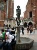
| Kraków  FeatureType : null Elevation : 219 Lat/Lng : 50.0617 / 19.9372 | Kraków , also spelled Cracow or Krakow, is the second largest and one of the oldest cities in Poland. Situated on the Vistula River in the Lesser Poland region, the city dates back to the 7th century. Kraków was the official capital of Poland until 1596 and has traditionally been one of the leading (...) |
| 2 | 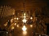
| Wieliczka FeatureType : city Elevation : 249 Lat/Lng : 49.9833 / 20.0667 | Wieliczka (German: Groß Salze) is a town (2006 population: 19,128) in southern Poland in the Kraków metropolitan area, and situated (since 1999) in Lesser Poland Voivodeship; previously, it was in Kraków Voivodeship (1975–1998). The town was founded in 1290 by Duke Premislas II of Poland (...) |
| 3 | 
| Carpathian Mountains FeatureType : mountain Elevation : 904 Lat/Lng : 47.0 / 25.5 | The Carpathian Mountains or Carpathians are a mountain range system forming an arc roughly long across Central and Eastern Europe, making them the second-longest mountain range in Europe (after the Scandinavian Mountains) (...) |
| 4 | 
| Dąbrowa Górnicza FeatureType : null Elevation : 283 Lat/Lng : 50.3167 / 19.2667 | Dąbrowa Górnicza is a city in Zagłębie Dąbrowskie, southern Poland, near Katowice and Sosnowiec. It is located in eastern part of the Silesian Voivodeship, on the Czarna Przemsza and Biała Przemsza rivers (tributaries of the Vistula, see Przemsza) (...) |
| 5 | 
| Donetsk FeatureType : null Elevation : 194 Lat/Lng : 48.0028 / 37.8053 | Donetsk (; ; former names: Aleksandrovka, Hughesovka, Yuzovka, Stalino (see also:)) is an industrial city in Ukraine on the Kalmius River. The population was estimated at in the city, and over 2,000,000 in the metropolitan area (2011) (...) |
| 6 | 
| Kielce FeatureType : city Elevation : 266 Lat/Lng : 50.8725 / 20.6319 | Kielce is a city in south central Poland with 196,804 inhabitants. It has been the capital city of the Świętokrzyskie Voivodeship (Holy Cross Province) since 1999, and was previously the capital of the predecessor Kielce Voivodeship (1919–1939, 1945–1998) (...) |
| 7 | 
| Krosno FeatureType : city Elevation : 277 Lat/Lng : 49.6822 / 21.7658 | Krosno (in full The Royal Free City of Krosno) is a town and county in Subcarpathian Voivodeship, Poland with 47,140 inhabitants (Metro: 115,617), as of 30 June 2014. Krosno is a medieval fortified town, a former Royal Free Town, a centre of cloth, linen, canvas, baize and Hungarian wine trade (...) |
| 8 | 
| Kamianets-Podilskyi FeatureType : city Elevation : 212 Lat/Lng : 48.6806 / 26.5806 | Kamianets-Podilskyi is a city on the Smotrych River in western Ukraine, to the north-east of Chernivtsi. Formerly the administrative center of the Khmelnytskyi Oblast, the city is now the administrative center of the Kamianets-Podilskyi Raion (district) within the Khmelnytskyi Oblast (province) (...) |
| 9 | 
| Buchach FeatureType : null Elevation : 322 Lat/Lng : 49.0648 / 25.3873 | Buchach (; ; .or ביטשאטש (Bitshtosh); ;) is a town located on the Strypa River (a tributary of the Dniester) in Ternopil Oblast (province) of Western Ukraine. It is the administrative center of the Buchach Raion (district), and rests south east of Lviv, in the historic region of Halychyna (Galicia) (...) |
| 10 | 
| Rzeszów FeatureType : city Elevation : 201 Lat/Lng : 50.0336 / 22.0047 | Rzeszów Cf. Pięć wieków miasta Rzeszowa XIV-XVIII, Collective of authors, (ed.) on behalf of the Polskie Towarzystwo Historyczne, Rzeszów department, Warsaw: Państwowe Wydawnictwo Naukowe, 1958, p. 18; and Władysław Makarski, Roczniki humanistyczne, Towarzystwo Naukowe Katolickiego Uniwersytetu (...) |
| 11 | 
| Kiev FeatureType : null Elevation : 157 Lat/Lng : 50.4501 / 30.5234 | Kiev . Dictionary.com. or Kyiv is the capital and largest city of Ukraine, located in the north central part of the country on the Dnieper. The population in July 2015 was 2,887,974 (though higher estimated numbers have been cited in the press),The most recent Ukrainian census, conducted on 5 (...) |
| 12 | 
| Gniezno FeatureType : city Elevation : 121 Lat/Lng : 52.5333 / 17.6 | Gniezno is a city in central-western Poland, about east of Poznań, with about 70,000 inhabitants. One of the Piast dynasty's chief cities, it was mentioned in 10th-century sources, possibly including the Dagome Iudex, as the capital of Piast Poland (...) |
| 13 | 
| University of Cologne FeatureType : landmark Elevation : 52 Lat/Lng : 50.9281 / 6.9286 | The University of Cologne is a university in Cologne, Germany. It was the sixth university to be established in Central EuropePrague (1348), Kraków (1364), Vienna (1365), Pécs (1367), Heidelberg (1386), Cologne (1388) and, although it closed in 1798 before being re-established in 1919, it is now one (...) |
| 14 | 
| Lviv FeatureType : null Elevation : 307 Lat/Lng : 49.83 / 24.0142 | Lviv (; ' ; ; ; ; see also other names) is the largest city in western Ukraine and the seventh-largest city in the country overall, with a population of around 728,350 as of 2016. Lviv is one of the main cultural centres of Ukraine (...) |
| 15 | 
| Zakopane FeatureType : city Elevation : 883 Lat/Lng : 49.3 / 19.9667 | Zakopane is a town in the extreme south of Poland. It lies in the southern part of the Podhale region at the foot of the Tatra Mountains. From 1975 to 1998, it was in Nowy Sącz Province, but since 1999, it has been in Lesser Poland Province. It had a population of about 27,424 (...) |
| 16 | 
| Poland FeatureType : country Elevation : 110 Lat/Lng : 52.2323 / 21.0084 | Poland , officially the Republic of Poland , is a country located in Central Europe. It is divided into 16 administrative subdivisions, covering an area of , and has a largely temperate seasonal climate. With a population of approximately 38 (...) |
| 17 | 
| Ropczyce FeatureType : city Elevation : 199 Lat/Lng : 50.0861 / 21.6333 | Ropczyce is a town in the Subcarpathian Voivodeship in south-eastern Poland, situated in the valley of the Wielopolka River (a tributary of the Wisłoka River). The town has a population of 15,098 . and is the seat of Ropczyce-Sędziszów County. (...) |
| 18 | 
| Zamość FeatureType : city Elevation : 220 Lat/Lng : 50.7167 / 23.2667 | Zamość (Latin: Zamoscia, Yiddish: זאמאשטש Zamoshtsh) is a city in southeastern Poland, situated in the southern part of Lublin Voivodeship (since 1999), about from Lublin, from Warsaw and from the border with Ukraine. In 2014, the population was 65,149 (...) |
| 19 | 
| Vilnius FeatureType : city Elevation : 106 Lat/Lng : 54.6883 / 25.2714 | Vilnius (see also other names) is the capital of Lithuania and its largest city, with a population of 574,147 . Vilnius is in the southeast part of Lithuania and is the second largest city in the Baltic states. Vilnius is the seat of the main government institutions of Lithuania and the Vilnius (...) |
| 20 | 
| Bełżec extermination camp FeatureType : landmark Elevation : 274 Lat/Lng : 50.3734 / 23.4581 | Bełżec (in) was a Nazi German extermination camp built by the SS for the purpose of implementing the secretive Operation Reinhard, the plan to eradicate Polish Jewry, a key part of the "Final Solution" which entailed the murder of some 6 million Jews in the Holocaust (...) |
| 21 | 
| Łańcut FeatureType : city Elevation : 243 Lat/Lng : 50.0667 / 22.2333 | Łańcut (Polish pronunciation: ;Approximately "wine-suit"), is a town in south-eastern Poland, with 18,004 inhabitants, as of 2 June 2009. Situated in the Subcarpathian Voivodeship (since 1999), it is the capital of Łańcut County. (...) |
| 22 | 
| Kołobrzeg FeatureType : city Elevation : 5 Lat/Lng : 54.1833 / 15.5833 | Kołobrzeg is a city in the West Pomeranian Voivodeship in north-western Poland with about 47,000 inhabitants . Kołobrzeg is located on the Parsęta River on the south coast of the Baltic Sea (in the middle of the section divided by the Oder and Vistula Rivers) (...) |
| 23 | 
| Zvolen FeatureType : null Elevation : 307 Lat/Lng : 48.5831 / 19.1331 | Zvolen is a town in central Slovakia, situated on the confluence of Hron and Slatina rivers, close to Banská Bystrica. It is a seat of an okres (Zvolen District). (...) |
| 24 | 
| Warsaw FeatureType : city Elevation : 110 Lat/Lng : 52.2323 / 21.0084 | Warsaw (; see also other names) is the capital and largest city of Poland. The metropolis stands on the Vistula River in east-central Poland and its population is officially estimated at 1.765 million residents within a greater metropolitan area of 3 (...) |
| 25 | 
| Katowice FeatureType : city Elevation : 266 Lat/Lng : 50.2649 / 19.0238 | Katowice (; ; ; officially Miasto Katowice) is a city in southern Poland, with a population of 297,197 and the center of the Silesian Metropolis, with a population of 2.2 million. Throughout the mid-18th century, Katowice had developed into a village upon the discovery of rich coal reserves in the (...) |
| 26 | 
| Gdańsk FeatureType : null Elevation : 7 Lat/Lng : 54.352 / 18.6466 | Gdańsk is a Polish city on the Baltic coast. It is the capital of the Pomeranian Voivodeship and the capital of Kashubia, Poland's principal seaport and the centre of the country's fourth-largest metropolitan area (...) |
| 27 | 
| Karlsruhe FeatureType : null Elevation : 118 Lat/Lng : 49.0092 / 8.404 | Karlsruhe (; formerly Carlsruhe) is the second-largest city of the German federal state of Baden-Württemberg after its capital of Stuttgart, and its 309,999 (2016) inhabitants make it the 21st largest city of Germany (...) |
| 28 | 
| Końskie FeatureType : city Elevation : 247 Lat/Lng : 51.1925 / 20.4062 | Końskie is a town in central Poland with 20,328 inhabitants (2008), situated in the Świętokrzyskie Voivodeship (since 1999), previously in Kielce Voivodeship (1975–1998). Most of the town labour force was employed in the local foundry (Koneckie Zakłady Odlewnicze) in the late 1980s and early 1990s (...) |
| 29 | 
| Palais Garnier FeatureType : landmark Elevation : 55 Lat/Lng : 48.8719 / 2.3317 | The Palais Garnier (French) is a 1,979-seat opera house, which was built from 1861 to 1875 for the Paris Opera. It was called the Salle des Capucines, because of its location on the Boulevard des Capucines in the 9th arrondissement of Paris, but soon became known as the Palais Garnier, in (...) |
| 30 | 
| Poznań FeatureType : null Elevation : 65 Lat/Lng : 52.4083 / 16.9342 | Poznań (;. Random House Webster's Unabridged Dictionary. ; ; known also by other historical names) is a city on the Warta River in west-central Poland, in the Greater Poland region. It is best known for its renaissance Old Town and Ostrów Tumski Cathedral (...) |
| 31 | 
| Trieste FeatureType : city Elevation : 116 Lat/Lng : 45.6361 / 13.8042 | Trieste (;. CollinsDictionary.com. Collins English Dictionary - Complete & Unabridged 11th Edition. Retrieved September 21, 2012 listen;) is a city and a seaport in northeastern Italy. It is situated towards the end of a narrow strip of Italian territory lying between the Adriatic Sea (...) |
| 32 | 
| Innsbruck FeatureType : null Elevation : 582 Lat/Lng : 47.2667 / 11.3833 | Innsbruck is the capital city of Tyrol in western Austria and the fifth-largest city in Austria. It is in the Inn valley, at its junction with the Wipp valley, which provides access to the Brenner Pass some to the south (...) |
| 33 | 
| Terebovlia FeatureType : city Elevation : 263 Lat/Lng : 49.2992 / 25.69 | Terebovlia is a small city in the Ternopil Oblast (province) of western Ukraine, and the administrative center of the Terebovlya Raion (district). It is an ancient settlement that traces its roots to the settlement of Terebovl which existed in Kievan Rus (...) |
| 34 | 
| Leipzig FeatureType : null Elevation : 118 Lat/Lng : 51.3403 / 12.3748 | Leipzig is the most populous city in the federal state of Saxony, Germany. With a population of 591,686 inhabitants as of 30 June 2018, (1.1 million residents in the larger urban zone) it is Germany's tenth most populous city.http://www.statistik-bremen.de/aktuelle_statistiken/01a (...) |
| 35 | 
| Łęczyca FeatureType : null Elevation : 101 Lat/Lng : 52.05 / 19.2 | Łęczyca (in full the Royal Town of Łęczyca; ; ;) is a town of 14,362 inhabitants in central Poland. Situated in the Łódź Voivodeship, it is the county seat of the Łęczyca County. (...) |
| 36 | 
| Florence FeatureType : city Elevation : 67 Lat/Lng : 43.7717 / 11.2536 | Florence Alternative obsolete form: Fiorenza ; is the capital city of the Italian region of Tuscany. It is the most populous city in Tuscany, with 383,084 inhabitants in 2013, and over 1,520,000 in its metropolitan area (...) |
| 37 | 
| Boryslav FeatureType : null Elevation : 372 Lat/Lng : 49.285 / 23.4214 | Boryslav is a city located on the (a tributary of the Dniester), in Lviv Oblast (region) of western Ukraine. Boryslav is designated as a city of oblast significance. It is a major center of petroleum industry. Population: . (...) |
| 38 | 
| Tricity, Poland FeatureType : null Elevation : 99 Lat/Lng : 54.4333 / 18.55 | Tricity, or Tri-City is a metropolitan area in Poland consisting of three cities in Pomerania: Gdańsk, Gdynia and Sopot, as well as minor towns in their vicinity. They are situated adjacent to one other, in a row on the coast of Gdańsk Bay, Baltic Sea, in Pomerelia (Pomeranian Voivodeship), northern (...) |
| 39 | 
| Berezhany FeatureType : city Elevation : 278 Lat/Lng : 49.445 / 24.9381 | Berezhany (Bzhezhani/Bzhizhani) is a city of regional significance located in the Ternopil Oblast (province) of western Ukraine. It is the administrative center of Berezhanskyi Raion (district), and lies about 100 km from Lviv and 50 km from the oblast capital, Ternopil (...) |
| 40 | 
| Geography of Poland FeatureType : country Elevation : 110 Lat/Lng : 52.0 / 20.0 | Poland is a country in East-Central Europe with an area of 312,679 square kilometres (120,726 sq. mi.), and mostly temperate climate. Central Statistical Office (Poland). 28 July 2008. Generally speaking, Poland is an almost unbroken plain reaching from the Baltic Sea in the north, to the Carpathian (...) |
| 41 | European route E40 FeatureType : null Elevation : 3 Lat/Lng : 50.936 / 1.9095 | European route E 40 is the longest European route, more than long, connecting Calais in France via Belgium, Germany, Poland, Ukraine, Russia, Kazakhstan, Uzbekistan, Turkmenistan, and Kyrgyzstan, with Ridder in Kazakhstan near the border with Russia and China. (...) | |
| 42 | Przemyśl FeatureType : city Elevation : 197 Lat/Lng : 49.7861 / 22.7739 | Przemyśl is a city in south-eastern Poland with 66,756 inhabitants, as of June 2009. In 1999, it became part of the Subcarpathian Voivodeship; it was previously the capital of Przemyśl Voivodeship. Przemyśl owes its long and rich history to the advantages of its geographic location (...) | |
| 43 | Sędziszów FeatureType : city Elevation : 258 Lat/Lng : 50.5833 / 20.0667 | Sędziszów is a town in Jędrzejów County, Świętokrzyskie Voivodeship, Poland, with 6,830 inhabitants (2004). The town belongs to Lesser Poland, and since its foundation until the Partitions of Poland, it was part of Kraków Voivodeship (...) | |
| 44 | UEFA Euro 2012 FeatureType : null Elevation : 85 Lat/Lng : 52.2394 / 21.0456 | The 2012 UEFA European Championship, commonly referred to as UEFA Euro 2012 or simply Euro 2012, was the 14th European Championship for men's national football teams organised by UEFA. The final tournament, held between 8 June and 1 July 2012, was co-hosted for the first time by Poland and Ukraine, (...) | |
| 45 | Tarnów FeatureType : null Elevation : 227 Lat/Lng : 50.0126 / 20.9883 | Tarnów (; is a city in southeastern Poland with 115,341 inhabitants and a metropolitan area population of 269,000 inhabitants. The city is situated in the Lesser Poland Voivodeship since 1999. From 1975 to 1998, it was the capital of the Tarnów Voivodeship (...) | |
| 46 | Kolomyia FeatureType : null Elevation : 290 Lat/Lng : 48.5306 / 25.0403 | Kolomyia or Kolomyya, formerly known as Kolomea , is a city located on the Prut River in the Ivano-Frankivsk Oblast (province), in western Ukraine. It is administratively incorporated as a town of oblast significance and serves as the administrative centre of the surrounding Kolomyia Raion (...) | |
| 47 | Stadion Miejski, Kraków FeatureType : landmark Elevation : 201 Lat/Lng : 50.0636 / 19.9119 | Stadion Miejski im. Henryka Reymana is a football-specific stadium in Kraków, Poland. It is currently used as home ground by Wisła Kraków football team playing in the Ekstraklasa. The address of the stadium is Kraków, ul. Reymonta 22 (...) | |
| 48 | Chrzanów FeatureType : null Elevation : 295 Lat/Lng : 50.1442 / 19.3994 | Chrzanów is a town in southern Poland with 39,704 inhabitants . It is situated in the Lesser Poland Voivodeship (since 1999) and is the capital of Chrzanów County. (...) | |
| 49 | Galicia (Eastern Europe) FeatureType : adm2nd Elevation : 287 Lat/Lng : 49.522 / 23.2458 | Galicia (;. Collins English Dictionary Ukrainian and , Halyčyna; ; Czech and ; ; ; ; , Galitsiya; Galitsiye) is a historical and geographic region between Central and Eastern Europe. It was once the small Kingdom of Galicia–Volhynia and later a crown land of Austria-Hungary, the Kingdom of Galicia (...) | |
| 50 | Vilshana FeatureType : null Elevation : 144 Lat/Lng : 49.2097 / 31.2089 | Vilshana is an urban-type settlement located in Horodyshche Raion (district) of Cherkasy Oblast (province) in central Ukraine. Population: (...) | |
| 51 | Sambir FeatureType : city Elevation : 298 Lat/Lng : 49.5222 / 23.1969 | Sambir is a city in Lviv Oblast, Ukraine. Serving as the administrative center of Sambir Raion (district), It is designated as a city of oblast significance and does not belong to the raion. It is located close to the border with Poland. Population: 35,500 (2017). (...) | |
| 52 | Lviv Danylo Halytskyi International Airport FeatureType : airport Elevation : 317 Lat/Lng : 49.8125 / 23.9561 | Lviv Danylo Halytskyi International Airport is an international airport in Lviv, Ukraine. The airport is located from central Lviv. The airport is named after King Daniel of Galicia, the historical founder of the city in 1256 AD. (...) | |
| 53 | Vistula FeatureType : null Lat/Lng : 54.3617 / 18.9519 | The Vistula is the longest and largest river in Poland and the 9th longest river in Europe, at in length. The drainage basin area of the Vistula is , of which lies within Poland (54% of its land area)., Statistics Poland, p. 85-86 The remainder is in Belarus, Ukraine and Slovakia (...) | |
| 54 | Battle of Grunwald FeatureType : event Elevation : 209 Lat/Lng : 53.4861 / 20.1247 | The Battle of Grunwald, First Battle of Tannenberg or Battle of Žalgiris, was fought on 15 July 1410 during the Polish–Lithuanian–Teutonic War. The alliance of the Kingdom of Poland and the Grand Duchy of Lithuania, led respectively by King Władysław II Jagiełło (Jogaila) and Grand Duke Vytautas, (...) | |
| 55 | Second Polish Republic FeatureType : country Elevation : 114 Lat/Lng : 52.2167 / 21.0 | The Second Polish Republic, commonly known as interwar Poland, refers to the country of Poland in the period between the First and Second World Wars (1918–1939). Officially known as the Republic of Poland , the Polish state was re-established in 1918, in the aftermath of World War I (...) | |
| 56 | Dobromyl FeatureType : null Elevation : 298 Lat/Lng : 49.5708 / 22.7864 | Dobrómyl’ is a city in Staryi Sambir Raion, Lviv Oblast, Ukraine. It is located some 5 kilometers to the border with Poland. Population: . (...) | |
| 57 | Polish–Lithuanian Commonwealth FeatureType : country Elevation : 220 Lat/Lng : 50.0614 / 19.9383 | The Polish–Lithuanian Commonwealth, formally the Crown of the Kingdom of Poland and the Grand Duchy of Lithuania, after 1791 the Commonwealth of Poland, was a dualistic state, a bi-confederation of Poland and Lithuania ruled by a common monarch, who was both the King of Poland and the Grand Duke of (...) | |
| 58 | Puławy FeatureType : null Elevation : 137 Lat/Lng : 51.4164 / 21.9692 | Puławy is a city in eastern Poland, in Lublin Province of northern Lesser Poland, located at the confluence of the Wisła and Kurówka rivers. According to the GUS census estimate, the city had a total population of 49,839 in 2006 (...) | |
| 59 | Chorzów FeatureType : null Elevation : 293 Lat/Lng : 50.3 / 18.95 | Chorzów is a city in Silesia in southern Poland, near Katowice. Chorzów is one of the central districts of the Upper Silesian Metropolitan Union - a metropolis with a population of 2 million. It is located in the Silesian Highlands, on the Rawa River (a tributary of the Vistula) (...) | |
| 60 | General Government FeatureType : null Elevation : 198 Lat/Lng : 50.05 / 19.9333 | The General Government , also referred to as the General Governorate, was a German zone of occupation established after the joint invasion of Poland by Nazi Germany and the Soviet Union in 1939 at the onset of World War II (...) | |
| 61 | Bieszczady Mountains FeatureType : mountain Elevation : 625 Lat/Lng : 49.283 / 22.483 | Bieszczady is a mountain range that runs from the extreme south-east of Poland through Ukraine and Slovakia. It forms the western part of the Eastern Beskids (Beskidy Wschodnie), and is more generally part of the Outer Eastern Carpathians (...) | |
| 62 | Kiev Voivodeship FeatureType : landmark Elevation : 157 Lat/Lng : 50.45 / 30.5233 | The Kiev Voivodeship (Kyivske voyevodstvo) was a unit of administrative division and local government in the Grand Duchy of Lithuania from 1471 until 1569 and of the Crown of the Kingdom of Poland from 1569 until 1793, as part of Lesser Poland Province of the Polish Crown (...) | |
| 63 | University of Lviv FeatureType : edu Elevation : 283 Lat/Lng : 49.8405 / 24.0225 | The University of Lviv (briefly known as the Theresianum in the early 19th-century), presently the Ivan Franko National University of Lviv is the oldest university foundation in Ukraine, dating from 1661 when the Polish King, John II Casimir, granted it its first royal charter (...) | |
| 64 | Belz FeatureType : null Elevation : 199 Lat/Lng : 50.3822 / 24.0011 | Belz (; ; ' ) is a small city in Sokal Raion of Lviv Oblast (region) of Western Ukraine, near the border with Poland, is located between the Solokiya river (a tributary of the Bug River) and the Rzeczyca stream. Its population is approximately . (...) | |
| 65 | Polish People's Republic FeatureType : country Elevation : 90 Lat/Lng : 52.2167 / 21.0333 | The Polish People's Republic was a country that existed from 1947 to 1989 in Central Europe, and the predecessor to the modern democratic Republic of Poland. With a population of approximately 37.9 million inhabitants near the end of its existence, it was the most populous state of the Eastern Bloc (...) | |
| 66 | Vawkavysk FeatureType : city Elevation : 195 Lat/Lng : 53.1422 / 24.4475 | Vawkavysk is one of the oldest towns in southwestern Belarus and the capital of the Vawkavysk district. It is located on the Wołkowyja River, roughly from Grodno and from Minsk. Its population is estimated at 43,826 inhabitants (...) | |
| 67 | Tuchów FeatureType : null Elevation : 231 Lat/Lng : 49.895 / 21.0542 | Tuchów is a town in Tarnów County, Lesser Poland Voivodeship, Poland, with a population of 6,476 (2004). It lies on the Biała river, at the height of above sea level. The distance to Kraków is , and to the border with Slovakia, approximately (...) | |
| 68 | 2010 Central European floods FeatureType : null Elevation : 217 Lat/Lng : 50.2945 / 18.6714 | The 2010 Central European floods were a devastating series of weather events which occurred across several Central European countries during May and June 2010. Poland was the worst affected. Austria, Czech Republic, Germany, Hungary, Slovakia, Serbia and Ukraine were also affected (...) | |
| 69 | Stalowa Wola FeatureType : city Elevation : 160 Lat/Lng : 50.5667 / 22.05 | Stalowa Wola is the largest city and capital of Stalowa Wola County with a population of 64,353 inhabitants, as of June 2008. It is located in southeastern Poland in the Subcarpathian Voivodeship. The city lies in historic Lesser Poland, near the confluence of the Vistula and San rivers and covers (...) | |
| 70 | University of Wrocław FeatureType : null Elevation : 125 Lat/Lng : 51.1136 / 17.0333 | The University of Wrocław (UWr; ; ;) is a public research university located in Wrocław, Poland. The University of Wrocław was founded in 1945, replacing the previous German University of Breslau. Following the territorial changes of Poland's borders, academics primarily from the Jan Kazimierz (...) | |
| 71 | Zbruch River FeatureType : waterbody Elevation : 271 Lat/Lng : 49.549 / 26.177 | Zbruch River is a river in Western Ukraine, a left tributary of the Dniester. It flows within the Podolian Upland starting from the Avratinian Upland. Zbruch is the namesake of the Zbruch idol, a sculpture of a Slavic deity (9th century) in the form of a column with a head with four faces, (...) | |
| 72 | 2015 Men's World Ice Hockey Championships FeatureType : null Elevation : 255 Lat/Lng : 50.0861 / 14.5014 | The 2015 Men's World Ice Hockey Championships was the 79th such event hosted by the International Ice Hockey Federation. Teams participated at several levels of competition, which also served as qualification to the 2016 Men's World Ice Hockey Championships and finalize seeding for 2018 Winter (...) | |
| 73 | Kievan Rus' FeatureType : country Elevation : 157 Lat/Lng : 50.45 / 30.5233 | Kievan Rus' , , p. 73.) was a loose federationJohn Channon & Robert Hudson, Penguin Historical Atlas of Russia (Penguin, 1995), p.16. of East Slavic and Finnic peoples in Europe from the late 9th to the mid-13th century,, Encyclopædia Britannica Online. under the reign of the Varangian Rurik dynasty (...) | |
| 74 | Monastyryska FeatureType : city Elevation : 316 Lat/Lng : 49.0908 / 25.1722 | Monastyryska is a town in Ternopil Oblast, Ukraine. It is the administrative center of the Monastyryska Raion. In 2001, the population was 6,344. The town is situated on the river Koropets, from Buchach, south east from Lviv, on the road between Ternopil or Berezhany and Ivano-Frankivsk (...) | |
| 75 | Wrocław FeatureType : null Elevation : 118 Lat/Lng : 51.1167 / 17.0333 | Wrocław is a city in western Poland and the largest city in the historical region of Silesia. It lies on the banks of the River Oder in the Silesian Lowlands of Central Europe, roughly 350 kilometres (220 mi) from the Baltic Sea to the north and 40 kilometres (25 mi) from the Sudeten Mountains to (...) | |
| 76 | Tarnobrzeg FeatureType : city Elevation : 143 Lat/Lng : 50.5833 / 21.6833 | Tarnobrzeg (- Jikov) is a city in south-eastern Poland (historic Lesser Poland), on the east bank of the river Vistula, with 49,419 inhabitants, as of December 31, 2009. Situated in the Subcarpathian Voivodeship (Polish: Województwo Podkarpackie) since 1999, it had previously been the capital of (...) | |
| 77 | Chervonohrad FeatureType : city Elevation : 192 Lat/Lng : 50.3867 / 24.2289 | Chervonohrad (former Polish name: Krystynopol) is a mining city located in the Lviv Oblast of western Ukraine. Chervonohrad is designated as a city of oblast significance. It lies about 62 km north of Lviv, 7 km from Sokal, 28 km northeast of the town of Voroniv, and has a population of (...) | |
| 78 | National University of Kyiv-Mohyla Academy FeatureType : edu Elevation : 104 Lat/Lng : 50.4644 / 30.5198 | National University of Kyiv-Mohyla Academy (NaUKMA) (Natsional'nyi universytet "Kyyevo-Mohylians'ka akademiya") is a national, coeducational research university located in Kiev, Ukraine. The Kyiv-Mohyla Academy, the school's predecessor, was established in 1615 (...) | |
| 79 | Czeladź FeatureType : null Elevation : 276 Lat/Lng : 50.3333 / 19.0833 | Czeladź is a town in Zagłębie Dąbrowskie (part of historic Lesser Poland), in southern Poland, near Katowice and Sosnowiec. Located in the Silesian Highlands, on the Brynica river (tributary of the Vistula), it is the oldest urban center of Zagłębie Dąbrowskie. The area of Czeladź is 16 km2 (...) | |
| 80 | Soviet invasion of Poland FeatureType : country Elevation : 102 Lat/Lng : 52.1469 / 19.3781 | The Soviet invasion of Poland was a military operation by the Soviet Union without a formal declaration of war. On 17 September 1939, the Soviet Union invaded Poland from the east, sixteen days after Germany invaded Poland from the west (...) | |
| 81 | Ruthenian Voivodeship FeatureType : landmark Elevation : 276 Lat/Lng : 49.85 / 24.0167 | The Ruthenian Voivodeship was a voivodeship of the Crown of the Kingdom of Poland from 1434 until the 1772 First Partition of Poland. by Zygmunt Gloger 1903. Biblioteka Literatury Polskiej. Uniwersytet Gdański. Instytut Filologii Polskiej. 2003 with a center in the city of Lviv (...) | |
| 82 | National Museum, Warsaw FeatureType : landmark Elevation : 106 Lat/Lng : 52.2317 / 21.0247 | The National Museum in Warsaw , popularly abbreviated as MNW, is a national museum in Warsaw, one of the largest museums in Poland and the largest in the capital. It comprises a rich collection of ancient art (Egyptian, Greek, Roman), counting about 11,000 pieces, an extensive gallery of Polish (...) | |
| 83 | 
| Płonna, Podkarpackie Voivodeship FeatureType : null Elevation : 441 Lat/Lng : 49.4344 / 22.1017 | Płonna (Polonna), in Plone 1433, de Plona 1437, villa Plona 1451, Plonna 1508, Płonna 1699, village in eastern Lesser Poland in the Lesser Beskid mountains, Bukowsko rural commune, located near the towns of Medzilaborce and Palota (in northeastern Slovakia) (...) |
| 84 | Limanowa FeatureType : city Elevation : 437 Lat/Lng : 49.7006 / 20.4267 | Limanowa (Liminuv) is a small town (population 14,624) in southern Poland, in the Lesser Poland Voivodeship. It is the capital of Limanowa County. (...) | |
| 85 | Belváros-Lipótváros FeatureType : null Elevation : 116 Lat/Lng : 47.5 / 19.05 | District V is the heart of Budapest and the political, financial, commercial and touristic center of Hungary. The name of the district is Belváros-Lipótváros (English: Inner City – Leopold Town), which refers to the two historical neighbourhoods that is located in the district; Belváros ("Inner (...) | |
| 86 | Bełżec, Lublin Voivodeship FeatureType : city Elevation : 262 Lat/Lng : 50.3844 / 23.4383 | Bełżec is a village in Tomaszów Lubelski County, Lublin Voivodeship, in eastern Poland. It is the seat of the gmina (administrative district) called Gmina Bełżec. It lies approximately south of Tomaszów Lubelski and south-east of the regional capital Lublin (...) | |
| 87 | Lechia Gdańsk FeatureType : null Elevation : 25 Lat/Lng : 54.3679 / 18.6211 | Lechia Gdańsk is a Polish football club based in Gdańsk. The club's name comes from Lechia, a poetic name for Poland. The club was founded by people expelled from Lwów, who were supporters of the oldest Polish football team Lechia Lwów, founded in 1903.http://www.rsssf.com/tableso/oekrfound (...) | |
| 88 | Lanckorona FeatureType : null Elevation : 466 Lat/Lng : 49.845 / 19.7158 | Lanckorona is a village located south-west of Kraków in Lesser Poland. It lies on the Skawinka river, among the hills of the Beskids, above sea level. It is known for the Lanckorona Castle, today in ruins. Lanckorona is also known for the Battle of the Bar Confederation that took place at the (...) | |
| 89 | KGB FeatureType : null Elevation : 155 Lat/Lng : 55.7587 / 37.6256 | The KGB, an initialism for Komitet gosudarstvennoy bezopasnosti , translated in English as Committee for State Security, was the main security agency for the Soviet Union from 1954 until its break-up in 1991. As a direct successor of such preceding agencies as Cheka, NKGB, NKVD and MGB, the (...) | |
| 90 | World Youth Day 2016 FeatureType : null Elevation : 193 Lat/Lng : 50.0309 / 20.0934 | World Youth Day 2016 (WYD 2016) was an international Catholic event focused on faith and youth, that took place from 26 to 31 July 2016 in Kraków, Poland, organised by the Catholic Church. It was the third World Youth Day held in Central Europe (...) | |
| 91 | Krasnystaw FeatureType : city Elevation : 194 Lat/Lng : 50.9846 / 23.165 | Krasnystaw is a town in eastern Poland with 19,750 inhabitants (29 March 2011). Situated in the Lublin Voivodeship (since 1999), previously in Chełm Voivodeship (1975–1998). It is the capital of Krasnystaw County (...) | |
| 92 | Low Beskids FeatureType : mountain Elevation : 995 Lat/Lng : 49.3876 / 21.163 | The Low Beskids or Lower Beskids , are one of the Beskids mountain ranges in the Outer Eastern Carpathians in southeastern Poland and northeastern Slovakia. It is a hilly region in Prešov Region, Sanok County and Jasło County, between Busov, Ondavská vrchovina, Laborecká vrchovina, Beskydské (...) | |
| 93 | Lwów Voivodeship FeatureType : landmark Elevation : 295 Lat/Lng : 49.8348 / 24.028 | Lwów Voivodeship was an administrative unit of interwar Poland (1918–1939). Because of the Nazi-Soviet invasion of Poland in accordance with the secret Molotov–Ribbentrop Pact, it became occupied by both the Wehrmacht and the Red Army in September 1939 (...) | |
| 94 | Horodenka FeatureType : city Elevation : 286 Lat/Lng : 48.6675 / 25.5003 | Horodenka (Horodenke) is a city located in Ivano-Frankivsk Oblast, in Western Ukraine. It is the administrative center of Horodenka Raion (district). Population: . In 2001 the population was around 9,800. (...) | |
| 95 | 2010 Polish Air Force Tu-154 crash FeatureType : landmark Elevation : 257 Lat/Lng : 54.8239 / 32.0513 | On 10 April 2010, a Tupolev Tu-154 aircraft of the Polish Air Force crashed near the city of Smolensk, Russia, killing all 96 people on board. Among the victims were the President of Poland Lech Kaczyński and his wife Maria, the former President of Poland in exile Ryszard Kaczorowski, the chief of (...) | |
| 96 | San (river) FeatureType : null Elevation : 913 Lat/Lng : 49.0028 / 22.875 | The San (; Sian;) is a river in southeastern Poland and western Ukraine, a tributary of the Vistula River, with a length of 458 km (it is the 6th-longest Polish river) and a basin area of 16,877 km2 (14,426 km2 of it in Poland)., Statistics Poland, p. 85-86 (...) | |
| 97 | Kozienice FeatureType : city Elevation : 104 Lat/Lng : 51.5833 / 21.5667 | Kozienice (; Kozhnits; Virtual Shtetl:) is a town in central Poland with 21,500 inhabitants (1995). Located four miles from the Vistula, it is the capital of Kozienice County (Polish Powiat kozienicki). The name of the town first appeared in records in 1429, when it was spelled in Latin Coszinicze (...) | |
| 98 | Sędziszów Małopolski FeatureType : city Elevation : 223 Lat/Lng : 50.0694 / 21.7014 | Sędziszów Małopolski is a town in Ropczyce-Sędziszów County, Subcarpathian Voivodeship, Poland, with a population of 7,078 (02.06.2009). Sędziszów is located in eastern Lesser Poland, near the historic boundary between Lesser Poland and Red Ruthenia (...) | |
| 99 | Warsaw Uprising FeatureType : event Elevation : 111 Lat/Lng : 52.23 / 21.0108 | The Warsaw Uprising was a major World War II operation, in the summer of 1944, by the Polish underground resistance, led by the Home Army , to liberate Warsaw from German occupation. The uprising was timed to coincide with the retreat of the German forces from Poland ahead of the Soviet advance (...) | |
| 100 | Schutzstaffel FeatureType : landmark Elevation : 42 Lat/Lng : 52.5072 / 13.3825 | The Schutzstaffel (SS; also stylized as with Armanen runes; ; literally "Protection Squadron") was a major paramilitary organization under Adolf Hitler and the Nazi Party (NSDAP) in Nazi Germany, and later throughout German-occupied Europe during World War II (...) | |
| 101 | Kurgan FeatureType : null Elevation : 538 Lat/Lng : 53.9028 / 90.7629 | A kurgan is a tumulus, a type of burial mound or barrow, heaped over a burial chamber, often of wood."kurgan." Webster's Third New International Dictionary, Unabridged. Merriam-Webster, 2002. http://unabridged.merriam-webster.com (14 October 2006) (...) | |
| 102 | Free City of Danzig FeatureType : country Elevation : 5 Lat/Lng : 54.35 / 18.6667 | The Free City of Danzig was a semi-autonomous city-state that existed between 1920 and 1939, consisting of the Baltic Sea port of Danzig (now , Poland) and nearly 200 towns and villages in the surrounding areas (...) | |
| 103 | Bydgoszcz Cathedral FeatureType : null Elevation : 39 Lat/Lng : 53.1228 / 17.9989 | St. Martin and St. Nicholas Cathedral , or simply known as Bydgoszcz Cathedral, is a Catholic church built in the 15th century. It has a Gothic style, serves as a parish church and cathedral of the Diocese of Bydgoszcz. It also houses a shrine dedicated to the Virgin Mary (...) | |
| 104 | Andrey Sheptytsky FeatureType : null Elevation : 316 Lat/Lng : 49.8387 / 24.0128 | Andrey Sheptytsky, O.S.B.M., (; Polish: Andrzej Szeptycki; 29 July 1865 – 1 November 1944) was the Metropolitan Archbishop of the Ukrainian Greek Catholic Church from 1901 until his death in 1944. His tenure spanned two world wars and seven political regimes: Austrian, Russian, Ukrainian, Polish, (...) | |
| 105 | Kamianka-Buzka FeatureType : null Elevation : 213 Lat/Lng : 50.1081 / 24.3456 | Kamianka-Buzka is a city in Lviv Oblast, of western Ukraine. It is the administrative center of Kamianka-Buzka (district). The city was previously known as Kamianka Strumilova, and was a district city in Galicia (...) | |
| 106 | Kosiv FeatureType : city Elevation : 364 Lat/Lng : 48.3208 / 25.0925 | Kosiv is a city located in Ivano-Frankivsk Oblast, in western Ukraine. It is the administrative center of Kosiv Raion (district). Population: . (...) | |
| 107 | Marshal Józef Piłsudski Stadium FeatureType : landmark Elevation : 201 Lat/Lng : 50.058 / 19.9198 | Marszałek Piłsudski Stadium (formerly Stadion Cracovia or Stadion Cracovii) is a football stadium located in Kraków, Poland. It is used mostly for football matches and it is the home ground of Cracovia. Originally, the first Cracovia stadium was built in 1912. It was demolished in mid-2009 (...) | |
| 108 | Leopoldstädter Tempel FeatureType : landmark Elevation : 174 Lat/Lng : 48.2139 / 16.385 | The Leopoldstädter Tempel was the largest synagogue of Vienna, in the district (Bezirk) of Leopoldstadt. It was also known as the Israelitische Bethaus in der Wiener Vorstadt Leopoldstadt. It was built in 1858 in a Moorish Revival style by the architect Ludwig Förster (...) | |
| 109 | Vasyl Stefanyk Precarpathian National University FeatureType : null Elevation : 258 Lat/Lng : 48.9152 / 24.7012 | Vasyl Stefanyk Precarpathian National University is one of the oldest institutions of higher education in Western Ukraine. Its history dates back to March 15, 1940, when Stanislav Teacher Training Institute was established (...) | |
| 110 | Ossolineum FeatureType : landmark Elevation : 123 Lat/Lng : 51.1136 / 17.0367 | The Ossolineum or the National Ossoliński Institute (ZNiO) is a non-profit foundation located in Wrocław, Poland since 1947, and subsidized from the state budget. It was founded in 1817 by Józef Maksymilian Ossoliński of the Topór coat of arms, politician, writer and researcher who devoted his life (...) | |
| 111 | Szczawnica FeatureType : city Elevation : 561 Lat/Lng : 49.4167 / 20.4833 | Szczawnica is a resort town in Nowy Targ County in Lesser Poland Voivodeship, in southern Poland. As of June 30, 2007, its population was 7,378. Szczawnica has been a well-known resort town since the mid nineteenth century (...) | |
| 112 | Polish Golden Age FeatureType : country Elevation : 198 Lat/Lng : 50.05 / 19.9333 | The Polish Golden Age refers to the period from the late 15th century Jagiellon Poland to the death of the last of the Jagiellons, Sigismund August in 1572. Some historians claim that the Golden Age lasted until the mid-17th century, when in 1648 the Polish-Lithuanian Commonwealth was ravaged by the (...) | |
| 113 | Bids for the 2022 Winter Olympics FeatureType : null Elevation : 17 Lat/Lng : 59.3294 / 18.0686 | A total of six bids were initially submitted for the 2022 Winter Olympics. Four of the bids were subsequently withdrawn by 1 October 2014, citing either the high costs of hosting the Games or the lack of local support, leaving Almaty, Kazakhstan and Beijing, China as the only two remaining candidate (...) | |
| 114 | Polish Land Forces FeatureType : null Elevation : 114 Lat/Lng : 52.2333 / 21.0 | The Land Forces (Wojska Lądowe) are a military branch of the Armed Forces of the Republic of Poland. They currently contain some 65,000 active personnel and form many components of European Union and NATO deployments around the world (...) | |
| 115 | Sudova Vyshnia FeatureType : city Elevation : 218 Lat/Lng : 49.7914 / 23.3714 | Sudóva Výšnja is a town of Mostyska Raion in Lviv Oblast (region) of Ukraine. Population: . The town has a number of Catholic cathedrals, a secondary school, is a market centre for surrounding agricultural area (...) | |
| 116 | Roman Catholic Diocese of Kyiv-Zhytomyr FeatureType : null Elevation : 227 Lat/Lng : 50.2548 / 28.6547 | The Roman Catholic Diocese of Kyiv-Zhytomyr is a suffragan diocese of the Latin Rite of the Catholic Church in Ukraine in ecclesiastical province of the Metropolitan Archdiocese of Lviv of the Latins. Its cathedral episcopal see is the St. Sophia's Cathedral, Zhytomyr , Zhytomyr Oblast (...) | |
| 117 | Kyiv National University of Trade and Economics FeatureType : landmark Elevation : 107 Lat/Lng : 50.4654 / 30.6386 | The Kyiv National University of Trade and Economics (KNUTE) is a university in Ukraine. Post address: 19 Kyoto st., Kyiv, Ukraine, 02156. (...) | |
| 118 | 2018 WTA Tour FeatureType : null Elevation : 20 Lat/Lng : 16.8636 / -99.8825 | The 2018 WTA Tour is the elite professional tennis circuit organised by the Women's Tennis Association (WTA) for the 2018 tennis season. The 2018 WTA Tour calendar comprises the Grand Slam tournaments, supervised by the International Tennis Federation (ITF); the WTA Premier tournaments (Premier (...) | |
| 119 | Dominican Church, Lviv FeatureType : landmark Elevation : 294 Lat/Lng : 49.8428 / 24.0342 | The Dominican church and monastery (Dominikanskyi kostel i monastyr) in Lviv, Ukraine is located in the city's Old Town, east of the market square. It was originally built as the Roman Catholic church of Corpus Christi, and today serves as the Greek Catholic church of the Holy Eucharist. (...) | |
| 120 | Kamianets-Podilskyi Castle FeatureType : null Elevation : 198 Lat/Lng : 48.6747 / 26.5736 | Kamianets-Podilskyi Castle is a former Ruthenian-Lithuanian castle and a later three-part Polish fortress MIBS Travel, Roman Woronowycz, Kyiv Press Bureau located in the historic city of Kamianets-Podilskyi, Ukraine, in the historic region of Podolia in the western part of the country (...) | |
| 121 | Revolutions of 1848 FeatureType : null Elevation : 66 Lat/Lng : 48.8468 / 2.3435 | The Revolutions of 1848, known in some countries as the Spring of Nations, People's Spring, Springtime of the Peoples,Merriman, John, A History of Modern Europe: From the French Revolution to the Present, 1996, p (...) | |
| 122 | College of Europe FeatureType : landmark Elevation : 12 Lat/Lng : 51.211 / 3.2258 | The College of Europe is an elite, independent university institute of postgraduate European studies with the main campus in Bruges, Belgium and a smaller campus in Warsaw, Poland. The College of Europe in Bruges was founded in 1949 by such leading European figures and founding fathers of the (...) | |
| 123 | Veit Stoss altarpiece in Kraków FeatureType : landmark Elevation : 219 Lat/Lng : 50.0617 / 19.9392 | The Altarpiece by Veit Stoss in Kraków , also St. Mary's Altar (Ołtarz Mariacki), is the largest Gothic altarpiece in the world and a national treasure of Poland. It is located behind the High altar of St. Mary's Basilica in Kraków (...) | |
| 124 | PZL.37 Łoś FeatureType : null Elevation : 167 Lat/Lng : 50.31 / 21.4611 | The PZL.37 Łoś (moose) was a Polish twin-engined medium bomber designed and manufactured by national aircraft company PZL. It is also known as "PZL P-37" or "PZL P.37", but the letter "P" was generally reserved for fighters of Zygmunt Puławski's design (such as the PZL P.11).E.g (...) | |
| 125 | University of Chernivtsi FeatureType : landmark Elevation : 247 Lat/Lng : 48.2966 / 25.9249 | Chernivtsi National University (full name Yurii Fedkovych Chernivtsi National University) is a public university in the City of Chernivtsi in Western Ukraine. One of the leading Ukrainian institutions for higher education, it was founded in 1875 as the Franz-Josephs-Universität Czernowitz when (...) | |
| 126 | Massacre of Lwów professors FeatureType : null Elevation : 322 Lat/Lng : 49.8285 / 24.0135 | In July 1941, 25 Polish academics from the city of Lwów (modern-day Lviv, Ukraine, then part of Poland) along with their families were killed by Nazi German occupation forces. By targeting prominent citizens and intellectuals for elimination, the Nazis hoped to prevent anti-Nazi activity and to (...) | |
| 127 | Swastika FeatureType : null Elevation : 5 Lat/Lng : 32.6762 / -117.1577 | The swastika (as a character 卐 or 卍) is a geometrical figure and an ancient religious icon from the cultures of Eurasia, where it is a symbol of divinity and spirituality in some Eastern religions. In the Western world it was a symbol of auspiciousness and good luck until the 1930s, when it became a (...) | |
| 128 | The Master and Margarita FeatureType : landmark Elevation : 160 Lat/Lng : 55.767 / 37.5941 | The Master and Margarita is a novel by Russian writer Mikhail Bulgakov, written in the Soviet Union between 1928 and 1940 during Stalin's regime. A censored version was published in Moscow magazine in 1966–1967, after the writer's death (...) | |
| 129 | Brześć Ghetto FeatureType : city Elevation : 136 Lat/Lng : 52.1 / 23.7 | The Brześć Ghetto or the Ghetto in Brest on the Bug, also: Brześć nad Bugiem Ghetto, and Brest-Litovsk Ghetto was a World War II Jewish ghetto created by Nazi Germany in occupied Poland in December 1941, six months after the German troops had overrun the Soviet-occupied zone of the Second Polish (...) | |
| 130 | European Bank for Reconstruction and Development FeatureType : landmark Elevation : 40 Lat/Lng : 51.5196 / -0.0797 | The European Bank for Reconstruction and Development (EBRD) is an international financial institution founded in 1991. As a multilateral developmental investment bank, the EBRD uses investment as a tool to build market economies (...) | |
| 131 | Nieznajowa FeatureType : null Elevation : 441 Lat/Lng : 49.4908 / 21.3914 | Nieznajowa (Neznayova, Neznayeva) is a depopulated village in the administrative district of Gmina Sękowa, within Gorlice County, Lesser Poland Voivodeship, in southern Poland, close to the border with Slovakia (...) | |
| 132 | Wola Sękowa FeatureType : null Elevation : 418 Lat/Lng : 49.5045 / 22.0043 | Wola Sękowa (Volia Sen’kova) is a village in East Małopolska in the Bukowsko Upland mountains, Bukowsko rural commune, parish in Bukowsko. Wola Sękowa is about 15 miles from Sanok in southeast Poland near the border with Slovakia and Ukraine (...) | |
| 133 | Roman Catholic Archdiocese of Vilnius FeatureType : adm1st Elevation : 72 Lat/Lng : 54.9 / 23.95 | The Roman Catholic Metropolitan Archdiocese of Vilnius is an ecclesiastical territory or diocese of the Roman Catholic Church in Lithuania. Established as the Diocese of Vilnius in the 14th century, it was elevated to the rank of a metropolitan archdiocese by Pope Pius XI on October 28, 1925 (...) | |
| 134 | Tyrawa Wołoska FeatureType : city Elevation : 401 Lat/Lng : 49.5833 / 22.3666 | Tyrawa Wołoska (Tyriava Volos’ka; , Thyrawa Walaska) is a village in East Małopolska in the Lesser Beskid mountains of Poland. The community is about 40 miles from Rzeszów, in south-eastern Poland. It is situated below the main watershed, at the foot of the Słonne Mountain, and has an elevation of (...) | |
| 135 | Urzędów FeatureType : city Elevation : 184 Lat/Lng : 50.9931 / 22.1425 | Urzędów is a town in Kraśnik County, Lublin Voivodeship, in eastern Poland. It is the seat of the gmina (administrative district) called Gmina Urzędów. It lies in Lesser Poland, approximately north-west of Kraśnik and south-west of the regional capital Lublin (...) | |
| 136 | Jan Długosz University FeatureType : edu Elevation : 252 Lat/Lng : 50.8103 / 19.1159 | The Jan Dlugosz University in Czestochowa is a public university located in Częstochowa, in the Silesian Voivodeship of Poland. Founded in 1971 as a teacher training college, it was transformed into a higher teacher education school in 1974 with two faculties, the Faculty of Mathematics and Natural (...) | |
| 137 | Medukha, Halych Raion FeatureType : null Elevation : 233 Lat/Lng : 49.1489 / 24.81 | Medukha is a village in the Halych Raion (district) of the Ivano-Frankivsk Oblast (province) in western Ukraine. Hnyla Lypa River flows near of the village. (...) | |
| 138 | Mostyska II FeatureType : null Elevation : 220 Lat/Lng : 49.8167 / 23.0328 | Mostyska II is a railway station in the village Mostyska Druhi, Mostyska Raion in the Lviv Oblast of Ukraine. It is part of the Lviv administration (Lviv Railways). The station is located on the historical Galician Railway of Archduke Charles Louis linking Kraków with Lviv through Przemyśl (...) | |
| 139 | Pidhirtsi Castle FeatureType : null Elevation : 385 Lat/Lng : 49.9431 / 24.9835 | Pidhirtsi Castle is a residential castle-fortress located in the village of Pidhirtsi in Lviv Oblast (province) western Ukraine, located eighty kilometers east of Lviv. It was constructed by Guillaume Le Vasseur de Beauplan between 1635–1640 by order of the Polish-Lithuanian Commonwealth's Grand (...) | |
| 140 | Grodzisko Górne FeatureType : city Elevation : 199 Lat/Lng : 50.1889 / 22.4372 | Grodzisko Górne is a farming village in the administrative district of Gmina Grodzisko Dolne, within Leżajsk County, Subcarpathian Voivodeship, in south-eastern Poland. It lies approximately north-west of Grodzisko Dolne, south of Leżajsk, and north-east of the regional capital Rzeszów (...) | |
| 141 | History of Poland during the Jagiellonian dynasty FeatureType : country Elevation : 198 Lat/Lng : 50.05 / 19.9333 | The rule of the Jagiellonian dynasty in Poland between 1386 and 1572 spans the late Middle Ages and early Modern Era in European history. The dynasty was founded by the Lithuanian Grand Duke Jogaila (Władysław II Jagiełło), whose marriage to Queen Jadwiga of Poland formed a Polish–Lithuanian union (...) | |
| 142 | Cathedral Basilica of the Assumption, Lviv FeatureType : landmark Elevation : 288 Lat/Lng : 49.8408 / 24.0306 | The Archcathedral Basilica of the Assumption of the Blessed Virgin Mary, usually called simply the Latin Cathedral is a 14th-century Roman Catholic cathedral in Lviv, western Ukraine. It is located in the city's Old Town, in the south western corner of the market square, called Cathedral Square. (...) | |
| 143 | History of Wrocław FeatureType : null Elevation : 121 Lat/Lng : 51.1069 / 17.077 | Wrocław has long been the largest and culturally dominant city in Silesia, and is today the capital of Poland's Lower Silesian Voivodeship. The history of Wrocław starts at a crossroads in Lower Silesia. It was one of the centres of the Duchy and then Kingdom of Poland, and briefly, in the first (...) | |
| 144 | West Ukrainian People's Republic FeatureType : null Elevation : 159 Lat/Lng : 50.45 / 30.5 | The West Ukrainian People's Republic (Zakhidnoukrayins’ka Narodna Respublika, ZUNR) was a short-lived republic that existed from November 1918 to July 1919 in eastern Galicia. It included the cities of Lviv, Przemyśl, Ternopil, Kolomyia, Boryslav and Stanislaviv (now Ivano-Frankivsk), and claimed (...) | |
| 145 | Klepariv FeatureType : null Elevation : 315 Lat/Lng : 49.8503 / 24.0108 | Klepariv , is a suburb of Lviv in Ukraine., Geographical Dictionary of the Polish Kingdom and other Slavic countries, Volume XV, Part. 2 (Januszpol - Wola Justowska) of 1902 The Yanivsky cemetery in Klepariv was founded in 1883. Klepariv has a railway station (...) | |
| 146 | Zbarazh Castle FeatureType : landmark Elevation : 317 Lat/Lng : 49.6667 / 25.7722 | Zbarazh Castle is a fortified defense stronghold in Zbarazh, built during the times of the Polish-Lithuanian Commonwealth. It dominates the crests of the Zamkova Hills of Ternopil Oblast in Western Ukraine next to the city's central plaza that was not in so distant past surrounded by marshland (...) | |
| 147 | Battle of Zhovti Vody FeatureType : event Elevation : 169 Lat/Lng : 48.4731 / 33.5019 | Battle of Zhovti Vody (- literally "yellow waters": April 29 to May 16, 1648 .Last accessed on 23 December 2006.) was the first significant battle of the Khmelnytsky Uprising. The name of the battle derived from a nearby Zhovta River (...) | |
| 148 | Zielona Góra Airport FeatureType : airport Elevation : 54 Lat/Lng : 52.1385 / 15.7986 | Zielona Góra Airport is a regional airport located within the greater Zielona Góra agglomeration (the so-called Lubusian Tri-city) in western Poland. It lies from Sulechów, or northeast of the Zielona Góra city centre (...) | |
| 149 | Lviv railway station FeatureType : railwaystation Elevation : 321 Lat/Lng : 49.8398 / 23.9945 | Lviv-Holovnyi railway station is the main railway terminal in Lviv, Ukraine. It is one of the most notable pieces of Art Nouveau architecture in former Galicia. The station was opened to the public in 1904, and celebrated its centennial anniversary on 26 March 2004 (...) | |
| 150 | Dem'ianiv Laz FeatureType : landmark Elevation : 288 Lat/Lng : 48.9431 / 24.6685 | Dem'ianiv Laz Robert Nodzewski, IV Rozbiór Polski, 1939. Retrieved 1 December 2014. is a mass burial site of victims of the Soviet extrajudicial killings committed in the wake of the Nazi German takeover of Stanisławów (modern Ivano-Frankivsk, Ukraine) in 1941 (...) | |
| 151 | Mariiampil FeatureType : null Elevation : 224 Lat/Lng : 49.0383 / 24.8525 | Mariiampil , or formerly Marynopil is a village (a former township) in the Halych Raion of the Ivano-Frankivsk Oblast (province) on the left bank of the Dnister. (...) | |
| 152 | Trawniki men FeatureType : landmark Elevation : 178 Lat/Lng : 51.1393 / 22.9931 | Trawniki men were Central and Eastern European collaborators recruited from prisoner-of-war camps set up by Nazi Germany for Soviet Red Army soldiers captured in the border regions during Operation Barbarossa launched in June 1941 (...) | |
| 153 | Our Lady of the Gate of Dawn FeatureType : landmark Elevation : 132 Lat/Lng : 54.6743 / 25.2895 | Our Lady of the Gate of Dawn is the prominent Catholic painting of the Blessed Virgin Mary venerated by the faithful in the Chapel of the Gate of Dawn in Vilnius, Lithuania. The painting was historically displayed above the Vilnius city gate; city gates of the time often contained religious (...) | |
| 154 | Wielbark culture FeatureType : city Elevation : 14 Lat/Lng : 54.0333 / 19.05 | The Wielbark culture or East Pomeranian-Mazovian is part of an Iron Age archaeological complex that dates from the 1st century AD to the 4th century AD. It replaced the Oksywie culture, in the area of modern-day Eastern Pomerania around the lower Vistula river, which was related to the Przeworsk (...) | |
| 155 | Battle of Zawichost FeatureType : event Elevation : 155 Lat/Lng : 50.806 / 21.8588 | The Battle of Zawichost (1205) was a battle fought between Roman the Great of Galicia-Volhynia and Leszek I the White of Lesser Poland, along with his brother, Konrad I of Masovia. After declaring war and invading Lesser Poland, Roman and his forces (druzhina) were ambushed by the Poles in the (...) | |
| 156 | Faculty of Law and Administration of the Jagiellonian University FeatureType : null Elevation : 213 Lat/Lng : 50.0608 / 19.9328 | Faculty of Law and Administration is the oldest unit of the Jagiellonian University. In 1364, when the University was established, 8 out of 11 chairs were devoted to legal sciences. At the beginning only courses in Canon Law and Roman Law were available (...) | |
| 157 | National road 4 (Poland) FeatureType : landmark Elevation : 227 Lat/Lng : 50.0404 / 22.0792 | National road 4 is a route belonging to the Polish national road network. The highway connects the southern regions of Poland. It runs from Jędrzychowice near Zgorzelec at the German border to Korczowa at the Ukrainian border, as the A4 motorway (...) | |
| 158 | Adam Koc FeatureType : null Elevation : 75 Lat/Lng : 51.7913 / -1.2732 | Adam Ignacy Koc (31 August 1891 – 3 February 1969) was a Polish politician, MP, soldier, journalist and freemasoner. Koc, who had several noms de guerre (Witold, Szlachetny, Adam Krajewski, Adam Warmiński and Witold Warmiński), fought in Polish units in World War One and in the Polish-Soviet (...) | |
| 159 | Sts. Peter and Paul Cathedral, Kamianets-Podilskyi FeatureType : null Elevation : 194 Lat/Lng : 48.6767 / 26.5719 | The Sts. Peter and Paul Cathedral also called Kamianets-Podilskyi Cathedral is the name given to a religious building affiliated with the Catholic Church which is in the cathedral square in city of Kamianets-Podilskyi in Khmelnytskyi Oblast in the west part of the European country of Ukraine (...) | |
| 160 | Huta Pieniacka massacre FeatureType : null Elevation : 388 Lat/Lng : 49.902 / 25.099 | The Huta Pieniacka massacre was a massacre of the Polish inhabitants of the village Huta Pieniacka, located in modern-day Ukraine, which took place on February 28, 1944. Estimates of the number of victims range from 500, to 1,200 (...) | |
| 161 | Battle of Lesnaya FeatureType : null Elevation : 161 Lat/Lng : 53.55 / 30.9167 | The Battle of Lesnaya (Bitva pri Lesnoy), was one of the major battles of the Great Northern War. It took place on September 28, 1708 (O.S.) / September 29, 1708 (Swedish calendar) / October 9, 1708 (N.S.) between a Russian army of between 26,500 and 29,000 men commanded by Peter I of Russia, (...) | |
| 162 | Koliyivshchyna FeatureType : landmark Elevation : 241 Lat/Lng : 49.14 / 32.23 | Koliyivshchyna was a major haidamaka rebellion that broke out in Right-bank Ukraine in June 1768, caused by the dissatisfaction of the peasants because of the serfdom oppression, the anti-nobility and anti-Polish moods among the Cossacks and peasants (...) | |
| 163 | Market Square (Lutsk) FeatureType : landmark Elevation : 183 Lat/Lng : 50.7397 / 25.3176 | Market Square is one of the oldest squares in Lutsk, Ukraine, dating back to the 14th century. The square was developed after Lutsk received Magdeburg Rights. Over the years, Market Square has been the commercial, social and political center of the city (...) | |
| 164 | Crown of the Kingdom of Poland FeatureType : null Elevation : 220 Lat/Lng : 50.0614 / 19.9383 | The Crown of the Kingdom of Poland (; Latin: Corona Regni Poloniae), commonly known as the Polish Crown, or, simply, the Crown, is the common name for the historic (but unconsolidated) Late Middle Ages territorial possessions of the King of Poland, including Poland proper (...) | |
| 165 | Cathedral of the Resurrection of Christ, Ivano-Frankivsk FeatureType : null Elevation : 258 Lat/Lng : 48.9224 / 24.7087 | The Cathedral of the Resurrection of Christ or of Our Saviour , also called the Ivano-Frankivsk Jesuit Church, is an historic religious building in the city of Ivano-Frankivsk in western UkraineAndrzej Betlej, Kościół jezuitów w Staninsławowie Paweł Giżycki SJ architekt polski XVIII wieku, (...) | |
| 166 | Saint Peter and Paul Cathedral, Lutsk FeatureType : null Elevation : 190 Lat/Lng : 50.7383 / 25.3199 | The Saint Peter and Paul Cathedral and its Jesuit college are national landmarks in Lutsk. The church and college were built for the Society of Jesus of Lutsk in the 17th century. The cathedral is the main church in the Roman Catholic Diocese of Lutsk, the college part of the National university of (...) | |
| 167 | Cathedral Square, Vilnius FeatureType : landmark Elevation : 96 Lat/Lng : 54.6855 / 25.2871 | The Cathedral Square in Vilnius is the main square of the Vilnius Old Town, right in front of the neo-classical Vilnius Cathedral. It is a key location in city's public life, situated as it is at the crossing of the city's main streets and reflecting the city's diversity (...) | |
| 168 | SprintAir FeatureType : null Elevation : 108 Lat/Lng : 52.1751 / 20.947 | SprintAir S.A. is a Polish airline headquartered in Warsaw and based at Warsaw Frederic Chopin Airport. It operates cargo services as well as passenger charter flights. (...) | |
| 169 | Stanisławów Ghetto FeatureType : null Elevation : 119 Lat/Lng : 53.679 / 23.8249 | Stanisławów Ghetto was a Jewish World War II ghetto established in 1941 by the Schutzstaffel (SS) in the prewar Polish city of Stanisławów in the south-eastern region of Kresy (now Ivano-Frankivsk, Ukraine) occupied by Germany after Operation Barbarossa (...) | |
| 170 | Pawłokoma massacre FeatureType : landmark Elevation : 240 Lat/Lng : 49.8152 / 22.2882 | The Pawłokoma massacre refers to the murder of Ukrainians by Poles at the end of World War II in Pawłokoma west of Przemyśl in Poland, on March 3, 1945. In the period before the outbreak of World War II there were 1370 residents including 1190 Ukrainians, 170 Poles and 10 Jews.http://tyzhden (...) | |
| 171 | Battle of Kraśnik FeatureType : event Elevation : 204 Lat/Lng : 50.9333 / 22.2167 | The Battle of Kraśnik started on August 23, 1914 in the province of Galicia and the adjacent areas across the border in the Russian Empire, in northern Austria (in present-day Poland), and ended two days later. The Austro-Hungarian First Army defeated the Russian Fourth Army (...) | |
| 172 | Wolica, Sanok County FeatureType : null Elevation : 355 Lat/Lng : 49.5094 / 22.0872 | Wolica (Volytsia) is a village in East Małopolska in the Lesser Beskid mountains, located near the towns of Medzilaborce and Palota (in northeastern Slovakia). Wolica is about 10 miles from Sanok in south-west Poland (...) | |
| 173 | Hetman Petro Sahaidachnyi National Ground Forces Academy FeatureType : null Elevation : 341 Lat/Lng : 49.8257 / 24.0183 | The Hetman Petro Sahaidachnyi National Ground Forces Academy – one of the leading educational institutions in the military education system of the Ministry of Defense of Ukraine, founded in 1899 as a school of infantry cadets (...) | |
| 174 | Nowy Sącz Ghetto FeatureType : null Elevation : 304 Lat/Lng : 49.6333 / 20.7166 | The Nowy Sącz Ghetto known in German as Ghetto von Neu-Sandez and in Yiddish as צאנז (Tsanz; Zanc) or נײ-סאנץ (Nay-Sants; Nojzanc) was a World War II ghetto set up by Nazi Germany for the purpose of persecution and exploitation of Polish Jews in the city of Nowy Sącz during the occupation of Poland (...) | |
| 175 | Bolesław Biegas FeatureType : landmark Elevation : 43 Lat/Lng : 48.8513 / 2.3557 | Bolesław Biegas (1877–1954) was a Polish, surrealist and Symbolist painter and sculptor. Biegas was born in Koziczyn, Poland and orphaned at a young age. He began studying sculpture in Warsaw in the studio of a local sculptor, Antoni Panasiukhttp://culture (...) | |
| 176 | Royal Castle Library, Warsaw FeatureType : landmark Elevation : 97 Lat/Lng : 52.2475 / 21.0158 | The Library at the Royal Castle is a large building adjacent to the Royal Castle in Warsaw, Poland. It was built between 1779 and 1783 according to design of Dominik Merlini and Jan Chrystian Kamsetzer in order to accommodate the royal collection of books belonging to King Stanisław August (...) | |
| 177 | Church of Virgin Mary (Ivano-Frankivsk) FeatureType : null Elevation : 258 Lat/Lng : 48.9237 / 24.7092 | Church of Virgin Mary is a collegiate parish church and the oldest building of Ivano-Frankivsk city. The church building ensemble includes the main building and a belfry that was rebuilt after the fall of Soviet Union. (...) | |
| 178 | Huta FeatureType : null Elevation : 336 Lat/Lng : 51.2019 / 20.736 | Huta (meaning "foundry" or "glass production shop" in Slavic languages) may refer to: (...) | |
| 179 | Baworowscy Library FeatureType : null Elevation : 200 Lat/Lng : 50.3969 / 24.0364 | The Baworowscy Library (Polish: Biblioteka Baworowskich) was one of major Polish libraries, with thousands of books and historical documents. It was located in Lwow (now Lviv, Ukraine), and ceased to exist after World War II. (...) | |
| 180 | Great Suburb Synagogue FeatureType : landmark Elevation : 314 Lat/Lng : 49.8481 / 23.9811 | The Great Suburb Synagogue was a synagogue at Bożnicza-Street 16 in Lviv, Ukraine. (...) | |
| 181 | Congregation Aish Kodesh FeatureType : landmark Elevation : 8 Lat/Lng : 40.633 / -73.7139 | Congregation Aish Kodesh ("Congregation Holy Fire") is an Orthodox synagogue in Woodmere, New York. Led since its founding in 1992 by Rabbi Moshe Weinberger, the synagogue was named after the Piaseczna Rav, Rabbi Kalonymus Kalman Shapira, known by the name of his last work, Aish Kodesh, who was a (...) | |
| 182 | Ostrówki massacre FeatureType : null Elevation : 178 Lat/Lng : 51.0728 / 25.6908 | Massacre of Ostrówki refers to the mass murder of the Polish inhabitants of the Volhynian village of , located during the interbellum in the gmina Hushcha, Liuboml (Polish: Huszcza, Luboml), Volhynian Voivodeship of the Second Polish Republic, now known as Ostrowky, located in the Manevychi Raion of (...) | |
| 183 | Gwoździec Synagogue FeatureType : landmark Elevation : 265 Lat/Lng : 48.5794 / 25.2836 | The synagogue was erected around 1650 in Gwoździec (- Hvizdets), then in the Polish-Lithuanian Commonwealth, today in the Kolomyia Raion, Ivano-Frankivsk Oblast. The building was seriously damaged in a fire during World War I (...) | |
| 184 | Boim Chapel FeatureType : landmark Elevation : 288 Lat/Lng : 49.8406 / 24.0311 | The Boim Chapel is a monument of religious architecture in Cathedral Square, Lviv, Ukraine. It was constructed from 1609 to 1615 and is part of Lviv's Old Town, a UNESCO World Heritage Site. (...) | |
| 185 | Great Synagogue, Lutsk FeatureType : landmark Elevation : 181 Lat/Lng : 50.736 / 25.3187 | The Great Synagogue in Lutsk, Ukraine, is a Renaissance building with a tower. Located in the Jewish quarter, it was the religious, educational and community centre of Lutsk Jews until the invasion of Poland in the Second World War. It was built in 1626 and is a good example of a fortress synagogue (...) | |
| 186 | Korosciatyn massacre FeatureType : city Elevation : 295 Lat/Lng : 49.0553 / 25.1075 | The Korosciatyn massacre took place on the night of February 28/29, 1944, during the province-wide wave of massacres of Poles in Volhynia in World War II. Korosciatyn, which now bears the name of Krynica and is located in western Ukraine, was one of the biggest ethnic Polish villages of the interwar (...) | |
| 187 | Siege of Kamenets FeatureType : null Elevation : 227 Lat/Lng : 48.6833 / 26.5833 | The Siege of Kamieniec Podolski (Polish: Oblężenie Kamieńca Podolskiego; Turkish: Kamaniçe kuşatması) was laid by the Ottoman Empire on August 18, 1672, in the Polish fortress of Kamieniec Podolski (now: Kamianets-Podilskyi, Ukraine) (...) | |
| 188 | Saints Peter and Paul Garrison Church (Lviv) FeatureType : null Elevation : 285 Lat/Lng : 49.8415 / 24.0291 | Saints Peter and Paul Garrison Church (1610-1630) is known to Lviv's residents as the Jesuit Church and was built in the style of early baroque in the beginning of the 17th century. The building resembles Rome's Il Gesù Cathedral and is considered one of the most beautiful religious buildings in (...) | |
| 189 | Polish Theater in Vilnius FeatureType : landmark Elevation : 140 Lat/Lng : 54.6706 / 25.2608 | The Polish Theater in Vilnius is a Polish-language theater in Vilnius, Lithuania. It was founded in 1963 by actress and director Irena Rymowicz. It staged its first premiere comedy Ladies and Hussars by Aleksander Fredro in 1965 (...) | |
| 190 | Battle of Jarosław FeatureType : event Elevation : 210 Lat/Lng : 50.0167 / 22.6667 | The Battle of Jarosław (known as the Defence of Jarosław in Polish sources) took place between September 10 and September 11, 1939, in the city of Jarosław on the San River. During the battle the Polish forces of General Stanisław Maczek successfully held the river crossings in the town for two days (...) | |
| 191 | Gaj massacre FeatureType : null Elevation : 192 Lat/Lng : 50.8481 / 24.3222 | Gaj massacre was a wartime massacre of the Polish population of Gaj, committed on 30 August 1943 by the Ukrainian Insurgent Army death squad aided by the Ukrainian peasants, in which 600 civilian Poles were killed including a large number of children (...) | |
 by
by