| 64 records found in wikipedia | |||
| 1 | 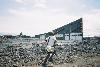
| Goma  FeatureType : city Elevation : 1461 Lat/Lng : -1.6933 / 29.2252 | Goma is the capital of North Kivu province in the eastern Democratic Republic of the Congo. It is located on the northern shore of Lake Kivu, next to the Rwandan city of Gisenyi. The lake and the two cities are in the Albertine Rift, the western branch of the East African Rift system (...) |
| 2 | 
| Democratic Republic of the Congo FeatureType : country Elevation : 444 Lat/Lng : -2.3333 / 22.8 | The Democratic Republic of the Congo , also known as DR Congo, the DRC, Congo-Kinshasa, East Congo, or simply the Congo, is the southernmost country located in East Africa and Central Africa. It is sometimes referred to by its former name of Zaire, which was its official name between 1971 and 1997 (...) |
| 3 | 
| Mount Nyiragongo FeatureType : mountain Elevation : 3442 Lat/Lng : -1.5185 / 29.254 | Mount Nyiragongo is an active stratovolcano with an elevation of in the Virunga Mountains associated with the Albertine Rift. It is located inside Virunga National Park, in the Democratic Republic of the Congo, about north of the town of Goma and Lake Kivu and just west of the border with Rwanda (...) |
| 4 | 
| Kisangani FeatureType : city Elevation : 401 Lat/Lng : 0.5193 / 25.1962 | Kisangani (formerly Stanleyville or Stanleystad) is the capital of Tshopo province in the Democratic Republic of the Congo. It is the third largest urbanized city in the country and the largest of the cities that lie in the tropical woodlands of the Congo (...) |
| 5 | 
| Nyamuragira FeatureType : mountain Elevation : 2949 Lat/Lng : -1.408 / 29.2 | Nyamuragira, also known as Nyamulagira, is an active composite volcano in the Virunga Mountains of the Democratic Republic of the Congo, situated about 25 km north of Lake Kivu. The name is derived from the Kifuru and kishi verb Kuragira ngavu, meaning to herd cows; ngavu means cow or cows (...) |
| 6 | 
| Gabon FeatureType : country Elevation : 24 Lat/Lng : 0.391 / 9.45 | Gabon , officially the Gabonese Republic , is a country on the west coast of Central Africa. Located on the equator, Gabon is bordered by Equatorial Guinea to the northwest, Cameroon to the north, the Republic of the Congo on the east and south, and the Gulf of Guinea to the west (...) |
| 7 | 
| Bunia FeatureType : city Elevation : 1265 Lat/Lng : 1.5594 / 30.2522 | Bunia is a city in the Ituri Province of the Democratic Republic of the Congo (DRC) and the headquarters of Ituri Interim Administration. It was part of the Orientale Province until that province's dissolution. It lies at an elevation of 1275 m on a plateau about 30 km west of Lake Albert in the (...) |
| 8 | 
| Lake Kivu FeatureType : waterbody Elevation : 1461 Lat/Lng : -2.0 / 29.0 | Lake Kivu is one of the African Great Lakes. It lies on the border between the Democratic Republic of the Congo and Rwanda, and is in the Albertine Rift, the western branch of the East African Rift. Lake Kivu empties into the Ruzizi River, which flows southwards into Lake Tanganyika. (...) |
| 9 | North Kivu FeatureType : adm1st Elevation : 1461 Lat/Lng : -1.69 / 29.22 | North Kivu is a province bordering Lake Kivu in the eastern Democratic Republic of the Congo. Its capital is Goma. North Kivu borders the provinces of Ituri to the north, Tshopo to the northwest, Maniema to the southwest, and South Kivu to the south (...) | |
| 10 | 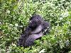
| Rwanda FeatureType : country Elevation : 1528 Lat/Lng : -1.9439 / 30.0595 | Rwanda , officially the Republic of Rwanda (; Swahili: Jamhuri ya Rwanda;), is a country in Central and East Africa and one of the smallest countries on the African mainland. Located a few degrees south of the Equator, Rwanda is bordered by Uganda, Tanzania, Burundi and the Democratic Republic of (...) |
| 11 | Goma (disambiguation) FeatureType : null Elevation : 849 Lat/Lng : -7.9458 / 14.8816 | Goma is a city in the Democratic Republic of Congo, and associated facilities. *University of Goma, a public university *Roman Catholic Diocese of Goma, a diocese in the Ecclesiastical province of Bukavu *Goma International Airport, an airport serving Goma * Goma (commune) Goma or GOMA may also (...) | |
| 12 | Bukavu FeatureType : null Elevation : 1716 Lat/Lng : -2.5154 / 28.8451 | Bukavu (former official names: Costermansville (French) and Costermansstad (Dutch)) is a city in eastern Democratic Republic of the Congo (DRC), lying at the extreme south-western edge of Lake Kivu, west of Cyangugu in Rwanda, and separated from it by the outlet of the Ruzizi River (...) | |
| 13 | South Kivu FeatureType : null Elevation : 1609 Lat/Lng : -2.5167 / 28.85 | South Kivu is one of 26 provinces of the Democratic Republic of the Congo. Its capital is Bukavu. (...) | |
| 14 | Gisenyi FeatureType : city Elevation : 1548 Lat/Lng : -1.6792 / 29.2608 | Gisenyi is a city in Rubavu district in Rwanda's Western Province. Gisenyi is contiguous with Goma, the city across the border in the Democratic Republic of the Congo. (...) | |
| 15 | M23 rebellion FeatureType : null Elevation : 1620 Lat/Lng : -1.6038 / 29.1953 | The M23 rebellion was fighting in North Kivu, Democratic Republic of the Congo (DRC), that occurred between the March 23 Movement and government forces. The rebellion was part of continued fighting in the region after the formal end of the Second Congo War in 2003 (...) | |
| 16 | Goma International Airport FeatureType : null Elevation : 1529 Lat/Lng : -1.6709 / 29.2384 | Goma International Airport is an airport serving Goma, a city in the Democratic Republic of the Congo in Africa. (...) | |
| 17 | Kindu FeatureType : null Elevation : 465 Lat/Lng : -2.95 / 25.92 | Kindu is a city in the Democratic Republic of Congo, the capital of Maniema province. It has a population of about 200,000 and is situated on the Lualaba River at an altitude of about 500 metres, and is about 400 km west of Bukavu (...) | |
| 18 | Sake, Democratic Republic of the Congo FeatureType : null Elevation : 1495 Lat/Lng : -1.5741 / 29.0413 | Sake is a town in the Democratic Republic of the Congo in the eastern province of North Kivu. It is located at the northwestern extremity of Lake Kivu, 25 km (15 mi) west-northwest of Goma on National Road No. 2, , IRIN via cidi (...) | |
| 19 | Bunagana, Democratic Republic of the Congo FeatureType : null Elevation : 1942 Lat/Lng : -1.3 / 29.595 | Bunagana, is a small town in Rutshuru Territory, North Kivu Province, in eastern Democratic Republic of the Congo, at the border with Uganda. It served as the headquarters of the M23 rebel militia until October 2013. (...) | |
| 20 | Moba, Democratic Republic of the Congo FeatureType : null Elevation : 1135 Lat/Lng : -7.0841 / 29.7368 | Moba is a town located in the Democratic Republic of the Congo in Tanganyika Province. It is the administrative center of Moba Territory. (...) | |
| 21 | Kigali International Airport FeatureType : null Elevation : 1492 Lat/Lng : -1.9664 / 30.1331 | Kigali International Airport , formerly known as Gregoire Kayibanda International Airport, but sometimes referred to as Kanombe International Airport, is the primary airport serving Kigali, the capital of Rwanda (...) | |
| 22 | Goma (commune) FeatureType : null Elevation : 1461 Lat/Lng : -1.6933 / 29.2252 | Goma is a commune of the city of Goma in North Kivu, Democratic Republic of the Congo. This is the southern part of the city or town going from the main road (also called la nationale N2N2) to the kivu lake. (...) | |
| 23 | Pweto FeatureType : null Elevation : 954 Lat/Lng : -8.466 / 28.9008 | Pweto is a town in the Haut-Katanga Province of the Democratic Republic of the Congo (DRC). It is the administrative center of Pweto Territory. The town was the scene of a decisive battle in December 2000 during the Second Congo War which resulted in both sides making more active efforts to achieve (...) | |
| 24 | South Sudan FeatureType : city Elevation : 500 Lat/Lng : 4.85 / 31.6 | South Sudan , officially known as the Republic of South Sudan, is a landlocked country in East-Central Africa. The country gained its independence from the Republic of the Sudan in 2011, making it the newest country with widespread recognition. Its capital and largest city is Juba (...) | |
| 25 | Hewa Bora Airways Flight 122 FeatureType : event Elevation : 1509 Lat/Lng : -1.6814 / 29.2394 | On 15 April 2008, Hewa Bora Airways Flight 122, a McDonnell Douglas DC-9-51 plane crashed into a residential and market area of Goma of the Democratic Republic of the Congo immediately south of Goma International Airport. (...) | |
| 26 | Katale Airport FeatureType : null Elevation : 1422 Lat/Lng : -1.325 / 29.375 | Katale Airport is an airport serving the village of Katale in North Kivu Province, Democratic Republic of the Congo. The Goma VOR/DME (Ident: GOM) is south-southwest of the airport. (...) | |
| 27 | Rwandan genocide FeatureType : null Elevation : 1583 Lat/Lng : -1.9403 / 29.8739 | The Rwandan genocide, also known as the genocide against the Tutsi, was a mass slaughter of Tutsi in Rwanda during the Rwandan Civil War, which had started in 1990. It was directed by members of the Hutu majority government during the 100-day period from 7 April to mid-July 1994 (...) | |
| 28 | Mbuji-Mayi FeatureType : city Elevation : 626 Lat/Lng : -6.173 / 23.6031 | Mbuji-Mayi (formerly Bakwanga) serves as the capital city of Kasai-Oriental Province in the south-central Democratic Republic of Congo. It is the third largest city in the country, following the capital Kinshasa and second largest city Lubumbashi but ahead of Kisangani and Kananga, though the exact (...) | |
| 29 | South African Air Force FeatureType : null Elevation : 18 Lat/Lng : -29.9686 / 30.9478 | The South African Air Force (SAAF) is the air force of South Africa, with headquarters in Pretoria. The South African Air Force was established on 1 February 1920. The Air Force has seen service in World War II and the Korean War (...) | |
| 30 | Canada–Democratic Republic of the Congo relations FeatureType : null Elevation : 59 Lat/Lng : 45.4274 / -75.6737 | Canada–Democratic Republic of the Congo relations refers to the bilateral relationship between Canada and the Democratic Republic of the Congo. Canada has an embassy in Kinshasa and D.R. Congo has an embassy in Ottawa (...) | |
| 31 | Karisimbi (commune) FeatureType : city Elevation : 1214 Lat/Lng : -11.6971 / 27.4795 | Karisimbi is a commune of the city of Goma in North Kivu, Democratic Republic of the Congo. It is named after the nearby Mount Karisimbi. | |
| 32 | Tanganyika Province FeatureType : adm1st Elevation : 767 Lat/Lng : -5.9167 / 29.2 | Tanganyika is one of the 26 provinces of the Democratic Republic of the Congo. Specified under Article 2 of the country's 2006 Constitution, Tanganyika was finally created in 2015 from the eponymous Tanganyika District, previously part of the pre-2015 Katanga Province. Its capital is Kalemie (...) | |
| 33 | Kitona FeatureType : city Elevation : 123 Lat/Lng : -5.92 / 12.4439 | Kitona is a town of about 4,000 persons in the Bas-Congo province of the Democratic Republic of the Congo. It is located to the southwest of the country along the Atlantic Ocean, about 190 miles southwest of the capital city of Kinshasa (...) | |
| 34 | Kivu FeatureType : adm1st Elevation : 1114 Lat/Lng : -2.5 / 28.0 | Kivu was the name for a large "Region" in the Democratic Republic of Congo under the rule of Mobutu Sese Seko that bordered Lake Kivu. It included three "Sub-Regions" ("Sous-Regions" in French): Nord-Kivu, Sud-Kivu and Maniema, corresponding to the three current provinces created in 1986 (...) | |
| 35 | Roman Catholic Archdiocese of Bukavu FeatureType : null Elevation : 1559 Lat/Lng : -2.5018 / 28.8595 | The Roman Catholic Archdiocese of Bukavu is the Metropolitan See for the Ecclesiastical province of Bukavu in the Democratic Republic of the Congo. (...) | |
| 36 | Mount Bisoke FeatureType : mountain Elevation : 3638 Lat/Lng : -1.463 / 29.487 | Mount Bisoke (also Visoke) is an active volcano in the Virunga Mountains of the Albertine Rift, the western branch of the East African Rift. It straddles the border of Rwanda and the Democratic Republic of the Congo, but the summit is located in Rwanda (...) | |
| 37 | Kasindi FeatureType : city Elevation : 1201 Lat/Lng : 0.0478 / 29.6864 | Kasindi is a town in north eastern Democratic Republic of Congo. (...) | |
| 38 | 2013 Goma Compagnie Africaine d'Aviation Fokker 50 crash FeatureType : event Elevation : 1504 Lat/Lng : -1.6833 / 29.2333 | On 4 March 2013, a Compagnie Africaine d'Aviation Fokker 50 making a domestic cargo flight from Lodja Airport to Goma International Airport, Democratic Republic of the Congo crashed in poor weather on approach to Goma. There were nine people on the aircraft; six died in the accident (...) | |
| 39 | Rutshuru Hydroelectric Power Station FeatureType : landmark Elevation : 1230 Lat/Lng : -1.2258 / 29.46 | Rutshuru Hydroelectric Power Station, also referred to as Rutshuru Hydropower Station, is a hydroelectric power station under construction in the Democratic Republic of the Congo. The plant was finished in December 16, 2015. (...) | |
| 40 | Walikale Territory FeatureType : adm2nd Elevation : 959 Lat/Lng : -1.4167 / 28.05 | Walikale Territory is a territory located within the Congolese province of North Kivu, in the eastern regions of the Democratic Republic of the Congo. The headquarters are in the town of Walikale. The locality is situated between Bukavu and Lubutu (Maniema Province) on DR Congo National Road No (...) | |
| 41 | 2008 Lake Kivu earthquake FeatureType : event Elevation : 1534 Lat/Lng : -2.314 / 28.896 | The 2008 Lake Kivu earthquake shook several countries in Africa's Great Lakes region at 07:34:12 (GMT) on February 3. It measured 5.9 on the moment magnitude scale. The epicentre was north of Bukavu at Lake Kivu in the Democratic Republic of Congo. (...) | |
| 42 | Mutwanga Hydroelectric Power Station FeatureType : landmark Elevation : 1286 Lat/Lng : 0.34 / 29.76 | Mutwanga Hydroelectric Power Station, also referred to as Mutwanga Hydropower Station, is a hydroelectric power station in the Democratic Republic of the Congo. (...) | |
| 43 | Minova FeatureType : null Elevation : 1468 Lat/Lng : -1.7069 / 29.0192 | Minova is a town and refugee area in northern South Kivu Province, Democratic Republic of the Congo., United States National Geospatial-Intelligence Agency It is known for atrocities committed there in 2012. (...) | |
| 44 | Linafoot FeatureType : null Elevation : 1504 Lat/Lng : -1.6833 / 29.2333 | The Linafoot is the top division of the Fédération Congolaise de Football-Association, the governing body of football in the Democratic Republic of the Congo. It was created in 1958. In 2013, the highest attendance was set in the match DC Motema Pembe - AS Vita Club, which saw an attendance of (...) | |
| 45 | Bunagana, Uganda FeatureType : city Elevation : 1908 Lat/Lng : -1.2944 / 29.5997 | Bunagana is a town in the Western Region of Uganda. (...) | |
| 46 | National Assembly (Democratic Republic of the Congo) FeatureType : landmark Elevation : 291 Lat/Lng : -4.3322 / 15.3031 | The National Assembly is the lower house and main legislative political body of the Parliament of the Democratic Republic of the Congo. It was established by the 2006 constitution. It is located at the People's Palace in Kinshasa. (...) | |
| 47 | Rutshuru Territory FeatureType : null Elevation : 1236 Lat/Lng : -1.1873 / 29.446 | Rutshuru Territory is a territory in the North Kivu province of the eastern Democratic Republic of the Congo (DRC), with headquarters is the town of Rutshuru. The territory is mountainous, including a large portion of the Virunga National Park, famous for its mountain gorillas (...) | |
| 48 | Masisi FeatureType : null Elevation : 1536 Lat/Lng : -1.4 / 28.8181 | Masisi is a town in the North Kivu Province of the Democratic Republic of the Congo (DRC). It is the administrative center of the Masisi Territory. (...) | |
| 49 | Kanyabayonga FeatureType : null Elevation : 1752 Lat/Lng : -0.702 / 29.1726 | Kanyabayonga (also Kanya Bayonga, Kanyabayungu) is a town in Lubero Territory, North Kivu province, Democratic Republic of the Congo. The town has suffered from continued violence between the army and rival militias since 1993. (...) | |
| 50 | Pweto Territory FeatureType : null Elevation : 955 Lat/Lng : -8.4667 / 28.9 | Pweto Territory is a territory in the Haut-Katanga Province of the Democratic Republic of the Congo (DRC). The headquarters are in the town of Pweto. (...) | |
| 51 | Gisenyi Airport FeatureType : null Elevation : 1544 Lat/Lng : -1.68 / 29.2583 | Gisenyi Airport is an airport in Rwanda. (...) | |
| 52 | Lubero FeatureType : null Elevation : 1859 Lat/Lng : -0.155 / 29.24 | Lubero is a town in the North Kivu Province of the Democratic Republic of the Congo (DRC). It is the administrative center of the Lubero Territory. (...) | |
| 53 | Nyanzale FeatureType : null Elevation : 1608 Lat/Lng : -0.7749 / 29.1251 | Nyanzale is a camp for Internally Displaced People (IDPs) in the Masisi territory of North Kivu province, Democratic Republic of the Congo. Nyanzale is about north of Goma and south of Kanya Bayonga. It is a small town which population has more than doubled with the arrival of 20,000 displaced (...) | |
| 54 | Bena Dibele FeatureType : null Elevation : 462 Lat/Lng : -4.102 / 22.8303 | Bena Dibele (also Beni Dibele or Bene Dibele) is a community in the Sankuru District of the Democratic Republic of the Congo. Bena Dibele is on the right bank of the Sankuru River just below the point where it is joined by the Lubefu River (...) | |
| 55 | Moliro FeatureType : null Elevation : 785 Lat/Lng : -8.221 / 30.5665 | Moliro is a community in the east of the Democratic Republic of the Congo beside Lake Tanganyika on the border with Zambia. It is in Katanga Province. The Congo Free State Enclave of Moliro was founded in 1902, with its own fort and detachment of soldiers, one of three such military divisions in (...) | |
| 56 | Pepa, Democratic Republic of the Congo FeatureType : null Elevation : 2030 Lat/Lng : -7.7106 / 29.776 | Pepa is a community in the northeast of the Tanganyika District of the Katanga Province of the Democratic Republic of the Congo. It is located 167 kilometres northeast by road from Pweto, to the west of Lake Tanganyika. (...) | |
| 57 | National Road No. 2 (Democratic Republic of the Congo) FeatureType : null Elevation : 675 Lat/Lng : -1.4278 / 28.0736 | National Road No. 2 is an 863-km road in the Democratic Republic of the Congo. It runs from the eastern city of Goma, which lies on the northern shore of Lake Kivu across the border from the Rwandan city of Gisenyi, around the western shore of Lake Kivu via Katana towards Bukavu (...) | |
| 58 | Bisie FeatureType : city Elevation : 687 Lat/Lng : -1.0333 / 27.7333 | Bisie is a tin deposit in the Walikale territory of the province of North Kivu in the Democratic Republic of the Congo (DRC), although the name is also sometimes used for the nearby village of Manoire. The mine was formerly an illegal source of an estimated 15,000 tons of tin, or 4% of global (...) | |
| 59 | 2011 United Nations Bombardier CRJ-100 crash FeatureType : event Elevation : 282 Lat/Lng : -4.3167 / 15.3 | On 4 April 2011, a Georgian Airways Canadair Regional Jet (CRJ 100 ER), registration 4L-GAE, using call sign "UNO 834", operating a domestic flight from Kisangani to Kinshasa for United Nation's Stabilization Mission in the Democratic Republic of Congo, crashed during Go Around at Kinshasa Airport, (...) | |
| 60 | Nyundo, Rubavu FeatureType : null Elevation : 1812 Lat/Lng : -1.7006 / 29.3275 | Nyundo is a community in the Rubavu District of Western Province, Rwanda, on the Sebeya River to the east of Gisenyi. It is the location of one of the first Catholic missions to be established in Rwanda, and today is the headquarters of the Roman Catholic Diocese of Nyundo. (...) | |
| 61 | Stade de Virunga FeatureType : landmark Elevation : 1512 Lat/Lng : -1.6781 / 29.2269 | Stade de Virunga is a multi-use stadium in Goma, Democratic Republic of the Congo. It is currently used mostly for football matches and serves as the home venue for DC Virunga. The stadium has a capacity of 8,000 people. Its pitch has a surface of dark grey basaltic sand. | |
| 62 | 2002 Kalehe earthquake FeatureType : null Elevation : 1461 Lat/Lng : -1.905 / 29.013 | The 2002 Kalehe earthquake occurred on October 24 at 06:08 UTC. This earthquake had a magnitude 6.2, and the epicenter was located in Democratic Republic of the Congo, near Lake Kivu. Two people were reported dead. Building damage was reported in Goma, Lwiro, Kalehe, and Mugeri.https://earthquake (...) | |
| 63 | Rumangabo FeatureType : null Elevation : 1674 Lat/Lng : -1.3454 / 29.3926 | Rumangabo is a military base of the military of the Democratic Republic of the Congo located north of Goma in Nord Kivu province. It is north of the headquarters of Virunga National Park. During Mobutu Sese Seko's presidency, the strategic base of Rumangabo was occupied by the 411th Chinese-trained (...) | |
| 64 | Mercy Corps FeatureType : null Elevation : 21 Lat/Lng : 45.5236 / -122.6709 | Mercy Corps is a global non-governmental, humanitarian aid organization operating in transitional contexts that have undergone, or have been undergoing, various forms of economic, environmental, social and political instabilities (...) | |
 by
by