| 204 records found in wikipedia | |||
| 1 | 
| Halifax, Nova Scotia  FeatureType : null Elevation : 17 Lat/Lng : 44.6479 / -63.5716 | Halifax, also known as the Halifax Regional Municipality (HRM), is the capital of the Canadian province of Nova Scotia. The municipality had a population of 403,131 in 2016, with 316,701 in the urban area centred on Halifax Harbour (...) |
| 2 | 
| Fécamp FeatureType : null Elevation : 17 Lat/Lng : 49.7583 / 0.38 | Fécamp is a commune in the Seine-Maritime department in the Normandy region in northern France. (...) |
| 3 | 
| Cape Breton Island FeatureType : isle Elevation : 61 Lat/Lng : 46.0885 / -60.8093 | Cape Breton Island (—formerly '; or '; ; or simply Cape Breton) is an island on the Atlantic coast of North America and part of the province of Nova Scotia, Canada. The island accounts for 18.7% of Nova Scotia's total area (...) |
| 4 | 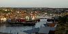
| Whitby FeatureType : null Elevation : 37 Lat/Lng : 54.4858 / -0.6206 | Whitby is a seaside town, port and civil parish in the Scarborough borough of North Yorkshire, England. Situated on the east coast of Yorkshire at the mouth of the River Esk, Whitby has a maritime, mineral and tourist heritage (...) |
| 5 | 
| Shippagan FeatureType : city Elevation : 4 Lat/Lng : 47.7439 / -64.7177 | Shippagan (2011 population: 2,631) is a Canadian town in Gloucester County, New Brunswick. (...) |
| 6 | 
| Saint-Nazaire FeatureType : null Elevation : 8 Lat/Lng : 47.2806 / -2.2086 | Saint-Nazaire (; ; Gallo: Saint-Nazère/Saint-Nazaer) is a commune in the Loire-Atlantique department in western France, in traditional Brittany. The town has a major harbour on the right bank of the Loire River estuary, near the Atlantic Ocean (...) |
| 7 | 
| Sandefjord FeatureType : city Elevation : 67 Lat/Lng : 59.1458 / 10.2236 | Sandefjord is the most populous city and municipality in Vestfold County, Norway. The administrative center of the municipality is the city of Sandefjord. The municipality of Sandefjord was established on January 1, 1838. The municipality of Sandar was merged into Sandefjord on January 1, 1968 (...) |
| 8 | 
| Lunenburg, Nova Scotia FeatureType : city Elevation : 13 Lat/Lng : 44.3784 / -64.3172 | Lunenburg is a port town in Lunenburg County, Nova Scotia, Canada. Situated on the province's South Shore, Lunenburg is located on the Fairhaven Peninsula at the western side of Mahone Bay. The town is approximately 90 kilometres southwest of the county boundary with the Halifax Regional (...) |
| 9 | 
| Scarborough, North Yorkshire FeatureType : null Elevation : 46 Lat/Lng : 54.2825 / -0.4072 | Scarborough is a town on the North Sea coast of North Yorkshire, England. Historically part of the North Riding of Yorkshire, the town lies between 10–230 feet (3–70 m) above sea level, rising steeply northward and westward from the harbour on to limestone cliffs (...) |
| 10 | 
| Charlottetown FeatureType : null Elevation : 13 Lat/Lng : 46.2354 / -63.1266 | Charlottetown is the capital and largest city of the Canadian province of Prince Edward Island, and the county seat of Queens County. Named after Charlotte of Mecklenburg-Strelitz, queen consort of King George III of the United Kingdom, Charlottetown was originally an unincorporated town that (...) |
| 11 | 
| Vancouver Island FeatureType : isle Elevation : 1387 Lat/Lng : 49.5083 / -125.5083 | Vancouver Island is in the northeastern Pacific Ocean. It is part of the Canadian province of British Columbia. The island is in length, in width at its widest point, and in area. It is the largest island on the West Coast of North America (...) |
| 12 | 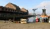
| Greenock FeatureType : null Elevation : 12 Lat/Lng : 55.9481 / -4.7602 | Greenock is a town and administrative centre in the Inverclyde council area in Scotland and a former burgh within the historic county of Renfrewshire, located in the west central Lowlands of Scotland. It forms part of a contiguous urban area with Gourock to the west and Port Glasgow to the east (...) |
| 13 | 
| Honfleur FeatureType : null Elevation : 11 Lat/Lng : 49.4189 / 0.2331 | Not to be confused with nearby Harfleur. Honfleur (Honfleur in French) is a commune in the Calvados department in northwestern France. It is located on the southern bank of the estuary of the Seine across from le Havre and very close to the exit of the Pont de Normandie (...) |
| 14 | 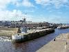
| Lossiemouth FeatureType : null Elevation : 22 Lat/Lng : 57.7214 / -3.2834 | Lossiemouth is a town in Moray, Scotland. Originally the port belonging to Elgin, it became an important fishing town. Although there has been over a 1,000 years of settlement in the area, the present day town was formed over the past 250 years and consists of four separate communities that (...) |
| 15 | 
| Shelburne, Nova Scotia FeatureType : city Elevation : 5 Lat/Lng : 43.7632 / -65.3247 | Shelburne is a town located in southwestern Nova Scotia, Canada. It is home to the Bowers Meadows Wilderness Area.https://novascotia.ca/nse/protectedareas/wa_bowersmeadows.asp (...) |
| 16 | 
| Portsmouth FeatureType : city Elevation : 7 Lat/Lng : 50.7953 / -1.0889 | Portsmouth is a port city in Hampshire, England, with a total population of 205,400 residents. The city of Portsmouth is nicknamed Pompey and is mainly built on Portsea Island, a flat, low-lying island measuring 24 square kilometres (9 sq mi) in area, just off the south-east coast of Hampshire (...) |
| 17 | 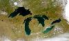
| Great Lakes FeatureType : waterbody Elevation : 175 Lat/Lng : 45.8106 / -84.6825 | The Great Lakes , also called the Laurentian Great Lakes and the Great Lakes of North America, are a series of interconnected freshwater lakes located primarily in the upper mid-east region of North America, on the Canada–United States border, which connect to the Atlantic Ocean through the Saint (...) |
| 18 | 
| Keelung FeatureType : city Elevation : 37 Lat/Lng : 25.1333 / 121.7333 | Keelung (Standard Mandarin Pīnyīn: Jīlóng; Hokkien POJ: Ke-lâng), officially known as Keelung City, is a major port city situated in the northeastern part of Taiwan. It borders New Taipei with which it forms the Taipei–Keelung metropolitan area, along with Taipei itself (...) |
| 19 | 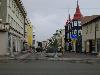
| Akureyri FeatureType : null Lat/Lng : 65.6833 / -18.1 | Akureyri is a town in northern Iceland. It is Iceland's second largest urban area (after the Capital Region) and fourth largest municipality (after Reykjavík, Hafnarfjörður, and Kópavogur). Nicknamed the Capital of North Iceland, Akureyri is an important port and fishing centre (...) |
| 20 | 
| Trincomalee FeatureType : city Lat/Lng : 8.5833 / 81.2333 | Trincomalee (; Tirukōṇamalai; Trikuṇāmalaya) also known as Gokanna, is the administrative headquarters of the Trincomalee District and major resort port city of Eastern Province, Sri Lanka. Located on the east coast of the island overlooking the Trincomalee Harbour, 113 miles south of Jaffna and 69 (...) |
| 21 | 
| Stornoway FeatureType : null Elevation : 12 Lat/Lng : 58.209 / -6.387 | Stornoway is the main town of the Western Isles and the capital of Lewis and Harris in Scotland. The town's population is around 8,000, making it by far the largest town in the Hebrides, as well as the second largest island town in Scotland after Kirkwall in the Orkney (...) |
| 22 | 
| Yarmouth, Nova Scotia FeatureType : null Elevation : 13 Lat/Lng : 43.8429 / -66.1192 | Yarmouth is a port town located on the Bay of Fundy in southwestern Nova Scotia, Canada. Yarmouth is the shire town of Yarmouth County and is largest population centre in the region. Long connected to fishing due to its proximity to Georges Bank, the town is located in the heart of the world's (...) |
| 23 | 
| Iqaluit FeatureType : city Lat/Lng : 63.7544 / -68.519 | Iqaluit , meaning "place of fish", is the capital of the Canadian territory of Nunavut; its largest community, and its only city. It was known as Frobisher Bay until 1987, after the large bay on the coast of which the city is situated (...) |
| 24 | 
| Bridgetown FeatureType : city Lat/Lng : 13.0947 / -59.6175 | Bridgetown (UN/LOCODE: BB BGI), United Nations - Code for Trade and Transport Locations (UN/LOCODE) via UNECE is the capital and largest city of Barbados. Formerly The Town of Saint Michael, the Greater Bridgetown area is located within the parish of Saint Michael (...) |
| 25 | 
| Newfoundland and Labrador FeatureType : adm1st Elevation : 63 Lat/Lng : 47.6011 / -52.6976 | Newfoundland and Labrador (; ; Newfoundland Irish:) is the most easterly province of Canada. Situated in the country's Atlantic region, it comprises the island of Newfoundland and mainland Labrador to the northwest, with a combined area of (...) |
| 26 | 
| Dock (maritime) FeatureType : landmark Elevation : 4 Lat/Lng : 53.5397 / 8.5847 | A dock (from Dutch dok) is the area of water between or next to one or a group of human-made structures that are involved in the handling of boats or ships (usually on or near a shore) or such structures themselves. The exact meaning varies among different variants of the English language (...) |
| 27 | 
| Pori FeatureType : city Lat/Lng : 61.486 / 21.791 | Pori is a city and municipality on the west coast of Finland. The city is located some from the Gulf of Bothnia, on the estuary of the Kokemäenjoki river. Pori was established in 1558 by Duke John, who later became John III of Sweden (...) |
| 28 | 
| Sligo FeatureType : null Elevation : 24 Lat/Lng : 54.2667 / -8.4833 | Sligo is a coastal seaport and the county town of County Sligo, Ireland, within the western province of Connacht. With a population of approximately 20,000 in 2016, it is the second largest urban centre in the West of Ireland, with only Galway being larger (...) |
| 29 | 
| Rarotonga FeatureType : isle Elevation : 83 Lat/Lng : -21.2538 / -159.7893 | Rarotonga is the most populous island of the Cook Islands, with a population of 10,572 (census 2011), out of the country's total resident population of 14,974. Captain John Dibbs, master of the colonial brig Endeavour, is credited as the European discoverer on 25 July 1823, while transporting the (...) |
| 30 | 
| Welland Canal FeatureType : landmark Elevation : 113 Lat/Lng : 43.1556 / -79.1938 | The Welland Canal is a ship canal in Ontario, Canada, connecting Lake Ontario and Lake Erie. It forms a key section of the St. Lawrence Seaway. Traversing the Niagara Peninsula from Port Weller to Port Colborne, it enables ships to ascend and descend the Niagara Escarpment and bypass Niagara Falls (...) |
| 31 | 
| Antarctica FeatureType : null Lat/Lng : -69.3578 / -2.2472 | Antarctica (or) is Earth's southernmost continent. It contains the geographic South Pole and is situated in the Antarctic region of the Southern Hemisphere, almost entirely south of the Antarctic Circle, and is surrounded by the Southern Ocean. At , it is the fifth-largest continent (...) |
| 32 | 
| Islay FeatureType : null Elevation : 13 Lat/Lng : 55.7844 / -6.2408 | Islay is the southernmost island of the Inner Hebrides of Scotland. Known as "The Queen of the Hebrides", it lies in Argyll just south west of Jura and around north of the Northern Irish coast. The island's capital is Bowmore where the distinctive round Kilarrow Parish Church and a distillery are (...) |
| 33 | 
| Bermuda FeatureType : country Lat/Lng : 32.3333 / -64.75 | Bermuda is a British Overseas Territory in the North Atlantic Ocean. It is approximately east-southeast of Cape Hatteras, North Carolina; south of Cape Sable Island, Nova Scotia; and north of Cuba. The capital city is Hamilton (...) |
| 34 | 
| Sydney FeatureType : city(4575532) Elevation : 72 Lat/Lng : -33.8694 / 151.2083 | Sydney is the state capital of New South Wales and the most populous city in Australia and Oceania. Located on Australia's east coast, the metropolis surrounds Port Jackson and extends about on its periphery towards the Blue Mountains to the west, Hawkesbury to the north, and Macarthur to the south (...) |
| 35 | 
| Stanley Park FeatureType : forest Elevation : 39 Lat/Lng : 49.3037 / -123.1452 | Stanley Park is a public park that borders the downtown of Vancouver in British Columbia, Canada and is almost entirely surrounded by waters of Vancouver Harbour and English Bay. The park has a long history and was one of the first areas to be explored in the city (...) |
| 36 | 
| Hampshire FeatureType : adm1st Elevation : 37 Lat/Lng : 51.0577 / -1.3081 | Hampshire (; abbreviated Hants) is a county on the southern coast of England in the United Kingdom. The county town of Hampshire is Winchester, the former capital of England. After the metropolitan counties and Greater London, Hampshire is the most populous ceremonial county (1 (...) |
| 37 | 
| Minehead FeatureType : city Elevation : 15 Lat/Lng : 51.2038 / -3.4738 | Minehead is a coastal town and civil parish in Somerset, England. It lies on the south bank of the Bristol Channel, north-west of the county town of Taunton, from the border with the county of Devon and in proximity of the Exmoor National Park (...) |
| 38 | 
| Red Bay, Newfoundland and Labrador FeatureType : null Elevation : 9 Lat/Lng : 51.7319 / -56.4256 | Red Bay is a fishing village in Labrador, notable as one of the most precious underwater archaeological sites in the Americas. Between 1530 and the early 17th century, it was a major Basque whaling area. Several whaling ships, both large galleons and small chalupas, sunk there, and their discovery (...) |
| 39 | 
| Churchill, Manitoba FeatureType : null Elevation : 10 Lat/Lng : 58.7692 / -94.1663 | Churchill (Kuugjuaq)Issenman, Betty. Sinews of Survival: The living legacy of Inuit clothing. UBC Press, 1997. pp. 252–254 is a town in northern Manitoba, Canada on the west shore of Hudson Bay, roughly from the Manitoba–Nunavut border (...) |
| 40 | 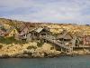
| Malta FeatureType : country Elevation : 96 Lat/Lng : 35.9167 / 14.4333 | Malta , officially known as the Republic of Malta , is a Southern European island country consisting of an archipelago in the Mediterranean Sea. It lies south of Italy, east of Tunisia, and north of Libya. Malta is one of the world's smallest and most densely populated countries, at over with a (...) |
| 41 | 
| Dalian FeatureType : city Elevation : 23 Lat/Lng : 39.0333 / 121.7667 | Dalian is a major city and seaport in the south of Liaoning Province, China. It is the southernmost city of the Liaodong Peninsula. Dalian is the province's second largest city and has sub-provincial administrative status (...) |
| 42 | 
| Truro FeatureType : city Elevation : 18 Lat/Lng : 50.26 / -5.051 | Truro is a city and civil parish in Cornwall, England, United Kingdom. It is Cornwall's county town, only city and centre for administration, leisure and retail. Truro's population was recorded as 18,766 in the 2011 census. People from Truro are known as Truronians (...) |
| 43 | 
| Isles of Scilly FeatureType : isle Elevation : 23 Lat/Lng : 49.9212 / -6.2943 | The Isles of Scilly (; or ') is an archipelago off the southwestern tip of Cornwall. One of the islands, St Agnes, is the most southerly point in both England and the United Kingdom, being over further south than the most southerly point of the British mainland at Lizard Point (...) |
| 44 | 
| Digby, Nova Scotia FeatureType : null Elevation : 35 Lat/Lng : 44.6219 / -65.7586 | Digby is a town in southwestern Nova Scotia, Canada. It is the administrative centre and largest population centre in Digby County. The town is situated on the western shore of the Annapolis Basin near the entrance to Digby Gut, which connects the basin to the Bay of Fundy (...) |
| 45 | 
| Prince Edward Island FeatureType : adm1st Elevation : 13 Lat/Lng : 46.2354 / -63.1265 | Prince Edward Island (PEI or P.E.I.;) is a province of Canada consisting of the island of the same name, and several much smaller islands. Prince Edward Island is one of the three Maritime Provinces and is the smallest province in both land area and population (...) |
| 46 | 
| Cairns FeatureType : null Lat/Lng : -16.9167 / 145.7797 | Cairns Macquarie Dictionary, Fourth Edition (2005). Melbourne, The Macquarie Library Pty Ltd. is a city in the Cairns Region, Queensland, Australia. It is on the east coast of Far North Queensland. The city is the 5th-most-populous in Queensland and ranks 14th overall in Australia (...) |
| 47 | 
| Richmond, California FeatureType : null Elevation : 12 Lat/Lng : 37.9358 / -122.3478 | Richmond is a city in western Contra Costa County, California, United States. The city was incorporated on August 7, 1905. , El Cerrito Historical Society, June 2007. Retrieved August 15, 2007. Located in the East Bay region of the San Francisco Bay Area, Richmond borders the cities of San Pablo, (...) |
| 48 | 
| Minas Basin FeatureType : waterbody Lat/Lng : 45.2502 / -64.1655 | The Minas Basin is an inlet of the Bay of Fundy and a sub-basin of the Fundy Basin located in Nova Scotia, Canada. It is known for its extremely high tides. (...) |
| 49 | 
| Gaza Strip FeatureType : adm1st Elevation : 12 Lat/Lng : 31.4167 / 34.3333 | The Gaza Strip (;The New Oxford Dictionary of English (1998) – p.761 "Gaza Strip /'gɑːzə/ a strip of territory under the control of the Palestinian National Authority and Hamas, on the SE Mediterranean coast including the town of Gaza..." (...) |
| 50 | 
| Isle of May FeatureType : isle Lat/Lng : 56.1833 / -2.5667 | The Isle of May is located in the north of the outer Firth of Forth, approximately off the coast of mainland Scotland. It is long and less than half a kilometre wide. The island is owned and managed by Scottish Natural Heritage as a National Nature Reserve (...) |
| 51 | Sheet Harbour, Nova Scotia FeatureType : null Lat/Lng : 44.9167 / -62.5333 | Sheet Harbour is a rural community on the Eastern Shore of Nova Scotia, Canada. It is part of the Halifax Regional Municipality and lies along the Marine Drive on Trunk 7 approximately northeast of Halifax. The catchment area around the community contains approximately 5,000 people (...) | |
| 52 | 
| Netherlands FeatureType : country Elevation : 25 Lat/Lng : 52.35 / 5.7667 | The Netherlands is a country located mainly in Northwestern Europe. Together with three island territories in the Caribbean (Bonaire, Sint Eustatius and Saba), it forms a constituent country of the Kingdom of the Netherlands (...) |
| 53 | 
| Îles des Saintes FeatureType : isle Lat/Lng : 15.8611 / -61.6098 | The Îles des Saintes ("Islands of the Saints"), also known as Les Saintes, is a small archipelago of the French Antilles (West Indies) located to the south of Basse-Terre Island, west of Marie-Galante and north of Dominica (...) |
| 54 | Victoria Harbour (British Columbia) FeatureType : waterbody Lat/Lng : 48.4211 / -123.3928 | Victoria Harbour is a harbour, seaport, and seaplane airport located in the Canadian city of Victoria, British Columbia. It serves as a cruise ship and ferry destination for tourists and visitors to the city and Vancouver Island (...) | |
| 55 | 
| Parrsboro FeatureType : city Elevation : 17 Lat/Lng : 45.4057 / -64.3258 | Parrsboro is a Canadian community located in Cumberland County, Nova Scotia. A regional service centre for southern Cumberland County, the community is also known for its port on the Minas Basin, the Ship's Company Theatre productions, and the Fundy Geological Museum. (...) |
| 56 | New Harbour, Newfoundland and Labrador FeatureType : null Elevation : 23 Lat/Lng : 47.5832 / -53.5314 | New Harbour, Newfoundland and Labrador, is a community on the East shore of Trinity Bay, located along Provincial Route 80; Route 80's intersection with Route 73 is inside New Harbour, in the Canadian province of Newfoundland and Labrador. The population is about 1,500 (...) | |
| 57 | 
| Canna, Scotland FeatureType : null Elevation : 2 Lat/Lng : 57.0579 / -6.5456 | Canna is the westernmost of the Small Isles archipelago, in the Scottish Inner Hebrides. It is linked to the neighbouring island of Sanday by a road and sandbanks at low tide. The island is long and wide. The isolated skerries of Hyskeir and Humla lie south west of the island (...) |
| 58 | Sovetskaya Gavan FeatureType : null Elevation : 51 Lat/Lng : 48.9667 / 140.2833 | Sovetskaya Gavan (lit. Soviet harbor) is a town in Khabarovsk Krai, Russia, and a port on the Strait of Tartary which connects the Sea of Okhotsk in the north with the Sea of Japan in the south. Population: (...) | |
| 59 | Prince Rupert, British Columbia FeatureType : null Elevation : 35 Lat/Lng : 54.3122 / -130.3271 | Prince Rupert is a port city in the province of British Columbia, Canada. Located on Kaien Island, Prince Rupert is the land, air, and water transportation hub of British Columbia's North Coast, and has a population of 12,220 people (Statistics Canada, 2016). (...) | |
| 60 | Sachs Harbour FeatureType : city Lat/Lng : 71.9841 / -125.2463 | Sachs Harbour is a hamlet located in the Inuvik Region of the Northwest Territories, Canada. Situated on the southwestern coast of Banks Island in the Inuvialuit Settlement Region, the population according to the 2011 census count was 103 people (...) | |
| 61 | 
| Swissair Flight 111 FeatureType : landmark Lat/Lng : 44.4091 / -63.9736 | Swissair Flight 111 (IATA: SR111, ICAO: SWR111) was a scheduled international passenger flight from John F. Kennedy International Airport in New York City, United States to Cointrin International Airport in Geneva, Switzerland. This flight was also a codeshare flight with Delta Air Lines (...) |
| 62 | 
| Gjøa FeatureType : landmark Elevation : 4 Lat/Lng : 59.9036 / 10.7005 | Gjøa was the first vessel to transit the Northwest Passage. With a crew of six, Roald Amundsen traversed the passage in a three-year journey, finishing in 1906. (...) |
| 63 | Louisbourg FeatureType : null Elevation : 14 Lat/Lng : 45.9199 / -59.9728 | Louisbourg is an unincorporated community and former town in Cape Breton Regional Municipality, Nova Scotia. (...) | |
| 64 | Port Hawkesbury FeatureType : null Elevation : 42 Lat/Lng : 45.6169 / -61.3485 | Port Hawkesbury (Scottish Gaelic: Baile a' Chlamhain) is a town located on the southwestern end of Cape Breton Island, on the north shore of the Strait of Canso, in the Canadian province of Nova Scotia. The town was originally named Ship Harbour (after the harbour upon which it is located) and is (...) | |
| 65 | Northwest Passage FeatureType : null Lat/Lng : 74.3439 / -124.7697 | The Northwest Passage (NWP) is, from the European and northern Atlantic point of view, the sea route to the Pacific Ocean through the Arctic Ocean, along the northern coast of North America via waterways through the Canadian Arctic Archipelago (...) | |
| 66 | La Rochelle FeatureType : null Elevation : 13 Lat/Lng : 46.1591 / -1.1517 | La Rochelle is a city in western France and a seaport on the Bay of Biscay, a part of the Atlantic Ocean. It is the capital of the Charente-Maritime department. The city is connected to the Île de Ré by a bridge completed on 19 May 1988 (...) | |
| 67 | Trepassey FeatureType : city Elevation : 19 Lat/Lng : 46.7332 / -53.3648 | Trepassey , is a small fishing community located in Trepassey Bay on the south eastern corner of the Avalon Peninsula of Newfoundland and Labrador. It was in Trepassey Harbour where the flight of the Friendship took off, with Amelia Earhart on board, the first woman to fly across the Atlantic Ocean (...) | |
| 68 | Sept-Îles, Quebec FeatureType : null Elevation : 5 Lat/Lng : 50.2001 / -66.3821 | Sept-Îles (Quebec French pronunciation : , French for "Seven Islands") is a city in the Côte-Nord region of eastern Quebec, Canada. It is among the northernmost locales with a paved connection to the rest of Quebec's road network. The population was 25,686 as of the Canada 2011 Census (...) | |
| 69 | Pictou FeatureType : null Elevation : 45 Lat/Lng : 45.6788 / -62.7094 | Pictou (Scottish Gaelic: Baile Phiogto) is a town in Pictou County, in the Canadian province of Nova Scotia. Located on the north shore of Pictou Harbour, the town is approximately 10 km (6 miles) north of the larger town of New Glasgow (...) | |
| 70 | Bathurst, New Brunswick FeatureType : city Elevation : 7 Lat/Lng : 47.6175 / -65.6491 | Bathurst (2011 population; UA 12,275; CA population 13,424) is the county seat for Gloucester County, New Brunswick, and is at the estuary of the Nepisiguit River. (...) | |
| 71 | 
| Zeballos, British Columbia FeatureType : null Elevation : 2 Lat/Lng : 49.9844 / -126.8539 | Zeballos (pop. 107) is a village located on the northwest coast of Vancouver Island in British Columbia, Canada. While legend suggests Spanish gold seekers may have explored the area in the late 16th century, Zeballos is now known for its ecotourism and sport fishing. (...) |
| 72 | Gimli, Manitoba FeatureType : null Elevation : 222 Lat/Lng : 50.6336 / -96.9902 | Gimli is a community in the Rural Municipality of Gimli on the west side of Lake Winnipeg in Manitoba. The community's first European settlers were Icelanders who were part of the New Iceland settlement in Manitoba (...) | |
| 73 | Dieppe FeatureType : null Elevation : 7 Lat/Lng : 49.92 / 1.08 | Dieppe is a coastal community in the Arrondissement of Dieppe in the Seine-Maritime department in the Normandy region of northern France. The population stood at 34,670 in 2006. A port on the English Channel, at the mouth of the Arques river, famous for its scallops, and with a regular ferry service (...) | |
| 74 | Owen Sound FeatureType : null Elevation : 216 Lat/Lng : 44.5667 / -80.9333 | Owen Sound (Canada 2016 Census population 21,341), the county seat of Grey County, is a city in the northern area of Southwestern Ontario, Canada. Owen Sound is located at the mouths of the Pottawatomi and Sydenham Rivers on an inlet of Georgian Bay (...) | |
| 75 | Saint Lawrence Seaway FeatureType : null Elevation : 46 Lat/Lng : 45.3035 / -73.9268 | The Saint Lawrence Seaway is a system of locks, canals, and channels in Canada and the United States that permits oceangoing vessels to travel from the Atlantic Ocean to the Great Lakes of North America, as far inland as the western end of Lake Superior (...) | |
| 76 | Baltic Fleet FeatureType : null Elevation : 19 Lat/Lng : 54.7167 / 20.5167 | The Baltic Fleet is the fleet of the Russian Navy in the Baltic Sea. Established 18 May 1703, under Tsar Peter the Great as part of the Imperial Russian Navy, the Baltic Fleet is the oldest Russian Navy formation (...) | |
| 77 | 
| Muck, Scotland FeatureType : null Elevation : 32 Lat/Lng : 56.8355 / -6.2444 | Muck is the smallest of four main islands in the Small Isles, part of the Inner Hebrides of Scotland. (...) |
| 78 | Sable Island FeatureType : isle Elevation : 3 Lat/Lng : 43.9308 / -59.9178 | Sable Island is a small island situated southeast of Halifax, Nova Scotia, and about southeast of the closest point of mainland Nova Scotia in the Atlantic Ocean. The island is staffed year round by four federal government staff, rising during summer months when research projects and tourism (...) | |
| 79 | Liverpool, Nova Scotia FeatureType : null Elevation : 7 Lat/Lng : 44.0364 / -64.7204 | Liverpool is a Canadian community and former town located along the Atlantic Ocean of the Province of Nova Scotia's South Shore. It is situated within the Region of Queens Municipality which is the local governmental unit that comprises all of Queens County, Nova Scotia. (...) | |
| 80 | Bay de Verde FeatureType : null Lat/Lng : 48.0832 / -52.898 | Bay de Verde (2011 population: 398) is an incorporated town in Conception Bay on the northern tip of the Bay de Verde Peninsula of Newfoundland and Labrador, Canada. The first recorded inhabitants at Bay de Verde arrived in 1662. Bay de Verde became an incorporated town in 1950. (...) | |
| 81 | Canso, Nova Scotia FeatureType : city Elevation : 15 Lat/Lng : 45.3368 / -60.9988 | For the headland, see Cape Canso. Canso is a community in Guysborough County, on the north-eastern tip of mainland Nova Scotia, Canada, next to Chedabucto Bay. In January 2012, it ceased to be a separate town and as of July 2012 was amalgamated into the Municipality of the District of Guysborough (...) | |
| 82 | Annapolis Royal FeatureType : city Elevation : 13 Lat/Lng : 44.7419 / -65.5156 | Annapolis Royal, formerly known as Port Royal, is a town located in the western part of Annapolis County, Nova Scotia, Canada. Today's Annapolis Royal evolved from the 1605 French settlement of Port Royal (briefly Charlesfort), renamed in honour of Queen Anne following the Siege of Port Royal in (...) | |
| 83 | Strait of Canso FeatureType : waterbody Lat/Lng : 45.6032 / -61.3779 | The Strait of Canso (also Gut of Canso or Canso Strait, also called Straits of Canceau or Canseaux until the early 20th century) is a strait located in the province of Nova Scotia, Canada. It divides the Nova Scotia peninsula from Cape Breton Island (...) | |
| 84 | British Columbia FeatureType : adm1st Elevation : 981 Lat/Lng : 55.0333 / -124.9667 | British Columbia (BC;) is the westernmost province of Canada, located between the Pacific Ocean and the Rocky Mountains. With an estimated population of 4.817 million as of 2017, it is Canada's third-most populous province (...) | |
| 85 | Cape Sable Island FeatureType : null Elevation : 9 Lat/Lng : 43.4568 / -65.6141 | Cape Sable Island, locally referred to as Cape Island, is a small Canadian island at the southernmost point of the Nova Scotia peninsula. Sometimes confused with Sable Island. Historically, the Argyle, Nova Scotia region was known as Cape Sable and encompassed a much larger area than simply the (...) | |
| 86 | Campbell River, British Columbia FeatureType : null Elevation : 13 Lat/Lng : 50.0262 / -125.2494 | Campbell River or Wiwek̓a̱m is a coastal city in British Columbia on the east coast of Vancouver Island at the south end of Discovery Passage, which lies along the important Inside Passage shipping route. Campbell River has a population (2016 census) of 35,138 and has long been touted as "the Salmon (...) | |
| 87 | Cape Breton Regional Municipality FeatureType : null Elevation : 114 Lat/Lng : 46.0021 / -60.2574 | Cape Breton Regional Municipality, often referred to as simply CBRM, is the Canadian province of Nova Scotia's second largest municipality and the economic heart of Cape Breton Island.http://sydneyareachamber.ca/our-community/ As of 2016 the municipality has a population of 94,285 (...) | |
| 88 | 
| Head of Jeddore, Nova Scotia FeatureType : city Elevation : 11 Lat/Lng : 44.7756 / -63.0553 | Head of Jeddore is a rural community of the Halifax Regional Municipality on Trunk 7 on the Eastern Shore of Nova Scotia 47.06 kilometers from Downtown Halifax. (...) |
| 89 | Pugwash, Nova Scotia FeatureType : null Lat/Lng : 45.8502 / -63.6654 | Pugwash (2012 population: 736) is a village in Cumberland County, Nova Scotia, Canada. The village is home to fishing, salt mining, and small-scale manufacturing and is situated on the Northumberland Strait at the mouth of the Pugwash River (...) | |
| 90 | Bonavista, Newfoundland and Labrador FeatureType : null Elevation : 4 Lat/Lng : 48.6515 / -53.1129 | Bonavista (2016 population: 3,448) is a town on the Bonavista Peninsula, Newfoundland in the Canadian province of Newfoundland and Labrador. Unlike many Newfoundland coastal settlements, Bonavista was built on an open plain, not in a steep cove, and thus had room to expand to its current area of 31 (...) | |
| 91 | Bideford FeatureType : null Elevation : 19 Lat/Lng : 51.0152 / -4.2069 | Bideford is a historic port town on the estuary of the River Torridge in north Devon, south-west England. It is the main town of the Torridge local government district. (...) | |
| 92 | Greenpeace FeatureType : null Elevation : 1 Lat/Lng : 52.3503 / 4.8331 | Greenpeace is a non-governmental environmental organization with offices in over 39 countries and with an international coordinating body in Amsterdam, the Netherlands. Greenpeace was founded by Irving Stowe and Dorothy Stowe, Canadian and US ex-pat environmental activists in 1971 (...) | |
| 93 | Klondike Gold Rush FeatureType : null Lat/Lng : 64.0569 / -139.4361 | The Klondike Gold Rush was a migration by an estimated 100,000 prospectors to the Klondike region of the Yukon in north-western Canada between 1896 and 1899. Gold was discovered there by local miners on August 16, 1896, and, when news reached Seattle and San Francisco the following year, it (...) | |
| 94 | Bay Roberts FeatureType : null Elevation : 9 Lat/Lng : 47.5999 / -53.2648 | Bay Roberts (2011 Population 5,818; UA population 10,871; Census Agglomeration 10,871) is located on the north shore of Conception Bay on the northeastern Avalon Peninsula in the province of Newfoundland and Labrador, Canada (...) | |
| 95 | Tobermory, Mull FeatureType : null Elevation : 44 Lat/Lng : 56.622 / -6.0723 | Tobermory is the capital of, and until 1973 the only burgh on, the Isle of Mull in the Scottish Inner Hebrides. It is located on the east coast of Mishnish, the most northerly part of the island, near the northern entrance of the Sound of Mull (...) | |
| 96 | Murray Harbour, Prince Edward Island FeatureType : null Elevation : 18 Lat/Lng : 46.0015 / -62.5194 | Murray Harbour (2011 pop.: 320) is a municipality that holds rural municipality status in Prince Edward Island, Canada. It is located in southeastern Kings County. Located in the township of Lot 64, the community is named after General the Honourable James Murray, (1721–94), Governor of Quebec (...) | |
| 97 | Sint Maarten FeatureType : city Elevation : 5 Lat/Lng : 18.0243 / -63.0435 | Sint Maarten is an island country in the Caribbean. It is a constituent country of the Kingdom of the Netherlands. With a population of 40,120 on an area of , it encompasses the southern 40% of the divided island of Saint Martin, while the northern 60% of the island constitutes the French overseas (...) | |
| 98 | Britannia Yacht Club FeatureType : edu Elevation : 59 Lat/Lng : 45.3722 / -75.8003 | The Britannia Yacht Club (BYC) is a private social club, yacht club and tennis club based in Britannia, Ottawa, Ontario, Canada. It was founded in 1887 by a group of cottagers. The members have contributed to the sports of yachting and tennis (...) | |
| 99 | Norfolk County, Ontario FeatureType : null Elevation : 235 Lat/Lng : 42.8334 / -80.383 | Norfolk County is a rural single-tier municipality on the north shore of Lake Erie in Southwestern Ontario, Canada with a 2016 population of 64,044. The largest community in Norfolk County is Simcoe, Ontario with a 2016 population of 13,922 (...) | |
| 100 | Port Dover, Ontario FeatureType : null Elevation : 189 Lat/Lng : 42.7867 / -80.2031 | Port Dover is an unincorporated community and former town located in Norfolk County, Ontario, Canada on the north shore of Lake Erie. Prior to the War of 1812, this community was known as Dover Mills. This community is the southern terminus for Ontario Highway 6; located to the south of the Northern (...) | |
| 101 | Lark Harbour FeatureType : city Elevation : 21 Lat/Lng : 49.1025 / -58.367 | Lark Harbour is small fishing community on the western coast of Newfoundland, on the south side of the Bay of Islands, and west of the City of Corner Brook. Combined with neighbouring York Harbour, there is a population of about 866http://www12.statcan.gc (...) | |
| 102 | North Atlantic right whale FeatureType : null Lat/Lng : 43.0 / -10.5 | The North Atlantic right whale (Eubalaena glacialis, which means "good, or true, whale of the ice") is a baleen whale, one of three right whale species belonging to the genus Eubalaena, all of which were formerly classified as a single species (...) | |
| 103 | Port Colborne FeatureType : null Elevation : 177 Lat/Lng : 42.8866 / -79.2519 | Port Colborne (2016 population 18,306) is a city on Lake Erie, at the southern end of the Welland Canal, in the Niagara Region of southern Ontario, Canada. The original settlement, known as Gravelly Bay, dates from 1832 and was renamed after Sir John Colborne, a British war hero and the Lieutenant (...) | |
| 104 | Deal, Kent FeatureType : city Elevation : 6 Lat/Lng : 51.2226 / 1.4006 | Deal is a town in Kent, England, which lies on the border of the North Sea and the English Channel, eight miles north-east of Dover and eight miles south of Ramsgate. It is a former fishing, mining and garrison town (...) | |
| 105 | Radio Caroline FeatureType : null Lat/Lng : 51.6833 / 1.5833 | Radio Caroline is a British radio station founded in 1964 by Ronan O'Rahilly to circumvent the record companies' control of popular music broadcasting in the United Kingdom and the BBC's radio broadcasting monopoly (...) | |
| 106 | Aasiaat FeatureType : null Lat/Lng : 68.7167 / -52.8833 | Aasiaat or Ausiait, formerly Egedesminde, is a town in the Qeqertalik municipality in western Greenland, located in the heart of Aasiaat Archipelago at the southern end of Disko Bay. With a population of 3,102 as of 2014, it is Greenland's fifth-largest town. (...) | |
| 107 | River Thames FeatureType : null Elevation : 109 Lat/Lng : 51.6943 / -2.0297 | The River Thames, known alternatively in parts as the Isis, is a river that flows through southern England including London. At , it is the longest river entirely in England and the second longest in the United Kingdom, after the River Severn (...) | |
| 108 | HMS Amelia (1796) FeatureType : null Lat/Lng : 44.6833 / -21.4 | Proserpine was a 38-gun Hébé-class frigate of the French Navy launched in 1785 that captured on 13 June 1796. The Admiralty commissioned Proserpine into the Royal Navy as the fifth rate, HMS Amelia. She spent 20 years in the Royal Navy, participating in numerous actions in the French Revolutionary (...) | |
| 109 | Padstow FeatureType : null Elevation : 42 Lat/Lng : 50.5386 / -4.9411 | Padstow is a town, civil parish and fishing port on the north coast of Cornwall, England, United Kingdom. The town is situated on the west bank of the River Camel estuary approximately northwest of Wadebridge, northwest of Bodmin and northeast of Newquay (...) | |
| 110 | Fenit FeatureType : null Elevation : 4 Lat/Lng : 52.2768 / -9.858 | Fenit is a small village in County Kerry, Ireland, located on north side of Tralee Bay about west of Tralee town, just south of the Shannon Estuary. The bay is enclosed from the Atlantic by the Maharee spit which extends northwards from the Dingle peninsula (...) | |
| 111 | The Maritimes FeatureType : null Lat/Lng : 46.0 / -64.0 | The Maritimes, also called the Maritime provinces or the Canadian Maritimes, is a region of Eastern Canada consisting of three provinces: New Brunswick, Nova Scotia, and Prince Edward Island (PEI). The Maritimes had a population of 1,813,606 in 2016 (...) | |
| 112 | HMS Express (H61) FeatureType : null Lat/Lng : 49.654 / -124.9483 | HMS Express was an E-class minelaying destroyer built for the Royal Navy in the early 1930s. Although assigned to the Home Fleet upon completion, the ship was attached to the Mediterranean Fleet in 1935–36 during the Abyssinia Crisis (...) | |
| 113 | Train ferry FeatureType : landmark Elevation : 2 Lat/Lng : 55.3696 / 13.1589 | A train ferry is a ship (ferry) designed to carry railway vehicles. Typically, one level of the ship is fitted with railway tracks, and the vessel has a door at the front and/or rear to give access to the wharves (...) | |
| 114 | Petitcodiac River FeatureType : river Lat/Lng : 45.8584 / -64.5668 | The Petitcodiac River , known informally as the Chocolate River, is a river in south-eastern New Brunswick, Canada. The river has a meander length of and is located in Westmorland, Albert, and Kings counties, draining a watershed area of about (...) | |
| 115 | Southampton, Ontario FeatureType : null Elevation : 177 Lat/Lng : 44.5 / -81.367 | Southampton is a community on the shores of Lake Huron in Bruce County, Ontario, Canada and close to Port Elgin. It is located at the mouth of the Saugeen River. The size of the town is 6.44 square kilometres. The permanent population in 2016 was 3,678 but the summer population is higher, due to (...) | |
| 116 | La Baie, Quebec FeatureType : null Elevation : 5 Lat/Lng : 48.3378 / -70.8794 | La Baie (French pronunciation: /la bɛ/, Quebec French pronunciation: /la be/) is one of three boroughs in the city of Saguenay, Quebec, Canada. It was created during Quebec's municipal reorganization in 2002. From 1976 to 2001, it was known as the Town of La Baie, a municipality composed of the (...) | |
| 117 | Siege of Louisbourg (1745) FeatureType : city Elevation : 10 Lat/Lng : 45.9214 / -59.9703 | The Siege of Louisbourg took place in 1745 when a New England colonial force aided by a British fleet captured Louisbourg, the capital of the French province of Île-Royale (present-day Cape Breton Island) during the War of the Austrian Succession, known as King George's War in the British colonies (...) | |
| 118 | Flower-class corvette FeatureType : landmark Lat/Lng : 69.4 / 33.7 | The Flower-class corvetteGardiner and Chesneau 1980, p. 62.(reproduction with introduction by Antony Preston), Jane's Fighting Ships of World War II, New Jersey: Random House, 1996, , page 68.United States Navy Warship Identification Manual (NAVPERS 10796) (also referred to as the Gladiolus class (...) | |
| 119 | Stroma, Scotland FeatureType : isle Elevation : 40 Lat/Lng : 58.6806 / -3.1156 | Stroma is an island off the northern coast of the mainland of Scotland. It is the most southerly of the islands in the Pentland Firth between the Orkney islands and Caithness, the northeasternmost part of the mainland. The name is from the Old Norse Straumr-øy meaning "island in the stream" (...) | |
| 120 | Concrete ship FeatureType : null Lat/Lng : 20.9213 / -156.9101 | Concrete ships are built of steel and ferrocement (reinforced concrete) instead of more traditional materials, such as steel or wood. The advantage of ferrocement construction is that materials are cheap and readily available, while the disadvantages are that construction labor costs are high, as (...) | |
| 121 | Vikings FeatureType : null Elevation : 105 Lat/Lng : 58.336 / 15.2273 | Vikings (—"pirate",Whitelock, Dorothy. Sweet's Anglo-Saxon Reader, OUP 1967, p. 392 Danish and ; Swedish and ; , from Old Norse) were Norse seafarers, mainly speaking the Old Norse language, who during the late 8th to late 11th centuries, raided and traded from their Northern European homelands (...) | |
| 122 | Burnham-on-Sea FeatureType : null Elevation : 7 Lat/Lng : 51.2376 / -2.9935 | Burnham-on-Sea is a large seaside town in Somerset, England, at the mouth of the River Parrett, upon Bridgwater Bay. Burnham was a small fishing village until the late 18th century, when it began to grow because of its popularity as a seaside resort (...) | |
| 123 | Greenspond FeatureType : null Lat/Lng : 49.0666 / -53.5648 | Greenspond is a community in the province of Newfoundland and Labrador, Canada. It is one of the communities that comprise an area called Bonavista North, in Bonavista Bay, on the northeast coast of the Island of Newfoundland (...) | |
| 124 | Conche, Newfoundland and Labrador FeatureType : city Elevation : 3 Lat/Lng : 50.8851 / -55.8948 | Conche is a community on the Northern Peninsula of Newfoundland and Labrador, Canada. Its population in 2016 was 170. (...) | |
| 125 | Hall's Harbour, Nova Scotia FeatureType : null Elevation : 10 Lat/Lng : 45.2008 / -64.6189 | Hall's Harbour is a fishing community in the Canadian province of Nova Scotia, located in Kings County on the North Mountain along the shore of the Bay of Fundy. (...) | |
| 126 | Richard Grenville FeatureType : null Lat/Lng : 38.7692 / -27.3783 | Sir Richard Grenville (15 June 1542 – 10 September 1591) (alias Greynvile, Greeneville, Greenfield, etc.) lord of the manors of Stowe, Kilkhampton in Cornwall and of Bideford in Devon, was an English sailor who, as captain of the Revenge, died at the Battle of Flores (1591), fighting against (...) | |
| 127 | Last voyage of the Karluk FeatureType : null Lat/Lng : 69.5833 / -139.0833 | The last voyage of the Karluk, flagship of the Canadian Arctic Expedition of 1913–16, ended with the loss of the ship in the Arctic seas, and the subsequent deaths of nearly half her complement of 25. In August 1913, Karluk, a brigantine formerly used as a whaler, became trapped in the ice while (...) | |
| 128 | Portishead, Somerset FeatureType : null Elevation : 9 Lat/Lng : 51.484 / -2.7626 | Portishead is a coastal town on the Severn Estuary, close to Bristol, but within the unitary authority of North Somerset, which falls within the ceremonial county of Somerset, England. It has a population of around 25,000, with a growth rate considerably in excess of surrounding towns (...) | |
| 129 | Tilting, Newfoundland and Labrador FeatureType : null Elevation : 9 Lat/Lng : 49.6999 / -54.0648 | Tilting is a community on the eastern end of Fogo Island off the northeast coast of Newfoundland. It was incorporated as a town before becoming part of the Town of Fogo Island through an amalgamation in 2011. The community has been designated as a National Historic Site of Canada, and has also been (...) | |
| 130 | Argentia FeatureType : null Elevation : 16 Lat/Lng : 47.3031 / -53.9886 | Argentia is a Canadian commercial seaport and industrial Park located in the Town of Placentia, Newfoundland and Labrador. It is situated on the southwest coast of the Avalon Peninsula and defined by a triangular shaped headland which reaches northward out into Placentia Bay creating a natural (...) | |
| 131 | Common minke whale FeatureType : null Lat/Lng : 78.0333 / 11.7167 | The common minke whale or northern minke whale (Balaenoptera acutorostrata) is a species of minke whale within the suborder of baleen whales. It is the smallest member of the rorquals and the second smallest species of baleen whale (...) | |
| 132 | Port Elgin, Ontario FeatureType : null Elevation : 201 Lat/Lng : 44.4361 / -81.3898 | Port Elgin is a community in Bruce County, Ontario, Canada. Originally named Normanton the town was renamed Port Elgin when it was incorporated in 1874, after James Bruce, 8th Earl of Elgin, a former Governor General of the Province of Canada (...) | |
| 133 | Grand Bank FeatureType : null Elevation : 5 Lat/Lng : 47.1 / -55.765 | Grand Bank, Newfoundland and Labrador, Canada or 'Grand Banc' as the first French settlers pronounced it, is a small rural town with a population of 2,580. It is located on the southern tip or "toe" of the Burin Peninsula (also known as "the boot"), 360 km from the province's capital of St. John's (...) | |
| 134 | RMS Atlantic FeatureType : null Elevation : 3 Lat/Lng : 44.4419 / -63.7319 | RMS Atlantic was a transatlantic ocean liner of the White Star Line that operated between Liverpool, United Kingdom, and New York City, United States. During the ship's 19th voyage, on 1 April 1873, she ran onto rocks and sank off the coast of Nova Scotia, Canada, killing at least 535 people (...) | |
| 135 | Communities in Norfolk County, Ontario FeatureType : null Elevation : 234 Lat/Lng : 42.7631 / -80.5942 | Norfolk County in the Canadian province of Ontario consists of a long list of communities. Its four designated population centres are Simcoe, Port Dover, Delhi, and Waterford. The population of the County at the time of the 2016 Census was 64,044.http://www12.statcan.gc (...) | |
| 136 | MV Queen of the North FeatureType : landmark Lat/Lng : 53.332 / -129.2455 | MV Queen of the North was a roll-on/roll-off (RORO) ferry built by AG Weser of Germany and operated by BC Ferries, which ran along a scenic 18-hour route along the British Columbia Coast of Canada between Port Hardy and Prince Rupert, British Columbia, a route also known as the Inside Passage (...) | |
| 137 | Drayton Manor Theme Park FeatureType : landmark Elevation : 69 Lat/Lng : 52.6108 / -1.7133 | Drayton Manor is a theme park resort and zoo in the grounds of the former Drayton Manor, in Drayton Bassett, Staffordshire, England, UK. The park covers of which about 113 acres are in use, and hosts about 1.5 million people each year (...) | |
| 138 | Rossport, Ontario FeatureType : null Elevation : 198 Lat/Lng : 48.8358 / -87.5206 | Rossport is a dispersed rural community and unincorporated place in the Unorganized part of Thunder Bay District in northwestern Ontario, Canada. It is on the north shore of Lake Superior in geographic Lahontan Township, and is on Ontario Highway 17 (...) | |
| 139 | Pictou Harbour FeatureType : waterbody Lat/Lng : 45.6694 / -62.7035 | Pictou Harbour is a natural harbour in Nova Scotia on the Northumberland Strait. (...) | |
| 140 | Division No. 1, Subdivision E, Newfoundland and Labrador FeatureType : null Lat/Lng : 47.6167 / -53.5167 | Division No. 1, Subdivision E is an unorganized subdivision on the Avalon Peninsula in Newfoundland and Labrador, Canada. It is in Division 1 and contains the unincorporated communities of Broad Cove, Dildo, Green's Harbour, Harnum Point, Hopeall, New Harbour and Reids Room. (...) | |
| 141 | Operation Gearbox II FeatureType : null Lat/Lng : 78.0 / 16.0 | Operation Gearbox II (17 September 1942 – 7 September 1943) was a Norwegian and British operation during the Second World War on the Arctic island of Spitzbergen in the Svalbard Archipelago. Operation Fritham, the first attempt to establish a base had been defeated when the two ships carrying the (...) | |
| 142 | Operation Gearbox FeatureType : null Lat/Lng : 78.0 / 16.0 | Operation Gearbox (30 June – 17 September 1942) was a Norwegian and British operation on the Arctic island of Spitzbergen in the Svalbard Archipelago, during the Second World War. Operation Fritham, an earlier expedition in two ships, arrived on 13 May but met disaster after being spotted by a (...) | |
| 143 | History of New South Wales FeatureType : null Lat/Lng : -38.0 / 145.0 | The history of New South Wales refers to the history of the state of New South Wales and the area's preceding Indigenous and British colonial societies. The Mungo Lake remains indicate occupation of parts of the New South Wales area by Indigenous Australians for at least 40,000 years (...) | |
| 144 | Arichat, Nova Scotia FeatureType : city Elevation : 16 Lat/Lng : 45.5119 / -61.0151 | Arichat is a Canadian village in Nova Scotia. It is one of the oldest communities in the province, dating back to the 18th century. It is a district of Richmond County on Isle Madame and is currently the seat of the Municipality of Richmond County. (...) | |
| 145 | Division No. 1, Subdivision G, Newfoundland and Labrador FeatureType : null Elevation : 27 Lat/Lng : 47.88 / -53.083 | Division No. 1, Subdivision G is an unorganized subdivision on the Avalon Peninsula in Newfoundland and Labrador, Canada. It is in Division 1 and contains the unincorporated communities of Baccalieu Island, Besom Cove, Bradley's Cove, Burnt Point, Caplin Cove, Daniel's Cove, Grates Cove, Gull (...) | |
| 146 | Irish Mercantile Marine during World War II FeatureType : null Lat/Lng : 43.4 / -12.16 | The Irish Mercantile Marine during World War II continued essential overseas trade in the conflict, a period referred to as The Long Watch by Irish mariners.Forde, (1981). The Long Watch. Irish merchant shipping saw to it that vital imports continued to arrive and exports, mainly food supplies to (...) | |
| 147 | Royal British Columbia Museum FeatureType : landmark Elevation : 15 Lat/Lng : 48.4198 / -123.3674 | Founded in 1886, the Royal British Columbia Museum (sometimes referred to as Royal BC Museum) consists of The Province of British Columbia's natural and human history museum as well as the British Columbia Provincial Archives. The museum is located in Victoria, British Columbia, Canada (...) | |
| 148 | Operation Gauntlet FeatureType : isle Lat/Lng : 78.75 / 16.0 | Operation Gauntlet was an Allied Combined Operation from 25 August until 3 September 1941 during the Second World War. Canadian, British and Free Norwegian Forces landed on the Norwegian island of Spitsbergen in the Svalbard Archipelago, south of the North Pole (...) | |
| 149 | Lot 62, Prince Edward Island FeatureType : null Elevation : 45 Lat/Lng : 45.9833 / -62.75 | Lot 62 is a township in Queens County, Prince Edward Island, part of St. John's Parish. Lot 62 was awarded to Richard Spry, Esquire in the 1767 Land Lottery, and came to be settled through the efforts of Thomas Douglas, The 5th Earl of Selkirk in 1803 (...) | |
| 150 | Burin, Newfoundland and Labrador FeatureType : null Lat/Lng : 47.0332 / -55.165 | Burin is a town on the Burin Peninsula in Placentia Bay, Newfoundland and Labrador, Canada. The Burin Peninsula is often affectionately nicknamed "The Boot" due to its resemblance to the footwear when seen on a map, with the town of Burin located near the "heel" (...) | |
| 151 | Herring Cove, Nova Scotia FeatureType : null Elevation : 10 Lat/Lng : 44.5711 / -63.5583 | Herring Cove (2006 pop.: 2,790)Nova Scotia Community Counts: is a Canadian suburban and former fishing community in Nova Scotia's Halifax Regional Municipality. It is situated on the eastern shore of the Chebucto Peninsula, 15 kilometres south of Downtown Halifax (...) | |
| 152 | Siege of Port Royal (1710) FeatureType : city Elevation : 13 Lat/Lng : 44.7417 / -65.5153 | The Siege of Port Royal (5 – 13 October 1710),Dates in this article are given in the New Style; many older English accounts use Old Style dates for this action: 24 September to 2 October also known as the Conquest of Acadia,Reid, John; Basque, Maurice; Mancke, Elizabeth; Moody, Barry; Plank, (...) | |
| 153 | Operation Fritham FeatureType : null Lat/Lng : 78.0 / 16.0 | Operation Fritham (30 April – 14 May 1942) was an Allied military operation during the Second World War to secure the coal mines on Spitsbergen, the main island of the Svalbard Archipelago, from the North Pole and about the same distance from Norway (...) | |
| 154 | Port Saunders FeatureType : city Elevation : 40 Lat/Lng : 50.6501 / -57.2982 | Port Saunders is a community of 674 located in Newfoundland and Labrador, Canada. It had a population of 336 in 1940 and 522 in 1956. (...) | |
| 155 | Falkland Islands sovereignty dispute FeatureType : null Lat/Lng : -51.6667 / -59.5 | Sovereignty over the Falkland Islands is disputed by Argentina and the United Kingdom. The British claim to sovereignty dates from 1690, and the United Kingdom has exercised de facto sovereignty over the archipelago almost continuously since 1833 (...) | |
| 156 | Homebush Bay FeatureType : city Elevation : 24 Lat/Lng : -33.848 / 151.0649 | Homebush Bay is a bay on the south bank of the Parramatta River, in the Inner West of Sydney, Australia. The name is also used to refer to an area to the west and south of the bay itself, which was formerly an official suburb of Sydney, and has now become the suburbs of Sydney Olympic Park, (...) | |
| 157 | Raleigh, Newfoundland and Labrador FeatureType : null Lat/Lng : 51.5668 / -55.7313 | Raleigh is a town located northwest of St. Anthony. It had a population of 295 in 1956, declining to 177 by the 2016 census. Raleigh was originally named Ha Ha Bay, after the bay where it is located. However, in 1922, the Royal Navy cruiser HMS Raleigh, the flagship of the North Atlantic & West (...) | |
| 158 | Riverport, Nova Scotia FeatureType : null Elevation : 10 Lat/Lng : 44.2752 / -64.326 | Riverport is a village in Lunenburg County, Nova Scotia, Canada. The harbour of Ritcey Cove's is free from shoals and safe from every wind, considered one of the finest in North America. Riverport is a five-minute drive to several public beaches including Hirtle's Beach, Kingsburg Beach, Oxner (...) | |
| 159 | Naval Station Argentia FeatureType : airport Elevation : 14 Lat/Lng : 47.3061 / -53.99 | Naval Station Argentia is a former base of the United States Navy that operated from 1941 to 1994. It was established in the community of Argentia in what was then the Dominion of Newfoundland, which later became the tenth Canadian province, Newfoundland and Labrador. (...) | |
| 160 | LORAN FeatureType : landmark Elevation : 110 Lat/Lng : 24.8017 / 141.325 | LORAN, short for long range navigation, was a hyperbolic radio navigation system developed in the United States during World War II. It was similar to the UK's Gee system but operated at lower frequencies in order to provide an improved range up to with an accuracy of tens of miles (...) | |
| 161 | Melville Island (Nova Scotia) FeatureType : isle Elevation : 21 Lat/Lng : 44.6335 / -63.6154 | Melville Island is a small peninsula in Nova Scotia, Canada, located in the Northwest Arm of Halifax Harbour, west of Deadman's Island. It is part of the Halifax Regional Municipality. The land is rocky, with thin, acidic soil, but supports a limited woodland habitat (...) | |
| 162 | Cape Shore FeatureType : landmark Elevation : 30 Lat/Lng : 47.036 / -54.1162 | The Cape Shore is a region on the southwestern portion of the Avalon Peninsula on the island of Newfoundland, Canada. Often confused or conflated with the Southern Shore (a rural district with strong Irish-Newfoundland heritage stretching south from St (...) | |
| 163 | Newfoundland expedition FeatureType : adm1st Elevation : 313 Lat/Lng : 48.5417 / -56.125 | The Newfoundland expedition (French: Expédition à Terre-Neuve, Spanish: Expedición a Terranova) was a series of fleet manoeuvres and amphibious landings in the coasts of Newfoundland, Labrador and Saint Pierre and Miquelon carried out by the combined French and Spanish fleets during the French (...) | |
| 164 | Active Pass FeatureType : waterbody Lat/Lng : 48.8586 / -123.3193 | Active Pass (Saanich: sqθeq) is a strait separating Mayne Island in the south and Galiano Island in the north in the southern Gulf Islands, British Columbia, Canada. It connects the Trincomali Channel in the west and the Strait of Georgia in the east. The pass stretches 5 (...) | |
| 165 | Kegashka, Quebec FeatureType : null Elevation : 5 Lat/Lng : 50.1877 / -61.2739 | Kegashka, population 138 (as of the 2011 census), is the easternmost point in the Côte-Nord region of Quebec, Canada to be reachable by road without passing through Newfoundland and Labrador. Quebec Route 138 reached the community on September 26, 2013 with the inauguration of a bridge across the (...) | |
| 166 | Poplar River First Nation FeatureType : city Elevation : 215 Lat/Lng : 52.9961 / -97.2831 | Poplar River First Nation (or Azaadiwi-ziibi Nitam-Anishinaabe in the Anishinaabe language) is an Ojibwa First Nation in Manitoba, Canada. Poplar River First Nation is named after the Poplar River, which is the main river on which it resides (...) | |
| 167 | Swansea Canal FeatureType : landmark Elevation : 53 Lat/Lng : 51.7329 / -3.8313 | The Swansea Canal (Welsh: Camlas Abertawe) was a canal constructed by the Swansea Canal Navigation Company between 1794 and 1798, running for from Swansea to Hen Neuadd, Abercraf in South Wales. It was steeply graded, and 36 locks were needed to enable it to rise over its length (...) | |
| 168 | Division No. 1, Subdivision C, Newfoundland and Labrador FeatureType : null Elevation : 55 Lat/Lng : 46.963 / -54.157 | Division No. 1, Subdivision C is an unorganized subdivision on the Avalon Peninsula in Newfoundland and Labrador, Canada. It is in Division 1 and contains the unincorporated communities of Cape St. Mary's, Cuslett, Gooseberry Cove, Great Barasway, Lears Cove, Patrick's Cove-Angels Cove, Ship Cove (...) | |
| 169 | Lodge Bay FeatureType : null Elevation : 2 Lat/Lng : 52.2316 / -55.8498 | Lodge Bay(AST) is a permanent community located along the southeast coast of Labrador, part of the province of Newfoundland and Labrador, Canada. Encompassing a population of less than one hundred residents, the community has uniquely evolved from both early European colonization of Labrador, and (...) | |
| 170 | Swansea, Toronto FeatureType : null Elevation : 107 Lat/Lng : 43.6439 / -79.4778 | Swansea is a neighbourhood in the city of Toronto, Ontario, Canada, bounded on the west by the Humber River, on the north by Bloor Street, on the east by High Park and on the south by Lake Ontario. The neighbourhood was originally a separate municipality, the Village of Swansea, which was annexed by (...) | |
| 171 | Apple River, Nova Scotia FeatureType : null Elevation : 40 Lat/Lng : 45.4606 / -64.7836 | Apple River is a community in the Canadian province of Nova Scotia, located in Cumberland County. The community is located on two sides of the Apple River, a small river which widens dramatically to produce a large, shallow tidal harbour facing Chignecto Bay, an arm of the Bay of Fundy (...) | |
| 172 | Wood Islands Lighthouse FeatureType : landmark Elevation : 5 Lat/Lng : 45.9499 / -62.7462 | The Wood Islands Lighthouse is a historic lighthouse situated on the southeastern shore of Prince Edward Island, located in the community of Wood Islands. The lighthouse is a well-preserved three storey tower with an adjoining -storey keeper's residence (...) | |
| 173 | 1987 America's Cup FeatureType : event Lat/Lng : -31.9525 / 115.6467 | The 1987 America's Cup was the twenty-sixth challenge for the America's Cup. The American challenger Stars & Stripes 87, sailed by Dennis Conner, beat the Australian defender Kookaburra III, sailed by Iain Murray, four wins to nil in the best of seven series (...) | |
| 174 | Welland FeatureType : null Elevation : 177 Lat/Lng : 42.9935 / -79.2472 | Welland (2016 population 52,293) is a city in the Regional Municipality of Niagara in Southern Ontario, Canada. The city is in the centre of Niagara. Within a half-hour, residents can travel to Niagara Falls, Niagara-On-The-Lake, St. Catharines and Port Colborne (...) | |
| 175 | Hurricane Michael (2000) FeatureType : null Lat/Lng : 44.0 / -58.5 | Hurricane Michael of the 2000 Atlantic hurricane season caused moderate damage in Atlantic Canada. The seventeenth tropical cyclone, thirteenth named storm, and eighth hurricane of the season, Michael developed from a non-tropical system to the southwest of Bermuda on October 15 (...) | |
| 176 | East Jeddore, Nova Scotia FeatureType : null Elevation : 27 Lat/Lng : 44.731 / -63.0026 | East Jeddore is a small rural fishing community`of the Halifax Regional Municipality in the Canadian province of Nova Scotia. It is 45 minutes East of Dartmouth along Highway 7. East Jeddore Road is approximately 11 kilometers long and generally follows Jeddore Harbour from its basin in Oyster (...) | |
| 177 | Jeddore, Nova Scotia FeatureType : null Elevation : 30 Lat/Lng : 44.7788 / -63.0789 | Jeddore is a Canadian rural community in Nova Scotia's Halifax Regional Municipality. The community itself comprises several smaller communities. Often the inner communities are referred to on their own but much of the time simply the encapsulating region of Jeddore is simply used (...) | |
| 178 | New London, Prince Edward Island FeatureType : null Elevation : 19 Lat/Lng : 46.4667 / -63.5167 | New London is a Canadian rural community located in Queens County, Prince Edward Island. Situated in the township of Lot 21, halfway between Kensington and Cavendish, New London was formerly known as Clifton and previous to that, Graham's Corner (...) | |
| 179 | Lincoln, Ontario FeatureType : null Elevation : 87 Lat/Lng : 43.1864 / -79.4769 | Lincoln is a town on Lake Ontario in the Niagara Region, Ontario, Canada. The town's administrative and commercial centre is in the community of Beamsville. (...) | |
| 180 | Naufrage, Prince Edward Island FeatureType : landmark Elevation : 0 Lat/Lng : 46.467 / -62.418 | Naufrage is a community in Kings County, Prince Edward Island, Canada, in the northeast section of the province in Lot 43. "Naufrage" is the French word for shipwreck. The name stems from the numerous shipwrecks that occurred in the area, starting with the arrival of European settlers in 1719 (...) | |
| 181 | James Bay, Greater Victoria FeatureType : null Elevation : 11 Lat/Lng : 48.419 / -123.382 | James Bay is a high density neighbourhood of Victoria, British Columbia, Canada. It is the oldest residential neighbourhood on the West coast of North America that is north of San Francisco. James Bay occupies the south side of the Inner Harbour close to downtown (...) | |
| 182 | Donkin, Nova Scotia FeatureType : null Elevation : 25 Lat/Lng : 46.1816 / -59.8728 | Donkin is a Canadian rural village with a population of 573 people. It is located on the picturesque coastline of Nova Scotia's Cape Breton Island. The smaller communities of Port Caledonia and Schooner Pond are directly adjacent to the village proper, connected by a single strip of road called the (...) | |
| 183 | Port Quin FeatureType : null Elevation : 11 Lat/Lng : 50.589 / -4.8673 | Port Quin (meaning white cove) is a small cove and hamlet between Port Isaac and Polzeath in north Cornwall, England, UK. (...) | |
| 184 | L'Acadien II FeatureType : waterbody Lat/Lng : 46.8214 / -60.0664 | L'Acadien II was a Canadian-registered fishing vessel that capsized and sank on March 29, 2008. The vessel was being towed by Canadian Coast Guard Ship (CCGS) Sir William Alexander off Cape Breton, Nova Scotia at the time of the incident (...) | |
| 185 | Newfoundland expedition (1702) FeatureType : event Lat/Lng : 47.0873 / -54.6698 | The Newfoundland expedition was a naval raiding expedition led by English Captain John Leake between August and October 1702 that targeted French colonial settlements on the North Atlantic island of Newfoundland and its satellite Saint Pierre (...) | |
| 186 | Leith, Ontario FeatureType : city Elevation : 180 Lat/Lng : 44.6253 / -80.8764 | Leith is an unincorporated community in Ontario, Canada, named after Leith, Scotland. It is located on the eastern shore of the Owen Sound Bay, an inlet (sound) on the south shore of Georgian Bay on Lake Huron. Owen Sound Bay is a broad valley that cuts through the Niagara Escarpment (...) | |
| 187 | USS Irene Forsyte (IX-93) FeatureType : null Lat/Lng : 38.0 / -66.0 | USS Irene Forsyte (IX-93) was a three masted schooner originally built as MacLean Clan which was briefly converted to a Q-ship, of the United States Navy. (...) | |
| 188 | Brig Bay FeatureType : null Lat/Lng : 51.0597 / -56.9096 | Brig Bay is a small traditional fishing village in Newfoundland and Labrador. It was first mapped by Captain James Cook in September 1764. The name "Brig" was adopted by the French who occupied the bay prior to English occupation. It provided a safe and well-sheltered harbor. (...) | |
| 189 | Sail and Life Training Society FeatureType : null Elevation : 6 Lat/Lng : 48.4294 / -123.3731 | The Sail and Life Training Society (SALTS), founded in 1974, is a non-profit Christian organization based in Victoria, British Columbia, which provides sail training and life lessons for 1,700 young people each year on tall ships and provides a valued link to area's maritime heritage (...) | |
| 190 | Seal Harbour, Nova Scotia FeatureType : null Elevation : 11 Lat/Lng : 45.1517 / -61.5839 | Seal Harbour is a community in the Canadian province of Nova Scotia, located in Guysborough County. Located on the east side of Isaac's Harbour, it was named for the abundance of seals once found there. Founded as a fishing settlement, it became a gold mining community with an initial discovery in (...) | |
| 191 | Battle of the Îles Saint-Marcouf FeatureType : null Lat/Lng : 49.4931 / -1.1625 | The Battle of the Îles Saint-Marcouf was an engagement fought off the Îles Saint-Marcouf near the Cotentin peninsula on the Normandy coast of France in May 1798 during the French Revolutionary Wars. In 1795 a British garrison was placed on the islands, which operated as a resupply base for Royal (...) | |
| 192 | Burnham-on-Sea Round Tower FeatureType : null Elevation : 12 Lat/Lng : 51.24 / -2.9986 | The Round Tower was a lighthouse in Burnham-on-Sea, Somerset, England. It is now a private dwelling. Burnham-on-Sea is notable for its beach and mudflats, which are characteristic of Bridgwater Bay and the rest of the Bristol Channel where the tide can recede for over (...) | |
| 193 | Little Lorraine FeatureType : null Elevation : 6 Lat/Lng : 45.9566 / -59.8671 | Little Lorraine is a small village located on the east coast of Cape Breton, Nova Scotia, Canada. It is known to have had several different names in the past such as Little Loran, Lorembec, Cap-de-Lorembec, Petit Laurenbec and between 1750-51 Petit Lorembec was in use (...) | |
| 194 | Devils Island Light (Nova Scotia) FeatureType : null Elevation : 3 Lat/Lng : 44.5809 / -63.4585 | The Devils Island Light is a Nova Scotia lighthouse located at the eastern shore entrance to Halifax Harbour on Devils Island, Nova Scotia. First lit in 1852, it was succeeded by a second lighthouse in 1877 which survives today (...) | |
| 195 | Brigus South FeatureType : null Elevation : 27 Lat/Lng : 47.114 / -52.8848 | Brigus South is a small fishing community on the Avalon Peninsula in the province of Newfoundland and Labrador, Canada. (...) | |
| 196 | Breaclete FeatureType : null Elevation : 16 Lat/Lng : 58.23 / -6.838 | Breacleit (or Roulanish; ; Old Norse: Breiðiklettr) is the central village on Great Bernera in the Outer Hebrides, Scotland. Breaclete is within the parish of Uig. Although the village name comes from a geographical feature rather than a steading it is generally believed to be an ancient settlement (...) | |
| 197 | HMS Somerset (1748) FeatureType : null Elevation : 35 Lat/Lng : 42.039 / -70.061 | HMS Somerset was a 70-gun third-rate ship of the line of the Royal Navy, built at Chatham Dockyard to the draught specified by the 1745 Establishment, and launched on 18 July 1748. She was the third vessel of the Royal Navy to bear the name (...) | |
| 198 | Grand Manan Museum FeatureType : landmark Elevation : 10 Lat/Lng : 44.6865 / -66.7651 | The Grand Manan Museum (French: Musée de Grand Manan) is located in Grand Harbour on Grand Manan Island, New Brunswick, Canada. The Museum collects, preserves and displays pieces that represent the history of the Village and Island (...) | |
| 199 | Thomas Land (Drayton Manor) FeatureType : landmark Elevation : 67 Lat/Lng : 52.6128 / -1.7133 | Thomas Land is a themed area at Drayton Manor Theme Park in Staffordshire, England, based on the children's television series Thomas and Friends. It stands on the former site of Robinsons Land, a themed area sponsored by the soft drinks brand of the same name (...) | |
| 200 | Cuper's Cove FeatureType : landmark Elevation : 3 Lat/Lng : 47.5454 / -53.232 | Cuper's Cove, on the southwest shore of Conception Bay on Newfoundland's Avalon Peninsula was an early English settlement in the New World, and the second one after Jamestown, Virginia to endure for longer than a year (...) | |
 by
by