| 49 records found in wikipedia | |||
| 1 | 
| Charlotte Amalie, U.S. Virgin Islands  FeatureType : null Elevation : 11 Lat/Lng : 18.3414 / -64.9326 | Charlotte Amalie , located on the island of St. Thomas, is the capital and the largest city of the United States Virgin Islands, founded in 1666 as Taphus (meaning "beer house" or "beer hall"). In 1691, the town was renamed to Amalienborg (in English Charlotte Amalie) after Charlotte Amalie of (...) |
| 2 | 
| Saint Thomas, U.S. Virgin Islands FeatureType : null Elevation : 87 Lat/Lng : 18.3333 / -64.9167 | Saint Thomas is one of the Virgin Islands in the Caribbean Sea and, together with Saint John, Water Island and Saint Croix, a former Danish colony, form a county and constituent district of the United States Virgin Islands (USVI), an unincorporated territory of the United States (...) |
| 3 | 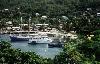
| Saint Vincent and the Grenadines FeatureType : city Elevation : 124 Lat/Lng : 12.9558 / -61.2525 | Saint Vincent and the Grenadines is a country in the Lesser Antilles island arc, in the southern portion of the Windward Islands, which lies in the West Indies at the southern end of the eastern border of the Caribbean Sea where the latter meets the Atlantic Ocean (...) |
| 4 | 
| Florida State University FeatureType : edu Elevation : 38 Lat/Lng : 30.442 / -84.298 | Florida State University (Florida State or FSU) is a public space-grant and sea-grant research university with its primary campus on a campus in Tallahassee, Florida. It is a senior member of the State University System of Florida (...) |
| 5 | 
| Vandalia, Illinois FeatureType : null Elevation : 160 Lat/Lng : 38.9681 / -89.1019 | Vandalia is a city in Fayette County, Illinois, United States. At the 2010 Census, the population was 7,042. Vandalia is northeast of St. Louis, on the Kaskaskia River. It served as the state capital of Illinois from 1819 until 1839, when the seat of state government moved to the current capital of (...) |
| 6 | 
| Statue of Liberty FeatureType : landmark Elevation : 0 Lat/Lng : 40.6892 / -74.0444 | The Statue of Liberty (Liberty Enlightening the World;) is a colossal neoclassical sculpture on Liberty Island in New York Harbor in New York City, in the United States. The copper statue, a gift from the people of France to the people of the United States, was designed by French sculptor Frédéric (...) |
| 7 | 
| Charleston, South Carolina FeatureType : null Elevation : 10 Lat/Lng : 32.7761 / -79.9325 | Charleston is the oldest and largest city in the U.S. state of South Carolina, the county seat of Charleston County, and the principal city in the Charleston–North Charleston–Summerville Metropolitan Statistical Area.As defined by the U.S. Office of Management and Budget, for use by the U.S (...) |
| 8 | 
| Monterrey Institute of Technology and Higher Education FeatureType : edu Elevation : 543 Lat/Lng : 25.6514 / -100.2907 | Instituto Tecnológico y de Estudios Superiores de Monterrey (ITESM) (in), also known as Tecnológico de Monterrey or simply as Tec, is a private, nonsectarian and coeducational multi-campus university based in Monterrey, Mexico (...) |
| 9 | 
| Millburn, New Jersey FeatureType : city Elevation : 147 Lat/Lng : 40.7416 / -74.3213 | Millburn is a suburban township in Essex County, New Jersey, United States. As of the 2010 United States Census, the township's population was 20,149, reflecting an increase of 384 (+1.9%) from the 19,765 counted in the 2000 Census, which had in turn increased by 1,135 (+6 (...) |
| 10 | 
| Weddell Island FeatureType : isle Elevation : 16 Lat/Lng : -51.8786 / -61.0067 | Weddell Island Falkland Islands. GeoNames Geographical Database is one of the Falkland Islands in the South Atlantic, lying off the southwest extremity of West Falkland. It is situated west-northwest of South Georgia Island, north of Livingston Island, northeast of Cape Horn, northeast of Isla de (...) |
| 11 | 
| Denver Art Museum FeatureType : landmark Elevation : 1607 Lat/Lng : 39.7372 / -104.9897 | The Denver Art Museum — DAM is an art museum located in the Civic Center of Denver, Colorado. The museum is one of the largest art museums between the West Coast and Chicago. It is known for its collection of American Indian art, and its other collections of more than 70,000 diverse works from (...) |
| 12 | 2015 CONCACAF Gold Cup FeatureType : null Elevation : 11 Lat/Lng : 33.8397 / -118.2597 | The 2015 CONCACAF Gold Cup was the 13th edition of the CONCACAF Gold Cup competition and the 23rd CONCACAF regional championship overall in the organization's fifty-four years of existence. It was held in the United States, with two matches being played in Canada, marking the first time the CONCACAF (...) | |
| 13 | Chautauqua County, New York FeatureType : adm2nd Elevation : 494 Lat/Lng : 42.3 / -79.4 | Chautauqua County is the westernmost county in the U.S. state of New York. As of the 2010 census, the population was 134,905. Its county seat is Mayville, and its largest city is Jamestown. Its name is believed to be the lone surviving remnant of the Erie language, a tongue lost in the Beaver Wars; (...) | |
| 14 | 1855 FeatureType : null Elevation : 1691 Lat/Lng : 46.1 / 7.2 | == Events == === January–March === * January 1 – Ottawa, Ontario is incorporated as a city. * January 5 – Ramón Castilla begins his third term as President of Peru. * January 23 ** The first bridge over the Mississippi River opens in what is now Minneapolis, a predecessor of the (...) | |
| 15 | May 2 FeatureType : null Elevation : 364 Lat/Lng : 30.0 / 35.2 | ==Events== *1194 – King Richard I of England gives Portsmouth its first Royal Charter. *1230 – William de Braose is hanged by Prince Llywelyn the Great. *1335 – Otto the Merry, Duke of Austria, becomes Duke of Carinthia (...) | |
| 16 | Northwest Passage FeatureType : null Lat/Lng : 74.3439 / -124.7697 | The Northwest Passage (NWP) is, from the European and northern Atlantic point of view, the sea route to the Pacific Ocean through the Arctic Ocean, along the northern coast of North America via waterways through the Canadian Arctic Archipelago (...) | |
| 17 | Caribbean FeatureType : waterbody Lat/Lng : 14.5256 / -75.8183 | The Caribbean is a region of North America that consists of the Caribbean Sea, its islands (some surrounded by the Caribbean Sea and some bordering both the Caribbean Sea and the North Atlantic Ocean) and the surrounding coasts (...) | |
| 18 | Marion, Ohio FeatureType : city Elevation : 302 Lat/Lng : 40.5867 / -83.1264 | Marion is a city in and the county seat of Marion County, Ohio, United States. The municipality is located in north-central Ohio, approximately north of Columbus. The population was 36,837 at the 2010 census. According to the US Census 2008 estimate Ohio's Columbus–Marion–Chillicothe Combined (...) | |
| 19 | 1989 Loma Prieta earthquake FeatureType : null Elevation : 303 Lat/Lng : 37.04 / -121.877 | The 1989 Loma Prieta earthquake occurred in Northern California on October 17 at local time (1989-10-18 00:04 UTC). The shock was centered in The Forest of Nisene Marks State Park approximately northeast of Santa Cruz on a section of the San Andreas Fault System and was named for the nearby Loma (...) | |
| 20 | WBT (AM) FeatureType : landmark Elevation : 214 Lat/Lng : 35.1322 / -80.8897 | WBT (known on air as "News 1110/99.3 WBT") is a commercial AM radio station serving the Charlotte metropolitan area, which includes parts of North Carolina and South Carolina. First licensed on March 18, 1922, it was one of the United States' first broadcasting stations (...) | |
| 21 | Baltimore FeatureType : city Elevation : 15 Lat/Lng : 39.2864 / -76.615 | Baltimore is the largest city in the U.S. state of Maryland, and the 30th-most populous city in the United States. Baltimore was established by the Constitution of MarylandThe form and type of government of the city is described by Article XI of the State Constitution (...) | |
| 22 | Fort Walton Beach, Florida FeatureType : null Elevation : 13 Lat/Lng : 30.4203 / -86.6167 | Fort Walton Beach is a city in southern Okaloosa County, Florida, United States. As of 2010, the population estimate for Fort Walton Beach was 19,507 recorded by the U.S. Census Bureau. It is the principal city of the Fort Walton Beach−Crestview−Destin Metropolitan Statistical Area (...) | |
| 23 | Panama City–Bay County International Airport FeatureType : null Elevation : 4 Lat/Lng : 30.2122 / -85.6828 | Panama City–Bay County International Airport was a public airport three miles northwest of Panama City, in Bay County, Florida. It was owned and operated by the Panama City–Bay County Airport and Industrial District.http://airnav (...) | |
| 24 | Pottstown, Pennsylvania FeatureType : null Elevation : 76 Lat/Lng : 40.2497 / -75.6403 | Pottstown is a borough in Montgomery County, Pennsylvania, United States about 40 miles (55 km) northwest of Philadelphia and southeast of Reading, on the Schuylkill River. Pottstown was laid out in 1752–53 and named Pottsgrove in honor of its founder, John Potts (...) | |
| 25 | Global city FeatureType : null Lat/Lng : 40.39 / -73.56 | A global city, also called world city or sometimes alpha city or world center, is a city which is a primary node in the global economic network. The concept comes from geography and urban studies, and the idea that globalization is created, facilitated, and enacted in strategic geographic locales (...) | |
| 26 | USS Yorktown (CV-5) FeatureType : null Lat/Lng : 30.5997 / -176.5678 | USS Yorktown (CV-5) was an aircraft carrier commissioned in the United States Navy from 1937 until she was sunk at the Battle of Midway in June 1942. She was named after the Battle of Yorktown in 1781 and the lead ship of the which was designed after lessons learned from operations with the large (...) | |
| 27 | Second Federal Republic of Mexico FeatureType : country Elevation : 2233 Lat/Lng : 19.4333 / -99.1333 | The Second Federal Republic of Mexico is the name given to the second attempt to achieve a federalist government in Mexico. Officially called the United Mexican States , a federal republic was implemented again on August 22, 1846 when interim president José Mariano Salas issued a decree restoring (...) | |
| 28 | Camping World Stadium FeatureType : landmark Elevation : 35 Lat/Lng : 28.539 / -81.4028 | Camping World Stadium is a stadium in Orlando, Florida, located in the West Lakes neighborhood of Downtown Orlando, west of new sports and entertainment facilities including the Amway Center, the Dr. Phillips Center for the Performing Arts and Orlando City Stadium (...) | |
| 29 | Ramón Emeterio Betances FeatureType : null Elevation : 49 Lat/Lng : 48.8758 / 2.3416 | Ramón Emeterio Betances y Alacán (April 8, 1827 – September 16, 1898) was a Puerto Rican nationalist. He was the primary instigator of the Grito de Lares revolution and is considered to be the father of the Puerto Rican independence movement (...) | |
| 30 | Owen Roberts International Airport FeatureType : null Elevation : 6 Lat/Lng : 19.2928 / -81.3577 | Owen Roberts International Airport is an airport serving Grand Cayman, Cayman Islands. It is the main international airport for the Cayman Islands as well as the main base for Cayman Airways. The airport is named after British Royal Air Force (RAF) Wing Commander Owen Roberts, a pioneer of (...) | |
| 31 | Boeing C-17 Globemaster III FeatureType : null Elevation : 14 Lat/Lng : 32.8986 / -80.0406 | The Boeing C-17 Globemaster III is a large military transport aircraft. It was developed for the United States Air Force (USAF) from the 1980s to the early 1990s by McDonnell Douglas. The C-17 carries forward the name of two previous piston-engined military cargo aircraft, the Douglas C-74 (...) | |
| 32 | University of Dayton FeatureType : landmark Elevation : 245 Lat/Lng : 39.7404 / -84.1792 | The University of Dayton (UD) is an American private Roman Catholic national research university in Ohio's sixth-largest city, Dayton. Founded in 1850 by the Society of Mary (Marianists), it is one of three Marianist universities in the nation and the second-largest private university in Ohio (...) | |
| 33 | Northwest Florida Beaches International Airport FeatureType : null Elevation : 23 Lat/Lng : 30.3583 / -85.7956 | The Northwest Florida Beaches International Airport is a public airport 18 miles northwest of Panama City, in Bay County. The airport is owned by the Panama City-Bay County Airport & Industrial District. and is north of Panama City Beach, Florida, near West Bay (...) | |
| 34 | History of Florida FeatureType : null Elevation : 6 Lat/Lng : 27.5234 / -82.6431 | The history of Florida can be traced to when the first Native Americans began to inhabit the peninsula as early as 14,000 years ago. They left behind artifacts and archeological evidence. Florida's written history begins with the arrival of Europeans; the Spanish explorer Juan Ponce de León in 1513 (...) | |
| 35 | Montgomery Regional Airport FeatureType : null Elevation : 61 Lat/Lng : 32.3006 / -86.3939 | Montgomery Regional Airport (Dannelly Field) is a civil-military airport seven miles southwest of Montgomery, the capital of Alabama. Owned by the Montgomery Airport Authority, it is used for general aviation and military aviation, and sees three airlines (...) | |
| 36 | Dar Pomorza FeatureType : landmark Elevation : 1 Lat/Lng : 54.5195 / 18.5528 | The Dar Pomorza is a Polish full-rigged sailing ship built in 1909 which is preserved in Gdynia as a museum ship. She has served as a sail training ship in Germany, France, and Poland. Dar Pomorza won the Cutty Sark Trophy in 1980. (...) | |
| 37 | Portobello, Dublin FeatureType : landmark Elevation : 24 Lat/Lng : 53.3304 / -6.2652 | Portobello (– meaning 'beautiful harbour') is an area of Dublin located in the South City Centre, adjacent to the Grand Canal. Portobello came into existence as a small suburb south of the city of Dublin in the 18th century, centred on Richmond St (...) | |
| 38 | SMS Geier FeatureType : null Lat/Lng : 34.187 / -76.6021 | SMS Geier ("His Majesty's Ship Vulture") was an unprotected cruiser of the built for the German Imperial Navy (Kaiserliche Marine). She was laid down in 1893 at the Imperial Dockyard in Wilhelmshaven, launched in October 1894, and commissioned into the fleet a year later in October 1895 (...) | |
| 39 | Destin–Fort Walton Beach Airport FeatureType : null Elevation : 21 Lat/Lng : 30.4833 / -86.5254 | Destin–Fort Walton Beach Airport is an airport located within Eglin Air Force Base, near Destin and Fort Walton Beach in Okaloosa County, Florida. No private aircraft are allowed, so Destin Executive Airport is used instead for non-commercial operations by general aviation and business aircraft (...) | |
| 40 | Timeline of European exploration FeatureType : null Lat/Lng : 52.3786 / -127.4706 | The following timeline covers European exploration from 1418 to 1957. The 15th century witnessed the rounding of the feared Cape Bojador and Portuguese exploration of the west coast of Africa, while in the last decade of the century the Spanish sent expeditions to the New World, focusing on (...) | |
| 41 | University of Maine at Farmington FeatureType : null Elevation : 121 Lat/Lng : 44.6667 / -70.1472 | The University of Maine at Farmington (UMaine Farmington or UMF) is a public liberal arts college and a founding member of the Council of Public Liberal Arts Colleges, offering programs in teacher education, human services and arts and sciences as a part of the University of Maine System. (...) | |
| 42 | Théâtre des Mathurins FeatureType : landmark Elevation : 50 Lat/Lng : 48.8731 / 2.3259 | The théâtre des Mathurins, also called Les Mathurins, is a Parisian theatre located 36, rue des Mathurins in the 8th arrondissement of Paris established in 1897. (...) | |
| 43 | Don Pedro Island State Park FeatureType : null Elevation : 2 Lat/Lng : 26.8711 / -82.3211 | Don Pedro Island State Recreation Area is a State Park in the U.S. state of Florida. It is located on a stretch of Don Pedro Island, a barrier island lying across the Intracoastal Waterway from Placida in Charlotte County, FL between Palm Island and Little Gasparilla Island (...) | |
| 44 | Central Station (Chicago terminal) FeatureType : landmark Elevation : 181 Lat/Lng : 41.8681 / -87.6219 | Central Station was an intercity passenger terminal in downtown Chicago, Illinois, at the southern end of Grant Park near Roosevelt Road and Michigan Avenue. Owned by the Illinois Central Railroad, it also served other companies via trackage rights (...) | |
| 45 | SS Princess Kathleen (1924) FeatureType : landmark Lat/Lng : 58.3952 / -134.7793 | The SS Princess Kathleen was a passenger and freight steamship owned and operated by Canadian Pacific Steamships. She served the coastal communities of British Columbia, Alaska and Washington. The Princess Kathleen, along with the Princess Marguerite, was built to replace the SS Princess Irene and (...) | |
| 46 | National Diaper Bank Network FeatureType : null Elevation : 14 Lat/Lng : 41.3061 / -72.925 | The National Diaper Bank Network is a United States-based non-profit organization that is dedicated to ensuring that every child in the U.S. has an adequate supply of diapers to remain clean, dry and healthy. NDBN is a nationwide network of independently operating diaper banks and pantries that (...) | |
| 47 | Rancho Niguel FeatureType : landmark Elevation : 55 Lat/Lng : 33.56 / -117.71 | Rancho Niguel was a Mexican land grant in the San Joaquin Hills, within present-day Orange County, California. It was granted in 1842 by Governor Juan B. Alvarado to Juan Avila.Ogden Hoffman, 1862, Reports of Land Cases Determined in the United States District Court for the Northern District of (...) | |
| 48 | Weddell Settlement FeatureType : null Elevation : 4 Lat/Lng : -51.8961 / -60.9075 | Weddell Settlement is the only settlement on Weddell Island in the Falkland Islands, situated on the east coast of the island at the head of the sheltered Gull Harbour (formerly Great Harbour. Surveyed by Capt. Fitz Roy R.N. and the Officers of H.M. Ship Beagle, 1834 (...) | |
| 49 | Swan Point, Weddell Island FeatureType : null Elevation : 1 Lat/Lng : -51.7644 / -60.8653 | Swan Point is the point on the southwest side of the entrance to Queen Charlotte Bay, forming the northeast extremity of Weddell Island in the Falkland Islands. Falkland Islands. GeoNames Geographical Database The point is located at , which is north-northeast of Race Point, east of Loop Head and (...) | |
 by
by