| 686 records found in wikipedia | |||
| 1 | 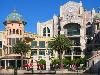
| Cape Town  FeatureType : city Elevation : 40 Lat/Lng : -33.9227 / 18.4167 | Cape Town (; Xhosa: iKapa; Dutch: Kaapstad) is a coastal city in South Africa. It is the capital and primate city of the Western Cape province. It forms part of the City of Cape Town metropolitan municipality. As the place where the Parliament of South Africa is found, Cape Town is the legislative (...) |
| 2 | 
| Cape of Good Hope FeatureType : isle Elevation : 55 Lat/Lng : -34.3547 / 18.4908 | The Cape of Good Hope (Every word in isolation .) is a rocky headland on the Atlantic coast of the Cape Peninsula in South Africa. A common misconception is that the Cape of Good Hope is the southern tip of Africa (...) |
| 3 | 
| Cape Verde FeatureType : country Elevation : 320 Lat/Lng : 15.0872 / -23.6322 | Cape Verde or Cabo Verde , officially the Republic of Cabo Verde, is an island country spanning an archipelago of 10 volcanic islands in the central Atlantic Ocean. It forms part of the Macaronesia ecoregion, along with the Azores, Canary Islands, Madeira, and the Savage Isles (...) |
| 4 | 
| Table Mountain FeatureType : mountain Elevation : 1064 Lat/Lng : -33.9573 / 18.4031 | Table Mountain (Khoekhoe: Huri ‡oaxa, mountain rising from the sea; Afrikaans: Tafelberg) is a flat-topped mountain forming a prominent landmark overlooking the city of Cape Town in South Africa. It is a significant tourist attraction, with many visitors using the cableway or hiking to the top (...) |
| 5 | 
| Monrovia FeatureType : null Elevation : 28 Lat/Lng : 6.3133 / -10.8014 | Monrovia is the capital city of the West African country of Liberia. Located on the Atlantic Coast at Cape Mesurado, Monrovia had a population of 1,010,970 as of the 2008 census. With 29% of the total population of Liberia, Monrovia is the country's most populous city (...) |
| 6 | 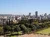
| South Africa FeatureType : country Elevation : 1155 Lat/Lng : -28.6167 / 24.3333 | South Africa, officially the Republic of South Africa (RSA), is the southernmost country in Africa. It is bounded to the south by of coastline of Southern Africa stretching along the South Atlantic and Indian Oceans; to the north by the neighbouring countries of Namibia, Botswana, and Zimbabwe; and (...) |
| 7 | 
| Dorchester, Dorset FeatureType : null Elevation : 70 Lat/Lng : 50.7154 / -2.4367 | Dorchester is the county town of Dorset, England. It is situated between Poole and Bridport on the A35 trunk route. A historic market town, Dorchester is on the banks of the River Frome to the south of the Dorset Downs and north of the South Dorset Ridgeway that separates the area from Weymouth, to (...) |
| 8 | 
| Warwick FeatureType : city Elevation : 63 Lat/Lng : 52.2822 / -1.5853 | Warwick is the county town of Warwickshire, England. It lies near the River Avon, south of Coventry and just west of Leamington Spa and Whitnash, with which it is contiguous. At the 2011 Census, the population was 31,345 (...) |
| 9 | 
| Phuket Province FeatureType : adm1st Elevation : 23 Lat/Lng : 7.89 / 98.3983 | Phuket (or Tanjung Salang) is one of the southern provinces (changwat) of Thailand. It consists of the island of Phuket, the country's largest island, and another 32 smaller islands off its coast. It lies off the west coast of Thailand in the Andaman Sea (...) |
| 10 | 
| Falkland Islands FeatureType : isle Lat/Lng : -51.7963 / -59.5236 | The Falkland Islands is an archipelago in the South Atlantic Ocean on the Patagonian Shelf. The principal islands are about east of South America's southern Patagonian coast, at a latitude of about 52°S. The archipelago, with an area of , comprises East Falkland, West Falkland and 776 smaller (...) |
| 11 | 
| Kyrenia FeatureType : city Elevation : 16 Lat/Lng : 35.3403 / 33.3192 | Kyrenia is a city on the northern coast of Cyprus, noted for its historic harbour and castle. It is under the de facto control of Northern Cyprus. While there is evidence showing that Kyrenia has been populated since ca (...) |
| 12 | 
| Bermuda FeatureType : country Lat/Lng : 32.3333 / -64.75 | Bermuda is a British Overseas Territory in the North Atlantic Ocean. It is approximately east-southeast of Cape Hatteras, North Carolina; south of Cape Sable Island, Nova Scotia; and north of Cuba. The capital city is Hamilton (...) |
| 13 | 
| Saint Helena FeatureType : isle Elevation : 349 Lat/Lng : -15.9333 / -5.7167 | Saint Helena is a volcanic tropical island in the South Atlantic Ocean, east of Rio de Janeiro and 1,950 kilometres (1,210 mi) west of the Cunene River, which marks the border between Namibia and Angola in southwestern Africa (...) |
| 14 | 
| Grahamstown FeatureType : city Elevation : 550 Lat/Lng : -33.3039 / 26.5332 | Grahamstown is a town of about 70,000 people in the Eastern Cape province of South Africa. It is situated about northeast of Port Elizabeth and southwest of East London. Grahamstown is the largest town in the Makana Local Municipality, and the seat of the municipal council (...) |
| 15 | 
| Pietermaritzburg FeatureType : city Elevation : 646 Lat/Lng : -29.6008 / 30.3833 | Pietermaritzburg (; Zulu: umGungundlovu) is the capital and second-largest city in the province of KwaZulu-Natal, South Africa. It was founded in 1838 and is currently governed by the Msunduzi Local Municipality. Its Zulu name umGungundlovu is the name used for the district municipality (...) |
| 16 | 
| Villefranche-sur-Mer FeatureType : null Elevation : 24 Lat/Lng : 43.705 / 7.3125 | Villefranche-sur-Mer (; Niçard: Vilafranca de Mar) is a commune in the Alpes-Maritimes department in the Provence-Alpes-Côte d'Azur region on the French Riviera. (...) |
| 17 | 
| Ferrol, Galicia FeatureType : city Elevation : 24 Lat/Lng : 43.4844 / -8.233 | Ferrol (In the neighbourhood of Strabo's Cape Nerium, modern day Cape Prior) , is a city in the Province of A Coruña in Galicia, on the Atlantic coast in north-western Spain. According to the 2014 census, the city has a population of 70,389, making it the 5th largest settlement in Galicia (...) |
| 18 | 
| Stanley, Falkland Islands FeatureType : null Elevation : 3 Lat/Lng : -51.6907 / -57.8653 | Stanley (; also known as Port Stanley) is the capital of the Falkland Islands. It is located on the island of East Falkland, on a north-facing slope in one of the wettest parts of the islands. At the 2016 census, the town had a population of 2,460 the entire population of the Falkland Islands was (...) |
| 19 | 
| Lesotho FeatureType : country Elevation : 2302 Lat/Lng : -29.6 / 28.3 | Lesotho officially the Kingdom of Lesotho is an enclaved country within the border of South Africa. It is just over in size and has a population of around million. Its capital and largest city is Maseru. Lesotho was previously known as Basutoland, but it declared independence from the United Kingdom (...) |
| 20 | 
| Strait of Dover FeatureType : waterbody Lat/Lng : 51.0214 / 1.4772 | The Strait of Dover or Dover Strait, historically known as the Dover Narrows (- Strait of Calais); or Straat van Dover), is the strait at the narrowest part of the English Channel, marking the boundary between the Channel and North Sea, separating Great Britain from continental Europe (...) |
| 21 | 
| Bouvet Island FeatureType : isle Elevation : 521 Lat/Lng : -54.4215 / 3.3679 | Bouvet Island is an uninhabited subantarctic high island and dependency of Norway located in the South Atlantic Ocean at , thus putting it north of and outside the Antarctic Treaty System. It lies at the southern end of the Mid-Atlantic Ridge and is the most remote island in the world, approximately (...) |
| 22 | 
| Newfoundland (island) FeatureType : isle Elevation : 256 Lat/Lng : 48.5663 / -55.7773 | Newfoundland Both names can be found in ."Ikkarumikluak" means "place of many shoals" while "Kallunasillik" means "place of many white people". It is thought the "Ikkarumiklua" was used before the colonization of Newfoundland and was later replaced by "Kallunasillik" (...) |
| 23 | 
| Bloemfontein FeatureType : null Elevation : 1382 Lat/Lng : -29.1198 / 26.2248 | Bloemfontein (;Dictionary Reference: The Free Dictionary: ; Afrikaans and Dutch "fountain of flowers" or "blooming fountain"; also known as Bloem) is the capital city of the province of Free State of South Africa; and, as the judicial capital of the nation, one of South Africa's three national (...) |
| 24 | 
| Leiria FeatureType : adm1st Elevation : 33 Lat/Lng : 39.7432 / -8.8063 | Leiria is a city and a municipality in the Centro Region of Portugal. It is the capital of Leiria District. The population in 2011 was 126,879, in an area of . It is the seat of the Roman Catholic Diocese of Leiria-Fátima. (...) |
| 25 | 
| Annapolis, Maryland FeatureType : null Elevation : 10 Lat/Lng : 38.9729 / -76.5012 | Annapolis is the capital of the U.S. state of Maryland, as well as the county seat of Anne Arundel County. Situated on the Chesapeake Bay at the mouth of the Severn River, south of Baltimore and about east of Washington, D.C., Annapolis is part of the Baltimore–Washington metropolitan area (...) |
| 26 | 
| Calais FeatureType : null Elevation : 6 Lat/Lng : 50.9481 / 1.8564 | Calais is a city and major ferry port in northern France in the department of Pas-de-Calais, of which it is a sub-prefecture. Although Calais is by far the largest city in Pas-de-Calais, the department's prefecture is its third-largest city of Arras (...) |
| 27 | 
| Hampton, Virginia FeatureType : null Elevation : 5 Lat/Lng : 37.0349 / -76.3601 | Hampton is an independent city in the Commonwealth of Virginia in the United States. As of the 2010 census, the population was 137,436. As one of the seven major cities that compose the Hampton Roads metropolitan area, it is on the southeastern end of the Virginia Peninsula (...) |
| 28 | 
| Arusha FeatureType : city Elevation : 1415 Lat/Lng : -3.3667 / 36.6833 | Arusha is a city in north eastern Tanzania and the capital of the Arusha Region, with a population of 416,442 plus 323,198 in the surrounding Arusha District (2012 census). Located below Mount Meru on the eastern edge of the eastern branch of the Great Rift Valley, Arusha has a temperate climate (...) |
| 29 | 
| Zanzibar FeatureType : adm1st Elevation : 28 Lat/Lng : -6.1333 / 39.3167 | Zanzibar is a semi-autonomous region of Tanzania. It is composed of the Zanzibar Archipelago in the Indian Ocean, off the coast of the mainland, and consists of many small islands and two large ones: Unguja (the main island, referred to informally as Zanzibar) and Pemba Island (...) |
| 30 | 
| Ithaca FeatureType : null Elevation : 4 Lat/Lng : 38.3675 / 20.7189 | Ithaca, Ithaki or Ithaka (; Greek: Ιθάκη, Ithakē) is a Greek island located in the Ionian Sea, off the northeast coast of Kefalonia and to the west of continental Greece. Ithaca's main island has an area of and had a population in 2011 of 3,231 (...) |
| 31 | 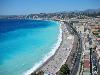
| Nice FeatureType : null Elevation : 22 Lat/Lng : 43.7034 / 7.2663 | Nice (; Niçard , classical norm, or ', nonstandard, ; ; ;) is the fifth most populous city in France and the capital of the Alpes-Maritimes département. The metropolitan area of Nice extends beyond the administrative city limits, with a population of about 1 million, April 2016 – INSEE, 2008 on an (...) |
| 32 | 
| The Bahamas FeatureType : country Elevation : 6 Lat/Lng : 23.9167 / -77.6667 | The Bahamas , known officially as the Commonwealth of The Bahamas, is a country within the Lucayan Archipelago. The archipelagic state consists of more than 700 islands, cays, and islets in the Atlantic Ocean, and is located north of Cuba and Hispaniola (Haiti and the Dominican Republic), northwest (...) |
| 33 | 
| Póvoa de Varzim FeatureType : city Elevation : 22 Lat/Lng : 41.4167 / -8.7667 | Póvoa de Varzim , also spelled Povoa de Varzim, is a Portuguese city in Northern Portugal and sub-region of Greater Porto. It sits in a sandy coastal plain, a cuspate foreland, halfway between the Minho and Douro rivers. In 2001, there were 63,470 inhabitants, with 42,396 living in the city proper (...) |
| 34 | 
| Windhoek FeatureType : city Elevation : 1667 Lat/Lng : -22.5631 / 17.0786 | Windhoek is the capital and largest city of the Republic of Namibia. It is located in central Namibia in the Khomas Highland plateau area, at around above sea level, almost exactly at the country's geographical centre (...) |
| 35 | 
| Cagliari FeatureType : city Elevation : 69 Lat/Lng : 39.2278 / 9.1111 | Cagliari is an Italian municipality and the capital of the island of Sardinia, an autonomous region of Italy. Cagliari's Sardinian name Casteddu literally means castle. It has about 155,000 inhabitants, while its metropolitan city (including Cagliari and 16 other nearby municipalities) has more than (...) |
| 36 | 
| Grantham FeatureType : null Elevation : 54 Lat/Lng : 52.9182 / -0.6382 | Grantham is a town in the South Kesteven district of Lincolnshire, England. It straddles the London–Edinburgh East Coast Main Line and the River Witham and is bounded to the west by the A1 north–south trunk road (...) |
| 37 | 
| St Ives, Cornwall FeatureType : null Elevation : 28 Lat/Lng : 50.2107 / -5.4803 | St Ives (meaning "St Ia's cove") is a seaside town, civil parish and port in Cornwall. The town lies north of Penzance and west of Camborne on the coast of the Celtic Sea. In former times it was commercially dependent on fishing (...) |
| 38 | 
| British Virgin Islands FeatureType : null Elevation : 75 Lat/Lng : 18.4844 / -64.5317 | The British Virgin Islands (BVI), officially simply "Virgin Islands",According to the ', the territory's official name is simply 'Virgin Islands'. are a British Overseas Territory in the Caribbean, to the east of Puerto Rico (...) |
| 39 | 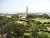
| Kisumu FeatureType : city Elevation : 1168 Lat/Lng : -0.1019 / 34.7517 | Kisumu, officially known as Kisumu City (and formerly Port Florence), is the Kenyan inland port city on Lake Victoria and the capital city of Kisumu County, Kenya. At an elevation of , the city has an estimated population of 500,000, while the metropolitan region comprising the city and its suburbs (...) |
| 40 | 
| Bay of Kotor FeatureType : null Lat/Lng : 42.4333 / 18.6582 | The Bay of Kotor (Montenegrin: Бока Которска / Boka Kotorska) ;), known simply as Boka ("the Bay"), is the name of the winding bay of the Adriatic Sea in southwestern Montenegro and the region of Montenegro concentrated around the bay. The bay has been inhabited since antiquity (...) |
| 41 | 
| Villa San Giovanni FeatureType : city Elevation : 9 Lat/Lng : 38.2167 / 15.6333 | Villa San Giovanni is a town and comune in the province of Reggio Calabria, Calabria, southern Italy. In 2010 its population was 13,747. It is the main terminal of access to Sicily. On 25 April 2005 the President of the Republic had conferred upon it the title of "city". (...) |
| 42 | 
| Guinea-Bissau FeatureType : country Elevation : 6 Lat/Lng : 12.0333 / -14.9167 | Guinea-Bissau , officially the Republic of Guinea-Bissau , is a country in West Africa that covers with an estimated population of . Guinea-Bissau was once part of the kingdom of Gabu, as well as part of the Mali Empire (...) |
| 43 | 
| Botswana FeatureType : country Elevation : 1012 Lat/Lng : -24.6583 / 25.9083 | Botswana , officially the Republic of Botswana , is a landlocked country located in Southern Africa. Formerly the British protectorate of Bechuanaland, Botswana adopted its new name after becoming independent within the Commonwealth on 30 September 1966 (...) |
| 44 | 
| Luanda FeatureType : city Elevation : 77 Lat/Lng : -8.8383 / 13.2344 | Luanda, formerly named São Paulo da Assunção de Loanda, is the capital and largest city in Angola, and the country's most populous and important city, primary port and major industrial, cultural and urban centre (...) |
| 45 | 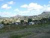
| Maseru FeatureType : city Elevation : 1570 Lat/Lng : -29.3156 / 27.502 | Maseru is the capital and largest city of Lesotho. It is also the capital of the Maseru District. Located on the Caledon River, Maseru lies directly on the Lesotho-South Africa border. Maseru is Lesotho's capital city with a population of 330,760 in the 2016 census (...) |
| 46 | 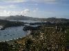
| Antigua FeatureType : isle Elevation : 56 Lat/Lng : 17.0833 / -61.8 | Antigua , also known as Waladli or Wadadli by the native population, is an island in the West Indies. It is one of the Leeward Islands in the Caribbean region and the main island of the country of Antigua and Barbuda (...) |
| 47 | 
| Jamestown, Virginia FeatureType : landmark Elevation : 8 Lat/Lng : 37.2094 / -76.78 | The JamestownPreviously also written variously as James Town, James Towne, Jamestowne, and James City. settlement in the Colony of Virginia was the first permanent English settlement in the Americas. It was located on the east bank of the Powhatan (James) River about southwest of the center of (...) |
| 48 | 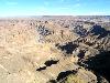
| Namibia FeatureType : country Elevation : 1667 Lat/Lng : -22.5631 / 17.0786 | Namibia , officially the Republic of Namibia (German: Republik Namibia;), is a country in southern Africa. Its western border is the Atlantic Ocean; it shares land borders with Zambia and Angola to the north, Botswana to the east and South Africa to the south and east (...) |
| 49 | 
| Portugal FeatureType : country Elevation : 13 Lat/Lng : 38.7 / -9.1833 | Portugal , officially the Portuguese Republic ,In recognized minority languages of Portugal: :* is a country located mostly on the Iberian Peninsula in southwestern Europe. It is the westernmost sovereign state of mainland Europe (...) |
| 50 | 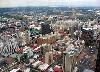
| Johannesburg FeatureType : null Elevation : 1766 Lat/Lng : -26.2044 / 28.0456 | Johannesburg (; ; also known as Jozi, Joburg, and eGoli) is the largest city in South Africa and one of the 50 largest urban areas in the world. It is the provincial capital and largest city of Gauteng, which is the wealthiest province in South Africa (...) |
| 51 | 
| Cocos (Keeling) Islands FeatureType : isle Lat/Lng : -12.1603 / 96.8586 | The Territory of Cocos (Keeling) Islands is an Australian external territory in the Indian Ocean, comprising a small archipelago approximately midway between Australia and Sri Lanka and closer to the Indonesian island of Sumatra. It is part of Southeast Asia and is in the Southern Hemisphere (...) |
| 52 | 
| Sintra FeatureType : adm1st Elevation : 230 Lat/Lng : 38.798 / -9.381 | Sintra is a city and municipality in the Greater Lisbon region of Portugal, located on the Portuguese Riviera. The population of the municipality in 2011 was 377,835, in an area of . Sintra is a major tourist destination in Portugal, famed for its picturesqueness and for its numerous historic (...) |
| 53 | 
| Cartagena, Spain FeatureType : city Elevation : 6 Lat/Lng : 37.61 / -0.98 | Cartagena is a Spanish city and a major naval station located in the Region of Murcia, by the Mediterranean coast, south-eastern Spain. As of January 2011, it has a population of 218,210 inhabitants being the Region’s second largest municipality and the country’s 6th non-Province capital city (...) |
| 54 | 
| Greenland FeatureType : isle Lat/Lng : 64.18 / -51.72 | Greenland is an autonomous constituent country of the Kingdom of Denmark between the Arctic and Atlantic Oceans, east of the Canadian Arctic Archipelago. Though physiographically a part of the continent of North America, Greenland has been politically and culturally associated with Europe (...) |
| 55 | 
| Maui FeatureType : isle Elevation : 614 Lat/Lng : 20.8075 / -156.3311 | The island of Maui (; Hawaiian:) is the second-largest of the Hawaiian Islands at 727.2 square miles (1,883 km2) and is the 17th-largest island in the United States. Maui is part of the State of Hawaii and is the largest of Maui County's four islands, which include Molokai, Lānai, and unpopulated (...) |
| 56 | 
| Bogor FeatureType : regency Elevation : 263 Lat/Lng : -6.5966 / 106.7972 | Bogor (Sundanese: ᮘᮧᮌᮧᮁ, Dutch: Buitenzorg) is a city in the West Java province, Indonesia. Located around south from the national capital of Jakarta, Bogor is the 6th largest city of Jabodetabek (Jakarta metropolitan region) and the 14th nationwide.http://www.depkes.go (...) |
| 57 | 
| Chiba Prefecture FeatureType : adm1st Elevation : 11 Lat/Lng : 35.605 / 140.1233 | is a prefecture of Japan located in the Kantō region, and the Greater Tokyo Area.Nussbaum, Louis-Frédéric. (2005). "Chiba-ken" in ; "Kantō" in . The sixth most populous prefecture, and 27th largest by land area, Chiba is on the east coast of Honshu and largely consists of the Bōsō Peninsula, which (...) |
| 58 | 
| Bonn FeatureType : city Elevation : 69 Lat/Lng : 50.734 / 7.0998 | The Federal City of Bonn is a city on the banks of the Rhine in the German state of North Rhine-Westphalia, with a population of over 300,000. About south-southeast of Cologne, Bonn is in the southernmost part of the Rhine-Ruhr region, Germany's largest metropolitan area, with over 11 million (...) |
| 59 | 
| Castle of Good Hope FeatureType : landmark Elevation : 3 Lat/Lng : -33.9259 / 18.4278 | The Castle of Good Hope known locally as the Castlehttps://janalinesworldjourney.com/2016/03/28/torture-chambers-at-castle/ or Cape Town Castlehttps://www.iol.co.za/castle-of-good-hope-350/castle350-capes-bastion-of-history-2086709 is a bastion fort built in the 17th century in Cape Town, South (...) |
| 60 | 
| Tainan FeatureType : null Elevation : 4 Lat/Lng : 22.9833 / 120.1833 | Tainan (Hokkien POJ: Tâi-lâm), officially Tainan City, is a special municipality of Taiwan, facing the Formosan Strait or Taiwan Strait in the west and south. Tainan is the oldest city on the island of Taiwan and also commonly known as the "Capital City" (; POJ: Hú-siâⁿ) for its over 200 years of (...) |
| 61 | 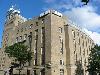
| Belfast FeatureType : null Elevation : 5 Lat/Lng : 54.596 / -5.914 | Belfast – Belfast is a city in the United Kingdom and the capital city of Northern Ireland, on the banks of the River Lagan on the east coast of Ireland. It is the largest city in Northern Ireland and second largest on the island of Ireland. It had a population of 333,871 in 2015 (...) |
| 62 | 
| Rhode Island FeatureType : adm1st Elevation : 25 Lat/Lng : 41.678 / -71.4743 | Rhode Island , officially the State of Rhode Island and Providence Plantations, is a state in the New England region of the United States. It is the smallest state in area, the seventh least populous, and is the second most densely populated. It has the longest official name of any state (...) |
| 63 | 
| Spitsbergen FeatureType : isle Lat/Lng : 78.75 / 16.0 | Spitsbergen (formerly known as West Spitsbergen; Norwegian: Vest Spitsbergen or Vestspitsbergen, also sometimes spelled Spitzbergen)“Of this Spitsbergen archipelago, the main island (the biggest) had the Norwegian name ‘Vest Spitsbergen’ (‘West Spitsbergen’ in English) (...) |
| 64 | 
| Jeddah FeatureType : city Elevation : 15 Lat/Lng : 21.5433 / 39.1728 | Jeddah (sometimes spelled Jiddah or Jedda; ; ', Hejazi pronunciation:) is a city in the Tihamah region of the Hejaz on the coast of the Red Sea and is the major urban center of western Saudi Arabia. It is the largest city in Makkah Province, the largest seaport on the Red Sea, and with a population (...) |
| 65 | 
| Boston FeatureType : null Elevation : 28 Lat/Lng : 42.3578 / -71.0594 | Boston is the capital and most populous municipality of the Commonwealth of Massachusetts in the United States. The city proper covers with an estimated population of 685,094 in 2017, making it also the most populous city in the New England region (...) |
| 66 | 
| Cephalonia FeatureType : null Elevation : 723 Lat/Lng : 38.2333 / 20.5667 | Cephalonia or Kefalonia (or), formerly also known as Kefallinia or Kephallenia , is the largest of the Ionian Islands in western Greece and the 6th largest island in Greece after Crete, Evoia, Lesvos, Rhodes, and Chios (...) |
| 67 | 
| Surabaya FeatureType : null Elevation : 8 Lat/Lng : -7.2492 / 112.7508 | Surabaya is the capital of East Java province in Indonesia. Surabaya is the second-largest city in Indonesia with a population of over 3 million within the city proper and over 10 million in the Greater Surabaya metropolitan area, known as Gerbangkertosusila (...) |
| 68 | 
| Hull, Massachusetts FeatureType : null Elevation : 26 Lat/Lng : 42.3019 / -70.9083 | Hull is a town in Plymouth County, Massachusetts, United States, located on a peninsula at the southern edge of Boston Harbor. Its population was 10,293 at the 2010 census. Hull is the smallest town by land area in Plymouth County and the fourth smallest in the state (...) |
| 69 | 
| Ghana FeatureType : country Elevation : 139 Lat/Lng : 7.6833 / -0.9833 | Ghana , officially the Republic of Ghana, is a country located along the Gulf of Guinea and Atlantic Ocean, in the subregion of West Africa. Spanning a land mass of , Ghana is bordered by the Ivory Coast in the west, Burkina Faso in the north, Togo in the east and the Gulf of Guinea and Atlantic (...) |
| 70 | 
| Syracuse, Sicily FeatureType : null Elevation : 58 Lat/Lng : 37.0833 / 15.2833 | Syracuse (; , ; ; ; , Syrakousai; Medieval) is a historic city on the island of Sicily, the capital of the Italian province of Syracuse. The city is notable for its rich Greek history, culture, amphitheatres, architecture, and as the birthplace of the preeminent mathematician and engineer Archimedes (...) |
| 71 | 
| Suez Canal FeatureType : waterbody Elevation : 0 Lat/Lng : 30.705 / 32.3442 | The Suez Canal is an original sea-level waterway in Egypt, connecting the Mediterranean Sea to the Red Sea through the Isthmus of Suez. Constructed by the Suez Canal Company between 1859 and 1869, it was officially opened on 17 November 1869 (...) |
| 72 | 
| Motherwell FeatureType : null Elevation : 81 Lat/Lng : 55.784 / -3.9852 | Motherwell is a large town and former burgh in North Lanarkshire, Scotland, south east of Glasgow. It has a population of around 32,120. Historically in the parish of Dalziel and part of Lanarkshire, Motherwell is the headquarters for North Lanarkshire Council (...) |
| 73 | 
| Quebec City FeatureType : city Elevation : 10 Lat/Lng : 46.8161 / -71.2242 | Quebec City (pronounced or ; ; , Abenaki language: Kephek http://www.toponymie.gouv.qc.ca/ct/pdf/la%20toponymie%20des%20Abenaquis.pdf?ts=0.14881141134537756) officially Québec, is the capital city of the Canadian province of Quebec (...) |
| 74 | 
| Trinidad and Tobago FeatureType : country Elevation : 222 Lat/Lng : 10.6918 / -61.2225 | Trinidad and Tobago , officially the Republic of Trinidad and Tobago, is a twin island country that is the southernmost nation of the West Indies in the Caribbean. It is situated south of Grenada off the northern edge of the South American mainland, off the coast of northeastern Venezuela (...) |
| 75 | 
| Newfoundland and Labrador FeatureType : adm1st Elevation : 63 Lat/Lng : 47.6011 / -52.6976 | Newfoundland and Labrador (; ; Newfoundland Irish:) is the most easterly province of Canada. Situated in the country's Atlantic region, it comprises the island of Newfoundland and mainland Labrador to the northwest, with a combined area of (...) |
| 76 | 
| Burundi FeatureType : country Elevation : 1995 Lat/Lng : -3.6667 / 29.8167 | Burundi , officially the Republic of Burundi (. justice.gov.bi. 25 June 2012 ; , or), is a landlocked country in the African Great Lakes region of East Africa, bordered by Rwanda to the north, Tanzania to the east and south, and the Democratic Republic of the Congo to the west (...) |
| 77 | 
| London School of Economics FeatureType : edu Elevation : 37 Lat/Lng : 51.514 / -0.1167 | The London School of Economics (officially The London School of Economics and Political Science, often referred to as the LSE) is a public research university located in London, England, and a constituent college of the federal University of London (...) |
| 78 | 
| Newmarket, Suffolk FeatureType : null Elevation : 35 Lat/Lng : 52.2459 / 0.4105 | Newmarket is a market town in the English county of Suffolk, approximately 65 miles (105 kilometres) north of London. It is generally considered the birthplace and global centre of thoroughbred horse racing and a potential World Heritage Site (...) |
| 79 | 
| Lisbon FeatureType : null Elevation : 70 Lat/Lng : 38.7203 / -9.14 | Lisbon is the capital and the largest city of Portugal, with an estimated population of 505,526 within its administrative limits in an area of 100.05 km2. Its urban area extends beyond the city's administrative limits with a population of around 2 (...) |
| 80 | 
| Orlando, Florida FeatureType : city Elevation : 54 Lat/Lng : 28.54 / -81.38 | Orlando is a city in the U.S. state of Florida and the county seat of Orange County. Located in Central Florida, it is the center of the Orlando metropolitan area, which had a population of 2,802,570, according to U.S. Census Bureau figures released in July 2017 (...) |
| 81 | 
| Panama FeatureType : country Elevation : 14 Lat/Lng : 9.0 / -79.5 | Panama , officially the Republic of Panama , is a country in Central America, Standard Country and Area Codes Classifications (M49), United Nations Statistics Division Atlas of Canada National Geographic bordered by Costa Rica to the west, Colombia to the southeast, the Caribbean Sea to the north (...) |
| 82 | 
| Bradford FeatureType : null Elevation : 121 Lat/Lng : 53.7887 / -1.7487 | Bradford is a city in the Metropolitan Borough of the City of Bradford, West Yorkshire, England. Bradford lies in the foothills of the Pennines, west of Leeds, and northwest of Wakefield. Bradford became a municipal borough in 1847, and received its charter as a city in 1897 (...) |
| 83 | 
| Netherlands FeatureType : country Elevation : 25 Lat/Lng : 52.35 / 5.7667 | The Netherlands is a country located mainly in Northwestern Europe. Together with three island territories in the Caribbean (Bonaire, Sint Eustatius and Saba), it forms a constituent country of the Kingdom of the Netherlands (...) |
| 84 | 
| Bristol FeatureType : city Elevation : 11 Lat/Lng : 51.4546 / -2.5879 | Bristol is a city and county in South West England with a population of 459,300.https://www.bristol.gov.uk/statistics-census-information/the-population-of-bristol The wider district has the 10th-largest population in England. The urban area population of 724,000 is the 8th-largest in the UK (...) |
| 85 | 
| Trieste FeatureType : city Elevation : 116 Lat/Lng : 45.6361 / 13.8042 | Trieste (;. CollinsDictionary.com. Collins English Dictionary - Complete & Unabridged 11th Edition. Retrieved September 21, 2012 listen;) is a city and a seaport in northeastern Italy. It is situated towards the end of a narrow strip of Italian territory lying between the Adriatic Sea (...) |
| 86 | 
| Corfu FeatureType : null Elevation : 80 Lat/Lng : 39.6239 / 19.82 | Corfu or Kerkyra is a Greek island in the Ionian Sea. It is the second largest of the Ionian Islands, and, including its small satellite islands, forms the northwesternmost part of Greece. The island is part of the Corfu regional unit, and is administered as a single municipality, which also (...) |
| 87 | 
| Mold, Flintshire FeatureType : null Elevation : 115 Lat/Lng : 53.1667 / -3.1414 | Mold is a town and community in Flintshire, Wales, on the River Alyn. It is the administrative seat of Flintshire County Council, and was the county town of Clwyd from 1974 to 1996. According to the 2011 UK Census, it had a population of 10,058. (...) |
| 88 | 
| Peloponnese FeatureType : isle Elevation : 886 Lat/Lng : 37.3497 / 22.3522 | The Peloponnese or Peloponnesus (; , Peloponnisos) is a peninsula and geographic region in southern Greece. It is connected to the central part of the country by the Isthmus of Corinth land bridge which separates the Gulf of Corinth from the Saronic Gulf (...) |
| 89 | 
| Vermont FeatureType : adm1st Elevation : 542 Lat/Lng : 44.0833 / -72.6167 | Vermont is a state in the New England region of the Northeastern United States. It borders the U.S. states of Massachusetts to the south, New Hampshire to the east, New York to the west, and the Canadian province of Quebec to the north (...) |
| 90 | 
| Washington, Tyne and Wear FeatureType : null Elevation : 54 Lat/Lng : 54.9111 / -1.5086 | Washington is a new town in the City of Sunderland local government district of Tyne and Wear, England, and part of historic County Durham. Washington is located geographically at an equal distance from the centres of Newcastle, Durham and Sunderland, hence it has close ties to all three cities (...) |
| 91 | 
| Maputo FeatureType : null Elevation : 40 Lat/Lng : -25.9153 / 32.5764 | Maputo (; officially named Lourenço Marques until 1976) is the capital and most populous city of Mozambique. Located near the southern end of the country, it is positioned within 120 km of the Swaziland and South Africa borders (...) |
| 92 | 
| Australia FeatureType : city Elevation : 607 Lat/Lng : -35.3081 / 149.1244 | Australia, officially the Commonwealth of Australia, is a sovereign country comprising the mainland of the Australian continent, the island of Tasmania and numerous smaller islands. It is the largest country in Oceania and the world's sixth-largest country by total area (...) |
| 93 | 
| Antwerp FeatureType : null Elevation : 15 Lat/Lng : 51.2178 / 4.4003 | Antwerp is a city in Belgium, and is the capital of Antwerp province in Flanders. With a population of 520,504, Population of all municipalities in Belgium, as of 1 January 2017. Retrieved on 1 November 2017. it is the most populous city proper in Belgium (...) |
| 94 | 
| Morocco FeatureType : country Lat/Lng : 34.0333 / -6.85 | Morocco , officially the Kingdom of Morocco , is a country located in the far west of North Africa with an area of . Its capital is Rabat, the largest city Casablanca. It overlooks the Mediterranean Sea to the north and the Atlantic Ocean to the west, bordered to the east by Algeria and to the south (...) |
| 95 | 
| Billericay FeatureType : null Elevation : 86 Lat/Lng : 51.628 / 0.4184 | Billericay is a town and civil parish in the Borough of Basildon, Essex, England. It lies within the London Basin and constitutes a commuter town east of Central London. The town has three secondary schools and a variety of open spaces. It is thought to have been occupied since the Bronze Age. (...) |
| 96 | 
| St. John's, Newfoundland and Labrador FeatureType : null Elevation : 63 Lat/Lng : 47.6011 / -52.6976 | St. John's is the capital and largest city of the Canadian province of Newfoundland and Labrador. It is on the eastern tip of the Avalon Peninsula on the large Canadian island, Newfoundland. The city spans and is North America's easternmost city.Paul O'Neill, The Oldest City: The Story of St (...) |
| 97 | 
| Porto FeatureType : null Elevation : 22 Lat/Lng : 41.1333 / -8.6667 | Porto (; also known as Oporto in English Google Books) is the second-largest city in Portugal after Lisbon and one of the major urban areas of the Iberian Peninsula. The city proper has a population of 237,591 and the metropolitan area of Porto, which extends beyond the administrative limits of the (...) |
| 98 | 
| Xi'an FeatureType : adm2nd Elevation : 415 Lat/Lng : 34.265 / 108.954 | Xi'an is the capital of Shaanxi Province, China. A sub-provincial city on the Guanzhong Plain in northwestern China, it is one of the oldest cities in China, and the oldest of the Four Great Ancient Capitals, having held the position under several of the most important dynasties in Chinese history, (...) |
| 99 | 
| Dunedin FeatureType : city Elevation : 21 Lat/Lng : -45.8742 / 170.5036 | Dunedin is the second-largest city in the South Island of New Zealand, and the principal city of the Otago region. Its name comes from , the Scottish Gaelic name for Edinburgh, the capital of Scotland., The Scotsman, 18 April 2012 The urban area of Dunedin city lies on the central-eastern coast of (...) |
| 100 | 
| Benin FeatureType : country Elevation : 0 Lat/Lng : 6.4667 / 2.6 | Benin , officially the Republic of Benin and formerly Dahomey, is a country in West Africa. It is bordered by Togo to the west, Nigeria to the east, and Burkina Faso and Niger to the north. The majority of its population lives on the small southern coastline of the Bight of Benin, part of the Gulf (...) |
| 101 | 
| Sochi FeatureType : null Elevation : 4 Lat/Lng : 43.5853 / 39.7203 | Sochi is a city in Krasnodar Krai, Russia, located on the Black Sea coast near the border between Georgia/Abkhazia and Russia. The Greater Sochi area, which includes territories and localities subordinated to Sochi proper, has a total area of and sprawls for - http://edemkavkaza (...) |
| 102 | 
| Trafalgar Square FeatureType : landmark Elevation : 19 Lat/Lng : 51.5081 / -0.1281 | Trafalgar Square is a public square in the City of Westminster, Central London, built around the area formerly known as Charing Cross. Its name commemorates the Battle of Trafalgar, a British naval victory in the Napoleonic Wars with France and Spain that took place on 21 October 1805 off the coast (...) |
| 103 | 
| Sierra Leone FeatureType : country Elevation : 89 Lat/Lng : 8.5833 / -11.8333 | Sierra Leone , officially the Republic of Sierra Leone, is a country in West Africa. It is bordered by Guinea to the northeast, Liberia to the southeast and the Atlantic Ocean to the southwest. It has a tropical climate, with a diverse environment ranging from savanna to rainforests (...) |
| 104 | 
| Aleppo FeatureType : city Elevation : 429 Lat/Lng : 36.1992 / 37.1625 | Aleppo (; / ALA-LC: ') is a city in Syria, serving as the capital of the Aleppo Governorate, the most-populous Syrian governorate. With an official population of 4.6 million in 2010,http://www.aksalser.com/?page=view_news&id=dea2316c19d685faf12f9850768f87b7 Aleppo was the largest Syrian city before (...) |
| 105 | 
| Oman FeatureType : country Elevation : 129 Lat/Lng : 21.0 / 57.0 | Oman , officially the Sultanate of Oman , is an Arab country on the southeastern coast of the Arabian Peninsula in Western Asia. Its official religion is Islam. Holding a strategically important position at the mouth of the Persian Gulf, the country shares land borders with the United Arab Emirates (...) |
| 106 | 
| Perth FeatureType : null Elevation : 30 Lat/Lng : -31.9522 / 115.8589 | Perth is the capital and largest city of the Australian state of Western Australia. It is the fourth-most populous city in Australia, with a population of 2,022,044 living in Greater Perth. Perth is part of the South West Land Division of Western Australia, with the majority of the metropolitan area (...) |
| 107 | 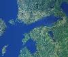
| Gulf of Finland FeatureType : null Lat/Lng : 59.8794 / 26.1053 | The Gulf of Finland is the easternmost arm of the Baltic Sea. It extends between Finland (to the north) and Estonia (to the south) all the way to Saint Petersburg in Russia, where the river Neva drains into it. Other major cities around the gulf include Helsinki and Tallinn (...) |
| 108 | 
| Durham, North Carolina FeatureType : city Elevation : 95 Lat/Lng : 35.9875 / -78.9072 | Durham is a city in and the county seat of Durham County in the U.S. state of North Carolina. The U.S. Census Bureau estimated the city's population to be 251,893 as of July 1, 2014, making it the 4th-most populous city in North Carolina, and the 78th-most populous city in the United States (...) |
| 109 | 
| Somalia FeatureType : country Elevation : 273 Lat/Lng : 6.1833 / 47.0 | Somalia , officially the Federal Republic of SomaliaThe Federal Republic of Somalia is the country's name per Article 1 of the . , is a sovereign state with its territory located in the Horn of Africa. It is bordered by Ethiopia to the west, Djibouti to the northwest, the Gulf of Aden to the north, (...) |
| 110 | 
| Felixstowe FeatureType : city Elevation : 22 Lat/Lng : 51.9639 / 1.3515 | Felixstowe is a seaside town in Suffolk, England. At the 2011 Census, it had a population of 23,689. The Port of Felixstowe is the largest container port in the United Kingdom. (...) |
| 111 | 
| Yaroslavl FeatureType : null Elevation : 89 Lat/Lng : 57.6167 / 39.85 | Yaroslavl is a city and the administrative center of Yaroslavl Oblast, Russia, located northeast of Moscow. The historic part of the city, a World Heritage Site, is located at the confluence of the Volga and the Kotorosl Rivers (...) |
| 112 | 
| Ashanti Empire FeatureType : landmark Elevation : 90 Lat/Lng : 5.45 / -0.9667 | The Ashanti Empire (also spelled Asante) was an Akan empire and kingdom in what is now modern-day Ghana from 1670 to 1957. The Ashanti Empire expanded from Ashanti to include the Brong-Ahafo Region, Central Region, Eastern Region, Greater Accra Region and Western Region of present-day Ghana (...) |
| 113 | 
| 2004 Indian Ocean earthquake and tsunami FeatureType : event Lat/Lng : 3.316 / 95.854 | The 2004 Indian Ocean earthquake occurred at 00:58:53 UTC on 26 December, with an epicentre off the west coast of northern Sumatra and a magnitude of 9.1–9.3 , reaching a Mercalli intensity up to IX in certain areas (...) |
| 114 | 
| Llandudno, Cape Town FeatureType : null Elevation : 51 Lat/Lng : -34.0103 / 18.3428 | Llandudno is a residential suburb of Cape Town, South Africa, on the Atlantic seaboard of the Cape Peninsula. There are no street lights, shops or commercial activities, and the suburb has some of the most expensive residential property in South Africa (...) |
| 115 | 
| Gabon FeatureType : country Elevation : 24 Lat/Lng : 0.391 / 9.45 | Gabon , officially the Gabonese Republic , is a country on the west coast of Central Africa. Located on the equator, Gabon is bordered by Equatorial Guinea to the northwest, Cameroon to the north, the Republic of the Congo on the east and south, and the Gulf of Guinea to the west (...) |
| 116 | 
| Peterborough FeatureType : city Elevation : 14 Lat/Lng : 52.5725 / -0.2425 | Peterborough is a cathedral city in Cambridgeshire, England, with a population of 183,631 in 2011. Historically part of Northamptonshire, it is north of London, on the River Nene which flows into the North Sea to the north-east (...) |
| 117 | 
| Bogotá FeatureType : city Elevation : 2613 Lat/Lng : 4.5981 / -74.0758 | Bogotá , officially Bogotá, Distrito Capital, abbreviated Bogotá, D.C., and formerly known as Santafé/Santa Fé de Bogotá between 1991 and 2000, is the capital and largest city of Colombia, administered as the Capital District, although often erroneously thought of as part of Cundinamarca (...) |
| 118 | 
| Democratic Republic of the Congo FeatureType : country Elevation : 444 Lat/Lng : -2.3333 / 22.8 | The Democratic Republic of the Congo , also known as DR Congo, the DRC, Congo-Kinshasa, East Congo, or simply the Congo, is the southernmost country located in East Africa and Central Africa. It is sometimes referred to by its former name of Zaire, which was its official name between 1971 and 1997 (...) |
| 119 | 
| Havana FeatureType : null Elevation : 17 Lat/Lng : 23.1388 / -82.3573 | Havana (; Spanish: La Habana) is the capital city, largest city, province, major port, and leading commercial center of Cuba. The city has a population of 2.1 million inhabitants, and it spans a total of – making it the largest city by area, the most populous city, and the fourth largest (...) |
| 120 | 
| Jinan FeatureType : city Elevation : 38 Lat/Lng : 36.6667 / 116.9833 | Jinan, formerly romanized as Tsinan, is the capital of Shandong province in Eastern China. The area of present-day Jinan has played an important role in the history of the region from the earliest beginnings of civilization and has evolved into a major national administrative, economic, and (...) |
| 121 | 
| Amiens FeatureType : null Elevation : 35 Lat/Lng : 49.8943 / 2.2957 | Amiens is a city and commune in northern France, north of Paris and south-west of Lille. It is the capital of the Somme department in Hauts-de-France. The city had a population of 136,105 according to the 2006 census (...) |
| 122 | 
| East Orange, New Jersey FeatureType : city Elevation : 60 Lat/Lng : 40.7651 / -74.2119 | East Orange is a city in Essex County, New Jersey, United States. As of the 2010 United States Census the city's population was 64,270, reflecting a decline of 5,554 (−8.0%) from the 69,824 counted in the 2000 Census, which had in turn declined by 3,728 (−5 (...) |
| 123 | 
| Asbury Park, New Jersey FeatureType : city Elevation : 9 Lat/Lng : 40.2229 / -74.0102 | Asbury Park is a city in Monmouth County, New Jersey, United States, located on the Jersey Shore and part of the New York City Metropolitan Area. As of the 2010 United States Census, the city's population was 16,116, reflecting a decline of 814 (−4 (...) |
| 124 | 
| Colombia FeatureType : country Elevation : 1215 Lat/Lng : 3.8167 / -73.9167 | Colombia , officially the Republic of Colombia (Es-republica_de_colombia.ogg), is a country largely situated in the northwest of South America, with territories in Central America. Colombia shares a border to the northwest with Panama, to the east with Venezuela and Brazil and to the south with (...) |
| 125 | 
| Carthage FeatureType : null Elevation : 47 Lat/Lng : 36.8528 / 10.3233 | Carthage (; , ', "New City"; ; , Qarṭāj) was the center or capital city of the ancient Carthaginian civilization, on the eastern side of the Lake of Tunis in what is now the Tunis Governorate in Tunisia. The city developed from a Phoenician colony into the capital of an empire dominating the (...) |
| 126 | 
| Tortola FeatureType : null Elevation : 9 Lat/Lng : 18.4233 / -64.6181 | Tortola is the largest and most populated of the British Virgin Islands, a group of islands that form part of the archipelago of the Virgin Islands. It has a surface area of with a total population of 23,908, with 9,400 residents in Road Town. Mount Sage is its highest point at above sea level (...) |
| 127 | 
| Tel Aviv FeatureType : null Elevation : 24 Lat/Lng : 32.0452 / 34.7698 | Tel Aviv is the second most populous city in Israel—after Jerusalem—and the most populous city in the conurbation of Gush Dan, Israel's largest metropolitan area. Located on the country's Mediterranean coastline and with a population of , it is the economic and technological center of the country (...) |
| 128 | 
| Brown University FeatureType : edu Elevation : 13 Lat/Lng : 41.8262 / -71.4032 | Brown University is a private Ivy League research university in Providence, Rhode Island, United States. Founded in 1764 as the College in the English Colony of Rhode Island and Providence Plantations, it is the seventh-oldest institution of higher education in the U.S (...) |
| 129 | 
| São Paulo (state) FeatureType : adm1st Elevation : 747 Lat/Lng : -23.5333 / -46.6333 | São Paulo is one of the 26 states of the Federative Republic of Brazil and is named after Saint Paul of Tarsus. As the richest Brazilian state and a major industrial complex, often dubbed the "locomotive of Brazil", the state is responsible for 33.9% of the Brazilian GDP (...) |
| 130 | 
| Nile FeatureType : landmark Elevation : 2406 Lat/Lng : -2.2822 / 29.3312 | The Nile is a major north-flowing river in northeastern Africa, and is commonly regarded as the longest river in the world, though some sources cite the Amazon River as the longest. The Nile, which is 6,853 km (4,258 miles) long, is an "international" river as its drainage basin covers eleven (...) |
| 131 | 
| Victoria Falls FeatureType : landmark Elevation : 886 Lat/Lng : -17.9248 / 25.8579 | Victoria Falls (Lozi: Mosi-oa-Tunya, "The Smoke that Thunders") is a waterfall in southern Africa on the Zambezi River at the border between Zambia and Zimbabwe. (...) |
| 132 | 
| Mozambique FeatureType : country Elevation : 79 Lat/Lng : -17.7667 / 35.4667 | Mozambique , officially the Republic of Mozambique (or '), is a country in Southeast Africa bordered by the Indian Ocean to the east, Tanzania to the north, Malawi and Zambia to the northwest, Zimbabwe to the west, and Swaziland (Eswatini) and South Africa to the southwest (...) |
| 133 | 
| Thessaloniki FeatureType : null Elevation : 185 Lat/Lng : 40.6472 / 22.9639 | Thessaloniki (Thessaloníki , also familiarly known as Thessalonica, Salonica, or Salonika is the second-largest city in Greece, with over 1 million inhabitants in its metropolitan area, and the capital of Greek Macedonia, the administrative region of Central Macedonia and the Decentralized (...) |
| 134 | 
| Athens FeatureType : null Elevation : 84 Lat/Lng : 37.984 / 23.7278 | Athens (; , Athína ; , Athênai) is the capital and largest city of Greece. Athens dominates the Attica region and is one of the world's oldest cities, with its recorded history spanning over 3,400 years and its earliest human presence starting somewhere between the 11th and 7th millennium BC (...) |
| 135 | 
| Geography of Bulgaria FeatureType : country Elevation : 441 Lat/Lng : 43.0 / 25.0 | Bulgaria is a country situated in south-eastern Europe, bordering Romania to the north, Serbia and the Republic of Macedonia to the west, Greece and Turkey to the south, and the Black Sea to the east. The northern border with Romania follows the river Danube until the city of Silistra (...) |
| 136 | 
| Latvia FeatureType : null Elevation : 0 Lat/Lng : 56.95 / 24.1 | Latvia (or ;), officially the Republic of Latvia , is a country in the Baltic region of Northern Europe. Since its independence, Latvia has been referred to as one of the Baltic states. It is bordered by Estonia in the northern region, Lithuania in the southern, to the east is Russia, and Belarus to (...) |
| 137 | 
| CSS Alabama FeatureType : landmark Lat/Lng : 49.7525 / -1.695 | CSS Alabama was a screw sloop-of-war built in 1862 for the Confederate States Navy at Birkenhead on the River Mersey opposite Liverpool, England by John Laird Sons and Company. Alabama served as a successful commerce raider, attacking Union merchant and naval ships over the course of her two-year (...) |
| 138 | 
| Wick, Caithness FeatureType : null Elevation : 6 Lat/Lng : 58.4408 / -3.0894 | Wick is a town and royal burgh in Caithness, in the far north of Scotland. The town straddles the River Wick and extends along both sides of Wick Bay. Wick Locality had a population of 6,954 at the time of the 2011 census, a decrease of 3.8% from 2001., The Highland Council. 11 February 2014 (...) |
| 139 | 
| Gisborne, New Zealand FeatureType : adm1st Elevation : 9 Lat/Lng : -38.6625 / 178.0178 | Gisborne ("Great standing place of Kiwa") is a city in northeastern New Zealand and the largest settlement in the Gisborne District (or Gisborne Region). It has a population of The district council has its headquarters in Whataupoko, in the central city (...) |
| 140 | Cape York Peninsula FeatureType : null Elevation : 14 Lat/Lng : -10.6833 / 142.5333 | Cape York Peninsula is a large remote peninsula located in Far North Queensland, Australia. It is the largest unspoiled wilderness in northern Australia.Mittermeier, R.E. et al. (2002). Wilderness: Earth’s last wild places. Mexico City: Agrupación Sierra Madre, S.C (...) | |
| 141 | 
| Kitwe FeatureType : city Elevation : 1222 Lat/Lng : -12.8096 / 28.2198 | Kitwe is the second largest city in terms of size and population in Zambia. With a population of 522,092 (2010 census provisional) Kitwe is one of the most developed commercial and industrial areas in the nation, alongside Ndola and Lusaka (...) |
| 142 | 
| Suomenlinna FeatureType : isle Lat/Lng : 60.148 / 24.9863 | Suomenlinna (Finnish; until 1918 Viapori), or Sveaborg (Swedish), literal translation in Finnish is Castle of Finland and in Swedish Castle of Sweden is an inhabited sea fortress built on six islands (Kustaanmiekka (sv:Vargskär / Gustavssvärd), Susisaari (sv:Vargö), Iso-Mustasaari (sv:Stora (...) |
| 143 | Barnstable, Massachusetts FeatureType : city Elevation : 18 Lat/Lng : 41.6627 / -70.3572 | Barnstable is a city,Galvin Francis, Secretary of the Commonwealth of Massachusetts (2007) Citizen Information Service, A Listing of Counties and the Cities and Towns Within referred to as the Town of Barnstable,Town of Barnstable (2007) Information Systems Department, Official Website of the town (...) | |
| 144 | 
| Cutty Sark FeatureType : landmark Elevation : 6 Lat/Lng : 51.4828 / -0.0097 | Cutty Sark is a British clipper ship. Built on the River Clyde in 1869 for the Jock Willis Shipping Line, she was one of the last tea clippers to be built and one of the fastest, coming at the end of a long period of design development, which halted as sailing ships gave way to steam propulsion (...) |
| 145 | 
| Yonaguni FeatureType : isle Elevation : 48 Lat/Lng : 24.4556 / 122.9889 | , one of the Yaeyama Islands, is the westernmost inhabited island of Japan, lying from the east coast of Taiwan, between the East China Sea and the Pacific Ocean proper. (...) |
| 146 | 
| Awasa FeatureType : city Elevation : 1685 Lat/Lng : 7.06 / 38.47 | Awasa (also spelled Awassa or Hawassa) is a city in Ethiopia, on the shores of Lake Awasa in the Great Rift Valley. It is located 273 km south of Addis Ababa via Bishoftu, 130 km east of Sodo, and 75 km north of Dilla (...) |
| 147 | 
| HMHS Britannic FeatureType : landmark Lat/Lng : 37.7014 / 24.2839 | Britannic was the third and final vessel of the White Star Line's of steamships and the second to bear the name "Britannic." She was the fleet mate of both the and the and was intended to enter service as a transatlantic passenger liner (...) |
| 148 | 
| German battleship Scharnhorst FeatureType : landmark Lat/Lng : 72.2667 / 28.6833 | Scharnhorst was a German capital ship, alternatively described as a battleship and battlecruiser, of Nazi Germany's Kriegsmarine. She was the lead ship of her class, which included one other ship, . The ship was built at the Kriegsmarinewerft dockyard in Wilhelmshaven; she was laid down on 15 June (...) |
| 149 | Cape Peninsula FeatureType : landmark Elevation : 103 Lat/Lng : -34.2056 / 18.4043 | The Cape Peninsula is a generally rocky peninsula that juts out into the Atlantic Ocean at the south-western extremity of the African continent. At the southern end of the peninsula are Cape Point and the Cape of Good Hope. On the northern end is Table Mountain, overlooking Cape Town, South Africa (...) | |
| 150 | 
| Nida, Lithuania FeatureType : city Elevation : 4 Lat/Lng : 55.304 / 21.0053 | Nida is a resort town in Lithuania, the administrative centre of Neringa municipality. Located on the Curonian Spit between the Curonian Lagoon and the Baltic Sea, it is the westernmost point of Lithuania and the Baltic states, close to the border with the Russian Kaliningrad Oblast exclave (...) |
| 151 | Union of South Africa FeatureType : null Elevation : 1486 Lat/Lng : -30.0 / 25.0 | The Union of South Africa (pronunciation) is the historic predecessor to the present-day Republic of South Africa. It came into being on 31 May 1910 with the unification of four previously separate British colonies: the Cape, Natal, Transvaal and Orange River colonies (...) | |
| 152 | 
| Geography of Israel FeatureType : null Elevation : 21 Lat/Lng : 32.0761 / 34.7833 | The geography of Israel is very diverse, with desert conditions in the south, and snow-capped mountains in the north. Israel is located at the eastern end of the Mediterranean Sea in western Asia. It is bounded to the north by Lebanon, the northeast by Syria, the east by Jordan and the West Bank, (...) |
| 153 | Truro, Massachusetts FeatureType : null Elevation : 4 Lat/Lng : 41.9933 / -70.0503 | Truro is a town in Barnstable County, Massachusetts, United States, comprising two villages: Truro and North Truro. Located slightly more than 100 miles (160 km) by road from Boston, it is a summer vacation community just south of the northern tip of Cape Cod, in an area known as the "Outer Cape" (...) | |
| 154 | 
| Rùm FeatureType : isle Elevation : 226 Lat/Lng : 56.9996 / -6.3344 | Rùm , a Scottish Gaelic name often anglicised to Rum, is one of the Small Isles of the Inner Hebrides, in the district of Lochaber, Scotland. For much of the 20th century the name became Rhum, a spelling invented by the former owner, Sir George Bullough, because he did not relish the idea of having (...) |
| 155 | 
| Imperial War Museum FeatureType : landmark Elevation : 13 Lat/Lng : 51.4958 / -0.1083 | Imperial War Museums (IWM) is a British national museum organisation with branches at five locations in England, three of which are in London. Founded as the Imperial War Museum in 1917, the museum was intended to record the civil and military war effort and sacrifice of Britain and its Empire (...) |
| 156 | 
| Durness FeatureType : city Elevation : 42 Lat/Lng : 58.568 / -4.746 | Durness is a village and civil parish in the north-west Highlands of Scotland. It lies on the north coast of the country in the traditional county of Sutherland, around north of Inverness. The area is remote, and the parish is huge and sparsely populated, covering an area from east of Loch Eriboll (...) |
| 157 | Western Cape FeatureType : adm1st Elevation : 218 Lat/Lng : -34.0 / 20.0 | The Western Cape is a province of South Africa, situated on the south-western coast of the country. It is the fourth largest of the nine provinces with an area of , and the third most populated, with an estimated 6.6 million inhabitants in 2018. Statistics South Africa, 2018 (...) | |
| 158 | Brewster, Massachusetts FeatureType : null Elevation : 16 Lat/Lng : 41.76 / -70.0833 | Brewster is a town in Barnstable County, Massachusetts, United States, Barnstable County being coextensive with Cape Cod. The population of Brewster was 9,820 at the 2010 census. Brewster is twinned with the town of Budleigh Salterton in the United Kingdom. (...) | |
| 159 | 
| SS America (1939) FeatureType : landmark Elevation : 16 Lat/Lng : 28.3461 / -14.1804 | SS America was an ocean liner built in 1940 for the United States Lines and was designed by the noted American naval architect William Francis Gibbs. She carried many names in the 54 years between her construction and her 1994 wrecking, as she served as the SS America (carrying this name three (...) |
| 160 | 
| HMS Belfast (C35) FeatureType : landmark Elevation : 3 Lat/Lng : 51.5067 / -0.0812 | HMS Belfast is a Town-class light cruiser that was built for the Royal Navy. She is now permanently moored as a museum ship on the River Thames in London and is operated by the Imperial War Museum. Construction of Belfast, the first ship in the Royal Navy to be named after the capital city of (...) |
| 161 | 
| Bell Rock Lighthouse FeatureType : landmark Lat/Lng : 56.4342 / -2.3873 | The Bell Rock Lighthouse, off the coast of Angus, Scotland, is the world's oldest surviving sea-washed lighthouse. It was built between 1807 and 1810 by Robert Stevenson on the Bell Rock (also known as Inchcape) in the North Sea, east of the Firth of Tay (...) |
| 162 | 
| Portmeirion FeatureType : city Elevation : 41 Lat/Lng : 52.9139 / -4.0986 | Portmeirion is a tourist village in Gwynedd, North Wales. It was designed and built by Sir Clough Williams-Ellis between 1925 and 1975 in the style of an Italian village, and is now owned by a charitable trust. The village is located in the community of Penrhyndeudraeth, on the estuary of the River (...) |
| 163 | 
| Southern African Large Telescope FeatureType : city Elevation : 1753 Lat/Lng : -32.376 / 20.8107 | The Southern African Large Telescope (SALT) is a 10-metre class optical telescope designed mainly for spectroscopy. It consists of 91 hexagonal mirror segments each with a 1-metre inscribed diameter, resulting in a total hexagonal mirror of 11.1 m by 9.8 m (...) |
| 164 | Mahikeng FeatureType : null Elevation : 1282 Lat/Lng : -25.85 / 25.6333 | Mahikeng, formerly, and still commonly known as Mafikeng and historically Mafeking in English, is the capital city of the North-West Province of South Africa. It was the site of the Siege of Mafeking during the Second Boer War (...) | |
| 165 | Mutual Building FeatureType : null Elevation : 32 Lat/Lng : -33.9242 / 18.4222 | The Mutual Building , in Cape Town, South Africa, was built as the headquarters of the South African Mutual Life Assurance Society, now the "Old Mutual" insurance and financial services company. It was opened in 1940, but before the end of the 1950s—less than 20 years later—business operations were (...) | |
| 166 | 
| Japanese battleship Kongō FeatureType : landmark Lat/Lng : 26.15 / 121.3833 | Kongō (金剛, "Indestructible Diamond", named for Mount Kongō) was a warship of the Imperial Japanese Navy during World War I and World War II. She was the first battlecruiser of the , among the most heavily armed ships in any navy when built (...) |
| 167 | 
| USS America (CV-66) FeatureType : null Lat/Lng : 33.1525 / -71.6519 | USS America (CVA/CV-66) was one of three supercarriers built for the United States Navy in the 1960s. Commissioned in 1965, she spent most of her career in the Atlantic and Mediterranean, but did make three Pacific deployments serving in the Vietnam War (...) |
| 168 | 
| Military history of South Africa FeatureType : null Elevation : 3 Lat/Lng : -33.9258 / 18.4278 | The military history of South Africa chronicles a vast time period and complex events from the dawn of history until the present time. It covers civil wars and wars of aggression and of self-defence both within South Africa and against it (...) |
| 169 | Saint Helena, Ascension and Tristan da Cunha FeatureType : null Elevation : 523 Lat/Lng : -15.9594 / -5.7036 | Saint Helena, Ascension and Tristan da Cunha is a British Overseas Territory located in the South Atlantic and consisting of the island of Saint Helena, Ascension Island and the archipelago of Tristan da Cunha. Its name was Saint Helena and Dependencies until 1 September 2009, when a new (...) | |
| 170 | 
| Rogue wave FeatureType : null Lat/Lng : 58.1887 / 2.4667 | Rogue waves (also known as freak waves, monster waves, episodic waves, killer waves, extreme waves, and abnormal waves) are large, unexpected and suddenly appearing surface waves that can be extremely dangerous, even to large ships such as ocean liners (...) |
| 171 | Braintree, Massachusetts FeatureType : null Elevation : 42 Lat/Lng : 42.206 / -71.005 | Braintree , officially the Town of Braintree, is a suburban New England city in Norfolk County, Massachusetts, United States. Although officially known as a town, Braintree adopted a municipal charter, effective 2008, with a mayor-council form of government, and is considered a city under (...) | |
| 172 | Worcester, Western Cape FeatureType : city Elevation : 238 Lat/Lng : -33.6472 / 19.4319 | Worcester is a town in the Western Cape, South Africa. It is located north-east of Cape Town on the N1 highway north to Johannesburg. Being the largest town in the Western Cape's interior region, it serves as the administrative capital of the Breede Valley Local Municipality and as regional (...) | |
| 173 | Algarve FeatureType : landmark Elevation : 201 Lat/Lng : 37.2233 / -8.0646 | The Algarve is the southernmost region of continental Portugal. It has an area of with 451,006 permanent inhabitants, and incorporates 16 municipalities. The region has as its administrative centre in the city of Faro, where both the region's international airport (FAO) and public university, the (...) | |
| 174 | United Kingdom of Great Britain and Ireland FeatureType : null Elevation : 10 Lat/Lng : 51.5 / -0.1167 | The United Kingdom of Great Britain and Ireland was established by the Acts of Union 1800, which merged the kingdoms of Great Britain and Ireland. The United Kingdom having financed the European coalition that defeated France during the Napoleonic Wars, developed a large Royal Navy that led the (...) | |
| 175 | October 1 FeatureType : null Elevation : -3 Lat/Lng : 45.2 / 36.6 | It is the first day of the fourth quarter of the year. (...) | |
| 176 | Vaal River FeatureType : river Elevation : 975 Lat/Lng : -29.0708 / 23.6361 | The Vaal River is the largest tributary of the Orange River in South Africa. The river has its source near Breyten in Mpumalanga province, east of Johannesburg and about north of Ermelo and only about from the Indian Ocean.Times Comprehensive Atlas, 12th ed (...) | |
| 177 | Southern Ocean FeatureType : waterbody Lat/Lng : -77.8333 / 166.6667 | The Southern Ocean, also known as the Antarctic Ocean or the Austral Ocean, comprises the southernmost waters of the World Ocean, generally taken to be south of 60° S latitude and encircling Antarctica. As such, it is regarded as the fourth-largest of the five principal oceanic divisions: smaller (...) | |
| 178 | Bodmin FeatureType : city Elevation : 126 Lat/Lng : 50.466 / -4.718 | Bodmin is a civil parish and historic town in Cornwall, England, United Kingdom. It is situated south-west of Bodmin Moor.Ordnance Survey: Landranger map sheet 200 Newquay & Bodmin The extent of the civil parish corresponds fairly closely to that of the town so is mostly urban in character (...) | |
| 179 | Biarritz FeatureType : null Elevation : 38 Lat/Lng : 43.4817 / -1.5561 | Biarritz (; or ' ; Gascon) is a city on the Bay of Biscay, on the Atlantic coast in the Pyrénées-Atlantiques department in the French Basque Country in Southwestern France. It is located from the border with Spain (...) | |
| 180 | Orange Free State FeatureType : adm1st Elevation : 1293 Lat/Lng : -29.0 / 26.0 | The Orange Free State (abbreviated as OVS) was an independent Boer sovereign republic in southern Africa during the second half of the 19th century, which later became a British colony and a province of the Union of South Africa. It is the historical precursor to the present-day Free State province (...) | |
| 181 | Gravesend FeatureType : city Elevation : 20 Lat/Lng : 51.4415 / 0.3685 | Gravesend is an ancient town in northwest Kent, England, situated 21 miles (35 km) east-southeast of Charing Cross (central London) on the south bank of the Thames Estuary and opposite Tilbury in Essex. Located in the diocese of Rochester, it is the administrative centre of the Borough of Gravesham (...) | |
| 182 | Cape Cornwall FeatureType : isle Elevation : 22 Lat/Lng : 50.127 / -5.706 | Cape Cornwall (meaning "goose back of St Just") is a small headland in West Cornwall, UK. It is four miles north of Land's End near the town of St Just.Ordnance Survey: Landranger map sheet 203 Land's End A cape is the point of land where two bodies of water meet (...) | |
| 183 | International Air Transport Association FeatureType : null Elevation : 29 Lat/Lng : 45.5006 / -73.5617 | The International Air Transport Association (IATA) is a trade association of the world’s airlines. Consisting of 290 airlines, primarily major carriers, representing 117 countries, the IATA's member airlines account for carrying approximately 82% of total Available Seat Miles air traffic (...) | |
| 184 | Ndola FeatureType : city Elevation : 1306 Lat/Lng : -12.9667 / 28.6333 | Ndola is the third largest city in Zambia, with a population of 475,194 (2010 census provisional). It is the industrial and commercial center of the Copperbelt, Zambia's copper-mining region, and capital of Copperbelt Province. It is also the commercial capital city of Zambia (...) | |
| 185 | Congress of Vienna FeatureType : null Elevation : 188 Lat/Lng : 48.2083 / 16.3731 | The Congress of Vienna also called Vienna Congress, was a meeting of ambassadors of European states chaired by Austrian statesman Klemens von Metternich, and held in Vienna from November 1814 to June 1815, though the delegates had arrived and were already negotiating by late September 1814 (...) | |
| 186 | Virginia Beach, Virginia FeatureType : city Elevation : 6 Lat/Lng : 36.8506 / -75.9779 | Virginia Beach is an independent city located on the southeastern coast of the Commonwealth of Virginia in the United States. As of the 2010 census, the population was 437,994. In 2015, the population was estimated to be 452,745. In 2017 estimated population was 450,435 (...) | |
| 187 | Budva FeatureType : null Elevation : 10 Lat/Lng : 42.2881 / 18.8425 | Budva (Montenegrin Cyrillic: Будва, or) is a Montenegrin town on the Adriatic Sea, former bishopric and present Latin Catholic titular see. It has around 14,000 inhabitants, and it is the centre of Budva Municipality (...) | |
| 188 | Pawtucket, Rhode Island FeatureType : city Elevation : 4 Lat/Lng : 41.8756 / -71.3761 | Pawtucket is a city in Providence County, Rhode Island, United States. The population was 71,148 at the 2010 census. It is the fourth largest city in the state. Pawtucket borders Providence, Central Falls, North Providence, Lincoln, and East Providence in Rhode Island and Seekonk and Attleboro in (...) | |
| 189 | Galicia (Spain) FeatureType : adm1st Elevation : 616 Lat/Lng : 42.5 / -8.1 | Galicia (;, Collins English Dictionary. Galician: Galicia , Galiza ;These words both demonstrate the two main regional speech phenomena of the language, gheada and seseo, and are realized as , in the east, , more centrally, and , further west; , are de facto standard, though all of these (...) | |
| 190 | 2010 FIFA World Cup FeatureType : null Elevation : 1699 Lat/Lng : -26.2348 / 27.9824 | The 2010 FIFA World Cup was the 19th FIFA World Cup, the world championship for men's national association football teams. It took place in South Africa from 11 June to 11 July 2010. The bidding process for hosting the tournament finals was open only to African nations (...) | |
| 191 | South African Air Force FeatureType : null Elevation : 18 Lat/Lng : -29.9686 / 30.9478 | The South African Air Force (SAAF) is the air force of South Africa, with headquarters in Pretoria. The South African Air Force was established on 1 February 1920. The Air Force has seen service in World War II and the Korean War (...) | |
| 192 | Dartmouth, Devon FeatureType : city Elevation : 12 Lat/Lng : 50.351 / -3.579 | Dartmouth is a town and civil parish in the English county of Devon. It is a tourist destination set on the western bank of the estuary of the River Dart, which is a long narrow tidal ria that runs inland as far as Totnes (...) | |
| 193 | Queen Maud Land FeatureType : landmark Lat/Lng : -72.0019 / 2.5339 | Queen Maud Land is a square kilometre (1.04 million sq mi) region of Antarctica claimed as a dependent territory by Norway. The territory lies between 20° west and 45° east, between the self-claimed British Antarctic Territory to the west and the similarly self-claimed Australian Antarctic Territory (...) | |
| 194 | Kingdom of Galicia FeatureType : city Elevation : 273 Lat/Lng : 42.8825 / -8.5411 | The Kingdom of Galicia (or Galiza; ; ;) was a political entity located in southwestern Europe, which at its territorial zenith occupied the entire northwest of the Iberian Peninsula. Founded by Suebic king Hermeric in 409, the Galician capital was established in Braga, being the first kingdom which (...) | |
| 195 | Tristan da Cunha FeatureType : isle Elevation : 1659 Lat/Lng : -37.1167 / -12.2833 | Tristan da Cunha , colloquially Tristan, is both a remote group of volcanic islands in the south Atlantic Ocean and the main island of that group. It is the most remote inhabited archipelago in the world which lies proximately off the coast of Cape Town in South Africa, from Saint Helena and off the (...) | |
| 196 | Nova Scotia FeatureType : adm1st Elevation : 228 Lat/Lng : 45.2167 / -62.7 | Nova Scotia (; Latin for "New Scotland"; ; Scottish Gaelic: Alba Nuadh) is one of Canada's three Maritime Provinces, and one of the four provinces that form Atlantic Canada. Its provincial capital is Halifax. Nova Scotia is the second-smallest of Canada's ten provinces, with an area of 55,284 square (...) | |
| 197 | HMS Beagle FeatureType : landmark Elevation : 1 Lat/Lng : 51.5952 / 0.8142 | HMS Beagle was a 10-gun brig-sloop of the Royal Navy, one of more than 100 ships of this class. The vessel, constructed at a cost of £7,803 (£ in today's currency), was launched on 11 May 1820 from the Woolwich Dockyard on the River Thames (...) | |
| 198 | Natick, Massachusetts FeatureType : null Elevation : 55 Lat/Lng : 42.2833 / -71.35 | Natick is a town in Middlesex County, Massachusetts, United States. Natick is located near the center of the MetroWest region of Massachusetts, with a population of 32,786 at the 2010 census. Only west from Boston, Natick is considered part of the Greater Boston area (...) | |
| 199 | St Just in Penwith FeatureType : city Elevation : 127 Lat/Lng : 50.124 / -5.68 | St Just is a town and civil parish in the Penwith district of Cornwall, England, United Kingdom. It lies along the B3306 road which connects St Ives to the A30 road. The parish encompasses the town of St Just and the nearby settlements of Trewellard, Pendeen and Kelynack: it is bounded by the (...) | |
| 200 | York, Maine FeatureType : null Elevation : 26 Lat/Lng : 43.1633 / -70.6486 | York is a town in York County, Maine, United States, near the southern tip of the state. The population in the 2010 census was 12,529. Situated beside the Atlantic Ocean on the Gulf of Maine, York is a well-known summer resort town (...) | |
 by
by