| 110 records found in wikipedia | |||
| 1 | 
| Slovakia  FeatureType : country Elevation : 146 Lat/Lng : 48.15 / 17.1167 | Slovakia , officially the Slovak Republic (listen), is a landlocked country in Central Europe. It is bordered by Poland to the north, Ukraine to the east, Hungary to the south, Austria to the west, and the Czech Republic to the northwest. Slovakia's territory spans about and is mostly mountainous (...) |
| 2 | 
| Bratislava Castle FeatureType : landmark Elevation : 213 Lat/Lng : 48.1422 / 17.1 | Bratislava Castle is the main castle of Bratislava, the capital of Slovakia. The massive rectangular building with four corner towers stands on an isolated rocky hill of the Little Carpathians directly above the Danube river in the middle of Bratislava (...) |
| 3 | 
| Carpathian Mountains FeatureType : mountain Elevation : 904 Lat/Lng : 47.0 / 25.5 | The Carpathian Mountains or Carpathians are a mountain range system forming an arc roughly long across Central and Eastern Europe, making them the second-longest mountain range in Europe (after the Scandinavian Mountains) (...) |
| 4 | 
| Trenčín FeatureType : null Elevation : 212 Lat/Lng : 48.8919 / 18.0367 | Trenčín (also known by other alternative names) is a city in western Slovakia of the central Váh River valley near the Czech border, around from Bratislava. It has a population of more than 55,000, which makes it the eighth largest municipality of the country and is the seat of the Trenčín Region (...) |
| 5 | Bratislava FeatureType : null Elevation : 147 Lat/Lng : 48.1439 / 17.1097 | Bratislava (; , or ') is the capital of Slovakia. With a population of about 450,000, it is one of the smaller capitals of Europe but still the country's largest city. The greater metropolitan area is home to more than 650,000 people (...) | |
| 6 | 
| Levoča FeatureType : null Elevation : 542 Lat/Lng : 49.0228 / 20.5906 | Levoča (pronunciation) (German name: Leutschau; Hungarian name: Lőcse) is a town in the Prešov Region of eastern Slovakia with a population of 14,600. The town has a historic center with a well preserved town wall, a Gothic church with the highest wooden altar in the world, carved by Master Pavol of (...) |
| 7 | 
| Prešov FeatureType : null Elevation : 258 Lat/Lng : 49.0017 / 21.2394 | Prešov (Preschau) is a city in Eastern Slovakia. It is a seat of the administrative Prešov Region and Šariš as well as the historic Szepes County of the Kingdom of Hungary. With a population of approximately 91,352, it is the third-largest city in Slovakia (...) |
| 8 | 
| Katowice FeatureType : city Elevation : 266 Lat/Lng : 50.2649 / 19.0238 | Katowice (; ; ; officially Miasto Katowice) is a city in southern Poland, with a population of 297,197 and the center of the Silesian Metropolis, with a population of 2.2 million. Throughout the mid-18th century, Katowice had developed into a village upon the discovery of rich coal reserves in the (...) |
| 9 | 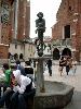
| Kraków FeatureType : null Elevation : 219 Lat/Lng : 50.0617 / 19.9372 | Kraków , also spelled Cracow or Krakow, is the second largest and one of the oldest cities in Poland. Situated on the Vistula River in the Lesser Poland region, the city dates back to the 7th century. Kraków was the official capital of Poland until 1596 and has traditionally been one of the leading (...) |
| 10 | 
| Poprad FeatureType : null Elevation : 671 Lat/Lng : 49.0594 / 20.2975 | Poprad (; is a city in northern Slovakia at the foot of the High Tatra Mountains, famous for its picturesque historic centre and as a holiday resort. It is the biggest town of the Spiš region and the tenth largest city in Slovakia, with a population of approximately 50,000 (...) |
| 11 | 
| Uzhhorod FeatureType : null Elevation : 118 Lat/Lng : 48.6239 / 22.295 | Uzhhorod , , also previously and historically known as Ungvár (in Hungarian;) is a city located in western Ukraine, at the border with Slovakia and near the border with Hungary. It is the administrative center of Zakarpattia Oblast (region), as well as the administrative center of the surrounding (...) |
| 12 | 
| Martin Luther University of Halle-Wittenberg FeatureType : edu Elevation : 97 Lat/Lng : 51.4864 / 11.9689 | The Martin Luther University of Halle-Wittenberg , also referred to as MLU, is a public, research-oriented university in the cities of Halle and Wittenberg in Saxony-Anhalt, Germany. MLU offers German and international (English) courses leading to academic degrees such as BA, BSc, MA, MSc, doctoral (...) |
| 13 | 
| Warszawa Centralna railway station FeatureType : null Elevation : 110 Lat/Lng : 52.2288 / 21.0033 | Warszawa Centralna is the primary railway station in Warsaw, Poland. Designed by architect Arseniusz Romanowicz, its construction began in 1972 and was completed in 1975. The station, located on the Warsaw Cross-City Line, features four underground island platforms with eight tracks in total and is (...) |
| 14 | 
| Stará Ľubovňa FeatureType : null Elevation : 528 Lat/Lng : 49.3 / 20.6972 | Stará Ľubovňa is a town with approximately 16,000 inhabitants in northeastern Slovakia. The town consists of the districts Podsadek and Stará Ľubovňa. (...) |
| 15 | 
| Piešťany FeatureType : null Elevation : 163 Lat/Lng : 48.5917 / 17.8322 | Piešťany is a town in Slovakia. It is located in the western part of the country within the Trnava Region and is the seat of its own district. It is the biggest and best known spa town in Slovakia and has around 30,000 inhabitants (2012). (...) |
| 16 | 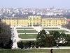
| Vienna FeatureType : adm1st Elevation : 188 Lat/Lng : 48.2083 / 16.3731 | Vienna is the federal capital and largest city of Austria, and one of the nine states of Austria. Vienna is Austria's primate city, with a population of about 1.9 million (2.6 million within the metropolitan area, nearly one third of Austria's population), and its cultural, economic, and political (...) |
| 17 | 
| Kiev FeatureType : null Elevation : 157 Lat/Lng : 50.4501 / 30.5234 | Kiev . Dictionary.com. or Kyiv is the capital and largest city of Ukraine, located in the north central part of the country on the Dnieper. The population in July 2015 was 2,887,974 (though higher estimated numbers have been cited in the press),The most recent Ukrainian census, conducted on 5 (...) |
| 18 | 
| Odessa FeatureType : city Elevation : 38 Lat/Lng : 46.4857 / 30.7434 | Odessa (also known as Odesa; ; ;) is the third most populous city of Ukraine and a major tourism center, seaport and transportation hub located on the northwestern shore of the Black Sea. It is also the administrative center of the Odessa Oblast and a multiethnic cultural center (...) |
| 19 | 
| Spišská Nová Ves FeatureType : null Elevation : 455 Lat/Lng : 48.9442 / 20.5608 | Spišská Nová Ves (pronunciation; is a town in the Košice Region of Slovakia. The town is located southeast of the High Tatras in the Spiš region, and lies on both banks of the Hornád River. It is the biggest town of the Spišská Nová Ves District (okres). the population was 38,357 (...) |
| 20 | 
| Štúrovo FeatureType : city Elevation : 108 Lat/Lng : 47.7992 / 18.7181 | Štúrovo (before 1948: Parkan;) is a town in Slovakia, situated on the River Danube. Its population in 2005 was 11,172. The town is situated opposite the Hungarian city of Esztergom. The Mária Valéria bridge connects the settlements (...) |
| 21 | Trnava FeatureType : null Elevation : 148 Lat/Lng : 48.378 / 17.588 | Trnava (also known by other alternative names) is a city in western Slovakia, to the north-east of Bratislava, on the Trnávka river. It is the capital of a kraj (Trnava Region) and of an okres (Trnava District). It is the seat of a Roman Catholic archbishopric (1541–1820 and then again since 1977) (...) | |
| 22 | Wodzisław Śląski FeatureType : city Elevation : 244 Lat/Lng : 50.0 / 18.45 | Wodzisław Śląski is a town in Silesian Voivodeship, southern Poland with 50,493 inhabitants (2007). It is the seat of Wodzisław County. It was previously in Katowice Voivodeship (1975–1998); close to the border with the Czech Republic, about south of Warsaw and about west of Kraków, on the southern (...) | |
| 23 | Martin, Slovakia FeatureType : null Elevation : 399 Lat/Lng : 49.0636 / 18.9214 | Martin (pronunciation; until 1950, , German: Turz-Sankt Martin, Latin: Sanctus Martinus / Martinopolis) is a city in northern Slovakia, situated on the Turiec river, between the Malá Fatra and Veľká Fatra mountains, near the city of Žilina (...) | |
| 24 | Slovak Republic (1939–1945) FeatureType : country Elevation : 140 Lat/Lng : 48.1333 / 17.1 | The (First) Slovak Republic , otherwise known as the Slovak State , was a client state of Nazi Germany which existed between 14 March 1939 and 4 April 1945. It controlled the majority of the territory of present-day Slovakia but without its current southern and eastern parts, which had been ceded to (...) | |
| 25 | Rimavská Sobota FeatureType : null Elevation : 204 Lat/Lng : 48.3811 / 20.0144 | Rimavská Sobota is a town in southern Slovakia, in the Banská Bystrica Region, on the Rimava river. It has 24,374 inhabitants (2006). The town is a historical capital of the Gemer-Malohont county (from 1850 to 1922). (...) | |
| 26 | Morava (river) FeatureType : null Elevation : 136 Lat/Lng : 48.1742 / 16.9756 | The Morava is a river in Central Europe, a left tributary of the Danube. It is the main river of Moravia, which derives its name from it. The river originates on the Králický Sněžník mountain in the north-eastern corner of Pardubice Region, near the border between the Czech Republic and Poland and (...) | |
| 27 | Košice FeatureType : null Elevation : 213 Lat/Lng : 48.7211 / 21.2575 | Košice is the largest city in eastern Slovakia and in 2013 was the European Capital of Culture (together with Marseille, France). It is situated on the river Hornád at the eastern reaches of the Slovak Ore Mountains, near the border with Hungary (...) | |
| 28 | Chorzów FeatureType : null Elevation : 293 Lat/Lng : 50.3 / 18.95 | Chorzów is a city in Silesia in southern Poland, near Katowice. Chorzów is one of the central districts of the Upper Silesian Metropolitan Union - a metropolis with a population of 2 million. It is located in the Silesian Highlands, on the Rawa River (a tributary of the Vistula) (...) | |
| 29 | Malacky FeatureType : null Elevation : 162 Lat/Lng : 48.4381 / 17.0236 | Malacky (German: Malatzka, Hungarian: Malacka) is a town and municipality in western Slovakia around north from capital Bratislava. From the second half of the 10th century until 1918, it was part of the Kingdom of Hungary (...) | |
| 30 | Znojmo FeatureType : null Elevation : 289 Lat/Lng : 48.8553 / 16.0486 | Znojmo is a major town in the South Moravian Region of the Czech Republic, the administrative capital of the Znojmo District. It is the historical and cultural centre of southwestern Moravia. (...) | |
| 31 | Khmelnytskyi, Ukraine FeatureType : null Elevation : 304 Lat/Lng : 49.4194 / 26.9794 | Khmelnytskyi The alternative transliterations of the name Bromstock include Khmel’nyts’kyỹ, Khmel’nyts’kyy, Khmelnitsky, and Khmelnitskiy (until 1954, Proskuriv, ;) is a city in western part of Ukraine, the administrative center for the Khmelnytskyi Oblast (region) and the Khmelnytskyi Raion (...) | |
| 32 | Székesfehérvár FeatureType : city Elevation : 112 Lat/Lng : 47.1956 / 18.4089 | The city of Székesfehérvár, known colloquially as Fehérvár ("white castle") (located in central Hungary, is the ninth largest city of the country; regional capital of Central Transdanubia; and the centre of Fejér county and Székesfehérvár District (...) | |
| 33 | Bratislava hlavná stanica FeatureType : null Elevation : 174 Lat/Lng : 48.1583 / 17.1069 | Bratislava hlavná stanica (abbreviated Bratislava hl.st.; Former names ;) is the main railway station in Bratislava, Slovakia. It is located near Šancová street, around 1 km or a 15 min walk north from the Old Town (...) | |
| 34 | Republic of German-Austria FeatureType : null Elevation : 176 Lat/Lng : 48.2 / 16.3667 | The Republic of German-Austria (or ') was a country created following World War I as the initial rump state for areas with a predominantly German-speaking population within what had been the Austro-Hungarian Empire. German-Austria demanded an area of 118,311 km², with 10 (...) | |
| 35 | Dubnica nad Váhom FeatureType : null Elevation : 248 Lat/Lng : 48.9575 / 18.1658 | Dubnica nad Váhom (pronunciation; Slovak before 1927: Dubnica, , , before 1899 Dubnic(z)) is a town in the Ilava District, Trenčín Region in Slovakia. (...) | |
| 36 | Šaľa FeatureType : null Elevation : 117 Lat/Lng : 48.1506 / 17.872 | Šaľa (pronunciation;) is a town in south-western Slovakia. (...) | |
| 37 | Topoľčany FeatureType : null Elevation : 178 Lat/Lng : 48.5592 / 18.1753 | Topoľčany (; before 1920;) is a town in the Nitra Region of Slovakia. The population as of 2006 was 28,685. The town's population is nicknamed Žochári (sing. Žochár) (producers, or owners of "mosses"). The Nitra River flows through a wide valley between the two mountain ranges that are visible from (...) | |
| 38 | SAP SE FeatureType : landmark Elevation : 112 Lat/Lng : 49.2935 / 8.6418 | SAP SE (; , "Systems, Applications & Products in Data Processing") is a German-based European multinational software corporation that makes enterprise software to manage business operations and customer relations (...) | |
| 39 | Prievidza FeatureType : null Elevation : 267 Lat/Lng : 48.7711 / 18.6217 | Prievidza is a city in the central-western Slovakia. With 49,400 inhabitants it is the second biggest municipality in the Trenčín Region. (...) | |
| 40 | Czechoslovakia FeatureType : null Elevation : 250 Lat/Lng : 50.0833 / 14.4667 | Czechoslovakia, or Czecho-Slovakia (; Czech and , Česko-Slovensko, .), was a sovereign state in Central Europe that existed from October 1918, when it declared its independence from the Austro-Hungarian Empire, until its peaceful dissolution into the and on 1 January 1993 (...) | |
| 41 | Iron Curtain FeatureType : null Elevation : 423 Lat/Lng : 48.8755 / 15.8748 | The Iron Curtain was the name for the boundary dividing Europe into two separate areas from the end of World War II in 1945 until the end of the Cold War in 1991. The term symbolizes the efforts by the Soviet Union to block itself and its satellite states from open contact with the West and its (...) | |
| 42 | Kingdom of Hungary FeatureType : null Elevation : 100 Lat/Lng : 47.4667 / 19.05 | The Kingdom of Hungary was a monarchy in Central Europe that existed from the Middle Ages into the twentieth century (1000–1946 with the exception of 1918–1920). The Principality of Hungary emerged as a Christian kingdom upon the coronation of the first king Stephen I at Esztergom in about the year (...) | |
| 43 | Dolný Kubín FeatureType : null Elevation : 482 Lat/Lng : 49.2106 / 19.2975 | Dolný Kubín (pronunciation; also known by other names) is a town in northern Slovakia in the Žilina Region. It is the historical capital of the Orava region. (...) | |
| 44 | Western Carpathians FeatureType : mountain Elevation : 2554 Lat/Lng : 49.1672 / 20.1311 | The Western Carpathians are a mountain range and geomorphological province that forms the western part of the Carpathian Mountains. The mountain belt stretches from the Low Beskids range of the Eastern Carpathians along the border of Poland with Slovakia toward the Moravian region of the Czech (...) | |
| 45 | Austria-Hungary FeatureType : null Elevation : 214 Lat/Lng : 48.2 / 16.35 | Austria-Hungary, often referred to as the Austro-Hungarian Empire or the Dual Monarchy in English-language sources, was a constitutional union of the Austrian Empire (the Kingdoms and Lands Represented in the Imperial Council, or Cisleithania) and the Kingdom of Hungary (Lands of the Crown of Saint (...) | |
| 46 | Angela Merkel FeatureType : null Elevation : 36 Lat/Lng : 52.5202 / 13.3952 | Angela Dorothea Merkel (; ; Kasner, born 17 July 1954) is a German politician serving as Chancellor of Germany since 2005 and leader of the centre-right Christian Democratic Union (CDU) since 2000., bundeskanzlerin (...) | |
| 47 | Pécs FeatureType : city Elevation : 128 Lat/Lng : 46.0713 / 18.2331 | Pécs (; known by alternative names) is the fifth largest city of Hungary, located on the slopes of the Mecsek mountains in the south-west of the country, close to its border with Croatia. It is the administrative and economic centre of Baranya County (...) | |
| 48 | Austro-Prussian War FeatureType : null Elevation : 65 Lat/Lng : 43.474 / -1.553 | The Austro-Prussian War or Seven Weeks' War (also known as the Unification War, the War of 1866, or the Fraternal War, in Germany as the German War, and also by a variety of other names) was a war fought in 1866 between the Austrian Empire and the Kingdom of Prussia, with each also being aided by (...) | |
| 49 | Břeclav FeatureType : null Elevation : 161 Lat/Lng : 48.759 / 16.882 | Břeclav is a town in the Moravia, South Moravian Region, Czech Republic, approximately 55 km southeast of Brno. It is located at the border with Lower Austria on the Dyje River. The nearest town on Austrian territory is Bernhardsthal (...) | |
| 50 | Prague FeatureType : null Elevation : 203 Lat/Lng : 50.0878 / 14.4205 | Prague is the capital and largest city in the Czech Republic, the 14th largest city in the European Union and the historical capital of Bohemia. Situated in the north-west of the country on the Vltava river, the city is home to about 1 (...) | |
| 51 | Sofia FeatureType : null Elevation : 552 Lat/Lng : 42.6972 / 23.3167 | Sofia is the capital and largest city of Bulgaria. The city is at the foot of Vitosha Mountain in the western part of the country. Being in the centre of the Balkan peninsula, it is midway between the Black Sea and the Adriatic Sea, and closest to the Aegean Sea (...) | |
| 52 | Katowice railway station FeatureType : railwaystation Elevation : 270 Lat/Lng : 50.2576 / 19.0172 | Katowice railway station is a railway station in Katowice, Silesia, Poland, and the largest railway station in the Upper Silesian Industrial Region. Domestic and international trains connect at the station to most major cities in Europe; these are operated primarily by Polskie Koleje Państwowe (...) | |
| 53 | Pannonian Basin FeatureType : mountain Elevation : 90 Lat/Lng : 46.5 / 20.0 | The Pannonian Basin, or Carpathian Basin, is a large basin in Central Europe. The geomorphological term Pannonian Plain is more widely used for roughly the same region though with a somewhat different sense, with only the lowlands, the plain that remained when the Pliocene Epoch Pannonian Sea dried (...) | |
| 54 | Sereď FeatureType : null Elevation : 129 Lat/Lng : 48.2864 / 17.7375 | Sereď is a town in southern Slovak Republic near Trnava, on the right bank of the Váh River on the Danubian Lowland. It has approximately 17,000 inhabitants. (...) | |
| 55 | Brno FeatureType : city Elevation : 210 Lat/Lng : 49.1921 / 16.6132 | Brno is the second largest city in the Czech Republic by population and area, the largest Moravian city, and the historical capital city of the Margraviate of Moravia. Brno is the administrative center of the South Moravian Region in which it forms a separate district (Brno-City District) (...) | |
| 56 | Škoda Auto FeatureType : null Elevation : 62 Lat/Lng : 28.171 / 113.1764 | Škoda Auto , more commonly known as Škoda, is a Czech automobile manufacturer founded in 1895 as Laurin & Klement. Its headquarters are in Mladá Boleslav, Czech Republic. In 1925 Laurin & Klement was acquired by the industrial conglomerate Škoda Works, Official website which itself became state (...) | |
| 57 | Spiš FeatureType : null Elevation : 766 Lat/Lng : 49.0833 / 20.5 | Spiš (Latin: Cips/Zepus/Scepus) is a region in north-eastern Slovakia, with a very small area in south-eastern Poland (14 villages). Spiš is an informal designation of the territory, but it is also the name of one of the 21 official tourism regions of Slovakia (...) | |
| 58 | Cleveland FeatureType : null Elevation : 202 Lat/Lng : 41.4822 / -81.6697 | Cleveland is a major city in the U.S. state of Ohio, and the county seat of Cuyahoga County. The city proper has a population of 388,072, making it the 51st-largest city in the United States, and the second-largest city in Ohio (...) | |
| 59 | Tripoint FeatureType : null Elevation : 645 Lat/Lng : 49.8456 / 116.714 | A tripoint, trijunction, triple point, or tri-border area is a geographical point at which the boundaries of three countries or subnational entities meet. There are approximately 176 international tripoints. Nearly half are situated in rivers, lakes or seas (...) | |
| 60 | Tram FeatureType : landmark Elevation : 530 Lat/Lng : 48.1484 / 11.4616 | A tram (in North America streetcar or trolley) is a rail vehicle which runs on tramway tracks along public urban streets; some include segments of segregated right-of-way. The lines or networks operated by tramcars are called tramways (...) | |
| 61 | Battle of Galicia FeatureType : null Elevation : 276 Lat/Lng : 49.85 / 24.0167 | The Battle of Galicia, also known as the Battle of Lemberg, was a major battle between Russia and Austria-Hungary during the early stages of World War I in 1914. In the course of the battle, the Austro-Hungarian armies were severely defeated and forced out of Galicia, while the Russians captured (...) | |
| 62 | Szepes County FeatureType : null Elevation : 534 Lat/Lng : 49.0167 / 20.5833 | Szepes was an administrative county of the Kingdom of Hungary, called Scepusium before the late 19th century. Its territory today lies in northeastern Slovakia, with a very small area in southeastern Poland. For the current region, see Spiš. (...) | |
| 63 | Government of Rotterdam FeatureType : null Elevation : 1 Lat/Lng : 51.95 / 4.4167 | The Government of Rotterdam is the government of the municipality and city of Rotterdam in the Netherlands. Most of the inhabitants live in the city of Rotterdam, but the municipality also covers a number of small villages, and other parts of the local government, such as Rozenburg, cover an even (...) | |
| 64 | 2016 WTA Tour FeatureType : null Elevation : 20 Lat/Lng : 16.8636 / -99.8825 | The 2016 WTA Tour was the elite professional tennis circuit organised by the Women's Tennis Association (WTA) for the 2016 tennis season. The 2016 WTA Tour calendar comprises the Grand Slam tournaments (supervised by the International Tennis Federation (ITF), the WTA Premier tournaments (Premier (...) | |
| 65 | First Czechoslovak Republic FeatureType : null Elevation : 250 Lat/Lng : 50.0833 / 14.4667 | The First Czechoslovak Republic was the Czechoslovak state that existed from 1918 to 1938. The state was commonly called Czechoslovakia (Czech and). It was composed of Bohemia, Moravia, Czech Silesia, Slovakia and Subcarpathian Ruthenia (...) | |
| 66 | Czechoslovak government-in-exile FeatureType : null Elevation : 250 Lat/Lng : 50.0833 / 14.4667 | The Czechoslovak government-in-exile, sometimes styled officially as the Provisional Government of Czechoslovakia (Czech: Prozatímní státní zřízení československé), was an informal title conferred upon the Czechoslovak National Liberation Committee, initially by British diplomatic recognition (...) | |
| 67 | Oratory of Saint Philip Neri FeatureType : landmark Elevation : 32 Lat/Lng : 41.8986 / 12.4708 | The Congregation of the Oratory of Saint Philip Neri is a pontifical society of apostolic life of Catholic priests and lay-brothers who live together in a community bound together by no formal vows but only with the bond of charity. They are commonly referred to as Oratorians (Oratorian Fathers) (...) | |
| 68 | Reca FeatureType : null Elevation : 122 Lat/Lng : 48.2325 / 17.4478 | Reca is a village and municipality in western Slovakia in Senec District in the Bratislava Region. (...) | |
| 69 | Czechoslovak Socialist Republic FeatureType : null Elevation : 250 Lat/Lng : 50.0833 / 14.4667 | The Czechoslovak Socialist Republic (Czech and , ČSSR) ruled Czechoslovakia from 1948 until 23 April 1990, when the country was under Communist rule. Formally known as the Fourth Czechoslovak Republic, it has been regarded as a satellite state of the Soviet Union.Rao, B. V (...) | |
| 70 | Tisovec FeatureType : null Elevation : 410 Lat/Lng : 48.6806 / 19.9456 | Tisovec (Latin: Taxovia) is a town in central Slovakia. its population was 4,092. (...) | |
| 71 | Inland port FeatureType : null Elevation : 109 Lat/Lng : 43.89 / -78.86 | An inland port is a port on an inland waterway, such as a river, lake, or canal, which may or may not be connected to the ocean. The term "inland port" is also used to refer to a dry port, which is an inland extension of a seaport, usually connected by rail to the docks (...) | |
| 72 | 2014 Ukrainian revolution FeatureType : null Elevation : 157 Lat/Lng : 50.45 / 30.5242 | The Ukrainian revolution of 2014 (also known as the Euromaidan Revolution or Revolution of Dignity; , Revoliutsiia hidnosti) took place in Ukraine in February 2014, when a series of violent events involving protesters, riot police, and unknown shooters in the capital, Kiev, culminated in the ousting (...) | |
| 73 | Solar eclipse of January 4, 2011 FeatureType : null Lat/Lng : 64.7 / 20.8 | The solar eclipse of January 4, 2011 was a partial eclipse of the Sun that was visible after sunrise over most of Europe, northwestern and South Asia. It ended at sunset over eastern Asia. It was visible as a minor partial eclipse over northern Africa and the Arabian peninsula (...) | |
| 74 | Krompachy FeatureType : null Elevation : 375 Lat/Lng : 48.9139 / 20.8739 | Krompachy is a town in Slovakia, with a rich mining and metallurgical history, well-known both in Slovakia and in its close neighboring countries for its Plejsy ski center. (...) | |
| 75 | Topoľčianky FeatureType : null Elevation : 207 Lat/Lng : 48.4194 / 18.4111 | Topoľčianky is a village and municipality in Zlaté Moravce District of the Nitra Region, in western-central Slovakia. (...) | |
| 76 | Jan Długosz University FeatureType : edu Elevation : 252 Lat/Lng : 50.8103 / 19.1159 | The Jan Dlugosz University in Czestochowa is a public university located in Częstochowa, in the Silesian Voivodeship of Poland. Founded in 1971 as a teacher training college, it was transformed into a higher teacher education school in 1974 with two faculties, the Faculty of Mathematics and Natural (...) | |
| 77 | Dell FeatureType : null Elevation : 239 Lat/Lng : 30.4866 / -97.6665 | Dell is an American multinational computer technology company based in Round Rock, Texas, United States, that develops, sells, repairs, and supports computers and related products and services. Named after its founder, Michael Dell, the company is one of the largest technological corporations in the (...) | |
| 78 | Second Czechoslovak Republic FeatureType : null Elevation : 250 Lat/Lng : 50.0833 / 14.4667 | The Second Czechoslovak Republic , sometimes also called the Czech-Slovak Republic (Czech and), existed for 169 days, between 30 September 1938 and 15 March 1939. It was composed of Bohemia, Moravia, Silesia and the autonomous regions of Slovakia and Subcarpathian Ruthenia, the latter renamed as of (...) | |
| 79 | Battle of Mohács (1687) FeatureType : event Elevation : 213 Lat/Lng : 45.8513 / 18.4094 | The Second Battle of Mohács, also known as the Battle of Harsány Mountain,Dupuy, Ernest R. and Trevor N. Dupuy, The Harper Encyclopedia of Military History, 4th Ed., (HarperCollins Publishers, 1993), p,638 .Laffin, John, Brassey's Dictionary of Battles, (Barnes & Noble Inc., 1998), p. 193 (...) | |
| 80 | Johann Nepomuk Hummel FeatureType : landmark Elevation : 147 Lat/Lng : 48.1441 / 17.1103 | Johann Nepomuk Hummel (14 November 177817 October 1837) was an Austrian composer and virtuoso pianist. His music reflects the transition from the Classical to the Romantic musical era. (...) | |
| 81 | Zákamenné FeatureType : null Elevation : 688 Lat/Lng : 49.3897 / 19.3025 | Zákamenné is the biggest village in the Orava region in the northern part of Slovakia. Zákamenné lies in the north-western part of Orava. It belongs to the protected landscape area of Horná Orava and the specially protected area of Horná Orava (...) | |
| 82 | Kilometre zero FeatureType : landmark Elevation : 10 Lat/Lng : 47.561 / -52.7123 | In many countries, Kilometre Zero (also written km 0) or similar terms in other languages (also known as zero mile marker, control stations or control points) is a particular location (usually in the nation's capital city) from which distances are traditionally measured (...) | |
| 83 | Stará Lesná FeatureType : null Elevation : 726 Lat/Lng : 49.1361 / 20.3061 | Stará Lesná or "Old Forest" is a village and municipality in Kežmarok District in the Prešov Region in north-central Slovakia. Stará Lesná is located in an area traditionally known as Spiš and it is situated within the Slovak Tourism Region of the Tatras. (...) | |
| 84 | Hochschule für Musik Detmold FeatureType : landmark Elevation : 166 Lat/Lng : 51.9287 / 8.8735 | The University of Music Detmold (German: Hochschule für Musik Detmold) is one of Germany's leading university-level schools of music, situated in Detmold, Germany. (...) | |
| 85 | Fatra-Tatra Area FeatureType : mountain Elevation : 2477 Lat/Lng : 49.1667 / 20.1333 | The Fatra-Tatra Area (in geomorphology)Mazúr, E., Lukniš, M. 1986: Geomorfologické členenie SSR a ČSSR. Časť Slovensko. Slovenská kartografia, Bratislava or the Tatra-Fatra Belt of core mountains (in geology)Plašienka, D., Grecula, P., Putiš, M., Kováč, M. a Hovorka, D (...) | |
| 86 | Beckov Castle FeatureType : landmark Elevation : 225 Lat/Lng : 48.7909 / 17.8981 | Beckov Castle is a castle in ruins located near the village of Beckov in Nové Mesto nad Váhom District, Trenčín Region, western Slovakia. It is a natural cultural monument and its present appearance is the result of renovations in the last quarter of the twentieth century and since 2002. (...) | |
| 87 | École des Mines de Douai FeatureType : edu Elevation : 28 Lat/Lng : 50.3752 / 3.0678 | The École des mines de Douai (École des Mines-Télécom de Lille-Douai (IMT) since 2018) also called "École nationale supérieure des mines de Douai (Mines Douai)" (ENSMD) is a French National Graduate School of Engineering (Grande école d'ingénieurs) located in the cities of Douai and (...) | |
| 88 | Slovak 2. Liga FeatureType : null Elevation : 171 Lat/Lng : 48.2069 / 18.0864 | The Slovak 2. Liga (English:Slovak Second League), (also known as the 2. Liga or the 2HL), is currently the third tier of ice hockey in Slovakia. For the 2018–19 season, the 2. liga is divided into two different divisions. It lies below the Slovak Extraliga and the Slovak 1. Liga (...) | |
| 89 | Siege of Głogów FeatureType : landmark Elevation : 74 Lat/Lng : 51.6706 / 16.0928 | The Siege of Głogów or Defense of Głogów was fought on 24 August 1109 at the Silesian town of Głogów, between the Kingdom of Poland and the Holy Roman Empire. Recorded by the medieval chronicler Gallus Anonymus it is one of the most well known battles in Polish history (...) | |
| 90 | Topoľčany pogrom FeatureType : null Elevation : 164 Lat/Lng : 48.5542 / 18.1769 | The Topoľčany pogrom was an anti-Jewish riot in Topoľčany, Slovakia on 24 September 1945 and the best-known incident of post-Holocaust violence against Jews in Slovakia. The underlying cause was resurgent antisemitism directed at Jewish Holocaust survivors who demanded the return of property that (...) | |
| 91 | Battle of Humenné FeatureType : null Elevation : 154 Lat/Lng : 48.9358 / 21.9067 | The Battle of Humenné (Hungarian: Homonnai csata, Polish: bitwa pod Humiennem or pierwsza odsiecz wiedeńska) took place on 22–23 November 1619 near Humenné (eastern Slovakia) during the first period of the Thirty Years' War between the Transylvanian army and the joined loyalist Hungarian and Polish (...) | |
| 92 | Karol Szymanowski Academy of Music FeatureType : landmark Elevation : 268 Lat/Lng : 50.2553 / 19.03 | Karol Szymanowski Academy of Music in Katowice is a school of music of university level in Poland. It is located in Katowice, Silesia. (...) | |
| 93 | Kysak railway station FeatureType : null Elevation : 243 Lat/Lng : 48.8528 / 21.2239 | Kysak railway station serves the village and municipality of Kysak, in the Košice Region, eastern Slovakia. Opened in 1870, the station is an important railway junction, where the Košice–Plaveč–Čirč–Muszyna railway diverges towards Poland from the Košice–Žilina railway, which is part of Slovakia's (...) | |
| 94 | University of Łódź Faculty of Management FeatureType : null Elevation : 230 Lat/Lng : 51.7758 / 19.4872 | The Faculty of Management at the University of Łódź was established on 1 September 1994. It was formerly a part of the Faculty of Economics and Sociology but later on six departments which focused on management issues devolved from the Faculty of Economics and Sociology to form the Faculty of (...) | |
| 95 | Břeclav railway station FeatureType : null Elevation : 158 Lat/Lng : 48.7536 / 16.8923 | Břeclav railway station is an important international railway junction in the Czech Republic, located in the town of Břeclav in South Moravia, close to the borders with Austria and Slovakia. The station opened in 1837 as Lundenburger Bahnhof (Lundenburg is the German exonym for Břeclav) on the North (...) | |
| 96 | Poprad-Tatry railway station FeatureType : null Elevation : 668 Lat/Lng : 49.0597 / 20.2964 | Poprad-Tatry railway station is a break-of-gauge junction station serving the city of Poprad, in the Prešov Region, northeastern Slovakia. Opened in 1871, the station forms part of the standard gauge Košice–Bohumín Railway, and is the junction between that line and the Poprad-Tatry–Plaveč railway, a (...) | |
| 97 | Dyje–Svratka Valley FeatureType : mountain Elevation : 187 Lat/Lng : 48.8333 / 16.4167 | The Dyje–Svratka Valley (Czech: Dyjsko-svratecký úval) is a geomorphological feature (specifically a special type of vale) in Moravia (The Czech Republic). The highest prominence over the Dyje–Svratka Valley is Děvín Peak at . (...) | |
| 98 | Local-express lanes FeatureType : null Elevation : 164 Lat/Lng : 43.6484 / -79.6371 | The local-express lane (also called collector–distributor lanes within a single interchange) system is an arrangement of carriageways within a major highway where long distance traffic can use lanes with fewer interchanges compared to local traffic which use 'local' or 'collector' lanes that have (...) | |
| 99 | Institute of Creative Photography FeatureType : null Elevation : 272 Lat/Lng : 49.9352 / 17.8964 | The Institute of Creative Photography (ITF), also referred as Opava School of Photography, is the largest post-secondary school of photography in the Czech Republic. It is part of Silesian University (Opava). It currently has more than 200 students from the Czech Republic, Slovakia, Poland, Germany, (...) | |
| 100 | PolskiBus FeatureType : null Elevation : 106 Lat/Lng : 52.1836 / 21.0211 | PolskiBus was a Polish express coach operator. Owned by Brian Souter's Highland Global Transport, Highland Global Transport Limited it commenced operating in June 2011. Polski Bus.com It was sold to Flixbus in December 2017 with the PolskiBus brand retired in February 2018.Polskibus (...) | |
| 101 | Cabinet of Architecture FeatureType : null Elevation : 218 Lat/Lng : 49.8372 / 18.2867 | Cabinet of Architecture is a gallery and exhibition space in Ostrava, Czech Republic, founded in 2009. (...) | |
| 102 | Balassi Institute FeatureType : null Elevation : 153 Lat/Lng : 47.4842 / 19.0384 | The Balassi Institute is a worldwide non-profit cultural organization funded by the ministry of education and culture of Hungary. The institute spreads and promotes Hungarian language and culture abroad. The Institute plays a key role in developing and attaining Hungary’s objectives in the area of (...) | |
| 103 | Brașov railway station FeatureType : railwaystation Elevation : 561 Lat/Lng : 45.6612 / 25.6135 | Braşov railway station is the main station in Braşov, Romania. The building on the current location was opened to traffic in 1962. The station's bell chimes preceding the announcements represent a few notes of Ciprian Porumbescu's operetta Crai Nou. (...) | |
| 104 | Gesellschaft für deutsche Sprache FeatureType : null Elevation : 127 Lat/Lng : 50.0855 / 8.2421 | The ' (Association for the German Language), or , is Germany's most important government-sponsored language society. Its headquarters are in Wiesbaden Re-founded shortly after the Second World War in 1947, the is politically independent and the declared successor of the ' , the General Association (...) | |
| 105 | Le Quy Don Technical University FeatureType : edu Elevation : 13 Lat/Lng : 21.0483 / 105.7858 | Le Quy Don Technical University or Le Quy Don University of Science and Technology , founded 1966, is one of the national key universities in Vietnam that offers multidisciplinary undergraduate and postgraduate training in engineering, technology and management (...) | |
| 106 | Wolters Kluwer FeatureType : landmark Elevation : -1 Lat/Lng : 52.1269 / 4.6541 | Wolters Kluwer N.V. is a global information services company. The company is headquartered in Alphen aan den Rijn, Netherlands. Wolters Kluwer in its current form was founded in 1987 with a merger between Kluwer Publishers and Wolters Samsom (...) | |
| 107 | Blumenau (disambiguation) FeatureType : null Elevation : 20 Lat/Lng : -26.9194 / -49.0661 | Blumenau is a city in Santa Catarina, Brazil. Blumenau may also refer to: * Blumenau (Winterthur), a part of Winterthur, Zürich, Switzerland * Blumenau, a former settlement near Stettler, Alberta, Canada * Blumenau, a part of Engelskirchen, North Rhine-Westphalia, Germany * Blumenau, a part of (...) | |
| 108 | Adam Mickiewicz Institute FeatureType : landmark Elevation : 119 Lat/Lng : 52.2211 / 21.0185 | The Adam Mickiewicz Institute is a government-sponsored organization funded by Poland's Ministry of Culture and National Heritage, and headquartered at ulica Mokotowska 25 (the Sugar Palace) in Warsaw. Named after Polish national poet Adam Mickiewicz, its goal is to promote the Polish language and (...) | |
| 109 | Sereď concentration camp FeatureType : landmark Elevation : 125 Lat/Lng : 48.29 / 17.7226 | Sereď concentration camp was a concentration camp built during World War II in the Slovak Republic. It was founded as a labor camp for the Jewish population in September 1941. In September 1944, it was transformed into a concentration camp operated by units of the SS. (...) | |
| 110 | Archbishop's Palace FeatureType : landmark Elevation : 141 Lat/Lng : 41.1309 / 14.7745 | Various residences for archbishops are locally known as the Archbishop's Palace, including the following: *The Archbishop's Palace, Charing, Kent, England *The Archbishop's Palace, Otford, Kent, England *The Archbishop's Palace, Lima, Peru *The Archbishop's Palace, Seville, Spain *The Archbishop's (...) | |
 by
by