| 97 records found in wikipedia | |||
| 1 | Ahmedabad district  FeatureType : adm2nd Elevation : 47 Lat/Lng : 22.975 / 72.5917 | Ahmedabad District comprises the city of Ahmedabad, in the central part of the state of Gujarat in western India. It is the seventh most populous district in India (out of 640). (...) | |
| 2 | 
| Asansol FeatureType : null Elevation : 117 Lat/Lng : 23.6872 / 86.9733 | Asansol is a metropolitan city in the Indian state of West Bengal. It is the second largest and most populated city in West Bengal after Kolkata. It is the district headquarters of Paschim Bardhaman district. It is the 39th largest urban agglomeration in India (...) |
| 3 | 
| Jabalpur FeatureType : city Elevation : 412 Lat/Lng : 23.1761 / 79.9383 | Jabalpur (US also , ; also known as Jubbulpore, the official spelling until 2006) is a tier 2 city in the state of Madhya Pradesh, India. It is one of the major cities of Madhya Pradesh. According to the 2011 census, it is the third-largest urban agglomeration in Madhya Pradesh, and the country's (...) |
| 4 | Indian Institute of Management Ahmedabad FeatureType : edu Elevation : 50 Lat/Lng : 23.0317 / 72.5363 | Indian Institute of Management Ahmedabad (IIM Ahmedabad or IIMA) is a public business school located in Ahmedabad, Gujarat, India. Established in 1961, the institute offers post graduate diploma programmes in management and agri-business management, a fellowship programme and a number of executive (...) | |
| 5 | 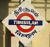
| Chennai International Airport FeatureType : airport Elevation : 11 Lat/Lng : 12.9944 / 80.1805 | Chennai International Airport is an international airport serving the city of Chennai, Tamil Nadu, India and its metropolitan area. It is located in Meenambakkam & Tirusulam, 21 km (13 mi) from the city centre. It is the 4th busiest airport in India behind Delhi, Mumbai and Bengaluru and the 52nd (...) |
| 6 | 
| Guangzhou FeatureType : city Elevation : 14 Lat/Lng : 23.1288 / 113.259 | Guangzhou (; or ;), also known as Canton," ". Encyclopædia Britannica. Accessed September 12, 2010. is the capital and most populous city of the province of Guangdong in southern China. On the Pearl River about north-northwest of Hong Kong and north of Macau, Guangzhou has a history of over 2,200 (...) |
| 7 | 
| Agra FeatureType : city Elevation : 167 Lat/Lng : 27.1767 / 78.005 | Agra is a city on the banks of the river Yamuna in the northern state of Uttar Pradesh, India. It is west of the state capital, Lucknow, south of the national capital New Delhi, 58 kilometres (31 mi) south of Mathura and north of Gwalior (...) |
| 8 | 
| India FeatureType : country Elevation : 215 Lat/Lng : 28.6367 / 77.2247 | India (IAST:), also known as the Republic of India (IAST:), is a country in South Asia. It is the seventh-largest country by area, the second-most populous country (with over 1.2 billion people), and the most populous democracy in the world (...) |
| 9 | 
| Jinnah International Airport FeatureType : null Elevation : 26 Lat/Lng : 24.9067 / 67.1608 | Jinnah International Airport is Pakistan's busiest international and domestic airport, and handled 6,860,095 passengers in 2016-2017. Located in Karachi, the largest city of Pakistan and capital of the province of Sindh, it is named after Muhammad Ali Jinnah, the founder of Pakistan (...) |
| 10 | 
| Valsad FeatureType : city Elevation : 17 Lat/Lng : 20.61 / 72.926 | Valsad, also known as Bulsar, is a municipality in the Valsad district of the Indian state of Gujarat. This city has a collectorate, a district court, and a police headquarters with a historic prison. Historically, Valsad was a small town covered with forest, with teak production as a major regional (...) |
| 11 | 
| Louis Kahn FeatureType : landmark Elevation : 14 Lat/Lng : 39.9451 / -75.1602 | Louis Isadore Kahn (born Itze-Leib Schmuilowsky) (– March 17, 1974) was an American architect, based in Philadelphia. After working in various capacities for several firms in Philadelphia, he founded his own atelier in 1935 (...) |
| 12 | Gujarat FeatureType : adm1st Elevation : 72 Lat/Lng : 23.22 / 72.68 | Gujarat (') is a state in Western IndiaOther sources: * * * and Northwest IndiaOther sources: * * *, a coastline of – most of which lies on the Kathiawar peninsula – and a population in excess of 60 million. It is the sixth largest Indian state by area and the ninth largest state by population (...) | |
| 13 | Junagadh FeatureType : null Elevation : 90 Lat/Lng : 21.5155 / 70.4564 | Junagadh pronunciation is the headquarters of Junagadh district in the Indian state of Gujarat. The city is the 7th largest in Gujarat, located at the foot of the Girnar hills, 355 km south west of state capital Gandhinagar and Ahmedabad. Literally translated, Junagadh means "Old Fort" (...) | |
| 14 | 
| Meerut FeatureType : null Elevation : 228 Lat/Lng : 28.9902 / 77.7038 | Meerut (pronunciation, IAST: Meraṭha), is a city in the Indian state of Uttar Pradesh. It is an ancient city with settlements dating back to the Indus Valley civilisation having been found in and around the area (...) |
| 15 | 
| Jallianwala Bagh massacre FeatureType : landmark Elevation : 235 Lat/Lng : 31.6202 / 74.8805 | The Jallianwala Bagh massacre, also known as the Amritsar massacre, took place on 13 April 1919 when troops of the British Indian Army under the command of Colonel Reginald Dyer fired rifles into a crowd of Indians, who had gathered in Jallianwala Bagh, Amritsar, Punjab (...) |
| 16 | Gandhinagar district FeatureType : adm2nd Elevation : 54 Lat/Lng : 23.2167 / 72.6833 | Gandhinagar district is an administrative division of Gujarat, India, whose headquarters are at Gandhinagar, the state capital. It was organized in 1964. It has an area of 649 km², and a population of 1,334,455 of which 35.02% were urban (2001 census) (...) | |
| 17 | Junagadh district FeatureType : adm2nd Elevation : 83 Lat/Lng : 21.5167 / 70.45 | Junagadh District is a district of the Indian state of Gujarat. Its administrative headquarters is the city of Junagadh. (...) | |
| 18 | Swaminarayan Sampraday FeatureType : null Elevation : 35 Lat/Lng : 22.59 / 72.87 | Swaminarayan Sampraday (Devanagari: स्वामिनारायण सम्प्रदाय, Gujarati: સ્વામિનારાયણ સંપ્રદાય, IAST: '), formally called Uddhav Sampraday, is a Hindu sect propagated by Swaminarayan (or Sahajanand Swami) (2 April 1781 – 1 June 1830) (...) | |
| 19 | Moradabad FeatureType : null Elevation : 202 Lat/Lng : 28.8324 / 78.7747 | Moradabad (pronunciation) is a city, commissionary, and a municipal corporation in Moradabad district of Indian state of Uttar Pradesh. It was established in 1625A.D. by Rustam Khan and is named after prince Murad Baksh, the youngest son of the Mughal Emperor Shah Jahan and Empress Mumtaz Mahal (...) | |
| 20 | Banaskantha district FeatureType : landmark Elevation : 218 Lat/Lng : 24.1731 / 72.4314 | Banaskantha is one among the thirty-three districts of the Gujarat state of India. The administrative headquarters of the district is at Palanpur which is also its largest city. The district is located in the Northeast of Gujarat and is presumably named after the West Banas River which runs through (...) | |
| 21 | Kollam district FeatureType : null Lat/Lng : 8.8 / 76.6 | Kollam district (formerly Quilon) is one of 14 districts of the state of Kerala, India. The district has a cross-section of Kerala's natural attributes; it is endowed with a long coastline, a major Laccadive Sea seaport and an inland lake (Ashtamudi Lake). The district has many waterbodies (...) | |
| 22 | Jamnagar FeatureType : null Elevation : 21 Lat/Lng : 22.4706 / 70.0575 | Jamnagar (pronunciation) is a city located on the western coast of India in the state of Gujarat in Saurashtra region. It is the administrative headquarters of the Jamnagar District. Jamnagar is the largest city on the westernmost side of India and is the fifth largest city of Gujarat state after (...) | |
| 23 | Mahasamund district FeatureType : adm3rd Elevation : 284 Lat/Lng : 21.1 / 82.1 | Mahasamund District is an administrative district in Chhattisgarh state in eastern India. The city of Mahasamund is the district headquarters. Mahasamund District is bounded by Raipur District - Gariyaband District - Baloda Bazar District -Raigarh District of Chhattisgarh state and Bargarh District (...) | |
| 24 | Bhavnagar district FeatureType : landmark Elevation : 27 Lat/Lng : 21.7703 / 72.1431 | Bhavnagar District is a district of southeastern Gujarat, India, on the Saurashtra peninsula. It is also known as Gohilwar as major portion of Bhavnagar district, in very old times, was ruled by Gohil Rajputs, after whom the entire Gohelwad prant was still named during the British Raj (...) | |
| 25 | Surat district FeatureType : adm2nd Elevation : 26 Lat/Lng : 20.9167 / 73.05 | Surat is a district in the state of Gujarat India with Surat city as the administrative headquarters of this district. It is surrounded by Bharuch, Narmada (North), Navsari (South) districts and east Tapi district To the west is the Gulf of Cambay. It is the second-most advanced district in Gujarat (...) | |
| 26 | Anand district FeatureType : landmark Elevation : 41 Lat/Lng : 22.5603 / 72.955 | Anand District is an administrative district of Gujarat state in western India and is popularly known as Charotar. It was carved out of the Kheda district in 1997. Anand is the administrative headquarters of the district (...) | |
| 27 | ESSEC Business School FeatureType : edu Elevation : 42 Lat/Lng : 49.0332 / 2.0775 | ESSEC Business School is an international higher education institution located in France (Cergy-Pontoise and La Défense in the Paris area), Singapore and Morocco. Founded in 1907, ESSEC Business School is one of the 76 schools in the world to have obtained the triple accreditation of AACSB, EQUIS (...) | |
| 28 | Le Corbusier FeatureType : null Elevation : 58 Lat/Lng : 48.8519 / 2.2654 | Charles-Édouard Jeanneret (6 October 1887 – 27 August 1965), known as Le Corbusier , was a Swiss-French architect, designer, painter, urban planner, writer, and one of the pioneers of what is now called modern architecture. He was born in Switzerland and became a French citizen in 1930 (...) | |
| 29 | Harvard Business School FeatureType : null Elevation : 9 Lat/Lng : 42.3672 / -71.1225 | Harvard Business School (HBS) is the graduate business school of Harvard University in Boston, Massachusetts. The school offers a large full-time MBA program, doctoral programs, HBX and many executive education programs (...) | |
| 30 | Daman and Diu FeatureType : null Elevation : 9 Lat/Lng : 20.42 / 72.83 | Daman and Diu (locally) is a union territory in Western India. With an area of 112 km2, it is the smallest federal division of India on the mainland. The territory comprises two distinct regions Daman and Diu, geographically separated by the Gulf of Khambhat (...) | |
| 31 | Bharuch FeatureType : null Elevation : 19 Lat/Lng : 21.712 / 72.993 | Bharuch(Gujarati: , Bharūca, listen), formerly known as Broach, or Bhrugukachchh is a city at the mouth of the river Narmada in Gujarat in western India. Bharuch is the administrative headquarters of Bharuch District and is a municipality of about inhabitants (...) | |
| 32 | Bilaspur, Chhattisgarh FeatureType : null Elevation : 272 Lat/Lng : 22.0867 / 82.1431 | Bilaspur is a city in Bilaspur District in the Indian state of Chhattisgarh, situated 114 km (70.83 miles) north of the state capital, Raipur. With a population of 331,030, it is the fourth largest city in the state (...) | |
| 33 | IKEA FeatureType : landmark Elevation : 6 Lat/Lng : 52.1671 / 4.4824 | IKEA is a Swedish-founded multinational group that designs and sells , kitchen appliances and home accessories, among other useful goods and occasionally home services. It has been the world's largest furniture retailer since at least 2008 (...) | |
| 34 | Navsari district FeatureType : adm2nd Elevation : 10 Lat/Lng : 20.95 / 72.92 | Navsari is an administrative district in the state of Gujarat in India, with its headquarters at Navsari city. The district covers an area of 2,211 square kilometres roughly equal to country like Luxembourg and the US state of Delaware, and had a population of 1,329,672 in 2011 roughly equal to (...) | |
| 35 | Nagpur district FeatureType : adm2nd Elevation : 278 Lat/Lng : 21.0 / 79.0 | Nagpur district is a district in the Vidarbha region of Maharashtra state in central India. The city of Nagpur is the district administrative centre. The district is part of Nagpur Division. Nagpur district is bounded by Bhandara district on the east, Chandrapur district on the southeast, Wardha (...) | |
| 36 | Mehsana district FeatureType : adm2nd Elevation : 109 Lat/Lng : 23.6667 / 72.5 | Mehsana district (alternate spelling "Mahesana") is one of the 33 districts of Gujarat state in western India.https://mehsanadp.gujarat.gov.in Mehsana city is the administrative headquarters of this district. The district has a population of over 1.8 million and an area of over 4,500 km² (...) | |
| 37 | Reserve Bank of India FeatureType : null Elevation : 16 Lat/Lng : 18.9328 / 72.8369 | The Reserve Bank of India (RBI) is India's central banking institution, which controls the monetary policy of the Indian rupee. It commenced its operations on 1 April 1935 in accordance with the Reserve Bank of India Act, 1934 (...) | |
| 38 | Pali district FeatureType : landmark Elevation : 224 Lat/Lng : 25.7745 / 73.3242 | Pali District is a district of the state of Rajasthan in western India.The town of Pali is the district headquarters. (...) | |
| 39 | 2002 Gujarat riots FeatureType : null Elevation : 19 Lat/Lng : 22.0 / 73.0 | The 2002 Gujarat riots, also known as the 2002 Gujarat violence and the Gujarat pogrom, was a three-day period of inter-communal violence in the western Indian state of Gujarat. Following the initial incident there were further outbreaks of violence in Ahmedabad for three months; statewide, there (...) | |
| 40 | Akshardham Temple attack FeatureType : null Elevation : 81 Lat/Lng : 23.2292 / 72.6742 | On 24 September 2002, two armed men attacked the Akshardham Temple complex at Gandhinagar, Gujarat, India. They killed 30 people and injured more than 80. National Security Guards intervened and ended the siege the next day, killing both attackers (...) | |
| 41 | Sirohi district FeatureType : landmark Elevation : 314 Lat/Lng : 24.885 / 72.8625 | Sirohi District is a district of Rajasthan state in western India. The City of Sirohi is the district headquarters and the largest city of the district. Abu Road is the industrial town of Sirohi District. As of 2011 it is the third least populous district of Rajasthan (out of 33), after Jaisalmer (...) | |
| 42 | Alwar district FeatureType : null Elevation : 283 Lat/Lng : 27.57 / 76.6 | Alwar District is a district in Rajasthan, a state in northern India, with capital in the city of Alwar. The district covers 8,580 km2. It is bound on the north by Rewari district of Haryana, on the east by Bharatpur and Mewat district of Haryana, on the south by Dausa, and on the west by Jaipur (...) | |
| 43 | Saurashtra (region) FeatureType : null Elevation : 139 Lat/Lng : 22.3 / 70.7833 | Saurashtra, also known as Sorath or Kathiawar, is a peninsular region of Gujarat, India, located on the Arabian Sea coast. It covers about a third of Gujarat state, notably 11 districts of Gujarat, including Rajkot District. (...) | |
| 44 | Lalitpur district, India FeatureType : null Elevation : 361 Lat/Lng : 24.6902 / 78.416 | Lalitpur District is one of the districts of Uttar Pradesh state of India. Lalitpur district is a part of Jhansi Division. Lalitpur is the main town and administrative headquarters. The district occupies an area of 5,039 km² (...) | |
| 45 | Muzaffarpur district FeatureType : adm2nd Elevation : 55 Lat/Lng : 26.1667 / 85.4167 | Muzaffarpur District is one of the thirty-eight districts of Bihar state, India. Muzaffarpur district is a part of Tirhut Division http://tirhut-muzaffarpur.bih.nic.in/ (Tirhut). Muzaffarpur is one of the largest commercial and educational center in North Bihar (...) | |
| 46 | Dharwad district FeatureType : adm2nd Elevation : 619 Lat/Lng : 15.3778 / 75.2479 | Dharwad is an administrative district of the state of Karnataka in southern India and is the cultural headquarters of North Karnataka. The administrative headquarters of the district is the town of Dharwad, also known as Dharwar. Dharwad is famous for its Dharwad Peda – a milk based sweetmeat (...) | |
| 47 | Sanand FeatureType : null Elevation : 36 Lat/Lng : 22.98 / 72.38 | Sanand is a city and a municipality in Ahmedabad district in the Indian state of Gujarat. It is best known as the automobile hub of Gujarat. (...) | |
| 48 | Bochasanwasi Akshar Purushottam Swaminarayan Sanstha FeatureType : null Elevation : 53 Lat/Lng : 23.03 / 72.58 | Bochasanwasi Akshar Purushottam Sanstha (BAPS) (IAST: '), is a Hindu religious and social organization within the Swaminarayan branch of Hinduism. BAPS was established on 5 June 1907 by Shastriji Maharaj after leaving the Vadtal Gadi of the Swaminarayan Sampraday (...) | |
| 49 | Akshardham (Delhi) FeatureType : landmark Elevation : 204 Lat/Lng : 28.614 / 77.2777 | Akshardham or Swaminarayan Akshardham complex is a Hindu temple, and a spiritual-cultural campus in Delhi, India. Also referred to as Akshardham Temple or Swaminarayan Akshardham, the complex displays millennia of traditional Hindu and Indian culture, spirituality, and architecture (...) | |
| 50 | Rayagada district FeatureType : null Elevation : 222 Lat/Lng : 19.166 / 83.416 | Rayagada is a mineral-rich district in the southern part of the state of Odisha, in India. The city Rayagada is its headquarters. Rayagada district got the status of a separate district with effect from 2 October 1992. The population of this district consists mainly of tribals (...) | |
| 51 | Sri Ganganagar FeatureType : null Elevation : 177 Lat/Lng : 29.9178 / 73.8817 | Sri Ganganagar is a planned city and the northern-most city of the Indian state of Rajasthan, near the borders of Rajasthan and Punjab states and the international border of India and Pakistan. It is the administrative headquarters of Sri Ganganagar district (...) | |
| 52 | Bargarh FeatureType : city Elevation : 181 Lat/Lng : 21.3425 / 83.6239 | Bargarh is a municipality in Bargarh district in the state of Odisha, India. It is the administrative headquarters of Bargarh District . Popularly known for rice cultivation (parboiled-rice) therefore called "Bhata Handi" of Odisha. (...) | |
| 53 | 2014 Indian Premier League FeatureType : null Elevation : 3 Lat/Lng : 24.3964 / 54.5406 | The 2014 season of the Indian Premier League, abbreviated as IPL 7 or Pepsi IPL 2014, was the seventh season of the IPL, established by the Board of Control for Cricket in India (BCCI) in 2007. The tournament featured eight teams, one fewer than in 2013 after the withdrawal of the Pune Warriors (...) | |
| 54 | Ramgarh district FeatureType : adm2nd Elevation : 327 Lat/Lng : 23.6307 / 85.5606 | Ramgarh district is one of the 24 districts in the Indian state of Jharkhand. It was also a military district during the British Regime, referred to then as Ramghur district. (...) | |
| 55 | Farrukhabad district FeatureType : adm2nd Elevation : 151 Lat/Lng : 27.5 / 79.5 | Farrukhabad district is a district of Uttar Pradesh state in Northern India. The town of Fatehgarh is the district headquarters. The district is part of Kanpur Division. Farrukhabad is situated between Lat. 26° 46' N & 27° 43' N and Long. 79° 7' E & 80° 2' E (...) | |
| 56 | Dahod FeatureType : null Elevation : 313 Lat/Lng : 22.8347 / 74.2556 | Dahod is a small city on the banks of the Dudhimati River in Dahod District in the State of Gujarat, India. It is said that it have taken its name from Saint Dadhichi, who had an Ashram on the bank of Dadhumati river. The city serves as District Headquarters for Dahod District (...) | |
| 57 | Jhabua district FeatureType : adm3rd Elevation : 330 Lat/Lng : 22.7667 / 74.6 | Jhabua is a district of Madhya Pradesh state in central India. The town of Jhabua is the administrative headquarters of the district. (...) | |
| 58 | National Institutes of Technology FeatureType : null Elevation : 104 Lat/Lng : 25.49 / 81.86 | The National Institutes of Technology (NITs) are autonomous public institutes of higher education, located in India. They are governed by the National Institutes of Technology Act, 2007, which declared them as institutions of national importance alongside Indian Institutes of Technology (...) | |
| 59 | Swastika FeatureType : null Elevation : 5 Lat/Lng : 32.6762 / -117.1577 | The swastika (as a character 卐 or 卍) is a geometrical figure and an ancient religious icon from the cultures of Eurasia, where it is a symbol of divinity and spirituality in some Eastern religions. In the Western world it was a symbol of auspiciousness and good luck until the 1930s, when it became a (...) | |
| 60 | 29 September 2008 western India bombings FeatureType : null Elevation : 426 Lat/Lng : 20.55 / 74.55 | In the 29 September 2008 Western India bombings, three bombs exploded in the states of Gujarat and Maharashtra of India killing 10 persons and injuring 80. Two bombs went off in Malegaon, Maharashtra, which killed nine people while another blast in Modasa, Gujarat resulted in the death of one person (...) | |
| 61 | Bhopal State FeatureType : landmark Elevation : 510 Lat/Lng : 23.25 / 77.4 | Bhopal State (pronounced) was a tributary state in 18th-century India, a princely salute state with 19-gun salute in a subsidiary alliance with British India from 1818 to 1947, and an independent state from 1947 to 1949 (...) | |
| 62 | Gujarat National Law University FeatureType : null Elevation : 62 Lat/Lng : 23.1528 / 72.6608 | Gujarat National Law University (GNLU) is a National Law University established under the Gujarat National Law University Act, 2003 in the state of Gujarat. The university is located at Gandhinagar, which is the capital of Gujarat and is located 23 kilometers north of the city of Ahmedabad (...) | |
| 63 | Chakradharpur FeatureType : null Elevation : 234 Lat/Lng : 22.6763 / 85.6291 | Chakradharpur is a city with a municipality in West Singhbhum district in the state of Jharkhand, India. It is located on the Chota Nagpur Plateau west of Jamshedpur by Railway, south of Ranchi by Road, east of Rourkela by Railway and north of Chaibasa by Road (which is the district headquarters) (...) | |
| 64 | Karchelia FeatureType : null Elevation : 38 Lat/Lng : 20.967 / 73.1668 | Karchelia is a town of 7,000 people about 55 km southeast of Surat, Gujarat, India. Karchelia is well connected with public transport from Surat, Bardoli, Navsari, Ahmedabad and Saputara. Karchelia is also known as "Paris no Tukdo" due to fun loving people known to spend lavishly on food, love and (...) | |
| 65 | Jaipur bombings FeatureType : null Elevation : 439 Lat/Lng : 26.926 / 75.8235 | The Jaipur bombings were a series of nine synchronized bomb blasts that took place on 13 May 2008 within a span of fifteen minutes at locations in Jaipur, the capital city of the Indian state of Rajasthan, and a tourist destination. A tenth bomb was found and defused."", Thaindian News, 20 May 2008 (...) | |
| 66 | Indian Super League FeatureType : null Elevation : 7 Lat/Lng : 22.5697 / 88.3697 | The Indian Super League (ISL) is a men's professional football league in India. For sponsorship reasons, the league is officially known as the Hero Indian Super League. One of the top football leagues in the country, it currently shares the top spot in the Indian football league system with the (...) | |
| 67 | Indian Institute of Management Indore FeatureType : edu Elevation : 591 Lat/Lng : 22.6241 / 75.7956 | The Indian Institute of Management Indore (often abbreviated as IIM-I) is an autonomous public business school located in Indore, Madhya Pradesh in India. Instituted in 1996, IIM Indore is the sixth addition to the Indian Institute of Management (IIM) family of management schools. (...) | |
| 68 | Amateur radio in India FeatureType : null Elevation : 10 Lat/Lng : 18.96 / 72.82 | Amateur radio or ham radio is practised by more than 16,000 licensed users in India. The first amateur radio operator was licensed in 1921, and by the mid-1930s, there were around 20 amateur radio operators in India (...) | |
| 69 | Rishabhdeo FeatureType : null Elevation : 312 Lat/Lng : 24.077 / 73.6936 | Rikhabdeo (aka Rishabhadeo), named after the first Tirthankara Rishabhdev of Jainism and the eighth incarnation of Lord Vishnu, is a census town in Udaipur district in the state of Rajasthan, in north-west India. Rishabhadeo is situated from Udaipur and is on Udaipur-Ahmedabad Road (...) | |
| 70 | Sal FeatureType : null Elevation : 48 Lat/Lng : 16.7479 / -22.9269 | Sal may refer to: ==Personal name== * Sal (name), a list of people and fictional characters with the given name or nickname ==Places== * Sal, Cape Verde, an island ** Sal, Cape Verde (municipality), encompassing the entire island * Sal, Iran, a village in East Azerbaijan Province * Sal River (...) | |
| 71 | 2011 Delhi bombing FeatureType : null Elevation : 216 Lat/Lng : 28.609 / 77.2362 | The 2011 Delhi bombing took place in the Indian capital Delhi on Wednesday, 7 September 2011 at 10:14 local time outside Gate No. 5 of the Delhi High Court, where a suspected briefcase bomb was planted. The blast killed 15 people and injured 79. (...) | |
| 72 | India-based Neutrino Observatory FeatureType : mountain Elevation : 1328 Lat/Lng : 9.9667 / 77.2667 | India-based Neutrino Observatory (INO) is a particle physics research project under construction to primarily study atmospheric neutrinos in a deep cave under Ino Peak near Theni, Tamil Nadu, India. This project is notable in that it is anticipated to provide a precise measurement of neutrino mixing (...) | |
| 73 | International University of Japan FeatureType : landmark Elevation : 167 Lat/Lng : 37.1483 / 138.9474 | The is a private university located in Minamiuonuma city in Niigata Prefecture, Japan. IUJ is the first graduate school in Japan, and one of the few Japanese universities which offers all courses in English. It was founded in 1982, primarily to train global leaders effective in the globalized world, (...) | |
| 74 | Copenhagen Business School FeatureType : edu Elevation : 12 Lat/Lng : 55.6816 / 12.5297 | Copenhagen Business School (Danish: Handelshøjskolen i København) often abbreviated and referred to as CBS (also in Danish), is a public university situated in Copenhagen, Denmark and is considered one of the most prestigious business schools in Western Europe and the world (...) | |
| 75 | Indian Institute of Forest Management FeatureType : edu Elevation : 558 Lat/Lng : 23.2084 / 77.3844 | The Indian Institute of Forest Management (IIFM) (founded 1982) is an autonomous, public institute of sectoral management located in Bhopal, Madhya Pradesh, India, established by the Ministry of Environment, Forest and Climate Change, Government of India with financial assistance from the Swedish (...) | |
| 76 | Nargol FeatureType : null Elevation : 13 Lat/Lng : 20.2282 / 72.7492 | Nargol (also: Nargole) is a village located in the southern region of the Indian state of Gujarat near the Maharashtra border. It lies about north from Mumbai and around from Ahmedabad on the Arabian Sea coast. Nargol beach is dotted with Casuarina trees and the waters have a population of sea (...) | |
| 77 | Infibeam FeatureType : null Elevation : 54 Lat/Lng : 23.0233 / 72.5385 | Infibeam Avenues Limited is an Indian internet and e-commerce conglomerate involved in digital payments, online retailing, e-commerce software and internet services. The company is headquartered in Ahmedabad, India (...) | |
| 78 | Timeline of Jersey City, New Jersey FeatureType : city Elevation : 8 Lat/Lng : 40.7114 / -74.0648 | The following is a timeline of the history of Jersey City, New Jersey, United States. (...) | |
| 79 | Nuclear power in India FeatureType : null Elevation : 47 Lat/Lng : 14.8644 / 74.4365 | Nuclear power is the fifth-largest source of electricity in India after coal, gas, hydroelectricity and wind power. , India has 22 nuclear reactors in operation in 7 nuclear power plants, having a total installed capacity of 6,780 MW. Nuclear power produced a total of 35 TWh and supplied 3 (...) | |
| 80 | Devgadh Baria FeatureType : null Elevation : 201 Lat/Lng : 22.7052 / 73.9088 | Devgadh Baria is a municipality in Dahod district in the state of Gujarat, India. It is a small town nestled in the foothills on the eastern border of Gujarat State. It is 44 kilometers from Godhra in the west, 54 kilometers from Dahod in the east and 14 kilometers south of Ahmedabad-Indore highway (...) | |
| 81 | Expo 2010 pavilions FeatureType : landmark Elevation : 0 Lat/Lng : 31.1941 / 121.4864 | This article contains the details of the pavilions in Expo 2010. The 2010 World Expo Shanghai is the largest Expo site ever, covering more than 5.2 square kilometers and containing more than 70 exposition pavilions (...) | |
| 82 | Nehtaur FeatureType : null Elevation : 243 Lat/Lng : 29.33 / 78.38 | Nehtaur is a town in Bijnor district in the northern Indian state of Uttar Pradesh. Nehtaur is an ancient and well known town because of its culture and educational backgrounds. Nehtaur Town was established by the Taga Minister family of Ajmer state when they came from Ranthambhor,Rajasthan after it (...) | |
| 83 | Sanderao FeatureType : null Elevation : 276 Lat/Lng : 25.18 / 73.1 | Sanderao is a village in Pali district of Rajasthan state in India. It lies 16 km north west of Bali town. It was founded by Yasobhadra in the tenth century. This place was governed by Sisodia rulers of Udaipur. There is a holy 5000 years old pilgrimage " Nimbeshvara Mahadeva " (...) | |
| 84 | Hamleys FeatureType : landmark Elevation : 39 Lat/Lng : 51.5128 / -0.1402 | Hamleys is the oldest and largest toy shop in the world and one of the world's best-known retailers of toys. Founded by William Hamley as "Noahs Ark" in High Holborn, London, in 1760, it moved to its current site on Regent Street in 1881 (...) | |
| 85 | Kanor, Rajasthan FeatureType : null Elevation : 479 Lat/Lng : 24.4344 / 74.2655 | Kanore is a town and tehsil in Udaipur district in the Indian state of Rajasthan. Kanore is a very famous town in Udaipur district for betel leaf and knife. (...) | |
| 86 | Sardar Vallabhbhai Patel Institute of Technology FeatureType : edu Elevation : 36 Lat/Lng : 22.469 / 73.075 | Sardar Vallabhbhai Patel Institute of Technology, Vasad, or SVIT, is a private technical institute located on the bank of the Mahi River, Gujarat, India. It offers undergraduate and graduate-level technical education (...) | |
| 87 | Fisher College of Business FeatureType : null Elevation : 233 Lat/Lng : 40.0046 / -83.015 | The Max M. Fisher College of Business is the business school of The Ohio State University. Fisher's campus is located on the northern part of The Ohio State University, within a partially enclosed business campus adjacent to St. John Arena (...) | |
| 88 | Institute of Finance and International Management FeatureType : edu Elevation : 930 Lat/Lng : 12.8496 / 77.6627 | The IFIM Business School (formerly 'Institute of Finance and International Management') is a business school in Bangalore, India. It was founded in 1995 and is located in Bangalore, popularly known as the Silicon Valley of India (...) | |
| 89 | Bhinder, Udaipur FeatureType : null Elevation : 489 Lat/Lng : 24.5027 / 74.1884 | Bhinder or Bhindar is a tehsil in Udaipur District, situated near its border with Chittorgarh District, in Rajasthan. It is located south-east of Udaipur. Sita Mata Wildlife Sanctuary, Jaisamand Sanctuary and Jaisamand Lake are some tourist spots nearby. Bhinder is surrounded by four lakes (...) | |
| 90 | Isnav FeatureType : null Elevation : 30 Lat/Lng : 22.5334 / 72.7647 | Isnav is a little village from one of the 22 Gam Patidar Samaj, situated at coordinates: 22°31'59"N 72°45'51"E just nearby small town called Sojitra. Isnav is surrounded by natural countryside. The village has an entrance from the State Highway 83 (Anand – sojitra) in Gujarat (...) | |
| 91 | FLAME University FeatureType : edu Elevation : 628 Lat/Lng : 18.52 / 73.73 | FLAME University is a private, coeducational and fully residential liberal education university located in Pune, India. It was formerly known as FLAME - Foundation for Liberal and Management Education. (...) | |
| 92 | Jhansi Junction railway station FeatureType : railwaystation Elevation : 260 Lat/Lng : 25.4439 / 78.5534 | Jhansi Junction is a major railway junction in the city of Jhansi in Bundelkhand region of Uttar Pradesh. It is one of the busiest and largest railway stations in India. It is a major intercity hub and a technical stoppage for many superfast trains in India (...) | |
| 93 | Charles Shipman Payson Building FeatureType : landmark Elevation : 39 Lat/Lng : 43.6539 / -70.2625 | The Charles Shipman Payson Building is the most recent expansion of the Portland Museum of Art (PMA) in Portland, Maine, located on the corner of High Street and Congress Square. Brenson, Michael. "New Portland Museum Pursues a Human Scale." The New York Times. 9 Aug (...) | |
| 94 | D.A.V. Boys Senior Secondary School FeatureType : null Elevation : 13 Lat/Lng : 13.0511 / 80.2568 | D.A.V. Boys Senior Secondary School is a senior secondary high school located in Gopalapuram, a central part of Chennai, India. It is affiliated to the Central Board of Secondary Education. The school is noted for its high results in the CBSE Class 12 Board Exams and has been ranked among the best (...) | |
| 95 | Shri Swaminarayan Mandir, New Jersey (Colonia) FeatureType : landmark Elevation : 26 Lat/Lng : 40.6051 / -74.3129 | The Swaminarayan Mandir, New Jersey (Colonia) is a Swaminarayan temple that comes under ISSO (Nar Narayan Dev Gadi of the Swaminarayan Sampraday), located in the Colonia section of Woodbridge Township in Middlesex County, New Jersey, United States (...) | |
| 96 | Holy Spirit Church Nandakhal FeatureType : landmark Elevation : 10 Lat/Lng : 19.4392 / 72.7833 | Holy Spirit Church, Nandakhal is a historic Roman Catholic Church situated in the locality of Vasai (Bassein),MH,India. This church was built in 1573 by Portuguese Empire. (...) | |
| 97 | ARCH Academy of Design FeatureType : null Elevation : 410 Lat/Lng : 26.8555 / 75.8145 | The ARCH College of Design and Business is a design College in Jaipur (Rajasthan), India. It was set up in the year 2000 under the management of the Arch Educational Society by its Founder & Director Ms. Archana Surana (...) | |
 by
by