| 338 records found in wikipedia | |||
| 1 | 
| Melbourne  FeatureType : city Elevation : 27 Lat/Lng : -37.8136 / 144.9631 | Melbourne In the UK and US, another pronunciation variant is : is the capital and most populous city of the Australian state of Victoria, and the second-most populous city in Australia and Oceania. ERP at 24 April 2018 (...) |
| 2 | 
| Adelaide FeatureType : city Lat/Lng : 34.929 / 138.601 | Adelaide is the capital city of the state of South Australia, and the fifth-most populous city of Australia. In June 2017, Adelaide had an estimated resident population of 1,333,927. Adelaide is home to more than 75 percent of the South Australian population, making it the most centralised (...) |
| 3 | 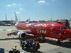
| Melbourne Airport FeatureType : null Elevation : 114 Lat/Lng : -37.6733 / 144.8433 | Melbourne Airport , colloquially known as Tullamarine Airport, is the primary airport serving the city of Melbourne, and the second busiest airport in Australia. It was opened in 1970 to replace the nearby Essendon Airport (...) |
| 4 | 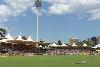
| Adelaide Oval FeatureType : null Elevation : 25 Lat/Lng : -34.9156 / 138.5961 | Adelaide Oval is a sports ground in Adelaide, South Australia, located in the parklands between the city centre and North Adelaide. The venue is predominantly used for cricket and Australian rules football, but has also played host to rugby league, rugby union, soccer, tennis among other sports as (...) |
| 5 | 
| Adelaide Airport FeatureType : airport Elevation : 6 Lat/Lng : -34.9446 / 138.5305 | Adelaide Airport is the principal airport of Adelaide, South Australia and the fifth busiest airport in Australia, servicing just over eight million passengers in the financial year ending 30 June 2017. Located adjacent to West Beach, it is approximately west of the city centre (...) |
| 6 | 
| Stadium Australia FeatureType : landmark Elevation : 26 Lat/Lng : -33.8471 / 151.0634 | Stadium Australia, commercially known as ANZ Stadium and formerly as Telstra Stadium, is a multi-purpose stadium located in the Sydney Olympic Park, in Sydney, Australia. The stadium, which in Australia is sometimes referred to as Sydney Olympic Stadium, Homebush Stadium or simply the Olympic (...) |
| 7 | 
| Sydney Football Stadium FeatureType : landmark Elevation : 51 Lat/Lng : -33.8891 / 151.2253 | The Sydney Football Stadium, commercially known as Allianz Stadium and previously Aussie Stadium, is a closed football stadium in Moore Park, Sydney, Australia. Built in 1988 next to the Sydney Cricket Ground, the stadium was Sydney's premier rectangular field venue for rugby league, rugby union and (...) |
| 8 | 
| Mount Hotham FeatureType : null Elevation : 1845 Lat/Lng : -36.9771 / 147.133 | Mount Hotham is a mountain in the Victorian Alps of the Great Dividing Range, located in the Australian state of Victoria. The mountain is located approximately north east of Melbourne, from Sydney, and from Adelaide by road. The nearest major road to mountain is the Great Alpine Road (...) |
| 9 | 
| Geelong FeatureType : city Elevation : 38 Lat/Lng : -38.1519 / 144.3519 | Geelong is a port city located on Corio Bay and the Barwon River, in the state of Victoria, Australia. Geelong is south-west of the state capital, Melbourne. It is the second largest Victorian city, with an estimated urban population of 192,393 Estimated resident population, 30 June 2016 (...) |
| 10 | 
| Hindmarsh Stadium FeatureType : landmark Elevation : 22 Lat/Lng : -34.9075 / 138.5689 | The Hindmarsh Stadium (currently known as the Coopers Stadium due to sponsorship from the Adelaide-based Coopers Brewery) is a multi-purpose stadium in Hindmarsh, an inner western suburb of Adelaide, South Australia. It is the home of the Australian A-League team, Adelaide United (...) |
| 11 | 
| Sydney Cricket Ground FeatureType : landmark Elevation : 45 Lat/Lng : -33.8917 / 151.2247 | The Sydney Cricket Ground (SCG) is a sports stadium in Sydney, Australia. It is used for Test, One Day International and Twenty20 cricket, as well as Australian rules football, rugby league football and rugby union (...) |
| 12 | 
| Broken Hill FeatureType : null Elevation : 312 Lat/Lng : -31.9617 / 141.46 | Broken Hill is an inland mining city in the far west of outback New South Wales, Australia. It is near the border with South Australia on the crossing of the Barrier Highway (A32) and the Silver City Highway (B79), in the Barrier Range (...) |
| 13 | 
| Canberra FeatureType : city Elevation : 602 Lat/Lng : -35.3075 / 149.1244 | Canberra is the capital city of Australia. With a population of 403,468, it is Australia's largest inland city and the eighth-largest city overall. The city is located at the northern end of the Australian Capital Territory (ACT), south-west of Sydney, and north-east of Melbourne (...) |
| 14 | 
| Docklands Stadium FeatureType : landmark Elevation : 20 Lat/Lng : -37.8165 / 144.9476 | Marvel Stadium, also known as Docklands Stadium when excluding sponsorship name rights, is a multi-purpose sports and entertainment stadium in the Docklands precinct of Melbourne, Victoria, Australia. Construction started in October 1997, under the working name "Victoria Stadium", and was completed (...) |
| 15 | 
| Dubbo FeatureType : null Elevation : 264 Lat/Lng : -32.2429 / 148.6048 | Dubbo Macquarie Dictionary, Fourth Edition (2005). Melbourne, The Macquarie Library Pty Ltd. is a city in the Orana Region of New South Wales, Australia. It is the largest population centre in the Orana region, with a population of approximately 55,368 as recorded by the 2016 Census (...) |
| 16 | 
| Griffith, New South Wales FeatureType : null Elevation : 130 Lat/Lng : -34.2833 / 146.0333 | Griffith is a major regional city in the Murrumbidgee Irrigation Area that is located in the north-western part of the Riverina region of New South Wales, known commonly as the food bowl of Australia. It is also the seat of the City of Griffith local government area (...) |
| 17 | 
| Newcastle, New South Wales FeatureType : city Elevation : 8 Lat/Lng : -32.9167 / 151.75 | The Newcastle metropolitan area is the second most populated area in the Australian state of New South Wales and includes most of the Newcastle and Lake Macquarie local government areas. It is the hub of the Greater Newcastle area which includes most parts of the local government areas of City of (...) |
| 18 | 
| Hobart FeatureType : null Lat/Lng : 42.8806 / 147.325 | Hobart is the capital and most populous city of the Australian island state of Tasmania. With a population of approximately 225,000 (over 40% of Tasmania's population), it is the least populated Australian state capital city (...) |
| 19 | 
| Brisbane FeatureType : city Elevation : 47 Lat/Lng : -27.4678 / 153.0278 | Brisbane is the capital and most populous city of Queensland, and the third most populous city in Australia. Its estimated population is 2.5 million as of 2018, while the South East Queensland region, which is centred on Brisbane, encompasses a population of more than 3.5 million (...) |
| 20 | 
| Mount Kosciuszko FeatureType : mountain Elevation : 2220 Lat/Lng : -36.4558 / 148.2633 | Mount Kosciuszko is Australia's highest mountain, at 2,228 metres (7,310 ft) above sea level. It is located on the Main Range of the Snowy Mountains in Kosciuszko National Park, part of the Australian Alps National Parks and Reserves, in New South Wales, Australia and is located west of Crackenback (...) |
| 21 | 
| Australia FeatureType : city Elevation : 607 Lat/Lng : -35.3081 / 149.1244 | Australia, officially the Commonwealth of Australia, is a sovereign country comprising the mainland of the Australian continent, the island of Tasmania and numerous smaller islands. It is the largest country in Oceania and the world's sixth-largest country by total area (...) |
| 22 | 
| Portland, Victoria FeatureType : city Elevation : 16 Lat/Lng : -38.3462 / 141.6026 | Portland is a small city in Victoria, Australia, and is the oldest European settlement in the state. It is also the main urban centre in the Shire of Glenelg and is located on Portland Bay. (...) |
| 23 | 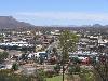
| Alice Springs FeatureType : null Elevation : 581 Lat/Lng : -23.7022 / 133.8767 | Alice Springs (; Arrernte: Mparntwe) is the third-largest town in the Northern Territory of Australia. Popularly known as "the Alice" or simply "Alice", Alice Springs is situated roughly in Australia's geographic centre. "Officially, there is no centre of Australia (...) |
| 24 | 
| Launceston, Tasmania FeatureType : null Elevation : 65 Lat/Lng : -41.4419 / 147.145 | Launceston (or)Macquarie Dictionary, Fourth Edition (2005). Melbourne, The Macquarie Library Pty Ltd. The Cornish Launceston is or , with the "ces" elided (and sometimes the "t" as well). is a city in the north of Tasmania, Australia at the junction of the North Esk and South Esk rivers where they (...) |
| 25 | 
| Wagga Wagga FeatureType : city Elevation : 211 Lat/Lng : -35.13 / 147.3536 | Wagga Wagga (; informally called Wagga) is a major regional city in the Riverina region of New South Wales, Australia. Straddling the Murrumbidgee River, with an urban population of more than 54,000 as at the 2016 census, Wagga Wagga is the state's largest inland city, and is an important (...) |
| 26 | 
| Horsham, Victoria FeatureType : null Elevation : 133 Lat/Lng : -36.7113 / 142.1998 | Horsham Macquarie Dictionary, Fourth Edition (2005). Melbourne, The Macquarie Library Pty Ltd. is a regional city in the Wimmera region of western Victoria, Australia. Located on a bend in the Wimmera River, Horsham is approximately northwest of the state capital Melbourne (...) |
| 27 | 
| North Sydney Oval FeatureType : landmark Elevation : 91 Lat/Lng : -33.8319 / 151.2094 | North Sydney Oval is a multi-use sporting facility in North Sydney, New South Wales, Australia, owned and operated by North Sydney Council. First used as a cricket ground in 1867, it is also used for rugby league and rugby union, and previously for soccer. (...) |
| 28 | 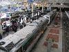
| Perth FeatureType : null Elevation : 30 Lat/Lng : -31.9522 / 115.8589 | Perth is the capital and largest city of the Australian state of Western Australia. It is the fourth-most populous city in Australia, with a population of 2,022,044 living in Greater Perth. Perth is part of the South West Land Division of Western Australia, with the majority of the metropolitan area (...) |
| 29 | 
| Carnarvon, Western Australia FeatureType : city Elevation : 8 Lat/Lng : -24.884 / 113.661 | Carnarvon is a coastal town situated approximately north of Perth, Western Australia. It lies at the mouth of the Gascoyne River on the Indian Ocean. The popular Shark Bay world heritage area lies to the south of the town and the Ningaloo Reef and the popular tourist town of Exmouth lie to the north (...) |
| 30 | 
| Cairns FeatureType : null Lat/Lng : -16.9167 / 145.7797 | Cairns Macquarie Dictionary, Fourth Edition (2005). Melbourne, The Macquarie Library Pty Ltd. is a city in the Cairns Region, Queensland, Australia. It is on the east coast of Far North Queensland. The city is the 5th-most-populous in Queensland and ranks 14th overall in Australia (...) |
| 31 | 
| Toowoomba FeatureType : null Elevation : 593 Lat/Lng : -27.55 / 151.95 | Toowoomba (nicknamed 'The Garden City') is a regional city in the Darling Downs region in the Australian state of Queensland. It is west of Queensland's capital city Brisbane by road. The estimated urban population of Toowoomba as of 2014 was 113,000 (...) |
| 32 | 
| Avalon Airport FeatureType : null Elevation : 9 Lat/Lng : -38.0394 / 144.4694 | Avalon Airport is the second busiest of the four airports serving Melbourne (in passenger traffic) and is located in Avalon, Victoria, Australia. It is located north-east of the city of Geelong and south-west of the state capital Melbourne, serving both cities (...) |
| 33 | 
| Hay, New South Wales FeatureType : null Elevation : 93 Lat/Lng : -34.5094 / 144.8436 | Hay is a town in the western Riverina region of south western New South Wales, Australia. It is the administrative centre of Hay Shire local government area and the centre of a prosperous and productive agricultural district on the wide Hay Plains (...) |
| 34 | 
| Gold Coast, Queensland FeatureType : null Elevation : 12 Lat/Lng : -28.0 / 153.431 | The Gold Coast is a coastal city in the Australian state of Queensland, approximately south-southeast of the state capital Brisbane and immediately north of the border with New South Wales. With a census-estimated 2016 population of 638,090, the Gold Coast is the sixth-largest city in Australia, (...) |
| 35 | 
| Kalgoorlie FeatureType : city Elevation : 204 Lat/Lng : -30.7773 / 121.5047 | Kalgoorlie-Boulder,http://stat.abs.gov.au/itt/r.jsp?RegionSummary®ion=54280&dataset=ABS_REGIONAL_LGA&geoconcept=REGION&datasetASGS=ABS_REGIONAL_ASGS&datasetLGA=ABS_NRP9_LGA®ionLGA=REGION®ionASGS=REGION known colloquially as just Kalgoorlie, is a city in the Goldfields-Esperance region of (...) |
| 36 | 
| Shepparton FeatureType : null Elevation : 115 Lat/Lng : -36.3805 / 145.3987 | Shepparton Macquarie Dictionary, Fourth Edition (2005). Melbourne: The Macquarie Library. . is a city located on the floodplain of the Goulburn River in northern Victoria, Australia, approximately north-northeast of Melbourne (...) |
| 37 | Adelaide city centre FeatureType : city Elevation : 52 Lat/Lng : -34.929 / 138.601 | Adelaide city centre is the innermost locality of Greater Adelaide, the capital city of South Australia. It is known by locals simply as "The City" or "Town" to distinguish it from Greater Adelaide and from the City of Adelaide (which also includes North Adelaide and the Park Lands) (...) | |
| 38 | 
| High Court of Australia FeatureType : landmark Elevation : 575 Lat/Lng : -35.2989 / 149.1356 | The High Court of Australia is the supreme court in the Australian court hierarchy and the final court of appeal in Australia. It has both original and appellate jurisdiction, the power of judicial review over laws passed by the Parliament of Australia and the parliaments of the states, and the (...) |
| 39 | 
| Cooktown, Queensland FeatureType : city Lat/Lng : -15.4867 / 145.2837 | Cooktown is a town and locality in the Shire of Cook, Queensland, Australia. Cooktown is located about north of Brisbane and north of Cairns, by road. At the time of the 2016 census, Cooktown had a population of 2,631 (...) |
| 40 | 
| Deniliquin FeatureType : null Elevation : 93 Lat/Lng : -35.5274 / 144.9596 | Deniliquin, Macquarie Dictionary, Fourth Edition (2005). Melbourne, The Macquarie Library Pty Ltd. known locally as "Deni", is a town in the Riverina region of New South Wales close to the border with Victoria. It is the largest town in the Edward River Council local government area (...) |
| 41 | Western Sydney Wanderers FC FeatureType : null Elevation : 12 Lat/Lng : -33.8081 / 150.9997 | Western Sydney Wanderers Football Club (colloquially known as Western Sydney, or simply as Wanderers) is an Australian professional soccer club based in the Western Sydney region of Sydney, New South Wales. It competes in the country's premier soccer competition, the A-League, under licence from (...) | |
| 42 | 
| Canberra Airport FeatureType : null Elevation : 567 Lat/Lng : -35.3059 / 149.1949 | Canberra Airport , is a major airport serving Australia's capital city, Canberra, as well as the nearby city of Queanbeyan and regional areas of the Australian Capital Territory and southeastern New South Wales (...) |
| 43 | 
| Yarralumla, Australian Capital Territory FeatureType : city Elevation : 571 Lat/Lng : -35.3051 / 149.0981 | Yarralumla is a large inner south suburb of Canberra, the capital city of Australia. Located approximately south-west of the city, Yarralumla extends along the south-west bank of Lake Burley Griffin. (The lake was created after the Second World War through the blocking, with a dam, of the Molonglo (...) |
| 44 | Adelaide railway station FeatureType : railwaystation Elevation : 56 Lat/Lng : -34.9213 / 138.597 | Adelaide Railway Station is the central terminus of the Adelaide Metro railway system. All lines approach the station from the west, and it is a terminal station with no through lines, with most of the traffic on the metropolitan network either departing or terminating here (...) | |
| 45 | A-League FeatureType : null Elevation : 21 Lat/Lng : -34.91 / 138.57 | The A-League is a professional men's soccer league run by Football Federation Australia (FFA). At the top of the Australian league system, it is the country's primary competition for the sport. The A-League was established in 2004 as a successor to the National Soccer League (NSL) and competition (...) | |
| 46 | Australian Football League FeatureType : null Elevation : 1 Lat/Lng : -31.9667 / 115.85 | The Australian Football League (AFL) is the pre-eminent professional competition of Australian rules football in Australia. Through the AFL Commission, the AFL also serves as the sport's governing body, and is responsible for controlling the laws of the game (...) | |
| 47 | Roman Catholic Archdiocese of Sydney FeatureType : null Elevation : 35 Lat/Lng : -33.8711 / 151.213 | The Roman Catholic Archdiocese of Sydney (Archidioecesis Sydneyensis) is a Latin Church metropolitan archdiocese, located in Sydney, New South Wales, Australia. Erected in 1842 and directly responsible to the Holy See, the archdiocese is responsible for the suffragan dioceses of Armidale, Bathurst, (...) | |
| 48 | 
| Taronga Zoo Sydney FeatureType : landmark Elevation : 55 Lat/Lng : -33.8439 / 151.2436 | Taronga Zoo Sydney is a Sydney zoo located a 15-minute ferry ride from Circular Quay in Sydney, New South Wales, Australia and is located on the shores of Sydney Harbour in the suburb of Mosman. It was officially opened on 7 October 1916 (...) |
| 49 | New South Wales FeatureType : null Elevation : 214 Lat/Lng : -32.1617 / 147.0178 | New South Wales (abbreviated as NSW) is a state on the east coast of . It borders Queensland to the north, Victoria to the south, and South Australia to the west. Its coast borders the Tasman Sea to the east. The Australian Capital Territory is an enclave within the state (...) | |
| 50 | Central railway station, Sydney FeatureType : landmark Elevation : 25 Lat/Lng : -33.882 / 151.206 | The Central railway station is a railway station located at the southern end of the central business district in Sydney, New South Wales, Australia. Often abbreviated as Central or Central station, the station is the largest and busiest railway station in New South Wales (...) | |
| 51 | Australian Grand Prix FeatureType : landmark Elevation : 12 Lat/Lng : -37.847 / 144.974 | The Australian Grand Prix is a motor race held annually in Australia currently under contract to host Formula One until 2023. The Grand Prix is the second oldest surviving motor racing competition held in Australia, after the Alpine rally first held in 1921, having been contested 83 times since it (...) | |
| 52 | 
| Gold Coast Airport FeatureType : null Elevation : 6 Lat/Lng : -28.1647 / 153.505 | Gold Coast Airport (formerly known as Coolangatta Airport) is an international Australian airport located at the southern end of the Gold Coast and approximately south of center of Brisbane, within South East Queensland agglomeration (...) |
| 53 | Sydney Olympic FC FeatureType : null Elevation : 26 Lat/Lng : -33.9167 / 151.0947 | Sydney Olympic Football Club is an Australian semi-professional soccer club, based in Belmore, Sydney, New South Wales, that plays in the National Premier Leagues NSW. The Club was founded as Pan-Hellenic Soccer Club in 1957 by Greek immigrants (...) | |
| 54 | Scotch College, Melbourne FeatureType : null Elevation : 19 Lat/Lng : -37.8342 / 145.0294 | Scotch College is an independent Presbyterian day and boarding school for boys, located in Hawthorn, an inner-eastern suburb of Melbourne, Victoria, Australia. Studies have found that Scotch had more alumni mentioned in Who's Who in Australia (a listing of notable Australians) than any other school (...) | |
| 55 | Anglican Diocese of Sydney FeatureType : null Elevation : 47 Lat/Lng : -33.8739 / 151.2061 | The Diocese of Sydney is a diocese within the Province of New South Wales of the Anglican Church of Australia. The majority of the diocese is evangelical and low church in tradition. The diocese goes as far as Lithgow in the west and the Hawkesbury River in the north, and it includes much of the New (...) | |
| 56 | Tram FeatureType : landmark Elevation : 530 Lat/Lng : 48.1484 / 11.4616 | A tram (in North America streetcar or trolley) is a rail vehicle which runs on tramway tracks along public urban streets; some include segments of segregated right-of-way. The lines or networks operated by tramcars are called tramways (...) | |
| 57 | 
| Royal Military College, Duntroon FeatureType : edu Elevation : 578 Lat/Lng : -35.2997 / 149.165 | The Royal Military College, Duntroon, also known simply as Duntroon, is the Australian Army's officer training establishment. It was founded at Duntroon, in Canberra, Australian Capital Territory, in 1911 and is located at the foot of Mount Pleasant near Lake Burley Griffin, close to the Department (...) |
| 58 | Burke and Wills expedition FeatureType : null Elevation : 55 Lat/Lng : -27.6239 / 141.0758 | The Burke and Wills expedition was organised by the Royal Society of Victoria in Australia in 1860–61 of 19 men, led by Robert O'Hara Burke and William John Wills, with the objective of crossing Australia from Melbourne in the south, to the Gulf of Carpentaria in the north, a distance of around (...) | |
| 59 | 
| WACA Ground FeatureType : null Elevation : 10 Lat/Lng : -31.96 / 115.8797 | The WACA (formally the WACA Ground) is a sports stadium in Perth, Western Australia. The stadium's name derives from the initials of its owners and operators, the Western Australian Cricket Association. The WACA was Western Australia's "home of cricket" since the early 1890s, with Test cricket (...) |
| 60 | Port Pirie FeatureType : null Elevation : 10 Lat/Lng : -33.1918 / 138.0175 | Port Pirie is the sixth most populous city in South Australia after Adelaide, Mount Gambier, Whyalla, Murray Bridge and Port Lincoln. It is a seaport on the east coast of the Spencer Gulf, UBD South Australia and Northern Territory Country Road Atlas, 6th Edition, 2005. Universal Publishers Pty Ltd (...) | |
| 61 | Sydney Showground Stadium FeatureType : null Elevation : 21 Lat/Lng : -33.8431 / 151.0678 | Sydney Showground Stadium (commercial name Spotless Stadium, previously Škoda Stadium) is a sports and events stadium located at the Sydney Showground in Sydney Olympic Park. It hosted the baseball events for the 2000 Summer Olympics (...) | |
| 62 | Melbourne International Exhibition (1880) FeatureType : null Elevation : 52 Lat/Lng : -37.8061 / 144.9703 | The Melbourne International Exhibition is the eighth World's fair officially recognised by the Bureau International des Expositions (BIE) and the first official World's Fair in the Southern Hemisphere. (...) | |
| 63 | 
| Mildura FeatureType : null Elevation : 56 Lat/Lng : -34.1855 / 142.1625 | Mildura is a regional city in north-west Victoria, Australia. Located on the Victorian side of the Murray River, Mildura had a population of 33,444 in 2016. When nearby Wentworth, Irymple, Nichols Point and Merbein are included, the area had an estimated urban population of 50,998 Estimated resident (...) |
| 64 | 2016–17 A-League FeatureType : null Elevation : 52 Lat/Lng : -34.9289 / 138.6011 | The 2016–17 A-League was the 40th season of top-flight soccer in Australia, and the 12th since the establishment of the A-League in 2004. The season began on 7 October 2016. Adelaide United were both the defending A-League Premiers and Champions (...) | |
| 65 | Wellington Phoenix FC FeatureType : null Elevation : 13 Lat/Lng : -41.2731 / 174.786 | Wellington Phoenix Football Club is a New Zealand professional football club based in Wellington. It competes in the Australian A-League, under licence from Football Federation Australia. Phoenix entered the competition in the 2007–08 season after its formation in March 2007, by New Zealand Football (...) | |
| 66 | Big Bash League FeatureType : null Elevation : 36 Lat/Lng : -34.9167 / 138.6 | The Big Bash League (BBL, also known as the KFC Big Bash League for sponsorship reasons) is an Australian professional Twenty20 cricket league, which was established in 2011 by Cricket Australia. The Big Bash League replaced the previous competition, the KFC Twenty20 Big Bash, and features eight (...) | |
| 67 | Robina Stadium FeatureType : null Elevation : 0 Lat/Lng : -28.0669 / 153.3789 | Robina Stadium, also known by its sponsored name Cbus Super Stadium, is a rectangular football stadium in the Gold Coast suburb of Robina, Queensland. The main usage is as the home ground to the National Rugby League's Gold Coast Titans (...) | |
| 68 | History of Australia FeatureType : null Elevation : 528 Lat/Lng : -25.35 / 131.2333 | The history of Australia is the history of the area and people of the Commonwealth of Australia and its preceding Indigenous and colonial societies. Aboriginal Australians arrived on the Australian mainland by sea from Maritime Southeast Asia between 40,000 and 70,000 years ago (...) | |
| 69 | National Rugby League FeatureType : null Elevation : 59 Lat/Lng : -34.0503 / 150.8336 | The National Rugby League (NRL) is a league of professional men's rugby league teams in Australia. Run by the Australian Rugby League Commission, the NRL's main competition is known as the Telstra Premiership due to sponsorship from Telstra Corporation and is contested by sixteen teams, fifteen of (...) | |
| 70 | Australian Broadcasting Corporation FeatureType : landmark Elevation : 18 Lat/Lng : -33.882 / 151.202 | The Australian Broadcasting Corporation (ABC) is Australia's national broadcaster founded in 1929. It is currently principally funded by direct grants from the Australian government, but is expressly independent of Government and politics (...) | |
| 71 | 
| ANZAC War Memorial FeatureType : null Elevation : 43 Lat/Lng : -33.8757 / 151.2109 | The ANZAC War Memorial, completed in 1934, is the main commemorative military monument of Sydney, Australia. Listed on the New South Wales State Heritage Register, the Art Deco monument was designed by C. Bruce Dellit, with the exterior adorned with monumental figural reliefs and sculptures by (...) |
| 72 | Yorke Peninsula FeatureType : landmark Elevation : 143 Lat/Lng : -34.35 / 137.6167 | The Yorke Peninsula is a peninsula located north-west and west of Adelaide in South Australia, between Spencer Gulf on the west and Gulf St Vincent on the east. The peninsula is separated from Kangaroo Island to the south by Investigator Strait. The most populous town in the region is Kadina. (...) | |
| 73 | Tailem Bend, South Australia FeatureType : null Elevation : 22 Lat/Lng : -35.2523 / 139.4555 | Tailem Bend is a progressive river town on the Murray River in South Australia and the home of the Bend Motor Sport Park. It is located less than 100 km south-east of Adelaide. It is located on the cliffs above the east (left) bank of the Murray River close to where the river empties into Lake (...) | |
| 74 | Melbourne High School FeatureType : null Elevation : 8 Lat/Lng : -37.8356 / 144.9944 | Melbourne High School is a selective-entry state school for boys in years 9 to 12 located in the Melbourne suburb of South Yarra. The school is known mainly for its strong academic reputation. Melbourne High School had the leading rank based on VCE average, with its 2009 cohort achieving a median (...) | |
| 75 | St Peter's College, Adelaide FeatureType : edu Elevation : 49 Lat/Lng : -34.9136 / 138.6178 | Saint Peter's College (officially The Collegiate School of St Peter, but commonly known as SPSC, Sancti Petri Schola Collegiata, St Peter's or Saints) is an independent boys' school in the South Australian capital of Adelaide (...) | |
| 76 | 
| Dalton, New South Wales FeatureType : null Elevation : 567 Lat/Lng : -34.7167 / 149.2 | Dalton is a small inland country town in the Southern Tablelands of New South Wales, Australia in Upper Lachlan Shire. Dalton is north of the Hume Highway that joins Sydney and Melbourne, between Goulburn and Yass in southern New South Wales, southwest of Sydney and north of the national capital, (...) |
| 77 | Nullarbor Plain FeatureType : city Elevation : 161 Lat/Lng : -30.7678 / 128.97 | The Nullarbor Plain (; Latin: nullus, "no", and arbor, "tree") is part of the area of flat, almost treeless, arid or semi-arid country of southern Australia, located on the Great Australian Bight coast with the Great Victoria Desert to its north (...) | |
| 78 | 
| The Lodge (Australia) FeatureType : null Elevation : 597 Lat/Lng : -35.3108 / 149.1165 | The Lodge is the primary official residence of the Prime Minister of Australia, situated in the national capital Canberra. It is located at 5 Adelaide Avenue in the suburb of Deakin, a short distance away from Parliament House (...) |
| 79 | Ballarat FeatureType : city Elevation : 442 Lat/Lng : -37.5667 / 143.85 | Ballarat is a city located on the Yarrowee River in the Central Highlands of Victoria, Australia. The city has a population of 101,588. Estimated resident population, 30 June 2016. In terms of population Ballarat is the third largest inland city in Australia.. Aec.gov.au (7 October 2010) (...) | |
| 80 | Matthew Flinders FeatureType : null Elevation : 1 Lat/Lng : -34.9939 / 117.9444 | Captain Matthew Flinders (16 March 1774 – 19 July 1814) was an English navigator and cartographer, who was the leader of the first circumnavigation of Australia and identified it as a continent. Flinders made three voyages to the southern ocean between 1791 and 1810 (...) | |
| 81 | Sunshine railway station, Melbourne FeatureType : railwaystation Elevation : 40 Lat/Lng : -37.7881 / 144.8325 | Sunshine railway station is located on the Sunbury line, in Victoria, Australia. It serves the western Melbourne suburb of Sunshine. Sunshine is serviced by V/Line Ballarat and Geelong passenger services, with Bendigo line passenger services running through but no longer stopping since 2014, with (...) | |
| 82 | St Mary's Cathedral, Sydney FeatureType : landmark Elevation : 35 Lat/Lng : -33.8711 / 151.2132 | The Cathedral Church and Minor Basilica of the Immaculate Mother of God, Help of Christians (colloquially, St Mary's Cathedral) is the cathedral church of the Roman Catholic Archdiocese of Sydney and the seat of the Archbishop of Sydney, currently (...) | |
| 83 | Glenelg, South Australia FeatureType : city Elevation : 13 Lat/Lng : -34.9808 / 138.515 | Glenelg is a beach-side suburb of the South Australian capital of Adelaide. Located on the shore of Holdfast Bay in Gulf St Vincent, it has become a tourist destination due to its beach and many attractions, home to several hotels and dozens of restaurants (...) | |
| 84 | Central Queensland University FeatureType : edu Elevation : 32 Lat/Lng : -23.3181 / 150.5183 | Central Queensland University (alternatively known as CQUniversity) is an Australian dual sector university based in Queensland. Its main campus is in Norman Gardens in Rockhampton. However, it also has campuses in Rockhampton City, Bundaberg (Branyan), Emerald, Melbourne, Sydney, Adelaide (...) | |
| 85 | North Sydney Boys High School FeatureType : edu Elevation : 88 Lat/Lng : -33.8294 / 151.2075 | North Sydney Boys High School is an academically selective, public high school for boys, located at Crows Nest in Sydney, Australia. North Sydney Boys High School is known for its high academic performance in the HSC. In 2017, North Sydney Boys High School ranked 3rd in the state (...) | |
| 86 | St Joseph's College, Melbourne FeatureType : edu Elevation : 41 Lat/Lng : -37.8039 / 144.9548 | St Joseph's College MelbourneCatholic Education Melbourne; Our schools (webpage) retrieved on 14 May 2015 from http://www.ceomelb.catholic.edu.au/our-schools/school/4167/ was a Roman Catholic secondary college which opened early in 1903 and closed at the end of 2010 (...) | |
| 87 | Adelaide International Raceway FeatureType : null Elevation : 13 Lat/Lng : -34.6992 / 138.5647 | The Adelaide International Raceway (often shortened to Adelaide International or more commonly AIR) is a permanent circuit owned by Australian Motorsport Club Limited under the auspices of the Bob Jane Corporation (...) | |
| 88 | Scotch College, Adelaide FeatureType : null Elevation : 104 Lat/Lng : -34.9819 / 138.6158 | Scotch College is an independent, Uniting Church, co-educational, day and boarding school, located on two adjacent campuses in Torrens Park and Mitcham, inner-southern suburbs of Adelaide, South Australia. Founded in 1919 out of the earlier Kyre College (1902-1918), and incorporated under an Act of (...) | |
| 89 | St Patrick's Cathedral, Melbourne FeatureType : landmark Elevation : 51 Lat/Lng : -37.81 / 144.9761 | The Cathedral Church and Minor Basilica of Saint Patrick (colloquially St Patrick's Cathedral) is the cathedral church of the Roman Catholic Archdiocese of Melbourne in Victoria, Australia, and seat of its archbishop, currently Peter Comensoli (...) | |
| 90 | Women's Big Bash League FeatureType : null Elevation : 1 Lat/Lng : -31.9667 / 115.85 | The Women's Big Bash League (WBBL) is the Australian women's domestic Twenty20 cricket competition. The WBBL replaced the Australian Women's Twenty20 Cup, which ran from the 2007–08 season through to the 2014–15 season (...) | |
| 91 | AFL Grand Final FeatureType : event Elevation : 10 Lat/Lng : -37.82 / 144.9833 | The AFL Grand Final is an annual Australian rules football match, traditionally held on the final Saturday in September or the first Saturday in October at the Melbourne Cricket Ground in Melbourne, Australia, to determine the Australian Football League (AFL) premiers for that year (...) | |
| 92 | Hume Highway FeatureType : landmark Elevation : 169 Lat/Lng : -36.0661 / 146.9394 | The Hume Highway, inclusive of the sections now known as the Hume Freeway and Hume Motorway, is one of Australia's major inter-city national highways, running for between Melbourne in the southwest and Sydney in the northeast (...) | |
| 93 | Sydney Girls High School FeatureType : edu Elevation : 44 Lat/Lng : -33.8942 / 151.2206 | Sydney Girls High School, is an academically selective public high school for girls located at Moore Park, in Sydney, NSW. Established in 1883 and operated by the New South Wales Department of Education and Communities, as a school within the Port Jackson Education Area of the Sydney Region, the (...) | |
| 94 | Adelaide Parklands Terminal FeatureType : railwaystation Elevation : 32 Lat/Lng : -34.9381 / 138.5811 | Adelaide Parklands Terminal is the only interstate railway station in Adelaide, South Australia. It is from the city centre, adjacent to the suburb of Keswick, and is within the southern part of the West Parklands. (...) | |
| 95 | 
| Auckland Zoo FeatureType : landmark Elevation : 16 Lat/Lng : -36.8622 / 174.7189 | Auckland Zoo is a zoological garden in Auckland, New Zealand, situated next to Western Springs park not far from Auckland's central business district. It is run by the Auckland Council with the Auckland Zoological Society as a supporting organisation (...) |
| 96 | Leeton, New South Wales FeatureType : null Elevation : 148 Lat/Lng : -34.551 / 146.4048 | Leeton is a town located in the Riverina region of southern New South Wales, Australia. Situated approximately 550 km west of Sydney and 450 km north of Melbourne in the Murrumbidgee Irrigation Area, it is the administerative centre of the Leeton Shire Council local government area (...) | |
| 97 | Adelaide Arcade FeatureType : landmark Elevation : 67 Lat/Lng : -34.9235 / 138.6038 | Adelaide Arcade is a heritage shopping arcade in the centre of Adelaide, South Australia. It is linked to, and closely associated with, Gay's Arcade. . (...) | |
| 98 | Southern Cross railway station FeatureType : railwaystation Elevation : 20 Lat/Lng : -37.8197 / 144.9556 | Southern Cross railway station (formerly and still colloquially known as Spencer Street station) is a major railway station in Docklands, Melbourne. It is on Spencer Street, between Collins and La Trobe Streets, at the western edge of the central business district (...) | |
| 99 | Prince Alfred College FeatureType : null Elevation : 53 Lat/Lng : -34.9225 / 138.6192 | Prince Alfred College (also referred to as PAC, Princes, or in sporting circles, The Reds) is a private independent, day and boarding school for boys, located on Dequetteville Terrace, Kent Town – near the centre of Adelaide, South Australia (...) | |
| 100 | Perth Airport FeatureType : null Elevation : 18 Lat/Lng : -31.9422 / 115.9557 | Perth Airport is a domestic and international airport serving Perth, the capital and largest city of Western Australia. It is the fourth busiest airport in Australia measured by passenger movements and falls within the boundaries of the City of Belmont, City of Kalamunda and the City of Swan (...) | |
| 101 | Rod Laver Arena FeatureType : landmark Elevation : 17 Lat/Lng : -37.8217 / 144.9783 | Rod Laver Arena is a multipurpose arena located within Melbourne Park, in Melbourne, Victoria, Australia. The arena is the main venue for the Australian Open, the first Grand Slam tennis of the calendar year. (...) | |
| 102 | St. Mark's College (University of Adelaide) FeatureType : null Elevation : 41 Lat/Lng : -34.9128 / 138.5977 | St Mark's College is a co-residential college in North Adelaide, South Australia. Founded in 1925,Kerr, 1983 it is affiliated with the Anglican Church of Australia, yet accepts individuals from all faiths. It is the oldest residential college associated with the University of Adelaide and also (...) | |
| 103 | Fort Street High School FeatureType : edu Elevation : 33 Lat/Lng : -33.89 / 151.1528 | For the primary school of similar name see Fort Street Public School Fort Street High School is a co-educational, academically selective, public high school in Petersham, an inner western suburb of Sydney, New South Wales, Australia (...) | |
| 104 | Nairne, South Australia FeatureType : null Elevation : 369 Lat/Lng : -35.0345 / 138.9115 | Nairne is a small township in South Australia, founded by Matthew Smillie in 1839 and named for his wife's family. Nairne is about from Mount Barker, South Australia, in the federal Division of Mayo and in the state electoral district of Kavel. At the 2011 census, Nairne had a population of 4,198. (...) | |
| 105 | 2017–18 A-League FeatureType : null Elevation : 52 Lat/Lng : -34.9289 / 138.6011 | The 2017–18 A-League is the 41st season of top-flight soccer in Australia, and the 13th since the establishment of the A-League in 2004. The season began on 6 October 2017. (...) | |
| 106 | Wangaratta FeatureType : null Elevation : 151 Lat/Lng : -36.3585 / 146.3206 | Wangaratta is a cathedral city in the northeast of Victoria, Australia, approximately from Melbourne along the Hume Highway. The city had an estimated urban population of 18,891 Estimated resident population, 30 June 2016. at June 2016 (...) | |
| 107 | Carrara Stadium FeatureType : null Elevation : 2 Lat/Lng : -28.0064 / 153.3672 | Carrara Stadium (known commercially as Metricon Stadium) is a sporting venue on the Gold Coast in Queensland, Australia, located in the suburb of Carrara. The venue is primarily used for Australian rules football and is the home ground of the Gold Coast Suns, who compete in the Australian Football (...) | |
| 108 | University of Ballarat FeatureType : edu Elevation : 520 Lat/Lng : -37.626 / 143.891 | The University of Ballarat, or Ballarat University, Australia was a dual-sector university with multiple campuses in Victoria, Australia, including its main Ballarat campus, Melbourne, Sydney, and Adelaide that were authorized by the University to provide diploma, undergraduate and postgraduate (...) | |
| 109 | Riverina FeatureType : adm2nd Elevation : 122 Lat/Lng : -35.0 / 146.0 | The Riverina Macquarie Dictionary, Fourth Edition (2005). Melbourne, The Macquarie Library Pty Ltd. is an agricultural region of South-Western New South Wales (NSW), Australia. The Riverina is distinguished from other Australian regions by the combination of flat plains, warm to hot climate and an (...) | |
| 110 | Titanium Security Arena FeatureType : null Elevation : 18 Lat/Lng : -34.9003 / 138.5461 | The Titanium Security Arena (TSA), formerly known as the Clipsal Powerhouse (1992–2002), Distinctive Homes Dome (2003–2009), Adelaide Dome (2009–2010), and Adelaide Arena (2010–2015), is an 8,000 seat, Australian privately owned multipurpose indoor sports stadium located in Findon, an inner western (...) | |
| 111 | Pembroke School, Adelaide FeatureType : null Elevation : 98 Lat/Lng : -34.9219 / 138.655 | Pembroke School is an Australian upmarket independent co-educational and non-denominational day and boarding school located in Kensington Park, a suburb east of the centre of Adelaide, South Australia. The school is on two campuses catering for approximately 1700 students from the Early Learning (...) | |
| 112 | Xavier College FeatureType : null Elevation : 53 Lat/Lng : -37.8122 / 145.0317 | Xavier College is a Roman Catholic, day and boarding school predominantly for boys, founded in 1872 by the Society of Jesus, with its main campus located in Kew, an eastern suburb of Melbourne, Victoria, Australia. Classes started in 1878 (...) | |
| 113 | Bankstown Airport FeatureType : null Elevation : 0 Lat/Lng : -33.925 / 150.9883 | Bankstown Airport is an airport and business park located in the Canterbury-Bankstown area, from the central business district of Sydney, Australia. It is the second biggest airport serving Sydney. The airport is situated on of land and has three parallel runways, several apron areas, a small (...) | |
| 114 | Traffic light FeatureType : landmark Elevation : 1905 Lat/Lng : 43.4795 / -110.7627 | Traffic lights, also known as traffic signals, traffic lamps, traffic semaphore, signal lights, stop lights, robots (in South Africa and most of Africa), and traffic control signals (in technical parlance), The Origins and Globalization of Traffic Control Signals — Retrieved 8 December 2013 are (...) | |
| 115 | HSV (TV station) FeatureType : null Elevation : 625 Lat/Lng : -37.8356 / 145.3478 | HSV is a television station in Melbourne. It is part of the Seven Network, one of the three main commercial television networks in Australia, and its first and oldest station, having been launched in time for the 1956 Summer Olympic Games in Melbourne. HSV-7 is the home of the AFL coverage (...) | |
| 116 | Reserve Bank of Australia building, Sydney FeatureType : landmark Elevation : 63 Lat/Lng : -33.8682 / 151.2117 | Reserve Bank of Australia building is a heritage-listed bank building at 65 Martin Place, Sydney, New South Wales, Australia. It was added to the Australian Commonwealth Heritage List on 22 June 2004. (...) | |
| 117 | Mintaro, South Australia FeatureType : null Elevation : 408 Lat/Lng : -33.9173 / 138.7215 | Mintaro is a historic town in the eastern Clare Valley, east of the Horrocks Highway, about north of Adelaide, South Australia. The town lies at the south-eastern corner of the Hundred of Clare, within the Clare Valley wine region (...) | |
| 118 | Pinnaroo, South Australia FeatureType : null Elevation : 109 Lat/Lng : -35.2609 / 140.9059 | Pinnaroo is a town in the Murray Mallee region of South Australia, near the border with Victoria, 243 km east of Adelaide. Pinnaroo is on the Mallee Highway, and on the railway line between Tailem Bend and Ouyen (...) | |
| 119 | Adelaide High School FeatureType : null Elevation : 46 Lat/Lng : -34.9258 / 138.5866 | Adelaide High School is a coeducational state high school situated on the corner of West Terrace and Glover Avenue in the Adelaide Parklands. It was the first government high school in South Australia.Peddie, Clare. (29 July 2008). "History lesson", The Advertiser, Adelaide, South Australia. p29 (...) | |
| 120 | St Peter's Cathedral, Adelaide FeatureType : landmark Elevation : 38 Lat/Lng : -34.9129 / 138.5983 | St Peter's Cathedral is an Anglican cathedral in the South Australian capital of Adelaide. It is the seat of the Archbishop of Adelaide and Metropolitan of the Province of South Australia.Reed, p.48. The cathedral, a significant Adelaide landmark, is situated on approximately of land at the corner (...) | |
| 121 | Gundagai FeatureType : null Elevation : 228 Lat/Lng : -35.0659 / 148.1077 | Gundagai Macquarie Dictionary, Fourth Edition (2005). Melbourne, The Macquarie Library Pty Ltd. is a town in New South Wales, Australia. Although a small town, Gundagai is a popular topic for writers and has become a representative icon of a typical Australian country town (...) | |
| 122 | Brisbane central business district FeatureType : null Elevation : 46 Lat/Lng : -27.4625 / 153.0243 | The Brisbane central business district (CBD), officially gazetted as the suburb of Brisbane City and colloquially referred to as 'the city', is the heart of the state capital of Queensland, Australia. It is located on a point on the northern bank of the Brisbane River (...) | |
| 123 | Temora, New South Wales FeatureType : city Elevation : 292 Lat/Lng : -34.45 / 147.5333 | Temora Macquarie Dictionary, Fourth Edition (2005). Melbourne, The Macquarie Library Pty Ltd. is a town in the north-east of the Riverina area of New South Wales, south-west of the state capital, Sydney. At the the urban population of Temora was 4,054 (...) | |
| 124 | 2011–12 Brisbane Roar FC season FeatureType : landmark Elevation : 8 Lat/Lng : -27.4647 / 153.0094 | The 2011–12 season is Brisbane Roar's seventh season in the A-League. Brisbane successfully defended their Championship by defeating Perth Glory 2-1 in front of 50,344, but relinquished the Premiership to Central Coast Mariners, who ended the regular season 2 points ahead of the Roar, with the (...) | |
| 125 | Beaudesert, Queensland FeatureType : null Elevation : 46 Lat/Lng : -27.9833 / 152.9833 | Beaudesert is a town and locality in the Scenic Rim Region, Queensland, Australia. (...) | |
| 126 | Rowley Park Speedway FeatureType : null Elevation : 19 Lat/Lng : -34.8933 / 138.5767 | Rowley Park Speedway is a former dirt track racing venue that was located on Torrens Road in Brompton, South Australia and supplanted the Kilburn speedway (1946–1951) and the earlier Camden motordrome (1935–1941) (...) | |
| 127 | Mittagong FeatureType : null Elevation : 635 Lat/Lng : -34.45 / 150.4457 | Mittagong is a town located in the Southern Highlands of New South Wales, Australia, in Wingecarribee Shire. The town acts as the gateway to the Southern Highlands when coming from Sydney. Mittagong is situated at an elevation of (...) | |
| 128 | Luna Park, Melbourne FeatureType : null Elevation : 9 Lat/Lng : -37.868 / 144.9764 | Melbourne's Luna Park is a historic amusement park located on the foreshore of Port Phillip Bay in St Kilda, Melbourne, Victoria. It opened on 13 December 1912, with a formal opening a week later, and has been operating almost continuously ever since. (...) | |
| 129 | Hindmarsh Island FeatureType : isle Elevation : 0 Lat/Lng : -35.5162 / 138.8762 | Hindmarsh Island (Aboriginal: Kumerangk) is a sacred island in the lower Murray River near the town of Goolwa, South Australia. The island is a tourist destination, which has increased in popularity since the opening of the Hindmarsh Island bridge in 2001 (...) | |
| 130 | 2010–11 Brisbane Roar FC season FeatureType : null Elevation : 8 Lat/Lng : -27.4647 / 153.0094 | The 2010–11 season was Brisbane Roar's 6th season in the A-League. On Friday 4 February 2011, Brisbane Roar were confirmed as Premiers with two games remaining in the regular season. The seasons' Premiers Plate is the first piece of silverware for the club and meant automatic qualification for the (...) | |
| 131 | York Park FeatureType : null Elevation : 5 Lat/Lng : -41.4258 / 147.1389 | York Park is a sports ground in the Inveresk and York Park Precinct, Launceston, Australia. Holding 21,000 people — the largest capacity stadium in Tasmania — York Park is known commercially as University of Tasmania Stadium and was formerly known as Aurora Stadium under a previous naming rights (...) | |
| 132 | City of Brisbane FeatureType : adm2nd Elevation : 7 Lat/Lng : -27.47 / 153.12 | The City of Brisbane is a local government area that has jurisdiction over the inner portion of the metropolitan area of Brisbane, the capital of Queensland, Australia. Brisbane is located in the county of Stanley and is the largest city followed by Ipswich with bounds in part of the county (...) | |
| 133 | Broadford, Victoria FeatureType : null Elevation : 213 Lat/Lng : -37.2028 / 145.0484 | Broadford is a small town in central Victoria, Australia. At the 2016 census, Broadford had a population of 4,319. The town is the headquarters of the Shire of Mitchell local government area and is approximately north of the state capital, Melbourne (...) | |
| 134 | Swifts, Darling Point FeatureType : landmark Elevation : 43 Lat/Lng : -33.8695 / 151.2383 | Swifts (also known as The Swifts) is a late-Victorian castellated Gothic Revival mansion located in the suburb of Darling Point, Sydney. Swifts is a rare survivor of a group of similar grand private residences sited on the southern shore of Sydney Harbour (...) | |
| 135 | Queensland Cultural Centre FeatureType : landmark Elevation : 12 Lat/Lng : -27.4727 / 153.0184 | The Queensland Cultural Centre is a heritage-listed entertainment centre at Grey Street, South Brisbane, City of Brisbane, Queensland, Australia. It is part of the South Bank precinct of the Brisbane River. It was built from 1976 (...) | |
| 136 | Adelaide Entertainment Centre FeatureType : null Elevation : 26 Lat/Lng : -34.9075 / 138.5742 | The Adelaide Entertainment Centre (AEC) is an indoor arena located in the South Australian capital of Adelaide. It is used for sporting and entertainment events. It is the principal venue for concerts, events and attractions for audiences between 1,000 and 11,300 (...) | |
| 137 | Warragul FeatureType : null Elevation : 135 Lat/Lng : -38.1591 / 145.9312 | Warragul is a town in Victoria, Australia, east-southeast of Melbourne. Warragul lies between the Strzelecki Ranges to the south and the Mount Baw Baw Plateau of the Great Dividing Range to the north. The town is named after an Aboriginal word (either Woiwurrung or Gunai/Kurnai based on location) (...) | |
| 138 | Loch Vennachar FeatureType : null Lat/Lng : -35.88 / 136.52 | Loch Vennachar was a three-masted iron sailing ship (clipper) that operated between Great Britain and Australia between the late 19th century and 1905. The name was drawn from Loch Venachar, a lake which lies to the south-west of the burgh of Callander, in the Stirling region of Scotland (...) | |
| 139 | 1998 NRL season FeatureType : null Elevation : 59 Lat/Lng : -34.0503 / 150.8336 | The 1998 NRL season was the 91st season of professional rugby league football in Australia, and the inaugural season of the newly formed National Rugby League (NRL). After the 1997 season, in which the Australian Rugby League and Super League organisations ran separate competitions parallel to each (...) | |
| 140 | Brewarrina, New South Wales FeatureType : city Elevation : 118 Lat/Lng : -29.96 / 146.8611 | Brewarrina (locally known as "Bre") is a town in North West New South Wales, Australia on the banks of the Barwon River in Brewarrina Shire. The name Brewarrina is derived from 'burru waranha', a Weilwan name for a species of Acacia, Cassia tree, "Acacia clumps", "a native standing" or "place where (...) | |
| 141 | Brisbane State High School FeatureType : null Elevation : 14 Lat/Lng : -27.4803 / 153.0181 | Brisbane State High School (BSHS or often commonly State High or High) is a partially selective, co-educational, state secondary school, located in South Brisbane, Queensland, Australia. It is a member of the Great Public Schools Association of Queensland, and the Queensland Girls' Secondary Schools (...) | |
| 142 | Reserve Bank of Australia FeatureType : landmark Elevation : 63 Lat/Lng : -33.8681 / 151.2117 | The Reserve Bank of Australia (RBA), on 14 January 1960, became the Australian central bank and banknote issuing authority, when the Reserve Bank Act 1959 (23 April 1959) removed the central banking functions from the Commonwealth Bank (...) | |
| 143 | Bentleigh Greens SC FeatureType : landmark Elevation : 21 Lat/Lng : -37.9686 / 145.0908 | Bentleigh Greens Soccer Club is an Australian semi professional soccer club based in Cheltenham, a suburb of Melbourne, Victoria. The club was formed in 1986, by the Greek Cypriot community and currently competes in the National Premier Leagues Victoria (...) | |
| 144 | Mount Macedon, Victoria FeatureType : null Elevation : 600 Lat/Lng : -37.4005 / 144.5841 | Mount Macedon Macquarie Dictionary, Fourth Edition (2005). Melbourne, The Macquarie Library Pty Ltd. is a small town north-west of Melbourne in the Australian state of Victoria. The town is located below the mountain of the same name, which rises to AHD (...) | |
| 145 | 2009 Australian dust storm FeatureType : event Elevation : 598 Lat/Lng : -35.307 / 149.124 | The 2009 Australian dust storm, also known as the Eastern Australian dust storm, was a dust storm that swept across the Australian states of New South Wales and Queensland from 22 to 24 September. The capital, Canberra, experienced the dust storm on 22 September, and on 23 September the storm (...) | |
| 146 | Sunshine Coast Region FeatureType : null Elevation : 138 Lat/Lng : -26.561 / 152.8511 | The Sunshine Coast Region is a local government area located in the Sunshine Coast district of South East Queensland, Australia. It was created by the amalgamation in 2008 of the City of Caloundra and the Shires of Maroochy and Noosa (...) | |
| 147 | Baudin expedition to Australia FeatureType : null Elevation : 120 Lat/Lng : -35.8 / 136.5833 | The Baudin expedition of 1800 to 1803 was a French expedition to map the coast of New Holland (now Australia). Nicolas Baudin was selected as leader in October 1800. The expedition started with two ships, Géographe, captained by Baudin, and Naturaliste captained by Jacques Hamelin, and was (...) | |
| 148 | Regent Theatre, Melbourne FeatureType : landmark Elevation : 47 Lat/Lng : -37.8155 / 144.9675 | The Regent Theatre is a 2,143 seat theatre in Melbourne's East End Theatre District, Australia. It is listed by the National Trust of Australia and is on the Victorian Heritage Register. (...) | |
| 149 | SS Gothenburg FeatureType : landmark Lat/Lng : -19.3683 / 148.0558 | The SS Gothenburg was a steamship that operated along the British and then later the Australian and New Zealand coastlines. In February 1875, she left Darwin, Australia en route to Adelaide when she encountered a cyclone-strength storm off the north Queensland coast (...) | |
| 150 | St Mary's Primary School, West Melbourne FeatureType : edu Elevation : 39 Lat/Lng : -37.8061 / 144.9525 | St Mary's Primary School was a Roman Catholic school located in West Melbourne and was part of the parish of St Mary Star of the Sea, West Melbourne. The parish complex included a school for boys and one for girls each using the same or similar school name (...) | |
| 151 | Whitsunday Coast Airport FeatureType : null Elevation : 20 Lat/Lng : -20.495 / 148.5522 | Proserpine Airport (also known as Whitsunday Coast Airport) is located 14 kilometres south of Proserpine in Queensland, Australia. The airport serves the mainland and offshore islands with flights to Brisbane (Jetstar Airways, Tigerair, Virgin Australia), Sydney (Tigerair) and Melbourne (Jetstar (...) | |
| 152 | Moomba, South Australia FeatureType : null Elevation : 35 Lat/Lng : -28.11 / 140.21 | Moomba is a company town located in the Australian state of South Australia within the gazetted locality of Gidgealpa about north of the state capital of Adelaide. It is operated by Santos Limited for the purpose of exploration and processing of natural gas found in and recovered from the Cooper and (...) | |
| 153 | John Hart (South Australian colonist) FeatureType : null Elevation : 0 Lat/Lng : -34.8426 / 138.4996 | Captain John Hart (25 February 1809 – 28 January 1873) was a South Australian politician and a Premier of South Australia. His son John Hart, Jr. was inaugural president of the Port Adelaide Football Club and had a brief political career. (...) | |
| 154 | Anglican Church Grammar School FeatureType : null Elevation : 3 Lat/Lng : -27.4819 / 153.0539 | The Anglican Church Grammar School (ACGS), formerly the Church of England Grammar School but commonly referred to as Churchie, is an independent, Anglican, day and boarding school for boys, located in East Brisbane, an inner suburb of Brisbane, Queensland, Australia (...) | |
| 155 | Canberra Roller Derby League FeatureType : null Elevation : 579 Lat/Lng : -35.415 / 149.0629 | The Canberra Roller Derby League (CRDL) is a Canberra-based all-women's roller derby league. It was created in 2008, with the first s occurring in 2009. Skaters joined the league during "Fresh Meat" and "Boot Camp" intakes, where they learn skating and derby skills before appearing in bouts nine to (...) | |
| 156 | Fleet Base East FeatureType : null Elevation : 5 Lat/Lng : -33.8639 / 151.2253 | The Fleet Base East is a Royal Australian Navy (RAN) major fleet base that comprises several naval establishments and facilities clustered around Sydney Harbour, centred on HMAS Kuttabul. The Fleet Base East extends beyond the borders of Kuttabul and includes the commercially-operated dockyard at , (...) | |
| 157 | Light rail in Canberra FeatureType : landmark Elevation : 626 Lat/Lng : -35.1856 / 149.1355 | The Canberra light rail network is an under-construction light rail system to serve the city of Canberra, Australia. The initial line will link the northern town centre of Gungahlin to the city centre (Civic) and will have 13 stops. It is scheduled to open in early 2019 (...) | |
| 158 | Intervarsity Choral Festival (Australia) FeatureType : city Elevation : 29 Lat/Lng : -27.4974 / 153.0133 | The Australian Intervarsity Choral Festival is an annual event in which members of university choirs from all state capitals of Australia and the national capital Canberra meet for two weeks to rehearse, socialise and perform combined concerts (...) | |
| 159 | Great Barrier Reef Airport FeatureType : null Elevation : 4 Lat/Lng : -20.3581 / 148.952 | Great Barrier Reef Airport or Hamilton Island Airport is a privately owned public use aerodrome and is the primary airport of the Whitsunday Islands Group, and the airport of Hamilton Island. The airport is settled on mostly reclaimed land and due the island's tourism status, is occupied mostly and (...) | |
| 160 | Albury railway station FeatureType : railwaystation Elevation : 163 Lat/Lng : -36.0843 / 146.9246 | The Albury railway station is a heritage-listed railway station at Railway Place, Albury, New South Wales, Australia, adjacent to the border with Victoria, in Australia. It was designed by John Whitton and built from 1880 to 1881 (...) | |
| 161 | 2009–10 A-League FeatureType : null Elevation : 22 Lat/Lng : -34.9075 / 138.5689 | The 2009–10 A-League was the 33rd season of top-flight soccer in Australia, and the fifth season of the A-League competition since its establishment in 2004. The season marked the addition of two new teams from Queensland (...) | |
| 162 | Sunshine Coast Airport FeatureType : null Elevation : 3 Lat/Lng : -26.6033 / 153.091 | Sunshine Coast Airport (formerly Maroochydore Airport) is an Australian airport located at the northern end of the Sunshine Coast and approximately north of centre of Brisbane, within South East Queensland agglomeration (...) | |
| 163 | NWS (TV station) FeatureType : null Elevation : 695 Lat/Lng : -34.9825 / 138.7083 | NWS is an Australian television station based in Adelaide, Australia. It is owned-and-operated by the Nine Network. The station callsign, NWS, is an acronym of The NeWs South Australia. (...) | |
| 164 | Roman Catholic Diocese of Ballarat FeatureType : null Elevation : 431 Lat/Lng : -37.5717 / 143.85 | The Roman Catholic Diocese of Ballarat, based in Ballarat, Australia, is a diocese in the ecclesiastical province of Melbourne. It is a suffragan diocese of the Archdiocese of Melbourne and was established in 1874. Its geography covers the west, Wimmera and Mallee regions of Victoria (...) | |
| 165 | St Stanislaus' College (Bathurst) FeatureType : null Elevation : 707 Lat/Lng : -33.4289 / 149.5697 | St Stanislaus' College is a Catholic day and boarding high school for boys, founded in 1867 and conducted since 1889 by the Congregation of the Mission's priests and brothers. It is located in , New South Wales, Australia, a regional centre west of Sydney (...) | |
| 166 | European maritime exploration of Australia FeatureType : null Elevation : 14 Lat/Lng : -12.2344 / 141.7206 | The maritime European exploration of Australia consisted of several waves of white European seafarers that sailed the edges of the Australian continent. Dutch navigators were the first Europeans known to have explored and mapped the Australian coastline (...) | |
| 167 | Emanuel School, Australia FeatureType : edu Elevation : 74 Lat/Lng : -33.9068 / 151.2437 | The Emanuel School is an independent, co-educational, Jewish day school, located on a heritage-listed campus in the Sydney eastern suburb of Randwick, in New South Wales, Australia. The school was founded in 1983 at Woollahra (...) | |
| 168 | Australian Lesbian and Gay Archives FeatureType : landmark}} Elevation : 19 Lat/Lng : -37.8521 / 144.9799 | The Australian Lesbian and Gay Archives (ALGA) is a community-based non-profit organisation committed to the collection, preservation and celebration of material reflecting the lives and experiences of lesbian, gay, bisexual, transgender and intersex LGBTI Australians.http://www.alga.org (...) | |
| 169 | William Jolly Bridge FeatureType : landmark Elevation : 3 Lat/Lng : -27.4694 / 153.0159 | The William Jolly Bridge is a heritage-listed road bridge over the Brisbane River between North Quay in the Brisbane CBD and Grey Street in South Brisbane, within City of Brisbane, Queensland, Australia. It was designed by A E Harding Frew and built from 1928 to 1932 by M R Hornibrook Ltd (...) | |
| 170 | Tarcoola, South Australia FeatureType : null Elevation : 137 Lat/Lng : -30.7 / 134.5667 | Tarcoola is a town in the Far North of South Australia north-northwest of Port Augusta. At the , the Tarcoola district had a population of 38. Tarcoola was named after Tarcoola the winner of the 1893 Melbourne Cup horse race (...) | |
| 171 | The Women's College building, Newtown FeatureType : edu Elevation : 43 Lat/Lng : -33.8907 / 151.1866 | The Women's College building is the heritage-listed building of The Women's College. a residential college for women studies at the University of Sydney, located at 15 Carillon Avenue, Newtown, City of Sydney, New South Wales, Australia (...) | |
| 172 | Glenunga International High School FeatureType : edu Elevation : 87 Lat/Lng : -34.9493 / 138.6351 | Glenunga International High School (informally known as Glenunga or GIHS) is a publicly funded school in Adelaide, South Australia. It is located approximately four kilometres south-east of the Adelaide city centre in the suburb of Glenunga, between L'Estrange and Conyngham Streets, adjoining the (...) | |
| 173 | Big Brother (Australian TV series) FeatureType : landmark Elevation : 14 Lat/Lng : -27.8589 / 153.3147 | Big Brother was the Australian version of the international Big Brother reality television series. Big Brother was produced from 2001 and ran for eight seasons on Network Ten before the network cancelled it in July 2008 after experiencing audience erosion and controversy (...) | |
| 174 | Maralinga FeatureType : null Elevation : 240 Lat/Lng : -30.2 / 131.5833 | Maralinga in the remote western areas of South Australia was the home of the Maralinga Tjarutja, a southern Pitjantjatjara Indigenous Australian people. Maralinga was the site of the British nuclear tests in the 1950s. The site measures about 3,300 km² in area (...) | |
| 175 | Association of Chartered Certified Accountants FeatureType : landmark Elevation : 8 Lat/Lng : 55.8581 / -4.274 | Founded in 1904, the Association of Chartered Certified Accountants (ACCA) is the global professional accounting body offering the Chartered Certified Accountant qualification (ACCA or FCCA). In March 2018, ACCA recorded that it has 208,000 members and 503,000 students in 179 countries (...) | |
| 176 | Saint Ignatius' College, Riverview FeatureType : edu Elevation : 33 Lat/Lng : -33.8247 / 151.1622 | Saint Ignatius' College, Riverview is a Jesuit, day and boarding school for boys located in Riverview, a small suburb situated on the Lane Cove River on the Lower North Shore of Sydney, New South Wales, Australia. Established in 1880 by Fr (...) | |
| 177 | Perth Modern School FeatureType : edu Elevation : 48 Lat/Lng : -31.945 / 115.8377 | Perth Modern School (colloquially known as Perth Mod or just "Mod") is Western Australia's only academically selective co-educational public high school and is located in Subiaco, an inner city suburb of Perth, Western Australia (...) | |
| 178 | Coopers Brewery FeatureType : landmark Elevation : 18 Lat/Lng : -34.8726 / 138.5731 | Coopers Brewery Limited, the largest Australian-owned brewery, is based in the Adelaide suburb of Regency Park. Coopers is known for making a variety of beers, the most famous of which are its Pale Ale and Sparkling Ale. The brewery sold 69.7 million litres of beer in the 2013 financial year (...) | |
| 179 | Treasury Building, Brisbane FeatureType : null Elevation : 23 Lat/Lng : -27.4716 / 153.0236 | The Treasury Building, also previously known as the New Public Offices, is an heritage-listed former government public administration building located at 21 Queen Street, Brisbane City, City of Brisbane, Queensland, Australia. It was built from 1886 to 1928 for the Queensland Government (...) | |
| 180 | ADS (TV station) FeatureType : null Elevation : 690 Lat/Lng : -34.9811 / 138.7081 | ADS is an Australian television station based in Adelaide, South Australia. It is owned and operated by Network 10. (...) | |
| 181 | Burke, Wills, King and Yandruwandha National Heritage Place FeatureType : landmark Elevation : 56 Lat/Lng : -27.7008 / 140.8379 | The Burke, Wills, King and Yandruwandha National Heritage Place is a heritage-listed historic precinct on the Birdsville Track, Innamincka, South Australia, Australia. It was added to the Australian National Heritage List on 22 January 2016. (...) | |
| 182 | Fort Glanville Conservation Park FeatureType : null Elevation : 8 Lat/Lng : -34.8516 / 138.478 | Fort Glanville Conservation Park is a protected area located in the Australian state of South Australia located in Semaphore Park, a seaside suburb of Adelaide consisting of a functional 19th century fort listed on the South Australian Heritage Register and some adjoining land used as a caravan park (...) | |
| 183 | Franklin Dam controversy FeatureType : landmark Elevation : 50 Lat/Lng : -42.584 / 145.732 | The Franklin Dam or Gordon-below-Franklin Dam project was a proposed dam on the Gordon River in Tasmania, Australia, that was never constructed. The movement that eventually led to the project's cancellation became one of the most significant environmental campaigns in Australian history (...) | |
| 184 | Women's ice hockey in Australia FeatureType : null Elevation : 2 Lat/Lng : -37.8124 / 144.9356 | In 1940, a study of 314 women in New Zealand and Australia was done. Most of the women in the study were middle class, conservative, Protestant and white. The study found that 183 participated in sport. The twenty-fourth most popular sport that these women participated in was ice hockey, with one (...) | |
| 185 | Lavington Sports Ground FeatureType : null Elevation : 207 Lat/Lng : -36.035 / 146.9131 | Lavington Sports Ground (known as "Lavington Panthers Oval" between 2001 and 2009) is a sports ground located in the suburb of Hamilton Valley near Lavington on the north-west fringe of the city of Albury, Australia (...) | |
| 186 | Regent Theatre, Brisbane FeatureType : landmark Elevation : 22 Lat/Lng : -27.4694 / 153.0261 | Regent Theatre was a heritage-listed cinema at 167 Queen Street, Brisbane City, City of Brisbane, Queensland, Australia (on the Queen Street Mall). It was designed by Richard Gailey, Junior, Charles N Hollinshed, and Aaron Bolot and built from 1928 to 1929 by J & E L Rees and A J Dickenson (...) | |
| 187 | Rostrevor College FeatureType : null Elevation : 148 Lat/Lng : -34.901 / 138.6863 | Rostrevor College is a Roman Catholic day and boarding school for boys, located in Woodforde, a suburb of Adelaide, South Australia, approximately nine kilometres from the Adelaide city centre. The school was established in 1923 by the Christian Brothers. Its founder and first headmaster was (...) | |
| 188 | First Church of Christ, Scientist, Brisbane FeatureType : landmark Elevation : 12 Lat/Lng : -27.4671 / 153.0169 | First Church of Christ, Scientist, Brisbane is a heritage-listed site at 273 North Quay, Brisbane City, City of Brisbane, Queensland, Australia. It was designed by Lucas and Cummings, Architects. It was added to the Queensland Heritage Register on 11 March 2016. (...) | |
| 189 | 3MMM FeatureType : null Elevation : 539 Lat/Lng : -37.8389 / 145.3453 | 3MMM (identified on air and in print as Triple M) is a radio station broadcasting in Melbourne, Victoria. Its target demographic is the 18-54 age group."3MMM Station Profile", http://www.austereo.com.au/profiles/3mmm/index (...) | |
| 190 | History of broadcasting in Australia FeatureType : null Elevation : 674 Lat/Lng : -33.42 / 149.5778 | The history of broadcasting in Australia has been shaped for over a century by the problem of communication across long distances, coupled with a strong base in a wealthy society with a deep taste for aural communications in a silent landscape (...) | |
| 191 | Marden Sports Complex FeatureType : null Elevation : 44 Lat/Lng : -34.8908 / 138.6333 | Marden Sports Complex is a multi-use stadium in Marden, South Australia. It is mainly used for association football and is the home ground for National Premier League side Adelaide Blue Eagles. It was also used for the 2004 OFC Nations Cup and the 2006 AFC Women's Asian Cup (...) | |
| 192 | Climate of Australia FeatureType : null Elevation : 46 Lat/Lng : -29.1956 / 138.9911 | Australia's climate is governed mostly by its size and by the hot, sinking air of the subtropical high pressure belt. This moves north and south with the seasons. The climate is variable, with frequent droughts lasting several seasons, thought to be caused in part by the El Niño-Southern Oscillation (...) | |
| 193 | Cooma Cottage FeatureType : landmark Elevation : 516 Lat/Lng : -34.8637 / 148.9487 | Cooma Cottage is a heritage-listed former farm and tuberculosis sanatorium and now house museum and historic site at Yass Valley Way, Yass, Yass Valley Shire, New South Wales, Australia. It was built from 1830 to 1837 by Cornelius and Rebecca O'Brien (...) | |
| 194 | Trinity Grammar School, Kew FeatureType : null Elevation : 66 Lat/Lng : -37.8092 / 145.0344 | Trinity Grammar School, Kew (abbreviated to TGS) is an independent Anglican day and boarding school for boys, located in Kew in Melbourne, Australia. The school was founded at a meeting of several high-ranking church figures on 14 November 1902. It opened in 1903, operating out of a church hall (...) | |
| 195 | Queen's Birthday match FeatureType : event Elevation : 10 Lat/Lng : -37.82 / 144.9833 | The Queen's Birthday match is an annual Australian rules football match between the Melbourne Football Club and Collingwood Football Club in the Australian Football League (AFL), held at the Melbourne Cricket Ground (MCG) on the Queen's Birthday public holiday in Victoria (the second Monday in June) (...) | |
| 196 | Ned Kelly FeatureType : landmark Elevation : 231 Lat/Lng : -36.464 / 146.2211 | Edward "Ned" Kelly (December 1854 – 11 November 1880) was an Australian bushranger, outlaw, gang leader and convicted police murderer. One of the last bushrangers, and by far the most famous, he is best known for wearing a suit of bulletproof armour during his final shootout with the police (...) | |
| 197 | 2012–13 Brisbane Roar FC season FeatureType : landmark Elevation : 8 Lat/Lng : -27.4647 / 153.0094 | The 2012–13 Brisbane Roar season was their eighth season in the A-League. As runner up in 2011–12, Brisbane will be looking to continue their run of good form in the League, aiming to win their second Premiership (...) | |
| 198 | W-League (Australia) FeatureType : null Elevation : 15 Lat/Lng : -31.95 / 115.87 | The W-League is the top-division women's soccer league in Australia, run by Football Federation Australia (FFA). The W-League was established in 2008 and was composed of eight teams of which seven had an affiliation with an A-League club. The eighth team was a new entity based in Canberra (...) | |
| 199 | Robogals FeatureType : null Elevation : 51 Lat/Lng : -37.7985 / 144.9618 | Robogals is an international student-run organisation that aims to inspire, engage and empower young women to consider studying engineering and related fields. Its primary activity is interactive, engineering based workshops for girls aged between 8-18 (depending on location) (...) | |
| 200 | St Patrick's College, Ballarat FeatureType : edu Elevation : 456 Lat/Lng : -37.5603 / 143.8314 | St Patrick's College, sometimes referred to as St Pat's, Paddy's or SPC, is an Australian school founded by the Christian Brothers in 1893. It is a Roman Catholic day and boarding school, located in Ballarat, Victoria (...) | |
 by
by