| 55 records found in wikipedia | |||
| 1 | 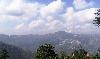
| Shimla  FeatureType : null Elevation : 2129 Lat/Lng : 31.1033 / 77.1722 | Shimla , also known as Simla, is the capital and the largest city of the northern Indian state of Himachal Pradesh. Shimla is also a district which is bounded by the state of Uttarakhand in the south-east, districts of Mandi and Kullu in the north, Kinnaur in the east, Sirmaur in the south and Solan (...) |
| 2 | 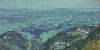
| Dharamshala FeatureType : null Elevation : 1322 Lat/Lng : 32.2167 / 76.3167 | Dharamshala (also spelled Dharamsala) is the district headquarters of Kangra district in India. It was formerly known as Bhagsu. The Dalai Lama's residence and the headquarters of the Central Tibetan Administration (the Tibetan government in exile) are in Dharamshala (...) |
| 3 | 
| Alappuzha FeatureType : null Elevation : 8 Lat/Lng : 9.4977 / 76.3385 | Alappuzha (pronunciation), also known by its former name Alleppey, is the administrative headquarters of Alappuzha District in the Indian State of Kerala. Alappuzha is a city and a municipality in Kerala with an urban population of 174,164http://www.censusindia.gov (...) |
| 4 | 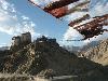
| Ladakh FeatureType : landmark Elevation : 3518 Lat/Lng : 34.17 / 77.58 | Ladakh ("land of high passes") is a region in the Indian state of Jammu and Kashmir that currently extends from the Siachen Glacier in the Karakoram range to the main Great Himalayas to the south, inhabited by people of Indo-Aryan and Tibetan descent (...) |
| 5 | 
| Friends FeatureType : null Elevation : 15 Lat/Lng : 40.7325 / -74.0055 | Friends is an American television sitcom, created by David Crane and Marta Kauffman, which aired on NBC from September 22, 1994, to May 6, 2004, lasting ten seasons. With an ensemble cast starring Jennifer Aniston, Courteney Cox, Lisa Kudrow, Matt LeBlanc, Matthew Perry and David Schwimmer, the show (...) |
| 6 | 
| Nagpur FeatureType : null Elevation : 320 Lat/Lng : 21.1539 / 79.0831 | Nagpur is the winter capital and the third largest city of the Indian state of Maharashtra after Mumbai and Pune. Nagpur is the 13th largest Indian city in terms of population. It has been proposed as one of the Smart Cities in Maharashtra (...) |
| 7 | 
| J. Edgar Hoover Building FeatureType : landmark Elevation : 23 Lat/Lng : 38.8952 / -77.025 | The J. Edgar Hoover Building is a low-rise office building located at 935 Pennsylvania Avenue NW in Washington, D.C., in the United States. It is the headquarters of the Federal Bureau of Investigation (FBI). Planning for the building began in 1962, and a site was formally selected in January 1963 (...) |
| 8 | Le Corbusier FeatureType : null Elevation : 58 Lat/Lng : 48.8519 / 2.2654 | Charles-Édouard Jeanneret (6 October 1887 – 27 August 1965), known as Le Corbusier , was a Swiss-French architect, designer, painter, urban planner, writer, and one of the pioneers of what is now called modern architecture. He was born in Switzerland and became a French citizen in 1930 (...) | |
| 9 | Dehradun FeatureType : null Elevation : 655 Lat/Lng : 30.3157 / 78.0336 | Dehradun or Dehra Dun is the provisional or temporary capital of Uttarakhand, a state in the northern part of India. Located in the Garhwal region, it lies north of India's capital New Delhi and from Chandigarh (...) | |
| 10 | Mandi district FeatureType : adm2nd Elevation : 838 Lat/Lng : 31.6836 / 76.9483 | Mandi district (earlier known as Mandavya Nagar) is one of the central districts of Himachal Pradesh state in northern India. Mandi town is the headquarters of Mandi district. The town has mythological and historical significance and boasts of a unique temple architecture (...) | |
| 11 | Kollam district FeatureType : null Lat/Lng : 8.8 / 76.6 | Kollam district (formerly Quilon) is one of 14 districts of the state of Kerala, India. The district has a cross-section of Kerala's natural attributes; it is endowed with a long coastline, a major Laccadive Sea seaport and an inland lake (Ashtamudi Lake). The district has many waterbodies (...) | |
| 12 | Panjab University FeatureType : edu Elevation : 354 Lat/Lng : 30.758 / 76.7682 | Panjab University(in Punjabi ਪੰਜਾਬ ਯੂਨੀਵਰਸਿਟੀ) is a public collegiate university located in Chandigarh, India. It originated in 1882, but was established in 1947, making it one of the oldest universities in India (...) | |
| 13 | Sahibzada Ajit Singh Nagar district FeatureType : null Elevation : 317 Lat/Lng : 30.69 / 76.72 | Sahibzada Ajit Singh Nagar district (SAS Nagar district) It’s Sahibzada Ajit Singh Nagar, not Ajitgarh: DC: Retrieved from : Nov 28 2014, also known as Ajitgarh district, or Mohali district is one of the twenty two districts of Punjab a state in north-west India (...) | |
| 14 | Communist Party of India (Marxist) FeatureType : null Elevation : 223 Lat/Lng : 28.6316 / 77.205 | The Communist Party of India (Marxist) (abbreviated CPI(M)) is a communist party in India. The party emerged from a split from the Communist Party of India in 1964. The CPI(M) was formed at the Seventh Congress of the Communist Party of India held in Calcutta from 31 October to 7 November 1964 (...) | |
| 15 | Gurdaspur district FeatureType : null Elevation : 254 Lat/Lng : 31.92 / 75.27 | Gurdaspur district is a district in the Majha region of the state of Punjab, situated in the northwest part of the Republic of India. Gurdaspur is the district headquarters. It internationally borders Narowal District of the Pakistani Punjab, the Punjab districts of Amritsar, Pathankot, Kapurthala (...) | |
| 16 | Reserve Bank of India FeatureType : null Elevation : 16 Lat/Lng : 18.9328 / 72.8369 | The Reserve Bank of India (RBI) is India's central banking institution, which controls the monetary policy of the Indian rupee. It commenced its operations on 1 April 1935 in accordance with the Reserve Bank of India Act, 1934 (...) | |
| 17 | Gandhinagar district FeatureType : adm2nd Elevation : 54 Lat/Lng : 23.2167 / 72.6833 | Gandhinagar district is an administrative division of Gujarat, India, whose headquarters are at Gandhinagar, the state capital. It was organized in 1964. It has an area of 649 km², and a population of 1,334,455 of which 35.02% were urban (2001 census) (...) | |
| 18 | Shimla district FeatureType : adm2nd Elevation : 2092 Lat/Lng : 31.1595 / 77.2167 | Shimla district of Himachal Pradesh lies between longitude 77.00" and 78.19" east and latitude 30.45" and 31.44" north, with its headquarters in Shimla. It is surrounded by Mandi and Kullu in the north, Kinnaur in the east, Uttarakhand in the southeast, Solan to the southwest and Sirmaur in the (...) | |
| 19 | Gujarat FeatureType : adm1st Elevation : 72 Lat/Lng : 23.22 / 72.68 | Gujarat (') is a state in Western IndiaOther sources: * * * and Northwest IndiaOther sources: * * *, a coastline of – most of which lies on the Kathiawar peninsula – and a population in excess of 60 million. It is the sixth largest Indian state by area and the ninth largest state by population (...) | |
| 20 | Rupnagar district FeatureType : null Elevation : 265 Lat/Lng : 30.97 / 76.51 | Rupnagar district is one of the twenty two districts in the state of Punjab in North-West Republic of India. The town of Rupnagar (formerly known as Rupar or Ropar) is said to have been founded by a Raja called Rokeshar, who ruled during the 11th century and named it after his son Rup Sen (...) | |
| 21 | Hoshiarpur district FeatureType : null Elevation : 368 Lat/Lng : 31.5833 / 75.9833 | Hoshiarpur District is a district of Punjab state in northern India. Hoshiarpur, one of the oldest districts of Punjab, is located in the North-east part of the Punjab state and shares common boundaries with Gurdaspur district in the north-west, Jalandhar and Kapurthala districts in south-west, (...) | |
| 22 | Jind district FeatureType : adm2nd Elevation : 226 Lat/Lng : 29.31 / 76.32 | Jind district is one of the 22 districts of Haryana state in northern India. Jind town is the administrative headquarters of the district. It is part of Hisar Division and was created in 1966. One of the first Sikh Kingdoms, Jind lies in the heart of Haryana and is the fourth district of the Jat (...) | |
| 23 | Sonipat district FeatureType : null Elevation : 230 Lat/Lng : 28.9833 / 77.0167 | Sonipat district is one of the 22 districts of Haryana state in northern India. Sonipat town is the district headquarters. It is a part of National Capital Region. The district borders Delhi union territory in south, Panipat District in the north, Jind District in the north-west, Uttar Pradesh state (...) | |
| 24 | Shaheed Bhagat Singh Nagar district FeatureType : null Elevation : 257 Lat/Lng : 31.1318 / 76.1333 | Shaheed Bhagat Singh Nagar district (formerly Nawanshahr district) is one of the districts in Doaba region of the state of Punjab in North-West Republic of India. It consists of three Sub -Divisions Nawanshahr, Banga and Balachaur (...) | |
| 25 | Saharanpur district FeatureType : adm2nd Elevation : 274 Lat/Lng : 29.9 / 77.6833 | Saharanpur district is the northernmost of the districts of Uttar Pradesh state, India. Bordering the states of Haryana, Himachal Pradesh and Uttarakhand, and close to the foothills of Shivalik range, it lies in the northern part of the Doab region. It is primarily an agricultural area (...) | |
| 26 | Gurgaon district FeatureType : adm2nd Elevation : 201 Lat/Lng : 28.25 / 77.1667 | Gurugram (also known as Gurgaon) district is one of the 22 Districts of Haryana in northern India. Gurugram city is the administrative headquarters of the district. District Magistrate & Deputy Commissioner of Gurgaon district is Vinay Pratap Singh, an IAS officer. The population is 15,14,085 (...) | |
| 27 | Sri Ganganagar FeatureType : null Elevation : 177 Lat/Lng : 29.9178 / 73.8817 | Sri Ganganagar is a planned city and the northern-most city of the Indian state of Rajasthan, near the borders of Rajasthan and Punjab states and the international border of India and Pakistan. It is the administrative headquarters of Sri Ganganagar district (...) | |
| 28 | Empire State Plaza FeatureType : landmark Elevation : 44 Lat/Lng : 42.6503 / -73.7597 | The Governor Nelson A. Rockefeller Empire State Plaza (known commonly as the Empire State Plaza, and also as the South Mall) is a complex of several state government buildings in downtown Albany, New York. The complex was built between 1965 and 1976 at an estimated total cost of $2 billion (...) | |
| 29 | Siachen conflict FeatureType : waterbody Elevation : 4765 Lat/Lng : 35.4672 / 77.05 | The Siachen conflict, sometimes referred to as the Siachen War, was a military conflict between India and Pakistan over the disputed Siachen Glacier region in Kashmir. A cease-fire went into effect in 2003. The contended area is nearly of territory (...) | |
| 30 | Smoking ban FeatureType : landmark Elevation : 522 Lat/Lng : 48.1402 / 11.5574 | Smoking bans (or smoke-free laws) are public policies, including criminal laws and occupational safety and health regulations, that prohibit tobacco smoking in workplaces and other public spaces. Legislation may also define smoking as more generally being the carrying or possessing of any lit (...) | |
| 31 | Amway FeatureType : landmark Elevation : 237 Lat/Lng : 42.9575 / -85.5443 | Amway (short for "American Way") is an American company specializing in the use of multi-level marketing to sell health, beauty, and home care products. The company was founded in 1959 by Jay Van Andel and Richard DeVos and is based in Ada, Michigan (...) | |
| 32 | 2018 Indian Premier League FeatureType : null Elevation : 8 Lat/Lng : 18.975 / 72.8258 | The 2018 season of the Indian Premier League, also known as IPL 11, was the eleventh season of the IPL, a professional Twenty20 cricket league established by the BCCI in 2007. The season, which is being held from 7 April to 27 May, saw the return of the Chennai Super Kings and the Rajasthan Royals (...) | |
| 33 | Rohtak district FeatureType : null Elevation : 223 Lat/Lng : 28.8333 / 76.6667 | Rohtak district considered as the heart of Haryana, is on the top of the 22 districts of Haryana state in Northern India. It is located in the southeast of Haryana and northwest of Delhi, bounded by Jind and Sonipat districts to the north, Jhajjar and Sonipat districts to the east, and Hissar, (...) | |
| 34 | Smiling Buddha FeatureType : event Elevation : 226 Lat/Lng : 27.0788 / 71.7224 | Smiling BuddhaThis test has many code names. Civilian scientists called it "Operation Smiling Buddha" and the Indian Army referred to it as Operation Happy Krishna. According to United States Military Intelligence, Operation Happy Krishna was the code name for the Indian Army's construction of the (...) | |
| 35 | Watts Towers FeatureType : landmark Elevation : 33 Lat/Lng : 33.9387 / -118.241 | The Watts Towers, Towers of Simon Rodia, or Nuestro Pueblo ("our town" in Spanish) are a collection of 17 interconnected sculptural towers, architectural structures, and individual sculptural features and mosaics within the site of the artist's original residential property in Watts, Los Angeles (...) | |
| 36 | Mawsynram FeatureType : null Elevation : 960 Lat/Lng : 25.28 / 91.35 | Mawsynram is a village in the East Khasi Hills district of Meghalaya state in north-eastern India, 65 kilometres from Shillong. Mawsynram receives one of the highest rainfalls in India. It is reportedly the wettest place on Earth, with an average annual rainfall of , but that claim is disputed by (...) | |
| 37 | Aulikaras FeatureType : null Elevation : 433 Lat/Lng : 24.07 / 75.08 | The Aulikaras were an ancient Indian clan. Two royal houses belonging to this clan ruled over the present-day western Malwa region of Madhya Pradesh state from c. 350 CE to 550 CE. Epigraphical discoveries have brought to light two distinct royal houses, who call themselves as the Aulikaras and (...) | |
| 38 | Ramnagar, Uttarakhand FeatureType : null Elevation : 364 Lat/Lng : 29.3925 / 79.1283 | Ramnagar is a small town and municipal board in the Nainital district of Uttarakhand, India. It is located approximately from Nainital, the headquarters of the district. Ramnagar is the gateway to the Corbett National Park, the oldest national park and a famous tourist destination of India (...) | |
| 39 | August 1965 FeatureType : null Lat/Lng : 15.1667 / 117.6667 | The following events occurred in August 1965: (...) | |
| 40 | Hindon Air Force Station FeatureType : null Elevation : 211 Lat/Lng : 28.7078 / 77.3389 | Air Force Station Hindon (Hindon AFS) (also Hindan) is an Indian Air Force base under the Western Air Command (WAC). It is the biggest and largest air base in Asia and 8th in the world. Its area measured 14 km rounded and . This base celebrates Air Force Day on 8 October (...) | |
| 41 | Gardhiwala FeatureType : null Elevation : 290 Lat/Lng : 31.7415 / 75.7557 | Gardhiwala is a city and a municipal council in Hoshiarpur district in the state of Punjab, India. (...) | |
| 42 | Loyola School, Thiruvananthapuram FeatureType : null Elevation : 45 Lat/Lng : 8.5422 / 76.9118 | Loyola School, Thiruvananthapuram, is a private Jesuit school for boys situated in a large, leafy campus in the suburb of Sreekariyam in Thiruvananthapuram (formerly Trivandrum) city, in the Indian state of Kerala. The school serves students from upper kindergarten to higher secondary level (...) | |
| 43 | India-based Neutrino Observatory FeatureType : mountain Elevation : 1328 Lat/Lng : 9.9667 / 77.2667 | India-based Neutrino Observatory (INO) is a particle physics research project under construction to primarily study atmospheric neutrinos in a deep cave under Ino Peak near Theni, Tamil Nadu, India. This project is notable in that it is anticipated to provide a precise measurement of neutrino mixing (...) | |
| 44 | Jawaharlal Nehru University FeatureType : null Elevation : 253 Lat/Lng : 28.5458 / 77.1703 | Jawaharlal Nehru University (JNU) is a public university located in New Delhi, India. (...) | |
| 45 | Tira Sujanpur FeatureType : null Elevation : 565 Lat/Lng : 31.8336 / 76.5054 | Sujanpur Tihra is a town and a Municipal council in Hamirpur district in the Indian state of Himachal Pradesh. (...) | |
| 46 | Point 5353 FeatureType : null Elevation : 5291 Lat/Lng : 34.525 / 75.6987 | Point 5353 (also called Point 17561, and Marpo La Peak) is a mountain peak on the Line of Control dividing the Indian- and Pakistani-administered portions of Kashmir in the vicinity of Drass in the Kargil district.: Description of the Cease-Fire Line: ".. (...) | |
| 47 | International University of Business Agriculture and Technology FeatureType : edu Elevation : 7 Lat/Lng : 23.8883 / 90.3909 | IUBAT—International University of Business Agriculture and Technology is also known as (IUBAT) is the first non-government university in Bangladesh. It was established in 1991 under the Private University Act 1992 (...) | |
| 48 | Atal Nagar FeatureType : null Elevation : 308 Lat/Lng : 21.161 / 81.787 | Atal Nagar (Formerly Naya Raipur) is a city located between National Highways NH-53 and NH-30, about 17 km south-east of the current capital Raipur; Swami Vivekananda Airport separates the old and new cities. Naya Raipur is serving as the administrative capital of the State and also caters to the (...) | |
| 49 | Chabbewal FeatureType : null Elevation : 307 Lat/Lng : 31.4455 / 75.9903 | Chabbewal is a town in the district of Hoshiarpur, Punjab, India, with a population of 5000. Chabbewal is situated just in the middle of Hoshiarpur and Mahilpur stretch about 10 km each side on State Highway 24 of the state Punjab that connect Dasuya, Pathankot to Chandigarh (...) | |
| 50 | UBIS University FeatureType : edu Elevation : 390 Lat/Lng : 46.2215 / 6.1486 | University of Business and International Studies (UBIS University) was founded in 2006 in Geneva, Switzerland. UBIS University is an internationally accredited Swiss private university and is part of the U.S. investment and advisory firm, Hamilton White (...) | |
| 51 | Shankar (village) FeatureType : null Elevation : 231 Lat/Lng : 31.1468 / 75.5207 | Shankar is a village in the Nakodar tehsil of Jalandhar district in Punjab, India. (...) | |
| 52 | Lion (disambiguation) FeatureType : null Lat/Lng : -66.6589 / 140.0147 | The lion is a big cat of the species Panthera leo that inhabits the African continent and one forest in India. Lion or Lions may also refer to: (...) | |
| 53 | Greenbelt Historic District FeatureType : null Elevation : 37 Lat/Lng : 39.0028 / -76.8911 | The Greenbelt Historic District is a national historic district located in Greenbelt, Prince George's County, Maryland, United States. The district preserves the center of one of the few examples of the Garden City Movement in the United States (...) | |
| 54 | Frances Newton (Mission) Hospital FeatureType : null Elevation : 201 Lat/Lng : 30.9406 / 74.6116 | Frances Newton Hospital, also called Mission Hospital, is a hospital in Ferozepur Cantonment. It was established in 1894. The hospital functions under the aegis of the CNI, Diocese of Chandigarh, with Rev. Joel Mall as the Bishop. The hospital is located on station road about 3 (...) | |
| 55 | Phase 9, Mohali FeatureType : null Elevation : 310 Lat/Lng : 30.6928 / 76.737 | Sector 63 (popularly known as Phase 9) is an important locality in Mohali famous for sports as Punjab Cricket Association, Stadium, International Hockey Stadium and Sports complex of Department of Sports is situated in this locality (...) | |
 by
by