| 40 records found in wikipedia | |||
| 1 | 
| Bangalore  FeatureType : city Elevation : 926 Lat/Lng : 12.9779 / 77.5925 | Bangalore , officially known as Bengaluru , is the capital of the Indian state of Karnataka. It has a population of over ten million, making it a megacity and the third most populous city and fifth most populous urban agglomeration in India. It is located in southern India on the Deccan Plateau (...) |
| 2 | Bangalore Rural district FeatureType : null Elevation : 914 Lat/Lng : 12.9811 / 77.5746 | Bengaluru Rural District is one of the 30 districts in Karnataka, India. It was formed in 1986, when Bengaluru was divided into Bengaluru (Rural) and Bengaluru (Urban). Presently in Bengaluru Rural district, there are 2 divisions, 4 Talukas, 35 Hoblis (cluster of villages), 1,713 inhabited and 177 (...) | |
| 3 | 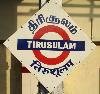
| Chennai International Airport FeatureType : airport Elevation : 11 Lat/Lng : 12.9944 / 80.1805 | Chennai International Airport is an international airport serving the city of Chennai, Tamil Nadu, India and its metropolitan area. It is located in Meenambakkam & Tirusulam, 21 km (13 mi) from the city centre. It is the 4th busiest airport in India behind Delhi, Mumbai and Bengaluru and the 52nd (...) |
| 4 | 
| Agra FeatureType : city Elevation : 167 Lat/Lng : 27.1767 / 78.005 | Agra is a city on the banks of the river Yamuna in the northern state of Uttar Pradesh, India. It is west of the state capital, Lucknow, south of the national capital New Delhi, 58 kilometres (31 mi) south of Mathura and north of Gwalior (...) |
| 5 | Dakshina Kannada FeatureType : null Elevation : 50 Lat/Lng : 12.84 / 75.29 | Dakshina Kannada is a district in the state of Karnataka in India. Sheltered by the Western Ghats on the east and surrounded by the Arabian Sea on the west, Dakshina Kannada receives abundant rainfall during the monsoon (...) | |
| 6 | Goethe-Institut FeatureType : landmark Elevation : 516 Lat/Lng : 48.1622 / 11.5449 | The Goethe-Institut (GI, "") is a non-profit German cultural association operational worldwide with 159 institutes, promoting the study of the German language abroad and encouraging international cultural exchange and relations. Around 246.000 people take part in these German courses per year (...) | |
| 7 | Bijapur district, Karnataka FeatureType : null Elevation : 608 Lat/Lng : 16.82 / 75.72 | Bijapur district, officially known as Vijayapura district, is a district in the state of Karnataka in India. The city of Bijapur is the headquarters of the district, and is located 530 km northwest of Bangalore (...) | |
| 8 | Tumakuru district FeatureType : null Elevation : 820 Lat/Lng : 13.34 / 77.1 | Tumakuru District is an administrative district in the state of Karnataka in India. It was formerly the part of old Mysuru State. It was formed in 1832 during the days of British commissioner of Mysuru Sir Mark Cubbon as Chitaldroog Division including the area of present Chitradurga and Tumakuru (...) | |
| 9 | Eluru FeatureType : city Elevation : 21 Lat/Lng : 16.7108 / 81.0944 | Eluru is a city and the district headquarters of West Godavari district in the Indian state of Andhra Pradesh. It is one of the 14 municipal corporations in the state and the mandal headquarters of Eluru mandal in the Eluru revenue division. The city is on the Tammileru river (...) | |
| 10 | IKEA FeatureType : landmark Elevation : 6 Lat/Lng : 52.1671 / 4.4824 | IKEA is a Swedish-founded multinational group that designs and sells , kitchen appliances and home accessories, among other useful goods and occasionally home services. It has been the world's largest furniture retailer since at least 2008 (...) | |
| 11 | Bidar FeatureType : city Elevation : 672 Lat/Lng : 17.9074 / 77.5271 | Bidar is a hill top city in the north-eastern part of Karnataka state in south India. It is the headquarters of the Bidar which borders Maharashtra and Telangana. It is a rapidly urbanising city in the wider Bidar Metropolitan area (...) | |
| 12 | Chamarajanagar district FeatureType : null Elevation : 875 Lat/Lng : 12.0 / 77.3 | Chamarajanagar is the southernmost district in the state of Karnataka, India. It was carved out of the original larger Mysore District in the year 1998. Chamarajanagar town is the headquarters of this district.http://chamrajnagar.nic.in/home (...) | |
| 13 | Ramanagara district FeatureType : null Elevation : 685 Lat/Lng : 12.72 / 77.2796 | Ramanagara district, is one of the 30 districts of Karnataka state in southern India. Ramanagara City is the administrative headquarters of this district. The district is part of Bengaluru Division. (...) | |
| 14 | Pune district FeatureType : adm3rd Elevation : 569 Lat/Lng : 18.53 / 73.84 | Pune is a District in the state of Maharashtra, India. Pune City Central is the District Headquarters. The district's population was 9,426,959 in the 2011 census, the fourth-most-populous of India's 640 districts. Its urban population is 58 (...) | |
| 15 | Saurashtra (region) FeatureType : null Elevation : 139 Lat/Lng : 22.3 / 70.7833 | Saurashtra, also known as Sorath or Kathiawar, is a peninsular region of Gujarat, India, located on the Arabian Sea coast. It covers about a third of Gujarat state, notably 11 districts of Gujarat, including Rajkot District. (...) | |
| 16 | Lalitpur district, India FeatureType : null Elevation : 361 Lat/Lng : 24.6902 / 78.416 | Lalitpur District is one of the districts of Uttar Pradesh state of India. Lalitpur district is a part of Jhansi Division. Lalitpur is the main town and administrative headquarters. The district occupies an area of 5,039 km² (...) | |
| 17 | Acharya Institute of Technology FeatureType : edu Elevation : 879 Lat/Lng : 13.0834 / 77.484 | Acharya Institute of Technology, or AIT, is a private co-educational engineering and management college in Bengaluru, India, affiliated with the Visvesvaraya Technological University (VTU) and accredited by the National Board of Accreditation (NBA) (...) | |
| 18 | Indian Super League FeatureType : null Elevation : 7 Lat/Lng : 22.5697 / 88.3697 | The Indian Super League (ISL) is a men's professional football league in India. For sponsorship reasons, the league is officially known as the Hero Indian Super League. One of the top football leagues in the country, it currently shares the top spot in the Indian football league system with the (...) | |
| 19 | Maersk FeatureType : landmark Elevation : 4 Lat/Lng : 55.688 / 12.5976 | A.P. Moller–Maersk Group , also known as simply Maersk, it is a Danish business conglomerate with activities in the transport, logistics and energy sectors. Maersk has been the largest container ship and supply vessel operator in the world since 1996 (...) | |
| 20 | Rayagada district FeatureType : null Elevation : 222 Lat/Lng : 19.166 / 83.416 | Rayagada is a mineral-rich district in the southern part of the state of Odisha, in India. The city Rayagada is its headquarters. Rayagada district got the status of a separate district with effect from 2 October 1992. The population of this district consists mainly of tribals (...) | |
| 21 | Bidar district FeatureType : null Elevation : 673 Lat/Lng : 17.9126 / 77.5144 | Bidar district is the northernmost part of the Karnataka state in India. Geographically, it resembles the "Crown of the State", occupying its northeastern end. It is bounded by Kamareddy and Sangareddy districts of Telangana state on the eastern side, Latur and Osmanabad districts of Maharashtra (...) | |
| 22 | Ballari district FeatureType : null Elevation : 452 Lat/Lng : 15.15 / 76.9333 | Ballari (pronounced) is a district in Karnataka state, India. Historical sites, farm land and rich minerals characterize Ballari district. It is also the home of the former capital of the famous Vijayanagara Empire, Vijayanagara, a UNESCO World Heritage Site (...) | |
| 23 | Flipkart FeatureType : null Elevation : 886 Lat/Lng : 12.9333 / 77.6944 | Flipkart Pvt Ltd. is an Indian electronic commerce company based in Bengaluru, India. Founded by Sachin Bansal and Binny Bansal in 2007, the company initially focused on book sales, before expanding into other product categories such as consumer electronics, fashion, and lifestyle products (...) | |
| 24 | Bannerghatta National Park FeatureType : null Elevation : 855 Lat/Lng : 12.7202 / 77.5877 | Bannerghatta National Park, near Bangalore, Karnataka, was founded in 1970 and declared as a national park in 1974. Karnataka.com Accessed 23 May 2014. In 2002 a portion of the park, became a biological reserve, the Bannerghatta Biological Park (...) | |
| 25 | Peter Sugandhar FeatureType : null Elevation : 530 Lat/Lng : 17.4456 / 78.4931 | B. P. SugandharThe Church of England Yearbook 2007, Volume 123, 2007, p.404. (28 September 1943 – 5 December 2017)Times of India Hyderabad edition, Former CSI moderator passes away, 7.12.2017. was the fifth successor of Frank Whittaker as Bishop - in - Medak of the Church of South India whose (...) | |
| 26 | West Bengal National University of Juridical Sciences FeatureType : edu Elevation : 2 Lat/Lng : 22.55 / 88.4 | The West Bengal National University of Juridical Sciences (WBNUJS or NUJS) is an autonomous law university offering courses at the undergraduate and postgraduate levels. It is in Salt Lake City of Kolkata, West Bengal, India (...) | |
| 27 | Aero India FeatureType : airport Elevation : 928 Lat/Lng : 13.1358 / 77.6075 | Aero India is a biennial air show and aviation exhibition held in Bengaluru, India at the Yelahanka Air Force Station. It is organised by the Defence Exhibition Organisation, Ministry of Defence. (...) | |
| 28 | Solar power in India FeatureType : null Elevation : 53 Lat/Lng : 18.2697 / 83.8093 | Solar power in India is a fast developing industry. The country's solar installed capacity reached 26 GW as of 30 September 2018. India expanded its solar-generation capacity 8 times from 2,650 MW on 26 May 2014 to over 20 GW as on 31 January 2018 (...) | |
| 29 | Jajmau FeatureType : null Elevation : 134 Lat/Lng : 26.46 / 80.35 | Jajmau also known as Jajesmow, is a suburb of Kanpur, India. It is situated on the banks of the Ganges River. Jajmau is an industrial suburb. It has the population of about 652,831 according to census 2011. It is believed to be the oldest inhabited place in the region (...) | |
| 30 | Indian Air Force FeatureType : null Elevation : 246 Lat/Lng : 31.4369 / 75.7558 | The Indian Air Force (IAF) is the air arm of the Indian armed forces. Its complement of personnel and aircraft assets ranks fourth amongst the airforces of the world. Its primary mission is to secure Indian airspace and to conduct aerial warfare during armed conflict (...) | |
| 31 | Nrityagram FeatureType : null Elevation : 892 Lat/Lng : 13.161 / 77.45 | Nrityagram is India's first modern Gurukul (residential school) for Indian classical dances and an intentional community in the form of a dance village, set up by Odissi dancer Protima Gauri in 1990. The residential school offers training in Indian classical dance forms, Odissi, Mohiniattam, Kathak, (...) | |
| 32 | Infibeam FeatureType : null Elevation : 54 Lat/Lng : 23.0233 / 72.5385 | Infibeam Avenues Limited is an Indian internet and e-commerce conglomerate involved in digital payments, online retailing, e-commerce software and internet services. The company is headquartered in Ahmedabad, India (...) | |
| 33 | Ecumenical Christian Centre FeatureType : null Elevation : 885 Lat/Lng : 12.975 / 77.7389 | Ecumenical Christian Centre (ECC) was founded in 1963 by a visionary by name M. A. Thomas. ECC is located in Whitefield in Bengaluru on a campus. (...) | |
| 34 | R. S. Krishnan FeatureType : null Elevation : 12 Lat/Lng : 10.4095 / 76.2685 | Rappal Sangameswaran Krishnan (23 September 1911 – 2 October 1999) was an Indian experimental physicist and scientist. He was the Head of the department of Physics at the Indian Institute of Science and the vice chancellor of the University of Kerala (...) | |
| 35 | Kuruvathi Basaveshwara temple FeatureType : null Elevation : 516 Lat/Lng : 14.78 / 75.7 | Shri Kuruvathi Basaveshwara temple at Kuruvathi (Kannada: ಕುರುವತ್ತಿ) is one of the ancient and historic temples at the extreme south-western corner of Hoovina Hadagali taluk, Bellary District, Karnataka, India. This temple is on the bank of Tungabhadra river, 10 km from Halavagalu and 2 km from (...) | |
| 36 | Amrita Vishwa Vidyapeetham FeatureType : null Elevation : 321 Lat/Lng : 10.9011 / 76.9028 | Amrita Vishwa Vidyapeetham is a multi-campus, multi-disciplinary research academia that is accredited 'A' by NAAC and is ranked as one of the best research institutions in India. Amrita is spread across six campuses in three states of India - Kerala, Tamil Nadu and Karnataka, with the headquarters (...) | |
| 37 | Larsen & Toubro FeatureType : null Elevation : 17 Lat/Lng : 18.935 / 72.8417 | Larsen & Toubro Limited, commonly known as L&T, is one of the largest Indian multi-national firms and leading construction company in India headquartered in Mumbai, Maharashtra, India. It was founded by two Danish engineers taking refuge in India (...) | |
| 38 | International Centre for Theoretical Sciences FeatureType : null Elevation : 883 Lat/Lng : 13.1463 / 77.5121 | The International Centre for Theoretical Sciences , a centre of the Tata Institute of Fundamental Research, is a research institute based in Bengaluru, India. Founded in 2007, ICTS has grown from a fledgling institution to a global centre of activity in various areas of science. Prof. Spenta R (...) | |
| 39 | Puttenahalli Lake (Yelahanka) FeatureType : waterbody Elevation : 899 Lat/Lng : 13.1111 / 77.5761 | Puttenahalli WS Lake is a 10-hectare water body near Yelahanka, 14 km north of Bangalore. It may soon become the first bird sanctuary in Karnataka. Biodiversity experts have discovered 49 species of birds breeding here (...) | |
| 40 | SGPTA PU College FeatureType : null Elevation : 918 Lat/Lng : 12.9348 / 77.57 | SGPTA PU College is a pre-university college in Bangalore, Karnataka, India.Retrieved from Google Maps https://www.google.com/maps/place/S.G.P.T.A/@12.9347577,77.5698349,101m/data=!3m1!1e3!4m12!1m6!3m5!1s0x0:0xa3008b42e0495bb9!2sS.G.P.T.A!8m2!3d12.9348014!4d77 (...) | |
 by
by