| 416 records found in wikipedia | |||
| 1 | 
| Vancouver International Airport  FeatureType : airport Elevation : 3 Lat/Lng : 49.1942 / -123.1844 | Vancouver International Airport is located on Sea Island in Richmond, British Columbia, Canada, about from Downtown Vancouver. It is the second busiest airport in Canada by aircraft movements (306,799) and passengers (24.0 million), behind Toronto Pearson International Airport (...) |
| 2 | 
| Sydney Airport FeatureType : airport Elevation : 2 Lat/Lng : -33.9455 / 151.1772 | Sydney (Kingsford Smith) Airport (colloquially Mascot Airport, Kingsford Smith Airport, or Sydney Airport; ;) is an international airport in Sydney, Australia located 8 km (5 mi) south of Sydney city centre, in the suburb of Mascot. The airport is owned by the ASX-listed Sydney Airport Group (...) |
| 3 | 
| Fort McMurray FeatureType : null Elevation : 253 Lat/Lng : 56.7266 / -111.379 | Fort McMurray is a population centre, technically classified as an urban service area, in the Regional Municipality (RM) of Wood Buffalo in Alberta, Canada. It is located in northeast Alberta, in the middle of the Athabasca oil sands, surrounded by boreal forest (...) |
| 4 | 
| Antarctic Peninsula FeatureType : null Lat/Lng : -69.5 / -65.0 | The Antarctic Peninsula is the northernmost part of the mainland of Antarctica, located at the base of the Southern Hemisphere. At the surface, it is the biggest, most prominent peninsula in Antarctica as it extends from a line between Cape Adams (Weddell Sea) and a point on the mainland south of (...) |
| 5 | 
| Saint Helena FeatureType : isle Elevation : 349 Lat/Lng : -15.9333 / -5.7167 | Saint Helena is a volcanic tropical island in the South Atlantic Ocean, east of Rio de Janeiro and 1,950 kilometres (1,210 mi) west of the Cunene River, which marks the border between Namibia and Angola in southwestern Africa (...) |
| 6 | 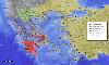
| Battle of Marathon FeatureType : landmark Elevation : 10 Lat/Lng : 38.1181 / 23.9783 | The Battle of Marathon (Greek: , Machē tou Marathōnos) took place in 490 BC, during the first Persian invasion of Greece. It was fought between the citizens of Athens, aided by Plataea, and a Persian force commanded by Datis and Artaphernes (...) |
| 7 | 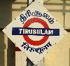
| Chennai International Airport FeatureType : airport Elevation : 11 Lat/Lng : 12.9944 / 80.1805 | Chennai International Airport is an international airport serving the city of Chennai, Tamil Nadu, India and its metropolitan area. It is located in Meenambakkam & Tirusulam, 21 km (13 mi) from the city centre. It is the 4th busiest airport in India behind Delhi, Mumbai and Bengaluru and the 52nd (...) |
| 8 | 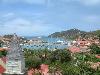
| Saint Barthélemy FeatureType : isle Elevation : 12 Lat/Lng : 17.8954 / -62.8276 | Saint Barthélemy , officially the Territorial collectivity of Saint-Barthélemy , called Ouanalao by the indigenous people, is an overseas collectivity of France in the West Indies. Often abbreviated to St-Barth in French, and St. Barths or St. Barts in English, R. P. Raymond BRETON (...) |
| 9 | 
| Google Earth FeatureType : landmark Elevation : 29 Lat/Lng : 44.88 / 10.4242 | Google Earth is a computer program that renders a 3D representation of Earth based on satellite imagery. The program maps the Earth by superimposing satellite images, aerial photography, and GIS data onto a 3D globe, allowing users to see cities and landscapes from various angles (...) |
| 10 | 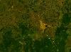
| Bangui FeatureType : city Elevation : 351 Lat/Lng : 4.3614 / 18.5553 | Bangui (or Bangî in Sango, formerly written Bangi in English) is the capital and largest city of the Central African Republic. it had an estimated population of 734,350. It was established as a French outpost in 1889 and named after its location on the northern bank of the Ubangi River ; the Ubangi (...) |
| 11 | 
| Palau FeatureType : country Elevation : 29 Lat/Lng : 7.4864 / 134.5533 | Palau (historically Belau, Palaos, or Pelew), officially the Republic of Palau , . (PDF). palauembassy.com. Retrieved 1 June 2013. is an island country located in the western Pacific Ocean. The country contains approximately 340 islands, forming the western chain of the Caroline Islands in (...) |
| 12 | 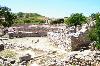
| Sevastopol FeatureType : city Elevation : 79 Lat/Lng : 44.595 / 33.5217 | Sevastopol (; ; ; , Aqyar) is the largest city on the Crimean Peninsula and a major Black Sea port. The city is administered as a federal city of the Russian Federation following Crimea's annexation by Russia in 2014, though Ukraine and most of the UN member countries continue to regard Sevastopol (...) |
| 13 | 
| Kwajalein Atoll FeatureType : null Lat/Lng : 8.7353 / 167.7239 | Kwajalein Atoll (; Marshallese:) is part of the Republic of the Marshall Islands (RMI). The southernmost and largest island in the atoll is named Kwajalein Island, which its majority English-speaking residents (about 1,000 mostly U.S. civilian personnel) often called by the shortened name, Kwaj (...) |
| 14 | 
| Papua New Guinea FeatureType : country Lat/Lng : -9.5 / 147.1167 | Papua New Guinea (PNG; , ; ;), officially the Independent State of Papua New Guinea, is an Oceanian country that occupies the eastern half of the island of New Guinea and its offshore islands in Melanesia, a region of the southwestern Pacific Ocean north of Australia (...) |
| 15 | 
| Newport News, Virginia FeatureType : null Elevation : 13 Lat/Lng : 37.0708 / -76.4844 | Newport News is an independent city in the U.S. state of Virginia. As of the 2010 census, the population was 180,719. In 2013, the population was estimated to be 183,412,. Virginia State 2013 Population Estimates Retrieved February 2, 2013 making it the fifth-most populous city in Virginia (...) |
| 16 | 
| Great Salt Lake FeatureType : waterbody Elevation : 1282 Lat/Lng : 41.12 / -112.5 | The Great Salt Lake, located in the northern part of the U.S. state of Utah, is the largest salt water lake in the Western Hemisphere, and the eighth-largest terminal lake in the world. In an average year the lake covers an area of around , but the lake's size fluctuates substantially due to its (...) |
| 17 | 
| Diego Garcia FeatureType : isle Elevation : 0 Lat/Lng : -7.3133 / 72.4111 | Diego Garcia is an atoll just south of the equator in the central Indian Ocean, and the largest of 60 small islands comprising the Chagos Archipelago. It was settled by the French in the 1790s and was transferred to British rule after the Napoleonic Wars (...) |
| 18 | 
| Tuvalu FeatureType : country Elevation : 8 Lat/Lng : -8.5208 / 179.1986 | Tuvalu (or), formerly known as the Ellice Islands, is a Polynesian island country located in the Pacific Ocean, situated in Oceania, about midway between Hawaii and Australia. It lies east-northeast of the Santa Cruz Islands (belonging to the Solomons), southeast of Nauru, south of Kiribati, west of (...) |
| 19 | 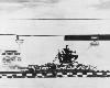
| Edwards Air Force Base FeatureType : landmark Elevation : 694 Lat/Lng : 34.9056 / -117.8836 | Edwards Air Force Base (AFB) is a United States Air Force installation located in Kern County in southern California, about northeast of Lancaster and east of Rosamond. It is the home of the Air Force Test Center, Air Force Test Pilot School, and NASA's Armstrong Flight Research Center (...) |
| 20 | 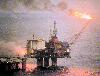
| Norway FeatureType : country Lat/Lng : 65.8333 / 13.4 | Norway (Norwegian: help=no (Bokmål) or (Nynorsk);), officially the Kingdom of Norway, is a Nordic country in Northwestern Europe whose core territory comprises the western and northernmost portion of the Scandinavian Peninsula; the remote island of Jan Mayen and the archipelago of Svalbard are also (...) |
| 21 | 
| San Francisco International Airport FeatureType : airport Elevation : 4 Lat/Lng : 37.6216 / -122.3827 | San Francisco International Airport is an international airport south of downtown San Francisco, California, United States, near Millbrae and San Bruno in unincorporated San Mateo County. It has flights to points throughout North America and is a major gateway to Europe and Asia (...) |
| 22 | 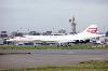
| Heathrow Airport FeatureType : airport Elevation : 26 Lat/Lng : 51.4784 / -0.4613 | Heathrow Airport (also known as London Heathrow) is a major international airport in London, United Kingdom. Heathrow is the second busiest airport in the world by international passenger traffic, as well as the busiest airport in Europe by passenger traffic, and the seventh busiest airport in the (...) |
| 23 | 
| Area 51 FeatureType : landmark Elevation : 1363 Lat/Lng : 37.2388 / -115.8105 | The United States Air Force facility commonly known as Area 51 is a highly classified remote detachment of Edwards Air Force Base, within the Nevada Test and Training Range. According to the Central Intelligence Agency (CIA), the correct names for the facility are Homey Airport and Groom Lake, (...) |
| 24 | 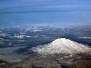
| Mount Adams (Washington) FeatureType : mountain Elevation : 3737 Lat/Lng : 46.2024 / -121.4909 | Mount Adams, known by some Native American tribes as Pahto or Klickitat, is a potentially active stratovolcano in the Cascade Range. Although Adams has not erupted in more than 1,000 years, it is not considered extinct. It is the second-highest mountain in the U.S (...) |
| 25 | 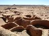
| Chile FeatureType : country Elevation : 543 Lat/Lng : -33.45 / -70.6667 | Chile , officially the Republic of Chile (RepChile.ogg), is a South American country occupying a long, narrow strip of land between the Andes to the east and the Pacific Ocean to the west. It borders Peru to the north, Bolivia to the northeast, Argentina to the east, and the Drake Passage in the far (...) |
| 26 | 
| Jamestown, Virginia FeatureType : landmark Elevation : 8 Lat/Lng : 37.2094 / -76.78 | The JamestownPreviously also written variously as James Town, James Towne, Jamestowne, and James City. settlement in the Colony of Virginia was the first permanent English settlement in the Americas. It was located on the east bank of the Powhatan (James) River about southwest of the center of (...) |
| 27 | 
| Kyrgyzstan FeatureType : country Elevation : 779 Lat/Lng : 42.8667 / 74.6 | Kyrgyzstan (;Or , or with the stress on the first syllable. See J. C. Wells, Longman Pronunciation Dictionary, 3rd ed. (Harlow, England: Pearson Education Ltd., 2008). Kyrgyzstan ; or Кыргызстан), officially the Kyrgyz Republic , and also known as Kirghizia, is a sovereign state in Central Asia (...) |
| 28 | 
| Northern Cyprus FeatureType : null Elevation : 243 Lat/Lng : 35.2667 / 33.55 | Northern Cyprus , officially the Turkish Republic of Northern Cyprus (TRNC;), is a de facto state that comprises the northeastern portion of the island of Cyprus. Recognised only by Turkey, Northern Cyprus is considered by the international community to be part of the Republic of Cyprus (...) |
| 29 | 
| Asheville, North Carolina FeatureType : city Elevation : 633 Lat/Lng : 35.58 / -82.5558 | Asheville is a city and the county seat of Buncombe County, North Carolina, United States. It is the largest city in Western North Carolina, and the 12th-most populous city in the U.S. state of North Carolina. The city's population was 89,121 according to 2016 estimates.https://www.census (...) |
| 30 | 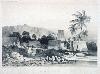
| Fiji FeatureType : country Elevation : 175 Lat/Lng : -17.8133 / 179.4122 | Fiji (; ; Fiji Hindi: फ़िजी), officially the Republic of FijiIn February 2011, the Prime Minister's Office issued a statement saying that the name of the state had been officially changed from the Republic of the Fiji Islands to the Republic of Fiji, and that the name written in the 1997 (...) |
| 31 | 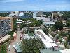
| Darwin, Northern Territory FeatureType : city Elevation : 30 Lat/Lng : -12.4362 / 130.8412 | Darwin Macquarie Dictionary, Fourth Edition (2005). Melbourne, The Macquarie Library Pty Ltd. is the capital city of the Northern Territory of Australia. Situated on the Timor Sea, Darwin is the largest city in the sparsely populated Northern Territory, with a population of 145,916 (...) |
| 32 | 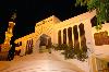
| Maldives FeatureType : country Elevation : 8 Lat/Lng : 4.1743 / 73.51 | The Maldives (; Dhivehi Raa'jey), officially the Republic of Maldives, is a South Asian country, located in the Indian Ocean, situated in the Arabian Sea. It lies southwest of Sri Lanka and India. The chain of 26 atolls stretches from Ihavandhippolhu Atoll in the north to the Addu City in the south (...) |
| 33 | 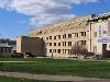
| Carnegie Mellon University FeatureType : edu Elevation : 292 Lat/Lng : 40.4433 / -79.9436 | Carnegie Mellon University (CMU) is a private nonprofit research university based in Pittsburgh, Pennsylvania. Founded in 1900 by Andrew Carnegie as the Carnegie Technical Schools, the university became the Carnegie Institute of Technology in 1912 and began granting four-year degrees (...) |
| 34 | 
| Chernobyl disaster FeatureType : event Elevation : 149 Lat/Lng : 51.3896 / 30.0991 | The Chernobyl disaster, also referred to as the Chernobyl accident, was a catastrophic nuclear accident. It occurred on 25–26 April 1986 in the No. 4 light water graphite moderated reactor at the Chernobyl Nuclear Power Plant near the now-abandoned town of Pripyat, in northern Ukrainian Soviet (...) |
| 35 | 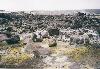
| Kīlauea FeatureType : mountain Elevation : 1231 Lat/Lng : 19.421 / -155.287 | Kīlauea is a currently active shield volcano in the Hawaiian Islands, and the most active of the five volcanoes that together form the island of Hawaii. Located along the southern shore of the island, the volcano is between 300,000 and 600,000 years old and emerged above sea level about 100,000 (...) |
| 36 | 
| Ely, Cambridgeshire FeatureType : null Elevation : 21 Lat/Lng : 52.3996 / 0.262 | Ely is a cathedral city in Cambridgeshire, England, about north-northeast of Cambridge and about by road from London. Æthelthryth (also known as Etheldreda) founded an abbey at Ely in 673; the abbey was destroyed in 870 by Danish invaders and was rebuilt by Æthelwold, Bishop of Winchester, in 970 (...) |
| 37 | 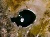
| Mono Lake FeatureType : waterbody Elevation : 1948 Lat/Lng : 38.0166 / -119.0093 | Mono Lake is a large, shallow saline soda lake in Mono County, California, formed at least 760,000 years ago as a terminal lake in an endorheic basin. The lack of an outlet causes high levels of salts to accumulate in the lake. These salts also make the lake water alkaline (...) |
| 38 | 
| Bulgaria FeatureType : country Elevation : 414 Lat/Lng : 42.65 / 25.4 | Bulgaria (; , tr. '), officially the Republic of Bulgaria (tr. '), is a country in southeastern Europe. It is bordered by Romania to the north, Serbia and Macedonia to the west, Greece and Turkey to the south, and the Black Sea to the east (...) |
| 39 | 
| Coney Island FeatureType : landmark Elevation : 4 Lat/Lng : 40.574 / -73.978 | Coney Island is a peninsular residential neighborhood, beach, and leisure/entertainment destination of Long Island on the Coney Island Channel, which is part of the Lower Bay in the southwestern part of the borough of Brooklyn in New York City (...) |
| 40 | 
| Vietnam FeatureType : country Elevation : 934 Lat/Lng : 16.1667 / 107.8333 | Vietnam , officially the Socialist Republic of Viet Nam , is the easternmost country on the Indochina Peninsula. With an estimated million inhabitants , it is the world's 15th-most-populous country, and the ninth-most-populous Asian country (...) |
| 41 | 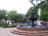
| Atlanta FeatureType : null Elevation : 335 Lat/Lng : 33.755 / -84.39 | Atlanta is the capital of, and the most populous city in, the U.S. state of Georgia. With an estimated 2017 population of 486,290, it is also the 39th most-populous city in the United States. The city serves as the cultural and economic center of the Atlanta metropolitan area, home to 5 (...) |
| 42 | 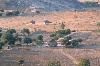
| Zimbabwe FeatureType : country Elevation : 1487 Lat/Lng : -17.8268 / 31.0553 | Zimbabwe , officially the Republic of Zimbabwe, is a landlocked country located in southern Africa, between the Zambezi and Limpopo Rivers, bordered by South Africa, Botswana, Zambia and Mozambique. The capital and largest city is Harare (...) |
| 43 | 
| Somalia FeatureType : country Elevation : 273 Lat/Lng : 6.1833 / 47.0 | Somalia , officially the Federal Republic of SomaliaThe Federal Republic of Somalia is the country's name per Article 1 of the . , is a sovereign state with its territory located in the Horn of Africa. It is bordered by Ethiopia to the west, Djibouti to the northwest, the Gulf of Aden to the north, (...) |
| 44 | 
| Carthage FeatureType : null Elevation : 47 Lat/Lng : 36.8528 / 10.3233 | Carthage (; , ', "New City"; ; , Qarṭāj) was the center or capital city of the ancient Carthaginian civilization, on the eastern side of the Lake of Tunis in what is now the Tunis Governorate in Tunisia. The city developed from a Phoenician colony into the capital of an empire dominating the (...) |
| 45 | 
| Tabriz FeatureType : null Elevation : 1396 Lat/Lng : 38.08 / 46.2919 | Tabriz is the most populated city in Iranian Azerbaijan, one of the historical capitals of Iran and the present capital of East Azerbaijan province. Located in the Quru River valley, between long ridges of volcanic cones in the Sahand and Eynali mountains, Tabriz's elevation ranges between above sea (...) |
| 46 | 
| Dubai FeatureType : adm1st Elevation : 4 Lat/Lng : 25.205 / 55.2698 | Dubai is the largest and most populous city in the United Arab Emirates (UAE). On the southeast coast of the Persian Gulf, it is the capital of the Emirate of Dubai, one of the seven emirates that make up the country.The Government and Politics of the Middle East and North Africa. D Long, B Reich. p (...) |
| 47 | 
| Santa Barbara, California FeatureType : null Elevation : 42 Lat/Lng : 34.4258 / -119.7142 | Santa Barbara (Spanish for "Saint Barbara") is the county seat of Santa Barbara County in the U.S. state of California. Situated on a south-facing section of coastline, the longest such section on the West Coast of the United States, the city lies between the steeply rising Santa Ynez Mountains and (...) |
| 48 | 
| London Borough of Croydon FeatureType : adm1st Elevation : 153 Lat/Lng : 51.3333 / -0.0833 | The London Borough of Croydon (pronunciation) is a London borough in south London, England and is part of Outer London. It covers an area of and is the largest London borough by population. It is the southernmost borough of London (...) |
| 49 | 
| Atlantic City, New Jersey FeatureType : city Lat/Lng : 39.3773 / -74.4511 | Atlantic City is a resort city in Atlantic County, New Jersey, United States, known for its casinos, boardwalk, and beaches. In 2010, it had a population of 39,558. , New Jersey Department of Labor and Workforce Development, February 2011. Accessed June 19, 2013., United States Census Bureau (...) |
| 50 | 
| Sweden FeatureType : country Lat/Lng : 63.0 / 16.0 | Sweden , officially the Kingdom of Sweden (Swedish: Konungariket Sverige), is a Scandinavian Nordic country in Northern Europe. It borders Norway to the west and north and Finland to the east, and is connected to Denmark in the southwest by a bridge-tunnel across the Öresund, a strait at the (...) |
| 51 | 
| Georgia (country) FeatureType : country Elevation : 659 Lat/Lng : 42.0167 / 43.7333 | Georgia is a country in the Caucasus region of Eurasia. Located at the crossroads of Western Asia and Eastern Europe, it is bounded to the west by the Black Sea, to the north by Russia, to the south by Turkey and Armenia, and to the southeast by Azerbaijan. The capital and largest city is Tbilisi (...) |
| 52 | 
| Cambodia FeatureType : city Elevation : 15 Lat/Lng : 11.55 / 104.9167 | Cambodia (; also Kampuchea ; ;), officially the Kingdom of Cambodia , is a country located in the southern portion of the Indochina peninsula in Southeast Asia. It is in area, bordered by Thailand to the northwest, Laos to the northeast, Vietnam to the east and the Gulf of Thailand to the southwest (...) |
| 53 | 
| Russia FeatureType : country Elevation : 157 Lat/Lng : 55.75 / 37.6167 | Russia , officially the Russian Federation"The names Russian Federation and Russia shall be equal". , is a country in Eurasia. At , Russia is the largest country in the world by area, covering more than one-eighth of the Earth's inhabited land area, and the ninth most populous, with about 144 (...) |
| 54 | 
| Trenton, New Jersey FeatureType : city Elevation : 18 Lat/Lng : 40.2237 / -74.764 | Trenton is the capital city of the U.S. state of New Jersey and the county seat of Mercer County., New Jersey Department of State. Accessed July 10, 2017. It was briefly the capital of the United States. The city's metropolitan area is grouped with the New York metropolitan area by the United States (...) |
| 55 | 
| São Paulo FeatureType : null Elevation : 765 Lat/Lng : -23.5477 / -46.6364 | São Paulo is a municipality in the Southeast Region of Brazil. The metropolis is an alpha global city (as listed by the GaWC) and the most populous city in Brazil, the Western Hemisphere and the Southern Hemisphere, besides being the largest Portuguese-speaking city in the world (...) |
| 56 | 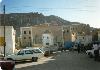
| Yemen FeatureType : country Elevation : 711 Lat/Lng : 15.8134 / 47.7905 | Yemen , officially known as the Republic of Yemen , is a country at the southern end of the Arabian Peninsula. Yemen is the second-largest Arab sovereign state in the peninsula, occupying . The coastline stretches for about (...) |
| 57 | 
| Jomo Kenyatta International Airport FeatureType : landmark Elevation : 1616 Lat/Lng : -1.3192 / 36.9275 | Jomo Kenyatta International Airport is an international airport in Nairobi, the capital of and largest city in Kenya. Located in the Embakasi suburb southeast of Nairobi's central business district, the airport has scheduled flights to destinations in over 50 countries (...) |
| 58 | 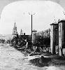
| Mount Pelée FeatureType : mountain Elevation : 1234 Lat/Lng : 14.817 / -61.167 | Mount Pelée (pronounced ; meaning "bald mountain" or "peeled" mountain") is an active volcano at the northern end of Martinique, an island and French overseas department in the Lesser Antilles island arc of the Caribbean (...) |
| 59 | 
| Glendora, California FeatureType : null Elevation : 244 Lat/Lng : 34.1308 / -117.8542 | Glendora is a city in the San Gabriel Valley in Los Angeles County, California, east of downtown Los Angeles. As of the 2010 census, the population of Glendora was 50,073. Known as the "Pride of the Foothills", Glendora is nestled in the foothills of the San Gabriel Mountains (...) |
| 60 | 
| Alert, Nunavut FeatureType : null Lat/Lng : 82.5014 / -62.3389 | Alert, in the Qikiqtaaluk Region, Nunavut, Canada, is the northernmost permanently inhabited place in the world, ("Twice a year, the military resupply Alert, the world's northernmost settlement.") at latitude 82°30'05" north, from the North Pole (...) |
| 61 | 
| ITER FeatureType : city Elevation : 310 Lat/Lng : 43.705 / 5.7692 | ITER (International Thermonuclear Experimental Reactor) is an international nuclear fusion research and engineering megaproject, which will be the world's largest magnetic confinement plasma physics experiment. It is an experimental tokamak nuclear fusion reactor that is being built next to the (...) |
| 62 | 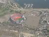
| Shea Stadium FeatureType : landmark Elevation : 8 Lat/Lng : 40.7558 / -73.8482 | Shea Stadium (; formally known as William A. Shea Municipal Stadium) was a stadium in Flushing Meadows–Corona Park, Queens, New York City. of the dedication handout that shows the stadium is in Flushing Meadows–Corona Park (...) |
| 63 | 
| High Frequency Active Auroral Research Program FeatureType : landmark Lat/Lng : 62.392 / -145.151 | The High Frequency Active Auroral Research Program (HAARP) was initiated as an ionospheric research program jointly funded by the U.S. Air Force, the U.S. Navy, the University of Alaska Fairbanks, and the Defense Advanced Research Projects Agency (DARPA) (...) |
| 64 | 
| TWA Flight 800 FeatureType : event Lat/Lng : 40.6503 / -72.6333 | Trans World Airlines Flight 800 (TWA 800) was a Boeing 747-100 that exploded and crashed into the Atlantic Ocean near East Moriches, New York, on July 17, 1996, at about 8:31 p.m. EDT, 12 minutes after takeoff from John F (...) |
| 65 | 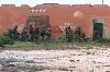
| Battle of Mogadishu (1993) FeatureType : landmark Elevation : 67 Lat/Lng : 2.0525 / 45.3247 | The Battle of Mogadishu, or Day of the Rangers , was part of Operation Gothic Serpent. It was fought on 3–4 October 1993, in Mogadishu, Somalia, between forces of the United States—supported by UNOSOM II—and Somali militiamen loyal to the self-proclaimed president-to-be Mohamed Farrah Aidid, who had (...) |
| 66 | 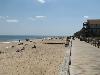
| Bethany Beach, Delaware FeatureType : city Elevation : 5 Lat/Lng : 38.5394 / -75.0553 | Bethany Beach is an incorporated town in Sussex County, Delaware, United States. According to the 2010 Census Bureau figures, the population of the town is 1,060; however, during the summer months some 15,000 more populate the town as vacationers., Graeme Browning, Washington Post, July 22, 1989 (...) |
| 67 | 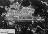
| Loring Air Force Base FeatureType : airport Elevation : 222 Lat/Lng : 46.9497 / -67.8889 | Loring Air Force Base was a United States Air Force installation in northeastern Maine, near Limestone and Caribou in Aroostook County. It was one of the largest bases of the U.S. Air Force's Strategic Air Command during its existence, and was transferred to the newly created Air Combat Command in (...) |
| 68 | 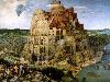
| Tower of Babel FeatureType : city Elevation : 33 Lat/Lng : 32.5363 / 44.4208 | The Tower of Babel (Migdal Bavel) as told in Genesis 11:1-9 is an origin myth meant to explain why the world's peoples speak different languages. According to the story, a united humanity in the generations following the Great Flood, speaking a single language and migrating eastward, comes to the (...) |
| 69 | 
| Genting Highlands FeatureType : null Elevation : 1734 Lat/Lng : 3.424 / 101.7919 | Resorts World Genting (Abbreviation: RWG), originally known as Genting Highlands Resort is an integrated hill resort development comprising hotels, shopping malls, theme parks and casinos, perched on the peak of Mount Ulu Kali at 1,800 meters high and nestled near the border between the states of (...) |
| 70 | 
| SS Edmund Fitzgerald FeatureType : landmark Elevation : 179 Lat/Lng : 46.9985 / -85.1102 | SS Edmund Fitzgerald was an American Great Lakes freighter that sank in a Lake Superior storm on November 10, 1975, with the loss of the entire crew of 29. When launched on June 7, 1958, she was the largest ship on North America's Great Lakes, and she remains the largest to have sunk there (...) |
| 71 | 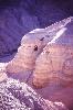
| Qumran FeatureType : landmark Elevation : -338 Lat/Lng : 31.7408 / 35.4586 | Qumran is an archaeological site in the West Bank managed by Israel's Qumran National Park. It is located on a dry plateau about from the northwestern shore of the Dead Sea, near the Israeli settlement and kibbutz of Kalya (...) |
| 72 | 
| Green Bank Telescope FeatureType : landmark Elevation : 809 Lat/Lng : 38.4331 / -79.8398 | The Robert C. Byrd Green Bank Telescope (GBT) in Green Bank, West Virginia, US is the world's largest fully steerable radio telescope. The Green Bank site was part of the National Radio Astronomy Observatory (NRAO) until September 30, 2016 (...) |
| 73 | 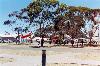
| Woomera, South Australia FeatureType : city Elevation : 168 Lat/Lng : -31.1986 / 136.8253 | Woomera, officially Woomera Village, is a town located in the Far North region of South Australia in Australia, approximately north of Adelaide. In common usage, "Woomera" also refers to the wider RAAF Woomera Range Complex (WRC), a large Australian Defence Force aerospace and systems testing range (...) |
| 74 | 
| New Carissa FeatureType : null Lat/Lng : 43.3987 / -124.3118 | MV New Carissa was a freighter that ran aground on a beach near Coos Bay, Oregon, United States, during a storm in February 1999 and subsequently broke apart. An attempt to tow the bow section of the ship out to sea failed when the tow line broke, and the bow was grounded again (...) |
| 75 | 
| Great Neck, New York FeatureType : null Elevation : 32 Lat/Lng : 40.7872 / -73.7272 | Great Neck is a region on Long Island, New York, that covers a peninsula on the North Shore, which includes 9 villages, such as the villages of Great Neck, Great Neck Estates, Great Neck Plaza, a number of unincorporated areas, as well as an area south of the peninsula near Lake Success and the (...) |
| 76 | 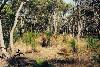
| Palm Island, Queensland FeatureType : null Elevation : 56 Lat/Lng : -18.7333 / 146.5833 | Palm Island is an Aboriginal community located on Great Palm Island, also called by the Aboriginal name "Bwgcolman", an island on the Great Barrier Reef in North Queensland, AustraliaBindloss, Joseph (2002) page 330 The settlement is also known by a variety of other names including "the Mission", (...) |
| 77 | German Air Force FeatureType : null Elevation : 33 Lat/Lng : 51.6675 / 6.275 | The German Air Force (German: Luftwaffe , the German-language generic term for air force) is the aerial warfare branch of the Bundeswehr, the armed forces of Germany. With a strength of 27,704 personnel (30 June 2018), it is the fourth largest air force within the European Union, after the air (...) | |
| 78 | 
| Rogue wave FeatureType : null Lat/Lng : 58.1887 / 2.4667 | Rogue waves (also known as freak waves, monster waves, episodic waves, killer waves, extreme waves, and abnormal waves) are large, unexpected and suddenly appearing surface waves that can be extremely dangerous, even to large ships such as ocean liners (...) |
| 79 | Russian Railways FeatureType : null Elevation : 156 Lat/Lng : 55.7667 / 37.65 | Russian Railways is a Russian fully state-owned vertically integrated company, both managing infrastructure and operating freight and passenger train services. The company was established on September 18, 2003, when a decree was passed to separate the railways from the (dissolved in 2004) (...) | |
| 80 | King Fahd International Airport FeatureType : airport Elevation : 20 Lat/Lng : 26.4712 / 49.7986 | King Fahd International Airport (KFIA) is an airport in Dammam, Saudi Arabia northwest of Dammam, Saudi Arabia. The airport's basic infrastructure was complete by the end of 1990, which allowed the Allied forces engaged in the first Gulf War in early 1991 to use the field for the storage of military (...) | |
| 81 | Nunavut FeatureType : adm1st Lat/Lng : 73.0 / -91.0 | Nunavut (; ; Inuktitut syllabics) is the newest, largest, and northernmost territory of Canada. It was separated officially from the Northwest Territories on April 1, 1999, via the Nunavut Act and the Nunavut Land Claims Agreement Act, though the boundaries had been contemplatively drawn in 1993 (...) | |
| 82 | 
| SL-1 FeatureType : landmark Elevation : 1541 Lat/Lng : 43.5182 / -112.8237 | The SL-1, or Stationary Low-Power Reactor Number One, was a United States Army experimental nuclear power reactor in the United States which underwent a steam explosion and meltdown on January 3, 1961, killing its three operators (...) |
| 83 | North Cascades National Park FeatureType : null Elevation : 2795 Lat/Lng : 48.4831 / -120.9115 | North Cascades National Park is an American national park in the state of Washington. At more than , North Cascades National Park is the largest of the three National Park Service units that comprise the North Cascades National Park Complex (...) | |
| 84 | AOL FeatureType : landmark Elevation : 47 Lat/Lng : 40.7308 / -73.9914 | AOL (stylized as Aol., formerly a company known as AOL Inc. and originally known as America Online) is a web portal and online service provider based in New York City. It is a brand marketed by Oath, a subsidiary of Verizon Communications (...) | |
| 85 | SpaceX FeatureType : landmark Elevation : 26 Lat/Lng : 33.9207 / -118.3278 | Space Exploration Technologies Corp., doing business as SpaceX, is a private American aerospace manufacturer and space transportation services company headquartered in Hawthorne, California. It was founded in 2002 by entrepreneur Elon Musk with the goal of reducing space transportation costs and (...) | |
| 86 | Intel FeatureType : landmark Elevation : 9 Lat/Lng : 37.3879 / -121.9635 | Intel Corporation (commonly known as Intel and stylized as intel) is an American multinational corporation and technology company headquartered in Santa Clara, California, in the Silicon Valley. It is the world's second largest and second highest valued semiconductor chip maker based on revenue (...) | |
| 87 | Dallas/Fort Worth International Airport FeatureType : null Elevation : 185 Lat/Lng : 32.8968 / -97.038 | Dallas/Fort Worth International Airport is the primary international airport serving the Dallas–Fort Worth metroplex area in the U.S. state of Texas. It is the largest hub for American Airlines, which is headquartered near the airport (...) | |
| 88 | Shenandoah National Park FeatureType : null Elevation : 1057 Lat/Lng : 38.5153 / -78.4375 | Shenandoah National Park (often) is a national park that encompasses part of the Blue Ridge Mountains in the U.S. state of Virginia. The park is long and narrow, with the broad Shenandoah River and Valley on the west side, and the rolling hills of the Virginia Piedmont on the east (...) | |
| 89 | Idaho Falls, Idaho FeatureType : null Elevation : 1442 Lat/Lng : 43.4917 / -112.0325 | Idaho Falls is the county seat of Bonneville County, Idaho, United States, and the state's largest city outside the Boise metropolitan area. As of the 2010 census, the population of Idaho Falls was 56,813 (2016 estimate: 60,211), with a metro population of 133,265 (...) | |
| 90 | Operation Crossroads FeatureType : landmark Lat/Lng : 11.6 / 165.5 | Operation Crossroads was a pair of nuclear weapon tests conducted by the United States at Bikini Atoll in mid-1946. They were the first nuclear weapon tests since Trinity in July 1945, and the first detonations of nuclear devices since the atomic bombing of Nagasaki on August 9, 1945 (...) | |
| 91 | Tampa International Airport FeatureType : null Elevation : 18 Lat/Lng : 27.9756 / -82.5333 | Tampa International Airport is an international airport six miles west of Downtown Tampa, in Hillsborough County, Florida, United States. The airport is publicly owned by Hillsborough County Aviation Authority (HCAA) (...) | |
| 92 | Coos Bay, Oregon FeatureType : city Elevation : 29 Lat/Lng : 43.3764 / -124.2372 | Coos Bay (Coos language: Atsixiis) is a city located in Coos County, Oregon, United States, where the Coos River enters Coos Bay on the Pacific Ocean. The city borders the city of North Bend, and together they are often referred to as one entity called either Coos Bay-North Bend or Oregon's Bay Area (...) | |
| 93 | Nuclear weapons testing FeatureType : null Elevation : 1224 Lat/Lng : 37.0114 / -116.0598 | Nuclear weapons tests are experiments carried out to determine the effectiveness, yield, and explosive capability of nuclear weapons. Throughout the twentieth century, most nations that developed nuclear weapons tested them (...) | |
| 94 | Germanwings Flight 9525 FeatureType : event Elevation : 1667 Lat/Lng : 44.2818 / 6.4402 | Germanwings Flight 9525 was a scheduled international passenger flight from Barcelona–El Prat Airport in Spain to Düsseldorf Airport in Germany. The flight was operated by Germanwings, a low-cost carrier owned by the German airline Lufthansa (...) | |
| 95 | April 2015 Nepal earthquake FeatureType : null Elevation : 1384 Lat/Lng : 28.23 / 84.731 | The April 2015 Nepal earthquake (also known as the Gorkha earthquake) killed nearly 9,000 people and injured nearly 22,000. It occurred at on 25 April 2015, with a magnitude of 7.8Mw or 8.1Ms and a maximum Mercalli Intensity of VIII (Severe) (...) | |
| 96 | Fat Man FeatureType : landmark Elevation : 7 Lat/Lng : 32.7738 / 129.8632 | "Fat Man" was the codename for the nuclear bomb that was detonated over the Japanese city of Nagasaki by the United States on 9 August 1945. It was the second of the only two nuclear weapons ever used in warfare, the first being Little Boy, and its detonation marked the third nuclear explosion in (...) | |
| 97 | Mindanao FeatureType : null Elevation : 396 Lat/Lng : 7.5439 / 124.9406 | Mindanao or still commonly known as Southern Philippines, is the second largest island in the Philippines. Mindanao and the smaller islands surrounding it make up the island group of the same name. Located in the southern region of the archipelago, as of the 2010 census, the main island was (...) | |
| 98 | Garland, Texas FeatureType : city Elevation : 171 Lat/Lng : 32.9072 / -96.6353 | Garland is a city in the U.S. state of Texas. It is a large city located northeast of Dallas and is a part of the Dallas–Fort Worth metroplex. It is located almost entirely within Dallas County, except a small portion located in Collin and Rockwall Counties (...) | |
| 99 | Colorado Plateau FeatureType : null Elevation : 1509 Lat/Lng : 37.0 / -110.0 | The Colorado Plateau, also known as the Colorado Plateau Province, is a physiographic and desert region of the Intermontane Plateaus, roughly centered on the Four Corners region of the southwestern United States (...) | |
| 100 | Glacier National Park (U.S.) FeatureType : null Elevation : 2033 Lat/Lng : 48.6953 / -113.718 | Glacier National Park is an American national park located in northwestern Montana, on the Canada–United States border, adjacent to the Canadian provinces of Alberta and British Columbia. The park encompasses over and includes parts of two mountain ranges (sub-ranges of the Rocky Mountains), over (...) | |
| 101 | Vandenberg Air Force Base FeatureType : airport Elevation : 94 Lat/Lng : 34.7373 / -120.5843 | Vandenberg Air Force Base is a United States Air Force Base northwest of Lompoc, California. It is under the jurisdiction of the 30th Space Wing, Air Force Space Command (AFSPC). Vandenberg AFB is a Department of Defense space and missile testing base, with a mission of placing satellites into polar (...) | |
| 102 | Battle of Plataea FeatureType : landmark Elevation : 308 Lat/Lng : 38.2275 / 23.2886 | The Battle of Plataea was the final land battle during the second Persian invasion of Greece. It took place in 479 BC near the city of Plataea in Boeotia, and was fought between an alliance of the Greek city-states (including Sparta, Athens, Corinth and Megara), and the Persian Empire of Xerxes I (...) | |
| 103 | Chechnya FeatureType : adm1st Elevation : 199 Lat/Lng : 43.4 / 45.7167 | Chechnya (; ; , Noxçiyçö), officially the Chechen Republic (; ; , Noxçiyn Respublika), is a federal subject (a republic) of Russia. It is located in the North Caucasus, situated in the southernmost part of Eastern Europe, and within of the Caspian Sea (...) | |
| 104 | Battle of Salamis FeatureType : event Lat/Lng : 37.9514 / 23.5667 | The Battle of Salamis (; , Naumachia tēs Salaminos) was a naval battle fought between an alliance of Greek city-states under Themistocles and the Persian Empire under King Xerxes in 480 BC which resulted in a decisive victory for the outnumbered Greeks (...) | |
| 105 | Wrangell–St. Elias National Park and Preserve FeatureType : null Lat/Lng : 62.2908 / -145.1225 | Wrangell–St. Elias National Park and Preserve is an American national park and preserve managed by the National Park Service in south central Alaska. The park and preserve were established in 1980 by the Alaska National Interest Lands Conservation Act (...) | |
| 106 | Apple Inc. FeatureType : landmark Elevation : 69 Lat/Lng : 37.3318 / -122.0312 | Apple Inc. is an American multinational technology company headquartered in Cupertino, California, that designs, develops, and sells consumer electronics, computer software, and online services. The company's hardware products include the iPhone smartphone, the iPad tablet computer, the Mac personal (...) | |
| 107 | Berlin Tegel Airport FeatureType : airport Elevation : 32 Lat/Lng : 52.5597 / 13.2877 | Berlin Tegel "Otto Lilienthal" Airport is the main international airport of Berlin, the federal capital of Germany. It formerly served West Berlin. The airport is named after Otto Lilienthal and is the fourth busiest airport in Germany with just over 20.7 million passengers in 2014 (...) | |
| 108 | Cisco Systems FeatureType : null Elevation : 7 Lat/Lng : 37.4084 / -121.9541 | Cisco Systems, Inc. is an American multinational technology conglomerate headquartered in San Jose, California, in the center of Silicon Valley, that develops, manufactures and sells networking hardware, telecommunications equipment and other high-technology services and products (...) | |
| 109 | Colorado River FeatureType : null Elevation : 1 Lat/Lng : 31.9 / -114.9508 | The Colorado River is one of the principal rivers of the Southwestern United States and northern Mexico (the other being the Rio Grande). The river drains an expansive, arid watershed that encompasses parts of seven U.S. and two Mexican states (...) | |
| 110 | Boston Marathon bombing FeatureType : event Elevation : 10 Lat/Lng : 42.3498 / -71.0789 | During the annual Boston Marathon on April 15, 2013, two homemade pressure cooker bombs detonated 12 seconds and apart at 2:49 p.m., near the finish line of the race, killing three people and injuring several hundred others, including 16 who lost limbs (...) | |
| 111 | Southeast Asia FeatureType : country Elevation : 3 Lat/Lng : 12.0 / 105.1 | Southeast Asia or Southeastern Asia is a subregion of Asia, consisting of the countries that are geographically south of Japan and China, east of India, west of Papua New Guinea, and north of Australia. Southeast Asia is bordered to the north by East Asia, to the west by South Asia and the Bay of (...) | |
| 112 | Tesla, Inc. FeatureType : null Elevation : 60 Lat/Lng : 37.3947 / -122.1503 | Tesla, Inc. (formerly Tesla Motors, Inc.) is an American automotive and energy company based in Palo Alto, California. The company specializes in electric car manufacturing and, through its SolarCity subsidiary, solar panel manufacturing (...) | |
| 113 | Quincy, Massachusetts FeatureType : null Elevation : 17 Lat/Lng : 42.2528 / -71.0028 | Quincy is the largest city in Norfolk County, Massachusetts, United States. It is part of Metropolitan Boston and one of Boston's immediate southern suburbs. Its population in 2014 was 93,397, making it the eighth largest city in the state (...) | |
| 114 | Sonoma County, California FeatureType : adm2nd Elevation : 35 Lat/Lng : 38.51 / -122.93 | Sonoma County is a county in the U.S. state of California. As of the 2010 United States Census, its population was 483,878. Its county seat and largest city is Santa Rosa. It is to the north of Marin County and the south of Mendocino County. It is west of Napa County and Lake County (...) | |
| 115 | University of Miami FeatureType : edu Elevation : 15 Lat/Lng : 25.7216 / -80.2793 | The University of Miami (informally referred to as UM, U of M, or The U) is a private, nonsectarian research university in Coral Gables, Florida, United States. , the university enrolls 17,003 studentshttps://welcome.miami.edu/about-um/fast-facts/student-enrollment/index (...) | |
| 116 | Everglades National Park FeatureType : landmark Elevation : 4 Lat/Lng : 25.3167 / -80.9333 | Everglades National Park is an American national park that protects the southern twenty percent of the original Everglades in Florida. The park is the largest tropical wilderness in the United States, and the largest wilderness of any kind east of the Mississippi River (...) | |
| 117 | National Weather Service FeatureType : landmark Elevation : 114 Lat/Lng : 38.9917 / -77.03 | The National Weather Service (NWS) is an agency of the United States federal government that is tasked with providing weather forecasts, warnings of hazardous weather, and other weather-related products to organizations and the public for the purposes of protection, safety, and general information (...) | |
| 118 | Sawtooth National Forest FeatureType : adm1st Elevation : 2838 Lat/Lng : 43.7333 / -114.6667 | Sawtooth National Forest is a National Forest that covers 2,110,408 acres (854,052 ha) in the U.S. states of Idaho (~96 percent) and Utah (~4 percent). Managed by the U.S. Forest Service in the U.S. Department of Agriculture, it was originally named the Sawtooth Forest Reserve in a proclamation (...) | |
| 119 | RMS Lusitania FeatureType : landmark Lat/Lng : 51.4167 / -8.55 | RMS Lusitania was a British ocean liner and briefly the world's largest passenger ship. The ship was sunk on 7 May 1915 by a German U-boat off the southern coast of Ireland. The sinking presaged the United States declaration of war on Germany in 1917 (...) | |
| 120 | Six Flags Magic Mountain FeatureType : landmark Elevation : 338 Lat/Lng : 34.427 / -118.597 | Six Flags Magic Mountain is a amusement park located in the Santa Clarita, California neighborhood of Valencia, northwest of downtown Los Angeles that opened on May 30, 1971, as Magic Mountain, a development of the Newhall Land and Farming Company (...) | |
| 121 | Central Intelligence Agency FeatureType : landmark Elevation : 73 Lat/Lng : 38.9521 / -77.1452 | The Central Intelligence Agency (CIA) is a civilian foreign intelligence service of the Federal government of the United States, tasked with gathering, processing, and analyzing national security information from around the world, primarily through the use of human intelligence (HUMINT) (...) | |
| 122 | Oberlin College FeatureType : landmark Elevation : 250 Lat/Lng : 41.2929 / -82.2186 | Oberlin College is a private liberal arts college in Oberlin, Ohio. Founded as the Oberlin Collegiate Institute in 1833 by John Jay Shipherd and Philo Stewart, it is the oldest coeducational liberal arts college in the United States and the second oldest continuously operating coeducational (...) | |
| 123 | Fire Island FeatureType : isle Elevation : 2 Lat/Lng : 40.653 / -73.126 | Fire Island is the large center island of the outer barrier islands parallel to the south shore of Long Island, New York. The island is approximately long and varies between wide. Its land area is .Consisting of the Fire Island CDP plus the villages of Saltaire and Ocean Beach: Fire Island is part (...) | |
| 124 | Siege of Vicksburg FeatureType : event Elevation : 86 Lat/Lng : 32.3436 / -90.8511 | The Siege of Vicksburg (May 18 – July 4, 1863) was the final major military action in the Vicksburg Campaign of the American Civil War. In a series of maneuvers, Union Maj. Gen. Ulysses S. Grant and his Army of the Tennessee crossed the Mississippi River and drove the Confederate Army of (...) | |
| 125 | Far North Region, Cameroon FeatureType : null Elevation : 321 Lat/Lng : 11.0 / 14.5 | The Far North Region, also known as the Extreme North Region (from), is the northernmost constituent province of the Republic of Cameroon. It borders the North Region to the south, Chad to the east, and Nigeria to the west. The capital is Maroua (...) | |
| 126 | Jules Dumont d'Urville FeatureType : null Lat/Lng : -66.6053 / 140.0667 | Jules Sébastien César Dumont d'Urville (; 23 May 1790 – 8 May 1842) was a French explorer, naval officer and rear admiral, who explored the south and western Pacific, Australia, New Zealand and Antarctica. As a botanist and cartographer he gave his name to several seaweeds, plants and shrubs, and (...) | |
| 127 | Soviet Union FeatureType : null Elevation : 157 Lat/Lng : 55.75 / 37.6167 | The Union of Soviet Socialist Republics (USSR), commonly known as the Soviet Union and known outside as Russia, was a socialist state in Eurasia that existed from 30 December 1922 to 26 December 1991.Television documentary from CC&C Ideacom Production,"Apocalypse Never-Ending War 1918-1926", part 2, (...) | |
| 128 | 1989 Loma Prieta earthquake FeatureType : null Elevation : 303 Lat/Lng : 37.04 / -121.877 | The 1989 Loma Prieta earthquake occurred in Northern California on October 17 at local time (1989-10-18 00:04 UTC). The shock was centered in The Forest of Nisene Marks State Park approximately northeast of Santa Cruz on a section of the San Andreas Fault System and was named for the nearby Loma (...) | |
| 129 | 2011 Norway attacks FeatureType : event Elevation : 39 Lat/Lng : 59.915 / 10.7458 | The 2011 Norway attacks, referred to in Norway as 22 July , the date of the events, were two sequential lone wolf terrorist attacks by Anders Behring Breivik against the government, the civilian population, and a Workers' Youth League (AUF) summer camp. 77 people were killed (...) | |
| 130 | Empire of Japan FeatureType : null Elevation : 13 Lat/Lng : 35.6833 / 139.7667 | The was the historical nation-state and great power that existed from the Meiji Restoration in 1868 to the enactment of the 1947 constitution of modern Japan. Japan's rapid industrialization and militarization under the slogan led to its emergence as a world power and the establishment of a colonial (...) | |
| 131 | Packard FeatureType : null Elevation : 196 Lat/Lng : 42.3796 / -83.0289 | Packard was an American luxury automobile marque built by the Packard Motor Car Company of Detroit, Michigan, United States. The first Packard automobiles were produced in 1899, and the last Detroit-built Packard in 1956, when they built the Packard Predictor, their last concept car (...) | |
| 132 | Vichy France FeatureType : country Elevation : 249 Lat/Lng : 46.1667 / 3.4 | Vichy France is the common name of the French State (État français) headed by Marshal Philippe Pétain during World War II. Evacuated from Paris to Vichy in the unoccupied "Free Zone" (zone libre) in the southern part of metropolitan France which included French Algeria, it remained responsible for (...) | |
| 133 | Royal Canadian Mounted Police FeatureType : landmark Elevation : 63 Lat/Lng : 45.42 / -75.66 | The Royal Canadian Mounted Police (RCMP; , "Royal Gendarmerie of Canada"; colloquially known as The "Mounties", and internally as "the Force") is the federal and national police force of Canada. The RCMP provides law enforcement at the federal level (...) | |
| 134 | Croatian Army FeatureType : null Elevation : 83 Lat/Lng : 45.4667 / 18.8 | The Croatian Army, ((HV)) or Croatian Ground Army, (HKoV)) is the largest and most significant component of the Croatian Armed Forces (CAF). (...) | |
| 135 | Lansing, Michigan FeatureType : city Elevation : 254 Lat/Lng : 42.7335 / -84.5467 | Lansing is the capital of the U.S. state of Michigan. It is mostly in Ingham County, although portions of the city extend west into Eaton County and north into Clinton County. The 2010 Census placed the city's population at 114,297, making it the fifth largest city in Michigan (...) | |
| 136 | Eleventh Air Force FeatureType : null Elevation : 8 Lat/Lng : 51.8778 / -176.6425 | The Eleventh Air Force (11 AF) is a Numbered Air Force of the United States Air Force Pacific Air Forces (PACAF). It is headquartered at Joint Base Elmendorf–Richardson, Alaska.This unit is not related to the Eleventh Air Force headquartered in Pennsylvania described below (...) | |
| 137 | Trams in Frankfurt am Main FeatureType : railwaystation Elevation : 108 Lat/Lng : 50.1078 / 8.6647 | The Frankfurt am Main tramway network is a network of tramways forming a major part of the public transport system in Frankfurt am Main, a city in the federal state of Hesse, Germany. , there were 10 tram lines, along with two special lines and one heritage tourist tramline (...) | |
| 138 | Nelson Mandela FeatureType : null Elevation : 834 Lat/Lng : -31.8061 / 28.6146 | Nelson Rolihlahla Mandela (; ; 18 July 1918 – 5 December 2013) was a South African anti-apartheid revolutionary, political leader, and philanthropist who served as President of South Africa from 1994 to 1999. He was the country's first black head of state and the first elected in a fully (...) | |
| 139 | Twitter FeatureType : null Elevation : 38 Lat/Lng : 37.7768 / -122.4166 | Twitter, Inc. is an American online news and social networking service on which users post and interact with messages known as "tweets". Tweets were originally restricted to 140 characters, but on November 7, 2017, this limit was doubled for all languages except Chinese, Japanese, and Korean (...) | |
| 140 | Northeastern University FeatureType : edu Elevation : 12 Lat/Lng : 42.3389 / -71.0903 | Northeastern University (NU, formerly NEU) is a private research university in Boston, Massachusetts, established in 1898. It is categorized as an R1 institution (Doctoral Universities: Highest Research Activity) by the Carnegie Classification of Institutions of Higher Education (...) | |
| 141 | Tet Offensive FeatureType : adm1st Elevation : 18 Lat/Lng : 11.0 / 107.0 | The Tet Offensive , or officially called The General Offensive and Uprising of Tet Mau Than 1968 by North Vietnam and the Viet Cong, was one of the largest military campaigns of the Vietnam War, launched on January 30, 1968, by forces of the Viet Cong and North Vietnamese People's Army of Vietnam (...) | |
| 142 | German Aerospace Center FeatureType : landmark Elevation : 494 Lat/Lng : 48.3218 / 10.8354 | The German Aerospace Center , abbreviated DLR, is the national center for aerospace, energy and transportation research of the Federal Republic of Germany. Its headquarters are located in Cologne and it has multiple other locations throughout Germany (...) | |
| 143 | Rutgers University FeatureType : edu Elevation : 18 Lat/Lng : 40.7416 / -74.1749 | Rutgers, The State University of New Jersey , commonly referred to as Rutgers University, Rutgers, or RU, is a public research university in the U.S. state of New Jersey. It is the largest institution of higher education in New Jersey (...) | |
| 144 | 
| Safeguard Program FeatureType : null Elevation : 1010 Lat/Lng : 48.2877 / -111.3423 | The Safeguard Program was a U.S. Army anti-ballistic missile (ABM) system designed to protect the U.S. Air Force's Minuteman ICBM silos from attack, thus preserving the US's nuclear deterrent fleet. It was intended primarily to protect against the very small Chinese ICBM fleet, limited Soviet (...) |
| 145 | Colorado State University FeatureType : landmark Elevation : 1532 Lat/Lng : 40.5748 / -105.081 | Colorado State University (also referred to as Colorado State, State, and CSU) is a public research university located in Fort Collins, in the U.S. state of Colorado. The university is the state's land grant university, and the flagship university of the Colorado State University System (...) | |
| 146 | Huntington, West Virginia FeatureType : null Elevation : 173 Lat/Lng : 38.413 / -82.4336 | Huntington is a city in Cabell County and Wayne County in the U.S. state of West Virginia. It is the county seat of Cabell County, and largest city in the Huntington-Ashland, WV-KY-OH Metropolitan Statistical Area, sometimes referred to as the Tri-State Area (...) | |
| 147 | 2010 Polish Air Force Tu-154 crash FeatureType : landmark Elevation : 257 Lat/Lng : 54.8239 / 32.0513 | On 10 April 2010, a Tupolev Tu-154 aircraft of the Polish Air Force crashed near the city of Smolensk, Russia, killing all 96 people on board. Among the victims were the President of Poland Lech Kaczyński and his wife Maria, the former President of Poland in exile Ryszard Kaczorowski, the chief of (...) | |
| 148 | The Blitz FeatureType : null Elevation : 10 Lat/Lng : 51.5 / -0.12 | The Blitz was a German bombing offensive against Britain in 1940 and 1941, during the Second World War. The term was first used by the British press and is the German word for 'lightning'. The Germans conducted mass air attacks against industrial targets, towns, and cities, beginning with raids on (...) | |
| 149 | Wilhelm Reich FeatureType : null Elevation : 474 Lat/Lng : 44.991 / -70.7139 | Wilhelm Reich (; ; 24 March 1897 – 3 November 1957) was an Austrian doctor of medicine and psychoanalyst, a member of the second generation of analysts after Sigmund Freud.Danto 2007, p. . The author of several influential books, most notably Character Analysis (1933), The Mass Psychology of Fascism (...) | |
| 150 | Baker County, Florida FeatureType : adm2nd Elevation : 44 Lat/Lng : 30.32 / -82.27 | Baker County is a county in the U.S. state of Florida. As of the 2010 census, the population was 27,115. Its county seat is Macclenny. The county was founded in 1861 and is named for James McNair Baker, a judge and Confederate Senator (...) | |
| 151 | Lincoln, New Hampshire FeatureType : city Elevation : 256 Lat/Lng : 44.045 / -71.6706 | Lincoln is a town in Grafton County, New Hampshire, United States. It is the second-largest town by area in New Hampshire. The population was 1,662 at the 2010 census.United States Census Bureau, , 2010 Census figures. Retrieved March 23, 2011 (...) | |
| 152 | Tongass National Forest FeatureType : landmark Elevation : 71 Lat/Lng : 56.75 / -133.0 | The Tongass National Forest in Southeast Alaska is the largest national forest in the United States at . Most of its area is part of the temperate rain forest WWF ecoregion, itself part of the larger Pacific temperate rain forest WWF ecoregion, and is remote enough to be home to many species of (...) | |
| 153 | SES S.A. FeatureType : landmark Elevation : 277 Lat/Lng : 49.6942 / 6.33 | SES S.A. is a communications satellite owner and operator providing video and data connectivity worldwide to broadcasters, content and internet service providers, mobile and fixed network operators, governments and institutions, with a mission to “connect, enable, and enrich”. SES Company Brochure (...) | |
| 154 | United States Naval Research Laboratory FeatureType : landmark Elevation : 7 Lat/Lng : 38.8239 / -77.0225 | The United States Naval Research Laboratory (NRL) is the corporate research laboratory for the United States Navy and the United States Marine Corps. It conducts basic scientific research, applied research, technological development and prototyping (...) | |
| 155 | Ulithi FeatureType : isle Lat/Lng : 9.97 / 139.67 | Ulithi (or Yapese Dictionary: English Finderlist. Updated 27 July 2012. Retrieved 25 November 2013.) is an atoll in the Caroline Islands of the western Pacific Ocean, about east of Yap. It consists of 40 islets totalling , surrounding a lagoon about long and up to wide—at one of the largest in the (...) | |
| 156 | 
| Kebira Crater FeatureType : landmark Elevation : 557 Lat/Lng : 24.6799 / 24.977 | __NOTOC__ Kebira Crater is the name given to a circular topographic feature that was identified in 2007 by Farouk El-Baz and Eman Ghoneim using satellite imagery, Radarsat-1, and Shuttle Radar Topography Mission (SRTM) data in the Sahara desert (...) |
| 157 | Olympiapark (Munich) FeatureType : landmark Elevation : 552 Lat/Lng : 48.17 / 11.5517 | The Olympiapark München (English: Olympic Park Munich) in Munich, Germany, is an Olympic Park which was constructed for the 1972 Summer Olympics. Located in the Oberwiesenfeld neighborhood of Munich, the Park continues to serve as a venue for cultural, social, and religious events, such as events of (...) | |
| 158 | CIM-10 Bomarc FeatureType : null Elevation : 358 Lat/Lng : 46.4294 / -79.4711 | The Boeing CIM-10 Bomarc (IM-99 Weapon System prior to September 1962) was a supersonic long-range surface-to-air missile (SAM) used during the Cold War for the air defense of North America. In addition to being the first operational long-range SAM, it was the only SAM deployed by the United States (...) | |
| 159 | Wethersfield, Connecticut FeatureType : null Elevation : 19 Lat/Lng : 41.7142 / -72.6525 | Wethersfield is a town in Hartford County, Connecticut, United States. It is located immediately south of Hartford along the Connecticut River. Its population was 26,668 in the 2010 census. Many records from colonial times spell the name "Weathersfield" and "Wythersfield", while Native Americans (...) | |
| 160 | SRI International FeatureType : landmark Elevation : 18 Lat/Lng : 37.4566 / -122.1753 | SRI International (SRI) is an American nonprofit scientific research institute and organization headquartered in Menlo Park, California. The trustees of Stanford University established SRI in 1946 as a center of innovation to support economic development in the region (...) | |
| 161 | Birmingham–Shuttlesworth International Airport FeatureType : airport Elevation : 188 Lat/Lng : 33.5639 / -86.7522 | Birmingham–Shuttlesworth International Airport , formerly Birmingham Municipal Airport and later Birmingham International Airport, is a joint civil-military airport serving the city of Birmingham, Alabama and its metropolitan area, including Tuscaloosa, in the United States (...) | |
| 162 | Sony Mobile FeatureType : landmark Elevation : 526 Lat/Lng : 48.1368 / 11.6881 | Sony Mobile Communications Inc. is a multinational telecommunications company founded on October 1, 2001 as a joint venture between Sony and Ericsson, headquartered in Tokyo, Japan and wholly owned by Sony. It was originally incorporated as Sony Ericsson Mobile Communications, and headquartered in (...) | |
| 163 | Dhemaji district FeatureType : adm3rd Elevation : 106 Lat/Lng : 27.4798 / 94.5511 | Dhemaji district (Pron:deɪˈmɑ:ʤi or di:ˈmɑ:ʤi) is an administrative district in the state of Assam in India. The district headquarters are located at Dhemaji. The district occupies an area of 3237 km² and has a population of 686,133 (as of 2011) (...) | |
| 164 | University of Texas at San Antonio FeatureType : edu Elevation : 308 Lat/Lng : 29.5871 / -98.6194 | The University of Texas at San Antonio (UTSA)The terms "Texas-San Antonio" and "UT-San Antonio" are discouraged. "". UTSA.edu. is a state research university in San Antonio, Texas, United States. With nearly 31,000 students, it is the largest university in San Antonio and the eighth-largest (2014) (...) | |
| 165 | Colebrook, New Hampshire FeatureType : city Elevation : 314 Lat/Lng : 44.8944 / -71.4958 | Colebrook is a town in Coos County, New Hampshire, United States. The population was 2,301 at the 2010 census.United States Census Bureau, , 2010 Census figures. Retrieved March 23, 2011. Situated in the Great North Woods Region, it is bounded on the west by the Connecticut River and home to Beaver (...) | |
| 166 | New Center, Detroit FeatureType : city Elevation : 216 Lat/Lng : 42.3693 / -83.077 | New Center is a commercial and residential historic district located uptown in Detroit, Michigan, adjacent to Midtown, one mile (1.6 km) north of the Cultural Center, and approximately three miles (5 km) north of Downtown (...) | |
| 167 | Chapman University FeatureType : edu Elevation : 69 Lat/Lng : 33.7928 / -117.8514 | Chapman University is a private university in Orange, California, the largest in the county. Chapman University offers 110 areas of study (49 majors and 61 minors), and encompasses ten schools and colleges: Dodge College of Film and Media Arts, Wilkinson College of Humanities and Social Sciences, (...) | |
| 168 | Photovoltaics FeatureType : null Elevation : 1292 Lat/Lng : 37.55 / 105.0539 | Photovoltaics (PV) is the conversion of light into electricity using semiconducting materials that exhibit the photovoltaic effect, a phenomenon studied in physics, photochemistry, and electrochemistry. A photovoltaic system employs solar panels, each comprising a number of solar cells, which (...) | |
| 169 | Special member state territories and the European Union FeatureType : null Elevation : 54 Lat/Lng : 57.9058 / 27.7132 | The special territories of the European Union are 31 territories of EU member states which, for historical, geographical, or political reasons, enjoy special status within or outside the European Union. The special territories divided themselves in two categories: 9 Outermost Regions (OMR) that form (...) | |
| 170 | JAXA FeatureType : null Elevation : 265 Lat/Lng : 35.0006 / 139.0072 | The is the Japanese national aerospace and space agency. Through the merger of three previously independent organizations, JAXA was formed on 1 October 2003. JAXA is responsible for research, technology development and launch of satellites into orbit, and is involved in many more advanced missions (...) | |
| 171 | Eritrean–Ethiopian War FeatureType : null Elevation : 1867 Lat/Lng : 15.0 / 39.0 | The Eritrean–Ethiopian War, one of the conflicts in the Horn of Africa, took place between Ethiopia and Eritrea from May 1998 to June 2000, with the final peace only agreed to in 2018, twenty years after the initial confrontation (...) | |
| 172 | Hoonah, Alaska FeatureType : null Elevation : 34 Lat/Lng : 58.1094 / -135.4364 | Hoonah (Xunaa in Tlingit) is a largely Tlingit community on Chichagof Island, located in Alaska's panhandle in the southeast region of the state. It is west of Juneau, across the Alaskan Inside Passage. Hoonah is the only first-class city on Chichagof Island, the 109th largest island in the world (...) | |
| 173 | Roman Catholic Archdiocese of Miami FeatureType : null Elevation : 9 Lat/Lng : 25.8517 / -80.2008 | The Archdiocese of Miami is a particular church of the Roman Catholic Church in the United States of America. Its ecclesiastic territory includes Broward, Miami-Dade, and Monroe counties in the U.S. state of Florida (...) | |
| 174 | Southern Ontario FeatureType : adm1st Elevation : 305 Lat/Lng : 44.0 / -80.0 | Southern Ontario is a primary region of the province of Ontario, Canada, the other primary region being Northern Ontario. It is the most densely populated and southernmost region in Canada. The exact northern boundary of Southern Ontario is disputed, however the core region is situated south of (...) | |
| 175 | National Transportation Safety Board FeatureType : null Elevation : 23 Lat/Lng : 38.8836 / -77.0244 | The National Transportation Safety Board (NTSB) is an independent U.S. government investigative agency responsible for civil transportation accident investigation. In this role, the NTSB investigates and reports on aviation accidents and incidents, certain types of highway crashes, ship and marine (...) | |
| 176 | Society for Worldwide Interbank Financial Telecommunication FeatureType : landmark Elevation : 88 Lat/Lng : 50.7343 / 4.4785 | The Society for Worldwide Interbank Financial Telecommunication (SWIFT) provides a network that enables financial institutions worldwide to send and receive information about financial transactions in a secure, standardized and reliable environment (...) | |
| 177 | Human rights in North Korea FeatureType : null Elevation : 250 Lat/Lng : 39.4462 / 126.1632 | Human rights in North Korea are severely limited. Despite numerous rights being de jure guaranteed by the country's constitution, human rights groups such as Amnesty International and nations such as the United States have asserted that in practice, there is no de facto right to free speech, and the (...) | |
| 178 | Buran programme FeatureType : landmark Elevation : 140 Lat/Lng : 45.9281 / 63.2981 | The Buran programme ("Snowstorm" or "Blizzard"), also known as the "VKK Space Orbiter programme" ("VKK" is for , "Air Space Ship"), was a Soviet and later Russian reusable spacecraft project that began in 1974 at the Central Aerohydrodynamic Institute in Moscow and was formally suspended in 1993 (...) | |
| 179 | Alberta Highway 63 FeatureType : null Elevation : 645 Lat/Lng : 54.0372 / -113.0257 | Alberta Provincial Highway No. 63, commonly referred to as Highway 63, is a highway in northern Alberta, Canada that connects the Athabasca oil sands and Fort McMurray to Edmonton via Highway 28. It begins as a two-lane road near the hamlet of Radway where it splits from Highway 28, running north (...) | |
| 180 | Uruguayan Air Force Flight 571 FeatureType : landmark}} Elevation : 3599 Lat/Lng : -34.765 / -70.2864 | Uruguayan Air Force Flight 571 was a chartered flight that crashed on a glacier at an elevation of in the remote Andes. Among the 45 people on board, 28 survived the initial crash. Facing starvation and death, the survivors reluctantly resorted to cannibalism (...) | |
| 181 | Rocky Mountain Trench FeatureType : landmark Elevation : 976 Lat/Lng : 54.4999 / -122.503 | The Rocky Mountain Trench, also known as The Valley of a Thousand Peaks or simply the Trench, is a large valley in the northern part of the Rocky Mountains, a major mountain range in western North America. The Trench is both visually and cartographically a striking physiographic feature extending (...) | |
| 182 | Flower-class corvette FeatureType : landmark Lat/Lng : 69.4 / 33.7 | The Flower-class corvetteGardiner and Chesneau 1980, p. 62.(reproduction with introduction by Antony Preston), Jane's Fighting Ships of World War II, New Jersey: Random House, 1996, , page 68.United States Navy Warship Identification Manual (NAVPERS 10796) (also referred to as the Gladiolus class (...) | |
| 183 | Father Ted FeatureType : null Elevation : 79 Lat/Lng : 53.0098 / -9.03 | Father Ted is a British sitcom that was produced by Hat Trick Productions for Channel 4. Written by Irish writers Arthur Mathews & Graham Linehan and starring a predominantly Irish cast, it originally aired over three series from 21 April 1995 until 1 May 1998, including a Christmas special, for a (...) | |
| 184 | Freeport, New York FeatureType : city Elevation : 10 Lat/Lng : 40.6539 / -73.5869 | Freeport (officially The Incorporated Village of Freeport) is a village in the town of Hempstead, Nassau County, New York, US, on the South Shore of Long Island. The population was 43,713 at the 2010 census. A settlement since the 1640s, it was once an oystering community and later a resort popular (...) | |
| 185 | Epicurus FeatureType : null Elevation : 84 Lat/Lng : 37.9838 / 23.7275 | Epicurus (341–270 BC) was an ancient Greek philosopher who founded a highly influential school of philosophy now called Epicureanism. He was born on the Greek island of Samos to Athenian parents. Influenced by Democritus, Aristotle, and possibly the Cynics, he turned against the Platonism of his day (...) | |
| 186 | Solar power FeatureType : null Elevation : 1292 Lat/Lng : 37.55 / 105.0539 | Solar power is the conversion of energy from sunlight into electricity, either directly using photovoltaics (PV), indirectly using concentrated solar power, or a combination. Concentrated solar power systems use lenses or mirrors and tracking systems to focus a large area of sunlight into a small (...) | |
| 187 | Burma Railway FeatureType : landmark Elevation : 26 Lat/Lng : 14.0408 / 99.5031 | The Burma Railway, also known as the Death Railway, the Siam–Burma Railway, the Thai–Burma Railway and similar names, was a railway between Ban Pong, Thailand, and Thanbyuzayat, Burma, built by the Empire of Japan in 1943 to support its forces in the Burma campaign of World War II (...) | |
| 188 | Late Show with David Letterman FeatureType : landmark Elevation : 33 Lat/Lng : 40.7638 / -73.9829 | Late Show with David Letterman is an American late-night talk show hosted by David Letterman on CBS, the first iteration of the Late Show franchise. The show debuted on August 30, 1993, and was produced by Letterman's production company, Worldwide Pants, and CBS Television Studios (...) | |
| 189 | 2011 Minsk Metro bombing FeatureType : landmark Elevation : 221 Lat/Lng : 53.9019 / 27.5614 | The 2011 Minsk Metro bombing occurred on 11 April 2011 when at least 15 people were killed and more than two hundred were injured in an explosion on the Minsk Metro, Belarus. The explosion happened at the central Kastryčnickaja station at 17:55 local time (...) | |
| 190 | Portuguese Mozambique FeatureType : null Elevation : 40 Lat/Lng : -25.9153 / 32.5764 | Portuguese Mozambique or Portuguese East Africa (África Oriental Portuguesa) are the common terms by which Mozambique is designated when referring to the historic period when it was a Portuguese overseas territory (...) | |
| 191 | Wardenclyffe Tower FeatureType : landmark Elevation : 48 Lat/Lng : 40.9476 / -72.8982 | Wardenclyffe Tower (1901–1917), also known as the Tesla Tower, was an early experimental wireless transmission station designed and built by Nikola Tesla in Shoreham, New York in 1901–1902. Tesla intended to transmit messages, telephony and even facsimile images across the Atlantic to England and to (...) | |
| 192 | Trinity River (California) FeatureType : waterbody Elevation : 56 Lat/Lng : 41.1847 / -123.7086 | The Trinity River (originally called the Hoopa or Hupa by the Yurok, and hun' by the Natinixwe/Hupa people) is a major river in northwestern California in the United States, and is the principal tributary of the Klamath River (...) | |
| 193 | West Indies Federation FeatureType : null Elevation : 9 Lat/Lng : 10.6833 / -61.6333 | The West Indies Federation, also known as the West Indies, the Federation of the West Indies or the West Indian Federation, was a short-lived political union that existed from 3 January 1958 to 31 May 1962. Various islands in the Caribbean that were colonies of the United Kingdom, including Trinidad (...) | |
| 194 | Fort Ross, California FeatureType : landmark Elevation : 36 Lat/Lng : 38.5142 / -123.244 | Fort Ross , originally Fortress Ross (tr. Krepostʹ Ross), is a former Russian establishment on the west coast of North America in what is now Sonoma County, California, in the United States. It was the hub of the southernmost Russian settlements in North America from 1812 to 1842 (...) | |
| 195 | Carrizo Plain FeatureType : null Elevation : 586 Lat/Lng : 35.1914 / -119.7929 | The Carrizo Plain (Obispeño: tšɨłkukunɨtš, "Place of the rabbits") is a large enclosed grassland plain, approximately long and up to across, in southeastern San Luis Obispo County, California, about northwest of Los Angeles."Carrizo Plain National Monument" Bureau of Land Management. 27 Feb. 2008. U (...) | |
| 196 | Philmont Scout Ranch FeatureType : landmark Elevation : 2043 Lat/Lng : 36.4542 / -104.9558 | Philmont Scout Ranch is a ranch located near the town of Cimarron, New Mexico; it covers 140,177 acres (219 sq mi; 567 km²) of wilderness in the Sangre de Cristo Mountains of the Rocky Mountains. Donated by oil baron Waite Phillips, the ranch is owned and operated by the Boy Scouts of America (...) | |
| 197 | KTVU FeatureType : landmark Elevation : 267 Lat/Lng : 37.7552 / -122.4529 | KTVU, virtual channel 2 (UHF digital channel 44), is a Fox owned-and-operated television station licensed to Oakland, California, United States and serving the San Francisco Bay Area. The station is owned by the Fox Television Stations subsidiary of 21st Century Fox, as part of a duopoly with San (...) | |
| 198 | 1996 Manchester bombing FeatureType : landmark Elevation : 55 Lat/Lng : 53.4833 / -2.2435 | The 1996 Manchester bombing was an attack carried out by the Provisional Irish Republican Army (IRA) on Saturday 15 June 1996. The IRA detonated a Lorry bomb on Corporation Street in the centre of Manchester, England (...) | |
| 199 | KPRC-TV FeatureType : null Elevation : 28 Lat/Lng : 29.5683 / -95.4992 | KPRC-TV, virtual channel 2 (UHF digital channel 35), is an NBC-affiliated television station licensed to Houston, Texas, United States. The station is owned by the Graham Media Group subsidiary of the Graham Holdings Company (...) | |
| 200 | Roanoke Colony FeatureType : city Elevation : 9 Lat/Lng : 35.9283 / -75.7041 | The Roanoke Colony , also known as the Lost Colony, was the first attempt at founding a permanent English settlement in North America. It was established in 1585 on Roanoke Island in what is today's Dare County, North Carolina (...) | |
 by
by