| 456 records found in wikipedia | |||
| 1 | 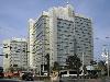
| Bonn  FeatureType : city Elevation : 69 Lat/Lng : 50.734 / 7.0998 | The Federal City of Bonn is a city on the banks of the Rhine in the German state of North Rhine-Westphalia, with a population of over 300,000. About south-southeast of Cologne, Bonn is in the southernmost part of the Rhine-Ruhr region, Germany's largest metropolitan area, with over 11 million (...) |
| 2 | 
| Hungary FeatureType : country Elevation : 111 Lat/Lng : 47.4981 / 19.04 | Hungary is a country in Central Europe. Spanning in the Carpathian Basin, it borders Slovakia to the north, Ukraine to the northeast, Austria to the northwest, Romania to the east, Serbia to the south, Croatia to the southwest, and Slovenia to the west (...) |
| 3 | 
| Isar FeatureType : waterbody Elevation : 1762 Lat/Lng : 47.3546 / 11.4817 | The Isar is a river in Tyrol, Austria and Bavaria, Germany. Its source is in the Karwendel range of the Alps in Tyrol; it enters Germany near Mittenwald, and flows through Bad Tölz, Munich, and Landshut before reaching the Danube near Deggendorf (...) |
| 4 | 
| Marzahn-Hellersdorf FeatureType : adm2nd Elevation : 48 Lat/Lng : 52.5397 / 13.5843 | Marzahn-Hellersdorf is the tenth borough of Berlin, formed in 2001 by merging the former boroughs of Marzahn and Hellersdorf. (...) |
| 5 | 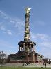
| Berlin FeatureType : landmark Elevation : 38 Lat/Lng : 52.5029 / 13.4042 | Berlin is the capital and largest city of Germany by both area and population. Its 3,711,930 (2017) inhabitants make it the second most populous city proper of the European Union after London. The city is one of Germany's 16 federal states, and it is surrounded by the state of Brandenburg, the (...) |
| 6 | 
| Vienna International Airport FeatureType : airport}} Elevation : 181 Lat/Lng : 48.1116 / 16.5697 | Vienna International Airport is the international airport of Vienna, the capital of Austria, located in Schwechat, southeast of central Vienna and 57 km west of Bratislava. It is the country's largest airport and serves as the hub for Austrian Airlines and Eurowings Europe as well as a base for (...) |
| 7 | 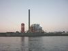
| E.ON FeatureType : landmark Elevation : 40 Lat/Lng : 51.2333 / 6.7728 | E.ON SE (marketed with an interpunct and lowercase letters as e·on) is a European holding company based in Essen, North Rhine-Westphalia, Germany. It runs one of the world's largest investor-owned electric utility service providers. The name comes from the Greek word aeon which means age (...) |
| 8 | 
| Zalaegerszeg FeatureType : city Elevation : 151 Lat/Lng : 46.8392 / 16.8511 | Zalaegerszeg is the administrative center of Zala county in western Hungary. (...) |
| 9 | 
| Opole Voivodeship FeatureType : adm1st Elevation : 153 Lat/Lng : 50.6483 / 17.9006 | Opole Voivodeship, or Opole ProvinceArkadiusz Belczyk, , 2002–2006. , is the smallest and least populated voivodeship (province) of Poland. The province's name derives from that of the region's capital and largest city, Opole. It is part of Upper Silesia (...) |
| 10 | 
| Frankfurt FeatureType : null Elevation : 109 Lat/Lng : 50.117 / 8.683 | Frankfurt, officially Frankfurt am Main (; "Frank ford at the Main"), is a metropolis and the largest city of the German federal state of Hesse, and its 736,414 (2016) inhabitants make it the fifth-largest city of Germany after Berlin, Hamburg, Munich, and Cologne (...) |
| 11 | Budapest FeatureType : null Elevation : 104 Lat/Lng : 47.4983 / 19.0408 | Budapest is the capital and the most populous city of Hungary, and the tenth-largest city in the European Union by population within city limits. The city had an estimated population of 1,752,704 in 2016 distributed over a land area of about (...) | |
| 12 | 
| Esztergom FeatureType : city Elevation : 107 Lat/Lng : 47.7856 / 18.7403 | Esztergom (listen, , , known by), is a city in northern Hungary, northwest of the capital Budapest. It lies in Komárom-Esztergom county, on the right bank of the river Danube, which forms the border with Slovakia there (...) |
| 13 | 
| Hungaroring FeatureType : landmark Elevation : 216 Lat/Lng : 47.5831 / 19.2523 | The Hungaroring is a motorsport race track in Mogyoród, Hungary where the Formula One Hungarian Grand Prix is held. In 1986, it became the location of the first Formula One Grand Prix behind the Iron Curtain. Bernie Ecclestone wanted a race in the USSR, but a Hungarian friend recommended Budapest (...) |
| 14 | 
| Munich East station FeatureType : railwaystation Elevation : 530 Lat/Lng : 48.1269 / 11.6047 | München Ost (English: Munich East, also called München Ostbahnhof in regional services) is a railway station in Munich, the state capital of Bavaria, Germany. It opened as Haidhausen station in 1871 on the new Munich–Mühldorf and Munich–Rosenheim railway lines (...) |
| 15 | 
| Speyer Cathedral FeatureType : landmark Elevation : 109 Lat/Lng : 49.3171 / 8.4424 | The Speyer Cathedral, officially the Imperial Cathedral Basilica of the Assumption and St Stephen, in Latin: Domus sanctae Mariae Spirae (German: Dom zu Unserer lieben Frau in Speyer) in Speyer, Germany, is the seat of the Roman Catholic Bishop of Speyer and is suffragan to the Archdiocese of (...) |
| 16 | 
| Mainz FeatureType : null Elevation : 95 Lat/Lng : 50.0 / 8.2711 | Mainz is the capital and largest city of Rhineland-Palatinate, Germany. The city is located on the Rhine river at its confluence with the Main river, opposite Wiesbaden on the border with Hesse. Mainz is an independent city with a population of 206,628 (2015) and forms part of the Frankfurt (...) |
| 17 | 
| Hatvan FeatureType : city Elevation : 118 Lat/Lng : 47.6681 / 19.6697 | Hatvan is a town in Heves county, Hungary. Hatvan is the Hungarian word for "sixty". Hatvan is located at around . (...) |
| 18 | 
| Bad Cannstatt FeatureType : null Elevation : 224 Lat/Lng : 48.8056 / 9.2141 | Bad Cannstatt, formerly just "Cannstatt" or "Kannstadt" (until 1900), is one of the outer stadtbezirke, or city districts, of Stuttgart in Baden-Württemberg, Germany. Bad Cannstatt is the oldest and most populous of Stuttgart's districts, and one of the most historically significant towns in the (...) |
| 19 | 
| Alsace FeatureType : adm1st Elevation : 172 Lat/Lng : 48.5 / 7.5 | Alsace (; ; Alsatian: ’s Elsass ; German: ElsassGerman spelling before 1996: Elsaß ;) is a cultural and historical region in eastern France, on the west bank of the upper Rhine next to Germany and Switzerland. From 1982 to 2016, Alsace was the smallest administrative région in metropolitan France, (...) |
| 20 | 
| Lecce FeatureType : null Elevation : 48 Lat/Lng : 40.3537 / 18.1755 | Lecce (or ; Salentino: ; Griko:) is a historic city of 95,766 inhabitants (2015) in southern Italy, the capital of the province of Lecce, the second province in the region by population, as well as one of the most important cities of Apulia (...) |
| 21 | 
| Piliscsaba FeatureType : city Elevation : 277 Lat/Lng : 47.6167 / 18.8333 | Piliscsaba is a town in Budapest metropolitan area, Hungary, located in northwestern Pest County, near the border of Komárom-Esztergom in a valley between the Buda and Pilis hills. It is accessible by Highway 10 and lies on the Budapest-Esztergom rail line, from the center of Budapest (...) |
| 22 | 
| Berlin Hauptbahnhof FeatureType : railwaystation Elevation : 27 Lat/Lng : 52.5253 / 13.3694 | Berlin Hauptbahnhof (help=no) (English: Berlin Central Station DB's publication for the International Transportation Workshop, May 2012. "Berlin Central Station" is their station project example. Accessed 14 August 2013 . Accessed 14 August 2013 at www.bahn.com (...) |
| 23 | 
| Berlin Ostbahnhof FeatureType : railwaystation Elevation : 46 Lat/Lng : 52.5104 / 13.4352 | Berlin Ostbahnhof (German for Berlin East railway station) is a main line railway station in Berlin, Germany. It is located in the Friedrichshain quarter, now part of Friedrichshain-Kreuzberg borough, and has undergone several name changes in its history (...) |
| 24 | 
| Katowice FeatureType : city Elevation : 266 Lat/Lng : 50.2649 / 19.0238 | Katowice (; ; ; officially Miasto Katowice) is a city in southern Poland, with a population of 297,197 and the center of the Silesian Metropolis, with a population of 2.2 million. Throughout the mid-18th century, Katowice had developed into a village upon the discovery of rich coal reserves in the (...) |
| 25 | Tolna, Hungary FeatureType : null Elevation : 98 Lat/Lng : 46.4236 / 18.7903 | Tolna is a town in Tolna county, Hungary. It lies about north of Szekszárd and south of Budapest. (...) | |
| 26 | 
| Szentendre FeatureType : null Elevation : 332 Lat/Lng : 47.7044 / 19.0686 | Szentendre is a riverside town in Pest County, Hungary, near the capital city Budapest. It is known for its museums (most notably the Open-Air Ethnographic Museum), galleries, and artists. Due to its historic architecture and easy rail and river access, it has become a popular destination for (...) |
| 27 | 
| Hamburg Hauptbahnhof FeatureType : railwaystation Elevation : 16 Lat/Lng : 53.5528 / 10.0064 | Hamburg Hauptbahnhof (abbrev. Hamburg Hbf) is the main railway station of the city of Hamburg, Germany and is classed by Deutsche Bahn as a category 1 railway station. Opened in 1906 to replace 4 separate terminal stations, today Hamburg Hauptbahnhof is operated by DB Station&Service AG (...) |
| 28 | 
| Trieste FeatureType : city Elevation : 116 Lat/Lng : 45.6361 / 13.8042 | Trieste (;. CollinsDictionary.com. Collins English Dictionary - Complete & Unabridged 11th Edition. Retrieved September 21, 2012 listen;) is a city and a seaport in northeastern Italy. It is situated towards the end of a narrow strip of Italian territory lying between the Adriatic Sea (...) |
| 29 | 
| Cluj-Napoca FeatureType : city Elevation : 347 Lat/Lng : 46.78 / 23.5594 | Cluj-Napoca (; , ; Medieval Latin: Castrum Clus, Claudiopolis; and , Kloiznburg), commonly known as Cluj, is the fourth most populous city in Romania, and the seat of Cluj County in the northwestern part of the country (...) |
| 30 | 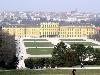
| Vienna FeatureType : adm1st Elevation : 188 Lat/Lng : 48.2083 / 16.3731 | Vienna is the federal capital and largest city of Austria, and one of the nine states of Austria. Vienna is Austria's primate city, with a population of about 1.9 million (2.6 million within the metropolitan area, nearly one third of Austria's population), and its cultural, economic, and political (...) |
| 31 | 
| Slovakia FeatureType : country Elevation : 146 Lat/Lng : 48.15 / 17.1167 | Slovakia , officially the Slovak Republic (listen), is a landlocked country in Central Europe. It is bordered by Poland to the north, Ukraine to the east, Hungary to the south, Austria to the west, and the Czech Republic to the northwest. Slovakia's territory spans about and is mostly mountainous (...) |
| 32 | 
| Graz FeatureType : null Elevation : 362 Lat/Lng : 47.0706 / 15.4381 | Graz is the capital of Styria and the second-largest city in Austria after Vienna. On 1 January 2018, it had a population of 325,021 (of which 289,440 had principal residence status). In 2015, the population of the Graz larger urban zone who had principal residence status stood at 633,168 (...) |
| 33 | 
| Borsod-Abaúj-Zemplén County FeatureType : adm1st Elevation : 115 Lat/Lng : 48.2056 / 20.9833 | Borsod-Abaúj-Zemplén is an administrative county (comitatus or megye) in north-eastern Hungary (commonly called "Northern Hungary"), on the border with Slovakia. It shares borders with the Hungarian counties Nógrád, Heves, Hajdú-Bihar and Szabolcs-Szatmár-Bereg (...) |
| 34 | 
| Bijeljina FeatureType : null Elevation : 91 Lat/Lng : 44.7587 / 19.2144 | Bijeljina is a city in Bosnia and Herzegovina. It is located in the Republika Srpska entity and is the provincial center of Semberija, a geographic region in the country's northeast. As of 2013, it has a population of 107,715 inhabitants. (...) |
| 35 | 
| Auschwitz concentration camp FeatureType : landmark Elevation : 233 Lat/Lng : 50.0366 / 19.1759 | Auschwitz concentration camp was a network of concentration and extermination camps built and operated by Nazi Germany in occupied Poland during World War II. It consisted of (the original concentration camp), Auschwitz II–Birkenau (a combined concentration/extermination camp), (a labor camp to (...) |
| 36 | 
| München Hauptbahnhof FeatureType : railwaystation Elevation : 533 Lat/Lng : 48.1404 / 11.5577 | München Hauptbahnhof (German for Munich main railway station) is the main railway station in the city of Munich, Germany. It is one of the three long distance stations in Munich, the others being München Ost and München-Pasing (...) |
| 37 | 
| Theresienstadt concentration camp FeatureType : landmark Elevation : 151 Lat/Lng : 50.5136 / 14.1647 | Theresienstadt (Czech: Terezín) was a hybrid concentration camp and ghetto established by the SS during World War II in the fortress town Terezín, located in the Protectorate of Bohemia and Moravia (German-occupied Czech lands) (...) |
| 38 | 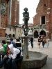
| Kraków FeatureType : null Elevation : 219 Lat/Lng : 50.0617 / 19.9372 | Kraków , also spelled Cracow or Krakow, is the second largest and one of the oldest cities in Poland. Situated on the Vistula River in the Lesser Poland region, the city dates back to the 7th century. Kraków was the official capital of Poland until 1596 and has traditionally been one of the leading (...) |
| 39 | Budapest Ferenc Liszt International Airport FeatureType : null Elevation : 142 Lat/Lng : 47.4393 / 19.2618 | Budapest Ferenc Liszt International Airport" ." Budapest Ferenc Liszt International Airport. Retrieved on 4 February 2012. , formerly known as Budapest Ferihegy International Airport and still commonly called just Ferihegy, is the international airport serving the Hungarian capital city of Budapest, (...) | |
| 40 | 
| Rotterdam FeatureType : null Elevation : 3 Lat/Lng : 51.9167 / 4.4833 | Rotterdam is the second-largest city and a municipality of the Netherlands. It is located in the province of South Holland, at the mouth of the Nieuwe Maas channel leading into the Rhine–Meuse–Scheldt delta at the North Sea (...) |
| 41 | 
| Abkhazia FeatureType : null Elevation : 119 Lat/Lng : 43.0167 / 41.0333 | Abkhazia , officially the Republic of Abkhazia, is a de facto and partially recognized republic on the eastern coast of the Black Sea, south of the Greater Caucasus mountains, in northwestern Georgia. It covers and has a population of around 240,000. Its capital is Sukhumi (...) |
| 42 | 
| Mongolia FeatureType : country Elevation : 1299 Lat/Lng : 47.9167 / 106.9167 | Mongolia (; Monggol Ulus in Mongolian; in Mongolian Cyrillic) is a landlocked country in East Asia. Its area is roughly equivalent with the historical territory of Outer Mongolia, and that term is sometimes used to refer to the current state (...) |
| 43 | 
| Warsaw Chopin Airport FeatureType : airport Elevation : 99 Lat/Lng : 52.1657 / 20.9671 | Warsaw Frederic Chopin Airport , more commonly referred to as Chopin Airport or Warsaw-Chopin Airport, is an international airport located in the Włochy district of Warsaw, Poland. As Poland's largest, covering of land, and busiest airport, Warsaw Chopin handles just under 40% of the country's air (...) |
| 44 | 
| Dome of the Rock FeatureType : landmark Elevation : 746 Lat/Lng : 31.7781 / 35.2353 | The Dome of the Rock (Qubbat al-Sakhrah, Kippat ha-Sela) is an Islamic shrine located on the Temple Mount in the Old City of Jerusalem. It was initially completed in 691 CE at the order of Umayyad Caliph Abd al-Malik during the Second Fitna, built on the site of the Roman temple of Jupiter (...) |
| 45 | 
| Seychelles FeatureType : country Elevation : 9 Lat/Lng : -7.0675 / 52.7344 | Seychelles (; French:), officially the Republic of Seychelles (; Creole: Repiblik Sesel), is an archipelago country in the Indian Ocean. The capital of the 115-island country, Victoria, lies east of mainland East Africa (...) |
| 46 | 
| Bamako FeatureType : city Elevation : 313 Lat/Lng : 12.6333 / -7.9833 | Bamako is the capital and largest city of Mali, with a population of 2,009,109. In 2006, it was estimated to be the fastest-growing city in Africa and sixth-fastest in the world. It is located on the Niger River, near the rapids that divide the upper and middle Niger valleys in the southwestern part (...) |
| 47 | 
| Vilnius FeatureType : city Elevation : 106 Lat/Lng : 54.6883 / 25.2714 | Vilnius (see also other names) is the capital of Lithuania and its largest city, with a population of 574,147 . Vilnius is in the southeast part of Lithuania and is the second largest city in the Baltic states. Vilnius is the seat of the main government institutions of Lithuania and the Vilnius (...) |
| 48 | 
| Bucharest FeatureType : null Elevation : 82 Lat/Lng : 44.4325 / 26.1039 | Bucharest is the capital and largest city of Romania, as well as its cultural, industrial, and financial centre. It is located in the southeast of the country, at , on the banks of the Dâmbovița River, less than north of the Danube River and the Bulgarian border (...) |
| 49 | 
| Vukovar FeatureType : null Elevation : 85 Lat/Lng : 45.35 / 19.0034 | Vukovar (The official use of Serbian Cyrillic in Vukovar is subject to a dispute involving the local and national authorities, and is the source of a current political controversy. See #Minority languages.) is a city in eastern Croatia (...) |
| 50 | 
| Helsinki Airport FeatureType : airport Lat/Lng : 60.3172 / 24.9633 | Helsinki Airport is the main international airport of the city of Helsinki, its surrounding metropolitan area, and the Uusimaa region. The airport is located in the city of Vantaa, about west of Tikkurila, the administrative center of Vantaa and north of Helsinki city center (...) |
| 51 | 
| Bury, Greater Manchester FeatureType : null Elevation : 102 Lat/Lng : 53.593 / -2.298 | Bury is a town in Greater Manchester, England, on the River Irwell east of Bolton, southwest of Rochdale and northwest of Manchester. Bury is the administrative centre of the Metropolitan Borough of Bury, and had a population of 78,723 in 2015; City Population, Retrieved 4 June 2017 the borough had (...) |
| 52 | 
| Vatican City FeatureType : city Elevation : 47 Lat/Lng : 41.9034 / 12.4534 | Vatican City , officially Vatican City State , is an independent city-state enclaved within Rome, Italy. Established with the Lateran Treaty (1929), it is distinct from yet under "full ownership, exclusive dominion, and sovereign authority and jurisdiction" of the Holy See (...) |
| 53 | 
| Balatonfüred FeatureType : city Elevation : 130 Lat/Lng : 46.9564 / 17.8892 | Balatonfüred is a popular resort town in Veszprém county, in Hungary, with a population of 13,000, situated on the northern shore of Lake Balaton. It is considered to be the capital of the Northern lake shore and is a popular yachting destination (...) |
| 54 | 
| Kiev FeatureType : null Elevation : 157 Lat/Lng : 50.4501 / 30.5234 | Kiev . Dictionary.com. or Kyiv is the capital and largest city of Ukraine, located in the north central part of the country on the Dnieper. The population in July 2015 was 2,887,974 (though higher estimated numbers have been cited in the press),The most recent Ukrainian census, conducted on 5 (...) |
| 55 | 
| Lviv FeatureType : null Elevation : 307 Lat/Lng : 49.83 / 24.0142 | Lviv (; ' ; ; ; ; see also other names) is the largest city in western Ukraine and the seventh-largest city in the country overall, with a population of around 728,350 as of 2016. Lviv is one of the main cultural centres of Ukraine (...) |
| 56 | 
| Mariupol FeatureType : null Elevation : 54 Lat/Lng : 47.101 / 37.543 | Mariupol (also ; . "Radianske Budivnytstvo i Pravo". State archives. February 29, 1932 ;) is a city of regional significance in south eastern Ukraine, situated on the north coast of the Sea of Azov at the mouth of the Kalmius river, in the Pryazovia region (...) |
| 57 | 
| Lisbon FeatureType : null Elevation : 70 Lat/Lng : 38.7203 / -9.14 | Lisbon is the capital and the largest city of Portugal, with an estimated population of 505,526 within its administrative limits in an area of 100.05 km2. Its urban area extends beyond the city's administrative limits with a population of around 2 (...) |
| 58 | 
| Osaka FeatureType : null Elevation : 15 Lat/Lng : 34.6938 / 135.5022 | (; listen) is a designated city in the Kansai region of Japan. It is the capital city of Osaka Prefecture and the largest component of the Keihanshin Metropolitan Area, the second largest metropolitan area in Japan and among the largest in the world with over 19 million inhabitants (...) |
| 59 | 
| Florence FeatureType : city Elevation : 67 Lat/Lng : 43.7717 / 11.2536 | Florence Alternative obsolete form: Fiorenza ; is the capital city of the Italian region of Tuscany. It is the most populous city in Tuscany, with 383,084 inhabitants in 2013, and over 1,520,000 in its metropolitan area (...) |
| 60 | 
| Thessaloniki FeatureType : null Elevation : 185 Lat/Lng : 40.6472 / 22.9639 | Thessaloniki (Thessaloníki , also familiarly known as Thessalonica, Salonica, or Salonika is the second-largest city in Greece, with over 1 million inhabitants in its metropolitan area, and the capital of Greek Macedonia, the administrative region of Central Macedonia and the Decentralized (...) |
| 61 | 
| São Paulo FeatureType : null Elevation : 765 Lat/Lng : -23.5477 / -46.6364 | São Paulo is a municipality in the Southeast Region of Brazil. The metropolis is an alpha global city (as listed by the GaWC) and the most populous city in Brazil, the Western Hemisphere and the Southern Hemisphere, besides being the largest Portuguese-speaking city in the world (...) |
| 62 | 
| Fort Worth, Texas FeatureType : city Elevation : 205 Lat/Lng : 32.7574 / -97.3332 | Fort Worth is the 15th-largest city in the United States and the fifth-largest city in the state of Texas. It is the county seat of Tarrant County, covering nearly into four other counties: Denton, Johnson, Parker and Wise. According to the 2017 census estimates, Fort Worth's population is 874,168 (...) |
| 63 | 
| St. Stephen's Basilica FeatureType : landmark Elevation : 113 Lat/Lng : 47.5008 / 19.0539 | St. Stephen's Basilica is a Roman Catholic basilica in Budapest, Hungary. It is named in honour of Stephen, the first King of Hungary (c 975–1038), whose supposed right hand is housed in the reliquary. It was the sixth largest church building in Hungary before 1920 (...) |
| 64 | 
| Glasgow FeatureType : null Elevation : 19 Lat/Lng : 55.858 / -4.259 | Glasgow is the most populous city in Scotland, and the third most populous city in the United Kingdom, as of the 2017 estimated city population of 621,020. Historically part of Lanarkshire, the city now forms the Glasgow City council area, one of the 32 council areas of Scotland; the local authority (...) |
| 65 | 
| Piešťany FeatureType : null Elevation : 163 Lat/Lng : 48.5917 / 17.8322 | Piešťany is a town in Slovakia. It is located in the western part of the country within the Trnava Region and is the seat of its own district. It is the biggest and best known spa town in Slovakia and has around 30,000 inhabitants (2012). (...) |
| 66 | 
| Szerencs FeatureType : city Elevation : 102 Lat/Lng : 48.1628 / 21.2022 | Szerencs is a town in Borsod-Abaúj-Zemplén county, Northern Hungary. It lies away from Miskolc, and away from Budapest. (...) |
| 67 | 
| Tata, Hungary FeatureType : null Elevation : 132 Lat/Lng : 47.6526 / 18.3238 | Tata is a town in Komárom-Esztergom county, northwestern Hungary, northwest of the county town Tatabánya. (...) |
| 68 | 
| Zürich Hauptbahnhof FeatureType : railwaystation Elevation : 413 Lat/Lng : 47.3778 / 8.5403 | Zürich Hauptbahnhof (often shortened to Zürich HB) (Zürich Main Station or Zürich Central Station) is the largest railway station in Switzerland. Zürich is a major railway hub, with services to and from across Switzerland and neighbouring European countries such as Germany, Italy, Austria and France (...) |
| 69 | 
| Mezőkövesd FeatureType : city Elevation : 113 Lat/Lng : 47.8068 / 20.5649 | Mezőkövesd is a town in Borsod-Abaúj-Zemplén county, Northern Hungary. It lies from Miskolc and from Eger. (...) |
| 70 | 
| Mauer, Vienna FeatureType : city Elevation : 243 Lat/Lng : 48.1506 / 16.2689 | Mauer (German for "wall") is a former village of Lower Austria that has been part of Vienna since 1938. Today's cadastral community belongs to the 23rd District of Vienna, called Liesing. In the west, Mauer borders the Vienna Woods. (...) |
| 71 | 
| Csurgó FeatureType : null Elevation : 149 Lat/Lng : 46.257 / 17.098 | Csurgó (formerly Somogy-Csurgó) is a town in Somogy county, Hungary and the seat of Csurgó District. The settlement is part of the Balatonboglár wine region. (...) |
| 72 | 
| Liberty Statue (Budapest) FeatureType : landmark Elevation : 216 Lat/Lng : 47.487 / 19.0468 | The Liberty Statue or Freedom Statue is a monument on the Gellért Hill in Budapest, Hungary. It commemorates those who sacrificed their lives for the independence, freedom, and prosperity of Hungary. (...) |
| 73 | 
| Dresden Hauptbahnhof FeatureType : railwaystation Elevation : 125 Lat/Lng : 51.0403 / 13.7317 | Dresden Hauptbahnhof (“main station”, abbreviated Dresden Hbf) is the largest passenger station in the Saxon capital of Dresden. In 1898, it replaced the Böhmischen Bahnhof ("Bohemian station") of the former Saxon-Bohemian State Railway (Sächsisch-Böhmische Staatseisenbahn), and was designed with (...) |
| 74 | 
| Babelsberg Studio FeatureType : landmark Elevation : 36 Lat/Lng : 52.3912 / 13.1189 | Babelsberg Film Studio , located in Potsdam-Babelsberg outside Berlin, Germany, is the oldest large-scale film studio in the world, producing films since 1912. Today it covers an area of about and thus is Europe's second largest film studio after Cinecittà in Rome, Italy (...) |
| 75 | 
| Bratislava Castle FeatureType : landmark Elevation : 213 Lat/Lng : 48.1422 / 17.1 | Bratislava Castle is the main castle of Bratislava, the capital of Slovakia. The massive rectangular building with four corner towers stands on an isolated rocky hill of the Little Carpathians directly above the Danube river in the middle of Bratislava (...) |
| 76 | 
| First Vienna FC FeatureType : landmark Elevation : 178 Lat/Lng : 48.2489 / 16.3597 | First Vienna FC is an Austrian association football club based in the Döbling district of Vienna. Established on 22 August 1894, it is the country's oldest team and has played a notable role in the history of the game there. It is familiarly known to Austrians by the English name Vienna. __TOC__ (...) |
| 77 | Buda FeatureType : city Elevation : 156 Lat/Lng : 47.4956 / 19.0397 | Buda (; German: Ofen, Croatian: Budim, Serbian: Будим, Slovak: Budín, Turkish: Budin) was the ancient capital of the Kingdom of Hungary and since 1873 has been the western part of the Hungarian capital Budapest, on the west bank of the Danube (...) | |
| 78 | 
| Dorog FeatureType : city Elevation : 145 Lat/Lng : 47.7167 / 18.7333 | Dorog is a small town in Komárom-Esztergom, Hungary. It lies north-west from the center of Budapest. (...) |
| 79 | 
| Ohel Jakob synagogue, Munich FeatureType : landmark Elevation : 522 Lat/Lng : 48.1347 / 11.5717 | Ohel Jakob (from Hebrew: "Jacob's Tent") is a synagogue in Munich, Germany. It was built between 2004 and 2006 as the new main synagogue for the Jewish community in Munich and is located at the Sankt-Jakobs-Platz (...) |
| 80 | 
| Berlin Südkreuz FeatureType : railwaystation Elevation : 41 Lat/Lng : 52.4756 / 13.3644 | Berlin Südkreuz (in English, literally: Berlin South Cross) is a railway station in the German capital Berlin. The station was originally opened in 1898 and is an interchange station. The Berlin Ringbahn line of the Berlin S-Bahn metro railway is situated on the upper level and connects to the east (...) |
| 81 | 
| Rostock Hauptbahnhof FeatureType : railwaystation Elevation : 14 Lat/Lng : 54.0783 / 12.1311 | Rostock Hauptbahnhof, also Rostock Central Station (from 1896 until the turn of the 20th century called Rostock Central-Bahnhof), is the main railway station in the German city of Rostock. It is situated well to the south of the city centre, to which it is linked by tram (...) |
| 82 | 
| Museum of Military History, Vienna FeatureType : landmark Elevation : 202 Lat/Lng : 48.1854 / 16.3874 | The Museum of Military History – Military History Institute in Vienna is the leading museum of the Austrian Armed Forces. It documents the history of Austrian military affairs through a wide range of exhibits comprising, above all, weapons, armours, tanks, aeroplanes, uniforms, flags, (...) |
| 83 | 
| Berlin-Spandau station FeatureType : railwaystation Elevation : 36 Lat/Lng : 52.5347 / 13.1965 | Berlin-Spandau station is a Deutsche Bahn station in the Berlin district of Spandau on the south-western edge of the old town of Spandau. The railway junction station is one of the 80 stations classified by Deutsche Bahn as a category 2 station. It has the longest train shed (440 metres) in Germany (...) |
| 84 | 
| Bicske FeatureType : city Elevation : 165 Lat/Lng : 47.4906 / 18.6364 | Bicske is a town in Fejér county, Hungary. Its name is also spelled Bykche, Biccke, Bykcze, Biczke, and Bitske. It is around west of Budapest. Its administration has undergone many changes; it has been a settlement, a village, a market town, and a village constituting an administrative division. (...) |
| 85 | Danube FeatureType : null Elevation : 111 Lat/Lng : 47.4824 / 19.0707 | The Danube , known by various names in other languages, is Europe's second longest river, after the Volga. It is located in Central and Eastern Europe. The Danube was once a long-standing frontier of the Roman Empire, and today flows through 10 countries, more than any other river in the world (...) | |
| 86 | Austria-Hungary FeatureType : null Elevation : 214 Lat/Lng : 48.2 / 16.35 | Austria-Hungary, often referred to as the Austro-Hungarian Empire or the Dual Monarchy in English-language sources, was a constitutional union of the Austrian Empire (the Kingdoms and Lands Represented in the Imperial Council, or Cisleithania) and the Kingdom of Hungary (Lands of the Crown of Saint (...) | |
| 87 | 
| Memorial to the Murdered Jews of Europe FeatureType : landmark Elevation : 31 Lat/Lng : 52.514 / 13.3787 | The Memorial to the Murdered Jews of EuropeTitle as given in the official website: Memorial to the Murdered Jews of Europe and Information Centre http://www.stiftung-denkmal.de/startseite.html , also known as the Holocaust Memorial (German: Holocaust-Mahnmal), is a memorial in Berlin to the Jewish (...) |
| 88 | Roman Catholic Archdiocese of Esztergom-Budapest FeatureType : null Elevation : 165 Lat/Lng : 47.7989 / 18.7364 | The Roman Catholic Archdiocese of Esztergom-Budapest is the primatial seat of the Roman Catholic Church in Hungary and the Metropolitan of one of its four Latin rite ecclesiastical provinces. The Metropolitan archbishopric retains the title of Primate, which gives this see precedence over all other (...) | |
| 89 | Budakalász FeatureType : null Elevation : 109 Lat/Lng : 47.6215 / 19.046 | Budakalász is a town in Pest county, Budapest metropolitan area, Hungary. Residents are Magyars, with minority of Serbs. (...) | |
| 90 | 
| University of Hagen FeatureType : edu Elevation : 182 Lat/Lng : 51.3772 / 7.4953 | The University of Hagen (informally often referred to as FU Hagen) is a public research university that is primarily focused on distance teaching. While its main campus is located in Hagen, North Rhine-Westphalia, Germany, the university maintains more than 50 study and research centers in Germany (...) |
| 91 | Vecsés FeatureType : null Elevation : 126 Lat/Lng : 47.411 / 19.2724 | Vecsés is a town of 20,550 inhabitants in Budapest metropolitan area, Pest county, Hungary, situated adjacent to Budapest's Ferihegy Airport. (...) | |
| 92 | Görlitz FeatureType : null Elevation : 214 Lat/Lng : 51.1528 / 14.9872 | Görlitz (; Upper Lusatian dialect: Gerlz, Gerltz, and Gerltsch) is a town in the German federal state of Saxony. Located in the region of Lusatia on the Lusatian Neisse River, it is the second largest town of Lusatia after Cottbus, and the largest in Upper Lusatia (...) | |
| 93 | 
| Dresden-Neustadt station FeatureType : railwaystation Elevation : 119 Lat/Lng : 51.0656 / 13.7408 | Dresden-Neustadt station is the second largest railway station in the German city of Dresden after Dresden Hauptbahnhof and is also a stop for long-distance traafic. It is the junction for rail traffic on the northern side of the Elbe (...) |
| 94 | Belváros-Lipótváros FeatureType : null Elevation : 116 Lat/Lng : 47.5 / 19.05 | District V is the heart of Budapest and the political, financial, commercial and touristic center of Hungary. The name of the district is Belváros-Lipótváros (English: Inner City – Leopold Town), which refers to the two historical neighbourhoods that is located in the district; Belváros ("Inner (...) | |
| 95 | Kingdom of Hungary (1920–1946) FeatureType : country Elevation : 100 Lat/Lng : 47.4667 / 19.05 | The Kingdom of Hungary (Hungarian: Magyar Királyság), sometimes referred to as the Regency, existed from 1920 to 1946 as a country under the rule of Regent Miklós Horthy. Horthy officially represented the Hungarian monarchy of Charles IV, Apostolic King of Hungary (...) | |
| 96 | Győr FeatureType : null Elevation : 117 Lat/Lng : 47.684 / 17.6351 | Győr is the most important city of northwest Hungary, the capital of Győr-Moson-Sopron County and Western Transdanubia region, and—halfway between Budapest and Vienna—situated on one of the important roads of Central Europe (...) | |
| 97 | 
| Bucerius Kunst Forum FeatureType : landmark Elevation : 18 Lat/Lng : 53.5511 / 9.9919 | The Bucerius Kunst Forum is an international exhibition centre in Hamburg, Germany; founded in 2002 through the ZEIT-Stiftung Ebelin und Gerd Bucerius foundation. It is named after Gerd Bucerius and his wife, and located directly beside the Hamburg Rathaus (...) |
| 98 | Miskolc FeatureType : city Elevation : 119 Lat/Lng : 48.1042 / 20.7917 | Miskolc (Slovak/Czech: Miškovec, German: Mischkolz, Romanian: Mișcolț, Mishkoltz) is a city in northeastern Hungary, known for its heavy industry. With a population of 161,265 (1st Jan 2014) Miskolc is the fourth largest city in Hungary (behind Budapest, Debrecen, and Szeged) (...) | |
| 99 | Berlin Wall FeatureType : landmark Elevation : 36 Lat/Lng : 52.5161 / 13.3769 | The Berlin Wall was a guarded concrete barrier that physically and ideologically divided Berlin from 1961 to 1989. Constructed by the German Democratic Republic (GDR, East Germany), starting on 13 August 1961, the Wall cut off (by land) West Berlin from virtually all of surrounding East Germany and (...) | |
| 100 | Gerstetten FeatureType : null Elevation : 628 Lat/Lng : 48.623 / 10.0184 | Gerstetten is a municipality in the district of Heidenheim in Baden-Württemberg in southern Germany. It consists of the following villages: * Gerstetten (population: 7534) * Dettingen (population: 2.042, incorporation 1972) * Gussenstadt (population: 1 (...) | |
| 101 | Angela Merkel FeatureType : null Elevation : 36 Lat/Lng : 52.5202 / 13.3952 | Angela Dorothea Merkel (; ; Kasner, born 17 July 1954) is a German politician serving as Chancellor of Germany since 2005 and leader of the centre-right Christian Democratic Union (CDU) since 2000., bundeskanzlerin (...) | |
| 102 | Dunavarsány FeatureType : null Elevation : 96 Lat/Lng : 47.2781 / 19.0672 | Dunavarsány is a town in Pest county, Budapest metropolitan area, Hungary. (...) | |
| 103 | World War II FeatureType : landmark Elevation : 65 Lat/Lng : 48.7194 / 44.5018 | World War II (often abbreviated to WWII or WW2), also known as the Second World War, was a global war that lasted from 1939 to 1945. The vast majority of the world's countries—including all the great powers—eventually formed two opposing military alliances: the Allies and the Axis (...) | |
| 104 | Chorzów FeatureType : null Elevation : 293 Lat/Lng : 50.3 / 18.95 | Chorzów is a city in Silesia in southern Poland, near Katowice. Chorzów is one of the central districts of the Upper Silesian Metropolitan Union - a metropolis with a population of 2 million. It is located in the Silesian Highlands, on the Rawa River (a tributary of the Vistula) (...) | |
| 105 | Mitte FeatureType : adm2nd Elevation : 36 Lat/Lng : 52.5167 / 13.3667 | Mitte is the first and most central borough of Berlin. The borough consists of six sub-entities: Mitte proper, Gesundbrunnen, Hansaviertel, Moabit, Tiergarten and Wedding. It is one of the two boroughs (beside Friedrichshain-Kreuzberg) which comprises former West and East Berlin districts (...) | |
| 106 | History of Budapest FeatureType : null Elevation : 111 Lat/Lng : 47.4824 / 19.0707 | The city of Budapest was officially created on 17 November 1873 by the merging of the neighboring cities of Pest, Buda and Óbuda, with smaller outskirt towns amalgamated into Greater Budapest in 1950. Its origins can be traced to the Celtic people who occupied the plains of Hungary from the 4th (...) | |
| 107 | World War I FeatureType : landmark Elevation : 108 Lat/Lng : 48.973 / 2.905 | World War I (often abbreviated as WWI or WW1), also known as the First World War or the Great War, was a global war originating in Europe that lasted from 28 July 1914 to 11 November 1918. Contemporaneously described as the "war to end all wars", it led to the mobilisation of more than 70 million (...) | |
| 108 | Congress of Berlin FeatureType : null Elevation : 38 Lat/Lng : 52.5117 / 13.3819 | The Congress of Berlin (13 June – 13 July 1878) was a meeting of the representatives of six great powers of the time (Russia, Great Britain, France, Austria-Hungary, Italy and Germany), the Ottoman Empire and four Balkan states (Greece, Serbia, Romania and Montenegro) (...) | |
| 109 | Český Krumlov FeatureType : null Elevation : 492 Lat/Lng : 48.8107 / 14.315 | Český Krumlov (; or Böhmisch Krumau) is a town in the South Bohemian Region of the Czech Republic. Its historic centre, centred around the Český Krumlov Castle, is a designated UNESCO World Heritage Site since 1992 and was given this status along with the historic Prague castle district (...) | |
| 110 | Bauhaus FeatureType : null Elevation : 230 Lat/Lng : 50.9748 / 11.3295 | The Staatliches Bauhaus , commonly known as the Bauhaus, was a German art school operational from 1919 to 1933 that combined crafts and the fine arts, and was famous for the approach to design that it publicized and taught (...) | |
| 111 | Heidelberg University FeatureType : edu Elevation : 126 Lat/Lng : 49.4103 / 8.7064 | Heidelberg University is a public research university in Heidelberg, Baden-Württemberg, Germany. Founded in 1386 on instruction of Pope Urban VI, Heidelberg is Germany's oldest university and one of the world's oldest surviving universities (...) | |
| 112 | Stuttgart FeatureType : null Elevation : 257 Lat/Lng : 48.7766 / 9.1777 | Stuttgart (; ; Swabian: , ;) is the capital and largest city of the German state of Baden-Württemberg. Stuttgart is located on the Neckar river in a fertile valley known locally as the "Stuttgart Cauldron." It lies an hour from the Swabian Jura and the Black Forest (...) | |
| 113 | Rieger Orgelbau FeatureType : landmark Elevation : 422 Lat/Lng : 47.4382 / 9.7579 | Rieger Orgelbau is an Austrian firm of organ builders, known generally as Rieger. The firm was founded by Franz Rieger. From 1873 it was known as Rieger & Söhne, and from 1879 as Gebrüder Rieger, after his sons took over (...) | |
| 114 | 
| Sirkeci railway station FeatureType : railwaystation Elevation : 11 Lat/Lng : 41.0149 / 28.977 | Sirkeci railway station , listed on maps as Istanbul railway station , is a railway terminal in Istanbul. The terminal is located on the tip of Istanbul's historic peninsula right next to the Golden Horn and just northwest of Gülhane Park and the Topkapı Palace (...) |
| 115 | Iron Curtain FeatureType : null Elevation : 423 Lat/Lng : 48.8755 / 15.8748 | The Iron Curtain was the name for the boundary dividing Europe into two separate areas from the end of World War II in 1945 until the end of the Cold War in 1991. The term symbolizes the efforts by the Soviet Union to block itself and its satellite states from open contact with the West and its (...) | |
| 116 | Ústí nad Labem Region FeatureType : adm1st Elevation : 381 Lat/Lng : 50.53 / 13.84 | Ústí nad Labem Region or Ústecký Region , also known as Region Aussig (after the German name of the capital), is an administrative unit of the Czech Republic, located in the north-western part of the historical land of Bohemia, and named after the capital, Ústí nad Labem (...) | |
| 117 | 
| Kiskőrös FeatureType : city Elevation : 102 Lat/Lng : 46.6202 / 19.2838 | Kiskőrös (Kishkerish, , ; Živko Mandić: Hrvatska imena naseljenih mjesta u Madžarskoj) is a town in Bács-Kiskun, Hungary. It is located at around . Sándor Petőfi, the national poet of Hungary, was born here. (...) |
| 118 | Székesfehérvár FeatureType : city Elevation : 112 Lat/Lng : 47.1956 / 18.4089 | The city of Székesfehérvár, known colloquially as Fehérvár ("white castle") (located in central Hungary, is the ninth largest city of the country; regional capital of Central Transdanubia; and the centre of Fejér county and Székesfehérvár District (...) | |
| 119 | UEFA Euro 2020 FeatureType : null Elevation : 60 Lat/Lng : 51.5558 / -0.2797 | The 2020 UEFA European Football Championship, commonly referred to as UEFA Euro 2020 or simply Euro 2020, is scheduled to be the 16th UEFA European Championship, the quadrennial international men's football championship of Europe organised by UEFA (...) | |
| 120 | Schutzstaffel FeatureType : landmark Elevation : 42 Lat/Lng : 52.5072 / 13.3825 | The Schutzstaffel (SS; also stylized as with Armanen runes; ; literally "Protection Squadron") was a major paramilitary organization under Adolf Hitler and the Nazi Party (NSDAP) in Nazi Germany, and later throughout German-occupied Europe during World War II (...) | |
| 121 | Gestapo FeatureType : landmark Elevation : 42 Lat/Lng : 52.5072 / 13.3825 | The Gestapo , abbreviation of Geheime Staatspolizei (Secret State Police), was the official secret police of Nazi Germany and German-occupied Europe. The force was created by Hermann Göring in 1933 by combining the various security police agencies of Prussia into one organisation (...) | |
| 122 | Ansbach FeatureType : null Elevation : 409 Lat/Lng : 49.3026 / 10.5719 | Ansbach is a city in the German state of Bavaria. It is the capital of the administrative region of Middle Franconia. Ansbach is southwest of Nuremberg and north of Munich, on the Fränkische Rezat (Rezat River), a tributary of the Main river. In 2004, its population was 40,723 (...) | |
| 123 | Wodzisław Śląski FeatureType : city Elevation : 244 Lat/Lng : 50.0 / 18.45 | Wodzisław Śląski is a town in Silesian Voivodeship, southern Poland with 50,493 inhabitants (2007). It is the seat of Wodzisław County. It was previously in Katowice Voivodeship (1975–1998); close to the border with the Czech Republic, about south of Warsaw and about west of Kraków, on the southern (...) | |
| 124 | Independent State of Croatia FeatureType : null Elevation : 609 Lat/Lng : 44.8 / 15.9667 | The Independent State of Croatia was a World War II fascist puppet state of Germany, Britannica Online Encyclopedia; retrieved 8 September 2009. . Microsoft Encarta Online Encyclopedia; retrieved 8 September 2009., Holocaust Encyclopedia (...) | |
| 125 | SAP SE FeatureType : landmark Elevation : 112 Lat/Lng : 49.2935 / 8.6418 | SAP SE (; , "Systems, Applications & Products in Data Processing") is a German-based European multinational software corporation that makes enterprise software to manage business operations and customer relations (...) | |
| 126 | Ulm FeatureType : null Elevation : 480 Lat/Lng : 48.3985 / 9.9918 | Ulm is a city in the federal German state of Baden-Württemberg, situated on the River Danube. The city, whose population is estimated at almost 120,000 (2015), forms an urban district of its own and is the administrative seat of the Alb-Donau district (...) | |
| 127 | Kingdom of Hungary FeatureType : null Elevation : 100 Lat/Lng : 47.4667 / 19.05 | The Kingdom of Hungary was a monarchy in Central Europe that existed from the Middle Ages into the twentieth century (1000–1946 with the exception of 1918–1920). The Principality of Hungary emerged as a Christian kingdom upon the coronation of the first king Stephen I at Esztergom in about the year (...) | |
| 128 | Budapest University of Technology and Economics FeatureType : edu Elevation : 113 Lat/Lng : 47.4816 / 19.056 | The Budapest University of Technology and Economics (or in short), official abbreviation BME, is the most significant University of Technology in Hungary and is considered the world's oldest Institute of Technology which has university rank and structure (...) | |
| 129 | 2009–10 UEFA Europa League FeatureType : null Elevation : 426 Lat/Lng : 47.8163 / 12.9982 | The 2009–10 UEFA Europa League was the first season of the UEFA Europa League, Europe's secondary club football tournament organised by UEFA. The competition was previously known as the UEFA Cup, which had been in existence for 38 years (...) | |
| 130 | Rosenheim station FeatureType : railwaystation Elevation : 448 Lat/Lng : 47.8504 / 12.1195 | Rosenheim station is the main railway station in the city of Rosenheim in Bavaria, Germany. It is the seventh largest passenger station in Bavaria and an important railway hub between the Munich–Rosenheim railway line and the lines to Salzburg, Kufstein/Innsbruck and Mühldorf, as well as the (...) | |
| 131 | Mittelgebirge FeatureType : mountain Elevation : 1490 Lat/Lng : 47.8736 / 8.0039 | A Mittelgebirge (German term) is a relatively low mountain range or highland area, a typical geographical feature of Central Europe, especially Central and Southern Germany; it refers to something between rolling low hill country or Hügelland and a proper mountain range (or Hochgebirge) like the (...) | |
| 132 | Second Polish Republic FeatureType : country Elevation : 114 Lat/Lng : 52.2167 / 21.0 | The Second Polish Republic, commonly known as interwar Poland, refers to the country of Poland in the period between the First and Second World Wars (1918–1939). Officially known as the Republic of Poland , the Polish state was re-established in 1918, in the aftermath of World War I (...) | |
| 133 | LGV Est FeatureType : null Elevation : 211 Lat/Lng : 48.9475 / 6.1697 | The Ligne à Grande Vitesse Est européenne (East European High Speed Line), typically shortened to LGV Est, is a French high-speed rail line that connects Vaires-sur-Marne (near Paris) and Vendenheim (near Strasbourg) (...) | |
| 134 | Prague FeatureType : null Elevation : 203 Lat/Lng : 50.0878 / 14.4205 | Prague is the capital and largest city in the Czech Republic, the 14th largest city in the European Union and the historical capital of Bohemia. Situated in the north-west of the country on the Vltava river, the city is home to about 1 (...) | |
| 135 | Star of David FeatureType : null Elevation : 9 Lat/Lng : -21.8159 / 114.1659 | The Star of David , known in Hebrew as the Shield of David or Magen David (Hebrew ; Biblical Hebrew Māḡēn Dāwīḏ , Tiberian , Modern Hebrew , Ashkenazi Hebrew and Yiddish Mogein Dovid or Mogen Dovid), is a generally recognized symbol of modern Jewish identity and Judaism (...) | |
| 136 | BMW FeatureType : landmark Elevation : 513 Lat/Lng : 48.1771 / 11.5593 | BMW AG (; originally an initialism for Bayerische Motoren Werke in German, or Bavarian Motor Works in English) is a German multinational company which currently produces luxury automobiles and motorcycles, and also produced aircraft engines until 1945 (...) | |
| 137 | Eisenstadt FeatureType : null Elevation : 181 Lat/Lng : 47.8472 / 16.525 | Eisenstadt is a city in Austria, the state capital of Burgenland. It has a population of about 14,241 (2016). In the Habsburg Empire's Kingdom of Hungary, Kismarton (Eisenstadt) was the seat of the Eszterházy Hungarian noble family (...) | |
| 138 | St Anton am Arlberg FeatureType : null Elevation : 1297 Lat/Lng : 47.1278 / 10.2667 | Sankt Anton am Arlberg, commonly referred to as St. Anton, is a village and ski resort in the Austrian state of Tyrol. It lies in the Tyrolean Alps, with aerial tramways and chairlifts up to , yielding a vertical drop of . It is also a popular summer resort among hikers, trekkers and mountaineers (...) | |
| 139 | Inđija FeatureType : city Elevation : 112 Lat/Lng : 45.0492 / 20.0792 | Inđija is a town and a municipality located in the Srem District of the autonomous province of Vojvodina, Serbia. As of 2011, the town has total population of 26,025, while the municipality has 47,433 inhabitants. It is located in the geographical region of Syrmia. (...) | |
| 140 | Austrian Federal Railways FeatureType : landmark Elevation : 227 Lat/Lng : 48.1689 / 16.3469 | The Austrian Federal Railways (or ÖBB, formerly the Bundesbahn Österreich or BBÖ) is the national railway system of Austria, and the administrator of Liechtenstein's railways. The ÖBB group is owned entirely by the Republic of Austria and is divided into several separate businesses that manage the (...) | |
| 141 | Battle of Berlin FeatureType : event Elevation : 35 Lat/Lng : 52.5167 / 13.3833 | The Battle of Berlin, designated the Berlin Strategic Offensive Operation by the Soviet Union, and also known as the Fall of Berlin, was the final major offensive of the European theatre of World War II. Following the Vistula–Oder Offensive of January–February 1945, the Red Army had temporarily (...) | |
| 142 | Hungarian Defence Forces FeatureType : null Elevation : 153 Lat/Lng : 47.4925 / 19.0214 | Hungarian Defence Forces is the national defence force of Hungary. The President holds the title of commander-in-chief of the nation's armed forces. The Ministry of Defence jointly with Chief of staff administers the armed forces, including the Hungarian Ground Force and the Hungarian Air Force (...) | |
| 143 | Dunaharaszti FeatureType : null Elevation : 101 Lat/Lng : 47.3554 / 19.0845 | Dunaharaszti is a town in Pest county, Budapest metropolitan area, Hungary. (...) | |
| 144 | Kaposvár FeatureType : null Elevation : 144 Lat/Lng : 46.3638 / 17.7823 | Kaposvár (; ; see also other alternative names) is a city in the southwestern part of Hungary, south from the Lake Balaton. It is one of the leading cities of Transdanubia and it is the capital of Somogy County as well as the seat of Kaposvár District and of the Roman Catholic Diocese of Kaposvár. (...) | |
| 145 | Timișoara FeatureType : city Elevation : 89 Lat/Lng : 45.7597 / 21.23 | Timișoara (; , also formerly Temeschburg or Temeschwar; , ; ; / Temišvar; Banat Bulgarian: Timišvár; ;) is the capital city of Timiș County, and the main social, economic and cultural centre in western Romania. The third most populous city in the country, with 319,279 inhabitants as of the 2011 (...) | |
| 146 | Oskar Schindler FeatureType : null Elevation : 723 Lat/Lng : 31.7702 / 35.2304 | Oskar Schindler (28 April 1908 – 9 October 1974) was a German industrialist and a member of the Nazi Party who is credited with saving the lives of 1,200 Jews during the Holocaust by employing them in his enamelware and ammunitions factories in occupied Poland and the Protectorate of Bohemia and (...) | |
| 147 | 1936 Summer Olympics FeatureType : null Elevation : 51 Lat/Lng : 52.5363 / 13.0092 | The 1936 Summer Olympics (German: Olympische Sommerspiele 1936), officially known as the Games of the XI Olympiad, was an international multi-sport event held in 1936 in Berlin, Nazi Germany. Berlin won the bid to host the Games over Barcelona, Spain, on 26 April 1931, at the 29th IOC Session in (...) | |
| 148 | Bad Schandau FeatureType : null Elevation : 127 Lat/Lng : 50.9174 / 14.1547 | Bad Schandau is a spa town in Germany, in the south of the Free State of Saxony and the district of Sächsische Schweiz-Osterzgebirge. It is situated on the right bank of the Elbe, at the mouth of the little valley of the Kirnitzsch. (...) | |
| 149 | Premonstratensians FeatureType : landmark Elevation : 46 Lat/Lng : 41.8789 / 12.4887 | The Order of Canons Regular of Prémontré, also known as the Premonstratensians, the Norbertines and, in Britain and Ireland, as the White Canons (from the colour of their habit), are a religious order of Canons regular of the Catholic Church founded in Prémontré near Laon in 1120 by Norbert of (...) | |
| 150 | Plzeň FeatureType : null Elevation : 316 Lat/Lng : 49.7475 / 13.3776 | Plzeň , also called Pilsen in English and German, is a city in the Czech Republic. About west of Prague in western Bohemia, it is the fourth most populous city in the Czech Republic. The city is known worldwide for Pilsner beer, created by Bavarian brewer Josef Groll there in 1842. (...) | |
| 151 | Austrian Empire FeatureType : null Elevation : 214 Lat/Lng : 48.2 / 16.35 | The Austrian Empire (modern spelling ') was a Central European multinational great power from 1804 to 1867, created by proclamation out of the realms of the Habsburgs. During its existence, it was the third most populous empire after the Russian Empire and the United Kingdom in Europe (...) | |
| 152 | Kingdom of Romania FeatureType : country Elevation : 67 Lat/Lng : 44.4167 / 26.1 | The Kingdom of Romania was a constitutional monarchy at the crossroads of Eastern and Southeastern Europe which existed from 1881, when prince Karl of Hohenzollern-Sigmaringen was crowned as King Carol I of Romania, until 1947, when King Michael I of Romania abdicated and the Parliament proclaimed (...) | |
| 153 | Transylvania FeatureType : null Elevation : 349 Lat/Lng : 46.7667 / 23.5833 | Transylvania is a historical region which today is located in central Romania. Bound on the east and south by its natural borders, the Carpathian mountain range, historical Transylvania extended westward to the Apuseni Mountains (...) | |
| 154 | Sălaj County FeatureType : adm1st Elevation : 248 Lat/Lng : 47.1911 / 23.0572 | Sălaj County (also known as Land of Silvania, silva, -ae means "forest") is a county (județ) of Romania, located in the north-west of the country, in the historical regions of Crișana and Transylvania. It is bordered to the north by Satu Mare and Maramureș counties, to the west and south-west by (...) | |
| 155 | Valtellina FeatureType : landmark Elevation : 299 Lat/Lng : 46.1667 / 9.8667 | Valtellina or the Valtelline (occasionally spelled as two words in English: Val Telline; (help=no); or ; ;) is a valley in the Lombardy region of northern Italy, bordering Switzerland. Today it is known for its ski center, hot spring spas, bresaola, cheeses (in particular Bitto, named after the (...) | |
| 156 | Baia Mare FeatureType : null Elevation : 236 Lat/Lng : 47.6503 / 23.5903 | Baia Mare (; ; ; ; ; , Banya) is a municipality along the Săsar River, in northwestern Romania; it is the capital of Maramureș County. The city is situated about from Bucharest, from the border with Hungary, and from the border with Ukraine (...) | |
| 157 | Zagreb FeatureType : null Elevation : 134 Lat/Lng : 45.8131 / 15.9773 | Zagreb is the capital and the largest city of Croatia. It is located in the northwest of the country, along the Sava river, at the southern slopes of the Medvednica mountain. Zagreb lies at an elevation of approximately above sea level. The estimated population of the city in 2018 is 810,003 (...) | |
| 158 | Tram FeatureType : landmark Elevation : 530 Lat/Lng : 48.1484 / 11.4616 | A tram (in North America streetcar or trolley) is a rail vehicle which runs on tramway tracks along public urban streets; some include segments of segregated right-of-way. The lines or networks operated by tramcars are called tramways (...) | |
| 159 | Pesterzsébet FeatureType : city Elevation : 114 Lat/Lng : 47.4375 / 19.1008 | Pesterzsébet is the 20th district of Budapest, Hungary. It is located in the southern part of the capital and is the 17th biggest district in the city. It is a mostly suburban area with approximately 70,000 residents. (...) | |
| 160 | Szekszárd FeatureType : null Elevation : 93 Lat/Lng : 46.356 / 18.7038 | Szekszárd (Hungarian:) is a city in Hungary and the capital of Tolna county. By population, Szekszárd is the smallest county capital in Hungary; by area, it is the second-smallest (after Tatabánya). (...) | |
| 161 | Radio Free Europe/Radio Liberty FeatureType : null Elevation : 256 Lat/Lng : 50.0789 / 14.4786 | Radio Free Europe/Radio Liberty (RFE/RL) is a United States government-funded organization that broadcasts and reports news, information, and analysis to countries in Eastern Europe, Central Asia and the Middle East where it says that "the free flow of information is either banned by government (...) | |
| 162 | Rosenheim FeatureType : null Elevation : 448 Lat/Lng : 47.8561 / 12.1289 | The independent city of Rosenheim (Central Bavarian: Rousnam) is located in the centre of the district of Rosenheim (Upper Bavaria), and is also the ' of this region. It is located on the west bank of the Inn at the confluence of the rivers Inn and Mangfall, in the Bavarian Alpine Foreland (...) | |
| 163 | Trogir FeatureType : null Elevation : 0 Lat/Lng : 43.5169 / 16.2514 | Trogir (; ; Ancient Greek: Τραγύριον, Tragyrion or Τραγούριον, Tragourion) is a historic town and harbour on the Adriatic coast in Split-Dalmatia County, Croatia, with a population of 10,818 (2011) and a total municipality population of 13,260 (2011) (...) | |
| 164 | Pančevo FeatureType : null Elevation : 81 Lat/Lng : 44.8708 / 20.6403 | Pančevo (Serbian Cyrillic: Панчево) is a city and the administrative center of the South Banat District in autonomous province of Vojvodina, Serbia. Pančevo is the fourth largest city in Vojvodina by population (...) | |
| 165 | European Union FeatureType : null Elevation : 57 Lat/Lng : 50.8333 / 4.35 | The European Union (EU) is a political and economic union of member states that are located primarily in Europe. It has an area of and an estimated population of about 513 million. The EU has developed an internal single market through a standardised system of laws that apply in all member states in (...) | |
| 166 | Warsaw Uprising FeatureType : event Elevation : 111 Lat/Lng : 52.23 / 21.0108 | The Warsaw Uprising was a major World War II operation, in the summer of 1944, by the Polish underground resistance, led by the Home Army , to liberate Warsaw from German occupation. The uprising was timed to coincide with the retreat of the German forces from Poland ahead of the Soviet advance (...) | |
| 167 | Ulm Hauptbahnhof FeatureType : railwaystation Elevation : 480 Lat/Lng : 48.4 / 9.9833 | Ulm Hauptbahnhof is the main station in the city of Ulm, which lies on the Danube, on the border of the German states of Baden-Württemberg and Bavaria in the Danube-Iller region (Region Donau-Iller). Ulm Hauptbahnhof has twelve platforms, of which five are terminating platforms, and forms a major (...) | |
| 168 | Banat FeatureType : landmark Elevation : 109 Lat/Lng : 45.5 / 21.375 | The Banat . Collins English Dictionary/Webster's New World College Dictionary. is a geographical and historical region in Central Europe that is currently divided among three countries: the eastern part lies in western Romania (the counties of Timiș, Caraș-Severin, Arad south of the Körös/Criș (...) | |
| 169 | Satu Mare FeatureType : null Elevation : 124 Lat/Lng : 47.7917 / 22.8917 | Satu Mare (; ; ; or) is a city with a population of 102,400 (2011) and the capital of Satu Mare County, Romania, as well as the center of the Satu Mare metropolitan area. Mentioned in the Gesta Hungarorum as ("Zotmar's fort"), the city has a history going back to the Middle Ages (...) | |
| 170 | Bratislava FeatureType : null Elevation : 147 Lat/Lng : 48.1439 / 17.1097 | Bratislava (; , or ') is the capital of Slovakia. With a population of about 450,000, it is one of the smaller capitals of Europe but still the country's largest city. The greater metropolitan area is home to more than 650,000 people (...) | |
| 171 | Moravia FeatureType : null Elevation : 339 Lat/Lng : 49.5 / 17.0 | Moravia (;. Random House Webster's Unabridged Dictionary. ; Mähren.ogg; ;) is a historical country in the Czech Republic (forming its eastern part) and one of the historical Czech lands, together with Bohemia and Czech Silesia (...) | |
| 172 | Rijeka FeatureType : null Elevation : 10 Lat/Lng : 45.3297 / 14.4321 | Rijeka is the principal seaport and the third-largest city in Croatia (after Zagreb and Split). It is located in Primorje-Gorski Kotar County on Kvarner Bay, an inlet of the Adriatic Sea and has a population of 128,624 inhabitants (...) | |
| 173 | Red Bull Racing FeatureType : landmark Elevation : 75 Lat/Lng : 52.0083 / -0.6928 | Red Bull Racing (also known as Red Bull or RBR and competing as Aston Martin Red Bull Racing) is a Formula One racing team, racing under an Austrian licence and based in the United Kingdom. The team raced under a British licence from to and has raced under an Austrian licence since (...) | |
| 174 | Theodor Herzl FeatureType : null Elevation : 832 Lat/Lng : 31.7739 / 35.1806 | Theodor Herzl (; ; Te'odor Hertsel; ; Hebrew name given at his brit milah Binyamin Ze'ev , also known in Hebrew as , Chozeh HaMedinah, lit. "Visionary of the State"; 2 May 1860 – 3 July 1904) was an Austro-Hungarian journalist, playwright, political activist, and writer who was the father of modern (...) | |
| 175 | Operation Spring Awakening FeatureType : event Elevation : 141 Lat/Lng : 46.9833 / 18.35 | Operation Spring Awakening (Unternehmen Frühlingserwachen) (6 – 16 March 1945) was the last major German offensive of World War II. It took place in Hungary on the Eastern Front. This offensive was also referred to in Germany as the Plattensee Offensive and in the Soviet Union as the Balaton (...) | |
| 176 | Rácalmás FeatureType : null Elevation : 140 Lat/Lng : 47.0226 / 18.9406 | Rácalmás is a town in Central Transdanubia, in Fejér county, Hungary. Located on the right side of river Danube around 61 km south of Budapest. The Name Rácalmás is derived from a Special Tribe that Tend the Apple Orchards (...) | |
| 177 | Biatorbágy FeatureType : null Elevation : 175 Lat/Lng : 47.4712 / 18.8252 | Biatorbágy is a town in Pest County, Budapest metropolitan area, Hungary. It has a population of 10,720 (2007). On 13 September 1931 a demented man (Szilveszter Matuska) blasted the train to Vienna on the viaduct of Biatorbágy. (...) | |
| 178 | Railway electrification system FeatureType : landmark Elevation : 3 Lat/Lng : 53.4491 / 10.0015 | A railway electrification system supplies electric power to railway trains and trams without an on-board prime mover or local fuel supply. Electric railways use electric locomotives to haul passengers or freight in separate cars or electric multiple units, passenger cars with their own motors (...) | |
| 179 | Keszthely FeatureType : null Elevation : 117 Lat/Lng : 46.7697 / 17.2481 | Keszthely is a Hungarian city of 20,895 inhabitants located on the western shore of Lake Balaton. It is the largest city by the lake and one of the more important cultural, educational and economic hubs in the region (...) | |
| 180 | Andrássy University Budapest FeatureType : landmark Elevation : 111 Lat/Lng : 47.4918 / 19.0642 | Andrássy University Budapest (AUB) (full name: Andrássy Gyula German Speaking University Budapest/Andrássy Gyula Deutschsprachige Universität Budapest) is a private university in Budapest, the capital of Hungary (...) | |
| 181 | Cegléd FeatureType : null Elevation : 106 Lat/Lng : 47.1743 / 19.802 | Cegléd is a city in Pest county, Hungary, approximately southeast of the Hungarian capital, Budapest. (...) | |
| 182 | Obervellach FeatureType : null Elevation : 802 Lat/Lng : 46.9367 / 13.2042 | Obervellach is a market town in the district of Spittal an der Drau, in the Austrian state of Carinthia. (...) | |
| 183 | Burgwald FeatureType : null Elevation : 328 Lat/Lng : 51.0195 / 8.7948 | Burgwald is a community in Waldeck-Frankenberg in Hesse, Germany. (...) | |
| 184 | Wehrheim FeatureType : null Elevation : 313 Lat/Lng : 50.3029 / 8.5681 | Wehrheim is a municipality in Hesse, Germany some 30 km (20 mi) north of Frankfurt am Main. The town's nickname is "Apfeldorf Wehrheim" (Apple-village Wehrheim). (...) | |
| 185 | Oradea FeatureType : null Elevation : 128 Lat/Lng : 47.0514 / 21.9403 | Oradea (; , , Hungarian pronunciation: , colloquially also ', former , ') the capital city of Bihor County and Crișana region, is one of the important centers of economic, social and cultural development in the western part of Romania, retaining these characteristics throughout history (...) | |
| 186 | Košice FeatureType : null Elevation : 213 Lat/Lng : 48.7211 / 21.2575 | Košice is the largest city in eastern Slovakia and in 2013 was the European Capital of Culture (together with Marseille, France). It is situated on the river Hornád at the eastern reaches of the Slovak Ore Mountains, near the border with Hungary (...) | |
| 187 | Safed FeatureType : null Elevation : 737 Lat/Lng : 32.9656 / 35.4998 | Safed (Tsfat, Ashkenazi: Tzfas, Biblical: Ṣǝp̄aṯ; , Ṣafad) is a city in the Northern District of Israel. Located at an elevation of , Safed is the highest city in the Galilee and in Israel. Due to its high elevation, Safed experiences warm summers and cold, often snowy, winters (...) | |
| 188 | Suspension bridge FeatureType : null Lat/Lng : 34.6167 / 135.0217 | A suspension bridge is a type of bridge in which the deck (the load-bearing portion) is hung below suspension cables on vertical suspenders. The first modern examples of this type of bridge were built in the early 1800s. by Manfred Gerner. Thimphu: Center for Bhutan Studies 2007 (...) | |
| 189 | Sarajevo FeatureType : city Elevation : 508 Lat/Lng : 43.8476 / 18.3564 | Sarajevo (; , ; see) is the capital and largest city of Bosnia and Herzegovina, with a population of 275,524 in its administrative limits. The Sarajevo metropolitan area, including Sarajevo Canton, East Sarajevo and nearby municipalities is home to 555,210 inhabitants.http://www.popis.gov (...) | |
| 190 | Tótkomlós FeatureType : city Elevation : 91 Lat/Lng : 46.4167 / 20.7333 | Tótkomlós is a town in Békés County, Hungary. (...) | |
| 191 | Szigetszentmiklós FeatureType : null Elevation : 100 Lat/Lng : 47.3456 / 19.0483 | Szigetszentmiklós is a city in Pest county, Hungary with approximately 30,000 inhabitants. (...) | |
| 192 | FC Wacker München FeatureType : landmark Elevation : 525 Lat/Lng : 48.1149 / 11.542 | FC Wacker München is a German association football club of about 200 members based in the Sendling borough of Munich, Bavaria. At their zenith in the 1920s the Blue Stars twice reached the semi-finals of the German Championship (...) | |
| 193 | Eindhoven FeatureType : city Elevation : 22 Lat/Lng : 51.4381 / 5.4752 | Eindhoven is the fifth-largest city and a municipality of the Netherlands. It had a population of 229,126 in 2018, making it the largest city in the province of North Brabant, although 's-Hertogenbosch is its capital. Eindhoven was originally located at the confluence of the Dommel and Gender (...) | |
| 194 | Édouard Manet FeatureType : landmark Elevation : 69 Lat/Lng : 48.8625 / 2.2853 | Édouard Manet (; ; ; 23 January 1832 – 30 April 1883) was a French painter. He was one of the first 19th-century artists to paint modern life, and a pivotal figure in the transition from Realism to Impressionism (...) | |
| 195 | Le Corbusier FeatureType : null Elevation : 58 Lat/Lng : 48.8519 / 2.2654 | Charles-Édouard Jeanneret (6 October 1887 – 27 August 1965), known as Le Corbusier , was a Swiss-French architect, designer, painter, urban planner, writer, and one of the pioneers of what is now called modern architecture. He was born in Switzerland and became a French citizen in 1930 (...) | |
| 196 | Josip Broz Tito FeatureType : null Elevation : 168 Lat/Lng : 44.7867 / 20.4517 | Josip Broz (Cyrillic: Јосип Броз, ; 7 May 1892 – 4 May 1980), commonly known as Tito (;. Random House Webster's Unabridged Dictionary. Cyrillic: Тито), was a Yugoslav communist revolutionary and political leader, serving in various roles from 1943 until his death in 1980 (...) | |
| 197 | International Red Cross and Red Crescent Movement FeatureType : landmark Elevation : 443 Lat/Lng : 46.2277 / 6.1371 | The International Red Cross and Red Crescent Movement is an international humanitarian movement with approximately 17 million volunteers, members and staff worldwide which was founded to protect human life and health, to ensure respect for all human beings, and to prevent and alleviate human (...) | |
| 198 | Budaörs FeatureType : null Elevation : 135 Lat/Lng : 47.4606 / 18.9578 | Budaörs is a town in Pest county, Budapest metropolitan area, Hungary. (...) | |
| 199 | Kocs FeatureType : city Elevation : 144 Lat/Lng : 47.6067 / 18.2154 | Kocs is a village in Komárom-Esztergom county, Hungary. It lies west of Tata and north-west of Budapest. (...) | |
| 200 | Međimurje County FeatureType : adm1st Elevation : 202 Lat/Lng : 46.466 / 16.414 | Međimurje County is a triangle-shaped county in the northernmost part of Croatia, roughly corresponding to the historical and geographical region of Međimurje. Despite being the smallest Croatian county by size, it is the most densely populated one (not including the City of Zagreb) (...) | |
 by
by