| 773 records found in wikipedia | |||
| 1 | 
| Brussels-South railway station  FeatureType : railwaystation Elevation : 26 Lat/Lng : 50.8352 / 4.3352 | Brussels-South (IATA code: ZYR) is one of the three major railway stations in Brussels (the other two are Brussels Central and Brussels North) and the busiest station in Belgium. It is located on the territory of the municipality of Saint Gilles/Sint Gillis (...) |
| 2 | 
| Brussels FeatureType : null Elevation : 66 Lat/Lng : 50.8432 / 4.363 | Brussels , officially the Brussels-Capital Region (All text and all but one graphic show the English name as Brussels-Capital Region.) , is a region of Belgium comprising 19 municipalities, including the City of Brussels, which is the capital of Belgium (...) |
| 3 | 
| Anderlecht FeatureType : city Elevation : 33 Lat/Lng : 50.8364 / 4.3069 | Anderlecht is one of the nineteen municipalities of the Brussels-Capital Region. Located in the southwest of the city, it is bordered by the City of Brussels, Dilbeek, Forest, Molenbeek-Saint-Jean, Saint-Gilles and Sint-Pieters-Leeuw (...) |
| 4 | 
| Saint-Gilles, Belgium FeatureType : city Elevation : 83 Lat/Lng : 50.8242 / 4.3458 | Saint-Gilles or Sint-Gillis is one of the nineteen municipalities located in the Brussels-Capital Region of Belgium. It is bordered by the City of Brussels, Anderlecht, Forest and Ixelles. Saint-Gilles has a multicultural identity stemming from its diverse population (...) |
| 5 | 
| Uccle FeatureType : city Elevation : 99 Lat/Lng : 50.8114 / 4.3536 | Uccle or Ukkel is one of the 19 municipalities located in the Brussels-Capital Region of Belgium. In common with all the Brussels municipalities, it is legally bilingual (French–Dutch). (...) |
| 6 | 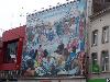
| Ixelles FeatureType : city Elevation : 81 Lat/Lng : 50.8303 / 4.3614 | Ixelles (; Dutch: Elsene) is one of the nineteen municipalities of the Brussels-Capital Region of Belgium. Ixelles is located in the suburbs towards the south of Brussels' city centre and is geographically bisected by the City of Brussels municipality (...) |
| 7 | 
| Schaerbeek FeatureType : city Elevation : 48 Lat/Lng : 50.8608 / 4.3875 | Schaerbeek (obsolete Dutch spelling, retained in French, pronounced) or Schaarbeek (Dutch) is one of the nineteen municipalities located in the Brussels-Capital Region of Belgium. It is bordered by the City of Brussels, Etterbeek, Evere and Saint-Josse-ten-Noode (...) |
| 8 | 
| Waterloo, Belgium FeatureType : city Elevation : 124 Lat/Lng : 50.7175 / 4.3979 | Waterloo (Jean-Marie Pierret, Phonétique historique du français et notions de phonétique générale, Peeters, Louvain-la-Neuve, 1994, p. 103.) is a Walloon municipality in the province of Walloon Brabant, Belgium, which in 2011 had a population of 29,706 and an area of (...) |
| 9 | 
| Sint-Jans-Molenbeek FeatureType : null Elevation : 41 Lat/Lng : 50.8578 / 4.3158 | (Dutch) or (French), often simply called Molenbeek, is one of 19 municipalities of the Brussels-Capital Region (Belgium). Located in the west of the region, it is bordered by the City of Brussels, from which it is separated by the Brussels-Charleroi Canal, as well as by the municipalities of (...) |
| 10 | 
| Gare de Lille Europe FeatureType : landmark Elevation : 21 Lat/Lng : 50.6394 / 3.0753 | Lille Europe is a SNCF railway station in Lille, France, on the LGV Nord High Speed railway. The station is primarily used for Eurostar and SNCF TGV services although some high-speed regional trains also call at the station (...) |
| 11 | 
| Grand Place FeatureType : landmark Elevation : 31 Lat/Lng : 50.8467 / 4.3525 | The Grand Place (French, ; "Grand Square"; also used in EnglishIn this case, the French word place is a "false friend", and the correct counterparts in English are "plaza" or "town square".) or Grote Markt (Dutch, ; "Grand Market") is the central square of Brussels (...) |
| 12 | 
| Manneken Pis FeatureType : landmark Elevation : 31 Lat/Lng : 50.845 / 4.35 | Manneken Pis ([ˌmɑnəkə(m) ˈpɪs], meaning "Little Pisser" in Dutch) is a landmark small bronze sculpture (61 cm) in Brussels, depicting a naked little boy urinating into a fountain's basin. It was designed by and put in place in 1618 or 1619 (...) |
| 13 | 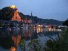
| Dinant FeatureType : null Elevation : 91 Lat/Lng : 50.2564 / 4.9136 | Dinant is a Walloon city and municipality located on the River Meuse, in the Belgian province of Namur. It is around south-east of Brussels, south-east of Charleroi, south of Namur and north of Givet (France). The municipality includes the old communes of Anseremme, Bouvignes-sur-Meuse, Dréhance, (...) |
| 14 | 
| Halle, Belgium FeatureType : city Elevation : 34 Lat/Lng : 50.7333 / 4.2333 | Halle is a city and municipality of Belgium, in the district (arrondissement) Halle-Vilvoorde of the province Flemish Brabant. It is located on the Brussels-Charleroi Canal and on the Flemish side of the language border that separates Flanders and Wallonia (...) |
| 15 | 
| Zaventem FeatureType : city Elevation : 43 Lat/Lng : 50.8878 / 4.4692 | Zaventem is a Belgian municipality in the province of Flemish Brabant. It is located in the Dijleland area, one of the three large recreational areas which together form the Groene Gordel ("Green Belt") around the Brussels-Capital Region (...) |
| 16 | 
| Belgium FeatureType : null Elevation : 66 Lat/Lng : 50.8432 / 4.363 | Belgium officially the Kingdom of Belgium, is a country in Western Europe bordered by the Netherlands to the north, Germany to the east, Luxembourg to the southeast, France to the southwest, and the North Sea to the northwest. It covers an area of and has a population of more than 11.4 million (...) |
| 17 | 
| Lille FeatureType : null Elevation : 28 Lat/Lng : 50.6372 / 3.0633 | Lille is a city at the northern tip of France, in French Flanders. On the Deûle River, near France's border with Belgium, it is the capital of the Hauts-de-France region, the prefecture of the Nord department, and the main city of the European Metropolis of Lille (...) |
| 18 | 
| Woluwe-Saint-Pierre FeatureType : city Elevation : 83 Lat/Lng : 50.8272 / 4.4619 | Woluwe-Saint-Pierre (Woluwe-Saint-Pierre is sometimes also spelled in French: Woluwé-Saint-Pierre with an accent on the first "e". Though the first version (without an accent) is the official version, the second one fits more the French pronunciation (...) |
| 19 | 
| Compiègne FeatureType : null Elevation : 41 Lat/Lng : 49.4149 / 2.8231 | Compiègne is a commune in the Oise department in northern France. It is located on the Oise River. Its inhabitants are called Compiégnois. (...) |
| 20 | 
| Gare du Nord FeatureType : null Elevation : 52 Lat/Lng : 48.8828 / 2.3567 | The Gare du Nord (North Station), officially Paris-Nord, is one of the six large terminus stations of the SNCF mainline network for Paris, France. Near Gare de l'Est in the 10th arrondissement, the Gare du Nord offers connections with several urban transport lines, including Paris Métro, RER and (...) |
| 21 | 
| Aire-sur-la-Lys FeatureType : null Elevation : 27 Lat/Lng : 50.6384 / 2.3959 | Aire-sur-la-Lys (Dutch: Ariën-aan-de-Leie) is a commune in the Pas-de-Calais department in northern France. (...) |
| 22 | 
| Thionville FeatureType : null Elevation : 162 Lat/Lng : 49.3589 / 6.1692 | Thionville is a commune in the Moselle department in Grand Est in northeastern France. The city is located on the left bank of the river Moselle, opposite its suburb Yutz. (...) |
| 23 | 
| Leuven FeatureType : null Elevation : 36 Lat/Lng : 50.8792 / 4.7019 | Leuven or Louvain is the capital of the province of Flemish Brabant in Belgium. It is located about east of Brussels. The municipality itself comprises the historic city and the former neighbouring municipalities of Heverlee, Kessel-Lo, a part of Korbeek-Lo, Wilsele and Wijgmaal (...) |
| 24 | 
| Aalst, Belgium FeatureType : null Elevation : 14 Lat/Lng : 50.9375 / 4.0411 | Aalst (; , Brabantian: Oilsjt) is a city and municipality on the Dender River, northwest from Brussels. It is located in the Flemish province of East Flanders in the Denderstreek. The municipality comprises the city of Aalst itself and the villages of Baardegem, Erembodegem, Gijzegem, Herdersem, (...) |
| 25 | 
| Luxembourg City FeatureType : null Elevation : 303 Lat/Lng : 49.61 / 6.1333 | Luxembourg , also known as Luxembourg City (or '), is the capital city of the Grand Duchy of Luxembourg (also named "Luxembourg"), and the country's most populous commune. Standing at the confluence of the Alzette and Pétrusse rivers in southern Luxembourg, the city lies at the heart of Western (...) |
| 26 | 
| Mulhouse FeatureType : null Elevation : 242 Lat/Lng : 47.7495 / 7.3399 | Mulhouse (; Alsatian: Milhüsa or Milhüse, ; ; i.e. mill house) is a city and commune in eastern France, close to the Swiss and German borders. With a population of 112,063 in 2013 and 284,739 inhabitants in the metropolitan area in 2012, it is the largest city in the Haut-Rhin département, and the (...) |
| 27 | 
| Charles de Gaulle Airport FeatureType : airport Elevation : 104 Lat/Lng : 49.01 / 2.5486 | Paris Charles de Gaulle Airport , also known as Roissy Airport (name of the local district), is the largest international airport in France and the second largest in Europe. It is named after Charles de Gaulle (1890–1970), leader of the Free French Forces during the Second World War, founder of the (...) |
| 28 | 
| Namur FeatureType : city Elevation : 88 Lat/Lng : 50.4639 / 4.8603 | Namur (Dutch: Namen, Nameur in Walloon) is a city and municipality in Wallonia, Belgium. It is both the capital of the province of Namur and of Wallonia, hosting the Parliament of Wallonia, Walloon Government and administration (...) |
| 29 | 
| Antwerp FeatureType : null Elevation : 15 Lat/Lng : 51.2178 / 4.4003 | Antwerp is a city in Belgium, and is the capital of Antwerp province in Flanders. With a population of 520,504, Population of all municipalities in Belgium, as of 1 January 2017. Retrieved on 1 November 2017. it is the most populous city proper in Belgium (...) |
| 30 | 
| Valenciennes FeatureType : null Elevation : 30 Lat/Lng : 50.358 / 3.5233 | Valenciennes (; Dutch: Valencijn, Latin: Valentianae) is a commune in the Nord department in northern France. It lies on the Scheldt river. Although the city and region experienced a steady population decline between 1975 and 1990, it has since rebounded (...) |
| 31 | 
| Nivelles FeatureType : city Elevation : 101 Lat/Lng : 50.5977 / 4.3237 | Nivelles is a Walloon city and municipality located in the Belgian province of Walloon Brabant. The Nivelles municipality includes the old communes of Baulers, Bornival, Thines, and Monstreux. The Nivelles district includes all the municipalities in Walloon Brabant (...) |
| 32 | 
| Spa, Belgium FeatureType : null Elevation : 256 Lat/Lng : 50.4924 / 5.8643 | Spa is a Belgian town located in the Province of Liège, and the town where the term spa originates. The town of Spa is situated in a valley in the Ardennes mountains southeast of Liège and southwest of Aachen. In 2006, Spa had a population of 10,543 and an area of , giving a population density of (...) |
| 33 | 
| Réunion FeatureType : adm1st Elevation : 1715 Lat/Lng : -21.1144 / 55.5325 | Réunion (; previously Île Bourbon) is an overseas department and region of France and an island in the Indian Ocean, east of Madagascar and southwest of Mauritius. , it had a population of 865,826. It has the highest per capita GDP in the Indian Ocean (...) |
| 34 | Schaarbeek railway station FeatureType : landmark Elevation : 15 Lat/Lng : 50.8781 / 4.3797 | Schaerbeek/Schaarbeek railway station is a railway station in the municipality of Schaerbeek, Brussels-Capital Region, Belgium. Located to the north-east of the centre of Brussels, the station mainly serves trains travelling between central Brussels and Leuven, Antwerp or Brussels National Airport (...) | |
| 35 | 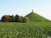
| Battle of Waterloo FeatureType : event Elevation : 135 Lat/Lng : 50.679 / 4.406 | The Battle of Waterloo was fought on Sunday, 18 June 1815, near Waterloo in present-day Belgium, then part of the United Kingdom of the Netherlands. A French army under the command of Emperor Napoleon Bonaparte was defeated by two of the armies of the Seventh Coalition: a British-led Allied army (...) |
| 36 | 
| Centre Georges Pompidou FeatureType : landmark Elevation : 58 Lat/Lng : 48.8607 / 2.3524 | Centre Georges Pompidou , commonly shortened to Centre Pompidou and also known as the Pompidou Centre in English, is a complex building in the Beaubourg area of the 4th arrondissement of Paris, near Les Halles, rue Montorgueil, and the Marais (...) |
| 37 | Brussels bombings FeatureType : landmark Elevation : 37 Lat/Lng : 50.9014 / 4.4844 | On the morning of 22 March 2016, three coordinated suicide bombings occurred in Belgium: two at Brussels Airport in Zaventem, and one at Maalbeek metro station in central Brussels. Thirty-two civilians and three perpetrators were killed, and more than 300 people were injured (...) | |
| 38 | 
| Hasselt FeatureType : null Elevation : 42 Lat/Lng : 50.9297 / 5.3381 | Hasselt is a Flemish city and municipality, and capital of the province of Limburg in Belgium. The Hasselt municipality includes the original city of Hasselt, plus the old communes of Sint-Lambrechts-Herk, Wimmertingen, Kermt, Spalbeek, Kuringen, Stokrooie, Stevoort and Runkst, as well as the (...) |
| 39 | Mechelen railway station FeatureType : railwaystation Elevation : 14 Lat/Lng : 51.0176 / 4.4837 | Mechelen is a railway station in the city of Mechelen, Antwerp, Belgium. The station opened on 5 May 1835 on the Lines 25, 27 and 53. In 1835 the first public train journey on the European mainland arrived near the station (...) | |
| 40 | 
| Ghent FeatureType : city Elevation : 9 Lat/Lng : 51.0539 / 3.7217 | Ghent is a city and a municipality in the Flemish Region of Belgium. It is the capital and largest city of the East Flanders province, and the second largest municipality in Belgium, after Antwerp. The city started as a settlement at the confluence of the Rivers Scheldt and Leie and in the Late (...) |
| 41 | 
| Diest FeatureType : city Elevation : 28 Lat/Lng : 50.9844 / 5.0528 | Diest is a city and municipality located in the Belgian province of Flemish Brabant. Situated in the northeast of the Hageland region, Diest neighbours the provinces of Antwerp to its North, and Limburg to the East and is situated around 60 km from Brussels (...) |
| 42 | 
| Bruges FeatureType : city Elevation : 9 Lat/Lng : 51.2094 / 3.22 | Bruges is the capital and largest city of the province of West Flanders in the Flemish Region of Belgium, in the northwest of the country. The area of the whole city amounts to more than 13,840 hectares (138.4 sq km; 53 (...) |
| 43 | 
| Cambrai FeatureType : null Elevation : 65 Lat/Lng : 50.1767 / 3.2356 | Cambrai (; ; ; historically in English Camerick and Camericke) is a commune in the Nord department and in the Hauts-de-France region of France on the Scheldt river, which is known locally as the Escaut river. A sub-prefecture of the department, Cambrai is a town which had 32,518 inhabitants in the (...) |
| 44 | 
| French Polynesia FeatureType : state Elevation : 8 Lat/Lng : -17.5333 / -149.5667 | French Polynesia is an overseas collectivity of the French Republic and the only overseas country of France. It is composed of 118 geographically dispersed islands and atolls stretching over an expanse of more than in the South Pacific Ocean. Its total land area is (...) |
| 45 | 
| Paris FeatureType : city Elevation : 37 Lat/Lng : 48.8567 / 2.3508 | Paris is the capital and most populous city of France, with an area of and a population of 2,206,488."Paris perd ses habitants, la faute à la démographie et aux… meublés touristiques pour la Ville." Le Parisien, 28 December 2017 Since the 17th century, Paris has been one of Europe's major centres of (...) |
| 46 | 
| De Panne FeatureType : null Elevation : 0 Lat/Lng : 51.0792 / 2.5917 | De Panne (French: La Panne) is a town and a municipality located on the North Sea coast of the Belgian province of West Flanders. There it borders France, which implies that it is the westernmost location of Belgium. The municipality comprises apart from De Panne the village of Adinkerke (...) |
| 47 | 
| Arras FeatureType : null Elevation : 78 Lat/Lng : 50.2897 / 2.7808 | Arras is the capital (chef-lieu/préfecture) of the Pas-de-Calais department, which forms part of the region of Hauts-de-France; prior to the reorganization of 2014 it was located in Nord-Pas-de-Calais. The historic centre of the Artois region, with a Baroque town square, Arras is located in Northern (...) |
| 48 | 
| Kortrijk FeatureType : null Elevation : 21 Lat/Lng : 50.8275 / 3.2686 | Kortrijk (in English also Courtrai or Courtray; official name in Dutch: Kortrijk, ; West Flemish: Kortryk or Kortrik, , ;) is a Belgian city and municipality in the Flemish province of West Flanders. It is the capital and largest city of the judicial and administrative arrondissement of Kortrijk (...) |
| 49 | 
| Liège FeatureType : null Elevation : 72 Lat/Lng : 50.6425 / 5.57 | Liège is a major Walloon city and municipality and the capital of the Belgian province of Liège. The city is situated in the valley of the Meuse, in the east of Belgium, not far from borders with the Netherlands (Maastricht is about to the north) and with Germany (Aachen is about north-east) (...) |
| 50 | 
| St Pancras railway station FeatureType : landmark}} Elevation : 28 Lat/Lng : 51.53 / -0.125 | St Pancras railway station , also known as London St Pancras and officially since 2007 as St Pancras International, is a central London railway terminus located on Euston Road in the London Borough of Camden. It is the terminal station for Eurostar continental services from London via High Speed 1 (...) |
| 51 | 
| Oakland International Airport FeatureType : airport Elevation : -3 Lat/Lng : 37.7214 / -122.2208 | Oakland International Airport is an international airport in Oakland, California, United States. It is located approximately 10 miles south of Downtown Oakland and across from San Francisco which is situated on the other side of the San Francisco Bay (...) |
| 52 | 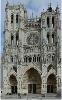
| Amiens FeatureType : null Elevation : 35 Lat/Lng : 49.8943 / 2.2957 | Amiens is a city and commune in northern France, north of Paris and south-west of Lille. It is the capital of the Somme department in Hauts-de-France. The city had a population of 136,105 according to the 2006 census (...) |
| 53 | 
| Cannes FeatureType : null Elevation : 11 Lat/Lng : 43.5513 / 7.0128 | Cannes is a city located on the French Riviera. It is a commune located in the Alpes-Maritimes department, and host city of the annual Cannes Film Festival, Midem, and Cannes Lions International Festival of Creativity (...) |
| 54 | 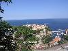
| Monaco FeatureType : city Elevation : 29 Lat/Lng : 43.7325 / 7.4183 | Monaco , officially the Principality of Monaco , is a sovereign city-state, country and microstate on the French Riviera in Western Europe. France borders the country on three sides while the other side borders the Mediterranean Sea (...) |
| 55 | 
| Entebbe International Airport FeatureType : airport}} Elevation : 1160 Lat/Lng : 0.0431 / 32.4433 | Entebbe International Airport is the principal international airport of Uganda. It is near the town of Entebbe, on the shores of Lake Victoria, and approximately by road south-west of the central business district of Kampala, the capital and largest city of Uganda (...) |
| 56 | 
| Marseille FeatureType : null Elevation : 6 Lat/Lng : 43.2963 / 5.3699 | Marseille (; , ; Marseilles;) is the second-largest city of France. The main city of the historical province of Provence, today it is the capital of the department of Bouches-du-Rhône and region of Provence-Alpes-Côte d'Azur (...) |
| 57 | 
| Bordeaux FeatureType : null Elevation : 11 Lat/Lng : 44.8379 / -0.5795 | Bordeaux (; Gascon) is a port city on the Garonne in the Gironde department in Southwestern France. The municipality (commune) of Bordeaux proper has a population of 246,586 (2014). Together with its suburbs and satellite towns, Bordeaux is the centre of the Bordeaux Métropole (...) |
| 58 | 
| Kinshasa FeatureType : null Elevation : 283 Lat/Lng : -4.3317 / 15.3139 | Kinshasa (; ; formerly Léopoldville (or Dutch nocat=true)) is the capital and the largest city of the Democratic Republic of the Congo. The city is situated alongside the Congo River. Once a site of fishing and trading villages, Kinshasa is now a megacity with an estimated population of more than (...) |
| 59 | 
| Togo FeatureType : country Lat/Lng : 6.1167 / 1.2167 | Togo , officially the Togolese Republic , is a country in West Africa bordered by Ghana to the west, Benin to the east and Burkina Faso to the north. The sovereign state extends south to the Gulf of Guinea, where its capital Lomé is located (...) |
| 60 | 
| Ypres FeatureType : city Elevation : 21 Lat/Lng : 50.8522 / 2.8847 | Ypres is a Belgian municipality in the province of West Flanders. Though the Flemish ' is the official name, the city's French name Ypres is most commonly used in English. The municipality comprises the city of Ypres and the villages of Boezinge, Brielen, Dikkebus, Elverdinge, Hollebeke, Sint-Jan, (...) |
| 61 | 
| Musée d'Orsay FeatureType : landmark Elevation : 47 Lat/Lng : 48.8602 / 2.3254 | The Musée d'Orsay is a museum in Paris, France, on the Left Bank of the Seine. It is housed in the former Gare d'Orsay, a Beaux-Arts railway station built between 1898 and 1900. The museum holds mainly French art dating from 1848 to 1914, including paintings, sculptures, furniture, and photography (...) |
| 62 | 
| Gijón FeatureType : city Elevation : 15 Lat/Lng : 43.545 / -5.6625 | Gijón (or) or is the largest city and municipality in the autonomous community of Asturias in Spain. It is located on the Bay of Biscay, approximately north of Oviedo, the capital of Asturias. (...) |
| 63 | 
| Aix-en-Provence FeatureType : null Elevation : 189 Lat/Lng : 43.5263 / 5.4454 | Aix-en-Provence , or simply Aix (; medieval Occitan Aics), is a city-commune in the south of France, about north of Marseille. A former capital of Provence, it is in the region of Provence-Alpes-Côte d'Azur, in the department of Bouches-du-Rhône, of which it is a subprefecture (...) |
| 64 | 
| English Channel FeatureType : waterbody Lat/Lng : 50.1836 / -0.5311 | The English Channel ("The Sleeve"; , "Sleeve Channel"; , "Sea of Brittany"; , "British Sea"; , "The Channel"), also called simply the Channel, is the body of water that separates southern England from northern France and links the southern part of the North Sea to the Atlantic Ocean (...) |
| 65 | 
| Essaouira FeatureType : city Elevation : 9 Lat/Lng : 31.5131 / -9.7697 | Essaouira , formerly known as Mogador, is a city in the western Moroccan economic region of Marrakesh-Safi, on the Atlantic coast. The modern name means "the little rampart", a reference to the fortress walls that still enclose part of the city. (...) |
| 66 | 
| The Hague FeatureType : null Elevation : 15 Lat/Lng : 52.08 / 4.32 | The Hague (; , , short for s-Gravenhage;) is a city on the western coast of the Netherlands and the capital of the province of South Holland. It is also the seat of government of the Netherlands. With a metropolitan population of more than 1 million, it is the third-largest city in the (...) |
| 67 | 
| Roubaix FeatureType : null Elevation : 31 Lat/Lng : 50.6901 / 3.1817 | Roubaix (Dutch: Robaais) is a city in Northern France, located in the Lille metropolitan area. It is a historically mono-industrial commune in the Nord department, which grew rapidly in the 19th century from its textile industries, with most of the same characteristic features as those of English (...) |
| 68 | 
| Palencia FeatureType : city Elevation : 742 Lat/Lng : 42.0167 / -4.5333 | Palencia is a city south of Tierra de Campos, in north-northwest Spain, the capital of the province of Palencia in the autonomous community of Castile and León. The municipality had a population of 78,892 in 2017. (...) |
| 69 | 
| Bonn FeatureType : city Elevation : 69 Lat/Lng : 50.734 / 7.0998 | The Federal City of Bonn is a city on the banks of the Rhine in the German state of North Rhine-Westphalia, with a population of over 300,000. About south-southeast of Cologne, Bonn is in the southernmost part of the Rhine-Ruhr region, Germany's largest metropolitan area, with over 11 million (...) |
| 70 | 
| Warsaw Chopin Airport FeatureType : airport Elevation : 99 Lat/Lng : 52.1657 / 20.9671 | Warsaw Frederic Chopin Airport , more commonly referred to as Chopin Airport or Warsaw-Chopin Airport, is an international airport located in the Włochy district of Warsaw, Poland. As Poland's largest, covering of land, and busiest airport, Warsaw Chopin handles just under 40% of the country's air (...) |
| 71 | 
| John F. Kennedy International Airport FeatureType : airport Elevation : 6 Lat/Lng : 40.6405 / -73.7789 | John F. Kennedy International Airport (colloquially referred to as Kennedy Airport, JFK Airport, New York-JFK, or simply JFK or Kennedy) is the primary international airport serving New York City. It is the busiest international air passenger gateway into North America, the 22nd-busiest airport in (...) |
| 72 | 
| Malta International Airport FeatureType : airport Elevation : 78 Lat/Lng : 35.8575 / 14.4774 | Malta International Airport is the only airport in Malta and it serves the whole of the Maltese Islands. It is located on island of Malta, southwest of the Maltese capital Valletta in the town of Gudja, and occupies the location of the former RAF Luqa (...) |
| 73 | 
| Belgrade Nikola Tesla Airport FeatureType : airport Elevation : 97 Lat/Lng : 44.8184 / 20.3091 | Belgrade Nikola Tesla Airport (/ Aerodrom Nikola Tesla Beograd) , is an international airport serving Belgrade, Serbia. Previously known as Belgrade Airport (/ Aerodrom Beograd) or Surčin Airport (/ Aerodrom Surčin), it was renamed in 2006 in honor of Serbian scientist and inventor Nikola Tesla (...) |
| 74 | 
| Pescara FeatureType : null Elevation : 6 Lat/Lng : 42.4667 / 14.2167 | Pescara listen (Abruzzese: '; Pescarese: ') is the capital city of the Province of Pescara, in the Abruzzo region of Italy. It is the most populated city in Abruzzo, with 125,717 (2017) residents (and approximately 450,000 including the surrounding metropolitan area) (...) |
| 75 | 
| Sheremetyevo International Airport FeatureType : airport Elevation : 186 Lat/Lng : 55.9726 / 37.4146 | Sheremetyevo International Airport is an international airport located in Molzhaninovsky District, Northern Administrative Okrug, Moscow, Russia, northwest of central Moscow. It is a hub for passenger operations of the Russian international airline Aeroflot, and is one of the three major airports (...) |
| 76 | 
| Athens International Airport FeatureType : airport Elevation : 83 Lat/Lng : 37.9364 / 23.9445 | Athens International Airport "Eleftherios Venizelos" (Diethnís Aeroliménas Athinón "Elefthérios Venizélos") , commonly initialized as "AIA", began operation on 28 March 2001 and is the primary international airport that serves the city of Athens and the region of Attica (...) |
| 77 | 
| Pau, Pyrénées-Atlantiques FeatureType : null Elevation : 203 Lat/Lng : 43.2947 / -0.3747 | Pau is a commune on the northern edge of the Pyrenees, and capital of the Pyrénées-Atlantiques Département in the region of Nouvelle-Aquitaine, France. The city is located in the heart of the former sovereign Principality of Béarn, of which it was the capital from 1464 (...) |
| 78 | 
| Rotterdam FeatureType : null Elevation : 3 Lat/Lng : 51.9167 / 4.4833 | Rotterdam is the second-largest city and a municipality of the Netherlands. It is located in the province of South Holland, at the mouth of the Nieuwe Maas channel leading into the Rhine–Meuse–Scheldt delta at the North Sea (...) |
| 79 | 
| Burgos FeatureType : null Elevation : 869 Lat/Lng : 42.3408 / -3.6997 | Burgos is a city in northern Spain and the historic capital of Castile. It is situated on the confluence of the Arlanzón river tributaries, at the edge of the Iberian central plateau. It has about 180,000 inhabitants in the actual city and another 20,000 in the metropolitan area (...) |
| 80 | 
| Bayonne FeatureType : null Elevation : 13 Lat/Lng : 43.4936 / -1.475 | Bayonne (; Gascon: Baiona ; ;) is a city and commune and one of the two sub-prefectures of the department of Pyrénées-Atlantiques, in the Nouvelle-Aquitaine region of south-western France. It is located at the confluence of the Nive and Adour rivers in the northern part of the cultural region of the (...) |
| 81 | 
| Jersey FeatureType : isle Elevation : 90 Lat/Lng : 49.2206 / -2.1372 | Jersey (; Jèrriais: Jèrri), officially the Bailiwick of Jersey (; Jèrriais: Bailliage dé Jèrri), is a Crown dependency located near the coast of Normandy, France. Jersey was part of the Duchy of Normandy, whose dukes went on to become kings of England from 1066 (...) |
| 82 | 
| Banja Luka FeatureType : null Elevation : 166 Lat/Lng : 44.7758 / 17.1856 | Banja Luka or Banjaluka , is the second largest city of Bosnia and Herzegovina and the de facto capital of the Republika Srpska entity. Traditionally, it has been the centre of the Bosanska Krajina region, located in the northwestern part of the country (...) |
| 83 | 
| Democratic Republic of the Congo FeatureType : country Elevation : 444 Lat/Lng : -2.3333 / 22.8 | The Democratic Republic of the Congo , also known as DR Congo, the DRC, Congo-Kinshasa, East Congo, or simply the Congo, is the southernmost country located in East Africa and Central Africa. It is sometimes referred to by its former name of Zaire, which was its official name between 1971 and 1997 (...) |
| 84 | 
| Aachen FeatureType : null Elevation : 178 Lat/Lng : 50.7767 / 6.0836 | Aachen or Bad Aachen, French and traditional English: Aix-la-Chapelle , is a spa and border city. in North Rhine-Westphalia, Germany. Aachen developed from a Roman settlement and spa, subsequently becoming the preferred medieval Imperial residence of Charlemagne, and, from 936 to 1531, the place (...) |
| 85 | 
| Nymphenburg Palace FeatureType : landmark Elevation : 518 Lat/Lng : 48.1582 / 11.5033 | The Nymphenburg Palace , i. e., "Castle of the Nymph (or Nymphs)", is a Baroque palace in Munich, Bavaria, southern Germany. The palace was the main summer residence of the former rulers of Bavaria of the House of Wittelsbach. (...) |
| 86 | 
| Maastricht FeatureType : null Elevation : 57 Lat/Lng : 50.8492 / 5.6892 | Maastricht (;Local pronunciation: Limburgish : Mestreech ; French: Maestricht ; Spanish: Mastrique) is a city and a municipality in the southeast of the Netherlands. It is the capital and largest city of the province of Limburg (...) |
| 87 | Roman Catholic Archdiocese of Mechelen-Brussels FeatureType : landmark Elevation : 7 Lat/Lng : 51.0301 / 4.4788 | The Archdiocese of Mechelen-Brussels is an archdiocese of the Roman Catholic Church in Belgium. It is the Primatial See of Belgium and the centre of the Ecclesiastical Province governed by the Archbishop of Mechelen-Brussels, which covers the whole of Belgium (...) | |
| 88 | 
| Valence (city) FeatureType : null Elevation : 134 Lat/Lng : 44.9333 / 4.8917 | Valence is a commune in southeastern France, the capital of the Drôme department and within the Auvergne-Rhône-Alpes region. It is situated on the left bank of the Rhône, about south of Lyon, along the railway line that runs from Paris to Marseille (...) |
| 89 | 
| Amsterdam FeatureType : null Elevation : 10 Lat/Lng : 52.3702 / 4.8904 | Amsterdam is the capital city and most populous municipality of the Netherlands. Its status as the capital is mandated by the Constitution of the Netherlands, although it is not the seat of the government, which is The Hague (...) |
| 90 | 
| Blenheim Palace FeatureType : landmark Elevation : 105 Lat/Lng : 51.8419 / -1.3617 | Blenheim Palace (pronounced) is a monumental country house in Blenheim, Oxfordshire, England. It is the principal residence of the Dukes of Marlborough, and the only non-royal, non-episcopal country house in England to hold the title of palace (...) |
| 91 | 
| Macau FeatureType : city Elevation : 29 Lat/Lng : 22.1986 / 113.5447 | Macau or Macao , officially the Macao Special Administrative Region of the People's Republic of China, is an autonomous territory on the western side of the Pearl River estuary in East Asia. Along with Hong Kong, Guangzhou, Shenzhen, Zhuhai, and several other major cities in Guangdong, the territory (...) |
| 92 | Aulnoye-Aymeries FeatureType : null Elevation : 144 Lat/Lng : 50.205 / 3.8364 | Aulnoye-Aymeries is a commune in the Nord department in northern France. Before the opening of the high-speed railway line between Brussels and Paris, the railway station of Aulnoye-Aymeries was a major junction, where the lines Paris–Brussels and Calais–Lille–Thionville connected. (...) | |
| 93 | 
| Berlin Tempelhof Airport FeatureType : null Elevation : 44 Lat/Lng : 52.4735 / 13.4038 | Berlin Tempelhof Airport was one of the first airports in Berlin, Germany. Situated in the south-central Berlin borough of Tempelhof-Schöneberg, the airport ceased operating in 2008 amid controversy, leaving Tegel and Schönefeld as the two main airports serving the city, with the new Berlin (...) |
| 94 | 
| Frankfurt Airport FeatureType : airport Elevation : 101 Lat/Lng : 50.0326 / 8.5599 | Frankfurt am Main Airport (also known as Rhein-Main-Flughafen) is a major international airport located in Frankfurt, the fifth-largest city of Germany and one of the world's leading financial centres. It is operated by Fraport and serves as the main hub for Lufthansa including Lufthansa CityLine (...) |
| 95 | 
| Burkina Faso FeatureType : country Elevation : 327 Lat/Lng : 12.2667 / -2.0667 | Burkina Faso is a landlocked country in West Africa. It covers an area of around and is surrounded by six countries: Mali to the north; Niger to the east; Benin to the southeast; Togo and Ghana to the south; and Ivory Coast to the southwest (...) |
| 96 | 
| Switzerland FeatureType : country Elevation : 1522 Lat/Lng : 46.8011 / 8.2267 | Switzerland, officially the Swiss Confederation, is a country in Europe. It consists of 26 cantons, and the city of Bern is the seat of the federal authorities.Bern is referred to as "federal city" . Swiss law does not designate a capital as such, but the federal parliament and government are (...) |
| 97 | 
| Porto FeatureType : null Elevation : 22 Lat/Lng : 41.1333 / -8.6667 | Porto (; also known as Oporto in English Google Books) is the second-largest city in Portugal after Lisbon and one of the major urban areas of the Iberian Peninsula. The city proper has a population of 237,591 and the metropolitan area of Porto, which extends beyond the administrative limits of the (...) |
| 98 | 
| Helsinki FeatureType : city Lat/Lng : 60.1667 / 24.9333 | Helsinki is the capital city and most populous municipality of Finland. Located on the shore of the Gulf of Finland, it is the seat of the region of Uusimaa in southern Finland, and has a population of . The city's urban area has a population of , making it by far the most populous urban area in (...) |
| 99 | 
| Montreal FeatureType : null Elevation : 44 Lat/Lng : 45.5077 / -73.5626 | Montreal (; is the local English pronunciation; in the rest of Canada, it tends to be , but the British and American pronunciation is . ; officially Montréal) is the most populous municipality in the Canadian province of Quebec and the second-most populous municipality in Canada (...) |
| 100 | 
| Berlin FeatureType : landmark Elevation : 38 Lat/Lng : 52.5029 / 13.4042 | Berlin is the capital and largest city of Germany by both area and population. Its 3,711,930 (2017) inhabitants make it the second most populous city proper of the European Union after London. The city is one of Germany's 16 federal states, and it is surrounded by the state of Brandenburg, the (...) |
| 101 | 
| Czech Republic FeatureType : country Elevation : 324 Lat/Lng : 49.85 / 15.4667 | The Czech Republic , also known by its short-form name, Czechia , is a landlocked country in Central Europe bordered by Germany to the west, Austria to the south, Slovakia to the east and Poland to the northeast (...) |
| 102 | 
| Bank for International Settlements FeatureType : landmark Elevation : 279 Lat/Lng : 47.5481 / 7.5919 | The Bank for International Settlements (BIS) is an international financial institution owned by central banks which "fosters international monetary and financial cooperation and serves as a bank for central banks" (...) |
| 103 | 
| Madrid FeatureType : null Elevation : 700 Lat/Lng : 40.4333 / -3.6833 | Madrid is the capital of Spain and the largest municipality in both the Community of Madrid and Spain as a whole. The city has almost 3.2 million, Instituto Nacional de Estadística, 2015. inhabitants and a metropolitan area population of approximately 6.5 million (...) |
| 104 | 
| Armenia FeatureType : country Elevation : 992 Lat/Lng : 40.17 / 44.52 | Armenia (;"." Dictionary.com Unabridged. 2015.), officially the Republic of Armenia , is a country in the South Caucasus region of Eurasia. Located in Western AsiaThe UN places Armenia in Western Asia; the CIA World Factbook , , and Oxford Reference Online also place Armenia in Asia (...) |
| 105 | 
| Benin FeatureType : country Elevation : 0 Lat/Lng : 6.4667 / 2.6 | Benin , officially the Republic of Benin and formerly Dahomey, is a country in West Africa. It is bordered by Togo to the west, Nigeria to the east, and Burkina Faso and Niger to the north. The majority of its population lives on the small southern coastline of the Bight of Benin, part of the Gulf (...) |
| 106 | 
| Victoria and Albert Museum FeatureType : landmark Elevation : 23 Lat/Lng : 51.4967 / -0.1719 | The Victoria and Albert Museum (often abbreviated as the V&A) in London is the world's largest museum of decorative arts and design, housing a permanent collection of over 2.27 million objects. It was founded in 1852 and named after Queen Victoria and Prince Albert (...) |
| 107 | 
| Petit Palais FeatureType : landmark Elevation : 40 Lat/Lng : 48.866 / 2.3146 | The Petit Palais (small palace) is an art museum in the 8th arrondissement of Paris, France. Built for the 1900 Exposition Universelle ("universal exhibition"), it now houses the City of Paris Museum of Fine Arts (Musée des beaux-arts de la ville de Paris) (...) |
| 108 | 
| Quiévrain FeatureType : null Elevation : 35 Lat/Lng : 50.4072 / 3.6851 | Quiévrain is a Walloon municipality located in the Belgian province of Hainaut. On 1 January 2006, the municipality had 6,559 inhabitants. The total area is 21.22 km², giving a population density of 309 inhabitants per km² (...) |
| 109 | 
| Netherlands FeatureType : country Elevation : 25 Lat/Lng : 52.35 / 5.7667 | The Netherlands is a country located mainly in Northwestern Europe. Together with three island territories in the Caribbean (Bonaire, Sint Eustatius and Saba), it forms a constituent country of the Kingdom of the Netherlands (...) |
| 110 | Brussels and the European Union FeatureType : landmark Elevation : 68 Lat/Lng : 50.84 / 4.373 | Brussels in Belgium is consideredsee the references below in the Status section the de facto capital of the European Union, having a long history of hosting the institutions of the European Union within its European Quarter (...) | |
| 111 | 
| Leicester FeatureType : null Elevation : 71 Lat/Lng : 52.6349 / -1.1301 | Leicester ("Lester")"", Merriam-Webster Dictionary. Retrieved 28 August 2015 is a city and unitary authority area in the East Midlands of England, and the county town of Leicestershire. The city lies on the River Soar and close to the eastern end of the National Forest (...) |
| 112 | 
| University of Waterloo FeatureType : landmark Elevation : 337 Lat/Lng : 43.4689 / -80.54 | The University of Waterloo (commonly referred to as Waterloo, UW, or UWaterloo) is a public research university with a main campus in Waterloo, Ontario, Canada. The main campus is on of land adjacent to "Uptown" Waterloo and Waterloo Park (...) |
| 113 | 
| Ecumenical Patriarchate of Constantinople FeatureType : landmark Elevation : 18 Lat/Lng : 41.0292 / 28.9517 | The Ecumenical Patriarchate of Constantinople (Oikoumenikón Patriarkhíon Konstantinoupóleos, ; ; Vatican City State, 1978, p. 3 ,Ortaylı, İlber (2003). "Osmanlı Barışı", p. 14. .In Turkey it is also referred to unofficially as Fener Rum Patrikhanesi, "Roman Patriarchate of the Phanar" "Roman (...) |
| 114 | 
| Lisbon FeatureType : null Elevation : 70 Lat/Lng : 38.7203 / -9.14 | Lisbon is the capital and the largest city of Portugal, with an estimated population of 505,526 within its administrative limits in an area of 100.05 km2. Its urban area extends beyond the city's administrative limits with a population of around 2 (...) |
| 115 | 
| Vilnius FeatureType : city Elevation : 106 Lat/Lng : 54.6883 / 25.2714 | Vilnius (see also other names) is the capital of Lithuania and its largest city, with a population of 574,147 . Vilnius is in the southeast part of Lithuania and is the second largest city in the Baltic states. Vilnius is the seat of the main government institutions of Lithuania and the Vilnius (...) |
| 116 | 
| Burundi FeatureType : country Elevation : 1995 Lat/Lng : -3.6667 / 29.8167 | Burundi , officially the Republic of Burundi (. justice.gov.bi. 25 June 2012 ; , or), is a landlocked country in the African Great Lakes region of East Africa, bordered by Rwanda to the north, Tanzania to the east and south, and the Democratic Republic of the Congo to the west (...) |
| 117 | 
| Mongolia FeatureType : country Elevation : 1299 Lat/Lng : 47.9167 / 106.9167 | Mongolia (; Monggol Ulus in Mongolian; in Mongolian Cyrillic) is a landlocked country in East Asia. Its area is roughly equivalent with the historical territory of Outer Mongolia, and that term is sometimes used to refer to the current state (...) |
| 118 | 
| Washington, D.C. FeatureType : null Elevation : 6 Lat/Lng : 38.8951 / -77.0366 | Washington, D.C., formally the District of Columbia and commonly referred to as Washington or D.C., is the capital of the United States. Founded after the American Revolution as the seat of government of the newly independent country, Washington was named after George Washington, first President of (...) |
| 119 | Small ring (Brussels) FeatureType : null Elevation : 20 Lat/Lng : 50.857 / 4.3525 | The Brussels small ring inner ring road, formally R20 is a series of roadways in central Brussels, Belgium, surrounding the historic city centre. The city centre is usually defined as the area within the small ring; this area is called the pentagon due to its pentagonal shape (...) | |
| 120 | 
| Georgia (country) FeatureType : country Elevation : 659 Lat/Lng : 42.0167 / 43.7333 | Georgia is a country in the Caucasus region of Eurasia. Located at the crossroads of Western Asia and Eastern Europe, it is bounded to the west by the Black Sea, to the north by Russia, to the south by Turkey and Armenia, and to the southeast by Azerbaijan. The capital and largest city is Tbilisi (...) |
| 121 | 
| Leipzig FeatureType : null Elevation : 118 Lat/Lng : 51.3403 / 12.3748 | Leipzig is the most populous city in the federal state of Saxony, Germany. With a population of 591,686 inhabitants as of 30 June 2018, (1.1 million residents in the larger urban zone) it is Germany's tenth most populous city.http://www.statistik-bremen.de/aktuelle_statistiken/01a (...) |
| 122 | 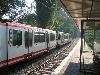
| Dortmund FeatureType : null Elevation : 98 Lat/Lng : 51.5139 / 7.4653 | Dortmund is, with a population of 601,402 (2017), the third largest city of Germany's most populous federal state of North Rhine-Westphalia after Cologne and Düsseldorf, and Germany's eighth largest city. It is the largest city (by area and population) of the Ruhr, Germany's largest urban area with (...) |
| 123 | 
| Leipzig/Halle Airport FeatureType : null Elevation : 128 Lat/Lng : 51.424 / 12.2364 | Leipzig/Halle Airport (German: Flughafen Leipzig/Halle) is an international airport located in Schkeuditz, Saxony and serves both Leipzig, Saxony and Halle, Saxony-Anhalt. It is Germany's 13th largest airport by passengers and handled more than 2 (...) |
| 124 | 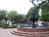
| Atlanta FeatureType : null Elevation : 335 Lat/Lng : 33.755 / -84.39 | Atlanta is the capital of, and the most populous city in, the U.S. state of Georgia. With an estimated 2017 population of 486,290, it is also the 39th most-populous city in the United States. The city serves as the cultural and economic center of the Atlanta metropolitan area, home to 5 (...) |
| 125 | 
| Skopje FeatureType : city Elevation : 243 Lat/Lng : 41.9966 / 21.4324 | Skopje is the capital and largest city of the Republic of Macedonia. It is the country's political, cultural, economic, and academic center. It was known in the Greek and Roman period under the name Scupi. The territory of Skopje has been inhabited since at least 4000 BC; remains of Neolithic (...) |
| 126 | 
| Nador FeatureType : city Elevation : 24 Lat/Lng : 35.17 / -2.93 | Nador (Berber: Ennaḍur, ⴻⵏⵏⴰⴹⵓⵔ; Arabic: الناظور) is a coastal city and provincial capital in the northeastern Rif region of Morocco with a population of about 161,726 (2014 census). It is separated from the Mediterranean Sea by a salt lagoon named Sebkha Bou Areq (Arabic), Bḥar Ameẓẓyan (Berber) or (...) |
| 127 | 
| Montevideo FeatureType : null Elevation : 46 Lat/Lng : -34.8833 / -56.1667 | Montevideo is the capital and largest city of Uruguay. According to the 2011 census, the city proper has a population of 1,319,108 (about one-third of the country's total population) in an area of . The southernmost capital city in the Americas, Montevideo is situated on the southern coast of the (...) |
| 128 | 
| Potsdamer Platz FeatureType : landmark Elevation : 41 Lat/Lng : 52.5094 / 13.3765 | Potsdamer Platz (literally Potsdam Square) is an important public square and traffic intersection in the centre of Berlin, Germany, lying about south of the Brandenburg Gate and the Reichstag (German Parliament Building), and close to the southeast corner of the Tiergarten park (...) |
| 129 | 
| Thessaloniki FeatureType : null Elevation : 185 Lat/Lng : 40.6472 / 22.9639 | Thessaloniki (Thessaloníki , also familiarly known as Thessalonica, Salonica, or Salonika is the second-largest city in Greece, with over 1 million inhabitants in its metropolitan area, and the capital of Greek Macedonia, the administrative region of Central Macedonia and the Decentralized (...) |
| 130 | 
| Sierra Leone FeatureType : country Elevation : 89 Lat/Lng : 8.5833 / -11.8333 | Sierra Leone , officially the Republic of Sierra Leone, is a country in West Africa. It is bordered by Guinea to the northeast, Liberia to the southeast and the Atlantic Ocean to the southwest. It has a tropical climate, with a diverse environment ranging from savanna to rainforests (...) |
| 131 | 
| Alte Pinakothek FeatureType : landmark Elevation : 522 Lat/Lng : 48.1483 / 11.57 | The Alte Pinakothek (Old Pinakothek) is an art museum located in the Kunstareal area in Munich, Germany. It is one of the oldest galleries in the world and houses a significant collection of Old Master paintings (...) |
| 132 | 
| Sarajevo International Airport FeatureType : airport Elevation : 505 Lat/Lng : 43.8245 / 18.3318 | Sarajevo International Airport ; , also known as Butmir Airport, is the main international airport in Bosnia and Herzegovina, serving Sarajevo, capital of Bosnia and Herzegovina. It is located southwest of the Sarajevo railway station and some west of downtown Sarajevo in the Ilidža municipality, (...) |
| 133 | 
| Tobruk FeatureType : null Elevation : 7 Lat/Lng : 32.0761 / 23.9614 | Tobruk or Tubruq (; Ṭubruq; also transliterated as Tóbruch, Tobruch, Tobruck and Tubruk) is a port city on Libya's eastern Mediterranean coast, near the border of Egypt. It is the capital of the Butnan District (formerly Tobruk District) and has a population of 120,000 (2011 est.) (...) |
| 134 | 
| Aichi Prefecture FeatureType : adm1st Elevation : 17 Lat/Lng : 35.1802 / 136.9135 | is a prefecture of Japan located in the Chūbu region.Nussbaum, Louis-Frédéric. (2005). "Aichi-ken" ; "Chūbu" . The region of Aichi is also known as the Tōkai region. The capital is Nagoya. It is the focus of the Chūkyō metropolitan area.Nussbaum, "Nagoya" . (...) |
| 135 | 
| Supreme Headquarters Allied Powers Europe FeatureType : landmark Elevation : 87 Lat/Lng : 50.4994 / 3.9839 | Supreme Headquarters Allied Powers Europe (SHAPE) is the headquarters of the North Atlantic Treaty Organization's Allied Command Operations (ACO). SHAPE is located at Casteau, north of the Belgian city of Mons. The commander of ACO and SHAPE is Supreme Allied Commander Europe (SACEUR), a U.S (...) |
| 136 | European route E40 FeatureType : null Elevation : 3 Lat/Lng : 50.936 / 1.9095 | European route E 40 is the longest European route, more than long, connecting Calais in France via Belgium, Germany, Poland, Ukraine, Russia, Kazakhstan, Uzbekistan, Turkmenistan, and Kyrgyzstan, with Ridder in Kazakhstan near the border with Russia and China. (...) | |
| 137 | 
| Sandwich, Kent FeatureType : null Elevation : 3 Lat/Lng : 51.2722 / 1.3378 | Sandwich is a historic town and civil parish on the River Stour in the non-metropolitan district of Dover, within the ceremonial county of Kent, south-east England. It has a population of 4,985. Sandwich was one of the Cinque Ports and still has many original medieval buildings, including several (...) |
| 138 |
| Luxembourg railway station FeatureType : null Elevation : 287 Lat/Lng : 49.5998 / 6.1344 | Luxembourg railway station is the main railway station serving Luxembourg City, in southern Luxembourg. It is operated by Chemins de Fer Luxembourgeois, the state-owned railway company. 80,000 passengers use this station every day (...) |
| 139 | Étrœungt FeatureType : null Elevation : 168 Lat/Lng : 50.0581 / 3.9283 | Étrœungt is a commune in the Nord department in northern France. (...) | |
| 140 | Walloon Brabant FeatureType : null Elevation : 104 Lat/Lng : 50.66 / 4.5833 | Walloon Brabant (Dutch: Waals-Brabant) is a province of Wallonia and Belgium. It borders on (clockwise from the North) the province of Flemish Brabant (Flemish Region) and the provinces of Liège, Namur and Hainaut (Wallonia). Its capital is Wavre (...) | |
| 141 | Wannehain FeatureType : null Elevation : 44 Lat/Lng : 50.5694 / 3.2664 | Wannehain is a commune in the Nord department in northern France, on the border with Belgium. The HSL 1 railway line to Brussels crosses the border at Wannehain. (...) | |
| 142 | 
| Courbevoie FeatureType : null Elevation : 48 Lat/Lng : 48.8978 / 2.2531 | Courbevoie is a commune located from the center of Paris, France. The centre of Courbevoie is situated 2 kilometres from the outer limits of central Paris. It is one of the most densely populated municipalities in Europe, and ranks as the third-best place to live in the Île-de-France region, after (...) |
| 143 | 
| Monterrey Institute of Technology and Higher Education FeatureType : edu Elevation : 543 Lat/Lng : 25.6514 / -100.2907 | Instituto Tecnológico y de Estudios Superiores de Monterrey (ITESM) (in), also known as Tecnológico de Monterrey or simply as Tec, is a private, nonsectarian and coeducational multi-campus university based in Monterrey, Mexico (...) |
| 144 | 
| Imperial Crypt FeatureType : landmark Elevation : 185 Lat/Lng : 48.2057 / 16.3702 | The Imperial Crypt , also called the Capuchin Crypt (Kapuzinergruft), is a burial chamber beneath the Capuchin Church and monastery in Vienna, Austria. It was founded in 1618 and dedicated in 1632, and located on the Neuer Markt square of the Innere Stadt, near the Hofburg Palace (...) |
| 145 | Bombardment of Brussels FeatureType : null Elevation : 31 Lat/Lng : 50.8467 / 4.3524 | The bombardment of Brussels by troops of Louis XIV of France on August 13, 14, and 15, 1695, and the resulting fire were together the most destructive event in the entire history of Brussels.Brussels was mostly untouched by most other conflicts (...) | |
| 146 | Flanders FeatureType : country Elevation : 5 Lat/Lng : 51.0 / 4.5 | Flanders is the Dutch-speaking northern portion of Belgium and one of the communities, regions and language areas of Belgium. However, there are several overlapping definitions, including ones related to culture, language, politics and history, and sometimes involving neighbouring countries (...) | |
| 147 | Sonian Forest FeatureType : null Elevation : 120 Lat/Lng : 50.7833 / 4.4167 | The Sonian Forest or Sonian WoodAlso known as the forest or wood of Soignies, and if derived from Walloon the forest or wood of Soignes. is a forest at the southeast edge of Brussels, Belgium. The forest lies in the Flemish municipalities of Sint-Genesius-Rode, Hoeilaart, Overijse, and Tervuren, in (...) | |
| 148 | Île-de-France FeatureType : adm1st Elevation : 84 Lat/Lng : 48.5 / 2.5 | Île-de-France (; , literally "Island of France"), often known colloquially as the région parisienne ("Parisian Region"), is one of the 18 regions of France and includes the city of Paris. It covers and has its own regional council and president (...) | |
| 149 | Broxeele FeatureType : null Elevation : 25 Lat/Lng : 50.8308 / 2.3222 | Broxeele (Dutch: Broksele) is a commune in the Nord department in northern France. It is south of Dunkirk and also west of the Belgian border. (...) | |
| 150 | European route E19 FeatureType : null Elevation : 4 Lat/Lng : 52.3381 / 4.8145 | European route E 19 is long European route. Its route begins in the Netherlands, and ends in France, via Belgium. Cities it passes en route include: * Netherlands: Amsterdam - Den Haag - Rijswijk - Rotterdam - Breda * Belgium: Antwerp - Mechelen - Brussels - Mons * France: Valenciennes - Cambrai - (...) | |
| 151 | Oostende railway station FeatureType : railwaystation Elevation : 7 Lat/Lng : 51.2289 / 2.9258 | Oostende railway station is located in Ostend in West Flanders, Belgium. The first station in Ostend was opened in 1838 during the reign of Leopold I of Belgium on the former Belgian railway line 62 to Torhout and is now a supermarket (...) | |
| 152 | Béthune FeatureType : null Elevation : 35 Lat/Lng : 50.5302 / 2.6408 | Béthune (; archaic and Bethwyn historically in English) is a city in northern France, sub-prefecture of the Pas-de-Calais department. (...) | |
| 153 | Hazebrouck FeatureType : null Elevation : 29 Lat/Lng : 50.725 / 2.5392 | Hazebrouck is a commune in the Nord department in northern France. Hazebrouck in Flanders was a small market town before it became an important railway junction in the 1860s. West Flemish was the usual popular language used in the town until 1880 (...) | |
| 154 | Fretin FeatureType : null Elevation : 35 Lat/Lng : 50.5581 / 3.135 | Fretin is a commune in the Nord department in northern France. It is in the south of the Urban Community of Lille Métropole. (...) | |
| 155 | November 2015 Paris attacks FeatureType : null Elevation : 35 Lat/Lng : 48.8619 / 2.3468 | The November 2015 Paris attacks were a series of coordinated terrorist attacks that took place on Friday, 13 November 2015 in Paris, France and the city's northern suburb, Saint-Denis. Beginning at 21:16 CET, three suicide bombers struck outside the Stade de France in Saint-Denis, during a football (...) | |
| 156 | Gare de Chambéry-Challes-les-Eaux FeatureType : railwaystation Elevation : 272 Lat/Lng : 45.5715 / 5.9194 | Chambéry-Challes-les-Eaux station is a railway station in the Savoie département of France. The station serves the city of Chambéry. The station is served by two major high speed services, the TGV and Thalys. (...) | |
| 157 | Gare de Toulon FeatureType : railwaystation Elevation : 23 Lat/Lng : 43.1285 / 5.9296 | Gare de Toulon is a railway station serving the city Toulon, Var department, southeastern France. It is situated on the Marseille–Ventimiglia railway. (...) | |
| 158 | Aéroport Charles de Gaulle 2 TGV FeatureType : null Elevation : 111 Lat/Lng : 49.0039 / 2.5711 | Aéroport Charles de Gaulle 2 TGV is a major passenger railway station in Tremblay-en-France, France. It is located directly beneath terminal two of Paris Charles de Gaulle Airport (between the C/D and E/F concourses) and is operated by the SNCF. The station was opened in 1994 (...) | |
| 159 | Kortrijk railway station FeatureType : railwaystation Elevation : 19 Lat/Lng : 50.8244 / 3.2644 | Kortrijk railway station is the main railway station in the Belgian city of Kortrijk and one of the busiest railway stations in Belgium. Its NMBS/SNCB internal code is LK. The station was first inaugurated on 22 September 1839 (...) | |
| 160 | Charleroi FeatureType : null Elevation : 139 Lat/Lng : 50.4117 / 4.4447 | Charleroi is a city and a municipality of Wallonia, located in the province of Hainaut, Belgium. By January 1, 2008, the total population of Charleroi was 201,593. Population of all municipalities in Belgium, as of January 1, 2008. Retrieved on 2008-10-19 (...) | |
| 161 | Le Touquet FeatureType : null Elevation : 15 Lat/Lng : 50.5233 / 1.5853 | Le Touquet-Paris-Plage , commonly referred to as Le Touquet, is a commune near Étaples, in the Pas-de-Calais department in northern France. It has a population of 50,355 Retrieved 20 January 2010 but welcomes up to 250,000 people during the summer. www.letour (...) | |
| 162 | Institutional seats of the European Union FeatureType : null Elevation : 143 Lat/Lng : 48.58 / 7.75 | The seven institutions of the European Union (EU) are seated in four different cities, viz. Brussels, Frankfurt, Luxembourg and Strasbourg, rather than being concentrated in a single capital city. The EU agencies and other bodies are located all across the union, but usually not fixed in the (...) | |
| 163 | NATO FeatureType : landmark Elevation : 56 Lat/Lng : 50.8762 / 4.422 | The North Atlantic Treaty Organization (NATO ; ; '), also called the North Atlantic Alliance, is an intergovernmental military alliance between 29 North American and European countries. The organization implements the North Atlantic Treaty that was signed on 4 April 1949 (...) | |
| 164 | Rixensart FeatureType : null Elevation : 80 Lat/Lng : 50.7147 / 4.5358 | Rixensart is a Walloon municipality located in the Belgian province of Walloon Brabant. On January 1, 2006, Rixensart had a total population of 21,355. The total area is 17.54 km² which gives a population density of 1,217 inhabitants per km² (...) | |
| 165 | European Parliament FeatureType : landmark Elevation : 161 Lat/Lng : 48.5974 / 7.7687 | The European Parliament (EP) is the directly elected parliamentary institution of the European Union (EU). Together with the Council of the European Union (the Council) and the European Commission, it exercises the legislative function of the EU (...) | |
| 166 | Meuse FeatureType : null Lat/Lng : 51.715 / 4.6678 | The Meuse (; ; Walloon: Moûze) or Maas (; or Maas) is a major European river, rising in France and flowing through Belgium and the Netherlands before draining into the North Sea from the Rhine–Meuse–Scheldt delta. It has a total length of . (...) | |
| 167 | Beringen, Belgium FeatureType : null Elevation : 40 Lat/Lng : 51.0483 / 5.2233 | Beringen is a city and municipality located in the Belgian province of Limburg The Beringen municipality includes the town of Beringen proper and the old communes of Beverlo, Koersel, and Paal. (...) | |
| 168 | 
| Maison Carrée FeatureType : landmark Elevation : 54 Lat/Lng : 43.8383 / 4.3561 | The Maison Carrée (; French for "square house") is an ancient building in Nîmes, southern France; it is one of the best preserved Roman temple façades to be found in the territory of the former Roman Empire. (...) |
| 169 | Aubange FeatureType : null Elevation : 298 Lat/Lng : 49.573 / 5.7938 | Aubange (German: Ibingen, Luxembourgish: Éibeng, Walloon: Åbindje) is a Walloon municipality of Belgium located in the Province of Luxembourg. On 1 January 2012 the municipality, which covers 45.6 km², had 16,042 inhabitants, giving a population density of 330.9 inhabitants per km² (...) | |
| 170 | 
| Dejima FeatureType : isle Elevation : 9 Lat/Lng : 32.7435 / 129.873 | , in old Western documents Latinised as Deshima, Decima, Desjima, Dezima, Disma, or Disima, was a Dutch trading post notable for being the single place of direct trade and exchange between Japan and the outside world during the Edo period (...) |
| 171 | Scheldt FeatureType : null Lat/Lng : 51.4308 / 3.5289 | The Scheldt is a long river in northern France, western Belgium, and the southwestern part of the Netherlands. Its name is derived from an adjective corresponding to Old English sceald ("shallow"), Modern English shoal, Low German schol, West Frisian skol, and Swedish (obsolete) skäll ("thin"). (...) | |
| 172 | Tournai FeatureType : null Elevation : 30 Lat/Lng : 50.6064 / 3.3864 | Tournai (; Latin: Tornacum, Picard: Tornai), known in Dutch as Doornik and historically as Dornick in English, is a Walloon municipality of Belgium, southwest of Brussels on the river Scheldt. In the province of Hainaut, Tournai is part of the Lille-Kortrijk-Tournai metropolitan area which had (...) | |
| 173 | Nord-Pas-de-Calais FeatureType : adm1st Elevation : 37 Lat/Lng : 50.4667 / 2.7167 | Nord-Pas-de-Calais (is a former administrative region of France. Since 1 January 2016, it is part of the new region Hauts-de-France. It consisted of the departments of Nord and Pas-de-Calais. Nord-Pas-de-Calais borders the English Channel (west), the North Sea (northwest), Belgium (north and east) (...) | |
| 174 | Gare de Bourg-Saint-Maurice FeatureType : railwaystation Elevation : 813 Lat/Lng : 45.6185 / 6.7713 | Bourg-Saint-Maurice is a railway station in Bourg-Saint-Maurice, Auvergne-Rhône-Alpes in south-east France. (...) | |
| 175 | 
| Battle of Ligny FeatureType : city Elevation : 134 Lat/Lng : 50.5203 / 4.5814 | The Battle of Ligny (16 June 1815) was the last victory of the military career of Napoleon Bonaparte. In this battle, French troops of the Armée du Nord under Napoleon's command, defeated part of a Prussian army under Field Marshal Prince Blücher, near Ligny in present-day Belgium (...) |
| 176 | 
| Bouchout Castle FeatureType : null Elevation : 30 Lat/Lng : 50.9281 / 4.3288 | Bouchout Castle is a castle in the Flemish town of Meise, Belgium. In the 12th century, this territory of the young Duchy of Brabant was strategically positioned between the County of Flanders and the Berthout family, lords of Grimbergen (...) |
| 177 | Gabicce Mare FeatureType : null Elevation : 12 Lat/Lng : 43.96 / 12.75 | Gabicce Mare, also named Gabicce (Romagnol: Gabéc), is a town and comune (municipality) in the Province of Pesaro e Urbino, in Italy, region Marche. It is located about northwest of Ancona, north of Pesaro, and is close to the borders with the Province of Rimini, in Emilia-Romagna (...) | |
| 178 | Wemmel FeatureType : city Elevation : 46 Lat/Lng : 50.9061 / 4.3064 | Wemmel is a municipality located in the Belgian province of Flemish Brabant. The municipality only comprises the town of Wemmel proper. On January 1, 2006, Wemmel had a total population of 14,774. The total area is 8.74 km² which gives a population density of 1,690 inhabitants per km² (...) | |
| 179 | Gare d'Avignon TGV FeatureType : landmark Elevation : 22 Lat/Lng : 43.9217 / 4.7858 | Avignon TGV (IATA: XZN) is a railway station located in Avignon, France. It was opened on 10 June 2001 and is located on the LGV Méditerranée high-speed line and Avignon-Centre–Avignon TGV railway. The train services are operated by the SNCF. The station is located 6 km south of the city centre. (...) | |
| 180 | Villeneuve-d'Ascq FeatureType : null Elevation : 39 Lat/Lng : 50.6195 / 3.1318 | Villeneuve-d'Ascq is a commune in the Nord department in northern France. With more than 60,000 inhabitants and 50,000 students, it is one of the main cities of the Métropole Européenne de Lille and the largest in area (27 (...) | |
| 181 | European Commission FeatureType : landmark Elevation : 70 Lat/Lng : 50.8436 / 4.3828 | The European Commission (EC) is an institution of the European Union, responsible for proposing legislation, implementing decisions, upholding the EU treaties and managing the day-to-day business of the EU. Commissioners swear an oath at the European Court of Justice in Luxembourg City, pledging to (...) | |
| 182 | Lufthansa FeatureType : landmark Elevation : 50 Lat/Lng : 50.9415 / 6.9809 | Deutsche Lufthansa AG (or JSC) , commonly known as Lufthansa (sometimes also as Lufthansa German Airlines), is the largest German airline and, when combined with its subsidiaries, also the largest airline in Europe both in terms of fleet size, largest airlines in Europe (...) | |
| 183 | Belgian Congo FeatureType : city Elevation : 279 Lat/Lng : -4.3167 / 15.3167 | The Belgian Congo was a Belgian colony in Central Africa from 1908 until independence in 1960. The former colony is now the Democratic Republic of the Congo (DRC). Colonial rule in the Congo began in the late 19th century (...) | |
| 184 | Expo 58 FeatureType : landmark Elevation : 63 Lat/Lng : 50.8967 / 4.3439 | Expo 58, also known as the Brussels World’s Fair , was held from 17 April to 19 October 1958. It was the first major World Expo registered under the Bureau International des Expositions (BIE) after World War II. (...) | |
| 185 | Gare de Marne-la-Vallée–Chessy FeatureType : null Elevation : 126 Lat/Lng : 48.8704 / 2.7828 | Marne-la-Vallée–Chessy is a combined RER (commuter rail) and TGV (high-speed train) station in Chessy, France, about east of Paris. The station is located inside Disneyland Paris, in front of the entrances to the two theme parks and Disney Village (...) | |
| 186 | Gare de Narbonne FeatureType : railwaystation Elevation : 13 Lat/Lng : 43.1906 / 3.0057 | Narbonne is a railway station in Narbonne, Occitanie, France. The station opened on 22 April 1857 and is located on the Bordeaux–Sète railway and Narbonne–Portbou railway. The station is served by TGV (high speed), Intercités (long distance, also night train) and TER (local) services operated by the (...) | |
| 187 | Botanical Garden of Brussels FeatureType : landmark Elevation : 49 Lat/Lng : 50.8549 / 4.3652 | The Botanical Garden of Brussels (French: Jardin botanique de Bruxelles; Dutch: Kruidtuin van Brussel) stands on Rue Royale in Saint-Josse-ten-Noode, near the Northern Quarter financial district in Brussels. Its main building is a cultural complex and music venue known as Le Botanique. (...) | |
| 188 | Boulogne-Billancourt FeatureType : null Elevation : 38 Lat/Lng : 48.8352 / 2.2409 | Boulogne-Billancourt (; often colloquially called simply Boulogne, until 1924 Boulogne-sur-Seine) is a commune in the western suburbs of Paris, France. It is located from the centre of Paris. Boulogne-Billancourt is a subprefecture of the Hauts-de-Seine department and the seat of the Arrondissement (...) | |
| 189 | LGV Est FeatureType : null Elevation : 211 Lat/Lng : 48.9475 / 6.1697 | The Ligne à Grande Vitesse Est européenne (East European High Speed Line), typically shortened to LGV Est, is a French high-speed rail line that connects Vaires-sur-Marne (near Paris) and Vendenheim (near Strasbourg) (...) | |
| 190 | Wallonia FeatureType : adm1st Elevation : 188 Lat/Lng : 50.51 / 4.75 | Wallonia is a region of Belgium. As the southern portion of the country, Wallonia is primarily French-speaking, and accounts for 55% of the territory of Belgium, and a third of its population. The Walloon Region was not merged with the French Community of Belgium which is the political entity that (...) | |
| 191 | Hyères FeatureType : null Elevation : 36 Lat/Lng : 43.1199 / 6.1316 | Hyères , Provençal Occitan: Ieras in classical norm, or Iero in Mistralian norm) is a commune in the Var department in the Provence-Alpes-Côte d'Azur region in southeastern France. The old town lies from the sea clustered around the Castle of Saint Bernard, which is set on a hill (...) | |
| 192 | Province of Brabant FeatureType : adm1st Elevation : 34 Lat/Lng : 50.7833 / 4.6333 | The Province of Brabant was a province in Belgium from 1830 to 1995. It was created in 1815 as South Brabant, part of the United Kingdom of the Netherlands. In 1995, it was split into the Dutch-speaking Flemish Brabant, the French-speaking Walloon Brabant and the bilingual Brussels-Capital Region. (...) | |
| 193 | 
| Belgian Comic Strip Center FeatureType : landmark Elevation : 32 Lat/Lng : 50.8511 / 4.36 | The Belgian Comic Strip Center is a museum in Brussels, located in the Rue des Sables /Zandstraat 20, dedicated to Belgian comics. (...) |
| 194 | House of Arenberg FeatureType : city Elevation : 36 Lat/Lng : 50.8792 / 4.7019 | The House of Arenberg is an aristocratic lineage that is constituted by three successive families who took their name from Arenberg, a small territory of the Holy Roman Empire in the Eifel region. The inheritance of the House of Croÿ-Aarschot made the Arenbergs the wealthiest and most influential (...) | |
| 195 | Council of the European Union FeatureType : null Elevation : 68 Lat/Lng : 50.8414 / 4.3814 | The Council of the European Union, referred to in the treaties and other official documents simply as the Council is the third of the seven Institutions of the European Union (EU) as listed in the Treaty on European Union (...) | |
| 196 | Benelux FeatureType : null Elevation : 28 Lat/Lng : 50.85 / 4.35 | The Benelux Union is a politico-economic union of three neighbouring states in western Europe: Belgium, the Netherlands, and Luxembourg. The name Benelux is formed from joining the first two or three letters of each country's name – Belgium Netherlands Luxembourg – and was first used to name the (...) | |
| 197 | Aix-en-Provence TGV railway station FeatureType : railwaystation Elevation : 188 Lat/Lng : 43.4551 / 5.3173 | Aix-en-Provence TGV is a high speed railway station located in Cabriès, Bouches-du-Rhône, southern France. The station was opened in 2001 and is located on the LGV Méditerranée. The train services are operated by SNCF (...) | |
| 198 | Congo Free State FeatureType : country Elevation : 32 Lat/Lng : -5.85 / 13.05 | The Congo Free State ("Independent State of the Congo";) was a large state in Central Africa from 1885 to 1908. It was ruled personally by Leopold II and operated entirely separate from Belgium, of which he was also king (...) | |
| 199 | French Guiana FeatureType : adm1st Elevation : 195 Lat/Lng : 4.0 / -53.0 | French Guiana (pronounced or , ;) is an overseas department and region of France, on the north Atlantic coast of South America in the Guyanas. It borders Brazil to the east and south and Suriname to the west. Since 1981, when Belize became independent, French Guiana has been the only territory of (...) | |
| 200 | French Open FeatureType : landmark Elevation : 38 Lat/Lng : 48.8472 / 2.2492 | The French Open , also called Roland-Garros , is a major tennis tournament held over two weeks between late May and early June at the Stade Roland-Garros in Paris, France. The venue is named after the French aviator Roland Garros (...) | |
 by
by