| 146 records found in wikipedia | |||
| 1 | 
| Bratislava Airport  FeatureType : null Elevation : 129 Lat/Lng : 48.171 / 17.2131 | M. R. Štefánik Airport , also called – especially in English – Bratislava Airport or Bratislava-Ivanka, located approximately northeast of Bratislava city center on area of three municipalities (Bratislava-Ružinov, Bratislava-Vrakuňa and Ivanka pri Dunaji) is the main international airport of (...) |
| 2 | 
| Slovakia FeatureType : country Elevation : 146 Lat/Lng : 48.15 / 17.1167 | Slovakia , officially the Slovak Republic (listen), is a landlocked country in Central Europe. It is bordered by Poland to the north, Ukraine to the east, Hungary to the south, Austria to the west, and the Czech Republic to the northwest. Slovakia's territory spans about and is mostly mountainous (...) |
| 3 | 
| Bratislava Castle FeatureType : landmark Elevation : 213 Lat/Lng : 48.1422 / 17.1 | Bratislava Castle is the main castle of Bratislava, the capital of Slovakia. The massive rectangular building with four corner towers stands on an isolated rocky hill of the Little Carpathians directly above the Danube river in the middle of Bratislava (...) |
| 4 | 
| Trenčín FeatureType : null Elevation : 212 Lat/Lng : 48.8919 / 18.0367 | Trenčín (also known by other alternative names) is a city in western Slovakia of the central Váh River valley near the Czech border, around from Bratislava. It has a population of more than 55,000, which makes it the eighth largest municipality of the country and is the seat of the Trenčín Region (...) |
| 5 | 
| Nové Mesto nad Váhom FeatureType : null Elevation : 184 Lat/Lng : 48.7589 / 17.8344 | Nové Mesto nad Váhom is a town in the Trenčín Region of Slovakia. (...) |
| 6 | Bratislava FeatureType : null Elevation : 147 Lat/Lng : 48.1439 / 17.1097 | Bratislava (; , or ') is the capital of Slovakia. With a population of about 450,000, it is one of the smaller capitals of Europe but still the country's largest city. The greater metropolitan area is home to more than 650,000 people (...) | |
| 7 | 
| Carpathian Mountains FeatureType : mountain Elevation : 904 Lat/Lng : 47.0 / 25.5 | The Carpathian Mountains or Carpathians are a mountain range system forming an arc roughly long across Central and Eastern Europe, making them the second-longest mountain range in Europe (after the Scandinavian Mountains) (...) |
| 8 | 
| Poprad FeatureType : null Elevation : 671 Lat/Lng : 49.0594 / 20.2975 | Poprad (; is a city in northern Slovakia at the foot of the High Tatra Mountains, famous for its picturesque historic centre and as a holiday resort. It is the biggest town of the Spiš region and the tenth largest city in Slovakia, with a population of approximately 50,000 (...) |
| 9 | 
| Levoča FeatureType : null Elevation : 542 Lat/Lng : 49.0228 / 20.5906 | Levoča (pronunciation) (German name: Leutschau; Hungarian name: Lőcse) is a town in the Prešov Region of eastern Slovakia with a population of 14,600. The town has a historic center with a well preserved town wall, a Gothic church with the highest wooden altar in the world, carved by Master Pavol of (...) |
| 10 | 
| Prešov FeatureType : null Elevation : 258 Lat/Lng : 49.0017 / 21.2394 | Prešov (Preschau) is a city in Eastern Slovakia. It is a seat of the administrative Prešov Region and Šariš as well as the historic Szepes County of the Kingdom of Hungary. With a population of approximately 91,352, it is the third-largest city in Slovakia (...) |
| 11 | 
| Piešťany FeatureType : null Elevation : 163 Lat/Lng : 48.5917 / 17.8322 | Piešťany is a town in Slovakia. It is located in the western part of the country within the Trnava Region and is the seat of its own district. It is the biggest and best known spa town in Slovakia and has around 30,000 inhabitants (2012). (...) |
| 12 | 
| Martin Luther University of Halle-Wittenberg FeatureType : edu Elevation : 97 Lat/Lng : 51.4864 / 11.9689 | The Martin Luther University of Halle-Wittenberg , also referred to as MLU, is a public, research-oriented university in the cities of Halle and Wittenberg in Saxony-Anhalt, Germany. MLU offers German and international (English) courses leading to academic degrees such as BA, BSc, MA, MSc, doctoral (...) |
| 13 | 
| Uzhhorod FeatureType : null Elevation : 118 Lat/Lng : 48.6239 / 22.295 | Uzhhorod , , also previously and historically known as Ungvár (in Hungarian;) is a city located in western Ukraine, at the border with Slovakia and near the border with Hungary. It is the administrative center of Zakarpattia Oblast (region), as well as the administrative center of the surrounding (...) |
| 14 | 
| Modra FeatureType : null Elevation : 172 Lat/Lng : 48.3331 / 17.3069 | Modra (Latin: Modur) is a city and municipality in the Bratislava Region in Slovakia. It has a population of 8,704 . It nestles in the foothills of the Malé Karpaty (Little Carpathian mountains) and is an excellent centre of hiking. Modra is famous for its pottery industry (...) |
| 15 | 
| Nitra FeatureType : null Elevation : 141 Lat/Lng : 48.3069 / 18.0864 | Nitra (; also known by other alternative names) is a city in western Slovakia, situated at the foot of Zobor Mountain in the valley of the river Nitra. With a population of about 77,048, it is the fifth-largest city in Slovakia (...) |
| 16 | 
| Galanta FeatureType : null Elevation : 118 Lat/Lng : 48.1889 / 17.7264 | Galanta is a small town (about 16,000 inhabitants) in Slovakia. It is situated 50 km due east from the Slovak capital Bratislava. (...) |
| 17 | 
| Kremnica FeatureType : null Elevation : 534 Lat/Lng : 48.6997 / 18.9158 | Kremnica (pronunciation;) is a town in central Slovakia. It has some 5,700 inhabitants. The well-preserved medieval town built above important gold mines is the site of the oldest still-working mint in the world. (...) |
| 18 | 
| Banská Bystrica FeatureType : null Elevation : 339 Lat/Lng : 48.7325 / 19.1492 | Banská Bystrica (also known by other alternative names) is a city in central Slovakia located on the Hron River in a long and wide valley encircled by the mountain chains of the Low Tatras, the Veľká Fatra, and the Kremnica Mountains (...) |
| 19 | 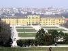
| Vienna FeatureType : adm1st Elevation : 188 Lat/Lng : 48.2083 / 16.3731 | Vienna is the federal capital and largest city of Austria, and one of the nine states of Austria. Vienna is Austria's primate city, with a population of about 1.9 million (2.6 million within the metropolitan area, nearly one third of Austria's population), and its cultural, economic, and political (...) |
| 20 | 
| Katowice FeatureType : city Elevation : 266 Lat/Lng : 50.2649 / 19.0238 | Katowice (; ; ; officially Miasto Katowice) is a city in southern Poland, with a population of 297,197 and the center of the Silesian Metropolis, with a population of 2.2 million. Throughout the mid-18th century, Katowice had developed into a village upon the discovery of rich coal reserves in the (...) |
| 21 | 
| Ružomberok FeatureType : null Elevation : 476 Lat/Lng : 49.0786 / 19.3083 | Ružomberok is a town in northern Slovakia, in the historical Liptov region. It has a population of around 30,000 (45,000 with nearby villages) (...) |
| 22 | Skalica District FeatureType : adm2nd Elevation : 215 Lat/Lng : 48.75 / 17.1667 | Skalica District (okres Skalica) is a district in the Trnava Region of western Slovakia. It lies in northern part of Záhorská nížina, a lowland between Bratislava and Czech Republic. The district had been established in 1923 and in its current borders exists from 1996 (...) | |
| 23 | 
| Kraków FeatureType : null Elevation : 219 Lat/Lng : 50.0617 / 19.9372 | Kraków , also spelled Cracow or Krakow, is the second largest and one of the oldest cities in Poland. Situated on the Vistula River in the Lesser Poland region, the city dates back to the 7th century. Kraków was the official capital of Poland until 1596 and has traditionally been one of the leading (...) |
| 24 | 
| Považská Bystrica FeatureType : null Elevation : 308 Lat/Lng : 49.1139 / 18.4417 | Považská Bystrica is a town in northwestern Slovakia. It is located on the Váh river, around 30 km from the city of Žilina. It belongs to Upper Váh region of tourism. (...) |
| 25 | Slovak Super Liga FeatureType : null Elevation : 137 Lat/Lng : 48.1661 / 17.1592 | The Slovak Super Liga is the top level football league in Slovakia, currently known as the Fortuna Liga due to a sponsorship arrangement. It was formed in 1993 following the dissolution of Czechoslovakia. The record for most titles is eight, held by Slovan Bratislava (...) | |
| 26 | Morava (river) FeatureType : null Elevation : 136 Lat/Lng : 48.1742 / 16.9756 | The Morava is a river in Central Europe, a left tributary of the Danube. It is the main river of Moravia, which derives its name from it. The river originates on the Králický Sněžník mountain in the north-eastern corner of Pardubice Region, near the border between the Czech Republic and Poland and (...) | |
| 27 | 
| Berlin Südkreuz FeatureType : railwaystation Elevation : 41 Lat/Lng : 52.4756 / 13.3644 | Berlin Südkreuz (in English, literally: Berlin South Cross) is a railway station in the German capital Berlin. The station was originally opened in 1898 and is an interchange station. The Berlin Ringbahn line of the Berlin S-Bahn metro railway is situated on the upper level and connects to the east (...) |
| 28 | D2 motorway (Czech Republic) FeatureType : null Elevation : 154 Lat/Lng : 48.6862 / 16.9872 | D2 motorway is a highway in the Czech Republic. It runs from the City of Brno to the border with Slovakia at the Morava river near Lanžhot, from where the Slovak diaľnica D2 leads to Bratislava. Construction on the D2 highway began in 1974; the first opened in 1978 (...) | |
| 29 | Znojmo FeatureType : null Elevation : 289 Lat/Lng : 48.8553 / 16.0486 | Znojmo is a major town in the South Moravian Region of the Czech Republic, the administrative capital of the Znojmo District. It is the historical and cultural centre of southwestern Moravia. (...) | |
| 30 | Czechoslovakia FeatureType : null Elevation : 250 Lat/Lng : 50.0833 / 14.4667 | Czechoslovakia, or Czecho-Slovakia (; Czech and , Česko-Slovensko, .), was a sovereign state in Central Europe that existed from October 1918, when it declared its independence from the Austro-Hungarian Empire, until its peaceful dissolution into the and on 1 January 1993 (...) | |
| 31 | 
| Štúrovo FeatureType : city Elevation : 108 Lat/Lng : 47.7992 / 18.7181 | Štúrovo (before 1948: Parkan;) is a town in Slovakia, situated on the River Danube. Its population in 2005 was 11,172. The town is situated opposite the Hungarian city of Esztergom. The Mária Valéria bridge connects the settlements (...) |
| 32 | 2019 IIHF World Championship FeatureType : null Elevation : 206 Lat/Lng : 48.7161 / 21.2614 | The 2019 IIHF Ice Hockey World Championship is scheduled to be hosted by Slovakia, as announced by the IIHF on 15 May 2015. It would be the second time that Slovakia is to host the event as an independent country. As was the case in 2011, the host cities were announced to be Bratislava and Košice. (...) | |
| 33 | Trnava FeatureType : null Elevation : 148 Lat/Lng : 48.378 / 17.588 | Trnava (also known by other alternative names) is a city in western Slovakia, to the north-east of Bratislava, on the Trnávka river. It is the capital of a kraj (Trnava Region) and of an okres (Trnava District). It is the seat of a Roman Catholic archbishopric (1541–1820 and then again since 1977) (...) | |
| 34 | D1 motorway (Slovakia) FeatureType : landmark Elevation : 169 Lat/Lng : 48.6864 / 17.8725 | D1 is a motorway in Slovakia. Its route is Bratislava (D2/D4) - Trnava (R1) - Trenčín (R2) - Púchov (R6) - Žilina (D3) - Martin (R3) - Poprad - Prešov (R4) - Košice (R4) - Michalovce - SK/UA border. It forms part of the following European routes: E50, E58, E75, E571 and of the V (...) | |
| 35 | Martin, Slovakia FeatureType : null Elevation : 399 Lat/Lng : 49.0636 / 18.9214 | Martin (pronunciation; until 1950, , German: Turz-Sankt Martin, Latin: Sanctus Martinus / Martinopolis) is a city in northern Slovakia, situated on the Turiec river, between the Malá Fatra and Veľká Fatra mountains, near the city of Žilina (...) | |
| 36 | Žilina FeatureType : null Elevation : 348 Lat/Lng : 49.2225 / 18.7397 | Žilina (; , or ; ;) is a city in north-western Slovakia, around from the capital Bratislava, close to both the Czech and Polish borders. It is the fourth largest city of Slovakia with a population of approximately 85,000, an important industrial center, the largest city on the Váh river, and the (...) | |
| 37 | Petržalka FeatureType : null Elevation : 138 Lat/Lng : 48.1222 / 17.1167 | Petržalka is the largest borough of Bratislava, the capital of Slovakia. Situated on the right bank of the river Danube, the area shares a land border with Austria, and is home to around 100,000 people. (...) | |
| 38 | Danube FeatureType : null Elevation : 111 Lat/Lng : 47.4824 / 19.0707 | The Danube , known by various names in other languages, is Europe's second longest river, after the Volga. It is located in Central and Eastern Europe. The Danube was once a long-standing frontier of the Roman Empire, and today flows through 10 countries, more than any other river in the world (...) | |
| 39 | Prague FeatureType : null Elevation : 203 Lat/Lng : 50.0878 / 14.4205 | Prague is the capital and largest city in the Czech Republic, the 14th largest city in the European Union and the historical capital of Bohemia. Situated in the north-west of the country on the Vltava river, the city is home to about 1 (...) | |
| 40 | Brno FeatureType : city Elevation : 210 Lat/Lng : 49.1921 / 16.6132 | Brno is the second largest city in the Czech Republic by population and area, the largest Moravian city, and the historical capital city of the Margraviate of Moravia. Brno is the administrative center of the South Moravian Region in which it forms a separate district (Brno-City District) (...) | |
| 41 | Brno–Tuřany Airport FeatureType : null Elevation : 210 Lat/Lng : 49.1921 / 16.6132 | Brno–Tuřany Airport is an airport in Brno, Czech Republic. It is about from Brno city centre, on the edge of the historical Austerlitz battlefield. The airport is about from other international airports, such as Vienna Airport and Bratislava airport and smaller international airports in Ostrava and (...) | |
| 42 | Republic of German-Austria FeatureType : null Elevation : 176 Lat/Lng : 48.2 / 16.3667 | The Republic of German-Austria (or ') was a country created following World War I as the initial rump state for areas with a predominantly German-speaking population within what had been the Austro-Hungarian Empire. German-Austria demanded an area of 118,311 km², with 10 (...) | |
| 43 | Slovak Republic (1939–1945) FeatureType : country Elevation : 140 Lat/Lng : 48.1333 / 17.1 | The (First) Slovak Republic , otherwise known as the Slovak State , was a client state of Nazi Germany which existed between 14 March 1939 and 4 April 1945. It controlled the majority of the territory of present-day Slovakia but without its current southern and eastern parts, which had been ceded to (...) | |
| 44 | Rimavská Sobota FeatureType : null Elevation : 204 Lat/Lng : 48.3811 / 20.0144 | Rimavská Sobota is a town in southern Slovakia, in the Banská Bystrica Region, on the Rimava river. It has 24,374 inhabitants (2006). The town is a historical capital of the Gemer-Malohont county (from 1850 to 1922). (...) | |
| 45 | Tipsport liga (hockey) FeatureType : null Elevation : 181 Lat/Lng : 48.8422 / 17.2267 | The Slovak Tipsport Liga (Slovenská Extraliga) is the highest-level ice hockey league in Slovakia. Since the 2018-19 season, the league also includes two teams from Hungary.In 2009, it was ranked by the IIHF as the fifth strongest league in Europe and in 2012, it was ranked by The Hockey News as the (...) | |
| 46 | Záhorie FeatureType : null Elevation : 180 Lat/Lng : 48.55 / 17.0833 | Záhorie is a region in western Slovakia between by the Little Carpathians to the east and the Morava River to the west. Although not an administrative region, it is one of the 21 official tourism regions in Slovakia (...) | |
| 47 | Nové Zámky FeatureType : null Elevation : 117 Lat/Lng : 47.9856 / 18.1578 | Nové Zámky (pronunciation; Hungarian: Érsekújvár,) is a town in southwestern Slovakia. (...) | |
| 48 | Wodzisław Śląski FeatureType : city Elevation : 244 Lat/Lng : 50.0 / 18.45 | Wodzisław Śląski is a town in Silesian Voivodeship, southern Poland with 50,493 inhabitants (2007). It is the seat of Wodzisław County. It was previously in Katowice Voivodeship (1975–1998); close to the border with the Czech Republic, about south of Warsaw and about west of Kraków, on the southern (...) | |
| 49 | Austrian Football League FeatureType : null Elevation : 166 Lat/Lng : 48.17 / 16.43 | The Austrian Football League (AFL) is the elite league of American football in Austria. The league was founded in 1984 and plays by the rules of the NCAA. (...) | |
| 50 | Haidmühle FeatureType : null Elevation : 822 Lat/Lng : 48.828 / 13.7748 | Haidmühle is a municipality in the district of Freyung-Grafenau in Bavaria in Germany. (...) | |
| 51 | Gbely FeatureType : null Elevation : 186 Lat/Lng : 48.7175 / 17.115 | Gbely (German and Hungarian: Egbell) is a town in the Skalica District, Trnava Region in western Slovakia, close to the Czech border. (...) | |
| 52 | Košice FeatureType : null Elevation : 213 Lat/Lng : 48.7211 / 21.2575 | Košice is the largest city in eastern Slovakia and in 2013 was the European Capital of Culture (together with Marseille, France). It is situated on the river Hornád at the eastern reaches of the Slovak Ore Mountains, near the border with Hungary (...) | |
| 53 | Malacky FeatureType : null Elevation : 162 Lat/Lng : 48.4381 / 17.0236 | Malacky (German: Malatzka, Hungarian: Malacka) is a town and municipality in western Slovakia around north from capital Bratislava. From the second half of the 10th century until 1918, it was part of the Kingdom of Hungary (...) | |
| 54 | First Czechoslovak Republic FeatureType : null Elevation : 250 Lat/Lng : 50.0833 / 14.4667 | The First Czechoslovak Republic was the Czechoslovak state that existed from 1918 to 1938. The state was commonly called Czechoslovakia (Czech and). It was composed of Bohemia, Moravia, Czech Silesia, Slovakia and Subcarpathian Ruthenia (...) | |
| 55 | Hlohovec FeatureType : null Elevation : 146 Lat/Lng : 48.4311 / 17.8031 | Hlohovec (Hungarian Galgóc, is a town in southwestern Slovakia, with a population of 22,192.http://mesto.hlohovec.sk/download_file_f.php?id=236853 Population as to end of 2011 Retrieved 2012-01-16 (...) | |
| 56 | Kontinental Hockey League FeatureType : null Elevation : 89 Lat/Lng : 57.6167 / 39.85 | The Kontinental Hockey League (KHL) is an international professional ice hockey league founded in 2008. It comprises 25 member clubs based in Belarus, China, Finland, Latvia, Kazakhstan, Russia, and Slovakia and it is planned to expand to more countries (...) | |
| 57 | Břeclav FeatureType : null Elevation : 161 Lat/Lng : 48.759 / 16.882 | Břeclav is a town in the Moravia, South Moravian Region, Czech Republic, approximately 55 km southeast of Brno. It is located at the border with Lower Austria on the Dyje River. The nearest town on Austrian territory is Bernhardsthal (...) | |
| 58 | Škoda Auto FeatureType : null Elevation : 62 Lat/Lng : 28.171 / 113.1764 | Škoda Auto , more commonly known as Škoda, is a Czech automobile manufacturer founded in 1895 as Laurin & Klement. Its headquarters are in Mladá Boleslav, Czech Republic. In 1925 Laurin & Klement was acquired by the industrial conglomerate Škoda Works, Official website which itself became state (...) | |
| 59 | Comenius University FeatureType : edu Elevation : 191 Lat/Lng : 48.1534 / 17.0659 | Comenius University in Bratislava is the largest university in Slovakia, with most of its faculties located in Bratislava. It was founded in 1919, shortly after the creation of Czechoslovakia. It is named after Jan Amos Comenius, a 17th-century Czech teacher and philosopher (...) | |
| 60 | Dubnica nad Váhom FeatureType : null Elevation : 248 Lat/Lng : 48.9575 / 18.1658 | Dubnica nad Váhom (pronunciation; Slovak before 1927: Dubnica, , , before 1899 Dubnic(z)) is a town in the Ilava District, Trenčín Region in Slovakia. (...) | |
| 61 | Žiar nad Hronom FeatureType : null Elevation : 256 Lat/Lng : 48.5842 / 18.8608 | Žiar nad Hronom (until 1920 Svätý Kríž and until 1955 Svätý Kríž nad Hronom) is a town in Banská Bystrica Region, Slovakia. (...) | |
| 62 | Šaľa FeatureType : null Elevation : 117 Lat/Lng : 48.1506 / 17.872 | Šaľa (pronunciation;) is a town in south-western Slovakia. (...) | |
| 63 | Holíč FeatureType : null Elevation : 177 Lat/Lng : 48.8122 / 17.1606 | Holíč (until 1946 "Holič") is a town in western Slovakia. (...) | |
| 64 | Topoľčany FeatureType : null Elevation : 178 Lat/Lng : 48.5592 / 18.1753 | Topoľčany (; before 1920;) is a town in the Nitra Region of Slovakia. The population as of 2006 was 28,685. The town's population is nicknamed Žochári (sing. Žochár) (producers, or owners of "mosses"). The Nitra River flows through a wide valley between the two mountain ranges that are visible from (...) | |
| 65 | 2015 IIHF World Championship FeatureType : null Elevation : 209 Lat/Lng : 50.1047 / 14.4936 | The 2015 IIHF World Championship was the 79th event hosted by the International Ice Hockey Federation (IIHF), held in Prague and Ostrava, Czech Republic, between 1–17 May 2015. The tournament was the top division of the 2015 Men's World Ice Hockey Championships (...) | |
| 66 | Czechoslovak Socialist Republic FeatureType : null Elevation : 250 Lat/Lng : 50.0833 / 14.4667 | The Czechoslovak Socialist Republic (Czech and , ČSSR) ruled Czechoslovakia from 1948 until 23 April 1990, when the country was under Communist rule. Formally known as the Fourth Czechoslovak Republic, it has been regarded as a satellite state of the Soviet Union.Rao, B. V (...) | |
| 67 | Slovak Greek Catholic Church FeatureType : landmark Elevation : 257 Lat/Lng : 48.9942 / 21.2432 | The Slovak Greek Catholic Church (Slovak: Gréckokatolícka cirkev na Slovensku, "Greek-Catholic Church in Slovakia"), or Slovak Byzantine Catholic Church, is a Metropolitan sui iuris Eastern particular Church in full union with the Catholic Church. Its liturgical rite is the Byzantine Rite (...) | |
| 68 | Tripoint FeatureType : null Elevation : 645 Lat/Lng : 49.8456 / 116.714 | A tripoint, trijunction, triple point, or tri-border area is a geographical point at which the boundaries of three countries or subnational entities meet. There are approximately 176 international tripoints. Nearly half are situated in rivers, lakes or seas (...) | |
| 69 | Bratislava hlavná stanica FeatureType : null Elevation : 174 Lat/Lng : 48.1583 / 17.1069 | Bratislava hlavná stanica (abbreviated Bratislava hl.st.; Former names ;) is the main railway station in Bratislava, Slovakia. It is located near Šancová street, around 1 km or a 15 min walk north from the Old Town (...) | |
| 70 | Complutense University of Madrid FeatureType : edu Elevation : 649 Lat/Lng : 40.4492 / -3.7281 | The Complutense University of Madrid (or Universidad de Madrid) is a public research university located in Madrid, and one of the oldest universities in the world. The university enrolls over 86,000 students, being the 3rd largest non-distance European university by enrollment, and consistently (...) | |
| 71 | Prievidza FeatureType : null Elevation : 267 Lat/Lng : 48.7711 / 18.6217 | Prievidza is a city in the central-western Slovakia. With 49,400 inhabitants it is the second biggest municipality in the Trenčín Region. (...) | |
| 72 | Austria-Hungary FeatureType : null Elevation : 214 Lat/Lng : 48.2 / 16.35 | Austria-Hungary, often referred to as the Austro-Hungarian Empire or the Dual Monarchy in English-language sources, was a constitutional union of the Austrian Empire (the Kingdoms and Lands Represented in the Imperial Council, or Cisleithania) and the Kingdom of Hungary (Lands of the Crown of Saint (...) | |
| 73 | 2004 World Cup of Hockey FeatureType : null Lat/Lng : 60.1667 / 24.9333 | The 2004 World Cup of Hockey was an international ice hockey tournament. It was the second installment of the National Hockey League (NHL)-sanctioned competition, eight years after the inaugural 1996 World Cup of Hockey (...) | |
| 74 | Pannonian Basin FeatureType : mountain Elevation : 90 Lat/Lng : 46.5 / 20.0 | The Pannonian Basin, or Carpathian Basin, is a large basin in Central Europe. The geomorphological term Pannonian Plain is more widely used for roughly the same region though with a somewhat different sense, with only the lowlands, the plain that remained when the Pliocene Epoch Pannonian Sea dried (...) | |
| 75 | SAP SE FeatureType : landmark Elevation : 112 Lat/Lng : 49.2935 / 8.6418 | SAP SE (; , "Systems, Applications & Products in Data Processing") is a German-based European multinational software corporation that makes enterprise software to manage business operations and customer relations (...) | |
| 76 | 2011 IIHF World Championship FeatureType : null Elevation : 206 Lat/Lng : 48.7161 / 21.2614 | The 2011 IIHF World Championship was the 75th IIHF World Championship, an annual international men's ice hockey tournament. It took place between the 29 April and the 15 May 2011 in Slovakia. The games were played in the Orange Arena in Bratislava, and the Steel Aréna in Košice (...) | |
| 77 | Iron Curtain FeatureType : null Elevation : 423 Lat/Lng : 48.8755 / 15.8748 | The Iron Curtain was the name for the boundary dividing Europe into two separate areas from the end of World War II in 1945 until the end of the Cold War in 1991. The term symbolizes the efforts by the Soviet Union to block itself and its satellite states from open contact with the West and its (...) | |
| 78 | Western Carpathians FeatureType : mountain Elevation : 2554 Lat/Lng : 49.1672 / 20.1311 | The Western Carpathians are a mountain range and geomorphological province that forms the western part of the Carpathian Mountains. The mountain belt stretches from the Low Beskids range of the Eastern Carpathians along the border of Poland with Slovakia toward the Moravian region of the Czech (...) | |
| 79 | Pezinok FeatureType : null Elevation : 170 Lat/Lng : 48.2919 / 17.2661 | Pezinok is a city in southwestern Slovakia. It is roughly northeast of Bratislava and, as of December 2014, had a population of 24,070."". Pezinok.sk. Retrieved 16 August 2015. Pezinok lies near the Little Carpathians and thrives mainly on viticulture and agriculture, as well as on brick making and (...) | |
| 80 | Záhoří FeatureType : null Elevation : 488 Lat/Lng : 50.6115 / 15.2741 | Záhoří may refer to: *Záhoří (Písek District), South Bohemian Region, Czech Republic *Záhoří (Jindřichův Hradec District), South Bohemian Region, Czech Republic *Záhoří (Tábor District), South Bohemian Region, Czech Republic *Záhoří (Semily District), Liberec Region, Czech Republic (...) | |
| 81 | Chorzów FeatureType : null Elevation : 293 Lat/Lng : 50.3 / 18.95 | Chorzów is a city in Silesia in southern Poland, near Katowice. Chorzów is one of the central districts of the Upper Silesian Metropolitan Union - a metropolis with a population of 2 million. It is located in the Silesian Highlands, on the Rawa River (a tributary of the Vistula) (...) | |
| 82 | Trnávka FeatureType : null Elevation : 226 Lat/Lng : 49.7218 / 18.1677 | Trnávka is name of several locations in central Europe: *Trnávka (Nový Jičín District) - Czech Republic * Trnávka, a village in the Pardubice Region (Pardubice District) of the Czech Republic * Trnávka, part of Ružinov, a borough of Bratislava, the capital of Slovakia * Trnávka, a village in the (...) | |
| 83 | Dolný Kubín FeatureType : null Elevation : 482 Lat/Lng : 49.2106 / 19.2975 | Dolný Kubín (pronunciation; also known by other names) is a town in northern Slovakia in the Žilina Region. It is the historical capital of the Orava region. (...) | |
| 84 | Sofia FeatureType : null Elevation : 552 Lat/Lng : 42.6972 / 23.3167 | Sofia is the capital and largest city of Bulgaria. The city is at the foot of Vitosha Mountain in the western part of the country. Being in the centre of the Balkan peninsula, it is midway between the Black Sea and the Adriatic Sea, and closest to the Aegean Sea (...) | |
| 85 | Pécs FeatureType : city Elevation : 128 Lat/Lng : 46.0713 / 18.2331 | Pécs (; known by alternative names) is the fifth largest city of Hungary, located on the slopes of the Mecsek mountains in the south-west of the country, close to its border with Croatia. It is the administrative and economic centre of Baranya County (...) | |
| 86 | Austro-Prussian War FeatureType : null Elevation : 65 Lat/Lng : 43.474 / -1.553 | The Austro-Prussian War or Seven Weeks' War (also known as the Unification War, the War of 1866, or the Fraternal War, in Germany as the German War, and also by a variety of other names) was a war fought in 1866 between the Austrian Empire and the Kingdom of Prussia, with each also being aided by (...) | |
| 87 | Czechoslovak government-in-exile FeatureType : null Elevation : 250 Lat/Lng : 50.0833 / 14.4667 | The Czechoslovak government-in-exile, sometimes styled officially as the Provisional Government of Czechoslovakia (Czech: Prozatímní státní zřízení československé), was an informal title conferred upon the Czechoslovak National Liberation Committee, initially by British diplomatic recognition (...) | |
| 88 | Brodské FeatureType : null Elevation : 160 Lat/Lng : 48.6914 / 17.0128 | Brodské is a village and municipality in Skalica District in the Trnava Region of western Slovakia. Brodské is a small village lying on the left side of the Morava river, which makes border with the Czech republic and Austria. In historical records the village was first mentioned in 1163 (...) | |
| 89 | Kopčany FeatureType : null Elevation : 162 Lat/Lng : 48.7861 / 17.1147 | Kopčany (German Koptschan, Hungarian Kopcsány) is a village in western Slovakia, near the border with the Czech Republic. (...) | |
| 90 | Sereď FeatureType : null Elevation : 129 Lat/Lng : 48.2864 / 17.7375 | Sereď is a town in southern Slovak Republic near Trnava, on the right bank of the Váh River on the Danubian Lowland. It has approximately 17,000 inhabitants. (...) | |
| 91 | Timeline of Bratislava FeatureType : city Elevation : 147 Lat/Lng : 48.1439 / 17.1097 | The following is a of the history of the city of Bratislava, Slovakia. (...) | |
| 92 | Second Czechoslovak Republic FeatureType : null Elevation : 250 Lat/Lng : 50.0833 / 14.4667 | The Second Czechoslovak Republic , sometimes also called the Czech-Slovak Republic (Czech and), existed for 169 days, between 30 September 1938 and 15 March 1939. It was composed of Bohemia, Moravia, Silesia and the autonomous regions of Slovakia and Subcarpathian Ruthenia, the latter renamed as of (...) | |
| 93 | 2008–09 Champions Hockey League FeatureType : null Elevation : 306 Lat/Lng : 49.4528 / 11.0778 | The 2008–09 Champions Hockey League was the only season of the Champions Hockey League (2008–09), an IIHF-organized ice hockey tournament for the best club teams in Europe. The season was played with 12 teams from seven countries (two teams each from Russia, Czech Republic, Sweden and Finland, one (...) | |
| 94 | Děvín in Moravia (Pavlov Hills) FeatureType : mountain Elevation : 538 Lat/Lng : 48.8693 / 16.6502 | Děvín ; (Girl´s hill or Maiden hill); (549 metres) is the highest (double-peaked) mountain of Pavlov Hills, northern part of (Mikulov Highlands), Moravia Czech Republic. Located nearby of the historical border between Austria and Moravia (9,2 km), and right on trace where runs line of drainage (...) | |
| 95 | 2012–13 KHL season FeatureType : null Elevation : 354 Lat/Lng : 51.1667 / 71.4167 | The 2012–13 KHL season was the fifth season of the Kontinental Hockey League. The regular season began on 4 September with the Lokomotiv Cup between last year's finalists Dynamo Moscow and Avangard Omsk. For the first time, the league consisted of 26 teams from 7 different countries (...) | |
| 96 | Devínska Nová Ves FeatureType : null Elevation : 149 Lat/Lng : 48.2094 / 16.9728 | Devínska Nová Ves is a borough of Bratislava, the capital of Slovakia. Its western borders are formed by the Morava River, which also represents the national border between Slovakia and Austria. Devínska Nová Ves is notable mainly for its large Volkswagen factory , for world-known paleontological (...) | |
| 97 | Government of Rotterdam FeatureType : null Elevation : 1 Lat/Lng : 51.95 / 4.4167 | The Government of Rotterdam is the government of the municipality and city of Rotterdam in the Netherlands. Most of the inhabitants live in the city of Rotterdam, but the municipality also covers a number of small villages, and other parts of the local government, such as Rozenburg, cover an even (...) | |
| 98 | 2016 WTA Tour FeatureType : null Elevation : 20 Lat/Lng : 16.8636 / -99.8825 | The 2016 WTA Tour was the elite professional tennis circuit organised by the Women's Tennis Association (WTA) for the 2016 tennis season. The 2016 WTA Tour calendar comprises the Grand Slam tournaments (supervised by the International Tennis Federation (ITF), the WTA Premier tournaments (Premier (...) | |
| 99 | European Trophy FeatureType : null Elevation : 14 Lat/Lng : 57.7 / 11.9667 | European Trophy (previously named Nordic Trophy between 2006 and 2009) was an annually held ice hockey tournament, traditionally composed of teams from the higher-level ice hockey leagues in countries across Europe (...) | |
| 100 | Slovak Catholic Metropolitan Archeparchy of Prešov FeatureType : landmark Elevation : 256 Lat/Lng : 48.9941 / 21.2429 | The Slovak (Greek) Catholic Archeparchy of Prešov (until 2008 Eparchy of Prešov) is the Metropolitan archeparchy (Eastern Catholic Archdiocese) of the Byzantine Rite Slovak Greek Catholic Church which covers the territory of the Prešov Region. As of 2004 it had 136,593 Greek Catholic faithful (...) | |
| 101 | Krompachy FeatureType : null Elevation : 375 Lat/Lng : 48.9139 / 20.8739 | Krompachy is a town in Slovakia, with a rich mining and metallurgical history, well-known both in Slovakia and in its close neighboring countries for its Plejsy ski center. (...) | |
| 102 | Tisovec FeatureType : null Elevation : 410 Lat/Lng : 48.6806 / 19.9456 | Tisovec (Latin: Taxovia) is a town in central Slovakia. its population was 4,092. (...) | |
| 103 | International E-road network FeatureType : null Lat/Lng : 71.1667 / 25.8 | The international E-road network is a numbering system for roads in Europe developed by the United Nations Economic Commission for Europe (UNECE). The network is numbered from E 1 up and its roads cross national borders (...) | |
| 104 | Oratory of Saint Philip Neri FeatureType : landmark Elevation : 32 Lat/Lng : 41.8986 / 12.4708 | The Congregation of the Oratory of Saint Philip Neri is a pontifical society of apostolic life of Catholic priests and lay-brothers who live together in a community bound together by no formal vows but only with the bond of charity. They are commonly referred to as Oratorians (Oratorian Fathers) (...) | |
| 105 | Burgenland FeatureType : adm1st Elevation : 333 Lat/Lng : 47.5 / 16.4167 | Burgenland (; ; ; ; ; is the easternmost and least populous state of Austria. It consists of two statutory cities and seven rural districts, with in total 171 municipalities. It is long from north to south but much narrower from west to east (wide at Sieggraben) (...) | |
| 106 | Szepes County FeatureType : null Elevation : 534 Lat/Lng : 49.0167 / 20.5833 | Szepes was an administrative county of the Kingdom of Hungary, called Scepusium before the late 19th century. Its territory today lies in northeastern Slovakia, with a very small area in southeastern Poland. For the current region, see Spiš. (...) | |
| 107 | Várkerület FeatureType : null Elevation : 158 Lat/Lng : 47.5026 / 19.0354 | Várkerület (Castle District) is the historical part of the Buda side of Budapest and consists of the Buda Castle Hill and some other neighbourhoods around it, like Tabán, Krisztinaváros and parts of Gellért Hill. (...) | |
| 108 | Prague–Kbely Airport FeatureType : airport Elevation : 277 Lat/Lng : 50.1217 / 14.5453 | Prague–Kbely Airport (Czech: letiště Praha–Kbely) (ICAO: LKKB) is a military airport located in Kbely, in the northeast municipal district of Prague, Czech Republic. Once Prague's principal airport, it is now used mainly as a military base for the Czech Air Force (...) | |
| 109 | Pankrác Prison FeatureType : landmark Elevation : 250 Lat/Lng : 50.0586 / 14.4389 | Pankrác Prison, officially Prague Pankrác Remand Prison (Vazební věznice Praha Pankrác in Czech), is a prison in Prague, Czech Republic. It is located southeast of Prague city centre in Pankrác, not far from Pražského povstání metro station on Line C (...) | |
| 110 | Břeclav railway station FeatureType : null Elevation : 158 Lat/Lng : 48.7536 / 16.8923 | Břeclav railway station is an important international railway junction in the Czech Republic, located in the town of Břeclav in South Moravia, close to the borders with Austria and Slovakia. The station opened in 1837 as Lundenburger Bahnhof (Lundenburg is the German exonym for Břeclav) on the North (...) | |
| 111 | Structure of the Czechoslovak People's Army 1989 FeatureType : null Elevation : 452 Lat/Lng : 49.4144 / 14.6597 | At the end of the Cold War in 1989 the Czechoslovak People's Army structure was as follows:http://forum.valka.cz/topic/view/123489/Ministerstvo-narodni-obrany-1950-1990 The article is based on the Czech ' website, which lists all units of the Czechoslovak People's Army in existence between 1950 and (...) | |
| 112 | Kamzík TV Tower FeatureType : landmark Elevation : 436 Lat/Lng : 48.1825 / 17.0947 | The Kamzík TV Tower is a tall television transmission tower in the Koliba area of Bratislava, the capital of Slovakia. The tower sits above sea level on the Kamzík hill, part of the Little Carpathians, overlooking much of the city. The tower lies within the territory of the Bratislava Forest Park (...) | |
| 113 | Solar eclipse of January 4, 2011 FeatureType : null Lat/Lng : 64.7 / 20.8 | The solar eclipse of January 4, 2011 was a partial eclipse of the Sun that was visible after sunrise over most of Europe, northwestern and South Asia. It ended at sunset over eastern Asia. It was visible as a minor partial eclipse over northern Africa and the Arabian peninsula (...) | |
| 114 | Pardubice hlavní nádraží FeatureType : null Elevation : 220 Lat/Lng : 50.032 / 15.757 | Pardubice main railway station (Czech Pardubice hlavní nádraží) is one of the largest railway stations in the Czech Republic, located about WSW from city centre of Pardubice, an important railway network hub. (...) | |
| 115 | Jablonec FeatureType : null Elevation : 518 Lat/Lng : 50.7243 / 15.1711 | Jablonec can refer to several towns in central Europe: *Jablonec nad Nisou, a town in Liberec Region, Czech Republic *Jablonec nad Nisou District *FK Jablonec, an association football club based in Jablonec nad Nisou *Jablonec nad Jizerou, a town in Semily District, Liberec Region, Czech Republic (...) | |
| 116 | Volkswagen Bratislava Plant FeatureType : landmark Elevation : 165 Lat/Lng : 48.2341 / 16.9879 | The Volkswagen Bratislava Plant is an automotive factory and co-located test track in Bratislava, Slovakia owned by Volkswagen Group. (...) | |
| 117 | Šakvice train collision FeatureType : landmark Elevation : 173 Lat/Lng : 48.9188 / 16.6858 | The Šakvice train disaster occurred on 24 December 1953 in Czechoslovakia (now the Czech Republic). A local train was standing at the Šakvice station near Brno, when the Prague-Bratislava express ran into it, resulting in 103 deaths and a further 83 injured (...) | |
| 118 | École des Mines de Douai FeatureType : edu Elevation : 28 Lat/Lng : 50.3752 / 3.0678 | The École des mines de Douai (École des Mines-Télécom de Lille-Douai (IMT) since 2018) also called "École nationale supérieure des mines de Douai (Mines Douai)" (ENSMD) is a French National Graduate School of Engineering (Grande école d'ingénieurs) located in the cities of Douai and (...) | |
| 119 | Imperial Crown of Austria FeatureType : landmark Elevation : 194 Lat/Lng : 48.2067 / 16.3656 | The Imperial Crown of Austria was made in 1602 in Prague by Jan Vermeyen as the personal crown of Holy Roman Emperor Rudolf II, and therefore is also known as the Crown of Emperor Rudolf II . The crown was used as a private crown of the Holy Roman Emperors and Kings of Hungary and Bohemia from the (...) | |
| 120 | Transalpine Pipeline FeatureType : landmark Elevation : 432 Lat/Lng : 48.3931 / 11.9393 | The Transalpine Pipeline (TAL) is a crude oil pipeline, which connects Italy, Austria and Germany. (...) | |
| 121 | Permanent Representative of Andorra to the United Nations Office at Vienna FeatureType : landmark Elevation : 185 Lat/Lng : 48.2022 / 16.3699 | The Andorran Permanent representative to the United Nations Office at Vienna has his residence in Andorra La Vella and is also acreditated as Ambassador to the governments in Vienna (Austria), San Marino, Prague (Czech Republic), Bratislava (Slovakia), Bucharest (Romania) Budapest (Hungary) and is (...) | |
| 122 | TABSO Flight 101 FeatureType : event Elevation : 400 Lat/Lng : 48.2444 / 17.1653 | TABSO Flight LZ101 was a scheduled service of the Bulgarian national airline from Sofia, Bulgaria via Budapest, Hungary and Prague, Czechoslovakia (today's Czech Republic) to East Berlin in the German Democratic Republic (today's Germany) (...) | |
| 123 | Institute of Creative Photography FeatureType : null Elevation : 272 Lat/Lng : 49.9352 / 17.8964 | The Institute of Creative Photography (ITF), also referred as Opava School of Photography, is the largest post-secondary school of photography in the Czech Republic. It is part of Silesian University (Opava). It currently has more than 200 students from the Czech Republic, Slovakia, Poland, Germany, (...) | |
| 124 | Bad Schandau station FeatureType : null Elevation : 140 Lat/Lng : 50.9193 / 14.1372 | Bad Schandau station is a minor junction station in Bad Schandau in the German state of Saxony. The station is located on the south bank on the Elbe on the Děčín–Dresden-Neustadt railway and it is also the terminus of the Bautzen–Bad Schandau railway (...) | |
| 125 | Small Carpathian Museum FeatureType : landmark Elevation : 160 Lat/Lng : 48.287 / 17.2707 | The Small Carpathian Museum (aka Little Carpathian Museum) in Pezinok, Bratislava, Slovakia, is a local museum with an emphasis on wine making. (...) | |
| 126 | Car crash of Marika Gombitová FeatureType : null Elevation : 211 Lat/Lng : 49.2 / 16.62 | Marika Gombitová (born September 12, 1956 in Turany nad Ondavou, Czechoslovakia) is a Slovak singer-songwriter who began her career as a female vocalist in the band Modus in the late 1970s. Besides gaining fame for her subsequent solo career, she also became known as the victim of a single-vehicle (...) | |
| 127 | Karol Szymanowski Academy of Music FeatureType : landmark Elevation : 268 Lat/Lng : 50.2553 / 19.03 | Karol Szymanowski Academy of Music in Katowice is a school of music of university level in Poland. It is located in Katowice, Silesia. (...) | |
| 128 | Dyje–Svratka Valley FeatureType : mountain Elevation : 187 Lat/Lng : 48.8333 / 16.4167 | The Dyje–Svratka Valley (Czech: Dyjsko-svratecký úval) is a geomorphological feature (specifically a special type of vale) in Moravia (The Czech Republic). The highest prominence over the Dyje–Svratka Valley is Děvín Peak at . (...) | |
| 129 | Komárov FeatureType : null Elevation : 395 Lat/Lng : 49.8065 / 13.8564 | Komárov is name of several locations: *in the Czech Republic: ** Komárov (Beroun District), a village in Central Bohemian Region ** the hamlet Komárov is an administrative part of the village Dolní Roveň in Pardubice Region (Pardubice District) ** the hamlet Komárov is administrative part of village (...) | |
| 130 | Kysak railway station FeatureType : null Elevation : 243 Lat/Lng : 48.8528 / 21.2239 | Kysak railway station serves the village and municipality of Kysak, in the Košice Region, eastern Slovakia. Opened in 1870, the station is an important railway junction, where the Košice–Plaveč–Čirč–Muszyna railway diverges towards Poland from the Košice–Žilina railway, which is part of Slovakia's (...) | |
| 131 | Mikulčice Archaeopark FeatureType : landmark Elevation : 158 Lat/Lng : 48.8039 / 17.0867 | The Mikulčice Archaeopark is centred on the site of Valy or Na Valech, which is to the east of Mikulčice and immediately adjacent to the river Morava, which forms the boundary between the Czech Republic and Slovakia (...) | |
| 132 | Topoľčany pogrom FeatureType : null Elevation : 164 Lat/Lng : 48.5542 / 18.1769 | The Topoľčany pogrom was an anti-Jewish riot in Topoľčany, Slovakia on 24 September 1945 and the best-known incident of post-Holocaust violence against Jews in Slovakia. The underlying cause was resurgent antisemitism directed at Jewish Holocaust survivors who demanded the return of property that (...) | |
| 133 | Uzhhorod National University FeatureType : null Elevation : 186 Lat/Lng : 48.6357 / 22.2902 | Uzhhorod National University (also known as UzhNU, full name - State University `Uzhhorod National University`), in the city of Uzhhorod, is one of the major universities in Ukraine, and earlier in the Soviet Union. (...) | |
| 134 | Senec FeatureType : null Elevation : 415 Lat/Lng : 50.0667 / 13.7069 | Senec may refer to: (...) | |
| 135 | Cabinet of Architecture FeatureType : null Elevation : 218 Lat/Lng : 49.8372 / 18.2867 | Cabinet of Architecture is a gallery and exhibition space in Ostrava, Czech Republic, founded in 2009. (...) | |
| 136 | Probošt's mechanical Christmas crib FeatureType : null Elevation : 241 Lat/Lng : 50.2013 / 15.9939 | Probošt's mechanical Christmas crib, also known as Bethlehem of TřebechoviceVaclík. Lidové betlémy v Čechách a na Moravě. p. 27. or Probošt's Nativity Scene of Třebechovice,Zemanová. Třebechovický Proboštův betlém. p. 156 (...) | |
| 137 | Dachser FeatureType : landmark Elevation : 658 Lat/Lng : 47.7475 / 10.3021 | DACHSER Group SE & Co. KG is a German logistics company, founded by Thomas Dachser in 1930, with its headquarters in Kempten in the Allgäu region. In January 2005, Thomas Dachser’s grandson, Bernhard Simon, took over as Head of the Management Board (...) | |
| 138 | City University of Seattle FeatureType : null Elevation : 44 Lat/Lng : 47.6174 / -122.3445 | City University of Seattle, also known as CityU, is a private not-for-profit institution of higher learning based in Seattle, Washington. In 2016–17, CityU enrolled 6,755 students worldwide. The university consists of the School of Management, Albright School of Education, School of Arts and (...) | |
| 139 | Pan-European University FeatureType : edu Elevation : 137 Lat/Lng : 48.159 / 17.1646 | The Pan-European University is a private institute of higher education located in Bratislava, Slovakia. It was established on July 14, 2004. (...) | |
| 140 | PSA Trnava Plant FeatureType : null Elevation : 145 Lat/Lng : 48.3614 / 17.6286 | The PSA Trnava Plant is a major car plant in Slovakia and the most recently established PSA Peugeot Citroën plant in Europe. It is located directly to the south-east of Trnava, approximately from Bratislava and the frontier with Austria to the south-west. (...) | |
| 141 | Le Quy Don Technical University FeatureType : edu Elevation : 13 Lat/Lng : 21.0483 / 105.7858 | Le Quy Don Technical University or Le Quy Don University of Science and Technology , founded 1966, is one of the national key universities in Vietnam that offers multidisciplinary undergraduate and postgraduate training in engineering, technology and management (...) | |
| 142 | Brașov railway station FeatureType : railwaystation Elevation : 561 Lat/Lng : 45.6612 / 25.6135 | Braşov railway station is the main station in Braşov, Romania. The building on the current location was opened to traffic in 1962. The station's bell chimes preceding the announcements represent a few notes of Ciprian Porumbescu's operetta Crai Nou. (...) | |
| 143 | Comenius University, Faculty of Natural Sciences FeatureType : landmark Elevation : 168 Lat/Lng : 48.15 / 17.0717 | The Faculty of Natural Sciences (FNS) (Slovak: Prírodovedecká Fakulta (PriF UK)) is a faculty of the Comenius University in Bratislava. (...) | |
| 144 | Gesellschaft für deutsche Sprache FeatureType : null Elevation : 127 Lat/Lng : 50.0855 / 8.2421 | The ' (Association for the German Language), or , is Germany's most important government-sponsored language society. Its headquarters are in Wiesbaden Re-founded shortly after the Second World War in 1947, the is politically independent and the declared successor of the ' , the General Association (...) | |
| 145 | Balassi Institute FeatureType : null Elevation : 153 Lat/Lng : 47.4842 / 19.0384 | The Balassi Institute is a worldwide non-profit cultural organization funded by the ministry of education and culture of Hungary. The institute spreads and promotes Hungarian language and culture abroad. The Institute plays a key role in developing and attaining Hungary’s objectives in the area of (...) | |
| 146 | Archbishop's Palace FeatureType : landmark Elevation : 141 Lat/Lng : 41.1309 / 14.7745 | Various residences for archbishops are locally known as the Archbishop's Palace, including the following: *The Archbishop's Palace, Charing, Kent, England *The Archbishop's Palace, Otford, Kent, England *The Archbishop's Palace, Lima, Peru *The Archbishop's Palace, Seville, Spain *The Archbishop's (...) | |
 by
by