| 338 records found in wikipedia | |||
| 1 | 
| Antwerp  FeatureType : null Elevation : 15 Lat/Lng : 51.2178 / 4.4003 | Antwerp is a city in Belgium, and is the capital of Antwerp province in Flanders. With a population of 520,504, Population of all municipalities in Belgium, as of 1 January 2017. Retrieved on 1 November 2017. it is the most populous city proper in Belgium (...) |
| 2 | Antwerp (province) FeatureType : null Elevation : 14 Lat/Lng : 51.2167 / 4.4167 | Antwerp is the northernmost province both of the Flemish Region, also called Flanders, and of Belgium. It borders on (clockwise from the North) North Brabant province of the Netherlands and the Belgian provinces of Limburg, Flemish Brabant and East Flanders (...) | |
| 3 | 
| Antwerp City Hall FeatureType : landmark Elevation : 13 Lat/Lng : 51.2213 / 4.3992 | The Stadhuis (City Hall) of Antwerp, Belgium, stands on the western side of Antwerp's Grote Markt (Great Market Square). Erected between 1561 and 1565 after designs made by Cornelis Floris de Vriendt and several other architects and artists, this Renaissance building incorporates both Flemish and (...) |
| 4 | 
| Belgium FeatureType : null Elevation : 66 Lat/Lng : 50.8432 / 4.363 | Belgium officially the Kingdom of Belgium, is a country in Western Europe bordered by the Netherlands to the north, Germany to the east, Luxembourg to the southeast, France to the southwest, and the North Sea to the northwest. It covers an area of and has a population of more than 11.4 million (...) |
| 5 | 
| Aachen Hauptbahnhof FeatureType : railwaystation Elevation : 190 Lat/Lng : 50.7676 / 6.0912 | Aachen Hauptbahnhof (German for Aachen main station) is the most important railway station for the city of Aachen, in the far west of Germany near the Dutch and Belgian border. It is the largest of the four currently active Aachen stations, and is integrated into the long-distance network. (...) |
| 6 | 
| Oudenaarde FeatureType : city Elevation : 14 Lat/Lng : 50.8428 / 3.6042 | Oudenaarde (French Audenarde, English sometimes Oudenarde) is a Belgian municipality in the Flemish province of East Flanders. The municipality comprises the city of Oudenaarde proper and the towns of Bevere, Edelare, Eine, Ename, Heurne, Leupegem, Mater, Melden, Mullem, Nederename, Welden, Volkegem (...) |
| 7 | 
| Breda FeatureType : city Elevation : 4 Lat/Lng : 51.5833 / 4.7833 | Breda is a city and municipality in the southern part of the Netherlands, located in the province of North Brabant. The name derived from brede Aa ('wide Aa' or 'broad Aa') and refers to the confluence of the rivers Mark and Aa (...) |
| 8 | 
| Diest FeatureType : city Elevation : 28 Lat/Lng : 50.9844 / 5.0528 | Diest is a city and municipality located in the Belgian province of Flemish Brabant. Situated in the northeast of the Hageland region, Diest neighbours the provinces of Antwerp to its North, and Limburg to the East and is situated around 60 km from Brussels (...) |
| 9 | 
| Bielefeld FeatureType : city Elevation : 120 Lat/Lng : 52.0204 / 8.5322 | Bielefeld is a city in the Ostwestfalen-Lippe Region in the north-east of North Rhine-Westphalia, Germany. With a population of 340,159, it is also the most populous city in the Regierungsbezirk Detmold. The historical centre of the city is situated north of the Teutoburg Forest line of hills, but (...) |
| 10 | 
| Mulhouse FeatureType : null Elevation : 242 Lat/Lng : 47.7495 / 7.3399 | Mulhouse (; Alsatian: Milhüsa or Milhüse, ; ; i.e. mill house) is a city and commune in eastern France, close to the Swiss and German borders. With a population of 112,063 in 2013 and 284,739 inhabitants in the metropolitan area in 2012, it is the largest city in the Haut-Rhin département, and the (...) |
| 11 | 
| Liège FeatureType : null Elevation : 72 Lat/Lng : 50.6425 / 5.57 | Liège is a major Walloon city and municipality and the capital of the Belgian province of Liège. The city is situated in the valley of the Meuse, in the east of Belgium, not far from borders with the Netherlands (Maastricht is about to the north) and with Germany (Aachen is about north-east) (...) |
| 12 | 
| Echternach FeatureType : null Elevation : 165 Lat/Lng : 49.8117 / 6.4217 | Echternach is a commune with town status in the canton of Echternach, which is part of the district of Grevenmacher, in eastern Luxembourg. Echternach lies near the border with Germany, and is the oldest town (current population 4,610) in Luxembourg. (...) |
| 13 | 
| Zwijndrecht, Belgium FeatureType : null Elevation : 4 Lat/Lng : 51.2219 / 4.3257 | Zwijndrecht is both a village and a municipality located in the Flemish province of Antwerp, in Belgium. As well as Zwijndrecht proper, the municipality includes the village of Burcht. As of January 1, 2006, Zwijndrecht had a total population of 18,231. The total area is 17 (...) |
| 14 | 
| Bruges FeatureType : city Elevation : 9 Lat/Lng : 51.2094 / 3.22 | Bruges is the capital and largest city of the province of West Flanders in the Flemish Region of Belgium, in the northwest of the country. The area of the whole city amounts to more than 13,840 hectares (138.4 sq km; 53 (...) |
| 15 | 
| Roermond FeatureType : null Elevation : 29 Lat/Lng : 51.1925 / 5.9936 | Roermond is a city, a municipality, and a diocese in the southeastern part of the Netherlands. Roermond is an historically important town, on the lower Roer at the east bank of the Meuse river. It received town rights in 1231. Roermond town centre has been designated as a conservation area (...) |
| 16 | 
| Opel FeatureType : landmark Elevation : 93 Lat/Lng : 49.9892 / 8.3908 | Opel (Opel) is a German automobile manufacturer, subsidiary of French automaker Groupe PSA since August 2017. From 1929 until 2017, Opel was owned by American automaker General Motors. Opel vehicles are sold in the United Kingdom under the Vauxhall brand (...) |
| 17 | 
| Rotterdam FeatureType : null Elevation : 3 Lat/Lng : 51.9167 / 4.4833 | Rotterdam is the second-largest city and a municipality of the Netherlands. It is located in the province of South Holland, at the mouth of the Nieuwe Maas channel leading into the Rhine–Meuse–Scheldt delta at the North Sea (...) |
| 18 | 
| Brussels FeatureType : null Elevation : 66 Lat/Lng : 50.8432 / 4.363 | Brussels , officially the Brussels-Capital Region (All text and all but one graphic show the English name as Brussels-Capital Region.) , is a region of Belgium comprising 19 municipalities, including the City of Brussels, which is the capital of Belgium (...) |
| 19 | 
| Kortrijk FeatureType : null Elevation : 21 Lat/Lng : 50.8275 / 3.2686 | Kortrijk (in English also Courtrai or Courtray; official name in Dutch: Kortrijk, ; West Flemish: Kortryk or Kortrik, , ;) is a Belgian city and municipality in the Flemish province of West Flanders. It is the capital and largest city of the judicial and administrative arrondissement of Kortrijk (...) |
| 20 | 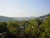
| Siegen FeatureType : null Elevation : 275 Lat/Lng : 50.8667 / 8.0167 | Siegen is a city in Germany, in the south Westphalian part of North Rhine-Westphalia. It is located in the district of Siegen-Wittgenstein in the Arnsberg region. The university town (18.600 students in the 2013–2014 winter semester) is the district seat, and is ranked as a "higher centre" in the (...) |
| 21 | 
| Lille FeatureType : null Elevation : 28 Lat/Lng : 50.6372 / 3.0633 | Lille is a city at the northern tip of France, in French Flanders. On the Deûle River, near France's border with Belgium, it is the capital of the Hauts-de-France region, the prefecture of the Nord department, and the main city of the European Metropolis of Lille (...) |
| 22 | 
| Wembley Stadium (1923) FeatureType : landmark Elevation : 60 Lat/Lng : 51.5556 / -0.2797 | The original Wembley Stadium (; formerly known as the Empire Stadium) was a football stadium in Wembley Park, London, which stood on the same site now occupied by its successor, the new Wembley Stadium. The demolition in 2003 of its famous twin towers upset many people worldwide (...) |
| 23 | 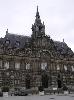
| Roubaix FeatureType : null Elevation : 31 Lat/Lng : 50.6901 / 3.1817 | Roubaix (Dutch: Robaais) is a city in Northern France, located in the Lille metropolitan area. It is a historically mono-industrial commune in the Nord department, which grew rapidly in the 19th century from its textile industries, with most of the same characteristic features as those of English (...) |
| 24 | 
| Europoort FeatureType : landmark Elevation : 3 Lat/Lng : 51.9435 / 4.1425 | Europoort (also "Europort") is an area of the Port of Rotterdam and the adjoining industrial area in the Netherlands. Being situated at Southside of the mouth of the rivers Rhine and Meuse with the hinterland consisting of the Netherlands, Germany, Belgium and partly France, Europoort is one of the (...) |
| 25 | 
| Durban FeatureType : city Lat/Lng : -29.8741 / 31.0102 | Durban (from itheku meaning "bay/lagoon") is the third most populous city in South Africa—after Johannesburg and Cape Town—and the largest city in the South African province of KwaZulu-Natal. Located on the east coast of South Africa, Durban is famous for being the busiest port in the country (...) |
| 26 | 
| Maastricht FeatureType : null Elevation : 57 Lat/Lng : 50.8492 / 5.6892 | Maastricht (;Local pronunciation: Limburgish : Mestreech ; French: Maestricht ; Spanish: Mastrique) is a city and a municipality in the southeast of the Netherlands. It is the capital and largest city of the province of Limburg (...) |
| 27 | 
| Alte Pinakothek FeatureType : landmark Elevation : 522 Lat/Lng : 48.1483 / 11.57 | The Alte Pinakothek (Old Pinakothek) is an art museum located in the Kunstareal area in Munich, Germany. It is one of the oldest galleries in the world and houses a significant collection of Old Master paintings (...) |
| 28 | 
| Netherlands FeatureType : country Elevation : 25 Lat/Lng : 52.35 / 5.7667 | The Netherlands is a country located mainly in Northwestern Europe. Together with three island territories in the Caribbean (Bonaire, Sint Eustatius and Saba), it forms a constituent country of the Kingdom of the Netherlands (...) |
| 29 | 
| Tilburg FeatureType : null Elevation : 16 Lat/Lng : 51.5606 / 5.0919 | Tilburg is a city in the Netherlands, in the southern province of North Brabant. With a population of 214,157 (April 30, 2017), it is the second largest municipality in North Brabant, and the sixth largest in the Netherlands (...) |
| 30 | 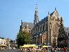
| Haarlem FeatureType : null Elevation : 5 Lat/Lng : 52.3803 / 4.6406 | Haarlem (; predecessor of Harlem in the English language) is a city and municipality in the Netherlands. It is the capital of the province of North Holland and is situated at the northern edge of the Randstad, one of the most populated metropolitan areas in Europe. Haarlem had a population of in (...) |
| 31 | 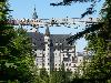
| Neuschwanstein Castle FeatureType : landmark Elevation : 955 Lat/Lng : 47.5578 / 10.7499 | Neuschwanstein Castle is a 19th-century Romanesque Revival palace on a rugged hill above the village of Hohenschwangau near Füssen in southwest Bavaria, Germany. The palace was commissioned by Ludwig II of Bavaria as a retreat and in honour of Richard Wagner (...) |
| 32 | 
| Burundi FeatureType : country Elevation : 1995 Lat/Lng : -3.6667 / 29.8167 | Burundi , officially the Republic of Burundi (. justice.gov.bi. 25 June 2012 ; , or), is a landlocked country in the African Great Lakes region of East Africa, bordered by Rwanda to the north, Tanzania to the east and south, and the Democratic Republic of the Congo to the west (...) |
| 33 | 
| Palace of Fontainebleau FeatureType : landmark Elevation : 75 Lat/Lng : 48.4019 / 2.6981 | The Palace of Fontainebleau or Château de Fontainebleau, located southeast of the center of Paris, in the commune of Fontainebleau, is one of the largest French royal châteaux. The medieval castle and subsequent palace served as a residence for the French monarchs from Louis VII to Napoleon III (...) |
| 34 | 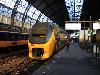
| Amsterdam FeatureType : null Elevation : 10 Lat/Lng : 52.3702 / 4.8904 | Amsterdam is the capital city and most populous municipality of the Netherlands. Its status as the capital is mandated by the Constitution of the Netherlands, although it is not the seat of the government, which is The Hague (...) |
| 35 | 
| Bordeaux FeatureType : null Elevation : 11 Lat/Lng : 44.8379 / -0.5795 | Bordeaux (; Gascon) is a port city on the Garonne in the Gironde department in Southwestern France. The municipality (commune) of Bordeaux proper has a population of 246,586 (2014). Together with its suburbs and satellite towns, Bordeaux is the centre of the Bordeaux Métropole (...) |
| 36 | 
| Chongqing FeatureType : adm1st Elevation : 238 Lat/Lng : 29.55 / 106.5069 | Chongqing , formerly romanized as Chungking, is a major city in southwest China. Administratively, it is one of China's four municipalities under the direct administration of central government (the other three are Beijing, Shanghai and Tianjin), and the only such municipality in China located far (...) |
| 37 | 
| Duisburg Hauptbahnhof FeatureType : railwaystation Elevation : 39 Lat/Lng : 51.43 / 6.7743 | Duisburg Hauptbahnhof is a railway station in the city of Duisburg in western Germany. It is situated at the meeting point of many important national and international railway lines in the Northwestern Ruhr valley. (...) |
| 38 | 
| Cambrai FeatureType : null Elevation : 65 Lat/Lng : 50.1767 / 3.2356 | Cambrai (; ; ; historically in English Camerick and Camericke) is a commune in the Nord department and in the Hauts-de-France region of France on the Scheldt river, which is known locally as the Escaut river. A sub-prefecture of the department, Cambrai is a town which had 32,518 inhabitants in the (...) |
| 39 | 
| Schenectady, New York FeatureType : null Elevation : 106 Lat/Lng : 42.8025 / -73.9276 | Schenectady is a city in Schenectady County, New York, United States, of which it is the county seat. As of the 2010 census, the city had a population of 66,135. The name "Schenectady" is derived from a Mohawk word, skahnéhtati, meaning "beyond the pines" (...) |
| 40 | 
| Marseille FeatureType : null Elevation : 6 Lat/Lng : 43.2963 / 5.3699 | Marseille (; , ; Marseilles;) is the second-largest city of France. The main city of the historical province of Provence, today it is the capital of the department of Bouches-du-Rhône and region of Provence-Alpes-Côte d'Azur (...) |
| 41 | 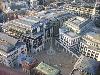
| London FeatureType : city Elevation : 8 Lat/Lng : 51.5094 / -0.1183 | London is the capital and largest city of both the United Kingdom and England. Standing on the River Thames in southeastern England, upstream from its estuary with the North Sea, London has been a major settlement for two millennia. Londinium was founded by the Romans (...) |
| 42 | 
| Barcelona FeatureType : city Elevation : 30 Lat/Lng : 41.3825 / 2.1769 | Barcelona is a city in Spain. It is the capital and largest city of Catalonia, as well as the second most populous municipality of Spain. With a population of 1.6 million within city limits, its urban area extends to numerous neighbouring municipalities within the Province of Barcelona and is home (...) |
| 43 | 
| Victoria and Albert Museum FeatureType : landmark Elevation : 23 Lat/Lng : 51.4967 / -0.1719 | The Victoria and Albert Museum (often abbreviated as the V&A) in London is the world's largest museum of decorative arts and design, housing a permanent collection of over 2.27 million objects. It was founded in 1852 and named after Queen Victoria and Prince Albert (...) |
| 44 | 
| Bavarian State Library FeatureType : landmark Elevation : 520 Lat/Lng : 48.1474 / 11.5806 | The Bavarian State Library (abbreviated BSB, called Bibliotheca Regia Monacensis before 1919) in Munich is the central "Landesbibliothek", i. e. the state library of the Free State of Bavaria and one of Europe's most important universal libraries. With its collections currently comprising around 10 (...) |
| 45 | 
| Nazca Lines FeatureType : city Elevation : 452 Lat/Lng : -14.7167 / -75.1333 | The Nazca Lines are a group of very large trenches in the Nazca Desert, in southern Peru. They were created between 500 BCE and 500 CE. These geoglyphs are 10 to 15 cm (4 to 6 in) deep, and between 0.4 and 1.1 km (.2 and .7 mi) wide (...) |
| 46 | Herentals FeatureType : null Elevation : 14 Lat/Lng : 51.1794 / 4.8358 | Herentals is a city in the province of Antwerp. The municipality comprises the city of Herentals proper and the towns of Morkhoven and Noorderwijk. On January 1, 2006 Herentals had a total population of 26,071. The total area is which gives a population density of 537 inhabitants per km² (...) | |
| 47 | Essen, Belgium FeatureType : null Elevation : 16 Lat/Lng : 51.4617 / 4.4558 | Essen is a municipality in the Belgian province of Antwerp which comprises the towns of Essen Centrum, Heikant, Horendonk, Wildert, Statie and Hoek. In 2007, Essen had a population of 17,143. The total area is 47.48 km² which gives a population density of 358 inhabitants per km² (...) | |
| 48 | Ekeren FeatureType : city Elevation : 3 Lat/Lng : 51.2809 / 4.4181 | Ekeren is a northern district of the municipality of Antwerp in the Flemish Region of Belgium. The suburb celebrated its 850th birthday in 2005; the name of the town was first mentioned in 1155, as "Hecerna". The name possibly originates from Vikings who settled there in the 9th century after using (...) | |
| 49 | 
| Atacama Large Millimeter Array FeatureType : null Elevation : 5024 Lat/Lng : -23.0193 / -67.7532 | The Atacama Large Millimeter/submillimeter Array (ALMA) is an astronomical interferometer of 66 radio telescopes in the Atacama Desert of northern Chile, which observe electromagnetic radiation at millimeter and submillimeter wavelengths (...) |
| 50 | Wilrijk FeatureType : null Elevation : 16 Lat/Lng : 51.1673 / 4.3951 | Wilrijk (former, original spelling: Wilrijck) is a district of the municipality and city of Antwerp in the Belgian province of Antwerp. Wilrijk had been a separate municipality before January 1, 1983; the enlarged municipality of Antwerp was decentralized in 2000 and Wilrijk became one of the city's (...) | |
| 51 | Worms, Germany FeatureType : null Elevation : 98 Lat/Lng : 49.6322 / 8.3655 | Worms is a city in Rhineland-Palatinate, Germany, situated on the Upper Rhine about south-southwest of Frankfurt-am-Main. It had approximately 82,000 inhabitants . A pre-Roman foundation, Worms was the capital of the Kingdom of the Burgundians in the early 5th century and hence the scene of the (...) | |
| 52 | 
| Pamir (ship) FeatureType : landmark Lat/Lng : 24.5167 / -146.783 | Pamir, a four-masted barque, was one of the famous Flying P-Liner sailing ships of the German shipping company F. Laeisz. She was the last commercial sailing ship to round Cape Horn, in 1949. By 1957, she had been outmoded by modern bulk carriers and could not operate at a profit (...) |
| 53 | Flanders FeatureType : country Elevation : 5 Lat/Lng : 51.0 / 4.5 | Flanders is the Dutch-speaking northern portion of Belgium and one of the communities, regions and language areas of Belgium. However, there are several overlapping definitions, including ones related to culture, language, politics and history, and sometimes involving neighbouring countries (...) | |
| 54 | 
| Museum of Military History, Vienna FeatureType : landmark Elevation : 202 Lat/Lng : 48.1854 / 16.3874 | The Museum of Military History – Military History Institute in Vienna is the leading museum of the Austrian Armed Forces. It documents the history of Austrian military affairs through a wide range of exhibits comprising, above all, weapons, armours, tanks, aeroplanes, uniforms, flags, (...) |
| 55 | Dyle (river) FeatureType : waterbody Elevation : 0 Lat/Lng : 51.0736 / 4.4199 | The Dyle (Dyle and Dijle), is a river in central Belgium, left tributary of the Rupel. It is long. It flows through the Belgian provinces of Walloon Brabant, Flemish Brabant and Antwerp. Its source is in Houtain-le-Val, near Nivelles in Walloon Brabant (...) | |
| 56 | Londerzeel FeatureType : city Elevation : 13 Lat/Lng : 51.0017 / 4.3022 | Londerzeel is a municipality located in the Belgian province of Flemish Brabant. The municipality comprises the towns of Londerzeel proper, Malderen, Steenhuffel (home of Palm Breweries) and Sint-Jozef. On 1 January 2006, Londerzeel had a total population of 17,435. The total area is 36 (...) | |
| 57 | Geel FeatureType : null Elevation : 25 Lat/Lng : 51.1619 / 4.9914 | Geel is a city located in the Belgian province of Antwerp, which acquired city status in the 1980s. It comprises Central-Geel which is constituted of 4 old parishes a/o towns: Sint-Amand, Sint-Dimpna, Holven and Elsum (...) | |
| 58 | 
| Berlin-Hohenschönhausen Memorial FeatureType : landmark Elevation : 56 Lat/Lng : 52.5418 / 13.5015 | The Berlin-Hohenschönhausen Memorial is a museum and memorial located in Berlin's north-eastern Lichtenberg district in the locality of Alt-Hohenschönhausen, part of the former borough of Hohenschönhausen. It was opened in 1994 on the site of the main political prison of the former East German (...) |
| 59 | 
| Votivkirche, Vienna FeatureType : landmark Elevation : 185 Lat/Lng : 48.2153 / 16.3586 | The Votivkirche is a neo-Gothic church located on the Ringstraße in Vienna, Austria. Following the attempted assassination of Emperor Franz Joseph in 1853, the Emperor's brother Archduke Ferdinand Maximilian inaugurated a campaign to create a church to thank God for saving the Emperor's life (...) |
| 60 | V-2 rocket FeatureType : null Elevation : 452 Lat/Lng : 50.1885 / 5.9038 | The V-2 ("Retribution Weapon 2"), technical name Aggregat 4 (A4), was the world's first long-range"Long-range" in the context of the time. See guided ballistic missile. The missile, powered by a liquid-propellant rocket engine, was developed during the Second World War in Germany as a "vengeance (...) | |
| 61 | European route E03 FeatureType : null Elevation : 3 Lat/Lng : 49.646 / -1.5959 | The European route E 03, is a series of road in Europe, part of the United Nations International E-road network, running from Cherbourg, France to La Rochelle, also in France. (...) | |
| 62 | Meuse FeatureType : null Lat/Lng : 51.715 / 4.6678 | The Meuse (; ; Walloon: Moûze) or Maas (; or Maas) is a major European river, rising in France and flowing through Belgium and the Netherlands before draining into the North Sea from the Rhine–Meuse–Scheldt delta. It has a total length of . (...) | |
| 63 | Walloon Brabant FeatureType : null Elevation : 104 Lat/Lng : 50.66 / 4.5833 | Walloon Brabant (Dutch: Waals-Brabant) is a province of Wallonia and Belgium. It borders on (clockwise from the North) the province of Flemish Brabant (Flemish Region) and the provinces of Liège, Namur and Hainaut (Wallonia). Its capital is Wavre (...) | |
| 64 | Aubange FeatureType : null Elevation : 298 Lat/Lng : 49.573 / 5.7938 | Aubange (German: Ibingen, Luxembourgish: Éibeng, Walloon: Åbindje) is a Walloon municipality of Belgium located in the Province of Luxembourg. On 1 January 2012 the municipality, which covers 45.6 km², had 16,042 inhabitants, giving a population density of 330.9 inhabitants per km² (...) | |
| 65 | 
| St. Mary's Church, Lübeck FeatureType : landmark Elevation : 18 Lat/Lng : 53.868 / 10.6849 | St. Mary's Church in Lübeck (German: , officially) was built between 1250 and 1350. It has always been a symbol of the power and prosperity of the old Hanseatic city, and is situated at the highest point of the island that forms the old town of Lübeck (...) |
| 66 | Albert Canal FeatureType : landmark Elevation : 35 Lat/Lng : 51.0674 / 5.1907 | The Albert Canal is a canal located in northeastern Belgium, which was named for King Albert I of Belgium. The Albert Canal connects Antwerp with Liège, and also the Meuse River with the Scheldt River. It also connects with the Canal Dessel-Turnhout-Schoten, and its total length is . (...) | |
| 67 | Battle of the Bulge FeatureType : null Elevation : 423 Lat/Lng : 50.4081 / 5.9297 | The Battle of the Bulge (16 December 1944 – 25 January 1945) was the last major German offensive campaign on the Western Front during World War II. It was launched through the densely forested Ardennes region of Wallonia in eastern Belgium, northeast France, and Luxembourg, towards the end of World (...) | |
| 68 | 
| Essen Minster FeatureType : landmark Elevation : 85 Lat/Lng : 51.456 / 7.0137 | Essen Minster (German:), since 1958 also Essen Cathedral is the seat of the Roman Catholic Bishop of Essen, the "Diocese of the Ruhr", founded in 1958. The church, dedicated to Saints Cosmas and Damian and the Blessed Virgin Mary, stands on the Burgplatz in the centre of the city of Essen, Germany (...) |
| 69 | 1908 Summer Olympics FeatureType : null Elevation : 18 Lat/Lng : 51.5136 / -0.2274 | The 1908 Summer Olympics, officially the Games of the IV Olympiad, were an international multi-sport event which was held in 1908 in London, United Kingdom from 27 April to 31 October 1908. These games were originally scheduled to be held in Rome, but were re-located on financial grounds following a (...) | |
| 70 | Ostend FeatureType : null Elevation : 3 Lat/Lng : 51.2167 / 2.9 | Ostend is a Belgian coastal city and municipality, located in the province of West Flanders. It comprises the boroughs of Mariakerke, Raversijde, Stene and Zandvoorde, and the city of Ostend proper – the largest on the Belgian coast. (...) | |
| 71 | Herbstein FeatureType : null Elevation : 439 Lat/Lng : 50.5624 / 9.3487 | Herbstein is a small town in the Vogelsbergkreis in Hesse, Germany. (...) | |
| 72 | Angela Merkel FeatureType : null Elevation : 36 Lat/Lng : 52.5202 / 13.3952 | Angela Dorothea Merkel (; ; Kasner, born 17 July 1954) is a German politician serving as Chancellor of Germany since 2005 and leader of the centre-right Christian Democratic Union (CDU) since 2000., bundeskanzlerin (...) | |
| 73 | Meerhout FeatureType : null Elevation : 29 Lat/Lng : 51.1276 / 5.0747 | Meerhout is a municipality located in the Belgian province of Antwerp. The municipality only comprises the town of Meerhout proper. As of January 1, 2008, Meerhout had a total population of 9,578. The total area is 36.29 km² which gives a population density of 264 inhabitants per km² (...) | |
| 74 | Antwerp Zoo FeatureType : landmark Elevation : 9 Lat/Lng : 51.2164 / 4.4233 | Antwerp Zoo is a zoo in the centre of Antwerp, Belgium, located next to the Antwerpen-Centraal railway station. It is the oldest animal park in the country, and one of the oldest in the world, established on 21 July 1843. (...) | |
| 75 | 
| Bucerius Kunst Forum FeatureType : landmark Elevation : 18 Lat/Lng : 53.5511 / 9.9919 | The Bucerius Kunst Forum is an international exhibition centre in Hamburg, Germany; founded in 2002 through the ZEIT-Stiftung Ebelin und Gerd Bucerius foundation. It is named after Gerd Bucerius and his wife, and located directly beside the Hamburg Rathaus (...) |
| 76 | Port of Liège FeatureType : null Elevation : 56 Lat/Lng : 50.66 / 5.636 | The Port of Liège is a Belgian inland port in Liège at the Meuse river and at the Albert Canal in the heart of Europe. Liège is the third largest inland port in Europe after Duisburg and Paris. It also has direct links to Antwerp and Rotterdam via its canals (...) | |
| 77 | Essen (disambiguation) FeatureType : null Elevation : 22 Lat/Lng : 51.4622 / 4.4563 | Essen is a city in the Ruhr area of Germany. Essen may also refer to: * Spiel or Essen, a game fair held in Essen, Germany * Essen (surname) * Essen, Belgium, a municipality in Antwerp, Belgium * Essen, Lower Saxony, a municipality in Cloppenburg, Lower Saxony, Germany * Essen, Groningen, a hamlet (...) | |
| 78 | Plochingen FeatureType : null Elevation : 258 Lat/Lng : 48.7133 / 9.417 | Plochingen is a town in the district of Esslingen in Baden-Württemberg in southern Germany. (...) | |
| 79 | Operation Market Garden FeatureType : event Elevation : 18 Lat/Lng : 51.9833 / 5.9167 | Operation Market Garden was an unsuccessful World War II military operation fought in the Netherlands from 17 to 25 September 1944, planned and predominantly led by the British Army. Its objective was a series of nine bridges that could have provided an Allied invasion route into Germany (...) | |
| 80 | Ardennes FeatureType : null Elevation : 693 Lat/Lng : 50.5017 / 6.0931 | The Ardennes (; ; ; ; ; also known as the Ardennes Forest or Forest of Ardennes) is a region of extensive forests, rough terrain, rolling hills and ridges formed by the geological features of the Ardennes mountain range and the Moselle and Meuse River basins (...) | |
| 81 | Kingdom of Bavaria FeatureType : null Elevation : 525 Lat/Lng : 48.1333 / 11.5667 | The Kingdom of Bavaria was a German state that succeeded the former Electorate of Bavaria in 1805 and continued to exist until 1918. The Bavarian Elector Maximilian IV Joseph of the House of Wittelsbach became the first King of Bavaria in 1805 as Maximilian I Joseph (...) | |
| 82 | Andernach FeatureType : null Elevation : 70 Lat/Lng : 50.4397 / 7.4017 | Andernach is a town in the district of Mayen-Koblenz, in Rhineland-Palatinate, Germany, of currently about 30,000 inhabitants. It is situated towards the end of the Neuwied basin on the left bank of the Rhine between the former tiny fishing village of Fornich in the north and the mouth of the small (...) | |
| 83 | Battle of the Scheldt FeatureType : event Elevation : 2 Lat/Lng : 51.4167 / 4.1667 | The Battle of the Scheldt in World War II was a series of military operations by Canadian, British and Polish formations to open up the shipping route to Antwerp so that its port could be used to supply the Allies in north-west Europe (...) | |
| 84 | World War II FeatureType : landmark Elevation : 65 Lat/Lng : 48.7194 / 44.5018 | World War II (often abbreviated to WWII or WW2), also known as the Second World War, was a global war that lasted from 1939 to 1945. The vast majority of the world's countries—including all the great powers—eventually formed two opposing military alliances: the Allies and the Axis (...) | |
| 85 | Baarle-Hertog FeatureType : null Elevation : 29 Lat/Lng : 51.4417 / 4.9319 | Baarle-Hertog is a Flemish municipality of Belgium, much of which consists of a number of small Belgian exclaves in the Netherlands. While some of its territory consists of exclaves in the Dutch province of North Brabant, it is part of the Belgian province of Antwerp (...) | |
| 86 | 
| Bouchout Castle FeatureType : null Elevation : 30 Lat/Lng : 50.9281 / 4.3288 | Bouchout Castle is a castle in the Flemish town of Meise, Belgium. In the 12th century, this territory of the young Duchy of Brabant was strategically positioned between the County of Flanders and the Berthout family, lords of Grimbergen (...) |
| 87 | Limburg (Belgium) FeatureType : adm2nd Elevation : 273 Lat/Lng : 50.6 / 5.9333 | Limburg (; Dutch and Limburgish: Limburg;) is a province in Belgium. It is the easternmost of the five Dutch-speaking provinces that together form the Region of Flanders, one of the three main political and cultural sub-divisions of modern Belgium (...) | |
| 88 | Bosuilstadion FeatureType : landmark}} Elevation : 3 Lat/Lng : 51.2324 / 4.4721 | The Bosuilstadion is an association football stadium in the city of Antwerp, Belgium. The stadium was opened in 1923 and has been the home of Royal Antwerp FC ever since. It has a capacity of 12,975 HLN, 25 november 2017, of which 800 indoor VIP seats. It is located in the district of Deurne (...) | |
| 89 | Bay of Gibraltar FeatureType : waterbody Lat/Lng : 36.1311 / -5.396 | The Bay of Gibraltar (also known as Gibraltar Bay or Bay of Algeciras) is a bay at the southern end of the Iberian Peninsula. It is around long by wide, covering an area of some , with a depth of up to in the centre of the bay (...) | |
| 90 | 1952 Winter Olympics FeatureType : null Elevation : 37 Lat/Lng : 59.56 / 10.45 | The 1952 Winter Olympics (Norwegian: Vinter-OL 1952), officially known as the VI Olympic Winter Games (French: Les VIes Jeux olympiques d'hiver), took place in Oslo, Norway, from 14 to 25 February 1952. Discussions about Oslo hosting the Winter Olympic Games began as early as 1935; the city wanted (...) | |
| 91 | Habsburg Spain FeatureType : null Elevation : 675 Lat/Lng : 40.4167 / -3.7 | Habsburg Spain refers to the history of Spain over the 16th and 17th centuries (1516–1700), when it was ruled by kings from the House of Habsburg (also associated with its role in the history of Central Europe) (...) | |
| 92 | Bad Bentheim FeatureType : null Elevation : 73 Lat/Lng : 52.3025 / 7.1596 | Bad Bentheim is a town in Lower Saxony, Germany in the district of Grafschaft Bentheim on the borders of North Rhine-Westphalia and the Netherlands roughly 15 km south of Nordhorn and 20 km northeast of Enschede (...) | |
| 93 | Vincent van Gogh FeatureType : null Elevation : 60 Lat/Lng : 49.0753 / 2.1789 | Vincent Willem van Gogh (; 30 March 185329 July 1890) was a Dutch Post-Impressionist painter who is among the most famous and influential figures in the history of Western art. In just over a decade he created about 2,100 artworks, including around 860 oil paintings, most of them in the last two (...) | |
| 94 | Charleroi FeatureType : null Elevation : 139 Lat/Lng : 50.4117 / 4.4447 | Charleroi is a city and a municipality of Wallonia, located in the province of Hainaut, Belgium. By January 1, 2008, the total population of Charleroi was 201,593. Population of all municipalities in Belgium, as of January 1, 2008. Retrieved on 2008-10-19 (...) | |
| 95 | First Battle of the Marne FeatureType : event Elevation : 56 Lat/Lng : 49.0167 / 3.3833 | The Battle of the Marne (also known as the Miracle of the Marne, Le Miracle de la Marne) was a World War I battle fought from It resulted in an Allied victory against the German armies in the west. The battle was the culmination of the German advance into France and pursuit of the Allied armies (...) | |
| 96 | Battle of Arnhem FeatureType : event Elevation : 6 Lat/Lng : 51.9749 / 5.9116 | The Battle of Arnhem was a major battle of the Second World War at the vanguard of the Allied Operation Market Garden. It was fought in and around the Dutch towns of Arnhem, Oosterbeek, Wolfheze, Driel, and the surrounding countryside from 17–26 September 1944 (...) | |
| 97 | County of Flanders FeatureType : null Elevation : 9 Lat/Lng : 51.06 / 3.72 | The County of Flanders was a historic territory in the Low Countries. From 862 onwards the Counts of Flanders were one of the original twelve of the Kingdom of France. For centuries their estates around the cities of Ghent, Bruges and Ypres formed one of the most affluent regions in Europe (...) | |
| 98 | Einbeck FeatureType : null Elevation : 116 Lat/Lng : 51.8166 / 9.8661 | Einbeck is a town in the district Northeim, in southern Lower Saxony, Germany. It is located on the German Timber-Frame Road. (...) | |
| 99 | Dinklage FeatureType : null Elevation : 31 Lat/Lng : 52.661 / 8.1238 | Dinklage is a town in the district of Vechta, in Lower Saxony, Germany. It is situated approximately 13 km southwest of Vechta, and 45 km north of Osnabrück. (...) | |
| 100 | 
| Doel Nuclear Power Station FeatureType : landmark Elevation : 17 Lat/Lng : 51.3247 / 4.2586 | The Doel Nuclear Power Station is one of two nuclear power plants in Belgium. The plant includes 4 reactors. The site is located on the bank of the Scheldt river, near the village of Doel in the Flemish province of East Flanders (...) |
| 101 | Schutzstaffel FeatureType : landmark Elevation : 42 Lat/Lng : 52.5072 / 13.3825 | The Schutzstaffel (SS; also stylized as with Armanen runes; ; literally "Protection Squadron") was a major paramilitary organization under Adolf Hitler and the Nazi Party (NSDAP) in Nazi Germany, and later throughout German-occupied Europe during World War II (...) | |
| 102 | North Sea FeatureType : waterbody Lat/Lng : 56.0 / 3.0 | The North Sea is a marginal sea of the Atlantic Ocean located between the United Kingdom (particularly England and Scotland), Denmark, Norway, Sweden, Germany, the Netherlands, Belgium and France. An epeiric (or "shelf") sea on the European continental shelf, it connects to the ocean through the (...) | |
| 103 | 1936 Summer Olympics FeatureType : null Elevation : 51 Lat/Lng : 52.5363 / 13.0092 | The 1936 Summer Olympics (German: Olympische Sommerspiele 1936), officially known as the Games of the XI Olympiad, was an international multi-sport event held in 1936 in Berlin, Nazi Germany. Berlin won the bid to host the Games over Barcelona, Spain, on 26 April 1931, at the 29th IOC Session in (...) | |
| 104 | Idstein FeatureType : null Elevation : 271 Lat/Lng : 50.2205 / 8.2743 | Idstein is a town of about 25,000 inhabitants in the Rheingau-Taunus-Kreis in the Regierungsbezirk of Darmstadt in Hesse, Germany. Because of its well preserved historical Altstadt (Old Town) it is part of the Deutsche Fachwerkstraße (German Timber-Frame Road), connecting towns with fire fachwerk (...) | |
| 105 | Haren, Belgium FeatureType : city Elevation : 33 Lat/Lng : 50.892 / 4.4182 | Haren (Dutch and French, sometimes written Haeren in French) is an old municipality of Brussels in Belgium, that was merged into the municipality of the City of Brussels in 1921. It is an outlying part of the municipality of the city and is situated at the northeastern edge of the Brussels Capital (...) | |
| 106 | Geleen FeatureType : city Elevation : 65 Lat/Lng : 50.9669 / 5.8281 | Geleen is a city in the southern part of the province of Limburg in the Netherlands. With 33,960 inhabitants, it is part of the municipality of Sittard-Geleen. Geleen is situated along the river Geleenbeek, a right tributary to the river Meuse (...) | |
| 107 | Alheim FeatureType : null Elevation : 317 Lat/Lng : 51.0184 / 9.6505 | Alheim is a community in Hersfeld-Rotenburg district in northeastern Hesse, Germany. It is named after nearby Alheimer Mountain. Alheim consist of 10 former souverain villages situated on both banks of the river Fulda. (...) | |
| 108 | Wallonia FeatureType : adm1st Elevation : 188 Lat/Lng : 50.51 / 4.75 | Wallonia is a region of Belgium. As the southern portion of the country, Wallonia is primarily French-speaking, and accounts for 55% of the territory of Belgium, and a third of its population. The Walloon Region was not merged with the French Community of Belgium which is the political entity that (...) | |
| 109 | War of the Spanish Succession FeatureType : null Elevation : 0 Lat/Lng : 51.0667 / 2.65 | The War of the Spanish Succession (1701–1714) was a European conflict of the early 18th century, triggered by the death of the childless Charles II of Spain in November 1700. His closest heirs were members of the Austrian Habsburg and French Bourbon families; acquisition of an undivided Spanish (...) | |
| 110 | Prince-Bishopric of Liège FeatureType : null Elevation : 71 Lat/Lng : 50.6459 / 5.5736 | The Prince-Bishopric of LiègeThe name of the city and prince-bishopric was spelled Liége until the early 20th century and that spelling is still occasionally found in the title of old newspapers, etc. https://www.jewishvirtuallibrary.org/jsource/judaica/ejud_0002_0012_0_12513 (...) | |
| 111 | Dordrecht FeatureType : null Elevation : 1 Lat/Lng : 51.8172 / 4.6482 | Dordrecht , colloquially Dordt , historically in English named Dort, is a city and municipality in the Western Netherlands, located in the province of South Holland. It is the fourth-largest city of the province, with a population of (...) | |
| 112 | Niedernhausen FeatureType : null Elevation : 302 Lat/Lng : 50.1667 / 8.3167 | Niedernhausen im Taunus is a municipality in the Rheingau-Taunus-Kreis in the Regierungsbezirk of Darmstadt in Hesse, Germany, with almost 15,000 inhabitants. (...) | |
| 113 | European Union FeatureType : null Elevation : 57 Lat/Lng : 50.8333 / 4.35 | The European Union (EU) is a political and economic union of member states that are located primarily in Europe. It has an area of and an estimated population of about 513 million. The EU has developed an internal single market through a standardised system of laws that apply in all member states in (...) | |
| 114 | Kingdom of Hungary FeatureType : null Elevation : 100 Lat/Lng : 47.4667 / 19.05 | The Kingdom of Hungary was a monarchy in Central Europe that existed from the Middle Ages into the twentieth century (1000–1946 with the exception of 1918–1920). The Principality of Hungary emerged as a Christian kingdom upon the coronation of the first king Stephen I at Esztergom in about the year (...) | |
| 115 | French war planning 1920–1940 FeatureType : null Elevation : 28 Lat/Lng : 50.85 / 4.35 | The Dyle Plan or Plan D was the plan of the Commander-in-Chief of the French Army, Général d'armée Maurice Gamelin to defeat a German attempt to invade France through Belgium. The Dyle (Dijle) river is long, from Houtain-le-Val through Flemish Brabant and Antwerp; Gamelin intended French, British (...) | |
| 116 | Brecht (disambiguation) FeatureType : null Elevation : 23 Lat/Lng : 51.3502 / 4.6383 | Bertolt Brecht was a German poet and playwright. Brecht may also refer to: *Brecht (name) *Brecht, Belgium, a town in the province of Antwerp, Belgium **Brecht Abbey, a trappist abbey in the same town *Brecht, Germany, a municipality in Rhineland-Palatinate, Germany | |
| 117 | Aniche FeatureType : null Elevation : 46 Lat/Lng : 50.3306 / 3.2519 | Aniche is a commune in the Nord department in the Hauts-de-France region of northern France. The commune, located in the Nord-Pas-de-Calais mining area, long lived on the mining of coal with fourteen pits on its territory (...) | |
| 118 | Scunthorpe FeatureType : null Elevation : 42 Lat/Lng : 53.5809 / -0.6502 | Scunthorpe is a large industrial town in North Lincolnshire, England. It is the administrative centre of the North Lincolnshire unitary authority, and had an estimated total resident population of 82,334 according to the 2016 census (...) | |
| 119 | Race to the Sea FeatureType : event Elevation : 43 Lat/Lng : 49.5 / 2.8333 | The Race to the Sea took place from about 1914, after the Battle of the Frontiers and the German advance into France, which had been stopped at the First Battle of the Marne and was followed by the First Battle of the Aisne a Franco-British counter-offensive (...) | |
| 120 | Royal Palace of Amsterdam FeatureType : landmark Elevation : 15 Lat/Lng : 52.373 / 4.891 | The Royal Palace of Amsterdam in Amsterdam (Dutch: Koninklijk Paleis van Amsterdam or) is one of three palaces in the Netherlands which are at the disposal of the monarch by Act of Parliament. It is situated on the west side of Dam Square in the centre of Amsterdam, opposite the War Memorial and (...) | |
| 121 | Roundabout FeatureType : landmark Elevation : 52 Lat/Lng : 50.8924 / 6.9673 | A roundabout, (also called a traffic circle, road circle, rotary, rotunda or island), is a type of circular intersection or junction in which road traffic is permitted to flow in one direction around a central island, and priority is given to traffic already on the junction (...) | |
| 122 | Order of Saint Augustine FeatureType : null Elevation : 30 Lat/Lng : 41.9007 / 12.457 | The Order of Saint Augustine (abbreviated as OSA; historically Ordo eremitarum sancti Augustini, OESA, the Order of Hermits of Saint Augustine), generally called Augustinians or Austin Friars (not to be confused with the Augustinian Canons Regular), is a Catholic religious order (...) | |
| 123 | 
| USS Barry (DD-933) FeatureType : landmark Elevation : 0 Lat/Lng : 38.871 / -76.996 | USS Barry (DD-933) was one of eighteen Forrest Sherman–class destroyers of the United States Navy, and was the third US destroyer to be named for Commodore John Barry. Commissioned in 1954, she spent most of her career in the Caribbean, Atlantic, and Mediterranean, but also served in the Vietnam (...) |
| 124 | Essex FeatureType : adm1st Elevation : 18 Lat/Lng : 51.75 / 0.5833 | Essex is a county in south-east England, north-east of London. One of the home counties, it borders Suffolk and Cambridgeshire to the north, Hertfordshire to the west, Kent across the estuary of the River Thames to the south, and London to the south-west (...) | |
| 125 | Eindhoven FeatureType : city Elevation : 22 Lat/Lng : 51.4381 / 5.4752 | Eindhoven is the fifth-largest city and a municipality of the Netherlands. It had a population of 229,126 in 2018, making it the largest city in the province of North Brabant, although 's-Hertogenbosch is its capital. Eindhoven was originally located at the confluence of the Dommel and Gender (...) | |
| 126 | Oslo FeatureType : null Elevation : 111 Lat/Lng : 59.9494 / 10.7564 | Oslo (; , rarely) is the capital and most populous city of Norway. It constitutes both a county and a municipality. Founded in the year 1040, and established as a kaupstad or trading place in 1048 by Harald Hardrada, the city was elevated to a bishopric in 1070 and a capital under Haakon V of Norway (...) | |
| 127 | Escalator FeatureType : landmark Elevation : 529 Lat/Lng : 48.1404 / 11.5617 | An escalator is a type of vertical transportation in the form of a moving staircase which carries people between floors of a building. It consists of a motor-driven chain of individually linked steps on a track which cycle on a pair of tracks which keep them horizontal (...) | |
| 128 | Gare d'Avignon TGV FeatureType : landmark Elevation : 22 Lat/Lng : 43.9217 / 4.7858 | Avignon TGV (IATA: XZN) is a railway station located in Avignon, France. It was opened on 10 June 2001 and is located on the LGV Méditerranée high-speed line and Avignon-Centre–Avignon TGV railway. The train services are operated by the SNCF. The station is located 6 km south of the city centre. (...) | |
| 129 | Klausen, Germany FeatureType : null Elevation : 239 Lat/Lng : 49.9057 / 6.8829 | Klausen is an Ortsgemeinde – a municipality belonging to a Verbandsgemeinde, a kind of collective municipality – in the Bernkastel-Wittlich district in Rhineland-Palatinate, Germany. (...) | |
| 130 | Battle of Liège FeatureType : event Elevation : 72 Lat/Lng : 50.6406 / 5.5721 | The Battle of Liège was the opening engagement of the German invasion of Belgium and the first battle of the First World War. The attack on Liège, a town protected by the Fortified position of Liège, a ring fortress built from the late 1880s to the early 1890s, began on 5 August 1914 and lasted (...) | |
| 131 | Ferris wheel FeatureType : null Elevation : 641 Lat/Lng : 36.1174 / -115.1681 | A Ferris wheel (sometimes called in the case of the very tallest examples, giant wheel) is an amusement ride consisting of a rotating upright wheel with multiple passenger-carrying components (commonly referred to as passenger cars, cabins, tubs, capsules, gondolas, or pods) attached to the rim in (...) | |
| 132 | 
| Steelyard FeatureType : landmark Elevation : 26 Lat/Lng : 51.5114 / -0.0906 | The Steelyard, from the Middle Low German Stalhof, was the main trading base (kontor) of the Hanseatic League in London during 15th and 16th centuries. (...) |
| 133 | National Library of Wales FeatureType : landmark Elevation : 64 Lat/Lng : 52.4144 / -4.0678 | The National Library of Wales , Aberystwyth, is the national legal deposit library of Wales and is one of the Welsh Government sponsored bodies. It is the biggest library in Wales, holding over 6.5 million books and periodicals, and the largest collections of archives, portraits, maps and (...) | |
| 134 | Tram FeatureType : landmark Elevation : 530 Lat/Lng : 48.1484 / 11.4616 | A tram (in North America streetcar or trolley) is a rail vehicle which runs on tramway tracks along public urban streets; some include segments of segregated right-of-way. The lines or networks operated by tramcars are called tramways (...) | |
| 135 | Budapest FeatureType : null Elevation : 104 Lat/Lng : 47.4983 / 19.0408 | Budapest is the capital and the most populous city of Hungary, and the tenth-largest city in the European Union by population within city limits. The city had an estimated population of 1,752,704 in 2016 distributed over a land area of about (...) | |
| 136 | Lock (water navigation) FeatureType : null Elevation : 44 Lat/Lng : 52.3064 / 8.9197 | A lock is a device used for raising and lowering boats, ships and other watercraft between stretches of water of different levels on river and canal waterways. The distinguishing feature of a lock is a fixed chamber in which the water level can be varied; whereas in a caisson lock, a boat lift, or (...) | |
| 137 | Battle of Lorraine FeatureType : event Elevation : 265 Lat/Lng : 49.0339 / 6.6619 | The Battle of Lorraine (14 August – 7 September 1914) was a battle on the Western Front during the First World War. The armies of France and Germany had completed their mobilisation, the French with Plan XVII, to conduct an offensive through Lorraine and Alsace into Germany and the Germans with (...) | |
| 138 | Cologne-Minden Railway Company FeatureType : landmark Elevation : 47 Lat/Lng : 50.9404 / 6.9744 | The Cologne-Minden Railway Company (German, old spelling: Cöln-Mindener Eisenbahn-Gesellschaft, CME) was along with the Bergisch-Märkische Railway Company and the Rhenish Railway Company one of the railway companies that in the mid-19th century built the first railways in the Ruhr and large parts of (...) | |
| 139 | Aix-en-Provence TGV railway station FeatureType : railwaystation Elevation : 188 Lat/Lng : 43.4551 / 5.3173 | Aix-en-Provence TGV is a high speed railway station located in Cabriès, Bouches-du-Rhône, southern France. The station was opened in 2001 and is located on the LGV Méditerranée. The train services are operated by SNCF (...) | |
| 140 | Belgian Congo FeatureType : city Elevation : 279 Lat/Lng : -4.3167 / 15.3167 | The Belgian Congo was a Belgian colony in Central Africa from 1908 until independence in 1960. The former colony is now the Democratic Republic of the Congo (DRC). Colonial rule in the Congo began in the late 19th century (...) | |
| 141 | Polish–Lithuanian Commonwealth FeatureType : country Elevation : 220 Lat/Lng : 50.0614 / 19.9383 | The Polish–Lithuanian Commonwealth, formally the Crown of the Kingdom of Poland and the Grand Duchy of Lithuania, after 1791 the Commonwealth of Poland, was a dualistic state, a bi-confederation of Poland and Lithuania ruled by a common monarch, who was both the King of Poland and the Grand Duke of (...) | |
| 142 | Le Corbusier FeatureType : null Elevation : 58 Lat/Lng : 48.8519 / 2.2654 | Charles-Édouard Jeanneret (6 October 1887 – 27 August 1965), known as Le Corbusier , was a Swiss-French architect, designer, painter, urban planner, writer, and one of the pioneers of what is now called modern architecture. He was born in Switzerland and became a French citizen in 1930 (...) | |
| 143 | Port of Rotterdam FeatureType : null Lat/Lng : 51.885 / 4.2867 | The Port of Rotterdam is the largest port in Europe, located in the city of Rotterdam, Netherlands. From 1962 until 2004 it was the world's busiest port, now overtaken first by Singapore and then Shanghai. In 2011, Rotterdam was the world's eleventh-largest container port in terms of twenty-foot (...) | |
| 144 | 
| Schütting (Bremen) FeatureType : landmark Elevation : 15 Lat/Lng : 53.0756 / 8.8067 | The Schütting, situated on the Marktplatz (market square) in Bremen, Germany, initially served the city's merchants and tradesmen as a guild house. In 1849, it became Bremen's chamber of commerce. Since 1973, it has been under monument protection (...) |
| 145 | University of Gdańsk FeatureType : landmark Elevation : 28 Lat/Lng : 54.3994 / 18.5686 | The University of Gdańsk is a public research university located in Gdańsk, Poland. It is an important centre for the studies of the Kashubian language. (...) | |
| 146 | Government of Rotterdam FeatureType : null Elevation : 1 Lat/Lng : 51.95 / 4.4167 | The Government of Rotterdam is the government of the municipality and city of Rotterdam in the Netherlands. Most of the inhabitants live in the city of Rotterdam, but the municipality also covers a number of small villages, and other parts of the local government, such as Rozenburg, cover an even (...) | |
| 147 | Schiphol Airport railway station FeatureType : null Elevation : 0 Lat/Lng : 52.3089 / 4.7617 | Schiphol Airport railway station (previously Schiphol until 12 December 2015) is a major passenger railway station in Haarlemmermeer, Netherlands. It is located directly beneath the terminal complex of Amsterdam Airport Schiphol and is operated by the Nederlandse Spoorwegen (...) | |
| 148 | First Battle of Ypres FeatureType : event Elevation : 20 Lat/Lng : 50.8641 / 2.8956 | The First Battle of Ypres (was a battle of the First World War, fought on the Western Front around Ypres, in West Flanders, Belgium, during October and November 1914. The battle was part of the First Battle of Flanders, in which German, French and Belgian armies and the British Expeditionary Force (...) | |
| 149 | Battle of the Yser FeatureType : event Elevation : 5 Lat/Lng : 51.1528 / 2.7231 | The Battle of the Yser was a battle of World War I that took place in October 1914 between the towns on Nieuwpoort and Diksmuide, along a stretch of the Yser River and the Yperlee Canal, in Belgium. The front line was held by a large Belgian force, which halted the German advance in a costly (...) | |
| 150 | Advanced Landing Ground FeatureType : null Elevation : 2 Lat/Lng : 49.3839 / -1.3333 | Advanced Landing Grounds (ALGs) were temporary advance airfields constructed by the Allies during World War II during the liberation of Europe. They were built in the UK prior to the invasion and thereafter in from 6 June 1944 to V-E Day, 7 May 1945 (...) | |
| 151 | Diana, Princess of Wales FeatureType : null Elevation : 98 Lat/Lng : 52.2831 / -1.0003 | Diana, Princess of Wales (born Diana Frances Spencer; 1 July 1961 – 31 August 1997), was a member of the British royal family. She was the first wife of Charles, Prince of Wales, the heir apparent to the British throne, and the mother of Prince William, Duke of Cambridge, and Prince Harry, Duke of (...) | |
| 152 | Bückeberg FeatureType : mountain Elevation : 376 Lat/Lng : 52.2599 / 9.2115 | The Bückeberg (also the Bückeberge) is a small hill range, up to 375 metres high, in the Calenberg Uplands between the Harrl and the Deister in central Germany, and is often considered part of the Weser Uplands (...) | |
| 153 | Heusenstamm FeatureType : null Elevation : 127 Lat/Lng : 50.0594 / 8.8063 | Heusenstamm is a town of over 18,000 people in the Offenbach district in the Regierungsbezirk of Darmstadt in Hesse, Germany. (...) | |
| 154 | Frammersbach FeatureType : landmark Elevation : 229 Lat/Lng : 50.0635 / 9.4704 | Frammersbach is a market community in the Main-Spessart district in the Regierungsbezirk of Lower Franconia (Unterfranken) in Bavaria, Germany. In the early modern period, people from Frammersbach achieved international renown as drivers of wagons on the most important trans-European trade routes (...) | |
| 155 | Independent Order of Odd Fellows FeatureType : null Elevation : 290 Lat/Lng : 36.0988 / -80.2462 | The Independent Order of Odd Fellows (IOOF) is a non-political and non-sectarian international fraternal order of Odd Fellowship. It was founded in 1819 by Thomas Wildey in Baltimore, Maryland, United States. Evolving from the Order of Odd Fellows founded in England during the 1700s, the IOOF was (...) | |
| 156 | Plan XVII FeatureType : event Elevation : 228 Lat/Lng : 48.7544 / 5.8517 | Plan XVII was the name of a "scheme of mobilization and concentration" that was adopted by the French Conseil Supérieur de la Guerre (the peacetime title of the French General Staff) from 1912–1914, to be put into effect by the French Army in the event of war between France and Germany (...) | |
| 157 | Sint-Michiels FeatureType : city Elevation : 7 Lat/Lng : 51.1881 / 3.2114 | Sint-Michiels (French:Saint-Michel-lez-Bruges) is a suburb of Bruges, in the province of West Flanders, Belgium. The amusement park Boudewijn Seapark with the dolphinarium is situated in Sint-Michiels. (...) | |
| 158 | Modlin Fortress FeatureType : landmark Elevation : 98 Lat/Lng : 52.4383 / 20.6819 | Modlin Fortress (Polish Twierdza Modlin) is one of the biggest 19th century fortresses in Poland. It is located in the town of Nowy Dwór Mazowiecki in district Modlin on the Narew river, some 50 kilometres north of Warsaw. It was renamed Novogeorgievsk after it was captured by the Russians in 1813. (...) | |
| 159 | Poperinge FeatureType : city Elevation : 19 Lat/Lng : 50.8556 / 2.7269 | Poperinge (also spelled Poperinghe in the past) is a municipality located in the Belgian province of West Flanders, Flemish Region, and has a history going back to medieval times. The municipality comprises the city of Poperinge proper and surrounding villages (...) | |
| 160 | Museo Nacional de Escultura, Valladolid FeatureType : landmark Elevation : 698 Lat/Lng : 41.6575 / -4.7236 | The Museo Nacional de San Gregorio (National Museum of Sculpture) is a museum in Valladolid, Spain, belonging to the Spanish Ministry of Culture. The museum has an extensive collection sculptural ranging from the Middle Ages to the 19th century from Region of Castile's churchs that, at 19th-20th c (...) | |
| 161 | Historical Archive of the City of Cologne FeatureType : landmark Elevation : 56 Lat/Lng : 50.9434 / 6.9445 | The Historical Archive of the City of Cologne (or for short) is the municipal archive of Cologne, Germany. It ranks among the largest communal archives in Europe. A municipal archive has existed in Cologne since the Middle Ages. The oldest inventory of charters in the archive is dated 1408/1409 (...) | |
| 162 | Welcome Air FeatureType : null Elevation : 577 Lat/Lng : 47.2576 / 11.351 | Welcome Air, officially Welcome Air Luftfahrt GmbH & Co KG, was an Austrian charter airline with its head office in Innsbruck. (...) | |
| 163 | Wallmerod FeatureType : null Elevation : 321 Lat/Lng : 50.4852 / 7.9516 | Wallmerod is an Ortsgemeinde – a community belonging to a Verbandsgemeinde – in the Westerwaldkreis in Rhineland-Palatinate, Germany. (...) | |
| 164 | Igor Sikorsky Kyiv Polytechnic Institute FeatureType : landmark Elevation : 165 Lat/Lng : 50.4496 / 30.4608 | The National Technical University of Ukraine "Igor Sikorsky Kyiv Polytechnic Institute" See official English page (NTUU "KPI") is a major university in Kiev, Ukraine. In January 2012 Webometrics Ranking KPI made it into top 1,000 – taking 957th place out of 20,300 universities, 510th (February 2013) (...) | |
| 165 | Battle of the Frontiers FeatureType : event Elevation : 543 Lat/Lng : 46.0 / 2.0 | The Battle of the Frontiers was a series of battles fought along the eastern frontier of France and in southern Belgium, shortly after the outbreak of the First World War. The battles resolved the military strategies of the French Chief of Staff General Joseph Joffre with Plan XVII and an offensive (...) | |
| 166 | 1980 Summer Olympics FeatureType : null Elevation : 140 Lat/Lng : 57.24 / 43.58 | The 1980 Summer Olympics, officially known as the Games of the XXII Olympiad , was an international multi-sport event held in Moscow, Soviet Union, in present-day Russia.. sports-reference.com The 1980 Games were the first Olympic Games to be staged in Eastern Europe, and remain the only Summer (...) | |
| 167 | Mulberry harbour FeatureType : landmark Lat/Lng : 49.3504 / -0.6393 | Mulberry harbours were temporary portable harbours developed by the United Kingdom during the Second World War to facilitate the rapid offloading of cargo onto beaches during the Allied invasion of Normandy in June 1944 (...) | |
| 168 | Saints Peter and Paul Cathedral, Saint Petersburg FeatureType : landmark Elevation : 13 Lat/Lng : 59.9502 / 30.3164 | The Peter and Paul Cathedral is a Russian Orthodox cathedral located inside the Peter and Paul Fortress in St. Petersburg, Russia. It is the first and oldest landmark in St. Petersburg, built between 1712 and 1733 on Hare Island along the Neva River (...) | |
| 169 | Velodrome FeatureType : landmark Elevation : 96 Lat/Lng : 52.0307 / 8.5805 | A velodrome is an arena for track cycling. Modern velodromes feature steeply banked oval tracks, consisting of two 180-degree circular bends connected by two straights. The straights transition to the circular turn through a moderate easement curve. (...) | |
| 170 | KU Leuven FeatureType : edu Elevation : 34 Lat/Lng : 50.8778 / 4.7006 | The Katholieke Universiteit Leuven (in English: Catholic University of Leuven), abbreviated KU Leuven, is a research university in the Dutch-speaking town of Leuven in Flanders, Belgium. It conducts teaching, research, and services in the sciences, engineering, humanities, medicine, law, and social (...) | |
| 171 | Berenberg Bank FeatureType : landmark Elevation : 15 Lat/Lng : 53.5568 / 9.9919 | Joh. Berenberg, Gossler & Co. KG, commonly known as Berenberg Bank and also branded as simply Berenberg, is a Hamburg-based multinational full-service investment bank. It was founded by the Flemish-origined Berenberg family in 1590 and is the world's oldest merchant bank and also the world's oldest (...) | |
| 172 | Battle of Jemmingen FeatureType : null Elevation : -3 Lat/Lng : 53.25 / 7.3833 | After the Battle of Heiligerlee, the Dutch rebel leader Louis of Nassau (brother of William the Silent) failed to capture the city Groningen. Louis was driven away by Fernando Álvarez de Toledo, Duke of Alba and defeated at the Battle of Jemmingen (also known as Battle of Jemgum, at Jemgum in East (...) | |
| 173 | Bydgoszcz Canal FeatureType : landmark Elevation : 56 Lat/Lng : 53.1394 / 17.7648 | Bydgoszcz Canal is a canal, 24.7 km long, between the cities of Bydgoszcz and Nakło in Poland, connecting Vistula river with Oder river, through Brda and Noteć rivers (the latter ending in the Warta river which itself ends in Oder). The level difference along the canal is regulated by 6 locks (...) | |
| 174 | Central station FeatureType : null Elevation : 519 Lat/Lng : 48.1405 / 11.5529 | Central stations or central railway stations emerged in the second half of the nineteenth century as railway stations that had initially been built on the edge of city centres were enveloped by urban expansion and became an integral part of the city centres themselves.Kellerman, Aharon (...) | |
| 175 | Roman Catholic Archdiocese of Cambrai FeatureType : null Elevation : 62 Lat/Lng : 50.1732 / 3.2331 | The Roman Catholic Archdiocese of Cambrai (; French: Archidiocèse de Cambrai) is an archdiocese of the Latin Rite of the Roman Catholic Church in France, comprising the arrondissements of Avesnes-sur-Helpe, Cambrai, Douai, and Valenciennes within the département of Nord, in the region of (...) | |
| 176 | Philipp Franz von Siebold FeatureType : landmark Elevation : 524 Lat/Lng : 48.1257 / 11.5634 | Philipp Franz Balthasar von Siebold (17 February 1796 – 18 October 1866) was a German physician, botanist, and traveler. He achieved prominence by his studies of Japanese flora and fauna and the introduction of Western medicine in Japan (...) | |
| 177 | Manchester Arena FeatureType : landmark Elevation : 45 Lat/Lng : 53.4882 / -2.244 | The Manchester Arena is an indoor arena in Greater Manchester, England, immediately north of the city centre and partly above Manchester Victoria station in air rights space. The arena has the highest seating capacity of any indoor venue in the United Kingdom, and second largest in the European (...) | |
| 178 | Battle of Hürtgen Forest FeatureType : event Elevation : 389 Lat/Lng : 50.7089 / 6.3618 | The Battle of Hürtgen Forest was a series of fierce battles fought from 19 September to 16 December 1944 between American and German forces on the Western Front during World War II in the Hürtgen Forest, a area about east of the Belgian–German border (...) | |
| 179 | International E-road network FeatureType : null Lat/Lng : 71.1667 / 25.8 | The international E-road network is a numbering system for roads in Europe developed by the United Nations Economic Commission for Europe (UNECE). The network is numbered from E 1 up and its roads cross national borders (...) | |
| 180 | Battle of Mons FeatureType : city Elevation : 36 Lat/Lng : 50.45 / 3.95 | The Battle of Mons was the first major action of the British Expeditionary Force (BEF) in the First World War. It was a subsidiary action of the Battle of the Frontiers, in which the Allies clashed with Germany on the French borders (...) | |
| 181 | Battle for Brest FeatureType : null Elevation : 137 Lat/Lng : 48.3908 / 4.4856 | The Battle for Brest was fought on the Western Front during World War II. Part of the Allied plan for the invasion of mainland Europe called for the capture of port facilities, in order to ensure the timely delivery of the enormous amount of war required to supply the invading Allied forces (...) | |
| 182 | Köln Messe/Deutz station FeatureType : railwaystation Elevation : 49 Lat/Lng : 50.9409 / 6.9744 | Köln Messe/Deutz station (called Köln-Deutz until November 2004, Colognian:) is an important railway junction for long-distance rail and local services in the Cologne district of Deutz in the German state of North Rhine-Westphalia (...) | |
| 183 | Burcht, Antwerp FeatureType : city Elevation : 9 Lat/Lng : 51.2 / 4.3333 | Burcht is a village within the municipality of Zwijndrecht located in the Flemish province of Antwerp, in Belgium. (...) | |
| 184 | Siege of Bastogne FeatureType : city Elevation : 498 Lat/Lng : 50.0 / 5.7214 | The Siege of Bastogne was an engagement in December 1944 between American and German forces at the Belgian town of Bastogne, as part of the larger Battle of the Bulge. The goal of the German offensive was the harbour at Antwerp (...) | |
| 185 | Opera Nova Bydgoszcz FeatureType : null Elevation : 37 Lat/Lng : 53.1244 / 17.9975 | The Opera Nova is an opera house located in Bydgoszcz and established in 1956, which also plays the role of a musical theater. It is one of the 10 opera houses in Poland and the only one of this size in the Kuyavian-Pomeranian Voivodeship (...) | |
| 186 | SM UB-16 FeatureType : landmark Lat/Lng : 52.1 / 2.0167 | SM UB-16 was a German Type UB I submarine or U-boat in the German Imperial Navy during World War I. The submarine was sunk by a British submarine in May 1918. UB-16 was ordered in November 1914 and was laid down at the AG Weser shipyard in Bremen in February 1915 (...) | |
| 187 | Hans-Joachim Marseille FeatureType : landmark Elevation : 39 Lat/Lng : 30.8908 / 28.6952 | Hans-Joachim Walter Rudolf Siegfried Marseille (13 December 1919 – 30 September 1942) was a German fighter pilot during World War II. A flying ace, he is noted for his aerial battles during the North African Campaign (...) | |
| 188 | Total S.A. FeatureType : landmark Elevation : 63 Lat/Lng : 48.8924 / 2.2436 | Total S.A. (; or) is a French multinational integrated oil and gas company and one of the seven "Supermajor" oil companies in the world. Its businesses cover the entire oil and gas chain, from crude oil and natural gas exploration and production to power generation, transportation, refining, (...) | |
| 189 | Battle of Fort Eben-Emael FeatureType : landmark Elevation : 114 Lat/Lng : 50.797 / 5.6796 | The Battle of Fort Eben-Emael was a battle between Belgian and German forces that took place between 10 May and 11 May 1940, and was part of the Battle of Belgium and Fall Gelb, the German invasion of the Low Countries and France (...) | |
| 190 | Tomorrowland (festival) FeatureType : null Elevation : 15 Lat/Lng : 51.0922 / 4.3855 | Tomorrowland is an electronic dance music festival held in Boom, Belgium. Tomorrowland was first held in 2005 and has since become one of the world's largest and most notable music festivals. It now stretches over 2 weekends and usually sells out in minutes. (...) | |
| 191 | Operation Veritable FeatureType : event Elevation : 39 Lat/Lng : 51.7333 / 6.0333 | Operation Veritable (also known as the Battle of the Reichswald) was the northern part of an Allied pincer movement that took place between 8 February and 11 March 1945 during the final stages of the Second World War (...) | |
| 192 | Roman Catholic Diocese of Honolulu FeatureType : null Lat/Lng : 21.3089 / -57.8261 | The Catholic Diocese of Honolulu, officially in Latin Dioecesis Honoluluensis, is an ecclesiastical territory or particular church of the Catholic Church in the United States. The diocese comprises the entire state of Hawaii and the unincorporated Hawaiian Islands (...) | |
| 193 | Battle of Ramillies FeatureType : event Elevation : 142 Lat/Lng : 50.6386 / 4.9128 | The Battle of Ramillies , fought on 23 May 1706, was a battle of the War of the Spanish Succession. For the Grand Alliance – Austria, England, and the Dutch Republic – the battle had followed an indecisive campaign against the Bourbon armies of King Louis XIV of France in 1705 (...) | |
| 194 | Tom Simpson FeatureType : null Elevation : 141 Lat/Lng : 54.7834 / -1.4177 | Thomas Simpson (30 November 1937 – 13 July 1967) was one of Britain's most successful professional cyclists. He was born in Haswell, County Durham and later moved to Harworth, Nottinghamshire. Simpson began road cycling as a teenager before taking up track cycling, specialising in pursuit races (...) | |
| 195 | Cologne War FeatureType : null Elevation : 69 Lat/Lng : 50.734 / 7.0998 | The Cologne War (1583–88) was a conflict between Protestant and Catholic factions that devastated the Electorate of Cologne, a historical ecclesiastical principality of the Holy Roman Empire, within present-day North Rhine-Westphalia, in Germany (...) | |
| 196 | Chang and Eng Bunker FeatureType : landmark Elevation : 351 Lat/Lng : 36.4536 / -80.6288 | Chang and Eng Bunker (May 11, 1811 – January 17, 1874) were Siamese-American conjoined twin brothers, popularly known as the "Siamese twins", the name they used to promote themselves. Their fame propelled the expression to become a synonym for conjoined twins in general (...) | |
| 197 | Marmara University FeatureType : landmark Elevation : 40 Lat/Lng : 40.9861 / 29.0536 | Marmara University (Turkish: Marmara Üniversitesi) is a public university in the Fatih district of Istanbul, in Turkey. The rector (university president) has been M. Emin Arat since 2014. (...) | |
| 198 | Battle for Caen FeatureType : city Elevation : 24 Lat/Lng : 49.1861 / -0.3625 | The Battle for Caen (June to August 1944) is the name for the fighting between the British Second Army and German in the Second World War for control of the city of Caen and vicinity, during the Battle of Normandy (...) | |
| 199 | Battle of Borgerhout FeatureType : null Elevation : 9 Lat/Lng : 51.2133 / 4.4331 | The Battle of Borgerhout was a battle during the Eighty Years' War, of the Spanish Army of Flanders led by Alexander Farnese, Prince of Parma, upon a fortified camp at the village of Borgerhout, near Antwerp, where several thousand French, English, Scottish and Walloon soldiers in service of the (...) | |
| 200 | Ordnance Survey FeatureType : landmark Elevation : 12 Lat/Lng : 50.9378 / -1.4713 | Ordnance Survey (OS) is a national mapping agency in the United Kingdom which covers the island of Great Britain. Since 1 April 2015 it has operated as Ordnance Survey Ltd, a government-owned company, 100% in public ownership (...) | |
 by
by