| 70 records found in wikipedia |
| 1 | 
| Sipaliwini District 
FeatureType : adm1st
Elevation : 250
Lat/Lng : 3.7769 / -56.0278
| Sipaliwini is the largest district of Suriname, located in the south. Sipaliwini does not have a regional capital as it is directly administered by the national government in Paramaribo. The main villages in the district are Apetina, Apoera, Bakhuys, Bitagron, Pokigron, Kajana, Kamp 52, Pelelu Tepu, (...) |
| 2 | | Sipaliwini
FeatureType : null
Elevation : 267
Lat/Lng : 2.0253 / -56.1292
| Sipaliwini is a Tiriyó village on the Sipaliwini River in the Sipaliwini District of Suriname. The village lies next to the Sipaliwini Airstrip. (...) |
| 3 | 
| Coronie District
FeatureType : adm1st
Elevation : 5
Lat/Lng : 5.7636 / -56.2778
| Coronie is a district of Suriname, situated on the coast. Coronie's capital city is Totness, with other towns including Corneliskondre, Friendship, Jenny. The district border the Atlantic Ocean to the north, the Surinamese district of Saramacca to the east, the Surinamese district of Sipaliwini to (...) |
| 4 | 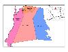
| Nickerie District
FeatureType : adm1st
Elevation : 5
Lat/Lng : 5.7672 / -56.8703
| Nickerie is a district of Suriname, on the north-west coast. Nickerie's capital city is Nieuw-Nickerie, the second largest city in the country. Other towns include Washabo and Wageningen. The district borders the Atlantic Ocean to the north, the Surinamese district of Coronie to the east, the (...) |
| 5 | 
| Suriname River
FeatureType : null
Elevation : 0
Lat/Lng : 5.8181 / -55.1591
| The Suriname River (Dutch: Surinamerivier) is 480 km long and flows through the country Suriname. Its sources are located in the Guiana Highlands on the border between the Wilhelmina Mountains and the Eilerts de Haan Mountains (where it is known as the Gran Rio) (...) |
| 6 | | Julianatop
FeatureType : mountain
Elevation : 1226
Lat/Lng : 3.6825 / -56.5355
| Julianatop is the highest mountain in Suriname at . It is located in the Sipaliwini District. (...) |
| 7 | 
| Suriname
FeatureType : city
Elevation : 15
Lat/Lng : 5.8681 / -55.1675
| Suriname (also spelled Surinam), officially known as the Republic of Suriname , is a country on the northeastern Atlantic coast of South America. It is bordered by the Atlantic Ocean to the north, French Guiana to the east, Guyana to the west and Brazil to the south (...) |
| 8 | 
| Pokigron
FeatureType : city
Elevation : 85
Lat/Lng : 4.5 / -55.3667
| Pokigron is a town in Suriname located on Brokopondo Reservoir. It is located in the Boven Suriname municipality (resort) in the Sipaliwini District. It has a population of approximately 500 people. Nearby towns and villages include Wittiehede Ston (19.6 nm), Mofina (15.6 nm), Wittikamba (1 (...) |
| 9 | | Aurora, Suriname
FeatureType : city
Elevation : 89
Lat/Lng : 4.3833 / -55.4
| Aurora is a town in the Sipaliwini District of Suriname, located at the Suriname River. (...) |
| 10 | | Tapanahony
FeatureType : adm2nd
Elevation : 168
Lat/Lng : 3.3408 / -55.1289
| Tapanahoni is a resort in Suriname, located in the Sipaliwini District. Its population at the 2012 census was 13,808. The disputed area of south-east Suriname between the Marowini (the eastern tributary river) and the Litani rivers belongs to the Tapanahoni resort. (...) |
| 11 | | Boven Suriname
FeatureType : null
Elevation : 133
Lat/Lng : 3.9669 / -55.5751
| Boven Suriname is a resort in Suriname, located in the Sipaliwini District. Its population at the 2012 census was 17,954. (...) |
| 12 | | Pontoetoe
FeatureType : city
Elevation : 198
Lat/Lng : 3.2667 / -55.4
| Pontoetoe is a village in the Sipaliwini District of Suriname, situated on the banks of the Tapanahony River. |
| 13 | | Corneliskondre
FeatureType : city
Elevation : 16
Lat/Lng : 5.35 / -56.1333
| Corneliskondre is a village in Suriname, located in the Sipaliwini district. (...) |
| 14 | | Boven Coppename
FeatureType : null
Elevation : 94
Lat/Lng : 4.5381 / -56.2555
| Boven Coppename is a resort in Suriname, located in the Sipaliwini District. Its population at the 2012 census was 539. (...) |
| 15 | | Sipaliwini Airstrip
FeatureType : null
Elevation : 267
Lat/Lng : 2.0259 / -56.1273
| Sipaliwini Airstrip , near the village of Sipaliwini, in the most southern part of Suriname in the Sipaliwini District. It was constructed as part of Operation Grasshopper and the runway of the airstrip was publicly opened in 1962 (...) |
| 16 | | Nieuw Jacobkondre
FeatureType : null
Elevation : 26
Lat/Lng : 4.9333 / -55.5333
| Nieuw Jacobkondre is a town in the Sipaliwini District of Suriname. It is situated on the Saramacca River. |
| 17 | | Sipaliwini River
FeatureType : waterbody
Elevation : 325
Lat/Lng : 1.8792 / -55.9575
| Sipaliwini River is a river of Suriname, the main source of the Courantyne River. It gives its name to the village of Sipaliwini and to the Sipaliwini District. It flows through the village of Kwamalasamutu. The name translates to thornback ray (sipari) river in the local Maroon dialect. (...) |
| 18 | | Coeroeni
FeatureType : adm2nd
Elevation : 298
Lat/Lng : 2.8461 / -56.545
| Coeroeni is a resort in Suriname, located in the Sipaliwini District. Its population at the 2012 census was 1,046. Kwamalasamutu is the main village of the resort. The disputed area of south-west Suriname known as Tigri Area belongs to the Coeroeni resort. (...) |
| 19 | | Marowijne District
FeatureType : adm1st
Elevation : 1
Lat/Lng : 5.7706 / -54.3247
| Marowijne is a district of Suriname, located on the north-east coast. Marowijne's capital city is Albina, with other towns including Moengo and Wanhatti. The district borders the Atlantic Ocean to the north, French Guiana to the east, the Surinamese district of Sipaliwini to the south, and the (...) |
| 20 | | Cottica
FeatureType : city
Elevation : 109
Lat/Lng : 3.85 / -54.2333
| Cottica is a village in the district of Sipaliwini, Suriname. It is located on the border with French Guiana. The Marowijne River flows through the village. (...) |
 by
by