| 516 records found in wikipedia |
| 1 | 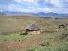
| Lesotho 
FeatureType : country
Elevation : 2302
Lat/Lng : -29.6 / 28.3
| Lesotho officially the Kingdom of Lesotho is an enclaved country within the border of South Africa. It is just over in size and has a population of around million. Its capital and largest city is Maseru. Lesotho was previously known as Basutoland, but it declared independence from the United Kingdom (...) |
| 2 | 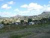
| Maseru
FeatureType : city
Elevation : 1570
Lat/Lng : -29.3156 / 27.502
| Maseru is the capital and largest city of Lesotho. It is also the capital of the Maseru District. Located on the Caledon River, Maseru lies directly on the Lesotho-South Africa border. Maseru is Lesotho's capital city with a population of 330,760 in the 2016 census (...) |
| 3 | 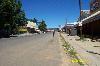
| Hlotse
FeatureType : city
Elevation : 1652
Lat/Lng : -28.8734 / 28.0416
| Hlotse (also Leribe) is an important market town in Lesotho. It is situated on the Hlotse River, near the South African border. The town was founded in 1876 by a British missionary, Reverend John Widdicombe. It was a colonial center until Lesotho gained its independence (...) |
| 4 | 
| Thabana Ntlenyana
FeatureType : mountain
Elevation : 3433
Lat/Lng : -29.4667 / 29.2667
| Thabana Ntlenyana, which literally means "Beautiful little mountain" in Sesotho, is the highest point in Lesotho and the highest mountain in southern Africa. It is situated on the Mohlesi ridge of the Drakensberg/Maloti Mountains, north of Sani Pass. It stands at high (...) |
| 5 | 
| Butha-Buthe
FeatureType : city
Elevation : 1750
Lat/Lng : -28.7833 / 28.2333
| Butha-Buthe is the capital city or camptown of the Butha-Buthe District in Lesotho. It has a population of 35,108 (2016 census). It is named for Butha-Buthe Mountain to the north of the town, which King Moshoeshoe I used as his a fortification and headquarters from 1821 to 1823, during his war with (...) |
| 6 | 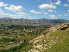
| Roma, Lesotho
FeatureType : city
Elevation : 1665
Lat/Lng : -29.4467 / 27.7081
| Roma is a settlement under the Manonyane Community Council in the Maseru District of Lesotho, some 34 kilometers southeast of Maseru, the capital of Lesotho. The Roma valley is broad and fertile, and is surrounded by sandstone cliffs topped to the East by basalt mountains which provide magnificent (...) |
| 7 | 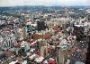
| Johannesburg
FeatureType : null
Elevation : 1766
Lat/Lng : -26.2044 / 28.0456
| Johannesburg (; ; also known as Jozi, Joburg, and eGoli) is the largest city in South Africa and one of the 50 largest urban areas in the world. It is the provincial capital and largest city of Gauteng, which is the wealthiest province in South Africa (...) |
| 8 | 
| Thaba-Tseka
FeatureType : city
Elevation : 2280
Lat/Lng : -29.5333 / 28.6
| Thaba-Tseka is the capital city or camptown of the Thaba-Tseka District in Lesotho. It has a population of 15,248 (2016 census). Thaba-Tseka was also the subject of the case studies in James Ferguson's book The Anti-Politics Machine, which identified the failures of outside-initiated development (...) |
| 9 | 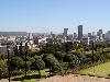
| South Africa
FeatureType : country
Elevation : 1155
Lat/Lng : -28.6167 / 24.3333
| South Africa, officially the Republic of South Africa (RSA), is the southernmost country in Africa. It is bounded to the south by of coastline of Southern Africa stretching along the South Atlantic and Indian Oceans; to the north by the neighbouring countries of Namibia, Botswana, and Zimbabwe; and (...) |
| 10 | 
| Botswana
FeatureType : country
Elevation : 1012
Lat/Lng : -24.6583 / 25.9083
| Botswana , officially the Republic of Botswana , is a landlocked country located in Southern Africa. Formerly the British protectorate of Bechuanaland, Botswana adopted its new name after becoming independent within the Commonwealth on 30 September 1966 (...) |
| 11 | 
| Mafeteng
FeatureType : city
Elevation : 1674
Lat/Lng : -29.8222 / 27.2383
| Mafeteng is a city in Lesotho, and the Camptown (capital city) of the district of Mafeteng. It is located about 76 kilometres south of the country's capital, Maseru and has a population of approximately 61,000. The South African border town to Mafeteng is Wepener (...) |
| 12 | 
| Butha-Buthe District
FeatureType : adm1st
Elevation : 2647
Lat/Lng : -28.8333 / 28.5
| Butha-Buthe is a district of Lesotho. Butha-Buthe is the capital or camptown, and only town in the district. In the north, Butha-Buthe borders on the Free State Province of South Africa. Domestically, it borders on Mokhotlong District in southeast and Leribe District on the south (...) |
| 13 | 
| Bedford
FeatureType : null
Elevation : 30
Lat/Lng : 52.1337 / -0.4577
| Bedford is the county town of Bedfordshire, England. The town has a population of around 80,000, whereas the Borough of Bedford had a population of 169,912 in mid 2017 together with Kempston. Bedford was founded at a ford on the River Great Ouse, and is thought to have been the burial place of Offa (...) |
| 14 | 
| Ceuta
FeatureType : adm2nd
Elevation : 14
Lat/Lng : 35.8883 / -5.3156
| Ceuta (or). Oxford Dictionaries. is an Spanish autonomous city on the north coast of Africa, separated by from Cadiz province on the Spanish mainland by the Strait of Gibraltar and sharing a land border with M'diq-Fnideq Prefecture in the Kingdom of Morocco (...) |
| 15 | 
| Bloemfontein
FeatureType : null
Elevation : 1382
Lat/Lng : -29.1198 / 26.2248
| Bloemfontein (;Dictionary Reference: The Free Dictionary: ; Afrikaans and Dutch "fountain of flowers" or "blooming fountain"; also known as Bloem) is the capital city of the province of Free State of South Africa; and, as the judicial capital of the nation, one of South Africa's three national (...) |
| 16 | 
| Dar es Salaam
FeatureType : city
Elevation : 10
Lat/Lng : -6.82 / 39.27
| Dar es Salaam (Dar) (from ', "the house of peace"; formerly Mzizima) is the former capital as well as the most populous city in Tanzania and a regionally important economic centre. Located on the Swahili coast, the city is one of the fastest growing cities in the world (...) |
| 17 | 
| Tonga
FeatureType : city
Elevation : 8
Lat/Lng : -21.1346 / -175.2083
| Tonga (; Tongan: Churchward, C.M. (1985) Tongan grammar, Oxford University Press, Puleʻanga Fakatuʻi ʻo Tonga), officially the Kingdom of Tonga, is a Polynesian country and archipelago comprising 169 islands, of which 36 are inhabited (...) |
| 18 | 
| Cape Town
FeatureType : city
Elevation : 40
Lat/Lng : -33.9227 / 18.4167
| Cape Town (; Xhosa: iKapa; Dutch: Kaapstad) is a coastal city in South Africa. It is the capital and primate city of the Western Cape province. It forms part of the City of Cape Town metropolitan municipality. As the place where the Parliament of South Africa is found, Cape Town is the legislative (...) |
| 19 | 
| Burundi
FeatureType : country
Elevation : 1995
Lat/Lng : -3.6667 / 29.8167
| Burundi , officially the Republic of Burundi (. justice.gov.bi. 25 June 2012 ; , or), is a landlocked country in the African Great Lakes region of East Africa, bordered by Rwanda to the north, Tanzania to the east and south, and the Democratic Republic of the Congo to the west (...) |
| 20 | 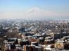
| Armenia
FeatureType : country
Elevation : 992
Lat/Lng : 40.17 / 44.52
| Armenia (;"." Dictionary.com Unabridged. 2015.), officially the Republic of Armenia , is a country in the South Caucasus region of Eurasia. Located in Western AsiaThe UN places Armenia in Western Asia; the CIA World Factbook , , and Oxford Reference Online also place Armenia in Asia (...) |
 by
by