| 41 records found in wikipedia |
| 1 | 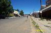
| Hlotse 
FeatureType : city
Elevation : 1652
Lat/Lng : -28.8734 / 28.0416
| Hlotse (also Leribe) is an important market town in Lesotho. It is situated on the Hlotse River, near the South African border. The town was founded in 1876 by a British missionary, Reverend John Widdicombe. It was a colonial center until Lesotho gained its independence (...) |
| 2 | | Leribe District
FeatureType : adm1st
Elevation : 1817
Lat/Lng : -29.0365 / 28.2527
| Leribè is a district of Lesotho. It has an area of 2,828 km² and a population in 2016 of approximately 337,500. Hlotse is the capital or camptown of the district. The district has one additional town, namely Maputsoe. In the west, Leribe borders on the Free State Province of South Africa (...) |
| 3 | | Leribe
FeatureType : null
Elevation : 1645
Lat/Lng : -28.8718 / 28.045
| Leribe may refer to: * Hlotse or Leribe, market town in Lesotho founded in 1876 * Leribe District, a district in Lesotho |
| 4 | 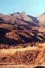
| Butha-Buthe District
FeatureType : adm1st
Elevation : 2647
Lat/Lng : -28.8333 / 28.5
| Butha-Buthe is a district of Lesotho. Butha-Buthe is the capital or camptown, and only town in the district. In the north, Butha-Buthe borders on the Free State Province of South Africa. Domestically, it borders on Mokhotlong District in southeast and Leribe District on the south (...) |
| 5 | 
| Lesotho
FeatureType : country
Elevation : 2302
Lat/Lng : -29.6 / 28.3
| Lesotho officially the Kingdom of Lesotho is an enclaved country within the border of South Africa. It is just over in size and has a population of around million. Its capital and largest city is Maseru. Lesotho was previously known as Basutoland, but it declared independence from the United Kingdom (...) |
| 6 | | Maputsoe
FeatureType : city
Elevation : 1583
Lat/Lng : -28.8866 / 27.8992
| Maputsoe is a town located in the northern district of Leribe in Lesotho; it shares a border-post with Ficksburg in the eastern Free State. With a population of 55,541 . |
| 7 | | Roman Catholic Diocese of Leribe
FeatureType : null
Elevation : 1627
Lat/Lng : -28.9005 / 27.9568
| The Roman Catholic Diocese of Leribe is a diocese located in the city of Leribe in the Ecclesiastical province of Maseru in Lesotho. (...) |
| 8 | | Free State (province)
FeatureType : adm1st
Elevation : 1381
Lat/Lng : -28.0 / 27.0
| The Free State (; ; ; ; ; before 1995, the Orange Free State) is a province of South Africa. Its capital is Bloemfontein, which is also South Africa's judicial capital. Its historical origins lie in the Boer republic called Orange Free State and later Orange Free State Province. (...) |
| 9 | | Berea District
FeatureType : adm1st
Elevation : 1743
Lat/Lng : -29.1667 / 27.9167
| Berea is a district of Lesotho. In the west, Berea borders on the Free State Province of South Africa. Domestically, it borders on the following districts: Leribe District in the north, Thaba-Tseka District in southeast and Maseru District in the south. Teyateyaneng is the capital of the district (...) |
| 10 | | Peka (Lesotho)
FeatureType : null
Elevation : 1602
Lat/Lng : -28.9667 / 27.7667
| Peka is a city of the Leribe District in Lesotho. It has a population of approximately 17,161 (2005). |
| 11 | | Leribe Airport
FeatureType : null
Elevation : 1634
Lat/Lng : -28.8556 / 28.0528
| Leribe Airport is an airport serving Hlotse, the camptown (capital) of the Leribe District of Lesotho. The runway is in a large, open field with many cross trails, but does have some side markers along its length. It is less than from the border with South Africa (...) |
| 12 | | Basutoland
FeatureType : null
Elevation : 2189
Lat/Lng : -29.5167 / 27.8
| Basutoland was a British Crown colony established in 1884 due to the Cape Colony's inability to control the territory. It was divided into seven administrative districts: Berea, Leribe, Maseru, Mohale's Hoek, Mafeteng, Qacha's Nek and Quthing (...) |
| 13 | | Mokhotlong District
FeatureType : adm1st
Elevation : 2287
Lat/Lng : -29.3333 / 29.0
| Mokhotlong district (in Sesotho language "the place of the bald ibis") is a district of Lesotho. It includes the highest terrain in the Maloti Range and the source of the Senqu River, Lesotho’s primary watershed. Mokhotlong is the capital or camptown, and only town in the district (...) |
| 14 | | Seshutes Airport
FeatureType : null
Elevation : 2149
Lat/Lng : -29.2671 / 28.5533
| Seshutes Airport or Seshote Airport is an airport serving the village of Seshote in Leribe District, Lesotho. High terrain off both runway ends may require an angling approach. (...) |
| 15 | | Thaba-Tseka District
FeatureType : adm1st
Elevation : 2301
Lat/Lng : -29.5667 / 28.6
| Thaba-Tseka is a district of Lesotho. Thaba-Tseka is also the name of the district's capital or camptown, which is the only town in the district. In the east, Thaba-Tseka borders on the KwaZulu-Natal Province of South Africa (...) |
| 16 | | Khomokhoana
FeatureType : null
Elevation : 1617
Lat/Lng : -28.8819 / 27.9317
| Khomokhoana is a community council located in the Leribe District of Lesotho. Its population in 2006 was 26,851. (...) |
| 17 | | Pitseng
FeatureType : null
Elevation : 1874
Lat/Lng : -29.007 / 28.2133
| Pitseng is a community council located in the Leribe District of Lesotho. The population in 2006 was 18,948.Lesotho Bureau of Statistics, 2006, (...) |
| 18 | | Seshote
FeatureType : null
Elevation : 2605
Lat/Lng : -29.2153 / 28.6169
| Seshote is a community council located in the Leribe District of Lesotho. Its population in 2006 was 9,359. (...) |
| 19 | | Maisa-Phoka
FeatureType : null
Elevation : 1655
Lat/Lng : -28.78 / 28.2058
| Maisa-Phoka is a community council located in the Leribe District of Lesotho. Its population in 2006 was 12,630. (...) |
| 20 | | Malaoaneng
FeatureType : null
Elevation : 1715
Lat/Lng : -28.9197 / 28.2381
| Malaoaneng is a community council located in the Leribe District of Lesotho. Its population in 2006 was 5,864. (...) |
 by
by