| 58 records found in wikipedia |
| 1 | | Kaliakra 
FeatureType : landmark
Elevation : 3
Lat/Lng : 43.36 / 28.4659
| Kaliakra is a long and narrow headland in the Southern Dobruja region of the northern Bulgarian Black Sea Coast, east of Kavarna, northeast of Varna and southwest of Mangalia. The coast is steep with vertical cliffs reaching down to the sea (...) |
| 2 | 
| Geography of Bulgaria
FeatureType : country
Elevation : 441
Lat/Lng : 43.0 / 25.0
| Bulgaria is a country situated in south-eastern Europe, bordering Romania to the north, Serbia and the Republic of Macedonia to the west, Greece and Turkey to the south, and the Black Sea to the east. The northern border with Romania follows the river Danube until the city of Silistra (...) |
| 3 | 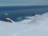
| Livingston Island
FeatureType : isle
Lat/Lng : -62.6 / -60.5
| Livingston Island (Russian name Smolensk, British Antarctic Territory Gazetteer. UK Antarctic Place-names Committee (Narrative fragment: Ostrov Smolensk, so called by RAE after the Battle of Smolensk in 1812 (Bellingshausen, 1831a, sheet 62))) is an Antarctic island in the South Shetland Islands, (...) |
| 4 | 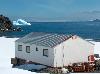
| St. Kliment Ohridski Base
FeatureType : null
Lat/Lng : -62.6414 / -60.3647
| St. Kliment Ohridski Base (Baza Sv. Kliment Ohridski \'ba-za sve-'ti 'kli-ment 'o-hrid-ski\) is a Bulgarian Antarctic base on Livingston Island in the South Shetland Islands. The base, originally known as Sofia University Refuge or Hemus Base, was named in 1993 after Clement of Ohrid, a ninth- and (...) |
| 5 | 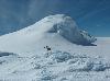
| Miziya Peak
FeatureType : null
Lat/Lng : -62.5342 / -60.1647
| Miziya Peak (Vrah Miziya \'vr&h 'mi-zi-ya\) is the 604 m summit of Vidin Heights on Varna Peninsula, eastern Livingston Island in the South Shetland Islands, Antarctica. The peak overlooks Kaliakra Glacier to the south, and Saedinenie Snowfield to the northwest (...) |
| 6 | | Kavarna Municipality
FeatureType : null
Elevation : 122
Lat/Lng : 43.4377 / 28.3468
| Kavarna Municipality is a municipality (obshtina) in Dobrich Province, Northeastern Bulgaria, located on the Northern Bulgarian Black Sea Coast in Southern Dobruja geographical region. It is named after its administrative centre - the town of Kavarna (...) |
| 7 | | Kavarna
FeatureType : landmark
Elevation : 122
Lat/Lng : 43.4377 / 28.3468
| Kavarna is a Black Sea coastal town and seaside resort in the Dobruja region of northeastern Bulgaria. It lies northeast of Varna, from Dobrich on the international road E87 and south of the border with Romania. It is the principal town of Kavarna Municipality, part of Dobrich Province (...) |
| 8 | | 2010–11 A Group
FeatureType : null
Elevation : 553
Lat/Lng : 42.6842 / 23.3397
| The 2010–11 A Group was the 87th season of the Bulgarian national top football division, and the 63rd of A Group as the top tier football league in the country. The season commenced on 31 July 2010 and ended with the last games on 28 May 2011 (...) |
| 9 | | Battle of Cape Kaliakra
FeatureType : null
Elevation : 0
Lat/Lng : 43.3741 / 28.5974
| The Battle of Cape Kaliakra was the last naval battle of the Russo-Turkish War (1787–1792). It took place on 11 August 1791 off the coast of Cape Kaliakra, Bulgaria, in the Black Sea. Neither side lost a ship, but the Ottomans retreated to Istanbul afterward (...) |
| 10 | 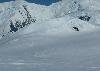
| Melnik Peak
FeatureType : null
Lat/Lng : -62.6003 / -60.1519
| Melnik Peak (Vrah Melnik \'vr&h 'mel-nik\) is the 696 m summit of Melnik Ridge in eastern Livingston Island, South Shetland Islands in Antarctica. Surmounting Kaliakra Glacier to the north and west, and Struma Glacier to the southeast. The peak takes its name from Melnik Ridge (...) |
| 11 | 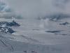
| Perunika Glacier
FeatureType : glacier
Lat/Lng : -62.6067 / -60.3091
| Perunika Glacier (Lednik Perunika \'led-nik pe-ru-'ni-ka\) is an 8 km long and 3 km wide (average) roughly crescent-shaped glacier in eastern Livingston Island in the South Shetland Islands, Antarctica situated east of Pimpirev Glacier, south of Saedinenie Snowfield, southwest of Kaliakra Glacier, (...) |
| 12 | | Dobruja
FeatureType : null
Elevation : 142
Lat/Lng : 44.45 / 28.3333
| Dobruja or Dobrudja (transliterated: Dobrudzha or Dobrudža; or ;) is a historical region in Eastern Europe that has been divided since the 19th century between the territories of Bulgaria and Romania. It is situated between the lower Danube River and the Black Sea, and includes the Danube Delta, (...) |
| 13 | 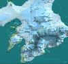
| Camp Academia
FeatureType : null
Lat/Lng : -62.645 / -60.1717
| Camp Academia (Lager Akademiya \'la-ger a-ka-'de-mi-ya\) is a geographical locality in eastern Livingston Island, South Shetland Islands, Antarctica, named for the Bulgarian Academy of Sciences in appreciation of Academy’s contribution to the Antarctic exploration (...) |
| 14 | | Battle of Kaliakra (1912)
FeatureType : null
Elevation : 0
Lat/Lng : 43.3167 / 28.4833
| The Battle of Kaliakra, usually known as the Attack of the Drazki in Bulgaria, was a maritime action between four Bulgarian torpedo boats and the Ottoman cruiser Hamidiye in the Black Sea. It took place on 21 November 1912 at 32 miles off Bulgaria's primary port of Varna (...) |
| 15 | 
| Panega Glacier
FeatureType : glacier
Lat/Lng : -62.5403 / -60.1136
| Panega Glacier (Lednik Panega \'led-nik 'pa-ne-ga\) on Varna Peninsula, Livingston Island in the South Shetland Islands, Antarctica is situated southeast of the northeastern portion of Saedinenie Snowfield, south of Rose Valley Glacier, southwest of Debelt Glacier and north of lower Kaliakra Glacier (...) |
| 16 | 
| Perperek Knoll
FeatureType : null
Lat/Lng : -62.5492 / -60.1281
| Perperek Knoll (Perperekska Mogila \per-pe-'rek-ska mo-'gi-la\) is a 360 m peak in Vidin Heights on Varna Peninsula, Livingston Island in the South Shetland Islands, Antarctica. Partly ice-free southeast slopes. Surmounting Kaliakra Glacier to the west and south (...) |
| 17 | 
| Sakar Peak
FeatureType : null
Lat/Lng : -62.5453 / -60.1208
| Sakar Peak (Vrah Sakar \'vr&h sa-'kar\) is a peak of elevation 355 m in Vidin Heights on Varna Peninsula, Livingston Island in the South Shetland Islands, Antarctica. Partly ice-free southeast slopes. Surmounting Panega Glacier to the north and east, and the lower course of Kaliakra Glacier to the (...) |
| 18 | 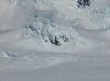
| Ticha Peak
FeatureType : null
Lat/Lng : -62.6161 / -60.1853
| Ticha Peak (Vrah Ticha \'vr&h 'ti-cha\) is a 790 m peak on the east side of Omurtag Pass in Bowles Ridge, Livingston Island in the South Shetland Islands, Antarctica. The peak is overlooking Perunika Glacier and Wörner Gap to the southwest, Huron Glacier to the southeast, and Kaliakra Glacier to the (...) |
| 19 | 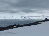
| Vidin Heights
FeatureType : null
Lat/Lng : -62.5324 / -60.1629
| Vidin Heights (Vidinski Vazvisheniya \'vi-din-ski v&z-vi-'she-ni-ya\) are predominantly ice-covered heights rising to 604 m on Varna Peninsula, eastern Livingston Island in the South Shetland Islands, Antarctica (...) |
| 20 | 
| Bowles Ridge
FeatureType : null
Lat/Lng : -62.6167 / -60.1722
| Bowles Ridge (Hrebet Bowles \'hre-bet 'bOls\) is the central ridge of eastern Livingston Island. The ridge extends 6.5 km in the east-west direction and is 1.5 km wide. The summit of the ridge is Mount Bowles which rises to 822m and is located 9.77 km northwest of Great Needle Peak, 6 (...) |
 by
by