| 1 | | Ras Dashen 
FeatureType : mountain
Elevation : 4517
Lat/Lng : 13.2369 / 38.3727
| Ras Dejen (alternatively Ras Dashan Ge'ez: ራስ ደጀን rās dejen or ራስ ዳሸን rās dashen, Amharic "head guard") is the highest mountain in Ethiopia and tenth highest mountain of Africa. Part of Simien Mountains National Park located in the Gondar, Amhara Region, it reaches an elevation of 4,550 metres (...) |
| 2 | | Mount Hay (Ethiopia)
FeatureType : mountain
Elevation : 2506
Lat/Lng : 13.35 / 38.35
| Mount Hay is a mountain in the northwestern Amhara Region of Ethiopia. It is located in the Semien Mountains National Park, close to the nation's highest peak, Ras Dashen. Mount Hay has an elevation of 4173 meters above sea level.Elevation per Ethiopian Mapping Authority. , Table A.1 (...) |
| 3 | | Zikuala
FeatureType : adm3rd
Elevation : 2165
Lat/Lng : 13.1667 / 38.5
| Zikuala is one of the woredas in the Amhara Region of Ethiopia. Located in the Wag Hemra Zone, Zikuala is bordered on the south by Dehana, on the west it is bordered by the Tekezé River which separates it from the Semien Gondar Zone and Sehala, on the north by Abergele, and on the east by Soqota (...) |
| 4 | | Mount Bwahit
FeatureType : mountain
Elevation : 4411
Lat/Lng : 13.2439 / 38.2178
| Mount Bwahit (or Buahit, Bachit, Buiheat) is a peak of the Semien Mountains in the Amhara Region of Ethiopia. Its altitude is estimated at 4430 or 4437 m above sea level, making it the third highest mountain in Ethiopia and the 13th or 14th highest mountain of Africa (...) |
| 5 | | Semien Mountains
FeatureType : mountain
Elevation : 1792
Lat/Lng : 13.4928 / 38.4436
| The Semien Mountains (Amharic: ስሜን ተራሮች) (or Səmen; also spelled Simien and Simen), in northern Ethiopia, north east of Gondar in Amhara region, are part of the Ethiopian Highlands. They are a World Heritage Site and include the Simien Mountains National Park (...) |
| 6 | | Beyeda
FeatureType : adm3rd
Elevation : 2057
Lat/Lng : 13.5 / 38.25
| Beyeda is one of the woredas in the Amhara Region of Ethiopia. Located in the easternmost point of the Semien Gondar Zone, Beyeda is bordered on the south by the Wag Hemra Zone, on the west by Jan Amora, on the north by Tselemt, and on the east by the Tekezé River which separates it from the Tigray (...) |
| 7 | 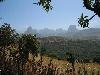
| Simien Mountains National Park
FeatureType : null
Elevation : 2322
Lat/Lng : 13.1833 / 38.0667
| Simien Mountains National Park is one of the national parks of Ethiopia. Located in the Semien (North) Gondar Zone of the Amhara Region, its territory covers the Semien Mountains and includes Ras Dashan, the highest point in Ethiopia (...) |
| 8 | | Mekane Berhan
FeatureType : null
Elevation : 2938
Lat/Lng : 12.9833 / 38.1167
| Mekane Berhan (Ge'ez: መካነ ብርሃን mekāne birhān, "Place of light") is a town in northern Ethiopia. Located in the Semien Gondar Zone of the Amhara Region, Mekane Berhan has a latitude and longitude of with an elevation of approximately 2900 meters above sea level (...) |
| 9 | | Jan Amora
FeatureType : adm3rd
Elevation : 2938
Lat/Lng : 12.9833 / 38.1167
| Jan Amora (Amharic: ጃን አሞራ jān āmōrā, "Royal eagle") is one of the woredas in the Amhara Region of Ethiopia. Part of the Semien Gondar Zone, Jan Amora is bordered on the south by Misraq Belessa, on the southwest by Wegera, on the west by Debarq, on the north by Addi Arkay and Tselemt, on the east by (...) |
| 10 | | Tekezé Dam
FeatureType : waterbody
Elevation : 1066
Lat/Lng : 13.3444 / 38.7453
| Tekezé Dam is a double-curvature arch dam located on the border of Amhara and Tigray region of Ethiopia. It is situated on the Tekezé River, a tributary of the Nile that flows through one of the deepest canyons in the world. (...) |
 by
by