| 118 records found in wikipedia | |||
| 1 | 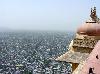
| Jaipur  FeatureType : null Elevation : 439 Lat/Lng : 26.926 / 75.8235 | Jaipur is the capital and the largest city of the Indian state of Rajasthan in Northern India. It was founded on 18 November 1727 by Jai Singh II, the ruler of Amer, and after whom the city is named. As of 2011, the city had a population of 3 (...) |
| 2 | 
| Pune FeatureType : null Elevation : 559 Lat/Lng : 18.5236 / 73.8478 | Pune , formerly spelled Poona (1857–1978), is the second largest city in the Indian state of Maharashtra, after Mumbai. It is the ninth most populous city in the country with an estimated population of 3.13 million (...) |
| 3 | 
| Bikaner FeatureType : null Elevation : 231 Lat/Lng : 28.0167 / 73.3119 | Bikaner (pronunciation) is a city in the northwest of the state of Rajasthan, India. It is located northwest of the state capital, Jaipur. Bikaner city is the administrative headquarters of Bikaner District and Bikaner division (...) |
| 4 | 
| Solapur FeatureType : city Elevation : 471 Lat/Lng : 17.6719 / 75.9044 | Solapur (pronunciation) is a city located in the south-western region of the Indian state of Maharashtra. Solapur is located on major road and rail routes between Mumbai and Hyderabad, with a branch line to the cities of Bijapur and Gadag in the neighbouring state of Karnataka (...) |
| 5 | 
| Jalandhar FeatureType : null Elevation : 243 Lat/Lng : 31.3256 / 75.5792 | Jalandhar is a city in the north Indian state of Punjab. Jalandhar lies alongside the Grand Trunk Road and is a well-connected rail and road junction. Jalandhar is 144 km northwest of Chandigarh, the state capital of Punjab and Haryana. (...) |
| 6 | 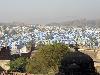
| Jodhpur FeatureType : null Elevation : 243 Lat/Lng : 26.28 / 73.02 | Jodhpur (; Listen) is the second largest city in the Indian state of Rajasthan and officially the second metropolitan city of the state. It was formerly the seat of a princely state of the same name. The capital of the kingdom was known as Marwar (...) |
| 7 | 
| Chandigarh FeatureType : city Elevation : 350 Lat/Lng : 30.7353 / 76.7911 | Chandigarh is a city and a union territory in India that serves as the capital of the two neighbouring states of Haryana and Punjab. The city is unique as it is not a part of either of the two states but is governed directly by the Union Government, which administers all such territories in the (...) |
| 8 | 
| Jabalpur FeatureType : city Elevation : 412 Lat/Lng : 23.1761 / 79.9383 | Jabalpur (US also , ; also known as Jubbulpore, the official spelling until 2006) is a tier 2 city in the state of Madhya Pradesh, India. It is one of the major cities of Madhya Pradesh. According to the 2011 census, it is the third-largest urban agglomeration in Madhya Pradesh, and the country's (...) |
| 9 | 
| Ujjain FeatureType : city Elevation : 494 Lat/Lng : 23.1828 / 75.7772 | Ujjain is previous capital of gwalior state and city in Ujjain district of the Indian state of Madhya Pradesh. It is the fifth largest city in Madhya Pradesh by population and is the administrative centre of Ujjain district and Ujjain division (...) |
| 10 | 
| Chittorgarh FeatureType : null Elevation : 406 Lat/Lng : 24.8806 / 74.6208 | Chittorgarh pronunciation (also Chittor or Chittaurgarh) is a major city and a municipality in Rajasthan state of western India. It lies on the Berach River, a tributary of the Banas, and is the administrative headquarters of Chittorgarh District and a former capital of the Sisodia Rajput Dynasty of (...) |
| 11 | 
| Vellore FeatureType : null Elevation : 218 Lat/Lng : 12.9202 / 79.1333 | Vellore is a city and the administrative headquarters of Vellore District in the South Indian state of Tamil Nadu. Located on the banks of the Palar River in the north-eastern part of Tamil Nadu, the city has been ruled, at different times, by the Pallavas, Medieval Cholas, Later Cholas, Vijayanagar (...) |
| 12 | 
| Lucknow FeatureType : city Elevation : 130 Lat/Lng : 26.8606 / 80.9158 | Lucknow is the capital and largest city of the Indian state of Uttar Pradesh, and is also the administrative headquarters of the eponymous district and division. It is the eleventh most populous city and the twelfth most populous urban agglomeration of India (...) |
| 13 | 
| Agra FeatureType : city Elevation : 167 Lat/Lng : 27.1767 / 78.005 | Agra is a city on the banks of the river Yamuna in the northern state of Uttar Pradesh, India. It is west of the state capital, Lucknow, south of the national capital New Delhi, 58 kilometres (31 mi) south of Mathura and north of Gwalior (...) |
| 14 | 
| Varanasi FeatureType : null Elevation : 82 Lat/Lng : 25.282 / 82.9563 | Varanasi , also known as Benares, Banaras (Banāras), or Kashi (Kāśī), is a city on the banks of the river Ganga in the Uttar Pradesh state of North India, south-east of the state capital, Lucknow, and east of Allahabad (...) |
| 15 | 
| Allahabad FeatureType : city Elevation : 103 Lat/Lng : 25.4425 / 81.8299 | Allahabad (pronunciation), officially known as Prayagraj since October 2018, and also known as Illahabad and Prayag, is a metropolitan city in the Indian state of Uttar Pradesh. It is the administrative headquarters of Allahabad district—the most populous district in the state and 13th most populous (...) |
| 16 | 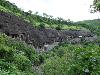
| Ajanta Caves FeatureType : landmark Elevation : 580 Lat/Lng : 20.5336 / 75.7497 | The Ajanta Caves are 30 (approximately) rock-cut Buddhist cave monuments which date from the 2nd century BCE to about 480 CE in Aurangabad district of Maharashtra state of India. The caves include paintings and rock-cut sculptures described as among the finest surviving examples of ancient Indian (...) |
| 17 | Sikar FeatureType : null Elevation : 435 Lat/Lng : 27.6119 / 75.1397 | Sikar is a city located midway between Agra and Bikaner on the National Highway 11 in the state of Rajasthan in India. It is the administrative headquarters of the Sikar District. Sikar is a historical city and contains many old havelis (large houses with Mughal-era architecture) (...) | |
| 18 | Lonavala railway station FeatureType : null Elevation : 623 Lat/Lng : 18.7493 / 73.4081 | Lonavala station or Lonavala railway station is a train station in Lonavla town, a hill station in the state of Maharashtra in India. Lonavala station is the origin of Lonavala – Pune Suburban Trains. 17 suburban trains operate on the Pune – Lonavala route (...) | |
| 19 | Udupi FeatureType : null Elevation : 26 Lat/Lng : 13.3389 / 74.7451 | Udupi is a city in the Indian state of Karnataka. It is the administrative headquarters of Udupi District. Udupi is one of the top tourist attractions in Karnataka. It is notable for the Krishna Temple. It lends its name to the popular Udupi cuisine (...) | |
| 20 | Ambala FeatureType : null Elevation : 273 Lat/Lng : 30.3749 / 76.7763 | Ambala , is a city and a municipal corporation in Ambala district in the state of Haryana, India, located on the border with the Indian state of Punjab and in proximity to both states capital Chandigarh. Politically; Ambala has two sub-areas: Ambala Cantonment also known as (Ambala Cantt) and Ambala (...) | |
| 21 | 2009 Jaipur fire FeatureType : null Elevation : 439 Lat/Lng : 26.926 / 75.8235 | The Jaipur oil depot fire broke out on 29 October 2009 at 7:30 PM (IST) at the Indian Oil Corporation (IOC) oil depot's giant tank holding of petrol, in Sitapura Industrial Area on the outskirts of Jaipur, Rajasthan, killing 12 people and injuring over 300 (...) | |
| 22 | Nawalgarh, Rajasthan FeatureType : null Elevation : 391 Lat/Lng : 27.8516 / 75.2738 | Nawalgarh is a town in Jhunjhunu district of Indian state Rajasthan. It is part of the Shekhawati region and is midway between Jhunjhunu and Sikar. It is 30 km from Sikar and 39 km from Jhunjhunu. Nawalgarh is famous for its fresco and havelis and considered as Golden City of Rajasthan (...) | |
| 23 | Akola FeatureType : city Elevation : 277 Lat/Lng : 20.7333 / 77.0 | Akola is called the Cotton City; it is one of the largest cotton-producing districts in central India. The city is also known for the vibrant Varhadi language. The city of Akola is located in the north central part of Maharashtra state, western India, on the banks of Morna River and it is an (...) | |
| 24 | Purna FeatureType : null Elevation : 381 Lat/Lng : 19.1817 / 77.0257 | Purna is a town with a municipal council in Parbhani district in the Indian state of Maharashtra. (...) | |
| 25 | Dhanbad FeatureType : city Elevation : 245 Lat/Lng : 23.7928 / 86.435 | Dhanbad is a city in the Indian state of Jharkhand. It is the second most populated city in Jharkhand. Dhanbad along with its adjacent urban areas ranks 42nd in population amongst other cities in India. Dhanbad shares its land borders with Asansol, West Bengal (...) | |
| 26 | Dhule FeatureType : null Elevation : 264 Lat/Lng : 20.8997 / 74.7697 | Dhule is one of the major cities in India situated on the banks of Panzara River. It is a municipal corporation in Dhule District in the northwestern part of Maharashtra state, India known as Khandesh. The town planning of this city was done by Sir Mokshagundam Visvesvaraya (...) | |
| 27 | Chiplun FeatureType : null Elevation : 14 Lat/Lng : 17.5334 / 73.5094 | Chiplun pronunciation is a city and a tehsil in Ratnagiri district in the state of Maharashtra, India. It is the headquarter of Chiplun taluka and located on the Mumbai–Goa highway (NH-66) (it was earlier numbered as NH-17) in western India (...) | |
| 28 | Jhansi FeatureType : null Elevation : 257 Lat/Lng : 25.4486 / 78.5696 | population_as_of = 2011 census population_footnotes = population_density_km2 = auto population_metro = 547,638 population_rank = 57 population_demonym = demographics_type1 = Languages demographics1_title1 = Official timezone1 = IST utc_offset1 = +5:30 postal_code_type = PIN (...) | |
| 29 | Bilaspur, Chhattisgarh FeatureType : null Elevation : 272 Lat/Lng : 22.0867 / 82.1431 | Bilaspur is a city in Bilaspur District in the Indian state of Chhattisgarh, situated 114 km (70.83 miles) north of the state capital, Raipur. With a population of 331,030, it is the fourth largest city in the state (...) | |
| 30 | Palanpur FeatureType : city Elevation : 230 Lat/Lng : 24.1712 / 72.4384 | Palanpur is a city and a municipality of Banaskantha district in the Indian state of Gujarat. Palanpur is the administrative headquarters of the district. (...) | |
| 31 | Smart Cities Mission FeatureType : null Elevation : 504 Lat/Lng : 23.25 / 77.41 | Smart Cities Mission, sometimes referred to as Smart City Mission, is an urban renewal and retrofitting program by the Government of India with the mission to develop 100 cities across the country making them citizen friendly and sustainable (...) | |
| 32 | Aurangabad district, Maharashtra FeatureType : null Elevation : 579 Lat/Lng : 19.8888 / 75.3434 | Aurangabad District, also called one of the 36 districts of Maharashtra state in western India. It is bordered by the districts of Nashik to the west, Jalgaon to the north, Jalna to the east, and Ahmednagar to the south. Aurangabad is the headquarters and principal city (...) | |
| 33 | Sirohi FeatureType : null Elevation : 314 Lat/Lng : 24.885 / 72.8625 | Sirohi is a city in southern Rajasthan state in western India. It is the administrative headquarters of Sirohi District and was formerly the capital of the princely state of Sirohi ruled by Deora Chauhan Rajput (...) | |
| 34 | Bhuj FeatureType : null Elevation : 105 Lat/Lng : 23.2461 / 69.6664 | Bhuj is a Municipality and District Headquarter of Kutch District in the state of Gujarat, India. (...) | |
| 35 | Dibrugarh FeatureType : null Elevation : 109 Lat/Lng : 27.4706 / 94.9123 | Dibrugarh (pron: ˌdɪbru:ˈgɑ:) is a city and is the headquarters of the Dibrugarh district in the state of Assam in India. Well known as the Tea City of India,http://www.business-standard.com/article/elections-2014/take-initiative-to-make-dibrugarh-world-s-tea-city-rahul-to-cm-114032700976_1 (...) | |
| 36 | Bharuch FeatureType : null Elevation : 19 Lat/Lng : 21.712 / 72.993 | Bharuch(Gujarati: , Bharūca, listen), formerly known as Broach, or Bhrugukachchh is a city at the mouth of the river Narmada in Gujarat in western India. Bharuch is the administrative headquarters of Bharuch District and is a municipality of about inhabitants (...) | |
| 37 | Reserve Bank of India FeatureType : null Elevation : 16 Lat/Lng : 18.9328 / 72.8369 | The Reserve Bank of India (RBI) is India's central banking institution, which controls the monetary policy of the Indian rupee. It commenced its operations on 1 April 1935 in accordance with the Reserve Bank of India Act, 1934 (...) | |
| 38 | Rewari FeatureType : city Elevation : 259 Lat/Lng : 28.1981 / 76.6181 | Rewari is a city and a municipal council in Rewari district in the Indian state of Haryana. It is located in south-west Haryana from Delhi railway station and from Gurgaon. Rewari may be considered centre of Ahirwal (Yadav) region. (...) | |
| 39 | Sri Ganganagar FeatureType : null Elevation : 177 Lat/Lng : 29.9178 / 73.8817 | Sri Ganganagar is a planned city and the northern-most city of the Indian state of Rajasthan, near the borders of Rajasthan and Punjab states and the international border of India and Pakistan. It is the administrative headquarters of Sri Ganganagar district (...) | |
| 40 | 2016 Indian Premier League FeatureType : null Elevation : 8 Lat/Lng : 18.975 / 72.8258 | The 2016 season of the Indian Premier League, also known as IPL 9, and branded as Vivo IPL 2016 for sponsorship reasons, was the ninth season of the IPL, a professional Twenty20 cricket league established by the Board of Control for Cricket in India (BCCI) in 2007 (...) | |
| 41 | 2014 Indian Premier League FeatureType : null Elevation : 3 Lat/Lng : 24.3964 / 54.5406 | The 2014 season of the Indian Premier League, abbreviated as IPL 7 or Pepsi IPL 2014, was the seventh season of the IPL, established by the Board of Control for Cricket in India (BCCI) in 2007. The tournament featured eight teams, one fewer than in 2013 after the withdrawal of the Pune Warriors (...) | |
| 42 | Indian Premier League FeatureType : null Elevation : 8 Lat/Lng : 18.975 / 72.8258 | The Indian Premier League (IPL), officially Vivo Indian Premier League for sponsorship reasons, is a professional Twenty20 cricket league in India contested during April and May of every year by teams representing Indian cities and some states (...) | |
| 43 | Abu Road FeatureType : null Elevation : 263 Lat/Lng : 24.4801 / 72.7819 | Abu Road is a city and municipality in Sirohi district of Rajasthan state in western India. It is the tehsil headquarters of Abu Road Tehsil by that name. It lies southeast of Mount Abu and its railway station is an important stop on the main Indian Railways line between Delhi and Ahmedabad (...) | |
| 44 | 2017 Pro Kabaddi League season FeatureType : null Elevation : 912 Lat/Lng : 12.9716 / 77.5946 | The 2017 Vivo Pro Kabaddi League season was the fifth season of Pro Kabaddi League, a professional kabaddi league in India since 2014. It is organised by Mashal Sports and Star India. This season includes 12 teams after the inclusion of four new teams: UP Yoddha, Tamil Thalaivas, Haryana Steelers (...) | |
| 45 | Buldhana district FeatureType : null Elevation : 657 Lat/Lng : 20.5328 / 76.1828 | Buldhana district is located in the Amravati division of Maharashtra, India. It is situated at the western border of Vidarbha region and is 500 km away from the state capital, Mumbai. The district has towns and cities like Shegaon,Malkapur,Khamgaon, Lonar, Mehkar, and Dongaon (...) | |
| 46 | Bandra FeatureType : null Elevation : 6 Lat/Lng : 19.0544 / 72.8406 | Bandra is a coastal suburb located on Salsette Island in Maharashtra, India. The suburb is located to the immediate north of the Mithi River, which separates Bandra from Mumbai City. It is the third-largest commercial hub in Maharashtra, after Mumbai and Pune, primarily aided by the Bandra-Kurla (...) | |
| 47 | Birla Institute of Technology, Mesra FeatureType : edu Elevation : 606 Lat/Lng : 23.4122 / 85.44 | Birla Institute of Technology, Mesra (BIT Mesra) is an Indian institute of higher education and a deemed University under Section 3 of the UGC Act. It was established in the year 1955 at Mesra, Ranchi in the state of Jharkhand, India by the philanthropist and industrialist Late Shri. B. M. Birla (...) | |
| 48 | Satara railway station FeatureType : railwaystation Elevation : 640 Lat/Lng : 17.6884 / 74.0633 | Satara railway station is a main railway station in Satara district, Maharashtra which city of Satara. Its code is STR. The station consists of 3 platforms. This station connects Satara with major Indian cities such as Mumbai, Pune, Bengaluru, Nagpur, Kolhapur, Ahmedabad, Jaipur, Delhi, Goa,and (...) | |
| 49 | Gwalior State FeatureType : landmark Elevation : 224 Lat/Lng : 26.22 / 78.17 | Gwalior was an Indian kingdom and princely state during the British Raj. It was focused in modern-day Madhya Pradesh, arising due to fragmentation in the Mughal Empire and lack of central authority from Delhi. It was ruled in subsidiary alliance with the British by the Scindia dynasty of the (...) | |
| 50 | Gandhidham FeatureType : null Elevation : 19 Lat/Lng : 23.0696 / 70.1359 | Gandhidham is a city and a municipality in the Kutch District of Gujarat state of India. The town was created in the early 1950s for the resettlement of the refugees from Sindh (now in Pakistan) in the aftermath of the partition of India (...) | |
| 51 | Dahanu FeatureType : null Elevation : 8 Lat/Lng : 19.9678 / 72.7126 | Dahanu is a coastal town and a municipal council in Palghar district of Maharashtra state in Konkan division. It is located 110 km from Mumbai city and hosts adani electricity's thermal power station and Tarapur atomic power station (...) | |
| 52 | Alliance Française FeatureType : null Elevation : 51 Lat/Lng : 48.8464 / 2.3286 | L'Alliance Française (French Alliance), or AF, is an international organization that aims to promote French language and culture around the world. Created in Paris on 21 July 1883 under the name Alliance française pour la propagation de la langue nationale dans les colonies et à l'étranger (French (...) | |
| 53 | Sahibi River FeatureType : river Elevation : 213 Lat/Lng : 28.4833 / 76.7333 | The Sahibi river, also called the Sabi River , is an ephemeral, rain-fed river flowing through Rajasthan, Haryana and Delhi states in India. It drains into Yamuna at Delhi, where its channeled course is also called the Najafgarh drain, which also serves as Najafgarh drain bird sanctuary (...) | |
| 54 | Surat railway station FeatureType : null Elevation : 19 Lat/Lng : 21.2049 / 72.8406 | Surat railway station (Code: ST) is an Indian railway station serving Surat, beside Gothangam, Kosad, Uttran, , Bhestan, Niol and Sachin. It is under the administrative control of Western Railway zone of the Indian Railways. It is on the Ahmedabad-Vadodara-Mumbai rail route (...) | |
| 55 | Hyderabad Deccan railway station FeatureType : railwaystation Elevation : 509 Lat/Lng : 17.3924 / 78.4675 | The Hyderabad Deccan railway station (station code:HYB), popularly known as Nampally railway station, is located at Nampally, a locality in Hyderabad. (...) | |
| 56 | Urban rail transit in India FeatureType : null Elevation : 899 Lat/Lng : 12.96 / 77.56 | Urban rail transit in India consists of suburban rail, rapid transit, monorail, light rail, and tram systems. (...) | |
| 57 | Dera Bassi FeatureType : null Elevation : 306 Lat/Lng : 30.5881 / 76.845 | Dera Bassi is a satellite city of Chandigarh and a municipal council in Mohali district in the state of Punjab, India. Dera Bassi is located on the Chandigarh – Delhi National Highway, 8 km from Chandigarh. It is located within 10km from Chandigarh, Mohali and Panchkula (...) | |
| 58 | S.A.S. Nagar FeatureType : city Elevation : 319 Lat/Lng : 30.706 / 76.7209 | Sahibzada Ajit Singh Nagar, also known as Mohali or Ajitgarh, is a city in the Sahibzada Ajit Singh Nagar district in Punjab, India, which is a commercial hub lying south-west to the Union Territory of Chandigarh. It is the administrative headquarters of Sahibzada Ajit Singh Nagar District (...) | |
| 59 | 29 September 2008 western India bombings FeatureType : null Elevation : 426 Lat/Lng : 20.55 / 74.55 | In the 29 September 2008 Western India bombings, three bombs exploded in the states of Gujarat and Maharashtra of India killing 10 persons and injuring 80. Two bombs went off in Malegaon, Maharashtra, which killed nine people while another blast in Modasa, Gujarat resulted in the death of one person (...) | |
| 60 | Mandideep FeatureType : null Elevation : 443 Lat/Lng : 23.0817 / 77.5333 | Mandideep is a town with municipality in Goharganj sub-district of Raisen district in the Indian state of Madhya Pradesh. Mandideep is 23 km from Bhopal and is basically an Industrial township which came into existence in late 1970s (...) | |
| 61 | Morena FeatureType : city Elevation : 177 Lat/Lng : 26.4964 / 77.9969 | Morena is a city and itself a District Morena district, in the Indian state of Madhya Pradesh. It is governed by a municipality corporation. Located there are the administrative headquarters of the Morena district and of the Chambal division. It is 39 km from Gwalior, Madhya Pradesh (...) | |
| 62 | Shaniwar Wada FeatureType : landmark Elevation : 557 Lat/Lng : 18.5191 / 73.8554 | Shaniwarwada is a historical fortification in the city of Pune in Maharashtra, India. Built in 1732, it was the seat of the Peshwas of the Maratha Empire until 1818, when the Peshwas lost control to the British East India Company after the Third Anglo-Maratha War (...) | |
| 63 | Washim FeatureType : city Elevation : 554 Lat/Lng : 20.1025 / 77.1369 | Washim pronunciation is a city and a municipal council in Washim district in the Indian state of Maharashtra. Washim is the district headquarters of Washim district. (...) | |
| 64 | Karera FeatureType : null Elevation : 279 Lat/Lng : 25.4582 / 78.1358 | Karera is a municipality or Nagar Palika in the Shivpuri district of the Indian state of Madhya Pradesh. (...) | |
| 65 | Chakradharpur FeatureType : null Elevation : 234 Lat/Lng : 22.6763 / 85.6291 | Chakradharpur is a city with a municipality in West Singhbhum district in the state of Jharkhand, India. It is located on the Chota Nagpur Plateau west of Jamshedpur by Railway, south of Ranchi by Road, east of Rourkela by Railway and north of Chaibasa by Road (which is the district headquarters) (...) | |
| 66 | 2016 Pro Kabaddi League season (January) FeatureType : null Elevation : 893 Lat/Lng : 12.9667 / 77.5667 | The 2016 Pro Kabaddi League season was the third season of Pro Kabaddi League, a professional kabaddi league played in India since 2014. Pro Kabaddi, which saw astounding success in its second season, was all set to make its much awaited return for a third season from 30 January 2016, just five (...) | |
| 67 | Mohania FeatureType : null Elevation : 81 Lat/Lng : 25.1692 / 83.6192 | Mohania is a city in Kaimur district in the Indian state of Bihar. It serves as headquarters for the Mohania sub-division in Kaimur district. It is 17 km by road north of the city of Bhabua, at the intersection of National Highway 19 (old number: NH 2) and State Highway 14 (...) | |
| 68 | Narkhed FeatureType : null Elevation : 424 Lat/Lng : 21.4383 / 78.5683 | Narkhed is a town and a municipal council in Nagpur district in the Indian state of Maharashtra. It is about 84 km north-west of Nagpur. It is the administrative headquarters of Narkhed taluka, one of the 14 talukas of this district (...) | |
| 69 | Meghnagar railway station FeatureType : railwaystation Elevation : 320 Lat/Lng : 22.9075 / 74.5397 | Meghnagar railway station is a small railway station in Jhabua district, Madhya Pradesh. Its code is MGN. It serves Meghnagar city. The station consists of 3 platforms. The platform is not well sheltered. It lacks many facilities including water and sanitation (...) | |
| 70 | Palsana, Rajasthan FeatureType : null Elevation : 481 Lat/Lng : 27.5121 / 75.326 | Palsana is a city located in the Sikar District region of Rajasthan state in India. It is 84 km away from Jaipur, 350 km from Jodhpur 245 km from Bikaner and 250 km from Delhi. (...) | |
| 71 | Pratapgarh district, Rajasthan FeatureType : landmark Elevation : 496 Lat/Lng : 24.03 / 74.78 | Pratapgarh district is the 33rd district of Rajasthan, created on 26 January 2008.Notication of the Government of Rajasthan No.Rev-Gp–1 F 9 (17) raj-1/07/3 January 25, 2008 It is a part of Udaipur Division and has been carved out from the erstwhile tehsils of Chittorgarh, Udaipur and Banswara (...) | |
| 72 | Shantinath Jain Teerth FeatureType : null Elevation : 526 Lat/Lng : 18.1239 / 75.0176 | Shri 1008 Shantinath Digambar Jain Mandir is located in Indapur, District Pune in Maharashtra. This is the new south pattern temple. The main attraction of this temple is 27 feet tall granite idol of Shri 1008 Munisuvrata Bhagwan. The temple is golden in colour. So it is now called as Golden Temple (...) | |
| 73 | Mavli FeatureType : null Elevation : 500 Lat/Lng : 24.7835 / 73.9839 | Mavli is a town and Tehsil in the Udaipur district, state of Rajasthan, India. Mavli Junction (IR Station code MVJ) is an important railway junction station under Ajmer division of North Western Railway zone of Indian Railways (...) | |
| 74 | Palanpur Junction railway station FeatureType : railwaystation Elevation : 216 Lat/Lng : 24.1747 / 72.4304 | Palanpur railway station is one of the major railway station located in Palanpur, Gujarat, India. The railway station is under the administrative control of Western Railway of Indian Railways. (...) | |
| 75 | Ambaji FeatureType : null Elevation : 444 Lat/Lng : 24.33 / 72.85 | Ambaji (Ambājī) is a census town in Banaskantha district in the state of Gujarat, India. It is known for its historical and mythological connections with sites of cultural heritage. (...) | |
| 76 | Indian Army FeatureType : null Elevation : 114 Lat/Lng : 26.5333 / 94.2167 | The Indian Army is the land-based branch and the largest component of the Indian Armed Forces. The President of India is the Supreme Commander of the Indian Army, and it is commanded by the Chief of Army Staff (COAS), who is a four-star general (...) | |
| 77 | Thalassery railway station FeatureType : railwaystation Elevation : 7 Lat/Lng : 11.752 / 75.494 | Thalassery railway station (Code:TLY) is a railway station serving the town of Thalassery in Kannur District of Kerala. It lies in the Shoranur - Mangalore Section of the Southern Railways. The station has 2 platforms and 3 tracks (...) | |
| 78 | Udupi railway station FeatureType : railwaystation Elevation : 17 Lat/Lng : 13.3361 / 74.7708 | Udupi railway station is a railway station in Udupi district, Karnataka. Its code is UD. It serves Udupi and the university town of Manipal, which is south from the station and Udupi. The station consists of 2 platforms. Most of the platform is not sheltered from the heavy rains that Udupi receives (...) | |
| 79 | Madgaon Junction railway station FeatureType : railwaystation Elevation : 12 Lat/Lng : 15.2677 / 73.9711 | Madgaon Junction railway station (Station code: MAO) is a railway junction and major station on the Indian Railways network, specifically on the South Western Railway line to Vasco da Gama and the Konkan Railway, in Madgaon, Goa, India. (...) | |
| 80 | Hazur Sahib Nanded railway station FeatureType : null Elevation : 359 Lat/Lng : 19.15 / 77.3 | Hazur Sahib Nanded is an A-Category railway station serving the city of Nanded in the state of Maharashtra, India. The station falls under Nanded Railway Division which was formed in 2003, until then the station used to be a part of Hyderabad Division (...) | |
| 81 | Dabra, Gwalior FeatureType : null Elevation : 209 Lat/Lng : 25.8863 / 78.3338 | Dabra is a town and a municipality in Gwalior district in the state of Madhya Pradesh, India located near NH-75 national highway. (...) | |
| 82 | Nimbi Jodha FeatureType : city Elevation : 341 Lat/Lng : 27.533 / 74.343 | Nimbi Jodha is a sub tehsil of Ladnu tehsil, Nagaur District of Rajasthan State, India. It belongs to Ajmer Division. It is located 75 km east of the district headquarters, Nagaur, 210 km from the state capital, Jaipur, 210 km from Jodhpur, 180 km from Ajmer, 180 km from Bikaner, and 52 km from (...) | |
| 83 | 2014 Pro Kabaddi League season FeatureType : null Elevation : 893 Lat/Lng : 12.9667 / 77.5667 | The 2014 Pro Kabaddi League was the first season of Pro Kabaddi League. The duration of the season was from 26 July 2014 to 31 August 2014. There was double round robin matches along with two semi finals, third place and final games (...) | |
| 84 | Mau Junction railway station FeatureType : null Elevation : 78 Lat/Lng : 25.9417 / 83.5608 | Mau Junction is located in the city of Mau in the Indian state of Uttar Pradesh. It is an important railway station. It falls on Allahabad-Mau-Gorakhpur Main Line. It is well connected to important cities like New Delhi, Mumbai, Surat, Ahmedabad, Kolkata, Pune, Lucknow, Kanpur, Allahabad, Jaipur, (...) | |
| 85 | Buxar railway station FeatureType : railwaystation Elevation : 69 Lat/Lng : 25.5612 / 83.981 | Buxar railway station is a railway station in Buxar district, Bihar, India. Its code is BXR. It serves Buxar city. The station consists of 3 platforms. Buxar is connected to the state capital Patna by rail routes and there are direct trains from Buxar to the metro cities of India like Banglore, (...) | |
| 86 | Techfest FeatureType : null Elevation : 54 Lat/Lng : 19.1336 / 72.9154 | Techfest is the annual science and technology festival of Indian Institute of Technology Bombay. It also refers to the independent body of students who organize this event along with many other social initiatives and outreach programs around the year (...) | |
| 87 | Najafgarh drain FeatureType : river Elevation : 215 Lat/Lng : 28.5167 / 76.6 | The Najafgarh drain or Najafgarh nullah (nullah in Hindi means rivulet or storm water drain), which also acts as Najafgarh drain bird sanctuary, is another name for the northernmost end of River Sahibi, which continues its flow through Delhi, where it is channelized, and then flows into the Yamuna (...) | |
| 88 | Navlakha FeatureType : null Elevation : 561 Lat/Lng : 22.6944 / 75.8742 | Navlakha is a residential locality within the city of Indore, Madhya Pradesh, India. The area is named after the famous Navlakha Temple in the city of Indore. Postal Code: 452012 (...) | |
| 89 | Gwalior Junction railway station FeatureType : null Elevation : 214 Lat/Lng : 26.2161 / 78.1819 | Gwalior railway station (station code: GWL) is an important railway station of Gwalior City in the state of Madhya Pradesh. It is operated by North Central Railway. The Gwalior Junction GWL is part of the Jhansi Division of the North Central Railways (...) | |
| 90 | Tirur railway station FeatureType : railwaystation Elevation : 8 Lat/Lng : 10.918 / 75.922 | Tirur railway station (Code:TIR) is a railway station serving the town of Tirur in Malappuram District of Kerala. It lies in the Shoranur - Mangalore Section of the Southern Railways. Almost all passenger and express trains have a halt here. The station has 3 platforms and 3 tracks (...) | |
| 91 | Koderma Junction railway station FeatureType : null Elevation : 400 Lat/Lng : 24.435 / 85.5278 | Koderma Junction Railway Station, (Hindi कोडरमा जंक्शन रेलवे स्टेशन) station code KQR, is railway station of the Indian railway serving the city of Jhumri Telaiya, Koderma, the headquarters of Koderma district in the Indian state of Jharkhand (...) | |
| 92 | Itarsi Junction railway station FeatureType : railwaystation Elevation : 329 Lat/Lng : 22.608 / 77.767 | Itarsi Junction (station code: ET) is a railway station in Hoshangabad District in Madhya Pradesh from which more than 330 trains passes everyday. It falls under the West Central Railway zone of Indian Railways network. It is located away from Hoshangabad by train, and by road it is 20 kilometers (...) | |
| 93 | Abu Road railway station FeatureType : railwaystation Elevation : 263 Lat/Lng : 24.4807 / 72.7854 | Abu Road railway station is located in Sirohi district in the Indian state of Rajasthan . It serves Abu Road and is gateway to the popular hill station at Mount Abu. (...) | |
| 94 | Baglan taluka FeatureType : null Elevation : 539 Lat/Lng : 20.58 / 74.22 | Baglan is a taluka (tehsil) in Nashik District in the Indian state of Maharashtra. Sometimes Baglan Taluka is unofficially referred to as Satana, because of that city's dominance within the taluka. (...) | |
| 95 | Ministry of Health and Family Welfare FeatureType : null Elevation : 212 Lat/Lng : 28.6139 / 77.2089 | The Ministry of Health and Family Welfare is an Indian government ministry charged with health policy in India. It is also responsible for all government programs relating to family planning in India. The Minister of Health and Family Welfare holds cabinet rank as a member of the Council of (...) | |
| 96 | 2010 Jama Masjid attack FeatureType : null Elevation : 227 Lat/Lng : 28.6507 / 77.2334 | The 2010 Jama Masjid attack occurred on 19 September 2010 when two gunmen on a motorcycle fired at a tourist bus near Gate 3 of the Jama Masjid in Old Delhi, India and injured two Taiwanese tourists. The incident provoked fears about security for the upcoming Commonwealth Games in Delhi (...) | |
| 97 | Mavjinjava FeatureType : null Elevation : 167 Lat/Lng : 21.5502 / 70.907 | . Mavjinjava is a small village near Bagasara in the Amreli district of the Saurashtra region in the state of Gujarat, India. There is a population of around 10,000 people in Mavjinjava. More than 7000 people live outside of Manjinjava in places like Surat, Ahmedabad & Mumbai. (...) | |
| 98 | Dharmabad railway station FeatureType : railwaystation Elevation : 355 Lat/Lng : 18.8884 / 77.8494 | Dharmabad railway station is a railway station belonging to Hyderabad railway division of South Central Railway. The station is situated in Nanded district of Maharashtra, India. Its station code is DAB. The station is on a single track non-electrified broad gauge line (...) | |
| 99 | Ratlam Junction railway station FeatureType : railwaystation Elevation : 496 Lat/Lng : 23.3408 / 75.051 | Ratlam Junction railway station is a major rail junction on the New Delhi–Mumbai main line of Indian Railways. (...) | |
| 100 | Morena railway station FeatureType : railwaystation Elevation : 176 Lat/Lng : 26.5006 / 78.0039 | Morena railway station is a small railway station in Morena district, Madhya Pradesh. Its code is MRA. It serves Morena city. The station consists of 3 platforms. The platform is not well sheltered. It lacks many facilities including water and sanitation (...) | |
| 101 | Bikaner Junction railway station FeatureType : railwaystation Elevation : 227 Lat/Lng : 28.0147 / 73.3159 | Bikaner railway station is located in Bikaner district in the Indian state of Rajasthan. It serves Bikaner. Bikaner is headquarters of Bikaner railway division. (...) | |
| 102 | Central Institute of Educational Technology FeatureType : null Elevation : 232 Lat/Lng : 28.5393 / 77.196 | The Central Institute of Educational Technology (acronym CIET) is an autonomous organization, formed as a nodal agency under the National Council of Educational Research and Training (NCERT) for promoting the use of mass media technology for expanding and improving the quality of education at the (...) | |
| 103 | Dedwa FeatureType : null Elevation : 45 Lat/Lng : 24.8617 / 71.7608 | Dedwa or Dedvahttps://goo.gl/maps/thsYFLaKCUS2 is a village in the Tehsil of Sanchore, Jalore District, Rajasthan State, India. It belongs to Jodhpur division. It is located on NH 15 road, 12 km north from Sanchore, 138 km south-west of the district headquarters in Jalore and 540 km from the state (...) | |
| 104 | Washim railway station FeatureType : railwaystation Elevation : 555 Lat/Lng : 20.103 / 77.148 | Washim railway station is a small railway station in Washim district, in Vidharbha region of the Maharashtra. Its code is WHM. It serves Washim city. The station consists of 3 platforms. The platform is well sheltered. It lacks many facilities including water and sanitation (...) | |
| 105 | Kumbhariya, Banaskantha district FeatureType : null Elevation : 431 Lat/Lng : 24.3254 / 72.8623 | Kumbhariya is a village of historical, archeological and religious importance with cultural heritage in Danta Taluka of Banaskantha district, Gujarat, India. It is a historical place associated with Jain temple. (...) | |
| 106 | National Council of Science Museums FeatureType : null Elevation : 9 Lat/Lng : 22.57 / 88.4286 | National Council of Science Museums (NCSM) is an autonomous organisation under Indian Ministry of Culture. It is the largest chain of science centers or museums under a single administrative umbrella in the world (...) | |
| 107 | Rupal, Gandhinagar FeatureType : null Elevation : 84 Lat/Lng : 23.31 / 72.597 | Rupal is a village in Gandhinagar District of Gujarat state, India. It is located 13 KM towards North from District headquarters Gandhinagar. Gujarati is the local language here. (...) | |
| 108 | Lucknow Charbagh railway station FeatureType : railwaystation Elevation : 125 Lat/Lng : 26.832 / 80.919 | Lucknow railway station (official name Lucknow NR, station code LKO) is one of the two main railway stations of Lucknow city for broad gauge trains, other one is "Lucknow Jn" (station code "LJN"). This page contains information about the Lucknow NR Railway Station. (...) | |
| 109 | Durgawati FeatureType : null Elevation : 75 Lat/Lng : 25.2114 / 83.5308 | Durgawati (also called Durgaoti or Durgauti) is a town in Kaimur district in the Indian state of Bihar. It serves as headquarters for the Durgawati sub-division in Kaimur district. It is 30.6 km by road north of the city of Bhabua, on National Highway 19 (old NH 2) (...) | |
| 110 | Nana Kheda Inter State Bus Terminal FeatureType : landmark Elevation : 490 Lat/Lng : 23.1585 / 75.7879 | Nana Kheda Bus Stand or Pandit Deendayal Upadhyay Bus Stand is a bus terminus in Ujjain, Madhya Pradesh. Nana Kheda is a bus terminus that provides bus service to destinations located in other states. Nana Kheda is the largest Bus stand in Madhya Pradesh (...) | |
| 111 | Godiji FeatureType : null Elevation : 8 Lat/Lng : 18.975 / 72.8258 | Godiji Parshwanath is the name given to several images of the Jain Tirthankar Parshwananth in India, and to the temple where it is the main deity (mulanayaka). Parshwanath was the 23rd Tirthankara who attained nirvana in 777 BCE. The original image, about 1 (...) | |
| 112 | Dhanbad Junction railway station FeatureType : null Elevation : 238 Lat/Lng : 23.7922 / 86.4283 | Dhanbad Junction Railway Station, station code DHN, is a railway station of the Indian railway serving the city of Dhanbad, the headquarters of Dhanbad district in the Indian state of Jharkhand. It is the largest railway station in Jharkhand, handling over 100 trains and 100,000+ passengers every (...) | |
| 113 | Women's Kabaddi Challenge FeatureType : null Elevation : 893 Lat/Lng : 12.9667 / 77.5667 | Women's Kabaddi Challenge is a Kabaddi league in India started like Pro Kabaddi League for women's. Three teams will take part in inaugural season in 2016 and the league will be played across seven cities in India. (...) | |
| 114 | Yesvantpur Junction railway station FeatureType : null Elevation : 916 Lat/Lng : 13.02 / 77.55 | Yesvantpur Junction railway station (station code: YPR) is one of the three important stations which serves the city of Bangalore which is located in Yesvantpur locality. It is one of the developing stations of Bangalore created for reducing the rush at Bangalore City Railway Station. (...) | |
| 115 | Mookambika Road Byndoor railway station FeatureType : railwaystation Elevation : 9 Lat/Lng : 13.8718 / 74.6327 | Mookambika Road Byndoor (Code:BYNR) is the main railway station in the town of Udupi. It serves Byndoor city which is 1 kilometres away from the station Trains from here connect the city to prominent state capitals of India like, Bangalore, Thiruvananthapuram (via Southern Railway), Mumbai (via (...) | |
| 116 | Madras Boat Club FeatureType : null Elevation : 5 Lat/Lng : 13.0167 / 80.2333 | The Madras Boat Club, located in the South of India, in the historic city of Chennai is one of the oldest rowing centres in India. (...) | |
| 117 | Katni Junction railway station FeatureType : railwaystation Elevation : 386 Lat/Lng : 23.8334 / 80.4011 | Katni Junction (Station Code: KTE)http://katni.nic.in/katniJunction.htm is a major rail junction in Katni, India. Rail links from the junction travel in five directions — Bina, Jabalpur, Satna, Bilaspur, Singrauli (...) | |
| 118 | Guna Junction railway station FeatureType : railwaystation Elevation : 477 Lat/Lng : 24.6408 / 77.3142 | Guna Junction railway station is a main railway station in Guna district, Madhya Pradesh. Its code is GUNA. It serves Guna city. The station consists of 3 platforms. The platform is not well sheltered. It lacks many facilities including water and sanitation. (...) | |
 by
by