| 62 records found in wikipedia | |||
| 1 | 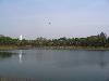
| Kozhikode  FeatureType : null Elevation : 15 Lat/Lng : 11.2554 / 75.7812 | Kozhikode , also known as Calicut, is a city in Kerala, India and the headquarters of the Kozhikode district. The Kozhikode metropolitan area is the second largest urban agglomeration in Kerala with a population of 2 million as of 2011 (...) |
| 2 | 
| Kochi FeatureType : city Elevation : 9 Lat/Lng : 9.9399 / 76.2602 | Kochi , also known as Cochin , is a major port city on the south-west coast of India bordering the Laccadive Sea. It is part of the district of Ernakulam in the state of Kerala and is often referred to as Ernakulam (...) |
| 3 | National Institute of Technology Calicut FeatureType : edu Elevation : 70 Lat/Lng : 11.322 / 75.9354 | National Institute of Technology Calicut (NIT Calicut or NITC) is an autonomous, federally funded technical university and an institute of national importance governed by the NIT Act passed by the Parliament of India (...) | |
| 4 | 
| Thrissur FeatureType : null Elevation : 17 Lat/Lng : 10.5333 / 76.2167 | Thrissur pronunciation (originally Thiru Siva Peroor and previously known by its anglicised form as Trichur), is the fourth largest city, the third largest urban agglomeration in Kerala (Pop. 1,854,783) and the 20th largest in India. It is also the headquarters of the Thrissur District (...) |
| 5 | 
| Chittagong FeatureType : null Elevation : 37 Lat/Lng : 22.3475 / 91.8123 | Chittagong , officially known as Chattogram, is a major coastal city and financial centre in southeastern Bangladesh. The city has a population of more than 2.5 million while the metropolitan area had a population of 4,009,423 in 2011, making it the second-largest city in the country (...) |
| 6 | University of Calicut FeatureType : null Elevation : 75 Lat/Lng : 11.1339 / 75.894 | The University of Calicut is the largest University in Kerala. Established in the year 1968. It is the second university to be set up in Kerala. Calicut University is affiliated by UGC and located at Thenjipalam in Malappuram district of Kerala state in India (...) | |
| 7 | 
| Alappuzha FeatureType : null Elevation : 8 Lat/Lng : 9.4977 / 76.3385 | Alappuzha (pronunciation), also known by its former name Alleppey, is the administrative headquarters of Alappuzha District in the Indian State of Kerala. Alappuzha is a city and a municipality in Kerala with an urban population of 174,164http://www.censusindia.gov (...) |
| 8 | 
| Jeddah FeatureType : city Elevation : 15 Lat/Lng : 21.5433 / 39.1728 | Jeddah (sometimes spelled Jiddah or Jedda; ; ', Hejazi pronunciation:) is a city in the Tihamah region of the Hejaz on the coast of the Red Sea and is the major urban center of western Saudi Arabia. It is the largest city in Makkah Province, the largest seaport on the Red Sea, and with a population (...) |
| 9 | Kozhikode district FeatureType : null Lat/Lng : 11.25 / 75.77 | Kozhikode District or Calicut district is a district of Kerala state, on the southwest coast of India. The city of Kozhikode, also known as Calicut, is the district headquarters. The district is 38.25% urbanised (...) | |
| 10 | 
| Cochin International Airport FeatureType : airport Elevation : 6 Lat/Lng : 10.1528 / 76.3922 | Cochin International Airport, Cochin is an international airport serving the city of Kochi, in the state of Kerala, India. Located at Nedumbassery, about 25 km (16 mi) northeast of the city. Cochin International Airport is the first airport in India developed under a public-private partnership (PPP) (...) |
| 11 | Kunnamangalam FeatureType : null Elevation : 29 Lat/Lng : 11.3046 / 75.8777 | Kunnamangalam is a growing census town located about 14.5 km east of Kozhikode (Calicut) city on the Calicut-Bangalore National Highway. Nearby places are Koduvally, Chathamangalam, and Kettangal. The locality is home of education (...) | |
| 12 | Dakshina Kannada FeatureType : null Elevation : 50 Lat/Lng : 12.84 / 75.29 | Dakshina Kannada is a district in the state of Karnataka in India. Sheltered by the Western Ghats on the east and surrounded by the Arabian Sea on the west, Dakshina Kannada receives abundant rainfall during the monsoon (...) | |
| 13 | National Institutes of Technology FeatureType : null Elevation : 104 Lat/Lng : 25.49 / 81.86 | The National Institutes of Technology (NITs) are autonomous public institutes of higher education, located in India. They are governed by the National Institutes of Technology Act, 2007, which declared them as institutions of national importance alongside Indian Institutes of Technology (...) | |
| 14 | Sardar Vallabhbhai National Institute of Technology, Surat FeatureType : edu Elevation : 10 Lat/Lng : 21.1646 / 72.7852 | The National Institute of Technology, Surat (NIT Surat), formally known as Sardar Vallabhbhai National Institute of Technology or SVNIT, is an engineering institute of higher education established by the Parliament of India in 1961 (...) | |
| 15 | Gujarat FeatureType : adm1st Elevation : 72 Lat/Lng : 23.22 / 72.68 | Gujarat (') is a state in Western IndiaOther sources: * * * and Northwest IndiaOther sources: * * *, a coastline of – most of which lies on the Kathiawar peninsula – and a population in excess of 60 million. It is the sixth largest Indian state by area and the ninth largest state by population (...) | |
| 16 | Palakkad district FeatureType : null Elevation : 86 Lat/Lng : 10.775 / 76.651 | Palakkad District is one of the 14 districts of the Indian state of Kerala. Also, it is the largest district in Kerala from 2006. The city of Palakkad is the district headquarters. Palakkad is bordered on the northwest by the Malappuram District, on the southwest by the Thrissur District, on the (...) | |
| 17 | Chennamangallur FeatureType : null Elevation : 30 Lat/Lng : 11.3 / 75.975 | Chennamangaloor, also spelt as Chennamangallur and/or Chendamangallur is a lush green village located in Kozhikode district, Kerala, India. It is about from the town of Kozhikode. The National Institute of Technology Calicut (NITC), the Indian Institute of Management Kozhikode (IIM-K), are located (...) | |
| 18 | Mangalore FeatureType : city Elevation : 35 Lat/Lng : 12.8694 / 74.8426 | Mangalore, officially known as Mangaluru, is the chief port city of the Indian state of Karnataka. It is located about west of the state capital, Bangalore, between the Arabian Sea and the Western Ghats mountain range (...) | |
| 19 | Kannur FeatureType : null Elevation : 11 Lat/Lng : 11.8689 / 75.3555 | Kannur, also known by its anglicised name Cannanore, is a city and a Municipal Corporation in Kannur district, state of Kerala, India. It is the administrative headquarters of the Kannur District and situated 518 km north of the state capital Thiruvananthapuram (...) | |
| 20 | Indian Institute of Management Kozhikode FeatureType : edu}} Elevation : 107 Lat/Lng : 11.2943 / 75.8736 | The Indian Institute of Management Kozhikode (IIM Kozhikode or IIMK) is an autonomous business school located in Calicut (Kozhikode), Kerala. The institute, setup in 1996 by the Government of India in collaboration with the State Government of Kerala, is one of the 20 Indian Institutes of Management (...) | |
| 21 | National Institute of Technology, Durgapur FeatureType : edu Elevation : 92 Lat/Lng : 23.5483 / 87.2914 | The National Institute of Technology Durgapur (abbreviated NIT Durgapur or NIT DGP) is a public engineering institution located in Durgapur, West Bengal, India. Formerly known as the Regional Engineering College, Durgapur (REC Durgapur), it is among the first 8 Regional Engineering Colleges (...) | |
| 22 | Perinthalmanna FeatureType : null Elevation : 44 Lat/Lng : 10.9804 / 76.2252 | Perinthalmanna is a town and municipality in Malappuram district of Kerala. Perinthalmanna's name is derived from Perumthallu (Malayalam: പെരുന്തല്ല്, the native name for fight). It was the capital of Valluvanad, a princely state ruled by the Valluvakonathiris, a suspected branch of the Pallava (...) | |
| 23 | Madras Presidency FeatureType : landmark Elevation : 4 Lat/Lng : 13.08 / 80.27 | The Madras Presidency, or the Presidency of Fort St. George, and also known as Madras Province, was an administrative subdivision (presidency) of British India. At its greatest extent, the presidency included most of southern India, including the whole of the Indian states of Tamil Nadu and Andhra (...) | |
| 24 | Kerala FeatureType : adm1st Elevation : 19 Lat/Lng : 8.5074 / 76.972 | Kerala is a state on the southwestern, Malabar Coast of India. It was formed on 1 November 1956, following passage of the States Reorganisation Act, by combining Malayalam-speaking regions. Spread over , Kerala is the twenty second largest Indian state by area (...) | |
| 25 | Chalakudy FeatureType : null Elevation : 17 Lat/Lng : 10.3 / 76.33 | Chalakudy is a municipal town situated on the banks of Chalakudy River in Thrissur District of the Kerala State in India. It is the headquarters of Chalakudy taluk. It is the base camp for travellers to Athirappilly and Vazhachal Falls (...) | |
| 26 | Kattangal FeatureType : null Elevation : 30 Lat/Lng : 11.3 / 75.975 | Kattangal is a small town situated near the National Institute of Technology Calicut, located in Kerala, India. It is about 22 km distant from the city of Kozhikode. Chathamangalam Gramapanchayath is the village administration and this village is a major educational hub in Kerala (...) | |
| 27 | Kingdom of Mysore FeatureType : landmark Elevation : 741 Lat/Lng : 12.3 / 76.65 | The Kingdom of Mysore was a kingdom in southern India, traditionally believed to have been founded in 1399 in the vicinity of the modern city of Mysore. The kingdom, which was ruled by the Wodeyar family, initially served as a vassal state of the Vijayanagara Empire (...) | |
| 28 | University of Kerala FeatureType : edu Elevation : 38 Lat/Lng : 8.5033 / 76.9472 | University of Kerala (UoK), formerly the University of Travancore, is an affiliating universityhttp://www.keralauniversity.ac.in/about.htm located in Thiruvananthapuram, capital of the south Indian state of Kerala, India (...) | |
| 29 | Koyilandy FeatureType : null Elevation : 18 Lat/Lng : 11.439 / 75.695 | Koyilandy (or Quilandy/Quilandi) is a taluk and a Municipality town in the Kozhikode district in the North Malabar region, state of Kerala. This town is between Kozhikode and Vatakara and is on NH 66 (previously NH 17). It is sometimes identified with Tyndis in Periplus of the Erythraean Sea (...) | |
| 30 | Zheng He FeatureType : null Elevation : 50 Lat/Lng : 31.9103 / 118.7286 | Zheng He (; 1371–1433 or 1435) was a Chinese mariner, explorer, diplomat, fleet admiral, and court eunuch during China's early Ming dynasty. He was originally born as Ma He in a Muslim family, later adopted the conferred surname Zheng from Emperor Yongle.Dreyer 2007, 22–23 (...) | |
| 31 | Taliparamba FeatureType : null Elevation : 45 Lat/Lng : 12.0416 / 75.3593 | Taliparamba or Thaliparamba is a city and a municipality of 72,500 people in the Kannur district, state of Kerala, spread over an area of 43.05 km2. Taliparamba (Perinchellur) is a part of Kannur district in the state of Kerala, India. Thali means a temple built by Namboothiri (...) | |
| 32 | Iritty FeatureType : null Elevation : 40 Lat/Lng : 11.989 / 75.677 | Iritty is a municipality and a taluk in the district of Kannur in the state of Kerala, India. The town is the main market place for the farmer communities in the surrounding regions. Iritty is known as The Coorg Valley in God's Own Country (...) | |
| 33 | National Institute of Technology, Arunachal Pradesh FeatureType : edu Elevation : 228 Lat/Lng : 27.15 / 93.7167 | The National Institute of Technology Arunachal Pradesh (also known as NIT Arunachal Pradesh) is one of the 31 National Institutes of Technology in India and is recognized as an Institute of National Importance. The classes of NIT Arunachal Pradesh were started from 2010 in a temporary campus in (...) | |
| 34 | Mukkam FeatureType : null Elevation : 30 Lat/Lng : 11.3 / 75.975 | Mukkam (Malayalam:മുക്കം) is a Municipality town in the Kozhikode district, state of Kerala, India; spread over an area of 31.28 km2. It is a malabar region in which people, food, coastal area, historical values etc. are famous comparerd to other localities in the town (...) | |
| 35 | National Institute of Technology Agartala FeatureType : edu Elevation : 59 Lat/Lng : 23.9667 / 91.4167 | The National Institute of Technology, Agartala, shortened to NIT Agartala or NITA, is a technology-oriented institute of higher education established by India's Ministry of Human Resource Development Government of India in Agartala, India (...) | |
| 36 | French Institute of Pondicherry FeatureType : edu Elevation : 11 Lat/Lng : 11.937 / 79.8361 | The French Institute of Pondicherry UMIFRE 21 CNRS-MAEE is a French financially autonomous institution in Puducherry, India, under the joint supervision of the French Ministry of Foreign and European Affairs (MAEE) and the French National Centre for Scientific Research (CNRS) (...) | |
| 37 | Technology Business Incubator TBI-NITC FeatureType : edu Elevation : 70 Lat/Lng : 11.322 / 75.9354 | The Technology Business Incubator TBI-NITC was set up by the National Institute of Technology Calicut and is located at Kettangal, in Kozhikode district, India.It is supported by the National Science and Technology Entrepreneurship Development Board (NSTEDB), Department of Science & Technology, Govt (...) | |
| 38 | Mahé, Puducherry FeatureType : null Elevation : 17 Lat/Lng : 11.7013 / 75.5369 | Mahé,The spelling "Mahe" appears to be the only one for the Mahe District (as can be seen from the District's official website and other official sites). "Mahé" seems to survive for the town proper. natively known as Mayyazhi, is a small town at the mouth of the Mahé River and is surrounded on all (...) | |
| 39 | St. Joseph's College of Engineering and Technology, Palai FeatureType : edu Elevation : 59 Lat/Lng : 9.7268 / 76.726 | St. Joseph's College of Engineering and Technology, Palai (also referred to as SJCET Palai) is an Indian private college managed by the Syro-Malabar Catholic Diocese of Palai, located in Palai, Kerala, India. It is an AICTE approved college offering professional degree programs in engineering and (...) | |
| 40 | Anthoor FeatureType : null Elevation : 38 Lat/Lng : 11.987 / 75.376 | Anthoor is a town with a municipality in the Kannur district of the North Malabar region in the Indian state of Kerala. Anthoor is located roughly 14 km from the Kannur Corporation, and it is adjacent to the Taliparamba municipality. (...) | |
| 41 | Kodakara FeatureType : null Elevation : 18 Lat/Lng : 10.3719 / 76.3056 | Kodakara is a big town in Thrissur district of Kerala state in South India. It is located on National Highway (NH 544) 20 km south of Thrissur town and about 10 km north of Chalakudy. Administratively, Kodakara comes under Kodakara Panchayat and Chalakudy Taluk (...) | |
| 42 | Footwear Design and Development Institute FeatureType : null Elevation : 204 Lat/Lng : 28.59 / 77.35 | Footwear Design and Development Institute is an educational institute headquartered in Noida, Uttar Pradesh,http://articles.timesofindia.indiatimes.com/2010-11-16/lucknow/28247200_1_amethi-mp-rahul-gandhi-congress-mp-footwear-design (...) | |
| 43 | History of India FeatureType : null Elevation : 1357 Lat/Lng : 36.7833 / 70.0 | The history of India includes the prehistoric settlements and societies in the Indian subcontinent; the advancement of civilisation from the Indus Valley Civilisation to the eventual blending of the Indo-Aryan culture to form the Vedic Civilisation; the rise of Hinduism, Jainism and Buddhism;AL (...) | |
| 44 | Kozhikode East FeatureType : null Elevation : 37 Lat/Lng : 11.3064 / 75.8789 | Kozhikode East is a suburb of Kozhikode city in India. Kozhikode East includes areas outside the city jurisdiction but they are still closely associated with the city in terms of commerce and everyday life. (...) | |
| 45 | Anjarakkandy FeatureType : null Elevation : 40 Lat/Lng : 11.8822 / 75.5097 | Anjarakandy is a Grama panchayath in Kannur district. Anjrakandy river is flowing through Anjarakandy. (...) | |
| 46 | Techfest FeatureType : null Elevation : 54 Lat/Lng : 19.1336 / 72.9154 | Techfest is the annual science and technology festival of Indian Institute of Technology Bombay. It also refers to the independent body of students who organize this event along with many other social initiatives and outreach programs around the year (...) | |
| 47 | Kalanthode FeatureType : null Elevation : 36 Lat/Lng : 11.3153 / 75.9548 | Kallanthode is a fast-growing rural area near to the National Institute of Technology Calicut, in the Kozhikode district of the Indian state of Kerala. (...) | |
| 48 | Government Engineering College, Kozhikode FeatureType : edu}} Elevation : 17 Lat/Lng : 11.2856 / 75.77 | The Government Engineering College, Kozhikode (GECK) was started by the government of Kerala, India, in August 1999. It is an engineering institution under the Department of Technical Education, Kerala. GECK has been rated consistently among the top technical institutes in kerala, with students (...) | |
| 49 | School of Engineering, CUSAT FeatureType : null Elevation : 37 Lat/Lng : 10.049 / 76.33 | The School of Engineering is a college under Cochin University of Science and Technology, in Kochi (Cochin), Kerala, India. Established in 1979 for offering part-time M.Tech programmes.The school was the first in the country to introduce Information Technology as an engineering stream and is one (...) | |
| 50 | Thangal Kunju Musaliar College of Engineering FeatureType : null Elevation : 27 Lat/Lng : 8.9139 / 76.6325 | Thangal Kunju Musaliar College of Engineering (TKMCE), founded in 1958, is the first government aided engineering institution in the Indian state of Kerala. The college is located at Karikode, from the city of Kollam in southern Kerala. The foundation stone was laid by Dr (...) | |
| 51 | Edavannappara FeatureType : null Elevation : 3 Lat/Lng : 11.25 / 75.95 | Edavannappara is a town in the Indian state of Kerala. Edavannappara town is 26 km away from Kozhikode city. The towns in Malappuram district like Kondotty, Vazhakkad, Areekode, Calicut Airport, 19 km) (Nilambur) are located near this town and near the Chaliyar river (...) | |
| 52 | Vidya Academy of Science and Technology, Thrissur FeatureType : edu Elevation : 47 Lat/Lng : 10.627 / 76.1458 | Vidya Academy of Science and Technology (VAST) is a privately financed engineering college in Thrissur District in Kerala. The college offers a degree in Bachelor of Technology and courses in six branches of engineering - Production, Civil, Computer Science, Electrical and Electronics, Electronics (...) | |
| 53 | Dayapuram Educational and Cultural Centre FeatureType : edu Elevation : 70 Lat/Lng : 11.322 / 75.9354 | Dayapuram is an institutional campus in Kerala, India. It is named for a part of the village Kattangal, near Kunnamangalam in Kozhikode district. In Malayalam, the word "Dayapuram" means "the land of kindness". (...) | |
| 54 | Mayyil FeatureType : null Elevation : 65 Lat/Lng : 12.04 / 75.46 | Mayyil is a Grama Panchayat in Kannur District of Kerala State, established in 1962 by merging the villages of Kayaralam, Mayyil and Kandakkai. It belongs to Irikkur block and Taliparamba assembly constituency. (...) | |
| 55 | Sree Chitra Thirunal College of Engineering FeatureType : edu Elevation : 24 Lat/Lng : 8.4708 / 76.9794 | Sree Chitra Thirunal College of Engineering (SCTCE) or SCT College of Engineering is a state-government-sponsored engineering college in Thiruvananthapuram, Kerala, India. In 2006 Outlook magazine gave it a rank of 98 in its list of Top 100 Engineering Colleges of India, and it is one of the top 3 (...) | |
| 56 | Chathamangalam FeatureType : null Elevation : 48 Lat/Lng : 11.296 / 75.915 | Chathamangalam is a village in Kozhikode district of Kerala state, India. (...) | |
| 57 | Vazhayur FeatureType : null Elevation : 35 Lat/Lng : 11.2167 / 75.9083 | Vazhayur is a village in Malappuram in the state of Kerala, India. Vazhayur is located in the border of Kozhikkode and Malappuram districs. The Vazhayur Census Town has population of 36,909 of which 18,163 are males while 18,746 are females as per report released by Census India 2011 (...) | |
| 58 | Karimbam, Taliparamba FeatureType : null Elevation : 63 Lat/Lng : 12.0473 / 75.3825 | Karimbam is a suburb of Taliparamba town in Kannur district in the Indian state of Kerala. It stretches from Government Hospital Karimbam to Panakkad and Varadool villages. (...) | |
| 59 | NSS College of Engineering FeatureType : edu Elevation : 107 Lat/Lng : 10.8243 / 76.642 | NSS College of Engineering, Palakkad is the fourth engineering educational institution established in Kerala, India. It was founded in 1960 by Nair Service Society. The college is one among the only three Govt-Aided Engineering colleges in Kerala and the first Govt-Aided Engineering College (...) | |
| 60 | Rajagiri FeatureType : null Elevation : 24 Lat/Lng : 10.0526 / 76.3165 | Rajagiri Valley is the provincial headquarters of the Sacred Heart Province, Kochi,http://www.shprovince.org and part of the Carmelites of Mary Immaculate (CMI), an indigenous Syrian Catholic religious congregation founded in 1831. It is located in Kakkanad, Kochi (...) | |
| 61 | Chemperi FeatureType : null Elevation : 74 Lat/Lng : 12.0833 / 75.55 | Chemperi is a town on the bank of the Chemperi River, in the Western Ghat, in the Kannur district of South India. Chemperi is often referred as the education city of Kannur with the coming up of Vimal Jyothi Engineering College, Chemperi (...) | |
| 62 | Koonam FeatureType : null Elevation : 42 Lat/Lng : 12.037 / 75.2599 | Koonam is a census village in Taliparamba Taluk in North Kerala Division, Kannur District of Kerala State, India. It comes under Kurumathoor and chuzali Panchayaths. It is located about 9 km from Taliparamba and 30 km north of Kannur. (...) | |
 by
by