| 26 records found in wikipedia | |||
| 1 | 
| Northampton  FeatureType : city Elevation : 82 Lat/Lng : 52.2372 / -0.896 | Northampton is the county town of Northamptonshire in the East Midlands of England. It lies on the River Nene, about north-west of London and south-east of Birmingham as the crow flies. One of the largest towns in the UK, Northampton had a population of 212,100 in the 2011 census (...) |
| 2 | 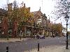
| Stoke-on-Trent FeatureType : city Elevation : 114 Lat/Lng : 53.004 / -2.1854 | Stoke-on-Trent (often abbreviated to Stoke) is a city and unitary authority area in Staffordshire, England, with an area of . Together with the neighbouring boroughs of Newcastle-under-Lyme and Staffordshire Moorlands, it is part of North Staffordshire. In 2016, the city had a population of 261,302 (...) |
| 3 | 
| Lancaster University FeatureType : edu Elevation : 56 Lat/Lng : 54.0082 / -2.7868 | Lancaster University (officially the University of Lancaster) is a public research university in the City of Lancaster, Lancashire, England. The university was established by Royal Charter in 1964, one of several new universities created in the 1960s (...) |
| 4 | 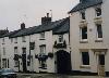
| Daventry FeatureType : city Elevation : 152 Lat/Lng : 52.2569 / -1.1607 | Daventry (historically) is a market town in Northamptonshire, England, with a population of 25,026 ])]. The town is also the administrative centre of the larger Daventry district, which has a population of 77,843 as of the 2011 census. (...) |
| 5 | 
| Marblehead, Massachusetts FeatureType : city Elevation : 23 Lat/Lng : 42.5 / -70.8583 | Marblehead is a coastal New England town in Essex County, Massachusetts. Its population was 19,808 at the 2010 census. It is home to the Marblehead Neck Wildlife Sanctuary, Crocker Park, Marblehead Light, Fort Sewall, Little Harbor and Devereux Beach (...) |
| 6 | Moulton, Cheshire FeatureType : null Elevation : 48 Lat/Lng : 53.2192 / -2.52 | Moulton is a civil parish and village in the unitary authority of Cheshire West and Chester and near the centre of the ceremonial county of Cheshire, England, situated south of Northwich and north of Winsford. (...) | |
| 7 | East Midlands FeatureType : adm2nd Elevation : 28 Lat/Lng : 52.98 / -0.75 | The East Midlands is one of nine official regions of England at the first level of NUTS for statistical purposes. It consists of Derbyshire, Leicestershire, Lincolnshire (except North and North East Lincolnshire), Northamptonshire, Nottinghamshire and Rutland (...) | |
| 8 | Moulton Castle FeatureType : landmark Elevation : 3 Lat/Lng : 52.7733 / -0.0558 | Moulton Castle, also known as King's Hall Park, is a medieval earthwork and scheduled monument situated to the south of Moulton, Lincolnshire, England. It probably dates from the twelfth century. It was owned by Thomas de Moulton in the early thirteenth century and it was during this period of (...) | |
| 9 | Northamptonshire FeatureType : adm1st Elevation : 78 Lat/Lng : 52.2369 / -0.8975 | Northamptonshire (; abbreviated Northants.), archaically known as the County of Northampton, is a county in the East Midlands of England. In 2015 it had a population of 723,000. The county is administered by Northamptonshire County Council and by seven non-metropolitan district councils (...) | |
| 10 | Bury St Edmunds (UK Parliament constituency) FeatureType : adm3rd Elevation : 65 Lat/Lng : 52.25 / 0.9 | Bury St Edmunds is a constituency in Suffolk centred on the town of Bury St Edmunds that elects a member of parliament (MP) to the House of Commons of the Parliament of the United Kingdom. The has elected Conservative Party candidates at the general elections and two by-elections since a Liberal (...) | |
| 11 | Moulton Seas End FeatureType : null Elevation : 5 Lat/Lng : 52.8288 / -0.0392 | Moulton Seas End is a village in the South Holland district of Lincolnshire, England. It is situated north-east from the centre of Spalding and north-west from Holbeach. The village is part of the civil parish of The Moultons (where the population is now included), a village 2 miles to the south (...) | |
| 12 | Cheshire West and Chester FeatureType : adm2nd Elevation : 21 Lat/Lng : 53.213 / -2.902 | Cheshire West and Chester is a unitary authority with borough status in the ceremonial county of Cheshire, England. It was established on 1 April 2009 as part of the 2009 local government changes, by virtue of an order under the Local Government and Public Involvement in Health Act 2007 (...) | |
| 13 | North Shields FeatureType : city Elevation : 42 Lat/Lng : 55.0165 / -1.4492 | North Shields is a town on the north bank of the River Tyne in North East England, eight miles (13 km) north-east of Newcastle upon Tyne. Historically part of Northumberland, its name derives from Middle English schele meaning "temporary sheds or huts used by fishermen". (...) | |
| 14 | Jean Robic FeatureType : null Elevation : 119 Lat/Lng : 47.9394 / -2.718 | Jean Robic (; 10 June 1921 – 6 October 1980)L'Équipe, 9 July 2003 was a French road racing cyclist, who won the 1947 Tour de France. Robic was a professional cyclist from 1943 to 1961. His diminutive stature (1.61m, 60 kg) and appearance was encapsulated in his nickname Biquet (Kid goat) (...) | |
| 15 | Winsford FeatureType : null Elevation : 25 Lat/Lng : 53.194 / -2.52 | Winsford is a town and civil parish within the unitary authority of Cheshire West and Chester and the ceremonial county of Cheshire, England. It lies on the River Weaver south of Northwich and west of Middlewich, and grew around the salt mining industry after the river was canalised in the 18th (...) | |
| 16 | Kingsbrook FeatureType : null Elevation : 30 Lat/Lng : 52.1226 / -0.4424 | Kingsbrook is an electoral ward and area within the town of Bedford, England. The boundaries of Kingsbrook are approximately the River Great Ouse and Priory Country Park to the north, Cambridge Road and the A421 to the south and east, with Redwood Grove and Willow Road to the west (...) | |
| 17 | The Leys School FeatureType : edu Elevation : 17 Lat/Lng : 52.197 / 0.1213 | The Leys School is a co-educational Independent school in Cambridge, England. It is a day and boarding school for about 560 pupils between the ages of eleven and eighteen, and a member of the Headmasters' and Headmistresses' Conference. (...) | |
| 18 | SS Arandora Star FeatureType : null Lat/Lng : 58.5 / -10.63 | SS Arandora Star was a British passenger ship of the Blue Star Line. She was built in 1927 as an ocean liner and refrigerated cargo ship, converted in 1929 into a cruise ship and requisitioned as a troop ship in World War II (...) | |
| 19 | Cowbit FeatureType : null Elevation : 3 Lat/Lng : 52.7438 / -0.1341 | __NOTOC__ Cowbit (locally pronounced Cubbit) is a village and civil parish in the South Holland district of Lincolnshire, England. The population of the civil parish at the 2011 census was 1,220. It is situated south from Spalding and north from Crowland (...) | |
| 20 | North Cowton FeatureType : null Elevation : 59 Lat/Lng : 54.4305 / -1.5631 | North Cowton is a village and civil parish, located in Richmondshire, North Yorkshire, England. It is north-west of the county town of Northallerton. (...) | |
| 21 | Gayles FeatureType : null Elevation : 164 Lat/Lng : 54.4628 / -1.8108 | Gayles is a village and civil parish in the Richmondshire district of North Yorkshire, England. Gayles is established in the district ward of Gilling West. This small village consists of 80 households, with a total population (including Kirby Hill) of 180 according to the 2011 UK census (...) | |
| 22 | Badby FeatureType : null Elevation : 122 Lat/Lng : 52.2292 / -1.1832 | Badby is a village and a rural parish of about in the Daventry district of the county of Northamptonshire, England.- OS Explorer Map 207: Newport Pagnell & Northampton South (1:25 000) (...) | |
| 23 | The Winsford Academy FeatureType : edu Elevation : 46 Lat/Lng : 53.1951 / -2.5359 | The Winsford Academy (simply referred to as Winsford Academy and formerly The Winsford E-ACT Academy) is an 11–16 mixed secondary school with academy status in Winsford, Cheshire, England. It was established in September 2010 following the amalgamation of the two predecessor schools; Verdin High (...) | |
| 24 | Stanwick St John FeatureType : null Elevation : 94 Lat/Lng : 54.4982 / -1.713 | Stanwick St John is a village, civil parish, former manor and ecclesiastical parish in the Richmondshire district of North Yorkshire, (formerly "North Riding" of Yorkshire), England. It is situated between the towns of Darlington and Richmond, close to Scotch Corner and the remains of the Roman fort (...) | |
| 25 | Rural Studio FeatureType : null Elevation : 60 Lat/Lng : 32.5888 / -87.5338 | The Rural Studio is a design-build architecture studio run by Auburn University. It aims to teach students about the social responsibilities of the profession of architecture while also providing safe, well-constructed and inspirational homes and buildings for poor communities in rural west Alabama, (...) | |
| 26 | Cliff College FeatureType : null Elevation : 139 Lat/Lng : 53.2622 / -1.6267 | Cliff College is a Christian theological college in Calver, Derbyshire, that teaches Biblical Theology at the undergraduate level and a number of mission courses to postgraduates. There are currently about 30 full-time undergraduates, 80 part-time undergraduates and 100 part-time postgraduates (...) | |
 by
by