| 37 records found in wikipedia | |||
| 1 | 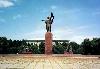
| Bishkek  FeatureType : city Elevation : 759 Lat/Lng : 42.8667 / 74.5667 | Bishkek (BISHKEK, بىشکەک; ;), formerly Pishpek and Frunze, is the capital and largest city of Kyrgyzstan (Kyrgyz Republic). Bishkek is also the administrative centre of the Chuy Region. The province surrounds the city, although the city itself is not part of the province, but rather a province-level (...) |
| 2 | 
| Kyrgyzstan FeatureType : country Elevation : 779 Lat/Lng : 42.8667 / 74.6 | Kyrgyzstan (;Or , or with the stress on the first syllable. See J. C. Wells, Longman Pronunciation Dictionary, 3rd ed. (Harlow, England: Pearson Education Ltd., 2008). Kyrgyzstan ; or Кыргызстан), officially the Kyrgyz Republic , and also known as Kirghizia, is a sovereign state in Central Asia (...) |
| 3 | Chuy Region FeatureType : adm1st Elevation : 3802 Lat/Lng : 42.5 / 74.5 | Chuy Region or Chui Region (Kyrgyz: Чүй облусу, Çüy oblusu; , Čujskaja oblastj) is the northernmost region (oblast) of the Kyrgyz Republic. It is bounded on the north by Kazakhstan, and clockwise, Issyk Kul Region, Naryn Region, Jalal-Abad Region and Talas Region (...) | |
| 4 | 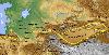
| Tokmok FeatureType : null Elevation : 824 Lat/Lng : 42.8419 / 75.3015 | Tokmok (Tokmok ('hammer'); , Tokmak) is a city in the Chuy Valley, northern Kyrgyzstan, east of the country's capital of Bishkek. Its area is , and its resident population was 53,231 in 2009(according to other data, "over 58,000") (...) |
| 5 | 
| Khujand FeatureType : city Elevation : 333 Lat/Lng : 40.2916 / 69.6221 | Khujand , formerly known as Leninabad from 1936–1991, is the second-largest city of Tajikistan and the capital of the northernmost province of Tajikistan, now called Sughd. Khujand is one of the oldest cities in Central Asia, dating back about 2,500 years (...) |
| 6 | 
| Aktobe FeatureType : city Elevation : 214 Lat/Lng : 50.266 / 57.216 | Aktobe is a city on the Ilek River in Kazakhstan. It is the administrative center of Aktobe Region. In 2013, it had a population of 371,546 people. (...) |
| 7 | Kyrgyz Revolution of 2010 FeatureType : null Elevation : 758 Lat/Lng : 42.875 / 74.612 | The Kyrgyz Revolution of 2010, also known as the Second Kyrgyz Revolution, the April Events (Aprel okuyası) or officially as the People's April Revolution,http://www.valerytishkov.ru/engine/documents/document1928 (...) | |
| 8 | Kant, Kyrgyzstan FeatureType : city Elevation : 743 Lat/Lng : 42.8911 / 74.8508 | Kant is a town in the Chuy Valley of northern Kyrgyzstan, some east of Bishkek. It is the administrative center of the Ysyk-Ata District (formerly Kant District). Kant was established in 1928. The Kyrgyz word for sugar is "kant", and the city received its name when a sugar plant was built there in (...) | |
| 9 | Kemin FeatureType : null Elevation : 1121 Lat/Lng : 42.7846 / 75.6892 | Kemin (previous name "Bystrovka") is a city in northeastern Kyrgyzstan, the administrative headquarters of Kemin District in Chuy Region. Its population was 8,169 in 2009. It is located about 95 km eastward of Bishkek on the left bank of the Chu River in the Chuy Valley (...) | |
| 10 | 2013 Kyrgyzstan League FeatureType : null Elevation : 749 Lat/Lng : 42.8833 / 74.85 | The 2013 Kyrgyzstan League is the 22nd season of Kyrgyzstan League, the Football Federation of Kyrgyz Republic's top division of association football. Dordoi Bishkek are the defending champions, having won the previous season. Due to sponsorship reasons the league is known as the Shoro Top League (...) | |
| 11 | Kyrgyzstan League FeatureType : null Elevation : 749 Lat/Lng : 42.8833 / 74.85 | Top League is the top division of the Football Federation of Kyrgyz Republic. It was created in 1992 after the Break-up of the Soviet Union. The league is composed of eight teams. The most successful team is Dordoi Bishkek who have won the league nine times (...) | |
| 12 | 2010 South Kyrgyzstan ethnic clashes FeatureType : null Elevation : 966 Lat/Lng : 40.53 / 72.8 | The 2010 South Kyrgyzstan riots were clashes between ethnic Kyrgyz and Uzbeks in southern Kyrgyzstan, primarily in the cities of Osh and Jalal-Abad, in the aftermath of the ouster of former President Kurmanbek Bakiyev on 7 April. It is part of the larger Kyrgyz Revolution of 2010 (...) | |
| 13 | Mikhail Frunze FeatureType : null Elevation : 555 Lat/Lng : 53.725 / 105.9939 | Mikhail Vasilyevich Frunze (2 February 1885 – 31 October 1925) was a Bolshevik leader during and just prior to the Russian Revolution of 1917. He was a major Red Army commander in the Russian Civil War and is best known for defeating Baron Wrangel in Crimea. (...) | |
| 14 | Merki FeatureType : city Elevation : 695 Lat/Lng : 42.8728 / 73.1786 | Merki is an administrative center in the Merki region located in the Jambyl Region in the south of Kazakhstan. It is located near to the mountains that serve as a border between Kazakhstan and Kyrgyzstan. It has an estimated population of roughly 35,900. The postal code of Merki is 080500 (...) | |
| 15 | Kirghiz Soviet Socialist Republic FeatureType : country Elevation : 751 Lat/Lng : 42.8789 / 74.6 | Kirghizia,From 1990 onwards, it was referred to as Kyrgyzstan officially the Kirghiz Soviet Socialist Republic (Kirghiz SSR; Kırğız Sovettik Soţialisttik Respublikası; Kirgizskaya Sovetskaya Sotsialisticheskaya Respublika) and the Republic of Kirghizia, also referred to as Soviet Kirghizia,Nelson (...) | |
| 16 | Isfana FeatureType : null Elevation : 1302 Lat/Lng : 39.8389 / 69.5276 | Isfana is a small town in the extreme western end of Batken Region in southern Kyrgyzstan. Isfana is on the southern fringe of the Fergana Valley in a region surrounded on three sides by Tajikistan. The word "isfana" is believed to have come from the Sogdian word "asbanikat", "asbanikent" or (...) | |
| 17 | Fergana Valley FeatureType : landmark Elevation : 658 Lat/Lng : 40.74 / 72.63 | The Fergana Valley (alternatively Farghana or Ferghana; , Фарғона водийси, فەرغانە ۉادىيسى; , Ferğana öröönü, فەرعانا ۅرۅۅنۉ ; , Vodiyi Farğona / Vodiji Farƣona; , Ferganskaja dolina; , Vâdiye Ferqâna; , Xiao'erjing: فِ عَر قًا نَ پٌ دِ) is a valley in Central Asia spread across eastern Uzbekistan, (...) | |
| 18 | International Film Festival Kyrgyzstan - Land of Short Films FeatureType : null Elevation : 818 Lat/Lng : 42.8451 / 74.585 | The International Film Festival Kyrgyzstan - Land of Short Films is an annual film festival held to celebrate short films from the former Soviet Union. The 5th Annual International Film Festival Kyrgyzstan - Land of Short Films will be held December 12 to December 15, 2015 in Bishkek, Kyrgyz (...) | |
| 19 | Military Institute of the Armed Forces of the Kyrgyz Republic FeatureType : null Elevation : 747 Lat/Lng : 42.8669 / 74.5304 | The Military Institute of the Armed Forces of the Kyrgyz Republic (Kyrgyz:Кыргыз Республикасынын Куралдуу Күчтөрүнүн Аскердик институтунун; Russian:Военная академия Вооруженных Сил Кыргызской Республики) is the main military academy of the Kyrgyz Republic (...) | |
| 20 | Kyrgyz National University FeatureType : null Elevation : 741 Lat/Lng : 42.8823 / 74.5871 | Kyrgyz National University named after Jusup Balasagyn is a national university of Kyrgyzstan located in the capital city of Bishkek; is state higher educational institution of the Kyrgyz Republic, the oldest and the largest higher educational institution of the republic (...) | |
| 21 | MVD Academy of Kyrgyzstan FeatureType : null Elevation : 764 Lat/Lng : 42.8717 / 74.6781 | The Academy of the Ministry of Internal Affairs of the Kyrgyz Republic named after Ergesh Aliyev (Kyrgyz: Кыргыз Республикасынын ички иштер министрлигинин Академиясы, Russian: Министерство внутренних дел Киргизской Республики), known locally as the MVD Academy of Kyrgyzstan is a military institution (...) | |
| 22 | Ala Archa National Park FeatureType : null Elevation : 1820 Lat/Lng : 42.645 / 74.48 | The Ala Archa National Park is an alpine national park in the Tian Shan mountains of Kyrgyzstan, established in 1976 (Protected areas of the Kyrgyz Republic (as of the end of 2004)) and located approximately 40 km south of the capital city of Bishkek. (...) | |
| 23 | Transit Center at Manas FeatureType : null Elevation : 638 Lat/Lng : 43.0613 / 74.4776 | Transit Center at Manas (formerly Manas Air Base and unofficially Ganci Air Base) is a former U.S. military installation at Manas International Airport, near Bishkek, the capital of Kyrgyzstan. It was primarily operated by the U.S. Air Force (...) | |
| 24 | Kumtor Gold Mine FeatureType : landmark Elevation : 3998 Lat/Lng : 41.8604 / 78.2016 | The Kumtor gold mine is an open-pit gold mining site in Issyk-Kul Region of Kyrgyzstan located about 350 km (220 mi) southeast of the capital Bishkek and 80 km (50 mi) south of Lake Issyk-Kul near the border with China (...) | |
| 25 | International University of Kyrgyzstan FeatureType : null Elevation : 750 Lat/Lng : 42.8775 / 74.5855 | The International University of Kyrgyzstan is a university in Bishkek, Kyrgyzstan. The university was established by decree of the President of the Kyrgyz Republic, Askar Akayev,№ UP-74, on March 11, 1993, and by the enactment of the Government of the Kyrgyz Republic, № 113, on March 16, 1993 (...) | |
| 26 | Bishkek International School FeatureType : null Elevation : 792 Lat/Lng : 42.8537 / 74.5805 | ESCA - Bishkek International School is an international school in Bishkek founded by a group of international and local parents as a non-profit community school and legally registered as a non-profit foundation in the Kyrgyz Republic on December 1, 2010 (...) | |
| 27 | Sulukta FeatureType : null Elevation : 1348 Lat/Lng : 39.94 / 69.56 | Sulukta or Sülüktü is a small town located at the extreme western end of Batken Region in southern Kyrgyzstan. Sulukta is situated at the southern fringe of the Fergana Valley in a region surrounded on three sides by Tajikistan (...) | |
| 28 | Manas University FeatureType : edu Elevation : 839 Lat/Lng : 42.8348 / 74.5753 | Manas University was founded according to the agreement between governments of Republic of Turkey and Kyrgyz Republic about establishment of Kyrgyz Turkish 'Manas University' in the Kyrgyzstan's capital city Bishkek, which was signed in Izmir on 30/09/1995, which was afterward approved by the (...) | |
| 29 | Kyrgyz National Agrarian University FeatureType : null Elevation : 813 Lat/Lng : 42.8509 / 74.605 | Kyrgyz National Agrarian University is a university in Bishkek, the capital of the former Soviet republic of Kyrgyzstan. KNAU was established in 1933 with its first admission of 53 students. Now more than 7000 students study in 7 faculties and 31 specializations (...) | |
| 30 | American University of Central Asia FeatureType : null Elevation : 888 Lat/Lng : 42.8224 / 74.6182 | The American University of Central Asia (AUCA), formerly the Kyrgyz-American University and the American University in Kyrgyzstan, is a liberal arts university located in Bishkek, the capital of the former Soviet republic of Kyrgyzstan (...) | |
| 31 | Santa Claus FeatureType : null Lat/Lng : 90.0 / 0.0 | Santa Claus, also known as Saint Nicholas, Kris Kringle, Father Christmas, or simply Santa, is a legendary figure originating in Western Christian culture who is said to bring gifts to the homes of well-behaved ("good" or "nice") children on Christmas Eve (24 December) and the early morning hours of (...) | |
| 32 | Uzbek Gymnasium FeatureType : null Elevation : 1341 Lat/Lng : 39.833 / 69.538 | The Uzbek Gymnasium is a gymnasium and boarding school located in Isfana, Kyrgyzstan. The official name of the school is Usmon Matkarimov Gymnasium and Secondary School . The school bears the name of Usmon Matkarimov who served as the head of Isfana's kolkhoz for many years and made a significant (...) | |
| 33 | Dungan Revolt (1862–77) FeatureType : null Elevation : 1295 Lat/Lng : 39.47 / 75.97 | The Dungan Revolt (1862–77) or Tongzhi Hui Revolt (Xiao'erjing: توْجِ حُوِ بِيًا/لُوًا) or Hui (Muslim) Minorities War was a mainly ethnic and religious war fought in 19th-century western China, mostly during the reign of the Tongzhi Emperor (r. 1861–75) of the Qing dynasty (...) | |
| 34 | Kerben, Kyrgyzstan FeatureType : null Elevation : 1310 Lat/Lng : 41.5 / 71.75 | Kerben (older name Karavan) is a town in Jalal-Abad Region of Kyrgyzstan. Its population was 14,141 in 2009. It is the administrative centre of Aksy District. Despite the fact that the town officially was founded in the early 1920s, medieval Persian historiographers noted in their works a (...) | |
| 35 | Geography of Kyrgyzstan FeatureType : null Elevation : 758 Lat/Lng : 42.8747 / 74.6122 | Kyrgyzstan is a landlocked nation in Central Asia, west of the People's Republic of China. Less than a seventh the size of Mongolia, at 199,951 square kilometers, United States Central Intelligence Agency. Retrieved 12 January 2010 Kyrgyzstan is one of the smaller Central Asian states (...) | |
| 36 | Narxoz University FeatureType : edu Elevation : 893 Lat/Lng : 43.2146 / 76.8711 | Narxoz University is a private higher education institution in Almaty, Kazakhstan, established in 1963. It focuses on teaching economics and offers over 20 specialties in the fields of economics, finance, management, marketing, law, international affairs, tourism, catering and hotel management, (...) | |
| 37 | Eurasia Foundation FeatureType : null Elevation : 131 Lat/Lng : 55.7535 / 37.6649 | Eurasia Foundation (EF) is a publicly and privately funded, privately managed grantmaker and program implementer working to strengthen civil society, advance private enterprise and promote public policy and administration in the successor states of the former Soviet Union—Armenia, Azerbaijan, (...) | |
 by
by