| 320 records found in wikipedia | |||
| 1 | 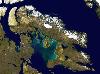
| Baffin Island  FeatureType : isle Lat/Lng : 69.0 / -72.0 | Baffin Island , in the Canadian territory of Nunavut, is the largest island in Canada and the fifth-largest island in the world. Its area is and its population is about 11,000 (2007 estimate). It is located 65.4215 N and 70.9654 W (...) |
| 2 | 
| Baffin Bay FeatureType : waterbody Lat/Lng : 73.3844 / -68.2344 | Baffin Bay (Inuktitut: Saknirutiak Imanga;. Wissenladen.de. Retrieved on 2013-03-22. ;), located between Baffin Island and the southwest coast of Greenland, is a marginal sea of the North Atlantic Ocean. It is connected to the Atlantic via Davis Strait and the Labrador Sea (...) |
| 3 | 
| Devon Island FeatureType : isle Lat/Lng : 75.1333 / -87.85 | Devon Island (Inuit: Tatlurutit)Jerry Kobalenko. The Horizontal Everest: Extreme Journeys on Ellesmere Island. BPS Books, 2010 is an island in Canada and the largest uninhabited island on Earth. It is located in Baffin Bay, Qikiqtaaluk Region, Nunavut, Canada (...) |
| 4 | 
| Iqaluit FeatureType : city Lat/Lng : 63.7544 / -68.519 | Iqaluit , meaning "place of fish", is the capital of the Canadian territory of Nunavut; its largest community, and its only city. It was known as Frobisher Bay until 1987, after the large bay on the coast of which the city is situated (...) |
| 5 | 
| Victoria Island (Canada) FeatureType : isle Lat/Lng : 71.0 / -110.0 | Victoria Island (or Kitlineq) is a large island in the Canadian Arctic Archipelago that straddles the boundary between Nunavut and the Northwest Territories of Canada. It is the eighth largest island in the world, and at in area, it is Canada's second largest island (...) |
| 6 | 
| Queen Elizabeth Islands FeatureType : isle Lat/Lng : 78.0833 / -95.1667 | The Queen Elizabeth Islands (; formerly Parry Islands or Parry Archipelago) are the northernmost cluster of islands in the Canadian Arctic Archipelago, split between Nunavut and Northwest Territories in Northern Canada (...) |
| 7 | 
| Ellesmere Island FeatureType : isle Lat/Lng : 79.255 / -79.6044 | Ellesmere Island (Inuit: Umingmak Nuna, meaning "land of muskoxen";) is part of the Qikiqtaaluk Region in the Canadian territory of Nunavut. Lying within the Canadian Arctic Archipelago, it is considered part of the Queen Elizabeth Islands, with Cape Columbia being the most northerly point of land (...) |
| 8 | 
| Frobisher Bay FeatureType : waterbody Lat/Lng : 62.8338 / -66.581 | Frobisher Bay is an inlet of the Labrador Sea in the Qikiqtaaluk Region of Nunavut, Canada. It is located in the southeastern corner of Baffin Island. Its length is about and its width varies from about at its outlet into the Labrador Sea to roughly towards its inner end (...) |
| 9 | 
| Canada FeatureType : country Elevation : 73 Lat/Lng : 45.4116 / -75.6984 | Canada is a country located in the northern part of North America. Its ten provinces and three territories extend from the Atlantic to the Pacific and northward into the Arctic Ocean, covering , making it the world's second-largest country by total area (...) |
| 10 | 
| Newfoundland and Labrador FeatureType : adm1st Elevation : 63 Lat/Lng : 47.6011 / -52.6976 | Newfoundland and Labrador (; ; Newfoundland Irish:) is the most easterly province of Canada. Situated in the country's Atlantic region, it comprises the island of Newfoundland and mainland Labrador to the northwest, with a combined area of (...) |
| 11 | 
| Southampton Island FeatureType : isle Lat/Lng : 64.5 / -84.5 | Southampton Island (Inuktitut: Shugliaq)Issenman, Betty. Sinews of Survival: The living legacy of Inuit clothing. UBC Press, 1997. pp252-254 is a large island at the entrance to Hudson Bay at Foxe Basin. One of the larger members of the Canadian Arctic Archipelago, Southampton Island is part of the (...) |
| 12 | 
| Alert, Nunavut FeatureType : null Lat/Lng : 82.5014 / -62.3389 | Alert, in the Qikiqtaaluk Region, Nunavut, Canada, is the northernmost permanently inhabited place in the world, ("Twice a year, the military resupply Alert, the world's northernmost settlement.") at latitude 82°30'05" north, from the North Pole (...) |
| 13 | 
| L'Anse aux Meadows FeatureType : landmark Elevation : 6 Lat/Lng : 51.5953 / -55.5312 | L'Anse aux Meadows (; a French-English name meaning the bay with the meadows) is an archaeological site on the northernmost tip of the Great Northern Peninsula on the island of Newfoundland in the Canadian province of Newfoundland and Labrador (...) |
| 14 | 
| Pond Inlet FeatureType : city Lat/Lng : 72.6992 / -77.9592 | Pond Inlet (Inuktitut: Mittimatalik, in English the place where the landing place is) is a small, predominantly Inuit community in the Qikiqtaaluk Region of Nunavut, Canada, and is located in northern Baffin Island. At the 2016 census the population was 1,617, an increase of 4 (...) |
| 15 | 
| Pangnirtung FeatureType : city Lat/Lng : 66.1468 / -65.6963 | Pangnirtung (or Pang, also Pangniqtuuq, in ᐸᖕᓂᖅᑑᖅ ;) is an Inuit hamlet, Qikiqtaaluk Region, in the Canadian territory of Nunavut, located on Baffin Island. As of the 2016 census the population was 1,481, an increase of 3.9% from the 2011 census. The area of the town is (...) |
| 16 | 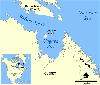
| Ungava Bay FeatureType : waterbody Lat/Lng : 59.5 / -67.25 | Ungava Bay (French: baie d'Ungava, Inuktitut (syllabics/Roman) ᐅᖓᕙ ᑲᖏᖅᓗᒃ/ungava kangiqluk) is a large bay in northeastern Canada separating Nunavik (far northern Quebec) from Baffin Island. The bay is roughly oval-shaped, about at its widest point and about in length; it has an area of approximately (...) |
| 17 | 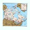
| Grise Fiord FeatureType : city Lat/Lng : 76.4184 / -82.8947 | Grise Fiord, (Inuktitut: Aujuittuq, "place that never thaws"; Inuktitut syllabics: ᐊᐅᔪᐃᑦᑐᖅ) is an Inuit hamlet in the Qikiqtaaluk Region in the territory of Nunavut, Canada. Despite its low population (129 residents as of the Canada 2016 Census), it is the largest community on Ellesmere Island (...) |
| 18 | 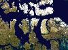
| Somerset Island (Nunavut) FeatureType : isle Lat/Lng : 73.2514 / -93.5003 | In the Canadian Arctic Archipelago, Somerset Island (Inuktitut Kuganajuup Qikiqtanga) is a large, uninhabited island separated by the wide Bellot Strait from the Boothia Peninsula in the Qikiqtaaluk Region of Nunavut, Canada, lying between Peel Sound (across which lies Prince of Wales Island) and (...) |
| 19 | 
| Arctic Archipelago FeatureType : isle Lat/Lng : 75.0 / -90.0 | The Arctic Archipelago, also known as the Canadian Arctic Archipelago, is a group of islands north of the Canadian mainland. Situated in the northern extremity of North America and covering about , this group of 36,563 islands in the Arctic Sea comprises much of the territory of Northern Canada – (...) |
| 20 | 
| Hans Island FeatureType : isle Lat/Lng : 80.8264 / -66.4535 | Hans Island (Greenlandic: Tartupaluk; Inuktitut: ᑕᕐᑐᐸᓗᒃ; ;) is a small, uninhabited measuring , long and wide, located in the centre of the Kennedy Channel of Nares Strait—the strait that separates Ellesmere Island from northern Greenland and connects Baffin Bay with the Lincoln Sea (...) |
| 21 | 
| Nettilling Lake FeatureType : waterbody Lat/Lng : 66.5 / -70.8333 | Nettilling Lake is a cold freshwater lake located toward the south end of Baffin Island in Qikiqtaaluk Region, Nunavut, Canada. It is also the world's largest lake on an island, with an area of and a maximum length of (...) |
| 22 | 
| Auyuittuq National Park FeatureType : null Lat/Lng : 67.8833 / -65.0167 | Auyuittuq National Park ("the land that never melts") is a national park located on Baffin Island's Cumberland Peninsula, Qikiqtaaluk Region in Nunavut, the largest political subdivision of Canada. It features many terrains of Arctic wilderness, such as fjords, glaciers, and ice fields (...) |
| 23 | 
| Sirmilik National Park FeatureType : null Lat/Lng : 72.9906 / -81.1373 | Sirmilik National Park (; Inuktitut: "the place of glaciers") is a protected area located in Qikiqtaaluk, Nunavut, Canada, established in 1999. Situated within the Arctic Cordillera, the park is composed of three areas: most of Bylot Island with the exception for a few areas that are Inuit-owned (...) |
| 24 | 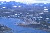
| Clyde River, Nunavut FeatureType : city Lat/Lng : 70.4733 / -68.5884 | Clyde River (Syllabics: ᑲᖏᖅᑐᒑᐱᒃ, official site in syllabics Inuktitut: Kanngiqtugaapik "nice little inlet" official site in English) is an Inuit hamlet located on the shore of Baffin Island's Patricia Bay, off Clyde Inlet, an arm of Davis Strait in the Qikiqtaaluk Region, of Nunavut Canada (...) |
| 25 | 
| Qikiqtarjuaq FeatureType : city Lat/Lng : 67.5581 / -64.0247 | Qikiqtarjuaq (; formerly known as Broughton Island until November 1998 , is a community located on the island of the same name in the Qikiqtaaluk Region of Nunavut, Canada. The island is known for Arctic wildlife, whale watching, and as the northern access point for Auyuittuq National Park (see also (...) |
| 26 | Qikiqtaaluk Region FeatureType : null Lat/Lng : 68.1977 / -70.9513 | The Qikiqtaaluk Region, Qikiqtani Region or Baffin Region is the easternmost administrative region of Nunavut, Canada. Qikiqtaaluk is the traditional Inuktitut name for Baffin Island. Although the Qikiqtaaluk Region is the most commonly used name in official contexts, several notable public (...) | |
| 27 | 
| Arctic Bay FeatureType : city Lat/Lng : 73.0387 / -85.1881 | Arctic Bay (Inuktitut syllabics: ᐃᒃᐱᐊᕐᔪᒃ, Ikpiarjuk "the pocket") is an Inuit hamlet located in the northern part of the Borden Peninsula on Baffin Island in the Qikiqtaaluk Region of Nunavut, Canada. Arctic Bay is located in the Eastern Time Zone although it is quite close to the time zone boundary (...) |
| 28 | 
| Cape Dorset FeatureType : city Lat/Lng : 64.2317 / -76.5403 | Cape Dorset (Inuktitut: Kinngait (meaning "high mountain"); Syllabics: ᑭᙵᐃᑦ) is an Inuit hamlet located on Dorset Island near Foxe Peninsula at the southern tip of Baffin Island in the Qikiqtaaluk Region of Nunavut, Canada. (...) |
| 29 | Nunavut FeatureType : adm1st Lat/Lng : 73.0 / -91.0 | Nunavut (; ; Inuktitut syllabics) is the newest, largest, and northernmost territory of Canada. It was separated officially from the Northwest Territories on April 1, 1999, via the Nunavut Act and the Nunavut Land Claims Agreement Act, though the boundaries had been contemplatively drawn in 1993 (...) | |
| 30 | 
| Coral Harbour FeatureType : city Lat/Lng : 64.1369 / -83.1642 | Coral Harbour (Inuktitut: Salliq/Salliit, Syllabics: ᓴᓪᓕᖅ/ᓴᓪᓖᑦ), is a small Inuit community that is located on Southampton Island, Kivalliq Region, in the Canadian territory of Nunavut. Its name is derived from the fossilized coral that can be found around the waters of the community which is (...) |
| 31 | 
| Ottawa Islands FeatureType : isle Lat/Lng : 59.5838 / -80.2662 | The Ottawa Islands (Inuit: Arviliit)Issenman, Betty. Sinews of Survival: The living legacy of Inuit clothing. UBC Press, 1997. pp252-254 are a group of uninhabited islands situated in the eastern edge of Canada's Hudson Bay. The group comprises 24 small islands, located at approximately 60N 80W (...) |
| 32 | 
| Whale Cove, Nunavut FeatureType : city Lat/Lng : 62.1728 / -92.5794 | Whale Cove (ᑎᑭᕋᕐᔪᐊᖅ in Inuktitut syllabics) (Tikiraqjuaq, meaning "long point"), is a hamlet located south of Rankin Inlet, north of Arviat, in Kivalliq Region, Nunavut, Canada, on the western shore of Hudson Bay. The community is named for the many beluga whales which congregate off the coast (...) |
| 33 | Northwest Territories FeatureType : adm1st Lat/Lng : 65.0167 / -117.95 | The Northwest Territories (NT or NWT; French: les Territoires du Nord-Ouest, TNO; Athabaskan languages: Denendeh; Inuinnaqtun: Nunatsiaq; Inuktitut: ᓄᓇᑦᓯᐊᖅ) is a federal territory of Canada. At a land area of approximately and a 2011 population of 41,462, it is the second-largest and the most (...) | |
| 34 | Gulf of Boothia FeatureType : waterbody Lat/Lng : 70.6667 / -91.0 | The Gulf of Boothia is a body of water in Nunavut, Canada. Administratively it is divided between the Kitikmeot Region on the west and the Qikiqtaaluk Region on the east. It merges north into Prince Regent Inlet, the two forming a single bay with different names for its parts (...) | |
| 35 | Nares Strait FeatureType : waterbody Lat/Lng : 80.0019 / -69.9948 | Nares Strait is a waterway between Ellesmere Island and Greenland that is the northern part of Baffin Bay where it meets the Lincoln Sea. From south to north, the strait includes Smith Sound, Kane Basin, Kennedy Channel, Hall Basin and Robeson Channel (...) | |
| 36 | Lancaster Sound FeatureType : waterbody Lat/Lng : 74.2182 / -83.9992 | Lancaster Sound (Inuktitut "Tallurutiup Imanga") is a body of water in the Qikiqtaaluk Region, Nunavut, Canada. It is located between Devon Island and Baffin Island, forming the eastern entrance to the Parry Channel and the Northwest Passage (...) | |
| 37 | Foxe Basin FeatureType : waterbody Lat/Lng : 65.9314 / -77.9179 | Foxe Basin is a shallow oceanic basin north of Hudson Bay, in Nunavut, Canada, located between Baffin Island and the Melville Peninsula. For most of the year, it is blocked by sea ice (fast ice) and drift ice made up of multiple ice floes (...) | |
| 38 | Kitikmeot Region FeatureType : adm2nd Lat/Lng : 68.9167 / -100.75 | Kitikmeot Region (Inuktitut: Qitirmiut ᕿᑎᕐᒥᐅᑦ) is an administrative region of Nunavut, Canada. It consists of the southern and eastern parts of Victoria Island with the adjacent part of the mainland as far as the Boothia Peninsula, together with King William Island and the southern portion of Prince (...) | |
| 39 | Arctic Cordillera FeatureType : mountain Lat/Lng : 81.9083 / -75.025 | The Arctic Cordillera is a vast, deeply dissected chain of mountain ranges extending along the northeastern flank of the Canadian Arctic Archipelago from Ellesmere Island to the northeasternmost part of the Labrador Peninsula in northern Labrador and northern Quebec, Canada (...) | |
| 40 | Melville Peninsula FeatureType : isle Lat/Lng : 68.001 / -83.9989 | Melville Peninsula is a large peninsula in the Canadian Arctic north of Hudson Bay. To the east is Foxe Basin and to the west the Gulf of Boothia. To the north the Fury and Hecla Strait separates it from Baffin Island (...) | |
| 41 | Prince Charles Island FeatureType : isle Lat/Lng : 67.7842 / -76.1983 | Prince Charles Island is a large, low-lying island with an area of , making it the world's 77th largest island and the 19th largest island in Canada. It is located in Foxe Basin, off the west coast of Baffin Island, in the Qikiqtaaluk Region of Nunavut, Canada (...) | |
| 42 | Kuujjuaq FeatureType : null Elevation : 1 Lat/Lng : 58.1 / -68.4 | Kuujjuaq is the largest northern village (Inuit community) in Nunavik, Quebec, Canada with a population of 2,754 as of the Canada 2016 Census. It is the administrative capital of the Kativik Regional Government and lies on the western shore of the Koksoak River (...) | |
| 43 | Eclipse Sound FeatureType : waterbody Lat/Lng : 72.6347 / -78.9984 | Eclipse Sound is a natural waterway through the Canadian Arctic Archipelago within Qikiqtaaluk Region, Nunavut, Canada. It separates Bylot Island (to the north) from Baffin Island (to the south). To the east, it opens into Baffin Bay via Pond Inlet, and to the north-west into the Navy Board Inlet. | |
| 44 | Air Force Island FeatureType : isle Lat/Lng : 67.9676 / -74.0814 | Air Force Island is an uninhabited island in the Qikiqtaaluk Region of Nunavut, Canada. It is located along the southwestern coast of Baffin Island and measures in size. The first written record of the island's existence was in 1948, as were neighbouring Prince Charles Island and Foley Island, by a (...) | |
| 45 | Iqaluit Airport FeatureType : null Lat/Lng : 63.7564 / -68.5558 | Iqaluit Airport serves Iqaluit, Nunavut, Canada and is located adjacent to the city. It is operated by the government of Nunavut. It hosts scheduled passenger service from Ottawa, Montreal, Rankin Inlet, and Kuujjuaq on carriers such as First Air and Canadian North, and from smaller communities (...) | |
| 46 | Area code 867 FeatureType : null Lat/Lng : 66.52 / -109.26 | Area code 867, the area code for the three Territories of Canada in the Arctic far north, was created on October 21, 1997, from portions of area codes 403 and 819. It is the least populated mainland North American area code, serving only about 100,000 people, but is the geographically largest (with (...) | |
| 47 | Indigenous and Northern Affairs Canada FeatureType : null Elevation : 74 Lat/Lng : 45.425 / -75.7218 | The Department of Indian Affairs and Northern Development (DIAND), referred to by its applied title under the Federal Identity Program as Indigenous and Northern Affairs Canada (INAC), (AANC), is the department of the government of Canada with responsibility for policies relating to Aboriginal (...) | |
| 48 | Jens Munk Island FeatureType : isle Lat/Lng : 69.651 / -80.065 | Jens Munk Island is one of the Canadian arctic islands in Qikiqtaaluk Region, Nunavut, Canada. It is an uninhabited Baffin Island offshore island. Located at 69°39'N 80°04'W it has an area of . The island is named in honor of Danish explorer Jens Munk who searched for the Northwest Passage in (...) | |
| 49 | Mary River Mine FeatureType : null Lat/Lng : 71.3233 / -79.2106 | The Mary River Mine is an open pit iron mine operated by the Baffinland Iron Mines Corporation in the Mary River area of Baffin Island, Nunavut, Canada. It is said to be the world's sixth most northerly mine. Paul Waldie, a business reporter for The Globe and Mail, called the project one of the most (...) | |
| 50 | Boothia Peninsula FeatureType : null Lat/Lng : 70.4333 / -94.4 | Boothia Peninsula (; formerly Boothia Felix, Inuktitut Kingngailap Nunanga) is a large peninsula in Nunavut's northern Canadian Arctic, south of Somerset Island. The northern part, Murchison Promontory, is the northernmost point of mainland Canada. (...) | |
| 51 | Igloolik FeatureType : city Lat/Lng : 69.3762 / -81.7994 | Igloolik (Inuktitut Syllabics: ᐃᒡᓗᓕᒃ , sometimes spelled Iglulik) is an Inuit hamlet in Foxe Basin, Qikiqtaaluk Region in Nunavut, northern Canada. Because its location on Igloolik Island is close to Melville Peninsula, it is often mistakenly thought to be on the peninsula (...) | |
| 52 | Canadian Arctic tundra FeatureType : null Lat/Lng : 83.0667 / -74.1667 | The Canadian Arctic tundra is a biogeographic designation for Northern Canada's terrain generally lying north of the tree line or boreal forest, at the University of California at Hinterland Who's Who at the Parliament of Canada that corresponds with the Scandinavian Alpine tundra to the east and (...) | |
| 53 | Fury and Hecla Strait FeatureType : waterbody Lat/Lng : 69.8344 / -82.9992 | Fury and Hecla Strait is a narrow (from) channel of water located in the Qikiqtaaluk Region of Nunavut, Canada. Situated between Baffin Island to the north and the Melville Peninsula to the south, it connects Foxe Basin on the east with the Gulf of Boothia on the west (...) | |
| 54 | Resolution Island (Nunavut) FeatureType : isle Lat/Lng : 61.5086 / -65.0059 | Resolution Island is one of the many uninhabited Canadian Arctic islands in Qikiqtaaluk Region, Nunavut. It is a Baffin Island offshore island located in Davis Strait. It has an area of . The Lower Savage Islands lie between Resolution Island and Baffin Island, while Graves Strait separates (...) | |
| 55 | Kimmirut FeatureType : city Lat/Lng : 62.8474 / -69.8692 | Kimmirut (Syllabics: ᑭᒻᒥᕈᑦ ; known as Lake Harbour until 1 January 1996) is a community in the Qikiqtaaluk Region, Nunavut, Canada. It is located on the shore of Hudson Strait on Baffin Island's Meta Incognita Peninsula. Kimmirut means "heel", and refers to a rocky outcrop in the inlet (...) | |
| 56 | Sybil Island FeatureType : null Lat/Lng : 63.5673 / -68.1978 | Sybil Island is one of the many uninhabited Canadian arctic islands in Qikiqtaaluk Region, Nunavut. It is a Baffin Island offshore island located in Frobisher Bay, southeast of the capital city of Iqaluit. Other islands in the immediate vicinity include Crimmins Island, Jenvey Island, Kudlago (...) | |
| 57 | Wishart Island FeatureType : isle Lat/Lng : 62.7173 / -69.5647 | Wishart Island is an uninhabited island located in Qikiqtaaluk Region, Nunavut, Canada. It is a Baffin Island offshore island in Hudson Strait, and a member of the Sheer Islands. The closest community is Kimmirut, away (...) | |
| 58 | Kekertaluk Island FeatureType : isle Lat/Lng : 68.2009 / -66.3968 | Kekertaluk Island is an uninhabited island in the Qikiqtaaluk Region of Nunavut, Canada. It is located in Davis Strait, southeast of Baffin Island's Cumberland Peninsula and north of Auyuittuq National Park Reserve (...) | |
| 59 | Kudlago Island FeatureType : isle Lat/Lng : 63.6006 / -68.2145 | Kudlago Island is one of the many uninhabited Canadian arctic islands in Qikiqtaaluk Region, Nunavut. It is a Baffin Island offshore island located in Frobisher Bay, southeast of the capital city of Iqaluit. Other islands in the immediate vicinity include Crimmins Island, Jenvey Island, Pichit (...) | |
| 60 | Lee Island (Nunavut) FeatureType : isle Lat/Lng : 62.6839 / -69.5813 | Lee Island is an uninhabited island located in Qikiqtaaluk Region, Nunavut, Canada. It is a Baffin Island offshore island in Hudson Strait, and a member of the Sheer Islands, along with Forder Island, Lavoie Island, and Wishart Island. The closest community is Kimmirut, away. (...) | |
| 61 | Forder Island FeatureType : isle Lat/Lng : 62.6839 / -69.598 | Forder Island is an uninhabited island located in Qikiqtaaluk Region, Nunavut, Canada. It is a Baffin Island offshore island in Hudson Strait, and a member of the Sheer Islands, along with Lee Island, Lavoie Island, and Wishart Island. The closest community is Kimmirut, away. (...) | |
| 62 | Pichit Island FeatureType : isle Lat/Lng : 63.5673 / -68.0978 | Pichit Island is one of the many uninhabited Canadian arctic islands in Qikiqtaaluk Region, Nunavut. It is a Baffin Island offshore island located in Frobisher Bay, approximately south of the capital city of Iqaluit (...) | |
| 63 | Koch Island FeatureType : isle Lat/Lng : 69.6344 / -78.3315 | Koch Island is one of the Canadian Arctic islands in Qikiqtaaluk Region, Nunavut, Canada. Located in Foxe Basin, it is an uninhabited Baffin Island offshore island. Located at 69°38'N 78°20'W, it has an area of . (...) | |
| 64 | Foxe Peninsula FeatureType : isle Lat/Lng : 65.0008 / -75.9985 | Foxe Peninsula is a peninsula found at the southern end of Baffin Island in the Qikiqtaaluk Region of Nunavut, Canada. It juts out from the southerly end of the island in a southwestly direction, dividing Foxe Basin and Hudson Strait (...) | |
| 65 | Mair Island FeatureType : isle Lat/Lng : 63.6762 / -68.411 | Mair Island is one of the many uninhabited Canadian arctic islands in Qikiqtaaluk Region, Nunavut. It is a Baffin Island offshore island located in Frobisher Bay, southeast of the capital city of Iqaluit. Other islands in the immediate vicinity include Cairn Island, Long Island, McLaren Island, (...) | |
| 66 | Jenvey Island FeatureType : isle Lat/Lng : 63.5839 / -68.1478 | Jenvey Island is one of the many uninhabited Canadian arctic islands in Qikiqtaaluk Region, Nunavut. It is a Baffin Island offshore island located in Frobisher Bay, southeast of the capital city of Iqaluit. Other islands in the immediate vicinity include Algerine Island, Alligator Island, Aubrey (...) | |
| 67 | Crimmins Island FeatureType : isle Lat/Lng : 63.5839 / -68.1811 | Crimmins Island is one of the many uninhabited Canadian Arctic islands in the Qikiqtaaluk Region, Nunavut. It is a Baffin Island offshore island located in Frobisher Bay, southeast of the capital city of Iqaluit (...) | |
| 68 | Sale Island FeatureType : isle Lat/Lng : 63.6173 / -68.2645 | Sale Island is one of the many uninhabited Canadian arctic islands in Qikiqtaaluk Region, Nunavut. It is a Baffin Island offshore island located in Frobisher Bay, southeast of the capital city of Iqaluit. Other islands in the immediate vicinity include Crimmins Island, Jenvey Island, Kudlago Island, (...) | |
| 69 | Foxe Channel FeatureType : waterbody Lat/Lng : 65.0008 / -79.999 | The Foxe Channel is an area of sea in Qikiqtaaluk Region, Nunavut, Canada. It separates the Foxe Basin (to the north) from Hudson Bay and the Hudson Strait (to the south). To the west and south-west is Southampton Island, to the east is Baffin Island, and to the north-west is the Melville Peninsula (...) | |
| 70 | Monument Island FeatureType : isle Lat/Lng : 63.699 / -68.5028 | Monument Island is one of the many uninhabited Canadian arctic islands in Qikiqtaaluk Region, Nunavut. It is a Baffin Island offshore island located in Frobisher Bay, southeast of the capital city of Iqaluit. Other islands in the immediate vicinity include Cairn Island, Long Island, Mair Island, (...) | |
| 71 | Ptarmigan Island FeatureType : isle Lat/Lng : 63.5339 / -68.5311 | Ptarmigan Island is one of the many uninhabited Canadian arctic islands in Qikiqtaaluk Region, Nunavut. It is a Baffin Island offshore island located in Frobisher Bay, southeast of the capital city of Iqaluit. Other islands in the immediate vicinity include Aubrey Island, Beveridge Island, Coffin (...) | |
| 72 | Lake Melville FeatureType : waterbody Lat/Lng : 53.6669 / -59.6649 | Lake Melville is a saltwater tidal extension of Hamilton Inlet on the Labrador coast in the Canadian province of Newfoundland and Labrador. Comprising 3,069 square kilometres, and stretching 140 kilometres inland to Happy Valley-Goose Bay, it forms part of the largest estuary in the province, (...) | |
| 73 | Big Island (Hudson Strait, Nunavut) FeatureType : isle Lat/Lng : 62.7172 / -70.7148 | Big Island is an uninhabited island located in the Qikiqtaaluk Region, Nunavut, Canada. It lies in Hudson Strait and is separated from Baffin Island by White Strait. The closest community is Kimmirut, away. Other islands in the immediate vicinity include Emma Island and Rabbit Island (...) | |
| 74 | Lavoie Island FeatureType : isle Lat/Lng : 62.7006 / -69.5647 | Lavoie Island is an uninhabited island located in Qikiqtaaluk Region, Nunavut, Canada. It is a Baffin Island offshore island in Hudson Strait, and a member of the Sheer Islands, along with Forder Island, Lee Island, and Wishart Island. The closest community is Kimmirut, away (...) | |
| 75 | Aubrey Island FeatureType : isle Lat/Lng : 63.5006 / -68.5311 | Aubrey Island is one of the many uninhabited Canadian Arctic islands in the Qikiqtaaluk Region, Nunavut. It is a Baffin Island offshore island located in Frobisher Bay, southeast of the capital city of Iqaluit. Other islands in the immediate vicinity include Anchorage Island, Beveridge Island, (...) | |
| 76 | Cairn Island FeatureType : isle Lat/Lng : 63.6634 / -68.4403 | Cairn Island is one of the many uninhabited Canadian Arctic islands in the Qikiqtaaluk Region, Nunavut. It is a Baffin Island offshore island located in Frobisher Bay, southeast of the capital city of Iqaluit. Other islands in the immediate vicinity include Aubrey Island, Beveridge Island, Bishop (...) | |
| 77 | Admiralty Inlet (Nunavut) FeatureType : waterbody Lat/Lng : 72.5 / -86.0 | Admiralty Inlet is a body of water in Nunavut's Qikiqtaaluk Region. It extends southerly from Lancaster Sound along the western shore of Baffin Island's Borden Peninsula. The hamlet of Arctic Bay is located on Uluksan Peninsula, a landform that juts into Admiralty Inlet south of Sirmilik National (...) | |
| 78 | Amadjuak Lake FeatureType : waterbody Lat/Lng : 64.9167 / -71.1333 | Amadjuak Lake is a lake in the Qikiqtaaluk Region, Nunavut, Canada. Along with Nettilling Lake, it is located in south-central Baffin Island's Great Plain of the Koukdjuak. It is south of Burwash Bay. The closest community is Iqaluit.Jacobs, J. D., A. N. Headley, L. A. Maus, and W. N. Mode. 1997. (...) | |
| 79 | Coats Island FeatureType : isle Lat/Lng : 62.5007 / -82.9998 | Coats Island (Inuktitut: Akpatordjuark) lies at the northern end of Hudson Bay in the Kivalliq Region of Nunavut. At in size, it is the 107th largest island in the world, and Canada's 24th largest island. The island has areas of federal crown land and areas of private land owned by Inuit, however, (...) | |
| 80 | Kuujjuaq Airport FeatureType : null Elevation : 28 Lat/Lng : 58.0923 / -68.4249 | Kuujjuaq Airport, , is located southwest of Kuujjuaq, Quebec, Canada. (...) | |
| 81 | Adams Island (Nunavut) FeatureType : isle Lat/Lng : 71.4512 / -73.081 | Adams Island (Inuit: Tuujjuk)Shelagh Grant. Arctic Justice: On Trial for Murder, Pond Inlet, 1923. McGill-Queen's Press, 2005 is an uninhabited island in the Qikiqtaaluk Region of Nunavut, Canada. The island is located in Baffin Bay off the northeastern coast of Baffin Island in the Canadian Arctic (...) | |
| 82 | Sillem Island FeatureType : isle Lat/Lng : 70.9344 / -71.7142 | Sillem Island is an uninhabited island in the Qikiqtaaluk Region of Nunavut, Canada. It is the second largest (after Bylot Island) of the several hundred islands and islets that are located in Baffin Bay, immediately off the northern coast of Baffin Island (...) | |
| 83 | Kogalu River FeatureType : null Lat/Lng : 70.7011 / -68.9974 | Kogalu River is a waterway on the eastern coast of Baffin Island in the Qikiqtaaluk Region of Nunavut, Canada. The river outflows from Ayr Lake and travels before reaching Baffin Bay. The nearest settlement, Clyde River, is approximately away. (...) | |
| 84 | Bergesen Island FeatureType : isle Lat/Lng : 71.6345 / -73.2977 | Bergesen Island is an uninhabited island located in the Qikiqtaaluk Region of Nunavut, Canada. It is located in Baffin Bay off the northeastern coast of Baffin Island. Adams Island is to the south, while Dexterity Island is to the east, across Isbjorn Strait (...) | |
| 85 | Aulitiving Island FeatureType : isle Lat/Lng : 69.5552 / -67.547 | Aulitiving Island is an uninhabited island located in the Qikiqtaaluk Region of Nunavut, Canada. It is located in Baffin Bay's Isabella Bay by the Davis Strait. It is situated north of Baffin Island's Henry Kater Peninsula (...) | |
| 86 | Dexterity Island FeatureType : isle Lat/Lng : 71.6012 / -72.8309 | Dexterity Island is an uninhabited island in the Qikiqtaaluk Region of Nunavut, Canada. It is located in Baffin Bay off the northeastern coast of Baffin Island. Adams Island is to the south, while Bergesen Island is to the west, across Isbjorn Strait. (...) | |
| 87 | Ivujivik FeatureType : null Lat/Lng : 62.4167 / -77.9167 | Ivujivik (Inuktitut: ᐃᕗᔨᕕᒃ, meaning "Place where ice accumulates because of strong currents", or "Sea-ice crash Area") is a northern village (Inuit community) in Nunavik, Quebec, and the northernmost settlement in any Canadian province. Canadian settlements farther north are in the territories (...) | |
| 88 | Nedlukseak Island FeatureType : isle Lat/Lng : 68.0842 / -65.9135 | Nedlukseak Island is an uninhabited island in the Qikiqtaaluk Region of Nunavut, Canada. It is located in Davis Strait, southeast of Baffin Island's Cumberland Peninsula and north of Auyuittuq National Park Reserve (...) | |
| 89 | Kekerten Island FeatureType : isle Lat/Lng : 65.7007 / -65.8139 | Kekerten Island is an uninhabited island in the Qikiqtaaluk Region of Nunavut, Canada. Southernmost of the Kikastan Islands, it is located in the Cumberland Sound, off Baffin Island's Cumberland Peninsula. Akulagok Island forms Kekerten Harbour with the island. Tuapait Island lies to the north (...) | |
| 90 | CFS Alert FeatureType : null Lat/Lng : 82.5014 / -62.3389 | Canadian Forces Station Alert, also CFS Alert, is a Canadian Armed Forces signals intelligence intercept facility located in Alert, Nunavut, Canada, on the northeastern tip of Ellesmere Island. Located in the Qikiqtaaluk Region, Nunavut, it is the northernmost permanently inhabited place in the (...) | |
| 91 | Sam Ford Fiord FeatureType : waterbody Lat/Lng : 70.5012 / -71.1475 | Sam Ford Fiord is an isolated, elongated Arctic fjord on Baffin Island's northeastern coast in the Qikiqtaaluk Region of Nunavut, Canada. The Inuit settlement of Pond Inlet is to the northwest and Clyde River is to the east (...) | |
| 92 | Geography of Greenland FeatureType : null Lat/Lng : 64.1667 / -51.7167 | Greenland is located between the Arctic Ocean and the North Atlantic Ocean, northeast of Canada and northwest of Iceland. The territory comprises the island of Greenland–the largest island in the world–and more than a hundred other smaller islands (see) (...) | |
| 93 | Low Island (Nunavut) FeatureType : isle Lat/Lng : 63.4006 / -67.9811 | Low Island is one of the many uninhabited Canadian arctic islands in Qikiqtaaluk Region, Nunavut. It is a Baffin Island offshore island located in Frobisher Bay just off the Bartlett Narrows, southeast of the capital city of Iqaluit (...) | |
| 94 | Juet Island FeatureType : isle Lat/Lng : 62.6006 / -69.4982 | Juet Island is an uninhabited island located in Qikiqtaaluk Region, Nunavut, Canada. It is a Baffin Island offshore island in Hudson Strait. The closest community is Kimmirut, away. Other islands in the immediate vicinity include: Lavoie Island, Wishart Island, Nuvursirpaaraaluk Island, Lee Island, (...) | |
| 95 | Satigsun Island FeatureType : isle Lat/Lng : 68.5509 / -66.6799 | Satigsun Island is an uninhabited island in the Qikiqtaaluk Region of Nunavut, Canada. It is located in Davis Strait, southeast of Baffin Island's Cumberland Peninsula and north of Auyuittuq National Park Reserve (...) | |
| 96 | Tay Sound FeatureType : waterbody Lat/Lng : 72.1013 / -78.9984 | Tay Sound is an uninhabited natural waterway within Qikiqtaaluk Region, Nunavut, Canada. It is located at the northern end of Baffin Island, south of Oliver Sound. Its mouth opens to Eclipse Sound. Pond Inlet is the nearest community. | |
| 97 | Tesseralik Island FeatureType : isle Lat/Lng : 65.93 / -65.93 | Tesseralik Island is an uninhabited island in the Qikiqtaaluk Region of Nunavut, Canada. It is located in the Cumberland Sound, off Baffin Island's Cumberland Peninsula, and is one of the islands forming Brown Harbour (...) | |
| 98 | Tuapait Island FeatureType : isle Lat/Lng : 65.76 / -65.79 | Tuapait Island is an uninhabited island in the Qikiqtaaluk Region of Nunavut, Canada. It is one of the Kikastan Islands, located in the Cumberland Sound, off Baffin Island's Cumberland Peninsula. To its south lie Akulagok Island and Kekerten Island (...) | |
| 99 | Ugpitimik Island FeatureType : isle Lat/Lng : 66.091 / -65.9 | Ugpitimik Island is an uninhabited island in the Qikiqtaaluk Region of Nunavut, Canada. It is located at the mouth of Pangnirtung Fiord, in the Cumberland Sound, off Baffin Island's Cumberland Peninsula. Akulagok Island, Aupaluktok Island, Beacon Island, Kekerten Island, Kekertukdjuak Island, (...) | |
| 100 | Nunatsiaq Island FeatureType : isle Lat/Lng : 67.9815 / -65.3078 | Nunatsiaq Island is an uninhabited island in the Qikiqtaaluk Region of Nunavut, Canada. It is located in Davis Strait, southeast of Baffin Island's Cumberland Peninsula and north of Auyuittuq National Park Reserve (...) | |
| 101 | Nuvursirpaaraaluk Island FeatureType : isle Lat/Lng : 62.7173 / -69.7314 | Nuvursirpaaraaluk Island is an uninhabited island located in Qikiqtaaluk Region, Nunavut, Canada. It is a Baffin Island offshore island in Hudson Strait. The closest community is Kimmirut, away. Other islands in the immediate vicinity include: Lavoie Island, Wishart Island, Black Bluff Island, Lee (...) | |
| 102 | Pilektuak Island FeatureType : isle Lat/Lng : 68.3342 / -66.4967 | Pilektuak Island is an uninhabited island in the Qikiqtaaluk Region of Nunavut, Canada. It is located in Davis Strait, southeast of Baffin Island's Cumberland Peninsula and north of Auyuittuq National Park Reserve (...) | |
| 103 | Precipice Island FeatureType : isle Lat/Lng : 63.3673 / -67.9645 | Precipice Island is one of the many uninhabited Canadian arctic islands in Qikiqtaaluk Region, Nunavut. It is a Baffin Island offshore island located in Frobisher Bay, southeast of Iqaluit. It is just west of the larger Culbertson Island, and southeast of Mark Island (...) | |
| 104 | Quadrifid Island FeatureType : isle Lat/Lng : 63.3062 / -68.12 | Quadrifid Island is one of the many uninhabited Canadian arctic islands in Qikiqtaaluk Region, Nunavut. It is a Baffin Island offshore island located in Frobisher Bay, southeast of the capital city of Iqaluit. Other islands in the immediate vicinity include Crowell Island, Dog Island, Kungo Island, (...) | |
| 105 | Uugalautiit Island FeatureType : isle Lat/Lng : 62.8006 / -69.8149 | Uugalautiit Island is an uninhabited island located in Qikiqtaaluk Region, Nunavut, Canada. It is a Baffin Island offshore island in Hudson Strait. The closest community is Kimmirut, away. Other islands in the immediate vicinity include: Lavoie Island, Wishart Island, Nuvursirpaaraaluk Island, Lee (...) | |
| 106 | Metela Island FeatureType : isle Lat/Lng : 63.3375 / -68.1208 | Metela Island is one of the many uninhabited Canadian arctic islands in Qikiqtaaluk Region, Nunavut. It is a Baffin Island offshore island located in Frobisher Bay, southeast of the capital city of Iqaluit. Other islands in the immediate vicinity include Camp Island, Dog Island, Kungo Island, (...) | |
| 107 | Shakshukuk Island FeatureType : isle Lat/Lng : 65.2618 / -66.8641 | Shakshukuk Island is a Baffin Island offshore island located in the Canadian Arctic Archipelago in Nunavut's Qikiqtaaluk Region. It lies in Cumberland Sound, at the mouth of Robert Peel Inlet. Shakshukowshee Island lies along its west side. (...) | |
| 108 | Black Bluff Island FeatureType : isle Lat/Lng : 62.7173 / -69.6313 | Black Bluff Island is an uninhabited island located in the Qikiqtaaluk Region, Nunavut, Canada. It is a Baffin Island offshore island in Hudson Strait. The closest community is Kimmirut, away. Other islands in the immediate vicinity include: Lavoie Island, Wishart Island, Nuvursirpaaraaluk Island, (...) | |
| 109 | Culbertson Island FeatureType : isle Lat/Lng : 63.3839 / -67.9311 | Culbertson Island is one of the many uninhabited Canadian Arctic islands in the Qikiqtaaluk Region, Nunavut. It is a Baffin Island offshore island located in Frobisher Bay, southeast of the capital city of Iqaluit. Culbertson Island is long, and wide. It is north-northwest of Gay Island (...) | |
| 110 | Kekertuk Island FeatureType : isle Lat/Lng : 65.5673 / -62.8637 | Kekertuk Island is an uninhabited island in the Qikiqtaaluk Region of Nunavut, Canada. It is located in Davis Strait, off southeastern Baffin Island's Cumberland Peninsula. Other islands in the immediate vicinity include Akuglek Island, Angijak Island, Kekertaluk Island, and Nuvuktik Island. (...) | |
| 111 | McLaren Island FeatureType : isle Lat/Lng : 63.7076 / -68.4404 | McLaren Island is one of the many uninhabited Canadian arctic islands in Qikiqtaaluk Region, Nunavut. It is a Baffin Island offshore island located in Frobisher Bay, southeast of the capital city of Iqaluit. Other islands in the immediate vicinity include Cairn Island, Long Island, Mair Island, (...) | |
| 112 | Kekerturnak Island FeatureType : isle Lat/Lng : 67.8675 / -64.8634 | Kekerturnak Island is an uninhabited island in the Qikiqtaaluk Region of Nunavut, Canada. It is located in Davis Strait, southeast of Baffin Island's Cumberland Peninsula and north of Auyuittuq National Park Reserve (...) | |
| 113 | Smith Island (Frobisher Bay, Nunavut) FeatureType : isle Lat/Lng : 63.3172 / -67.9478 | Smith Island is one of the many uninhabited Canadian arctic islands in Qikiqtaaluk Region, Nunavut. It is a Baffin Island offshore island located in Frobisher Bay, southeast of the capital city of Iqaluit. Other islands in the immediate vicinity include Brigus Island, Brook Island, Culbertson (...) | |
| 114 | Nest Island FeatureType : isle Lat/Lng : 63.2005 / -67.995 | Nest Island is one of the many uninhabited Canadian arctic islands in Qikiqtaaluk Region, Nunavut. It is a Baffin Island offshore island located in Frobisher Bay, southeast of Iqaluit. Other islands in the immediate vicinity include Pike Island, Pugh Island, Redan Island, Resor Island, and Whiskukun (...) | |
| 115 | Alligator Island FeatureType : isle Lat/Lng : 63.445 / -68.0145 | Alligator Island is one of the many uninhabited Canadian Arctic islands in the Qikiqtaaluk Region, Nunavut. It is a Baffin Island offshore island located in Frobisher Bay, southeast of the capital city of Iqaluit (...) | |
| 116 | Kekertelung Island FeatureType : isle Lat/Lng : 66.3507 / -66.7306 | Kekertelung Island is an uninhabited island in the Qikiqtaaluk Region of Nunavut, Canada. It is located in Baffin Island's Cumberland Sound. Anarnittuq Island lis to its west. Aupaluktok Island, Iglunga Island, and Nunatak Island are in the vicinity. (...) | |
| 117 | Manitung Island FeatureType : isle Lat/Lng : 68.13 / -65.63 | Manitung Island is an uninhabited island in the Qikiqtaaluk Region of Nunavut, Canada. It is located in Davis Strait, southeast of Baffin Island's Cumberland Peninsula and north of Auyuittuq National Park Reserve (...) | |
| 118 | Angijak Island FeatureType : isle Lat/Lng : 65.6673 / -62.2969 | Angijak Island is an uninhabited island in the Qikiqtaaluk Region of Nunavut, Canada. It is located in Davis Strait, off southeastern Baffin Island's Cumberland Peninsula. Other islands in the immediate vicinity include Akuglek Island, Kekertaluk Island, Kekertuk Island, and Nuvuktik Island (...) | |
| 119 | Falk Island FeatureType : isle Lat/Lng : 63.2672 / -67.8311 | Falk Island is one of the many uninhabited Canadian arctic islands in Qikiqtaaluk Region, Nunavut. It is a Baffin Island offshore island located in Frobisher Bay, southeast of Iqaluit. Other islands in the immediate vicinity include Brook Island, Brigus Island, Fletcher Island, Gay Island, and Smith (...) | |
| 120 | Brigus Island FeatureType : isle Lat/Lng : 63.3005 / -67.8978 | Brigus Island is one of the many uninhabited Canadian Arctic islands in the Qikiqtaaluk Region, Nunavut. It is a Baffin Island offshore island located in Frobisher Bay, southeast of the capital city of Iqaluit. Other islands in the immediate vicinity include Brook Island, Falk Island, Gay Island, (...) | |
| 121 | Mark Island (Frobisher Bay, Nunavut) FeatureType : isle Lat/Lng : 63.3839 / -67.9811 | Mark Island is one of the many uninhabited Canadian arctic islands in Qikiqtaaluk Region, Nunavut. It is a Baffin Island offshore island located in Frobisher Bay, southeast of the capital city of Iqaluit. Other islands in the immediate vicinity include Culbertson Island, Low Island, McAllister (...) | |
| 122 | Crowell Island FeatureType : isle Lat/Lng : 63.3006 / -68.1978 | Crowell Island is one of the many uninhabited Canadian Arctic islands in the Qikiqtaaluk Region, Nunavut. It is a Baffin Island offshore island located in Frobisher Bay, southeast of the capital city of Iqaluit (...) | |
| 123 | Crown Prince Frederik Island FeatureType : null Lat/Lng : 70.0344 / -86.8332 | Crown Prince Frederik Island is an island in Nunavut, Canada. It is located off the southern coast of western Baffin Island, in the Qikiqtaaluk Region's side of the Gulf of Boothia. It has an area of . (...) | |
| 124 | Kangigutsak Island FeatureType : isle Lat/Lng : 65.184 / -66.8141 | Kangigutsak Island is an uninhabited Baffin Island offshore island located in the Canadian Arctic Archipelago in Nunavut's Qikiqtaaluk Region. It lies in Cumberland Sound, across the mouth of Robert Peel Inlet. Shakshukuk Island lies north. (...) | |
| 125 | Utsusivik Island FeatureType : isle Lat/Lng : 65.1173 / -66.6474 | Utsusivik Island is an uninhabited Baffin Island offshore island located in the Canadian Arctic Archipelago in Nunavut's Qikiqtaaluk Region. It lies in Cumberland Sound, across the mouth of Chidliak Bay, approximately southeast of Robert Peel Inlet Nimigen Island lies to its west. (...) | |
| 126 | Kungo Island FeatureType : isle Lat/Lng : 63.3173 / -68.1478 | Kungo Island is one of the many uninhabited Canadian arctic islands in Qikiqtaaluk Region, Nunavut. It is a Baffin Island offshore island located in Frobisher Bay, southeast of the capital city of Iqaluit. Other islands in the immediate vicinity include Anchorage Island, Dog Island, Camp Island, (...) | |
| 127 | Alikdjuak Island FeatureType : isle Lat/Lng : 68.07 / -65.46 | Alikdjuak Island is an uninhabited island in the Qikiqtaaluk Region of Nunavut, Canada. It is located in Davis Strait, southeast of Baffin Island's Cumberland Peninsula and north of Auyuittuq National Park Reserve (...) | |
| 128 | Gay Island FeatureType : isle Lat/Lng : 63.3338 / -67.8311 | Gay Island is one of the many uninhabited Canadian arctic islands in Qikiqtaaluk Region, Nunavut. It is a Baffin Island offshore island located in Frobisher Bay, southeast of Iqaluit. Gay Island lies south-southeast of Culbertson Island (...) | |
| 129 | Luella Island FeatureType : isle Lat/Lng : 63.3339 / -68.2145 | Luella Island is one of the many uninhabited Canadian arctic islands in Qikiqtaaluk Region, Nunavut. It is a Baffin Island offshore island located in Frobisher Bay, southeast of the capital city of Iqaluit. Other islands in the immediate vicinity include Anchorage Island, Dog Island, Crowell Island, (...) | |
| 130 | Oliver Sound FeatureType : waterbody Lat/Lng : 72.251 / -77.731 | Oliver Sound is an uninhabited natural waterway within Qikiqtaaluk Region, Nunavut, Canada. It is located at the northern end of Baffin Island, north of Tay Sound. Its mouth opens to Eclipse Sound. Pond Inlet is the nearest community. The sound makes up part of Sirmilik National Park (...) | |
| 131 | Pink Lady Island FeatureType : isle Lat/Lng : 63.4506 / -68.0978 | Pink Lady Island is one of the many uninhabited Canadian arctic islands in Qikiqtaaluk Region, Nunavut. It is a Baffin Island offshore island located in Frobisher Bay, southeast of Iqaluit. Other islands in the immediate vicinity include Algerine Island, Alligator Island, Frobisher's Farthest, Low (...) | |
| 132 | McAllister Island FeatureType : isle Lat/Lng : 63.4006 / -67.9645 | McAllister Island is one of the many uninhabited Canadian arctic islands in Qikiqtaaluk Region, Nunavut. It is a Baffin Island offshore island located in Frobisher Bay, southeast of the capital city of Iqaluit. Other islands in the immediate vicinity include Culbertson Island, Low Island, Mark (...) | |
| 133 | Idjuniving Island FeatureType : isle Lat/Lng : 67.9008 / -64.7467 | Idjuniving Island is an uninhabited island in the Qikiqtaaluk Region of Nunavut, Canada. It is located in Davis Strait, southeast of Baffin Island's Cumberland Peninsula and north of Auyuittuq National Park Reserve (...) | |
| 134 | Shakshukowshee Island FeatureType : isle Lat/Lng : 65.2493 / -66.8974 | Shakshukowshee Island is a Baffin Island offshore island located in the Canadian Arctic Archipelago in Nunavut's Qikiqtaaluk Region. The uninhabited island lies in Cumberland Sound, at the mouth of Robert Peel Inlet. Shakshukuk Island lies along its east side. (...) | |
| 135 | Peak Island (Nunavut) FeatureType : isle Lat/Lng : 63.3838 / -67.8811 | Peak Island is one of the many uninhabited Canadian arctic islands in Qikiqtaaluk Region, Nunavut. It is a Baffin Island offshore island located in Frobisher Bay, southeast of Iqaluit. It is just east of the larger Culbertson Island (...) | |
| 136 | Mitchell Island (Nunavut) FeatureType : isle Lat/Lng : 63.4339 / -67.9645 | Mitchell Island is one of the many uninhabited Canadian arctic islands in Qikiqtaaluk Region, Nunavut. It is a Baffin Island offshore island located in Frobisher Bay, southeast of the capital city of Iqaluit. Other islands in the immediate vicinity include Algerine Island, Alligator Island, Low (...) | |
| 137 | Ijjurittiak Island FeatureType : isle Lat/Lng : 62.7673 / -69.7314 | Ijjurittiak Island is an uninhabited island located in Qikiqtaaluk Region, Nunavut, Canada. It is a Baffin Island offshore island in Hudson Strait. The closest community is Kimmirut, away. Other islands in the immediate vicinity include: Lavoie Island, Wishart Island, Nuvursirpaaraaluk Island, Lee (...) | |
| 138 | Ivisaat Island FeatureType : isle Lat/Lng : 62.7081 / -69.8017 | Ivisaat Island is an uninhabited island located in Qikiqtaaluk Region, Nunavut, Canada. It is a Baffin Island offshore island in Hudson Strait. The closest community is Kimmirut, away. Other islands in the immediate vicinity include: Lavoie Island, Wishart Island, Nuvursirpaaraaluk Island, Lee (...) | |
| 139 | Aupaluktut Island FeatureType : isle Lat/Lng : 65.4007 / -66.8307 | Aupaluktut Island is an uninhabited Baffin Island offshore island located in the Canadian Arctic Archipelago in Nunavut's Qikiqtaaluk Region. It lies in Cumberland Sound, between Brown Inlet and Ikpit Bay. It rises approximately above sea level. Nuvujen Island lies to its north (...) | |
| 140 | Glasgow Island FeatureType : isle Lat/Lng : 62.7673 / -69.7814 | Glasgow Island is an uninhabited island located in Qikiqtaaluk Region, Nunavut, Canada. It is a Baffin Island offshore island in Hudson Strait. The closest community is Kimmirut, away. Other islands in the immediate vicinity include: Lavoie Island, Wishart Island, Nuvursirpaaraaluk Island, Lee (...) | |
| 141 | Maktaktujanak Island FeatureType : isle Lat/Lng : 65.259 / -66.7502 | Maktaktujanak Island is an uninhabited Baffin Island offshore island located east of Shakshukuk Island in the Canadian Arctic Archipelago in Nunavut's Qikiqtaaluk Region. It lies in Cumberland Sound, approximately from Robert Peel Inlet (...) | |
| 142 | Redan Island FeatureType : isle Lat/Lng : 63.1838 / -67.8645 | Redan Island is one of the many uninhabited Canadian arctic islands in Qikiqtaaluk Region, Nunavut. It is a Baffin Island offshore island located in Frobisher Bay, southeast of Iqaluit. Other islands in the immediate vicinity include Fletcher Island, Eden Island, Nest Island, Scalene Island, and (...) | |
| 143 | Kudjak Island FeatureType : isle Lat/Lng : 65.634 / -67.2308 | Kudjak Island is an uninhabited Baffin Island offshore island located in the Canadian Arctic Archipelago in Nunavut's Qikiqtaaluk Region. It lies in Cumberland Sound, between the mouths of Irvine and Brown Inlets (...) | |
| 144 | Poodlatee Island FeatureType : isle Lat/Lng : 62.7173 / -69.6313 | Poodlatee Island is an uninhabited island located in Qikiqtaaluk Region, Nunavut, Canada. It is a Baffin Island offshore island in Hudson Strait. The closest community is Kimmirut, away. Other islands in the immediate vicinity include: Lavoie Island, Wishart Island, Black Bluff Island, Lee Island, (...) | |
| 145 | Nudlung Island FeatureType : isle Lat/Lng : 68.37 / -66.85 | Nudlung Island is an uninhabited island in the Qikiqtaaluk Region of Nunavut, Canada. It is located in Davis Strait, southeast of Baffin Island's Cumberland Peninsula and north of Auyuittuq National Park Reserve (...) | |
| 146 | Aulassivik Island FeatureType : isle Lat/Lng : 62.7173 / -69.7481 | Aulassivik Island is an uninhabited island located in the Qikiqtaaluk Region, Nunavut, Canada. It is a Baffin Island offshore island in Hudson Strait. The closest community is Kimmirut, away. Other islands in the immediate vicinity include: Lavoie Island, Wishart Island, Nuvursirpaaraaluk Island, (...) | |
| 147 | Nuvuktik Island FeatureType : isle Lat/Lng : 65.5506 / -62.4802 | Nuvuktik Island is an uninhabited island in the Qikiqtaaluk Region of Nunavut, Canada. It is in Davis Strait, off southeastern Baffin Island's Cumberland Peninsula. Other islands in the immediate vicinity include Akuglek Island, Angijak Island, Kekertaluk Island, and Kekertuk Island. (...) | |
| 148 | Dog Island (Nunavut) FeatureType : isle Lat/Lng : 63.3173 / -68.1978 | Dog Island is one of the many uninhabited Canadian Arctic islands in the Qikiqtaaluk Region, Nunavut. It is a Baffin Island offshore island located in Frobisher Bay, southeast of the capital city of Iqaluit. Other islands in the immediate vicinity include Anchorage Island, Crowell Island, Kungo (...) | |
| 149 | Nova Zembla Island FeatureType : isle Lat/Lng : 72.1846 / -74.8311 | Nova Zembla Island ("New Land") is an uninhabited island in the Qikiqtaaluk Region of Nunavut, Canada. It is located across the mouth of Coutts Inlet in Baffin Bay off the northeastern coast of Baffin Island. Round Island is to the southeast (...) | |
| 150 | Round Island (Nunavut) FeatureType : isle Lat/Lng : 72.1513 / -74.6478 | Round Island is an uninhabited island in the Qikiqtaaluk Region of Nunavut, Canada. It is located across the mouth of Coutts Inlet in Baffin Bay off the northeastern coast of Baffin Island. Nova Zembla Island is to the northwest (...) | |
| 151 | Aulitivik Island FeatureType : isle Lat/Lng : 69.6066 / -68.0123 | Aulitivik Island is an uninhabited island located in the Qikiqtaaluk Region of Nunavut, Canada. It is located in Baffin Bay's Isabella Bay by the Davis Strait. Situated north of Baffin Island's Henry Kater Peninsula, it is a member of the Canadian Arctic Archipelago (...) | |
| 152 | Ayr Lake FeatureType : waterbody Lat/Lng : 70.4 / -70.25 | Ayr Lake is a land-locked freshwater fjord on Baffin Island's northeastern coast in the Qikiqtaaluk Region of Nunavut, Canada. The Inuit settlement of Pond Inlet is to the northwest and Clyde River is to the east. (...) | |
| 153 | Bernier Bay FeatureType : waterbody Lat/Lng : 71.0847 / -88.2505 | Bernier Bay is an Arctic waterway in the Qikiqtaaluk Region, Nunavut, Canada. It is located in the Gulf of Boothia, northwest of Baffin Island. | |
| 154 | Royal Canadian Navy FeatureType : null Elevation : 2 Lat/Lng : 44.6566 / -63.5791 | The Royal Canadian Navy (RCN; French:) is the naval force of Canada. The RCN is one of three environmental commands within the unified Canadian Armed Forces. , Canada's navy operates 12 frigates, 4 patrol submarines, 12 coastal defence vessels and 8 unarmed patrol/training vessels, as well as (...) | |
| 155 | Padloping Island FeatureType : isle Lat/Lng : 67.1007 / -62.6301 | Padloping Island is an uninhabited island in the Qikiqtaaluk Region of Nunavut, Canada. It is located in Davis Strait's Merchants Bay off the eastern coast of Baffin Island. The smaller Durban Island is approximately to the east, while Auyuittuq National Park Reserve is to the west. (...) | |
| 156 | Rabbit Island (Qikiqtaaluk Region) FeatureType : isle Lat/Lng : 62.5338 / -70.5649 | Rabbit Island is an uninhabited island located in Qikiqtaaluk Region, Nunavut, Canada. It is a Baffin Island offshore island in Hudson Strait. The closest community is Kimmirut. Other islands in the immediate vicinity include Big Island, High Bluff Island, Emma Island, Ivisaat Island, Aulassivik (...) | |
| 157 | Brodeur Peninsula FeatureType : landmark Lat/Lng : 72.5014 / -88.0002 | Brodeur Peninsula is an uninhabited headland on Baffin Island in the Qikiqtaaluk Region of Nunavut, Canada. It is located on the northwestern part of the island and is bounded by Prince Regent Inlet, Lancaster Sound, and Admiralty Inlet (Nunavut) (...) | |
| 158 | Scalene Island FeatureType : isle Lat/Lng : 63.1505 / -67.7978 | Scalene Island is one of the many uninhabited Canadian arctic islands in Qikiqtaaluk Region, Nunavut. It is a Baffin Island offshore island located in Frobisher Bay, southeast of Iqaluit. Other islands in the immediate vicinity include Daniel Island, Eden Island, Fletcher Island, Nest Island, and (...) | |
| 159 | Sliver Island FeatureType : isle Lat/Lng : 63.3006 / -68.0978 | Sliver Island is one of the many uninhabited Canadian arctic islands in Qikiqtaaluk Region, Nunavut. It is a Baffin Island offshore island located in Frobisher Bay, southeast of the capital city of Iqaluit. Other islands in the immediate vicinity include Crowell Island, Kungo Island, Metela Island, (...) | |
| 160 | Nunatak Island FeatureType : isle Lat/Lng : 66.4674 / -66.964 | Nunatak Island is an uninhabited island in the Qikiqtaaluk Region of Nunavut, Canada. It is located at the northern end of Baffin Island's Cumberland Sound, at the junction of Shark Fiord and Clearwater Fiord. Southeast is Kekertelung Island (...) | |
| 161 | Okolli Island FeatureType : isle Lat/Lng : 64.1674 / -76.6154 | Okolli Island is one of the Canadian arctic islands located in Hudson Strait, Nunavut, Canada. It is a Baffin Island offshore island in Qikiqtaaluk Region. The island is long and wide. The elevation is above sea level. Cape Dorset, Nunavut, an Inuit hamlet on Dorset Island, is about away. (...) | |
| 162 | Miliakdjuin Island FeatureType : isle Lat/Lng : 65.5507 / -65.5139 | Miliakdjuin Island is an uninhabited island in the Qikiqtaaluk Region of Nunavut, Canada. It is located southeast of the Kikastan Islands in the Cumberland Sound, off Baffin Island's Cumberland Peninsula. Akulagok Island, Kekerten Island, Kekertukdjuak Island, Tesseralik Island, Tuapait Island, and (...) | |
| 163 | Rock Island (Nunavut) FeatureType : isle Lat/Lng : 68.4009 / -66.7134 | Rock Island is an uninhabited island in the Qikiqtaaluk Region of Nunavut, Canada. It is located in Davis Strait, southeast of Baffin Island's Cumberland Peninsula and north of Auyuittuq National Park Reserve. Other islands in the immediate vicinity include Kekertaluk Island, Nedlukseak Island, (...) | |
| 164 | High Bluff Island FeatureType : null Lat/Lng : 62.5672 / -69.9984 | High Bluff Island is an uninhabited island located in Qikiqtaaluk Region, Nunavut, Canada. It is a Baffin Island offshore island in Hudson Strait. The closest community is Kimmirut, away. Other islands in the immediate vicinity include: Lavoie Island, Wishart Island, Nuvursirpaaraaluk Island, Lee (...) | |
| 165 | Akuglek Island FeatureType : isle Lat/Lng : 65.6173 / -62.4636 | Akuglek Island is an uninhabited island in the Qikiqtaaluk Region of Nunavut, Canada. It is located in Davis Strait, southeast of Sakiak Fiord, off southeastern Baffin Island's Cumberland Peninsula. Angijak Island is to its northeast, Nuvuktik Island to its south (...) | |
| 166 | Akulagok Island FeatureType : isle Lat/Lng : 65.734 / -65.8472 | Akulagok Island is an uninhabited island in the Qikiqtaaluk Region of Nunavut, Canada. It belongs to the Kikastan Islands, located in the Cumberland Sound, off Baffin Island's Cumberland Peninsula. On its south side, Kekerten Harbour lies between Akulagok and Kekerten Island, while to the north lies (...) | |
| 167 | Anchorage Island (Nunavut) FeatureType : isle Lat/Lng : 63.3173 / -68.2645 | Anchorage Island is one of the uninhabited Canadian Arctic islands in the Qikiqtaaluk Region, Nunavut. It is a Baffin Island offshore island located in Frobisher Bay, southeast of the capital city of Iqaluit. Other islands in the immediate vicinity include Crowell Island, Dog Island, Kungo Island, (...) | |
| 168 | Coffin Island (Nunavut) FeatureType : isle Lat/Lng : 63.5173 / -68.4478 | Coffin Island is one of the many uninhabited Canadian Arctic islands in the Qikiqtaaluk Region, Nunavut. It is a Baffin Island offshore island located in Frobisher Bay, southeast of the capital city of Iqaluit. Other islands in the immediate vicinity include Aubrey Island, Beveridge Island, Bishop (...) | |
| 169 | Ekallulik Island FeatureType : isle Lat/Lng : 65.9174 / -67.2808 | Ekallulik Island is an uninhabited island in the Qikiqtaaluk Region of Nunavut, Canada. It is located in Baffin Island's Cumberland Sound. Imigen Island, Ivisa Island, Kaigosuit Islands, Kudjak Island, and Saunik Island are in the vicinity. (...) | |
| 170 | Algerine Island FeatureType : isle Lat/Lng : 63.4673 / -67.9811 | Algerine Island is one of the many uninhabited Canadian Arctic islands in the Qikiqtaaluk Region, Nunavut. It is a Baffin Island offshore island located in Frobisher Bay, southeast of the capital city of Iqaluit (...) | |
| 171 | Pope Island FeatureType : isle Lat/Lng : 63.3505 / -67.6645 | Pope Island is one of the many uninhabited Canadian arctic islands in Qikiqtaaluk Region, Nunavut. It is a Baffin Island offshore island located in Frobisher Bay, southeast of Iqaluit. Other islands in the immediate vicinity include Brook Island, Gay Island, Mary Island, Ogden Island, and Peak (...) | |
| 172 | McBride Island FeatureType : isle Lat/Lng : 63.5009 / -67.8978 | McBride Island is one of the many uninhabited Canadian arctic islands in Qikiqtaaluk Region, Nunavut. It is a Baffin Island offshore island located in Frobisher Bay, southeast of Iqaluit. Other islands in the immediate vicinity include Algerine Island, Alligator Island, Frobisher's Farthest, (...) | |
| 173 | Emerick Island FeatureType : isle Lat/Lng : 63.5173 / -68.5811 | Emerick Island is one of the many uninhabited Canadian Arctic islands in the Qikiqtaaluk Region, Nunavut. It is a Baffin Island offshore island located in Frobisher Bay, southeast of the capital city of Iqaluit (...) | |
| 174 | Iglunga Island FeatureType : isle Lat/Lng : 66.2882 / -67.1557 | Iglunga Island is an uninhabited island in the Qikiqtaaluk Region of Nunavut, Canada. It is located in Baffin Island's Cumberland Sound, between Kangilo Fiord and Kangerk Fiord. Anarnittuq Island, Clear Passage Island, Imigen Island, Ivisa Island, the Kekertelung Islands, Nunatak Island, and Saunik (...) | |
| 175 | Brook Island FeatureType : isle Lat/Lng : 63.3005 / -67.8645 | Brook Island is one of the many uninhabited Canadian Arctic islands in the Qikiqtaaluk Region, Nunavut. It is a Baffin Island offshore island located in Frobisher Bay, southeast of the capital city of Iqaluit. Other islands in the immediate vicinity include Brigus Island, Falk Island, Gay Island, (...) | |
| 176 | Christopher Hall Island FeatureType : isle Lat/Lng : 64.4839 / -65.0139 | Christopher Hall Island is a Baffin Island offshore island located in the Canadian Arctic Archipelago in Nunavut's Qikiqtaaluk Region. The island lies in the Labrador Sea between Popham Bay and Neptune Bay, off the east coast of Hall Peninsula's Finger Land (...) | |
| 177 | Ivisa Island FeatureType : isle Lat/Lng : 65.9674 / -67.0974 | Ivisa Island is an uninhabited island in the Qikiqtaaluk Region of Nunavut, Canada. It is located in Baffin Island's Cumberland Sound. Imigen Island lies to its east, Saunik Island to its northeast. Aupaluktok Island, Ekallulik Island, Iglunga Island, the Kaigosuit Islands, and Kudjak Island are in (...) | |
| 178 | Aupaluktok Island FeatureType : isle Lat/Lng : 66.1507 / -66.2806 | Aupaluktok Island is an uninhabited island in the Qikiqtaaluk Region of Nunavut, Canada. It is one of the two main Sanigut Islands, stretching between Avataktoo Bay to the north and the Cumberland Sound to the south, off Baffin Island's Cumberland Peninsula (...) | |
| 179 | Mary Island (Nunavut) FeatureType : isle Lat/Lng : 63.3838 / -67.6144 | Mary Island is one of the many uninhabited Canadian arctic islands in Qikiqtaaluk Region, Nunavut. It is a Baffin Island offshore island located in Frobisher Bay, southeast of Iqaluit. Other islands in the immediate vicinity include Bruce Island, Gay Island, Ogden Island, Peak Island, and Pope (...) | |
| 180 | Bear Island (Nunavut) FeatureType : isle Lat/Lng : 62.4504 / -64.2808 | Bear Island is an uninhabited island offshore of Baffin Island in the Qikiqtaaluk Region, Nunavut, Canada. The island lies in the Labrador Sea a few kilometres north of its confluence with Frobisher Bay. Other islands in the immediate vicinity of the tip of Hall Peninsula include the Harper Islands, (...) | |
| 181 | Potter Island FeatureType : isle Lat/Lng : 62.1171 / -65.9142 | Potter Island is an uninhabited island located in the Canadian Arctic Archipelago within the Qikiqtaaluk Region of Nunavut. It is a Baffin Island offshore island situated in Frobisher Bay. It is north of Lower Savage Islands, and northwest of Resolution Island and Edgell Island. (...) | |
| 182 | Emma Island FeatureType : isle Lat/Lng : 62.8005 / -71.0815 | Emma Island is an uninhabited island located in Qikiqtaaluk Region, Nunavut, Canada. It is a Baffin Island offshore island in Hudson Strait. The closest community is Kimmirut. Other islands in the immediate vicinity include Big Island and Rabbit Island. (...) | |
| 183 | Leopold Island FeatureType : isle Lat/Lng : 64.9673 / -63.3804 | Leopold Island is an uninhabited island in the Qikiqtaaluk Region of Nunavut, Canada. It is located in the Labrador Sea, east of Cape Mercy at the tip of Baffin Island's Cumberland Peninsula. Leopold Island is in size.Leopold Island at Atlas of Canada (...) | |
| 184 | Sanigut Islands FeatureType : isle Lat/Lng : 66.1674 / -66.3306 | The Sanigut Islands are an uninhabited island group in the Qikiqtaaluk Region of Nunavut, Canada. They are located in Baffin Island's Cumberland Sound, just south of Avataktoo Bay. Aupaluktok Island is the southern one (...) | |
| 185 | Tern Island (Nunavut) FeatureType : isle Lat/Lng : 69.551 / -80.8318 | Tern Island is an island located in Nunavut's Qikiqtaaluk Region in the northern Canadian Arctic. It is situated in the Foxe Basin. The mainland's Melville Peninsula is to the west, Baffin Island is to the northwest, and Jens Munk Island is to the northeast (...) | |
| 186 | Frobisher's Farthest FeatureType : isle Lat/Lng : 63.5048 / -68.0061 | Frobisher's Farthest is one of the many uninhabited Canadian arctic islands in Qikiqtaaluk Region, Nunavut. It is a Baffin Island offshore island located in Frobisher Bay, southeast of Iqaluit. It is in size.Frobisher's Farthest at Atlas of Canada The island was named by Arctic explorer Charles (...) | |
| 187 | Opingivik Island FeatureType : isle Lat/Lng : 65.3007 / -67.0641 | Opingivik Island is an uninhabited Baffin Island offshore island located in the Canadian Arctic Archipelago in Nunavut's Qikiqtaaluk Region. It lies in Cumberland Sound between Ikpit Bay to the north and Robert Peel Inlet approximately to the south (...) | |
| 188 | Whiskukun Island FeatureType : isle Lat/Lng : 63.2005 / -68.0478 | Whiskukun Island is one of the many uninhabited Canadian arctic islands in Qikiqtaaluk Region, Nunavut. It is a Baffin Island offshore island located in Frobisher Bay, southeast of Iqaluit. Other islands in the immediate vicinity include Nest Island, Pike Island, Pugh Island, Resor Island, and Wedge (...) | |
| 189 | Ogden Island FeatureType : isle Lat/Lng : 63.3672 / -67.531 | Ogden Island is one of the many uninhabited Canadian arctic islands in Qikiqtaaluk Region, Nunavut. It is a Baffin Island offshore island located in Frobisher Bay, southeast of Iqaluit. Other islands in the immediate vicinity include Bruce Island, Gay Island, Mary Island, Peak Island, and Pope (...) | |
| 190 | Kaigosuiyat Islands FeatureType : isle Lat/Lng : 65.734 / -67.4808 | One of the Baffin Island offshore, uninhabited island groups, the Kaigosuiyat Islands are located between Irvine Inlet and Nettilling Fiord, south of Iglunga and southwest of Pangnirtung. They are part of the Qikiqtaaluk Region, in the Canadian territory of Nunavut. (...) | |
| 191 | Eden Island FeatureType : isle Lat/Lng : 63.1505 / -67.7145 | Eden Island is one of the many uninhabited Canadian Arctic islands in the Qikiqtaaluk Region, Nunavut. It is a Baffin Island offshore island located in Frobisher Bay, southeast of Iqaluit. Other islands in the immediate vicinity include Daniel Island, Falk Island, Fletcher Island, Redan Island, and (...) | |
| 192 | Kekertukdjuak Island FeatureType : isle Lat/Lng : 65.8674 / -65.5805 | Kekertukdjuak Island is an uninhabited island in the Qikiqtaaluk Region of Nunavut, Canada. It is located where the Kingnait Fiord joins the Cumberland Sound, off Baffin Island's Cumberland Peninsula. The Kikastan Islands (Akulagok Island, Kekerten Island, Tuapait Island) lie to its southwest (...) | |
| 193 | Resor Island FeatureType : isle Lat/Lng : 63.2505 / -68.0645 | Resor Island is one of the many uninhabited Canadian arctic islands in Qikiqtaaluk Region, Nunavut. It is a Baffin Island offshore island located in Frobisher Bay, southeast of the capital city of Iqaluit. Other islands in the immediate vicinity include Pike Island, Pugh Island, Sliver Island, Wedge (...) | |
| 194 | Imigen Island FeatureType : isle Lat/Lng : 65.9674 / -66.9641 | Imigen Island is an uninhabited island in the Qikiqtaaluk Region of Nunavut, Canada. It is located in Baffin Island's Cumberland Sound. Ivisa Island lies to its west, Saunik Island to its northwest. Aupaluktok Island, Beacon Island, the Drum Islands, Ekallulik Island, Iglunga Island, the Kaigosuit (...) | |
| 195 | Pan Island FeatureType : isle Lat/Lng : 63.4339 / -67.8811 | Pan Island is one of the many uninhabited Canadian arctic islands in Qikiqtaaluk Region, Nunavut. It is a Baffin Island offshore island located in Frobisher Bay, southeast of the capital city of Iqaluit. Other islands in the immediate vicinity include Culbertson Island, Low Island, McAllister (...) | |
| 196 | Mill Island (Nunavut) FeatureType : isle Lat/Lng : 63.9757 / -77.7822 | Mill Island is an uninhabited Arctic island located in Hudson Bay between Foxe Channel and Hudson Strait. It is south of Baffin Island's Foxe Peninsula, and north of Nottingham and Salisbury islands. Mill Island is part of the Qikiqtaaluk Region of the Canadian territory of Nunavut (...) | |
| 197 | Alfred Island FeatureType : isle Lat/Lng : 69.8687 / -85.331 | Alfred Island is an uninhabited, irregularly shaped island located in Nunavut's Qikiqtaaluk Region within the northern Canadian Arctic. Approximately above sea level, it is in the Fury and Hecla Strait, north of the mainland's Melville Peninsula, and south of Baffin Island. (...) | |
| 198 | Qarsau Island FeatureType : isle Lat/Lng : 63.733 / -68.597 | Qarsau Island is one of the many uninhabited Canadian arctic islands in Qikiqtaaluk Region, Nunavut. It is a Baffin Island offshore island located in Frobisher Bay, approximately south of the capital city of Iqaluit (...) | |
| 199 | Faris Island FeatureType : isle Lat/Lng : 63.5839 / -68.7311 | Faris Island (alternate: Ferris Island) is one of the many uninhabited Canadian arctic islands in Qikiqtaaluk Region, Nunavut. It is a Baffin Island offshore island located in Frobisher Bay, approximately southwest of the capital city of Iqaluit (...) | |
| 200 | Nimigen Island FeatureType : isle Lat/Lng : 65.1173 / -66.7307 | Nimigen Island (previously: Kemisuack, Kemisoke, Kimersok, Kimisoke) is an uninhabited Baffin Island offshore island located in the Canadian Arctic Archipelago in Nunavut's Qikiqtaaluk Region. It lies in Cumberland Sound, approximately east of Robert Peel Inlet To its east is Utsusivik Island; south (...) | |
 by
by