| 217 records found in wikipedia | |||
| 1 | Fabian Gottlieb von Bellingshausen  FeatureType : null Lat/Lng : -69.3578 / -2.2472 | Fabian Gottlieb Thaddeus von Bellingshausen (tr. ; –), a Baltic German naval officer in the Imperial Russian Navy, cartographer and explorer, ultimately rose to the rank of admiral. He participated in the first Russian circumnavigation of the globe and subsequently became a leader of another (...) | |
| 2 | 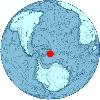
| Bellingshausen Island FeatureType : null Lat/Lng : -59.4167 / -27.05 | Bellingshausen Island is one of the most southerly of the South Sandwich Islands, close to Thule Island and Cook Island, and forming part of the Southern Thule group. It is named after its discoverer, Baltic German-Russian Antarctic explorer Fabian von Bellingshausen (1778–1852) (...) |
| 3 | Bellingshausen Sea FeatureType : waterbody Lat/Lng : -71.0 / -85.0 | The Bellingshausen Sea is an area along the west side of the Antarctic Peninsula between 57°18'W and 102°20'W, west of Alexander Island, east of Cape Flying Fish on Thurston Island, and south of Peter I Island (there the southern Vostokkysten) (...) | |
| 4 | 
| Macquarie Island FeatureType : null Elevation : 313 Lat/Lng : -54.6033 / 158.8753 | Macquarie Island, a UNESCO World Heritage Site, lies in the southwest Pacific Ocean, about halfway between New Zealand and Antarctica, at 54° 30' S, 158° 57' E. Regionally part of Oceania and politically a part of Tasmania, Australia since 1900, it became a Tasmanian State Reserve in 1978 and was (...) |
| 5 | 
| South Shetland Islands FeatureType : null Lat/Lng : -62.3292 / -59.2987 | The South Shetland Islands are a group of Antarctic islands, lying about north of the Antarctic Peninsula, with a total area of . By the Antarctic Treaty of 1959, the islands' sovereignty is neither recognized nor disputed by the signatories and they are free for use by any signatory for (...) |
| 6 | 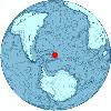
| Visokoi Island FeatureType : null Lat/Lng : -56.715 / -27.1436 | Visokoi Island is an uninhabited island in the Traversay Islands group of the South Sandwich Islands. It was discovered in 1819 by a Russian expedition under Fabian Gottlieb von Bellingshausen, who named the island Visokoi ("high") because of its conspicuous height (...) |
| 7 | 
| Antarctic Peninsula FeatureType : null Lat/Lng : -69.5 / -65.0 | The Antarctic Peninsula is the northernmost part of the mainland of Antarctica, located at the base of the Southern Hemisphere. At the surface, it is the biggest, most prominent peninsula in Antarctica as it extends from a line between Cape Adams (Weddell Sea) and a point on the mainland south of (...) |
| 8 | 
| Alexander Island FeatureType : null Lat/Lng : -71.0 / -70.0 | Alexander Island, which is also known as Alexander I Island, Alexander I Land, Alexander Land, Alexander I Archipelago, and Zemlja Alexandra I, is the largest island of Antarctica. It lies in the Bellingshausen Sea west of Palmer Land, Antarctic Peninsula from which it is separated by Marguerite Bay (...) |
| 9 | 
| Livingston Island FeatureType : isle Lat/Lng : -62.6 / -60.5 | Livingston Island (Russian name Smolensk, British Antarctic Territory Gazetteer. UK Antarctic Place-names Committee (Narrative fragment: Ostrov Smolensk, so called by RAE after the Battle of Smolensk in 1812 (Bellingshausen, 1831a, sheet 62))) is an Antarctic island in the South Shetland Islands, (...) |
| 10 | 
| Antarctica FeatureType : null Lat/Lng : -69.3578 / -2.2472 | Antarctica (or) is Earth's southernmost continent. It contains the geographic South Pole and is situated in the Antarctic region of the Southern Hemisphere, almost entirely south of the Antarctic Circle, and is surrounded by the Southern Ocean. At , it is the fifth-largest continent (...) |
| 11 | 
| Saaremaa FeatureType : isle Elevation : 33 Lat/Lng : 58.4167 / 22.5 | Saaremaa (; Danish: Øsel; English (esp. traditionally): Osel; Finnish: Saarenmaa; Swedish and German: Ösel) is the largest island in Estonia, measuring . The main island of Saare County, it is located in the Baltic Sea, south of Hiiumaa island and west of Muhu island, and belongs to the West (...) |
| 12 | 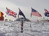
| South Pole FeatureType : landmark Lat/Lng : -90.0 / 180.0 | The South Pole, also known as the Geographic South Pole or Terrestrial South Pole, is one of the two points where the Earth's axis of rotation intersects its surface. It is the southernmost point on the surface of the Earth and lies on the opposite side of the Earth from the North Pole (...) |
| 13 | 
| South Georgia and the South Sandwich Islands FeatureType : isle Elevation : 364 Lat/Lng : -54.25 / -36.75 | South Georgia and the South Sandwich Islands (SGSSI) is a British Overseas Territory in the southern Atlantic Ocean. It is a remote and inhospitable collection of islands, consisting of South Georgia and a chain of smaller islands known as the South Sandwich Islands (...) |
| 14 |
| Cook Island, South Sandwich Islands FeatureType : null Lat/Lng : -59.45 / -27.1667 | Cook Island is the central and largest island of Southern Thule, part of the South Sandwich Islands in the far south Atlantic Ocean. Southern Thule was discovered by a British expedition under Captain James Cook in 1775 (...) |
| 15 |
| Leskov Island FeatureType : null Lat/Lng : -56.6667 / -28.1667 | Leskov Island is a small uninhabited island in the Traversay Islands group of the South Sandwich Islands. It is less than long, and lies west of Visokoi Island. It was discovered in 1819 by a Russian expedition under Fabian Gottlieb von Bellingshausen, who named it for the third lieutenant on the (...) |
| 16 | 
| King George Island (South Shetland Islands) FeatureType : null Lat/Lng : -62.3833 / -58.45 | King George Island (Argentina: Isla 25 de Mayo, Chile: Isla Rey Jorge, Russian: Ватерло́о Vaterloo) is the largest of the South Shetland Islands, lying off the coast of Antarctica in the Southern Ocean. The island was named after King George III. (...) |
| 17 | 
| Vostok Station FeatureType : null Lat/Lng : -78.4645 / 106.8351 | Vostok Station (literally "Station East") is a Russian research station in inland Princess Elizabeth Land, Antarctica. Founded by the Soviet Union in 1957, the station lies at the southern Pole of Cold, with the lowest reliably measured natural temperature on Earth of . National Climatic Data Center (...) |
| 18 | 
| Vostok 1 FeatureType : waterbody Elevation : 113 Lat/Lng : 45.9203 / 63.3422 | Vostok 1 (East or Orient 1) was the first spaceflight of the Vostok programme and the first manned spaceflight in history. The Vostok 3KA space capsule was launched from Baikonur Cosmodrome on April 12, 1961, with Soviet cosmonaut Yuri Gagarin aboard, making him the first human to cross into outer (...) |
| 19 | 
| Deception Island FeatureType : mountain Lat/Lng : -62.9564 / -60.6297 | Deception Island is an island in the South Shetland Islands archipelago, with one of the safest harbours in Antarctica. This island is the caldera of an active volcano, which seriously damaged local scientific stations in 1967 and 1969 (...) |
| 20 | Bellingshausen Station FeatureType : city Lat/Lng : -62.1986 / -58.9605 | Bellingshausen Station (Russian: станция Беллинсгаузен) is a Russian (formerly Soviet) at Collins Harbour, on King George Island of the South Shetland Islands. It was one of the first research stations founded by the Soviet Antarctic Expedition in 1968 (...) | |
| 21 | 
| Lake Vostok FeatureType : waterbody Lat/Lng : -77.5 / 106.0 | Lake Vostok (Ozero Vostok, lit. "Lake East") is the largest of Antarctica's almost 400 known subglacial lakes. Lake Vostok is located at the southern Pole of Cold, beneath Russia's Vostok Station under the surface of the central East Antarctic Ice Sheet, which is at above mean sea level (...) |
| 22 |
| Elephant Island FeatureType : isle Lat/Lng : -61.1333 / -55.1167 | Elephant Island is an ice-covered mountainous island off the coast of Antarctica in the outer reaches of the South Shetland Islands, in the Southern Ocean. Its name was given by early explorers sighting elephant seals on its shores (...) |
| 23 | Ellsworth Land FeatureType : null Lat/Lng : -75.5 / -80.0 | Ellsworth Land is that portion of the Antarctic continent bounded on the west by Marie Byrd Land, on the north by Bellingshausen Sea, on the northeast by the base of Antarctic Peninsula, and on the east by the western margin of Ronne Ice Shelf. It extends between 103°24'W and 79°45'W (...) | |
| 24 | 
| Mirny Station FeatureType : null Lat/Lng : -66.5527 / 93.0095 | The Mirny Station (literally Peaceful) is a Russian (formerly Soviet) science station located in Queen Mary Land, Antarctica, on the Antarctic coast of the Davis Sea. The station is managed by the Arctic and Antarctic Research Institute and was named after the support vessel Mirny captained by (...) |
| 25 | Allardyce Range FeatureType : mountain Elevation : 2094 Lat/Lng : -54.4167 / -36.5514 | The Allardyce Range is a mountain range rising south of Cumberland Bay and dominating the central part of South Georgia, a UK overseas territory. It extends for from Mount Globus in the northwest to Mount Brooker in the southeast, with peaks of and including Mount Paget the highest peak of the range (...) | |
| 26 | Jean-Baptiste Charcot FeatureType : landmark Lat/Lng : 64.4446 / -22.2319 | Jean-Baptiste-Étienne-Auguste Charcot (15 July 1867 – 16 September 1936), born in Neuilly-sur-Seine, was a French scientist, medical doctor and polar scientist. His father was the neurologist Jean-Martin Charcot (1825–1893). (...) | |
| 27 | Peter I Island FeatureType : island Lat/Lng : -68.8333 / -90.5833 | Peter I Island is an uninhabited volcanic island in the Bellingshausen Sea, from Antarctica. It is claimed as a dependency of Norway, and along with Bouvet Island and Queen Maud Land comprises one of the three Norwegian dependent territories in the Antarctic and Subantarctic (...) | |
| 28 | Motu One (Society Islands) FeatureType : isle Lat/Lng : -15.8083 / -154.525 | Motu One, also known as Bellinghausen, is an atoll in the Leeward group of the Society Islands. Motu One is located 550 km northwest from Tahiti and 72 km northeast of Manuae, its closest neighbor. Motu One's reef encloses totally a lagoon without a pass (...) | |
| 29 | Southern Ocean FeatureType : waterbody Lat/Lng : -77.8333 / 166.6667 | The Southern Ocean, also known as the Antarctic Ocean or the Austral Ocean, comprises the southernmost waters of the World Ocean, generally taken to be south of 60° S latitude and encircling Antarctica. As such, it is regarded as the fourth-largest of the five principal oceanic divisions: smaller (...) | |
| 30 | Princess Martha Coast FeatureType : null Lat/Lng : -72.0 / -7.5 | Princess Martha Coast is that portion of the coast of Queen Maud Land lying between 05° E and the terminus of Stancomb-Wills Glacier, at 20° W. The entire coastline is bounded by ice shelves with ice cliffs 20 to 35 m high (...) | |
| 31 | Queen Maud Land FeatureType : landmark Lat/Lng : -72.0019 / 2.5339 | Queen Maud Land is a square kilometre (1.04 million sq mi) region of Antarctica claimed as a dependent territory by Norway. The territory lies between 20° west and 45° east, between the self-claimed British Antarctic Territory to the west and the similarly self-claimed Australian Antarctic Territory (...) | |
| 32 | Lihula FeatureType : city Elevation : 19 Lat/Lng : 58.6814 / 23.8453 | Lihula is a town in Lääneranna Parish, Pärnu County, Estonia. (...) | |
| 33 | Baltic Fleet FeatureType : null Elevation : 19 Lat/Lng : 54.7167 / 20.5167 | The Baltic Fleet is the fleet of the Russian Navy in the Baltic Sea. Established 18 May 1703, under Tsar Peter the Great as part of the Imperial Russian Navy, the Baltic Fleet is the oldest Russian Navy formation (...) | |
| 34 | Thurston Island FeatureType : null Lat/Lng : -72.1667 / -99.0 | Thurston Island is an ice-covered, glacially dissected island, long, wide and in area, lying a short way off the northwest end of Ellsworth Land, Antarctica. It is the third largest island of Antarctica, after Alexander Island and Berkner Island (...) | |
| 35 | Maurice Channel FeatureType : null Lat/Lng : -59.4333 / -27.0833 | Maurice Channel is a strait wide between Bellingshausen Island and Cook Island, in the South Sandwich Islands off Antarctica. In 1820, Fabian Gottlieb von Bellingshausen indirectly indicated the existence of the strait by describing Southern Thule as consisting of one high rock and three small (...) | |
| 36 | Saunders Island, South Sandwich Islands FeatureType : null Lat/Lng : -57.7833 / -26.45 | Saunders Island is a crescent-shaped island long, lying between Candlemas Island and Montagu Island in the South Sandwich Islands, a part of the United Kingdom. It is a volcanic island composed of an active stratovolcano, Mount Michael, (Named by Commander William Melvin Carey of the Discovery II, (...) | |
| 37 | Bellingshausen Plain FeatureType : landmark Lat/Lng : -64.0 / -90.0 | Bellingshausen Plain , also known as Bellinghausen Abyssal Plain, is an undersea plain parallel to the continental rise in the Bellingshausen Sea, named for Admiral Fabian Gottlieb von Bellingshausen, commander of the Russian Antarctic Expedition (1818–1821) (...) | |
| 38 | Trinity Church (Antarctica) FeatureType : landmark Lat/Lng : -62.1964 / -58.9598 | Holy Trinity Church is a small Russian Orthodox church on King George Island near Bellingshausen Station, a Russian research station in Antarctica. It is one of the eight churches on Antarctica. It is the southernmost Eastern OrthodoxWorld Wide Antarctic Program. , 29 January 2006 (...) | |
| 39 | Fildes Peninsula FeatureType : null Lat/Lng : -62.1821 / -58.9481 | The Fildes Peninsula is a long peninsula that forms the south-western end of King George Island in the South Shetland Islands of Antarctica. It was named from association with nearby Fildes Strait by the UK Antarctic Place-Names Committee in 1960. (...) | |
| 40 | Amundsen Sea FeatureType : null Lat/Lng : -73.0 / -112.0 | The Amundsen Sea, an arm of the Southern Ocean off Marie Byrd Land in western Antarctica, lies between Cape Flying Fish (the northwestern tip of Thurston Island) to the east and Cape Dart on Siple Island to the west (...) | |
| 41 | French Antarctic Expedition FeatureType : null Lat/Lng : -66.6053 / 140.0667 | The French Antarctic Expedition is any of several French expeditions in Antarctica. (...) | |
| 42 | Antarctic FeatureType : landmark Lat/Lng : -90.0 / 0.0 | The Antarctic (US English , UK English or and or) is a polar region around the Earth's South Pole, opposite the Arctic region around the North Pole. The Antarctic comprises the continent of Antarctica, the Kerguelen Plateau and other island territories located on the Antarctic Plate or south of the (...) | |
| 43 | History of Antarctica FeatureType : null Lat/Lng : -67.25 / 39.5833 | The history of Antarctica emerges from early Western theories of a vast continent, known as Terra Australis, believed to exist in the far south of the globe. The term Antarctic, referring to the opposite of the Arctic Circle, was coined by Marinus of Tyre in the 2nd century AD (...) | |
| 44 | Traversay Islands FeatureType : null Lat/Lng : -56.6 / -27.7167 | The Traversay Islands are a group of three islands—Zavodovski, Leskov and Visokoi—at the northern end of the South Sandwich Islands. (...) | |
| 45 | Southern Thule FeatureType : null Lat/Lng : -59.4211 / -27.2304 | Southern Thule is a collection of the three southernmost islands in the South Sandwich Islands: Bellingshausen, Cook, and Thule (Morrell). The Southern Thule territory has been administered by the United Kingdom since 1908 and also claimed by Argentina since 1938 (...) | |
| 46 | Havre Mountains FeatureType : null Lat/Lng : -69.1333 / -71.6667 | The Havre Mountains are a large group of mountains forming the northwestern extremity of Alexander Island, Antarctica, extending in an east–west direction between Cape Vostok and the Russian Gap. They were first seen in 1821 by a Russian expedition under Fabian Gottlieb von Bellingshausen and (...) | |
| 47 | Thule Island FeatureType : null Lat/Lng : -59.45 / -27.3167 | Thule Island, also called Morrell Island, is one of the southernmost of the South Sandwich Islands, part of the grouping known as Southern Thule. It is named, on account of its remote location, after the mythical land of Thule, said by ancient geographers to lie at the extreme end of the Earth (...) | |
| 48 | Allen Point FeatureType : null Lat/Lng : -58.4833 / -26.25 | Allen Point is the southeast point of Montagu Island, in the South Sandwich Islands. Montagu Island was discovered in 1775 by a British expedition under James Cook, but the point was first mapped by Fabian Gottlieb von Bellingshausen in 1819–20 (...) | |
| 49 | Bellingshausen Point FeatureType : null Lat/Lng : -54.05 / -37.2333 | Bellingshausen Point is a headland marking the east side of the entrance to Sea Leopard Fjord in the Bay of Isles, South Georgia. It was charted in 1912–13 by Robert Cushman Murphy, American naturalist aboard the brig Daisy, who named it for Admiral Thaddeus Bellingshausen. (...) | |
| 50 | Iceberg FeatureType : null Lat/Lng : -48.8 / 107.5 | An iceberg or ice mountain is a large piece of freshwater ice that has broken off a glacier or an ice shelf and is floating freely in open water. It may subsequently become frozen into pack ice (one form of sea ice) (...) | |
| 51 | Fakarava FeatureType : isle Lat/Lng : -16.2833 / -145.6167 | Fakarava, Havaiki-te-araro, Havai'i or Farea is an atoll in the west of the Tuamotu group in French Polynesia. It is the second largest of the Tuamotu atolls. The nearest land is Toau Atoll, which lies to the northwest (...) | |
| 52 | Fangatau FeatureType : null Elevation : 7 Lat/Lng : -15.8199 / -140.8871 | Fangatau, or Nakai-erua, is a small atoll in the Tuamotu group in French Polynesia. The nearest land is Fakahina Atoll, located 72 km to the ESE. This small atoll has an elongated shape. Its length is , maximum width . It has a total area of . (land area 9.4 km2) (...) | |
| 53 | Antipodes FeatureType : null Lat/Lng : -21.4167 / -140.1833 | In geography, the antipode of any spot on Earth is the point on Earth's surface diametrically opposite to it; the antipodes of a region similarly represent the area opposite it. A pair of points antipodal to each other are situated such that a straight line connecting the two would pass through (...) | |
| 54 | Mikhail Lazarev FeatureType : null Lat/Lng : -69.3578 / -2.2472 | Admiral Mikhail Petrovich Lazarev (3 November 1788 – 11 April 1851) was a Russian fleet commander and an explorer. (...) | |
| 55 | Vostok Island FeatureType : null Lat/Lng : -10.0633 / -152.3111 | Vostok Island, also known as Staver Island, is an uninhabited coral island in the central Pacific Ocean, part of the Line Islands belonging to Kiribati. Other names for the island include Anne Island, Bostock Island, Leavitts Island, Reaper Island, Wostock Island or Wostok Island (...) | |
| 56 | Zavodovski Island FeatureType : null Lat/Lng : -56.2994 / -27.5685 | Zavodovski Island is an uninhabited volcanic island in the Traversay Islands subgroup of the South Sandwich Islands. It lies southeast of South Georgia Island. It is the northernmost of the South Sandwich Islands and the nearest to South Georgia (...) | |
| 57 | Hao (French Polynesia) FeatureType : null Elevation : 5 Lat/Lng : -18.0753 / -140.9453 | Hao, or Haorangi, is a large coral atoll in the central part of the Tuamotu Archipelago. It has c. 1000 people living on 35 km². It was used to house the military support base for the nuclear tests on Mururoa. Because of its shape, French explorer Louis Antoine de Bougainville named it "Île de la (...) | |
| 58 | Lazarev Bay FeatureType : null Lat/Lng : -69.3333 / -72.0 | Lazarev Bay is a rectangular bay, long and wide, which separates Alexander Island from Rothschild Island and is bounded on the south side by the Wilkins Ice Shelf, which joins the east portion of Rothschild Island and the west portion of Alexander Island (partially Cape Vostok, the Havre Mountains (...) | |
| 59 | Charcot Island FeatureType : null Lat/Lng : -69.75 / -75.25 | Charcot Island or Charcot Land is an island administered under the Antarctic Treaty System, long and wide, which is ice covered except for prominent mountains overlooking the north coast. Charcot Island lies within the Bellingshausen Sea, west of Alexander Island, and about north of Latady Island (...) | |
| 60 | Cape Vostok FeatureType : null Lat/Lng : -69.1167 / -72.1667 | Cape Vostok is a rocky headland which forms the west extremity of the Havre Mountains and the northwest extremity of Alexander Island in Antarctica. It was discovered by the First Russian Antarctic Expedition in 1821, led by Fabian Gottlieb von Bellingshausen and Mikhail Lazarev (...) | |
| 61 | Chilean Antarctic Territory FeatureType : null Lat/Lng : -75.0009 / -71.5931 | The Chilean Antarctic Territory or Chilean Antarctica (Spanish: Territorio Chileno Antártico, Antártica Chilena) is the territory in Antarctica claimed by Chile. The Chilean Antarctic Territory ranges from 53° West to 90° West and from the South Pole to the 60° South parallel, partially overlapping (...) | |
| 62 | Geography of Chile FeatureType : null Elevation : 66 Lat/Lng : -18.3333 / -70.3333 | The geography of Chile is extremely diverse as the country extends from a latitude of 17° South to Cape Horn at 56° (if Chilean claims on Antarctica are included Chile would extend to the South Pole) and from the ocean on the west to Andes on the east (...) | |
| 63 | Cape Paryadin FeatureType : null Elevation : 4 Lat/Lng : -54.0167 / -38.0792 | Cape Paryadin is a headland which forms the southernmost point of the west tip of South Georgia. It was discovered in 1775 by a British expedition under James Cook. The cape was resighted in 1819 by a Russian expedition under Bellingshausen, who named it for Yakov Poryadin, navigator on the Vostok (...) | |
| 64 | Hewison Point FeatureType : null Lat/Lng : -59.4578 / -27.2991 | Hewison Point is a point which forms the east side of Ferguson Bay and the southeast end of Thule Island, in the South Sandwich Islands. It was first charted by a Russian expedition under Fabian Gottlieb von Bellingshausen in 1819–20 (...) | |
| 65 | Herd Point FeatureType : null Lat/Lng : -59.4622 / -27.3384 | Herd Point is a point which forms the west side of Ferguson Bay at the south end of Thule Island, in the South Sandwich Islands. It was roughly charted by a Russian expedition under Fabian Gottlieb von Bellingshausen in 1819–20 (...) | |
| 66 | Phyllis Bay FeatureType : null Lat/Lng : -58.5008 / -26.3282 | Phyllis Bay is a small bight between Allen and Scarlett Points at the south end of Montagu Island, in the South Sandwich Islands. The feature was roughly outlined by Bellingshausen in 1819-20. Charted in 1930 by DI personnel on the Discovery II and named for Phyllis V (...) | |
| 67 | Nattriss Point FeatureType : null Lat/Lng : -57.8 / -26.3667 | Nattriss Point is a rocky headland forming the eastern end of Saunders Island in the South Sandwich Islands. First charted in 1819 by a Russian expedition under Fabian Gottlieb von Bellingshausen, it was re-charted in 1930 by DI personnel on the Discovery II and named by them for E.A (...) | |
| 68 | Wilson Rock FeatureType : null Lat/Lng : -59.0216 / -26.687 | Wilson Rock is a rock, 183 m high, lying 1.4 nautical miles (2.6 km) west of Bristol Island in the South Sandwich Islands. Discovered by Captain James Cook in 1775, but more accurately charted by Admiral Thaddeus Bellingshausen in 1819-20 (...) | |
| 69 | Hardy Point FeatureType : null Lat/Lng : -59.4167 / -27.0667 | Hardy Point is the western point of Bellingshausen Island in the South Sandwich Islands. It was charted in 1930 by Discovery Investigations personnel on the Discovery II, who named it for Alister C. Hardy, a member of the zoological staff of the Discovery Committee, 1924–28, and professor of zoology (...) | |
| 70 | Irving Point FeatureType : null Lat/Lng : -56.7115 / -27.1313 | Irving Point is a point forming the eastern extremity of Visokoi Island in the South Sandwich Islands. It was discovered and first roughly charted in 1819 by a Russian expedition under Fabian Gottlieb von Bellingshausen (...) | |
| 71 | Salamander Point FeatureType : null Lat/Lng : -59.4045 / -27.0808 | Salamander Point is the northern point of Bellingshausen Island, South Sandwich Islands. This feature was named North Point during the survey of the island from RRS Discovery II in 1930, but the name was changed by United Kingdom Antarctic Place-Names Committee (UK-APC) in 1971 to avoid duplication (...) | |
| 72 | Basilisk Peak FeatureType : null Lat/Lng : -59.4167 / -27.0833 | Basilisk Peak is, at , the highest peak marking the crater rim of Bellingshausen Island, South Sandwich Islands. The name as applied by the UK Antarctic Place-Names Committee in 1971 "marks the aura of this savage cliff which falls abruptly into a deep and steaming crater where the basilisk of (...) | |
| 73 | Mount Bellingshausen FeatureType : null Lat/Lng : -75.1167 / 162.1 | Mount Bellingshausen is a conspicuous cone-shaped mountain, 1,380 m, standing 5 nautical miles (9 km) northeast of Mount Priestley between Larsen and David Glaciers, in the Prince Albert Mountains of Victoria Land, Antarctica (...) | |
| 74 | Antarctic minke whale FeatureType : null Lat/Lng : 78.0333 / 11.7167 | The Antarctic minke whale or southern minke whale (Balaenoptera bonaerensis) is a species of minke whale within the suborder of baleen whales. It is the second smallest rorqual after the common minke whale and the third smallest baleen whale (...) | |
| 75 | Germany–Russia relations FeatureType : null Elevation : 157 Lat/Lng : 55.75 / 37.6167 | Germany–Russia relations display cyclical patterns, moving back and forth from cooperation and alliance to strain and to total warfare. Historian John Wheeler-Bennett says that since the 1740s: :Relations between Russia and Germany.. (...) | |
| 76 | Eights Coast FeatureType : null Lat/Lng : -73.5 / -96.0 | Eights Coast is that portion of the coast of West Antarctica between Cape Waite and Pfrogner Point. To the west is the Walgreen Coast, and to the east is the Bryan Coast. It is part of Ellsworth Land and stretches between 103°24'W and 89°35'W (...) | |
| 77 | Rakahanga FeatureType : null Lat/Lng : -10.0333 / -161.0833 | Rakahanga is part of the Cook Islands, situated in the central-southern Pacific Ocean. The unspoilt atoll is from the Cook Islands' capital, Rarotonga, and lies south of the equator. Its nearest neighbour is Manihiki which is just away. Rakahanga's population is 127, and its area is . (...) | |
| 78 | Common minke whale FeatureType : null Lat/Lng : 78.0333 / 11.7167 | The common minke whale or northern minke whale (Balaenoptera acutorostrata) is a species of minke whale within the suborder of baleen whales. It is the smallest member of the rorquals and the second smallest species of baleen whale (...) | |
| 79 | Sea Leopard Fjord FeatureType : null Lat/Lng : -54.0667 / -37.25 | Sea Leopard Fjord is a bay 1 mile (1.6 km) wide between Bellingshausen and Luck Points in the southeast part of the Bay of Isles, South Georgia. Charted in 1912-13 by Robert Cushman Murphy, American naturalist aboard the brig there. | |
| 80 | Mikhaylov Island FeatureType : landmark Lat/Lng : -66.85 / 85.6667 | Mikhaylov Island is an ice-covered island in the West Ice Shelf of Antarctica, rising to , southeast of Leskov Island. It was discovered by the Soviet expedition of 1956, who named it for Pavel N. Mikhaylov, artist on the Bellingshausen expedition of 1819–21. (...) | |
| 81 | Annenkov Island FeatureType : isle Elevation : 273 Lat/Lng : -54.4833 / -37.0833 | Annenkov Island is to the west of the main island of South Georgia. The Pickersgill Islands are to its southwest. It is irregularly shaped and long and high, lying off the south-central coast of South Georgia. (...) | |
| 82 | Newark Bay (South Georgia) FeatureType : null Lat/Lng : -54.3528 / -36.9169 | Newark Bay is a bay 3 miles (4.8 km) long, entered at the southeast end of Fanning Ridge, along the south coast of South Georgia. The presence of this bay seems to have been first noted in 1819 by a Russian expedition under Bellingshausen, who roughly charted a small inlet in this approximate (...) | |
| 83 | Bryan Coast FeatureType : null Lat/Lng : -73.5833 / -84.5 | Bryan Coast is that portion of the coast of Antarctica along the south shore of the Bellingshausen Sea between Pfrogner Point and the northern tip of the Rydberg Peninsula. To the west is Eights Coast, and to the east is English Coast (...) | |
| 84 | Douglas Strait FeatureType : null Lat/Lng : -59.4327 / -27.285 | Douglas Strait is a strait 2 nautical miles (4 km) wide between Thule Island and Cook Island, in the South Sandwich Islands. The existence of this strait was first noted by a Russian expedition under Fabian Gottlieb von Bellingshausen in 1820 (...) | |
| 85 | Queen Maud Bay FeatureType : null Lat/Lng : -54.2247 / -37.3856 | Queen Maud Bay is a V-shaped bay 2.5 miles (4.0 km) wide at the entrance, lying immediately north of Nunez Peninsula along the south coast of South Georgia. Roughly charted in 1819 by a Russian expedition under Bellingshausen, it was named prior to 1922 for Queen Maud, wife of King Haakon VII of (...) | |
| 86 | Collins Harbour FeatureType : null Lat/Lng : -62.174 / -58.8271 | Collins Harbour is a bay indenting the south coast of King George Island immediately east of Fildes Peninsula, in the South Shetland Islands. The name appears on a chart by Scottish geologist David Ferguson, who roughly charted the bay in 1913–14, but may reflect an earlier naming (...) | |
| 87 | New South Greenland FeatureType : null Lat/Lng : -64.8667 / 118.45 | New South Greenland, sometimes known as Morrell's Land, was an appearance of land recorded by the American captain Benjamin Morrell of the schooner Wasp in , during a sealing and exploration voyage in the Weddell Sea area of Antarctica (...) | |
| 88 | Mataiva FeatureType : isle Elevation : 0 Lat/Lng : -14.8824 / -148.6718 | Mataiva (meaning "Nine Eyes" in Tuamotuan), Tepoetiriura ("Sparkling Pearl") Publisher: Air Tahiti: Polynesian Airline - News (in French). Author: Jean-François Butaud. Accessed 22 February 2010 or Lazarev atoll is a coral atoll in the Tuamotu Archipelago (...) | |
| 89 | Lassus Mountains FeatureType : null Lat/Lng : -69.5636 / -71.5198 | The Lassus Mountains are a large group of mountains, long and wide, rising to and extending south from Palestrina Glacier in the northwest part of Alexander Island, Antarctica. They overlook Lazarev Bay and a few minor islands within the bay such as Dint Island and Umber Island; Haydn Inlet lies to (...) | |
| 90 | Lazarev Sea FeatureType : waterbody Lat/Lng : -68.0 / 7.0 | The Lazarev Sea (More Lazareva) was a proposed name for a marginal sea of the Southern Ocean. It would be bordered by two proposals from a 2002 International Hydrographic Organization (IHO) draft, a King Haakon VII Sea to the west and a Riiser-Larsen Sea to the east, or between the Prime Meridian of (...) | |
| 91 | Peacock Sound FeatureType : waterbody Lat/Lng : -72.7833 / -99.0833 | Peacock Sound is an ice-filled sound, long and wide, separating Thurston Island from the Eights Coast of Ellsworth Land in Antarctica. The sound is occupied by the western part of the Abbot Ice Shelf, and is therefore not navigable by ships (...) | |
| 92 | Taenga FeatureType : isle Lat/Lng : -16.36 / -143.12 | Taenga, or Taunga-hara, is one of the Tuamotu atolls in French Polynesia. It is located 32 km to the northeast of Makemo Atoll and 27 km to the northwest of Nihiru Atoll. Taenga Atoll is roughly triangular in shape. It measures 27 km in length with a maximum width of 11 km (...) | |
| 93 | Nihiru FeatureType : isle Lat/Lng : -16.7 / -142.833 | Nihiru, or Nikia, is one of the Tuamotu atolls in French Polynesia. It is a relatively small atoll located 49 km to the east of Makemo Atoll and 30 km northeast of Marutea Atoll. Nihiru Atoll is roughly triangular in shape. It measures 14 km in length with a maximum width of 10.5 km (...) | |
| 94 | Katiu FeatureType : isle Lat/Lng : -16.4333 / -144.367 | Katiu, or Taungataki, is an atoll of the central Tuamotu Archipelago in French Polynesia. It is located west of Makemo Atoll's westernmost point. Katiu Atoll is roughly oval in shape. It measures in length with a maximum width of (...) | |
| 95 | Tuanake FeatureType : isle Lat/Lng : -16.65 / -144.217 | Tuanake or Mata-rua-puna is a small atoll of the Tuamotu Archipelago in French Polynesia. It is located southwest of Makemo Atoll's westernmost point. Tuanake Atoll is roughly semicircular in shape. It measures in length with a maximum width of (...) | |
| 96 | Hiti FeatureType : isle Lat/Lng : -16.6667 / -144.1167 | Hiti, or Hiti-rau-mea, is a small atoll of the Tuamotu Archipelago in French Polynesia. It is located 19 km southwest of Makemo Atoll. Hiti Atoll is oval in shape. It measures 9 km in length with a maximum width of 6 km (...) | |
| 97 | Melchior Base FeatureType : null Lat/Lng : -64.3257 / -62.9761 | Melchior Base or, seldom, Estación Melchior) is an Argentine Antarctic base and scientific research station. It is located on Observatorio Island, Melchior Islands, Dallmann Bay, in Palmer Archipelago on Bellingshausen Sea, Antarctic Peninsula (...) | |
| 98 | Wilkins Sound FeatureType : waterbody Lat/Lng : -70.25 / -73.0 | Wilkins Sound is a seaway in Antarctica that is largely occupied by the Wilkins Ice Shelf. It is located on the southwest side of the Antarctic Peninsula between the concave western coastline of Alexander Island and the shores of Charcot Island and Latady Island farther to the west (...) | |
| 99 | Wilson Harbour FeatureType : null Lat/Lng : -54.1194 / -37.6892 | Wilson Harbour is a bay 1.5 miles (2.4 km) wide and 3 miles (4.8 km) long, between Kade Point and Cape Demidov along the south coast of South Georgia. This coast was roughly charted by a Russian expedition under Fabian Gottlieb von Bellingshausen in 1819 (...) | |
| 100 | Fletcher Peninsula FeatureType : null Lat/Lng : -72.75 / -88.8333 | Fletcher Peninsula is a broad ice-covered peninsula which extends into the Bellingshausen Sea between Abbot Ice Shelf and Venable Ice Shelf in Antarctica. It was mapped by the United States Geological Survey from surveys and U.S (...) | |
| 101 | Eltanin Bay FeatureType : null Lat/Lng : -73.6667 / -82.0 | Eltanin Bay is a bay in Antarctica about wide in the southern Bellingshausen Sea that indents the coast of Ellsworth Land west of the Wirth Peninsula. It was mapped by the United States Geological Survey from surveys and U.S (...) | |
| 102 | Leskov Island (Antarctica) FeatureType : null Lat/Lng : -66.6019 / 85.1857 | Leskov Island is an ice-covered island in the West Ice Shelf of Antarctica, rising to , northwest of Mikhaylov Island. It was discovered by the Soviet expedition of 1956, who named it for Lieutenant A. Leskov of the sloop Vostok on the Bellingshausen expedition of 1819–21. (...) | |
| 103 | Station Creek FeatureType : waterbody Lat/Lng : -62.1977 / -58.9629 | Station Creek is a creek that flows southeast from Lake Kitezh into Ardley Cove, Fildes Peninsula, King George Island. The name derives from the proximity of the Soviet Antarctic Expedition Bellingshausen Station, erected 1968, which is located just east of the creek (...) | |
| 104 | Sikorski Glacier FeatureType : glacier Lat/Lng : -71.8167 / -98.4 | Sikorski Glacier is a small glacier in the northeast part of Noville Peninsula, Thurston Island. It flows northeast to Bellingshausen Sea between Mounts Palmer and Mount Feury. First roughly delineated from air photos taken by U.S. Navy Operation Highjump, 1946-47 (...) | |
| 105 | Forsters Passage FeatureType : null Lat/Lng : -59.25 / -26.8333 | Forsters Passage is a body of water between Bristol Island and Southern Thule in the South Sandwich Islands. In 1775, a British expedition under James Cook gave the name "Forster's Bay", after John R. Forster, a naturalist with the expedition, to what appeared to be a bay in essentially this (...) | |
| 106 | Twitcher Rock FeatureType : null Lat/Lng : -59.4565 / -27.2834 | Twitcher Rock is a rock in the southern part of Douglas Strait, 55 meters high and 140 to 150 meters in diameter, lying 0.7 nautical miles (1.3 km) east of Hewison Point, the southeast point of Thule Island in the South Sandwich Islands (...) | |
| 107 | Lazarev Mountains, Antarctica FeatureType : null Lat/Lng : -69.5833 / 157.2833 | The Lazarev Mountains are a chain of mountains in Antarctica. They extend along the west side of Matusevich Glacier southward of Eld Peak, and are about long. The mountains were photographed from the air by U.S (...) | |
| 108 | Lahetaguse FeatureType : city Elevation : 8 Lat/Lng : 58.1881 / 22.0878 | Lahetaguse is a village in Saaremaa Parish, Saare County, Estonia, on the island of Saaremaa. It's located on the northern coast of Kaugatoma Bay (part of the Baltic Sea). As of 2011 Census, the settlement's population was 21. Lahetaguse was the location of Lahetaguse knight manor (...) | |
| 109 | Pickersgill Islands FeatureType : null Lat/Lng : -54.6247 / -36.7569 | The Pickersgill Islands are a small archipelago to the west of the main island of South Georgia. They are southeast of Annenkov Island and west-southwest of Leon Head, South Georgia. (...) | |
| 110 | Vostok FeatureType : null Lat/Lng : -69.1333 / -72.3167 | Vostok may refer to: (...) | |
| 111 | Hardy FeatureType : null Lat/Lng : -62.55 / -59.55 | Hardy may refer to: (...) | |
| 112 | Niau FeatureType : isle Elevation : 0 Lat/Lng : -16.1542 / -146.3557 | Niau is a small atoll in French Polynesia, in the commune of Fakarava (Tuamotu archipelago). This atoll has a broad fringing reef, a diameter of 8 km and an area of 53 km². Niau's lagoon is swampy, hypersaline and entirely enclosed (...) | |
| 113 | King Haakon VII Sea FeatureType : null Lat/Lng : -67.0 / 20.0 | King Haakon VII Sea is a proposed name for part of the Southern Ocean on the coast of East Antarctica. (...) | |
| 114 | Base Presidente Eduardo Frei Montalva FeatureType : null Lat/Lng : -62.1931 / -58.982 | Base Presidente Eduardo Frei Montalva is the most important Antarctic base of Chile. It is located at Fildes Peninsula, an ice-free area, in front of Fildes Bay (Maxwell Bay), west of King George Island, South Shetland Islands (...) | |
| 115 | Raroia FeatureType : isle Lat/Lng : -16.0167 / -142.4333 | Raroia, or Raro-nuku, is an atoll of the Tuamotus chain in French Polynesia, located 740 km northeast of Tahiti and 6 km southwest of Takume. Administratively it is a part of the commune of Makemo. The oval-shaped atoll measures 43 km by 14 km and has a land area of 41 km² (...) | |
| 116 | Tahanea FeatureType : isle Lat/Lng : -16.8667 / -144.7667 | Tahanea Atoll is an atoll of the Tuamotu Archipelago in French Polynesia. It is located to the east of Faaite Atoll. Tahanea Atoll measures in length with a maximum width of . The southern reef fringing the atoll is wider than the northern one, but the largest islands are on the narrower northern (...) | |
| 117 | Takume FeatureType : isle Lat/Lng : -15.8667 / -142.2 | Takume or Pukamaru is an atoll of the Tuamotus chain in French Polynesia, located 790 km northeast of Tahiti and 6 km northeast of Raroia and to the west of Fangatau. This elongated atoll measures . Its lagoon has an area of Takume has many small motus on its reef; most are located on its eastern (...) | |
| 118 | Faaite FeatureType : isle Lat/Lng : -16.7506 / -145.237 | Faaite, or Faaiti is an atoll of the Tuamotus in French Polynesia. It is located to the north of Anaa Atoll. The total surface of the atoll is Its dry land area is . Its length is and its width . The total population is 401 inhabitants. Faaite's inner lagoon has a navigable channel to the ocean (...) | |
| 119 | Cape Demidov FeatureType : null Elevation : 3 Lat/Lng : -54.1433 / -37.7286 | Cape Demidov is a cape which forms the south side of the entrance to Wilson Harbour, on the south coast and near the western end of South Georgia. It was discovered by a Russian expedition under Fabian Gottlieb von Bellingshausen in 1819, and named for Lieutenant Dimitri Demidov of the Vostok. (...) | |
| 120 | Beckmann Fjord FeatureType : null Lat/Lng : -54.05 / -37.2 | Beckmann Fjord is a small bay immediately east of Bellingshausen Point, on the east side of the Bay of Isles, South Georgia. It was charted in 1912–13 by Robert Cushman Murphy, American naturalist aboard the brig Daisy, who named it for Captain Beckmann, master gunner of the whaler Don Ernesto, who (...) | |
| 121 | Norma Cove FeatureType : null Lat/Lng : -62.1898 / -58.9131 | Norma Cove is a cove between Suffield Point and Jasper Point, Maxwell Bay, King George Island. The feature was named "Bukhta Norma" or "Norma Inlet" by L.S. Govorukha and I.M. Simonov, 1973, following Soviet Antarctic Expedition surveys from the nearby Bellingshausen Station. | |
| 122 | Slalom Lake FeatureType : null Lat/Lng : -62.1926 / -58.9508 | Slalom Lake is a small lake 0.25 nautical miles (0.5 km) north of Ardley Cove, Fildes Peninsula, King George Island. Located near the Soviet Antarctic Expedition Bellingshausen Station, erected 1968, the lake was named "Ozero Slalomnoye" (slalom lake). The translated form has been approved. | |
| 123 | South West Point FeatureType : null Elevation : 31 Lat/Lng : -54.5114 / -37.0889 | South West Point is the southwest point of Annenkov Island, off the south-central coast of South Georgia. Annenkov Island was discovered by Captain James Cook in 1775, and resighted by Admiral Thaddeus Bellingshausen in 1819 (...) | |
| 124 | Mount Priestley (Antarctica) FeatureType : null Lat/Lng : -75.1833 / 161.8833 | Mount Priestley is a mountain, , rising at the north side of David Glacier, 5 nautical miles (9 km) southwest of Mount Bellingshausen, in the Prince Albert Mountains of Victoria Land. First mapped by the British Antarctic Expedition, 1907–09, which named it for Raymond (later Sir Raymond) E (...) | |
| 125 | Novosilski Bay FeatureType : null Elevation : 128 Lat/Lng : -54.65 / -36.35 | Novosilski Bay is a bay 2 miles (3.2 km) wide, indenting the south coast of South Georgia immediately south of Mount Fraser. Discovered by a Russian expedition under Bellingshausen in 1819 and named for Lieutenant Pavel M (...) | |
| 126 | Frankenfield Glacier FeatureType : null Lat/Lng : -71.8667 / -98.2167 | Frankenfield Glacier is a small glacier in the northeast part of Noville Peninsula, Thurston Island, in Antarctica. It flows east-northeast to the Bellingshausen Sea between Mount Feury and Mulroy Island. The glacier was first roughly delineated from air photos taken by U.S (...) | |
| 127 | Hydrographers Cove FeatureType : null Lat/Lng : -62.2141 / -58.9537 | Hydrographers Cove is a cove between the southwest side of Ardley Island and Fildes Peninsula, King George Island, in the South Shetland Islands. The approved name is a translation of the Russian "Bukhta Gidrografov" (bay of the hydrographers), applied in 1968 following Soviet Antarctic Expedition (...) | |
| 128 | Ryder Bay FeatureType : null Lat/Lng : -67.566 / -68.333 | Ryder Bay is a bay 6 nautical miles (11 km) wide at its mouth and indenting 4 nautical miles (7 km), lying 5 nautical miles (9 km) east of Mount Gaudry on the southeast coast of Adelaide Island. The Leonie Islands lie across the mouth of this bay (...) | |
| 129 | Mikhaylov Point FeatureType : null Lat/Lng : -56.7316 / -27.2003 | Mikhaylov Point is a small promontory marking the southern extremity of Visokoi Island in the South Sandwich Islands. It was named "Low Point" by Discovery Investigations personnel following their survey of 1930, but the name has been changed to avoid duplication with Low Point on nearby Vindication (...) | |
| 130 | Mount Michael FeatureType : null Lat/Lng : -57.8037 / -26.4812 | Mount Michael is an active volcanic mountain, 805 m (2640 ft), surmounting Saunders Island in the South Sandwich Islands. It is a part of the British Overseas Territory, the South Georgia and the South Sandwich Islands and is one of the few volcanos in an overseas territory of the United Kingdom (...) | |
| 131 | Narechen Glacier FeatureType : null Lat/Lng : -69.575 / -71.6722 | Narechen Glacier (‘Lednik Narechen’ \'led-nik na-'re-chen\) is the 9 km long and 11 km wide glacier draining the western slopes of the Lassus Mountains on the northwest coast of Alexander Island in Antarctica. Flowing westwards to enter Lazarev Bay in the Wilkins Sound, Bellingshausen Sea (...) | |
| 132 | Lake Profound FeatureType : waterbody Lat/Lng : -62.1854 / -58.911 | Profound Lake or Lake Profound is a lake 0.25 miles (0.4 km) northwest of Jasper Point in northeast Fildes Peninsula, King George Island. The feature was named "Ozero Glubokoye" (deep lake) by the Soviet Antarctic Expedition working from Bellingshausen Station from 1968, but both forms of the name (...) | |
| 133 | Timeline of European exploration FeatureType : null Lat/Lng : 52.3786 / -127.4706 | The following timeline covers European exploration from 1418 to 1957. The 15th century witnessed the rounding of the feared Cape Bojador and Portuguese exploration of the west coast of Africa, while in the last decade of the century the Spanish sent expeditions to the New World, focusing on (...) | |
| 134 | Geographers Cove FeatureType : null Lat/Lng : -62.2171 / -59.018 | Geographers Cove is a cove between Flat Top Peninsula and Exotic Point on the southwest side of Fildes Peninsula, King George Island, in the South Shetland Islands. The approved name is a translation of the Russian "Bukhta Geografov" (geographers' bay), applied in 1968 following Soviet Antarctic (...) | |
| 135 | Zavadovskiy Island FeatureType : null Lat/Lng : -66.7333 / 86.4167 | Zavadovskiy Island is an ice-covered island in the West Ice Shelf near Antarctica located at . It rises to 200 meters (656 feet) and is located 12 miles east of Mikhaylov Island. It was discovered by the Soviet expedition of 1956 which named it for Ivan Zavadovskiy, second in command of the Imperial (...) | |
| 136 | Artigas Base FeatureType : landmark Lat/Lng : -62.1849 / -58.9056 | The General Artigas Station , also referred to as the Artigas Base is the larger of the two Uruguayan scientific research stations in Antarctica, the other one being Elichiribehety Base. It is one of the 68 bases in Antarctica. (...) | |
| 137 | Nadezhda (1802 Russian ship) FeatureType : null Elevation : 8 Lat/Lng : 26.0667 / -173.9667 | Nadezhda (or Nadeshda, or Nadeshada) was a three-masted sloop, the ex-British merchantman Leander, launched in 1799. Private Russian parties purchased her in 1802 for the first Russian circumnavigation of the world (1803-1806), and renamed her (...) | |
| 138 | Kupriyanov Islands FeatureType : null Lat/Lng : -54.7565 / -36.3179 | The Kupriyanov Islands are a group of islands off the south coast of South Georgia, close south of Diaz Cove. The name "Mys Kupriyanov" or "Mys Kupriyanova", for Ivan Kupriyanov, an officer of the Mirnyy, was given by Admiral Fabian Gottlieb von Bellingshausen in 1819 to a cape on the coast between (...) | |
| 139 | Allison Peninsula FeatureType : null Lat/Lng : -73.1667 / -85.8333 | The Allison Peninsula is a narrow ice-covered peninsula that extends into the Bellingshausen Sea from Ellsworth Land, Antarctica. It forms the east margin of the Venable Ice Shelf. It was mapped by the United States Geological Survey from surveys and U.S. Navy air photos (1961–66) (...) | |
| 140 | Savage Glacier FeatureType : null Lat/Lng : -72.4167 / -96.0833 | Savage Glacier is a glacier at the east end of Thurston Island, lying south of Tierney Peninsula and flowing east to Seraph Bay. The glacier was discovered on helicopter flights from the USS Glacier and Burton Island by personnel of the U.S. Navy Bellingshausen Sea Expedition in February 1960 (...) | |
| 141 | Mount Gaberlein FeatureType : null Lat/Lng : -75.0667 / 162.0667 | Mount Gaberlein is a mountain, high, standing north-northwest of Mount Bellingshausen in the Prince Albert Mountains of Victoria Land, Antarctica. It was mapped by the United States Geological Survey from surveys and U.S (...) | |
| 142 | Mulroy Island FeatureType : null Lat/Lng : -71.9167 / -97.8333 | Mulroy Island is a small island which lies just off Black Crag, the northeast extremity of Noville Peninsula, Thurston Island. Discovered by the U.S. Navy Bellingshausen Sea Expedition in February 1960. Named by Advisory Committee on Antarctic Names (US-ACAN) for Thomas B (...) | |
| 143 | Ehlers Knob FeatureType : null Lat/Lng : -72.5833 / -95.15 | Ehlers Knob is a small but conspicuous ice-covered knob which surmounts the western part of the north coast of Dustin Island, Antarctica. The knob was photographed from helicopters of the Burton Island and the Glacier on the US Navy Bellingshausen Sea Expedition in February 1960 (...) | |
| 144 | Hauge Reef FeatureType : null Lat/Lng : -54.4734 / -36.9476 | Hauge Reef is a chain of islands and rocks extending in an east-northeast direction from the eastern extremity of Annenkov Island to a point about west-southwest of Cape Darnley, South Georgia. It was first charted in 1819 by a Russian expedition under Fabian Gottlieb von Bellingshausen (...) | |
| 145 | Deadmond Glacier FeatureType : null Lat/Lng : -71.9667 / -96.5833 | Deadmond Glacier is a glacier about long, flowing from the east side of Evans Peninsula on Thurston Island into Cadwalader Inlet. It was discovered by the U.S. Navy Bellingshausen Sea Expedition in February 1960, and was named by the Advisory Committee on Antarctic Names for Lieutenant Commander (...) | |
| 146 | Klutschak Point FeatureType : null Elevation : 102 Lat/Lng : -54.1667 / -37.6833 | Klutschak Point is a rocky point southeast of Cape Demidov on the south coast of South Georgia. The coast in this vicinity was roughly charted in 1775 by a British expedition under James Cook and in 1819 by a Russian expedition under Fabian Gottlieb von Bellingshausen (...) | |
| 147 | Enigma Peak FeatureType : null Lat/Lng : -69.5613 / -72.6607 | Enigma Peak is a peak, high, surmounting Fournier Ridge in the Desko Mountains, on Rothschild Island. It was probably seen from a distance by F. Bellingshausen in 1821, Jean-Baptiste Charcot in 1909, and the British Graham Land Expedition in 1936 (...) | |
| 148 | Lake Kitezh FeatureType : null Lat/Lng : -62.1937 / -58.9654 | Lake Kitezh is a lake long near the center of Fildes Peninsula, King George Island, in the South Shetland Islands. The largest of many lakes on the peninsula, it has been used as a reservoir by the Soviet Antarctic Expedition Bellingshausen Station and the Chilean Rodolfo Marsh Station (...) | |
| 149 | Outer Lee Island FeatureType : null Elevation : 22 Lat/Lng : -54.0324 / -37.2333 | Outer Lee Island is a small island 1.5 nautical miles (2.8 km) north-northwest of Bellingshausen Point, lying in the outer part of the Bay of Isles, South Georgia. This island was charted in 1912-13 by Robert Cushman Murphy, American naturalist aboard the brig Daisy, who included it as one of two (...) | |
| 150 | Rocky Bay (South Georgia) FeatureType : null Lat/Lng : -54.4891 / -36.664 | Rocky Bay is a small bay, with numerous rocks lying in the bay and at its entrance, situated immediately north of Ducloz Head along the south coast of South Georgia. The presence of this bay seems to have been first noted in 1819 by Admiral Thaddeus Bellingshausen who roughly charted a small inlet (...) | |
| 151 | Ellsworth FeatureType : null Lat/Lng : -66.2833 / 162.3 | Ellsworth may refer to: (...) | |
| 152 | Desko Mountains FeatureType : null Lat/Lng : -69.6167 / -72.3833 | The Desko Mountains are a west-northwest–east-southeast mountain range on Rothschild Island, off northwest Alexander Island. The mountain range spans 20 nautical miles (37 km) from Bates Peak to Overton Peak and rises to about at Enigma Peak, Fournier Ridge. (...) | |
| 153 | Amanu FeatureType : null Lat/Lng : -17.8061 / -140.7608 | Amanu, Timanu, or Karere, is an atoll in the Tuamotu archipelago. Amanu lies at right angles to neighbouring Hao Atoll; this orientation is quite rare for the Tuamotu atolls. It is situated 900 km east of Tahiti and 15 km north of Hao (...) | |
| 154 | Faddey Bay FeatureType : null Lat/Lng : 76.6 / 107.4167 | The Faddey Bay (Залив Фаддея; Zaliv Faddeya) is a gulf in the Laptev Sea on the eastern coast of the Taymyr Peninsula. It measures about 47 km from its innermost point in the southwest, the delta of the Pregradnaya River, to its broadest opening to the sea in the northeast (...) | |
| 155 | Tepoto (South) FeatureType : null Elevation : 0 Lat/Lng : -16.8167 / -144.283 | Tepoto Atoll (Tepoto Sud), or Ti Poto, is a small atoll of the Tuamotu Archipelago in French Polynesia. It is located southwest of Makemo Atoll. Tepoto Atoll is almost round in shape. It measures in diameter. Its lovely turquoise-blue lagoon is connected to the ocean by a narrow channel in the (...) | |
| 156 | Samuel Enderby & Sons FeatureType : null Lat/Lng : -60.0 / 40.0 | Samuel Enderby & Sons was a whaling and sealing company based in London, England, founded circa 1775 by Samuel Enderby (1717–1797). The company encouraged their captains to combine exploration with their business activities, and sponsored several of the earliest expeditions to the subantarctic, (...) | |
| 157 | Religion in Antarctica FeatureType : null Lat/Lng : -77.85 / 166.6667 | Antarctica has various places of worship and an increasing demand for religious services and construction of sacred architecture on the continent. In spite of the famous saying "below 40 degrees south there is no law; below 50 degrees south there is no God"Melinda Mueller: What the Ice Gets: (...) | |
| 158 | Northeast Glacier FeatureType : glacier Lat/Lng : -68.15 / -66.9667 | Northeast Glacier is a steep, heavily crevassed glacier on the west side of Hemimont Plateau, long and wide at its mouth, which flows from McLeod Hill westward and then south-westwards into Marguerite Bay between the Debenham Islands and Roman Four Promontory, on the west coast of Graham Land, (...) | |
| 159 | Geologists Island FeatureType : null Lat/Lng : -62.2197 / -58.9433 | Geologists Island is an island, long, lying south of Ardley Island in the entrance of Hydrographers Cove, Fildes Peninsula, King George Island, in the South Shetland Islands. The approved name is a translation of the Russian "Ostrov Geologov" (geologists' island), applied in 1968 following Soviet (...) | |
| 160 | Cape Torson FeatureType : null Lat/Lng : -66.6667 / 90.6 | Cape Torson is a point at the east side of Posadowsky Bay on the coast of Antarctica. First mapped from air photos taken by U.S. Navy Operation Highjump, 1946-47. Remapped by the Soviet expedition 1956, who named it after Lieutenant K.P (...) | |
| 161 | Eadie Island FeatureType : null Lat/Lng : -61.4792 / -55.942 | Eadie Island is an island long which lies between Aspland Island and O'Brien Island, in the South Shetland Islands of Antarctica. The island was charted in February 1821 by a Russian expedition under Fabian Gottlieb von Bellingshausen, who gave the name "Ostrova Tri Brata" (three brothers islands) (...) | |
| 162 | Mirnyy Peak FeatureType : null Lat/Lng : -69.3333 / -72.5667 | Mirnyy Peak is a prominent peak, high, northeast of Enigma Peak in the northern part of Rothschild Island, Antarctica. It was presumably first seen from a distance in 1821 by the First Russian Antarctic Expedition, led by Fabian von Bellingshausen and Mikhail Lazarev (...) | |
| 163 | Ducloz Head FeatureType : null Elevation : 259 Lat/Lng : -54.5108 / -36.6383 | Ducloz Head is a headland which forms the northwest side of the entrance to Undine South Harbour on the south coast of South Georgia. It was first charted in 1819 by a Russian expedition under Fabian Gottlieb von Bellingshausen (...) | |
| 164 | Lazarev Trough FeatureType : waterbody Lat/Lng : -65.5833 / 130.0 | The Lazarev Trough is an undersea trough off the coast of Antarctica. It was named for the Russian polar explorer Admiral Mikhail P. Lazarev, commanding officer of the sloop Mirnyy during the Bellingshausen expedition of 1819–1821. The name, proposed by Dr. G (...) | |
| 165 | Mount Borgeson FeatureType : null Lat/Lng : -72.2 / -99.0 | Mount Borgeson is a peak east-southeast of Smith Peak in the Walker Mountains of Thurston Island. It was first delineated from air photos taken by U.S. Navy Operation Highjump, 1946–47, and named by the Advisory Committee on Antarctic Names for Warren T. Borgeson, a topographic engineer with the U.S (...) | |
| 166 | Edwards Peninsula FeatureType : null Lat/Lng : -72.0 / -97.6667 | Edwards Peninsula is an ice-covered peninsula about long, between Murphy Inlet and Koether Inlet on the north side of Thurston Island. It was delineated from aerial photographs made by U.S. Navy Operation Highjump in December 1946 and by U.S (...) | |
| 167 | Seraph Bay FeatureType : null Lat/Lng : -72.4667 / -95.1833 | Seraph Bay is an open bay about 15 nautical miles (28 km) wide, formed at the southeast end of Thurston Island. It is bounded by Cape Annawan on the northwest, Abbot Ice Shelf on the southwest and Dustin Island on the southeast Discovered by members of the United States Antarctic Service (USAS) in (...) | |
| 168 | Cadwalader Inlet FeatureType : null Lat/Lng : -72.1167 / -96.3333 | Cadwalader Inlet is an ice-filled inlet about long, indenting the northeast coast of Thurston Island between Evans Peninsula and Lofgren Peninsula. It was discovered on helicopter flights from the USS Burton Island and USS Glacier by personnel of the U.S (...) | |
| 169 | Condor Peninsula FeatureType : null Lat/Lng : -71.766 / -61.466 | Condor Peninsula is a mountainous, ice-covered peninsula, long and wide, between Odom Inlet and Hilton Inlet on the east coast of Palmer Land. The peninsula was first observed and photographed from the air in the course of the United States Antarctic Service (USAS) "Condor" flight of December 30, (...) | |
| 170 | Russian Gap FeatureType : null Lat/Lng : -69.1833 / -71.2167 | Russian Gap is a gap extending in a north-south direction between the Havre Mountains and Rouen Mountains, in the north part of Alexander Island, Antarctica. The north coast of Alexander Island was first sketched from a great distance in 1821 by the Russian expedition under Fabian Gottlieb von (...) | |
| 171 | Cape Waite FeatureType : null Lat/Lng : -72.7 / -103.05 | Cape Waite is a cape at the northwest extremity of King Peninsula, marking the southwest side of the entrance to Peacock Sound. Delineated from air photos taken by U.S. Navy Operation Highjump in December 1946. Named by Advisory Committee on Antarctic Names (US-ACAN) for Amory H (...) | |
| 172 | Mount Sinha FeatureType : null Lat/Lng : -75.0667 / -136.15 | Mount Sinha is a mountain (990 m) at the southeast extremity of Erickson Bluffs in the south part of McDonald Heights. It overlooks lower Kirkpatrick Glacier from the north in Marie Byrd Land. Mapped by United States Geological Survey (USGS) from surveys and U.S. Navy air photos, 1959-65 (...) | |
| 173 | Saint George Peak FeatureType : mountain Lat/Lng : -69.1435 / -72.0273 | Saint George Peak (Russian: "Gora Svyatogo Georgiya Pobedonostsa") is a peak rising to about 1,500 m in the western part of the Havre Mountains, situated 3 mi northeast of Cape Vostok within the northwest portion of Alexander Island, Antarctica (...) | |
| 174 | Erickson Bluffs FeatureType : null Lat/Lng : -75.0333 / -136.5 | The Erickson Bluffs are a series of conspicuous rock bluffs extending from Gilbert Bluff to Mount Sinha, forming the southwest edge of the McDonald Heights, near the coast of Marie Byrd Land, Antarctica. A portion of the bluffs were photographed from aircraft of the United States Antarctic Service, (...) | |
| 175 | Hughes Peninsula FeatureType : null Lat/Lng : -71.9 / -100.2833 | Hughes Peninsula is an ice-covered peninsula about long, lying west of Henry Inlet on the north side of Thurston Island, Antarctica. At the northeast end of the peninsula is ice-covered Cape Davies. These features were plotted from air photos taken by U.S (...) | |
| 176 | Faddey Islands FeatureType : isle Lat/Lng : 76.95 / 107.8333 | The Faddey Islands (Russian: Острова Фаддея; Ostrova Faddeya) is a group of islands in the Laptev Sea, Russia. (...) | |
| 177 | Geography of Antarctica FeatureType : null Lat/Lng : -90.0 / 0.0 | The geography of Antarctica is dominated by its south polar location and, thus, by ice. The Antarctic continent, located in the Earth's southern hemisphere, is centered asymmetrically around the South Pole and largely south of the Antarctic Circle (...) | |
| 178 | Ronne Entrance FeatureType : null Lat/Lng : -72.583 / -74.5 | Ronne Entrance is a broad southwest entrance of the George VI Sound where it opens from the southeast portion of the Bellingshausen Sea at the southwest side of Alexander Island, Antarctica. The south side of the Monteverdi Peninsula occupies the north portion of the Ronne Entrance while Ellsworth (...) | |
| 179 | Morgan Inlet FeatureType : null Lat/Lng : -72.2667 / -95.9 | Morgan Inlet is an ice-filled inlet about long, with two branches, indenting the east end of Thurston Island, Antarctica, between Lofgren Peninsula and Tierney Peninsula. The south side of the larger north arm of the inlet is an area of icy rock exposures called the King Cliffs (...) | |
| 180 | Evans Peninsula FeatureType : null Lat/Lng : -72.0167 / -96.7833 | Evans Peninsula is an ice-covered peninsula about long, between Koether Inlet and Cadwalader Inlet in the northeast part of Thurston Island. Cape Braathen is an ice-covered cape at the northwest termination of Evans Peninsula (...) | |
| 181 | Tierney Peninsula FeatureType : null Lat/Lng : -72.3833 / -95.7667 | Tierney Peninsula is an ice-covered peninsula about 14 nautical miles (26 km) long, between Savage Glacier and Morgan Inlet in the east end of Thurston Island. The east extremity of the peninsula (and Thurston Island overall) is Cape Annawan (...) | |
| 182 | Cape Flying Fish FeatureType : null Lat/Lng : -72.05 / -102.3333 | Cape Flying Fish (also known as Cape Dart) is an ice-covered cape which forms the western extremity of Thurston Island. It was discovered by Rear Admiral Richard E. Byrd and members of the US Antarctic Service in a flight from the Bear in February 1940 (...) | |
| 183 | Mount Stierer FeatureType : null Lat/Lng : -75.1 / 162.15 | Mount Stierer is a mountain (1,080 m) rising 1.5 nautical miles (2.8 km) north-northeast of Mount Bellingshausen in the Prince Albert Mountains, Victoria Land. Mapped by United States Geological Survey (USGS) from surveys and U.S. Navy air photos, 1957–62 (...) | |
| 184 | Ives Bank FeatureType : null Lat/Lng : -67.6718 / -68.2076 | Ives Bank is a submarine bank with a least depth of in the Bellingshausen Sea. It is located in the southern approaches to Ryder Bay, Adelaide Island, Antarctica, south of the Mikkelsen Islands. It was named by the UK Antarctic Place-Names Committee after Lieutenant Commander David M (...) | |
| 185 | Lord Bank FeatureType : null Lat/Lng : -67.833 / -69.25 | Lord Bank is a submarine bank in the Bellingshausen Sea with a least depth of lying west-southwest of the entrance to Quest Channel, Adelaide Island, Antarctica. The bank was surveyed from in January 1980 and was named by the UK Antarctic Place-Names Committee after Captain James Trevor Lord, Royal (...) | |
| 186 | Leon Head FeatureType : null Elevation : 59 Lat/Lng : -54.5536 / -36.4867 | Leon Head is a prominent rocky headland, high, forming the south side of the mouth of Brøgger Glacier and the southeast side of the entrance to Undine South Harbour, on the south coast of South Georgia. The headland was roughly charted in 1819 by a Russian expedition under Fabian Gottlieb von (...) | |
| 187 | Croom Glacier FeatureType : null Lat/Lng : -70.2255 / -62.4649 | Croom Glacier is a steep, broad glacier flowing to the head of Smith Inlet between Moe Point and Hughes Ice Piedmont, on the east coast of Palmer Land. It was mapped by the United States Geological Survey in 1974, and named by the Advisory Committee on Antarctic Names for John M (...) | |
| 188 | Wagoner Inlet FeatureType : null Lat/Lng : -72.0167 / -99.7833 | Wagoner Inlet is an ice-filled inlet between Tinglof Peninsula and Starr Peninsula on the north side of Thurston Island. Delineated from aerial photos taken by U.S. Navy Operation Highjump in December 1946. Named by Advisory Committee on Antarctic Names (US-ACAN) for Charles Wagoner, seaman on the (...) | |
| 189 | Starr Peninsula FeatureType : null Lat/Lng : -72.0833 / -99.3333 | Starr Peninsula is an ice-covered peninsula about 10 nautical miles (18 km) long, between Wagoner and Potaka Inlets on the north side of Thurston Island. Delineated from aerial photographs taken by U.S. Navy Operation Highjump in December 1946 (...) | |
| 190 | Mount Kolodkin FeatureType : null Lat/Lng : -71.75 / 12.6167 | Mount Kolodkin is a mountain, high, standing southeast of Pinegin Peak in the Südliche Petermann Range of the Wohlthat Mountains, Antarctica. It was discovered and plotted from air photos by the Third German Antarctic Expedition, 1938–39 and later mapped from air photos and surveys collected by the (...) | |
| 191 | Poryadin Island FeatureType : null Lat/Lng : -66.5333 / 92.9833 | Poryadin Island is an island lying 0.5 nautical miles (0.9 km) south of Haswell Island in the Haswell Islands. Discovered and mapped by the Australasian Antarctic Expedition under Mawson, 1911-1914. Remapped by the Soviet expedition of 1956, and named for Ya (...) | |
| 192 | Henry Inlet FeatureType : null Lat/Lng : -71.95 / -100.1333 | Henry Inlet is a narrow, ice-filled inlet about long, indenting the north coast of Thurston Island, Antarctica, immediately east of Hughes Peninsula. The inlet was first plotted from air photos taken by U.S. Navy Operation Highjump, 1946–47, and was named by the Advisory Committee on Antarctic Names (...) | |
| 193 | Cape Polar Sea FeatureType : null Lat/Lng : -73.5333 / 169.45 | Cape Polar Sea is a rock cape that forms the west extremity of Coulman Island in northwest Ross Sea. Named in 1998 by Advisory Committee on Antarctic Names (US-ACAN) after USCGC Polar Sea, an icebreaker in support of United States Antarctic Program (USAP) activities in the Ross, Amundsen and (...) | |
| 194 | Demidov Island FeatureType : null Lat/Lng : -67.4833 / 48.35 | Demidov Island is a small island north of the mouth of Rayner Glacier and southwest of the Hydrographer Islands along the coast of Enderby Land. It appears that the island was mapped by both the Australian National Antarctic Research Expeditions and the Soviet expedition in 1957 (...) | |
| 195 | Drake Nunatak FeatureType : null Lat/Lng : -85.2833 / -89.3333 | Drake Nunatak is a nunatak high at the base of Bermel Escarpment and 1 nautical mile (2 km) east of Elliott Nunatak, in the Thiel Mountains. The name was proposed by Arthur Ford and Peter Bermel, co-leaders of the United States Geological Survey (USGS) Thiel Mountains party of 1960–61, for Avery A (...) | |
| 196 | Cape Mikhaylov FeatureType : null Lat/Lng : -66.9 / 118.5333 | Cape Mikhaylov is an ice-covered point about east of Totten Glacier, Wilkes Land, Antarctica. It was photographed by U.S. Navy Operation Highjump in 1947, and plotted on base compilation maps by Gardner Blodgett of the Office of Geography, U.S. Department of the Interior, in 1955 (...) | |
| 197 | Edwards Islands (Canisteo Peninsula) FeatureType : null Lat/Lng : -73.8833 / -103.1333 | The Edwards Islands are a group of about 20 small islands, mostly ice free, lying off the southwest tip of Canisteo Peninsula in the Amundsen Sea. They were plotted from air photos taken by U.S. Navy Squadron VX-6 in January 1960, and were named by the Advisory Committee on Antarctic Names for Z T (...) | |
| 198 | Lofgren Peninsula FeatureType : null Lat/Lng : -72.1833 / -96.25 | Lofgren Peninsula is an ice-covered peninsula about long, projecting between Cadwalader Inlet and Morgan Inlet on the northeast side of Thurston Island, Antarctica. The northern extremity of the peninsula is Cape Menzel, a bold rock cape (...) | |
| 199 | Eltanin impact FeatureType : null Lat/Lng : -57.7833 / 90.7833 | The Eltanin impact is thought to be an asteroid impact in the eastern part of the South Pacific Ocean during the Pliocene-Pleistocene boundary around 2.51 ± 0.07 million years ago. The location was at the edge of the Bellingshausen Sea southwest of Chile (...) | |
| 200 | Mount Kazukaitis FeatureType : null Lat/Lng : -72.0333 / -100.9167 | Mount Kazukaitis is a peak of the Walker Mountains, located at the base of Hughes Peninsula in the western part of Thurston Island, Antarctica. It was delineated from air photos taken by U.S. Navy Operation Highjump in December 1946 (...) | |
 by
by