| 223 records found in wikipedia | |||
| 1 | 
| Kinshasa  FeatureType : null Elevation : 283 Lat/Lng : -4.3317 / 15.3139 | Kinshasa (; ; formerly Léopoldville (or Dutch nocat=true)) is the capital and the largest city of the Democratic Republic of the Congo. The city is situated alongside the Congo River. Once a site of fishing and trading villages, Kinshasa is now a megacity with an estimated population of more than (...) |
| 2 | 
| Brazzaville FeatureType : null Elevation : 311 Lat/Lng : -4.2678 / 15.2753 | Brazzaville is the capital and largest city of the Republic of the Congo and is on the north side of the Congo River, opposite Kinshasa. Its population is estimated to exceed 1.8 million. Over a third of the population of the Republic of Congo lives in the capital, and it is home to 40% of (...) |
| 3 | 
| Democratic Republic of the Congo FeatureType : country Elevation : 444 Lat/Lng : -2.3333 / 22.8 | The Democratic Republic of the Congo , also known as DR Congo, the DRC, Congo-Kinshasa, East Congo, or simply the Congo, is the southernmost country located in East Africa and Central Africa. It is sometimes referred to by its former name of Zaire, which was its official name between 1971 and 1997 (...) |
| 4 | 
| Kisangani FeatureType : city Elevation : 401 Lat/Lng : 0.5193 / 25.1962 | Kisangani (formerly Stanleyville or Stanleystad) is the capital of Tshopo province in the Democratic Republic of the Congo. It is the third largest urbanized city in the country and the largest of the cities that lie in the tropical woodlands of the Congo (...) |
| 5 | 
| Ixelles FeatureType : city Elevation : 81 Lat/Lng : 50.8303 / 4.3614 | Ixelles (; Dutch: Elsene) is one of the nineteen municipalities of the Brussels-Capital Region of Belgium. Ixelles is located in the suburbs towards the south of Brussels' city centre and is geographically bisected by the City of Brussels municipality (...) |
| 6 | 
| Nájera FeatureType : null Elevation : 486 Lat/Lng : 42.4167 / -2.7333 | Nájera is a small town, former bishopric and now Latin Catholic titular see, former capital of the Kingdom of Navarre, located in the "Rioja Alta" region of La Rioja, northern Spain, on the river Najerilla. Nájera is a stopping point on the French Way the most popular path on the Way of St James. (...) |
| 7 | 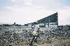
| Goma FeatureType : city Elevation : 1461 Lat/Lng : -1.6933 / 29.2252 | Goma is the capital of North Kivu province in the eastern Democratic Republic of the Congo. It is located on the northern shore of Lake Kivu, next to the Rwandan city of Gisenyi. The lake and the two cities are in the Albertine Rift, the western branch of the East African Rift system (...) |
| 8 | 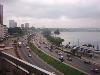
| Abidjan FeatureType : null Elevation : 38 Lat/Lng : 5.3364 / -4.0267 | Abidjan is the economic capital of Ivory Coast and one of the most populous French-speaking cities in Africa. According to the 2014 census, Abidjan's population was 4.7 million, which is 20 percent of the overall population of the country, and this also makes it the fourth most populous city proper (...) |
| 9 | 
| Malabo FeatureType : city Elevation : 35 Lat/Lng : 3.7524 / 8.7753 | Malabo (; ; formerly Santa Isabel) is the capital of Equatorial Guinea and the province of Bioko Norte. It is located on the north coast of the island of Bioko, formerly known by the Bubis, its indigenous inhabitants, as Etulá, and as Fernando Pó by the Europeans (...) |
| 10 | 
| Republic of the Congo FeatureType : country Elevation : 423 Lat/Lng : -1.44 / 15.556 | The Republic of the Congo , also known as Congo-Brazzaville, the Congo Republic or simply the Congo, is a country in Central Africa. It is bordered by five countries: Gabon to the west; Cameroon to the northwest; the Central African Republic to the northeast; the Democratic Republic of the Congo to (...) |
| 11 | 
| Montreal FeatureType : null Elevation : 44 Lat/Lng : 45.5077 / -73.5626 | Montreal (; is the local English pronunciation; in the rest of Canada, it tends to be , but the British and American pronunciation is . ; officially Montréal) is the most populous municipality in the Canadian province of Quebec and the second-most populous municipality in Canada (...) |
| 12 | 
| Dar es Salaam FeatureType : city Elevation : 10 Lat/Lng : -6.82 / 39.27 | Dar es Salaam (Dar) (from ', "the house of peace"; formerly Mzizima) is the former capital as well as the most populous city in Tanzania and a regionally important economic centre. Located on the Swahili coast, the city is one of the fastest growing cities in the world (...) |
| 13 | 
| Johannesburg FeatureType : null Elevation : 1766 Lat/Lng : -26.2044 / 28.0456 | Johannesburg (; ; also known as Jozi, Joburg, and eGoli) is the largest city in South Africa and one of the 50 largest urban areas in the world. It is the provincial capital and largest city of Gauteng, which is the wealthiest province in South Africa (...) |
| 14 | 
| Nairobi FeatureType : landmark Elevation : 1684 Lat/Lng : -1.2833 / 36.8167 | Nairobi is the capital and the largest city of Kenya. The name comes from the Maasai phrase Enkare Nairobi, which translates to "cool water", a reference to the Nairobi River which flows through the city. The city proper had a population of 3,138,369 in the 2009 census, while the metropolitan area (...) |
| 15 | 
| Rwanda FeatureType : country Elevation : 1528 Lat/Lng : -1.9439 / 30.0595 | Rwanda , officially the Republic of Rwanda (; Swahili: Jamhuri ya Rwanda;), is a country in Central and East Africa and one of the smallest countries on the African mainland. Located a few degrees south of the Equator, Rwanda is bordered by Uganda, Tanzania, Burundi and the Democratic Republic of (...) |
| 16 | 
| Ankara FeatureType : null Elevation : 868 Lat/Lng : 39.9272 / 32.8644 | Ankara , historically known as Ancyra and Angora, is the capital of the Republic of Turkey. With a population of 4,587,558 in the urban center (2014) and 5,150,072 in its province (2015), it is Turkey's second largest city after Istanbul (the former imperial capital), having outranked İzmir in the (...) |
| 17 | 
| Kananga FeatureType : city Elevation : 638 Lat/Lng : -5.897 / 22.4488 | Kananga, formerly known as Luluabourg or Luluaburg, is the capital city of the Lulua Province in the Democratic Republic of the Congo and was the capital of the former Kasaï-Occidental Province. The city has an estimated population of 1,463,556.http://www.tiptopglobe (...) |
| 18 | 
| Matadi FeatureType : null Elevation : 133 Lat/Lng : -5.8174 / 13.4708 | Matadi is the chief sea port of the Democratic Republic of the Congo and the capital of the Kongo Central province. It has a population of 245,862 (2004). Matadi is situated on the left bank of the Congo River, from the mouth and below the last navigable point before the rapids that make the river (...) |
| 19 | 
| Pool Malebo FeatureType : waterbody Elevation : 266 Lat/Lng : -4.2818 / 15.4887 | The Pool Malebo, formerly Stanley Pool, also known as Lake Nkunda by local indigenous people in pre-colonial times, is a lake-like widening in the lower reaches of the Congo River.. . Accessed June 2011. The former name Stanley Pool was named after early European explorer and journalist Henry Morton (...) |
| 20 | Congo River FeatureType : landmark Lat/Lng : -6.0792 / 12.45 | The great Congo River (also spelled Kongo River and known as the Zaire River; ; ;) is the second longest river in Africa, shorter only than the Nile, as well as the second largest river in the world by discharge volume, following only the Amazon (...) | |
| 21 | Lubumbashi FeatureType : city Elevation : 1255 Lat/Lng : -11.6697 / 27.4833 | Lubumbashi (former names: (French) and Elisabethstad (Dutch)) in the southeastern part of Democratic Republic of the Congo is the second-largest city in the country, the largest being the capital, Kinshasa. Lubumbashi is the mining capital of the Democratic Republic of the Congo, acting as a hub (...) | |
| 22 | N'djili Airport FeatureType : airport Elevation : 306 Lat/Lng : -4.3856 / 15.4447 | N'djili Airport , also known as N'Djili International Airport and Kinshasa International Airport, serves the city of Kinshasa and is the largest of the four international airports in the Democratic Republic of the Congo (DRC). It is named after the nearby Ndjili River. (...) | |
| 23 | Zaire FeatureType : null Elevation : 284 Lat/Lng : -4.4 / 15.4 | Zaire , officially the Republic of Zaire , was the name for the Democratic Republic of the Congo that existed between 1971 and 1997 in Central Africa. The country was a one-party totalitarian dictatorship, run by Mobutu Sese Seko and his ruling Popular Movement of the Revolution party (...) | |
| 24 | Douala FeatureType : city Lat/Lng : 4.05 / 9.6833 | Douala is the largest city in Cameroon and its economic capital. It is also the capital of Cameroon's Littoral Region. Home to Central Africa's largest port and its major international airport, Douala International Airport (DLA), it is the commercial and economic capital of Cameroon and the entire (...) | |
| 25 | Bandundu (city) FeatureType : null Elevation : 320 Lat/Lng : -3.3152 / 17.3856 | Bandundu, formerly known as Banningville or Banningstad, is a city in the Mai-Ndombe Province of the Democratic Republic of the Congo. (...) | |
| 26 | North Kivu FeatureType : adm1st Elevation : 1461 Lat/Lng : -1.69 / 29.22 | North Kivu is a province bordering Lake Kivu in the eastern Democratic Republic of the Congo. Its capital is Goma. North Kivu borders the provinces of Ituri to the north, Tshopo to the northwest, Maniema to the southwest, and South Kivu to the south (...) | |
| 27 | Kongo Central FeatureType : adm1st Elevation : 146 Lat/Lng : -5.8167 / 13.4833 | Kongo Central, formerly Bas-Congo, is one of the 26 provinces of the Democratic Republic of the Congo. Its capital is Matadi. (...) | |
| 28 | Uíge Province FeatureType : adm1st Elevation : 837 Lat/Lng : -7.6167 / 15.05 | Uíge , one of the eighteen Provinces of Angola, is located in the northwestern part of the country. Its capital city is of the same name. Municipalities within the province include Alto Cauale, Ambuila, Bembe, Buengas, Bungo, Damba, Macocola, Milunga, Mucaba, Negage, Puri, Quimbele, Quitexe, Sanza (...) | |
| 29 | Southern Hemisphere FeatureType : null Lat/Lng : -45.0 / 0.0 | The Southern Hemisphere is the half of Earth that is south of the Equator. It contains all or parts of five continents (Antarctica, Australia, about 90% of South America, the southern third of Africa, and several southern islands off the continental mainland of Asia), four oceans (Indian, South (...) | |
| 30 | Katanga Province FeatureType : adm1st Elevation : 1172 Lat/Lng : -11.1411 / 27.1047 | Katanga was one of the eleven provinces of the Democratic Republic of the Congo between 1966 and 2015, when it was split into the Tanganyika, Haut-Lomami, Lualaba and Haut-Katanga provinces. Between 1971 and 1997 (during the rule of Mobutu Sese Seko when Congo was known as Zaïre), its official name (...) | |
| 31 | Premonstratensians FeatureType : landmark Elevation : 46 Lat/Lng : 41.8789 / 12.4887 | The Order of Canons Regular of Prémontré, also known as the Premonstratensians, the Norbertines and, in Britain and Ireland, as the White Canons (from the colour of their habit), are a religious order of Canons regular of the Catholic Church founded in Prémontré near Laon in 1120 by Norbert of (...) | |
| 32 | Belgian Congo FeatureType : city Elevation : 279 Lat/Lng : -4.3167 / 15.3167 | The Belgian Congo was a Belgian colony in Central Africa from 1908 until independence in 1960. The former colony is now the Democratic Republic of the Congo (DRC). Colonial rule in the Congo began in the late 19th century (...) | |
| 33 | Linafoot FeatureType : null Elevation : 1504 Lat/Lng : -1.6833 / 29.2333 | The Linafoot is the top division of the Fédération Congolaise de Football-Association, the governing body of football in the Democratic Republic of the Congo. It was created in 1958. In 2013, the highest attendance was set in the match DC Motema Pembe - AS Vita Club, which saw an attendance of (...) | |
| 34 | 
| Auckland Zoo FeatureType : landmark Elevation : 16 Lat/Lng : -36.8622 / 174.7189 | Auckland Zoo is a zoological garden in Auckland, New Zealand, situated next to Western Springs park not far from Auckland's central business district. It is run by the Auckland Council with the Auckland Zoological Society as a supporting organisation (...) |
| 35 | Kasa-Vubu, Kinshasa FeatureType : city Elevation : 293 Lat/Lng : -4.3432 / 15.3044 | Kasa-Vubu is a municipality (commune) in the Funa district of Kinshasa, the capital city of the Democratic Republic of the Congo. Along with Kalamu, it forms the historical African heart of Kinshasa. Formerly known as Dendale, the town's name derives from the first president of the Congo after (...) | |
| 36 | Bandundu Province FeatureType : null Elevation : 300 Lat/Lng : -3.3167 / 17.3667 | Bandundu is one of eleven former provinces of the Democratic Republic of the Congo. It bordered the provinces of Kinshasa and Bas-Congo to the west, Équateur to the north, and Kasai-Occidental to the east. The provincial capital is also called Bandundu (formerly Banningstad/Banningville). (...) | |
| 37 | Sub-Saharan Africa FeatureType : null Elevation : 812 Lat/Lng : -27.9136 / 31.6475 | The sub-Saharan Africa is, geographically, the area of the continent of Africa that lies south of the Sahara. According to the United Nations, it consists of all African countries that are fully or partially located south of the Sahara (...) | |
| 38 | UNESCO FeatureType : landmark Elevation : 35 Lat/Lng : 48.8501 / 2.3062 | The United Nations Educational, Scientific and Cultural Organization (UNESCO;) is a specialized agency of the United Nations (UN) based in Paris. Its declared purpose is to contribute to peace and security by promoting international collaboration through educational, scientific, and cultural reforms (...) | |
| 39 | David Livingstone FeatureType : null Elevation : 15 Lat/Lng : 51.4994 / -0.1275 | David Livingstone (; 19 March 1813 – 1 May 1873) was a Scottish physician, Congregationalist, and pioneer Christian missionary with the London Missionary Society, an explorer in Africa, and one of the most popular British heroes of the late 19th-century Victorian era (...) | |
| 40 | South African Air Force FeatureType : null Elevation : 18 Lat/Lng : -29.9686 / 30.9478 | The South African Air Force (SAAF) is the air force of South Africa, with headquarters in Pretoria. The South African Air Force was established on 1 February 1920. The Air Force has seen service in World War II and the Korean War (...) | |
| 41 | Congo Free State FeatureType : country Elevation : 32 Lat/Lng : -5.85 / 13.05 | The Congo Free State ("Independent State of the Congo";) was a large state in Central Africa from 1885 to 1908. It was ruled personally by Leopold II and operated entirely separate from Belgium, of which he was also king (...) | |
| 42 | 1974 FeatureType : landmark Elevation : 19 Lat/Lng : 27.9606 / -82.7299 | ==Events== ===January=== * January 11 – David, Elizabeth, Emma, Grant, Jason and Nicolette Rosenkowitz are born in Cape Town, the first recorded sextuplets in the world where all six babies survive. * January 17 – Two commercial divers, Pier Skipness and Robert John Smyth, die from rapid (...) | |
| 43 | International Criminal Court FeatureType : landmark Elevation : 3 Lat/Lng : 52.0683 / 4.3536 | The International Criminal Court (ICC or ICCt)International Criminal Court is sometimes abbreviated as ICCt to distinguish it from several other organisations abbreviated as ICC. However the more common abbreviation ICC is used in this article (...) | |
| 44 | Traffic light FeatureType : landmark Elevation : 1905 Lat/Lng : 43.4795 / -110.7627 | Traffic lights, also known as traffic signals, traffic lamps, traffic semaphore, signal lights, stop lights, robots (in South Africa and most of Africa), and traffic control signals (in technical parlance), The Origins and Globalization of Traffic Control Signals — Retrieved 8 December 2013 are (...) | |
| 45 | 
| Stade des Martyrs FeatureType : landmark Elevation : 285 Lat/Lng : -4.3307 / 15.3097 | The Stade des Martyrs de la Pentecôte (Martyrs of Pentecost Stadium), also known as simply the Stade des Martyrs and formerly known as Stade Kamanyola, is a national stadium located in the town of Lingwala in Kinshasa, the capital of the Democratic Republic of the Congo (...) |
| 46 | 1968 African Cup of Nations FeatureType : landmark Elevation : 2346 Lat/Lng : 9.0133 / 38.7564 | The 1968 African Cup of Nations was the sixth edition of the Africa Cup of Nations, the soccer championship of Africa (CAF). It was hosted by Ethiopia. The field expanded to eight teams, split into two groups of four; the top two teams in each group advanced to the semifinals (...) | |
| 47 | Équateur (former province) FeatureType : null Elevation : 304 Lat/Lng : 0.0667 / 18.2667 | Équateur (French for "Equator") was one of the eleven provinces of the Democratic Republic of the Congo between 1966 and 2015, when it was split into the new, smaller Équateur province, as well as the Tshuapa, Mongala, Nord-Ubangi and Sud-Ubangi provinces (...) | |
| 48 | 
| Lake Mai-Ndombe FeatureType : waterbody Elevation : 292 Lat/Lng : -2.0503 / 18.3056 | Lake Mai-Ndombe is a large freshwater lake in the Mai-Ndombe District of the Bandundu Province in western Democratic Republic of the Congo. The lake is within the Tumba-Ngiri-Maindombe area, the largest Wetland of International Importance recognized by the Ramsar Convention in the world. (...) |
| 49 | Roman Catholic Archdiocese of Kinshasa FeatureType : null Elevation : 286 Lat/Lng : -4.3238 / 15.2944 | The Archdiocese of Kinshasa (Latin: Archidioecesis Kinshasana; French: Archidiocèse de Kinshasa) is an archdiocese of the Roman Catholic Church in the Democratic Republic of the Congo. Its ecclesiastic territory includes the capital city of Kinshasa and surrounding districts (...) | |
| 50 | Kindu FeatureType : null Elevation : 465 Lat/Lng : -2.95 / 25.92 | Kindu is a city in the Democratic Republic of Congo, the capital of Maniema province. It has a population of about 200,000 and is situated on the Lualaba River at an altitude of about 500 metres, and is about 400 km west of Bukavu (...) | |
| 51 | Kasai River FeatureType : river Elevation : 1439 Lat/Lng : -10.9603 / 19.3156 | The Kasai River (called Cassai in Angola) is a tributary (left side) of the Congo River, located in Central Africa. The river begins in Angola and then serves as the border between Angola and the Democratic Republic of the Congo (DRC), until it flows into the DRC (...) | |
| 52 | Makala FeatureType : city Elevation : 299 Lat/Lng : -4.3769 / 15.3103 | Makala is a municipality (commune) in the Funa district of Kinshasa, the capital city of the Democratic Republic of the Congo. (...) | |
| 53 | University of Kinshasa FeatureType : edu Elevation : 441 Lat/Lng : -4.4194 / 15.3097 | The University of Kinshasa , commonly known as UNIKIN, is one of the three major universities in the Democratic Republic of the Congo, together with the University of Kisangani and University of Lubumbashi. Originally founded in 1954 as Lovanium University during Belgian colonial rule, the current (...) | |
| 54 | Mbuji-Mayi FeatureType : city Elevation : 626 Lat/Lng : -6.173 / 23.6031 | Mbuji-Mayi (formerly Bakwanga) serves as the capital city of Kasai-Oriental Province in the south-central Democratic Republic of Congo. It is the third largest city in the country, following the capital Kinshasa and second largest city Lubumbashi but ahead of Kisangani and Kananga, though the exact (...) | |
| 55 | Likouala Department FeatureType : adm1st Elevation : 313 Lat/Lng : 1.6333 / 18.0667 | Likouala is a department of the Republic of the Congo in the northern part of the country. It borders the departments of Cuvette and Sangha, and internationally, the Democratic Republic of the Congo and the Central African Republic (...) | |
| 56 | Kikwit FeatureType : null Elevation : 466 Lat/Lng : -5.041 / 18.8162 | Kikwit is the largest city and capital of Kwilu Province, lying on the Kwilu River in the southwestern part of the Democratic Republic of Congo. Kikwit is also known in the region under the nickname "The Mother". The population is approximately 397,737 (2012) (...) | |
| 57 | Congo FeatureType : null Elevation : 400 Lat/Lng : -6.3412 / 16.6856 | Congo may refer to either of two countries that border the Congo River in central Africa: * the larger Democratic Republic of the Congo to the southeast (capital: Kinshasa), formerly known as Zaire and sometimes referred to as "Congo-Kinshasa" * the smaller Republic of the Congo to the northwest (...) | |
| 58 | Bukavu FeatureType : null Elevation : 1716 Lat/Lng : -2.5154 / 28.8451 | Bukavu (former official names: Costermansville (French) and Costermansstad (Dutch)) is a city in eastern Democratic Republic of the Congo (DRC), lying at the extreme south-western edge of Lake Kivu, west of Cyangugu in Rwanda, and separated from it by the outlet of the Ruzizi River (...) | |
| 59 | Gombe, Kinshasa FeatureType : city Elevation : 281 Lat/Lng : -4.3073 / 15.3055 | Gombe or La Gombe is a municipality (commune) in the Lukunga district of Kinshasa, the capital city of the Democratic Republic of the Congo. It was formerly known as Kalina, after Lieutenant E. Kallina - an Austro-Hungarian soldier who volunteered in the Congo Free State (...) | |
| 60 | Gombe FeatureType : null Elevation : 1164 Lat/Lng : -15.6333 / 20.1167 | Gombe may refer to: ;Places * Gombe, Gombe State, the capital of Gombe State, Nigeria ** Gombe State, Nigeria * Gombe, Angola * Gombe, Butambala - The capital of Butambala District in Central Uganda * Gombe, Wakiso - A town in Wakiso District, Central Uganda * Gombe, Kinshasa, in the Democratic (...) | |
| 61 | Gbadolite FeatureType : city Elevation : 397 Lat/Lng : 4.2833 / 21.0167 | Gbadolite or Gbado-Lite (pronounced) is the capital of Nord-Ubangi Province in the Democratic Republic of the Congo. The town is located south of the Ubangi River at the border to the Central African Republic and northeast of the national capital Kinshasa (...) | |
| 62 | Portuguese Angola FeatureType : country Elevation : 20 Lat/Lng : 2.1889 / 102.3844 | Portuguese Angola refers to Angola during the historic period when it was a territory under Portuguese rule in southwestern Africa. In the same context, it is also occasionally referred to as Portuguese West Africa (...) | |
| 63 | Ilebo FeatureType : null Elevation : 444 Lat/Lng : -4.3303 / 20.5873 | Ilebo, formerly known as Port-Francqui, is a town in Kasaï District, Kasaï-Occidental province in the Democratic Republic of Congo, lying at the highest navigable point of the Kasaï River. It is an important transport hub for ferries to Kinshasa and trains to Lubumbashi. (...) | |
| 64 | N'Dolo Airport FeatureType : null Elevation : 280 Lat/Lng : -4.3264 / 15.3275 | N'Dolo Airport , also known as Ndolo Airport, is a secondary airport in the city of Kinshasa, Democratic Republic of the Congo, located in the commune of Barumbu near the city center. The Aviation militaire de la Force Publique was established here in October 1940 with requisitioned aircraft (...) | |
| 65 | 1974 African Cup of Nations FeatureType : landmark Elevation : 16 Lat/Lng : 30.03 / 31.14 | The 1974 African Cup of Nations was the ninth edition of the Africa Cup of Nations, the soccer championship of Africa (CAF). It was hosted by Egypt. Just like in 1972, the field of eight teams was split into two groups of four (...) | |
| 66 | 2nd Foreign Parachute Regiment FeatureType : landmark Elevation : 17 Lat/Lng : 42.5536 / 8.8006 | The 2nd Foreign Parachute Regiment is the only airborne regiment of the French Foreign Legion. It was formed to fill the gap left by the 1st Foreign Parachute Regiment, dissolved in disgrace for its involvement in the Algiers putsch of 1961 (...) | |
| 67 | Enclave and exclave FeatureType : null Elevation : 28 Lat/Lng : 45.0134 / -73.1933 | An enclave is a territory, or a part of a territory, that is entirely surrounded by the territory of one other state. Territorial waters have the same sovereign attributes as land, and enclaves may therefore exist within territorial waters (...) | |
| 68 | Mbandaka FeatureType : null Elevation : 314 Lat/Lng : 0.0476 / 18.256 | Mbandaka, pronounced mba ˈnda ka and formerly known as Coquilhatville in French or Coquilhatstad in Flemish, is a city on the Congo River in the Democratic Republic of Congo lying near the confluence of the Congo and Ruki Rivers. It is the capital of Équateur Province (...) | |
| 69 | Ngaliema FeatureType : city Elevation : 315 Lat/Lng : -4.3514 / 15.2478 | Ngaliema is a municipality (commune) in the Lukunga District of Kinshasa, the capital city of the Democratic Republic of the Congo. (...) | |
| 70 | Cuban intervention in Angola FeatureType : null Elevation : 1221 Lat/Lng : -15.15 / 19.1667 | In November 1975, on the eve of Angola's independence, Cuba launched a large-scale military intervention in support of the leftist People's Movement for the Liberation of Angola (MPLA) against United States-backed interventions by South Africa and Zaire in support of two right-wing independence (...) | |
| 71 | Inland port FeatureType : null Elevation : 109 Lat/Lng : 43.89 / -78.86 | An inland port is a port on an inland waterway, such as a river, lake, or canal, which may or may not be connected to the ocean. The term "inland port" is also used to refer to a dry port, which is an inland extension of a seaport, usually connected by rail to the docks (...) | |
| 72 | Zaghouan FeatureType : city Elevation : 176 Lat/Lng : 36.4028 / 10.1433 | Zaghwan (or Zaghouan; Zaġwān) is a town in the northern half of Tunisia. Situated on a low ridge of the Dorsale Mountains, the town has a mild climate and presents a green aspect. Cold water from here was taken by aqueduct to Carthage (...) | |
| 73 |
| Geography of the Republic of the Congo FeatureType : country Elevation : 393 Lat/Lng : -1.0 / 15.0 | The Republic of the Congo is located in the western part of Central Africa. Situated on the Equator, it is bordered by the Angola exclave of Cabinda to the south (231 km), the Democratic Republic of the Congo to the south and east (1,229 km), the Central African Republic (487 km) and Cameroon (494 (...) |
| 74 | Boende FeatureType : null Elevation : 344 Lat/Lng : -0.281 / 20.876 | Boende is a town and capital of Tshuapa Province, lying on the Tshuapa River, in the Democratic Republic of Congo. It is a river port with ferries sailing to Kinshasa via Mbandaka and is also home to an airport. As of 2009 it had an estimated population of 36,158 (...) | |
| 75 | Kalemie FeatureType : landmark Elevation : 771 Lat/Lng : -5.9469 / 29.2017 | Kalemie, formerly Albertville or Albertstad, is a town on the western shore of Lake Tanganyika in the Democratic Republic of the Congo. The town is next to the outflow of the Lukuga River from Lake Tanganyika to the Lualaba River. Kalemie's twin town is Steinheim in Germany. (...) | |
| 76 | Canada–Democratic Republic of the Congo relations FeatureType : null Elevation : 59 Lat/Lng : 45.4274 / -75.6737 | Canada–Democratic Republic of the Congo relations refers to the bilateral relationship between Canada and the Democratic Republic of the Congo. Canada has an embassy in Kinshasa and D.R. Congo has an embassy in Ottawa (...) | |
| 77 | Limete FeatureType : city Elevation : 285 Lat/Lng : -4.3487 / 15.3389 | Limete is a municipality (commune) in the Mont Amba district of Kinshasa, the capital city of the Democratic Republic of the Congo. (...) | |
| 78 | 40 Commando FeatureType : null Elevation : 33 Lat/Lng : 51.039 / -3.1541 | 40 Commando RM is a battalion-sized formation of the British Royal Marines and subordinate unit within 3 Commando Brigade, the principal Commando formation, under the Operational Command of Commander in Chief Fleet (...) | |
| 79 | Selembao FeatureType : city Elevation : 322 Lat/Lng : -4.3734 / 15.2857 | Selembao is a municipality (commune) in the Funa district of Kinshasa, the capital city of the Democratic Republic of the Congo. It is situated in the south of Kinshasa. Selembao is one of the new settlements, located near the Kalamu and Kasa-Vubu hills. (...) | |
| 80 | Kimbanseke FeatureType : city Elevation : 354 Lat/Lng : -4.4403 / 15.4134 | Kimbanseke is a municipality (commune) in the Tshangu district of Kinshasa, the capital city of the Democratic Republic of the Congo. It is situated in the southeast of Kinshasa. Settlement in this hilled area is relatively new. (...) | |
| 81 | Lingwala FeatureType : city Elevation : 284 Lat/Lng : -4.326 / 15.3017 | Lingwala is a municipality (commune) in the Lukunga district of Kinshasa, the capital city of the Democratic Republic of the Congo. It is situated in northern Kinshasa, south of Gombe and Boulevard du 30 Juin. (...) | |
| 82 | Lemba, Kinshasa FeatureType : city Elevation : 335 Lat/Lng : -4.4238 / 15.3344 | Lemba is a municipality (commune) in the Mont Amba district of Kinshasa, the capital city of the Democratic Republic of the Congo. (...) | |
| 83 | Bandalungwa FeatureType : city Elevation : 288 Lat/Lng : -4.3394 / 15.2869 | Bandalungwa is a municipality (commune) in the Funa district of Kinshasa, the capital city of the Democratic Republic of the Congo. Its northern portion is occupied by the military barracks of Kokolo, whose buildings prominently display traditional Flemish architecture (...) | |
| 84 | Tanganyika Province FeatureType : adm1st Elevation : 767 Lat/Lng : -5.9167 / 29.2 | Tanganyika is one of the 26 provinces of the Democratic Republic of the Congo. Specified under Article 2 of the country's 2006 Constitution, Tanganyika was finally created in 2015 from the eponymous Tanganyika District, previously part of the pre-2015 Katanga Province. Its capital is Kalemie (...) | |
| 85 | Boma, Democratic Republic of the Congo FeatureType : null Elevation : 13 Lat/Lng : -5.8487 / 13.0561 | Boma is a port town on the Congo River, some 100 km upstream from the Atlantic Ocean, in the Kongo Central province of the Democratic Republic of the Congo. It had an estimated population of 162,521 in 2012. Boma was the capital city of the Congo Free State and Belgian Congo (the modern Democratic (...) | |
| 86 | Basankusu FeatureType : city Elevation : 333 Lat/Lng : 1.2222 / 19.8028 | Basankusu is a town in Équateur Province, Democratic Republic of the Congo. It is the main town and administrative centre of the Basankusu Territory. In 2004, it had an estimated population of 23,764. It has a gravel airstrip, covered and open markets, a hospital, and two cellphone networks, which (...) | |
| 87 | Barumbu FeatureType : city Elevation : 279 Lat/Lng : -4.3094 / 15.3214 | Barumbu is a municipality (commune) in the Lukunga district of Kinshasa, the capital city of the Democratic Republic of the Congo. It is situated in the north of Kinshasa, south of Gombe and the Boulevard du 30 Juin (...) | |
| 88 | Lodja FeatureType : null Elevation : 478 Lat/Lng : -3.521 / 23.6005 | Lodja is a town in central Democratic Republic of the Congo. It is located at around . Lodja is home to the Lodja Airport. (IATA Code: LJA) Lodja Airport, located 7 km north of Lodja, has one 1600 meter natural surface runway, oriented 88/268° (...) | |
| 89 | Isiro FeatureType : adm1st Elevation : 761 Lat/Lng : 2.7739 / 27.616 | Isiro (pronounced) is the capital of Haut-Uele Province in the northeastern part of the Democratic Republic of the Congo. It lies between the equatorial forest and the savannah and its main resource is coffee. Isiro's population is estimated at approximately 182,000 (...) | |
| 90 | Louvain Coopération FeatureType : null Elevation : 125 Lat/Lng : 50.6688 / 4.6039 | Louvain CoopérationThe official denomination of the NGO as published in the Belgian official journal is "Louvain Coopération au Développement" (abbreviated LD). is a Belgian International non-governmental organization (INGO) located in the university campus of Louvain-la-Neuve (...) | |
| 91 | Kimpese FeatureType : null Elevation : 331 Lat/Lng : -5.5627 / 14.4461 | Kimpese is a town in the Cataractes District of Bas-Congo province, Democratic Republic of the Congo. It lies on the main road and railway between Kinshasa and the provincial capital Matadi, at an altitude of 990 ft (301 m) above sea level (...) | |
| 92 | Lukunga District FeatureType : city Elevation : 289 Lat/Lng : -4.3054 / 15.3032 | Lukunga is one of the four districts that make up the capital city of Kinshasa, Democratic Republic of the Congo (DRC). It includes the communes (municipalities) of Barumbu, Gombe, Kinshasa, Kintambo, Lingwala, Mont Ngafula and Ngaliema. The district takes its name from the Lukunga River (...) | |
| 93 | Kintambo FeatureType : city Elevation : 293 Lat/Lng : -4.344 / 15.2677 | Kintambo is a municipality (commune) in the Lukunga district of Kinshasa, the capital city of the Democratic Republic of the Congo. It is situated in the northwest of the city of Kinshasa, at the junction of Boulevard du 30 Juin (or more accurately its short extension, Avenue du Colonel Mondjiba), (...) | |
| 94 | Bumbu FeatureType : city Elevation : 302 Lat/Lng : -4.3664 / 15.2921 | Bumbu is a municipality (commune) in the Funa district of Kinshasa, the capital city of the Democratic Republic of the Congo. The town is in the hilled southern portion of Kinshasa and settlement there is relatively new. It lies in the vicinity of the Kasa-Vubu and Kalamu boulevards. (...) | |
| 95 | Ndjili, Kinshasa FeatureType : city Elevation : 301 Lat/Lng : -4.4049 / 15.3737 | Ndjili or N'Djili is a municipality (commune) in the Tshangu district of Kinshasa, the capital city of the Democratic Republic of the Congo. It is named after the Ndjili River, which forms its western boundary. (...) | |
| 96 | Maluku, Kinshasa FeatureType : city Elevation : 638 Lat/Lng : -4.4614 / 16.0785 | Maluku is a municipality (commune) in the Tshangu district of Kinshasa, the capital city of the Democratic Republic of the Congo. (...) | |
| 97 | 2011 United Nations Bombardier CRJ-100 crash FeatureType : event Elevation : 282 Lat/Lng : -4.3167 / 15.3 | On 4 April 2011, a Georgian Airways Canadair Regional Jet (CRJ 100 ER), registration 4L-GAE, using call sign "UNO 834", operating a domestic flight from Kisangani to Kinshasa for United Nation's Stabilization Mission in the Democratic Republic of Congo, crashed during Go Around at Kinshasa Airport, (...) | |
| 98 | Goma International Airport FeatureType : null Elevation : 1529 Lat/Lng : -1.6709 / 29.2384 | Goma International Airport is an airport serving Goma, a city in the Democratic Republic of the Congo in Africa. (...) | |
| 99 | Sankuru FeatureType : adm1st Elevation : 540 Lat/Lng : -3.3575 / 23.5967 | Sankuru is one of the 26 provinces of the Democratic Republic of the Congo. Its capital is Lusambo. (...) | |
| 100 | Livingstone Falls FeatureType : waterbody Elevation : 263 Lat/Lng : -4.3219 / 15.2078 | Livingstone Falls (French, Chutes Livingstone) — named for the explorer David Livingstone — are a succession of enormous rapids on the lower course of the Congo River in west equatorial Africa, downstream from Malebo Pool in the Democratic Republic of the Congo.Stanley, H.M (...) | |
| 101 | Salonga National Park FeatureType : null Elevation : 411 Lat/Lng : -2.0 / 21.0 | Salonga National Park is a national park in the Democratic Republic of the Congo located in the Congo River basin. It is Africa's largest tropical rainforest reserve covering about 36,000 km2 or . It extends into the provinces of Mai Ndombe, Equateur, Kasaï and Sankuru. (...) | |
| 102 | Kinshasa (commune) FeatureType : city Elevation : 281 Lat/Lng : -4.3233 / 15.3082 | Kinshasa is a municipality (commune) in the Lukunga district of the city of Kinshasa, the capital of the Democratic Republic of the Congo. It is situated in the east of the city, south of Gombe and the Boulevard du 30 Juin. (...) | |
| 103 | Masina, Kinshasa FeatureType : city Elevation : 284 Lat/Lng : -4.388 / 15.3937 | Masina is a municipality (commune) in the Tshangu district of Kinshasa, the capital city of the Democratic Republic of the Congo. It is bordered by the Pool Malebo in the north and Boulevard Lumbumba to the south (...) | |
| 104 | Matete FeatureType : city Elevation : 292 Lat/Lng : -4.3912 / 15.3533 | Matete is a municipality (commune) in the Mont Amba district of Kinshasa, the capital city of the Democratic Republic of the Congo. (...) | |
| 105 | Ituri Province FeatureType : adm1st Elevation : 1014 Lat/Lng : 1.8333 / 29.5 | Ituri is one of the 26 provinces of the Democratic Republic of the Congo. Its capital is the city of Bunia. (...) | |
| 106 | 1996 Air Africa crash FeatureType : event Elevation : 286 Lat/Lng : -4.3295 / 15.318 | The 1996 Air Africa crash occurred on 8 January when an overloaded Air Africa Antonov An-32B aircraft, wet leased from Moscow Airways and bound for Kahemba Airport, overshot the runway at N'Dolo Airport in Kinshasa, Democratic Republic of the Congo after failing to take off and ploughed into (...) | |
| 107 | 2018 Équateur province Ebola outbreak FeatureType : null Elevation : 312 Lat/Lng : -0.75 / 18.1167 | The 2018 Équateur province Ebola outbreak occurred in the north-west of the Democratic Republic of the Congo (DRC) from May to July 2018. It was the largest outbreak of Ebola virus disease (EVD) since the West African epidemic of 2013–16, but never spread beyond Équateur province (...) | |
| 108 | Mbanza-Ngungu FeatureType : city Elevation : 690 Lat/Lng : -5.25 / 14.8667 | Mbanza-Ngungu, formerly known as Thysville or Thysstad, named after Albert Thys, is a city and territory in Kongo Central Province in the western part of the Democratic Republic of Congo, lying on a short branch off the Matadi-Kinshasa Railway. It has a population of nearly 100,000 people. (...) | |
| 109 | 2014–15 Linafoot FeatureType : null Elevation : 1206 Lat/Lng : -11.7046 / 27.484 | The 2014–15 Linafoot season (known as the Vodacom Superligue 2014–15 for sponsorship reasons) is the 54th since its establishment. It began on 4 October 2014. A total of 20 clubs participate in the 2014–15 Linafoot. (...) | |
| 110 | The Rumble in the Jungle FeatureType : null Elevation : 282 Lat/Lng : -4.338 / 15.322 | The Rumble in the Jungle was a historic boxing event in Kinshasa, Zaire (now Democratic Republic of the Congo) on October 30, 1974 (at 4:00 am). Held at the 20th of May Stadium (now the Stade Tata Raphaël), it pitted the undefeated world heavyweight champion George Foreman against challenger (...) | |
| 111 | Pweto FeatureType : null Elevation : 954 Lat/Lng : -8.466 / 28.9008 | Pweto is a town in the Haut-Katanga Province of the Democratic Republic of the Congo (DRC). It is the administrative center of Pweto Territory. The town was the scene of a decisive battle in December 2000 during the Second Congo War which resulted in both sides making more active efforts to achieve (...) | |
| 112 | Kalamu FeatureType : city Elevation : 288 Lat/Lng : -4.3476 / 15.32 | Kalamu is a municipality (commune) in the Funa district of Kinshasa, the capital city of the Democratic Republic of the Congo. It forms the part of the city to the south of major buildings such as the Palais du Peuple ("Palace of the People"), the Stade des Martyrs ("Martyrs' Stadium") and (...) | |
| 113 | Detroit–Windsor FeatureType : null Elevation : 172 Lat/Lng : 42.3225 / -83.0468 | The Detroit–Windsor region is an international transborder agglomeration comprising the American city of Detroit, Michigan, the Canadian city of Windsor, Ontario, and the Detroit River between them. The Detroit–Windsor area acts as a critical commercial link straddling the Canada–United States (...) | |
| 114 | Institut Français FeatureType : null Elevation : 38 Lat/Lng : 48.8544 / 2.2937 | The Institut Français (French capitalization, Institut français; "French institute") is a French public industrial and commercial organization (EPIC). Started in 1907 by the Ministry of Foreign Affairs for promoting French, francophone as well as local cultures around the world, in 2011 it replaced (...) | |
| 115 | Ngaba FeatureType : city Elevation : 297 Lat/Lng : -4.3846 / 15.3241 | Ngaba is a municipality (commune) in the Mont Amba district of Kinshasa, the capital city of the Democratic Republic of the Congo. It is situated in the south of Kinshasa. Settlement in this hilled area is relatively new. (...) | |
| 116 | Lemba FeatureType : null Elevation : 581 Lat/Lng : -8.3031 / 14.6057 | Lemba may refer to: * Lemba (grasshopper), a genus of insect in the tribe Oxyini * Lemba people, an African ethnic group in Zimbabwe and Southern Africa ;Places * Lemba, Kinshasa, a commune in Kinshasa, Democratic Republic of the Congo * Lembá District, a district of São Tomé Province * Lempa, (...) | |
| 117 | Shaba I FeatureType : null Elevation : 1094 Lat/Lng : -10.3667 / 23.45 | Shaba I was a conflict in Zaire's Shaba (Katanga) Province lasting from March 8, 1977, to May 26, 1977. The conflict began when the Front for the National Liberation of the Congo (FNLC), a group of about 2,000 Katangan Congolese soldiers (veterans of the Congo Crisis, the Angolan War of (...) | |
| 118 | Mbamu FeatureType : null Elevation : 266 Lat/Lng : -4.21 / 15.42 | Mbamu (also: M´Bamou and Bamu) is an island in the Republic of the Congo (Congo Brazzaville). It is situated in the Pool Malebo, a lake formed by the River Congo and has surface area of 180 km2.. . Accessed June 2017. To the south lies Kinshasa and to the northwest lies Brazzaville. (...) | |
| 119 | Benda FeatureType : null Elevation : 877 Lat/Lng : -6.55 / 15.4167 | Benda may refer to: (...) | |
| 120 | Medium Transport Helicopter Regiment 25 FeatureType : landmark Elevation : 532 Lat/Lng : 48.219 / 9.9115 | Medium Transport Helicopter Regiment 25 was a regiment in the German Army, part of the German Army Aviation Corps. It was based at Kurt Georg Kiesinger Barracks on Laupheim Air Base in the German state of Baden Württemberg, Southern Germany (...) | |
| 121 | Republic of Cabinda FeatureType : city Elevation : 37 Lat/Lng : -5.5708 / 12.1933 | The Republic of Cabinda (Ibinda: Kilansi kia cabinda;) http://www.cabinda.net/ was an unrecognized state in southern Africa. The Front for the Liberation of the State of Cabinda-Exercito de Cabinda (FLEC) claims sovereignty from Angola and proclaimed the Republic of Cabinda as an independent country (...) | |
| 122 | TAAG Angola Airlines FeatureType : landmark Elevation : 53 Lat/Lng : -8.8155 / 13.2374 | TAAG Angola Airlines E.P. is the state-owned national airline of Angola. Based in Luanda, the airline operates an all-Boeing fleet on domestic services within Angola, medium-haul services in Africa and long-haul services to Brazil, Cuba, China, and Portugal (...) | |
| 123 | Brazzaville arms dump blasts FeatureType : null Elevation : 285 Lat/Lng : -4.2433 / 15.2947 | On 4 March 2012, a series of blasts occurred at an army arms dump in Brazzaville, the capital of the Republic of the Congo. At least 250 people were killed by the explosions. Additional bodies were said to be "unfindable (...) | |
| 124 | Maluku FeatureType : null Elevation : 42 Lat/Lng : -6.7833 / 156.4833 | Maluku may refer to: (...) | |
| 125 | Republic of the Congo (Léopoldville) FeatureType : null Elevation : 284 Lat/Lng : -4.4 / 15.4 | The Republic of the Congo was a sovereign state in Central Africa that was created with the independence of the Belgian Congo in 1960. From 1960 to 1966, the country was often known as Congo-Léopoldville (after its capital) in order to distinguish it from its north-western neighbour, also called the (...) | |
| 126 | Inga dams FeatureType : landmark Elevation : 130 Lat/Lng : -5.5192 / 13.6219 | The Inga Dams are two hydroelectric dams connected to one of the largest waterfalls in the world, Inga Falls. They are located in the western Democratic Republic of the Congo and 140 miles southwest of Kinshasa. The Congo River drops . (...) | |
| 127 | Hewa Bora Airways Flight 122 FeatureType : event Elevation : 1509 Lat/Lng : -1.6814 / 29.2394 | On 15 April 2008, Hewa Bora Airways Flight 122, a McDonnell Douglas DC-9-51 plane crashed into a residential and market area of Goma of the Democratic Republic of the Congo immediately south of Goma International Airport. (...) | |
| 128 | Nsele FeatureType : city Elevation : 296 Lat/Lng : -4.3745 / 15.4948 | Nsele or N'Sele is a municipality (commune) in the Tshangu district of Kinshasa, the capital city of the Democratic Republic of the Congo. It is situated in the east of Kinshasa, on the Pool Malebo. Nsele is a primarily rural commune, just like its neighbour Maluku on the other bank of the river (...) | |
| 129 | Songololo FeatureType : null Elevation : 321 Lat/Lng : -5.7 / 14.0333 | Songololo is a town in Kongo Central Province in the Democratic Republic of the Congo. (...) | |
| 130 | Katanda Territory FeatureType : city Lat/Lng : -6.25 / -23.9167 | Katanda Territory is one of five territories which, along with the city of Mbuji-Mayi, constitute the current Congolese province of Kasai-Oriental. The Democratic Republic of the Congo (DRC) is made up of 192 territories and 20 cities which are grouped in 26 provinces including Kinshasa, the capital (...) | |
| 131 | Dekese FeatureType : null Elevation : 355 Lat/Lng : -3.4918 / 21.3766 | Dekese is a community in the Democratic Republic of the Congo, on the right bank of the Lukenie River. It is the administrative center of the Dekese Territory in Kasaï District. (...) | |
| 132 | Mampeza FeatureType : null Elevation : 275 Lat/Lng : -4.329 / 15.2537 | Mampeza is a stream in Kinshasa, the Democratic Republic of the Congo. (...) | |
| 133 | Fizi Territory FeatureType : null Elevation : 1321 Lat/Lng : -4.3011 / 28.9442 | Fizi is a territory in the south of Sud-Kivu Province, Democratic Republic of the Congo, bordering the South Kivu territories of Uvira, Mwenga and Shabunda to the north, Lake Tanganyika in the east, and the provinces Katanga in the south and Maniema in the west (...) | |
| 134 | 2010 Bandundu Filair Let L-410 crash FeatureType : city Elevation : 318 Lat/Lng : -3.3111 / 17.3733 | The 2010 Bandundu Filair Let L-410 crash occurred on August 25, 2010, after a Filair aircraft crashed on approach to Bandundu Airport in the Democratic Republic of the Congo, killing 20 people, leaving one survivor. The cause of the accident was uncertain (...) | |
| 135 | Kwame Nkrumah Mausoleum FeatureType : landmark Elevation : 21 Lat/Lng : 5.5444 / -0.2028 | The Kwame Nkrumah Mausoleum and memorial park is located in downtown Accra, the capital of Ghana. It is dedicated to the prominent Ghanaian leader Kwame Nkrumah. at www.odyssei.com. The mausoleum designed by Don Aurthur, houses the body of Dr Kwame Nkrumah and his wife Fathia Nkrumah, it is meant to (...) | |
| 136 | Kasai FeatureType : null Elevation : 476 Lat/Lng : -5.35 / 21.4167 | Kasai may refer to: (...) | |
| 137 | Kitona FeatureType : city Elevation : 123 Lat/Lng : -5.92 / 12.4439 | Kitona is a town of about 4,000 persons in the Bas-Congo province of the Democratic Republic of the Congo. It is located to the southwest of the country along the Atlantic Ocean, about 190 miles southwest of the capital city of Kinshasa (...) | |
| 138 | Mweka, Democratic Republic of the Congo FeatureType : null Elevation : 537 Lat/Lng : -4.84 / 21.57 | Mweka is a town in southern-central Democratic Republic of the Congo, situated on the Kasai railway line between Kananga (250 km away) and the Kasai River port of Ilebo (172 km away). Mweka is also the headquarters of the Territoire de Mweka (administrative district) of the present Kasai Province (...) | |
| 139 | Thiaroye FeatureType : null Elevation : 9 Lat/Lng : 14.7458 / -17.3561 | Thiaroye (or Tiaroye) is the name of a historic town in Sénégal, situated in the suburbs of Dakar, on the southeast coast of the Cap-Vert peninsula, between Pikine and Rufisque. Since the administrative reform in 1996, Thiaroye has been divided into independent communes, Thiaroye-Gare, (...) | |
| 140 | Ndjili River FeatureType : null Elevation : 270 Lat/Lng : -4.3355 / 15.3762 | The Ndjili River is a river that flows from the south through the capital city of Kinshasa in the Democratic Republic of the Congo, where it joins the Congo River. It separates the districts of Tshangu and Mont Amba (...) | |
| 141 | Lukaya River FeatureType : null Elevation : 367 Lat/Lng : -4.4947 / 15.2822 | The Lukaya is a river in the Democratic Republic of the Congo. Its source is located in the Crystal Mountains (Montagnes de Cristal), from which it runs eastward through Bas-Congo, then runs into the banks of the Ndjili River (...) | |
| 142 | Mont Ngafula FeatureType : city Elevation : 369 Lat/Lng : -4.4264 / 15.2956 | Mont Ngafula is a municipality (commune) in the Lukunga district of Kinshasa, the capital city of the Democratic Republic of the Congo. It is in the hilly southern area of Kinshasa and is intersected by the Lukaya River valley in its southern portion (...) | |
| 143 | Brazzaville–Kinshasa Bridge FeatureType : null Elevation : 285 Lat/Lng : -4.2592 / 15.2847 | The Brazzaville–Kinshasa Bridge is a proposed road-rail bridge planned to connect Brazzaville in the Republic of the Congo and Kinshasa in the Democratic Republic of the Congo, which are major capital cities on the Congo River (...) | |
| 144 | Kisenso FeatureType : city Elevation : 352 Lat/Lng : -4.413 / 15.3464 | Kisenso is a municipality (commune) in the Mont Amba district of Kinshasa, the capital city of the Democratic Republic of the Congo. (...) | |
| 145 | Mont Amba District FeatureType : null Elevation : 291 Lat/Lng : -4.3628 / 15.3367 | Mont Amba is one of the four districts that make up the capital city of Kinshasa, Democratic Republic of the Congo (DRC). It includes the communes (municipalities) of Kisenso, Lemba, Limete, Matete and Ngaba. It lies south of the Congo River, east of the downtown district, and is separated from (...) | |
| 146 | Pontifical Urban University FeatureType : edu Elevation : 55 Lat/Lng : 41.8996 / 12.4584 | The Pontifical Urban University, also called the Urbaniana after its names in both Latin and Italian, is a pontifical university under the authority of the Congregation for the Evangelization of Peoples. The university's mission is to train priests, religious brothers and sisters, and lay people for (...) | |
| 147 | University of Mbuji Mayi FeatureType : null Elevation : 609 Lat/Lng : -6.1132 / 23.6008 | The University of Mbuji Mayi (UM) is an accredited private university in the Democratic Republic of the Congo, located in the province of Kasai-Oriental, city of Mbuji Mayi. The university is one of the many initiatives by the "Fondation Cardinal Malula" (...) | |
| 148 | Lukenie River FeatureType : null Elevation : 288 Lat/Lng : -2.7309 / 18.1556 | The Lukenie River is a river in the central Congo basin of the Democratic Republic of the Congo (DRC). River barges from Kinshasa journey up the Congo, Kwah (Kasai), and Fimi Rivers to the Lukenie as far as the landing at Kole, a journey of 6 to 12 weeks (...) | |
| 149 | Roman Catholic Diocese of Basankusu FeatureType : null Elevation : 333 Lat/Lng : 1.2204 / 19.8029 | The Roman Catholic Diocese of Basankusu is a Latin suffragan diocese in the Ecclesiastical province of the Metropolitan Mbandaka-Bikoro in the Democratic Republic of the Congo (Congo-Kinshasa). Its cathedral episcopal see is Cathédrale Saints-Pierre-et-Paul (Saints Paul and Peter) in the city of (...) | |
| 150 | Roman Catholic Archdiocese of Mbandaka-Bikoro FeatureType : null Elevation : 311 Lat/Lng : 0.06 / 18.2562 | The Roman Catholic Archdiocese of Mbandaka-Bikoro is the Metropolitan See for the Latin Rite Ecclesiastical province of Mbandaka-Bikoro, in the western part of Democratic Republic of the Congo, yet depends on the missionary Roman Congregation for the Evangelization of Peoples (...) | |
| 151 | National Assembly (Democratic Republic of the Congo) FeatureType : landmark Elevation : 291 Lat/Lng : -4.3322 / 15.3031 | The National Assembly is the lower house and main legislative political body of the Parliament of the Democratic Republic of the Congo. It was established by the 2006 constitution. It is located at the People's Palace in Kinshasa. (...) | |
| 152 | Nuclear energy in Belgium FeatureType : null Elevation : 23 Lat/Lng : 51.2193 / 5.1022 | Belgium has two nuclear power plants operating with a net capacity of 5,761 MWe. Electricity consumption in Belgium has increased slowly since 1990 and in 2016 nuclear power provided 51.3%, 41 TWh per year, of the country's electricity (...) | |
| 153 | Matadi–Kinshasa Railway FeatureType : null Elevation : 43 Lat/Lng : -5.8195 / 13.4912 | The Matadi–Kinshasa Railway is a railway line in Bas-Congo Province between the port of Matadi and Kinshasa, the capital of Democratic Republic of the Congo. The Matadi–Kinshasa Railway was built from 1890 to 1898. Its length is and it is run by ONATRA (...) | |
| 154 | Masina FeatureType : null Elevation : 809 Lat/Lng : 44.0667 / 18.0117 | Masina may refer to: ;Places * Masina, Kinshasa, in the Democratic Republic of the Congo * Masina, alternate name of Tabas-e Masina, in Iran * Masina, Lumbini, in Nepal * Masina, Rapti, in Nepal * Masina, Purulia, West Bengal, India * Masina Empire, alternate spelling of Massina Empire ;People * (...) | |
| 155 | Tshangu District FeatureType : null Elevation : 306 Lat/Lng : -4.4204 / 15.3855 | Tshangu is one of the four districts that make up the capital city of Kinshasa, Democratic Republic of the Congo (DRC). It includes the communes (municipalities) of Kimbanseke, Maluku, Masina, Ndjili and Nsele. The district is south of the Congo River, east of the Ndjili River, a tributary of the (...) | |
| 156 | Palais du Peuple (Kinshasa) FeatureType : landmark Elevation : 291 Lat/Lng : -4.3322 / 15.3031 | The People's Palace or Palace of the People is the seat of the National Assembly and Senate in Kinshasa, Democratic Republic of Congo, formerly Zaire. It was completed in 1979 with a line of credit from the People's Republic of China. (...) | |
| 157 | Boulevard du 30 Juin FeatureType : null Elevation : 285 Lat/Lng : -4.3028 / 15.3117 | The Boulevard du 30 Juin ("Boulevard of June 30th") is a major 5‑km street in Kinshasa, capital of the Democratic Republic of the Congo. It is the city center's main transport artery, connecting the southern area of La Gombe (Kinshasa's political and business district) with Kintambo and the Ngaliema (...) | |
| 158 | Kasa FeatureType : null Elevation : 525 Lat/Lng : 4.5605 / 24.058 | Kasa may refer to Things *Gasa (poetry), a form of Korean poetry *Kasa-obake, a spirit or monster in Japanese folklore *Kasa (hat), a Japanese hat *Kasa or Kasaya (clothing), a patchwork robe worn by Buddhist monks and nuns (...) | |
| 159 | Tshuapa River FeatureType : landmark Elevation : 341 Lat/Lng : -0.3472 / 20.7889 | The Tshuapa or Ruka River is a river in DR Congo, a tributary to the great Congo River, about 1000 km long. The middle Tshuapa is navigable and about 150 m across. It flows northwest from Katako-Kombe town to XX cataracts, then west to Mbandaka, where it merges with the Congo (...) | |
| 160 | Masi-Manimba Territory FeatureType : null Elevation : 380 Lat/Lng : -4.7667 / 17.9167 | Masi-Manimba Territory is an administrative area in Kwilu District, Bandundu Province, Democratic Republic of the Congo. Its headquarters are in the town of Masi-Manimba, on the Lukula River, a tributary of the Kwilu River (...) | |
| 161 | Stade Cardinal Malula FeatureType : landmark Elevation : 275 Lat/Lng : -4.3229 / 15.3125 | Stade Cardinal Malula, formerly known as Stade 24 Novembre and before Stade Reine Astrid, is a stadium located in Kinshasa, Democratic Republic of the Congo. It opened in 1937 and serves as the home of AS Dragons (...) | |
| 162 | Université Libre de Kinshasa FeatureType : null Elevation : 292 Lat/Lng : -4.3667 / 15.3476 | The Université Libre de Kinshasa (ULK) is a private university in Kinshasa, Democratic Republic of the Congo. It was established on 15 October 1988. It was the first private secular university in the DRC."." Université Libre de Kinshasa. Retrieved on 28 February 2013 (...) | |
| 163 | Yambuku FeatureType : city Elevation : 503 Lat/Lng : 2.8231 / 22.2245 | Yambuku is a small village in Mongala Province in northern Democratic Republic of the Congo, best known as the center of the 1976 Ebola outbreak. It is northeast of the capital city of Kinshasa. The village has no running water or electricity (...) | |
| 164 | Kimwenza FeatureType : null Elevation : 432 Lat/Lng : -4.4592 / 15.2889 | Kimwenza is a community in the Democratic Republic of the Congo in the Mont Ngafula commune in the south of the capital, Kinshasa. (...) | |
| 165 | American School of Kinshasa FeatureType : edu Elevation : 343 Lat/Lng : -4.3357 / 15.2439 | The American School of Kinshasa (TASOK) is an international, private, independent K-12 school in Kinshasa, Democratic Republic of the Congo, for students aged between 3 and 18 years. (...) | |
| 166 | Ngiri-Ngiri FeatureType : city Elevation : 303 Lat/Lng : -4.3602 / 15.2986 | Ngiri-Ngiri is a municipality (commune) in the Funa district of Kinshasa, the capital city of the Democratic Republic of the Congo. It is situated in the south of Kinshasa. Ngiri-Ngiri is one of the new settlements, located at the foot of the Kalamu and Kasa-Vubu hills to the south of the province. (...) | |
| 167 | Bandundu Airport FeatureType : null Elevation : 321 Lat/Lng : -3.3111 / 17.3817 | Bandundu Airport is an airport serving Bandundu, capital of the Bandundu Province in the Democratic Republic of the Congo. The Bandundu non-directional beacon (Ident: BAN) is located on the field. (...) | |
| 168 | Shabunda Territory FeatureType : adm2nd Elevation : 585 Lat/Lng : -2.7 / 27.3333 | Shabunda is a territory of South Kivu in the Democratic Republic of the Congo. Shabunda is the largest territory in the province, covering more than 25,000 square kilometres. According to the Humanitarian Exchange Magazine, in 2002 it was "home to over a million people (...) | |
| 169 | Roman Catholic Archdiocese of Kisangani FeatureType : null Elevation : 395 Lat/Lng : 0.5096 / 25.1866 | The Roman Catholic Archdiocese of Kisangani is the Metropolitan See for the Ecclesiastical province of Kisangani in the Democratic Republic of the Congo. (...) | |
| 170 | Roman Catholic Archdiocese of Kananga FeatureType : null Elevation : 803 Lat/Lng : -6.413 / 22.0295 | The Roman Catholic Archdiocese of Kananga is the Metropolitan See for the Ecclesiastical province of Kananga in the Democratic Republic of the Congo. (...) | |
| 171 | Kisantu FeatureType : null Elevation : 408 Lat/Lng : -4.615 / 15.1044 | Kisantu, also known as Inkisi, is a town in the western Democratic Republic of Congo, lying south west of Kinshasa, on the Inkisi River. It is known for its large cathedral and for its botanical gardens, which include an arboretum of indigenous trees. It has a population of about 78,000 people. (...) | |
| 172 | Kinshasa General Hospital FeatureType : city Elevation : 280 Lat/Lng : -4.309 / 15.3057 | Kinshasa General Hospital is a hospital in Kinshasa, Democratic Republic of Congo. Before the ousting of President Mobutu Sese Seko it was known as Mama Yemo Hospital after the president's mother. The 2000-bed hospital registers over 3,000 consultations daily (...) | |
| 173 | 2007 Africa One Antonov An-26 crash FeatureType : event Elevation : 300 Lat/Lng : -4.4 / 15.41 | The 2007 Africa One Antonov An-26 crash occurred when a twin engine Antonov An-26, belonging to the Congolese air carrier Africa One, crashed and burned shortly after takeoff from N'djili Airport in Kinshasa, Democratic Republic of the Congo on October 4, 2007 (...) | |
| 174 | Bena Dibele FeatureType : null Elevation : 462 Lat/Lng : -4.102 / 22.8303 | Bena Dibele (also Beni Dibele or Bene Dibele) is a community in the Sankuru District of the Democratic Republic of the Congo. Bena Dibele is on the right bank of the Sankuru River just below the point where it is joined by the Lubefu River (...) | |
| 175 | University of Kisangani FeatureType : null Elevation : 398 Lat/Lng : 0.5138 / 25.1763 | The University of Kisangani (UNIKIS) is located in the city of Kisangani in the Democratic Republic of the Congo. It was founded in 1963 by Protestant missionaries as the Free University of the Congo (ULC); it was transformed into part of the National University of Zaire in 1971, and in 1981 was (...) | |
| 176 | Inga–Shaba HVDC FeatureType : landmark Elevation : 223 Lat/Lng : -5.5242 / 13.6108 | The Inga–Shaba EHVDC Intertie (officially: The Inga–Shaba Extra High Voltage D.C. Intertie; nickname: Inga–Shaba and also referred to as Inga–Kolwezi) is a -long high-voltage direct current overhead electric power transmission line in the Democratic Republic of Congo, linking the Inga hydroelectric (...) | |
| 177 | Kahemba Airport FeatureType : null Elevation : 1047 Lat/Lng : -7.3331 / 19.0165 | Kahemba Airport is southeast of the city of Kahemba in Bandundu Province, Democratic Republic of the Congo. (...) | |
| 178 | Lola ya Bonobo FeatureType : landmark Elevation : 358 Lat/Lng : -4.4898 / 15.269 | Founded by Claudine Andre in 1994, Lola ya Bonobo is the world's only sanctuary for orphaned bonobos. Since 2002, the sanctuary has been located just south of the suburb of Kimwenza at the Petites Chutes de la Lukaya, Kinshasa, in the Democratic Republic of the Congo (...) | |
| 179 | Stade Tata Raphaël FeatureType : landmark Elevation : 281 Lat/Lng : -4.3381 / 15.3222 | Stade Tata Raphaël (Father Raphael Stadium) is a multi-purpose stadium in Kinshasa, Democratic Republic of the Congo. Originally known as Stade Roi Baudouin (King Baudouin Stadium) when it was inaugurated in 1952 and Stade du 20 Mai (20 May Stadium) in 1967, it was used mostly for football matches (...) | |
| 180 | Roman Catholic Diocese of Isangi FeatureType : null Elevation : 374 Lat/Lng : 0.7788 / 24.2706 | The Roman Catholic Diocese of Isangi is a Latin suffragan diocese in the Ecclesiastical province of Kisanganiin the Democratic Republic of the Congo(-Kinshasa). Its cathedral episcopal see is the Cathédrale Marie Médiatrice (Mary Mediatrix) located in the city of Isangi . (...) | |
| 181 | Roman Catholic Diocese of Boma FeatureType : null Elevation : 32 Lat/Lng : -5.8536 / 13.0566 | The Roman Catholic Diocese of Boma is a diocese located in the city of Boma in the Ecclesiastical province of Kinshasa in the Democratic Republic of the Congo. (...) | |
| 182 | Bena Makima FeatureType : null Elevation : 474 Lat/Lng : -4.9714 / 21.1004 | Bena Makima is a community in the Democratic Republic of the Congo. It is on the right bank of the Kasai River, a few kilometers downstream from the point where the Lulua River enters the Kasai. It is at the highest navigable point on the Kasai in the dry season (...) | |
| 183 | Shadai Stallion Station FeatureType : null Elevation : 30 Lat/Lng : 42.7158 / 141.8239 | is a thoroughbred breeding facility located in Abira on the island of Hokkaido in Japan. The farm was begun in the late 1970s to early 1980s by the late Zenya Yoshida, and is now run jointly by his sons (Katsumi, Haruya, and Teruya Yoshida), known collectively as the Shadai Group (...) | |
| 184 | Lycée Français René Descartes Kinshasa FeatureType : null Elevation : 288 Lat/Lng : -4.3034 / 15.2953 | Lycée Français René Descartes Kinshasa is a French international school in Kinshasa, Democratic Republic of the Congo.. Avenue de la Gombe, Kinshasa, République Démocratique du Congo It serves maternelle (preschool) through terminale, the final year of lycée (senior high school) (...) | |
| 185 | Palais de la Nation (Kinshasa) FeatureType : null Elevation : 286 Lat/Lng : -4.3025 / 15.2801 | The Palais de la Nation (French; Palace of the Nation) is a building in Gombe, Kinshasa, which since 2001 serves as the official residence of the President of the Democratic Republic of the Congo. The palais was built in 1956 to a design by Marcel Lambrichs, as the official residence of the colonial (...) | |
| 186 | Yellala Falls FeatureType : waterbody Elevation : 23 Lat/Lng : -5.7257 / 13.5455 | The Yellala Falls (Rapides de Yelala or Chutes Yelala; also spelled as Ielala) are a series of waterfalls and rapids on the Congo River just upstream from Matadi in the Democratic Republic of the Congo. The falls are the lowest of a long series of rapids that render the river unnavigable, forcing (...) | |
| 187 | Hewa Bora Airways Flight 952 FeatureType : event Elevation : 408 Lat/Lng : 0.4694 / 25.37 | Hewa Bora Airways Flight 952 (EO952/ALX952) was a passenger flight which crashed at Bangoka International Airport, Kisangani, Democratic Republic of the Congo, on 8 July 2011. Seventy-four of the 118 people on board died (...) | |
| 188 | Tumba-Ngiri-Maindombe FeatureType : null Elevation : 295 Lat/Lng : -0.6818 / 18.0004 | Tumba-Ngiri-Maindombe is the largest Wetland of International Importance in the world as recognized by the Ramsar Convention. The site covers an area of in the region around Lake Tumba in the western Congo Basin in the Democratic Republic of the Congo (DRC) (...) | |
| 189 | Roman Catholic Diocese of Idiofa FeatureType : null Elevation : 680 Lat/Lng : -4.9656 / 19.5912 | The Roman Catholic Diocese of Idiofa is a diocese located in the city of Idiofa in the Ecclesiastical province of Kinshasa in the Democratic Republic of the Congo. (...) | |
| 190 | Makanza FeatureType : null Elevation : 320 Lat/Lng : 1.6779 / 19.1663 | Makanza is a community in the Équateur province of the Democratic Republic of the Congo, headquarters of the Makanza Territory. (...) | |
| 191 | Ituri Interim Administration FeatureType : adm1st Elevation : 1014 Lat/Lng : 1.8333 / 29.5 | The Ituri Interim Administration is an interim body that administers the Ituri region of the Democratic Republic of Congo (DRC). It was established in 2003 by the Ituri Pacification Commission and supported by the UN mission in the DRC. (...) | |
| 192 | Lufu-Toto FeatureType : city Elevation : 399 Lat/Lng : -5.4333 / 14.75 | Lufu-Toto, formerly known as Cattier after Félicien Cattier, is a locality in the province of Bas-Congo in the Democratic Republic of the Congo. It is a secondary station on the Matadi-Kinshasa railway line, housing the depots of the Office National des Transports (ONATRA) (...) | |
| 193 | Dibaya FeatureType : null Elevation : 801 Lat/Lng : -6.5 / 22.9333 | Dibaya is a small town in Lulua District of southern Democratic Republic of the Congo. As of 2009 it had an estimated population of 5,213. Dibaya has an airport with regular flights to Kinshasa, Kikwit and Angola (...) | |
| 194 | Ndjili FeatureType : null Elevation : 261 Lat/Lng : -4.3312 / 15.3767 | Ndjili may refer to: * Ndjili, Kinshasa, also known as N'djili or N'Djili, a commune of Kinshasa in the Democratic Republic of the Congo * Ndjili River, a river that runs through Kinshasa * Institut de N'Djili, a secondary school in Kinshasa * N'djili Airport, also known as Kinshasa International (...) | |
| 195 | Witness-Patchelly Kambale Musonia FeatureType : null Elevation : 282 Lat/Lng : -4.325 / 15.3222 | Witness-Patchelly Kambale Musonia, also known as Kambale Musoni, (1982?-June 21, 2011) of the Democratic Republic of the Congo was a journalist and host of a daily talk show program on a community station called Radio Communautaire de Lubero Sud in Kirumba, North Kivu, which is northwest of Rutshuru (...) | |
| 196 | Aviation Traders Carvair FeatureType : null Lat/Lng : 67.0213 / -146.5315 | The Aviation Traders ATL-98 Carvair was a large transport aircraft powered by four radial engines. It was a Douglas Aircraft C-54-based air ferry developed by Freddie Laker's Aviation Traders (Engineering) Limited (ATL), with a capacity generally of 22 passengers in a rear cabin, and five cars (...) | |
| 197 | Lukunga River FeatureType : null Elevation : 269 Lat/Lng : -4.3225 / 15.3431 | The Lukunga River is a river that flows through the capital city of Kinshasa in the Democratic Republic of the Congo, a tributary of the Congo River. Kinshasa lies on a plain that is surrounded by hills, drained by many rivers (...) | |
| 198 | Loyola University of Congo FeatureType : null Elevation : 465 Lat/Lng : -4.4537 / 15.2892 | Loyola University of Congo (ULC) was founded in 2016 by the Society of Jesus in Kinshasa, the capital city of the Democratic Republic of Congo. The Jesuits have pursued educational efforts in Kinshasa since 1954, and have named the university after the founder of Jesuits, Ignatius of Loyola. (...) | |
| 199 | Kiri Territory FeatureType : null Elevation : 309 Lat/Lng : -1.4955 / 18.9277 | Kiri Territory is an administrative region in the Mai-Ndombe District of Bandundu Province, Democratic Republic of the Congo. The headquarters is the town of Kiri. (...) | |
| 200 | Funa District FeatureType : city Elevation : 299 Lat/Lng : -4.3575 / 15.2971 | Funa is one of the four districts that make up the capital city of Kinshasa, Democratic Republic of the Congo (DRC). It includes the communes (municipalities) of Bandalungwa, Bumbu, Kalamu, Kasa-Vubu, Makala, Ngiri-Ngiri and Selembao. (...) | |
 by
by