| 91 records found in wikipedia | |||
| 1 | 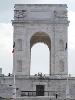
| Asiago  FeatureType : null Elevation : 1010 Lat/Lng : 45.8667 / 11.5167 | Asiago (; Cimbrian: Slege, German: Schlägen) is the name of both a major Italian Protected Designation of Origin (PDO) cheese and a minor township (population roughly 6,500) in the surrounding plateau region (the Altopiano di Asiago or Altopiano dei Sette Comuni, Asiago plateau) in the Province of (...) |
| 2 | 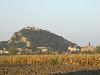
| Monselice FeatureType : null Elevation : 10 Lat/Lng : 45.2333 / 11.75 | "Monselice is the most picturesque town I have seen in Italy. It has an old ruin of a castle upon the hill and thence commands a beautiful and extraordinary view. It lies in the wide plain – a dead level – whereon Ferrara, Bologna, Rovigo, Este, Padua stand and even Venice we could dimly see in the (...) |
| 3 | 
| Orvieto FeatureType : null Elevation : 323 Lat/Lng : 42.7183 / 12.1103 | Orvieto is a city and comune in the Province of Terni, southwestern Umbria, Italy situated on the flat summit of a large butte of volcanic tuff. The city rises dramatically above the almost-vertical faces of tuff cliffs that are completed by defensive walls built of the same stone called Tufa. (...) |
| 4 | 
| Battle of Lepanto FeatureType : landmark Lat/Lng : 38.2 / 21.3 | The Battle of Lepanto was a naval engagement that took place on 7 October 1571 when a fleet of the Holy League, led by the Venetian Republic and the Spanish Empire, inflicted a major defeat on the fleet of the Ottoman Empire in the Gulf of Patras (...) |
| 5 | 
| Cagliari FeatureType : city Elevation : 69 Lat/Lng : 39.2278 / 9.1111 | Cagliari is an Italian municipality and the capital of the island of Sardinia, an autonomous region of Italy. Cagliari's Sardinian name Casteddu literally means castle. It has about 155,000 inhabitants, while its metropolitan city (including Cagliari and 16 other nearby municipalities) has more than (...) |
| 6 | 
| Sardinia FeatureType : isle Elevation : 669 Lat/Lng : 40.0865 / 9.0198 | Sardinia (; , /, Sassarese: Sardhigna, Gallurese: Saldigna, Catalan: Sardenya, Tabarchino: Sardegna) is the second-largest island in the Mediterranean Sea (after Sicily and before Cyprus). It is located west of the Italian Peninsula and to the immediate south of the French island of Corsica (...) |
| 7 | 
| São Paulo FeatureType : null Elevation : 765 Lat/Lng : -23.5477 / -46.6364 | São Paulo is a municipality in the Southeast Region of Brazil. The metropolis is an alpha global city (as listed by the GaWC) and the most populous city in Brazil, the Western Hemisphere and the Southern Hemisphere, besides being the largest Portuguese-speaking city in the world (...) |
| 8 | 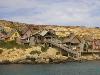
| Malta FeatureType : country Elevation : 96 Lat/Lng : 35.9167 / 14.4333 | Malta , officially known as the Republic of Malta , is a Southern European island country consisting of an archipelago in the Mediterranean Sea. It lies south of Italy, east of Tunisia, and north of Libya. Malta is one of the world's smallest and most densely populated countries, at over with a (...) |
| 9 | 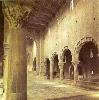
| Tuscania FeatureType : null Elevation : 181 Lat/Lng : 42.4214 / 11.8719 | Tuscania is a town and comune in the province of Viterbo, Lazio Region, Italy. Until the late 19th century the town was known as Toscanella.Catholic Encyclopedia http://www.newadvent.org/cathen/15487a.htm (...) |
| 10 | 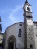
| Breno FeatureType : city Elevation : 326 Lat/Lng : 45.9586 / 10.3056 | Breno (Camunian: ; obsolete) is an Italian comune of 4,986 inhabitants in Val Camonica, province of Brescia, in Lombardy. (...) |
| 11 | 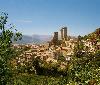
| Pacentro FeatureType : null Elevation : 1275 Lat/Lng : 42.05 / 14.05 | Pacentro is a comune of 1279 inhabitants of the province of L'Aquila in Abruzzo, Italy. It is a well-preserved historic medieval village located in the central part of Italy, several kilometers from the City of Sulmona about east of Rome (...) |
| 12 | Valdastico FeatureType : null Elevation : 570 Lat/Lng : 45.8833 / 11.3667 | Valdastico is a town in the province of Vicenza, Veneto, north-eastern Italy. It is east of SP350 road, on western ridge of the Sette Comuni plateau. (...) | |
| 13 | Rotzo FeatureType : null Elevation : 934 Lat/Lng : 45.8631 / 11.3986 | Rotzo (Cimbrian: Rotz) is a town in the province of Vicenza, Veneto, northern-eastern Italy. It is east of SP350 road, and is part of the Sette Communi plateau. (...) | |
| 14 | 
| San Sebastiano fuori le mura FeatureType : landmark Elevation : 44 Lat/Lng : 41.8556 / 12.5156 | San Sebastiano fuori le mura (Saint Sebastian outside the walls), or San Sebastiano ad Catacumbas (Saint Sebastian at the Catacombs), is a basilica in Rome, central Italy. Up to the Great Jubilee of 2000, San Sebastiano was one of the Seven Pilgrim Churches of Rome, and many pilgrims still favor the (...) |
| 15 | Magasa, Lombardy FeatureType : city Elevation : 960 Lat/Lng : 45.7667 / 10.6167 | Magasa is a town and comune in the province of Brescia, in Lombardy in northern Italy. (...) | |
| 16 | Umbertide FeatureType : null Elevation : 240 Lat/Lng : 43.3 / 12.3333 | Umbertide is a town and comune (township) of Italy, in the province of Perugia and in northwestern Umbria, at the confluence of the Reggia river and the Tiber. It is 30 km (19 mi) North of Perugia and 20 km (12 mi) South of Città di Castello (...) | |
| 17 | Roana FeatureType : null Elevation : 1074 Lat/Lng : 45.8833 / 11.4667 | Roana (Cimbrian: Robàan) is a commune in the province of Vicenza, Veneto, Italy. It is west of SP249 road. The commune consists of six villages or frazioni, spread over a total area of 7,838 hectares: Camporovere, Canove, Cesuna, Mezzaselva, Roana and Tresché Conca (...) | |
| 18 | Foggia FeatureType : null Elevation : 62 Lat/Lng : 41.4667 / 15.5667 | Foggia (; Foggiano:) is a city and comune of Apulia, in southern Italy, capital of the province of Foggia. In 2013 its population was 153,143. Foggia is the main city of a plain called Tavoliere, also known as the "granary of Italy". (...) | |
| 19 | Tyrol FeatureType : null Elevation : 2761 Lat/Lng : 46.916 / 11.206 | Tyrol (;. Random House Webster's Unabridged Dictionary. historically the Tyrole; ;) is a historical region in the Alps; in northern Italy and western Austria. The area was to Habsburg times the former County of Tyrol (...) | |
| 20 | Pisano, Piedmont FeatureType : city Elevation : 429 Lat/Lng : 45.7833 / 8.5 | Pisano is a small town (municipality) in the Province of Novara in the Italian region of Piedmont, located about northeast of Turin and about north of Novara. As of 31 December 2004, it had a population of 816 and an area of .All demographics and other statistics: Italian statistical institute Istat (...) | |
| 21 | Paramus, New Jersey FeatureType : city Elevation : 19 Lat/Lng : 40.94 / -74.0711 | Paramus (with the accent on the second syllableWaggoner, Walter H. , The New York Times, February 16, 1966. Accessed October 16, 2018. "Paramus – pronounced puh-RAHM-us, with the accent on the second syllable – may have taken its name from 'perremus' or 'perymus,' Indian for 'land of the turkey' (...) | |
| 22 | Ranica FeatureType : city Elevation : 306 Lat/Lng : 45.7333 / 9.7167 | Ranica (Bergamasque: or or or ; Medieval) is a comune (municipality) in the Province of Bergamo in the Italian region of Lombardy, located about northeast of Milan and about northeast of Bergamo. As of 31 December 2004, it had a population of 5,984 and an area of (...) | |
| 23 | Roman Catholic Diocese of Padua FeatureType : null Elevation : 12 Lat/Lng : 45.4167 / 11.8667 | The Roman Catholic Diocese of Padua is an episcopal see of the Catholic Church in Veneto, northern Italy. It was erected in the 3rd century and is a suffragan of the Patriarchate of Venice. Catholic-Hierarchy.org. David M. Cheney. Retrieved February 29, 2016 GCatholic.org. Gabriel Chow (...) | |
| 24 | Sette Cama Airport FeatureType : null Elevation : 26 Lat/Lng : -2.533 / 9.767 | Sette Cama Airport is an airstrip serving Sette Cama, in Ogooué-Maritime Province, Gabon. The runway is on a peninsula on the ocean side of the Ndogo Lagoon, southeast of the village. (...) | |
| 25 | Metropolitan City of Cagliari FeatureType : adm2nd Elevation : 4 Lat/Lng : 39.24 / 9.15 | The Metropolitan City of Cagliari is a metropolitan city in Sardinia, Italy. Its capital is the city of Cagliari and includes 17 comuni. It was established by law in 2016 and replaced the Province of Cagliari., Regione.sardegna (...) | |
| 26 | 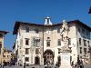
| Knights' Square FeatureType : landmark Elevation : 9 Lat/Lng : 43.7194 / 10.3997 | The Knights’ Square is a landmark in Pisa, Italy, and the second main square of the city. This square was the political centre in medieval Pisa. After the middle of 16th century the square became the headquarters of the Order of the Knights of St. Stephen (...) |
| 27 | Pineto FeatureType : null Lat/Lng : 42.6167 / 14.0667 | Pineto is a town and comune in the province of Teramo, Abruzzo, in central Italy. It is a 20th-century seaside resort on the Adriatic coast, with sandy beaches shaded by pine trees that give their name to the town. (...) | |
| 28 | Malcesine FeatureType : city Elevation : 150 Lat/Lng : 45.7667 / 10.8167 | Malcesine is a comune (municipality) on the eastern shore of Lake Garda in the Province of Verona in the Italian region Veneto, located about northwest of Venice and about northwest of Verona. (...) | |
| 29 | 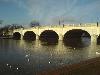
| Kingston Bridge, London FeatureType : landmark Elevation : 9 Lat/Lng : 51.4111 / -0.3089 | Kingston Bridge is a road bridge at Kingston upon Thames in south west London, England, carrying the A308 across the River Thames. It joins the town centre of Kingston in the Royal Borough of Kingston upon Thames, to Hampton Court Park, Bushy Park, and the village of Hampton Wick in the London (...) |
| 30 | Santa Maria dei Sette Dolori, Rome FeatureType : landmark Elevation : 30 Lat/Lng : 41.8897 / 12.4664 | Santa Maria dei Sette Dolori is a Baroque church in Rome built attached to a convent in the rione of Trastevere, located on Via Garibaldi, near the intersection with Via dei Panieri. Construction of the church was begun in 1643 with plans by Francesco Borromini, annexed to an Augustinian nunnery (...) | |
| 31 | Monte Cimone FeatureType : mountain Elevation : 2107 Lat/Lng : 44.1938 / 10.7013 | Monte Cimone is the highest mountain in the northern Apennines, of Italy. (...) | |
| 32 | Valstagna FeatureType : null Elevation : 192 Lat/Lng : 45.8667 / 11.6667 | Valstagna is a town and comune in the province of Vicenza, Veneto, northern Italy, It is connected to the 'frazione' Carpanè of San Nazario by a bridge and it is accessible by SS47 Provincial Road.The biggest towns nearby Valstagna are Bassano del Grappa, Marostica, Asiago, Trento and Venice (...) | |
| 33 | Santa Croce in Gerusalemme FeatureType : landmark Elevation : 56 Lat/Lng : 41.8884 / 12.5155 | The Basilica of the Holy Cross in Jerusalem or Basilica di Santa Croce in Gerusalemme, is a Roman Catholic minor basilica and titular church in rione Esquilino, Rome, Italy. It is one of the Seven Pilgrim Churches of Rome (...) | |
| 34 | Cremenaga FeatureType : city Elevation : 254 Lat/Lng : 45.9903 / 8.8042 | Cremenaga is a comune (municipality) in the Province of Varese in the Italian region Lombardy, located about northwest of Milan and about north of Varese, on the border with Switzerland. As of 31 December 2004, it had a population of 780 and an area of (...) | |
| 35 | Giudicarie FeatureType : adm2nd Elevation : 574 Lat/Lng : 46.03 / 10.73 | Giudicarie (also Val Giudicarie and Valli Giudicarie) is an area of Western Trentino, northern Italy, which includes the upper courses of the rivers Sarca and Chiese. (...) | |
| 36 | Santa Maria del Carmine, Naples FeatureType : landmark Elevation : 8 Lat/Lng : 40.8468 / 14.2676 | Santa Maria del Carmine (Our Lady of Mount Carmel) is a church in Naples, Italy. It is at one end of Piazza Mercato (Market Square), the centre of civic life in Naples for many centuries until it was cut off from the rest of the city by urban renewal in 1900 (...) | |
| 37 | Calverton, Nottinghamshire FeatureType : null Elevation : 54 Lat/Lng : 53.0374 / -1.0834 | Calverton is a village and civil parish, of some , in the Gedling district, about seven miles north-east of Nottingham, Nottinghamshire, England, and situated, like nearby Woodborough and Lambley, on one of the small tributaries of the Dover Beck (...) | |
| 38 | Mount Ortigara FeatureType : mountain Elevation : 2096 Lat/Lng : 46.0072 / 11.5078 | Mount Ortigara (2,105 m, 6,906 ft) is one of the peaks, about 2,000 m (6,000 feet) tall, which delimit to the north the Seven Municipalities Plateau (in Italian: Altipiano dei Sette Comuni), falling sheer on the underlying Sugana Valley with a jump of over 1,500 meters (4,500 feet) (...) | |
| 39 | Catacomb of Callixtus FeatureType : landmark Elevation : 47 Lat/Lng : 41.8589 / 12.5108 | The Catacomb(s) of Callixtus (also known as the Cemetery of Callixtus) is one of the Catacombs of Rome on the Appian Way, most notable for containing the Crypt of the Popes (Italian: Cappella dei Papi), which once contained the tombs of several popes from the 2nd to 4th centuries. (...) | |
| 40 | Minusio FeatureType : null Elevation : 600 Lat/Lng : 46.1867 / 8.8141 | Minusio is a municipality in the district of Locarno in the canton of Ticino in Switzerland. (...) | |
| 41 | Sette Cama FeatureType : null Elevation : 32 Lat/Lng : -2.7167 / 10.0833 | Setté Cama is a village in Gabon, lying on the peninsula between the Ndogo Lagoon and the Atlantic Ocean. In the sixteenth century, it was a major European colonial sea port trading in timber and ivory. Long declined, it is now home to a museum and an airstrip and lies on the edge of the Loango (...) | |
| 42 | Villa St Ignatius FeatureType : null Elevation : 29 Lat/Lng : 35.9137 / 14.4955 | Villa St Ignatius is a historic villa located in the Balluta area of St Julian's, Malta. It was built in the early 19th century for the English merchant John Watson, and it might be the earliest example of Gothic Revival architecture in the country (...) | |
| 43 | Allakh-Yun River FeatureType : landmark Lat/Lng : 61.8403 / 139.967 | The Allakh-Yun is a river in Sakha Republic and Khabarovsk Krai, Russia. It is a right tributary of the Aldan River. (...) | |
| 44 | Museo Nazionale della Magna Grecia FeatureType : landmark Elevation : 23 Lat/Lng : 38.1147 / 15.6511 | The Museo Nazionale della Magna Grecia (National Museum of Magna Græcia), Museo Archeologico Nazionale di Reggio Calabria (National Archaeological Museum of Reggio Calabria) or Palazzo Piacentini is a museum in Reggio Calabria, southern Italy, housing an archaeological collection from sites in Magna (...) | |
| 45 | Santa Maria ad Ogni Bene dei Sette Dolori FeatureType : null Lat/Lng : 40.5042 / 14.1442 | Santa Maria ad Ogni Bene dei Sette Dolori, also known as Santa Maria de Sette Dolori, is a Roman Catholic church in Naples, Italy. It stands on a hill, providing an excellent view of Spaccanapoli, a Decumanus of Naples which ends across via Francesco Girardi (...) | |
| 46 | Laocoön and His Sons FeatureType : null Elevation : 33 Lat/Lng : 41.9042 / 12.4547 | The statue of Laocoön and His Sons, also called the Laocoön Group , has been one of the most famous ancient sculptures ever since it was excavated in Rome in 1506 and placed on public display in the Vatican,Beard, 209 where it remains (...) | |
| 47 | Santa Caterina, Palermo FeatureType : landmark Elevation : 28 Lat/Lng : 38.1156 / 13.3626 | The Church of Saint Catherine (Italian: Chiesa di Santa Caterina or simply Santa Caterina) is a church in Palermo, Sicily, southern Italy. It is located in the heart of the historic centre, between Piazza Bellini and Piazza Pretoria, in the same area of other well-known architectural landmarks like (...) | |
| 48 | Villa of the Quintilii FeatureType : landmark Elevation : 71 Lat/Lng : 41.8305 / 12.5514 | The Villa of the Quintilii (Italian: Villa dei Quintili) is an ancient Roman villa beyond the fifth milestone along the Via Appia Antica just outside the traditional boundaries of Rome,The villa lies in the Parco Regionale dell'Appia Antica. Italy (...) | |
| 49 | Baths of Trajan FeatureType : landmark Elevation : 49 Lat/Lng : 41.8919 / 12.4963 | The Baths of Trajan were a massive thermae, a bathing and leisure complex, built in ancient Rome starting from 104 AD and dedicated during the Kalends of July in 109. Commissioned by Emperor Trajan, the complex of baths occupied space on the southern side of the Oppian Hill on the outskirts of what (...) | |
| 50 | Ndogo Lagoon FeatureType : waterbody Elevation : 21 Lat/Lng : -2.6 / 10.035 | The Ndogo Lagoon is located in the southwestern part of Gabon. Sette Cama and Gamba are two known places that lie on its banks. The Ndogo Lagoon has probably the largest density of island in the world. There are about 350 of them (...) | |
| 51 | Santo Stefano, Bologna FeatureType : landmark Elevation : 69 Lat/Lng : 44.4922 / 11.3488 | The basilica of Santo Stefano encompasses a complex of religious edifices in the city of Bologna, Italy. Located on Piazza Santo Stefano, it is locally known as Sette Chiese ("Seven Churches") and Santa Gerusalemme'Bologna: Le nuove guide Oro, page 166, Touring Club Italiano, Touring Editore, 2004, (...) | |
| 52 | Marywood University FeatureType : edu Elevation : 287 Lat/Lng : 41.4337 / -75.6342 | Marywood University is a co-educational, Catholic liberal arts university located on a campus in Scranton, Pennsylvania, United States, within the Diocese of Scranton. Established in 1915 by the Sisters, Servants of the Immaculate Heart of Mary, Marywood currently enrolls more than 3,400 students in (...) | |
| 53 | Via D'Amelio bombing FeatureType : event Elevation : 37 Lat/Lng : 38.1431 / 13.3547 | The via D'Amelio bombing was an attack by the Sicilian Mafia which took place in Palermo, Sicily, on 19 July 1992. It killed anti-mafia magistrate Paolo Borsellino and five members of his police escort: Agostino Catalano, Emanuela Loi (the first Italian female member of a police escort and the first (...) | |
| 54 | Appian Way Regional Park FeatureType : landmark Elevation : 75 Lat/Lng : 41.8425 / 12.5285 | The Appian Way Regional Park is a protected area of around 3400 hectares, established by the Italian region of Latium. It falls primarily within the territory of Rome but parts also extend into the neighbouring towns of Ciampino and Marino. (...) | |
| 55 | Gamba, Gabon FeatureType : null Elevation : 16 Lat/Lng : -2.725 / 10.0167 | Gamba is a small town in Gabon lying on the southern bay of the Ndogo Lagoon. Historically, the area was populated by gatherer-hunter-fishermen autochthons scattered in small villages around the Ndogo Lagoon and the Yenzi Lake (...) | |
| 56 | Faiano FeatureType : city Elevation : 151 Lat/Lng : 40.6626 / 14.9011 | Faiano is an Italian town and hamlet (frazione) of the municipality of Pontecagnano Faiano in the province of Salerno, Campania region. Along with the main town of Pontecagnano it is de jure the secondary seat of its municipality. (...) | |
| 57 | Foggia Cathedral FeatureType : landmark Elevation : 82 Lat/Lng : 41.4635 / 15.5439 | Foggia Cathedral (Cattedrale della Santa Maria Assunta in Coelo or della Santa Maria in Fovea;), otherwise the Church of the Assumption of the Virgin Mary or Church of Saint Mary of Foggia (or Chiesa della Santa Maria di Foggia), is a Roman Catholic cathedral in the city of Foggia, Italy, dedicated (...) | |
| 58 | Villa of the sette bassi FeatureType : null Elevation : 62 Lat/Lng : 41.8437 / 12.5765 | The Villa dei Sette Bassi (also Villa Via Tuscolana) is an archaeological site located in Rome, Italy. The site is located at the fifth mile of Via Tuscolana to the southeast of Rome and forms part of the Appian Way Regional Park (...) | |
| 59 | Sassari Mechanized Brigade FeatureType : null Elevation : 218 Lat/Lng : 40.7333 / 8.5667 | The Sassari Mechanized Brigade is a mechanized infantry brigade of the Italian Army, based on the island of Sardinia. Its core is two infantry regiments which distinguished themselves in combat during World War I (...) | |
| 60 | Outline of Rome FeatureType : null Elevation : 76 Lat/Lng : 41.9 / 12.5 | The following outline is provided as an overview of and topical guide to Rome: Rome – capital of Italy and a special comune (named Comune di Roma Capitale). Rome also serves as the capital of the Lazio region. With 2,876,076 residents in 1,285 km2 (496 (...) | |
| 61 | Crown Colony of Malta FeatureType : null Elevation : 56 Lat/Lng : 35.8978 / 14.5125 | The Crown Colony of the Island of Malta and its Dependencies (commonly known as the Crown Colony of Malta) was a British colony in the present-day Republic of Malta. It was established when the Malta Protectorate was transformed into a British Crown colony in 1813, and this was confirmed by the (...) | |
| 62 | Cima Dodici FeatureType : mountain Elevation : 2312 Lat/Lng : 45.9977 / 11.4682 | Cima Dodici (Italian for "peak 12", in Cimbrian language Freyjoch) is a mountain on the border of Vicenza in Veneto and Trentino in Trentino Alto Adige, northern Italy, south of the village of Borgo Valsugana. It has an elevation of 2,336 metres. and is the highest peak in Vicenza (...) | |
| 63 | Torra di l'Isuledda FeatureType : landmark Elevation : 54 Lat/Lng : 41.8444 / 8.7547 | The Tower of Isuledda is a Genoese tower located in the commune of Pietrosella (Corse-du-Sud) on the Corsica. The tower sits at an elevation of 68 m on a promontory, the Punta di Sette Nave, which forms the southern limit of the Gulf of Ajaccio. The tower was built in around 1597 (...) | |
| 64 | Raid on Alexandria (1941) FeatureType : landmark Lat/Lng : 31.1788 / 29.8625 | The Raid on Alexandria was carried out on 19 December 1941 by Italian Navy divers of the Decima Flottiglia MAS, who attacked and disabled two Royal Navy battleships in the harbour of Alexandria, Egypt, using manned torpedoes. (...) | |
| 65 | Poggio Reale (villa) FeatureType : null Elevation : 56 Lat/Lng : 40.87 / 14.2924 | The Poggio Reale villa or Villa Poggio Reale was an Italian Renaissance villa commissioned in 1487 by Alfonso II of Naples as a royal summer residence. The Italian phrase "poggio reale" translates to "royal hill" in English (...) | |
| 66 | Aqua Traiana FeatureType : landmark Elevation : 76 Lat/Lng : 41.8886 / 12.4641 | The Aqua Traiana (later rebuilt and named the Acqua Paola) was a 1st-century Roman aqueduct built by Emperor Trajan and inaugurated on 24 June 109 AD. It channelled water from sources around Lake Bracciano, 40 kilometers (25 mi) north-west of Rome, to Rome in ancient Roman times but had fallen into (...) | |
| 67 | Porticus of Livia FeatureType : landmark Elevation : 51 Lat/Lng : 41.8936 / 12.4958 | The Portico of Livia (Latin: porticus Liviae) was a portico in Regio III Isis et Serapis of ancient Rome. It was built by Augustus in honour of his wife Livia Drusilla and is located on the Esquiline Hill. Although little of its structure survives now, it was one of the most prominent porticos in (...) | |
| 68 | Basilica San Paolo (Rome Metro) FeatureType : railwaystation Elevation : 16 Lat/Lng : 41.8561 / 12.4776 | Basilica San Paolo is a station on the Line B of the Rome Metro. It was opened in 1955 and is located at the intersection between Viale Giustiniano Imperatore and Via Gaspare Gozzi, behind the Basilica of Saint Paul Outside the Walls (after which it is named) in the Ostiense quarter (...) | |
| 69 | Via Cassia FeatureType : null Elevation : 160 Lat/Lng : 41.9965 / 12.39 | The Via Cassia was an important Roman road striking out of the Via Flaminia near the Milvian Bridge in the immediate vicinity of Rome and, passing not far from Veii, traversed Etruria. The Via Cassia passed through Baccanae, Sutrium, Volsinii, Clusium, Arretium, Florentia, Pistoria, and Luca, (...) | |
| 70 | Fairfield University School of Engineering FeatureType : landmark Elevation : 99 Lat/Lng : 41.1815 / -73.2903 | The Fairfield University School of Engineering is a graduate and undergraduate engineering school and one of the professional schools of Fairfield University located in Fairfield, Connecticut. The school offers fully accredited graduate and undergraduate programs, according to the Accreditation (...) | |
| 71 | Clyman (town), Wisconsin FeatureType : city Elevation : 1757 Lat/Lng : 43.3278 / 88.7092 | Clyman is a town in Dodge County, Wisconsin, United States. The population was 849 at the 2000 census. The Village of Clyman is located within the town. The unincorporated community of Clyman Junction is also located in the town. (...) | |
| 72 | Capo di Bove FeatureType : null Elevation : 71 Lat/Lng : 41.8484 / 12.524 | Capo di Bove is an archeological site on the Appian Way on the outskirts of Rome, Italy. It contains the thermal baths of a vast property owned in the 2nd century AD by Herodes Atticus and his wife Annia Regilla. Formerly privately owned, the property at No (...) | |
| 73 | Sant'Agnello Maggiore FeatureType : landmark Elevation : 64 Lat/Lng : 40.8533 / 14.2526 | Sant'Agnello Maggiore, also called Sant'Aniello a Caponapoli or Santa Maria Intercede, is a church in the historical center of Naples, Italy. According to tradition, Agnello of Naples, now co-patron (compatrono) of the city of Naples, is buried in this church (...) | |
| 74 | Cross Seamount FeatureType : null Lat/Lng : 18.7044 / -158.2661 | Cross Seamount is a seamount far southwest of the Hawaii archipelago, about equidistant from the cities of Honolulu and Kona. It is one of the numerous seamounts surrounding Hawaii, although unrelated to the Hawaiian hotspot (...) | |
| 75 | Villa Duodo FeatureType : null Elevation : 68 Lat/Lng : 45.2409 / 11.7579 | Villa Duodo, also known as the Villa Valier, is a villa situated at Monselice near Padua in the Veneto, northern Italy. It is attributed to the architect Vincenzo Scamozzi although some later parts are known to have been designed by Andrea Tirali.dal Lago (...) | |
| 76 | Sleaford Castle FeatureType : landmark Elevation : 16 Lat/Lng : 52.9967 / -0.4152 | Sleaford Castle is a medieval castle in Sleaford, Lincolnshire, England. Built by the Bishop of Lincoln in the early 1120s, it was habitable as late as 1555 but fell into disrepair during the latter half of the 16th century (...) | |
| 77 | Seven Sisters FeatureType : null Elevation : 166 Lat/Lng : 51.7667 / -3.7167 | Seven Sisters may refer to: * Pleiades, or Seven Sisters, a star cluster named for mythological characters (...) | |
| 78 | Santa Maria a Scò FeatureType : null Elevation : 345 Lat/Lng : 43.6453 / 11.5479 | Santa Maria a Scò is a romanesque-style, Roman Catholic parish church located on the strada dei Sette Ponti, in the town of Castelfranco Piandiscò, in the Valdarno of the region of Tuscany, Italy. (...) | |
| 79 | Hastings Gardens FeatureType : null Elevation : 57 Lat/Lng : 35.8972 / 14.5083 | Hastings Gardens is a public garden in Valletta, Malta. It is located on top of St. John's Bastion and St. Michael's Bastion, on the west side of the City Gate. The garden offers views of Floriana, Msida, Sliema, and Manoel Island (...) | |
| 80 | Dendreon FeatureType : null Elevation : 50 Lat/Lng : 47.6079 / -122.3385 | Dendreon is a biotechnology company. Its lead product, Provenge (known generically as sipuleucel-T), is an immunotherapy for prostate cancer. It consists of a mixture of the patient's own blood cells (autologous, with dendritic cells thought to be the most important) that have been incubated with (...) | |
| 81 | Porta Caelimontana FeatureType : null Elevation : 47 Lat/Lng : 41.8856 / 12.4952 | The Porta Caelimontana or Celimontana was a gate in the Servian Wall on the rise of the Caelian Hill (Caelius Mons).Lawrence Richardson, A New Topographical Dictionary of Ancient Rome (Johns Hopkins University Press, 1992), pp (...) | |
| 82 | Salmagi FeatureType : null Elevation : 12 Lat/Lng : 39.1962 / 9.3364 | Salmagi is a small townland within the hinterland of the commune of Quartu Sant'Elena in Sardinia, Italy. Salmagi is currently a residential area, while high in the mountains, goats are managed by a shepherd. (...) | |
| 83 | Piazza Santo Stefano FeatureType : landmark Elevation : 72 Lat/Lng : 44.4922 / 11.3482 | Piazza Santo Stefano also known as Piazza delle Sette Chiese (Seven churches square) is a piazza of Bologna, Italy. It is a pedestrian zone, in a triangular space near the beginning of Via Santo Stefano, both of which are named after the Basilica of Santo Stefano which is located on the piazza (...) | |
| 84 | The Seven Halls FeatureType : null Elevation : 54 Lat/Lng : 41.8934 / 12.4965 | The Seven Halls, or Sette Sale, is the name of the complex of cisterns located on the Oppian Hill, Rome. (...) | |
| 85 | Sant'Elena, Venice FeatureType : null Elevation : 2 Lat/Lng : 45.4273 / 12.3656 | Sant'Elena, also sometimes called Santa Lena, is a Gothic-style, Roman Catholic church at the extreme east end of the sestiere of Castello in the City of Venice, Italy. (...) | |
| 86 | Santa Maria delle Grazie a Toledo FeatureType : null Elevation : 46 Lat/Lng : 40.8427 / 14.2488 | Santa Maria delle Grazie is a Roman Catholic church located on Via Toledo, near its intersection with Via Diaz Armando, in central Naples, Italy. (...) | |
| 87 | Santissima Trinità delle Monache FeatureType : null Elevation : 78 Lat/Lng : 40.8455 / 14.2451 | Santissima Trinità delle Monache is a large former monastery and church in central Naples, Italy; it now serves as a military hospital. It is located in the Spanish Quarter of the city. (...) | |
| 88 | The Club of Odd Volumes FeatureType : null Elevation : 44 Lat/Lng : 42.3585 / -71.0671 | The Club of Odd Volumes is a private social club and society of bibliophiles founded in 1887, in Boston, Massachusetts, USA. (...) | |
| 89 | Giants' grave of Sa Dom'è s'Orcu (Quartucciu) FeatureType : landmark Elevation : 340 Lat/Lng : 39.2575 / 9.3597 | The giants' grave of Is Concias (also called Sa Dom'è s'Orcu) is an archaeological site of Quartucciu, municipality of the metropolitan City of Cagliari. Located on the western slope of the Sette Fratelli mountains, the tomb, dated to the middle and late Bronze Age, has, like most other tombs of the (...) | |
| 90 | Forum Music Village FeatureType : null Elevation : 40 Lat/Lng : 41.9274 / 12.4811 | Forum Music Village (previously called Ortophonic recording studio) is a recording studio located in Rome, Italy underneath the Sacro Cuore di Maria. It was founded by Ennio Morricone, Armando Trovajoli, Luis Bacalov and Piero Piccioni with the studio manager and producer Enrico De Melis in 1969 (...) | |
| 91 | Mougambi FeatureType : city Elevation : 356 Lat/Lng : -2.1333 / 11.5 | Mougambi is a small village on an island located on the Ndogo Lagoon in Gabon, between the town of Gamba and the village Sette Cama.The closest village to Mougambi is Pitonga. | |
 by
by