| 2018 records found in wikipedia | |||
| 1 | Sarab-e Sar Firuzabad  FeatureType : null Elevation : 1639 Lat/Lng : 34.06 / 47.2792 | Sarab-e Sar Firuzabad (also Romanized as Sarāb-e Sar Fīrūzābād; also known as Sarāb, Sarāb-e Fīrūzābād, Sarāb-e Soflá, Sar-e Fīrūzābād, and Sar-i-Āb-i-Fīrūzābād) is a village in Sar Firuzabad Rural District, Firuzabad District, Kermanshah County, Kermanshah Province, Iran (...) | |
| 2 | 
| Gostivar FeatureType : city Elevation : 535 Lat/Lng : 41.7959 / 20.9083 | Gostivar , is a city in the Republic of Macedonia, located in the upper Polog valley region. It is one of the largest municipalities in the country with a population of 81,042, and the town also covers . Gostivar has road and railway connections with the other cities in the region, such as Tetovo, (...) |
| 3 | 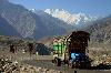
| Karakoram FeatureType : mountain Elevation : 8235 Lat/Lng : 35.8833 / 76.5167 | The Karakoram, or Karakorum is a large mountain range spanning the borders of Pakistan, India, and China, with the northwest extremity of the range extending to Afghanistan and Tajikistan. It begins in the Wakhan Corridor (Afghanistan) in the west and encompasses the majority of Gilgit–Baltistan (...) |
| 4 | 
| Ramsar, Mazandaran FeatureType : city Elevation : -19 Lat/Lng : 36.9169 / 50.6736 | Ramsar (also Romanized as Rāmsar and Rānsar; formerly, Sakht Sar) is the capital of Ramsar County, Mazandaran Province, Iran. In 2012 its population was 33,018, in 9,421 families. Ramsar lies on the coast of the Caspian Sea. It was also known as Sakhtsar in the past (...) |
| 5 | 
| Macau FeatureType : city Elevation : 29 Lat/Lng : 22.1986 / 113.5447 | Macau or Macao , officially the Macao Special Administrative Region of the People's Republic of China, is an autonomous territory on the western side of the Pearl River estuary in East Asia. Along with Hong Kong, Guangzhou, Shenzhen, Zhuhai, and several other major cities in Guangdong, the territory (...) |
| 6 | 
| Vlieland FeatureType : null Elevation : 0 Lat/Lng : 53.2467 / 4.96 | Vlieland is a municipality and island in the northern Netherlands. The municipality of Vlieland has one major town, Oost-Vlieland (West Frisian: East-Flylân). It is the second most sparsely populated municipality in the Netherlands, after Schiermonnikoog (...) |
| 7 | 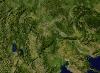
| Republic of Macedonia FeatureType : country Elevation : 243 Lat/Lng : 41.9969 / 21.4331 | Macedonia , officially the Republic of Macedonia , is a country in the Balkan peninsula in Southeast Europe. It is one of the successor states of the former Yugoslavia, from which it declared independence in 1991 (...) |
| 8 | 
| Srinagar FeatureType : city Elevation : 1585 Lat/Lng : 34.09 / 74.79 | Srinagar is the largest city and the summer capital of the Indian state of Jammu and Kashmir. It lies in the Kashmir Valley on the banks of the Jhelum River, a tributary of the Indus, and Dal and Anchar lakes. The city is known for its natural environment, gardens, waterfronts and houseboats (...) |
| 9 | 
| Gyöngyös FeatureType : city Elevation : 155 Lat/Lng : 47.775 / 19.9281 | Gyöngyös is a town in Heves county in Hungary, east of Budapest. Situated at the foot of the Sár-hegy and Mátra mountains, it is the home of numerous food production plants, including milk production and sausage factories. It is also the home of many vineyards on the slopes of the Sárhegy (...) |
| 10 | 
| Stanford University FeatureType : edu Elevation : 27 Lat/Lng : 37.43 / -122.17 | Stanford University (officially Leland Stanford Junior University, colloquially "the Farm") is a private research university in Stanford, California. Stanford is known for its academic strength, wealth, proximity to Silicon Valley, and ranking as one of the world's top universities (...) |
| 11 | 
| Kermanshah FeatureType : null Elevation : 1350 Lat/Lng : 34.3239 / 47.0733 | Kermanshah (Kirmashan; also known as Bākhtarān or Kermānshāhān), the capital of Kermanshah Province, is located from Tehran in the western part of Iran. According to the 2011 census, its population is 851,405. A majority of the population speaks Southern Kurdish (...) |
| 12 | 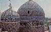
| Ardabil FeatureType : null Elevation : 1353 Lat/Lng : 38.2461 / 48.295 | Ardabil (also Romanized as Ardabīl and Ardebīl) is an ancient city in Iranian Azerbaijan. Ardabil is the capital of Ardabil Province. At the 2011 census, its population was 564,365, in 156,324 families, where the dominant majority are ethnic Iranian Azerbaijanis and the primary language of the (...) |
| 13 | 
| Lorestan Province FeatureType : adm1st Elevation : 1186 Lat/Lng : 33.4871 / 48.3538 | Lorestan Province (also written Luristan, Lurestan, or Loristan), is a province of western Iran in the Zagros Mountains. The population of Lorestan was estimated at 1,716,527 people in 2006. In 2014 it was placed in Region 4. Lorestan covers an area of 28,392 km2 (...) |
| 14 | 
| Zhuhai FeatureType : adm2nd Elevation : 97 Lat/Lng : 22.2667 / 113.5667 | Zhuhai (; Yale: Jyūhói; literally: "Pearl Sea") is a prefecture-level city on the southern coast of Guangdong province in China. Located in the Pearl River Delta, Zhuhai borders Jiangmen to the northwest, Zhongshan to the north, and Macau to the south (...) |
| 15 | 
| Whitehorse, Yukon FeatureType : null Lat/Lng : 60.7202 / -135.0522 | Whitehorse is the capital and only city of Yukon, and the largest city in northern Canada. It was incorporated in 1950 and is located at kilometre 1426 on the Alaska Highway in southern Yukon. Whitehorse's downtown and Riverdale areas occupy both shores of the Yukon River, which originates in (...) |
| 16 | 
| Kwajalein Atoll FeatureType : null Lat/Lng : 8.7353 / 167.7239 | Kwajalein Atoll (; Marshallese:) is part of the Republic of the Marshall Islands (RMI). The southernmost and largest island in the atoll is named Kwajalein Island, which its majority English-speaking residents (about 1,000 mostly U.S. civilian personnel) often called by the shortened name, Kwaj (...) |
| 17 | 
| Penang FeatureType : isle Elevation : 483 Lat/Lng : 5.4 / 100.2333 | Penang is a Malaysian state located on the northwest coast of Peninsular Malaysia, by the Malacca Strait. It has two parts: Penang Island, where the capital city, George Town, is located, and Seberang Perai (formerly Province Wellesley) on the Malay Peninsula (...) |
| 18 | 
| Coquitlam FeatureType : null Elevation : 39 Lat/Lng : 49.2846 / -122.7822 | Coquitlam is a city in the Lower Mainland of British Columbia, Canada. Coquitlam, mainly a suburban city, is the sixth-largest city in the province with a population of 139,284 in 2016. and one of the 21 municipalities comprising Metro Vancouver. The current mayor of Coquitlam is Richard Stewart (...) |
| 19 | 
| M'zab FeatureType : landmark Elevation : 489 Lat/Lng : 32.4833 / 3.6833 | The M'zab or Mzab, (Mozabite Aghlan), is a natural region of the northern Sahara Desert in Ghardaïa Province, Algeria. It is located south of Algiers and there are approximately 360,000 inhabitants (2005 estimate).http://lexicorient.com/e.o/mzab.htmhttp://www.globosapiens (...) |
| 20 | 
| Prizren FeatureType : null Elevation : 413 Lat/Lng : 42.2139 / 20.7397 | Prizren is a city and municipality located in the Prizren District of Kosovo. According to the 2011 census, the city of Prizren has 85,119 inhabitants, while the municipality has 177,781 inhabitants. Prizren is a historic city located on the banks of the Prizren Bistrica river, and on the slopes of (...) |
| 21 | 
| Santiago de Compostela FeatureType : null Elevation : 203 Lat/Lng : 42.8667 / -8.55 | Santiago de Compostela is the capital of the autonomous community of Galicia, in northwestern Spain. The city has its origin in the shrine of Saint James the Great, now the Cathedral of Santiago de Compostela, as the destination of the Way of St (...) |
| 22 | 
| Sassari FeatureType : city Elevation : 158 Lat/Lng : 40.7333 / 8.55 | Sassari (listen; ;) is an Italian city and the second-largest of Sardinia in terms of population with 127,525 inhabitants, and a Functional Urban Area of about 222,000 inhabitants.http://appsso.eurostat.ec.europa.eu/nui/show (...) |
| 23 | 
| Louisville, Kentucky FeatureType : null Elevation : 144 Lat/Lng : 38.2253 / -85.7417 | Louisville is the largest city in the Commonwealth of Kentucky and the 29th most-populous city in the United States. It is one of two cities in Kentucky designated as first-class, the other being Lexington, the state's second-largest city (...) |
| 24 | 
| Skopje FeatureType : city Elevation : 243 Lat/Lng : 41.9966 / 21.4324 | Skopje is the capital and largest city of the Republic of Macedonia. It is the country's political, cultural, economic, and academic center. It was known in the Greek and Roman period under the name Scupi. The territory of Skopje has been inhabited since at least 4000 BC; remains of Neolithic (...) |
| 25 | 
| Hong Kong International Airport FeatureType : airport Elevation : 3 Lat/Lng : 22.3089 / 113.9144 | Hong Kong International Airport is the commercial airport serving Hong Kong, built on reclaimed land on the island of Chek Lap Kok. The airport is also colloquially known as Chek Lap Kok Airport . The airport has been in commercial operation since 1998, replacing Kai Tak Airport (...) |
| 26 | 
| Salisbury FeatureType : null Elevation : 55 Lat/Lng : 51.0741 / -1.7937 | Salisbury is a cathedral city in Wiltshire, England, with a population of 40,302, at the confluence of the rivers Avon, Nadder, Ebble, Wylye and Bourne. The city is approximately from Southampton and from Bath. Salisbury is in the southeast of Wiltshire, near the edge of Salisbury Plain (...) |
| 27 | 
| Babylon FeatureType : city Elevation : 33 Lat/Lng : 32.5364 / 44.4208 | Babylon was a key kingdom in ancient Mesopotamia from the 18th to 6th centuries BC. The city was built on the Euphrates river and divided in equal parts along its left and right banks, with steep embankments to contain the river's seasonal floods (...) |
| 28 | 
| Lublin FeatureType : null Elevation : 168 Lat/Lng : 51.2333 / 22.5667 | Lublin is the ninth largest city in Poland and the second largest city of Lesser Poland. It is the capital and the center of Lublin Voivodeship (province) with a population of 349,103 (March 2011). Lublin is the largest Polish city east of the Vistula River and is approximately to the southeast of (...) |
| 29 | 
| Qom FeatureType : city Elevation : 931 Lat/Lng : 34.6439 / 50.8783 | Qom is the seventh metropolis amar.org.ir Retrieved 19 Oct 2018 and also the seventh largest city in Iran. worldatlas.com Retrieved 21 Oct 2018 Qom is the capital of Qom Province; and its distance to the south of Tehran is 140 km. yjc (...) |
| 30 | 
| Kabul FeatureType : null Elevation : 1817 Lat/Lng : 34.517 / 69.133 | Kabul is the capital of Afghanistan and its largest city, located in the eastern section of the country. It is also a municipality, forming part of the greater Kabul Province. According to estimates in 2015, the population of Kabul is 4.635 million, which includes all the major ethnic groups (...) |
| 31 | 
| Hong Kong FeatureType : adm1st Elevation : 1 Lat/Lng : 22.2806 / 114.1653 | Hong Kong , officially the Hong Kong Special Administrative Region of the People's Republic of China, is a special administrative region on the eastern side of the Pearl River estuary in southern China. With over 7 (...) |
| 32 | 
| Shenzhen FeatureType : city Elevation : 14 Lat/Lng : 22.55 / 114.1 | Shenzhen is a major city in Guangdong Province, China; it forms part of the Pearl River Delta megalopolis north of Hong Kong. It holds sub-provincial administrative status, with powers slightly less than a province (...) |
| 33 | 
| Council Bluffs, Iowa FeatureType : null Elevation : 299 Lat/Lng : 41.2536 / -95.8628 | Council Bluffs is a city in and the county seat of Pottawattamie County, Iowa, United States. , Pottawattamie County, 2007. Accessed 2007-09-05. The city is the most populous in Southwest Iowa, and a principal city in the Omaha–Council Bluffs metropolitan area (...) |
| 34 | 
| Los Angeles International Airport FeatureType : airport Elevation : 40 Lat/Lng : 33.9427 / -118.4081 | Los Angeles International Airport is the primary international airport serving Los Angeles, California. The airport is most often referred to by its IATA airport code (and FAA LID) LAX, with the letters pronounced individually (...) |
| 35 | 
| Nile FeatureType : landmark Elevation : 2406 Lat/Lng : -2.2822 / 29.3312 | The Nile is a major north-flowing river in northeastern Africa, and is commonly regarded as the longest river in the world, though some sources cite the Amazon River as the longest. The Nile, which is 6,853 km (4,258 miles) long, is an "international" river as its drainage basin covers eleven (...) |
| 36 | 
| Omaha, Nebraska FeatureType : null Elevation : 351 Lat/Lng : 41.2667 / -96.0167 | Omaha is the largest city in the state of Nebraska and the county seat of Douglas County. Omaha is located in the Midwestern United States on the Missouri River, about north of the mouth of the Platte River. Omaha is the anchor of the Omaha-Council Bluffs metropolitan area, which includes Council (...) |
| 37 | 
| Afghanistan FeatureType : country Elevation : 1817 Lat/Lng : 34.5167 / 69.1333 | Afghanistan (; Pashto/Dari: , Pashto: Afġānistān ,The phoneme ف occurs only in loanwords in Pashto, it tends to be replaced with پ. is also an allophone of before voiced consonants; is an allophone of before voiced consonants in loanwords (...) |
| 38 | 
| Austria FeatureType : country Elevation : 214 Lat/Lng : 48.2 / 16.35 | Austria , officially the Republic of Austria (listen), is a country of nearly 9 million people in Central Europe. It is bordered by the Czech Republic and Germany to the north, Hungary and Slovakia to the east, Slovenia and Italy to the south, and Switzerland and Liechtenstein to the west (...) |
| 39 | 
| Leitha FeatureType : river Elevation : 302 Lat/Lng : 47.7367 / 16.2303 | The Leitha (; Hungarian: , , formerly ; Czech and Slovak: Litava) is a river in Austria and Hungary, a right tributary of the Danube. It is 120.8 km long (168.5 km including its source river Schwarza). (...) |
| 40 | 
| Malta FeatureType : country Elevation : 96 Lat/Lng : 35.9167 / 14.4333 | Malta , officially known as the Republic of Malta , is a Southern European island country consisting of an archipelago in the Mediterranean Sea. It lies south of Italy, east of Tunisia, and north of Libya. Malta is one of the world's smallest and most densely populated countries, at over with a (...) |
| 41 | 
| Padrón FeatureType : null Elevation : 311 Lat/Lng : 42.7613 / -8.6313 | Padrón is a concello (Galician for municipality) in the Province of A Coruña, in Galicia (Spain) within the comarca of O Sar. It covers an area of 48.4 km², is 95 km from A Coruña and 23km from Santiago de Compostela. , had a population of 8968 according to the INE (...) |
| 42 | 
| Glasgow Prestwick Airport FeatureType : null Elevation : 10 Lat/Lng : 55.5057 / -4.5911 | Glasgow Prestwick Airport (IATA: PIK, ICAO: EGPK) (also known as Prestwick Airport) is an international airport serving the west of Scotland, situated northeast of the town of Prestwick in South Ayrshire and from the city centre of Glasgow (...) |
| 43 | 
| Legislative Council of Hong Kong FeatureType : null Elevation : 8 Lat/Lng : 22.2811 / 114.1661 | The Legislative Council of the Hong Kong Special Administrative Region (; LegCo) is the unicameral parliamentary legislature of the Hong Kong Special Administrative Region of the People's Republic of China. The legislature is a semi-democratically elected body comprising 70 members, 35 of whom are (...) |
| 44 | 
| Korab (mountain) FeatureType : mountain Elevation : 2713 Lat/Lng : 41.7906 / 20.5467 | Mount Korab (; , Golem Korab) is the highest peak of the eponymous fourth highest mountain in the entire Balkan Peninsula, standing at . The summit of the Korab mountain range in the Albanian-Macedonian border, Korab is the highest peak of Albania and the Republic of Macedonia and also one of only (...) |
| 45 | Šar Mountains FeatureType : null Elevation : 2070 Lat/Lng : 41.877 / 20.595 | The Šar Mountains (Macedonian and , Šar planina) or Sharr Mountains , form a mountain range in the Balkans that extends from Kosovo and the northwest of the Republic of Macedonia, to northeastern Albania. The mountain is colloquially called Šara and forms part of a national park in Kosovo (...) | |
| 46 | 
| Balkan Mountains FeatureType : mountain Elevation : 2375 Lat/Lng : 42.7167 / 24.9178 | The Balkan mountain range (Bulgarian and , Serbian Latin: Stara planina, "Old Mountain"; ;) is a mountain range in the eastern part of the Balkan Peninsula. The Balkan range runs 560 km from the Vrashka Chuka Peak on the border between Bulgaria and Serbia eastward through central Bulgaria to Cape (...) |
| 47 | 
| John Wayne Airport FeatureType : airport Elevation : 23 Lat/Lng : 33.6756 / -117.8684 | John Wayne Airport is an international airport in Orange County, California, United States, with its mailing address in the city of Santa Ana, hence the IATA airport code. The entrance to the airport is off MacArthur Blvd in Irvine, the city that borders the airport on the north and east (...) |
| 48 | 
| Nishapur FeatureType : null Elevation : 1199 Lat/Lng : 36.2133 / 58.7958 | Nishapur or Nishabur (; , also Romanized as Nīshāpūr, Nišâpur, Nişapur, Nīshābūr, Neyshābūr, and Neeshapoor, from Middle Persian: New-Shabuhr, meaning "New City of Shapur", "Fair Shapur",Honigmann, E.; Bosworth, C.E.. "." Encyclopaedia of Islam, Second Edition. Edited by: P. Bearman, Th. Bianquis, C (...) |
| 49 | 
| Bank for International Settlements FeatureType : landmark Elevation : 279 Lat/Lng : 47.5481 / 7.5919 | The Bank for International Settlements (BIS) is an international financial institution owned by central banks which "fosters international monetary and financial cooperation and serves as a bank for central banks" (...) |
| 50 | Sar Chah-e Shur FeatureType : null Elevation : 1236 Lat/Lng : 32.2165 / 58.9054 | Sar Chah-e Shur (also Romanized as Sar Chāh-e Shūr, Sar Chah Shoor, Sar Chāh Shūr, and Sar-e Chāh Shūr) is a village in Qaleh Zari Rural District, Jolgeh-e Mazhan District, Khusf County, South Khorasan Province, Iran. At the 2006 census, its population was 105, in 27 families. (...) | |
| 51 | Rezvanshahr County FeatureType : null Elevation : 551 Lat/Lng : 37.5333 / 48.95 | Rezvanshahr County (or Hashtpar: هشتپر)is a county in Gilan Province in Iran. The capital of the county is Rezvanshahr. At the 2006 census, the county's population was 64,193, in 16,518 families. The county is subdivided into two districts: the Central District and Pareh Sar District (...) | |
| 52 | 
| Burra, South Australia FeatureType : null Elevation : 472 Lat/Lng : -33.6717 / 138.9284 | Burra is a pastoral centre and historic tourist town in the mid-north of South Australia. It lies east of the Clare Valley in the Bald Hills range, part of the northern Mount Lofty Ranges, and on Burra Creek. The town began as a single company mining township that, by 1851, was a set of townships (...) |
| 53 | Pareh Sar FeatureType : null Elevation : 22 Lat/Lng : 37.6004 / 49.0713 | Pareh Sar (also known as Bāzār Pareh Sar) is a city and capital of Pareh Sar District, in Rezvanshahr County, Gilan Province, Iran. At the 2006 census, its population was 7,875, in 2,027 families. (...) | |
| 54 | 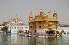
| Golden Temple FeatureType : landmark Elevation : 233 Lat/Lng : 31.6199 / 74.8765 | The Golden Temple, also known as Sri Harmandir Sahib ("abode of God") or Darbar Sahib ("exalted holy court"), is a Gurdwara located in the city of Amritsar, Punjab, India. It is the holiest Gurdwara and the most important pilgrimage site of Sikhism (...) |
| 55 | Sar-e Pol Province FeatureType : adm1st Elevation : 3799 Lat/Lng : 35.1 / 66.05 | Sar-e Pol, also spelled Sari Pul , is one of the thirty-four provinces of Afghanistan, located in the north of the country. It borders Jowzjan and Balkh to the west and north, Ghor Province to the south, and Samangan to the east. The province is divided into 7 districts and contains 896 villages (...) | |
| 56 | 
| Batura Muztagh FeatureType : mountain Elevation : 7557 Lat/Lng : 36.51 / 74.5269 | The Batura Muztagh mountains are a sub-range of the Karakoram mountain range. They are located in Gojal valley in the Hunza district of the Gilgit-Baltistan province in northern Pakistan. They are the westernmost sub-range of the Karakoram, running from Chalt village in Bar Valley in the east to (...) |
| 57 | Masal FeatureType : null Elevation : 61 Lat/Lng : 37.3631 / 49.1329 | Masal (also Romanized as Māsāl; also known as Bāzār-e Māsāl, Masal-Bazar, Sar-i-Bāzar, and Sārī Bāzār Mūsār) is a city and capital of Masal County, Gilan Province, Iran. At the 2006 census, its population was 10,992, in 2,986 families. (...) | |
| 58 | Sarbisheh FeatureType : null Elevation : 1824 Lat/Lng : 32.5757 / 59.7982 | Sarbisheh (also Romanized as Sarbīsheh and Sar-bice) is a city in and the capital of Sarbisheh County, South Khorasan Province, Iran. At the 2006 census, its population was 6,141, in 1,553 families. (...) | |
| 59 | 
| George Town, Penang FeatureType : city Elevation : 10 Lat/Lng : 5.4167 / 100.3167 | George Town, the capital city of the Malaysian state of Penang, is located at the north-eastern tip of Penang Island. It is Malaysia's second largest city, with 708,127 inhabitants , while Greater Penang is the nation's second biggest conurbation with a population of 2,412,616 (...) |
| 60 | 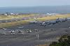
| Lajes Field FeatureType : null Elevation : 58 Lat/Lng : 38.7619 / -27.0908 | Lajes Field or Lajes Air Base , officially designated Air Base No. 4 (Base Aérea Nº 4, BA4) , is a multi-use airfield, home to the Portuguese Air Force Base Aérea N º4 and Azores Air Zone Command , a United States Air Force detachment unit (operated by the 65th Air Base Group of United States Air (...) |
| 61 | 
| Fernmeldeturm Mannheim FeatureType : landmark Elevation : 99 Lat/Lng : 49.4869 / 8.4922 | The Fernmeldeturm Mannheim is a 217.8 metre high concrete telecommunication tower with an observation deck in Mannheim, Germany. It was designed by the architects Heinle, Wischer und Partner and built from 1973 and 1975 (...) |
| 62 | 
| Behshahr FeatureType : null Elevation : 10 Lat/Lng : 36.6924 / 53.5526 | Behshahr (; formerly Ashraf and Ashraf ol BelādAlso spelt Ashraff in some sources) is a city in Mazandaran, Iran & the capital of Behshahr County. Located on the coast of the Caspian Sea, at the foot of the Alborz, it is approximately from Sari (...) |
| 63 | 
| Swissair Flight 111 FeatureType : landmark Lat/Lng : 44.4091 / -63.9736 | Swissair Flight 111 (IATA: SR111, ICAO: SWR111) was a scheduled international passenger flight from John F. Kennedy International Airport in New York City, United States to Cointrin International Airport in Geneva, Switzerland. This flight was also a codeshare flight with Delta Air Lines (...) |
| 64 | Si Sar FeatureType : null Elevation : 1397 Lat/Lng : 36.2464 / 45.6171 | Si Sar (also Romanized as Sī Sar and Sīser; also known as Seh Sīr and Sisir) is a village in Gavork-e Sardasht Rural District, in the Central District of Sardasht County, West Azerbaijan Province, Iran. At the 2006 census, its population was 915, in 146 families. (...) | |
| 65 | Kanjut Sar FeatureType : mountain Elevation : 7720 Lat/Lng : 36.2056 / 75.4168 | Kanjut Sar or Kunjudh Sar as pronounced in "Wakhi" is a mountain located in the Hispar Muztagh, a subrange of the Karakoram mountain range. Kunjudh Sar in wakhi language mean that which overlooks Kunjudh, or above Kunjudh, while Khujudh is the wakhi name for Lower Hunza (...) | |
| 66 | Sar-e Pol city FeatureType : city Elevation : 629 Lat/Lng : 36.2214 / 65.9278 | Sar-e Pol or Sari Pul is the capital city of the province of Sar-e Pol Province in northern Afghanistan. It is in Sari Pul District. In 2015, it had an official population of 51,075. There were 5,675 total number of dwellings in a total land area of 2,990 hectares. (...) | |
| 67 | Distaghil Sar FeatureType : mountain Elevation : 7801 Lat/Lng : 36.3258 / 75.1883 | Disteghil Sar or Distaghil Sar is the highest mountain in the Hispar Muztagh, a subrange of the Karakoram mountain range, in Gilgit-Baltistan, which is part of the Kashmir region that is disputed by India and Pakistan. It is the 19th highest mountain on earth and the 7th highest peak in Pakistan (...) | |
| 68 | Tukzar FeatureType : null Elevation : 1210 Lat/Lng : 35.9483 / 66.4213 | Tukzar or Tokzar or Tugzar is a town in Sancharak district of Sar-e Pol Province, Afghanistan. The town is the administrative centre of Sancharak district. (...) | |
| 69 | 
| Gol Transportes Aéreos Flight 1907 FeatureType : landmark Elevation : 321 Lat/Lng : -10.4833 / -53.25 | Gol Transportes Aéreos Flight 1907 was a Boeing 737-8EH on a scheduled domestic passenger flight from Manaus, Brazil, to Rio de Janeiro. On the afternoon of 29 September 2006, it collided in mid-air with an Embraer Legacy 600 business jet over the Brazilian state of Mato Grosso (...) |
| 70 | 
| Old Sarum FeatureType : landmark Elevation : 105 Lat/Lng : 51.0926 / -1.8057 | Old Sarum is the site of the earliest settlement of Salisbury in England. Located on a hill about north of modern Salisbury near the A345 road, the settlement appears in some of the earliest records in the country. It is an English Heritage property and is open to the public (...) |
| 71 | 
| USS Yorktown (CV-10) FeatureType : landmark Elevation : 9 Lat/Lng : 32.7906 / -79.9086 | USS Yorktown (CV/CVA/CVS-10) is one of 24 s built during World War II for the United States Navy. She is named after the Battle of Yorktown of the American Revolutionary War, and is the fourth U.S. Navy ship to bear the name (...) |
| 72 | 
| Tuol Sleng Genocide Museum FeatureType : landmark Elevation : 13 Lat/Lng : 11.5495 / 104.9178 | The Tuol Sleng Genocide Museum is a museum in Phnom Penh, the capital of Cambodia, chronicling the Cambodian genocide. The site is a former secondary school which was used as Security Prison 21 (S-21) by the Khmer Rouge regime from its rise to power in 1975 to its fall in 1979 (...) |
| 73 | 
| MS Estonia FeatureType : landmark Lat/Lng : 59.3833 / 21.7 | MS Estonia, previously Viking Sally (1980–1990), Silja Star (1990–1991), and Wasa King (1991–1993), was a cruise ferry built in 1979/80 at the German shipyard Meyer Werft in Papenburg. The ship sank in 1994 in the Baltic Sea in one of the worst maritime disasters of the 20th century.Boesten, E (...) |
| 74 | Jowzjan Province FeatureType : adm1st Elevation : 347 Lat/Lng : 36.75 / 66.0 | Jowzjan, sometimes spelled as Jawzjan or Jozjan , is one of the thirty-four provinces of Afghanistan, located in the north of the country bordering neighboring Turkmenistan. The province is divided into 11 districts and contains hundreds of villages (...) | |
| 75 | Rois FeatureType : null Elevation : 266 Lat/Lng : 42.794 / -8.7025 | Rois is a municipality of northwestern Spain in the province of A Coruña in the autonomous community of Galicia. It belongs to the comarca of Sar and it is located in the Southwest of the province of A Coruña. | |
| 76 | Kiasar FeatureType : null Elevation : 1246 Lat/Lng : 36.2381 / 53.541 | Kiasar (also Romanized as Kīāsar, Keyāsar, and Kīya Sar) is a city and capital of Chahardangeh District, in Sari County, Mazandaran Province, Iran. At the 2006 census, its population was 3,590, in 913 families. (...) | |
| 77 | Rudsar FeatureType : null Elevation : -21 Lat/Lng : 37.1376 / 50.288 | Rudsar (also known as, Roodsar, Rūdsar and Rūd-i-Sar) is a city and capital of Rudsar County, Gilan Province, Iran. At the 2006 census, its population was 33,321, in 9,741 families. (...) | |
| 78 | Sar Cheshmeh, Bushehr FeatureType : null Elevation : 193 Lat/Lng : 28.1278 / 51.9145 | Sar Cheshmeh (also Romanized as Sar Chashmeh) is a village in Riz District, Jam County, Bushehr Province, Iran. At the 2006 census, its population was 326, in 71 families. (...) | |
| 79 | 
| USS America (CV-66) FeatureType : null Lat/Lng : 33.1525 / -71.6519 | USS America (CVA/CV-66) was one of three supercarriers built for the United States Navy in the 1960s. Commissioned in 1965, she spent most of her career in the Atlantic and Mediterranean, but did make three Pacific deployments serving in the Vietnam War (...) |
| 80 | Tetovo FeatureType : null Elevation : 470 Lat/Lng : 42.0095 / 20.9709 | Tetovo is a city in the northwestern part of the Republic of Macedonia, built on the foothills of Šar Mountain and divided by the Pena River. The municipality of Tetovo covers an area of at above sea level, with a population of 52,915. The city of Tetovo is the seat of Tetovo Municipality (...) | |
| 81 | 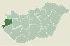
| Sárvár FeatureType : city Elevation : 159 Lat/Lng : 47.2542 / 16.9355 | Sárvár is a town in Hungary in Vas. (...) |
| 82 | Momhil Sar FeatureType : mountain Elevation : 7364 Lat/Lng : 36.3194 / 75.0351 | Momhil Sar , or Mumhail Sar as pronounced in Wakhi is at above sea level, is the 64th highest mountain peak in the world. Mumhail Sar in Wakhi means the mountain that overlooks or is above Grandmother's cattle pen or paddock (...) | |
| 83 | Sar-e Pol District FeatureType : city Elevation : 629 Lat/Lng : 36.2214 / 65.9278 | Sar-e Pol District is a district of Sar-e Pol Province, Afghanistan. It contains the capital, Sar-e Pol. (...) | |
| 84 | Sar Sakhti-ye Bala FeatureType : null Elevation : 2114 Lat/Lng : 33.8339 / 49.3585 | Sar Sakhti-ye Bala (also Romanized as Sar Sakhtī-ye Bālā; also known as Sabz Sanakhtī ‘Olyā, Sar Sakheī, Sarsakhleh, Sarsakhtīyeh, Sar Sakhtī-ye ‘Olyā, and Sarsakteh) is a village in Astaneh Rural District, in the Central District of Shazand County, Markazi Province, Iran (...) | |
| 85 | 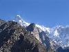
| Ultar FeatureType : mountain Elevation : 7316 Lat/Lng : 36.3909 / 74.7164 | Ultar Sar (also Ultar, Ultar II, Bojohagur Duanasir II) is the southeasternmost major peak of the Batura Muztagh, a subrange of the Karakoram range. It lies about northeast of the Karimabad, a town on the Karakoram Highway in the Hunza Valley, part of the Gilgit District of Gilgit–Baltistan, (...) |
| 86 | Northern Governorate FeatureType : adm1st Elevation : 10 Lat/Lng : 26.1167 / 50.4833 | The Northern Governorate is one of the four governorates of Bahrain. It includes parts of the former municipalities of Al Mintaqah al Gharbiyah, Al Mintaqah al Wusta, Al Mintaqah al Shamaliyah, Jidd Haffs and Madinat Hamad. (...) | |
| 87 | Sar-e Pol FeatureType : null Elevation : 1601 Lat/Lng : 35.8333 / 66.1667 | Sar-e Pol, Sar-i-Pul Sari Pul or Saripul may refer to the following places: (...) | |
| 88 | Sar Nezhmar FeatureType : null Elevation : 1429 Lat/Lng : 35.4187 / 46.2084 | Sar Nezhmar (also Romanized as Sar Nezhmār, Sar-e Nezhmār, and Saranzhmar; also known as Saranjmar, Sar-e Nejmar, Sar-i-Nijmār, and Sarnejmār) is a village in Sarkal Rural District, in the Central District of Marivan County, Kurdistan Province, Iran (...) | |
| 89 | Shileh Sar FeatureType : null Elevation : -19 Lat/Lng : 37.5234 / 49.2236 | Shileh Sar (also Romanized as Shīleh Sar; also known as Shīl-e Sar, Shil-i-Sar, and Shīl Sar) is a village in Chahar Farizeh Rural District, in the Central District of Bandar-e Anzali County, Gilan Province, Iran. At the 2006 census, its population was 354, in 116 families. (...) | |
| 90 | SAR-Lupe FeatureType : null Elevation : 276 Lat/Lng : 50.5683 / 7.0363 | SAR-Lupe is Germany's first reconnaissance satellite system and is used for military purposes. SAR is an abbreviation for synthetic aperture radar and "Lupe" is German for magnifying glass. The SAR-Lupe program consists of five identical (770 kg) satellites, developed by the German aeronautics (...) | |
| 91 | Yaneh Sar District FeatureType : null Elevation : 88 Lat/Lng : 36.6928 / 53.6422 | Yaneh Sar District is a district (bakhsh) in Behshahr County, Mazandaran Province, Iran. At the 2006 census, its population was 10,625, in 2,829 families. The District has no cities. The District has two rural districts (dehestan): Ashrestaq Rural District and Shohada Rural District. (...) | |
| 92 | Hashtrud FeatureType : null Elevation : 1651 Lat/Lng : 37.4779 / 47.0508 | Hashtrud (; also Romanized as Hashtrūd; also known as Āz̄arān, Sarāskand, Sar Eskand, Sar Eskandar, and Sar Eskand Khān) is a city and capital of Hashtrud County, East Azerbaijan Province, Iran. Hashtrud is located 140 km from Tabriz, the capital of the East-Azerbaijan province of Iran (...) | |
| 93 | Brazilian Air Force FeatureType : null Elevation : 995 Lat/Lng : -16.3339 / -48.9519 | The Brazilian Air Force (FAB) is the air branch of the Brazilian Armed Forces and one of the three national uniformed services. The FAB was formed when the Army and Navy air branch were merged into a single military force initially called "National Air Forces" in 1941 (...) | |
| 94 | 
| RAF St Mawgan FeatureType : landmark Elevation : 62 Lat/Lng : 50.4347 / -5.0131 | Royal Air Force St Mawgan or more simply RAF St Mawgan is a Royal Air Force station near St Mawgan and Newquay in Cornwall, England. In 2008 the runway part of the site was handed over to Newquay Airport. The remainder of the station continues to operate under the command of the RAF (...) |
| 95 | Turkish Air Force FeatureType : null Elevation : 780 Lat/Lng : 39.7839 / 30.5819 | The Turkish Air Force is the aerial warfare service branch of the Turkish Armed Forces. The Turkish Air Force can trace its origins back to June 1911 when it was founded by the Ottoman Empire, however, the air force as it is known today did not come into existence until 1923 with the creation of the (...) | |
| 96 | 
| Bodø Main Air Station FeatureType : null Lat/Lng : 67.2692 / 14.3653 | Bodø Air Station is a military airbase of the Royal Norwegian Air Force (RNoAF) located at Bodø, Norway. It is home to the General Dynamics F-16 Fighting Falcons of the 331 and 332 Squadrons and a detachment of Westland Sea King search and rescue (SAR) helicopters of the 330 Squadron (...) |
| 97 | Neyasar FeatureType : null Elevation : 1636 Lat/Lng : 33.9729 / 51.1489 | Neyasar (also Romanized as Niāsar, Nīāsar, and Nīyā Sar; also known as Nezār) is a city and capital of Neyasar District, in Kashan County, Isfahan Province, Iran. At the 2006 census, its population was 2,003, in 586 families. It is famous for its historical buildings from the Sassanid period (...) | |
| 98 | Kohistanat District FeatureType : city Elevation : 2705 Lat/Lng : 35.4383 / 65.9365 | Kohistanat District is a district of Sar-e Pol Province, Afghanistan. (...) | |
| 99 | 
| Shispare FeatureType : mountain Elevation : 7494 Lat/Lng : 36.4407 / 74.6811 | Shispare is one of the high peaks of the Batura Muztagh, which is the westernmost subrange of the Karakoram range. Alternate forms of the name of this peak are Shispare Sar and Shisparé Sar. __NOTOC__ (...) |
| 100 | Paktika Province FeatureType : adm1st Elevation : 1869 Lat/Lng : 32.5 / 68.8 | Paktika is one of the 34 provinces of Afghanistan, located in the eastern part of the country. Forming part of the larger Loya Paktia region, Paktika has a population of about 413,800, mostly ethnic Pashtuns. The town of Sharana serves as the provincial capital, while the most populous city is Urgun (...) | |
| 101 | Štrpce FeatureType : city Elevation : 845 Lat/Lng : 42.2333 / 21.0167 | Štrpce (Serbian Cyrillic: Штрпце) or Shtërpca , is a town and municipality located in the Ferizaj District in Kosovo. As of 2015, it has an estimated population of 13,630 inhabitants. After the 2013 Brussels Agreement, the municipality became part of the Community of Serb Municipalities. (...) | |
| 102 | Mureș (river) FeatureType : null Elevation : 77 Lat/Lng : 46.2517 / 20.1942 | The Mureș is a river in Eastern Europe. Its drainage basin covers an area of ., IPCDR It originates in the Hășmașu Mare Range in the Eastern Carpathian Mountains, Romania, rising close to the headwaters of the Olt River, and joins the Tisza at Szeged in southeastern Hungary (...) | |
| 103 | Jinjiang, Fujian FeatureType : city Elevation : 22 Lat/Lng : 24.82 / 118.57 | Jinjiang is a county-level city of Quanzhou City, Fujian Province, China. It is located in the southeastern part of the province, on the right or south bank of the Jin River, across from Quanzhou's urban district of Fengze (...) | |
| 104 | Moesia FeatureType : state Elevation : 354 Lat/Lng : 43.96 / 21.13 | Moesia (; Latin: Moesia; , Moisía) was an ancient region and later Roman province situated in the Balkans south of the Danube River. It included most of the territory of modern-day Central Serbia, Kosovo and the northern parts of the modern Republic of Macedonia (Moesia Superior), Northern Bulgaria (...) | |
| 105 | Lupghar Sar FeatureType : mountain Elevation : 7035 Lat/Lng : 36.3483 / 75.0258 | Lupghar Sar is 109th on the list of world tallest mountains. It is located in Shishkat valley of Hunza Gojal. It is part of the Momhail Sar cluster of mountains and has an elevation of above sea level. In Wakhi language Lupghar Sar translates as "the top of the big rock". (...) | |
| 106 | Abasár FeatureType : city Elevation : 175 Lat/Lng : 47.7971 / 20.0032 | Abasár is a village (population 2,593) in Heves county in Hungary, situated near Gyöngyös in the foothills of the Mátra mountains. It was founded as Saár (literally "mud", later Sár) in 1261, and later took the prefix Aba from the Aba clan (...) | |
| 107 | Pennington County, South Dakota FeatureType : adm2nd Elevation : 928 Lat/Lng : 44.01 / -102.82 | Pennington County is a county located in the U.S. state of South Dakota. As of the 2010 census, the population was 100,948, making it the second-most populous county in South Dakota. Its county seat is Rapid City. The county was created in 1875 and organized in 1877. It is named for John L (...) | |
| 108 | 
| Terowie, South Australia FeatureType : null Elevation : 507 Lat/Lng : -33.1667 / 138.9 | Terowie (formerly Gottliebs Well and Shebbear) is a small town in the mid-north of South Australia located north of the state capital of Adelaide. It is located in the Regional Council of Goyder. Terowie retains a number of authentic and well preserved 1880s buildings, and has been declared a (...) |
| 109 | Badakhshan Province FeatureType : adm1st Elevation : 4265 Lat/Lng : 38.0 / 71.0 | Badakhshan Province (Badaxšān wilāyat and) is one of the 34 provinces of Afghanistan, located in the farthest northeastern part of the country between Tajikistan and northern Pakistan. It shares a 56.5-mile (91 km) border with China. It is part of a broader historical Badakhshan region (...) | |
| 110 | Dinaric Alps FeatureType : mountain Elevation : 2645 Lat/Lng : 42.4417 / 19.8125 | The Dinaric Alps , also commonly Dinarides, are a mountain range in Southern and Southeastern Europe, separating the continental Balkan Peninsula from the Adriatic Sea. They stretch from Italy in the northwest through Slovenia, Croatia, Bosnia and Herzegovina, Serbia, Montenegro, Kosovo to Albania (...) | |
| 111 | Bodø FeatureType : null Lat/Lng : 67.3056 / 14.5492 | Bodø is a town and a municipality in Nordland county, Norway. It is part of the traditional region of Salten and it is the capital of Nordland county. The administrative centre of the municipality is the town of Bodø (...) | |
| 112 | Faryab Province FeatureType : adm1st Elevation : 949 Lat/Lng : 36.0 / 65.0 | Faryab (Persian/Pashto:) is one of the thirty-four provinces of Afghanistan, which is located in the north of the country bordering neighboring Turkmenistan. It has a population of about 948,000, which is multi-ethnic and mostly a tribal society (...) | |
| 113 | Akkadian Empire FeatureType : null Elevation : 39 Lat/Lng : 33.1 / 44.1 | The Akkadian Empire was the first ancient Semitic-speaking empire of Mesopotamia, centered in the city of Akkad Sumerian: Agade and its surrounding region, also called Akkad in ancient Mesopotamia in the Bible. The empire united Akkadian and Sumerian speakers under one rule (...) | |
| 114 | Sar Takaltu FeatureType : null Elevation : 1778 Lat/Lng : 36.1444 / 46.2747 | Sar Takaltu (also Romanized as Sar Takaltū; also known as Sar Taktalū) is a village in Zu ol Faqr Rural District, Sarshiv District, Saqqez County, Kurdistan Province, Iran. At the 2006 census, its population was 317, in 56 families. (...) | |
| 115 | Sar Dahi FeatureType : null Elevation : 25 Lat/Lng : 31.4816 / 49.0405 | Sar Dahi (also Romanized as Sar Dāḩī, Sardāḩī, and Sar Dāhī) is a village in Veys Rural District, Veys District, Bavi County, Khuzestan Province, Iran. At the 2006 census, its population was 216, in 30 families. (...) | |
| 116 | Bijar Sar FeatureType : null Elevation : 106 Lat/Lng : 37.0772 / 49.3841 | Bijar Sar (also Romanized as Bījār Sar; also known as Bodzhyarser, Bojār Sar, and Bojiarser) is a village in Chubar Rural District, Ahmadsargurab District, Shaft County, Gilan Province, Iran. At the 2006 census, its population was 512, in 141 families. (...) | |
| 117 | Sar Kubeh FeatureType : null Elevation : 1843 Lat/Lng : 33.7951 / 50.0932 | Sar Kubeh (also Romanized as Sar Kūbeh, Sar Koobeh, and Ser Kūbeh) is a village in Hamzehlu Rural District, in the Central District of Khomeyn County, Markazi Province, Iran. At the 2006 census, its population was 300, in 92 families. (...) | |
| 118 | Sar Tappeh-ye Zanganeh FeatureType : null Elevation : 1485 Lat/Lng : 34.1 / 47.125 | Sar Tappeh-ye Zanganeh (; also known as Sar Tappeh) is a village in Sar Firuzabad Rural District, Firuzabad District, Kermanshah County, Kermanshah Province, Iran. At the 2006 census, its population was 116, in 22 families. (...) | |
| 119 | Sar Yazd FeatureType : null Elevation : 1403 Lat/Lng : 31.6026 / 54.5254 | Sar Yazd (also Romanized as Sar-e Yazd and Sar-i-Yezd; also known as Mehriz) is a village in Khvormiz Rural District, in the Central District of Mehriz County, Yazd Province, Iran. At the 2006 census, its population was 421, in 141 families. (...) | |
| 120 | Jowrka Sar FeatureType : null Elevation : 51 Lat/Lng : 37.0697 / 50.19 | Jowrka Sar (also Romanized as Jowrkā Sar; also known as Jorkā Sar) is a village in Amlash-e Jonubi Rural District, in the Central District of Amlash County, Gilan Province, Iran. At the 2006 census, its population was 386, in 101 families. (...) | |
| 121 | Sar Khareh-ye Sofla FeatureType : null Elevation : 14 Lat/Lng : 30.4144 / 49.7196 | Sar Khareh-ye Sofla (also Romanized as Sar Khareh-ye Soflá and Sarkharreh Soflá; also known as Sar Khowr, Sar Khowrreh, and Sarkhurreh) is a village in Cham Khalaf-e Isa Rural District, Cham Khalaf-e Isa District, Hendijan County, Khuzestan Province, Iran (...) | |
| 122 | Sar Chah-e Tazian FeatureType : null Elevation : 2136 Lat/Lng : 33.0185 / 59.5605 | Sar Chah-e Tazian (also Romanized as Sar Chāh-e Tāzīān; also known as Sar-i-Chāh and Sar Chāh) is a village in Kahshang Rural District, in the Central District of Birjand County, South Khorasan Province, Iran. At the 2006 census, its population was 416, in 119 families. (...) | |
| 123 | Kosovo FeatureType : country Elevation : 572 Lat/Lng : 42.6333 / 20.9167 | Kosovo (; or ;), officially the Republic of Kosovo (; / Republika Kosovo), is a partially recognised state and disputed territory in Southeastern Europe. It declared independence from Serbia on 17 February 2008 (...) | |
| 124 | Mileh Sar FeatureType : null Elevation : 1327 Lat/Lng : 33.9635 / 46.7808 | Mileh Sar (also Romanized as Mīleh Sar) is a village in Homeyl Rural District, Homeyl District, Eslamabad-e Gharb County, Kermanshah Province, Iran. At the 2006 census, its population was 707, in 157 families. (...) | |
| 125 | Sar Dasht, Razavi Khorasan FeatureType : null Elevation : 1961 Lat/Lng : 35.6277 / 59.5867 | Sar Dasht (also Romanized as Sar-i-Dasht) is a village in Balaband Rural District, in the Central District of Fariman County, Razavi Khorasan Province, Iran. At the 2006 census, its population was 674, in 163 families. (...) | |
| 126 | Balkh Province FeatureType : adm1st Elevation : 1386 Lat/Lng : 36.5 / 67.5 | Balkh (Pashto and , Balx) is one of the 34 provinces of Afghanistan, located in the north of the country. It is divided into 15 districts and has a population of about 1,245,100, which is multi-ethnic and mostly a Persian-speaking society (...) | |
| 127 | AFC Ajax FeatureType : null Elevation : 32 Lat/Lng : 52.3142 / 4.9419 | Amsterdamsche Football Club Ajax , also known as AFC Ajax, Ajax Amsterdam or simply Ajax, is a Dutch professional football club based in Amsterdam. Historically, Ajax (named after the legendary Greek hero) has been the most successful club in the Netherlands, with 33 Eredivisie titles and 18 KNVB (...) | |
| 128 | UEFA Euro 2000 FeatureType : null Elevation : 32 Lat/Lng : 50.8469 / 4.355 | The 2000 UEFA European Football Championship, also known as Euro 2000, was the 11th UEFA European Championship, which is held every four years and organised by UEFA, association football's governing body in Europe (...) | |
| 129 | Heligoland FeatureType : null Lat/Lng : 54.1836 / 7.8966 | Heligoland (; ; Heligolandic Frisian: deät Lun , Mooring Frisian: Hålilönj) is a small German archipelago in the North Sea. The islands were at one time Danish and later British possessions. The islands are located in the Heligoland Bight (part of the German Bight) in the southeastern corner of the (...) | |
| 130 | National People's Congress FeatureType : landmark Elevation : 65 Lat/Lng : 39.9033 / 116.3875 | The National People's Congress (usually abbreviated NPC) is the national legislature of the People's Republic of China. With 2,980 members in 2018, it is the largest parliamentary body in the world. Under China's Constitution, the NPC is structured as a unicameral legislature, with the power to (...) | |
| 131 | Tuzla FeatureType : null Elevation : 225 Lat/Lng : 44.5384 / 18.6671 | Tuzla is the third largest city of Bosnia and Herzegovina and the administrative center of Tuzla Canton of the Federation of Bosnia and Herzegovina. As of 2013, it has a population of 110,979 inhabitants. Tuzla is the economic, cultural, educational, health and tourist centre of northeast Bosnia (...) | |
| 132 | 
| USS Long Beach (CGN-9) FeatureType : landmark Elevation : 6 Lat/Lng : 47.5588 / -122.6307 | USS Long Beach (CLGN-160/CGN-160/CGN-9) was a nuclear-powered guided missile cruiser in the United States Navy and the world's first nuclear-powered surface combatant. She was the third Navy ship named after the city of Long Beach, California (...) |
| 133 | Sari, Iran FeatureType : null Elevation : 43 Lat/Lng : 36.5633 / 53.06 | Sari ; also Romanized as Sārī; also known as Shahr-i-Tajan and Shari-i-Tajan) is the provincial capital of Mazandaran and former capital of Iran (for a short period), located in the north of Iran, between the northern slopes of the Alborz Mountains and southern coast of the Caspian Sea (...) | |
| 134 | Vayots Dzor Province FeatureType : adm1st Elevation : 1720 Lat/Lng : 39.75 / 45.5 | Vayots Dzor , is a province of Armenia. It lies at the southeastern end of the country, bordering the Nakhichevan exclave of Azerbaijan in the west and the Kalbajar District (de jure part of Azerbaijan, de facto controlled by the unrecognized Artsakh Republic) in the east. It covers an area of (...) | |
| 135 | Ipoh FeatureType : city Elevation : 48 Lat/Lng : 4.592 / 101.0903 | Ipoh is the capital city of the Malaysian state of Perak. Located by the Kinta River, it is nearly north of Kuala Lumpur and southeast of George Town in neighbouring Penang. , Ipoh contained a population of 657,892, making it the third largest city in Malaysia by population (...) | |
| 136 | Xinhua News Agency FeatureType : landmark Elevation : 64 Lat/Lng : 39.8988 / 116.3652 | Xinhua News Agency (English pronunciation: J. C. Wells: Longman Pronunciation Dictionary, 3rd ed., for both British and American English) or New China News Agency is the official state-run press agency of the People's Republic of China (...) | |
| 137 | O Sar FeatureType : adm3rd Elevation : 143 Lat/Lng : 42.7478 / -8.6983 | Sar is a comarca in the province of A Coruña, Galicia, western Spain. The overall population of this local region is 17,354 (2005). (...) | |
| 138 | Batura Sar FeatureType : mountain Elevation : 7708 Lat/Lng : 36.5103 / 74.5226 | Batura Sar , also referred to as Batura I, is the 25th highest mountain on earth and the 10th highest in Pakistan. It is the highest peak of the Batura Muztagh, which is the westernmost subrange of the Karakoram range (...) | |
| 139 | Puri FeatureType : null Elevation : 15 Lat/Lng : 19.8123 / 85.829 | Puri (listen) is a city and a Municipality in the state of Odisha in eastern India. It is the district headquarters of Puri district and is situated on the Bay of Bengal, south of the state capital of Bhubaneswar (...) | |
| 140 | Sareyn FeatureType : null Elevation : 1671 Lat/Lng : 38.1502 / 48.0707 | Sareyn (also Romanized as Sar‘eyn, Sara’eyn, Sar‘eīn, Sar ‘Eyn, and Sarein) is a city in and the capital of Sareyn County, in Ardabil Province, Iran. Sareyn is known for its hot springs. The population is about 8000, and increases to more than 20000 in the summer because of the many tourists who go (...) | |
| 141 | Oecusse FeatureType : adm1st Elevation : 161 Lat/Lng : -9.3333 / 124.3 | Oecusse, also variously Oecussi, Ocussi, Oekussi, Oekusi, Okusi, Oé-Cusse, and formerly Ambeno and Oecussi-Ambeno, is both a municipality and a Special Administrative Region (SAR) (RAEO; , ZEESM), and was formerly a district, of East Timor (...) | |
| 142 | Passu Sar FeatureType : mountain Elevation : 7407 Lat/Lng : 36.4878 / 74.5878 | Passu Sar (; or Passu Sar, Passu I) is a mountain peak in the Batura Muztagh, a sub-range of the Karakoram mountain range, located in the Gilgit District of Gilgit-Baltistan, Pakistan, west of the Hunza Valley. It is the high point of the Passu massif, which also includes Passu Diar (or "Passu (...) | |
| 143 | Satu Mare FeatureType : null Elevation : 124 Lat/Lng : 47.7917 / 22.8917 | Satu Mare (; ; ; or) is a city with a population of 102,400 (2011) and the capital of Satu Mare County, Romania, as well as the center of the Satu Mare metropolitan area. Mentioned in the Gesta Hungarorum as ("Zotmar's fort"), the city has a history going back to the Middle Ages (...) | |
| 144 | 
| USS Bataan (CVL-29) FeatureType : null Lat/Lng : 26.7 / 130.6333 | USS Bataan (CVL-29/AVT-4), originally planned as USS Buffalo (CL-99) and also classified as CV-29, was an 11,000 ton light aircraft carrier which was commissioned in the United States Navy during World War II. (...) |
| 145 | Perak FeatureType : adm1st Elevation : 117 Lat/Lng : 4.75 / 101.0 | Perak (; Jawi: ڤيراق; Chinese: 霹雳 Tamil: பேராக்), also known by its honorific Darul Ridzuan or "Abode of Grace" (Dār al-Riḍwān), is one of the thirteen states of Malaysia, and the fourth-largest one. It borders Kedah at the north; Thai Yala Province to the northeast; Penang to the northwest; (...) | |
| 146 | Amazon rainforest FeatureType : forest Elevation : 7 Lat/Lng : -3.16 / -60.03 | The Amazon rainforest (Portuguese: ' or '; , ' or usually '; ;), also known in English as Amazonia or the Amazon Jungle, is a moist broadleaf forest in the Amazon biome that covers most of the Amazon basin of South America. This basin encompasses , of which are covered by the rainforest (...) | |
| 147 | Uruk FeatureType : null Elevation : 27 Lat/Lng : 31.3244 / 45.6365 | Uruk (; Cuneiform: URUUNUG; Sumerian: Unug; Akkadian: Uruk; , '; Aramaic/Hebrew: '; , Ὀρέχ Oreḥ, ') was an ancient city of Sumer (and later of Babylonia), situated east of the present bed of the Euphrates river, on the dried-up, ancient channel of the Euphrates, some 30 km east of modern Samawah, (...) | |
| 148 | Yellow River FeatureType : null Elevation : -1 Lat/Lng : 37.78 / 119.25 | The Yellow River or Huang He (hell=no) is the second longest river in Asia, after the Yangtze River, and the sixth longest river system in the world at the estimated length of .. Geol.lsu.edu (2000-02-28). Retrieved on 2013-02-04 (...) | |
| 149 | 
| Prokletije FeatureType : mountain Elevation : 2645 Lat/Lng : 42.4417 / 19.8125 | Prokletije (; ; both translated as "cursed mountains"), also known as the Albanian Alps (Alpet Shqiptare) and the Accursed Mountains, is a mountain range on the western Balkan peninsula, extending from northern Albania to Kosovo and eastern Montenegro (...) |
| 150 | Hispar Muztagh FeatureType : null Elevation : 7801 Lat/Lng : 36.3258 / 75.1883 | Hispar Muztagh is a sub-range of the Karakoram mountain range. It is located in the Gojal region of Gilgit-Baltistan, Pakistan, north of Hispar Glacier, south of Shimshal Valley, and east of the Hunza Valley. It is the second highest sub-range of the Karakoram, the highest being the Baltoro Muztagh (...) | |
| 151 | Democratic Kampuchea FeatureType : country Elevation : 11 Lat/Lng : 12.25 / 105.6 | The state of Kampuchea (; Kâmpŭchéa;),Also referred to during that period as the Kingdom of Cambodia (Preăh Réachéanachâk Kâmpŭchéa). officially Democratic KampucheaFrom 5 January 1976. (DK; ; Kâmpŭchéa Prâcheathippadey;), existed between 1975 and 1979 in present-day Cambodia (...) | |
| 152 | Balkans FeatureType : isle Elevation : 713 Lat/Lng : 42.0 / 22.0 | The Balkans, also known as the Balkan Peninsula, or Southeast Europe, is a geographic area in Europe with various definitions. The region takes its name from the Balkan Mountains that stretch throughout the whole of Bulgaria from the Serbian-Bulgarian border to the Black Sea coast (...) | |
| 153 | Khuzestan Province FeatureType : null Elevation : 21 Lat/Lng : 31.3273 / 48.694 | Khuzestan Province (Ostān-e Khūzestān, Muḥāfaẓa Khūzistān) is one of the 31 provinces of Iran. It is in the southwest of the country, bordering Iraq and the Persian Gulf. Its capital is Ahvaz and it covers an area of 63,238 km2. Since 2014 it has been part of Iran's Region 4 (...) | |
| 154 | Çukurova FeatureType : null Elevation : 9 Lat/Lng : 36.8667 / 35.4833 | Çukurova , alternatively known as Cilicia, is a geo-cultural region in south-central Turkey, covering the provinces of Mersin, Adana, Osmaniye and Hatay. With a population of almost 6 million, it is one of the largest population concentrations in Turkey (...) | |
| 155 | University of Hong Kong FeatureType : edu Elevation : 66 Lat/Lng : 22.2842 / 114.1378 | The University of Hong Kong (HKU) is a public research university in Hong Kong. Founded in 1911, its origins trace back to the Hong Kong College of Medicine for Chinese, which was founded in 1887. It is the oldest tertiary institution in Hong Kong (...) | |
| 156 | Indian Space Research Organisation FeatureType : landmark Elevation : 909 Lat/Lng : 13.0352 / 77.5706 | The Indian Space Research Organisation (ISRO) is the space agency of the Government of India headquartered in the city of Bangalore. Its vision is to "harness space technology for national development while pursuing space science research and planetary exploration (...) | |
| 157 | Royal Netherlands Air Force FeatureType : null Elevation : 19 Lat/Lng : 51.4501 / 5.3745 | The Royal Netherlands Air Force (RNLAF; , "Royal Air Force"), is the military aviation branch of the Netherlands Armed Forces. It was created in 1953; its ancestor, the Luchtvaartafdeling (aviation department) of the Dutch Army was founded in 1913 (...) | |
| 158 | Royal Air Force FeatureType : null Elevation : 56 Lat/Lng : 51.6164 / -1.0958 | The Royal Air Force (RAF) is the United Kingdom's aerial warfare force. Formed towards the end of the First World War on 1 April 1918, it is the oldest independent air force in the world. Following victory over the Central Powers in 1918 the RAF emerged as, at the time, the largest air force in the (...) | |
| 159 | Royal Canadian Mounted Police FeatureType : landmark Elevation : 63 Lat/Lng : 45.42 / -75.66 | The Royal Canadian Mounted Police (RCMP; , "Royal Gendarmerie of Canada"; colloquially known as The "Mounties", and internally as "the Force") is the federal and national police force of Canada. The RCMP provides law enforcement at the federal level (...) | |
| 160 | 2010 Haiti earthquake FeatureType : event Elevation : 210 Lat/Lng : 18.457 / -72.533 | The 2010 Haiti earthquake was a catastrophic magnitude 7.0 Mw earthquake, with an epicenter near the town of Léogâne (Ouest), approximately west of Port-au-Prince, Haiti's capital. The earthquake occurred at 16:53 local time (21:53 UTC) on Tuesday, 12 January 2010 (...) | |
| 161 | Serbia FeatureType : country Elevation : 487 Lat/Lng : 43.95 / 20.9333 | Serbia (/ Srbija),Pannonian Rusyn: ; ; Albanian and Romanian: ; Slovak and Czech: , ; . officially the Republic of Serbia (/ Republika Srbija), is a country situated at the crossroads of Central and Southeast Europe in the southern Pannonian Plain and the central Balkans (...) | |
| 162 | Behshahr County FeatureType : null Elevation : 364 Lat/Lng : 36.6833 / 53.7333 | Behshahr County (Šahrestân-e Behšahr; , Ašref-e-Šahrestun) is a county on the Caspian Sea, in Mazandaran Province of northern Iran. (...) | |
| 163 | FK Teteks FeatureType : null Elevation : 463 Lat/Lng : 42.018 / 20.979 | FK Teteks is a football club from the city of Tetovo in the Republic of Macedonia. They currently play in the Macedonian Second League. (...) | |
| 164 | Cervo (river) FeatureType : river Elevation : 130 Lat/Lng : 45.3667 / 8.4 | The Cervo (Piedmontese Sar or Serv) is a torrent (a form of seasonally intermittent stream) in the Piedmont region of north-west Italy. It is the principal tributary of the river Sesia, which itself is a significant tributary of the Po. (...) | |
| 165 | Sar Tirah FeatureType : null Elevation : 713 Lat/Lng : 30.632 / 50.7439 | Sar Tirah (also Romanized as Sar Tīrah; also known as Sar Gīrah) is a village in Boyer Ahmad-e Garmsiri Rural District, in the Central District of Gachsaran County, Kohgiluyeh and Boyer-Ahmad Province, Iran. At the 2006 census, its population was 214, in 40 families. (...) | |
| 166 | Sar Peri FeatureType : null Elevation : 733 Lat/Lng : 30.7609 / 50.543 | Sar Peri (also Romanized as Sar Perī and Sar Parī) is a village in Dehdasht-e Gharbi Rural District, in the Central District of Kohgiluyeh County, Kohgiluyeh and Boyer-Ahmad Province, Iran. At the 2006 census, its population was 552, in 104 families. (...) | |
| 167 | Sar-e Mahur FeatureType : null Elevation : 746 Lat/Lng : 30.6885 / 50.5238 | Sar-e Mahur (also Romanized as Sar-e Māhūr; also known as Sar Mūr) is a village in Dehdasht-e Gharbi Rural District, in the Central District of Kohgiluyeh County, Kohgiluyeh and Boyer-Ahmad Province, Iran. At the 2006 census, its population was 114, in 23 families. (...) | |
| 168 | Ahmadabad-e Sar Tang FeatureType : null Elevation : 536 Lat/Lng : 32.0454 / 49.4128 | Ahmadabad-e Sar Tang (also Romanized as Aḩmadābād-e Sar Tang; also known as Sar Tang-e Dūlāb) is a village in Abezhdan Rural District, Abezhdan District, Andika County, Khuzestan Province, Iran. At the 2006 census, its population was 112, in 23 families. (...) | |
| 169 | Sar Darreh-ye Qobadi FeatureType : null Elevation : 2061 Lat/Lng : 35.0479 / 47.6321 | Sar Darreh-ye Qobadi (also Romanized as Sar Darreh-ye Qobādī; also known as Sardāreh and Sar Darreh) is a village in Gavrud Rural District, in the Central District of Sonqor County, Kermanshah Province, Iran. At the 2006 census, its population was 150, in 37 families. (...) | |
| 170 | Chil Sar, Dashtiari FeatureType : null Elevation : 14 Lat/Lng : 25.4247 / 61.3117 | Chil Sar (also Romanized as Chīl Sar; also known as Chīleh Sar, Nīlag, and Tembū’ī) is a village in Sand-e Mir Suiyan Rural District, Dashtiari District, Chabahar County, Sistan and Baluchestan Province, Iran. At the 2006 census, its population was 209, in 44 families. (...) | |
| 171 | Vani Sar FeatureType : null Elevation : 1273 Lat/Lng : 34.8066 / 46.0963 | Vani Sar (also Romanized as Vānī Sar; also known as Dārlī Sar) is a village in Khaneh Shur Rural District, in the Central District of Salas-e Babajani County, Kermanshah Province, Iran. At the 2006 census, its population was 260, in 61 families. (...) | |
| 172 | Sar Kalateh-ye Kafshgiri FeatureType : null Elevation : 88 Lat/Lng : 36.7919 / 54.2825 | Sar Kalateh-ye Kafshgiri (also Romanized as Sar Kalāteh-ye Kafshgīrī; also known as Sar Kalāteh) is a village in Roshanabad Rural District, in the Central District of Gorgan County, Golestan Province, Iran. At the 2006 census, its population was 967, in 240 families. (...) | |
| 173 | Ljuboten FeatureType : mountain Elevation : 2472 Lat/Lng : 42.2067 / 21.1194 | Ljuboten (Serbian and) or Luboten (in Albanian) is a peak of the Šar Mountains located at the border between Kosovo and the Republic of Macedonia. Its height is . Ljuboten peak although not being the highest peak of the range, is somewhat isolated from the rest of the mountains making it stand out (...) | |
| 174 | Tetovo Municipality FeatureType : null Elevation : 1223 Lat/Lng : 42.0444 / 20.9025 | Tetovo is a municipality in northwestern Republic of Macedonia. Tetovo is also the name of the town where the municipal seat is found. Tetovo Municipality is part of the Polog Statistical Region. (...) | |
| 175 | Tuzla Canton FeatureType : adm2nd Elevation : 255 Lat/Lng : 44.55 / 18.6 | The Tuzla Canton (Bosnian: Tuzlanski kanton) is one of 10 cantons of the Federation of Bosnia and Herzegovina, one of two entities in Bosnia and Herzegovina. The cantonal seat is in Tuzla. (...) | |
| 176 | Historic Centre of Macau FeatureType : null Elevation : 14 Lat/Lng : 22.1936 / 113.5397 | The Historic Centre of Macao, , , is a collection of over twenty locations that witness the unique assimilation and co-existence of Chinese and Portuguese cultures in Macau, a former Portuguese colony. It represents the architectural legacies of the city's cultural heritage, including monuments such (...) | |
| 177 | Mohammadabad-e Sar Cheshmeh Berashk FeatureType : null Elevation : 1386 Lat/Lng : 35.7011 / 60.38 | Mohammadabad-e Sar Cheshmeh Berashk (also Romanized as Moḩammadābād-e Sar Cheshmeh Berāshk; also known as Sar Cheshmeh Berāshk, Mohammad Ābād, Moḩammadābād-e Sar Cheshmeh, Sar Chashmeh, Sar Cheshmeh, and Sar-i-Chashmeh) is a village in Sefid Sang Rural District, Qalandarabad District, Fariman (...) | |
| 178 | Sar Durab FeatureType : null Elevation : 1890 Lat/Lng : 31.3298 / 50.221 | Sar Durab (also Romanized as Sar Dūrāb) is a village in Seydun-e Jonubi Rural District, Seydun District, Bagh-e Malek County, Khuzestan Province, Iran. At the 2006 census, its population was 359, in 68 families. (...) | |
| 179 | Sar Panbeh Dul FeatureType : null Elevation : 1839 Lat/Lng : 34.9532 / 47.3136 | Sar Panbeh Dul (also Romanized as Sar Panbeh Dūl) is a village in Amirabad Rural District, Muchesh District, Kamyaran County, Kurdistan Province, Iran. At the 2006 census, its population was 147, in 29 families. (...) | |
| 180 | Sar Huni FeatureType : null Elevation : 857 Lat/Lng : 32.4104 / 49.5891 | Sar Huni (also Romanized as Sar Ḩūnī; also known as Sarḩānī) is a village in Lalar and Katak Rural District, Chelo District, Andika County, Khuzestan Province, Iran. At the 2006 census, its population was 133, in 19 families. (...) | |
| 181 | Sar Taf FeatureType : null Elevation : 510 Lat/Lng : 32.812 / 48.4742 | Sar Taf (also Romanized as Sar Tāf) is a village in Qilab Rural District, Alvar-e Garmsiri District, Andimeshk County, Khuzestan Province, Iran. At the 2006 census, its population was 129, in 22 families. (...) | |
| 182 | Chalak Sar FeatureType : null Elevation : 52 Lat/Lng : 37.2926 / 49.1808 | Chalak Sar (also Romanized as Chālak Sar and Chāleksar) is a village in Gurab Zarmikh Rural District, Mirza Kuchek Janghli District, Sowme'eh Sara County, Gilan Province, Iran. At the 2006 census, its population was 680, in 169 families. (...) | |
| 183 | Daf Sar FeatureType : null Elevation : 7 Lat/Lng : 37.2165 / 49.4665 | Daf Sar (also Romanized as Dāf Sār; also known as Davsar) is a village in Pasikhan Rural District, in the Central District of Rasht County, Gilan Province, Iran. At the 2006 census, its population was 527, in 140 families. (...) | |
| 184 | Sar Khelaj FeatureType : null Elevation : 1833 Lat/Lng : 34.2949 / 47.8742 | Sar Khelaj (also Romanized as Sar Khalaj) is a village in Khezel-e Gharbi Rural District, in the Central District of Kangavar County, Kermanshah Province, Iran. At the 2006 census, its population was 297, in 68 families. (...) | |
| 185 | Bijar Basteh Sar FeatureType : null Elevation : -18 Lat/Lng : 37.2248 / 50.0544 | Bijar Basteh Sar (also Romanized as Bījār Basteh Sar) is a village in Layalestan Rural District, in the Central District of Lahijan County, Gilan Province, Iran. At the 2006 census, its population was 134, in 45 families. (...) | |
| 186 | Sar Bazar FeatureType : null Elevation : 704 Lat/Lng : 32.3315 / 49.772 | Sar Bazar (also Romanized as Sar Bāzār) is a village in Chelo Rural District, Chelo District, Andika County, Khuzestan Province, Iran. At the 2006 census, its population was 170, in 30 families. (...) | |
| 187 | Kateh Sar FeatureType : null Elevation : -14 Lat/Lng : 37.3692 / 49.6846 | Kateh Sar (; also known as Kateh Shūr and Katekhsar) is a village in Kateh Sar-e Khomam Rural District, Khomam District, Rasht County, Gilan Province, Iran. At the 2006 census, its population was 981, in 312 families. (...) | |
| 188 | Gach Sar FeatureType : null Elevation : 2246 Lat/Lng : 36.1036 / 51.3047 | Gach Sar (also Romanized as Gach-i-Sar and Getschesar) is a village in Nesa Rural District, Asara District, Karaj County, Alborz Province, Iran. At the 2006 census, its population was 133, in 35 families. (...) | |
| 189 | Alileh Sar FeatureType : null Elevation : 1131 Lat/Lng : 39.0041 / 48.2126 | Alileh Sar (also Romanized as Alīleh Sar and ‘Alīlahsar) is a village in Ani Rural District, in the Central District of Germi County, Ardabil Province, Iran. At the 2006 census, its population was 169, in 32 families. (...) | |
| 190 | Tazehabad-e Sar Dalan FeatureType : null Elevation : 1838 Lat/Lng : 35.9208 / 47.1799 | Tazehabad-e Sar Dalan (also Romanized as Tāzehābād-e Sar Dālān; also known as Tājābād) is a village in Howmeh Rural District, in the Central District of Divandarreh County, Kurdistan Province, Iran. At the 2006 census, its population was 144, in 26 families. (...) | |
| 191 | Sar Sahra FeatureType : null Elevation : 1570 Lat/Lng : 31.8731 / 50.2615 | Sar Sahra (also Romanized as Sar Şaḩrā) is a village in Donbaleh Rud-e Shomali Rural District, Dehdez District, Izeh County, Khuzestan Province, Iran. At the 2006 census, its population was 149, in 28 families. (...) | |
| 192 | Giga Sar FeatureType : null Elevation : 2 Lat/Lng : 37.2649 / 49.3777 | Giga Sar (also Romanized as Gīgā Sar, Gīgāsar) is a village in Rud Pish Rural District, in the Central District of Fuman County, Gilan Province, Iran. At the 2006 census, its population was 909, in 259 families. (...) | |
| 193 | Lakmeh Sar FeatureType : null Elevation : -14 Lat/Lng : 37.2733 / 50.0107 | Lakmeh Sar (also Romanized as Lākmeh Sar) is a village in Rudboneh Rural District, Rudboneh District, Lahijan County, Gilan Province, Iran. At the 2006 census, its population was 564, in 172 families. (...) | |
| 194 | Moni Sar FeatureType : null Elevation : 21 Lat/Lng : 31.1114 / 49.0977 | Moni Sar (also Romanized as Monī Sar; also known as Mane-Sīr, Manīser, Manīsur, and Monīşer) is a village in Gheyzaniyeh Rural District, in the Central District of Ahvaz County, Khuzestan Province, Iran. At the 2006 census, its population was 140, in 16 families. (...) | |
| 195 | Sar Takhtgah FeatureType : null Elevation : 1514 Lat/Lng : 34.4617 / 46.4894 | Sar Takhtgah (also Romanized as Sar Takhtgāh and Sartakhtgāh) is a village in Gurani Rural District, Gahvareh District, Dalahu County, Kermanshah Province, Iran. At the 2006 census, its population was 195, in 52 families. (...) | |
| 196 | Sar Tali FeatureType : null Elevation : 153 Lat/Lng : 31.2455 / 49.5845 | Sar Tali (also Romanized as Sar Talī) is a village in Howmeh-ye Gharbi Rural District, in the Central District of Ramhormoz County, Khuzestan Province, Iran. At the 2006 census, its population was 189, in 41 families. (...) | |
| 197 | Mordab Sar FeatureType : null Elevation : 6 Lat/Lng : 37.0786 / 50.2997 | Mordab Sar (also Romanized as Mordāb Sar) is a village in Reza Mahalleh Rural District, in the Central District of Rudsar County, Gilan Province, Iran. At the 2006 census, its population was 167, in 57 families. (...) | |
| 198 | Sileh Sar FeatureType : null Elevation : 727 Lat/Lng : 37.8302 / 48.7571 | Sileh Sar (also Romanized as Sīleh Sar and Sīlahsar) is a village in Kuhestani-ye Talesh Rural District, in the Central District of Talesh County, Gilan Province, Iran. At the 2006 census, its population was 157, in 38 families. (...) | |
| 199 | Sarab-e Mileh Sar FeatureType : null Elevation : 1338 Lat/Lng : 34.0014 / 46.8028 | Sarab-e Mileh Sar (also Romanized as Sarāb-e Mīleh Sar) is a village in Homeyl Rural District, Homeyl District, Eslamabad-e Gharb County, Kermanshah Province, Iran. At the 2006 census, its population was 369, in 93 families. (...) | |
| 200 | Kelid Sar FeatureType : null Elevation : -20 Lat/Lng : 37.315 / 50.0494 | Kelid Sar (also Romanized as Kelīd Sar) is a village in Dehshal Rural District, in the Central District of Astaneh-ye Ashrafiyeh County, Gilan Province, Iran. At the 2006 census, its population was 266, in 84 families. (...) | |
 by
by