| 2096 records found in wikipedia | |||
| 1 | 
| Great Barrier Reef  FeatureType : isle Lat/Lng : -18.2861 / 147.7 | The Great Barrier Reef is the world's largest coral reef system composed of over 2,900 individual reefsThe Great Barrier Reef World Heritage Area, which is 348,000 km squared, has 2900 reefs. However, this does not include the reefs found in the Torres Strait, which has an estimated area of 37,000 (...) |
| 2 | 
| Skagerrak FeatureType : waterbody Lat/Lng : 57.8472 / 9.0731 | The Skagerrak is a strait running between the southeast coast of Norway, the southwest coast of Sweden, and the Jutland peninsula of Denmark, connecting the North Sea and the Kattegat sea area, which leads to the Baltic Sea (...) |
| 3 | 
| Kattegat FeatureType : waterbody Lat/Lng : 56.9283 / 11.4281 | The Kattegat is a sea area bounded by the Jutlandic peninsula in the west, the Danish straits islands of Denmark to the south and the provinces of Västergötland, Scania, Halland and Bohuslän in Sweden in the east. The Baltic Sea drains into the Kattegat through the Danish Straits (...) |
| 4 | 
| Minerva Reefs FeatureType : null Lat/Lng : -23.6397 / -178.9117 | The Minerva Reefs (Tongan: Ongo Teleki) are a group of two mostly submerged atolls located in the Pacific Ocean south of Fiji and Tonga. (...) |
| 5 | 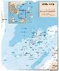
| Spratly Islands FeatureType : null Lat/Lng : 10.35 / 114.7668 | The Spratly Islands ((Nánshā Qúndǎo)) are a disputed group of islands, islets and cays and more than 100 reefs, sometimes grouped in submerged old atolls, in the South China Sea. The archipelago lies off the coasts of the Philippines, Malaysia, and southern Vietnam (...) |
| 6 | 
| Caribbean Sea FeatureType : waterbody Lat/Lng : 15.5 / -74.66 | The Caribbean Sea is a sea of the Atlantic Ocean in the tropics of the Western Hemisphere. It is bounded by Mexico and Central America to the west and south west, to the north by the Greater Antilles starting with Cuba, to the east by the Lesser Antilles, and to the south by the north coast of South (...) |
| 7 | 
| Torres Strait FeatureType : waterbody Lat/Lng : -9.8803 / 142.5906 | The Torres Strait is a strait which lies between Australia and the Melanesian island of New Guinea. It is approximately wide at its narrowest extent. To the south is Cape York Peninsula, the northernmost extremity of the Australian mainland. To the north is the Western Province of Papua New Guinea (...) |
| 8 | 
| Timor Sea FeatureType : waterbody Lat/Lng : -11.5339 / 126.0264 | The Timor Sea (; ; or Tasi Timór) is a relatively shallow sea bounded to the north by the island of Timor, to the east by the Arafura Sea, to the south by Australia. The sea contains a number of reefs, uninhabited islands and significant hydrocarbon reserves (...) |
| 9 | 
| Sharm El Sheikh FeatureType : null Elevation : 11 Lat/Lng : 27.9156 / 34.33 | Sharm El Sheikh is an Egyptian city on the southern tip of the Sinai Peninsula, in South Sinai Governorate, on the coastal strip along the Red Sea. Its population is approximately 73,000 . Sharm El Sheikh is the administrative hub of Egypt's South Sinai Governorate, which includes the smaller (...) |
| 10 |
| Red Sea FeatureType : adm1st Lat/Lng : 20.1553 / 38.6469 | The Red Sea (also the Erythraean Sea) is a seawater inlet of the Indian Ocean, lying between Africa and Asia. The connection to the ocean is in the south through the Bab el Mandeb strait and the Gulf of Aden. To the north lie the Sinai Peninsula, the Gulf of Aqaba, and the Gulf of Suez (leading to (...) |
| 11 | 
| Louisiade Archipelago FeatureType : isle Elevation : 127 Lat/Lng : -11.2 / 153.0 | The Louisiade Archipelago is a string of ten larger volcanic islands frequently fringed by coral reefs, and 90 smaller coral islands in Papua New Guinea. It is located 200 km southeast of New Guinea, stretching over more than and spread over an ocean area of between the Solomon Sea to the north and (...) |
| 12 | 
| Saint Barthélemy FeatureType : isle Elevation : 12 Lat/Lng : 17.8954 / -62.8276 | Saint Barthélemy , officially the Territorial collectivity of Saint-Barthélemy , called Ouanalao by the indigenous people, is an overseas collectivity of France in the West Indies. Often abbreviated to St-Barth in French, and St. Barths or St. Barts in English, R. P. Raymond BRETON (...) |
| 13 | 
| Mascarene Islands FeatureType : isle Lat/Lng : -20.7167 / 56.6167 | The Mascarene Islands or Mascarenes or Mascarenhas Archipelago is a group of islands in the Indian Ocean east of Madagascar consisting of Mauritius, Réunion and Rodrigues. Their name derives from the Portuguese navigator Pedro Mascarenhas, who first visited them in April 1512 (...) |
| 14 | 
| Paracel Islands FeatureType : null Lat/Lng : 16.6667 / 112.3333 | The Paracel Islands, also known as Xisha in Chinese and Hoàng Sa in Vietnamese, is a group of islands, reefs, banks and other maritime features in the South China Sea. It is controlled (and occupied) by the People's Republic of China, and also claimed by Taiwan (Republic of China) and Vietnam (...) |
| 15 | 
| Eilat FeatureType : null Elevation : 45 Lat/Lng : 29.5561 / 34.9509 | Eilat (; ; or , also) is Israel's southernmost city, a busy port and popular resort at the northern tip of the Red Sea, on the Gulf of Aqaba. The city's beaches, coral reef, nightlife and desert landscapes make it a popular destination for domestic and international tourism (...) |
| 16 | 
| Bay of Bengal FeatureType : waterbody Lat/Lng : 15.0 / 88.0 | The Bay of Bengal (Bengali: বঙ্গোপসাগর) is the northeastern part of the Indian Ocean, bounded on the west and northwest by India on the north by Bangladesh, and on the east by Myanmar and the Andaman and Nicobar Islands of (India) (...) |
| 17 | 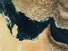
| Persian Gulf FeatureType : waterbody Lat/Lng : 26.9047 / 51.5308 | The Persian Gulf , is a mediterranean sea in Western Asia. The body of water is an extension of the Indian Ocean (Gulf of Oman) through the Strait of Hormuz and lies between Iran to the northeast and the Arabian Peninsula to the southwest (...) |
| 18 | 
| João Pessoa, Paraíba FeatureType : null Elevation : 8 Lat/Lng : -7.0833 / -34.8333 | João Pessoa The European Portuguese pronunciation is . is the capital of the state of Paraíba in Brazil. It was founded in 1585 and it is also known as the city where the sun rises first, because it is the easternmost city in the Americas at 34° 47′ 38″ W, 7° 9′ 28″ S (...) |
| 19 | 
| Tuamotus FeatureType : isle Lat/Lng : -18.0408 / -141.4094 | The Tuamotus, also referred to in English as the Tuamotu Archipelago or the Tuamotu Islands (, officially), are a French Polynesian chain of almost 80 islands and atolls forming the largest chain of atolls in the world (...) |
| 20 | 
| Gulf of Thailand FeatureType : waterbody Lat/Lng : 9.4403 / 101.9722 | The Gulf of Thailand, also known as the Gulf of Siam, is a shallow inlet in the western part of the South China Sea, a marginal body of water in the western Pacific Ocean. The gulf is around 800 km (497 mi) long and up to 560 km (348 mi) wide, has a surface area of 320,000 km2 (123,553 sq mi) and is (...) |
| 21 | 
| Barbados FeatureType : country Elevation : 193 Lat/Lng : 13.1667 / -59.5667 | Barbados (or) is an island country in the Lesser Antilles of the West Indies, in the Caribbean region of North America. It is in length and up to in width, covering an area of . It is situated in the western area of the North Atlantic and east of the Windward Islands and the Caribbean Sea; – U.S (...) |
| 22 | 
| Gulf of Carpentaria FeatureType : waterbody Lat/Lng : -14.0 / 139.0 | The Gulf of Carpentaria is a large, shallow sea enclosed on three sides by northern Australia and bounded on the north by the Arafura Sea (the body of water that lies between Australia and New Guinea). The northern boundary is generally defined as a line from Slade Point, Queensland (the (...) |
| 23 | 
| Maldives FeatureType : country Elevation : 8 Lat/Lng : 4.1743 / 73.51 | The Maldives (; Dhivehi Raa'jey), officially the Republic of Maldives, is a South Asian country, located in the Indian Ocean, situated in the Arabian Sea. It lies southwest of Sri Lanka and India. The chain of 26 atolls stretches from Ihavandhippolhu Atoll in the north to the Addu City in the south (...) |
| 24 | 
| Palawan FeatureType : isle Elevation : 308 Lat/Lng : 9.5275 / 118.3975 | Palawan (pron.), officially the Province of Palawan (Cuyonon: Probinsya i'ang Palawan / Paragua; ;) is an archipelagic province of the Philippines that is located in the region of MIMAROPA. It is the largest province in the country in terms of total area of jurisdiction (...) |
| 25 | 
| Curaçao FeatureType : isle Elevation : 67 Lat/Lng : 12.1861 / -68.9894 | Curaçao is a Lesser Antilles island in the southern Caribbean Sea and the Dutch Caribbean region, about north of the Venezuelan coast. It is a constituent country of the Kingdom of the Netherlands. The country was formerly part of the Curaçao and Dependencies colony (1815–1954) and is now formally (...) |
| 26 | 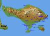
| Nusa Penida FeatureType : isle Elevation : 487 Lat/Lng : -8.7346 / 115.5378 | Nusa Penida is an island southeast of Indonesia's island Bali and a district of Klungkung Regency that includes the neighbouring small island of Nusa Lembongan. The Badung Strait separates the island and Bali. The interior of Nusa Penida is hilly with a maximum altitude of 524 metres (...) |
| 27 | 
| Funafuti FeatureType : isle Elevation : 8 Lat/Lng : -8.5167 / 179.2 | Funafuti is an atoll on which the capital of the island nation of Tuvalu is located. It has a population of 6,025 people, making it the country's most populated atoll, with 56.6 percent of Tuvalu's population. It is a narrow sweep of land between wide, encircling a large lagoon (Te Namo) long and (...) |
| 28 | 
| Archipelago of San Andrés, Providencia and Santa Catalina FeatureType : adm1st Elevation : 72 Lat/Lng : 12.55 / -81.7167 | Archipelago of San Andrés, Providencia and Santa Catalina , or, in everyday language, San Andrés y Providencia, is one of the departments of Colombia. It consists of two island groups about northwest of mainland Colombia, and eight outlying banks and reefs (...) |
| 29 | 
| Sinai Peninsula FeatureType : null Elevation : 725 Lat/Lng : 29.5 / 33.8333 | The Sinai Peninsula or simply Sinai (now usually) is a peninsula in Egypt, and the only part of the country located in Asia. It is situated between the Mediterranean Sea to the north and the Red Sea to the south, and is a land bridge between Asia and Africa (...) |
| 30 | 
| Nicobar Islands FeatureType : isle Elevation : 197 Lat/Lng : 7.0833 / 93.8 | The Nicobar Islands are an archipelagic island chain in the eastern Indian Ocean. They are located in Southeast Asia, 150 km north of Aceh on Sumatra, and separated from Thailand to the east by the Andaman Sea. Located 1,300 km southeast of the Indian subcontinent, across the Bay of Bengal, they (...) |
| 31 | 
| Bonaire FeatureType : isle Elevation : 74 Lat/Lng : 12.1796 / -68.2496 | Bonaire (pronounced or ; , ;Mangold, Max. Duden – Das Aussprachewörterbuch. In: Der Duden in zwölf Bänden, Band 6. 7. Auflage. Berlin: Dudenverlag; Mannheim : Institut für Deutsche Sprache, 2015, Seite 242. Papiamento: Boneiru) is an island in the Leeward Antilles in the Caribbean Sea (...) |
| 32 | 
| Veracruz (city) FeatureType : null Elevation : 11 Lat/Lng : 19.1778 / -96.1326 | Veracruz , officially known as Heroica Veracruz, is a major port city and municipality on the Gulf of Mexico in the Mexican state of Veracruz. The city is located along the coast in the central part of the state, southeast of the state capital Xalapa along Federal Highway 140 (...) |
| 33 | 
| Lord Howe Island FeatureType : landmark Elevation : 61 Lat/Lng : -31.5531 / 159.0839 | Lord Howe Island (; formerly Lord Howe's Island) is an irregularly crescent-shaped volcanic remnant in the Tasman Sea between Australia and New Zealand, directly east of mainland Port Macquarie, northeast of Sydney, and about southwest of Norfolk Island (...) |
| 34 | 
| Adam's Bridge FeatureType : landmark Lat/Lng : 9.121 / 79.5217 | Adam's Bridge (; Sinhala: adamgay palama), also known as Rama's Bridge or Rama Setu (Sanskrit:),also spelled Rama Setu, Ram Sethu, Ramasethu and variants. is a chain of limestone shoals, between Pamban Island, also known as Rameswaram Island, off the south-eastern coast of Tamil Nadu, India, and (...) |
| 35 | 
| Tuvalu FeatureType : country Elevation : 8 Lat/Lng : -8.5208 / 179.1986 | Tuvalu (or), formerly known as the Ellice Islands, is a Polynesian island country located in the Pacific Ocean, situated in Oceania, about midway between Hawaii and Australia. It lies east-northeast of the Santa Cruz Islands (belonging to the Solomons), southeast of Nauru, south of Kiribati, west of (...) |
| 36 | 
| Ryukyu Islands FeatureType : isle Elevation : 11 Lat/Lng : 26.3328 / 127.749 | The , also known as the or the , are a chain of Japanese islands that stretch southwest from Kyushu to Taiwan: the Ōsumi, Tokara, Amami, Okinawa, and Sakishima Islands (further divided into the Miyako and Yaeyama Islands), with Yonaguni the southernmost (...) |
| 37 | 
| Flores FeatureType : isle Elevation : 501 Lat/Lng : -8.6167 / 121.1333 | Flores (Indonesian: Pulau Flores) is one of the Lesser Sunda Islands, a group of islands in the eastern half of Indonesia. The population was 1,831,000 in the 2010 census and the largest town is Maumere. The name Flores is derived from the Portuguese for "flowers" (...) |
| 38 | 
| Maceió FeatureType : null Elevation : 21 Lat/Lng : -9.6639 / -35.7381 | Maceió is the capital and the largest city of the coastal state of Alagoas, Brazil. The name "Maceió" is an Indigenous term for a spring. Most maceiós flow to the sea, but some get trapped and form lakes ("lagoas", in Portuguese) (...) |
| 39 | 
| Antigua and Barbuda FeatureType : country Elevation : 56 Lat/Lng : 17.0833 / -61.8 | Antigua and Barbuda is a country in the West Indies in the Americas, lying between the Caribbean Sea and the Atlantic Ocean. It consists of two major islands, Antigua and Barbuda, and a number of smaller islands (including Great Bird, Green, Guiana, Long, Maiden and York Islands and further south, (...) |
| 40 | 
| Tromelin Island FeatureType : isle Elevation : 5 Lat/Lng : -15.8913 / 54.5235 | Tromelin Island is a low, flat, island in the Indian Ocean about north of Réunion, and about east of Madagascar. Tromelin is administered as part of the French Southern and Antarctic Lands, a French overseas territory; however, Mauritius claims sovereignty over the island, on grounds of its absence (...) |
| 41 | 
| Muscat FeatureType : null Elevation : 63 Lat/Lng : 23.6086 / 58.5919 | Muscat is the capital and largest city of Oman. It is the seat of the Governorate of Muscat. According to the National Centre for Statistics and Information (NCSI), the total population of Muscat Governorate reached 1.28 million as of September 2015 (...) |
| 42 | 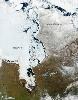
| Hudson Bay FeatureType : waterbody Lat/Lng : 59.32 / -84.41 | Hudson Bay (Inuktitut: Kangiqsualuk ilua) (sometimes called Hudson's Bay, usually historically) is a large body of saltwater in northeastern Canada with a surface area of . It drains a very large area, about , that includes parts of southeastern Nunavut, Saskatchewan, most of Manitoba, Ontario, (...) |
| 43 | 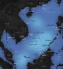
| South China Sea FeatureType : waterbody Lat/Lng : 12.1883 / 113.2264 | The South China Sea is a marginal sea that is part of the Pacific Ocean, encompassing an area from the Karimata and Malacca Straits to the Strait of Taiwan of around . The sea carries tremendous strategic importance; one-third of the world's shipping passes through it carrying over $3 trillion in (...) |
| 44 | 
| Pacific Ocean FeatureType : waterbody Lat/Lng : 0.0 / -160.0 | The Pacific Ocean is the largest and deepest of Earth's oceanic divisions. It extends from the Arctic Ocean in the north to the Southern Ocean (or, depending on definition, to Antarctica) in the south and is bounded by Asia and Australia in the west and the Americas in the east (...) |
| 45 | 
| Seychelles FeatureType : country Elevation : 9 Lat/Lng : -7.0675 / 52.7344 | Seychelles (; French:), officially the Republic of Seychelles (; Creole: Repiblik Sesel), is an archipelago country in the Indian Ocean. The capital of the 115-island country, Victoria, lies east of mainland East Africa (...) |
| 46 | 
| Saint Croix FeatureType : null Elevation : 106 Lat/Lng : 17.7397 / -64.7389 | Saint Croix; ; ; Danish and , Taino: Ay Ay is an island in the Caribbean Sea, and a county and constituent district of the United States Virgin Islands (USVI), an unincorporated territory of the United States. St. Croix is the largest of the islands in the territory (...) |
| 47 | 
| Savai'i FeatureType : null Elevation : 1739 Lat/Lng : -13.625 / -172.4867 | Savaii is the largest (area 1,694 km2) and highest (Mt Silisili at 1,858 m) island in Samoa and the Samoan Islands chain. The island is the fifth largest in Polynesia, behind the two main islands of New Zealand and the Hawaiian Islands of Hawaii and Maui (...) |
| 48 | 
| Bali FeatureType : adm1st Elevation : 606 Lat/Lng : -8.3692 / 115.1383 | Bali (Balinese:) is a province of Indonesia and an island on the westernmost of the Lesser Sunda Islands. Located on the east of Java and west of Lombok, the province includes the island of Bali and a few smaller neighbouring islands, notably Nusa Penida, Nusa Lembongan and Nusa Ceningan (...) |
| 49 | 
| Lake Champlain FeatureType : waterbody Elevation : 28 Lat/Lng : 44.5667 / -73.35 | Lake Champlain (French: Lac Champlain) (Abenaki: Pitawbagok) (Mohawk: Kaniatarakwà:ronte) is a natural freshwater lake in North America mainly within the borders of the United States (in the states of Vermont and New York) but partially situated across the Canada–U.S (...) |
| 50 | 
| Rotuma FeatureType : null Elevation : 100 Lat/Lng : -12.5 / 177.08 | Rotuma is a Fijian dependency, consisting of Rotuma Island and nearby islets. The island group is home to a large and unique indigenous ethnic group which constitutes a recognisable minority within the population of Fiji, known as "Rotumans" (...) |
| 51 | 
| Bass Strait FeatureType : waterbody Lat/Lng : -39.9358 / 146.0811 | Bass Strait is a sea strait separating Tasmania from the Australian mainland, specifically the state of Victoria. (...) |
| 52 | 
| Rodrigues FeatureType : null Elevation : 229 Lat/Lng : -19.7167 / 63.4167 | Rodrigues is a autonomous outer island of the Republic of Mauritius in the Indian Ocean, about east of Mauritius. It is part of the Mascarene Islands which include Mauritius and Réunion. It is of volcanic origin and is surrounded by coral reef, and just off its coast lie some tiny uninhabited (...) |
| 53 | 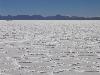
| Salar de Uyuni FeatureType : null Elevation : 3658 Lat/Lng : -20.1338 / -67.4891 | Salar de Uyuni (or Salar de Tunupa) is the world's largest salt flat, at 10,582 square kilometers (4,086 sq mi). It is in the Daniel Campos Province in Potosí in southwest Bolivia, near the crest of the Andes and is at an elevation of 3,656 meters (11,995 ft) above sea level (...) |
| 54 | 
| Hilo, Hawaii FeatureType : city Elevation : 55 Lat/Lng : 19.7056 / -155.0858 | Hilo is the largest settlement and census-designated place (CDP) in Hawaii County, Hawaii, United States, which encompasses the Island of Hawaii. The population was 43,263 at the 2010 census. Hilo is the county seat of the County of Hawaii and is in the District of South Hilo (...) |
| 55 | 
| Yap FeatureType : isle Elevation : 13 Lat/Lng : 9.5333 / 138.1167 | Yap or Wa′ab (Yapese Dictionary: English Finderlist. Updated 15 June 2012. Retrieved 25 November 2013.) traditionally refers to an island located in the Caroline Islands of the western Pacific Ocean, a part of the Federated States of Micronesia (...) |
| 56 | 
| Quintana Roo FeatureType : adm1st Elevation : 10 Lat/Lng : 19.5956 / -87.9131 | Quintana Roo , officially the Free and Sovereign State of Quintana Roo , is one of the 31 states which, with the Federal District, make up the 32 federal entities of Mexico. It is divided into 11 municipalities and its capital city is Chetumal (...) |
| 57 | 
| Robben Island FeatureType : isle Elevation : 13 Lat/Lng : -33.8067 / 18.3662 | Robben Island is an island in Table Bay, west of the coast of Bloubergstrand, Cape Town, South Africa. The name is Dutch for "seal island." Robben Island is roughly oval in shape, long north-south, and wide, with an area of (...) |
| 58 | 
| Tobago FeatureType : isle Elevation : 368 Lat/Lng : 11.25 / -60.667 | Tobago is an autonomous island within the Republic of Trinidad and Tobago. It is located northeast of the mainland of Trinidad and southeast of Grenada, about off the coast of northeast Venezuela. According to the earliest English-language source cited in the Oxford English Dictionary, Tobago bore a (...) |
| 59 | 
| Cook Islands FeatureType : country Elevation : 322 Lat/Lng : -21.2347 / -159.7778 | The Cook Islands (Cook Islands Māori: Kūki 'Āirani) by Jasper Buse & Raututi Taringa, Cook Islands Ministry of Education (1995) page 200 is a self-governing island country in the South Pacific Ocean in free association with New Zealand. It comprises 15 islands whose total land area is (...) |
| 60 | 
| Great Salt Lake FeatureType : waterbody Elevation : 1282 Lat/Lng : 41.12 / -112.5 | The Great Salt Lake, located in the northern part of the U.S. state of Utah, is the largest salt water lake in the Western Hemisphere, and the eighth-largest terminal lake in the world. In an average year the lake covers an area of around , but the lake's size fluctuates substantially due to its (...) |
| 61 | 
| Kaohsiung FeatureType : null Elevation : 162 Lat/Lng : 22.6333 / 120.2667 | Kaohsiung (Hokkien POJ: Ko-hiông; Hakka Pha̍k-fa-sṳ: Kô-hiùng; old names: Takao, Takow, Takau) is a special municipality located in southern-western Taiwan and facing the Taiwan Strait. Kaohsiung has a population of approximately 2 (...) |
| 62 | 
| Pago Pago FeatureType : city Elevation : 147 Lat/Lng : -14.2794 / -170.7006 | Pago Pago (; Samoan: ; pronounced pahng-oh pahng-oh)Harris, Ann G. and Esther Tuttle (2004). Geology of National Parks. Kendall Hunt. Page 604. . is the territorial capital of American Samoa. It is in Maoputasi County on the main island of American Samoa, Tutuila (...) |
| 63 | 
| Kiritimati FeatureType : isle Lat/Lng : 1.8833 / -157.4 | Kiritimati,Kiritimati is the rendition of Christmas in Taetae ni Kiribati, the local Kiribati language, and it is pronounced very closely to "Christmas," with the same meaning. or Christmas Island, is a Pacific Ocean raised coral atoll in the northern Line Islands (...) |
| 64 | 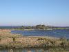
| Chesapeake Bay FeatureType : null Lat/Lng : 37.2481 / -76.1194 | The Chesapeake Bay is an estuary in the U.S. states of Maryland and Virginia. The Bay is located in the Mid-Atlantic region and is primarily separated from the Atlantic Ocean by the Delmarva Peninsula with its mouth located between Cape Henry and Cape Charles (...) |
| 65 | 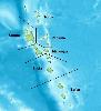
| Vanuatu FeatureType : country Lat/Lng : -16.6333 / 168.0167 | Vanuatu (or ; Bislama, French), officially the Republic of Vanuatu (Bislama: Ripablik blong Vanuatu), is a Pacific island country located in the South Pacific Ocean. The archipelago, which is of volcanic origin, is east of northern Australia, northeast of New Caledonia, east of New Guinea, southeast (...) |
| 66 | 
| Okinawa Prefecture FeatureType : adm1st Lat/Lng : 26.1831 / 127.5497 | is the southernmost prefecture of Japan.Nussbaum, Louis-Frédéric. (2005). "Okinawa-shi" in It encompasses two thirds of the Ryukyu Islands in a chain over long. The Ryukyu Islands extend southwest from Kyushu (the southwesternmost of Japan's four main islands) to Taiwan (Yilan County) (...) |
| 67 | 
| Grand Bahama FeatureType : null Elevation : 4 Lat/Lng : 26.655 / -78.3208 | Grand Bahama is the northernmost of the islands of The Bahamas, lying off Palm Beach, Florida. It is the fourth largest island in the Bahamas island chain of approximately 700 islands and 2,400 cays. The island is roughly in area and approximately long west to east and at its widest point north to (...) |
| 68 | 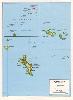
| Geography of Seychelles FeatureType : null Elevation : 411 Lat/Lng : -4.6667 / 55.4667 | The Seychelles is a small island nation located in the Indian Ocean northeast of Madagascar and about east of Kenya. Seychelles lies between approximately 4ºS and 10ºS and 46ºE and 54ºE. The nation is an archipelago of 115 tropical islands, some granite and some coral (...) |
| 69 | 
| 2004 Indian Ocean earthquake and tsunami FeatureType : event Lat/Lng : 3.316 / 95.854 | The 2004 Indian Ocean earthquake occurred at 00:58:53 UTC on 26 December, with an epicentre off the west coast of northern Sumatra and a magnitude of 9.1–9.3 , reaching a Mercalli intensity up to IX in certain areas (...) |
| 70 | 
| Nevis FeatureType : isle Elevation : 725 Lat/Lng : 17.1528 / -62.5892 | Nevis is a small island in the Caribbean Sea that forms part of the inner arc of the Leeward Islands chain of the West Indies. Nevis and the neighbouring island of Saint Kitts constitute one country: the Federation of Saint Kitts and Nevis (...) |
| 71 | 
| Diego Garcia FeatureType : isle Elevation : 0 Lat/Lng : -7.3133 / 72.4111 | Diego Garcia is an atoll just south of the equator in the central Indian Ocean, and the largest of 60 small islands comprising the Chagos Archipelago. It was settled by the French in the 1790s and was transferred to British rule after the Napoleonic Wars (...) |
| 72 | 
| Bermuda FeatureType : country Lat/Lng : 32.3333 / -64.75 | Bermuda is a British Overseas Territory in the North Atlantic Ocean. It is approximately east-southeast of Cape Hatteras, North Carolina; south of Cape Sable Island, Nova Scotia; and north of Cuba. The capital city is Hamilton (...) |
| 73 | 
| Recife FeatureType : null Elevation : 10 Lat/Lng : -8.0556 / -34.8722 | Recife The European Portuguese pronunciation is . is the fourth-largest urban agglomeration in Brazil with 4,031,485 inhabitants, the largest urban agglomeration of the North/Northeast Regions, and the capital and largest city of the state of Pernambuco in the northeast corner of South America (...) |
| 74 | 
| Zanzibar FeatureType : adm1st Elevation : 28 Lat/Lng : -6.1333 / 39.3167 | Zanzibar is a semi-autonomous region of Tanzania. It is composed of the Zanzibar Archipelago in the Indian Ocean, off the coast of the mainland, and consists of many small islands and two large ones: Unguja (the main island, referred to informally as Zanzibar) and Pemba Island (...) |
| 75 | 
| Bikini Atoll FeatureType : isle Lat/Lng : 11.6039 / 165.3897 | Bikini Atoll (pronounced or ; Marshallese: , , meaning "coconut place") is an atoll in the Marshall Islands which consists of 23 islands totalling surrounding a central lagoon. It is at the northern end of the Ralik Chain, approximately northwest of Ailinginae Atoll and northwest of Majuro (...) |
| 76 | 
| Gulf of Tadjoura FeatureType : null Lat/Lng : 11.6936 / 42.9408 | The Gulf of Tadjoura is a gulf or basin of the Indian Ocean in the Horn of Africa. It lies south of the straits of Bab-el-Mandeb, or the entrance to the Red Sea, at . The gulf has many fishing grounds, extensive coral reefs, and abundant pearl oysters (...) |
| 77 | 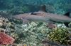
| Tubbataha Reef FeatureType : isle Lat/Lng : 8.9167 / 119.9167 | The Tubbataha Natural Park also known as Tubbataha Reefs Natural Park is a protected area of the Philippines located in the middle of the Sulu Sea. The marine and bird sanctuary consists of two huge atolls (named the North Atoll and South Atoll) and the smaller Jessie Beazley Reef covering a total (...) |
| 78 | 
| Newport Beach, California FeatureType : null Elevation : 6 Lat/Lng : 33.6167 / -117.8975 | Newport Beach is a seaside city in Orange County, California, United States. Its population was 85,287 at the 2010 census. Newport Beach is home to Newport Harbor. (...) |
| 79 | 
| Marquesas Islands FeatureType : adm1st Lat/Lng : -9.4544 / -139.3889 | The Marquesas Islands (; or ' or '; Marquesan: ' (North Marquesan) and ' (South Marquesan), both meaning "the land of men") are a group of volcanic islands in French Polynesia, an overseas collectivity of France in the southern Pacific Ocean. The Marquesas are located at 9.7812° S, 139.0817° W (...) |
| 80 | 
| Saba FeatureType : isle Elevation : 536 Lat/Lng : 17.6297 / -63.2356 | Saba Mangold, Max. Duden – Das Aussprachewörterbuch. In: Der Duden in zwölf Bänden, Band 6. 7. Auflage. Berlin: Dudenverlag; Mannheim : Institut für Deutsche Sprache, 2015, Seite 747. is a Caribbean island which is the smallest special municipality (officially “public body”) of the Netherlands (...) |
| 81 | 
| Natal, Rio Grande do Norte FeatureType : null Elevation : 33 Lat/Lng : -5.7997 / -35.212 | Natal (The European Portuguese pronunciation is "Christmas") is the capital and largest city of the state Rio Grande do Norte, located in northeastern Brazil. According to IBGE's July 2014 report, the city had a total population of 862,044, while Greater Natal had 1,485,505 inhabitants (...) |
| 82 | 
| Scapa Flow FeatureType : isle Lat/Lng : 58.8922 / -3.05 | Scapa Flow (or ; Scapa Flow: Graveyard of the German Fleet, Will Springer.) is a body of water in the Orkney Islands, Scotland, sheltered by the islands of Mainland, Graemsay, Burray,S. C. George, Jutland to Junkyard, 1973. South Ronaldsay and Hoy (...) |
| 83 | 
| Bohol FeatureType : isle Elevation : 201 Lat/Lng : 9.8667 / 124.2167 | Bohol is a 1st provincial income class island province of the Philippines located in the Central Visayas region, consisting of the island itself and 75 minor surrounding islands. Its capital is Tagbilaran. With a land area of and a coastline long, Bohol is the tenth largest island of the Philippines (...) |
| 84 | 
| Maui FeatureType : isle Elevation : 614 Lat/Lng : 20.8075 / -156.3311 | The island of Maui (; Hawaiian:) is the second-largest of the Hawaiian Islands at 727.2 square miles (1,883 km2) and is the 17th-largest island in the United States. Maui is part of the State of Hawaii and is the largest of Maui County's four islands, which include Molokai, Lānai, and unpopulated (...) |
| 85 | 
| Socotra FeatureType : null Elevation : 740 Lat/Lng : 12.51 / 53.92 | Socotra , also called Soqotra, located between the Guardafui Channel and the Arabian Sea, is the largest of four islands of the Socotra archipelago. The territory is located near major shipping routes and is officially part of Yemen, and had long been a subdivision of the Aden Governorate (...) |
| 86 | 
| Midway Atoll FeatureType : isle Lat/Lng : 28.2 / -177.35 | Midway Atoll (colloquial: Midway Islands; Hawaiian: Pihemanu Kauihelani) is a atoll in the North Pacific Ocean at . Midway is roughly equidistant between North America and Asia. Midway Atoll is an unorganized, unincorporated territory of the United States (...) |
| 87 | 
| Sulawesi FeatureType : isle Elevation : 1036 Lat/Lng : -2.1333 / 120.2833 | Sulawesi, formerly known as Celebes , is an island in Indonesia. One of the four Greater Sunda Islands, and the world's eleventh-largest island, it is situated east of Borneo, west of the Maluku Islands, and south of Mindanao and the Sulu Archipelago (...) |
| 88 | 
| Anguilla FeatureType : landmark Elevation : 43 Lat/Lng : 18.2272 / -63.049 | Anguilla is a British overseas territory in the Caribbean. It is one of the most northerly of the Leeward Islands in the Lesser Antilles, lying east of Puerto Rico and the Virgin Islands and directly north of Saint Martin (...) |
| 89 | 
| Phuket Province FeatureType : adm1st Elevation : 23 Lat/Lng : 7.89 / 98.3983 | Phuket (or Tanjung Salang) is one of the southern provinces (changwat) of Thailand. It consists of the island of Phuket, the country's largest island, and another 32 smaller islands off its coast. It lies off the west coast of Thailand in the Andaman Sea (...) |
| 90 | 
| Jan Mayen FeatureType : isle Lat/Lng : 70.9833 / -8.5333 | Jan Mayen is a Norwegian volcanic island situated in the Arctic Ocean. It is long (southwest-northeast) and in area, partly covered by glaciers (an area of around the Beerenberg volcano). It has two parts: larger northeast Nord-Jan and smaller Sør-Jan, linked by a wide isthmus (...) |
| 91 | 
| Palau FeatureType : country Elevation : 29 Lat/Lng : 7.4864 / 134.5533 | Palau (historically Belau, Palaos, or Pelew), officially the Republic of Palau , . (PDF). palauembassy.com. Retrieved 1 June 2013. is an island country located in the western Pacific Ocean. The country contains approximately 340 islands, forming the western chain of the Caroline Islands in (...) |
| 92 | 
| Northern Mariana Islands FeatureType : isle Elevation : 426 Lat/Lng : 15.1895 / 145.7443 | The Northern Mariana Islands, officially the Commonwealth of the Northern Mariana Islands (CNMI; ; Refaluwasch or Carolinian: Commonwealth Téél Falúw kka Efáng llól Marianas), is an insular area and commonwealth of the United States consisting of 15 islands in the northwestern Pacific Ocean (...) |
| 93 | 
| Gotland FeatureType : isle Elevation : 48 Lat/Lng : 57.4808 / 18.4883 | Gotland (; , Svenska Akademiens ordlista, 6 February 2013 older spellings include Gottland or Gothland), Gutland in the local dialect, is a province, county, municipality, and diocese of Sweden. It is Sweden's largest island (...) |
| 94 | 
| Martinique FeatureType : isle Elevation : 58 Lat/Lng : 14.6407 / -61.0112 | Martinique is an insular region of France located in the Lesser Antilles of the West Indies in the eastern Caribbean Sea, with a land area of and a population of 385,551 inhabitants as of January 2013. Like Guadeloupe, it is an overseas region of France, consisting of a single overseas department (...) |
| 95 | 
| Saudi Arabia FeatureType : country Elevation : 943 Lat/Lng : 24.0 / 45.0 | Saudi Arabia , officially the Kingdom of Saudi Arabia (KSA; '), is a country in Western Asia constituting the bulk of the Arabian Peninsula. With a land area of approximately , Saudi Arabia is the largest sovereign state in the Middle East, geographically the fifth-largest in Asia, second-largest in (...) |
| 96 | 
| Manila Bay FeatureType : null Lat/Lng : 14.5167 / 120.7667 | Manila Bay is a natural harbour which serves the Port of Manila (on Luzon), in the Philippines. Strategically located around the capital city of the Philippines, Manila Bay facilitated commerce and trade between the Philippines and its neighbouring countries,Jacinto, G.S., Azanza, R.V.,Velasquez,I.B (...) |
| 97 | 
| Tongatapu FeatureType : isle Elevation : 8 Lat/Lng : -21.1672 / -175.1964 | Tongatapu is the main island of the Kingdom of Tonga and the location of its capital Nukualofa. It is located in Tonga's southern island group, to which it gives its name, and is the country's most populous island, with approximately 71,260 residents (2006), 70.5% of the national population, on (...) |
| 98 | 
| Celebes Sea FeatureType : waterbody Lat/Lng : 3.5731 / 121.9622 | The Celebes Sea of the western Pacific Ocean is bordered on the north by the Sulu Archipelago and Sulu Sea and Mindanao Island of the Philippines, on the east by the Sangihe Islands chain, on the south by Sulawesi's Minahassa Peninsula, and on the west by Kalimantan in Indonesia (...) |
| 99 | 
| Simeulue Regency FeatureType : null Elevation : 34 Lat/Lng : 2.5833 / 96.0833 | Simeulue Regency is a regency in the Aceh special region of Indonesia. It occupies the whole island of Simeulue (Pulau Simeulue), 150 km off the west coast of Sumatra, with an area of . It had a population of 80,674 at the 2010 Census; the latest official estimate (for January 2014) is 84,933 (...) |
| 100 | 
| New Georgia Islands FeatureType : isle Elevation : 27 Lat/Lng : -8.1667 / 157.3333 | The New Georgia Islands are part of the Western Province of the Solomon Islands. They are located to the northwest of Guadalcanal. The larger islands are mountainous and covered in rain forest. The main islands are New Georgia, Vella Lavella, Kolombangara (a dormant volcano), Ghizo, Vangunu, Rendova (...) |
| 101 | 
| Belize FeatureType : country Elevation : 69 Lat/Lng : 17.25 / -88.75 | Belize , is a country located on the eastern coast of Central America. Belize is bordered on the northwest by Mexico, on the east by the Caribbean Sea, and on the south and west by Guatemala. It has an area of and a population of 387,879 (2017). Its mainland is about long and wide (...) |
| 102 | 
| Bahrain FeatureType : country Elevation : 57 Lat/Lng : 26.0675 / 50.5511 | Bahrain , officially the Kingdom of Bahrain (help=no), is an island country in the Persian Gulf. The sovereign state comprises a small archipelago centered around Bahrain Island, situated between the Qatar peninsula and the north eastern coast of Saudi Arabia, to which it is connected by the King (...) |
| 103 | 
| Sandakan FeatureType : null Lat/Lng : 5.837 / 118.1148 | Sandakan (Jawi:) formerly known at various times as Elopura, is the capital of the Sandakan District in Sabah, Malaysia. It is the second largest town in Sabah after Kota Kinabalu. It is located on the east coast of the state in the administrative centre of Sandakan Division and was the former (...) |
| 104 | 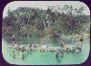
| Solomon Islands FeatureType : country Elevation : 553 Lat/Lng : -9.6667 / 160.2 | Solomon Islands is a country consisting of six major islands and over 900 smaller islands in Oceania lying to the east of Papua New Guinea and northwest of Vanuatu and covering a land area of . The country's capital, Honiara, is located on the island of Guadalcanal (...) |
| 105 | 
| Buru FeatureType : isle Elevation : 624 Lat/Lng : -3.3997 / 126.6667 | Buru (formerly spelled Boeroe, Boro, or Bouru) is the third largest island within Maluku Islands of Indonesia. It lies between the Banda Sea to the south and Seram Sea to the north, west of Ambon and Seram islands. The island belongs to Maluku province and includes the Buru and South Buru regencies (...) |
| 106 | 
| Rockall FeatureType : isle Elevation : 0 Lat/Lng : 57.5963 / -13.6873 | Rockall is a British uninhabited granite islet located within the exclusive economic zone (EEZ) of the United Kingdom,. Oireachtas, Dublin, 24 March 2011. Retrieved 5 April 2018. situated in the North Atlantic Ocean (...) |
| 107 | 
| Cocos (Keeling) Islands FeatureType : isle Lat/Lng : -12.1603 / 96.8586 | The Territory of Cocos (Keeling) Islands is an Australian external territory in the Indian Ocean, comprising a small archipelago approximately midway between Australia and Sri Lanka and closer to the Indonesian island of Sumatra. It is part of Southeast Asia and is in the Southern Hemisphere (...) |
| 108 | 
| Mull FeatureType : isle Elevation : 362 Lat/Lng : 56.4489 / -5.9925 | Mull is the second largest island of the Inner Hebrides (after Skye), and lies off the west coast of Scotland in the council area of Argyll and Bute. With an area of , Mull is the fourth largest Scottish island and the fourth largest island surrounding Great Britain (excluding Ireland) (...) |
| 109 | 
| Fortaleza FeatureType : null Elevation : 21 Lat/Lng : -3.7169 / -38.5428 | Fortaleza (locally , Portuguese for Fortress) is the state capital of Ceará, located in Northeastern Brazil. It belongs to the Metropolitan mesoregion of Fortaleza and microregion of Fortaleza. Located 2285 km (1420 miles) from Brasilia, the federal capital, the city has developed on the banks of (...) |
| 110 | 
| New Guinea FeatureType : isle Elevation : 2230 Lat/Lng : -5.3258 / 141.6072 | New Guinea (; ; ; , historically, ') is a large island off the continent of Australia. It is the world's second-largest island, after Greenland, covering a land area of , and the largest wholly or partly within the Southern Hemisphere and Oceania (...) |
| 111 | 
| Niue FeatureType : country Elevation : 60 Lat/Lng : -19.0618 / -169.8631 | Niue is an island country in the South Pacific Ocean, northeast of New Zealand, east of Tonga, south of Samoa, and west of the Cook Islands. Niue's land area is about and its population, predominantly Polynesian, was about 1,600 in 2016 (...) |
| 112 | 
| Montserrat FeatureType : null Elevation : 330 Lat/Lng : 16.7425 / -62.1872 | Montserrat is a Caribbean island in the Leeward Islands, which is part of the chain known as the Lesser Antilles, in the West Indies. It is a British Overseas Territory (BOT). Montserrat measures approximately in length and in width, with approximately of coastline (...) |
| 113 | 
| British Virgin Islands FeatureType : null Elevation : 75 Lat/Lng : 18.4844 / -64.5317 | The British Virgin Islands (BVI), officially simply "Virgin Islands",According to the ', the territory's official name is simply 'Virgin Islands'. are a British Overseas Territory in the Caribbean, to the east of Puerto Rico (...) |
| 114 | 
| Dominica FeatureType : country Elevation : 221 Lat/Lng : 15.4272 / -61.3477 | Dominica (; Island Carib:), officially the Commonwealth of Dominica, is an Island country in the West Indies. The capital, Roseau, is located on the western side of the island. It is part of the Windward Islands in the Lesser Antilles archipelago in the Caribbean Sea (...) |
| 115 | 
| Cayman Islands FeatureType : country Lat/Lng : 19.508 / -80.5215 | The Cayman Islands (or) is an autonomous British Overseas Territory in the western Caribbean Sea. The territory comprises the three islands of Grand Cayman, Cayman Brac and Little Cayman, which are located to the south of Cuba and northeast of Honduras, between Jamaica and the Yucatán Peninsula (...) |
| 116 | 
| Mayagüez, Puerto Rico FeatureType : null Elevation : 27 Lat/Lng : 18.2011 / -67.1397 | Mayagüez is the eighth-largest municipality of Puerto Rico (U.S.). It was founded as Nuestra Señora de la Candelaria, and is also known as La Sultana del Oeste (The Sultaness of the West), Ciudad de las Aguas Puras (City of Pure Waters), or Ciudad del Mangó (City of the Mango) (...) |
| 117 | 
| Geraldton FeatureType : null Elevation : 15 Lat/Lng : -28.779 / 114.6146 | Geraldton is a coastal city in the Mid West region of Western Australia, north of Perth. At the 2016 Census, Geraldton had an urban population of 37,432. Geraldton is the seat of government for the City of Greater Geraldton, which also incorporates the town of Mullewa, Walkaway and large rural areas (...) |
| 118 | 
| Thoothukudi FeatureType : city Elevation : 7 Lat/Lng : 8.8053 / 78.1447 | Tuticorin, known officially as Thoothukudi (Tamil: தூத்துக்குடி), is a port city and a municipal corporation and an industrial city in Thoothukudi district in the Indian state of Tamil Nadu. The city lies in the Coromandel Coast of Bay of Bengal (...) |
| 119 | 
| Kii Peninsula FeatureType : isle Elevation : 954 Lat/Lng : 34.3028 / 135.955 | The is the largest peninsula on the island of Honshū in Japan. It is named after the ancient Kii Province. The area south of the “Central Tectonic Line” is called Nanki , and includes the most poleward living coral reefs in the world due to the presence of the warm Kuroshio Current, though these are (...) |
| 120 | 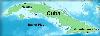
| Bay of Pigs FeatureType : waterbody Lat/Lng : 22.2625 / -81.195 | The Bay of Pigs is an inlet of the Gulf of Cazones located on the southern coast of Cuba. By 1910, it was included in Santa Clara Province, and then instead to Las Villas Province by 1961, but in 1976, it was reassigned to Matanzas Province, when the original six provinces of Cuba were re-organized (...) |
| 121 | 
| Liancourt Rocks FeatureType : null Lat/Lng : 37.2333 / 131.8667 | The Liancourt Rocks are a group of small islets in the Sea of Japan. While South Korea controls the islets, its sovereignty over them is contested by Japan. South Korea classifies the islets as Dokdo-ri, Ulleung-eup, Ulleung County, North Gyeongsang Province, "Pursuant to Act 1395 amending Chapter (...) |
| 122 | 
| Kosrae FeatureType : adm1st Elevation : 198 Lat/Lng : 5.3103 / 162.9773 | Kosrae (pronunciation: koh-), formerly known as Kusaie or Strong's Island, is an island in Federated States of Micronesia. The State of Kosrae is one of the four states of the Federated States of Micronesia, and includes the main island of Kosrae and a few nearby islands and islets, the most (...) |
| 123 | 
| Boca Raton, Florida FeatureType : null Elevation : 4 Lat/Lng : 26.3686 / -80.1 | Boca Raton is the southernmost city in Palm Beach County, Florida, United States, first incorporated on August 2, 1924 as "Bocaratone," and then incorporated as "Boca Raton" in 1925. The 2015 population estimated by the U.S. Census Bureau was 93,235 (...) |
| 124 | 
| Trincomalee FeatureType : city Lat/Lng : 8.5833 / 81.2333 | Trincomalee (; Tirukōṇamalai; Trikuṇāmalaya) also known as Gokanna, is the administrative headquarters of the Trincomalee District and major resort port city of Eastern Province, Sri Lanka. Located on the east coast of the island overlooking the Trincomalee Harbour, 113 miles south of Jaffna and 69 (...) |
| 125 | 
| East River FeatureType : river Lat/Lng : 40.7966 / -73.8673 | The East River is a salt water tidal estuary in New York City. The waterway, which is actually not a river despite its name, connects Upper New York Bay on its south end to Long Island Sound on its north end. It separates the borough of Queens on Long Island from the Bronx on the North American (...) |
| 126 | 
| Jeddah FeatureType : city Elevation : 15 Lat/Lng : 21.5433 / 39.1728 | Jeddah (sometimes spelled Jiddah or Jedda; ; ', Hejazi pronunciation:) is a city in the Tihamah region of the Hejaz on the coast of the Red Sea and is the major urban center of western Saudi Arabia. It is the largest city in Makkah Province, the largest seaport on the Red Sea, and with a population (...) |
| 127 | 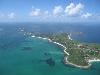
| Isles of Scilly FeatureType : isle Elevation : 23 Lat/Lng : 49.9212 / -6.2943 | The Isles of Scilly (; or ') is an archipelago off the southwestern tip of Cornwall. One of the islands, St Agnes, is the most southerly point in both England and the United Kingdom, being over further south than the most southerly point of the British mainland at Lizard Point (...) |
| 128 | 
| Jersey FeatureType : isle Elevation : 90 Lat/Lng : 49.2206 / -2.1372 | Jersey (; Jèrriais: Jèrri), officially the Bailiwick of Jersey (; Jèrriais: Bailliage dé Jèrri), is a Crown dependency located near the coast of Normandy, France. Jersey was part of the Duchy of Normandy, whose dukes went on to become kings of England from 1066 (...) |
| 129 | 
| Azores FeatureType : isle Elevation : 20 Lat/Lng : 37.7411 / -25.6756 | The Azores (or ;), officially the Autonomous Region of the Azores , is one of the two autonomous regions of Portugal (along with Madeira (Região Autónoma da Madeira). It is an archipelago composed of nine volcanic islands in the North Atlantic Ocean about west of continental Portugal, about west of (...) |
| 130 | 
| Tahiti FeatureType : isle Elevation : 824 Lat/Lng : -17.6767 / -149.4544 | Tahiti (; ; previously also known as Otaheite (obsolete) is the largest island in the Windward group of French Polynesia. The island is located in the archipelago of the Society Islands in the central Southern Pacific Ocean, and is divided into two parts: the bigger, northwestern part, Tahiti Nui, (...) |
| 131 | 
| Jamestown, Virginia FeatureType : landmark Elevation : 8 Lat/Lng : 37.2094 / -76.78 | The JamestownPreviously also written variously as James Town, James Towne, Jamestowne, and James City. settlement in the Colony of Virginia was the first permanent English settlement in the Americas. It was located on the east bank of the Powhatan (James) River about southwest of the center of (...) |
| 132 | 
| Johannesburg FeatureType : null Elevation : 1766 Lat/Lng : -26.2044 / 28.0456 | Johannesburg (; ; also known as Jozi, Joburg, and eGoli) is the largest city in South Africa and one of the 50 largest urban areas in the world. It is the provincial capital and largest city of Gauteng, which is the wealthiest province in South Africa (...) |
| 133 | 
| Carmel-by-the-Sea, California FeatureType : null Elevation : 64 Lat/Lng : 36.5553 / -121.9233 | Carmel-by-the-Sea, often simply called Carmel, is a city in Monterey County, California, United States, founded in 1902 and incorporated on October 31, 1916. Situated on the Monterey Peninsula, Carmel is known for its natural scenery and rich artistic history (...) |
| 134 | 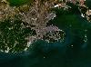
| Dalian FeatureType : city Elevation : 23 Lat/Lng : 39.0333 / 121.7667 | Dalian is a major city and seaport in the south of Liaoning Province, China. It is the southernmost city of the Liaodong Peninsula. Dalian is the province's second largest city and has sub-provincial administrative status (...) |
| 135 | 
| Papua New Guinea FeatureType : country Lat/Lng : -9.5 / 147.1167 | Papua New Guinea (PNG; , ; ;), officially the Independent State of Papua New Guinea, is an Oceanian country that occupies the eastern half of the island of New Guinea and its offshore islands in Melanesia, a region of the southwestern Pacific Ocean north of Australia (...) |
| 136 | 
| The Bahamas FeatureType : country Elevation : 6 Lat/Lng : 23.9167 / -77.6667 | The Bahamas , known officially as the Commonwealth of The Bahamas, is a country within the Lucayan Archipelago. The archipelagic state consists of more than 700 islands, cays, and islets in the Atlantic Ocean, and is located north of Cuba and Hispaniola (Haiti and the Dominican Republic), northwest (...) |
| 137 | 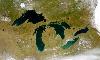
| Great Lakes FeatureType : waterbody Elevation : 175 Lat/Lng : 45.8106 / -84.6825 | The Great Lakes , also called the Laurentian Great Lakes and the Great Lakes of North America, are a series of interconnected freshwater lakes located primarily in the upper mid-east region of North America, on the Canada–United States border, which connect to the Atlantic Ocean through the Saint (...) |
| 138 | 
| Salvador, Bahia FeatureType : null Elevation : 61 Lat/Lng : -12.9737 / -38.5114 | Salvador, also known as São Salvador da Bahia de Todos os Santos (English: Savior; Saint Savior from the Bay of All Saints) is the capital of the Brazilian state of Bahia. With 2.9 million people (2017), it is the largest city proper in the Northeast Region and the 4th-largest city proper in the (...) |
| 139 | 
| Geography of Brazil FeatureType : country Elevation : 258 Lat/Lng : -10.0 / -55.0 | The country of Brazil occupies roughly half of South America, bordering the Atlantic Ocean. Brazil covers a total area of which includes of land and of water. The highest point in Brazil is Pico da Neblina at . Brazil is bordered by the countries of Argentina, Bolivia, Colombia, Guyana, Paraguay, (...) |
| 140 | 
| Madeira FeatureType : isle Elevation : 691 Lat/Lng : 32.7333 / -16.9667 | Madeira , officially the Autonomous Region of Madeira (Região Autónoma da Madeira) is one of the two autonomous regions of Portugal (along with the Azores). It is an archipelago situated in the north Atlantic Ocean, southwest of Portugal. Its total population was estimated in 2011 at 267,785 (...) |
| 141 | 
| Port Phillip FeatureType : waterbody Lat/Lng : -38.0865 / 144.8753 | Port Phillip (also commonly referred to as Port Phillip Bay), is a bay in southern Victoria, Australia; it is the location of Melbourne. Geographically, the bay covers and the shore stretches roughly . Although it is extremely shallow for its size, most of the bay is navigable (...) |
| 142 | 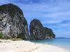
| Trang Province FeatureType : adm1st Elevation : 33 Lat/Lng : 7.5581 / 99.6117 | Trang , also called Mueang Thap Thiang, is one of the southern provinces (changwat) of Thailand, on the west side of the Malay Peninsula facing the Strait of Malacca. Neighboring provinces are (from north clockwise) Krabi, Nakhon Si Thammarat, Phatthalung, and Satun (...) |
| 143 | 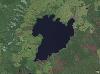
| Lake Taupo FeatureType : waterbody Elevation : 356 Lat/Lng : -38.8069 / 175.9078 | Lake Taupo is a lake in the North Island of New Zealand. It is in the caldera of the Taupo Volcano. With a surface area of , it is the largest lake by surface area in New Zealand, and the second largest freshwater lake by surface area in geopolitical Oceania after Lake Murray (Papua New Guinea) (...) |
| 144 | 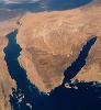
| Gulf of Aqaba FeatureType : waterbody Lat/Lng : 28.6861 / 34.6956 | The Gulf of Aqaba (Khalij al-Aqabah) or Gulf of Eilat (Mifrats Eilat) is a large gulf at the northern tip of the Red Sea, east of the Sinai Peninsula and west of the Arabian mainland. Its coastline is divided between four countries: Egypt, Israel, Jordan, and Saudi Arabia. (...) |
| 145 | 
| Golden Gate FeatureType : waterbody Lat/Lng : 37.8156 / -122.4845 | The Golden Gate is a strait on the west coast of North America that connects San Francisco Bay to the Pacific Ocean. It is defined by the headlands of the San Francisco Peninsula and the Marin Peninsula, and, since 1937, has been spanned by the Golden Gate Bridge (...) |
| 146 | 
| Tutuila FeatureType : null Elevation : 102 Lat/Lng : -14.2944 / -170.725 | Tutuila is the largest and the main island of American Samoa in the archipelago of Samoan Islands. It is the third largest island in the Samoan Islands chain of the Central Pacific located roughly north-east of Brisbane, Australia and over northeast of Fiji (...) |
| 147 | 
| Long Beach, California FeatureType : null Elevation : 14 Lat/Lng : 33.7683 / -118.1956 | Long Beach is a city on the Pacific Coast of the United States, within the Los Angeles metropolitan area of Southern California. As of 2010, its population was 462,257. It is the 39th most populous city in the United States and the 7th most populous in California (...) |
| 148 | 
| Indonesia FeatureType : country Elevation : -4 Lat/Lng : -6.175 / 106.8286 | Indonesia (; Indonesian:), officially the Republic of Indonesia , is a country in Southeast Asia, between the Indian and Pacific oceans. It is the world's largest island country, with more than thirteen thousand islands, and at , the 14th largest by land area and the 7th largest in combined sea and (...) |
| 149 | 
| Mogadishu FeatureType : null Elevation : 13 Lat/Lng : 2.0369 / 45.3436 | Mogadishu (;Dictionary Reference: : The Free Dictionary: : , , ; ;), locally known as Xamar or Hamar, is the capital and most populous city of Somalia. Located in the coastal Banadir region on the Indian Ocean, the city has served as an important port for millennia (...) |
| 150 | 
| Vancouver FeatureType : city Elevation : 52 Lat/Lng : 49.2611 / -123.1139 | Vancouver is a coastal seaport city in western Canada, located in the Lower Mainland region of British Columbia. As the most populous city in the province, the 2016 census recorded 631,486 people in the city, up from 603,502 in 2011 (...) |
| 151 | 
| Miami FeatureType : null Elevation : 10 Lat/Lng : 25.7878 / -80.2242 | Miami, officially the City of Miami, is the cultural, economic and financial center of South Florida, United States. Miami is the seat of Miami-Dade County, the most populous county in Florida. The city covers an area of about , between the Everglades to the west and Biscayne Bay on the east; it is (...) |
| 152 | 
| Coney Island FeatureType : landmark Elevation : 4 Lat/Lng : 40.574 / -73.978 | Coney Island is a peninsular residential neighborhood, beach, and leisure/entertainment destination of Long Island on the Coney Island Channel, which is part of the Lower Bay in the southwestern part of the borough of Brooklyn in New York City (...) |
| 153 | 
| Jamaica FeatureType : country Elevation : 206 Lat/Lng : 18.1096 / -77.2975 | Jamaica is an island country situated in the Caribbean Sea. Spanning in area, it is the third-largest island of the Greater Antilles and the fourth-largest island country in the Caribbean. Jamaica lies about south of Cuba, and west of Hispaniola (the island containing the countries of Haiti and the (...) |
| 154 | 
| Trinidad and Tobago FeatureType : country Elevation : 222 Lat/Lng : 10.6918 / -61.2225 | Trinidad and Tobago , officially the Republic of Trinidad and Tobago, is a twin island country that is the southernmost nation of the West Indies in the Caribbean. It is situated south of Grenada off the northern edge of the South American mainland, off the coast of northeastern Venezuela (...) |
| 155 | 
| Hawaii FeatureType : adm1st Elevation : 235 Lat/Lng : 21.3114 / -157.7964 | Hawaii is the 50th and most recent state to have joined the United States, having received statehood on August 21, 1959. Hawaii is the only U.S. state located in Oceania, the only U.S. state located outside North America, and the only one composed entirely of islands (...) |
| 156 | 
| United Arab Emirates FeatureType : country Elevation : 6 Lat/Lng : 24.4667 / 54.3667 | The United Arab Emirates (UAE; '), sometimes simply called the Emirates , is a country in Western Asia at the southeast end of the Arabian Peninsula on the Persian Gulf, bordering Oman to the east and Saudi Arabia to the south, as well as sharing maritime borders with Qatar to the west and Iran to (...) |
| 157 | 
| Geography of Norway FeatureType : null Elevation : 11 Lat/Lng : 59.91 / 10.75 | Norway is a country located in Northern Europe on the western and northern part of the Scandinavian Peninsula, bordering the North Sea to the southwest and the Skagerrak inlet to the south, the North Atlantic Ocean (Norwegian Sea) in the west and the Barents Sea to the northeast (...) |
| 158 | 
| Cardiff FeatureType : city Elevation : 10 Lat/Lng : 51.4827 / -3.1823 | Cardiff is the capital of Wales, and its largest city. The eleventh-largest city in the United Kingdom, it is Wales's chief commercial centre, the base for most national cultural institutions and Welsh media, and the seat of the National Assembly for Wales (...) |
| 159 |
| Sri Lanka FeatureType : country Elevation : 10 Lat/Lng : 6.9 / 79.9 | Sri Lanka (; '; Ilaṅkai), officially the Democratic Socialist Republic of Sri Lanka, is an island country in South Asia, located in the Indian Ocean to the southwest of the Bay of Bengal and to the southeast of the Arabian Sea (...) |
| 160 | 
| Australia FeatureType : city Elevation : 607 Lat/Lng : -35.3081 / 149.1244 | Australia, officially the Commonwealth of Australia, is a sovereign country comprising the mainland of the Australian continent, the island of Tasmania and numerous smaller islands. It is the largest country in Oceania and the world's sixth-largest country by total area (...) |
| 161 | Coral reef FeatureType : null Lat/Lng : 32.4 / -64.8 | A coral reef is an underwater ecosystem characterized by reef-building corals. Reefs are formed of colonies of coral polyps held together by calcium carbonate. Most coral reefs are built from stony corals, whose polyps cluster in groups (...) | |
| 162 | 
| Dahab FeatureType : city Elevation : 32 Lat/Lng : 28.4931 / 34.5047 | Dahab ("gold") is a small town on the southeast coast of the Sinai Peninsula in Egypt, approximately northeast of Sharm el-Sheikh. Formerly a Bedouin fishing village, Dahab is now considered to be one of Sinai's most treasured diving destinations (...) |
| 163 | 
| Moreton Bay FeatureType : waterbody Lat/Lng : -27.2653 / 153.2595 | The Moreton Bay is a bay located on the eastern coast of Australia from central Brisbane, Queensland. It is one of Queensland's most important coastal resources. The waters of Moreton Bay are a popular destination for recreational anglers and are used by commercial operators who provide seafood to (...) |
| 164 | 
| Fiji FeatureType : country Elevation : 175 Lat/Lng : -17.8133 / 179.4122 | Fiji (; ; Fiji Hindi: फ़िजी), officially the Republic of FijiIn February 2011, the Prime Minister's Office issued a statement saying that the name of the state had been officially changed from the Republic of the Fiji Islands to the Republic of Fiji, and that the name written in the 1997 (...) |
| 165 | 
| Venezuela FeatureType : country Elevation : 63 Lat/Lng : 7.0 / -65.0 | Venezuela , officially the Bolivarian Republic of Venezuela ,Previously, the official name was Estado de Venezuela (1830–1856), República de Venezuela (1856–1864), Estados Unidos de Venezuela (1864–1953), and again República de Venezuela (1953–1999) (...) |
| 166 | 
| Vermont FeatureType : adm1st Elevation : 542 Lat/Lng : 44.0833 / -72.6167 | Vermont is a state in the New England region of the Northeastern United States. It borders the U.S. states of Massachusetts to the south, New Hampshire to the east, New York to the west, and the Canadian province of Quebec to the north (...) |
| 167 | 
| Wilsons Promontory FeatureType : city Elevation : 233 Lat/Lng : -39.0986 / 146.3866 | The Wilsons Promontory is a peninsula that forms the southernmost part of the Australian mainland, located in the state of Victoria. South Point at is the southernmost tip of Wilsons Promontory and hence of mainland Australia. Located at nearby South East Point, is the Wilsons Promontory Lighthouse (...) |
| 168 | 
| Yakushima FeatureType : isle Elevation : 1205 Lat/Lng : 30.3333 / 130.5333 | is one of the Ōsumi Islands in Kagoshima Prefecture, Japan. The island, in area, has a population of 13,178. Access to the island is by hydrofoil ferry (7 or 8 times a day from Kagoshima, depending on the season), slow car ferry (once or twice a day from Kagoshima), or by air to Yakushima Airport (3 (...) |
| 169 | 
| New Britain FeatureType : isle Elevation : 360 Lat/Lng : -5.7333 / 150.7333 | New Britain is the largest island in the Bismarck Archipelago of Papua New Guinea. It is separated from the island of New Guinea by the Dampier and Vitiaz Straits and from New Ireland by St. George's Channel. The main towns of New Britain are Rabaul/Kokopo and Kimbe (...) |
| 170 | 
| Grand Cayman FeatureType : isle Elevation : 7 Lat/Lng : 19.3333 / -81.2167 | Grand Cayman is the largest of the three Cayman Islands and the location of the territory's capital, George Town. In relation to the other two Cayman Islands, it is approximately 75 miles (121 km) southwest of Little Cayman and 90 miles (145 km) southwest of Cayman Brac. (...) |
| 171 | 
| Tamandaré FeatureType : null Elevation : 25 Lat/Lng : -8.7487 / -35.1394 | Tamandaré is a coastal municipality about south of Recife, the capital city of the Brazilian state of Pernambuco. (...) |
| 172 | 
| North Sentinel Island FeatureType : isle Elevation : 78 Lat/Lng : 11.557 / 92.241 | North Sentinel Island is one of the Andaman Islands, which includes South Sentinel Island, in the Bay of Bengal. It is home to the Sentinelese who, often violently, reject any contact with the outside world, and are among the last people worldwide to remain virtually untouched by modern civilization (...) |
| 173 | 
| Cocos Island FeatureType : isle Elevation : 269 Lat/Lng : 5.5189 / -87.0717 | Cocos Island is an island designated as a National Park off the shore of Costa Rica, that does not allow inhabitants other than Costa Rican Park Rangers. It constitutes the 11th of the 13 districts of Puntarenas Canton of the province of Puntarenas (...) |
| 174 | 
| Clipperton Island FeatureType : isle Elevation : 0 Lat/Lng : 10.3039 / -109.2177 | Clipperton Island (or ;) is an uninhabited coral atoll in the eastern Pacific Ocean off the coast of Central America. It is 10,677 kilometres away from Paris, France, 5,400 km from Papeete, Tahiti, and 1,081 km from Mexico (...) |
| 175 | Coral Sea FeatureType : waterbody Lat/Lng : -16.9342 / 155.11 | The Coral Sea is a marginal sea of the South Pacific off the northeast coast of Australia, and classified as an interim Australian bioregion. The Coral Sea extends down the Australian northeast coast. It is bounded in the west by the east coast of Queensland, thereby including the Great Barrier (...) | |
| 176 | 
| Rottnest Island FeatureType : isle Elevation : 10 Lat/Lng : -32.002 / 115.517 | Rottnest Island (known as Wadjemup to the local Noongar people, and otherwise colloquially known as Rotto) is an island off the coast of Western Australia, located west of Fremantle. A sandy, low-lying island formed on a base of aeolianite limestone, Rottnest is an A-class reserve, the highest level (...) |
| 177 | 
| Corvo Island FeatureType : isle Elevation : 652 Lat/Lng : 39.7008 / -31.1078 | Corvo Island , literally the Island of the Crow, is the smallest and the northernmost island of the Azores archipelago and the northernmost in Macaronesia, has a population of approximately 468 inhabitants (in 2006) constituting the smallest single municipality in Azores and in Portugal, and lies (...) |
| 178 | 
| Vercors Massif FeatureType : mountain Elevation : 889 Lat/Lng : 44.9667 / 5.4167 | The Vercors Massif is a range in France consisting of rugged plateaux and mountains straddling the départements of Isère and Drôme in the French Prealps. It lies west of the Dauphiné Alps, from which it is separated by the rivers Drac and Isère (...) |
| 179 | 
| Tinian FeatureType : null Elevation : 89 Lat/Lng : 15.0 / 145.6333 | Tinian (or) is one of the three principal islands of the Commonwealth of the Northern Mariana Islands. Together with uninhabited neighboring Aguigan, it forms Tinian Municipality, one of the four constituent municipalities of the Northern Marianas. Tinian's largest village is San Jose. (...) |
| 180 | 
| Ko Samui FeatureType : null Elevation : 458 Lat/Lng : 9.5019 / 99.9931 | Ko Samui (or Koh Samui) is an island off the east coast of the Kra Isthmus, Thailand. Geographically in the Chumphon Archipelago, it is part of Surat Thani Province, though as of 2012, Ko Samui was granted municipal status and thus is now locally self-governing (...) |
| 181 | 
| Kingman Reef FeatureType : isle Lat/Lng : 6.4097 / -162.3868 | Kingman Reef is a largely submerged, uninhabited triangular shaped reef, east-west and north-south, located in the North Pacific Ocean, roughly halfway between the Hawaiian Islands and American Samoa at .Coordinates are near the dry land spits (...) |
| 182 | 
| Aldabra FeatureType : isle Lat/Lng : -9.4167 / 46.4167 | Aldabra is the world's second-largest coral atoll. It is situated in the Aldabra Group of islands in the Indian Ocean that are part of the Outer Islands of the Seychelles, with a distance of 1,120 km (700 mi) southwest of the capital, Victoria, on Mahé Island. (...) |
| 183 | Coral Sea Islands FeatureType : isle Lat/Lng : -19.0908 / 150.9017 | The Coral Sea Islands Territory is an external territory of Australia which comprises a group of small and mostly uninhabited tropical islands and reefs in the Coral Sea, northeast of Queensland, Australia. The only inhabited island is Willis Island (...) | |
| 184 | 
| Hesselberg FeatureType : mountain Elevation : 651 Lat/Lng : 49.07 / 10.5269 | Hesselberg (689 m above sea level) is the highest point in Middle Franconia and the Franconian Jura and is situated 60 km south west of Nuremberg, Germany. The mountain stands isolated and far from the center of the Franconian Jura, in its southwestern border region, 4 km to the north west of (...) |
| 185 | 
| Palmyra Atoll FeatureType : null Elevation : 11 Lat/Lng : 5.8868 / -162.0796 | Palmyra Atoll is one of the Northern Line Islands (southeast of Kingman Reef and north of Kiribati Line Islands), located almost due south of the Hawaiian Islands, roughly one-third of the way between Hawaii and American Samoa. The nearest continent is almost to the northeast (...) |
| 186 | 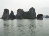
| Hạ Long Bay FeatureType : waterbody Lat/Lng : 20.85 / 107.15 | Ha Long Bay is a UNESCO World Heritage Site and popular travel destination in Quang Ninh Province, Vietnam. The name Hạ Long means "descending dragon". Administratively, the bay belongs to Ha Long City, Cam Pha City, and is a part of Van Don District (...) |
| 187 | 
| Courseulles-sur-Mer FeatureType : null Elevation : 5 Lat/Lng : 49.3336 / -0.4564 | Courseulles-sur-Mer is a commune in the Calvados department (14) in the Normandy region, la Basse-Normandie, in northwestern France, 1.1 km from Graye-sur-Mer, and 3.3 km from Reviers.Map-France, Basse-Normandie, Calvados, Courseulles-sur-Mer. See: http://www.map-france (...) |
| 188 | 
| Bowen, Queensland FeatureType : null Elevation : 4 Lat/Lng : -20.0167 / 148.2333 | Bowen is a coastal town and locality in the Whitsunday Region on the eastern coast of Queensland, Australia. The town of Merinda and the Abbot Point coal shipping port are also within the locality of Bowen. At the 2016 census, Bowen had a population of 10,377 (...) |
| 189 | 
| Cooktown, Queensland FeatureType : city Lat/Lng : -15.4867 / 145.2837 | Cooktown is a town and locality in the Shire of Cook, Queensland, Australia. Cooktown is located about north of Brisbane and north of Cairns, by road. At the time of the 2016 census, Cooktown had a population of 2,631 (...) |
| 190 | 
| Tauranga FeatureType : null Elevation : 21 Lat/Lng : -37.6875 / 176.1656 | Tauranga is the most populous city in the Bay of Plenty region of the North Island of New Zealand. It was settled by Māori late in the 13th century and by Europeans in the early 19th century and was constituted as a city in 1963 (...) |
| 191 | 
| Howland Island FeatureType : isle Elevation : 8 Lat/Lng : 0.8072 / -176.6165 | Howland Island is an uninhabited coral island located just north of the equator in the central Pacific Ocean, about southwest of Honolulu. The island lies almost halfway between Hawaii and Australia and is an unincorporated, unorganized territory of the United States (...) |
| 192 | 
| Kish Island FeatureType : isle Elevation : 29 Lat/Lng : 26.5357 / 53.9674 | Kish ((Kīsh) listen) is a resort island in Bandar Lengeh County, Hormozgān Province off the southern coast of Iran in the Persian Gulf . Owing to its free trade zone status, the island is touted as a consumer's paradise, with numerous malls, shopping centres, tourist attractions, and resort hotels (...) |
| 193 | 
| Principality of Sealand FeatureType : city Lat/Lng : 51.8952 / 1.4805 | The Principality of Sealand, commonly known as Sealand, is a micronation that claims Roughs Tower, an offshore platform in the North Sea approximately off the coast of Suffolk, as its territory. Roughs Tower is a disused Maunsell Sea Fort, originally called HM Fort Roughs, built as an anti-aircraft (...) |
| 194 | 
| Puerto Plata, Dominican Republic FeatureType : city Elevation : 19 Lat/Lng : 19.7888 / -70.6958 | Puerto Plata, officially known as San Felipe de Puerto Plata, is the ninth-largest city in the Dominican Republic, and capital of the province of Puerto Plata. The city is a trading port. Puerto Plata has resorts such as Playa Dorada and Costa Dorada, which are located east of the city proper (...) |
| 195 | 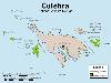
| Culebra, Puerto Rico FeatureType : isle Elevation : 44 Lat/Lng : 18.3169 / -65.29 | Isla Culebra (Snake Island) is an island-municipality of Puerto Rico and geographically part of the Virgin Islands. It is located approximately east of the Puerto Rican mainland, west of St. Thomas and north of Vieques (...) |
| 196 | 
| Negombo FeatureType : null Lat/Lng : 7.2167 / 79.8333 | Negombo is a major city in Sri Lanka, situated on the west coast and at the mouth of the Negombo Lagoon, in Western Province. Negombo is one of the major commercial hubs in the country and the administrative centre of Negombo Division (...) |
| 197 | 
| Arrecife FeatureType : city Elevation : 16 Lat/Lng : 28.9594 / -13.5475 | Arrecife is a city and municipality in the Canary Islands (Spain) situated in the centre-east of the island of Lanzarote, of which it has been the capital since 1852. The city owes its name to the rock reef ('Arrecife' is Spanish for 'reef') which covers the beach located in the city (...) |
| 198 | 
| Juan de Nova Island FeatureType : isle Elevation : 8 Lat/Lng : -17.0557 / 42.731 | Juan de Nova Island (French: Île Juan da Nova (official), Île Juan de Nova (local)), also known as Saint-Christophe, is a French tropical island in the narrowest part of the Mozambique Channel, about one-third of the way between Madagascar and Mozambique. It is a low, flat island, in size (...) |
| 199 | 
| Lloret de Mar FeatureType : city Elevation : 13 Lat/Lng : 41.6986 / 2.8472 | Lloret de Mar is a Mediterranean coastal town in Catalonia, Spain. One of the most popular holiday resorts on the Costa Brava, it is south of Girona and northeast of Barcelona. With a population of 39,363 in 2009, it is the second largest town in the Selva comarca of Catalonia (...) |
| 200 | 
| Edmonds, Washington FeatureType : city Elevation : 128 Lat/Lng : 47.8069 / -122.3467 | Edmonds is a city in Snohomish County, Washington, United States. It is located in the southwest corner of the county, facing Puget Sound and the Olympic Mountains to the west. The city is part of the Seattle metropolitan area and is located north of Seattle and southwest of Everett (...) |
 by
by