| 15307 records found in wikipedia | |||
| 1 | 
| Świętochłowice  FeatureType : city Elevation : 288 Lat/Lng : 50.2833 / 18.9167 | Świętochłowice is a city in Silesia in southern Poland, near Katowice. The central district of the Upper Silesian Metropolitan Union - metropolis with the population of 2 million. Located in the Silesian Highlands, on the Rawa River (tributary of the Vistula) (...) |
| 2 | 
| Capannori FeatureType : null Elevation : 23 Lat/Lng : 43.8756 / 10.5736 | Capannori is an Italian town and comune in the province of Lucca, in northern Tuscany. (...) |
| 3 | 
| Caleta Olivia FeatureType : city Elevation : 17 Lat/Lng : -46.4393 / -67.5281 | Caleta Olivia is a city located at the northeast of the Argentine province of Santa Cruz, on the San Jorge Gulf by the Atlantic Ocean. It has a population of 70,304 inhabitants . It is the second most important city of the province after Rio Gallegos, and the most populated of the Deseado Department (...) |
| 4 | 
| Sittard-Geleen FeatureType : null Elevation : 39 Lat/Lng : 51.0167 / 5.8667 | Sittard-Geleen (;Geleen in isolation: .) is a municipality in the southeastern Netherlands. It was formed in 2001 from the former municipalities Sittard, Geleen and Born. The combined municipality has approximately 96,000 inhabitants (2007) and is thus the second most populated municipality in (...) |
| 5 | 
| Drenthe FeatureType : adm1st Elevation : 14 Lat/Lng : 52.86 / 6.63 | Drenthe is a province of the Netherlands located in the northeastern part of the country. It is bordered by Overijssel to the south, Friesland to the west, Groningen to the north, and Germany (districts of Emsland and Bentheim) to the east (...) |
| 6 | 
| Levallois-Perret FeatureType : null Elevation : 40 Lat/Lng : 48.8933 / 2.2878 | Levallois-Perret is a commune in the northwestern suburbs of Paris, France. It is located from the centre of Paris. It is the most densely populated town in Europe. (...) |
| 7 | 
| Main-Taunus-Kreis FeatureType : null Elevation : 154 Lat/Lng : 50.0797 / 8.4493 | Main-Taunus is a Kreis (district) in the middle of Hesse, Germany and is part of the Frankfurt/Rhine-Main Metropolitan Region as well as the Frankfurt urban area. Neighboring districts are Hochtaunuskreis, district-free Frankfurt, Groß-Gerau, district-free Wiesbaden, Rheingau-Taunus (...) |
| 8 | 
| Montauban FeatureType : null Elevation : 107 Lat/Lng : 44.0181 / 1.3558 | Montauban is a commune in the Tarn-et-Garonne department in the Occitanie region in southern France. It is the capital of the department and lies north of Toulouse. Montauban is the most populated town in Tarn-et-Garonne, and the sixth most populated of Occitanie behind Toulouse, Montpellier, Nîmes, (...) |
| 9 | 
| Rocha Department FeatureType : null Elevation : 27 Lat/Lng : -34.4806 / -54.3303 | Rocha is a department in the east of Uruguay. Its capital is the city of Rocha. It borders Maldonado Department to its west, Lavalleja Department to its northwest, Treinta y Tres Department to its north, while to its northeast Laguna Merín forms part of its border with Brazil and at the south end of (...) |
| 10 | 
| Saronno FeatureType : null Elevation : 219 Lat/Lng : 45.6333 / 9.05 | Saronno is a comune of Lombardy, Italy, in the province of Varese. It received the honorary title of city with a presidential decree in 1960. It has an estimated population of 39,419 inhabitants and is the most densely populated among the big municipalities in its province (...) |
| 11 | 
| Belluno FeatureType : null Elevation : 397 Lat/Lng : 46.1396 / 12.217 | Belluno , is a town and province in the Veneto region of northern Italy. Located about north of Venice, Belluno is the capital of the province of Belluno and the most important city in the Eastern Dolomites region. With its roughly 36,000 inhabitants, it is the largest populated area of Valbelluna (...) |
| 12 | 
| Martina Franca FeatureType : city Elevation : 409 Lat/Lng : 40.7 / 17.3333 | Martina Franca, or just Martina (Martinese:), is a town and municipality in the province of Taranto, Apulia, southern Italy. It is the second most populated town of the province after Taranto, and has a population (2016) of 49,086 (...) |
| 13 | 
| Cergy FeatureType : null Elevation : 34 Lat/Lng : 49.0361 / 2.0631 | Cergy is a commune in the northwestern suburbs of Paris, France. It is located from the center of Paris, in the "new town" of Cergy-Pontoise, created in the 1960s, of which it is the central and most populated commune (...) |
| 14 | 
| Vincennes FeatureType : null Elevation : 57 Lat/Lng : 48.8478 / 2.4392 | Vincennes is a commune in the Val-de-Marne department in the eastern suburbs of Paris, France. It is located from the centre of Paris. It is one of the most densely populated municipalities in Europe. (...) |
| 15 | 
| Vlieland FeatureType : null Elevation : 0 Lat/Lng : 53.2467 / 4.96 | Vlieland is a municipality and island in the northern Netherlands. The municipality of Vlieland has one major town, Oost-Vlieland (West Frisian: East-Flylân). It is the second most sparsely populated municipality in the Netherlands, after Schiermonnikoog (...) |
| 16 | 
| Streymoy FeatureType : isle Lat/Lng : 62.1333 / -7.0167 | Streymoy is the largest and most populated island of the Faroe Islands. The capital, Tórshavn, is located on its southeast coast. The name means "island of currents". It also refers to the largest region of the country that also includes the islands of Hestur, Koltur and Nólsoy. (...) |
| 17 | 
| Marajó FeatureType : isle Elevation : 21 Lat/Lng : -0.9817 / -49.5849 | Marajó is a large delta island in the state of Pará, Brazil. The island is bordered by the mouth of the Amazon river to the west and northwest, the Atlantic Ocean to the northeast and by the Pará River, a distributary of the Amazon to the east (...) |
| 18 | 
| Texel FeatureType : null Elevation : -2 Lat/Lng : 53.0853 / 4.81 | Texel is a municipality and an island with a population of 13,641 in the province of North Holland in the Netherlands. It is the largest and most populated island of the West Frisian Islands in the Wadden Sea. The island is situated north of Den Helder, northeast of Noorderhaaks, also known as (...) |
| 19 | 
| Balé Province FeatureType : adm1st Elevation : 297 Lat/Lng : 11.7 / -3.1667 | Balé is one of the 45 provinces of Burkina Faso, located in its Boucle du Mouhoun Region with Boromo as capital. Its area is , and in 2006 had a population of 213,897. The province is known for its Deux Balé Forest, populated by savannah elephant herds (...) |
| 20 | 
| Vienna Woods FeatureType : mountain Elevation : 841 Lat/Lng : 48.0872 / 15.9119 | The Vienna WoodsRees, Henry (1974). Italy, Switzerland and Austria. A Geographical Study. Harrap, London, . are forested highlands that form the northeastern foothills of the Northern Limestone Alps in the states of Lower Austria and Vienna (...) |
| 21 | 
| Kırklareli Province FeatureType : adm1st Elevation : 260 Lat/Lng : 41.6811 / 27.4714 | Kırklareli Province is a province in northwestern Turkey on the west coast of the Black Sea. The province neighbours Bulgaria to the north along a long border. It borders the province of Edirne to the west and the province of Tekirdağ to the south and province of Istanbul to the southeast (...) |
| 22 | 
| Granollers FeatureType : city Elevation : 154 Lat/Lng : 41.608 / 2.288 | Granollers is a city near Barcelona, in Catalonia, Spain. It is the capital and most densely populated city of the comarca of Vallès Oriental. Granollers is now a bustling business centre, having grown from a town dominated by Catalonia's textile industry that was so prominent during the 19th (...) |
| 23 | 
| Charenton-le-Pont FeatureType : null Elevation : 49 Lat/Lng : 48.8214 / 2.4119 | Charenton-le-Pont is a commune in the southeastern suburbs of Paris, France. It is located from the centre of Paris. It is one of the most densely populated municipalities in Europe. The Charenton Psychiatric Hospital is located in the neighbouring commune Charenton-Saint-Maurice, which changed its (...) |
| 24 | 
| Landstraße FeatureType : adm2nd Elevation : 174 Lat/Lng : 48.1964 / 16.3958 | Landstraße is the 3rd municipal District of Vienna, Austria (German: 3. Bezirk). It is near the center of Vienna and was established in the 19th century. Landstraße is a heavily populated urban area with many workers and residential homes. Wien.gv.at webpage (see below: References) (...) |
| 25 | 
| Borgarbyggð FeatureType : null Lat/Lng : 64.54 / -21.9167 | Borgarbyggð is a municipality in the west of Iceland. The biggest township in the municipality is Borgarnes, with a population of 1,887 inhabitants. Other densely populated areas in the municipality include Bifröst, Hvanneyri, Kleppjárnsreykir, Reykholt and Varmaland. (...) |
| 26 | 
| Vinnytsia FeatureType : null Elevation : 231 Lat/Lng : 49.23 / 28.48 | Vinnytsia (; , , , and) is a city in west-central Ukraine, located on the banks of the Southern Bug. It is the administrative center of Vinnytsia Oblast and the largest city in the historic region of Podillia. Administratively, it is incorporated as a town of oblast significance (...) |
| 27 | 
| Rheine FeatureType : null Elevation : 41 Lat/Lng : 52.2792 / 7.4387 | Rheine is a town in the district of Steinfurt in Westphalia, Germany. It is the largest town in the district and the location of Rheine Air Base. (...) |
| 28 | 
| Ardea, Lazio FeatureType : city Elevation : 14 Lat/Lng : 41.6075 / 12.5419 | Ardea (IPA: or) is an ancient town and comune in the Metropolitan City of Rome, south of Rome and about from today's Mediterranean coast. The economy is mostly based on agriculture, although, starting from the 1970s, industry has had an increasingly important role. (...) |
| 29 | 
| Corrientes FeatureType : city Elevation : 63 Lat/Lng : -27.4833 / -58.8167 | Corrientes (; Guaraní: Taragüí, literally: "Currents") is the capital city of the province of Corrientes, Argentina, located on the eastern shore of the Paraná River, about from Buenos Aires and from Posadas, on National Route 12. It has a population of 346,334 according to the 2010 Census (...) |
| 30 | 
| Paysandú FeatureType : city Elevation : 40 Lat/Lng : -32.3058 / -58.0808 | Paysandú is the capital of Paysandú Department in western Uruguay. (...) |
| 31 | 
| Angola FeatureType : country Elevation : 1409 Lat/Lng : -12.35 / 17.35 | Angola , officially the Republic of Angola (; Kikongo, Kimbundu and), is a west-coast country of south-central Africa. It is the seventh-largest country in Africa, bordered by Namibia to the south, the Democratic Republic of the Congo to the north, Zambia to the east, and the Atlantic Ocean to the (...) |
| 32 | 
| Mount Vesuvius FeatureType : mountain Elevation : 975 Lat/Lng : 40.8214 / 14.4256 | Mount Vesuvius (; ; ; ; also ' or ' in some Roman sources) is a somma-stratovolcano located on the Gulf of Naples in Campania, Italy, about east of Naples and a short distance from the shore. It is one of several volcanoes which form the Campanian volcanic arc (...) |
| 33 | 
| Kawasaki, Kanagawa FeatureType : null Elevation : 15 Lat/Lng : 35.5308 / 139.7031 | is a city in Kanagawa Prefecture, Japan. It is the 8th most populated city in Japan (including the Tokyo Metropolitan Area) and one of the main cities forming the Greater Tokyo Area and Keihin Industrial Area.http://www.city.yokohama.lg.jp/ex/stat/jinko/city/new-e (...) |
| 34 | 
| Požarevac FeatureType : null Elevation : 80 Lat/Lng : 44.6153 / 21.1825 | Požarevac is a city and the administrative center of the Braničevo District in eastern Serbia. It is located between three rivers: Danube, Great Morava and Mlava. As of 2011, the city has a population of 44,183 inhabitants, while the city administrative area has 75,334 inhabitants. (...) |
| 35 | 
| Kuopio FeatureType : city Lat/Lng : 62.8997 / 27.6831 | Kuopio is a Finnish city and municipality located in the region of Northern Savonia (Pohjois-Savo). It has a population of , which makes it the ninth-most populous city in Finland. Kuopio has a total area of , of which is water and half is forest (...) |
| 36 | 
| Gambier Islands FeatureType : isle Lat/Lng : -23.14 / -134.94 | The Gambier Islands (or) are a populated (1319 people), small group of islands, remnants of a caldera along with islets on the surrounding fringing reef, in French Polynesia, located at the southeast terminus of the Tuamotu archipelago (...) |
| 37 | 
| Schiermonnikoog FeatureType : city Elevation : 0 Lat/Lng : 53.4892 / 6.2022 | Schiermonnikoog is an island, a municipality, and a national park in the northern Netherlands. Schiermonnikoog is one of the West Frisian Islands, and is part of the province of Friesland. It is situated between the islands of Ameland and Rottumerplaat (...) |
| 38 | 
| Yamagata Prefecture FeatureType : adm1st Elevation : 215 Lat/Lng : 38.4331 / 140.1331 | is a prefecture located in the Tōhoku region of Japan.Nussbaum, Louis-Frédéric. (2005). "Yamagata prefecture" in ; "Tōhoku" in Its capital is Yamagata.Nussbaum, "Yamagata" in (...) |
| 39 | 
| Opole Voivodeship FeatureType : adm1st Elevation : 153 Lat/Lng : 50.6483 / 17.9006 | Opole Voivodeship, or Opole ProvinceArkadiusz Belczyk, , 2002–2006. , is the smallest and least populated voivodeship (province) of Poland. The province's name derives from that of the region's capital and largest city, Opole. It is part of Upper Silesia (...) |
| 40 | 
| L'Hospitalet de Llobregat FeatureType : city Elevation : 13 Lat/Lng : 41.3589 / 2.0994 | L'Hospitalet de Llobregat , often shortened to L'Hospitalet, is a municipality to the immediate southwest of Barcelona in Catalonia, Spain. By population, it is the second largest in Catalonia and the sixteenth in Spain. It is noted as one of the most densely populated cities in the European Union. (...) |
| 41 | 
| Huddinge Municipality FeatureType : adm2nd Elevation : 41 Lat/Lng : 59.2167 / 17.9667 | Huddinge Municipality (Huddinge kommun) is a municipality in Stockholm County in east central Sweden. Its seat is located in Huddinge, which is a part of Stockholm urban area. The municipality is, with its approximately 110,000 inhabitants, the second most populated in Stockholm County. (...) |
| 42 | 
| Bartın Province FeatureType : adm1st Elevation : 402 Lat/Lng : 41.6044 / 32.5111 | Bartın Province , a small province in northern Turkey on the Black Sea, surrounds the city of Bartın. It lies to the east of Zonguldak Province. The town of Bartın contains a number of very old wooden houses in a style no longer extant in other places (...) |
| 43 | 
| Edirne Province FeatureType : adm1st Elevation : 22 Lat/Lng : 41.12 / 26.5206 | Edirne Province is a province of Turkey. It is located in the East Thrace region of the country, also known as European Turkey, one of only three provinces entirely within continental Europe. Edirne Province is bordered by Tekirdağ Province and Kırklareli Province to the east, the Gallipoli (...) |
| 44 | 
| Istanbul Province FeatureType : adm1st Elevation : 69 Lat/Lng : 41.1575 / 28.8683 | Istanbul Province , also the Istanbul Metropolitan Municipality (İstanbul Büyükşehir Belediyesi) is a province of Turkey. It has an area of and is located in the Marmara region in the north-west of the country, bordered by Tekirdağ Province to the west and Kocaeli Province to the east (...) |
| 45 | 
| Erzincan Province FeatureType : adm1st Elevation : 1673 Lat/Lng : 39.6783 / 39.33 | Erzincan Province is a province in the eastern region of Anatolia, Turkey, and home to Erzincan, a city which was destroyed and rebuilt after an earthquake of magnitude 7.9 on December 27, 1939.Rosie Ayliffe, Marc Dubin, John Gawthrop, Terry Richardson, Turkey, 1136 pp., Rough Guides, 2003, , (see p (...) |
| 46 | 
| Commewijne District FeatureType : adm1st Elevation : 25 Lat/Lng : 5.8697 / -54.9197 | Commewijne is a district of Suriname, located on the right bank of the Suriname River. Commewijne's capital city is Nieuw Amsterdam. Tamanredjo is another major town. The district has a population of 31,420 and an area of 2,353 km² (...) |
| 47 | 
| Mitrovica, Kosovo FeatureType : null Elevation : 509 Lat/Lng : 42.8833 / 20.8667 | Mitrovica or Kosovska Mitrovica (Serbian Cyrillic: Косовска Митровица) is a city and municipality located in Kosovo. Settled on the banks of Ibar and Sitnica rivers, the city is the administrative center of the Mitrovica District (...) |
| 48 | 
| Malé FeatureType : city Elevation : 6 Lat/Lng : 4.1748 / 73.5098 | Malé is the capital and most populous city in the Republic of Maldives. With a population of 133,412 and an area of , it is also one of the most densely populated cities in the world. The city is geographically located at the southern edge of North Malé Atoll (Kaafu Atoll) (...) |
| 49 | 
| Szolnok FeatureType : null Elevation : 85 Lat/Lng : 47.1747 / 20.1764 | Szolnok is the county seat of Jász-Nagykun-Szolnok county in central Hungary. Its location on the banks of the Tisza river, at the heart of the Great Hungarian Plain, has made it an important cultural and economic crossroads for centuries. (...) |
| 50 | 
| Taipei FeatureType : null Elevation : 19 Lat/Lng : 25.0333 / 121.5333 | Taipei (. Random House Webster's Unabridged Dictionary.; Hokkien POJ: Tâi-pak), officially known as Taipei City, is the capital and a special municipality of Taiwan (officially known as the Republic of China, "ROC") (...) |
| 51 | 
| Vantaa FeatureType : city Lat/Lng : 60.291 / 25.04 | Vantaa is a city and municipality in Finland. It is part of the inner core of the Finnish Capital Region along with Helsinki, Espoo, and Kauniainen. With a population of , Vantaa is the fourth most populated city of Finland (...) |
| 52 | 
| Drammen FeatureType : null Elevation : 10 Lat/Lng : 59.7378 / 10.205 | Drammen is a city in Buskerud, Norway. The port and river city of Drammen is centrally located in the eastern and most populated part of Norway. Drammen is the capital of the county of Buskerud. (...) |
| 53 | 
| Västerås FeatureType : null Elevation : 30 Lat/Lng : 59.6167 / 16.5333 | Västerås is a city in central Sweden, located on the shore of Lake Mälaren in the province Västmanland, some west of Stockholm. The city had a population of 119,372 inhabitants in 2016, out of the municipal total of 150,000 (2017).http://www.statistikdatabasen.scb (...) |
| 54 | 
| Bassano del Grappa FeatureType : city Elevation : 128 Lat/Lng : 45.7667 / 11.7333 | Bassano del Grappa (Venetian: Basan // (plain form) or Bassan/Bassàn (italianized form)) is a city and comune, in the Vicenza province, in the region Veneto, in northern Italy. It bounds the communes of Cassola, Marostica, Solagna, Pove del Grappa, Romano d'Ezzelino, Campolongo sul Brenta, Conco, (...) |
| 55 | 
| Hyōgo Prefecture FeatureType : adm1st Elevation : 97 Lat/Lng : 35.0 / 134.9167 | is a prefecture of Japan located in the Kansai region on Honshu island.Nussbaum, Louis-Frédéric. (2005). "Hyōgo prefecture" in ; "Kansai" in . The capital is Kobe.Nussbaum, "Kobe" in . (...) |
| 56 | 
| Salto, Uruguay FeatureType : city Elevation : 52 Lat/Lng : -31.3883 / -57.9606 | Salto is the capital city of the Salto Department in northwestern Uruguay. As of the 2011 census it had a population of 104,028 and is the second most populated city in Uruguay. (...) |
| 57 | 
| Tucumán Province FeatureType : null Elevation : 407 Lat/Lng : -26.94 / -65.34 | Tucumán is the most densely populated, and the second-smallest by land area, of the provinces of Argentina. Located in the northwest of the country, the province has the capital of San Miguel de Tucumán, often shortened to Tucumán (...) |
| 58 | 
| Tierra del Fuego Province, Argentina FeatureType : adm1st Elevation : 79 Lat/Lng : -54.3622 / -67.6381 | Tierra del Fuego (Spanish for "Land of Fire"; ; officially Provincia de Tierra del Fuego, Antártida e Islas del Atlántico Sur, spanish for "Land of Fire, Antarctica and South Atlantic Islands") is an Argentine province (...) |
| 59 | 
| Tskhinvali FeatureType : adm1st Elevation : 983 Lat/Lng : 42.2333 / 43.8833 | Tskhinvali is a city in the cultural region of South Ossetia, Transcaucasia and the capital of the de facto independent Republic of South Ossetia (which has been recognised by the Russian Federation and four other UN member states) and the former Soviet Georgian South Ossetian Autonomous Oblast (...) |
| 60 | 
| Puerto Montt FeatureType : null Elevation : 13 Lat/Lng : -41.4717 / -72.9369 | Puerto Montt is a port city and commune in southern Chile, located at the northern end of the Reloncaví Sound in the Llanquihue Province, Los Lagos Region, 1,055 km to the south of the capital, Santiago. The commune spans an area of and had a population of 175,938 in 2002 (...) |
| 61 | 
| Sucre FeatureType : city Elevation : 2808 Lat/Lng : -19.0429 / -65.2554 | Sucre is the constitutional capital of Bolivia, the capital of the Chuquisaca Department and the 6th most populated city in Bolivia. Located in the south-central part of the country, Sucre lies at an elevation of 2,810 meters (9,214 feet) (...) |
| 62 | 
| Sumatra FeatureType : isle Elevation : 12 Lat/Lng : 0.0 / 102.0 | Sumatra is a large island in western Indonesia that is part of the Sunda Islands. It is the largest island that is located entirely in Indonesia (after Borneo, which is shared between Indonesia and other countries) and the sixth-largest island in the world at 473,481 km2 (not including adjacent (...) |
| 63 | 
| Marsala FeatureType : null Elevation : 28 Lat/Lng : 37.8 / 12.4333 | Marsala is an Italian town located in the Province of Trapani in the westernmost part of Sicily. Marsala is the most populated town in its province and the fifth in Sicily. The town is famous for the docking of Giuseppe Garibaldi on 11 May 1860 (the Expedition of the Thousand) and for its Marsala (...) |
| 64 | 
| Alghero FeatureType : null Elevation : 25 Lat/Lng : 40.5578 / 8.3219 | Alghero , also known as L'Alguer , is a town of about 44,000 inhabitants in the Italian insular province of Sassari in northwestern Sardinia, next to the Mediterranean Sea. Part of its population descends from Catalan conquerors from the end of the Middle Ages, when Sardinia was part of the Crown of (...) |
| 65 | 
| Tende FeatureType : null Elevation : 819 Lat/Lng : 44.0886 / 7.5942 | Tende (in Italian, Occitan and Royasc: Tenda) is a commune in the Alpes-Maritimes department in southeastern France. (...) |
| 66 | 
| Nikopol, Ukraine FeatureType : city Elevation : 75 Lat/Lng : 47.5656 / 34.393 | Nikopol (; , ; , literally: "City of Victory") is a city in the Dnipropetrovsk Oblast of Ukraine, on the right bank of the Dnieper River, about 100 km south-west of Dnipro. Administratively, Nikopol is incorporated as the city of oblast significance and serves as the administrative center of Nikopol (...) |
| 67 | 
| Neufchâteau, Vosges FeatureType : null Elevation : 289 Lat/Lng : 48.3564 / 5.6964 | Neufchâteau is a commune in the Vosges department in Grand Est in northeastern France. Inhabitants are called Néocastriens. (...) |
| 68 | 
| Cuneo FeatureType : null Elevation : 541 Lat/Lng : 44.3894 / 7.5478 | Cuneo is a city and comune in Piedmont, Northern Italy, the capital of the province of Cuneo, the third largest of Italy’s provinces by area. It is located at 550 metres (1,804 ft) in the south-west of Piedmont, at the confluence of the rivers Stura and Gesso (...) |
| 69 | 
| Żywiec FeatureType : city Elevation : 372 Lat/Lng : 49.6667 / 19.1667 | Żywiec is a town in south-central Poland with 32,242 inhabitants (as of November 2007). Between 1975 and 1998, it was located within the Bielsko-Biała Voivodeship, but has since become part of the Silesian Voivodeship (...) |
| 70 | 
| Birkirkara FeatureType : city Elevation : 40 Lat/Lng : 35.8967 / 14.4625 | Birkirkara (abbreviated B'Kara) is a town in the central region of Malta. It is the second most populous on the island, with 23,034 inhabitants as of March 2018. The city consists of four autonomous parishes: Saint Helen, Saint Joseph, Our Lady of Mount Carmel and Saint Mary (...) |
| 71 | 
| Fukuoka Prefecture FeatureType : adm1st Elevation : 331 Lat/Lng : 33.6 / 130.5831 | is a prefecture of Japan on Kyūshū Island.Nussbaum, Louis-Frédéric. (2005). "Fukuoka-ken" in . The capital is the city of Fukuoka.Nussbaum, "Fukuoka" in . (...) |
| 72 | 
| Teruel FeatureType : city Elevation : 929 Lat/Lng : 40.3436 / -1.1072 | Teruel is a city in Aragon, located in eastern Spain, and is also the capital of Teruel Province. It has a population of 35,675 in 2014Instituto Nacional de Estadística, Cifras oficiales de población resultantes de la revisión del Padrón municipal a 1 de enero de 2014, Resumen por Capitales de (...) |
| 73 | 
| Thane FeatureType : null Elevation : 12 Lat/Lng : 19.1724 / 72.957 | Thane, colloquially called Thana, is a metropolitan city in India. Thane city coincides entirely with Thane taluka, one of the seven talukas of Thane district; also, it is the headquarter of the namesake district (...) |
| 74 | 
| Tatabánya FeatureType : null Elevation : 147 Lat/Lng : 47.5862 / 18.3949 | Tatabánya is a city of 65,849 inhabitants in northwestern Hungary, in the Central Transdanubian region. It is the capital of Komárom-Esztergom County. (...) |
| 75 | 
| Sisimiut FeatureType : null Lat/Lng : 66.9389 / -53.6722 | Sisimiut, formerly known by its colonial name Holsteinsborg, is the capital and largest city of the Qeqqata municipality, and the second-largest city in Greenland.The term 'city' is loosely used to describe any populated area in Greenland, given that the most populated place is Nuuk, the capital, (...) |
| 76 | 
| Taraz FeatureType : city Elevation : 623 Lat/Lng : 42.9 / 71.3667 | Taraz (; known to Europeans as Talas) is a city and the administrative center of Jambyl Region in Kazakhstan, located on the Talas (Taraz) River in the south of the country near the border with Kyrgyzstan. It had a population of 330,100 (1999 Census), up 9% from 1989, making it one of the (...) |
| 77 | 
| Maldonado Department FeatureType : null Elevation : 64 Lat/Lng : -34.6419 / -54.8797 | The Maldonado Department , with an area of and 190,500 inhabitants, is located to the southeast of Uruguay. Its capital is Maldonado. (...) |
| 78 | 
| Devon Island FeatureType : isle Lat/Lng : 75.1333 / -87.85 | Devon Island (Inuit: Tatlurutit)Jerry Kobalenko. The Horizontal Everest: Extreme Journeys on Ellesmere Island. BPS Books, 2010 is an island in Canada and the largest uninhabited island on Earth. It is located in Baffin Bay, Qikiqtaaluk Region, Nunavut, Canada (...) |
| 79 | 
| Cần Thơ FeatureType : null Elevation : 9 Lat/Lng : 10.0324 / 105.7841 | Cần Thơ (Standard Vietnamese: , Southern accent:) is the fourth largest city in Vietnam, and the largest city in the Mekong Delta. It is noted for its floating market, rice paper-making village, and picturesque rural canals. It had a population of 1 (...) |
| 80 | 
| Mérida, Spain FeatureType : city Elevation : 235 Lat/Lng : 38.915 / -6.3386 | Mérida (; Extremaduran: Méria) is the capital of the autonomous community of Extremadura, western central Spain. The population is 60,119 in 2017. The Emerita Augusta has been a UNESCO World Heritage site since 1993. (...) |
| 81 | 
| Cheboksary FeatureType : null Elevation : 169 Lat/Lng : 56.1103 / 47.2511 | Cheboksary (; ; , Šupaškar) is the capital city of Chuvashia, Russia and a port on the Volga River. Population: (...) |
| 82 | 
| Fukui Prefecture FeatureType : adm1st Elevation : 16 Lat/Lng : 35.9831 / 136.1831 | is a prefecture of Japan located in the Chūbu region on Honshū island.Nussbaum, Louis-Frédéric. (2005). "Fukui-ken" in ; "Chūbu" . The capital is the city of Fukui.Nussbaum, "Fukui" in . (...) |
| 83 | 
| Elche FeatureType : city Elevation : 91 Lat/Lng : 38.2669 / -0.6983 | Elche , or Elx ,Both names are official Elx/Elche. is a town located in the comarca of Baix Vinalopó, Spain. According to the 2014 census, Elche has a population of some 228,647 inhabitants, INFORMACION.es, December 31, 2008, Editorial Prensa Ibérica (called il·licitans in Valencian and ilicitanos (...) |
| 84 | 
| Ameland FeatureType : isle Elevation : 0 Lat/Lng : 53.448 / 5.73 | Ameland (; West Frisian: It Amelân) is a municipality and one of the West Frisian Islands off the north coast of the Netherlands. It consists mostly of sand dunes. It is the third major island of the West Frisians. It neighbours islands Terschelling to the west and Schiermonnikoog to the east (...) |
| 85 | 
| Adriatic Sea FeatureType : waterbody Lat/Lng : 43.0 / 15.0 | The Adriatic Sea is a body of water separating the Italian Peninsula from the Balkan peninsula. The Adriatic is the northernmost arm of the Mediterranean Sea, extending from the Strait of Otranto (where it connects to the Ionian Sea) to the northwest and the Po Valley (...) |
| 86 | 
| Java FeatureType : isle Elevation : 587 Lat/Lng : -7.4917 / 110.0044 | Java (Indonesian: Jawa; Javanese: ꦗꦮ; Sundanese:) is an island of Indonesia. With a population of over 141 million (Java only) or 145 million (including the inhabitants of its surrounding islands), Java is the home to 56.7 percent of the Indonesian population and is the world's most populous island (...) |
| 87 | 
| Balaklava FeatureType : city Elevation : 35 Lat/Lng : 44.51 / 33.5967 | Balaklava is a former city on the Crimean Peninsula and part of the city of Sevastopol. It was a city in its own right until 1957 when it was formally incorporated into the municipal borders of Sevastopol by the Soviet government (...) |
| 88 | 
| Cervignano del Friuli FeatureType : null Elevation : 3 Lat/Lng : 45.8167 / 13.3333 | Cervignano del Friuli (or locally) is a comune in the province of Udine, Italy. It is the most important town of Bassa Friulana. It lies at about from the Laguna di Grado and at about from the Adriatic Sea; from the point of view of viability, its position is peculiar since it lies at the junction (...) |
| 89 | 
| Saint-Mandé FeatureType : null Elevation : 53 Lat/Lng : 48.8422 / 2.4186 | Saint-Mandé is a high-end commune of the Val-de-Marne department in Île-de-France in the eastern suburbs of Paris, France. It is located from the center of Paris. The municipality is the sixth smallest surface of Île-de-France, and therefore one of the most densely populated ones in Europe (...) |
| 90 | 
| Upolu FeatureType : null Elevation : 739 Lat/Lng : -13.9239 / -171.7436 | Upolu is an island in Samoa, formed by a massive basaltic shield volcano which rises from the seafloor of the western Pacific Ocean. The island is long, in area, and is the second largest in geographic area as well as with 135,000 people the most populated of the Samoan Islands (...) |
| 91 | 
| Portland, Oregon FeatureType : city Elevation : 31 Lat/Lng : 45.52 / -122.6819 | Portland is the largest city in the U.S. state of Oregon and the seat of Multnomah County. It is a major port in the Willamette Valley region of the Pacific Northwest, at the confluence of the Willamette and Columbia rivers (...) |
| 92 | 
| Las Vegas FeatureType : null Elevation : 613 Lat/Lng : 36.175 / -115.1364 | Las Vegas (Also Spanish for "The Meadows";), officially the City of Las Vegas and often known simply as Vegas, is the 28th-most populated city in the United States, the most populated city in the state of Nevada, and the county seat of Clark County (...) |
| 93 | 
| Bursa Province FeatureType : adm1st Elevation : 840 Lat/Lng : 40.15 / 29.0208 | Bursa Province is a province in Turkey, along the Sea of Marmara coast in northwestern Anatolia. Its adjacent provinces are Balıkesir to the west, Kütahya to the south, Bilecik and Sakarya to the east, Kocaeli to the northeast and Yalova to the north (...) |
| 94 | 
| Samsun Province FeatureType : adm1st Elevation : 667 Lat/Lng : 41.2044 / 36.0072 | Samsun Province is a province of Turkey on the Black Sea coast with a population of 1,252,693 (2010). Its adjacent provinces are Sinop on the northwest, Çorum on the west, Amasya on the south, Tokat on the southeast on the east. Its traffic code is 55 (...) |
| 95 | 
| Burdur Province FeatureType : adm1st Elevation : 1039 Lat/Lng : 37.4239 / 30.0844 | Burdur Province is a province of Turkey, located in the southwest and bordering Muğla and Antalya to the south, Denizli to the west, Afyon to the north, and Isparta to the east. It has an area of 6,887 km² and a population of 258,868. The provincial capital is Burdur city (...) |
| 96 | 
| Kırıkkale Province FeatureType : adm1st Elevation : 1016 Lat/Lng : 39.8697 / 33.7161 | Kırıkkale Province is a province of Turkey. It is located on the crossroads of major highways east of Ankara leading east to the Black Sea region. With its rapid population growth it has become an industrial center. The provincial capital is Kırıkkale (...) |
| 97 | 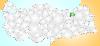
| Bayburt Province FeatureType : adm1st Elevation : 1701 Lat/Lng : 40.2367 / 40.2236 | Bayburt Province is a province of Turkey. Located in the Northeast Anatolia region of the country, the capital city is Bayburt, and with a population of 74,412 is the least-populous province in Turkey. (...) |
| 98 | 
| Karaman Province FeatureType : adm1st Elevation : 1409 Lat/Lng : 37.0231 / 33.0942 | Karaman Province is a province of central Turkey. It has an area of 9,163 km². It has a population of 232,633 (2010 est). According to the 2000 census the population was 243,210. Population density is 27.54 people/km². The traffic code is 70. The capital is the city of Karaman (...) |
| 99 | 
| Torcello FeatureType : isle Elevation : 1 Lat/Lng : 45.4966 / 12.4173 | Torcello is a sparsely populated island at the northern end of the Venetian Lagoon, in north-eastern Italy. It was first settled in the year 452 (...) |
| 100 | 
| Hakkâri Province FeatureType : adm1st Elevation : 2229 Lat/Lng : 37.4661 / 44.0644 | Hakkâri Province , is a province in the south east corner of Turkey. The administrative centre is located in the city of Hakkâri . The province covers an area of 7,121 km² and has a population of 251,302 (2010 est). The province had a population of 236,581 in 2000 (...) |
| 101 | 
| Neubau FeatureType : adm2nd Elevation : 212 Lat/Lng : 48.2025 / 16.3481 | Neubau is the seventh district of Vienna . It is located near the center of Vienna and was established as a district in 1850, but borders changed later. Neubau is a heavily populated urban area, with a major shopping area and residential buildings. Wien.gv.at webpage (see below: References) (...) |
| 102 | 
| Long Island FeatureType : null Elevation : 48 Lat/Lng : 40.8081 / -73.2775 | Long Island is a densely populated island off the East Coast of the United States, beginning at New York Harbor approximately 0.35 miles (0.56 km) from Manhattan Island and extending eastward into the Atlantic Ocean. The island comprises four counties in the U.S. state of New York (...) |
| 103 | 
| Maine FeatureType : adm1st Elevation : 188 Lat/Lng : 45.5 / -69.0 | Maine is a U.S. state in the New England region of the northeastern United States. Maine is the 12th smallest by area, the 9th least populous, and the 38th most densely populated of the 50 U.S. states. It is bordered by New Hampshire to the west, the Atlantic Ocean to the southeast, and the Canadian (...) |
| 104 | 
| Ōtsu FeatureType : null Elevation : 90 Lat/Lng : 35.0178 / 135.8547 | is the capital city of Shiga Prefecture, Japan. Ōtsu is known as the main port of Lake Biwa, the largest lake in Japan. It briefly served as the capital of Japan from 667 to 672 AD during the Asuka period (538 – 710) (...) |
| 105 | 
| Karlskrona FeatureType : null Elevation : 16 Lat/Lng : 56.1608 / 15.5861 | Karlskrona is a locality and the seat of Karlskrona Municipality, Blekinge County, Sweden with 35,212 inhabitants in 2010. It is also the capital of Blekinge County. Karlskrona is known as Sweden's only baroque city and is host to Sweden's only remaining naval base and the headquarters of the (...) |
| 106 | 
| Gävle FeatureType : null Lat/Lng : 60.6833 / 17.1667 | Gävle is a city in Sweden, the seat of Gävle Municipality and the capital of Gävleborg County. It had 100 603 inhabitants in 2017, which makes it the 13th most populated city in Sweden. It is the oldest city in the historical Norrland (Sweden's Northern Lands), having received its charter in 1446 (...) |
| 107 | 
| Pescara FeatureType : null Elevation : 6 Lat/Lng : 42.4667 / 14.2167 | Pescara listen (Abruzzese: '; Pescarese: ') is the capital city of the Province of Pescara, in the Abruzzo region of Italy. It is the most populated city in Abruzzo, with 125,717 (2017) residents (and approximately 450,000 including the surrounding metropolitan area) (...) |
| 108 | 
| Funafuti FeatureType : isle Elevation : 8 Lat/Lng : -8.5167 / 179.2 | Funafuti is an atoll on which the capital of the island nation of Tuvalu is located. It has a population of 6,025 people, making it the country's most populated atoll, with 56.6 percent of Tuvalu's population. It is a narrow sweep of land between wide, encircling a large lagoon (Te Namo) long and (...) |
| 109 | 
| Arendal FeatureType : null Elevation : 88 Lat/Lng : 58.4822 / 8.7825 | Arendal is a municipality in the county of Aust-Agder in southeastern Norway. Arendal belongs to the region of Sørlandet. The administrative centre of the municipality is the city of Arendal (which is also the seat of Aust-Agder county) (...) |
| 110 | 
| Punta Arenas FeatureType : null Elevation : 49 Lat/Lng : -53.1669 / -70.9336 | Punta Arenas (; historically Sandy Point in English) is the capital city of Chile's southernmost region, Magallanes and Antartica Chilena. The city was officially renamed as Magallanes in 1927, but in 1938 it was changed back to "Punta Arenas". It is the largest city south of the 46th parallel south (...) |
| 111 | 
| Mayotte FeatureType : isle Elevation : 90 Lat/Lng : -12.8333 / 45.1333 | Mayotte (; Shimaore: Maore, ;) is an insular department and region of France officially named the Department of Mayotte (French: Département de Mayotte). It consists of a main island, Grande-Terre (or Maore), a smaller island, Petite-Terre (or Pamanzi), and several islets around these two (...) |
| 112 | 
| Jūrmala FeatureType : city Elevation : 6 Lat/Lng : 56.9722 / 23.7969 | Jūrmala ("seaside") is a city in Latvia, about west of Riga. Jūrmala is a resort town stretching and sandwiched between the Gulf of Riga and the Lielupe River. It has a stretch of white-sand beach, and a population of 56,646, making it the fifth largest city in Latvia (...) |
| 113 | 
| South Holland FeatureType : adm1st Elevation : -5 Lat/Lng : 51.9631 / 4.4519 | South Holland is a province of the Netherlands with a population of just over 3.6 million as of 2015 and a population density of about , making it the country's most populous province and one of the world's most densely populated areas (...) |
| 114 | 
| Indian Ocean FeatureType : waterbody Lat/Lng : -20.0 / 80.0 | The Indian Ocean is the third largest of the world's oceanic divisions, covering (approximately 20% of the water on the Earth's surface). It is bounded by Asia on the north, on the west by Africa, on the east by Australia, and on the south by the Southern Ocean or, depending on definition, by (...) |
| 115 | 
| Okinawa Island FeatureType : null Elevation : 47 Lat/Lng : 26.4794 / 127.9278 | is the largest of the Okinawa Islands and the Ryukyu (Nansei) Islands of Japan. The island is approximately long and an average wide, and has an area of . It is roughly south of the rest of Japan and north of Taiwan (...) |
| 116 | 
| Espoo FeatureType : landmark Lat/Lng : 60.2056 / 24.6556 | Espoo is the second largest city and municipality in Finland. It is part of the Finnish Capital Region, and most of its population lives in the inner urban core of the Helsinki metropolitan area, along with the cities of Helsinki, Vantaa, and Kauniainen (...) |
| 117 | 
| Asansol FeatureType : null Elevation : 117 Lat/Lng : 23.6872 / 86.9733 | Asansol is a metropolitan city in the Indian state of West Bengal. It is the second largest and most populated city in West Bengal after Kolkata. It is the district headquarters of Paschim Bardhaman district. It is the 39th largest urban agglomeration in India (...) |
| 118 | 
| Southern Alps FeatureType : mountain Elevation : 2266 Lat/Lng : -43.6 / 170.167 | The Southern Alps / Kā Tiritiri o te Moana is a mountain range extending along much of the length of New Zealand's South Island, reaching its greatest elevations near the range's western side. The name "Southern Alps" generally refers to the entire range, although separate names are given to many of (...) |
| 119 | 
| Greve in Chianti FeatureType : null Elevation : 234 Lat/Lng : 43.5833 / 11.3167 | Greve in Chianti (the old name was Greve; in 1972 it was renamed Greve in Chianti after the inclusion of that area in the Chianti wine district) is a town and comune (municipality) in the Metropolitan City of Florence, Tuscany, Italy. It is located about south of Florence and north of Siena (...) |
| 120 | 
| Ptuj FeatureType : null Elevation : 228 Lat/Lng : 46.4186 / 15.8714 | Ptuj is a town in northeastern Slovenia that is the seat of the Municipality of Ptuj. Ptuj, the oldest recorded city in Slovenia, has been inhabited since the late Stone Age and developed from a Roman military fort (...) |
| 121 | 
| Meudon FeatureType : null Elevation : 87 Lat/Lng : 48.8075 / 2.2403 | Meudon is a municipality in the southwestern suburbs of Paris, France. It is in the département of Hauts-de-Seine. It is located from the center of Paris. (...) |
| 122 | 
| Eberswalde FeatureType : null Elevation : 15 Lat/Lng : 52.8339 / 13.8214 | Eberswalde is a major town and the administrative seat of the district Barnim in the German Federal State (Bundesland) of Brandenburg, about 50 km northeast of Berlin. Population 42144 (census in June 2005), geographical location (...) |
| 123 | 
| Enontekiö FeatureType : city Lat/Lng : 68.3847 / 23.6389 | Enontekiö is a municipality in the Finnish part of Lapland with approx. inhabitants. It is situated in the outermost northwest of the country and occupies a large and very sparsely populated area of about between the Swedish and Norwegian border (...) |
| 124 | 
| Otranto FeatureType : null Elevation : 20 Lat/Lng : 40.15 / 18.4833 | Otranto (Salentino: ; Griko: , translit. ; ;) is a town and comune in the province of Lecce (Apulia, Italy), in a fertile region once famous for its breed of horses. It is located on the east coast of the Salento peninsula (...) |
| 125 | 
| Ardahan FeatureType : null Elevation : 1810 Lat/Lng : 41.1111 / 42.7022 | Ardahan (Art’aani; , Ardahan) is a city in northeastern Turkey, near the Georgian border. (...) |
| 126 | 
| Tarifa FeatureType : city Elevation : 25 Lat/Lng : 36.014 / -5.606 | Tarifa is a small town in the province of Cádiz, Andalusia, on the southernmost coast of mainland Spain. It is primarily known as one of the world's most popular destinations for wind sports. The town is located on the Costa de la Luz ("coast of light") and across the Strait of Gibraltar facing (...) |
| 127 | 
| Mount Lebanon FeatureType : mountain Elevation : 3066 Lat/Lng : 34.2997 / 36.1164 | Mount Lebanon (jabal lubnān, Lebanese Arabic pronunciation ; , ') is a mountain range in Lebanon. It averages above in elevation. (...) |
| 128 | 
| Dinant FeatureType : null Elevation : 91 Lat/Lng : 50.2564 / 4.9136 | Dinant is a Walloon city and municipality located on the River Meuse, in the Belgian province of Namur. It is around south-east of Brussels, south-east of Charleroi, south of Namur and north of Givet (France). The municipality includes the old communes of Anseremme, Bouvignes-sur-Meuse, Dréhance, (...) |
| 129 | 
| Tottori Prefecture FeatureType : adm1st Elevation : 50 Lat/Lng : 35.45 / 133.7667 | is a prefecture of Japan located in the Chūgoku region.Nussbaum, Louis-Frédéric. (2005). "Tottori Prefecture" in ; "Chūgoku" at . The capital is the city of Tottori.Nussbaum, "Tottori" at . It is the least populous prefecture in Japan. (...) |
| 130 | 
| Gori, Georgia FeatureType : adm1st Elevation : 587 Lat/Lng : 41.975 / 44.1083 | Gori is a city in eastern Georgia, which serves as the regional capital of Shida Kartli and the centre of the homonymous administrative district. The name is from Georgian gora , that is, "heap", or "hill".E.M. Pospelov, or a mountainGeograficheskie nazvaniya mira (Moscow, 1998), p. 121 (...) |
| 131 | 
| Kars Province FeatureType : adm1st Elevation : 1981 Lat/Lng : 40.4547 / 43.0603 | Kars Province (; kari, lit. the "gate") is a province of Turkey, located in the northeastern part of the country. It shares part of its closed border with the Republic of Armenia. The provincial capital is the city of Kars (...) |
| 132 | 
| Azov FeatureType : null Elevation : 45 Lat/Lng : 47.1 / 39.4167 | Azov , formerly known as Azoff, is a town in Rostov Oblast, Russia, situated on the Don River just from the Sea of Azov, which derives its name from the town. Population: (...) |
| 133 | 
| Sumba FeatureType : isle Elevation : 604 Lat/Lng : -9.6982 / 119.9659 | Sumba is an island in eastern Indonesia. It is one of the Lesser Sunda Islands and is in the province of East Nusa Tenggara. Sumba has an area of , and the population was estimated to be 755,849 in 2015. To the northwest of Sumba is Sumbawa, to the northeast, across the Sumba Strait (Selat Sumba), (...) |
| 134 | 
| Rancagua FeatureType : null Elevation : 511 Lat/Lng : -34.1694 / -70.7403 | Rancagua is a city and commune in central Chile and part of the Rancagua conurbation. It is the capital of the Cachapoal Province and of the O'Higgins Region, located south of the national capital of Santiago. Its first name was Santa Cruz de Triana. In 2012, its population was 232,211 (...) |
| 135 | 
| Lake Neusiedl FeatureType : waterbody Elevation : 110 Lat/Lng : 47.825 / 16.7475 | Lake Neusiedl or Fertő is the largest endorheic lake in Central Europe, straddling the Austrian–Hungarian border. The lake covers , of which is on the Austrian side and on the Hungarian side. The lake's drainage basin has an area of about (...) |
| 136 | 
| Hobart FeatureType : null Lat/Lng : 42.8806 / 147.325 | Hobart is the capital and most populous city of the Australian island state of Tasmania. With a population of approximately 225,000 (over 40% of Tasmania's population), it is the least populated Australian state capital city (...) |
| 137 | 
| Cádiz FeatureType : city Elevation : 3 Lat/Lng : 36.5333 / -6.2833 | Cádiz (; ; see other pronunciations below) is a city and port in southwestern Spain. It is the capital of the Province of Cádiz, one of eight which make up the autonomous community of Andalusia. Cádiz, regarded by many as the oldest continuously inhabited city in Western Europe, with archaeological (...) |
| 138 | 
| Bytom FeatureType : null Elevation : 279 Lat/Lng : 50.347 / 18.923 | Bytom (Polish pronunciation: ; Silesian: Bytůń) is a city in Silesia in southern Poland, near Katowice. It lies in the central-western district of the Upper Silesian Metropolitan Union – a metropolis with a population of 2 million (...) |
| 139 | 
| Lipari FeatureType : null Elevation : 89 Lat/Lng : 38.4797 / 14.955 | Lipari (Meligounis or Lipara) is the largest of the Aeolian Islands in the Tyrrhenian Sea off the northern coast of Sicily, southern Italy; it is also the name of the island's main town and comune, which is administratively part of the Metropolitan City of Messina (...) |
| 140 | 
| Timgad FeatureType : city Elevation : 1058 Lat/Lng : 35.4848 / 6.4687 | Timgad (called Thamugas or Thamugadi in old Berber) was a Roman-Berber city in the Aurès Mountains of Algeria. It was founded by the Emperor Trajan around AD 100. The full name of the city was Colonia Marciana Ulpia Traiana Thamugadi (...) |
| 141 | 
| Dąbrowa Górnicza FeatureType : null Elevation : 283 Lat/Lng : 50.3167 / 19.2667 | Dąbrowa Górnicza is a city in Zagłębie Dąbrowskie, southern Poland, near Katowice and Sosnowiec. It is located in eastern part of the Silesian Voivodeship, on the Czarna Przemsza and Biała Przemsza rivers (tributaries of the Vistula, see Przemsza) (...) |
| 142 | 
| Chetumal FeatureType : city Elevation : 13 Lat/Lng : 18.5036 / -88.3053 | Chetumal (Modern Maya: Chactemàal , "Place of the Red Wood") (coordinates:) is a city on the east coast of the Yucatán Peninsula in Mexico. It is the capital of the state of Quintana Roo and the municipal seat of the Municipality of Othón P. Blanco. In 2010 it had a population of 151,243 people (...) |
| 143 | 
| Avilés FeatureType : city Elevation : 20 Lat/Lng : 43.5561 / -5.9222 | Avilés is a city in Asturias, Spain. Avilés is with Oviedo and Gijón, one of the main towns in the Principality of Asturias. The town occupies the flattest land in the municipality, in a land that belonged to the sea, surrounded by small promontories, all of them having an altitude of less than 140 (...) |
| 144 | 
| Talavera de la Reina FeatureType : null Elevation : 377 Lat/Lng : 39.9583 / -4.8328 | Talavera de la ReinaTalavera of the Queen distinguishes it from Talavera, Lleida, in Segarra, Catalonia is a city and municipality in the western part of the province of Toledo, which in turn is part of the autonomous community of Castile–La Mancha, Spain (...) |
| 145 | 
| Muscatine, Iowa FeatureType : null Elevation : 1027 Lat/Lng : 41.4239 / 91.0558 | Muscatine is a city in Muscatine County, Iowa, United States. The population was estimated at 23,968 in 2015, an increase from 22,697 in the 2000 census. The county seat of Muscatine County, it is located along the Mississippi River (...) |
| 146 | 
| Shizuoka (city) FeatureType : null Elevation : 34 Lat/Lng : 34.9756 / 138.3828 | is the capital city of Shizuoka Prefecture, Japan, and the prefecture's second-largest city in both population and area. It has been populated since prehistoric times. The city's name is made up of two kanji, 静 shizu, meaning "still" or "calm"; and 岡 oka, meaning "hill(s)" (...) |
| 147 | 
| Mount Merapi FeatureType : mountain Elevation : 2889 Lat/Lng : -7.5408 / 110.4448 | Mount Merapi, Gunung Merapi (literally Fire Mountain in Indonesian and Javanese), is an active stratovolcano located on the border between Central Java and Yogyakarta provinces, Indonesia. It is the most active volcano in Indonesia and has erupted regularly since 1548 (...) |
| 148 | 
| West Java FeatureType : adm1st Elevation : 881 Lat/Lng : -6.75 / 107.5 | West Java (abbreviated as Jabar; Sundanese:) is a province of Indonesia. It is located in the western part of the island of Java and its capital and largest urban center is Bandung, although much of its population in the northwest corner of the province live in areas suburban to the larger urban (...) |
| 149 | 
| Funchal FeatureType : null Elevation : 44 Lat/Lng : 32.651 / -16.9096 | Funchal is the largest city, the municipal seat and the capital of Portugal's Autonomous Region of Madeira, bordered by the Atlantic Ocean. The city has a population of 111,892, Nuno Pires Soares, Instituto Geográfico Português (Geographic Institute of Portugal) making it the sixth largest city in (...) |
| 150 | 
| Jura, Scotland FeatureType : isle Lat/Lng : 55.9596 / -5.9113 | Jura is an island in the Inner Hebrides of Scotland, adjacent to and to the north-east of Islay. With an area of 36,692 hectares, or 142 square miles, and only 196 inhabitants recorded in the 2011 census, Jura is much more sparsely populated than neighbouring Islay, and is one of the least densely (...) |
| 151 | 
| Kyrenia FeatureType : city Elevation : 16 Lat/Lng : 35.3403 / 33.3192 | Kyrenia is a city on the northern coast of Cyprus, noted for its historic harbour and castle. It is under the de facto control of Northern Cyprus. While there is evidence showing that Kyrenia has been populated since ca (...) |
| 152 | 
| Tashkent FeatureType : null Elevation : 467 Lat/Lng : 41.3082 / 69.2598 | Tashkent is the capital and largest city of Uzbekistan, as well as the most populated city in ex-Soviet Central Asia (though the larger urban centers of Urumqi in China and Kabul in Afghanistan lie well within the geographic region of Central Asia) with a population in 2018 of 2,485,900 (...) |
| 153 | 
| Turku FeatureType : city Lat/Lng : 60.4528 / 22.2722 | Turku is a city on the southwest coast of Finland at the mouth of the Aura River,'Aluetietopankki' at the Kuntaliitto website in the region of Southwest Finland (Varsinais-Suomi). Turku, as a town, was settled during the 13th century and founded most likely at the end of the 13th century, making it (...) |
| 154 | 
| Antananarivo FeatureType : city Elevation : 1277 Lat/Lng : -18.9121 / 47.5217 | Antananarivo (French: Tananarive), also known by its colonial shorthand form Tana, is the capital and largest city of Madagascar. The larger urban area surrounding the city, known as Antananarivo-Renivohitra ("Antananarivo-Mother Hill" or "Antananarivo-Capital"), is the capital of Analamanga region (...) |
| 155 | 
| Monaco FeatureType : city Elevation : 29 Lat/Lng : 43.7325 / 7.4183 | Monaco , officially the Principality of Monaco , is a sovereign city-state, country and microstate on the French Riviera in Western Europe. France borders the country on three sides while the other side borders the Mediterranean Sea (...) |
| 156 | 
| Union City, New Jersey FeatureType : city Elevation : 64 Lat/Lng : 40.7675 / -74.0323 | Union City is a city in Hudson County, New Jersey, United States. According to the 2010 United States Census the city had a total population of 66,455, reflecting a decline of 633 (−0.9%) from the 67,088 counted in the 2000 Census, which had in turn increased by 9,076 (+15 (...) |
| 157 | 
| Sardinia FeatureType : isle Elevation : 669 Lat/Lng : 40.0865 / 9.0198 | Sardinia (; , /, Sassarese: Sardhigna, Gallurese: Saldigna, Catalan: Sardenya, Tabarchino: Sardegna) is the second-largest island in the Mediterranean Sea (after Sicily and before Cyprus). It is located west of the Italian Peninsula and to the immediate south of the French island of Corsica (...) |
| 158 | 
| Saint Paul, Minnesota FeatureType : null Elevation : 233 Lat/Lng : 44.9537 / -93.09 | Saint Paul (abbreviated St. Paul) is the capital and second-most populous city of the U.S. state of Minnesota. As of 2017, the city's estimated population was 309,180. Saint Paul is the county seat of Ramsey County, the smallest and most densely populated county in Minnesota (...) |
| 159 | 
| Kaohsiung FeatureType : null Elevation : 162 Lat/Lng : 22.6333 / 120.2667 | Kaohsiung (Hokkien POJ: Ko-hiông; Hakka Pha̍k-fa-sṳ: Kô-hiùng; old names: Takao, Takow, Takau) is a special municipality located in southern-western Taiwan and facing the Taiwan Strait. Kaohsiung has a population of approximately 2 (...) |
| 160 | 
| Winnipeg FeatureType : null Elevation : 236 Lat/Lng : 49.8955 / -97.1383 | Winnipeg is the capital and largest city of the province of Manitoba in Canada. Centred on the confluence of the Red and Assiniboine rivers, it is near the longitudinal centre of North America, approximately north of the Canada–United States border (...) |
| 161 | 
| Dar es Salaam FeatureType : city Elevation : 10 Lat/Lng : -6.82 / 39.27 | Dar es Salaam (Dar) (from ', "the house of peace"; formerly Mzizima) is the former capital as well as the most populous city in Tanzania and a regionally important economic centre. Located on the Swahili coast, the city is one of the fastest growing cities in the world (...) |
| 162 | 
| Kiribati FeatureType : country Lat/Lng : 1.3272 / 172.9844 | Kiribati , officially the Republic of Kiribati (Gilbertese: Ribaberiki Kiribati),. CIA World Factbook.. Publications.europa.eu. Retrieved on 2016-01-29.. Bbc.com (2013-05-23). Retrieved on 2016-01-29. is a country in Micronesia in the central Pacific Ocean (...) |
| 163 | 
| Reggio Calabria FeatureType : null Elevation : 105 Lat/Lng : 38.1114 / 15.6619 | Reggio di Calabria , commonly known as Reggio Calabria (help=no) or simply Reggio in Southern Italy, is the largest city and the most populated comune of Calabria, Southern Italy. It is the capital of the Metropolitan City of Reggio Calabria and the seat of the Regional Council of Calabria (...) |
| 164 | 
| Tunguska event FeatureType : landmark Lat/Lng : 60.9169 / 101.9489 | The Tunguska event was a large explosion that occurred near the Stony Tunguska River in Yeniseysk Governorate (now Krasnoyarsk Krai), Russia, on the morning of 30 June 1908 (NS). The explosion over the sparsely populated Eastern Siberian Taiga flattened of forest, yet caused no known human (...) |
| 165 | 
| Mauriac, Cantal FeatureType : null Elevation : 726 Lat/Lng : 45.2197 / 2.3342 | Mauriac is a commune in the Cantal department in the Auvergne region in south-central France. It lies north-northwest of Aurillac by rail. Mauriac, built on the slope of a volcanic hill, has a medieval church, and the buildings of an old abbey now used as public offices and dwellings; the town owes (...) |
| 166 | 
| Gijón FeatureType : city Elevation : 15 Lat/Lng : 43.545 / -5.6625 | Gijón (or) or is the largest city and municipality in the autonomous community of Asturias in Spain. It is located on the Bay of Biscay, approximately north of Oviedo, the capital of Asturias. (...) |
| 167 | 
| Zadar FeatureType : null Elevation : 0 Lat/Lng : 44.1203 / 15.2307 | Zadar (; see other names) is the oldest continuously inhabited Croatian city. It is situated on the Adriatic Sea, at the northwestern part of Ravni Kotari region. Zadar serves as the seat of Zadar County and the wider northern Dalmatian region (...) |
| 168 | 
| Chiba (city) FeatureType : null Elevation : 7 Lat/Lng : 35.6073 / 140.1064 | , literally "Thousand(s) Leaves", is the capital city of Chiba Prefecture, Japan. It sits about southeast of the center of Tokyo on Tokyo Bay. Chiba City became a government-designated city in 1992. In February 2016, its population was 972,861, with a population density of 3,580 people per square (...) |
| 169 | 
| Lwówek Śląski FeatureType : city Elevation : 211 Lat/Lng : 51.1167 / 15.5833 | Lwówek Śląski is a town in the Lower Silesian Voivodeship in Poland. Situated on the Bóbr River, Lwówek Śląski is about NNW of Jelenia Góra and has a population of about 10,300 inhabitants. It is the administrative seat of Lwówek Śląski County, and also of the smaller municipality called Gmina (...) |
| 170 | 
| Kwidzyn FeatureType : city Elevation : 10 Lat/Lng : 53.7333 / 18.9167 | Kwidzyn (; Latin: Quedin; ; Prussian: Kwēdina) is a town in northern Poland on the Liwa river in the Powiśle (right bank of Vistula) region, with 40,008 inhabitants (2004). It has been a part of the Pomeranian Voivodeship since 1999, and was previously in the Elbląg Voivodeship (1975–1998) (...) |
| 171 | 
| Zell am See FeatureType : null Elevation : 1242 Lat/Lng : 47.3167 / 12.7833 | Zell am See is the administrative capital of the Zell am See District in the Austrian state of Salzburg. The town is an important tourist destination known as Zell am See-Kaprun and is a transportation hub for the region. (...) |
| 172 | 
| Okazaki, Aichi FeatureType : null Elevation : 33 Lat/Lng : 34.9547 / 137.1731 | is a city located in Aichi Prefecture, Japan. In 2010, the city had an estimated population of 372,357 and a population density of 991.88 persons per km2. The total area was . (...) |
| 173 | 
| Isernia FeatureType : null Elevation : 463 Lat/Lng : 41.6 / 14.2333 | Isernia is a town and comune in the southern Italian region of Molise, and the capital of province of Isernia. (...) |
| 174 | 
| Salta FeatureType : city Elevation : 1185 Lat/Lng : -24.79 / -65.41 | Salta is a city located in the Lerma Valley, at 1,152 metres (3780 feet) above sea level in the northwest part of Argentina. It is also the name for the capital city of Salta Province. Along with its metropolitan area, it has a population of 619,000 inhabitants, which makes it the second most (...) |
| 175 | 
| Kraljevo FeatureType : null Elevation : 207 Lat/Lng : 43.7258 / 20.6894 | Kraljevo is a city in central Serbia and the administrative center of the Raška District in central Serbia. Mainly built in the valley of West Morava /in Sumadia/ beside the river Ibar, on its confluence with the Western Morava, it is located in the midst of an upland valley, between the mountains (...) |
| 176 | 
| Sombor FeatureType : null Elevation : 89 Lat/Lng : 45.7742 / 19.1122 | Sombor (; ; / Zombor) is a city and the administrative center of the West Bačka District in the autonomous province of Vojvodina, Serbia. The city has a total population of 47,623 , while its administrative area (including neighboring villages) has 85,903 inhabitants. (...) |
| 177 | 
| Mendoza, Argentina FeatureType : null Elevation : 729 Lat/Lng : -32.8833 / -68.8167 | Ciudad de Mendoza is the capital of the province of Mendoza in Argentina. It is located in the northern-central part of the province, in a region of foothills and high plains, on the eastern side of the Andes. As of the , Mendoza had a population of 115,041 with a metropolitan population of (...) |
| 178 | 
| Osh FeatureType : city Elevation : 1057 Lat/Lng : 40.5333 / 72.7833 | Osh (Kyrgyz and ;), also spelled Oş, is the second largest city in Kyrgyzstan, located in the Fergana Valley in the south of the country and often referred to as the "capital of the south". It is the oldest city in the country (estimated to be more than 3000 years old), and has served as the (...) |
| 179 | 
| Feodosia FeatureType : null Elevation : 6 Lat/Lng : 45.0489 / 35.3792 | Feodosia (Feodosiya; , Feodosiia; Crimean Tatar and Turkish: Kefe), also called Theodosia (from), is a port and resort, a town of regional significance in Crimea on the Black Sea coast. Feodosia serves as the administrative center of Feodosia Municipality, one of the regions into which Crimea is (...) |
| 180 | 
| Cherepovets FeatureType : null Elevation : 136 Lat/Lng : 59.1333 / 37.9 | Cherepovets is a city in Vologda Oblast, Russia, located in the west of the oblast on the banks of the Sheksna River (a tributary of the Volga River) and on the shores of the Rybinsk Reservoir. As of the 2010 Census, its population was 312,310, making it the most populous city in the oblast. (...) |
| 181 | 
| Algeciras FeatureType : city Elevation : 30 Lat/Lng : 36.1306 / -5.4475 | Algeciras is a port city in the south of Spain, and is the largest city on the Bay of Gibraltar (in Spanish, the Bahía de Algeciras). The Port of Algeciras is one of the largest ports in Europe and the world in three categories: container, cargo and transhipment (...) |
| 182 | 
| Ilam Province FeatureType : adm1st Elevation : 1406 Lat/Lng : 33.6384 / 46.4226 | Ilam Province is one of the 31 provinces of Iran. In 2014 it was placed in Region 4. It is in the western part of the country, bordering Iraq. Its provincial center is the city of Ilam. Covering an area of 19,086 square kilometers, it includes Ilam, Mehran, Dehloran, Darreh Shahr, Sarable, Eyvan, (...) |
| 183 | 
| Hagåtña, Guam FeatureType : null Elevation : 5 Lat/Lng : 13.4757 / 144.7489 | Hagåtña (; , formerly in English: Agana and in Spanish: Agaña), is the capital village of the United States territory of Guam. From the 18th through mid-20th century, it was Guam's population center, but today it is the second smallest of the island's 19 villages in both area and population (...) |
| 184 | 
| Mount Vernon, New York FeatureType : null Elevation : 44 Lat/Lng : 40.9136 / -73.8291 | Mount Vernon is a city in Westchester County, New York, United States. It is an inner suburb of New York City, immediately to the north of the borough of the Bronx. As of the 2010 census, Mount Vernon had a population of 67,292. (...) |
| 185 | 
| Bærum FeatureType : null Elevation : 9 Lat/Lng : 59.89 / 10.5264 | Bærum is a municipality in Akershus County, Norway. The administrative centre of the municipality is the town of Sandvika. Bærum was established as a municipality on 1 January 1838. A suburb of Oslo, Bærum is located on the west coast of the city (...) |
| 186 | 
| Vaals FeatureType : null Elevation : 199 Lat/Lng : 50.7728 / 6.0181 | Vaals is a town in the extreme southeastern part of the Dutch province of Limburg, which in its turn finds itself in the southeastern part of the Netherlands. The municipality covers an area of in the foothills of the Ardennes–Eifelrange and is located about east of Maastricht and west of the (...) |
| 187 | 
| Krasnodar FeatureType : null Elevation : 27 Lat/Lng : 45.0333 / 38.9833 | Krasnodar is a city and the administrative center of Krasnodar Krai, Russia, located on the Kuban River, approximately northeast of the Black Sea port of Novorossiysk. As of the 2010 Census, its population was 744,995 (...) |
| 188 | 
| Santiago de Cuba FeatureType : null Elevation : 32 Lat/Lng : 20.0198 / -75.8139 | Santiago de Cuba is the second-largest city of Cuba and the capital city of Santiago de Cuba Province. It lies in the southeastern area of the island, some southeast of the Cuban capital of Havana. The municipality extends over , and contains the communities of Antonio Maceo, Bravo, Castillo Duany, (...) |
| 189 | 
| Bering Strait FeatureType : null Lat/Lng : 65.9521 / -168.8184 | The Bering Strait is a strait of the Pacific, which separates Russia and Alaska slightly south of the Arctic Circle at about 65° 40' N latitude. The present Russia-US east-west boundary is at 168° 58' 37" W. The Straight is named after Vitus Bering, a Danish explorer in the service of the Russian (...) |
| 190 | 
| Río de la Plata FeatureType : landmark Lat/Lng : -34.5 / -58.1667 | The Río de la Plata ("river of silver") — rendered River Plate in British English and the Commonwealth and La Plata River (occasionally Plata River) in other English-speaking countries — is the estuary formed by the confluence of the Uruguay and the Paraná rivers (...) |
| 191 | 
| Johannesburg FeatureType : null Elevation : 1766 Lat/Lng : -26.2044 / 28.0456 | Johannesburg (; ; also known as Jozi, Joburg, and eGoli) is the largest city in South Africa and one of the 50 largest urban areas in the world. It is the provincial capital and largest city of Gauteng, which is the wealthiest province in South Africa (...) |
| 192 | 
| Dodoma FeatureType : null Elevation : 1134 Lat/Lng : -6.1835 / 35.746 | Dodoma (literally "It has sunk" in Gogo), officially Dodoma City, is the national capital of The United Republic Of Tanzania and the capital of Dodoma Region, with a population of 410,956. (...) |
| 193 | 
| Zeeland FeatureType : null Elevation : 2 Lat/Lng : 51.49 / 3.81 | Zeeland (; , Zeelandic: Zeêland , historical English exonym Zealand) is the westernmost and least populous province of the Netherlands. The province, located in the south-west of the country, consists of a number of islands and peninsulas (hence its name, meaning "Sealand") and a strip bordering (...) |
| 194 | 
| Silesian Voivodeship FeatureType : adm1st Elevation : 277 Lat/Lng : 50.3333 / 19.0003 | Silesian Voivodeship, or Silesia ProvinceArkadiusz Belczyk, , 2002-2006. is a voivodeship, or province, in southern Poland, centered on the historic region known as Upper Silesia , with Katowice serving as its capital (...) |
| 195 | 
| Amur River FeatureType : adm1st Lat/Lng : 52.9472 / 141.0839 | The Amur River (Even: Тамур, Tamur;) or Heilong Jiang ("Black Dragon River"; , "Black Water") is the world's tenth longest river, forming the border between the Russian Far East and Northeastern China (Inner Manchuria) (...) |
| 196 | 
| Cape Canaveral FeatureType : landmark Elevation : 5 Lat/Lng : 28.4548 / -80.5255 | Cape Canaveral, from the Spanish Cabo Cañaveral, is a cape in Brevard County, Florida, United States, near the center of the state's Atlantic coast. Known as Cape Kennedy from 1963 to 1973, it lies east of Merritt Island, separated from it by the Banana River (...) |
| 197 | 
| Saline County, Kansas FeatureType : adm2nd Elevation : 375 Lat/Lng : 38.9006 / -97.5286 | Saline County (standard abbreviation: SA) is a county located in the U.S. state of Kansas. As of the 2010 census, the county population was 55,606. The largest city and county seat is Salina. (...) |
| 198 | 
| Saltillo FeatureType : null Elevation : 1627 Lat/Lng : 25.416 / -101.0 | Saltillo is the capital and largest city of the northeastern Mexican state of Coahuila and the municipal seat of the municipality of the same name. As of the 2015 census, Saltillo had a population of 807,537 people, while the population of the metropolitan area was 923,636 inhabitants, making (...) |
| 199 | 
| Torreón FeatureType : null Elevation : 1129 Lat/Lng : 25.5444 / -103.4417 | Torreón is a city and seat of Torreón Municipality in the Mexican state of Coahuila. As of 2015, the city's population was 679,288. The metropolitan population as of 2015 was 1,497,734, making it the ninth-biggest metropolitan area in the country and the largest metropolitan area in state of (...) |
| 200 | 
| Ponferrada FeatureType : null Elevation : 531 Lat/Lng : 42.5431 / -6.5944 | Ponferrada (from the Latin Pons Ferrata, Iron Bridge) is the capital city of El Bierzo in the Province of León, Spain. It lies on Sil River and it is completely surrounded by mountains. It is the last major town on the French route of the Camino de Santiago before it reaches Santiago de Compostela (...) |
 by
by