| 780 records found in wikipedia | |||
| 1 | 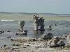
| Fårö  FeatureType : landmark Elevation : 10 Lat/Lng : 57.9333 / 19.15 | Fårö is a Baltic Sea island just off north of the island of Gotland, itself off mainland Sweden's southeastern coast. It is the second-largest island in the province and it is a popular summer resort. It has its own dialect (Faroymal, a dialect of Gutnish) (...) |
| 2 | 
| Faroe Islands FeatureType : country Lat/Lng : 61.9699 / -6.8445 | The Faroe Islands , or the Faeroe Islandsa North Atlantic archipelago located north-northwest of Scotland and about halfway between Norway and Icelandare an autonomous country of the Kingdom of Denmark. Total area is about with a population of 50,322 in October 2017 (...) |
| 3 | 
| Norðragøta FeatureType : city Lat/Lng : 62.2008 / -6.7408 | Norðragøta, also just referred to as Gøta , is a village on Eysturoy, Faroe Islands. (...) |
| 4 | 
| Streymoy FeatureType : isle Lat/Lng : 62.1333 / -7.0167 | Streymoy is the largest and most populated island of the Faroe Islands. The capital, Tórshavn, is located on its southeast coast. The name means "island of currents". It also refers to the largest region of the country that also includes the islands of Hestur, Koltur and Nólsoy. (...) |
| 5 | 
| Tórshavn FeatureType : city Lat/Lng : 62.0177 / -6.7719 | Tórshavn (; lit. 'Thor's harbour';) is the capital and largest town of the Faroe Islands. Tórshavn is in the southern part on the east coast of Streymoy. To the northwest of the city lies the mountain Húsareyn, and to the southwest, the Kirkjubøreyn. They are separated by the Sandá River (...) |
| 6 | 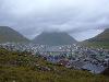
| Klaksvík FeatureType : null Lat/Lng : 62.2239 / -6.5786 | Klaksvík is the second largest town of the Faroe Islands behind Torshavn. The town is located on Borðoy, which is one of the northernmost islands (the Norðoyar). It is the administrative centre of Klaksvík municipality.http://www.klaksvik.fo/Index.asp?pID=41A7429E-7B67-464C-9E53-963F6BC62D57 (...) |
| 7 | 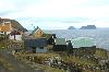
| Sandoy FeatureType : isle Lat/Lng : 61.85 / -6.7833 | Sandoy (. English: Sand Island) is the first of the five southern islands that make up the Faroe chain, the fifth biggest of all the Faroe Islands, an autonomous region of the Kingdom of Denmark. It also refers to the region that includes this island along with Skúvoy and Stóra Dímun (...) |
| 8 | 
| Nólsoy FeatureType : isle Lat/Lng : 61.9844 / -6.6506 | Nólsoy (previously also Nölsoy; ;) is an island and village in central Faroe Islands, 4 km east of the capital Tórshavn in Streymoy. (...) |
| 9 | 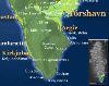
| Argir FeatureType : null Lat/Lng : 61.9981 / -6.7731 | Argir is a village in the Faroe Islands. Argir most likely takes its name from Old Irish airge meaning summer pasture.; several placenames in Faroe carry the same name with this meaning. Once a village south of Tórshavn, Argir has grown and is now merged with Tórshavn (...) |
| 10 | 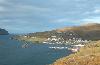
| Eiði FeatureType : null Lat/Lng : 62.2992 / -7.0903 | Eiði (Northern Faroese ;) is a village located on the north-west tip of Eysturoy, Faroe Islands. Its name means isthmus in the Faroese language. The town has a population of 669 inhabitants. Eiði was settled by Vikings in the 9th century AD (...) |
| 11 | 
| Fuglafjørður FeatureType : null Lat/Lng : 62.2444 / -6.8144 | Fuglafjørður is a village on Eysturoy's east coast in the Faroe Islands. Its name means "fjord of birds". The village is at the edge of a bay and expands into the surrounding steep hills. The town centre is located close to the harbour and contains most of the shops and services (...) |
| 12 | 
| Vágar FeatureType : isle Lat/Lng : 62.0833 / -7.2667 | Vágar is one of the 18 islands in the archipelago of the Faroe Islands and the most westerly of the large islands. With a size of , it ranks number three, behind Streymoy and Eysturoy. Vágar region also comprises the island of Mykines (...) |
| 13 | 
| Vágur FeatureType : null Lat/Lng : 61.475 / -6.8069 | Vágur meaning Bay is a town on the island of Suðuroy, part of the Faroe Islands It is situated on the east coast of the island on the Vágsfjørður fjord, and was founded in the fourteenth century. Expansion has meant that the nearby town of Nes is now a suburb of Vágur (...) |
| 14 | 
| Slættaratindur FeatureType : mountain Lat/Lng : 62.2968 / -7.0131 | Slættaratindur (English: Flat peak) is the highest mountain in the Faroe Islands, at an elevation of 880 metres. It is located in the northern part of Eysturoy, between the villages of Eiði, Gjógv, and Funningur (...) |
| 15 | 
| Mykines, Faroe Islands FeatureType : isle Lat/Lng : 62.1094 / -7.6075 | Mykines is the westernmost of the 18 main islands of the Faroe Archipelago. It lies west of 7.5 degrees W, effectively putting it in the UTC-1 region. However, Mykines uses Greenwich Mean Time like the rest of the Faroes. The only settlement on the island is also called Mykines. (...) |
| 16 | 
| Tvøroyri FeatureType : city Lat/Lng : 61.5556 / -6.8031 | Tvøroyri lies on the north side of the Trongisvágsfjørður (fjord) on the east coast of Suðuroy, Faroe Islands. Tvøroyri is a village, and together with Froðba, Trongisvágur, Líðin and Øravík form Tvøroyri Municipality. (...) |
| 17 | 
| Eysturoy FeatureType : isle Lat/Lng : 62.2167 / -6.8833 | Eysturoy (pronounced) meaning 'East Island' is a region and the second-largest of the Faroe Islands in the North Atlantic, both in size and population. (...) |
| 18 | 
| Hoyvík FeatureType : city Lat/Lng : 62.0256 / -6.7589 | Hoyvík is the third largest town in the Faroe Islands. It has grown in size for many years and is now merged with Tórshavn becoming a northern suburb of the Faroese capital. A person from Hoyvík is known as a hoyvíkingur. (...) |
| 19 | 
| Svínoy FeatureType : isle Lat/Lng : 62.2667 / -6.3667 | Svínoy is an island located in the north-east of the Faroe Islands, to the east of Borðoy and Viðoy. It takes its name from Old Norse, Svíney, meaning "Swine Isle". Svinoy also refers to a section of the ocean where North Atlantic water flows into the Norwegian Sea.C.Michael Hogan. 2011 (...) |
| 20 | 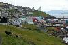
| Toftir FeatureType : city Lat/Lng : 62.0889 / -6.7356 | Toftir is a village in Nes Municipality on the island of Eysturoy, in the Faroe Islands. Toftir is part of a chain of villages stretching over a distance of 10 kilometres on the east side of Skálafjørður (fjord) on Eysturoy island (...) |
| 21 | 
| Innan Glyvur FeatureType : city Lat/Lng : 62.1392 / -6.7567 | Innan Glyvur is a village in the Faroe Islands on the island of Eysturoy. It is on the west side of Skalafjørður (fjord). It was founded in 1884. (...) |
| 22 | 
| Akrar FeatureType : city Lat/Lng : 61.4556 / -6.7592 | Akrar is a village in the Faroe Islands. It is located on Lopransfjørður, an inlet, which itself is part of Vágsfjørður, on the east-side of Suðuroy, and was founded in 1817. (...) |
| 23 | 
| Funningur FeatureType : city Lat/Lng : 62.2881 / -6.9672 | Funningur is a village on the Faroe Islands. It is located on the northwest coast of Eysturoy . It was the only village in the municipality called Funnings kommuna, which on 1 January 2009 became part of Runavíkar kommuna (...) |
| 24 | 
| Viðoy FeatureType : isle Lat/Lng : 62.3333 / -6.5167 | Viðoy is the northernmost island in the Faroe Islands, located east of Borðoy to which it is linked via a causeway. The name means wood island, despite the fact that no trees grow on the island; the name relates to the driftwood that floats in from Siberia and North America. (...) |
| 25 | 
| Kunoy FeatureType : isle Lat/Lng : 62.3044 / -6.6533 | Kunoy (meaning Woman island) is an island located in the north-east of the Faroe Islands between Kalsoy and Borðoy (to which it is linked via a causeway). (...) |
| 26 | 
| Norðskáli FeatureType : null Lat/Lng : 62.2131 / -6.9997 | Norðskáli is a settlement in the Faroe Islands on the island of Eysturoy, a few kilometres north of Oyri. Its name means north dwelling and its population is 295. The 226-metre Streymn Bridge crosses Sundini from the island of Streymoy between Norðskáli and Oyri (...) |
| 27 | 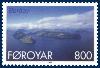
| Borðoy FeatureType : isle Lat/Lng : 62.2483 / -6.5575 | Borðoy is an island in the north-east of the Faroe Islands. Its name means 'headland island'.en.m.wiktionary.org There are eight settlements: Klaksvík (the second largest town in the Faroes), Norðoyri, Ánir, Árnafjørður, Strond, Norðtoftir, Depil and Norðdepil. (...) |
| 28 | 
| Saksun FeatureType : null Lat/Lng : 62.2486 / -7.1756 | Saksun is a village near the northwest coast of the Faroese island of Streymoy, in Sunda Municipality. (...) |
| 29 | 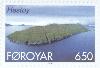
| Hestur FeatureType : isle Lat/Lng : 61.9547 / -6.8875 | Hestur is an island in the central Faroe Islands, to the west of Streymoy and the south of Koltur. Hestur means horse in Faroese. On the west coast is a guillemot colony. In the north there is moorland with four small lakes, of which Fagradalsvatn is the largest (...) |
| 30 | 
| Ísafjarðarbær FeatureType : city Lat/Lng : 66.0667 / -23.15 | Ísafjarðarbær is a municipality of Iceland in the Westfjords region, created in 1996 from Flateyrarhreppur, Ísafjarðarkaupstaður, Mosvallahreppur, Mýrahreppur, Suðureyrarhreppur and Þingeyrarhreppur. (...) |
| 31 | 
| Lerwick FeatureType : null Lat/Lng : 60.1547 / -1.1494 | Lerwick (; Scottish Gaelic: Liùrabhaig, Norwegian: Leirvik) is the main port of Shetland Islands, Scotland. It is centred off the north coast of the Scottish mainland and on the east coast of the Shetland Mainland (...) |
| 32 | 
| Kaldbak FeatureType : city Lat/Lng : 62.0631 / -6.8261 | Kaldbak is a village in the Faroe Islands, on Streymoy's east coast and part of Tórshavn Municipality. The village lies on the northern side of the fjord Kaldbaksfjørður. (...) |
| 33 | 
| Stadio Artemio Franchi FeatureType : landmark Elevation : 52 Lat/Lng : 43.7808 / 11.2823 | The Stadio Artemio Franchi is a football stadium in Florence, Italy. It is currently the home of ACF Fiorentina. The stadium was temporarily noticed as the host of Italy's Six Nations matches from 2012. The old nickname of the stadium was "Comunale (...) |
| 34 | 
| Vatnajökull FeatureType : glacier Lat/Lng : 64.4 / -16.8 | Vatnajökull , also known as the Water Glacier in English, is the largest and most voluminous ice cap in Iceland, and one of the largest in area in Europe. It is the second largest glacier in area after Austfonna on Svalbard in Norway but, nevertheless, larger by volume (...) |
| 35 | 
| Tierra del Fuego FeatureType : isle Elevation : 75 Lat/Lng : -53.9333 / -68.5333 | Tierra del Fuego (; Spanish for "Land of Fire") is an archipelago off the southernmost tip of the South American mainland, across the Strait of Magellan. The archipelago consists of the main island, Isla Grande de Tierra del Fuego, with an area of , and a group of many islands, including Cape Horn (...) |
| 36 | 
| Húsavík, Faroe Islands FeatureType : city Lat/Lng : 61.8106 / -6.6764 | Húsavík is an old village located on the east of the Isle of Sandoy, in Húsavík Municipality, Faroe Islands. In the center of Húsavík there is a ruin called ‘Heimi á Garði’. It is said to be the remains of a farm that was built by ‘Lady of the House in Húsavík' (...) |
| 37 | 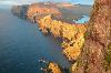
| Suðuroy FeatureType : isle Lat/Lng : 61.5333 / -6.85 | Suðuroy (literally South Island) is the southernmost of the Faroe Islands. The island covers 163.7 square kilometres (63.2 sq mi). In 2017 there were 4,607 inhabitants, but there has been a gradual decline in the population numbers ever since the 1950s. In 2005 the population had been 5,036 (...) |
| 38 | 
| Lamba (Faroe Islands) FeatureType : city Lat/Lng : 62.1425 / -6.7022 | Lamba , is a small village in the bottom of the inlet of Lambavík on the east coast of Eysturoy, Faroe Islands. There are similarly named places, Lamba in Shetland and Lambay in Ireland. (...) |
| 39 | 
| Húsar FeatureType : city Lat/Lng : 62.2651 / -6.697 | Húsar is a village on the island of Kalsoy in the Faroe Islands. (...) |
| 40 | 
| Hvannasund FeatureType : city Lat/Lng : 62.2953 / -6.5161 | Hvannasund (older spelling: Quannesund) is a village and municipality in the Faroe Islands, an autonomous region in Denmark. Hvannasund is located on the west coast of the island of Viðoy. It faces Norðdepil on Borðoy. The villages are connected to each other by a causeway (...) |
| 41 |
| Gásadalur FeatureType : null Lat/Lng : 62.1122 / -7.4347 | Gásadalur is a village located on the west side of Vágar, Faroe Islands, and enjoys a panoramic view over to the island of Mykines. Gásadalur is located on the edge of Mykinesfjørður, surrounded by the highest mountains on Vágar (...) |
| 42 | 
| Mariehamn FeatureType : city Lat/Lng : 60.0931 / 19.9392 | Mariehamn is the capital of Åland, an autonomous territory under Finnish sovereignty. Mariehamn is the seat of the Government and Parliament of Åland, and 40% of the population of Åland live in the city. Like all of Åland, Mariehamn is unilingually Swedish-speaking and around of the inhabitants (...) |
| 43 | Faroe Islands Premier League FeatureType : null Lat/Lng : 61.9949 / -6.8018 | The Faroe Islands Premier League is the top level of football in the Faroe Islands. It was founded in 2005, replacing 1. deild and it is organised by the Faroe Islands Football Association. For sponsorship reasons, the league will be called Betri deildin menn starting from 2018 (...) | |
| 44 | 
| Kirkjubøur FeatureType : city Lat/Lng : 61.9561 / -6.7936 | Kirkjubøur is the southernmost village on Streymoy, Faroe Islands. The village is located on the south-west coast of Streymoy and has a view towards the islands Hestur and Koltur towards west and to Sandoy towards south (...) |
| 45 | 
| Gotska Sandön FeatureType : isle Elevation : 24 Lat/Lng : 58.3667 / 19.25 | Gotska Sandön (literally translated as Gotlandic Sand Island) is an uninhabited Swedish island, since 1909 also a national park, situated north of Fårö in the Baltic Sea. Legally a part of Gotland province, it is approximately long and wide, with a total area of approximately (...) |
| 46 | 
| Hellurnar FeatureType : city Lat/Lng : 62.2636 / -6.8444 | Hellurnar is a village in the Faroe Islands, on Oyndarfjørður (fjord), located on the east side of Eysturoy. Hellurnar is part of the municipality of Fuglafjørður. (...) |
| 47 | 
| Sandavágur FeatureType : city Lat/Lng : 62.0567 / -7.1542 | Sandavágur is a city on the south coast of the Faroese island of Vágar, and has been voted the most well-kept village in the Faroes twice. And it's the most famous city in the country, and best voted traveling experience (...) |
| 48 | 
| Denmark FeatureType : country Elevation : 8 Lat/Lng : 55.7167 / 12.5667 | Denmark , officially the Kingdom of Denmark,, . See also: The unity of the Realm is a Nordic country and the southernmost of the Scandinavian nations. The sovereign state is south-west of Sweden and south of Norway,The island of Bornholm is offset to the east of the rest of the country, in the (...) |
| 49 | 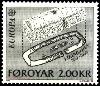
| Kvívík FeatureType : null Lat/Lng : 62.1206 / -7.0678 | Kvívík is a village on the west coast of Streymoy in the Faroe Islands, in the eponymous municipality of Kvívík. (...) |
| 50 | Faroe Islanders FeatureType : null Lat/Lng : 62.0 / -6.7833 | Faroese people or Faroe Islanders are a North Germanic ethnic group and nation native to the Faroe Islands. The Faroese are of mixed Norse and Gaelic origins. About 21,000 Faroese live in neighbouring countries, particularly in Denmark, Iceland and Norway (...) | |
| 51 | 
| Skúvoy FeatureType : null Lat/Lng : 61.7667 / -6.8167 | Skúvoy or Skúgvoy is an island in the central Faroe Islands, located to the south of Sandoy. It is named after the large number of skua present on the island (who have a habit of attacking intruders). There is only one settlement on the island: Skúvoy on the east coast (...) |
| 52 | 
| Kalsoy FeatureType : isle Lat/Lng : 62.2833 / -6.7333 | Kalsoy is an island in the north-east of the Faroe Islands between Eysturoy and Kunoy. The name means man island, by contrast with the parallel island to the east, Kunoy, the name of which means woman island.en.m.wiktionary (...) |
| 53 | 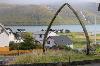
| Hvalvík FeatureType : null Lat/Lng : 62.1894 / -7.0306 | Hvalvík is a village in the Faroe Islands, located in a valley on the east coast of the island of Streymoy. It is the southern half of a twin-village situated on both sides of the valley. The villages are divided by the river Stórá (...) |
| 54 | 
| Trongisvágur FeatureType : city Lat/Lng : 61.5639 / -6.8444 | Trongisvágur is a village on the island of Suduroy in the Faroe Islands. Trongisvágur is the village in the bottom of Trongisvágsfjørður (fjord) on the east coast of Suduroy. Trongisvágur and the neighbouring villages Tvøroyri and Øravík have grown into one entity (the northern part of Øravík, which (...) |
| 55 | Vestmanna FeatureType : city Lat/Lng : 62.1564 / -7.1664 | Vestmanna is a town in the Faroe Islands on the west of the island of Streymoy. It was formerly a ferry port, until an undersea tunnel, the Vágatunnilin, was built from Vágar to Kvívík and Stykkið further south on Streymoy (...) | |
| 56 | 
| Nólsoy, Nólsoy FeatureType : null Lat/Lng : 62.0092 / -6.6686 | Nólsoy is the only settlement on the island of Nólsoy in the Faroe Islands. Its population was 247 in 2009. It takes 20 minutes to reach Nólsoy from Tórshavn by boat. The town can be accessed from the port by walking through the jawbones of a giant whale (...) |
| 57 | 
| Hvítanes FeatureType : city Lat/Lng : 62.0467 / -6.7694 | Hvítanes is a village in the Faroe Islands. It is on Streymoy's east coast, northeast of Hoyvík and Tórshavn. Its name means "White Point" in Faroese. Hvítanes is located in a little bay with a stone beach and a harbour where the small boats can be pulled up a ramp out of reach of the sometimes (...) |
| 58 | 
| Haraldssund FeatureType : city Lat/Lng : 62.2722 / -6.6019 | Haraldssund is a settlement in the Faroe Islands, situated on the island of Kunoy. Haraldssund is located on the east coast of Kunoy and is connected to the village of Kunoy on the west coast by a tunnel. To the east, it is linked to the town of Klaksvík on Borðoy by a causeway (...) |
| 59 | 
| Gøtugjógv FeatureType : null Lat/Lng : 62.1903 / -6.7464 | Gøtugjógv , Norðragøta and Sydrugøta are villages that are located in the Faroe Islands. These areas are located at the end of an inlet which is called 'Gøtuvík'. This is on the east-side of the island of Eysturoy (...) |
| 60 | 
| Dalur FeatureType : city Lat/Lng : 61.7822 / -6.6756 | Dalur is a village in the Faroe Islands. Dalur is located on the east-side of Sandoy. The village lies in the bottom of a relatively large valley. Dalur means valley in Faroese. A little road leads from Dalur to the south-tip of the island. From there it is possible to walk to the bird cliffs Skorin (...) |
| 61 | 
| Árnafjørður FeatureType : city Lat/Lng : 62.2558 / -6.5342 | Árnafjørður is a town of the municipality of Klaksvík, on the island of Borðoy, in the Faroe Islands. Árnafjørður is located at the bottom of a deep inlet, named (H)Árnfjarðarvík, "corner fjord's bay", on the east side of Borðoy (...) |
| 62 | 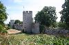
| Gotland FeatureType : isle Elevation : 48 Lat/Lng : 57.4808 / 18.4883 | Gotland (; , Svenska Akademiens ordlista, 6 February 2013 older spellings include Gottland or Gothland), Gutland in the local dialect, is a province, county, municipality, and diocese of Sweden. It is Sweden's largest island (...) |
| 63 | 
| Depil FeatureType : city Lat/Lng : 62.2861 / -6.5275 | Depil is a village in the Faroe Islands. Depil is located on the east side of Borðoy between Norðdepil and Norðtoftir. The village has only two inhabitants. (...) |
| 64 | 
| Koltur FeatureType : isle Lat/Lng : 61.9833 / -6.9667 | Koltur is an island in the Faroe Islands, located to the west of Streymoy and to the north-west of Hestur. The name 'Koltur' means 'colt', in contrast with the name of the larger island to the south-east, 'Hestur', which means 'horse'.en.m.wiktionary.org The island has just one settlement, Koltur (...) |
| 65 | 
| University of Copenhagen FeatureType : edu Elevation : 16 Lat/Lng : 55.6797 / 12.5725 | The University of Copenhagen (UCPH) is the oldest university and research institution in Denmark. Founded in 1479 as a studium generale, it is the second oldest institution for higher education in Scandinavia after Uppsala University (1477) (...) |
| 66 | 
| Fugloy FeatureType : isle Lat/Lng : 62.3379 / -6.2943 | Fugloy (Danish Fuglø, Old Norse Fuglaey) is the eastern-most island in the Faroe Islands. The name means bird island, and refers to the large number of birds that nest on the island's cliffs. (...) |
| 67 | 
| Hvalba FeatureType : null Lat/Lng : 61.6019 / -6.9494 | Hvalba is a village and a municipality in the Faroe Islands, which consists of Hvalba, Nes-Hvalba and Sandvík. The village spreads around the bottom of a deep inlet, Hvalbiarfjørður, in the northeast of Suðuroy. (...) |
| 68 | 
| Hov, Faroe Islands FeatureType : city Lat/Lng : 61.5065 / -6.7645 | Hov is a village located on Suduroy's east coast, in the Faroe Islands; it is frequently mentioned in the country's history. Salmon sea farming has been practiced in Hov since the 1980s. North of Hov along the old road to Øravík are interesting basalt columns that march along the hills. (...) |
| 69 | 
| Shetland FeatureType : adm1st Lat/Lng : 60.3038 / -1.2689 | Shetland , also called the Shetland Islands and formerly Zetland, is a subarctic archipelago of Scotland that lies northeast of Great Britain. The islands lie some to the northeast of Orkney, from the Scottish mainland and southeast of the Faroe Islands (...) |
| 70 | Kunoy (village) FeatureType : city Lat/Lng : 62.2936 / -6.6672 | Kunoy is a village, and seat of Kunoy Municipality in the Faroe Islands. As of 2006 it had a population of 64. | |
| 71 | 
| Geography of the Faroe Islands FeatureType : null Lat/Lng : 62.0 / -7.0 | The Faroe Islands are an island group consisting of eighteen islands between the Norwegian Sea and the North Atlantic, about half-way between Iceland and Norway. Its coordinates are . It is 1,393 square kilometres in area, and includes small lakes and rivers, but no major ones (...) |
| 72 | 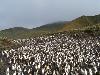
| Macquarie Island FeatureType : null Elevation : 313 Lat/Lng : -54.6033 / 158.8753 | Macquarie Island, a UNESCO World Heritage Site, lies in the southwest Pacific Ocean, about halfway between New Zealand and Antarctica, at 54° 30' S, 158° 57' E. Regionally part of Oceania and politically a part of Tasmania, Australia since 1900, it became a Tasmanian State Reserve in 1978 and was (...) |
| 73 | 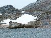
| South Shetland Islands FeatureType : null Lat/Lng : -62.3292 / -59.2987 | The South Shetland Islands are a group of Antarctic islands, lying about north of the Antarctic Peninsula, with a total area of . By the Antarctic Treaty of 1959, the islands' sovereignty is neither recognized nor disputed by the signatories and they are free for use by any signatory for (...) |
| 74 | Nes (Eysturoy) FeatureType : null Lat/Lng : 62.2008 / -6.7408 | null | |
| 75 | 
| Sandefjord FeatureType : city Elevation : 67 Lat/Lng : 59.1458 / 10.2236 | Sandefjord is the most populous city and municipality in Vestfold County, Norway. The administrative center of the municipality is the city of Sandefjord. The municipality of Sandefjord was established on January 1, 1838. The municipality of Sandar was merged into Sandefjord on January 1, 1968 (...) |
| 76 | 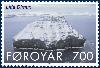
| Lítla Dímun FeatureType : isle Lat/Lng : 61.6331 / -6.7081 | Lítla Dímun is a small island between the islands of Suðuroy and Stóra Dímun in the Faroe Islands of Denmark. It is the smallest of the main 18 islands, being less than a square kilometre (247 acres) in area, and is the only uninhabited one (...) |
| 77 | 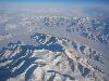
| Greenland FeatureType : isle Lat/Lng : 64.18 / -51.72 | Greenland is an autonomous constituent country of the Kingdom of Denmark between the Arctic and Atlantic Oceans, east of the Canadian Arctic Archipelago. Though physiographically a part of the continent of North America, Greenland has been politically and culturally associated with Europe (...) |
| 78 | 
| Glyvrar FeatureType : city Lat/Lng : 62.1314 / -6.7242 | Glyvrar is a village located on Eysturoy, in the Faroe Islands. It is one of several villages on the eastside of Skálafjørður (fjord) that have grown into a 10 kilometre long conurbation. In Glyvrar there is a museum called ’Bygdasavnid Forni’ (...) |
| 79 | 
| Garðabær FeatureType : null Lat/Lng : 64.0887 / -21.923 | Garðabær is a municipality in the Capital Region of Iceland. (...) |
| 80 | 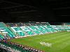
| Celtic Park FeatureType : landmark Elevation : 44 Lat/Lng : 55.8497 / -4.2056 | Celtic Park is a football stadium in the Parkhead area of Glasgow, and is the home ground of Celtic Football Club. With a capacity of , it is the largest football stadium in Scotland and the fifth-largest football stadium in the United Kingdom (...) |
| 81 | 
| Sisimiut FeatureType : null Lat/Lng : 66.9389 / -53.6722 | Sisimiut, formerly known by its colonial name Holsteinsborg, is the capital and largest city of the Qeqqata municipality, and the second-largest city in Greenland.The term 'city' is loosely used to describe any populated area in Greenland, given that the most populated place is Nuuk, the capital, (...) |
| 82 | 
| Scapa Flow FeatureType : isle Lat/Lng : 58.8922 / -3.05 | Scapa Flow (or ; Scapa Flow: Graveyard of the German Fleet, Will Springer.) is a body of water in the Orkney Islands, Scotland, sheltered by the islands of Mainland, Graemsay, Burray,S. C. George, Jutland to Junkyard, 1973. South Ronaldsay and Hoy (...) |
| 83 | 
| Jan Mayen FeatureType : isle Lat/Lng : 70.9833 / -8.5333 | Jan Mayen is a Norwegian volcanic island situated in the Arctic Ocean. It is long (southwest-northeast) and in area, partly covered by glaciers (an area of around the Beerenberg volcano). It has two parts: larger northeast Nord-Jan and smaller Sør-Jan, linked by a wide isthmus (...) |
| 84 | 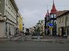
| Akureyri FeatureType : null Lat/Lng : 65.6833 / -18.1 | Akureyri is a town in northern Iceland. It is Iceland's second largest urban area (after the Capital Region) and fourth largest municipality (after Reykjavík, Hafnarfjörður, and Kópavogur). Nicknamed the Capital of North Iceland, Akureyri is an important port and fishing centre (...) |
| 85 | 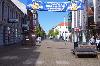
| Esbjerg FeatureType : null Elevation : 17 Lat/Lng : 55.4708 / 8.4514 | Esbjerg is a seaport town and seat of Esbjerg Municipality on the west coast of the Jutland peninsula in southwest Denmark. By road, it is west of Kolding and southwest of Aarhus. With an urban population of 71,618 , it is the fifth-largest city in Denmark, and the largest in west Jutland (...) |
| 86 | 
| Reykjavík FeatureType : city Lat/Lng : 64.1382 / -21.9287 | Reykjavík is the capital and largest city of Iceland. It is located in southwestern Iceland, on the southern shore of Faxa Bay. Its latitude is 64°08' N, making it the world's northernmost capital of a sovereign state (...) |
| 87 | 
| Norway FeatureType : country Lat/Lng : 65.8333 / 13.4 | Norway (Norwegian: help=no (Bokmål) or (Nynorsk);), officially the Kingdom of Norway, is a Nordic country in Northwestern Europe whose core territory comprises the western and northernmost portion of the Scandinavian Peninsula; the remote island of Jan Mayen and the archipelago of Svalbard are also (...) |
| 88 | 
| Ben Nevis FeatureType : mountain Elevation : 1335 Lat/Lng : 56.7969 / -5.0035 | Ben Nevis is the highest mountain in the British Isles. Standing at above sea level, it is at the western end of the Grampian Mountains in the Lochaber area of the Scottish Highlands, close to the town of Fort William (...) |
| 89 | 
| La Paz FeatureType : null Elevation : 3746 Lat/Lng : -16.4942 / -68.1475 | La Paz , officially known as Nuestra Señora de La Paz , also named Chuqi Yapu (Chuquiago) in Aymara, is the seat of government and the de facto national capital of the Plurinational State of Bolivia (the constitutional capital of Bolivia is Sucre) (...) |
| 90 | 
| Kola Peninsula FeatureType : landmark Lat/Lng : 67.6884 / 35.9437 | The Kola Peninsula ('; from , '; ; ;) is a peninsula in the far northwest of Russia. Constituting the bulk of the territory of Murmansk Oblast,2007 Atlas of Murmansk Oblast, p. 2The area of the peninsula is ; vs. Murmansk Oblast's total area of (...) |
| 91 | 
| Svalbard FeatureType : country Lat/Lng : 78.0 / 16.0 | Svalbard (; ; prior to 1925 known by its Dutch name Spitsbergen) is a Norwegian archipelago in the Arctic Ocean. Situated north of mainland Europe, it is about midway between continental Norway and the North Pole (...) |
| 92 | Nes Municipality FeatureType : null Lat/Lng : 62.0889 / -6.7356 | Nes Municipality in the Faroe Islands comprises three villages, Nes, Toftir and Saltnes. (...) | |
| 93 | 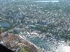
| Stavanger FeatureType : null Elevation : 12 Lat/Lng : 58.9694 / 5.7322 | Stavanger is a city and municipality in Norway. It is the third largest city and metropolitan area in Norway (through conurbation with neighbouring Sandnes) and the administrative centre of Rogaland county. The municipality is the fourth most populous in Norway (...) |
| 94 | 
| Aalborg FeatureType : null Elevation : 7 Lat/Lng : 57.0511 / 9.9194 | Aalborg , is Denmark's fourth largest city with an urban population of 136,000, including 22,000 in the twin city Nørresundby 600 meters across the Limfjord. With a population of 215,379 , the Municipality of Aalborg is the third most populous in the country after Copenhagen and Aarhus (...) |
| 95 | 
| Galway FeatureType : null Elevation : 16 Lat/Lng : 53.2778 / -9.0418 | Galway is a city in the West of Ireland, in the province of Connacht. Galway lies on the River Corrib between Lough Corrib and Galway Bay, surrounded by County Galway, and is the sixth most populous city in Ireland, with a population at the 2016 Census of 79,934 (...) |
| 96 | 
| Skagen FeatureType : null Elevation : 3 Lat/Lng : 57.7219 / 10.5853 | Skagen is Denmark's northernmost town, on the east coast of the Skagen Odde peninsula in the far north of Jutland, part of Frederikshavn Municipality in Nordjylland, north of Frederikshavn and northeast of Aalborg (...) |
| 97 | 
| Odense FeatureType : landmark Elevation : 17 Lat/Lng : 55.396 / 10.3885 | Odense is the third-largest city in Denmark. It has a population of 178,210 as of January 2016, and is the main city of the island of Funen. By road, Odense is located north of Svendborg, to the south of Aarhus and to the southwest of Copenhagen (...) |
| 98 | 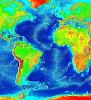
| Atlantic Ocean FeatureType : waterbody Lat/Lng : 0.0 / -25.0 | The Atlantic Ocean is the second largest of the world's oceans, with an area of about . It covers approximately 20 percent of the Earth's surface and about 29 percent of its water surface area. It separates the "Old World" from the "New World" (...) |
| 99 | 
| Stockholm FeatureType : null Elevation : 17 Lat/Lng : 59.3294 / 18.0686 | Stockholm is the capital of Sweden and the most populous city in the Nordic countries; 960,031 people live in the municipality, approximately 1.5 million in the urban area, and 2.3 million in the metropolitan area (...) |
| 100 | 
| Iceland FeatureType : country Lat/Lng : 64.8306 / -17.9867 | Iceland Interinstitutional Style Guide of the European Union guidance on Iceland reading "Do not use 'Republic of Iceland'. Although this name is found in some documents, it does not have official status." is a Nordic island country in the North Atlantic, with a population of and an area of , making (...) |
| 101 | 
| Bøur FeatureType : city Lat/Lng : 62.0867 / -7.37 | Bøur is a village in the Sørvágur Municipality of the Faroe Islands, 4 km west of Sørvágur, with a population of 75 (2012). - Municipality website Its location is and its postal code is FO 386. Bøur is a small village on the west-side of Vágoy on the north side of Sørvágsfjørður, Faroe Islands (...) |
| 102 | 
| Fámjin FeatureType : city Lat/Lng : 61.5264 / -6.8769 | Fámjin is a village, located in the middle of the coastline on the western side of Suðuroy, the southernmost island in Faroe Islands. It has a population of around 100. (...) |
| 103 | Sunda, Faroe Islands FeatureType : city Lat/Lng : 62.2131 / -6.9997 | Sunda kommuna is an amalgamated-municipality stretching across vast areas of the two large Faroese islands Streymoy and Eysturoy. Sunda kommuna is formed by the former municipalities of Hósvíkar kommuna, Hvalvíkar kommuna, Saksunar kommuna, Haldarsvíkar kommuna, (former) Sunda kommuna and Gjáar (...) | |
| 104 | Sandur, Faroe Islands FeatureType : city Lat/Lng : 61.8424 / -6.8077 | Sandur (meaning sandy beach;) is a village on the south coast of the island of Sandoy in the Faroe Islands. The Sandur hoard, dating to the end of the 11th century, attests to the long history of the village. In January 2010 the population stood at 558 (...) | |
| 105 | Runavík FeatureType : null Lat/Lng : 62.1094 / -6.7192 | Runavík is a comparatively urbanised village in Runavík Municipality, Faroe Islands. It lies on the south half of the isle of Eysturoy. (...) | |
| 106 | 
| Vatnsoyrar FeatureType : city Lat/Lng : 62.0742 / -7.2481 | Vatnsoyrar is a village founded in 1921 in the middle of the Faroese island of Vagar. Vatnsoyrar, being created in 1921, is one of the youngest settlements in the Faroes. It is the only village in the archipelago that is not on the coast, but instead it is next to Sørvagsvatn, the largest lake on (...) |
| 107 | 
| St Kilda, Scotland FeatureType : isle Elevation : 267 Lat/Lng : 57.8178 / -8.5811 | St Kilda is an isolated archipelago situated west-northwest of North Uist, in the North Atlantic Ocean. It contains the westernmost islands of the Outer Hebrides of Scotland. The largest island is Hirta, whose sea cliffs are the highest in the United Kingdom (...) |
| 108 | 
| Algeria FeatureType : country Elevation : 387 Lat/Lng : 27.25 / 3.45 | Algeria (; ', familary Algerian Arabic ';), officially the People's Democratic Republic of Algeria, is a country in the Maghreb (Northwest Africa) on the Mediterranean coast. The capital and most populous city is Algiers, located in the far north of the country (...) |
| 109 | 
| Gjógv FeatureType : null Lat/Lng : 62.325 / -6.9408 | Gjógv (pronounced , literally: gorge, geo) is a village located on the northeast tip of the island of Eysturoy, in the Faroe Islands and 63 km (39 mi) north by road from the capital of Tórshavn. The village was named after a 200-metre (650 ft) long sea-filled gorge that runs north to the sea from (...) |
| 110 | 
| Stóra Dímun FeatureType : isle Lat/Lng : 61.6969 / -6.7489 | Stóra Dímun is an island in the southern Faroe Islands, sometimes only referred to as Dímun. It is accessible by sea only during periods of clear and calm weather, but there is a regular helicopter service twice a week all year. There is a lighthouse on the island. (...) |
| 111 | 
| Ilulissat FeatureType : city Lat/Lng : 69.2167 / -51.1 | Ilulissat, formerly Jakobshavn or Jacobshaven,i.a., Lieber, Francis & al. Encyclopædia Americana: A Popular Dictionary of Arts, Sciences, Literature, History, Politics and Biography. "". B.B. Mussey & Co., 1854 (...) |
| 112 | 
| Scotland FeatureType : country Elevation : 288 Lat/Lng : 56.26 / -4.21 | Scotland is a country that is part of the United Kingdom and covers the northern third of the island of Great Britain. It shares a border with England to the south, and is otherwise surrounded by the Atlantic Ocean, with the North Sea to the east and the North Channel and Irish Sea to the south-west (...) |
| 113 | Norðoyar FeatureType : isle Lat/Lng : 62.282 / -6.543 | The six islands in the northeast of the Faroe Islands are together referred to as Norðoyar, i.e. the Northern Isles . These Islands from west to east are Kalsoy, Kunoy, Borðoy, Viðoy, Svínoy and Fugloy. Klaksvík is the biggest settlement of the region. Norðoyar is sometimes spelled Norðoyggjar (...) | |
| 114 | 
| Froðba FeatureType : city Lat/Lng : 61.5481 / -6.7722 | Froðba is a village located farthest out on the north brink of Trongisvágsfjørður, an inlet on the east coast of the island of Suðuroy in the Faroe Islands. (...) |
| 115 | Skálafjørður FeatureType : waterbody Lat/Lng : 62.138 / -6.746 | Skálafjørður, also known as Kongshavn (King's harbour) is a fjord (ford) in Eysturoy. It is the largest fjord in the Faroe Islands. | |
| 116 | Hestur, Hestur FeatureType : city Lat/Lng : 61.9561 / -6.8833 | Hestur is a village in Hestur, Faroe Islands. | |
| 117 | 
| Auckland Islands FeatureType : isle Elevation : 273 Lat/Lng : -50.7 / 166.0833 | The Auckland Islands (Māori: Motu Maha or Maungahuka) are an archipelago of New Zealand, lying south of the South Island. The main Auckland Island, occupying , is surrounded by smaller Adams Island, Enderby Island, Disappointment Island, Ewing Island, Rose Island, Dundas Island, and Green Island, (...) |
| 118 | 
| Þingvellir FeatureType : landmark Lat/Lng : 64.2538 / -21.0372 | , anglicised as Thingvellir,The spelling Pingvellir is incorrect, as the letter “p” should never be used to represent the letter “þ” (thorn), which is pronounced as "th". is a national park in the municipality of in southwestern Iceland, about 40 km northeast of Iceland's capital, (...) |
| 119 | Leirvík FeatureType : adm2nd Lat/Lng : 62.2111 / -6.7061 | Leirvík is a town on the Faroe Islands and was an important regional ferry harbour at the east coast of the second-largest island Eysturoy. Leirvík has 925 inhabitants (January 1, 2017). It was the only town in the municipality of Leirvík (Leirvíkar kommuna), however on 1 January 2009, it merged (...) | |
| 120 | 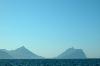
| Cape Enniberg FeatureType : landmark Lat/Lng : 62.391 / -6.563 | Cape Enniberg is a cliff located on the Island of Viðoy. It is high, thus one of the highest promontories in the world. Enniberg is the northernmost point of the Faroe Islands. From the landside, only experienced mountain climbers with a trained local guide should attempt to scale the cliff (...) |
| 121 | 2017 Faroe Islands Premier League FeatureType : null Lat/Lng : 62.0117 / -6.7675 | The 2017 Faroe Islands Premier League (also known as Effodeildin for sponsorship reasons) was the 75th season of top-tier football in the Faroe Islands. Víkingur Gøta successfully defended their first Faroese title from the previous season (...) | |
| 122 | 
| Scrabster FeatureType : city Elevation : 5 Lat/Lng : 58.6097 / -3.552 | Scrabster is a small settlement on Thurso Bay in Caithness on the north coast of Scotland. It is some from Thurso, from Wick and from Inverness. Scrabster Harbour is an important port for the Scottish fishing industry (...) |
| 123 | 
| Húsavík FeatureType : null Lat/Lng : 66.048 / -17.3333 | Húsavík is a town in Norðurþing municipality on the north coast of Iceland on the shores of Skjálfandi bay with 2,182 inhabitants. The most famous landmark of the town is the wooden church Húsavíkurkirkja, built in 1907. Húsavík is served by Húsavík Airport. (...) |
| 124 | 
| Kista FeatureType : city Elevation : 21 Lat/Lng : 59.4039 / 17.9415 | Kista is a district in the borough of Rinkeby-Kista, Stockholm, Sweden. It has a strategic position located in between Sweden's main airport, the Stockholm-Arlanda International Airport and central Stockholm, and alongside the main national highway E4 economic artery (...) |
| 125 | 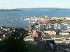
| Holmestrand FeatureType : null Elevation : 90 Lat/Lng : 59.4875 / 10.3047 | Holmestrand is a town and municipality in Vestfold county, Norway. The administrative centre of the municipality is the town of Holmestrand. The town was established as a municipality on 1 January 1838 (see formannskapsdistrikt) (...) |
| 126 | 
| Elduvík FeatureType : city Lat/Lng : 62.2825 / -6.9097 | Elduvík is a small village in the Faroe Islands. Elduvík is located in the Funningsfjørður-inlet on Eysturoy's northeast side. The village which has a population of 23 is split into two parts by a small river. The church in Elduvík dates from 1952. Visible from Elduvík is the nearby island of Kalsoy (...) |
| 127 | 
| Næstved FeatureType : null Elevation : 14 Lat/Lng : 55.2333 / 11.7667 | Næstved is a town in the municipality of the same name, located on the island of Zealand in Denmark. Næstved has several adult education centers, five elementary schools - and has at least one of each type of the four upper-second-level education centers (...) |
| 128 | 
| Thurso FeatureType : null Elevation : 12 Lat/Lng : 58.596 / -3.521 | Thurso (pronounced ;) is a town and former burgh on the north coast of the Highland council area of Scotland. Situated in the historical area of Caithness, it is the northernmost town on the British mainland. It lies at the junction of the north-south A9 road and the west-east A836 road, connected (...) |
| 129 | Klaksvík Municipality FeatureType : null Lat/Lng : 62.2239 / -6.5786 | Klaksvík Municipality (Klaksvíkar kommuna) is a municipality of the Faroe Islands. The town of Klaksvík is the administrative centre. Its area comprises the majority of the island of Borðoy, the north of Kalsoy and the island of Svínoy (added 1 January 2009) (...) | |
| 130 | Runavík Municipality FeatureType : null Lat/Lng : 62.1156 / -6.7222 | Runavík Municipalityhttp://www.visiteysturoy.fo/en/eysturoy/municipalities-and-villages/runavik-municipality/ (Runavíkar kommuna) is a municipality of the Faroe Islands. The town of Saltangará is the administrative centre. Its area comprises parts of the island of Eysturoy (...) | |
| 131 | 
| Geography of Ireland FeatureType : isle Elevation : 126 Lat/Lng : 53.0 / -8.0 | is an island in Northwestern Europe in the north Atlantic Ocean. The island lies on the European continental shelf, part of the Eurasian Plate. The island's main geographical features include low central plains surrounded by coastal mountains (...) |
| 132 | 
| Sandvík FeatureType : null Lat/Lng : 61.6325 / -6.9278 | Sandvík (pronounced , "Sandy Bay";) is the northernmost village of the island of Suðuroy in the Faroe Islands. It is situated on the northern side of a shallow fjord. The village was previously known as Hvalvík (Bay of Whales) (...) |
| 133 | 
| Porkeri FeatureType : null Lat/Lng : 61.4831 / -6.7433 | Porkeri is a village in the Faroe Islands, situated northeast of Vágur on Suðuroy's east coast. As of 2008 it had a population of 362, and it has been inhabited at least as early as the 14th century. (...) |
| 134 | Fjallavatn FeatureType : waterbody Lat/Lng : 62.1225 / -7.299 | Fjallavatn is the second largest lake in the Faroe Islands. It is situated on the island of Vágar and its size is 1 km2. | |
| 135 | 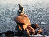
| The Little Mermaid (statue) FeatureType : landmark Elevation : 4 Lat/Lng : 55.6929 / 12.5993 | The Little Mermaid is a bronze statue by Edvard Eriksen, depicting a mermaid. The sculpture is displayed on a rock by the waterside at the Langelinie promenade in Copenhagen, Denmark. It is tall - denmark.net. Retrieved January 29, 2012. and weighs (...) |
| 136 | 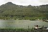
| Seyðisfjörður FeatureType : city Lat/Lng : 65.2631 / -14.0089 | Seyðisfjörður is a town and municipality in the Eastern Region of Iceland at the innermost point of the fjord of the same name. A road over Fjarðarheiði mountain pass connects Seyðisfjörður to the rest of Iceland; to the ring road and Egilsstaðir (...) |
| 137 | Saltnes, Faroe Islands FeatureType : city Lat/Lng : 62.1053 / -6.7394 | Saltnes is a village on the island Eysturoy, Faroe Islands, in Nes Municipality. The population was 151 in December 2008. (...) | |
| 138 | Svangaskarð FeatureType : landmark Lat/Lng : 62.0997 / -6.7361 | Svangaskarð (pronounced) or Tofta Leikvøllur is a multi-purpose stadium in Toftir, Faroe Islands with two football fields and a sports arena for athletics around the lower field. It is currently used mostly for football matches. The stadium holds 6,000 people (...) | |
| 139 | 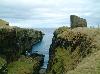
| Wick, Caithness FeatureType : null Elevation : 6 Lat/Lng : 58.4408 / -3.0894 | Wick is a town and royal burgh in Caithness, in the far north of Scotland. The town straddles the River Wick and extends along both sides of Wick Bay. Wick Locality had a population of 6,954 at the time of the 2011 census, a decrease of 3.8% from 2001., The Highland Council. 11 February 2014 (...) |
| 140 | 
| Ánirnar FeatureType : city Lat/Lng : 62.2564 / -6.5778 | Ánir , also Ánirnar (Danish: Åerne) is a village in the Faroe Islands on the northern island of Borðoy. In 2007 it had a population of 16, but with the expansion of the area with the new apartments above the old settlement the population has increased to 55 in 2013. (...) |
| 141 | 
| German battleship Scharnhorst FeatureType : landmark Lat/Lng : 72.2667 / 28.6833 | Scharnhorst was a German capital ship, alternatively described as a battleship and battlecruiser, of Nazi Germany's Kriegsmarine. She was the lead ship of her class, which included one other ship, . The ship was built at the Kriegsmarinewerft dockyard in Wilhelmshaven; she was laid down on 15 June (...) |
| 142 | 
| Geography of Denmark FeatureType : country Elevation : 50 Lat/Lng : 56.0 / 10.0 | Denmark is a Nordic country located in Northern Europe. It consists of the Jutland peninsula and several islands in the Baltic sea, referred to as the Danish Archipelago. Denmark is located southwest of Sweden and due south of Norway and is bordered by the German state (and former possession) (...) |
| 143 | Sumba, Faroe Islands FeatureType : city Lat/Lng : 61.4144 / -6.7039 | Sunnbøur is the southernmost village of the Faroe Islands on the island of Suðuroy. It is located in Sumba Municipality. (...) | |
| 144 | 
| Hirtshals FeatureType : city Elevation : 28 Lat/Lng : 57.5833 / 9.95 | Hirtshals is a town and seaport on the coast of Skagerrak on the island of Vendsyssel-Thy at the top of the Jutland peninsula in northern Denmark, Europe. It is located in Hjørring municipality in Region Nordjylland. The town of Hirtshals has a population of 5,959 (1 January 2014) (...) |
| 145 | Miðvágur FeatureType : null Lat/Lng : 62.0511 / -7.1939 | Miðvágur , is a village in the Faroe Islands on Vágar. It has been a municipality until 1 January 2009 when it fused with Sandavágur into Vága kommuna. Located on the south coast of the island of Vágar, Miðvágur is the largest town on this Faroese island (...) | |
| 146 | 2015 Faroe Islands Premier League FeatureType : null Lat/Lng : 61.9949 / -6.8018 | 2015 Faroe Islands Premier League was the 73rd season of top-tier football on the Faroe Islands. For sponsorship reasons, it is known as Effodeildin. B36 Tórshavn were the defending champions, having won their tenth Faroese title last season. (...) | |
| 147 | 2016 Faroe Islands Premier League FeatureType : null Lat/Lng : 61.9949 / -6.8018 | 2016 Faroe Islands Premier League was the 74th season of top-tier football on the Faroe Islands. For sponsorship reasons, it was known as Effodeildin. B36 Tórshavn were the defending champions, having won their eleventh Faroese title in 2015 (...) | |
| 148 | Vágar Airport FeatureType : landmark Lat/Lng : 62.0636 / -7.2772 | Vágar Airport is the only airport in the Faroe Islands, and is located east of Sørvágur. Due to the Faroe Islands' status as a self-governing territory, the airport is not subject to the rules of the European Union (...) | |
| 149 | Haldórsvík FeatureType : null Lat/Lng : 62.2769 / -7.0903 | Haldórsvik is a village located on the north-east coast of Streymoy in the Sunda Kommuna municipality. In the center of the village there is a small cataract. The stone church in the village is from 1856. It is the only octagonal church on the Faroe Islands. The altarpiece is also distinctive (...) | |
| 150 | Fugloyarfjørður FeatureType : null Lat/Lng : 62.3133 / -6.3345 | Fugloyarfjørður is the firth separating Svínoy from Fugloy in the Faroe Islands. (...) | |
| 151 | Nordic countries FeatureType : null Lat/Lng : 64.0 / 10.0 | The Nordic countries or the Nordics are a geographical and cultural region in Northern Europe and the North Atlantic, where they are most commonly known as Norden (literally "the North"). The term includes Denmark, Finland, Iceland, Norway, and Sweden, as well as Greenland and the Faroe (...) | |
| 152 | Kalmar Union FeatureType : country Elevation : 4 Lat/Lng : 55.6667 / 12.5667 | The Kalmar Union or Union of Kalmaris (Danish, Norwegian and ;) was a personal union that from 1397 to 1523Harald Gustafsson, "A State that Failed?" Scandinavian Journal of History (2006) 32#3 pp 205–220 joined under a single monarch the three kingdoms of Denmark, Sweden (then including most of (...) | |
| 153 | Syðradalur, Streymoy Island FeatureType : city Lat/Lng : 62.0183 / -6.9128 | Syðradalur is a small village in the Faroe Islands. It is located on the west coast of Streymoy, in Tórshavn Municipality. Not to be confused with Syðradalur village on Kalsoy, it has a view at the islands Koltur and Vágar. (...) | |
| 154 | 
| Funningsfjørður FeatureType : city Lat/Lng : 62.2381 / -6.9289 | Funningsfjørður is a village located at the end of a fjord of the same name ('fjørður' is the Faroese word for 'fjord'). It was founded in 1812 and has since 2005 been part of the municipality of Runavík. (...) |
| 155 | 
| Velbastaður FeatureType : city Lat/Lng : 61.9844 / -6.8503 | Velbastaður is a village on the island of Streymoy in the Faroe Islands. It is a part of Tórshavn Municipality and is considered among the oldest settlements in the islands. There are two schools and one kindergarten in the village, with children coming from the neighboring village of Kirkjubø as (...) |
| 156 | 2013 Faroe Islands Premier League FeatureType : null Lat/Lng : 62.0703 / -7.3238 | 2013 Faroe Islands Premier League was the seventy-first season of top-tier football on the Faroe Islands. For sponsorship reasons, it is known as Effodeildin. EB/Streymur were the defending champions. (...) | |
| 157 | 
| Hanstholm FeatureType : null Elevation : 31 Lat/Lng : 57.12 / 8.62 | Hanstholm is a small town and a former island, now elevated area in Thisted municipality of Region Nordjylland, located in the northern part of Denmark. Co-ordinates: . Population of the area is about 3,500 (2004), and the town has a population of 2,157 (1 January 2014) (...) |
| 158 | 
| Liebenauer Stadium FeatureType : landmark Elevation : 352 Lat/Lng : 47.0461 / 15.4546 | The Liebenauer Stadium, sponsored as the Merkur-Arena (formerly known as the Arnold Schwarzenegger Stadium and UPC-Arena) is in Graz, Styria, Austria. The ground is the home of the football clubs SK Sturm Graz and Grazer AK. (...) |
| 159 | 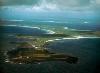
| Sanday, Orkney FeatureType : isle Elevation : 10 Lat/Lng : 59.2581 / -2.5683 | Sanday is one of the inhabited islands of Orkney that lies off the north coast of mainland Scotland. With an area of , it is the third largest of the Orkney Islands.Haswell-Smith (2004) p. 334 The main centres of population are Lady Village and Kettletoft (...) |
| 160 | 2014 Faroe Islands Premier League FeatureType : null Lat/Lng : 61.9949 / -6.8018 | 2014 Faroe Islands Premier League was the seventy-second season of top-tier football on the Faroe Islands. For sponsorship reasons, it is known as Effodeildin. Havnar Bóltfelag were the defending champions. (...) | |
| 161 | 2012 Faroe Islands Premier League FeatureType : null Lat/Lng : 62.0117 / -6.7675 | 2012 Faroe Islands Premier League was the seventieth season of top-tier football on the Faroe Islands. For sponsorship reasons, it was known as Effodeildin. The season began on 24 March 2012 with a match between B36 Tórshavn and FC Suðuroy, and ended on 6 October 2012 (...) | |
| 162 | Glückstadt FeatureType : null Elevation : 2 Lat/Lng : 53.788 / 9.4238 | Glückstadt (German pronunciation) is a town in the Steinburg district of Schleswig-Holstein, Germany. It is located on the right bank of the Lower Elbe at the confluence of the small Rhin river, about northwest of Altona. Glückstadt is part of the Hamburg Metropolitan Region (Metropolregion Hamburg) (...) | |
| 163 | Hósvík FeatureType : null Lat/Lng : 62.1547 / -6.9403 | Hósvík is a village in the Faroe Islands. It has 323 inhabitantshttp://statbank.hagstova.fo/pxweb/fo/H2/H2__IB__IB01/fo_vital_md.px/table/tableViewLayout1/?rxid=d5d67749-6e2a-4cd6-8b39-dce88ffa6128 and is located on a bay on Streymoy's east-coast (...) | |
| 164 | Norwegian Sea FeatureType : waterbody Lat/Lng : 69.0 / 0.0167 | The Norwegian Sea is a marginal sea in the Arctic Ocean, northwest of Norway between the North Sea and the Greenland Sea, adjoining the Barents Sea to the northeast. In the southwest, it is separated from the Atlantic Ocean by a submarine ridge running between Iceland and the Faroe Islands (...) | |
| 165 | Tjørnuvík FeatureType : null Lat/Lng : 62.2957 / -7.1439 | Tjørnuvík is the northernmost village on the Faroese island of Streymoy in Sunda Municipality. The 2002 population was 64. Its postal code is FO 445. Its current church was built in 1937. (...) | |
| 166 | 2008 Faroe Islands Premier League FeatureType : landmark Lat/Lng : 62.0167 / -6.7667 | The 2008 season of the Faroe Islands Premier League was the 66th season of the Faroese top-tier football since its establishment. It started on 29 March 2008 with a match between B36 Tórshavn and ÍF Fuglafjørður. The match was won by B36 with 4–0. The last games were played on 25 October 2008 (...) | |
| 167 | 2011 Faroe Islands Premier League FeatureType : null Lat/Lng : 62.0567 / -7.1542 | 2011 Faroe Islands Premier League, also known as Vodafonedeildin for sponsorship reasons is the sixty-ninth season of top-tier football on the Faroe Islands. It began on 9 April 2011 and ended on 22 October 2011 (...) | |
| 168 | 2009 Faroe Islands Premier League FeatureType : landmark Lat/Lng : 62.0972 / -7.3578 | Faroe Islands Premier League Football 2009, also known as Vodafonedeildin for sponsoring reasons, was the sixty-seventh season of top-tier football on the Faroe Islands. It began on 4 April 2009 and ended on 3 October 2009. EB/Streymur were the defending champions. The league was won by HB Tórshavn (...) | |
| 169 | Leynar FeatureType : city Lat/Lng : 62.1161 / -7.0392 | Leynar is a village in the Faroe Islands, a self-governing overseas administrative division of Denmark. The village is on the western coast of the island of Streymoy in the municipality of Kvívíkar. The 2005 population was 120. Leynar is the birthplace of Faroese actor Sverri Egholm (1930–2001). (...) | |
| 170 | Sund, Faroe Islands FeatureType : city Lat/Lng : 62.0486 / -6.8456 | Sund is a small village in the Faroe Islands, located north of Tórshavn. In 2012, it had a population of only 3 people. (...) | |
| 171 | Svínáir FeatureType : null Lat/Lng : 62.2294 / -7.0236 | Svínáir is a town on the Faroe Islands. It is located on the west coast of Eysturoy and part of Eiði Municipality. (...) | |
| 172 | 
| Weddell Island FeatureType : isle Elevation : 16 Lat/Lng : -51.8786 / -61.0067 | Weddell Island Falkland Islands. GeoNames Geographical Database is one of the Falkland Islands in the South Atlantic, lying off the southwest extremity of West Falkland. It is situated west-northwest of South Georgia Island, north of Livingston Island, northeast of Cape Horn, northeast of Isla de (...) |
| 173 | 
| HMS Belfast (C35) FeatureType : landmark Elevation : 3 Lat/Lng : 51.5067 / -0.0812 | HMS Belfast is a Town-class light cruiser that was built for the Royal Navy. She is now permanently moored as a museum ship on the River Thames in London and is operated by the Imperial War Museum. Construction of Belfast, the first ship in the Royal Navy to be named after the capital city of (...) |
| 174 | 2018 Faroe Islands Premier League FeatureType : null Lat/Lng : 61.9981 / -6.7731 | The 2018 Faroe Islands Premier League (also known as Betri deildin menn for sponsorship reasons) was the 76th season of top-tier football in the Faroe Islands. Víkingur Gøta were the defending champions, having won their second Faroese title in the previous season (...) | |
| 175 | Eystur Municipality FeatureType : city Lat/Lng : 62.2008 / -6.7408 | Eystur Municipality (Eysturkommuna) is a municipality (kommuna) in the Faroe Islands. In Faroese, eystur means east and so the municipality is East Municipality. It covers an eastern part of the island of Eysturoy. It was created on 1 January 2009 from the merger of Leirvík and Gøta municipalities (...) | |
| 176 | Sjóvar Municipality FeatureType : city Lat/Lng : 62.1437 / -6.8328 | Sjóvar Municipality (Faroese: Sjóvar kommuna) is a municipality of the Faroe Islands. The name of the municipality has its origins from the farm Sjógv á Strondum which gave name to Sjóvar parish. The name comes from the Faroese word for seawater (sjógvur) (...) | |
| 177 | Tórshavn Municipality FeatureType : null Lat/Lng : 62.0305 / -6.8816 | Tórshavn Municipalityhttp://www.torshavn.fo/Default.aspx?pageid=619 (Tórshavnar kommuna) is the municipality of the Faroese capital Tórshavn and its surroundings. The municipality covers the southern half of Streymoy island and adjacent minor islands and has an area of 173 km2 (...) | |
| 178 | 
| Øravík FeatureType : city Lat/Lng : 61.5361 / -6.8086 | Øravík (also spelled Ørðavík) is a village on the east coast of the island of Suðuroy in the Faroe Islands. The village is located in the center of the island on a crossroad where the road to Fámjin goes towards west over the mountains to the west coast (...) |
| 179 | Sørvágur FeatureType : null Lat/Lng : 62.0703 / -7.3222 | Sørvágur is a village on the island of Vágar in the Faroe Islands. It is located at the landward end of Sørvágsfjørður. Sørvágur is the largest village in Sørvágur Municipality. (...) | |
| 180 | Gøtueiði FeatureType : null Lat/Lng : 62.1757 / -6.7674 | Gøtueiði a town in the Faroe Islands, located deep in the Skalafjordur-inlet on Eysturoy, founded in 1850. The village has now grown towards its neighbour-village Skipanes. During the 1980s there were religious tent-meetings in Gøtueiði (...) | |
| 181 | Denmark–Norway FeatureType : country Elevation : 4 Lat/Lng : 55.6667 / 12.5667 | Denmark–Norway (Danish and Norwegian: Danmark–Norge), also known as the Dano-Norwegian Realm, the Oldenburg Monarchy or the Oldenburg realms, was an early modern multi-national and multi-lingual real unionFeldbæk 1998:11 consisting of the Kingdom of Denmark, the Kingdom of Norway (including (...) | |
| 182 | Eysturtindur FeatureType : null Lat/Lng : 62.114 / -7.3918 | Eysturtindur is the second highest point - 714 m - on the island of Vágoy, Faroe Islands. (...) | |
| 183 | 2010 Faroe Islands Premier League FeatureType : landmark Lat/Lng : 61.9981 / -6.7731 | 2010 Faroe Islands Premier League Football, also known as Vodafonedeildin for sponsoring reasons, was the sixty-eighth season of top-tier football on the Faroe Islands. It began on 31 March 2010 with a match between NSÍ Runavík and ÍF Fuglafjørður and ended on 23 October 2010 (...) | |
| 184 | Hattarvík FeatureType : city Lat/Lng : 62.3308 / -6.2736 | Hattarvík is a small village on the east side of the island Fugloy, Faroe Islands, and the easternmost settlement in the Faroes archipelago. The village is encircled by high mountains on three sides. (...) | |
| 185 | Tórsvøllur FeatureType : landmark Lat/Lng : 62.0192 / -6.778 | Tórsvøllur is a football stadium on the sport site of Gundadalur in Tórshavn, the capital of the Faroe Islands. The stadium holds 6,040 people, and was built in 1999 to become the country's national stadium to provide a grass surface on which international football matches could be played (...) | |
| 186 | Asker FeatureType : null Elevation : 113 Lat/Lng : 59.833 / 10.433 | Asker is a municipality in Akershus county, Norway. It is part of the Greater Oslo Region. The administrative centre of the municipality is the town of Asker. The municipality was established as a municipality on 1 January 1838 (see formannskapsdistrikt). (...) | |
| 187 | Skopun FeatureType : city Lat/Lng : 61.9124 / -6.8719 | Skopun (pronounced ;) is a town in the Faroe Islands situated on the northern coast of Sandoy (Sand Island). Skopun is the second-largest town on the island. Skopun Municipality consists only of the town of Skopun. (...) | |
| 188 | Válur FeatureType : landmark Lat/Lng : 62.1562 / -7.1664 | Válur is a village on the Faroese island of Streymoy located in Kvívík Municipality. Its population is 55. Its postal code is FO 358. (...) | |
| 189 | Saint Olav's Church, Kirkjubøur FeatureType : city Lat/Lng : 61.9516 / -6.7932 | Saint Olav's Church (Olavskirken) is a medieval church in the village of Kirkjubøur in Streymoy, Faroe Islands. It was built before 1200, which makes it the oldest church of the Faroe Islands. Until the Reformation, it served as the seat of the Catholic bishop (...) | |
| 190 | Lambareiði FeatureType : city Lat/Lng : 62.1422 / -6.7261 | Lambareiði is a village on the Faroese island of Eysturoy in Runavík Municipality. The 2005 population was 7. (...) | |
| 191 | Øravíkarlíð FeatureType : city Lat/Lng : 61.5506 / -6.8278 | Øravíkarlíð (alternative spelling Ørðavíkarlíð) or Líðin is a village on the island Suðuroy, Faroe Islands. The population was 60 in December 2008. (...) | |
| 192 | Sørvágur Municipality FeatureType : null Lat/Lng : 62.1 / -7.4 | Sørvágur Municipality (Sørvágs kommuna) is the westernmost municipality in the Faroe Islands. It consists of the villages of Sørvágur, Bøur, Gásadalur and Mykines. Originally the municipality only included the village of Sørvágur, but on January 2005 the municipality of Sørvágur agreed to merge with (...) | |
| 193 | Skála (village) FeatureType : null Lat/Lng : 62.1622 / -6.7825 | Skála (reclaimed its original name Skála as opposed to incorrect Skáli in 2011;) is a village on the east coast of the Faroese island of Eysturoy, located in Runavík Municipality. Its postal code is FO 480. In 2005 its population was 618. The current church in the village was opened in 1940 (...) | |
| 194 | Víkarbyrgi FeatureType : city Lat/Lng : 61.4428 / -6.7244 | Víkarbyrgi is a former village on the Faroese island of Suðuroy, Faroe Islands. It no longer has a population. It retains a postal code (FO 928) and is located at N 61° 26' 34 W 6° 43' 28. The etymology of its name is reputed to be connected with an early settlement of Irish monks who predated the (...) | |
| 195 | Æðuvík FeatureType : city Lat/Lng : 62.0697 / -6.69 | Æðuvík (from Æða meaning "duck" and vík meaning "bay") is a community, located on the southernmost tip of Eysturoy island of the Faroe Islands. Founded in 1897, its postal code is FO 645. Its population is about 100, and it is located at N 62° 4' 11 W 6° 41' 24 (...) | |
| 196 | Saltangará FeatureType : city Lat/Lng : 62.1167 / -6.7167 | Saltangará is a village in the Faroe Islands, on the island of Eysturoy. Saltangará was founded in 1846 and is situated on the eastern side of Eysturoys Skalafjordur-inlet between Rituvík and Søldarfjørður. The name is derived from three words: angar comes from the Old Norse angr which means a fjord (...) | |
| 197 | Gráfelli FeatureType : mountain Lat/Lng : 62.3071 / -6.9911 | Gráfelli is the second highest mountain of the Faroe Islands located on the island of Eysturoy. It has an elevation of 856 metres. Slættaratindur just south-east of the mountain is 24 metres higher at 880 metres, the highest point of the Faroes (...) | |
| 198 | Húsavík Municipality FeatureType : null Lat/Lng : 61.8106 / -6.6764 | Húsavík Municipality (Húsavíkar kommuna) is a municipality of the Faroe Islands. The town of Húsavík is the administrative centre. Its area comprises the southeastern quarter of the island of Sandoy. It contains the following towns and villages:http://www.visitsandoy.fo/index (...) | |
| 199 | Gluggarnir FeatureType : city Lat/Lng : 61.5463 / -6.893 | Gluggarnir is a mountain in the Faroe Islands. At 610 metres, it is the highest mountain on the southernmost island Suðuroy. The mountain is located between the villages Fámjin and Trongisvágur. (...) | |
| 200 | Tindhólmur FeatureType : landmark Lat/Lng : 62.0778 / -7.4342 | Tindhólmur is an islet on the southside of Sørvágsfjørður, west of Vágar in the Faroe Islands. It has its name from the five peaks, which are named Ytsti, Arni, Lítli, Breiði, Bogdi (Farthest, Eagle, Small, Broad, Bent). The islet is uninhabited (...) | |
 by
by