| 50 records found in wikipedia | |||
| 1 | 
| Växjö  FeatureType : null Elevation : 168 Lat/Lng : 56.8769 / 14.8092 | Växjö is a city and the seat of Växjö Municipality, Kronoberg County, Sweden. It had 66,275 inhabitants (2016) out of a municipal population of 90,721 (2017). It is the administrative, cultural, and industrial centre of Kronoberg County and the episcopal see of the Diocese of Växjö (...) |
| 2 | 
| Halmstad FeatureType : null Elevation : 8 Lat/Lng : 56.6714 / 12.8556 | Halmstad , is a port, university, industrial and recreational city at the mouth of the Nissan river, in the province of Halland on the Swedish west coast. Halmstad is the seat of Halmstad Municipality and the capital of Halland County (...) |
| 3 | 
| Uddevalla FeatureType : null Elevation : 7 Lat/Lng : 58.35 / 11.9333 | Uddevalla is a town and the seat of Uddevalla Municipality in Västra Götaland County, Sweden. In 2010, it had a population of 31,212. It is located at a bay of the south-eastern part of Skagerrak. The beaches of Uddevalla are filled with seashells and Uddevalla has one of the largest shell-banks in (...) |
| 4 | 
| Stockholm Bromma Airport FeatureType : airport Elevation : 8 Lat/Lng : 59.3543 / 17.9436 | Stockholm Bromma Airport is a Swedish domestic and minor international airport in Stockholm. It is located west-northwest of downtown Stockholm and is the closest to the city compared to the other commercial passenger airports in the area around Stockholm (Arlanda, Skavsta and Västerås) (...) |
| 5 | 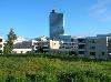
| Kista FeatureType : city Elevation : 21 Lat/Lng : 59.4039 / 17.9415 | Kista is a district in the borough of Rinkeby-Kista, Stockholm, Sweden. It has a strategic position located in between Sweden's main airport, the Stockholm-Arlanda International Airport and central Stockholm, and alongside the main national highway E4 economic artery (...) |
| 6 | Svealand FeatureType : null Lat/Lng : 60.8667 / 14.7333 | Svealand (listen), Swealand or (rarely or historically) Sweden proper is the historical core region of Sweden. It is located in south central Sweden and is one of three historical lands of Sweden, bounded to the north by Norrland and to the south by Götaland (...) | |
| 7 | Blekinge FeatureType : adm1st Elevation : 95 Lat/Lng : 56.3333 / 15.3333 | Blekinge is one of the traditional provinces of Sweden , situated in the south of the country. It borders Småland, Scania and the Baltic Sea. It is the country's second-smallest province by area (only Öland is smaller), and the smallest province located on the mainland (...) | |
| 8 | Eskilstuna Municipality FeatureType : adm2nd Elevation : 18 Lat/Lng : 59.3667 / 16.5167 | Eskilstuna Municipality (Eskilstuna kommun) is a municipality in Södermanland County in southeast Sweden, between Lake Mälaren and Lake Hjälmaren. The seat of the municipality is in the city of Eskilstuna. The present municipality was formed in 1971 by the merger of the City of Eskilstuna, the City (...) | |
| 9 | Västergötland FeatureType : null Elevation : 194 Lat/Lng : 57.728 / 12.7 | Västergötland , also known as West Gothland or the Latinized version Westrogothia in older literature,Eric Linklater in The Life of Charles XII pp. 53-54 & throughout is one of the 25 traditional non-administrative provinces of Sweden (landskap in Swedish), situated in the southwest of Sweden (...) | |
| 10 | 
| Karlsborg Fortress FeatureType : landmark Elevation : 101 Lat/Lng : 58.5319 / 14.5306 | Karlsborg Fortress is situated on the Vannäs peninsula in Karlsborg by lake Vättern, the province of Västergötland, Sweden. Construction on the fortress began 1819 to realize the so-called central defense idea adopted by the Swedish military after the Finnish and Napoleonic Wars (...) |
| 11 | Bohuslän FeatureType : null Elevation : 82 Lat/Lng : 58.248 / 11.887 | Bohuslän is a Swedish province in Götaland, on the northernmost part of the country's west coast. It is bordered by Dalsland to the northeast, Västergötland to the southeast, the Skagerrak arm of the North Sea to the west, and the county of Østfold, in Norway, to the north (...) | |
| 12 | Halland FeatureType : adm1st Elevation : 73 Lat/Lng : 56.888 / 12.744 | Halland is one of the traditional provinces of Sweden (landskap in Swedish), on the western coast of Sweden. It borders Västergötland, Småland, Scania and the sea of Kattegat. Until 1645 and the Second Treaty of Brömsebro, it was part of the Kingdom of Denmark. (...) | |
| 13 | Götaland FeatureType : null Elevation : 301 Lat/Lng : 57.65 / 14.6833 | Götaland (also Gothia, Gothland, (Gothland is also used for Gotland). (Gothland is also used for Gotland). Gothenland or Gautland) is one of three lands of Sweden and comprises ten provinces. Geographically it is located in the south of Sweden, bounded to the north by Svealand, with the deep woods (...) | |
| 14 | 
| European Centre for Disease Prevention and Control FeatureType : landmark Elevation : 19 Lat/Lng : 59.3728 / 18.0173 | The European Centre for Disease Prevention and Control (ECDC) is an independent agency of the European Union (EU) whose mission is to strengthen Europe's defences against infectious diseases. The Centre was established in 2004 and is located in Solna, Sweden. (...) |
| 15 | 
| Kopparberg FeatureType : null Elevation : 161 Lat/Lng : 59.875 / 14.9911 | Kopparberg is a locality and the seat of Ljusnarsberg Municipality, Örebro County, Sweden, with 4,200 inhabitants in 2015. It is famous for one of the most valuable postage stamps in the world, the Treskilling Yellow from 13 July 1857, Kopparberg's wooden church (voted No (...) |
| 16 | Jämtland FeatureType : adm1st Lat/Lng : 63.3333 / 14.3333 | Jämtland or Jamtland is a historical province in the centre of Sweden in northern Europe. It borders Härjedalen and Medelpad to the south, Ångermanland to the east, Lapland to the north and Trøndelag and Norway to the west. Jämtland covers an area of 34,009 square kilometres, 8 (...) | |
| 17 | 
| Drottningholm FeatureType : null Elevation : 23 Lat/Lng : 59.3247 / 17.8889 | Drottningholm, literally "Queen's Islet", is a locality situated in Ekerö Municipality, Stockholm County, Sweden, with 398 inhabitants in 2010. It is situated on the island Lovön in lake Mälaren on the outskirts of Stockholm (...) |
| 18 | Nybro Municipality FeatureType : adm2nd Elevation : 86 Lat/Lng : 56.7444 / 15.9083 | Nybro Municipality (Nybro kommun) is a municipality in Kalmar County, south-eastern Sweden, with its seat in the town Nybro. The amalgamation of the City of Nybro (instituted in 1932) with its surrounding municipalities took place in 1969 (...) | |
| 19 | Älvsbyn Municipality FeatureType : adm2nd Lat/Lng : 65.6833 / 21.0167 | Älvsbyn Municipality is a municipality in Norrbotten County in northern Sweden. Its seat is located in Älvsbyn. The present municipality has the same size as the original one, created at the time the municipalities of Sweden were formed in 1863 (...) | |
| 20 | Vetlanda Municipality FeatureType : adm2nd Elevation : 189 Lat/Lng : 57.4278 / 15.0833 | Vetlanda Municipality (Vetlanda kommun) is a municipality in Jönköping County, in southern Sweden where the town of Vetlanda is the seat. The municipality was created in 1971, when the City of Vetlanda (instituted in 1920) was amalgamated with the surrounding rural municipalities to form a unitary (...) | |
| 21 | Nybro FeatureType : null Elevation : 86 Lat/Lng : 56.7333 / 15.8833 | Nybro is a city and the seat of Nybro Municipality, Kalmar County, Sweden with 12,810 inhabitants in 2010. (...) | |
| 22 | Mark Municipality FeatureType : adm2nd Elevation : 105 Lat/Lng : 57.5167 / 12.6833 | Mark Municipality (Marks kommun) is a municipality in Västra Götaland County in southwest Sweden. The municipal seat is located in the center of Kinna town. The municipality was created through the Municipal Reform Act of 1971 by the amalgamation of eight smaller municipal entities. (...) | |
| 23 | Växjö Municipality FeatureType : adm2nd Elevation : 170 Lat/Lng : 56.8792 / 14.8069 | Växjö Municipality (Växjö kommun) is a municipality in Kronoberg County in southern Sweden, where Växjö is the seat. The municipality was created in 1971 by the amalgamation of the City of Växjö with the surrounding municipalities (...) | |
| 24 | Gästrikland FeatureType : null Lat/Lng : 60.557 / 16.793 | Gästrikland is a historical province or landskap on the eastern coast of Sweden. It borders Uppland, Västmanland, Dalarna, Hälsingland and the Gulf of Bothnia. Gästrikland is the southernmost of the Norrland provinces. Other used forms of the name is Gestricia, Gastrikland (...) | |
| 25 | Vällingby FeatureType : city Elevation : 39 Lat/Lng : 59.3622 / 17.8728 | Vällingby is a suburban district in Västerort in the western part of Stockholm Municipality, Sweden. (...) | |
| 26 | Battle of the Neva FeatureType : event Elevation : 3 Lat/Lng : 59.8075 / 30.6042 | The Battle of the Neva (Nevskaya bitva, , Finnish: Nevan taistelu) was fought between the Novgorod Republic and Karelians against Swedish, Norwegian, Finnish and Tavastian armies on the Neva River, near the settlement of Ust-Izhora, on 15 July 1240 (...) | |
| 27 | Västerlånggatan FeatureType : landmark Elevation : 23 Lat/Lng : 59.3244 / 18.07 | Västerlånggatan (The Western Long Street) is a street in Gamla stan, the old town of Stockholm, Sweden. Stretching southward between the squares Mynttorget and Järntorget, it follows the course of the city's now demolished 13th-century defensive wall (...) | |
| 28 | Skuleskogen National Park FeatureType : landmark Lat/Lng : 63.1111 / 18.4972 | Skuleskogen National Park is a Swedish national park in Västernorrland County, on the coast of the Baltic Sea, in northern Sweden. It covers , constituting the eastern part of the Forest of Skule. The park is characterized by a very rough topology with many rocky peaks, of which the highest is (...) | |
| 29 | Saba (disambiguation) FeatureType : null Elevation : 456 Lat/Lng : 6.2575 / 20.2308 | Saba is an island of the Netherlands located in the Caribbean Sea. Saba may also refer to: (...) | |
| 30 | Lessebo FeatureType : null Elevation : 151 Lat/Lng : 56.7497 / 15.2603 | Lessebo is a locality and the seat of Lessebo Municipality, Kronoberg County, Sweden with 2,737 inhabitants in 2010. The Lessebo community formed gradually around the paper and iron works that was founded in 1660 (...) | |
| 31 | Orrefors FeatureType : null Elevation : 168 Lat/Lng : 56.8417 / 15.7444 | Orrefors is a locality situated in southern Sweden and part of Nybro Municipality, Kalmar County, with 719 inhabitants in 2010. The township belongs to Hälleberga parish and is primarily famous for its glassworks with the same name (...) | |
| 32 | Säve airport FeatureType : airport Elevation : 16 Lat/Lng : 57.7756 / 11.8706 | Säve airport (Säve flygplats), until 2015 known as Göteborg City Airport , is an airport located north-west from the centre of Gothenburg, near Säve, on the island of Hisingen, Bohuslän, Sweden. It is located within the borders of Gothenburg Municipality, hence its former name (...) | |
| 33 | Battle of Gestilren FeatureType : null Elevation : 208 Lat/Lng : 58.1961 / 13.8272 | The Battle of Gestilren took place on July 17, 1210., nordstjernan.com. Retrieved April 24, 2014. The battle was fought between the exiled King of Sweden Sverker and the ruling King Eric X. Sverker had been beaten in the previous Battle of Lena, but returned with new forces (...) | |
| 34 | Nils Horner FeatureType : null Elevation : 1799 Lat/Lng : 34.5371 / 69.1814 | Nils Horner (5 December 1962 – 11 March 2014) was a Swedish Radio journalist. Horner was the chief correspondent for Sveriges Radio's Asia division and had covered multiple stories surrounding the War in Afghanistan (2001–2014), as well as natural disasters. (...) | |
| 35 | Hanö FeatureType : isle Elevation : 35 Lat/Lng : 56.015 / 14.8447 | Hanö is an island off Listerlandet peninsula, western Blekinge, Sweden. Between 1810 and 1812 the Royal Navy of the United Kingdom used the island as its base during its operations in the Baltic Sea. The "English Seaman's Graveyard" is situated on the island, and still today British warships visit (...) | |
| 36 | Pajala Airport FeatureType : airport Lat/Lng : 67.2456 / 23.0689 | Pajala Airport is an airport in Pajala, Sweden. (...) | |
| 37 | Brokind FeatureType : null Elevation : 87 Lat/Lng : 58.2167 / 15.6667 | Brokind is a locality situated in Linköping Municipality, Östergötland County, Sweden with 502 inhabitants in 2010. Brokind is located approximately south of Linköping, just next to the lake Lilla Rängen. Using bus it takes about 40 minutes to get to Linköping and by car approximately 20–25 minutes (...) | |
| 38 | Harpsund FeatureType : landmark Elevation : 37 Lat/Lng : 59.0992 / 16.4853 | Harpsund is a manor house located in Flen Municipality, Södermanland County, Sweden. Since May 22, 1953 Harpsund has been used as a country residence for the Prime Minister of Sweden. (...) | |
| 39 | Lyckeby FeatureType : null Elevation : 5 Lat/Lng : 56.1987 / 15.6547 | Lyckeby is a village in Karlskrona Municipality, Blekinge County, in southeastern Sweden, near the mouth of the Lyckeby River. The town was originally known as Lyckå. (...) | |
| 40 | Treaty of Malmö (1512) FeatureType : landmark Elevation : 9 Lat/Lng : 55.6025 / 13.0008 | The Treaty of Malmö (Swedish: Freden i Malmö, "The peace at Malmö") were actually two and a quarter peace treaties that were all signed on 23 April 1512, which brought an end to the second Dano-Swedish War. The first treaty included John, King of Denmark (Danish: Kong Hans) and Sweden (...) | |
| 41 | High Chaparral Theme Park FeatureType : null Elevation : 163 Lat/Lng : 57.2633 / 13.8272 | High Chaparral is a Wild West theme park and post-industrial museum of cultural artifacts and collectibles, located close to Värnamo, Sweden. It opened in 1966 and was founded by Bengt Erlandson, more commonly known as Big Bengt (...) | |
| 42 | St. Clare's Priory, Stockholm FeatureType : null Elevation : 21 Lat/Lng : 59.3311 / 18.0614 | St. Clare's Priory, Stockholm, was a Roman Catholic nunnery of the Poor Clares in Stockholm, Sweden that was active from 1289 to the Swedish Reformation in 1527. (...) | |
| 43 | Triberga FeatureType : city Elevation : 14 Lat/Lng : 56.4657 / 16.5751 | Triberga is a village on the island of Öland in the kingdom of Sweden. For many years Triberga has been investigated for its unusual flora and fauna including littoral species.Göran Wahlenberg, Flora Svecica enumerans plantas Sveciæ indigenas, 1826, Palmblad & C. (...) | |
| 44 | Battle of Axtorna FeatureType : event Elevation : 45 Lat/Lng : 57.04 / 12.643 | The Battle of Axtorna or simply Axtorna, was a battle fought between the Kingdom of Sweden and the Kingdom of Denmark 20 October 1565 at Axtorna, a small village in what is today Falkenberg Municipality, Halland County in south-western Sweden. (...) | |
| 45 | Vännäs TV Tower FeatureType : landmark Lat/Lng : 63.8403 / 19.8226 | Vännäs TV Tower is a Swedish concrete television tower that has a mast on top. It is used for transmitting FM-/TV-broadcasting. The Vännäs TV Tower resembles the Gerbrandy Tower in IJsselstein, the Netherlands. They both are a concrete tower with a steel mast on top that is guyed to the ground (...) | |
| 46 | Axevalla House FeatureType : landmark Elevation : 135 Lat/Lng : 58.3934 / 13.6028 | Axevalla House is the ruins of a medieval castle in the parish of Skärv in the municipality of Skara, Västergötland, Sweden. It is located on a headland by Lake Husesjön, east of Axevalla Hed and halfway between the cities Skara and Skövde. (...) | |
| 47 | Skärva House FeatureType : landmark Elevation : 19 Lat/Lng : 56.2014 / 15.5727 | ===Skärva Mansion=== Skärva Manor is the country house that shipbuilder Fredrik Henrik af Chapman made on the mainland, just northwest of Karlskrona and east of Nättraby. Behind the project, Gustav III commanded Chapman to move to Karlskrona to develop a build-up for the Kingdom's fleet (...) | |
| 48 | Holy Cross Priory, Dalby FeatureType : null Elevation : 67 Lat/Lng : 55.6642 / 13.3439 | Holy Cross Abbey is an important Augustinian monastery located in Skåne's old capital, Dalby, then Denmark, now southern Sweden. (...) | |
| 49 | Börringe Priory FeatureType : landmark Elevation : 57 Lat/Lng : 55.5069 / 13.3256 | Börringekloster Castle , formerly Börringe Priory , is a castle built in 1763 on the ruins of a medieval Benedictine priory in Svedala, Scania, in southern Sweden. (...) | |
| 50 | Runestones at Aspa FeatureType : landmark Elevation : 13 Lat/Lng : 58.9266 / 17.0992 | The Runestones at Aspa are four runestones located at Aspa, which is about six kilometers north of Runtuna, Södermanland, Sweden, where a road has passed a creek since prehistoric times. One of the stones Sö Fv1948;289, below is the oldest surviving native Scandinavian source that mentions the (...) | |
 by
by