| 3078 records found in wikipedia | |||
| 1 | Johnston County, North Carolina  FeatureType : adm2nd Elevation : 40 Lat/Lng : 35.52 / -78.37 | Johnston County is a county located in the U.S. state of North Carolina. As of the 2010 census, the population was 168,878. Its county seat is Smithfield. Johnston County is included in the Raleigh, NC Metropolitan Statistical Area, which is also included in the Raleigh-Durham-Chapel Hill, NC (...) | |
| 2 | 
| First Battle of Bull Run FeatureType : landmark Elevation : 79 Lat/Lng : 38.8147 / -77.5227 | The First Battle of Bull Run (the name used by Union forces), also known as the First Battle of Manassas. (the name used by Confederate forces), was fought on July 21, 1861 in Prince William County, Virginia, just north of the city of Manassas and about 25 miles west-southwest of Washington, D.C (...) |
| 3 | 
| Los Mochis FeatureType : null Elevation : 12 Lat/Lng : 25.7905 / -108.9859 | Los Mochis is a coastal city in northern Sinaloa, Mexico. It serves as the municipal seat of the municipality of Ahome. As of the 2010 census, the population was 256,613, which was 61 percent of the municipality's population (...) |
| 4 | 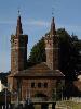
| Stargard FeatureType : city Elevation : 35 Lat/Lng : 53.3392 / 15.0375 | Stargard is a city in northwestern Poland, with a population of 71,017 (2005). Situated on the Ina River it is the capital of Stargard County and since 1999 has been in the West Pomeranian Voivodeship; prior to that it was in the Szczecin Voivodeship (1975–1998) (...) |
| 5 | 
| St. John's, Antigua and Barbuda FeatureType : null Elevation : 7 Lat/Lng : 17.1211 / -61.8447 | St. John's is the capital and largest city of Antigua and Barbuda, located in the West Indies in the Caribbean Sea and with a population of 22,193,http://www.antigua.gov.ag/pdf/Census_2011_Preliminary_Data_Release.pdf St (...) |
| 6 | 
| Lafayette, Louisiana FeatureType : null Elevation : 16 Lat/Lng : 30.2169 / -92.0264 | Lafayette is a city in and the parish seat of Lafayette Parish, Louisiana, located along the Vermilion River in the southwestern part of the state. The city of Lafayette is the fourth-largest in the state, with a population of 127,657 according to 2015 U.S. Census estimates (...) |
| 7 | 
| University of Waterloo FeatureType : landmark Elevation : 337 Lat/Lng : 43.4689 / -80.54 | The University of Waterloo (commonly referred to as Waterloo, UW, or UWaterloo) is a public research university with a main campus in Waterloo, Ontario, Canada. The main campus is on of land adjacent to "Uptown" Waterloo and Waterloo Park (...) |
| 8 | 
| Japanese battleship Yamato FeatureType : landmark Lat/Lng : 30.3667 / 128.0667 | was the lead ship of her class of battleships built for the Imperial Japanese Navy (IJN) shortly before World War II. She and her sister ship, , were the heaviest and most powerfully armed battleships ever constructed, displacing 72,800 tonnes at full load and armed with nine Type 94 main guns, (...) |
| 9 | 
| Newfoundland and Labrador FeatureType : adm1st Elevation : 63 Lat/Lng : 47.6011 / -52.6976 | Newfoundland and Labrador (; ; Newfoundland Irish:) is the most easterly province of Canada. Situated in the country's Atlantic region, it comprises the island of Newfoundland and mainland Labrador to the northwest, with a combined area of (...) |
| 10 | 
| Mount St. Helens FeatureType : mountain Elevation : 2493 Lat/Lng : 46.1912 / -122.1944 | Mount St. Helens or Louwala-Clough (known as Lawetlat'la to the indigenous Cowlitz people, and Loowit to the Klickitat) is an active stratovolcano located in Skamania County, Washington, in the Pacific Northwest region of the United States (...) |
| 11 | Johnston County, Oklahoma FeatureType : adm2nd Elevation : 261 Lat/Lng : 34.31 / -96.66 | Johnston County is a county located in the U.S. state of Oklahoma. As of the 2010 census, the population was 10,957. Its county seat is Tishomingo. It was established at statehood on November 16, 1907 and named for Douglas H. Johnston, a governor of the Chickasaw Nation.O'Dell, Larry (...) | |
| 12 | 
| Ojibwe FeatureType : null Elevation : 188 Lat/Lng : 46.6875 / -92.1892 | The Ojibwe, Ojibwa, Chippewa, or Saulteaux are an Anishinaabeg group of Indigenous Peoples in North America, which is referred to by many of its Indigenous peoples as Turtle Island. They live in Canada and the United States and are one of the largest Indigenous ethnic groups north of the Rio Grande (...) |
| 13 | Johnston Atoll FeatureType : null Lat/Lng : 16.7167 / -169.4833 | Johnston Atoll, also known as Kalama Atoll to Native Hawaiians, is an unincorporated territory of the United States currently administered by the United States Fish and Wildlife Service. Johnston Atoll is a National Wildlife Refuge and is closed to public entry (...) | |
| 14 | 
| Newfoundland (island) FeatureType : isle Elevation : 256 Lat/Lng : 48.5663 / -55.7773 | Newfoundland Both names can be found in ."Ikkarumikluak" means "place of many shoals" while "Kallunasillik" means "place of many white people". It is thought the "Ikkarumiklua" was used before the colonization of Newfoundland and was later replaced by "Kallunasillik" (...) |
| 15 | 
| Cape Horn FeatureType : isle Elevation : 0 Lat/Lng : -55.98 / -67.2892 | Cape Horn is the southernmost headland of the Tierra del Fuego archipelago of southern Chile, and is located on the small Hornos Island. Although not the most southerly point of South America (which are the Diego Ramírez Islands), Cape Horn marks the northern boundary of the Drake Passage and marks (...) |
| 16 | 
| Zomba, Malawi FeatureType : city Elevation : 890 Lat/Lng : -15.3889 / 35.3333 | Zomba is a city in southern Malawi, in the Shire Highlands. It is the administrative capital of Zomba District. It was the capital of first British Central Africa and then Nyasaland Protectorate before the establishment of Malawi in 1964 (...) |
| 17 | 
| Wake Island FeatureType : null Lat/Lng : 19.29 / 166.601 | Wake Island (also known as Wake Atoll) is a coral atoll in the western Pacific Ocean in the northeastern area of the Micronesia subregion, east of Guam, west of Honolulu and southeast of Tokyo. The island is an unorganized, unincorporated territory of the United States that is also claimed by the (...) |
| 18 | 
| North Channel (Great Britain and Ireland) FeatureType : waterbody Lat/Lng : 55.0575 / -5.6219 | The North Channel (known in Irish and Scottish Gaelic as Sruth na Maoile, in Scots as the Sheuch and alternatively in English as the Straits of Moyle or Sea of Moyle) is the strait between north-eastern Northern Ireland and south-western Scotland. Tourism Ireland. Retrieved 9 August 2012 (...) |
| 19 | 
| Shreveport, Louisiana FeatureType : null Elevation : 77 Lat/Lng : 32.4681 / -93.7711 | Shreveport is a city in the U.S. state of Louisiana. It is the most populous city in the Shreveport-Bossier City metropolitan area. Shreveport ranks third in Louisiana after New Orleans and Baton Rouge and 126th in the U.S. The bulk of the city is in Caddo Parish, of which it is the parish seat (...) |
| 20 | 
| Durham, North Carolina FeatureType : city Elevation : 95 Lat/Lng : 35.9875 / -78.9072 | Durham is a city in and the county seat of Durham County in the U.S. state of North Carolina. The U.S. Census Bureau estimated the city's population to be 251,893 as of July 1, 2014, making it the 4th-most populous city in North Carolina, and the 78th-most populous city in the United States (...) |
| 21 | 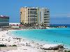
| Quintana Roo FeatureType : adm1st Elevation : 10 Lat/Lng : 19.5956 / -87.9131 | Quintana Roo , officially the Free and Sovereign State of Quintana Roo , is one of the 31 states which, with the Federal District, make up the 32 federal entities of Mexico. It is divided into 11 municipalities and its capital city is Chetumal (...) |
| 22 | 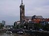
| Roermond FeatureType : null Elevation : 29 Lat/Lng : 51.1925 / 5.9936 | Roermond is a city, a municipality, and a diocese in the southeastern part of the Netherlands. Roermond is an historically important town, on the lower Roer at the east bank of the Meuse river. It received town rights in 1231. Roermond town centre has been designated as a conservation area (...) |
| 23 | 
| Wasilla, Alaska FeatureType : null Lat/Lng : 61.5817 / -149.4525 | Wasilla is a city in Matanuska-Susitna Borough, United States and the sixth-largest city in Alaska. It is located on the northern point of Cook Inlet in the Matanuska-Susitna Valley of the southcentral part of the state. The city's population was 7,831 at the 2010 census, up from 5,469 in 2000 (...) |
| 24 | 
| London Borough of Richmond upon Thames FeatureType : adm1st Elevation : 13 Lat/Lng : 51.4613 / -0.3035 | The London Borough of Richmond upon Thames (pronunciation) in southwest London, England, forms part of Outer London and is the only London borough on both sides of the River Thames. It was created in 1965 when three smaller council areas amalgamated under the London Government Act 1963 (...) |
| 25 | 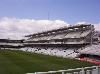
| Lord's FeatureType : landmark Elevation : 46 Lat/Lng : 51.5294 / -0.1729 | Lord's Cricket Ground, commonly known simply as Lord's, is a cricket venue in St John's Wood, London. Named after its founder, Thomas Lord, it is owned by Marylebone Cricket Club (MCC) and is the home of Middlesex County Cricket Club, the England and Wales Cricket Board (ECB), the European Cricket (...) |
| 26 | Johnston, Rhode Island FeatureType : city Elevation : 32 Lat/Lng : 41.8167 / -71.4833 | Johnston is a town in Providence County, Rhode Island, United States. The population was 28,769 at the 2010 census. Johnston is the site of the Clemence Irons House (1691) a stone-ender museum and the only landfill in Rhode Island (...) | |
| 27 | 
| Rhode Island FeatureType : adm1st Elevation : 25 Lat/Lng : 41.678 / -71.4743 | Rhode Island , officially the State of Rhode Island and Providence Plantations, is a state in the New England region of the United States. It is the smallest state in area, the seventh least populous, and is the second most densely populated. It has the longest official name of any state (...) |
| 28 | 
| Trincomalee FeatureType : city Lat/Lng : 8.5833 / 81.2333 | Trincomalee (; Tirukōṇamalai; Trikuṇāmalaya) also known as Gokanna, is the administrative headquarters of the Trincomalee District and major resort port city of Eastern Province, Sri Lanka. Located on the east coast of the island overlooking the Trincomalee Harbour, 113 miles south of Jaffna and 69 (...) |
| 29 | 
| Billings, Montana FeatureType : city Elevation : 982 Lat/Lng : 45.7867 / -108.5372 | Billings is the largest city in the U.S. state of Montana, and the principal city of the Billings Metropolitan Area with a population of 170,498.https://census.gov/data/tables/2017/demo/popest/total-metro-and-micro-statistical-areas.html It has a trade area of over half a million people (...) |
| 30 | 
| Jersey FeatureType : isle Elevation : 90 Lat/Lng : 49.2206 / -2.1372 | Jersey (; Jèrriais: Jèrri), officially the Bailiwick of Jersey (; Jèrriais: Bailliage dé Jèrri), is a Crown dependency located near the coast of Normandy, France. Jersey was part of the Duchy of Normandy, whose dukes went on to become kings of England from 1066 (...) |
| 31 | 
| Wilmington, North Carolina FeatureType : null Elevation : 15 Lat/Lng : 34.2231 / -77.9119 | Wilmington is a port city and the county seat of New Hanover County in coastal southeastern North Carolina, United States. With a population of in 2017, it is the eighth most populous city in the state. Wilmington is the principal city of the Wilmington Metropolitan Statistical Area, a metropolitan (...) |
| 32 | 
| Apollo 11 FeatureType : null Elevation : 511 Lat/Lng : 0.6741 / 23.473 | Apollo 11 was the spaceflight that landed the first two people on the Moon. Mission commander Neil Armstrong and pilot Buzz Aldrin, both American, landed the lunar module Eagle on July 20, 1969, at 20:17 UTC. Armstrong became the first person to step onto the lunar surface six hours after landing on (...) |
| 33 | 
| Greenock FeatureType : null Elevation : 12 Lat/Lng : 55.9481 / -4.7602 | Greenock is a town and administrative centre in the Inverclyde council area in Scotland and a former burgh within the historic county of Renfrewshire, located in the west central Lowlands of Scotland. It forms part of a contiguous urban area with Gourock to the west and Port Glasgow to the east (...) |
| 34 | Johnston FeatureType : null Lat/Lng : -64.9667 / -63.9167 | Johnston may refer to the surname Johnston or people with that name. It may also refer to: (...) | |
| 35 | 
| Hillsborough, North Carolina FeatureType : city Elevation : 166 Lat/Lng : 36.0706 / -79.1042 | The town of Hillsborough is the county seat of Orange County, North Carolina and is located along the Eno River. The population was 6,087 in 2010. Its name was unofficially shortened to "Hillsboro" during the 19th century (...) |
| 36 | 
| Raleigh, North Carolina FeatureType : null Elevation : 76 Lat/Lng : 35.8189 / -78.6447 | Raleigh is the capital of the state of North Carolina and the seat of Wake County in the United States. Raleigh is the second-largest city in the state, after Charlotte. Raleigh is known as the "City of Oaks" for its many oak trees, which line the streets in the heart of the city (...) |
| 37 | 
| National Air and Space Museum FeatureType : landmark Elevation : 13 Lat/Lng : 38.8883 / -77.02 | The National Air and Space Museum of the Smithsonian Institution, also called the NASM, is a museum in Washington, D.C.. It was established in 1946 as the National Air Museum and opened its main building on the National Mall near L'Enfant Plaza in 1976. In 2016, the museum saw approximately 7 (...) |
| 38 | 
| Maysville, Kentucky FeatureType : null Elevation : 266 Lat/Lng : 38.6439 / -83.7758 | Maysville is a home rule-class city in Mason County, Kentucky, United States and is the seat of Mason County. The population was 9,011 at the 2010 census, making it the 40th-largest city in Kentucky by population. Maysville is on the Ohio River, northeast of Lexington (...) |
| 39 | 
| Gettysburg, Pennsylvania FeatureType : null Elevation : 172 Lat/Lng : 39.8283 / -77.2322 | Gettysburg is a borough and the county seat of Adams County in the U.S. state of Pennsylvania. The Battle of Gettysburg (1863) and President Abraham Lincoln's Gettysburg Address are named for this town. The town hosts visitors to the Gettysburg National Battlefield in the Gettysburg National (...) |
| 40 | 
| Alcatraz Island FeatureType : isle Elevation : 27 Lat/Lng : 37.8269 / -122.4231 | Alcatraz Island is located in San Francisco Bay, offshore from San Francisco, California, United States. The small island was developed with facilities for a lighthouse, a military fortification, a military prison (1828), and a federal prison from 1934 until 1963 (...) |
| 41 | 
| Suffolk FeatureType : adm1st Elevation : 16 Lat/Lng : 52.0558 / 1.1494 | Suffolk is an East Anglian county of historic origin in England. It has borders with Norfolk to the north, Cambridgeshire to the west and Essex to the south. The North Sea lies to the east. The county town is Ipswich; other important towns include Lowestoft, Bury St Edmunds, Newmarket and (...) |
| 42 | 
| Pacific Ocean FeatureType : waterbody Lat/Lng : 0.0 / -160.0 | The Pacific Ocean is the largest and deepest of Earth's oceanic divisions. It extends from the Arctic Ocean in the north to the Southern Ocean (or, depending on definition, to Antarctica) in the south and is bounded by Asia and Australia in the west and the Americas in the east (...) |
| 43 | 
| Columbus, Georgia FeatureType : null Elevation : 107 Lat/Lng : 32.4922 / -84.9403 | Columbus is a consolidated city-county located on the west central border of the U.S. state of Georgia. Located on the Chattahoochee River directly across from Phenix City, Alabama, Columbus is the county seat of Muscogee County, with which it officially merged in 1970 (...) |
| 44 | 
| Dalton, Georgia FeatureType : city Elevation : 234 Lat/Lng : 34.7711 / -84.9717 | Dalton is a city in Whitfield County, Georgia, United States. It is the county seat of Whitfield County and the principal city of the Dalton, Georgia Metropolitan Statistical Area, which encompasses all of Murray and Whitfield counties (...) |
| 45 | 
| Kalgoorlie FeatureType : city Elevation : 204 Lat/Lng : -30.7773 / 121.5047 | Kalgoorlie-Boulder,http://stat.abs.gov.au/itt/r.jsp?RegionSummary®ion=54280&dataset=ABS_REGIONAL_LGA&geoconcept=REGION&datasetASGS=ABS_REGIONAL_ASGS&datasetLGA=ABS_NRP9_LGA®ionLGA=REGION®ionASGS=REGION known colloquially as just Kalgoorlie, is a city in the Goldfields-Esperance region of (...) |
| 46 | 
| Livingston, Montana FeatureType : city Elevation : 1374 Lat/Lng : 45.6625 / -110.5611 | Livingston is a town and the county seat of Park County, Montana, United States. Livingston is located in southwestern Montana, on the Yellowstone River, north of Yellowstone National Park. The population was 7,044 at the 2010 census. (...) |
| 47 | 
| Abingdon, Virginia FeatureType : city Elevation : 637 Lat/Lng : 36.7097 / -81.9756 | Abingdon is a town in Washington County, Virginia, United States, southwest of Roanoke. The population was 8,191 at the 2010 census. It is the county seat of Washington County. The town encompasses several historically significant sites and features a fine arts and crafts scene centered on the (...) |
| 48 | 
| Battle of Gettysburg FeatureType : event Elevation : 156 Lat/Lng : 39.811 / -77.225 | The Battle of Gettysburg Robert D. Quigley, Civil War Spoken Here: A Dictionary of Mispronounced People, Places and Things of the 1860's (Collingswood, NJ: C. W. Historicals, 1993), p. 68. . was fought July 1–3, 1863, in and around the town of Gettysburg, Pennsylvania, by Union and Confederate (...) |
| 49 | 
| Torrance, California FeatureType : null Elevation : 29 Lat/Lng : 33.83 / -118.34 | Torrance is a U.S. city in the South Bay (southwestern) region of Los Angeles County, California in the Los Angeles metropolitan area. Torrance has of beaches on the Pacific Ocean. Torrance has a moderate year-round climate with warm temperatures, sea breezes, low humidity, and an average rainfall (...) |
| 50 | 
| Winchester, Virginia FeatureType : null Elevation : 227 Lat/Lng : 39.1783 / -78.1667 | Winchester is an independent city located in the northwestern portion of the Commonwealth of Virginia in the United States. As of the 2010 census, the population was 26,203. As of 2015, its population is an estimated 27,284 (...) |
| 51 | 
| Clarksville, Tennessee FeatureType : null Elevation : 145 Lat/Lng : 36.5297 / -87.3594 | Clarksville is the county seat of Montgomery County, Tennessee, United States. It is the fifth-largest city in the state behind Nashville, Memphis, Knoxville, and Chattanooga. The city had a population of 132,929 at the 2010 census, and an estimated population of 153,205 in 2017 (...) |
| 52 | 
| Decatur, Alabama FeatureType : null Elevation : 174 Lat/Lng : 34.5808 / -86.9833 | Decatur is a city in Morgan and Limestone counties in the State of Alabama. The city, nicknamed "The River City", is located in Northern Alabama on the banks of Wheeler Lake, along the Tennessee River. It is the largest city and county seat of Morgan County. The population in 2010 was 55,683 (...) |
| 53 | 
| Times Square FeatureType : landmark Elevation : 26 Lat/Lng : 40.7589 / -73.9851 | Times Square is a major commercial intersection, tourist destination, entertainment center and neighborhood in the Midtown Manhattan section of New York City at the junction of Broadway and Seventh Avenue. It stretches from West 42nd to West 47th Streets.Rybczynski, Witold (...) |
| 54 | 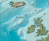
| Rockall FeatureType : isle Elevation : 0 Lat/Lng : 57.5963 / -13.6873 | Rockall is a British uninhabited granite islet located within the exclusive economic zone (EEZ) of the United Kingdom,. Oireachtas, Dublin, 24 March 2011. Retrieved 5 April 2018. situated in the North Atlantic Ocean (...) |
| 55 | 
| Mount Kilimanjaro FeatureType : mountain Elevation : 5773 Lat/Lng : -3.0667 / 37.3592 | Mount Kilimanjaro or just Kilimanjaro , with its three volcanic cones, "Kibo", "Mawenzi", and "Shira", is a dormant volcano in Tanzania. It is the highest mountain in Africa, about from its base, and above sea level (...) |
| 56 | 
| Bergen-Belsen concentration camp FeatureType : landmark Elevation : 58 Lat/Lng : 52.7578 / 9.9078 | Bergen-Belsen , or Belsen, was a Nazi concentration camp in what is today Lower Saxony in northern Germany, southwest of the town of Bergen near Celle. Originally established as a prisoner of war camp, in 1943, parts of it became a concentration camp (...) |
| 57 | 
| Falmouth, Cornwall FeatureType : city Elevation : 9 Lat/Lng : 50.1519 / -5.0653 | Falmouth is a town, civil parish and port on the River Fal on the south coast of Cornwall, England, United Kingdom.Ordnance Survey: Landranger map sheet 204 Truro & Falmouth It has a total resident population of 21,797 (2011 census). (...) |
| 58 | 
| Isole Tremiti FeatureType : null Elevation : 13 Lat/Lng : 42.12 / 15.4955 | The Isole Tremiti are an archipelago in the Adriatic Sea, north of the Gargano Peninsula. They constitute a comune of Italy's Province of Foggia and form part of the Gargano national park. The name of the islands relates to their seismic hazard, with a history of earthquakes in the area: tremiti (...) |
| 59 | 
| Buffalo, New York FeatureType : null Elevation : 189 Lat/Lng : 42.8923 / -78.8594 | Buffalo is the second largest city in the U.S. state of New York. , the population was 256,902. The city is the county seat of Erie County, and a major gateway for commerce and travel across the Canada–United States border, forming part of the bi-national Buffalo Niagara Region (...) |
| 60 | 
| Warrington FeatureType : city Elevation : 15 Lat/Lng : 53.3873 / -2.6029 | Warrington is a large town and unitary authority area in Cheshire, England, on the banks of the River Mersey, east of Liverpool, and west of Manchester. The population in 2017 was estimated at 209,700, more than double that of 1968 when it became a New Town (...) |
| 61 | 
| Kilmarnock FeatureType : null Elevation : 34 Lat/Lng : 55.6111 / -4.4957 | Kilmarnock ("Meàrnag's church") is a large burgh in East Ayrshire, Scotland with a population of 46,350,Brinkhoff (2007) making it the 15th most populated place in Scotland . Gro-scotland.gov.uk. Retrieved on 16 July 2013.. Webarchive.nationalarchives.gov.uk. Retrieved on 16 July 2013 (...) |
| 62 | 
| Galway FeatureType : null Elevation : 16 Lat/Lng : 53.2778 / -9.0418 | Galway is a city in the West of Ireland, in the province of Connacht. Galway lies on the River Corrib between Lough Corrib and Galway Bay, surrounded by County Galway, and is the sixth most populous city in Ireland, with a population at the 2016 Census of 79,934 (...) |
| 63 | 
| Lewes FeatureType : null Elevation : 6 Lat/Lng : 50.8756 / 0.0179 | Lewes is the county town of East Sussex and formerly all of Sussex. It is a civil parish and is the centre of the Lewes local government district. Its population is now around 17,000. The settlement is a traditional market town and centre of communications and in 1264, it was the site of the Battle (...) |
| 64 | 
| Darwin, Northern Territory FeatureType : city Elevation : 30 Lat/Lng : -12.4362 / 130.8412 | Darwin Macquarie Dictionary, Fourth Edition (2005). Melbourne, The Macquarie Library Pty Ltd. is the capital city of the Northern Territory of Australia. Situated on the Timor Sea, Darwin is the largest city in the sparsely populated Northern Territory, with a population of 145,916 (...) |
| 65 | 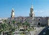
| Arequipa FeatureType : city Elevation : 2370 Lat/Lng : -16.4308 / -71.5155 | Arequipa is the capital and largest city of the Arequipa Region and the seat of the Constitutional Court of Peru. It is Peru's second most populous city with 861,145 inhabitants, as well as its second most populous metropolitan area as of 2016, according to the National Institute of Statistics and (...) |
| 66 | 
| Princeton University FeatureType : edu Elevation : 43 Lat/Lng : 40.344 / -74.6514 | Princeton University is a private Ivy League research university in Princeton, New Jersey. Founded in 1746 in Elizabeth as the College of New Jersey, Princeton is the fourth-oldest institution of higher education in the United States and one of the nine colonial colleges chartered before the (...) |
| 67 | 
| Puebla City FeatureType : null Elevation : 2158 Lat/Lng : 19.0453 / -98.1975 | Puebla (Spanish: Puebla de Zaragoza), formally Heroica Puebla de Zaragoza and also known as Puebla de los Ángeles, is the seat of Puebla Municipality, the capital and largest city of the state of Puebla, and one of the five most important Spanish colonial cities in Mexico (...) |
| 68 | 
| Isle of Man FeatureType : isle Elevation : 325 Lat/Lng : 54.2372 / -4.5231 | The Isle of Man , sometimes referred to simply as Mann , is a self-governing British Crown dependency in the Irish Sea between Great Britain and Ireland. The head of state is Queen Elizabeth II, who holds the title of Lord of Mann and is represented by a lieutenant governor (...) |
| 69 | 
| Canada FeatureType : country Elevation : 73 Lat/Lng : 45.4116 / -75.6984 | Canada is a country located in the northern part of North America. Its ten provinces and three territories extend from the Atlantic to the Pacific and northward into the Arctic Ocean, covering , making it the world's second-largest country by total area (...) |
| 70 | 
| Malawi FeatureType : null Elevation : 1339 Lat/Lng : -13.3575 / 34.0247 | Malawi (or ; or), officially the Republic of Malawi, is a landlocked country in southeast Africa that was formerly known as Nyasaland. It is bordered by Zambia to the northwest, Tanzania to the northeast, and Mozambique on the east, south and west (...) |
| 71 | 
| Paisley, Renfrewshire FeatureType : null Elevation : 15 Lat/Lng : 55.8444 / -4.425 | Paisley is the largest town in the historic county of Renfrewshire and the fifth-largest in Scotland. Situated in the west central Lowlands of Scotland, it serves as the administrative centre for the Renfrewshire council area (...) |
| 72 | 
| Sarnia FeatureType : null Elevation : 182 Lat/Lng : 42.9789 / -82.4039 | Sarnia is a city in Southwestern Ontario, Canada, and had a 2016 population of 71,594. It is the largest city on Lake Huron and in Lambton County. Sarnia is located on the eastern bank of the junction between the Upper and Lower Great Lakes where Lake Huron flows into the St (...) |
| 73 | 
| Greater Sudbury FeatureType : city Elevation : 258 Lat/Lng : 46.4902 / -80.9978 | Greater Sudbury, commonly referred to as Sudbury, is a city in Ontario, Canada. It is the largest city in Northern Ontario by population, with a population of 161,531 at the Canada 2016 Census. By land area, it is the largest in Ontario and the fifth largest in Canada (...) |
| 74 | 
| Cumbernauld FeatureType : null Elevation : 149 Lat/Lng : 55.9469 / -3.9905 | Cumbernauld (; http://theses.gla.ac.uk/5270/1/2014DrummondPhD.pdf#233 Peter Drummond PhD 2004 pg 233 ;) is a town in North Lanarkshire, Scotland. It is the ninth most-populous locality in Scotland, positioned in the centre of Scotland’s Central Belt (...) |
| 75 | 
| Enid, Oklahoma FeatureType : city Elevation : 387 Lat/Lng : 36.4006 / -97.8808 | Enid (ē'nĭd) is a city in Garfield County, Oklahoma, United States. As of the 2010 census, the population was 49,379, making it the ninth-largest city in Oklahoma. It is the county seat of Garfield County. Enid was founded during the opening of the Cherokee Outlet in the Land Run of 1893, and is (...) |
| 76 | 
| Peterborough FeatureType : city Elevation : 14 Lat/Lng : 52.5725 / -0.2425 | Peterborough is a cathedral city in Cambridgeshire, England, with a population of 183,631 in 2011. Historically part of Northamptonshire, it is north of London, on the River Nene which flows into the North Sea to the north-east (...) |
| 77 | 
| New Brunswick, New Jersey FeatureType : city Elevation : 23 Lat/Lng : 40.4867 / -74.4444 | New Brunswick is a city in Middlesex County, New Jersey, United States, in the New York City metropolitan area. The city is the county seat of Middlesex County,, New Jersey Department of State. Accessed July 10, 2017. and the home of Rutgers University (...) |
| 78 | 
| Huntsville, Alabama FeatureType : null Elevation : 188 Lat/Lng : 34.7136 / -86.5861 | Huntsville is a city located primarily in Madison County in the Appalachian region of northern Alabama. Huntsville is the county seat of Madison County. The city extends west into neighboring Limestone County and south into Morgan County. Huntsville's population was 180,105 as of the 2010 census (...) |
| 79 | 
| Norfolk, Virginia FeatureType : null Elevation : 11 Lat/Lng : 36.8489 / -76.1792 | Norfolk is an independent city in the Commonwealth of Virginia in the United States. At the 2010 census, the population was 242,803; in 2017, the population was estimated to be 244,703. American FactFinder QuickFacts Retrieved September 12, 2018 making it the second-most populous city in Virginia (...) |
| 80 | 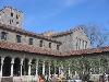
| Metropolitan Museum of Art FeatureType : landmark Elevation : 46 Lat/Lng : 40.7794 / -73.9633 | The Metropolitan Museum of Art of New York City, colloquially "the Met", is the largest art museum in the United States. With 7.06 million visitors in 2016, it was the third most visited art museum in the world, and the fifth most visited museum of any kind."The World's 20 most popular museums", CNN (...) |
| 81 | 
| Perth Amboy, New Jersey FeatureType : city Elevation : 32 Lat/Lng : 40.5194 / -74.2753 | Perth Amboy is a city in Middlesex County, New Jersey, United States. The City of Perth Amboy is part of the New York metropolitan area. As of the 2010 United States Census, the city's population was 50,814, reflecting an increase of 3,511 (+7 (...) |
| 82 | 
| Derry FeatureType : null Elevation : 30 Lat/Lng : 54.9958 / -7.3074 | Derry, officially Londonderry , is the second-largest city in Northern Ireland and the fourth-largest city on the island of Ireland.. Retrieved 1 November 2008. The name Derry is an anglicisation of the Old Irish name Daire (modern Irish: Doire) meaning "oak grove" (...) |
| 83 | 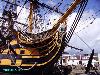
| Portsmouth FeatureType : city Elevation : 7 Lat/Lng : 50.7953 / -1.0889 | Portsmouth is a port city in Hampshire, England, with a total population of 205,400 residents. The city of Portsmouth is nicknamed Pompey and is mainly built on Portsea Island, a flat, low-lying island measuring 24 square kilometres (9 sq mi) in area, just off the south-east coast of Hampshire (...) |
| 84 | 
| Greenwich Village FeatureType : city Elevation : 17 Lat/Lng : 40.7307 / -73.9999 | Greenwich Village often referred to by locals as simply "the Village," is a neighborhood on the west side of Lower Manhattan, New York City. In the 20th century, Greenwich Village was known as an artists' haven, the Bohemian capital, the cradle of the modern LGBT movement, and the East Coast (...) |
| 85 | 
| Duke University FeatureType : edu Elevation : 123 Lat/Lng : 36.0011 / -78.9389 | Duke University is a private, non-profit, research university located in Durham, North Carolina. Founded by Methodists and Quakers in the present-day town of Trinity in 1838, the school moved to Durham in 1892. In 1924, tobacco and electric power industrialist James Buchanan Duke established The (...) |
| 86 | 
| Leeds FeatureType : null Elevation : 49 Lat/Lng : 53.7997 / -1.5492 | Leeds is a city in West Yorkshire, England, the principal settlement in the administrative district known as the City of Leeds. The Leeds urban subdivision defined in the last census constitutes of the of the City of Leeds, which also includes a number of towns and rural areas around Leeds (...) |
| 87 | 
| Sheffield FeatureType : city Elevation : 92 Lat/Lng : 53.3824 / -1.4719 | Sheffield is a city and metropolitan borough in South Yorkshire, England. Historically part of the West Riding of Yorkshire, its name derives from the River Sheaf, which runs through the city. With some of its southern suburbs annexed from Derbyshire, the city has grown from its largely industrial (...) |
| 88 | 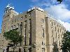
| Belfast FeatureType : null Elevation : 5 Lat/Lng : 54.596 / -5.914 | Belfast – Belfast is a city in the United Kingdom and the capital city of Northern Ireland, on the banks of the River Lagan on the east coast of Ireland. It is the largest city in Northern Ireland and second largest on the island of Ireland. It had a population of 333,871 in 2015 (...) |
| 89 | 
| Republic of Ireland FeatureType : country Elevation : 37 Lat/Lng : 53.1333 / -8.1167 | Ireland , also known as the Republic of Ireland , is a country in north-western Europe occupying 26 of 32 counties of the island of Ireland. The capital and largest city is Dublin, which is located on the eastern part of the island, and whose metropolitan area is home to around a third of the (...) |
| 90 | 
| Aberdeen FeatureType : city Elevation : 52 Lat/Lng : 57.15 / -2.1231 | Aberdeen (; , listen; ;) is a city in northeast Scotland. It is Scotland's third most populous city, one of Scotland's 32 local government council areas and the United Kingdom's 37th most populous built-up area, with an official population estimate of 196,670 for the city of Aberdeen and for the (...) |
| 91 | 
| Trujillo, Peru FeatureType : null Elevation : 30 Lat/Lng : -8.118 / -79.0287 | Trujillo is a city in coastal northwestern Peru and the capital of La Libertad Region. It is the third most populous city and center of the third most populous metropolitan area of Peru. It is located on the banks of the Moche River, near its mouth at the Pacific Ocean, in the Moche Valley (...) |
| 92 | 
| Massachusetts Institute of Technology FeatureType : edu Elevation : 17 Lat/Lng : 42.3598 / -71.0921 | The Massachusetts Institute of Technology (MIT) is a private research university in Cambridge, Massachusetts. Founded in 1861 in response to the increasing industrialization of the United States, MIT adopted a European polytechnic university model and stressed laboratory instruction in applied (...) |
| 93 | 
| Honduras FeatureType : country Elevation : 1001 Lat/Lng : 14.0819 / -87.1981 | Honduras , officially the Republic of Honduras , is a country in Central America. It has at times been referred to as Spanish Honduras to differentiate it from British Honduras, which became modern-day Belize. The republic of Honduras is bordered to the west by Guatemala, to the southwest by El (...) |
| 94 | 
| Edinburgh FeatureType : city Elevation : 129 Lat/Lng : 55.9496 / -3.1603 | Edinburgh is the capital city of Scotland and one of its 32 council areas. Historically part of the county of Midlothian (or Edinburghshire), it is located in Lothian on the Firth of Forth's southern shore. Recognised as the capital of Scotland since at least the 15th century, Edinburgh is the seat (...) |
| 95 | 
| Grantham FeatureType : null Elevation : 54 Lat/Lng : 52.9182 / -0.6382 | Grantham is a town in the South Kesteven district of Lincolnshire, England. It straddles the London–Edinburgh East Coast Main Line and the River Witham and is bounded to the west by the A1 north–south trunk road (...) |
| 96 | 
| Cyprus FeatureType : country Elevation : 949 Lat/Lng : 34.9 / 32.9333 | Cyprus , officially the Republic of Cyprus , is an island country in the Eastern Mediterranean and the third largest and third most populous island in the Mediterranean, located south of Turkey, west of Syria and Lebanon, northwest of Israel, north of Egypt, and southeast of Greece (...) |
| 97 | Atlanta Campaign FeatureType : event Elevation : 336 Lat/Lng : 33.749 / -84.388 | The Atlanta Campaign was a series of battles fought in the Western Theater of the American Civil War throughout northwest Georgia and the area around Atlanta during the summer of 1864. Union Maj. Gen. William Tecumseh Sherman invaded Georgia from the vicinity of Chattanooga, Tennessee, beginning in (...) | |
| 98 | 
| England FeatureType : city Elevation : 10 Lat/Lng : 51.5 / -0.1167 | England is a country that is part of the United Kingdom. It shares land borders with Scotland to the north and Wales to the west. The Irish Sea lies northwest of England and the Celtic Sea lies to the southwest (...) |
| 99 | 
| Gaza Strip FeatureType : adm1st Elevation : 12 Lat/Lng : 31.4167 / 34.3333 | The Gaza Strip (;The New Oxford Dictionary of English (1998) – p.761 "Gaza Strip /'gɑːzə/ a strip of territory under the control of the Palestinian National Authority and Hamas, on the SE Mediterranean coast including the town of Gaza..." (...) |
| 100 | 
| Sydney FeatureType : city(4575532) Elevation : 72 Lat/Lng : -33.8694 / 151.2083 | Sydney is the state capital of New South Wales and the most populous city in Australia and Oceania. Located on Australia's east coast, the metropolis surrounds Port Jackson and extends about on its periphery towards the Blue Mountains to the west, Hawkesbury to the north, and Macarthur to the south (...) |
| 101 | 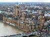
| United Kingdom FeatureType : country Elevation : 131 Lat/Lng : 53.55 / -2.4333 | The United Kingdom of Great Britain and Northern Ireland, commonly known as the United Kingdom (UK) or Britain,Usage is mixed. Some organisations, including the and , prefer to use Britain as shorthand for Great Britain is a sovereign country lying off the north-western coast of the European (...) |
| 102 | 
| Salt Lake City FeatureType : null Elevation : 1294 Lat/Lng : 40.7547 / -111.8925 | Salt Lake City (often shortened to Salt Lake and abbreviated as SLC) is the capital and the most populous municipality of the U.S. state of Utah. With an estimated population of 190,884 in 2014, the city is the core of the Salt Lake City metropolitan area, which has a population of 1,153,340 (2014 (...) |
| 103 | 
| Trenton, New Jersey FeatureType : city Elevation : 18 Lat/Lng : 40.2237 / -74.764 | Trenton is the capital city of the U.S. state of New Jersey and the county seat of Mercer County., New Jersey Department of State. Accessed July 10, 2017. It was briefly the capital of the United States. The city's metropolitan area is grouped with the New York metropolitan area by the United States (...) |
| 104 | 
| Duluth, Minnesota FeatureType : null Elevation : 193 Lat/Lng : 46.7869 / -92.0982 | Duluth is a major port city in the U.S. state of Minnesota and the county seat of Saint Louis County. Duluth has a population of 86,293 and is the 4th largest city in Minnesota. It is the second-largest city on Lake Superior after Thunder Bay, Ontario, Canada (...) |
| 105 | 
| Austin, Texas FeatureType : null Elevation : 139 Lat/Lng : 30.2672 / -97.7639 | Austin is the capital of the U.S. state of Texas and the seat of Travis County, with portions extending into Hays and Williamson counties. It is the 11th-most populous city in the United States and the 4th-most populous city in Texas (...) |
| 106 | 
| Australian Alps FeatureType : mountain Elevation : 1372 Lat/Lng : -37.0 / 148.0 | The Australian Alps, an interim Australian bioregion, data is the highest mountain range in Australia. This range is located in southeastern Australia, and it straddles eastern Victoria, southeastern New South Wales, and the Australian Capital Territory (...) |
| 107 | 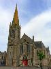
| Nairn FeatureType : null Elevation : 20 Lat/Lng : 57.5809 / -3.8797 | Nairn is a town and former burgh in the Highland council area of Scotland. It is an ancient fishing port and market town around east of Inverness. It is the traditional county town of the county of Nairn, also known as Nairnshire (...) |
| 108 | 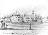
| Colchester, Connecticut FeatureType : null Elevation : 166 Lat/Lng : 41.5586 / -72.3519 | Colchester is a town in New London County, Connecticut, United States. The population was 16,068 at the 2010 census. In 2010 Colchester became the first town in Connecticut, and the 36th in the country, to be certified with the National Wildlife Federation as a Community Wildlife Habitat (...) |
| 109 | 
| Listowel FeatureType : city Elevation : 25 Lat/Lng : 52.4466 / -9.4862 | Listowel is a Heritage town and a market town in County Kerry, Ireland, and is situated on the River Feale, from the county town, Tralee. The town of Listowel had a population of 4,820 according to the CSO Census 2016 (...) |
| 110 | 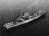
| USS Lexington (CV-2) FeatureType : landmark Lat/Lng : -15.33 / 155.5 | USS Lexington (CV-2), nicknamed "Lady Lex",Groom, p. 203 was an early aircraft carrier built for the United States Navy. She was the lead ship of the ; her only sister ship, , was commissioned a month earlier. Originally designed as a battlecruiser, she was converted into one of the Navy's first (...) |
| 111 | 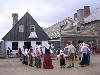
| Fortress of Louisbourg FeatureType : city Elevation : 6 Lat/Lng : 45.8924 / -59.9854 | The Fortress of Louisbourg is a National Historic Site of Canada and the location of a one-quarter partial reconstruction of an 18th-century French fortress at Louisbourg on Cape Breton Island, Nova Scotia. Its two sieges, especially that of 1758, were turning points in the Anglo-French struggle for (...) |
| 112 | 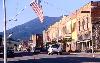
| Red Lodge, Montana FeatureType : city Elevation : 1694 Lat/Lng : 45.1875 / -109.2486 | Red Lodge is a city in and the county seat of Carbon County, Montana, United States. It is part of the Billings Metropolitan Statistical Area. The population was 2,125 at the United States Census, 2010. (...) |
| 113 | 
| Calhoun, Georgia FeatureType : city Elevation : 228 Lat/Lng : 34.5 / -84.9425 | Calhoun is a city in Gordon County, Georgia, United States. As of the 2010 census, the city had a population of 15,650, up from 10,667 in 2000. Calhoun is the county seat of Gordon County. (...) |
| 114 | 
| Fareham FeatureType : null Elevation : 6 Lat/Lng : 50.85 / -1.18 | Fareham is a market town at the north-west tip of Portsmouth Harbour, between the cities of Portsmouth and Southampton in south east Hampshire, England. It gives its name to the Borough of Fareham. It was historically an important manufacturer of bricks, used to build the Royal Albert Hall, and (...) |
| 115 | 
| Dahlonega, Georgia FeatureType : city Elevation : 436 Lat/Lng : 34.5306 / -83.9847 | The city of Dahlonega is the county seat of Lumpkin County, Georgia, United States. As of the 2010 census, the city had a population of 5,242. Dahlonega is located at the north end of the Georgia 400, which connects Dahlonega to Atlanta (...) |
| 116 | 
| Mackinac Island FeatureType : isle Elevation : 237 Lat/Lng : 45.8611 / -84.6305 | Mackinac Island is an island and resort area, covering in land area, in the U.S. state of Michigan. It is located in Lake Huron, at the eastern end of the Straits of Mackinac, between the state's Upper and Lower Peninsulas (...) |
| 117 | 
| Northern Rhodesia FeatureType : country Elevation : 1126 Lat/Lng : -14.1167 / 27.6333 | Northern Rhodesia was a protectorate in south central Africa, formed in 1911 by amalgamatingNorthern Rhodesia Order in Council, 1911, S.R.O. 1911 No. 438, p. 85. the two earlier protectorates of Barotziland-North-Western RhodesiaBarotziland-North-Western Rhodesia Order in Council, 1899, S.E.O (...) |
| 118 | 
| Palmyra Atoll FeatureType : null Elevation : 11 Lat/Lng : 5.8868 / -162.0796 | Palmyra Atoll is one of the Northern Line Islands (southeast of Kingman Reef and north of Kiribati Line Islands), located almost due south of the Hawaiian Islands, roughly one-third of the way between Hawaii and American Samoa. The nearest continent is almost to the northeast (...) |
| 119 | 
| Atchison, Kansas FeatureType : city Elevation : 266 Lat/Lng : 39.5625 / -95.1283 | Atchison is a city and county seat of Atchison County, Kansas, United States, and situated along the Missouri River. As of the 2010 census, its population was 11,021. The city is named in honor of David Rice Atchison, United States senator from Missouri, and was the original eastern terminus of the (...) |
| 120 | 
| Waynesville, North Carolina FeatureType : null Elevation : 843 Lat/Lng : 35.4833 / -82.9944 | Waynesville is a town in and the county seat of Haywood County, North Carolina, United States. It is the largest town in Haywood County and the largest in western North Carolina west of Asheville. Waynesville is located about southwest of Asheville between the Great Smoky and Blue Ridge mountains (...) |
| 121 | 
| Olean, New York FeatureType : city Elevation : 450 Lat/Lng : 42.0819 / -78.4321 | Olean is a city in Cattaraugus County, New York, United States. Olean is the largest city in Cattaraugus County and serves as its financial, business, transportation and entertainment center. It is one of the principal cities of the Southern Tier region of New York (...) |
| 122 | 
| Batavia, New York FeatureType : city Elevation : 276 Lat/Lng : 42.9986 / -78.1842 | Batavia is a city in and the county seat of Genesee County, New York, United States. It is near the center of the county, surrounded by the Town of Batavia, which is a separate municipality. Its population as of the 2010 census was 15,465 (...) |
| 123 | 
| Cleveland Hopkins International Airport FeatureType : airport Elevation : 233 Lat/Lng : 41.4121 / -81.8499 | Cleveland Hopkins International Airport is a public airport located in Cleveland, Ohio, southwest of the downtown area and adjacent to the Glenn Research Center, one of NASA's ten major field centers., effective July 5, 2007 It is the primary airport serving Greater Cleveland and Northeast Ohio, the (...) |
| 124 | 
| Alert, Nunavut FeatureType : null Lat/Lng : 82.5014 / -62.3389 | Alert, in the Qikiqtaaluk Region, Nunavut, Canada, is the northernmost permanently inhabited place in the world, ("Twice a year, the military resupply Alert, the world's northernmost settlement.") at latitude 82°30'05" north, from the North Pole (...) |
| 125 | 
| Hydra (island) FeatureType : isle Elevation : 8 Lat/Lng : 37.35 / 23.4667 | Hydra (pronounced in modern Greek) is one of the Saronic Islands of Greece, located in the Aegean Sea between the Saronic Gulf and the Argolic Gulf. It is separated from the Peloponnese by a narrow strip of water (...) |
| 126 | 
| Redditch FeatureType : null Elevation : 89 Lat/Lng : 52.3167 / -1.9333 | Redditch is a town and local government district in north-east Worcestershire, England, approximately south of Birmingham. The district had a population of 84,300 in 2011. In the 19th century it became the international centre for the needle and fishing tackle industry (...) |
| 127 | 
| Brandon, Manitoba FeatureType : city Elevation : 389 Lat/Lng : 49.8422 / -99.9618 | Brandon is the second-largest city in the province of Manitoba, Canada. It is located in the southwestern corner of the province on the banks of the Assiniboine River, approximately west of the provincial capital, Winnipeg, and east of the Saskatchewan border. Brandon covers an area of 77.41 km (29 (...) |
| 128 | 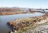
| Chillicothe, Ohio FeatureType : city Elevation : 188 Lat/Lng : 39.3364 / -82.9839 | Chillicothe is a city in and the county seat of Ross County, Ohio, United States. Located along the Scioto River 45 miles south of Columbus, Chillicothe was the first and third capital of Ohio. It is the only city in Ross County and the center of the Chillicothe Micropolitan Statistical Area (as (...) |
| 129 | 
| Port Alberni FeatureType : null Elevation : 64 Lat/Lng : 49.2347 / -124.8006 | Port Alberni is a city located on Vancouver Island in the province of British Columbia, Canada. Port Alberni has a total population of 17,678, and a census agglomeration area of 25,112. Port Alberni is a deep port city which lies within the Alberni Valley at the head of the Alberni Inlet, Vancouver (...) |
| 130 | 
| Skeena River FeatureType : null Lat/Lng : 54.0152 / -130.1128 | The Skeena River is the second-longest river entirely within British Columbia, Canada (after the Fraser River). Since ancient times, the Skeena has been an important transportation artery, particularly for the Tsimshian and the Gitxsan—whose names mean "inside the Skeena River" and "people of the (...) |
| 131 | 
| Trump Tower FeatureType : landmark Elevation : 18 Lat/Lng : 40.7625 / -73.9742 | Trump Tower is a 58-story, mixed-use skyscraper at 721–725 Fifth Avenue between 56th and 57th Streets in Midtown Manhattan, New York City. Trump Tower serves as the headquarters for The Trump Organization. Additionally, it houses the penthouse condominium residence of the building's namesake and (...) |
| 132 | 
| Bribie Island FeatureType : null Elevation : 5 Lat/Lng : -26.9485 / 153.128 | Bribie Island is the smallest and most northerly of three major sand islands forming the coastline sheltering the northern part of Moreton Bay, Queensland, Australia. The others are Moreton Island and North Stradbroke Island. Bribie Island is long, and at its widest (...) |
| 133 | 
| Presidio of San Francisco FeatureType : null Elevation : 27 Lat/Lng : 37.7958 / -122.4542 | The Presidio of San Francisco (originally, El Presidio Real de San Francisco or The Royal Fortress of Saint Francis) is a park and former U.S. Army military fort on the northern tip of the San Francisco Peninsula in San Francisco, California, and is part of the Golden Gate National Recreation Area (...) |
| 134 | 
| Sword Beach FeatureType : landmark Lat/Lng : 49.3064 / -0.3211 | Sword, commonly known as Sword Beach, was the code name given to one of the five main landing areas along the Normandy coast during the initial assault phase, Operation Neptune, of Operation Overlord, the Allied invasion of German-occupied France that commenced on 6 June 1944 (...) |
| 135 | 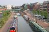
| Banbury FeatureType : null Elevation : 100 Lat/Lng : 52.0605 / -1.3362 | Banbury is a historic market town on the River Cherwell in Oxfordshire, England. The town is situated northwest of London, southeast of Birmingham, south-by-southeast of Coventry and north-by-northwest of the county town of Oxford. It had a population of 46,853 at the 2011 census (...) |
| 136 | 
| North Bay, Ontario FeatureType : null Elevation : 205 Lat/Lng : 46.3135 / -79.4666 | North Bay is a city in Northeastern Ontario, Canada. It is the seat of Nipissing District, and takes its name from its position on the shore of Lake Nipissing. North Bay is located on the traditional territory of the Nipissing First Nation peoples. (...) |
| 137 | 
| Todmorden FeatureType : null Elevation : 133 Lat/Lng : 53.7136 / -2.0978 | Todmorden See page 828 of John C. Wells's LPD. Also, see and Peter Wright, A Yorkshireman's Dictionary, page 8 is a market town and civil parish in the Upper Calder Valley in Calderdale, West Yorkshire, England. It is north east of Manchester and in 2011 had a population of 15,481 (...) |
| 138 | 
| Carrabelle, Florida FeatureType : null Elevation : 11 Lat/Lng : 29.8539 / -84.6658 | Carrabelle is a city in Franklin County along Florida's Panhandle, United States. The population was 2,778 as of the 2010 census. Carrabelle is located east of Apalachicola at the mouth of the Carrabelle River on the Gulf of Mexico. (...) |
| 139 | 
| Washita River FeatureType : null Elevation : 190 Lat/Lng : 33.9118 / -96.5781 | The Washita River is a river in the states of Texas and Oklahoma in the United States. The river is long and terminates at its confluence with the Red River, which is now part of Lake Texoma on the TexasOklahoma border. (...) |
| 140 | 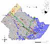
| Hammonton, New Jersey FeatureType : city Elevation : 19 Lat/Lng : 39.6608 / -74.767 | Hammonton is a town in Atlantic County, New Jersey, United States, known as the "Blueberry Capital of the World." As of the 2010 United States Census, the town's population was 14,791, reflecting an increase of 2,187 (+17 (...) |
| 141 | 
| Wick, Caithness FeatureType : null Elevation : 6 Lat/Lng : 58.4408 / -3.0894 | Wick is a town and royal burgh in Caithness, in the far north of Scotland. The town straddles the River Wick and extends along both sides of Wick Bay. Wick Locality had a population of 6,954 at the time of the 2011 census, a decrease of 3.8% from 2001., The Highland Council. 11 February 2014 (...) |
| 142 | 
| HMHS Britannic FeatureType : landmark Lat/Lng : 37.7014 / 24.2839 | Britannic was the third and final vessel of the White Star Line's of steamships and the second to bear the name "Britannic." She was the fleet mate of both the and the and was intended to enter service as a transatlantic passenger liner (...) |
| 143 | 
| Bellaire, Texas FeatureType : city Elevation : 22 Lat/Lng : 29.7062 / -95.4588 | Bellaire is a city in southwest Harris County, Texas, United States, within the metropolitan area.. Retrieved on January 24, 2010. As of the 2010 U.S. Census, the city population was 16,855. It is surrounded by the cities of Houston and West University Place (...) |
| 144 | 
| Selous Game Reserve FeatureType : null Elevation : 369 Lat/Lng : -8.85 / 37.449 | The Selous Game Reserve is a protected area in southern Tanzania. It covers a total area of and has additional buffer zones. It was designated a UNESCO World Heritage Site in 1982 due to its wildlife diversity and undisturbed nature (...) |
| 145 | 
| Batemans Bay FeatureType : null Lat/Lng : -35.7024 / 150.1785 | Batemans Bay is a town in the South Coast region of the state of New South Wales, Australia. Batemans Bay is administered by the Eurobodalla Shire council. The town is situated on the shores of an estuary formed where the Clyde River meets the South Pacific Ocean (...) |
| 146 | 
| Romeo and Juliet FeatureType : landmark Elevation : 67 Lat/Lng : 45.4421 / 10.9986 | Romeo and Juliet is a tragedy written by William Shakespeare early in his career about two young star-crossed lovers whose deaths ultimately reconcile their feuding families. It was among Shakespeare's most popular plays during his lifetime and along with Hamlet, is one of his most frequently (...) |
| 147 | 
| Mission San Juan Capistrano FeatureType : landmark Elevation : 43 Lat/Lng : 33.5028 / -117.6628 | Mission San Juan Capistrano was a Spanish mission in colonial Las Californias. It is located in present-day San Juan Capistrano, Orange County, southern California. (...) |
| 148 | 
| Rankin Inlet FeatureType : city Lat/Lng : 62.8167 / -92.0833 | Rankin Inlet (; Inuktitut syllabics: ᑲᖏᕿᓂᖅ or Kangirliniq, ᑲᖏᖅᖠᓂᖅ, or Kangir&iniq meaning deep bay/inlet) is an Inuit hamlet on Kudlulik Peninsula in Nunavut, Canada. at the Atlas of Canada Located on the northwestern Hudson Bay, between Chesterfield Inlet and Arviat, it is the regional centre for (...) |
| 149 | 
| Morrisville, North Carolina FeatureType : city Elevation : 98 Lat/Lng : 35.8275 / -78.8289 | Morrisville is a town located primarily in Wake County, North Carolina (a small portion extends into neighboring Durham County). The population was 18,576 at the 2010 census. The U.S. Census Bureau estimates the town's population to be 21,932 as of July 1, 2013 (...) |
| 150 | Battle of Shiloh FeatureType : event Elevation : 149 Lat/Lng : 35.1385 / -88.3421 | The Battle of Shiloh (also known as the Battle of Pittsburg Landing) was a battle in the Western Theater of the American Civil War, fought April 6–7, 1862, in southwestern Tennessee. A Union force known as the Army of the Tennessee (Major General Ulysses S (...) | |
| 151 | 
| Youngstown, New York FeatureType : null Elevation : 93 Lat/Lng : 43.2486 / -79.0444 | Youngstown is a village in Niagara County, New York, USA. The population was 2,063 at the 2013 census. It is part of the Buffalo–Niagara Falls Metropolitan Statistical Area. Youngstown is on the western edge of the town of Porter and is at the international border with Canada (...) |
| 152 | 
| Ealing Broadway station FeatureType : railwaystation Elevation : 37 Lat/Lng : 51.5147 / -0.3017 | Ealing Broadway is a major single-leveled interchange station in Ealing in London, England, in the London Borough of Ealing, West London and is served by the London Underground and also National Rail on the Great Western Main Line (...) |
| 153 | 
| Millersburg, Ohio FeatureType : city Elevation : 269 Lat/Lng : 40.555 / -81.9181 | Millersburg is a village that serves as the county seat of Holmes County, Ohio, United States located south of Cleveland. The population was 3,025 at the 2010 census. Holmes County Airport, located two miles southwest of Millersburg, serves the county. (...) |
| 154 | Peninsula Campaign FeatureType : null Elevation : 27 Lat/Lng : 37.2739 / -76.6097 | The Peninsula Campaign (also known as the Peninsular Campaign) of the American Civil War was a major Union operation launched in southeastern Virginia from March through July 1862, the first large-scale offensive in the Eastern Theater. The operation, commanded by Maj. Gen. George B (...) | |
| 155 | Johnston, Iowa FeatureType : city Elevation : 1161 Lat/Lng : 41.6711 / 93.7056 | Johnston is a city in Polk County, Iowa, United States. The population was 17,278 in the 2010 census, an increase of almost 100% from the 8,649 population in the 2000 census. It is part of the Des Moines–West Des Moines Metropolitan Statistical Area (...) | |
| 156 | Johnston Road FeatureType : null Elevation : 44 Lat/Lng : 22.2766 / 114.171 | Johnston Road is a major road in Wan Chai on the Hong Kong Island of Hong Kong. (...) | |
| 157 | 
| Baxter Springs, Kansas FeatureType : city Elevation : 258 Lat/Lng : 37.0231 / -94.7347 | Baxter Springs is a city in Cherokee County, Kansas, United States, and located along Spring River. As of the 2010 census, the city population was 4,238; it is the most populous city of Cherokee County. Natural springs in the area had long attracted indigenous peoples and later European-American (...) |
| 158 | 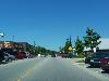
| Highland, Lake County, Indiana FeatureType : city Elevation : 1799 Lat/Lng : 41.5497 / 87.4581 | Highland is a town in Lake County, Indiana, United States. The population was 23,727 at the 2010 census. The town was incorporated on April 4, 1910. It is a part of the Chicago metropolitan area and North Township, and is surrounded by Hammond to the north, Munster to the west, Schererville to the (...) |
| 159 | 
| Oak Lawn, Illinois FeatureType : null Elevation : 188 Lat/Lng : 41.715 / -87.7533 | Oak Lawn is a village in Cook County, Illinois, United States. The population was 56,690 at the 2010 census. Oak Lawn is a suburb of Chicago, located southwest of the city. It shares borders with the city in two areas, but is surrounded mostly by other suburbs. (...) |
| 160 | 
| Kane, Pennsylvania FeatureType : city Elevation : 620 Lat/Lng : 41.6617 / -78.8103 | Kane is a borough in McKean County in the U.S. state of Pennsylvania, east by south of Erie. It was founded in 1863 by Civil War general Thomas L. Kane at an elevated site 2210 feet (674 m) above sea level. In the early part of the 20th century, Kane had large glass works, bottle works, lumber (...) |
| 161 | 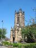
| Manchester Cathedral FeatureType : landmark Elevation : 40 Lat/Lng : 53.4852 / -2.2445 | Manchester Cathedral, formally the Cathedral and Collegiate Church of St Mary, St Denys and St George, in Manchester, England, is the mother church of the Anglican Diocese of Manchester, seat of the Bishop of Manchester and the city's parish church. It is on Victoria Street in Manchester city centre (...) |
| 162 | 
| Upper Arlington, Ohio FeatureType : city Elevation : 265 Lat/Lng : 40.0206 / -83.0664 | Upper Arlington is a city in Franklin County, Ohio, United States, on the northwest side of the Columbus metropolitan area. As of July, 2015, the population was estimated to be 34,907. (...) |
| 163 | 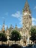
| Manchester Town Hall FeatureType : landmark Elevation : 54 Lat/Lng : 53.4792 / -2.2442 | Manchester Town Hall is a Victorian, Neo-gothic municipal building in Manchester, England. It is the ceremonial headquarters of Manchester City Council and houses a number of local government departments. The building faces Albert Square to the north and St Peter's Square to the south, with (...) |
| 164 | Annandale, New South Wales FeatureType : null Elevation : 29 Lat/Lng : -33.881 / 151.171 | Annandale is a suburb in the Inner West Retrieved 7 August 2013. of Sydney, in the state of New South Wales, Australia. Annandale is located within 5 kilometres west of the Sydney central business district and is part of the local government area of the Inner West Council (...) | |
| 165 | 
| Andersen Air Force Base FeatureType : null Elevation : 166 Lat/Lng : 13.5831 / 144.9283 | Andersen Air Force Base (Andersen AFB, AAFB) is a United States Air Force base located approximately northeast of Yigo near Agafo Gumas in the United States territory of Guam. Along with Naval Base Guam, Andersen AFB was placed under the command of Joint Region Marianas on 1 October 2009 (...) |
| 166 | 
| Lōʻihi Seamount FeatureType : mountain Lat/Lng : 18.92 / -155.27 | Lōihi Seamount (also known as Lōʻihi) is an active submarine volcano about off the southeast coast of the island of Hawaii. The top of the seamount is about below sea level. This seamount is on the flank of Mauna Loa, the largest shield volcano on Earth (...) |
| 167 | 
| Art Gallery of Ontario FeatureType : landmark Elevation : 101 Lat/Lng : 43.6539 / -79.3928 | The Art Gallery of Ontario (AGO) is an art museum in Toronto, Ontario, Canada. Its collection includes close to 95,000 works spanning the first century to the present day. The gallery has of physical space, making it one of the largest galleries in North America (...) |
| 168 | 
| Whitman College FeatureType : null Elevation : 308 Lat/Lng : 46.0707 / -118.3289 | Whitman College is a private liberal arts college located in Walla Walla, Washington. Initially founded as a seminary by a territorial legislative charter in 1859, the school became a four-year degree-granting institution in 1882.https://www.whitman (...) |
| 169 | Albert Sidney Johnston High School FeatureType : landmark Elevation : 142 Lat/Lng : 30.2581 / -97.6814 | Albert Sidney Johnston High School served as a comprehensive, coeducational high school in the Austin Independent School District from 1960 to 2008. Located in Austin, Texas, the school was named after General Albert Sidney Johnston, who served as Secretary of War for the Republic of Texas and as a (...) | |
| 170 | Braxton Bragg FeatureType : null Elevation : 13 Lat/Lng : 30.6751 / -88.0627 | Braxton Bragg (March 22, 1817 – September 27, 1876) was a senior officer of the Confederate States Army who was assigned to duty at Richmond, under direction of the President of the Confederate States of America, Jefferson Davis, and charged with the conduct of military operations of the armies of (...) | |
| 171 | 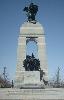
| National War Memorial (Canada) FeatureType : landmark Elevation : 77 Lat/Lng : 45.424 / -75.6955 | The National War Memorial (titled The Response) is a tall, granite memorial arch with accreted bronze sculptures in Ottawa, Ontario, Canada, designed by Vernon March and first dedicated by King George VI in 1939 (...) |
| 172 | Smithfield, North Carolina FeatureType : city Elevation : 64 Lat/Lng : 35.5092 / -78.4797 | Smithfield is a town in and the county seat of Johnston County, North Carolina, United States. As of the 2010 census the population was 10,966, and in 2016 the estimated population was 12,266. Smithfield is home to the Ava Gardner Museum and is situated along the Neuse River, where visitors enjoy (...) | |
| 173 | 
| Piz Palü FeatureType : mountain Elevation : 3874 Lat/Lng : 46.3787 / 9.96 | Piz Palü is a mountain in the Bernina Range of the Alps, located between Switzerland and Italy. It is a large glaciated massif composed of three main summits, on a ridge running from west to east. The main (and central) summit is 3,900 metres high and is located within the Swiss canton of (...) |
| 174 | Lens, Pas-de-Calais FeatureType : null Elevation : 32 Lat/Lng : 50.4322 / 2.8333 | Lens is a commune in the Pas-de-Calais department in northern France. It is one of the main towns of Hauts-de-France along with Lille, Valenciennes, Amiens, Roubaix, Tourcoing, Arras and Douai. The inhabitants are called Lensois. (...) | |
| 175 | 
| Bedford Square FeatureType : landmark Elevation : 36 Lat/Lng : 51.5189 / -0.1301 | Bedford Square is a garden square in the Bloomsbury district of the Borough of Camden in London, England. (...) |
| 176 | Leelanau County, Michigan FeatureType : adm2nd Elevation : 225 Lat/Lng : 45.13 / -86.03 | Leelanau County is a county located in the U.S. state of Michigan. As of the 2010 United States Census, the population was 21,708. The county seat was until recently the unincorporated community of Leland. On 3 August 2004, county voters approved a proposal to move the county seat to Suttons Bay, (...) | |
| 177 | 
| Pitt Island FeatureType : null Elevation : 99 Lat/Lng : -44.2897 / -176.2258 | Pitt Island is the second largest island in the Chatham Archipelago, New Zealand. It is called Rangiauria in Māori and Rangiaotea in Moriori.Government of New Zealand, Dept. of Conservation (1999) , map 6. Retrieved 13 July 2012. Pitt Island has an area of (...) |
| 178 | 
| Santa Maria del Popolo FeatureType : landmark Elevation : 33 Lat/Lng : 41.9114 / 12.4764 | The Parish Basilica of Santa Maria del Popolo is a titular church and a minor basilica in Rome run by the Augustinian order. It stands on the north side of Piazza del Popolo, one of the most famous squares in the city (...) |
| 179 | United States Minor Outlying Islands FeatureType : null Elevation : 5 Lat/Lng : 0.1947 / -176.4794 | The United States Minor Outlying Islands are a statistical designation defined by the International Organization for Standardization's ISO 3166-1 code. The entry code is . The minor outlying islands and groups of islands consist of eight United States insular areas in the Pacific Ocean (Baker (...) | |
| 180 | Orange County, North Carolina FeatureType : adm2nd Elevation : 218 Lat/Lng : 36.06 / -79.12 | Orange County is a county located in the U.S. state of North Carolina. As of the 2010 census, the population was 133,801. Its county seat is Hillsborough. Orange County is included in the Durham–Chapel Hill, NC Metropolitan Statistical Area, which is also included in the Raleigh–Durham–Chapel Hill, (...) | |
| 181 | Johnston City, Illinois FeatureType : null Elevation : 4460 Lat/Lng : 37.8206 / 88.9275 | Johnston City is a city in Williamson County, south central Illinois, United States. The population was 3,543 at the 2010 census. This was a center of coal mining in the early 20th century, having a peak of population in 1920. The mining jobs attracted many immigrants from Europe. (...) | |
| 182 | 
| Yasser Arafat International Airport FeatureType : airport Elevation : 92 Lat/Lng : 31.2464 / 34.2761 | Yasser Arafat International Airport (Maṭār Yāsir 'Arafāt ad-Dawli), formerly Gaza International Airport and Dahaniya International Airport, is located in the Gaza Strip, in between Rafah and Dahaniya, close to the Egyptian border (...) |
| 183 | Vire FeatureType : null Elevation : 179 Lat/Lng : 48.8386 / -0.8892 | Vire is a town and a former commune in the Calvados department in the Normandy region in northwestern France. On 1 January 2016, it was merged into the new commune of Vire-Normandie. 31 December 2015 (...) | |
| 184 | Vimy FeatureType : null Elevation : 83 Lat/Lng : 50.3733 / 2.8114 | Vimy (or ;) is a commune in the Pas-de-Calais department in the Hauts-de-France region of France. It is located east of the Canadian National Vimy Memorial dedicated to the Battle of Vimy Ridge and the Canadian soldiers who were killed during the war (...) | |
| 185 | 
| Balclutha, New Zealand FeatureType : null Elevation : 12 Lat/Lng : -46.2386 / 169.7372 | Balclutha is a town in Otago, lying towards the end of the Clutha River, on the east coast of the South Island of New Zealand. It is about halfway between Dunedin and Invercargill on the Main South Line railway, State Highway 1 and the Southern Scenic Route (...) |
| 186 | Edgefield County, South Carolina FeatureType : adm2nd Elevation : 126 Lat/Lng : 33.77 / -81.97 | Edgefield County is a county located on the western border of the U.S. state of South Carolina. As of the 2010 census, its population was 26,985. Its county seat is Edgefield. Edgefield County has as part of its western border the Savannah River; across the river is Augusta, Georgia (...) | |
| 187 | Siege of Vicksburg FeatureType : event Elevation : 86 Lat/Lng : 32.3436 / -90.8511 | The Siege of Vicksburg (May 18 – July 4, 1863) was the final major military action in the Vicksburg Campaign of the American Civil War. In a series of maneuvers, Union Maj. Gen. Ulysses S. Grant and his Army of the Tennessee crossed the Mississippi River and drove the Confederate Army of (...) | |
| 188 | 
| Castlepollard FeatureType : city Elevation : 90 Lat/Lng : 53.6652 / -7.2309 | Castlepollard (or Cionn Toirc) is a village in north County Westmeath, Republic of Ireland. It lies west of Lough Lene and northeast of Lough Derravaragh and Mullingar. (...) |
| 189 | Williamson County, Illinois FeatureType : adm2nd Elevation : 132 Lat/Lng : 37.73 / -88.93 | Williamson County is a county located in the southern part of the U.S. state of Illinois. According to the 2010 census, it had a population of 66,357. Its county seat is Marion. Williamson County is included in the Carbondale-Marion, IL Metropolitan Statistical Area (...) | |
| 190 | Falkirk FeatureType : null Elevation : 34 Lat/Lng : 56.0011 / -3.7835 | Falkirk is a large town in the Central Lowlands of Scotland, historically within the county of Stirlingshire. It lies in the Forth Valley, north-west of Edinburgh and north-east of Glasgow. Falkirk had a resident population of 32,422 at the 2001 UK Census (...) | |
| 191 | Becker County, Minnesota FeatureType : adm2nd Elevation : 443 Lat/Lng : 46.9274 / -95.6629 | Becker County is a county located in the U.S. state of Minnesota. As of the 2010 census, the population was 32,504. Its county seat is Detroit Lakes. A portion of the White Earth Indian Reservation extends into the county. The county was created in 1858 and organized in 1871. (...) | |
| 192 | 
| Belle Center, Ohio FeatureType : city Elevation : 318 Lat/Lng : 40.5075 / -83.7483 | Belle Center is a village in Logan County, Ohio, United States. The population was 813 at the 2010 census. It is a Tree City USA, one of the smallest in the state., arborday.org. Accessed 2007-11-24. (...) |
| 193 | 
| Arnos Grove tube station FeatureType : landmark Elevation : 50 Lat/Lng : 51.6162 / -0.1346 | Arnos Grove is a London Underground station located in Arnos Grove in the London Borough of Enfield, London. It is on the Piccadilly line between Bounds Green and Southgate stations and is in Travelcard Zone 4. The station opened on 19 September 1932 as the most northerly station on the first (...) |
| 194 | Johnston Creek (Alberta) FeatureType : waterbody Elevation : 1413 Lat/Lng : 51.2417 / -115.8544 | Johnston Creek is a tributary of the Bow River in Canada's Rocky Mountains. The creek is located in Banff National Park. (...) | |
| 195 | Norwalk, California FeatureType : null Elevation : 32 Lat/Lng : 33.91 / -118.08 | Norwalk is a suburban city in Los Angeles County, California, United States. The population is estimated to be 107,096 as of 2014. It is the 58th most densely-populated city in California. Founded in the late 19th century, Norwalk was incorporated as a city in 1957 (...) | |
| 196 | Johnston's Sawmill Steam Plant FeatureType : landmark Elevation : 401 Lat/Lng : -16.676 / 145.3299 | Johnston's Sawmill Steam Plant is a heritage-listed former sawmill at corner of Santowski Crescent and the Peninsular Development Road, Mount Molloy, Shire of Mareeba, Queensland, Australia. It was built from 1914 to 1954. It was added to the Queensland Heritage Register on 15 July 2011. (...) | |
| 197 | San Juan FeatureType : null Elevation : 2269 Lat/Lng : -31.0 / -69.0 | San Juan , Spanish for Saint John, may refer to: (...) | |
| 198 | 
| Morganville, New Jersey FeatureType : null Elevation : 108 Lat/Lng : 40.3753 / -74.2328 | Morganville is an unincorporated community and census-designated place (CDP) within Marlboro Township, in Monmouth County, New Jersey, United States., United States Census Bureau, August 2012. Accessed December 16, 2012., United States Census Bureau. Accessed December 16, 2012., State of New Jersey (...) |
| 199 | 
| Morristown (village), New York FeatureType : city Elevation : 85 Lat/Lng : 44.5856 / -75.6481 | Morristown is a village along the Saint Lawrence River in St. Lawrence County, New York, United States. The population was 395 at the 2010 census. The village is named after Gouverneur Morris. The Village of Morristown is on the northern edge of the Town of Morristown and is north of Gouverneur (...) |
| 200 | Wadden Sea FeatureType : null Lat/Lng : 53.3908 / 5.6658 | The Wadden Sea (or ') is an intertidal zone in the southeastern part of the North Sea. It lies between the coast of northwestern continental Europe and the range of low-lying Frisian Islands, forming a shallow body of water with tidal flats and wetlands. It is rich in biological diversity (...) | |
 by
by