| 9755 records found in wikipedia | |||
| 1 | 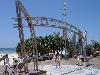
| Gold Coast, Queensland  FeatureType : null Elevation : 12 Lat/Lng : -28.0 / 153.431 | The Gold Coast is a coastal city in the Australian state of Queensland, approximately south-southeast of the state capital Brisbane and immediately north of the border with New South Wales. With a census-estimated 2016 population of 638,090, the Gold Coast is the sixth-largest city in Australia, (...) |
| 2 | 
| Innisfail, Queensland FeatureType : null Elevation : 13 Lat/Lng : -17.5221 / 146.031 | Innisfail (from Irish: Inis Fáil) a town and locality in the Cassowary Coast Region in Far North Queensland, Australia. The town was originally called Geraldton until 1910. It is the major township of the Cassowary Coast Region and is well renowned for its sugar and banana industries, as well as for (...) |
| 3 | 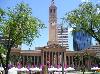
| Brisbane FeatureType : city Elevation : 47 Lat/Lng : -27.4678 / 153.0278 | Brisbane is the capital and most populous city of Queensland, and the third most populous city in Australia. Its estimated population is 2.5 million as of 2018, while the South East Queensland region, which is centred on Brisbane, encompasses a population of more than 3.5 million (...) |
| 4 | 
| Toowoomba FeatureType : null Elevation : 593 Lat/Lng : -27.55 / 151.95 | Toowoomba (nicknamed 'The Garden City') is a regional city in the Darling Downs region in the Australian state of Queensland. It is west of Queensland's capital city Brisbane by road. The estimated urban population of Toowoomba as of 2014 was 113,000 (...) |
| 5 | 
| Cooktown, Queensland FeatureType : city Lat/Lng : -15.4867 / 145.2837 | Cooktown is a town and locality in the Shire of Cook, Queensland, Australia. Cooktown is located about north of Brisbane and north of Cairns, by road. At the time of the 2016 census, Cooktown had a population of 2,631 (...) |
| 6 | 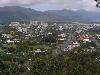
| Cairns FeatureType : null Lat/Lng : -16.9167 / 145.7797 | Cairns Macquarie Dictionary, Fourth Edition (2005). Melbourne, The Macquarie Library Pty Ltd. is a city in the Cairns Region, Queensland, Australia. It is on the east coast of Far North Queensland. The city is the 5th-most-populous in Queensland and ranks 14th overall in Australia (...) |
| 7 | 
| Surfers Paradise, Queensland FeatureType : city Elevation : -1 Lat/Lng : -28.0 / 153.4167 | Surfers Paradise is a suburb within the local government area of City of Gold Coast in Queensland, Australia. At the , Surfers Paradise had a population of 19,668. Colloquially known as 'Surfers', the suburb has many high-rise apartment buildings and a wide surf beach (...) |
| 8 | 
| Nambour, Queensland FeatureType : city Elevation : 19 Lat/Lng : -26.6261 / 152.9594 | Nambour is a town and locality in South East Queensland, Australia, north of the state capital, Brisbane. The town lies in the sub-tropical hinterland of the Sunshine Coast at the foot of the Blackall Range and has a population of 11,187 (...) |
| 9 | 
| Rockhampton FeatureType : city Elevation : 4 Lat/Lng : -23.3752 / 150.513 | Rockhampton is a city in the Rockhampton Region, Queensland, Australia. The estimated urban population of Rockhampton in June 2015 was 80,665, making it the fourth largest city in the state outside of the cities of South East Queensland. Estimated resident population, 30 June 2015 (...) |
| 10 | 
| Bowen, Queensland FeatureType : null Elevation : 4 Lat/Lng : -20.0167 / 148.2333 | Bowen is a coastal town and locality in the Whitsunday Region on the eastern coast of Queensland, Australia. The town of Merinda and the Abbot Point coal shipping port are also within the locality of Bowen. At the 2016 census, Bowen had a population of 10,377 (...) |
| 11 | 
| Mount Isa FeatureType : city Elevation : 352 Lat/Lng : -20.7283 / 139.4931 | Mount Isa is a city in the Gulf Country region of Queensland, Australia. It came into existence because of the vast mineral deposits found in the area. Mount Isa Mines (MIM) is one of the most productive single mines in world history, based on combined production of lead, silver, copper and zinc (...) |
| 12 | 
| Mount Morgan, Queensland FeatureType : null Elevation : 243 Lat/Lng : -23.6453 / 150.389 | Mount Morgan is a town and locality in Rockhampton Region, Queensland, Australia. The town was the administrative centre of the Mount Morgan Shire until March 2008, when it was amalgamated with neighbouring local government areas to form the Rockhampton Region (...) |
| 13 | 
| Great Barrier Reef FeatureType : isle Lat/Lng : -18.2861 / 147.7 | The Great Barrier Reef is the world's largest coral reef system composed of over 2,900 individual reefsThe Great Barrier Reef World Heritage Area, which is 348,000 km squared, has 2900 reefs. However, this does not include the reefs found in the Torres Strait, which has an estimated area of 37,000 (...) |
| 14 | 
| Brisbane Airport FeatureType : airport Elevation : 4 Lat/Lng : -27.3832 / 153.118 | Brisbane Airport is the primary international airport serving Brisbane and South East Queensland. The airport services 31 airlines flying to 50 domestic and 29 international destinations, in total amounting in more than 22.7 million passengers who travelled through the airport in 2016 (...) |
| 15 | 
| Herberton, Queensland FeatureType : city Elevation : 882 Lat/Lng : -17.3813 / 145.3838 | Herberton is a town and locality on the Atherton Tableland in Far North Queensland, Australia. In the , Herberton had a population of 855 people. (...) |
| 16 | 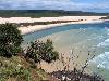
| Fraser Island FeatureType : null Elevation : 127 Lat/Lng : -25.2167 / 153.1333 | Fraser Island (K'gari, Gari) is a heritage-listed island located along the southeastern coast of the state of Queensland, Australia. It is approximately north of the state capital, Brisbane. Known as Fraser Island, it is a locality within the Fraser Coast local government in the Wide Bay–Burnett (...) |
| 17 | 
| Great Dividing Range FeatureType : mountain Elevation : 609 Lat/Lng : -25.0 / 147.0 | The Great Dividing Range, or the Eastern Highlands, is Australia's most substantial mountain range and the third longest land-based range in the world. It stretches more than from Dauan Island off the northeastern tip of Queensland, running the entire length of the eastern coastline through New (...) |
| 18 | 
| Longreach, Queensland FeatureType : city Elevation : 192 Lat/Lng : -23.4421 / 144.2492 | Longreach is a town in Central West Queensland, Australia, approximately from the coast, west of Rockhampton. The town is named after the "long reach" of the Thomson River on which it is situated. The town was gazetted in 1887, and the railway reached the town in 1892, causing the population to grow (...) |
| 19 | 
| Caboolture, Queensland FeatureType : null Elevation : 21 Lat/Lng : -27.0846 / 152.9511 | Caboolture Macquarie Dictionary, Fourth Edition (2005). Melbourne, The Macquarie Library Pty Ltd. is a town and suburb in Moreton Bay Region, Queensland, Australia. At the , the town of Caboolture had an estimated population of 67,460 (...) |
| 20 | 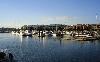
| Cleveland, Queensland FeatureType : null Elevation : 12 Lat/Lng : -27.5268 / 153.2652 | Cleveland is the central locality of Redland City, Queensland, Australia. In , Cleveland had a population of 14,801 people. (...) |
| 21 | 
| Stanthorpe, Queensland FeatureType : null Elevation : 811 Lat/Lng : -28.6562 / 151.9373 | Stanthorpe is a town situated in south east Queensland, Australia. The town lies on the New England Highway near the New South Wales border from Brisbane via Warwick, north of Tenterfield and 811 m above sea level. The area surrounding the town is known as the Granite Belt (...) |
| 22 | 
| Charleville, Queensland FeatureType : city Elevation : 300 Lat/Lng : -26.4016 / 146.2383 | Charleville is a town and a locality in the Shire of Murweh, Queensland, Australia. In the , Charleville had a population of 3,335 people. (...) |
| 23 | 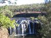
| Millstream Falls National Park FeatureType : null Elevation : 881 Lat/Lng : -17.6315 / 145.467 | Millstream Falls National Park is located just west of Ravenshoe, Queensland along the Kennedy Highway in Far North Queensland, Australia, 1,341 km northwest of Brisbane. Big Millstream Falls are reputedly the widest single-drop falls in Australia. (...) |
| 24 | 
| Torres Strait FeatureType : waterbody Lat/Lng : -9.8803 / 142.5906 | The Torres Strait is a strait which lies between Australia and the Melanesian island of New Guinea. It is approximately wide at its narrowest extent. To the south is Cape York Peninsula, the northernmost extremity of the Australian mainland. To the north is the Western Province of Papua New Guinea (...) |
| 25 | 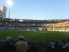
| The Gabba FeatureType : landmark Elevation : 9 Lat/Lng : -27.4858 / 153.0381 | The Brisbane Cricket Ground, commonly known as the Gabba, is a major sports stadium in Brisbane, the capital of Queensland, Australia. The nickname Gabba derives from the suburb of Woolloongabba, in which it is located (...) |
| 26 | 
| Stadium Australia FeatureType : landmark Elevation : 26 Lat/Lng : -33.8471 / 151.0634 | Stadium Australia, commercially known as ANZ Stadium and formerly as Telstra Stadium, is a multi-purpose stadium located in the Sydney Olympic Park, in Sydney, Australia. The stadium, which in Australia is sometimes referred to as Sydney Olympic Stadium, Homebush Stadium or simply the Olympic (...) |
| 27 | 
| Moreton Island FeatureType : null Elevation : 78 Lat/Lng : -27.1832 / 153.4097 | Moreton Island is an island on the eastern side of Moreton Bay on the coast of South East Queensland, Australia. The Coral Sea lies on the east coast of the island. Moreton Island lies northeast of the Queensland capital, Brisbane (...) |
| 28 | 
| Ashgrove, Queensland FeatureType : null Elevation : 36 Lat/Lng : -27.4453 / 152.9919 | Ashgrove is an inner suburb in the City of Brisbane in Queensland, Australia. It is located approximately north-west of the Brisbane CBD. Ashgrove is an upmarket, leafy residential suburb characterised by its hilly terrain and characteristic Ashgrovian houses built in the early 20th century (...) |
| 29 | 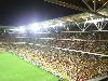
| Lang Park FeatureType : null Elevation : 8 Lat/Lng : -27.4647 / 153.0094 | Lang Park, also known as Brisbane Stadium, and by the sponsored name Suncorp Stadium, is a multi-purpose stadium in Brisbane, Queensland, Australia, located in the suburb of Milton. The current facility comprises a three-tiered rectangular sporting stadium with a capacity of 52,500 people (...) |
| 30 | 
| Moreton Bay FeatureType : waterbody Lat/Lng : -27.2653 / 153.2595 | The Moreton Bay is a bay located on the eastern coast of Australia from central Brisbane, Queensland. It is one of Queensland's most important coastal resources. The waters of Moreton Bay are a popular destination for recreational anglers and are used by commercial operators who provide seafood to (...) |
| 31 | 
| Noosa Heads, Queensland FeatureType : city Elevation : 47 Lat/Lng : -26.3943 / 153.0901 | Noosa Heads is a town and suburb of the Shire of Noosa on the Sunshine Coast, Queensland, Australia. It is located approximately north of Brisbane, the state's capital. (...) |
| 32 | 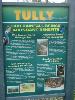
| Tully, Queensland FeatureType : null Elevation : 36 Lat/Lng : -17.9326 / 145.9228 | Tully is a town and locality in the Cassowary Coast Region, Queensland, Australia. It is adjacent to the Bruce Highway approximately south of Cairns by road and north of Townsville. In the , Tully had a population of 2,390 people (...) |
| 33 | 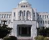
| Ehime Prefecture FeatureType : null Elevation : 261 Lat/Lng : 33.8333 / 132.8333 | is a prefecture in northwestern Shikoku, Japan.Nussbaum, Louis-Frédéric. (2005). "Ehime" in . The capital is Matsuyama.Nussbaum, "Matsuyama" at . (...) |
| 34 | 
| Australia FeatureType : city Elevation : 607 Lat/Lng : -35.3081 / 149.1244 | Australia, officially the Commonwealth of Australia, is a sovereign country comprising the mainland of the Australian continent, the island of Tasmania and numerous smaller islands. It is the largest country in Oceania and the world's sixth-largest country by total area (...) |
| 35 | 
| Foshan FeatureType : adm2nd Elevation : 8 Lat/Lng : 23.022 / 113.1207 | Foshan, formerly romanized as Fatshan, is a prefecture-level city in central Guangdong Province, China. The entire prefecture covers and has an urban population around 7.2 million in 2012. It forms part of the western side of the Pearl River Delta Economic Zone, which includes Guangzhou to the east (...) |
| 36 | 
| Kangaroo Island FeatureType : isle Elevation : 110 Lat/Lng : -35.8272 / 137.2678 | Kangaroo Island is Australia's third-largest island, after Tasmania and Melville Island. It lies in the state of South Australia southwest of Adelaide. Its closest point to the mainland is Snapper Point in Backstairs Passage which is from the Fleurieu Peninsula (...) |
| 37 | 
| Pézenas FeatureType : null Elevation : 31 Lat/Lng : 43.4606 / 3.4236 | Pézenas (Languedocien: Pesenàs) is a commune in the Hérault department in the Occitanie region in southern France. (...) |
| 38 | 
| Lake Eyre FeatureType : waterbody Elevation : -15 Lat/Lng : -28.3667 / 137.3667 | Lake Eyre , officially known as Kati Thanda–Lake Eyre, contains the lowest natural point in Australia, at approximately below sea level (AHD), and, on the rare occasions that it fills, is the largest lake in Australia covering (...) |
| 39 | 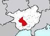
| Nanning FeatureType : null Elevation : 91 Lat/Lng : 22.8167 / 108.3167 | Nanning (; Zhuang: ') is the capital of the Guangxi Zhuang Autonomous Region in southern China. It is known as the "Green City" because of its abundance of lush subtropical foliage. As of 2014 it had a population of 6,913,800 with 4,037,000 in its urban area. (...) |
| 40 | 
| Martin Luther University of Halle-Wittenberg FeatureType : edu Elevation : 97 Lat/Lng : 51.4864 / 11.9689 | The Martin Luther University of Halle-Wittenberg , also referred to as MLU, is a public, research-oriented university in the cities of Halle and Wittenberg in Saxony-Anhalt, Germany. MLU offers German and international (English) courses leading to academic degrees such as BA, BSc, MA, MSc, doctoral (...) |
| 41 | 
| Saitama Prefecture FeatureType : adm1st Elevation : 15 Lat/Lng : 35.95 / 139.55 | is a prefecture of Japan located in the Kantō region.Nussbaum, Louis-Frédéric. (2005). "Saitama prefecture" in ; "Kantō" in . The capital is the city of Saitama. This prefecture is part of the Greater Tokyo Area, and most of Saitama's cities can be described as suburbs of Tokyo, to which a large (...) |
| 42 | 
| Kuranda, Queensland FeatureType : null Elevation : 357 Lat/Lng : -16.8198 / 145.6382 | Kuranda is a town and locality on the Atherton Tableland in the Shire of Mareeba, Far North Queensland, Australia. The town of Myola is also located within the locality of Kuranda. It is from Cairns, via the Kuranda Range road (...) |
| 43 | 
| University of New South Wales FeatureType : edu Elevation : 52 Lat/Lng : -33.9169 / 151.2325 | The University of New South Wales (UNSW; branded as UNSW Sydney) is an Australian public research university located in the Sydney suburb of Kensington. Established in 1949, it is ranked 4th in Australia, 45th in the world, and 2nd in New South Wales according to the 2018 QS World University (...) |
| 44 | 
| Port Moresby FeatureType : city Elevation : 26 Lat/Lng : -9.4789 / 147.1494 | (; Tok Pisin: Pot Mosbi), also referred to as Pom City or simply Moresby, is the capital and largest city of Papua New Guinea and the largest city in the South Pacific outside of Australia and New Zealand. It is located on the shores of the Gulf of Papua, on the south-western coast of the Papuan (...) |
| 45 | 
| Gordonvale, Queensland FeatureType : city Elevation : 25 Lat/Lng : -17.0936 / 145.7866 | Gordonvale is a small sugar-growing town and locality situated on the southern side of Cairns in the Cairns Region, Queensland, Australia. In the , Gordonvale had a population of 6,671 people. (...) |
| 46 | 
| North Stradbroke Island FeatureType : isle Elevation : 95 Lat/Lng : -27.5279 / 153.4608 | North Stradbroke Island (Indigenous: Minjerribah), colloquially Straddie or North Straddie, is an island that lies within Moreton Bay in the Australian state of Queensland, southeast of the capital Brisbane. Before 1896 the island was part of the Stradbroke Island (...) |
| 47 | 
| Barron Gorge National Park FeatureType : null Elevation : 381 Lat/Lng : -16.8428 / 145.6522 | Barron Gorge National Park is a protected area in the Cairns Region, Queensland, Australia. It is predominantly within the locality of Barron Gorge. (...) |
| 48 | 
| Bribie Island FeatureType : null Elevation : 5 Lat/Lng : -26.9485 / 153.128 | Bribie Island is the smallest and most northerly of three major sand islands forming the coastline sheltering the northern part of Moreton Bay, Queensland, Australia. The others are Moreton Island and North Stradbroke Island. Bribie Island is long, and at its widest (...) |
| 49 | 
| Ipswich FeatureType : null Elevation : 10 Lat/Lng : 52.0548 / 1.1575 | Ipswich is the county town of Suffolk, England, located on the estuary of the River Orwell, about north east of London. The town has been continuously occupied since the Saxon period, and its port has been one of England's most important for the whole of its history (...) |
| 50 | 
| New Guinea FeatureType : isle Elevation : 2230 Lat/Lng : -5.3258 / 141.6072 | New Guinea (; ; ; , historically, ') is a large island off the continent of Australia. It is the world's second-largest island, after Greenland, covering a land area of , and the largest wholly or partly within the Southern Hemisphere and Oceania (...) |
| 51 | 
| Norfolk Island FeatureType : null Elevation : 96 Lat/Lng : -29.03 / 167.95 | Norfolk Island (; Norfuk: Norf'k Ailen) is a small island in the Pacific Ocean located between Australia, New Zealand, and New Caledonia, directly east of mainland Australia's Evans Head, and about from Lord Howe Island (...) |
| 52 | 
| Gulf of Carpentaria FeatureType : waterbody Lat/Lng : -14.0 / 139.0 | The Gulf of Carpentaria is a large, shallow sea enclosed on three sides by northern Australia and bounded on the north by the Arafura Sea (the body of water that lies between Australia and New Guinea). The northern boundary is generally defined as a line from Slade Point, Queensland (the (...) |
| 53 | 
| Toowong FeatureType : null Elevation : 24 Lat/Lng : -27.487 / 152.984 | Toowong is an inner suburb of Brisbane, Australia, which is west of the Brisbane CBD. At the centre of Toowong is a commercial precinct including Toowong Village and several office buildings. The remainder of the suburb is predominantly residential with a mix of medium density dwellings and detached (...) |
| 54 | 
| Netanya FeatureType : null Elevation : 15 Lat/Lng : 32.3333 / 34.85 | Netanya (lit., "God gave";) is a city in the Northern Central District of Israel, and is the capital of the surrounding Sharon plain. It is north of Tel Aviv, and south of Haifa, between the 'Poleg' stream and Wingate Institute in the south and the 'Avichail' stream in the north (...) |
| 55 | 
| Sulawesi FeatureType : isle Elevation : 1036 Lat/Lng : -2.1333 / 120.2833 | Sulawesi, formerly known as Celebes , is an island in Indonesia. One of the four Greater Sunda Islands, and the world's eleventh-largest island, it is situated east of Borneo, west of the Maluku Islands, and south of Mindanao and the Sulu Archipelago (...) |
| 56 | 
| Fiji FeatureType : country Elevation : 175 Lat/Lng : -17.8133 / 179.4122 | Fiji (; ; Fiji Hindi: फ़िजी), officially the Republic of FijiIn February 2011, the Prime Minister's Office issued a statement saying that the name of the state had been officially changed from the Republic of the Fiji Islands to the Republic of Fiji, and that the name written in the 1997 (...) |
| 57 | 
| Maleny, Queensland FeatureType : city Elevation : 419 Lat/Lng : -26.758 / 152.8513 | Maleny is a town and a locality in the Sunshine Coast Region of the Australian state of Queensland. It is north of Brisbane on the Blackall Range overlooking the Sunshine Coast hinterland. Nearby towns include Landsborough, Montville, Peachester, Palmwoods and Hunchy (...) |
| 58 | 
| Melbourne Cricket Ground FeatureType : landmark Elevation : 10 Lat/Lng : -37.82 / 144.9832 | The Melbourne Cricket Ground (MCG), also known simply as "The G", is an Australian sports stadium located in Yarra Park, Melbourne, Victoria. Home to the Melbourne Cricket Club, it is the 10th-largest stadium in the world, the largest in Australia, the largest in the Southern Hemisphere, the largest (...) |
| 59 | 
| Da Nang FeatureType : null Elevation : 7 Lat/Lng : 16.0486 / 108.2206 | Da Nang is the fifth largest city in Vietnam after Ho Chi Minh City (Saigon), Hanoi, Can Tho and Haiphong in terms of urbanization and economy. Located on the coast of the South China Sea at the mouth of the Han River, it is one of Vietnam's most important port cities (...) |
| 60 | 
| Solomon Islands FeatureType : country Elevation : 553 Lat/Lng : -9.6667 / 160.2 | Solomon Islands is a country consisting of six major islands and over 900 smaller islands in Oceania lying to the east of Papua New Guinea and northwest of Vanuatu and covering a land area of . The country's capital, Honiara, is located on the island of Guadalcanal (...) |
| 61 | 
| New Caledonia FeatureType : country Elevation : 133 Lat/Lng : -21.0714 / 165.3433 | New Caledonia Previously known officially as the "Territory of New Caledonia and Dependencies" , then simply as the "Territory of New Caledonia" (French: Territoire de la Nouvelle-Calédonie), the official French name is now only Nouvelle-Calédonie (Organic Law of 19 March 1999, article 222 IV – see) (...) |
| 62 | 
| Hobart FeatureType : null Lat/Lng : 42.8806 / 147.325 | Hobart is the capital and most populous city of the Australian island state of Tasmania. With a population of approximately 225,000 (over 40% of Tasmania's population), it is the least populated Australian state capital city (...) |
| 63 | 
| Fortaleza FeatureType : null Elevation : 21 Lat/Lng : -3.7169 / -38.5428 | Fortaleza (locally , Portuguese for Fortress) is the state capital of Ceará, located in Northeastern Brazil. It belongs to the Metropolitan mesoregion of Fortaleza and microregion of Fortaleza. Located 2285 km (1420 miles) from Brasilia, the federal capital, the city has developed on the banks of (...) |
| 64 | 
| University of Sydney FeatureType : edu Elevation : 31 Lat/Lng : -33.8878 / 151.1872 | The University of Sydney (USYD, or informally Sydney Uni) is an Australian public research university in Sydney, Australia. Founded in 1850, it was Australia's first university and is regarded as one of the world's leading universities (...) |
| 65 | 
| Geraldton FeatureType : null Elevation : 15 Lat/Lng : -28.779 / 114.6146 | Geraldton is a coastal city in the Mid West region of Western Australia, north of Perth. At the 2016 Census, Geraldton had an urban population of 37,432. Geraldton is the seat of government for the City of Greater Geraldton, which also incorporates the town of Mullewa, Walkaway and large rural areas (...) |
| 66 | 
| Kakadu National Park FeatureType : null Elevation : 53 Lat/Lng : -13.0364 / 132.4397 | Kakadu National Park is a protected area in the Northern Territory of Australia, 171 km southeast of Darwin. The park is located within the Alligator Rivers Region of the Northern Territory. It covers an area of , extending nearly 200 kilometres from north to south and over 100 kilometres from east (...) |
| 67 | 
| Darwin, Northern Territory FeatureType : city Elevation : 30 Lat/Lng : -12.4362 / 130.8412 | Darwin Macquarie Dictionary, Fourth Edition (2005). Melbourne, The Macquarie Library Pty Ltd. is the capital city of the Northern Territory of Australia. Situated on the Timor Sea, Darwin is the largest city in the sparsely populated Northern Territory, with a population of 145,916 (...) |
| 68 | 
| Abu Dhabi FeatureType : city Elevation : 5 Lat/Lng : 24.465 / 54.3659 | Abu Dhabi is the capital and the second most populous city of the United Arab Emirates (the most populous being Dubai), and also capital of the Emirate of Abu Dhabi, the largest of the UAE's seven emirates. Abu Dhabi lies on a T-shaped island jutting into the Persian Gulf from the central western (...) |
| 69 | 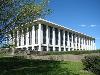
| Canberra FeatureType : city Elevation : 602 Lat/Lng : -35.3075 / 149.1244 | Canberra is the capital city of Australia. With a population of 403,468, it is Australia's largest inland city and the eighth-largest city overall. The city is located at the northern end of the Australian Capital Territory (ACT), south-west of Sydney, and north-east of Melbourne (...) |
| 70 | 
| Bathurst, New South Wales FeatureType : city Elevation : 695 Lat/Lng : -33.4167 / 149.5667 | Bathurst is a regional city in the Central Tablelands of New South Wales, Australia. It is about north-west of Sydney and is the seat of the Bathurst Regional Council. Bathurst is the oldest inland settlement in Australia and had a population of approximately 35,000 as at the 2016 Census (...) |
| 71 | 
| Tainan FeatureType : null Elevation : 4 Lat/Lng : 22.9833 / 120.1833 | Tainan (Hokkien POJ: Tâi-lâm), officially Tainan City, is a special municipality of Taiwan, facing the Formosan Strait or Taiwan Strait in the west and south. Tainan is the oldest city on the island of Taiwan and also commonly known as the "Capital City" (; POJ: Hú-siâⁿ) for its over 200 years of (...) |
| 72 | 
| Sydney FeatureType : city(4575532) Elevation : 72 Lat/Lng : -33.8694 / 151.2083 | Sydney is the state capital of New South Wales and the most populous city in Australia and Oceania. Located on Australia's east coast, the metropolis surrounds Port Jackson and extends about on its periphery towards the Blue Mountains to the west, Hawkesbury to the north, and Macarthur to the south (...) |
| 73 | 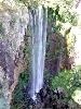
| Main Range National Park FeatureType : null Elevation : 513 Lat/Lng : -27.8158 / 152.2656 | The Main Range is a mountain range and a national park in Queensland, Australia, located predominantly in Tregony, Southern Downs Region southwest of Brisbane. It is part of the World Heritage Site Gondwana Rainforests of Australia (formerly known as the Central Eastern Rainforest Reserves) (...) |
| 74 | 
| Lord Howe Island FeatureType : landmark Elevation : 61 Lat/Lng : -31.5531 / 159.0839 | Lord Howe Island (; formerly Lord Howe's Island) is an irregularly crescent-shaped volcanic remnant in the Tasman Sea between Australia and New Zealand, directly east of mainland Port Macquarie, northeast of Sydney, and about southwest of Norfolk Island (...) |
| 75 | 
| Dubai FeatureType : adm1st Elevation : 4 Lat/Lng : 25.205 / 55.2698 | Dubai is the largest and most populous city in the United Arab Emirates (UAE). On the southeast coast of the Persian Gulf, it is the capital of the Emirate of Dubai, one of the seven emirates that make up the country.The Government and Politics of the Middle East and North Africa. D Long, B Reich. p (...) |
| 76 | 
| Chengdu FeatureType : adm2nd Elevation : 507 Lat/Lng : 30.657 / 104.066 | Chengdu , formerly romanized as Chengtu, is a sub-provincial city which serves as the capital of Sichuan province, People's Republic of China. It is one of the three most populous cities in Western China, the other two being Chongqing and Xi'an (...) |
| 77 | 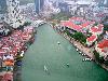
| Singapore FeatureType : city Elevation : 18 Lat/Lng : 1.35 / 103.85 | Singapore , officially the Republic of Singapore (Malay: ; Chinese: ; Tamil:), is a sovereign city-state and island country in Southeast Asia. It lies one degree north of the equator, at the southern tip of the Malay Peninsula, with Indonesia's Riau Islands to the south and Peninsular Malaysia to (...) |
| 78 | 
| Palm Island, Queensland FeatureType : null Elevation : 56 Lat/Lng : -18.7333 / 146.5833 | Palm Island is an Aboriginal community located on Great Palm Island, also called by the Aboriginal name "Bwgcolman", an island on the Great Barrier Reef in North Queensland, AustraliaBindloss, Joseph (2002) page 330 The settlement is also known by a variety of other names including "the Mission", (...) |
| 79 | 
| Cherbourg-Octeville FeatureType : null Elevation : 6 Lat/Lng : 49.6389 / -1.6161 | Cherbourg-Octeville is a city and former commune situated at the northern end of the Cotentin peninsula in the northwestern French department of Manche. It is a subprefecture of its department, and was officially formed when the commune of Cherbourg absorbed Octeville on 28 February 2000 (...) |
| 80 | Queensland FeatureType : null Elevation : 278 Lat/Lng : -23.0 / 143.0 | Queensland (abbreviated as Qld) is the second-largest and third-most populous state in the Commonwealth of Australia. Situated in the north-east of the country, it is bordered by the Northern Territory, South Australia and New South Wales to the west, south-west and south respectively (...) | |
| 81 | 
| Geography of Australia FeatureType : country Elevation : 191 Lat/Lng : -27.0 / 144.0 | The geography of Australia encompasses a wide variety of biogeographic regions being the world's smallest continent but the sixth-largest country in the world. The population of Australia is concentrated along the eastern and southeastern coasts (...) |
| 82 | 
| Lismore, New South Wales FeatureType : null Elevation : 11 Lat/Lng : -28.8135 / 153.2773 | Lismore is a city in northeastern New South Wales, Australia and the main population centre in the City of Lismore local government area; it is also a regional centre in the Northern Rivers region of the State. According to the 2016 Australian Census, the population in the Lismore urban centre was (...) |
| 83 |
| Moreton Island National Park FeatureType : null Elevation : 122 Lat/Lng : -27.152 / 153.3991 | Moreton Island National Park is a national park which covers 98% of Moreton Island in Queensland, Australia, 58 km northeast of Brisbane. It has three main townships, Bulwer, Cowan Cowan and Kooringal. The island is home to Queensland's oldest operating lighthouse located at Cape Moreton on the (...) |
| 84 | 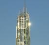
| Q1 (building) FeatureType : landmark Elevation : 17 Lat/Lng : -28.0062 / 153.4294 | Q1 (an abbreviation of Queensland Number One) is a skyscraper in Surfers Paradise, Queensland, Australia. The residential tower on the Gold Coast lost its title as the world's tallest residential building to the The Marina Torch in Dubai on 29 April 2011 (...) |
| 85 | 
| Whitsunday Islands FeatureType : isle Elevation : 46 Lat/Lng : -20.3 / 148.9333 | The Whitsunday Islands are a collection of continental islands of various sizes off the central coast of Queensland, Australia, approximately north of Brisbane. The northernmost of the islands are situated off the coast by the town of Bowen while the southernmost islands are off the coast by (...) |
| 86 | 
| Dirranbandi, Queensland FeatureType : null Elevation : 175 Lat/Lng : -28.5854 / 148.2255 | Dirranbandi is a town and locality in South West Queensland, Australia, located in the Shire of Balonne. At the 2011 census, Dirranbandi had a population of 711. It sits on the Castlereagh Highway and the Balonne River (...) |
| 87 | 
| Grafton, New South Wales FeatureType : null Elevation : 11 Lat/Lng : -29.6901 / 152.9334 | Grafton is a city in the Northern Rivers region of the Australian state of New South Wales. It is located on the Clarence River, approximately north-northeast of the state capital Sydney. The closest major cities, Brisbane and the Gold Coast, are located across the border in South-East Queensland (...) |
| 88 | 
| Tweed Heads, New South Wales FeatureType : city Elevation : 5 Lat/Lng : -28.1756 / 153.542 | Tweed Heads is a city in New South Wales. It is located on the Tweed River in north-eastern New South Wales, Australia, in Tweed Shire. Tweed Heads is located next to the border with Queensland, adjacent to its "Twin Town" of Coolangatta, which is a suburb of the Gold Coast (...) |
| 89 | 
| Eidsvoll FeatureType : adm2nd Lat/Lng : 60.3475 / 11.2508 | Eidsvoll (sometimes written as Eidsvold) is a municipality in Akershus county, Norway. It is part of the Romerike traditional region. The administrative centre of the municipality is the village of Sundet. (...) |
| 90 | 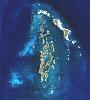
| Montebello Islands FeatureType : isle Elevation : 6 Lat/Lng : -20.4667 / 115.5333 | The Montebello Islands, also known as the Monte Bello Islands, are an archipelago of around 174 small islands (about 92 of which are named) lying north of Barrow Island and off the Pilbara coast of north-western Australia. Montebello is Italian for "beautiful mountain" (...) |
| 91 | 
| Sydney Football Stadium FeatureType : landmark Elevation : 51 Lat/Lng : -33.8891 / 151.2253 | The Sydney Football Stadium, commercially known as Allianz Stadium and previously Aussie Stadium, is a closed football stadium in Moore Park, Sydney, Australia. Built in 1988 next to the Sydney Cricket Ground, the stadium was Sydney's premier rectangular field venue for rugby league, rugby union and (...) |
| 92 | University of Queensland FeatureType : edu Elevation : 30 Lat/Lng : -27.4978 / 153.0128 | The University of Queensland (UQ) is a public research university primarily located in Queensland's capital city, Brisbane, Australia. UQ is considered to be one of Australia's leading universities, and is ranked as the 48th most reputable university in the world (...) | |
| 93 | 
| Airlie Beach, Queensland FeatureType : city Elevation : 15 Lat/Lng : -20.2679 / 148.716 | Airlie Beach is a coastal locality in the Whitsunday Region of Queensland, Australia. In the , Airlie Beach had a population of 1,208 people. (...) |
| 94 |
| Australian Alps FeatureType : mountain Elevation : 1372 Lat/Lng : -37.0 / 148.0 | The Australian Alps, an interim Australian bioregion, data is the highest mountain range in Australia. This range is located in southeastern Australia, and it straddles eastern Victoria, southeastern New South Wales, and the Australian Capital Territory (...) |
| 95 | 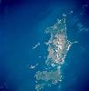
| Flinders Island FeatureType : null Elevation : 63 Lat/Lng : -40.017 / 148.06 | Flinders Island, the largest island in the Furneaux Group, is a island located in the Bass Strait, northeast of the island of Tasmania. Flinders Island is part of the state of Tasmania, Australia, and is situated from Cape Portland and it is located on 40° south, a zone known as the Roaring Forties (...) |
| 96 | 
| Largs FeatureType : city Elevation : 13 Lat/Lng : 55.7963 / -4.8634 | Largs is a town on the Firth of Clyde in North Ayrshire, Scotland, about from Glasgow. The original name means "the slopes" (An Leargaidh) in Scottish Gaelic. A popular seaside resort with a pier, the town markets itself on its historic links with the Vikings and an annual festival is held each year (...) |
| 97 | 
| Tamworth, New South Wales FeatureType : city Elevation : 378 Lat/Lng : -31.0833 / 150.9167 | Tamworth is a city and the major regional centre in the New England region of northern New South Wales, Australia. Situated on the Peel River within the local government area of Tamworth Regional Council, approximately 318 kilometres from the Queensland border, it is located almost midway between (...) |
| 98 | 
| Grampians National Park FeatureType : forest Elevation : 233 Lat/Lng : -37.2078 / 142.3997 | The Grampians National Park (also Gariwerd), commonly referred to as The Grampians, is a national park located in the Grampians region of Victoria, Australia. The national park is situated between and on the Western Highway and on the Glenelg Highway, west of Melbourne and east of Adelaide (...) |
| 99 | Maryborough, Queensland FeatureType : city Elevation : 11 Lat/Lng : -25.5407 / 152.7049 | Maryborough Macquarie Dictionary, Fourth Edition (2005). Melbourne, The Macquarie Library Pty Ltd. is a city and a suburb in the Fraser Coast Region, Queensland, Australia. It is located on the Mary River in Queensland, Australia, approximately north of the state capital, Brisbane (...) | |
| 100 | 
| Queanbeyan FeatureType : null Elevation : 581 Lat/Lng : -35.3542 / 149.2314 | Queanbeyan is a city in south-eastern region of the Australian state of New South Wales, located adjacent to the ACT in the Southern Tablelands region. Located on the Queanbeyan River, the city is the council seat of the Queanbeyan-Palerang Regional Council (...) |
| 101 | 
| High Court of Australia FeatureType : landmark Elevation : 575 Lat/Lng : -35.2989 / 149.1356 | The High Court of Australia is the supreme court in the Australian court hierarchy and the final court of appeal in Australia. It has both original and appellate jurisdiction, the power of judicial review over laws passed by the Parliament of Australia and the parliaments of the states, and the (...) |
| 102 | 
| Daintree National Park FeatureType : null Elevation : 247 Lat/Lng : -15.9592 / 145.4019 | The Daintree rainforest is a national park in Far North Queensland, Australia, northwest of Brisbane and northwest of Cairns. It was founded in 1981 and is part of the Wet Tropics of Queensland. In 1988 it became a World Heritage Site (...) |
| 103 | 
| Magnetic Island FeatureType : null Elevation : 284 Lat/Lng : -19.1333 / 146.8333 | Magnetic Island is an island offshore from the city of Townsville, Queensland, Australia. This mountainous island in Cleveland Bay has effectively become a suburb of Townsville, with 2,107 permanent residents. The island is accessible from Townsville Breakwater to Nelly Bay Harbour by ferry (...) |
| 104 | 
| Stuart, Queensland FeatureType : city Elevation : 7 Lat/Lng : -19.3216 / 146.8547 | Stuart is a rural suburb of the City of Townsville, Queensland, Australia. In the , Stuart had a population of 1,386 people. (...) |
| 105 | Ipswich, Queensland FeatureType : city Elevation : 42 Lat/Lng : -27.6167 / 152.7667 | Ipswich is an urban region in south-east Queensland, Australia, which is located in the south-west of the Brisbane metropolitan area. Situated on the Bremer River, it is approximately west of the Brisbane CBD. A local government area, the City of Ipswich has a population of 200,000 (projected to (...) | |
| 106 | 
| Tregole National Park FeatureType : null Elevation : 456 Lat/Lng : -26.4798 / 147.0673 | Tregole is a national park in South West Queensland, Australia, 603 km west of Brisbane. Until the gazetting of the park in 1975, the area was a grazing property. The park is located where the brigalow and mulga biospheres meet and has a representative sample of semi-arid ecosystems (...) |
| 107 | Sunshine Coast, Queensland FeatureType : null Elevation : 7 Lat/Lng : -26.6492 / 153.0458 | Sunshine Coast is a peri-urban area and the third most populated area in the Australian state of Queensland. Located north of the state capital Brisbane in South East Queensland on the Pacific Ocean coastline, its urban area spans approximately of coastline and hinterland from Pelican Waters to (...) | |
| 108 | 
| Sydney Cricket Ground FeatureType : landmark Elevation : 45 Lat/Lng : -33.8917 / 151.2247 | The Sydney Cricket Ground (SCG) is a sports stadium in Sydney, Australia. It is used for Test, One Day International and Twenty20 cricket, as well as Australian rules football, rugby league football and rugby union (...) |
| 109 | 
| Springbrook National Park FeatureType : null Elevation : 555 Lat/Lng : -28.2087 / 153.2914 | The Springbrook National Park is a protected national park that is located in the Gold Coast hinterland of Queensland, Australia. The park is situated on the McPherson Range, near Springbrook, approximately south of Brisbane (...) |
| 110 | Electoral district of Gregory FeatureType : adm2nd Elevation : 293 Lat/Lng : -24.65 / 145.3667 | Gregory is a Legislative Assembly of Queensland electoral district in Queensland, Australia. (...) | |
| 111 | 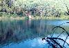
| Blue Lake National Park FeatureType : landmark Elevation : 96 Lat/Lng : -27.5217 / 153.4774 | Blue Lake National Park is a national park in Queensland, Australia, east of Brisbane on North Stradbroke Island. Access is provided by road west of Dunwich. Camping, open fires, and domestic animals are not permitted in the park. (...) |
| 112 | 
| Ibusuki, Kagoshima FeatureType : null Elevation : 7 Lat/Lng : 31.2528 / 130.6331 | is a city located in Kagoshima Prefecture, Japan, founded on April 1, 1954. As of March 1, 2012, the city has an estimated population of 43,931, with 19,119 households and a population density of 294.82 persons per km2. The total area is 149.01 km2 and shares a border with Ei, a town to its north (...) |
| 113 | 
| Olean, New York FeatureType : city Elevation : 450 Lat/Lng : 42.0819 / -78.4321 | Olean is a city in Cattaraugus County, New York, United States. Olean is the largest city in Cattaraugus County and serves as its financial, business, transportation and entertainment center. It is one of the principal cities of the Southern Tier region of New York (...) |
| 114 | 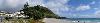
| Tauranga FeatureType : null Elevation : 21 Lat/Lng : -37.6875 / 176.1656 | Tauranga is the most populous city in the Bay of Plenty region of the North Island of New Zealand. It was settled by Māori late in the 13th century and by Europeans in the early 19th century and was constituted as a city in 1963 (...) |
| 115 | 
| Kythira FeatureType : isle Elevation : 211 Lat/Lng : 36.2445 / 22.996 | Kythira (; , also transliterated as Cythera, Kythera and KithiraThe Italian Cerigo can be used in speaking of late medieval and early modern Kythira.) is an island in Greece lying opposite the south-eastern tip of the Peloponnese peninsula (...) |
| 116 | 
| University of Western Australia FeatureType : edu Elevation : 6 Lat/Lng : -31.9803 / 115.8186 | The University of Western Australia (UWA) is a public research university in the Australian state of Western Australia. The university's main campus is in Perth, the state capital, with a secondary campus in Albany and various other facilities elsewhere (...) |
| 117 | 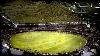
| Docklands Stadium FeatureType : landmark Elevation : 20 Lat/Lng : -37.8165 / 144.9476 | Marvel Stadium, also known as Docklands Stadium when excluding sponsorship name rights, is a multi-purpose sports and entertainment stadium in the Docklands precinct of Melbourne, Victoria, Australia. Construction started in October 1997, under the working name "Victoria Stadium", and was completed (...) |
| 118 | 
| Tolga, Queensland FeatureType : city Elevation : 758 Lat/Lng : -17.223 / 145.4788 | Tolga is a town and locality on the Atherton Tableland in the Tablelands Region in Far North Queensland, Australia. It is the centre of the region's peanut industry. In the 2016 census, the population of Tolga was 2718. (...) |
| 119 | Mackay, Queensland FeatureType : null Elevation : 10 Lat/Lng : -21.146 / 149.182 | Mackay is a city and its centre suburb in the Mackay Region on the eastern coast of Queensland, Australia. It is located about north of Brisbane, on the Pioneer River. Mackay is nicknamed the sugar capital of Australia because its region produces more than a third of Australia's sugar. (...) | |
| 120 | 
| Millaa Millaa, Queensland FeatureType : null Elevation : 782 Lat/Lng : -17.5167 / 145.6167 | Millaa Millaa is a small town and locality on the Atherton Tableland in Far North Queensland, Australia. It is located approximately west of Innisfail, north of Ravenshoe, south of Malanda. In the 2011 census, Millaa Millaa had a population of 598 people (...) |
| 121 | 
| Whanganui FeatureType : null Elevation : 16 Lat/Lng : -39.9303 / 175.0478 | Whanganui , also spelled Wanganui, is a city on the west coast of the North Island of New Zealand. The Whanganui River, New Zealand's longest navigable waterway, runs from Mount Tongariro to the sea. Whanganui is part of the Manawatu-Wanganui region (...) |
| 122 | 
| Hastings, New Zealand FeatureType : city Elevation : 16 Lat/Lng : -39.639 / 176.8401 | Hastings is a New Zealand city and is one of the two major urban areas in Hawke's Bay, on the east coast of the North Island of New Zealand. The population of Hastings is about Hastings is about 18 kilometres inland of the coastal city of Napier (...) |
| 123 | 
| Australian War Memorial FeatureType : landmark Elevation : 596 Lat/Lng : -35.2805 / 149.1491 | The Australian War Memorial is Australia's national memorial to the members of its armed forces and supporting organisations who have died or participated in wars involving the Commonwealth of Australia, and some conflicts involving personnel from the Australian colonies prior to Federation (...) |
| 124 | 
| Kingaroy FeatureType : null Elevation : 433 Lat/Lng : -26.5399 / 151.8373 | Kingaroy Macquarie Dictionary, Fourth Edition (2005). Melbourne, The Macquarie Library Pty Ltd. is an agricultural town and locality in the South Burnett Region, Queensland, Australia. It is approximately or about 2½ hours drive north-west of the state capital Brisbane (...) |
| 125 | 
| Gold Coast Airport FeatureType : null Elevation : 6 Lat/Lng : -28.1647 / 153.505 | Gold Coast Airport (formerly known as Coolangatta Airport) is an international Australian airport located at the southern end of the Gold Coast and approximately south of center of Brisbane, within South East Queensland agglomeration (...) |
| 126 | 
| Border Ranges National Park FeatureType : null Elevation : 280 Lat/Lng : -28.3597 / 152.9861 | The Border Ranges National Park is a protected national park that is located in the Northern Rivers region of New South Wales, Australia. A small portion of the national park is also located in South East Queensland. The park is situated approximately south of Brisbane, north of (...) |
| 127 | 
| Eumundi, Queensland FeatureType : city Elevation : 42 Lat/Lng : -26.4833 / 152.95 | Eumundi is a small town and locality in the Sunshine Coast hinterland in the Sunshine Coast Region, Queensland, Australia, 21 km south-west of Noosa Heads and 118 km north of the state capital, Brisbane. It is located just off the Bruce Highway. Nearby towns are Yandina and Cooroy (...) |
| 128 | 
| Horn Island, Queensland FeatureType : null Elevation : 26 Lat/Lng : -10.6071 / 142.2842 | Horn Island, or Ngurupai (pronounced Nœrupai/Nurupai) in the local language, is an island of the Torres Strait Islands archipelago located in the Torres Strait, in Queensland in Northern Australia between the Australian mainland and Papua New Guinea (...) |
| 129 | 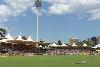
| Adelaide Oval FeatureType : null Elevation : 25 Lat/Lng : -34.9156 / 138.5961 | Adelaide Oval is a sports ground in Adelaide, South Australia, located in the parklands between the city centre and North Adelaide. The venue is predominantly used for cricket and Australian rules football, but has also played host to rugby league, rugby union, soccer, tennis among other sports as (...) |
| 130 | 
| Emu Park, Queensland FeatureType : null Elevation : 11 Lat/Lng : -23.2564 / 150.8264 | Emu Park is a small town and locality on the Capricorn Coast located 21 kilometres south of Yeppoon in Queensland, Australia. It is within the local government area of Shire of Livingstone (between 2008 and 2013, it was within the Rockhampton Region) (...) |
| 131 | 
| Aramac, Queensland FeatureType : null Elevation : 228 Lat/Lng : -22.9683 / 145.245 | Aramac is a small town and locality in the Barcaldine Region, Queensland, Australia. In the 2011 census, Aramac had a population of 299 people. (...) |
| 132 | Gladstone, Queensland FeatureType : null Elevation : 14 Lat/Lng : -23.8489 / 151.2625 | Gladstone is a city in the Gladstone Region, Queensland, Australia. It is approximately by road north of Brisbane and south-east of Rockhampton. Situated between the Calliope and Boyne Rivers, Gladstone is home to Queensland's largest multi-commodity shipping port (...) | |
| 133 | Electoral district of Burnett FeatureType : adm2nd Elevation : 55 Lat/Lng : -24.6167 / 152.0333 | Burnett is an electoral division of the Legislative Assembly of Queensland in central Queensland, Australia. It covers most of the coastal region south of Gladstone, as well as coastal and inland regions completely surrounding the district of Bundaberg (...) | |
| 134 | 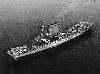
| USS Lexington (CV-2) FeatureType : landmark Lat/Lng : -15.33 / 155.5 | USS Lexington (CV-2), nicknamed "Lady Lex",Groom, p. 203 was an early aircraft carrier built for the United States Navy. She was the lead ship of the ; her only sister ship, , was commissioned a month earlier. Originally designed as a battlecruiser, she was converted into one of the Navy's first (...) |
| 135 | 
| Ageo, Saitama FeatureType : null Elevation : 16 Lat/Lng : 35.9774 / 139.5932 | is a city located in Saitama Prefecture, Japan. , the city had an estimated population of 224,841, and a population density of 4940 persons per km². Its total area is . (...) |
| 136 | 
| Tenterfield, New South Wales FeatureType : null Elevation : 849 Lat/Lng : -29.0495 / 152.0195 | Tenterfield is a town in New South Wales, Australia. It is located in the New England region at the intersection of the New England Highway and the Bruxner Highway. Tenterfield is a three-hour drive from Brisbane, Queensland, three hours from Byron Bay, New South Wales, two hours from Armidale, New (...) |
| 137 | Far North Queensland FeatureType : null Lat/Lng : 16.9833 / 145.4167 | Far North Queensland, or Tropical North Queensland, is the northernmost part of the state of Queensland, Australia. Centered on the city of Cairns, the region stretches north to the Torres Strait, and west to the Gulf Country (...) | |
| 138 | 
| Parliament House, Brisbane FeatureType : city Elevation : 16 Lat/Lng : -27.4754 / 153.027 | Parliament House in Brisbane is the meeting place of the Parliament of Queensland, housing its only chamber, the Legislative Assembly. It is located on the corner of George Street and Alice Street at Gardens Point in the CBD, and is next to the Queensland University of Technology and City Botanic (...) |
| 139 |
| Noosa National Park FeatureType : null Elevation : 15 Lat/Lng : -26.4492 / 153.0889 | Noosa National Park is a national park in Queensland, Australia, 121 km north of Brisbane. It is situated near Noosa Heads between the Pacific Ocean and the Sunshine Coasts's northern area of urban development and extends southwards, past Lake Weyba to Coolum. (...) |
| 140 | 
| Inuyama FeatureType : null Elevation : 56 Lat/Lng : 35.3786 / 136.9445 | is a city in Aichi Prefecture, Japan, north of the Nagoya Metropolis. , the city had an estimated population of 74,200 and a population density of 911 persons per km². The total area was . (...) |
| 141 | 
| Choiseul Island FeatureType : null Elevation : 368 Lat/Lng : -7.0003 / 156.9639 | Choiseul Island, native name Lauru,Hugo Bernatzik, Südsee; ein Reisebuch, first edition Leipzig 1934 is the largest island of the Choiseul Province, Solomon Islands, at . (...) |
| 142 | Supreme Court of Queensland FeatureType : landmark Elevation : 15 Lat/Lng : -27.4678 / 153.0206 | The Supreme Court of Queensland is the highest court in the Australian State of Queensland. The original jurisdiction of the Supreme Court allows its trial division to hear civil matters involving claims of more than 750,000; criminal matters involving serious offences (including murder and (...) | |
| 143 | Flinders Group National Park FeatureType : null Elevation : 8 Lat/Lng : -14.0736 / 144.2558 | Flinders Group is a national park in Queensland (Australia), 1,745 km northwest of Brisbane. (...) | |
| 144 | Forty Mile Scrub National Park FeatureType : null Elevation : 759 Lat/Lng : -18.095 / 144.8483 | Forty Mile Scrub is a national park in Queensland (Australia), 224 km drive southwest of Cairns. (...) | |
| 145 | Homevale National Park FeatureType : null Elevation : 349 Lat/Lng : -21.3569 / 148.4717 | Homevale is a national park in Queensland, Australia, 821 km northwest of Brisbane. (...) | |
| 146 | Mount Hypipamee National Park FeatureType : null Elevation : 973 Lat/Lng : -17.4257 / 145.4861 | Mount Hypipamee is a national park in Far North Queensland, Australia, 1,358 km northwest of Brisbane. (...) | |
| 147 | Mount Martin National Park FeatureType : null Elevation : 134 Lat/Lng : -21.0906 / 148.8949 | Mount Martin is a national park in Queensland, Australia, 829 km northwest of Brisbane. (...) | |
| 148 | Newry Islands National Park FeatureType : null Lat/Lng : -20.8562 / 148.9344 | Newry Islands is a national park in North Queensland, Australia, 847 km northwest of Brisbane. (...) | |
| 149 | Pioneer Peaks National Park FeatureType : null Elevation : 331 Lat/Lng : -21.0306 / 148.9521 | Pioneer Peaks is a national park in Queensland, Australia, 833 km northwest of Brisbane. (...) | |
| 150 | Precipice National Park FeatureType : null Elevation : 203 Lat/Lng : -25.3342 / 150.1067 | Precipice is a national park in Queensland, Australia, 377 km northwest of Brisbane. (...) | |
| 151 | Central West Queensland FeatureType : adm2nd Elevation : 214 Lat/Lng : -23.0 / 145.0 | Central West Queensland is a remote region in the Australian state of Queensland which covers 396 650.2 km². The region lies to the north of South West Queensland and south of the Gulf Country. Central West Queensland is serviced by the ABC Western Queensland radio station (...) | |
| 152 | Triunia National Park FeatureType : null Elevation : 199 Lat/Lng : -26.6537 / 152.9046 | Triunia is a national park in South East Queensland, Australia, 92 km north of Brisbane. The Administration is Wildlife Service of Queensland (...) | |
| 153 | 
| University of Canberra FeatureType : edu Elevation : 610 Lat/Lng : -35.2389 / 149.0875 | The University of Canberra (UC) is a public university that is located in Bruce, Canberra, Australian Capital Territory. UC offers undergraduate and postgraduate courses covering six main learning areas: Applied Science, Health, Art and Design, Business, Government and Law, Education and Information (...) |
| 154 | 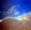
| Mornington Island FeatureType : isle Elevation : 10 Lat/Lng : -16.5503 / 139.4003 | Mornington Island is the northernmost of 22 islands that form the Wellesley Islands group. The island is in the Gulf of Carpentaria and is part of the Gulf Country region in the Australian state of Queensland. The Manowar and Rocky Islands Important Bird Area lies about to the north-west (...) |
| 155 | 
| Jindalee Operational Radar Network FeatureType : null Elevation : 202 Lat/Lng : -23.658 / 144.1454 | The Jindalee Operational Radar Network (JORN) is an over-the-horizon radar (OTHR) network that can monitor air and sea movements across 37,000 km2. It has a normal operating range of 1,000 km to 3,000 km. It is used in the defence of Australia, and can also monitor maritime operations, wave heights (...) |
| 156 | Warwick, Queensland FeatureType : null Elevation : 462 Lat/Lng : -28.219 / 152.0344 | Warwick Macquarie Dictionary, Fourth Edition (2005). Melbourne, The Macquarie Library Pty Ltd. is a town and locality in southeast Queensland, Australia, lying south-west of Brisbane. It is the administrative centre of the Southern Downs Region local government area (...) | |
| 157 | 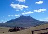
| Mount Barney National Park FeatureType : null Elevation : 943 Lat/Lng : -28.2642 / 152.635 | Mount Barney National Park is a national park in Queensland (Australia), 90 km southwest of Brisbane. It amalgamated the adjacent Mount Lindesay National Park in 1980. It is part of the Scenic Rim Important Bird Area, identified as such by BirdLife International because of its importance in the (...) |
| 158 | Rosewood railway station FeatureType : railwaystation Elevation : 46 Lat/Lng : -27.643 / 152.5926 | Rosewood railway station is located on the Main line in Queensland, Australia. It serves the town of Rosewood. (...) | |
| 159 | 
| WACA Ground FeatureType : null Elevation : 10 Lat/Lng : -31.96 / 115.8797 | The WACA (formally the WACA Ground) is a sports stadium in Perth, Western Australia. The stadium's name derives from the initials of its owners and operators, the Western Australian Cricket Association. The WACA was Western Australia's "home of cricket" since the early 1890s, with Test cricket (...) |
| 160 | 
| Hirakata FeatureType : null Elevation : 19 Lat/Lng : 34.8143 / 135.6506 | is a city in northeastern Osaka Prefecture, Japan.; retrieved 2013-8-28. It is known for Hirakata Park, an amusement park which includes roller coasters made of wood.; retrieved 2013-8-28. As of October 1, 2016, the city has an estimated population of 402,927, and a population density of 6,200 (...) |
| 161 | 
| Marree, South Australia FeatureType : null Elevation : 46 Lat/Lng : -29.6492 / 138.0636 | Marree is a small town located in the north of South Australia. It lies North of Adelaide at the junction of the Oodnadatta Track and the Birdsville Track, above sea level. Marree is an important service centre for the large sheep and cattle stations in northeast South Australia as well as a (...) |
| 162 | 
| Singleton, New South Wales FeatureType : null Elevation : 45 Lat/Lng : -32.5674 / 151.166 | Singleton is a town on the banks of the Hunter River in New South Wales, Australia. Singleton is north-north-west of Sydney, and northwest of Newcastle.Robinson's Road Atlas of Australia, Lansdowne Press, 1983 At June 2015, Singleton had an urban population of 16,921 (...) |
| 163 | 
| Burleigh Head National Park FeatureType : null Elevation : 74 Lat/Lng : -28.094 / 153.4583 | Burleigh Head is a small national park at Burleigh Heads in the City of Gold Coast in South East Queensland, Australia. (...) |
| 164 | 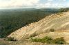
| Bald Rock National Park FeatureType : null Elevation : 1081 Lat/Lng : -28.8526 / 152.0563 | Bald Rock National Park is a national park in northern New South Wales, Australia, just north of Tenterfield on the Queensland border. The border passes over the rock on the Western side. On the other side of the border national park continues as the Girraween National Park (...) |
| 165 | Atherton, Queensland FeatureType : city Elevation : 790 Lat/Lng : -17.2667 / 145.4833 | Atherton is a town and locality on the Atherton Tablelands within the Tablelands Region, Far North Queensland, Australia. At the 2011 census, Atherton had a population of 7,287. (...) | |
| 166 | Central Queensland FeatureType : city Elevation : 251 Lat/Lng : -23.4397 / 144.886 | Central Queensland is an ambiguous geographical division of Queensland (a state in Australia) that centres on the eastern coast, around the Tropic of Capricorn. Its major regional centre is Rockhampton. The region extends from the Capricorn Coast west to the Central Highlands at Emerald, north to (...) | |
| 167 | 
| Peel Island FeatureType : isle Elevation : 15 Lat/Lng : -27.4978 / 153.3553 | Peel Island (Indigenous: Teerk Ro Ra) is a small heritage-listed island located in Moreton Bay, east of Brisbane, in South East Queensland, Australia. The island is within the local government area of Redland City (...) |
| 168 | Nambour railway station FeatureType : railwaystation Elevation : 18 Lat/Lng : -26.6253 / 152.9582 | Nambour railway station is located on the North Coast line in Queensland, Australia. It serves the town of Nambour in the Sunshine Coast Region. (...) | |
| 169 | 
| Cowra FeatureType : null Elevation : 285 Lat/Lng : -33.8333 / 148.6833 | Cowra is a town in the Central West region of New South Wales, Australia. It is the largest population centre and the council seat for the Cowra Shire, with a population of 10,063. Cowra is located approximately above sea level on the banks of the Lachlan River in the Lachlan Valley (...) |
| 170 | 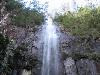
| Nightcap National Park FeatureType : null Elevation : 582 Lat/Lng : -28.547 / 153.2953 | The Nightcap National Park is a national park located in the Northern Rivers region of New South Wales, Australia. The park was created in April 1983 and is situated north of . The national park is classed by the IUCN World Commission on Protected Areas as Category II and is part of the Shield (...) |
| 171 | Wet Tropics of Queensland FeatureType : null Elevation : 491 Lat/Lng : -17.5 / 145.75 | The Wet Tropics of Queensland World Heritage Site consists of approximately 8,940 km² of Australian wet tropical forests growing along the north-east Queensland portion of the Great Dividing Range. The Wet Tropics of Queensland meets all four of the criteria for natural heritage for selection as a (...) | |
| 172 | Ipswich railway station, Queensland FeatureType : railwaystation Elevation : 35 Lat/Lng : -27.613 / 152.7603 | Ipswich railway station is located on the Main line in Queensland, Australia. It serves the urban centre of Ipswich. (...) | |
| 173 | Queensland Museum FeatureType : landmark Elevation : 9 Lat/Lng : -27.4732 / 153.0174 | The Queensland Museum is the state museum of Queensland, Australia. The museum currently operates from its headquarters and general museum in South Brisbane with specialist museums located in Woolloongabba in Brisbane, North Ipswich in Ipswich, East Toowoomba in Toowoomba, and in Townsville City in (...) | |
| 174 | Coalstoun Lakes National Park FeatureType : null Elevation : 396 Lat/Lng : -25.5962 / 151.91 | Coalstoun Lakes is a national park in Queensland, Australia, northwest of Brisbane. It features a volcano, Mount Le Brun, which has two craters that contain intermittent crater lakes. Coalstoun Lakes is Queensland's smallest national park. (...) | |
| 175 | Mary River (Queensland) FeatureType : null Elevation : 94 Lat/Lng : -26.585 / 152.7336 | The Mary River (Kabi: Moocooboola) is a major river system located in the South East and Wide Bay–Burnett regions of Queensland, Australia. (...) | |
| 176 | Torres Strait Islands FeatureType : isle Lat/Lng : -9.8803 / 142.5906 | The Torres Strait Islands are a group of at least 274 small islands which lie in Torres Strait, the waterway separating far northern continental Australia's Cape York Peninsula and the island of New Guinea. The islands are mostly part of Queensland, a constituent State of the Commonwealth of (...) | |
| 177 | Barnard Island Group National Park FeatureType : null Elevation : 42 Lat/Lng : -17.7376 / 146.1594 | The Barnard Island Group is a protected area in the Cassowary Coast Region, Queensland, Australia. (...) | |
| 178 | Lindeman Islands National Park FeatureType : null Elevation : 350 Lat/Lng : -20.4737 / 149.0841 | Lindeman Islands National Park is a national park covering the Lindeman Islands in Queensland, Australia, 885 km northwest of Brisbane. (...) | |
| 179 | Mount Ossa National Park FeatureType : null Elevation : 140 Lat/Lng : -20.9776 / 148.8211 | Mount Ossa is a national park in Queensland, Australia, 838 km northwest of Brisbane. There is Rainforest with Hoop Pines. (...) | |
| 180 | Coral Sea FeatureType : waterbody Lat/Lng : -16.9342 / 155.11 | The Coral Sea is a marginal sea of the South Pacific off the northeast coast of Australia, and classified as an interim Australian bioregion. The Coral Sea extends down the Australian northeast coast. It is bounded in the west by the east coast of Queensland, thereby including the Great Barrier (...) | |
| 181 | Bundaberg FeatureType : city Elevation : 17 Lat/Lng : -24.8662 / 152.3479 | Bundaberg is a city near the south-east coast of Queensland, Australia, situated on the Burnett River. Bundaberg is the business centre for a major sugar cane growing area, and is well known for its namesake export, Bundaberg Rum (...) | |
| 182 | 
| City of Thuringowa FeatureType : adm2nd Elevation : 24 Lat/Lng : -19.3167 / 146.7417 | The City of Thuringowa was a city and local government area in North Queensland, Australia covering the northern and western parts of what is now Townsville. The suburb of Thuringowa Central is the main business centre in this area (...) |
| 183 | 
| Principality of Hutt River FeatureType : null Elevation : 156 Lat/Lng : -28.0794 / 114.48 | The Principality of Hutt River, often referred to by its former name, the Hutt River Province, is a micronation in Australia. The principality claims to be an independent sovereign state founded on 21 April 1970 (...) |
| 184 | 
| Royal Military College, Duntroon FeatureType : edu Elevation : 578 Lat/Lng : -35.2997 / 149.165 | The Royal Military College, Duntroon, also known simply as Duntroon, is the Australian Army's officer training establishment. It was founded at Duntroon, in Canberra, Australian Capital Territory, in 1911 and is located at the foot of Mount Pleasant near Lake Burley Griffin, close to the Department (...) |
| 185 | South West Queensland FeatureType : null Elevation : 300 Lat/Lng : -26.4 / 146.25 | South West Queensland is a remote region in the Australian state of Queensland which covers . The region lies to the south of Central West Queensland and west of the Darling Downs and includes the Maranoa district and parts of the Channel Country (...) | |
| 186 | Electoral district of Whitsunday FeatureType : adm2nd Lat/Lng : -20.5833 / 149.0333 | Whitsunday is an electoral division in the Legislative Assembly of Queensland, Queensland, Australia. It extends from the northern suburbs of Mackay to Bowen and Proserpine as well as east to the Whitsunday Islands. (...) | |
| 187 | Errk Oykangand National Park FeatureType : null Elevation : 22 Lat/Lng : -15.4679 / 142.0864 | Errk Oykangand (formerly known as Mitchell-Alice Rivers until 2009) is a national park in Queensland, Australia, 1748 km northwest of Brisbane. (...) | |
| 188 | Northgate railway station, Brisbane FeatureType : railwaystation Elevation : 10 Lat/Lng : -27.3929 / 153.0693 | Northgate railway station is located on the North Coast line in Queensland, Australia. It serves the Brisbane suburb of Northgate. Immediately north of the station, the Shorncliffe line branches off. (...) | |
| 189 | Bowen Hills, Queensland FeatureType : city Elevation : 10 Lat/Lng : -27.4432 / 153.0384 | Bowen Hills is an inner suburb of Brisbane, Queensland, Australia, located 3 km (1.86 miles) northeast of the Brisbane CBD. It was named after a Governor of Queensland, Sir George Ferguson Bowen. At the 2016 Australian Census the suburb recorded a population of 3,266. (...) | |
| 190 | 
| Tamborine National Park FeatureType : null Elevation : 196 Lat/Lng : -27.8923 / 153.1905 | Tamborine is a national park in the Gold Coast hinterland and is a part of the Scenic Rim Regional Council of South East Queensland, Australia, south of Brisbane. It covers 11.60 km² on the plateau of Tamborine Mountain and around its foothills. The plateau is long, wide and rises to an altitude of (...) |
| 191 | 
| Hindmarsh Stadium FeatureType : landmark Elevation : 22 Lat/Lng : -34.9075 / 138.5689 | The Hindmarsh Stadium (currently known as the Coopers Stadium due to sponsorship from the Adelaide-based Coopers Brewery) is a multi-purpose stadium in Hindmarsh, an inner western suburb of Adelaide, South Australia. It is the home of the Australian A-League team, Adelaide United (...) |
| 192 | 
| Deniliquin FeatureType : null Elevation : 93 Lat/Lng : -35.5274 / 144.9596 | Deniliquin, Macquarie Dictionary, Fourth Edition (2005). Melbourne, The Macquarie Library Pty Ltd. known locally as "Deni", is a town in the Riverina region of New South Wales close to the border with Victoria. It is the largest town in the Edward River Council local government area (...) |
| 193 | Caboolture railway station FeatureType : railwaystation Elevation : 16 Lat/Lng : -27.0822 / 152.9531 | Caboolture railway station is located on the North Coast line in Queensland, Australia. It serves the urban centre of Caboolture in the Moreton Bay Region. (...) | |
| 194 | Queensland University of Technology FeatureType : edu Elevation : 19 Lat/Lng : -27.4769 / 153.0281 | The Queensland University of Technology (QUT) is a public research university located in the urban coastal city of Brisbane, Queensland, Australia. QUT is located on two campuses in the Brisbane area: Gardens Point and Kelvin Grove (...) | |
| 195 | Townsville FeatureType : null Elevation : 21 Lat/Lng : -19.266 / 146.806 | Townsville is a city on the north-eastern coast of Queensland, Australia. Townsville is Australia's largest urban centre north of the Sunshine Coast, with a population of 173,815 as of the 2016 Australian census (...) | |
| 196 | Cudmore National Park FeatureType : null Elevation : 400 Lat/Lng : -22.9265 / 146.3056 | Cudmore is a national park in Central West Queensland, Australia, 844 km northwest of Brisbane. (...) | |
| 197 | Dalrymple National Park FeatureType : null Elevation : 275 Lat/Lng : -19.8098 / 146.1056 | Dalrymple is a national park in Queensland, Australia, 1108 km northwest of Brisbane. (...) | |
| 198 | Denham Group National Park FeatureType : null Elevation : 6 Lat/Lng : -11.1708 / 143.0153 | Denham Group is a national park in Queensland, Australia, 2098 km northwest of Brisbane. (...) | |
| 199 | Fairlies Knob National Park FeatureType : null Elevation : 219 Lat/Lng : -25.504 / 152.2938 | Fairlies Knob is a national park in Queensland, Australia, 231 km north of Brisbane. (...) | |
| 200 | Ferntree Creek National Park FeatureType : null Elevation : 78 Lat/Lng : -26.6053 / 152.9636 | Ferntree Creek is a national park in Queensland, Australia, 97 km north of Brisbane. (...) | |
 by
by