| 1284 records found in wikipedia | |||
| 1 | 
| Beira, Mozambique  FeatureType : city Elevation : 9 Lat/Lng : -19.8278 / 34.8378 | Beira is the fourth largest city in Mozambique. It lies in the central region of the country in Sofala Province, where the Pungwe River meets the Indian Ocean. Beira had a population of 397,368 in 1997, which grew to 533,825 in 2017 (...) |
| 2 | 
| Mozambique FeatureType : country Elevation : 79 Lat/Lng : -17.7667 / 35.4667 | Mozambique , officially the Republic of Mozambique (or '), is a country in Southeast Africa bordered by the Indian Ocean to the east, Tanzania to the north, Malawi and Zambia to the northwest, Zimbabwe to the west, and Swaziland (Eswatini) and South Africa to the southwest (...) |
| 3 | 
| Island of Mozambique FeatureType : isle Elevation : 10 Lat/Lng : -15.0363 / 40.734 | The Island of Mozambique lies off northern Mozambique, between the Mozambique Channel and Mossuril Bay, and is part of Nampula Province. Prior to 1898, it was the capital of colonial Portuguese East Africa. With its rich history and sandy beaches, the Island of Mozambique is a UNESCO World Heritage (...) |
| 4 | Mozambique Channel FeatureType : waterbody Lat/Lng : -16.701 / 42.1421 | The Mozambique Channel is an arm of the Indian Ocean located between the Southeast African countries of Madagascar and Mozambique. The channel is about long and across at its narrowest point, and reaches a depth of about off the coast of Mozambique (...) | |
| 5 | 
| Maputo FeatureType : null Elevation : 40 Lat/Lng : -25.9153 / 32.5764 | Maputo (; officially named Lourenço Marques until 1976) is the capital and most populous city of Mozambique. Located near the southern end of the country, it is positioned within 120 km of the Swaziland and South Africa borders (...) |
| 6 | 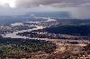
| Limpopo River FeatureType : null Elevation : 38 Lat/Lng : -25.1667 / 33.5833 | The Limpopo River rises in South Africa, and flows generally eastwards to the Indian Ocean in Mozambique. The term Limpopo is the original Sepedi name diphororo tša meetse, meaning "gushing strong waterfalls". The river is approximately long, with a drainage basin in size (...) |
| 7 | 
| Kruger National Park FeatureType : null Elevation : 302 Lat/Lng : -24.0114 / 31.4853 | Kruger National Park is one of the largest game reserves in Africa. It covers an area of in the provinces of Limpopo and Mpumalanga in northeastern South Africa, and extends from north to south and from east to west. The administrative headquarters are in Skukuza (...) |
| 8 | 
| Lichtenberg FeatureType : city Elevation : 56 Lat/Lng : 52.5333 / 13.5 | Lichtenberg is the eleventh borough of Berlin, Germany. In Berlin's 2001 administrative reform it absorbed the former borough of Hohenschönhausen. (...) |
| 9 | 
| Lake Malawi FeatureType : waterbody Elevation : 476 Lat/Lng : -12.1833 / 34.3667 | Lake Malawi, also known as Lake Nyasa in Tanzania and Lago Niassa in Mozambique, is an African Great Lake and the southernmost lake in the East African Rift system, located between Malawi, Mozambique and Tanzania (...) |
| 10 | 
| Le Port, Réunion FeatureType : null Elevation : 8 Lat/Lng : -20.9394 / 55.2872 | Le Port is a commune in the French overseas department of Réunion. It is located at the extreme northwest corner of the island of Réunion. It has a population of 36,952. It is the main harbor city of the island. (...) |
| 11 | 
| Europa Island FeatureType : isle Elevation : 12 Lat/Lng : -22.3504 / 40.3595 | Europa Island is a low-lying tropical atoll in the Mozambique Channel, about a third of the way from southern Madagascar to southern Mozambique. The island had never been inhabited until 1820, when the French family Rosier moved to it. The island officially became a possession of France in 1897 (...) |
| 12 | 
| Comoros FeatureType : country Lat/Lng : -12.1667 / 44.25 | The Comoros , officially the Union of the Comoros (Comorian: Udzima wa Komori, , '), is an island country in the Indian Ocean located at the northern end of the Mozambique Channel off the eastern coast of Africa between northeastern Mozambique, the french region of Mayotte and northwestern (...) |
| 13 | 
| Mbombela FeatureType : null Elevation : 650 Lat/Lng : -25.4658 / 30.9853 | Mbombela, formerly Nelspruit, is a city in northeastern South Africa. It is the capital of the Mpumalanga province. Located on the Crocodile River, Mbombela lies about by road west of the Mozambique border, east of Johannesburg and about 82 kilometres (51 mi) North of the Swaziland border. (...) |
| 14 | 
| Eswatini FeatureType : country Elevation : 538 Lat/Lng : -26.5 / 31.5 | Eswatini , officially the Kingdom of Eswatini, also known as Swaziland , is a landlocked country in Southern Africa. It is bordered by Mozambique to its northeast and South Africa to its north, west and south. The country and the Swazi people take their names from Mswati II, the 19th-century king (...) |
| 15 | 
| Zambia FeatureType : country Elevation : 1126 Lat/Lng : -14.1167 / 27.6333 | Zambia , officially the Republic of Zambia, is a landlocked country in south-central Africa (although some sources consider it part of east Africa), neighbouring the Democratic Republic of the Congo to the north, Tanzania to the north-east, Malawi to the east, Mozambique to the southeast, Zimbabwe (...) |
| 16 | 
| Bassas da India FeatureType : isle Lat/Lng : -21.4873 / 39.6824 | Bassas da India is an uninhabited, roughly circular French atoll that is part of the French Southern and Antarctic Lands. Located in the southern Mozambique Channel, about halfway between Mozambique and Madagascar (about further east) and around northwest of Europa Island, the rim of the atoll (...) |
| 17 | 
| Mayotte FeatureType : isle Elevation : 90 Lat/Lng : -12.8333 / 45.1333 | Mayotte (; Shimaore: Maore, ;) is an insular department and region of France officially named the Department of Mayotte (French: Département de Mayotte). It consists of a main island, Grande-Terre (or Maore), a smaller island, Petite-Terre (or Pamanzi), and several islets around these two (...) |
| 18 | 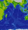
| Indian Ocean FeatureType : waterbody Lat/Lng : -20.0 / 80.0 | The Indian Ocean is the third largest of the world's oceanic divisions, covering (approximately 20% of the water on the Earth's surface). It is bounded by Asia on the north, on the west by Africa, on the east by Australia, and on the south by the Southern Ocean or, depending on definition, by (...) |
| 19 | 
| Malawi FeatureType : null Elevation : 1339 Lat/Lng : -13.3575 / 34.0247 | Malawi (or ; or), officially the Republic of Malawi, is a landlocked country in southeast Africa that was formerly known as Nyasaland. It is bordered by Zambia to the northwest, Tanzania to the northeast, and Mozambique on the east, south and west (...) |
| 20 | 
| Juan de Nova Island FeatureType : isle Elevation : 8 Lat/Lng : -17.0557 / 42.731 | Juan de Nova Island (French: Île Juan da Nova (official), Île Juan de Nova (local)), also known as Saint-Christophe, is a French tropical island in the narrowest part of the Mozambique Channel, about one-third of the way between Madagascar and Mozambique. It is a low, flat island, in size (...) |
| 21 | 
| Luanda FeatureType : city Elevation : 77 Lat/Lng : -8.8383 / 13.2344 | Luanda, formerly named São Paulo da Assunção de Loanda, is the capital and largest city in Angola, and the country's most populous and important city, primary port and major industrial, cultural and urban centre (...) |
| 22 | 
| Coimbra FeatureType : adm1st Elevation : 30 Lat/Lng : 40.2111 / -8.4292 | Coimbra is a city and a municipality in Portugal. The population at the 2011 census was 143,397, in an area of . The fourth-largest urban centre in Portugal (after Lisbon, Porto, Braga), it is the largest city of the district of Coimbra and the Centro Region (...) |
| 23 | 
| Bender, Moldova FeatureType : city Elevation : 32 Lat/Lng : 46.8306 / 29.4711 | Bender , Monitorul Oficial al Republicii Moldova, no. 16/53, December 29, 2001 (subsequent modifications taken into account) (; de facto official name Bendery ; also known by other alternative names) is a city within the internationally recognized borders of Moldova under de facto control of the (...) |
| 24 | 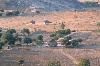
| Zimbabwe FeatureType : country Elevation : 1487 Lat/Lng : -17.8268 / 31.0553 | Zimbabwe , officially the Republic of Zimbabwe, is a landlocked country located in southern Africa, between the Zambezi and Limpopo Rivers, bordered by South Africa, Botswana, Zambia and Mozambique. The capital and largest city is Harare (...) |
| 25 | 
| Durban FeatureType : city Lat/Lng : -29.8741 / 31.0102 | Durban (from itheku meaning "bay/lagoon") is the third most populous city in South Africa—after Johannesburg and Cape Town—and the largest city in the South African province of KwaZulu-Natal. Located on the east coast of South Africa, Durban is famous for being the busiest port in the country (...) |
| 26 | 
| Tanzania FeatureType : null Elevation : 1135 Lat/Lng : -6.307 / 34.854 | Tanzania ,These approximate the Kiswahili pronunciation . However, is also heard in English. officially the United Republic of Tanzania , is a country in eastern Africa within the African Great Lakes region. It borders Uganda to the north; Kenya to the northeast; the Indian Ocean to the east; (...) |
| 27 | 
| Portugal FeatureType : country Elevation : 13 Lat/Lng : 38.7 / -9.1833 | Portugal , officially the Portuguese Republic ,In recognized minority languages of Portugal: :* is a country located mostly on the Iberian Peninsula in southwestern Europe. It is the westernmost sovereign state of mainland Europe (...) |
| 28 | 
| Zanzibar FeatureType : adm1st Elevation : 28 Lat/Lng : -6.1333 / 39.3167 | Zanzibar is a semi-autonomous region of Tanzania. It is composed of the Zanzibar Archipelago in the Indian Ocean, off the coast of the mainland, and consists of many small islands and two large ones: Unguja (the main island, referred to informally as Zanzibar) and Pemba Island (...) |
| 29 | Mocuba FeatureType : null Elevation : 137 Lat/Lng : -16.85 / 36.9833 | Mocuba is a city and seat of Mocuba District of Zambezia Province in Mozambique. (...) | |
| 30 | 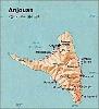
| Anjouan FeatureType : null Elevation : 709 Lat/Lng : -12.2275 / 44.4578 | Anjouan (also known as Ndzuwani or Nzwani, and historically as Johanna or Hinzuan) is an autonomous island in the Indian Ocean that forms part of the Union of the Comoros. Its chief town is Mutsamudu and, , its population is around 277,500 (...) |
| 31 | 
| Great Zimbabwe FeatureType : landmark Elevation : 1132 Lat/Lng : -20.2733 / 30.933 | Great Zimbabwe is a medieval city in the south-eastern hills of Zimbabwe near Lake Mutirikwe and the town of Masvingo. It was the capital of the Kingdom of Zimbabwe during the country's Late Iron Age. Construction on the monument began in the 11th century and continued until the 15th century (...) |
| 32 | 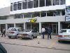
| Dar es Salaam FeatureType : city Elevation : 10 Lat/Lng : -6.82 / 39.27 | Dar es Salaam (Dar) (from ', "the house of peace"; formerly Mzizima) is the former capital as well as the most populous city in Tanzania and a regionally important economic centre. Located on the Swahili coast, the city is one of the fastest growing cities in the world (...) |
| 33 | 
| Póvoa de Varzim FeatureType : city Elevation : 22 Lat/Lng : 41.4167 / -8.7667 | Póvoa de Varzim , also spelled Povoa de Varzim, is a Portuguese city in Northern Portugal and sub-region of Greater Porto. It sits in a sandy coastal plain, a cuspate foreland, halfway between the Minho and Douro rivers. In 2001, there were 63,470 inhabitants, with 42,396 living in the city proper (...) |
| 34 | 
| Madagascar FeatureType : country Elevation : 1253 Lat/Lng : -18.9167 / 47.5167 | Madagascar , officially the Republic of Madagascar , and previously known as the Malagasy Republic, is an island country in the Indian Ocean, off the coast of East Africa. The nation comprises the island of Madagascar (the fourth-largest island in the world), and numerous smaller peripheral islands (...) |
| 35 | 
| Bulawayo FeatureType : null Elevation : 1362 Lat/Lng : -20.1598 / 28.5777 | Bulawayo is the second-largest city in Zimbabwe with an estimated population of 1 200 337, per city council estimates in 2018. This figure is disputed with the national government saying Bulawayo and the Matabeleland region is declining in population when the rest of the country is growing rapidly (...) |
| 36 | 
| Port Elizabeth FeatureType : null Elevation : 85 Lat/Lng : -33.9608 / 25.602 | Port Elizabeth or The Bay is one of the major cities in South Africa; it is situated in the Eastern Cape Province, east of Cape Town. The city, often shortened to PE and nicknamed "The Friendly City" or "The Windy City", stretches for 16 km along Algoa Bay, and is one of the major seaports in South (...) |
| 37 | 
| São Tomé and Príncipe FeatureType : city Elevation : 549 Lat/Lng : 0.2336 / 6.6128 | São Tomé and Príncipe , officially the Democratic Republic of São Tomé and Príncipe, is an island country in the Gulf of Guinea, off the western equatorial coast of Central Africa. It consists of two archipelagos around the two main islands of São Tomé and Príncipe, located about apart and about off (...) |
| 38 | 
| Pacific Ocean FeatureType : waterbody Lat/Lng : 0.0 / -160.0 | The Pacific Ocean is the largest and deepest of Earth's oceanic divisions. It extends from the Arctic Ocean in the north to the Southern Ocean (or, depending on definition, to Antarctica) in the south and is bounded by Asia and Australia in the west and the Americas in the east (...) |
| 39 | 
| Geography of Africa FeatureType : null Elevation : 3 Lat/Lng : 37.3386 / 9.8367 | Africa is a continent comprising 63 political territories, representing the largest of the great southward projections from the main mass of Earth's surface. Within its regular outline, it comprises an area of , excluding adjacent islands (...) |
| 40 | 
| South Africa FeatureType : country Elevation : 1155 Lat/Lng : -28.6167 / 24.3333 | South Africa, officially the Republic of South Africa (RSA), is the southernmost country in Africa. It is bounded to the south by of coastline of Southern Africa stretching along the South Atlantic and Indian Oceans; to the north by the neighbouring countries of Namibia, Botswana, and Zimbabwe; and (...) |
| 41 | 
| Bermuda FeatureType : country Lat/Lng : 32.3333 / -64.75 | Bermuda is a British Overseas Territory in the North Atlantic Ocean. It is approximately east-southeast of Cape Hatteras, North Carolina; south of Cape Sable Island, Nova Scotia; and north of Cuba. The capital city is Hamilton (...) |
| 42 | 
| Cuba FeatureType : country Elevation : 177 Lat/Lng : 21.9833 / -79.0333 | Cuba , officially the Republic of Cuba (RCUB.ogg), is a country comprising the island of Cuba as well as Isla de la Juventud and several minor archipelagos. Cuba is located in the northern Caribbean where the Caribbean Sea, Gulf of Mexico and Atlantic Ocean meet (...) |
| 43 | 
| Oman FeatureType : country Elevation : 129 Lat/Lng : 21.0 / 57.0 | Oman , officially the Sultanate of Oman , is an Arab country on the southeastern coast of the Arabian Peninsula in Western Asia. Its official religion is Islam. Holding a strategically important position at the mouth of the Persian Gulf, the country shares land borders with the United Arab Emirates (...) |
| 44 | 
| Sintra FeatureType : adm1st Elevation : 230 Lat/Lng : 38.798 / -9.381 | Sintra is a city and municipality in the Greater Lisbon region of Portugal, located on the Portuguese Riviera. The population of the municipality in 2011 was 377,835, in an area of . Sintra is a major tourist destination in Portugal, famed for its picturesqueness and for its numerous historic (...) |
| 45 | 
| Angra do Heroísmo FeatureType : null Elevation : 23 Lat/Lng : 38.6556 / -27.2194 | Angra do Heroísmo , generally known as Angra, is a municipality and city on the island of Terceira in the Portuguese autonomous region of the Azores. The population in 2011 was 35,402, in an area of 239.00 km². It forms the southern half of Terceira, with the north belonging to Praia da Vitória (...) |
| 46 | 
| Porto FeatureType : null Elevation : 22 Lat/Lng : 41.1333 / -8.6667 | Porto (; also known as Oporto in English Google Books) is the second-largest city in Portugal after Lisbon and one of the major urban areas of the Iberian Peninsula. The city proper has a population of 237,591 and the metropolitan area of Porto, which extends beyond the administrative limits of the (...) |
| 47 | 
| Equatorial Guinea FeatureType : country Elevation : 595 Lat/Lng : 1.9247 / 10.1114 | Equatorial Guinea , officially the Republic of Equatorial Guinea , is a country located in Central Africa, with an area of . Formerly the colony of Spanish Guinea, its post-independence name evokes its location near both the Equator and the Gulf of Guinea (...) |
| 48 | 
| Mopani District Municipality FeatureType : adm1st Elevation : 470 Lat/Lng : -23.3167 / 30.7167 | Mopani is one of the 5 districts of Limpopo province of South Africa. The seat of Mopani is Giyani. The majority of its 1,092,507 people speak Northern Sotho (2011 Census). The district code is DC33. After the 12th amendment of the Constitution of South Africa part of the area of the Bohlabela (...) |
| 49 | 
| Botswana FeatureType : country Elevation : 1012 Lat/Lng : -24.6583 / 25.9083 | Botswana , officially the Republic of Botswana , is a landlocked country located in Southern Africa. Formerly the British protectorate of Bechuanaland, Botswana adopted its new name after becoming independent within the Commonwealth on 30 September 1966 (...) |
| 50 | 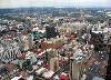
| Johannesburg FeatureType : null Elevation : 1766 Lat/Lng : -26.2044 / 28.0456 | Johannesburg (; ; also known as Jozi, Joburg, and eGoli) is the largest city in South Africa and one of the 50 largest urban areas in the world. It is the provincial capital and largest city of Gauteng, which is the wealthiest province in South Africa (...) |
| 51 | 
| Lisbon FeatureType : null Elevation : 70 Lat/Lng : 38.7203 / -9.14 | Lisbon is the capital and the largest city of Portugal, with an estimated population of 505,526 within its administrative limits in an area of 100.05 km2. Its urban area extends beyond the city's administrative limits with a population of around 2 (...) |
| 52 | 
| Guinea FeatureType : country Elevation : 15 Lat/Lng : 9.5092 / -13.7122 | Guinea , officially the Republic of Guinea , is a country on the western coast of Africa. Formerly known as French Guinea , the modern country is sometimes referred to as Guinea-Conakry in order to distinguish it from other countries with "Guinea" in the name and the eponymous region, such as (...) |
| 53 | 
| Salvador, Bahia FeatureType : null Elevation : 61 Lat/Lng : -12.9737 / -38.5114 | Salvador, also known as São Salvador da Bahia de Todos os Santos (English: Savior; Saint Savior from the Bay of All Saints) is the capital of the Brazilian state of Bahia. With 2.9 million people (2017), it is the largest city proper in the Northeast Region and the 4th-largest city proper in the (...) |
| 54 | Portuguese Mozambique FeatureType : null Elevation : 40 Lat/Lng : -25.9153 / 32.5764 | Portuguese Mozambique or Portuguese East Africa (África Oriental Portuguesa) are the common terms by which Mozambique is designated when referring to the historic period when it was a Portuguese overseas territory (...) | |
| 55 | 
| Mutare FeatureType : city Elevation : 1092 Lat/Lng : -18.9667 / 32.6333 | Mutare (known as Umtali until 1983) is the fourth largest city in Zimbabwe, with an urban population of approximately 188,243 and rural population of approximately 260,567. It is the capital of Manicaland province. (...) |
| 56 | 
| Boston FeatureType : null Elevation : 28 Lat/Lng : 42.3578 / -71.0594 | Boston is the capital and most populous municipality of the Commonwealth of Massachusetts in the United States. The city proper covers with an estimated population of 685,094 in 2017, making it also the most populous city in the New England region (...) |
| 57 | 
| Bristol FeatureType : city Elevation : 11 Lat/Lng : 51.4546 / -2.5879 | Bristol is a city and county in South West England with a population of 459,300.https://www.bristol.gov.uk/statistics-census-information/the-population-of-bristol The wider district has the 10th-largest population in England. The urban area population of 724,000 is the 8th-largest in the UK (...) |
| 58 | 
| Columbia University FeatureType : edu Elevation : 54 Lat/Lng : 40.8088 / -73.9623 | Columbia University (Columbia; officially Columbia University in the City of New York), is a private Ivy League research university in Upper Manhattan, New York City. Established in 1754, Columbia is the oldest institution of higher education in New York and the fifth-oldest institution of higher (...) |
| 59 | 
| Beijing FeatureType : adm1st Elevation : 65 Lat/Lng : 39.9035 / 116.3876 | (1st)—very high blank5_name_sec1 = License plate prefixes blank5_info_sec1 = (taxis) (outside urban area) (police and authorities) blank6_name_sec1 = Abbreviation blank6_info_sec1 = BJ / (jīng) blank2_name_sec2 = City flowers blank2_info_sec2 =China rose (Rosa chinensis) blank3_name_sec2 = (...) |
| 60 | 
| Mauritius FeatureType : country Elevation : 177 Lat/Lng : -20.2 / 57.5 | Mauritius , officially the Republic of Mauritius , is an island nation in the Indian Ocean about 2,000 kilometres (1,200 mi) off the southeast coast of the African continent. The country includes the islands of Mauritius and Rodrigues, 560 kilometres (350 mi) east of Mauritius, and the outer islands (...) |
| 61 | 
| Havana FeatureType : null Elevation : 17 Lat/Lng : 23.1388 / -82.3573 | Havana (; Spanish: La Habana) is the capital city, largest city, province, major port, and leading commercial center of Cuba. The city has a population of 2.1 million inhabitants, and it spans a total of – making it the largest city by area, the most populous city, and the fourth largest (...) |
| 62 | Tete, Mozambique FeatureType : city Elevation : 127 Lat/Lng : -16.17 / 33.58 | Tete is the capital city of Tete Province in Mozambique. It is located on the Zambezi River, and is the site of two of the four bridges crossing the river in Mozambique. A Swahili trade center before the Portuguese colonial era, Tete continues to dominate the west-central part of the country and (...) | |
| 63 | 
| Italy FeatureType : null Elevation : 729 Lat/Lng : 42.6384 / 12.6743 | Italy , officially the Italian Republic , Council of the European Union (retrieved 13 October 2013). Central Intelligence Agency (retrieved 13 October 2013). is a country in Europe. Located in the heart of the Mediterranean Sea, Italy shares open land borders with France, Switzerland, Austria, (...) |
| 64 | 
| Rio de Janeiro FeatureType : city Elevation : 5 Lat/Lng : -22.9028 / -43.2078 | Rio de Janeiro (; ;It is pronounced in the variety of Brazilian Portuguese spoken in Rio de Janeiro according to Larousse Concise Dictionary: Portuguese-English, 2008, p. 339. Vowel reduction at was added as it is the most often used speech pattern in vernacular, colloquial and educated colloquial (...) |
| 65 | 
| Nigeria FeatureType : country Elevation : 6 Lat/Lng : 4.5417 / 7.9833 | The Federal Republic of Nigeria, commonly referred to as Nigeria , is a federal republic in West Africa, bordering Niger in the north, Chad in the northeast, Cameroon in the southeast, and Benin in the west. Its coast in the south is located on the Gulf of Guinea in the Atlantic Ocean (...) |
| 66 | 
| Brazil FeatureType : country Elevation : 237 Lat/Lng : -14.16 / -51.9 | Brazil , officially the Federative Republic of Brazil (listen), is the largest country in both South America and Latin America. At 8.5 million square kilometers (3.2 million square miles) and with over 208 million people, Brazil is the world's fifth-largest country by area and the fifth most (...) |
| 67 | Nampula FeatureType : city Elevation : 431 Lat/Lng : -15.1167 / 39.2667 | Nampula is the capital city of Nampula Province in northeastern Mozambique. Also known as "The Capital of the North", Nampula is the centre of business in northern Mozambique. It has a few western-style hotels, restaurants and shopping centres (...) | |
| 68 | Inhambane Province FeatureType : adm1st Elevation : 138 Lat/Lng : -23.0 / 34.5 | Inhambane is a province of Mozambique located on the coast in the southern part of the country. It has an area of 68,615 km2 and a population of 1,496,824 (2017 census). The provincial capital is also called Inhambane. The climate is tropical throughout, more humid along the coast and dryer inland (...) | |
| 69 | Matola FeatureType : city Elevation : 45 Lat/Lng : -25.9673 / 32.4567 | Matola is the largest suburb of the Mozambique capital, Maputo, adjacent to its westernmost side. It is the nation's most populated city. Matola is the capital of Maputo Province and has had its own elected municipal government since 1998 (...) | |
| 70 | Niassa Province FeatureType : adm1st Elevation : 552 Lat/Lng : -13.25 / 36.5 | Niassa is a province of Mozambique. It has an area of 122,827 km2 and a population of 1,027,037 (2006). It is the most sparsely populated province in the country. Lichinga is the capital of the province. There are a minimum estimated 450,000 Yao people living in Mozambique (...) | |
| 71 | 
| Bazaruto Island FeatureType : null Elevation : 19 Lat/Lng : -21.6544 / 35.4633 | Bazaruto (from Ushurutswa, island of the mist) is a sandy island located approximately southeast of the mouth of the Save River, Mozambique . It is the largest island in the Bazaruto Archipelago and in the Bazaruto National Park (...) |
| 72 | Beira Airport FeatureType : null Elevation : 12 Lat/Lng : -19.7969 / 34.9083 | Beira Airport is an airport in Beira, Mozambique . It has 3 asphalt runways. (...) | |
| 73 | Namacurra District FeatureType : adm1st Elevation : 22 Lat/Lng : -17.495 / 37.028 | Namacurra District is a district of Zambezia Province in Mozambique. (...) | |
| 74 | Nicoadala District FeatureType : adm1st Elevation : 20 Lat/Lng : -17.603 / 36.814 | Nicoadala District is a district of Zambezia Province in Mozambique. (...) | |
| 75 | Mopeia District FeatureType : adm1st Elevation : 31 Lat/Lng : -17.98 / 35.715 | Mopeia District is a district of Zambezia Province in Mozambique. (...) | |
| 76 | Gilé District FeatureType : adm1st Elevation : 205 Lat/Lng : -16.147 / 38.371 | Gilé District is a district of Zambezia Province in Mozambique. (...) | |
| 77 | Mutarara District FeatureType : adm1st Elevation : 67 Lat/Lng : -17.444 / 35.075 | Mutarara District is a district of Tete Province in western Mozambique. (...) | |
| 78 | 
| Cahora Bassa FeatureType : landmark Elevation : 317 Lat/Lng : -15.6667 / 31.8333 | The Cahora Bassa lake—in the Portuguese colonial era (until 1974) known as Cabora Bassa, from Nyungwe Kahoura-Bassa, meaning "finish the job"—is Africa's fourth-largest artificial lake, situated in the Tete Province in Mozambique (...) |
| 79 | 
| Nsanje FeatureType : city Elevation : 55 Lat/Lng : -16.9199 / 35.262 | Nsanje (formerly Port Herald) is the main town in Nsanje District within the Southern Region of Malawi. (...) |
| 80 | Pemba, Mozambique FeatureType : city Elevation : 41 Lat/Lng : -12.9675 / 40.5058 | Pemba is a port city in Mozambique. It is the capital of the province of Cabo Delgado and lies on a peninsula in Pemba Bay. The town was founded by the Niassa Company in 1904 as Porto Amélia, after the Queen of Portugal, at the peninsula's south western tip and has grown around a port (...) | |
| 81 | Nacala FeatureType : city Elevation : 137 Lat/Lng : -14.5626 / 40.6854 | Nacala, also known as Cidade de Nacala or Nacala-Porto is a city on the northern coast of Mozambique. Located in the southwestern indentation of inner Fernao Veloso Bay, it is the deepest natural port on the east coast of Africa (...) | |
| 82 | Quelimane FeatureType : city Elevation : 5 Lat/Lng : -17.8833 / 36.85 | Quelimane is a seaport in Mozambique. It is the administrative capital of the Zambezia Province and the province's largest city, and stands from the mouth of the Rio dos Bons Sinais (or "River of the Good Signs") (...) | |
| 83 | 
| Cutty Sark FeatureType : landmark Elevation : 6 Lat/Lng : 51.4828 / -0.0097 | Cutty Sark is a British clipper ship. Built on the River Clyde in 1869 for the Jock Willis Shipping Line, she was one of the last tea clippers to be built and one of the fastest, coming at the end of a long period of design development, which halted as sailing ships gave way to steam propulsion (...) |
| 84 | 
| Northern Rhodesia FeatureType : country Elevation : 1126 Lat/Lng : -14.1167 / 27.6333 | Northern Rhodesia was a protectorate in south central Africa, formed in 1911 by amalgamatingNorthern Rhodesia Order in Council, 1911, S.R.O. 1911 No. 438, p. 85. the two earlier protectorates of Barotziland-North-Western RhodesiaBarotziland-North-Western Rhodesia Order in Council, 1899, S.E.O (...) |
| 85 | Port Maputo FeatureType : null Elevation : 7 Lat/Lng : -25.9603 / 32.546 | Port Maputo, or the Maputo Port Development Company (MPDC), is a parastatal authority that operates and governs the Mozambique ports of Maputo and Matola, located in the south of the Mozambique Channel in the southwest Indian Ocean (...) | |
| 86 | 
| Geography of Madagascar FeatureType : null Elevation : 1678 Lat/Lng : -20.0 / 47.0 | Madagascar is a large island in the Indian Ocean off the eastern coast of southern Africa, east of Mozambique. It is the fourth largest island in the world. The highest point is Maromokotro, in the Tsaratanana Massif region in the north of the island, at (...) |
| 87 | Great Rift Valley FeatureType : waterbody Elevation : 1632 Lat/Lng : 0.2633 / 36.1425 | The Great Rift Valley is a continuous geographic trench, approximately in length, that runs from Lebanon's Beqaa Valley in Asia to Mozambique in Southeastern Africa. The name continues in some usages, although it is today considered geologically imprecise as it combines features that are today (...) | |
| 88 | Cabo Delgado Province FeatureType : adm1st Elevation : 311 Lat/Lng : -12.75 / 39.5 | Cabo Delgado is the northernmost province of Mozambique. It has an area of 82,625 km² and a population of 2,333,278 (2017). As well as bordering the neighboring country of Tanzania, it borders the provinces of Nampula and Niassa. The region is an ethnic stronghold of the Makonde tribe (...) | |
| 89 | Sofala Province FeatureType : adm1st Elevation : 185 Lat/Lng : -19.0 / 34.75 | Sofala is a province of Mozambique. It has a population of 1,642,920 (2007 census). Beira is the capital of the province, named for the ruined port of Sofala which is to the south. (...) | |
| 90 | 
| Chipata FeatureType : city Elevation : 1130 Lat/Lng : -13.6358 / 32.6411 | Chipata is a city in the Eastern part of Zambia. It was declared the 5th city of the country, after Lusaka, Ndola, Kitwe and Livingstone, by President Edgar Lungu on 24 February 2017, after a rampant economic and infrastructure growth of the town in the recent years (...) |
| 91 | Dondo, Mozambique FeatureType : city Elevation : 57 Lat/Lng : -19.6167 / 34.75 | Dondo is a city and seat of Dondo District of Sofala Province in Mozambique. (...) | |
| 92 | Tete Province FeatureType : adm1st Elevation : 614 Lat/Lng : -15.5 / 32.5 | Tete is a province of Mozambique. It has an area of 98,417 km² and a population of 2,764,169 (2017 census). Tete is the capital of the province. The Cahora Bassa Dam is situated in this province. (...) | |
| 93 | Montepuez District FeatureType : null Elevation : 454 Lat/Lng : -13.07 / 39.0 | Montepuez District is a district of Cabo Delgado Province in northern Mozambique. It seat lies at Montepuez town. (...) | |
| 94 | Monapo District FeatureType : adm1st Elevation : 111 Lat/Lng : -14.9169 / 40.3022 | Monapo District is a district of Nampula Province in north-eastern Mozambique. The principal town is Monapo. (...) | |
| 95 | Eráti District FeatureType : null Elevation : 312 Lat/Lng : -14.05 / 39.45 | Eráti District is a district of Nampula Province in north-eastern Mozambique. The principal town is Eráti. (...) | |
| 96 | Malema District FeatureType : city Elevation : 628 Lat/Lng : -14.9486 / 37.4144 | Malema District is a district of Nampula Province in north-eastern Mozambique. The principal town is Malema. (...) | |
| 97 | Milange District FeatureType : adm1st Elevation : 680 Lat/Lng : -16.101 / 35.77 | Milange District is a district of Zambezia Province in Mozambique. The town of Milange is the district center. (...) | |
| 98 | Marrupa District FeatureType : adm1st Elevation : 833 Lat/Lng : -13.191 / 37.505 | Marrupa District is a district of Niassa Province in north-western Mozambique. The principal town is Marrupa. (...) | |
| 99 | Ribáuè District FeatureType : landmark Elevation : 600 Lat/Lng : -15.019 / 38.2125 | Ribáuè District is a district of Nampula Province in northeastern Mozambique. The principal town is Ribáuè. (...) | |
| 100 | Central Region, Malawi FeatureType : adm1st Elevation : 1144 Lat/Lng : -13.6244 / 33.53 | The Central Region of Malawi, population 5,491,034 (2008), covers an area of 35,592 km². Its capital city is Lilongwe, which is also the national capital. The region has an outlet on Lake Malawi and borders neighbouring countries Zambia and Mozambique (...) | |
| 101 | 
| Same, East Timor FeatureType : city Elevation : 496 Lat/Lng : -9.0033 / 125.6469 | Same (pronounced Sah-may) is a city in the Same Subdistrict in the interior of East Timor, south of Dili, the national capital. Same has a population of 7,413 and is the capital of Manufahi District, which was known as Same District in Portuguese Timor (...) |
| 102 | Manica Province FeatureType : adm1st Elevation : 656 Lat/Lng : -19.5 / 33.25 | Manica is a province of Mozambique. It has an area of 62,272 km² and a population of 1,412,245 (2007 census). The province is surrounded by Zimbabwe in the west, Tete Province in the northwest, Sofala Province in the east, Save River in the south, and Zambezi river in the northeast (...) | |
| 103 | Gaza Province FeatureType : adm1st Elevation : 95 Lat/Lng : -23.75 / 32.75 | Gaza is a province of Mozambique. It has an area of 75,709 km2 and a population of 1,446,654 (2017 census). Xai-Xai is the capital of the province. Inhambane Province is to the east, Manica Province to the north, Maputo Province to the south, South Africa to the west, and Zimbabwe to the northwest. (...) | |
| 104 | Chibuto FeatureType : city Elevation : 128 Lat/Lng : -24.7043 / 33.556 | Chibuto is a city located in the province of Gaza in Mozambique, about 200 km north of the capital, Maputo. It is the principal city of Chibuto District and is served by Chibuto Airport. (...) | |
| 105 | 
| Geography of Zambia FeatureType : country Elevation : 754 Lat/Lng : -15.0 / 30.0 | Zambia is a landlocked country located in Southern Africa, to the east of Angola. It has a total area of 752 618 square kilometres (slightly larger than France), of which 9 220 km² are water. (...) |
| 106 | Salane FeatureType : null Elevation : 20 Lat/Lng : -25.1 / 33.0667 | Salane, Mozambique is a small village located on the river Bubye in Mozambique. | |
| 107 | Lichinga FeatureType : city Elevation : 1283 Lat/Lng : -13.3167 / 35.2333 | Lichinga is the capital city of Niassa Province of Mozambique. It lies on the Lichinga Plateau at an altitude of 1360 metres, east of Lake Niassa (Lake Malawi). The town was founded as Vila Cabral as a farming and military settlement. It is served by Lichinga Airport. (...) | |
| 108 | Mpumalanga FeatureType : adm1st Elevation : 1631 Lat/Lng : -26.0 / 30.0 | Mpumalanga (; Swazi, ; ; ; Northern Sotho, Afrikaans, Southern Sotho: Mpumalanga) is a province of South Africa. The name means "east", or literally "the place where the sun rises" in the Swazi, Xhosa, Ndebele and Zulu languages (...) | |
| 109 | Metuge District FeatureType : adm1st Lat/Lng : -12.9667 / 40.55 | Metuge District is a district of Cabo Delgado Province in northern Mozambique. (...) | |
| 110 | Tsangano District FeatureType : null Elevation : 1072 Lat/Lng : -15.3722 / 34.4444 | Tsangano District is a district of Tete Province in western Mozambique. (...) | |
| 111 | Pemba Airport (Mozambique) FeatureType : null Elevation : 103 Lat/Lng : -12.9867 / 40.5225 | Pemba Airport is a small international airport in Pemba, Mozambique. (...) | |
| 112 | Namarroi District FeatureType : adm1st Elevation : 579 Lat/Lng : -15.957 / 36.868 | Namarroi District is a district of Zambezia Province in Mozambique. (...) | |
| 113 | Buzi River FeatureType : null Elevation : 0 Lat/Lng : -19.8667 / 34.7667 | Buzi River is a river in Mozambique. Buzi flows eastward through the Manica and Sofala provinces of Mozambique. It then empties to the Mozambique Channel west of Beira, forming an estuary. The Buzi River is long, with a drainage basin in size (...) | |
| 114 | Chimoio FeatureType : null Elevation : 698 Lat/Lng : -19.1167 / 33.45 | Chimoio is the capital of Manica Province in Mozambique. It is the fifth-largest city in Mozambique. Chimoio's name under Portuguese administration was Vila Pery. Vila Pery developed under Portuguese rule as an important agricultural and textiles centre (...) | |
| 115 | Shire River FeatureType : waterbody Elevation : 476 Lat/Lng : -14.4236 / 35.2361 | The Shire is the largest river in Malawi. The river has been known as the Shiré or Chire River. It is the only outlet of Lake Malawi and flows into the Zambezi River in Mozambique. Its length is . The upper Shire River issues from Lake Malawi and runs approximately 12 miles before it enters shallow (...) | |
| 116 | 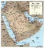
| Geography of Saudi Arabia FeatureType : country Elevation : 790 Lat/Lng : 25.0 / 45.0 | The Kingdom of Saudi Arabia is a country situated in Southwest Asia, the largest country of Arabia, by the Arabian Peninsula, bordering the Persian Gulf and the Red Sea, north of Yemen. Its extensive coastlines on the Persian Gulf and Red Sea provide great leverage on shipping (especially crude oil) (...) |
| 117 | Eduardo Mondlane University FeatureType : edu Elevation : 50 Lat/Lng : -25.9494 / 32.5988 | The Eduardo Mondlane University (; UEM) is the oldest and largest university in Mozambique. The UEM is located in Maputo and has about 40,000 students enrolled. (...) | |
| 118 | Lilongwe FeatureType : null Elevation : 1032 Lat/Lng : -13.9833 / 33.7833 | Lilongwe is the capital city of Malawi with an estimated population of 1,583,021 for 2015. The city is located in the central region of Malawi, near the borders with Mozambique and Zambia, and it is an important economic and transportation hub for central Malawi. It is named after the Lilongwe River (...) | |
| 119 | Monapo FeatureType : city Elevation : 111 Lat/Lng : -14.9169 / 40.3022 | Monapo is a town in northern Mozambique. (...) | |
| 120 | Nampula Airport FeatureType : null Elevation : 433 Lat/Lng : -15.1056 / 39.2818 | Nampula Airport is an airport in Nampula, Mozambique . In the northeastern part of Mozambique, with 2 paved runways. (...) | |
| 121 | Maxixe, Mozambique FeatureType : city Elevation : 19 Lat/Lng : -23.8627 / 35.3467 | Maxixe (pronounced 'ma-sheesh') is the largest city and economic capital of the province of Inhambane, Mozambique. It is situated on the Indian Ocean at 23°52′S 35°23′E just south of the Tropic of Capricorn, in a bay opposite historic Inhambane City which can be reached by local ferries (...) | |
| 122 | Zambezi FeatureType : landmark Elevation : 1015 Lat/Lng : -15.214 / 22.924 | The Zambezi (also spelled Zambeze and Zambesi) is the fourth-longest river in Africa, the longest east-flowing river in Africa and the largest flowing into the Indian Ocean from Africa. The area of its basin is , slightly less than half of the Nile's (...) | |
| 123 | LAM Mozambique Airlines Flight 470 FeatureType : event Elevation : 71 Lat/Lng : -25.9667 / 32.5833 | LAM Mozambique Airlines Flight 470 was a scheduled international passenger flight from Maputo International Airport, Mozambique that crashed on 29 November 2013 into the Bwabwata National Park in Namibia en route to Quatro de Fevereiro Airport, Angola (...) | |
| 124 | Nampula Province FeatureType : adm1st Elevation : 323 Lat/Lng : -15.25 / 39.5 | Nampula is a province of northern Mozambique. It has an area of 79,010 km² and a population of 3,985,613 (2007 census). Nampula is the capital of the province. (...) | |
| 125 | Maputo Province FeatureType : adm1st Elevation : 113 Lat/Lng : -25.5 / 32.3333 | Maputo is a province of Mozambique; the province excludes the city of Maputo (which comprises a separate province). The province has an area of 22,693 km² and a population of 1,205,709 (2007 census). Its capital is the city of Matola. (...) | |
| 126 | Save River (Africa) FeatureType : null Lat/Lng : -20.9042 / 35.0628 | The Save River, or Sabi River (Portuguese: Rio Save) is a river of southeastern Africa, flowing through Zimbabwe and Mozambique. The river has its source in Zimbabwe, some south of Harare, then flows south and then east, from the Zimbabwean highveld to its confluence with the Odzi River (...) | |
| 127 | Estado Novo (Portugal) FeatureType : country Elevation : 13 Lat/Lng : 38.7 / -9.1833 | The Estado Novo ("New State"), or the Second Republic, was the corporatist authoritarian regime installed in Portugal in 1933, which was considered fascist.Jorge Pais de Sousa, O Fascismo Catedrático de Salazar, Imprensa da Universidade de Coimbra, 2012 It evolved from the Ditadura Nacional (...) | |
| 128 | Marromeu FeatureType : city Elevation : 10 Lat/Lng : -18.2908 / 35.9453 | Marromeu is a town in central Mozambique on the south side of the Zambezi River. (...) | |
| 129 | Islamist insurgency in Mozambique FeatureType : null Elevation : 30 Lat/Lng : -11.35 / 40.3333 | The Islamist insurgency in Mozambique is an ongoing conflict in Cabo Delgado Province, Mozambique, between Ansar al-Sunna, an Islamist militant group attempting to establish an Islamic state in Mozambique, and Mozambican security forces (...) | |
| 130 | Montepuez FeatureType : null Elevation : 502 Lat/Lng : -13.1167 / 39.0 | Montepuez is the second largest city in the province of Cabo Delgado in Mozambique, after the provincial capital of Pemba. It is the seat of Montepuez District. (...) | |
| 131 | Nangade District FeatureType : adm1st Elevation : 250 Lat/Lng : -11.074 / 39.673 | Nangade District is a district of Cabo Delgado Province in northern Mozambique. It covers 3,005 km² with 71,588 inhabitants (2015). (...) | |
| 132 | Namuno District FeatureType : adm1st Elevation : 483 Lat/Lng : -13.621 / 38.819 | Namuno District is a district of Cabo Delgado Province in northern Mozambique. It covers 6,037 km² with 211,737 inhabitants (2015). (...) | |
| 133 | Macomia District FeatureType : adm1st Elevation : 97 Lat/Lng : -12.067 / 40.37 | Macomia District is a district of Cabo Delgado Province in northern Mozambique. It covers 4,252 km² with 91,033 inhabitants. (...) | |
| 134 | Mocuba District FeatureType : null Elevation : 137 Lat/Lng : -16.85 / 36.9833 | Mocuba District is a district of Zambezia Province in Mozambique. The main town is Mocuba. The district has 214748 inhabitants as of the 1997 census. (...) | |
| 135 | Meluco District FeatureType : adm1st Elevation : 309 Lat/Lng : -12.543 / 39.644 | Meluco District is a district of Cabo Delgado Province in northern Mozambique. It covers 5,799 km² with 26,221 inhabitants. (...) | |
| 136 | Mocímboa da Praia District FeatureType : null Elevation : 88 Lat/Lng : -11.21 / 40.2 | Mocímboa da Praia District is a district of Cabo Delgado Province in northern Mozambique. The district capital is Mocímboa da Praia town. (...) | |
| 137 | Chokwe, Mozambique FeatureType : adm1st Elevation : 33 Lat/Lng : -24.5253 / 33.0086 | Chokwé, and earlier known as Vila Trigo de Morais, is a rural town and capital of Chokwe District in the province of Gaza in Mozambique. It is located about north of the capital city of Maputo. This agricultural town is noted for its tomatoes.http://allafrica.com/stories/200008080305.html (...) | |
| 138 | Moatize FeatureType : city Elevation : 181 Lat/Lng : -16.1167 / 33.7333 | Moatize is the principal town and administrative center of Moatize District in western Mozambique's Tete Province. It is located on the eastern side of the Zambezi River at the confluence of the Moatize and Revuboe Rivers (...) | |
| 139 | Inhambane FeatureType : null Elevation : 14 Lat/Lng : -23.871 / 35.3857 | Inhambane, also known as Terra de Boa Gente (Land of Good People), is a city located in southern Mozambique, lying on Inhambane Bay, 470 km northeast of Maputo. It is the capital of the Inhambane Province and according to the 2017 census has a population of 79,724, growing from the 1997 census of (...) | |
| 140 | Zambezia Province FeatureType : adm1st Elevation : 123 Lat/Lng : -17.0 / 37.0 | Zambezia is the second most-populous province of Mozambique, located in the central coastal region south-west of Nampula Province and north-east of Sofala Province. It has a population of 5,11 million (census 2017). The provincial capital is Quelimane on the Bons Sinais River (...) | |
| 141 | Olifants River (Limpopo) FeatureType : river Elevation : 213 Lat/Lng : -24.0148 / 31.6669 | The Olifants River, Lepelle or Obalule is a river in South Africa and Mozambique, a tributary of the Limpopo River. It falls into the Drainage Area B of the Drainage basins of South Africa. The historical area of the Pedi people, Sekhukhuneland, is located between the Olifants River and one of its (...) | |
| 142 | Maputo International Airport FeatureType : airport Elevation : 36 Lat/Lng : -25.9208 / 32.5726 | Maputo International Airport , also known as Lourenço Marques Airport"." Aviation Safety Network. Retrieved on 3 October 2009. or Mavalane International Airport, is an airport located northwest of the center of Maputo, the largest city and capital of Mozambique (...) | |
| 143 | Xai-Xai FeatureType : city Elevation : 4 Lat/Lng : -25.05 / 33.65 | Xai-Xai is a city in the south of Mozambique. Until 1975, the city was named João Belo. It is the capital of Gaza Province. As of 2007 it has a population of 116,343. (...) | |
| 144 | 
| Inhaca FeatureType : city Elevation : 27 Lat/Lng : -26.0047 / 32.9144 | Inhaca is a settlement in Mozambique, on the subtropical Inhaca Island (' in Portuguese) off the East African coast. Inhaca settlement is centered on a missionary station located about 32 km east of Maputo. (...) |
| 145 | Paraíba FeatureType : adm1st Elevation : 635 Lat/Lng : -7.1667 / -36.8333 | Paraíba (Tupi: pa'ra a'íba: "bad for navigation";) is a state of Brazil. It is located in the Brazilian Northeast, and it is bordered by Rio Grande do Norte to the north, Ceará to the west, Pernambuco to the south and the Atlantic Ocean to the east (...) | |
| 146 | 
| Kariba Dam FeatureType : landmark Elevation : 487 Lat/Lng : -16.5217 / 28.7614 | The Kariba Dam is a double curvature concrete arch dam in the Kariba Gorge of the Zambezi river basin between Zambia and Zimbabwe. The dam stands tall and long. The dam forms Lake Kariba which extends for and holds of water. (...) |
| 147 | 
| Liwonde FeatureType : null Elevation : 488 Lat/Lng : -15.0667 / 35.2333 | Liwonde is a township in the Southern Region of Malawi. (...) |
| 148 | Inhambane (disambiguation) FeatureType : null Elevation : 138 Lat/Lng : -23.0 / 34.5 | Inhambane may refer to: * Inhambane, city located in southern Mozambique * Inhambane Province, province of Mozambique located on the coast in the southern part of the country * Inhambane Airport, airport in Jangamo District, Inhambane Province, Mozambique | |
| 149 | Ruvuma River FeatureType : waterbody Elevation : 0 Lat/Lng : -10.4744 / 40.4369 | Ruvuma River, formerly also known as the Rovuma River, is a river in the African Great Lakes region. During the greater part of its course, it forms the border between Tanzania and Mozambique (in Mozambique known as Rio Rovuma). The river is long, with a drainage basin in size (...) | |
| 150 | Eswatini–South Africa border FeatureType : landmark Elevation : 267 Lat/Lng : -25.9331 / 31.7613 | The border between South Africa and Eswatini is long; South Africa surrounds Swaziland to the north, west, south and southeast, with Mozambique bordering it on the northeast. (...) | |
| 151 | Ancuabe FeatureType : city Elevation : 331 Lat/Lng : -12.9833 / 39.85 | Ancuabe is a town in eastern Mozambique in Ancuabe District, Cabo Delgado Province. It is the seat of the district. According to the 1997 census it has a population of 12,561. (...) | |
| 152 | Grande-Terre (Mayotte) FeatureType : null Elevation : 111 Lat/Lng : -12.8333 / 45.15 | Grande-Terre (or Maore) is the main island of the French overseas region of Mayotte. The island is located in the northern Mozambique Channel in the Indian Ocean, namely between northwestern Madagascar and northeastern Mozambique. Its biggest city and prefecture is Mamoudzou (...) | |
| 153 | Assembly of the Republic (Mozambique) FeatureType : landmark Elevation : 53 Lat/Lng : -25.9593 / 32.5606 | The unicameral Assembly of the Republic is the legislative body of the Republic of Mozambique. The current parliament has 250 members who are directly elected through a system of party-list proportional representation and serve five-year terms (...) | |
| 154 | Transvaal (province) FeatureType : country Elevation : 1049 Lat/Lng : -25.0 / 28.5 | The Province of the Transvaal , commonly referred to as the Transvaal , was a province of South Africa from 1910 until the end of apartheid in 1994, when a new constitution subdivided it. The name "Transvaal" refers to the province's geographical location to the north of the Vaal River (...) | |
| 155 | 
| ISimangaliso Wetland Park FeatureType : null Elevation : 18 Lat/Lng : -27.8389 / 32.55 | iSimangaliso Wetland Park (previously known as the Greater St. Lucia Wetland Park) is situated on the east coast of KwaZulu-Natal, South Africa, about 275 kilometres north of Durban. It is South Africa's third-largest protected area, spanning 280 km of coastline, from the Mozambican border in the (...) |
| 156 | Lumbo FeatureType : null Elevation : 14 Lat/Lng : -15.0106 / 40.6664 | Lumbo is a port on the northeast Indian Ocean coast of Mozambique. It is part of the Island of Mozambique District in Nampula Province. It was served by a branch of the main northern line of the national Mozambique railway system which also serves the bigger port of Nacala to the north (...) | |
| 157 | Aveiro, Portugal FeatureType : adm1st Elevation : 11 Lat/Lng : 40.6389 / -8.6553 | Aveiro (or) is a city and a municipality in Portugal. In 2011, the population was 78,450, in an area of : it is the second most populous city in the Centro Region of Portugal (after Coimbra). Along with the neighbouring city of Ílhavo, Aveiro is part of an urban agglomeration that includes 120,000 (...) | |
| 158 | Macaiamo FeatureType : null Elevation : 418 Lat/Lng : -13.0964 / 39.4583 | Macaiamo is a village in Ancuabe District in Cabo Delgado Province in northeastern Mozambique. It is located west of the town of Mesa, Mozambique. (...) | |
| 159 | Alto Molocue District FeatureType : adm1st Elevation : 549 Lat/Lng : -15.631 / 37.692 | Alto Molocue District is a district of Zambezia Province in Mozambique. It covers 6,368 km² and has a population of 278,064.Mozambique September 2007 census (...) | |
| 160 | Manica, Mozambique FeatureType : city Elevation : 720 Lat/Lng : -18.9344 / 32.8756 | Manica is a market town in western Mozambique, lying west of Chimoio in the province of Manica. Originally the centre of the Kingdom of Manica, it grew around the gold trade but is now best known for the Chinamapere rock paintings. The Penha Longa Mountains lie north of the town. (...) | |
| 161 | Ulongué FeatureType : city Elevation : 1258 Lat/Lng : -14.7167 / 34.3667 | Ulongué is a town and the administrative seat of Angónia District, situated in the north east part of the Tete Province in Mozambique. This town is written as Vila Ulongué in some maps, but the name of this town is Ulongué not Vila Ulongué (...) | |
| 162 | Thyolo District FeatureType : null Elevation : 622 Lat/Lng : -16.1667 / 35.1667 | The Thyolo district of Malawi is one of the districts in Malawi. The capital is Thyolo. The district covers an area of 1,715 km.² and has a population of 458,976. It is also has crossroads leading to Makwasa, Molere, Konzalendo, Thekerani into Muona and eventually Nsanje leading to another border (...) | |
| 163 | Scattered Islands in the Indian Ocean FeatureType : isle Lat/Lng : -21.4761 / 39.6794 | The Scattered Islands in the Indian Ocean (or Îles Éparses de l'océan Indien) consist of four small coral islands, an atoll, and a reef in the Indian Ocean, and have constituted the 5th district of the French Southern and Antarctic Lands (TAAF) since February 2007 (...) | |
| 164 | Atoto FeatureType : null Elevation : 343 Lat/Lng : -12.8844 / 39.8678 | Atoto is a village in Ancuabe District in Cabo Delgado Province in northeastern Mozambique. (...) | |
| 165 | Memba District FeatureType : adm1st Elevation : 20 Lat/Lng : -14.183 / 40.526 | Memba District is a district of Nampula Province in north-eastern Mozambique. The principal town is Memba. (...) | |
| 166 | Mecubúri District FeatureType : adm1st Elevation : 463 Lat/Lng : -14.657 / 38.891 | Mecubúri District is a district of Nampula Province in north-eastern Mozambique. The principal town is Mecubúri. (...) | |
| 167 | Angoche District FeatureType : adm1st Elevation : 4 Lat/Lng : -16.244 / 39.907 | Angoche District is a district of Nampula Province in north-eastern Mozambique. The principal town is Angoche. (...) | |
| 168 | Zumbo District FeatureType : adm1st Elevation : 348 Lat/Lng : -15.6167 / 30.45 | Zumbo District is a district of Tete Province in westernmost Mozambique. The principal town is Zumbo. (...) | |
| 169 | Mecanhelas District FeatureType : adm1st Elevation : 652 Lat/Lng : -15.198 / 35.873 | Mecanhelas District is a district of Niassa Province in north-western Mozambique. The principal town is Mecanhelas. (...) | |
| 170 | Quissanga District FeatureType : adm2nd Elevation : 7 Lat/Lng : -12.4359 / 40.4965 | Quissanga District is a district of Cabo Delgado Province in northern Mozambique. It covers with 40,486 inhabitants (2015). (...) | |
| 171 | Meconta District FeatureType : adm1st Elevation : 265 Lat/Lng : -14.96 / 39.846 | Meconta District is a district of Nampula Province in north-eastern Mozambique. The principal town is Meconta. (...) | |
| 172 | Sanga District FeatureType : null Elevation : 749 Lat/Lng : -12.1772 / 35.5597 | Sanga District is a district of Niassa Province in north-western Mozambique. The principal town is Sanga. (...) | |
| 173 | Ibo District FeatureType : null Elevation : 82 Lat/Lng : -12.21 / 40.38 | Ibo District is a small district of Cabo Delgado Province in northern Mozambique. Its principal town is Vila do Ibo on Ibo Island. (...) | |
| 174 | Nipepe District FeatureType : adm1st Elevation : 523 Lat/Lng : -14.03 / 37.856 | Nipepe District is a district of Niassa Province in north-western Mozambique. The principal town is Nipepe. (...) | |
| 175 | Metarica District FeatureType : adm1st Elevation : 615 Lat/Lng : -14.328 / 36.803 | Metarica District is a district of Niassa Province in north-western Mozambique. The principal town is Metarica. (...) | |
| 176 | Cuamba District FeatureType : city Elevation : 568 Lat/Lng : -14.8167 / 36.55 | Cuamba District is a district of Niassa Province in north-western Mozambique. The principal town is Cuamba. (...) | |
| 177 | N'gauma District FeatureType : null Elevation : 1111 Lat/Lng : -13.9225 / 35.4253 | N'gauma District is a district of Niassa Province in north-western Mozambique. The principal town is N'gauma. (...) | |
| 178 | Nacarôa District FeatureType : adm1st Elevation : 311 Lat/Lng : -14.373 / 39.92 | Nacarôa District is a district of Nampula Province in north-eastern Mozambique. The principal town is Nacarôa. (...) | |
| 179 | Lichinga District FeatureType : city Elevation : 1336 Lat/Lng : -13.3128 / 35.24 | Lichinga District is a district of Niassa Province in north-western Mozambique. The principal town is Lichinga. (...) | |
| 180 | Chinde District FeatureType : city Elevation : 8 Lat/Lng : -18.5833 / 36.4667 | Chinde District is a district of Zambezia Province in Mozambique. The principal town is Chinde. (...) | |
| 181 | Murrupula District FeatureType : adm1st Elevation : 447 Lat/Lng : -15.461 / 38.681 | Murrupula District is a district of Nampula Province in north-eastern Mozambique. The principal town is Murrupula. (...) | |
| 182 | Mandimba FeatureType : city Elevation : 772 Lat/Lng : -14.353 / 35.651 | Mandimba is the principal town of Mandimba District in Niassa Province in north-western Mozambique. (...) | |
| 183 | Mecúfi District FeatureType : adm1st Elevation : 28 Lat/Lng : -13.307 / 40.551 | Mecúfi District is a district of Cabo Delgado Province in northern Mozambique. It covers 1,254 km² with 48,503 inhabitants. (...) | |
| 184 | Nacala-a-Velha District FeatureType : adm1st Elevation : 52 Lat/Lng : -14.566 / 40.723 | Nacala-a-Velha District is a district of Nampula Province in north-eastern Mozambique. (...) | |
| 185 | Moma District FeatureType : adm1st Elevation : 12 Lat/Lng : -16.757 / 39.222 | Moma District is a district of Nampula Province in north-eastern Mozambique. The principal town is Moma. (...) | |
| 186 | Muembe District FeatureType : adm1st Elevation : 1106 Lat/Lng : -13.087 / 35.643 | Muembe District is a district of Niassa Province in north-western Mozambique. The principal town is Muembe. (...) | |
| 187 | Mogincual District FeatureType : adm1st Elevation : 42 Lat/Lng : -15.566 / 40.442 | Mogincual District is a district of Nampula Province in north-eastern Mozambique. The principal town is Mogincual. (...) | |
| 188 | Mogovolas District FeatureType : null Elevation : 149 Lat/Lng : -15.7394 / 39.2483 | Mogovolas District is a district of Nampula Province in north-eastern Mozambique. The principal town is Nametil. (...) | |
| 189 | Mandimba District FeatureType : adm1st Elevation : 744 Lat/Lng : -14.36 / 35.655 | Mandimba District is a district of Niassa Province in north-western Mozambique. The principal town is Mandimba. (...) | |
| 190 | Lalaua District FeatureType : adm1st Elevation : 412 Lat/Lng : -14.393 / 38.268 | Lalaua District is a district of Nampula Province in north-eastern Mozambique. The principal town is Lalaua. (...) | |
| 191 | Majune District FeatureType : null Elevation : 626 Lat/Lng : -13.2632 / 36.3124 | Majune District is a district of Niassa Province in north-western Mozambique. The principal town is Majune. (...) | |
| 192 | Muecate District FeatureType : adm1st Elevation : 279 Lat/Lng : -14.889 / 39.634 | Muecate District is a district of Nampula Province in north-eastern Mozambique. The principal town is Muecate. (...) | |
| 193 | Évora FeatureType : adm1st Elevation : 310 Lat/Lng : 38.5725 / -7.9072 | Évora is a city and a municipality in Portugal. The population in 2011 was 56,596, in an area of 1307.08 km². It is the seat of the Évora District. The present Mayor is Carlos Pinto de Sá of the CDU coalition. The municipal holiday is 29 June (...) | |
| 194 | Paraná (state) FeatureType : adm1st Elevation : 910 Lat/Lng : -25.4297 / -49.2717 | Paraná (In Brazilian Portuguese. The European Portuguese pronunciation is .) is one of the 26 states of Brazil, in the south of the country, bordered on the north by São Paulo state, on the east by the Atlantic Ocean, on the south by Santa Catarina state and the province of Misiones, Argentina, and (...) | |
| 195 | Limpopo FeatureType : adm1st Elevation : 1244 Lat/Lng : -24.0 / 29.0 | Limpopo (; Northern Sotho, Tsonga, Venda, Afrikaans, ;) is the northernmost province of South Africa. It is named after the Limpopo River, which forms the province's western and northern borders. The name "Limpopo" has its etymological origin in the Northern Sotho language word diphororo tša meetse, (...) | |
| 196 | Tropic of Capricorn FeatureType : landmark Lat/Lng : -23.4371 / 0.0 | The Tropic of Capricorn (or the Southern Tropic) is the circle of latitude that contains the subsolar point on the December (or southern) solstice. It is thus the southernmost latitude where the Sun can be directly overhead. Its northern equivalent is the Tropic of Cancer (...) | |
| 197 | Southern Hemisphere FeatureType : null Lat/Lng : -45.0 / 0.0 | The Southern Hemisphere is the half of Earth that is south of the Equator. It contains all or parts of five continents (Antarctica, Australia, about 90% of South America, the southern third of Africa, and several southern islands off the continental mainland of Asia), four oceans (Indian, South (...) | |
| 198 | 
| Luapula River FeatureType : river Elevation : 921 Lat/Lng : -9.4138 / 28.5219 | The Luapula River is a section of Africa's second-longest river, the Congo. It is a transnational river forming for nearly all its length part of the border between Zambia and the DR Congo. It joins Lake Bangweulu (wholly in Zambia) to Lake Mweru (shared between the two countries) and gives its name (...) |
| 199 | Figueira da Foz FeatureType : adm1st Elevation : 18 Lat/Lng : 40.1508 / -8.8511 | Figueira da Foz , also known as Figueira for short, is a city and a municipality in the Coimbra District, in Portugal. Practically at the midpoint of the Iberian Peninsula's western coast, it is located at the mouth of the Mondego River, 40 km west of Coimbra, and sheltered by hills (Serra da Boa (...) | |
| 200 | Faro, Portugal FeatureType : adm1st Elevation : 12 Lat/Lng : 37.0333 / -7.9167 | Faro is a municipality and bishopric, the southernmost city and seat of the district of the same name, in the Algarve region of southern Portugal. With a population of 64,560 inhabitants in 2011 (with 50,000 inhabitants in the city proper, making it the biggest city in the Algarve and one of the (...) | |
 by
by