| 1482 records found in wikipedia | |||
| 1 | 
| Brčko District  FeatureType : adm1st Elevation : 89 Lat/Lng : 44.8667 / 18.7833 | Brčko District (; Bosnian, Croatian, Serbian: Брчко Дистрикт/Brčko Distrikt) is a self-governing administrative unit in north-eastern Bosnia and Herzegovina. Officially a condominium of the Federation of Bosnia and Herzegovina and Republika Srpska, it was formed in 1999 to reflect Brčko and the (...) |
| 2 | 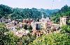
| Srebrenica FeatureType : city Elevation : 361 Lat/Lng : 44.1064 / 19.2969 | Srebrenica is a town and municipality located in the easternmost part of Republika Srpska, an entity of Bosnia and Herzegovina. It is a small mountain town, with its main industry being salt mining and a nearby spa (...) |
| 3 | 
| Banja Luka FeatureType : null Elevation : 166 Lat/Lng : 44.7758 / 17.1856 | Banja Luka or Banjaluka , is the second largest city of Bosnia and Herzegovina and the de facto capital of the Republika Srpska entity. Traditionally, it has been the centre of the Bosanska Krajina region, located in the northwestern part of the country (...) |
| 4 | 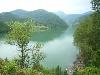
| Višegrad FeatureType : null Elevation : 321 Lat/Lng : 43.7847 / 19.2992 | Višegrad is a town and municipality located in eastern Republika Srpska, an entity of Bosnia and Herzegovina. It is resting at the confluence of the Drina and the Rzav river. As of 2013, it has a population of 10,668 inhabitants (...) |
| 5 | 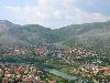
| Trebinje FeatureType : null Elevation : 278 Lat/Lng : 42.712 / 18.3436 | Trebinje is a city located in Republika Srpska, an entity of Bosnia and Herzegovina. It is the southernmost city in Bosnia and Herzegovina situated on the banks of Trebišnjica river in the region of East Herzegovina. As of 2013, it has a population of 31,433 inhabitants (...) |
| 6 | 
| Bijeljina FeatureType : null Elevation : 91 Lat/Lng : 44.7587 / 19.2144 | Bijeljina is a city in Bosnia and Herzegovina. It is located in the Republika Srpska entity and is the provincial center of Semberija, a geographic region in the country's northeast. As of 2013, it has a population of 107,715 inhabitants. (...) |
| 7 | Republika Srpska FeatureType : null Elevation : 221 Lat/Lng : 44.75 / 17.3167 | Republika Srpska (; , ; literally "Serb Republic") is one of two constitutional and legal entities of Bosnia and Herzegovina, the other being the Federation of Bosnia and Herzegovina. The entities are largely autonomous (...) | |
| 8 | 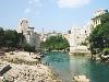
| Bosnia and Herzegovina FeatureType : country Elevation : 850 Lat/Lng : 44.1 / 17.9667 | Bosnia and Herzegovina (or ; abbreviated B&H; Bosnian and Serbian: Bosna i Hercegovina (BiH) / Боснa и Херцеговина , Croatian: Bosna i Hercegovina (BiH)), sometimes called Bosnia–Herzegovina, and often known informally as Bosnia, is a country in Southeastern Europe in the Balkan Peninsula (...) |
| 9 | 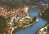
| Zvornik FeatureType : city Elevation : 150 Lat/Lng : 44.3869 / 19.1014 | Zvornik is a city in Bosnia and Herzegovina. It is located in entity of Republika Srpska, on the left bank of the Lower Drina river, east from Tuzla and south of Bijeljina. As of 2013, it has a population of 58,856 inhabitants (...) |
| 10 | 
| Bileća FeatureType : city Elevation : 479 Lat/Lng : 42.8719 / 18.4297 | Bileća is a town and municipality located in Republika Srpska, an entity of Bosnia and Herzegovina. As of 2013, the town has a population of 8,220 inhabitants, while the municipality has 10,807 inhabitants. (...) |
| 11 | 
| Srbac FeatureType : null Elevation : 99 Lat/Lng : 45.0978 / 17.525 | Srbac , is a town and municipality located in Republika Srpska, an entity of Bosnia and Herzegovina. It is situated on the confluence of rivers Vrbas and Sava. As of 2013, it has a population of 17,587 inhabitants. (...) |
| 12 | 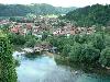
| Bosanska Krupa FeatureType : city Elevation : 153 Lat/Lng : 44.8825 / 16.1514 | Bosanska Krupa is a town and municipality located in Una-Sana Canton of the Federation of Bosnia and Herzegovina, an entity of Bosnia and Herzegovina. As of 2013, it has a population of 29,659 inhabitants. It is situated on the banks of river Una in northwestern Bosnia and Herzegovina, northeast (...) |
| 13 | 
| Visoko FeatureType : city Elevation : 423 Lat/Lng : 43.9889 / 18.1781 | Visoko is a town and municipality located in Zenica-Doboj Canton of the Federation of Bosnia and Herzegovina, an entity of Bosnia and Herzegovina. As of 2013, it has a population of 41,352 inhabitants. It was an early centre of the Bosnian medieval state, and the site where the first Bosnian king (...) |
| 14 | 
| Foča FeatureType : city Elevation : 405 Lat/Lng : 43.5064 / 18.7747 | Foča is a town and a municipality located in eastern Bosnia and Herzegovina. It is situated on the banks of Drina river. As of 2013, the town has a population of 12,234 inhabitants, while the municipality has 18,288 inhabitants. (...) |
| 15 | 
| Belgrade FeatureType : null Elevation : 93 Lat/Lng : 44.8206 / 20.4622 | Belgrade (; / Београд, meaning "white city", ;) is the capital and largest city of Serbia. It is located at the confluence of the Sava and Danube rivers, where the Pannonian Plain meets the Balkans. The urban area of the City of Belgrade has a population of 1.23 million, while nearly 1 (...) |
| 16 | 
| Transnistria FeatureType : null Elevation : 121 Lat/Lng : 47.3338 / 29.1976 | Transnistria, officially the Pridnestrovian Moldavian Republic (see more on names below) is an unrecognised state which split off from Moldova after the dissolution of the USSR and mostly consists of a narrow strip of land between the river Dniester and the territory of Ukraine (...) |
| 17 | 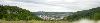
| Ugljevik FeatureType : city Elevation : 238 Lat/Lng : 44.6672 / 19.0119 | Ugljevik is a town and municipality located in Republika Srpska, an entity of Bosnia and Herzegovina. As of 2013, the town has a population of 4,155 inhabitants, while the municipality has 15,710 inhabitants. The municipality is located in the eastern foothills of Mount Majevica, in picturesque (...) |
| 18 | 
| Dubica, Bosnia-Herzegovina FeatureType : null Elevation : 99 Lat/Lng : 45.1767 / 16.8094 | Kozarska Dubica , formerly known as Bosanska Dubica , is a town and municipality located in northern Republika Srpska, an entity of Bosnia and Herzegovina. As of 2013, the town has 11,566, while the municipality has 21,542 inhabitants. It is situated in the eastern part of Bosanska Krajina region (...) |
| 19 | 
| Glamoč FeatureType : null Elevation : 950 Lat/Lng : 44.0458 / 16.8486 | Glamoč is a town and municipality located in Canton 10 of the Federation of Bosnia and Herzegovina, an entity of Bosnia and Herzegovina. It is situated in southwestern Bosnia and Herzegovina, at the foot of the hills of Staretina and Velika Golija on the edge of the central part of the Glamoč Field (...) |
| 20 | 
| Socialist Federal Republic of Yugoslavia FeatureType : country Elevation : 1256 Lat/Lng : 42.7833 / 19.4667 | The Socialist Federal Republic of Yugoslavia (SFR Yugoslavia or SFRY) was a country located in Central and Southeastern Europe that existed from its foundation in the aftermath of World War II until its dissolution in 1992 amid the Yugoslav Wars (...) |
| 21 | 
| Gradačac FeatureType : city Elevation : 153 Lat/Lng : 44.8808 / 18.4269 | Gradačac is a town and municipality located in Tuzla Canton of the Federation of Bosnia and Herzegovina, an entity of Bosnia and Herzegovina. It is situated in the northeastern part of Bosnia and Herzegovina, roughly south of the Sava river. As of 2013, it has a population of 41,836 inhabitants (...) |
| 22 | 
| Kostajnica, Bosnia and Herzegovina FeatureType : city Elevation : 110 Lat/Lng : 45.2197 / 16.5358 | Kostajnica ,, Kostajnica/Костајница. is a town and municipality located in northern Republika Srpska, an entity of Bosnia and Herzegovina. It is situated in the part of the Кrajina region. As of 2013, it has a population of 5,977 inhabitants (...) |
| 23 | 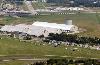
| Wright-Patterson Air Force Base FeatureType : null Elevation : 243 Lat/Lng : 39.8238 / -84.0494 | Wright-Patterson Air Force Base (WPAFB) is a United States Air Force base and census-designated place just east of Dayton, Ohio, in Greene and Montgomery counties. It includes both Wright and Patterson Fields, which were originally Wilbur Wright Field and Fairfield Aviation General Supply Depot (...) |
| 24 | Trnovo, Republika Srpska FeatureType : city Elevation : 817 Lat/Lng : 43.6658 / 18.4459 | Trnovo is a municipality of the city of Istočno Sarajevo located in Republika Srpska, an entity of Bosnia and Herzegovina. As of 2013, it has a population of 2,050 inhabitants. It consists of roughly one third of the pre-war municipality of Trnovo (...) | |
| 25 | 
| Mehmed Paša Sokolović Bridge FeatureType : landmark Elevation : 296 Lat/Lng : 43.7814 / 19.288 | The Mehmed Paša Sokolović Bridge (Bosnian and Serbian: Most Mehmed-paše Sokolovića/Мост Мехмед-паше Соколовића;) is a historic bridge in Višegrad, over the Drina River in eastern Bosnia and Herzegovina. It was completed in 1577 by the Ottoman court architect Mimar Sinan on the order of the Grand (...) |
| 26 | Vlasenica FeatureType : city Elevation : 660 Lat/Lng : 44.1819 / 18.9406 | Vlasenica is a town and municipality located in Republika Srpska, an entity of Bosnia and Herzegovina. As of 2013, it has a population 11,467 inhabitants. (...) | |
| 27 | Krupa na Uni FeatureType : city Elevation : 262 Lat/Lng : 44.9092 / 16.2655 | Krupa na Uni is a town and municipality in northern Republika Srpska, an entity of Bosnia and Herzegovina. It is situated in the north-western part of the Republika Srpska entity and the central part of the Bosanska Krajina region (...) | |
| 28 | Novi Grad, Republika Srpska FeatureType : null Elevation : 123 Lat/Lng : 45.0472 / 16.3828 | Novi Grad (; formerly Bosanski Novi), Novi Grad/Нови Град. is a town and municipality located in the northern portion of the Republika Srpska, an entity of Bosnia and Herzegovina. The town is situated on the Una river on the border with Croatia (opposite the town of Dvor) (...) | |
| 29 | Istočna Ilidža FeatureType : null Elevation : 680 Lat/Lng : 43.7945 / 18.3735 | Istočna Ilidža ("East Ilidža") is a municipality of the city of Istočno Sarajevo located in Republika Srpska, an entity of Bosnia and Herzegovina. As of 2013, it has a population of 14,763 inhabitants. It was also known as Srpska Ilidža (Српска Илиџа, "Serbian Ilidža"), as well as Kasindo, and was (...) | |
| 30 | Premier League of Bosnia and Herzegovina FeatureType : null Elevation : 317 Lat/Lng : 44.2057 / 17.9072 | The BH Telecom Premier League of Bosnia and Herzegovina , also known as Liga 12, is the top tier football league in Bosnia and Herzegovina, and is operated by the Football Association of Bosnia and Herzegovina. As the country's most prestigious level of football competition, the league changed (...) | |
| 31 | Gornji Ribnik FeatureType : city Elevation : 311 Lat/Lng : 44.4175 / 16.8169 | Gornji Ribnik is a village in the municipality of Ribnik, Republika Srpska, Bosnia and Herzegovina.Official results from the book: Ethnic composition of Bosnia-Herzegovina population, by municipalities and settlements, 1991. census, Zavod za statistiku Bosne i Hercegovine - Bilten no (...) | |
| 32 | 
| Avala FeatureType : null Elevation : 487 Lat/Lng : 44.6905 / 20.5143 | Avala is a mountain in Serbia, overlooking Belgrade. It is situated in the south-eastern corner of the city and provides a great panoramic view of Belgrade, Vojvodina and Šumadija, as the surrounding area on all sides is mostly lowlands (...) |
| 33 | Berkovići FeatureType : adm2nd Elevation : 544 Lat/Lng : 43.0947 / 18.1703 | Berkovići is a village and municipality located in southern Republika Srpska, an entity of Bosnia and Herzegovina. As of 2013, it has a population of 2,114 inhabitants. (...) | |
| 34 | Laktaši FeatureType : city Elevation : 124 Lat/Lng : 44.9086 / 17.3014 | Laktaši is a town and municipality located in Republika Srpska, an entity of Bosnia and Herzegovina. As of 2013, it has a population of 34,966 inhabitants. (...) | |
| 35 | Oštra Luka FeatureType : mountain Elevation : 148 Lat/Lng : 44.825 / 16.6583 | Oštra Luka is a village and a municipality located in Republika Srpska, an entity of Bosnia and Herzegovina. As of 2013, it has a population of 2,786 inhabitants. The municipality is situated in the northwestern part of the Republika Srpska and the central part of the Bosanska Krajina region (...) | |
| 36 | Teslić FeatureType : null Elevation : 202 Lat/Lng : 44.6064 / 17.8597 | Teslić is a town and municipality located in Republika Srpska, an entity of Bosnia and Herzegovina. It is situated in the central part of the Republika Srpska, on the banks of Usora River. As of 2013, the town has a population of 7,518 inhabitants, while the municipality has 38,536 inhabitants (...) | |
| 37 | Istočni Stari Grad FeatureType : city Elevation : 1062 Lat/Lng : 43.8572 / 18.4883 | Istočni Stari Grad ("East Old Town") is a municipality of the city of Istočno Sarajevo located in Republika Srpska, an entity of Bosnia and Herzegovina. As of 2013, it has a population of 1,131 inhabitants. It was also known as Srpski Stari Grad (Српски Стари Град, "Serbian Old Town") and was (...) | |
| 38 | Han Pijesak FeatureType : null Elevation : 1088 Lat/Lng : 44.0808 / 18.9525 | Han Pijesak is a town and municipality located in Republika Srpska, an entity of Bosnia and Herzegovina. As of 2013, it has a population of 3,530 inhabitants. (...) | |
| 39 | Rogatica FeatureType : null Elevation : 528 Lat/Lng : 43.7989 / 19.0036 | Rogatica is a town and municipality located in eastern Republika Srpska, an entity of Bosnia and Herzegovina. As of 2013, the town ha a population of 6,855 inhabitants, while the municipality has 10,723 inhabitants. (...) | |
| 40 | Novo Goražde FeatureType : null Elevation : 343 Lat/Lng : 43.6911 / 19.0892 | Novo Goražde , also known as Ustiprača, is a village and municipality located in Republika Srpska, an entity of Bosnia and Herzegovina. As of 2013, it has a population of 3,117 inhabitants. It was split from the pre-existing municipality of Goražde and given to Republika Srpska by the Dayton (...) | |
| 41 | Lopare FeatureType : null Elevation : 240 Lat/Lng : 44.6378 / 18.8428 | Lopare is a town and municipality located in Republika Srpska, an entity of Bosnia and Herzegovina. It is situated in the Majevica region. As of 2013, the town has a population of 2,709 inhabitants, while the municipality has 15,357 inhabitants. (...) | |
| 42 | Ribnik, Bosnia and Herzegovina FeatureType : adm2nd Elevation : 312 Lat/Lng : 44.4169 / 16.8166 | Ribnik is a village and municipality located in Republika Srpska, an entity of Bosnia and Herzegovina. It is situated in the southern part of the Bosanska Krajina region. As of 2013, it has a population of 6,048 inhabitants (...) | |
| 43 | Živinice (Kneževo) FeatureType : null Elevation : 778 Lat/Lng : 44.5477 / 17.3736 | Živinice (Cyrillic: Живинице), is a village in Kneževo municipality, Republika Srpska, Bosnia and Herzegovina. (...) | |
| 44 | Brčko FeatureType : city Elevation : 95 Lat/Lng : 44.8728 / 18.8083 | Brčko is a town, municipality and the administrative seat of Brčko District in northern Bosnia and Herzegovina. It lies on the banks of Sava river across from Croatia. As of 2013, it has a population of 83,516 inhabitants. It is the only existent entirely self-governing free city in Europe.. (...) | |
| 45 | Šiprage FeatureType : city Elevation : 520 Lat/Lng : 44.466 / 17.56 | Šiprage is a settlement and former municipality in the Bosnia and Herzegovina, Republika Srpska entity, Kotor Varoš Municipality. The administrative status of this populated place was changed – from the local community has grown a municipality in the County of Kotor Varoš – in order to ensure in the (...) | |
| 46 | Federation of Bosnia and Herzegovina FeatureType : state Elevation : 1231 Lat/Lng : 43.83 / 17.71 | The Federation of Bosnia and Herzegovina (abbreviated FB&H; Bosnian and Serbian: Federacija Bosna i Hercegovina (FBiH) / Федерација Боснa и Херцеговина , Croatian: Federacija Bosna i Hercegovina (FBiH)) is one of the two political entities that compose Bosnia and Herzegovina, the other being (...) | |
| 47 | Doboj FeatureType : null Elevation : 144 Lat/Lng : 44.7318 / 18.087 | Doboj is a city located in Republika Srpska, an entity of Bosnia and Herzegovina. It is situated on the banks of Bosna river, in the northern region of the Republika Srpska. As of 2013, it has a population of 71,441 inhabitants (...) | |
| 48 | Republic of Serbian Krajina FeatureType : waterbody Lat/Lng : 59.9833 / -179.9833 | The Republic of Serbian Krajina or Serb Republic of Krajina (/ Republika Srpska Krajina or РСК / RSK)), known as Serb Krajina (/ Srpska Krajina) or simply Krajina, was a self-proclaimed Serb proto-state, a territory within the newly independent Croatia (formerly part of Yugoslavia), which it defied, (...) | |
| 49 | Pale, Bosnia and Herzegovina FeatureType : city Elevation : 836 Lat/Lng : 43.8157 / 18.5707 | Pale is a municipality of the city of Istočno Sarajevo located in Republika Srpska, an entity of Bosnia and Herzegovina. It is situated southeast of the capital city of Sarajevo. As of 2013, it has a population of 20,909 inhabitants. (...) | |
| 50 | Petrovac, Bosnia and Herzegovina FeatureType : null Elevation : 722 Lat/Lng : 44.5072 / 16.4661 | Petrovac is a village and municipality located in Republika Srpska, an entity of Bosnia and Herzegovina. It is situated in the western part of Republika Srpska and the central part of the Krajina region. Petrovac was created from a small part of the pre-war municipality of Bosanski Petrovac, whose (...) | |
| 51 | Šamac, Bosnia and Herzegovina FeatureType : city Elevation : 86 Lat/Lng : 45.0592 / 18.4669 | Šamac is a town and municipality located in the northeastern part of the Republika Srpska, an entity of Bosnia and Herzegovina. As of 2013, the town has a population of 5,390 inhabitants, while the municipality has 17,273 inhabitants. It is situated on the right bank of the Sava river (...) | |
| 52 | Čajniče FeatureType : null Elevation : 841 Lat/Lng : 43.5575 / 19.0711 | Čajniče is a town and municipality located in Republika Srpska, an entity of Bosnia and Herzegovina. As of 2013, the town has a population of 2,401 inhabitants, while the municipality has 4,895 inhabitants. (...) | |
| 53 | Bratunac FeatureType : null Elevation : 177 Lat/Lng : 44.1875 / 19.3394 | Bratunac is a town and municipality located in easternmost part of Republika Srpska, an entity of Bosnia and Herzegovina. As of 2013 census, it has a population of 20,340 inhabitants. (...) | |
| 54 | Sokolac FeatureType : null Elevation : 861 Lat/Lng : 43.9372 / 18.7983 | Sokolac is a municipality of the city of Istočno Sarajevo located in Republika Srpska, an entity of Bosnia and Herzegovina. As of 2013, it has a population of 12,021 inhabitants. (...) | |
| 55 | Istočno Sarajevo FeatureType : null Elevation : 554 Lat/Lng : 43.8594 / 18.4358 | Istočno Sarajevo ("East Sarajevo") or East Sarajevo, is a city located in Republika Srpska (RS), an entity of Bosnia and Herzegovina. It consists of a few pre-war suburban parts of Sarajevo which are now in the Republika Srpska entity (east of Sarajevo), and newly built areas (...) | |
| 56 | Čelinac FeatureType : adm2nd Elevation : 199 Lat/Lng : 44.7228 / 17.3278 | Čelinac is a town and municipality located in north-west Republika Srpska, an entity of Bosnia and Herzegovina. As of 2013, it has a population of 15,548 inhabitants. The Stuplje monastery of the Serbian Orthodox Church is located in the municipality. (...) | |
| 57 | Srebrenica massacre FeatureType : null Elevation : 373 Lat/Lng : 44.103 / 19.298 | The Srebrenica massacre, also known as the Srebrenica genocide * * * * * , was the July 1995 massacre * * * of more than 8,000Potocari Memorial Center Preliminary List of Missing Persons from Srebrenica '95 * * , p. 81. * , p. 25 (...) | |
| 58 | Siege of Sarajevo FeatureType : city Elevation : 508 Lat/Lng : 43.8476 / 18.3564 | The Siege of Sarajevo was the siege of the capital of Bosnia and Herzegovina, and the longest of a capital city in the history of modern warfare. After being initially besieged by the forces of the Yugoslav People's Army, Sarajevo was besieged by the Army of Republika Srpska from 5 April 1992 to 29 (...) | |
| 59 | Museum of Modern Art of Republika Srpska FeatureType : null Elevation : 164 Lat/Lng : 44.7723 / 17.1897 | The Museum of Modern Art of Republika Srpska is an art museum in Banja Luka, Republika Srpska, Bosnia and Herzegovina. The museum has rebranded itself in recent years as the Museum of Contemporary Art of Republika Srpska. (...) | |
| 60 | Almada FeatureType : adm1st Elevation : 33 Lat/Lng : 38.6777 / -9.157 | Almada is a city and a municipality in Portugal, located on the southern margin of the Tagus River, on the opposite side of the river from Lisbon. The two cities are connected by the 25 de Abril Bridge. The population in 2011 was 174,030, in an area of 70.21 km² (...) | |
| 61 | Jajce FeatureType : null Elevation : 524 Lat/Lng : 44.3403 / 17.2572 | Jajce is a town and municipality located in Central Bosnia Canton of the Federation of Bosnia and Herzegovina, an entity of Bosnia and Herzegovina. As of 2013, it has a population of 30,758 inhabitants. It is situated in the region of Bosanska Krajina, on the crossroads between Banja Luka, Mrkonjić (...) | |
| 62 | Novi Sad FeatureType : null Elevation : 77 Lat/Lng : 45.2593 / 19.8291 | Novi Sad (; ; see below for other names) is the second largest city in modern-day Serbia, the capital of the autonomous province of Vojvodina and the administrative center of the South Bačka District. It is located in the southern part of the Pannonian Plain, on the border of the Bačka and Srem (...) | |
| 63 | Operation Storm FeatureType : null Elevation : 136 Lat/Lng : 45.8159 / 15.9782 | Operation Storm was the last major battle of the Croatian War of Independence and a major factor in the outcome of the Bosnian War. It was a decisive victory for the Croatian Army (HV), which attacked across a front against the Republic of Serbian Krajina (RSK), and a strategic victory for the Army (...) | |
| 64 | 2011–12 First League of the Republika Srpska FeatureType : null Elevation : 94 Lat/Lng : 45.0936 / 17.729 | The 2011–12 First League of the Republika Srpska is the seventeenth season of the First League of the Republika Srpska, the second tier football league of Bosnia and Herzegovina, since its original establishment and the tenth as a second tier league (...) | |
| 65 | Prijedor FeatureType : null Elevation : 140 Lat/Lng : 44.9799 / 16.714 | Prijedor is a city located in Republika Srpska, an entity of Bosnia and Herzegovina. As of 2013, it has a population of 89,397 inhabitants within its administrative limits. Prijedor is situated in the Bosanska Krajina region (...) | |
| 66 | Stanari FeatureType : null Elevation : 230 Lat/Lng : 44.7448 / 17.8271 | Stanari is a town and municipality located in Republika Srpska, an entity of Bosnia and Herzegovina. It was established in 2014, after it split from Doboj municipality. (...) | |
| 67 | Kupres, Republika Srpska FeatureType : null Elevation : 1121 Lat/Lng : 44.0797 / 17.1558 | Kupres , also known as Kupres Republike Srpske , is a village and municipality in western Republika Srpska, an entity of Bosnia and Herzegovina. It is bordering the region of Bosanska Krajina to the north. It is one of the most undeveloped and poorest municipalities in Bosnia and Herzegovina. (...) | |
| 68 | Maslovare, Kotor Varoš FeatureType : city Elevation : 401 Lat/Lng : 44.5659 / 17.5322 | Maslovare is a village in the central Bosnia, Bosnia and Herzegovina, Republika Srpska , Kotor Varoš Municipality.Vojnogeografski institut, Izd. (1955): Prnjavor (List karte 1:100.000, Izohipse na 20 m). Vojnogeografski institut, Beograd.Spahić M. et al. (2000): Bosna i Hercegovina (1:250.000) (...) | |
| 69 | Gacko FeatureType : null Elevation : 970 Lat/Lng : 43.1672 / 18.5353 | Gacko is a town and municipality located in Republika Srpska, an entity of Bosnia and Herzegovina. It is situated in the region of East Herzegovina. As of 2013, the town has a population of 5,784 inhabitants, while the municipality has 8,990 inhabitants. (...) | |
| 70 | Mrkonjić Grad FeatureType : null Elevation : 567 Lat/Lng : 44.4158 / 17.0861 | Mrkonjić Grad is a town and municipality located in western Republika Srpska, an entity of Bosnia and Herzegovina. It is located in the region of Bosanska Krajina, between Banja Luka and Jajce. As of 2013, it has a population of 16,671 inhabitants. (...) | |
| 71 | Šekovići FeatureType : city Elevation : 340 Lat/Lng : 44.299 / 18.8553 | Šekovići is a town and municipality located in northeastern Republika Srpska, an entity of Bosnia and Herzegovina. As of 2013, it has a population of 6,761 inhabitants. (...) | |
| 72 | Rudo FeatureType : city Elevation : 407 Lat/Lng : 43.6178 / 19.3672 | Rudo is a town and municipality located in Republika Srpska, an entity of Bosnia and Herzegovina. As of 2013, it has a population of 7,963 inhabitants. It is famous throughout former Yugoslav republics as the birthplace of the 1st Proletarian Brigade formed by Yugoslav Partisans, a museum to which (...) | |
| 73 | Croatian War of Independence FeatureType : null Elevation : 136 Lat/Lng : 45.8159 / 15.9782 | The Croatian War of Independence was fought from 1991 to 1995 between Croat forces loyal to the government of Croatia—which had declared independence from the Socialist Federal Republic of Yugoslavia (SFRY)—and the Serb-controlled Yugoslav People's Army (JNA) and local Serb forces, with the JNA (...) | |
| 74 | Sarajevo FeatureType : city Elevation : 508 Lat/Lng : 43.8476 / 18.3564 | Sarajevo (; , ; see) is the capital and largest city of Bosnia and Herzegovina, with a population of 275,524 in its administrative limits. The Sarajevo metropolitan area, including Sarajevo Canton, East Sarajevo and nearby municipalities is home to 555,210 inhabitants.http://www.popis.gov (...) | |
| 75 | Kamena FeatureType : city Elevation : 663 Lat/Lng : 43.2119 / 17.9572 | Kamena is a village in Istočni Mostar municipality, Republika Srpska, Bosnia and Herzegovina. (...) | |
| 76 | 2012–13 First League of the Republika Srpska FeatureType : null Elevation : 84 Lat/Lng : 45.0581 / 18.4666 | The 2012–13 First League of the Republika Srpska is the eighteenth season of the First League of the Republika Srpska, the second tier football league of Bosnia and Herzegovina, since its original establishment and the eleventh as a second tier league (...) | |
| 77 | Brod, Bosnia and Herzegovina FeatureType : city Elevation : 85 Lat/Lng : 45.1375 / 17.9897 | Brod (; , Brod/Брод.) is a town and municipality located in Republika Srpska, an entity of Bosnia and Herzegovina. It is situated on the south bank of the river Sava, in the western part of the Posavina region. As of 2013, the town has a population of 8,563 inhabitants, while the municipality has (...) | |
| 78 | Modriča FeatureType : city Elevation : 104 Lat/Lng : 44.9544 / 18.3036 | Modriča is a town and municipality located in Republika Srpska, an entity of Bosnia and Herzegovina. It is located near the towns of Šamac, Derventa and Doboj. As of 2013, the town has a population of 10,137 inhabitants, while the municipality has 25,712 inhabitants. (...) | |
| 79 | Zenica-Doboj Canton FeatureType : adm2nd Elevation : 1170 Lat/Lng : 44.2333 / 18.2 | The Zenica-Doboj Canton is one of 10 cantons of the Federation of Bosnia and Herzegovina in Bosnia and Herzegovina. The capital is Zenica. (...) | |
| 80 | Vojvodina FeatureType : null Elevation : 70 Lat/Lng : 45.416 / 20.198 | Vojvodina (Serbian and Croatian: ; ; Pannonian Rusyn: ; ; Slovak and Czech: ;), officially the Autonomous Province of Vojvodina (/ Autonomna Pokrajina Vojvodina; see Names in other languages), is an autonomous province of Serbia, located in the northern part of the country, in the Pannonian Plain (...) | |
| 81 | Mostar FeatureType : null Elevation : 66 Lat/Lng : 43.3433 / 17.8081 | Mostar is a city and the administrative center of Herzegovina-Neretva Canton of the Federation of Bosnia and Herzegovina, an entity of Bosnia and Herzegovina. Inhabited by 105,797 people, it is the most important city in the Herzegovina region, serving as its cultural and economic capital (...) | |
| 82 | Neretva FeatureType : river Elevation : 0 Lat/Lng : 43.0214 / 17.4483 | The Neretva , also known as the Narenta, is the largest river of the eastern part of the Adriatic basin. Four HE power-plants with large dams (higher than 15 metres) provide flood protection, power and water storage. It is recognized for its natural environment and diversity of its landscape (...) | |
| 83 | Syrmia FeatureType : adm1st Elevation : 203 Lat/Lng : 45.1695 / 19.2884 | Syrmia (/ Srem) is a fertile region of the Pannonian Plain in Europe, which lies between the Danube and Sava rivers. The majority of Syrmia is located in the Srem and South Bačka districts of the Autonomous Province of Vojvodina in Serbia (...) | |
| 84 | Kingdom of Serbia FeatureType : null Elevation : 104 Lat/Lng : 44.8167 / 20.4667 | The Kingdom of Serbia (/ Kraljevina Srbija) was created when Milan I, ruler of the Principality of Serbia, was proclaimed king in 1882. Since 1817, the Principality was ruled by the Obrenović dynasty (replaced by the Karađorđević dynasty for a short time) (...) | |
| 85 | Karlovac FeatureType : city Elevation : 111 Lat/Lng : 45.493 / 15.5558 | Karlovac is a city and municipality in central Croatia. According to the National census held in 2011 population of the settlement of Karlovac was 55,705. Karlovac is the administrative centre of Karlovac County (...) | |
| 86 | Republika Srpska (1992–95) FeatureType : null Elevation : 86 Lat/Lng : 44.728 / 0.0 | Republika Srpska was a proto-state under the control of the Army of Republika Srpska, while after 1995, it is recognized as one of the two political entities composing Bosnia and Herzegovina. The borders of the republic are, with a few negotiated modifications, based on the front lines and situation (...) | |
| 87 | Konjic FeatureType : city Elevation : 274 Lat/Lng : 43.6544 / 17.9608 | Konjic is a town and municipality located in Herzegovina-Neretva Canton of the Federation of Bosnia and Herzegovina, an entity of Bosnia and Herzegovina. It is located in northern Herzegovina, around southwest of Sarajevo. It is a mountainous, heavily wooded area, and is above sea level (...) | |
| 88 | Drina FeatureType : null Elevation : 73 Lat/Lng : 44.89 / 19.354 | The Drina (Serbian Cyrillic: Дрина) is a long international river, which forms a large portion of the border between Bosnia and Herzegovina and Serbia. It is the longest tributary of the Sava River and the longest karst river in the Dinaric Alps which belongs to the Danube river watershed (...) | |
| 89 | International Criminal Tribunal for the former Yugoslavia FeatureType : city Elevation : 12 Lat/Lng : 52.0944 / 4.2843 | The International Tribunal for the Prosecution of Persons Responsible for Serious Violations of International Humanitarian Law Committed in the Territory of the Former Yugoslavia since 1991, more commonly referred to as the International Criminal Tribunal for the former Yugoslavia (ICTY), was a body (...) | |
| 90 | Kneževo, Bosnia and Herzegovina FeatureType : null Elevation : 852 Lat/Lng : 44.4908 / 17.3775 | Kneževo (; formerly known as Skender Vakuf / Скендер Вакуф) is a town and municipality located in northwestern Republika Srpska, an entity of Bosnia and Herzegovina. As of 2013, it has a population of 9,793 inhabitants. (...) | |
| 91 | Subotica FeatureType : null Elevation : 115 Lat/Lng : 46.1003 / 19.6656 | Subotica is a city and the administrative center of the North Bačka District in the autonomous province of Vojvodina, Serbia. Formerly the largest city of Vojvodina region, contemporary Subotica is now the second largest city in the province, following the city of Novi Sad (...) | |
| 92 | 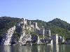
| Golubac Fortress FeatureType : landmark Elevation : 74 Lat/Lng : 44.6607 / 21.6779 | The Golubac Fortress (or Golubački grad) was a medieval fortified town on the south side of the Danube River, downstream from the modern-day town of Golubac, Serbia. The fortress, which was most likely built during the 14th century, is split into three compounds which were built in stages (...) |
| 93 | Bačka FeatureType : null Elevation : 119 Lat/Lng : 46.0 / 19.3333 | Bačka (/ Bačka, ;) is a geographical and historical area within the Pannonian Plain bordered by the river Danube to the west and south, and by the river Tisza to the east. It is divided between Serbia and Hungary (...) | |
| 94 | NATO FeatureType : landmark Elevation : 56 Lat/Lng : 50.8762 / 4.422 | The North Atlantic Treaty Organization (NATO ; ; '), also called the North Atlantic Alliance, is an intergovernmental military alliance between 29 North American and European countries. The organization implements the North Atlantic Treaty that was signed on 4 April 1949 (...) | |
| 95 | Nova Crnja FeatureType : null Elevation : 73 Lat/Lng : 45.6486 / 20.5691 | Nova Crnja is a village and municipality located in the Central Banat District of the autonomous province of Vojvodina, Serbia. The village has a population of 1,491, while the municipality has 10,272 inhabitants. (...) | |
| 96 | Osmaci FeatureType : adm2nd Elevation : 283 Lat/Lng : 44.4011 / 18.9161 | Osmaci is a village and a municipality located in eastern Republika Srpska, an entity of Bosnia and Herzegovina. As of 2013, it has a population of 6,016 inhabitants. (...) | |
| 97 | Archives of Republika Srpska FeatureType : null Elevation : 164 Lat/Lng : 44.7756 / 17.1944 | The Archives of Republika Srpska is an administrative organisation within the Ministry of Education and Culture of Republika Srpska, one of two constituent entities of Bosnia and Herzegovina. The Archives' headquarters is in Banja Luka, and it has its regional offices in Doboj, Zvornik, Foča, (...) | |
| 98 | Derventa FeatureType : city Elevation : 135 Lat/Lng : 44.9772 / 17.9103 | Derventa is a town and municipality located in Republika Srpska, an entity of Bosnia and Herzegovina. It is situated in the Posavina region, northwest of Doboj. As of 2013, the town has a population of 12,680 inhabitants, while the municipality has 27,404 inhabitants. (...) | |
| 99 | Sanski Most FeatureType : null Elevation : 158 Lat/Lng : 44.7667 / 16.667 | Sanski Most is a town and municipality located in Una-Sana Canton of the Federation of Bosnia and Herzegovina, an entity of Bosnia and Herzegovina. It is situated on the banks of Sana River in northwestern Bosnia and Herzegovina, in region of Bosanska krajina, between Prijedor and Ključ (...) | |
| 100 | Posavina Canton FeatureType : adm2nd Elevation : 83 Lat/Lng : 45.0333 / 18.4833 | The Posavina Canton (Bosnian and Serbian: Posavski kanton/Посавски кантон, Croatian: Županija Posavska) is one of ten cantons of the Federation of Bosnia and Herzegovina in Bosnia and Herzegovina. It is the smallest canton with an area of only 325 km². Its capital is Orašje. (...) | |
| 101 | Republic of Ragusa FeatureType : null Elevation : 83 Lat/Lng : 42.65 / 18.0667 | The Republic of Ragusa was a maritime republic centered on the city of Dubrovnik (' in Italian, German and Latin; ' in French) in Dalmatia (today in southernmost Croatia) that carried that name from 1358 until 1808 (...) | |
| 102 | New Belgrade FeatureType : city Elevation : 71 Lat/Lng : 44.8056 / 20.4242 | New Belgrade is a municipality of the city of Belgrade. It is the central business district in Serbia and one of the major ones in Southeast Europe. It was a planned municipality, built since 1948 in a previously uninhabited area on the left bank of the Sava river, opposite old Belgrade (...) | |
| 103 | Yugoslavia FeatureType : city Elevation : 93 Lat/Lng : 44.8206 / 20.4622 | Yugoslavia (; / ; ; ; Pannonian Rusyn: , transcr. ; literally "Land of Southern Slavs") was a country in Southeastern and Central Europe for most of the 20th century. It came into existence after World War I in 1918 under the name of the Kingdom of Serbs, Croats and Slovenes by the merger of the (...) | |
| 104 | Sava FeatureType : null Elevation : 106 Lat/Lng : 44.8242 / 20.4489 | The Sava is a river in Central and Southeastern Europe, a right tributary of the Danube. It flows through Slovenia, Croatia, along the northern border of Bosnia and Herzegovina, and through Serbia, discharging into the Danube in Belgrade (...) | |
| 105 | Pelagićevo FeatureType : null Elevation : 97 Lat/Lng : 44.9061 / 18.6114 | Pelagićevo is a town and municipality located in Republika Srpska, an entity of Bosnia and Herzegovina. It is located in the Posavina geographical region. As of 2013, the town has a population of 2,796 inhabitants, while the municipality has 5,220 inhabitants (...) | |
| 106 | Plužine FeatureType : null Elevation : 693 Lat/Lng : 43.1528 / 18.8394 | Plužine (Montenegrin Cyrillic: Плужине) is a town in northwestern Montenegro. According to the 2011 census, it has a population of 1,341. Plužine is the centre of Plužine Municipality and unofficial centre of Piva region, named after Piva River (...) | |
| 107 | Kalinovik FeatureType : city Elevation : 1078 Lat/Lng : 43.5053 / 18.4467 | Kalinovik is a town and municipality located in Republika Srpska, an entity of Bosnia and Herzegovina. As of 2013, the town has a population of 1,093 inhabitants, while the municipality has 2,029 inhabitants. The municipality adjoins the municipality of Konjic, with which the boundary also forms (...) | |
| 108 | Ljubinje FeatureType : city Elevation : 408 Lat/Lng : 42.9508 / 18.0886 | Ljubinje is a town and municipality located in Republika Srpska, an entity of Bosnia and Herzegovina. It is situated in south-eastern part of Herzegovina region. As of 2013, the town has a population of 2,744 inhabitants, while the municipality has 3,511 inhabitants. (...) | |
| 109 | Šipovo FeatureType : city Elevation : 443 Lat/Lng : 44.2814 / 17.0839 | Šipovo is a town and municipality located in Republika Srpska, an entity of Bosnia and Herzegovina. It is situated in the southern part of the Bosanska Krajina region. As of 2013, it has a population of 10,293 inhabitants. The municipality covers an area of , much of which is forested. (...) | |
| 110 | Una-Sana Canton FeatureType : adm2nd Elevation : 743 Lat/Lng : 44.7333 / 16.2 | The Una-Sana Canton Official name of canton is Una-Sana Canton is one of the ten cantons of the Federation of Bosnia and Herzegovina entity within Bosnia and Herzegovina. It is located in the northwest of the country and has been named after the rivers Una and Sana (...) | |
| 111 | Gradiška, Bosnia and Herzegovina FeatureType : city Elevation : 93 Lat/Lng : 45.1458 / 17.2539 | Gradiška (; formerly Bosanska Gradiška / Босанска Градишка) Gradiška/Градишка. is a town and municipality located in northwestern Republika Srpska, an entity of Bosnia and Herzegovina. As of 2013, it has a population of 51,727 inhabitants (...) | |
| 112 | Serbia FeatureType : country Elevation : 487 Lat/Lng : 43.95 / 20.9333 | Serbia (/ Srbija),Pannonian Rusyn: ; ; Albanian and Romanian: ; Slovak and Czech: , ; . officially the Republic of Serbia (/ Republika Srbija), is a country situated at the crossroads of Central and Southeast Europe in the southern Pannonian Plain and the central Balkans (...) | |
| 113 | Mikoyan-Gurevich MiG-21 FeatureType : null Elevation : 130 Lat/Lng : 49.8517 / 36.661 | The Mikoyan-Gurevich MiG-21 (; NATO reporting name: Fishbed) is a supersonic jet fighter and interceptor aircraft, designed by the Mikoyan-Gurevich Design Bureau in the Soviet Union. It was popularly nicknamed "balalaika", from the aircraft's planform-view resemblance to the Russian stringed musical (...) | |
| 114 | Prnjavor, Bosnia and Herzegovina FeatureType : adm2nd Elevation : 173 Lat/Lng : 44.8703 / 17.6628 | Prnjavor is a town and municipality located in Republika Srpska, an entity of Bosnia and Herzegovina. As of 2013, it has a population of 35,956 inhabitants. (...) | |
| 115 | Kupres FeatureType : null Elevation : 1176 Lat/Lng : 43.9928 / 17.2775 | Kupres is a town and municipality located in Canton 10 of the Federation of Bosnia and Herzegovina, an entity of Bosnia and Herzegovina. (...) | |
| 116 | Zavait FeatureType : city Elevation : 1075 Lat/Lng : 43.424 / 18.8798 | Zavait is a village in the municipality of Foča, Republika Srpska, Bosnia and Herzegovina.Official results from the book: Ethnic composition of Bosnia-Herzegovina population, by municipalities and settlements, 1991. census, Zavod za statistiku Bosne i Hercegovine - Bilten no.234, Sarajevo 1991. (...) | |
| 117 | Knežica, Bosnia and Herzegovina FeatureType : city Elevation : 139 Lat/Lng : 45.1028 / 16.6775 | Knežica is a village in the municipality of Kozarska Dubica, Republika Srpska, Bosnia and Herzegovina.Official results from the book: Ethnic composition of Bosnia-Herzegovina population, by municipalities and settlements, 1991. census, Zavod za statistiku Bosne i Hercegovine - Bilten no (...) | |
| 118 | Dobrljin FeatureType : city Elevation : 121 Lat/Lng : 45.1511 / 16.4787 | Dobrljin (Cyrillic: Добрљин) is a village in the municipality of Novi Grad, Republika Srpska, Bosnia and Herzegovina.Official results from the book: Ethnic composition of Bosnia-Herzegovina population, by municipalities and settlements, 1991 (...) | |
| 119 | Čađavica Donja (Bosanski Novi) FeatureType : city Elevation : 246 Lat/Lng : 44.9658 / 16.3234 | In Republika Srpska there is two Cadjavice: Čađavica Donja is a village in the municipality of Novi Grad, Republika Srpska, Bosnia and Herzegovina,or Cadjavica Donja in Republika Srpska near Bijeljina.Official results from the book: Ethnic composition of Bosnia-Herzegovina population, by (...) | |
| 120 | Donji Žabar FeatureType : mountain Elevation : 87 Lat/Lng : 44.9432 / 18.6467 | Donji Žabar is a village and municipality located in Republika Srpska, an entity of Bosnia and Herzegovina. As of 2013, it has a population of 3,809 inhabitants. (...) | |
| 121 | Tarevci FeatureType : null Elevation : 160 Lat/Lng : 44.9531 / 18.2731 | Tarevci is a village in the municipality of Modriča, Republika Srpska, Bosnia and Herzegovina. (...) | |
| 122 | Ljeljenča FeatureType : null Elevation : 143 Lat/Lng : 44.7388 / 19.0928 | Ljeljenča (Cyrillic: Љељенча) is a village located west of the municipalilty of Bijeljina in Republika Srpska, Bosnia and Herzegovina. (...) | |
| 123 | Ljeskovac FeatureType : city Elevation : 98 Lat/Lng : 44.7081 / 19.2298 | Ljeskovac (Cyrillic: Љесковац) is a place located south of the city of Bijeljina in Republika Srpska, Bosnia and Herzegovina. (...) | |
| 124 | Vranjak, Modriča FeatureType : null Elevation : 248 Lat/Lng : 44.9128 / 18.2259 | Vranjak is a village in the municipality of Modriča, Republika Srpska, Bosnia and Herzegovina. (...) | |
| 125 | Papažani FeatureType : null Elevation : 171 Lat/Lng : 44.9282 / 17.4029 | Papažani is a village in the municipality of Laktaši, Republika Srpska, Bosnia and Herzegovina. (...) | |
| 126 | Brodac Donji FeatureType : null Elevation : 81 Lat/Lng : 44.8646 / 19.2809 | Brodac Donji is a small village located north of the city of Bijeljina in Republika Srpska, Bosnia and Herzegovina. (...) | |
| 127 | Razboj Župski FeatureType : null Elevation : 163 Lat/Lng : 44.9599 / 17.5411 | Župski Razboj is a village in the municipality of Srbac, Republika Srpska, Bosnia and Herzegovina. | |
| 128 | Modran FeatureType : city Elevation : 122 Lat/Lng : 44.6722 / 19.1767 | Modran (Cyrillic: Модран) is a place located in the municipality of Bijeljina in Republika Srpska, Bosnia and Herzegovina. (...) | |
| 129 | Garevac FeatureType : null Elevation : 101 Lat/Lng : 44.9692 / 18.3536 | Garevac is a village in the municipality of Modriča, Republika Srpska, Bosnia and Herzegovina. (...) | |
| 130 | Kotor Varoš FeatureType : null Elevation : 284 Lat/Lng : 44.6169 / 17.3717 | Kotor Varoš or Kotor-Varoš is a town and municipality located in north-western Republika Srpska, an entity of Bosnia and Herzegovina. As of 2013 census, it has a population of 19,710 inhabitants. (...) | |
| 131 | Nevesinje FeatureType : null Elevation : 891 Lat/Lng : 43.2586 / 18.1133 | Nevesinje is a town and municipality located in Republika Srpska an entity of Bosnia and Herzegovina. As of 2013, the town has a population of 5,464 inhabitants, while the municipality has 12,961 inhabitants. (...) | |
| 132 | Srpska Crnja FeatureType : null Elevation : 75 Lat/Lng : 45.7233 / 20.6886 | Srpska Crnja is a village in Serbia, situated in central-east Banat alongside the border with Romania. It is located in Nova Crnja municipality, Central Banat District, Province of Vojvodina. It is about 120 km away from the capital city of Belgrade, 113 km from Novi Sad, 9 km south-east of Kikinda (...) | |
| 133 | Republic of Bosnia and Herzegovina FeatureType : country Elevation : 593 Lat/Lng : 43.867 / 18.417 | The Republic of Bosnia and Herzegovina was the direct legal predecessor to the modern-day state of Bosnia and Herzegovina. The Republic of Bosnia and Herzegovina existed legally until co-signing the Annex 4 of the Dayton Agreement, containing the Constitution of Bosnia and Herzegovina on 14 December (...) | |
| 134 | Kozara National Park FeatureType : null Elevation : 626 Lat/Lng : 45.0083 / 16.8917 | Kozara National Park (Serbian Cyrillic: Национални парк Козара) is a national park that was proclaimed a protected national forest in 1967 by Josip Broz Tito. It is situated between the rivers Una, Sava, Sana and Vrbas, in the Republika Srpska entity of Bosnia and Herzegovina. These 33 (...) | |
| 135 | Armed Forces of Bosnia and Herzegovina FeatureType : null Elevation : 230 Lat/Lng : 44.5333 / 18.6833 | The Armed Forces of Bosnia and Herzegovina (OSBiH; Serbo-Croat-Bosnian: Oružane snage Bosne i Hercegovine/Оружане снаге Босне и Херцеговине, ОСБИХ) is the official military force of Bosnia and Herzegovina. The BiH Armed forces were officially unified in 2005 and are composed of two founding armies: (...) | |
| 136 | Stari Grad, Novi Sad FeatureType : null Elevation : 84 Lat/Lng : 45.2566 / 19.848 | Stari Grad is an urban neighborhood of the city of Novi Sad, Serbia. It is the main part of Novi Sad, and it is also known as City Centre. In the Serbian language, the name "Stari Grad" means "Old Town". (...) | |
| 137 | Herzegovina FeatureType : null Elevation : 121 Lat/Lng : 43.4769 / 17.815 | Herzegovina (or ; Serbo-Croatian: Hercegovina, Херцеговина) is the southern region of Bosnia and Herzegovina. While there is no official border distinguishing it from the Bosnian geographical region, it is sometimes asserted that the borders of the region are Dalmatia to the southwest, Montenegro to (...) | |
| 138 | Trnovo, Federation of Bosnia and Herzegovina FeatureType : mountain Elevation : 935 Lat/Lng : 43.6886 / 18.3397 | Trnovo is a town and municipality located in Sarajevo Canton of the Federation of Bosnia and Herzegovina, an entity of Bosnia and Herzegovina. As of 2013, it has a population of 1,830 inhabitants. It is located a 30 kilometers southeast of the city of Sarajevo (...) | |
| 139 | Istočni Drvar FeatureType : city Elevation : 1051 Lat/Lng : 44.3894 / 16.6236 | Istočni Drvar is a village and municipality located in western Republika Srpska, an entity of Bosnia and Herzegovina. It is situated in the central part of the Bosanska Krajina region. It was also known as Srpski Drvar , and was created from part of the pre-war municipality of Drvar (the other part (...) | |
| 140 | Vukosavlje FeatureType : null Elevation : 113 Lat/Lng : 44.9797 / 18.2819 | Vukosavlje is a town and municipality located in Republika Srpska, an entity of Bosnia and Herzegovina. It is situated in the southern part of the Posavina region. As of 2013, it has a population of 4,667 inhabitants (...) | |
| 141 | Ćuprija FeatureType : null Elevation : 121 Lat/Lng : 43.9231 / 21.3686 | Ćuprija (Serbian Cyrillic: Ћуприја) is a town and municipality located in the Pomoravlje District of central Serbia. The population of the town is 19,380, while the municipality has 30,020 inhabitants. (...) | |
| 142 | Operation Flash FeatureType : null Elevation : 104 Lat/Lng : 45.25 / 17.2 | Operation Flash was a brief Croatian Army (HV) offensive conducted against the forces of the self-declared Republic of Serbian Krajina (RSK) from 1–3 May 1995. The offensive occurred in the later stages of the Croatian War of Independence and was the first major confrontation after ceasefire (...) | |
| 143 | Šargan Eight FeatureType : landmark Elevation : 737 Lat/Lng : 43.8 / 19.522 | The Šargan Eight (Šarganska osmica) is a narrow-gauge heritage railway in Serbia, running from the village of Mokra Gora to Šargan Vitasi station. An extension to Višegrad in the Republika Srpska, Bosnia and Herzegovina, was finished on 28 August 2010 (...) | |
| 144 | South Bačka District FeatureType : null Elevation : 82 Lat/Lng : 45.2644 / 19.8317 | The South Bačka District is one of seven administrative districts of the autonomous province of Vojvodina, Serbia. Geographically it lies in the southern part of Bačka and northern part of Syrmia. According to the 2011 census results, it has a population of 615,371 inhabitants (...) | |
| 145 | Eparchy of Srem FeatureType : landmark Elevation : 79 Lat/Lng : 45.2014 / 19.9364 | The Eparchy of Srem (or) is an eparchy (diocese) of the Serbian Orthodox Church in the Syrmia (Srem) region, Serbia. Most of the eparchy is in the autonomous province of Vojvodina, and it also includes a small south-eastern part of Syrmia within the city limits of Belgrade, as well as some West (...) | |
| 146 | Maglaj FeatureType : city Elevation : 177 Lat/Lng : 44.5477 / 18.1 | Maglaj is a town and municipality located in Zenica-Doboj Canton of the Federation of Bosnia and Herzegovina, an entity of Bosnia and Herzegovina. It is located in northern Bosnia and Herzegovina, south of Doboj. It has a population of 24,980 inhabitants. (...) | |
| 147 | Stolac FeatureType : city Elevation : 59 Lat/Lng : 43.0839 / 17.9592 | Stolac is a town and municipality located in Herzegovina-Neretva Canton of the Federation of Bosnia and Herzegovina, an entity of Bosnia and Herzegovina. It is located in the region of Herzegovina. Stolac is situated in the area known as Herzegovina Humina on the tourist route crossing Herzegovina (...) | |
| 148 | Ključ, Una-Sana Canton FeatureType : city Elevation : 258 Lat/Lng : 44.5325 / 16.7768 | Ključ is a town and municipality located in Una-Sana Canton of the Federation of Bosnia and Herzegovina, an entity of Bosnia and Herzegovina. The name of the town and the municipality translates to "Key" in Bosnian. (...) | |
| 149 | Irig, Serbia FeatureType : null Elevation : 185 Lat/Lng : 45.1011 / 19.8583 | Irig is a town and municipality located in the Srem District of the autonomous province of Vojvodina, Serbia. The town has a population of 4,415, while Irig municipality has 10,866 inhabitants. (...) | |
| 150 | Brod, Foča FeatureType : city Elevation : 419 Lat/Lng : 43.4881 / 18.7478 | Brod is a village in the municipality of Foča, Republika Srpska, Bosnia and Herzegovina.Official results from the book: Ethnic composition of Bosnia-Herzegovina population, by municipalities and settlements, 1991. census, Zavod za statistiku Bosne i Hercegovine - Bilten no.234, Sarajevo 1991. (...) | |
| 151 | Krupa na Vrbasu FeatureType : city Elevation : 221 Lat/Lng : 44.6187 / 17.1435 | Krupa na Vrbasu is a village in the municipality of Banja Luka, Republika Srpska, Bosnia and Herzegovina.Official results from the book: Ethnic composition of Bosnia-Herzegovina population, by municipalities and settlements, 1991. census, Zavod za statistiku Bosne i Hercegovine - Bilten no (...) | |
| 152 | Bronzani Majdan FeatureType : null Elevation : 275 Lat/Lng : 44.7924 / 16.9404 | Bronzani Majdan is a village in the municipality of Banja Luka, Republika Srpska, Bosnia and Herzegovina.Official results from the book: Ethnic composition of Bosnia-Herzegovina population, by municipalities and settlements, 1991. census, Zavod za statistiku Bosne i Hercegovine - Bilten no (...) | |
| 153 | Trebević FeatureType : mountain Elevation : 1195 Lat/Lng : 43.7964 / 18.4788 | Trebević is a mountain in central Bosnia and Herzegovina, located to the southeast of Sarajevo, in the territory of East Sarajevo city, bordering Jahorina mountain. Trebević is tall, making it the second shortest of the Sarajevo mountains. During the Middle Ages, Trebević was known as Zlatni Do (...) | |
| 154 | Banja Luka International Airport FeatureType : null Elevation : 114 Lat/Lng : 44.9416 / 17.2975 | Banja Luka International Airport , also known as Mahovljani Airport, after the nearby village of the same name, is an airport located north northeast of the railway station. Ead.eurocontrol.int. in the city of Banja Luka, the largest city in Republika Srpska, and second largest in Bosnia and (...) | |
| 155 | Croats of Bosnia and Herzegovina FeatureType : null Elevation : 1123 Lat/Lng : 43.93 / 18.58 | The Croats of Bosnia and Herzegovina, often referred to as the Bosnian Croats, are the third most populous ethnic group in that country after Bosniaks and Serbs, and are one of the constitutive nations of Bosnia and Herzegovina (...) | |
| 156 | Amajlije FeatureType : city Elevation : 93 Lat/Lng : 44.7415 / 19.2758 | Amajlije is a place located east of the city of Bijeljina in Republika Srpska, Bosnia and Herzegovina. Its population in 1991 was 1,110. The name "Amajlije" means "amulets". (...) | |
| 157 | Vlatkovići FeatureType : null Elevation : 998 Lat/Lng : 44.4303 / 17.4844 | Vlatkovići is a village in Kneževo municipality, Republika Srpska, Bosnia and Herzegovina. (...) | |
| 158 | Lukavica (Istočno Novo Sarajevo) FeatureType : null Elevation : 546 Lat/Lng : 43.8269 / 18.3832 | Lukavica is town and center of municipality of East New Sarajevo, Republika Srpska, Bosnia and Herzegovina. (...) | |
| 159 | Velika Obarska FeatureType : null Elevation : 84 Lat/Lng : 44.8046 / 19.1618 | Velika Obarska (Cyrillic: Велика Обарска) is a village located north-west of the city of Bijeljina in Republika Srpska, Bosnia and Herzegovina. (...) | |
| 160 | Erdősmecske FeatureType : city Elevation : 200 Lat/Lng : 46.1779 / 18.5113 | Erdősmecske (until 1948: Rácmecske; ; / Srpska Mečka, Рацмечка / Racmečka;) is a village in Baranya county, Hungary. Majority residents are Magyars, with minority of Serbs. (...) | |
| 161 | Serbian Academy of Sciences and Arts FeatureType : null Elevation : 126 Lat/Lng : 44.8179 / 20.4565 | The Serbian Academy of Sciences and Arts (abbr. САНУ/SANU) is a national academy and the most prominent academic institution in Serbia, founded in 1841. The Academy's membership has included Josif Pančić, Jovan Cvijić, Stojan Novaković, Branislav Petronijević, Mihajlo Pupin, Nikola Tesla, Milutin (...) | |
| 162 | Osredak FeatureType : null Elevation : 1197 Lat/Lng : 44.2353 / 18.5336 | Osredak may refer to several places: * Osredak (Bosanska Krupa) *Osredak, Doboj, Republika Srpska * Osredak (Gornji Vakuf) *Osredak, Krupa na Uni, Republika Srpska *Osredak, Srebrenica, Republika Srpska *Osredak, Cazin, Federation *Osredak, Zenica, Federation *Osredak, Vareš, Federation *Osredak, (...) | |
| 163 | 2001–02 Premier League of Bosnia and Herzegovina FeatureType : null Elevation : 423 Lat/Lng : 43.9889 / 18.1781 | Statistics of Premier League of Bosnia and Herzegovina in the 2001–02 season. It was contested by Bosniak and Croatian clubs. Serbian clubs played in the 2001–02 First League of the Republika Srpska. (...) | |
| 164 | Hubjeri FeatureType : city Elevation : 353 Lat/Lng : 43.6783 / 19.0016 | Hubjeri is a suburb in the municipality of Novo Goražde, Republika Srpska, Bosnia and Herzegovina. (...) | |
| 165 | Kopači (Goražde) FeatureType : city Elevation : 543 Lat/Lng : 44.0019 / 18.2074 | Kopači is a suburb in the municipality of Novo Goražde, Republika Srpska, Bosnia and Herzegovina. (...) | |
| 166 | Kokorina FeatureType : city Elevation : 1029 Lat/Lng : 43.2719 / 18.0244 | Kokorina is a village in Istočni Mostar municipality, Republika Srpska, Bosnia and Herzegovina. (...) | |
| 167 | Jakeš FeatureType : null Elevation : 113 Lat/Lng : 44.9833 / 18.2783 | Jakeš is a village in the municipality of Vukosavlje, Republika Srpska, Bosnia and Herzegovina. (...) | |
| 168 | Matica srpska FeatureType : landmark Elevation : 80 Lat/Lng : 45.2594 / 19.8453 | The Matica srpska is the oldest cultural-scientific institution of Serbia. Matica Srpska was founded in 1826, in Pest (today a part of Budapest), and moved to Novi Sad in 1864. (...) | |
| 169 | Pelješac FeatureType : null Elevation : 243 Lat/Lng : 42.9167 / 17.4167 | Pelješac (local Chakavian dialect: Pelišac;) is a peninsula in southern DalmatiaJohn Everett-Heath. "Dalmatia." Concise Dictionary of World Place-Names. Oxford University Press. 2005. Encyclopedia.com in Croatia (...) | |
| 170 | Vareš FeatureType : city Elevation : 832 Lat/Lng : 44.1618 / 18.3268 | Vareš is a town and municipality located in Zenica-Doboj Canton of the Federation of Bosnia and Herzegovina, an entity of Bosnia and Herzegovina. It is situated in central Bosnia and Herzegovina, and is famous for the local mining activities and production of iron (...) | |
| 171 | Gračanica, Kosovo FeatureType : null Elevation : 588 Lat/Lng : 42.6011 / 21.1958 | Gračanica or Graçanica , is a town and municipality located in Pristina District in central Kosovo. As of 2011, it has an estimated population of 10,675 inhabitants. It is centered around the Gračanica Monastery, ten kilometers east of Pristina (...) | |
| 172 | Bujanovac FeatureType : null Elevation : 401 Lat/Lng : 42.4592 / 21.7667 | Bujanovac is a town and municipality located in the Pčinja District of southern Serbia. Situated in the South Morava basin, it is located in the geographical area known as Preševo Valley. It is also known for its source of mineral water and spa town Bujanovačka banja (...) | |
| 173 | Barajevo FeatureType : null Elevation : 241 Lat/Lng : 44.6089 / 20.4547 | Barajevo is a municipality of the city of Belgrade. According to the 2011 census results, the municipality has a population of 27,110 inhabitants. The municipality is located in the lower northern part of Šumadija, southeast of the Belgrade, with an elevation spanning from 140 meters to 364 meters (...) | |
| 174 | 2013–14 Premier League of Bosnia and Herzegovina FeatureType : null Elevation : 159 Lat/Lng : 44.776 / 17.1996 | The 2013–14 Premier League of Bosnia and Herzegovina, also known as BH Telecom Premier League for sponsorship reasons, is the fourteenth season of the Premier League of Bosnia and Herzegovina, the highest football league of Bosnia and Herzegovina, since its original establishment in 2000 and twelfth (...) | |
| 175 | Bečej FeatureType : null Elevation : 77 Lat/Lng : 45.6189 / 20.0361 | Bečej (/ Bečej) is a town and municipality located in the South Bačka District of the autonomous province of Vojvodina, Serbia. The town has a population of 23,895, while the municipality has 37,351 inhabitants. It is a multiethnic town, predominantly inhabited by Serbs and Hungarians. (...) | |
| 176 | Drvar FeatureType : city Elevation : 492 Lat/Lng : 44.3739 / 16.3808 | Drvar (Cyrillic: Дрвар) is a town and municipality located in Canton 10 of the Federation of Bosnia and Herzegovina, an entity of Bosnia and Herzegovina. It is situated in western Bosnia and Herzegovina, on the road between Bosansko Grahovo and Bosanski Petrovac, also near Glamoč (...) | |
| 177 | Visoki Dečani FeatureType : landmark Elevation : 662 Lat/Lng : 42.5469 / 20.2661 | Visoki Dečani , or simply Dečani is a medieval Serbian Orthodox Christian monastery located near Deçan, Kosovo. It was founded in the first half of the 14th century by Serbian king Stefan Dečanski. The Visoki Dečani monastery is located by the Dečanska Bistrica river gorge at the foot of the (...) | |
| 178 | Ilidža FeatureType : city Elevation : 495 Lat/Lng : 43.8331 / 18.3039 | Ilidža is a municipality located in Sarajevo Canton of the Federation of Bosnia and Herzegovina, an entity of Bosnia and Herzegovina. It has a metro population of 47,654 and is a chief suburb of Sarajevo and de facto its neighborhood (...) | |
| 179 | Istočno Novo Sarajevo FeatureType : null Elevation : 545 Lat/Lng : 43.8237 / 18.3645 | Istočno Novo Sarajevo ("East New Sarajevo") is a municipality of the city of Istočno Sarajevo located in Republika Srpska, an entity of Bosnia and Herzegovina. As of 2013, it has a population of 10,642 inhabitants (...) | |
| 180 | Istočni Mostar FeatureType : city Elevation : 913 Lat/Lng : 43.4206 / 18.0083 | Istočni Mostar is a village and municipality located in Republika Srpska, an entity of Bosnia and Herzegovina. As of 2013, it has a population of 257 inhabitants. (...) | |
| 181 | 2002–03 Premier League of Bosnia and Herzegovina FeatureType : null Elevation : 228 Lat/Lng : 44.4268 / 18.0347 | The 2002–03 Premier League of Bosnia and Herzegovina was the third season since its establishment and the inaugural as a unified country-wide league after the clubs from Republika Srpska was entered the competition. It began on 3 August 2002 and ended on 24 May 2003 (...) | |
| 182 | Sapna FeatureType : null Elevation : 261 Lat/Lng : 44.5032 / 18.9999 | Sapna is a town and municipality located in Tuzla Canton of the Federation of Bosnia and Herzegovina, an entity of Bosnia and Herzegovina. (...) | |
| 183 | 2012–13 Premier League of Bosnia and Herzegovina FeatureType : null Elevation : 159 Lat/Lng : 44.776 / 17.1996 | The 2012–13 Premier League of Bosnia and Herzegovina, also known as BH Telecom Premier League for sponsorship reasons, was the thirteenth season of the Premier League of Bosnia and Herzegovina, the highest football league of Bosnia and Herzegovina, since its original establishment in 2000 and (...) | |
| 184 | Vučja Luka FeatureType : city Elevation : 1305 Lat/Lng : 43.9255 / 18.5154 | Vučja Luka is a village in Bosnia and Herzegovina (Republika Srpska).According to the 2001 census, the village is located in the municipality of Istočni Stari Grad, Istočno Sarajevo.Official results from the book: Ethnic composition of Bosnia-Herzegovina population, by municipalities and (...) | |
| 185 | Podromanija FeatureType : city Elevation : 860 Lat/Lng : 43.9178 / 18.7687 | Podromanija is a village in the municipality of Sokolac, Republika Srpska, Bosnia and Herzegovina. (...) | |
| 186 | Ušće FeatureType : landmark Elevation : 76 Lat/Lng : 44.819 / 20.4369 | Ušće (; pronounced) is an urban neighborhood of Belgrade, the capital of Serbia. It is located in Belgrade's municipality of Novi Beograd. Ušće is located on the mouth of the Sava river into the Danube, thus the name (ušće is Serbian for confluence) (...) | |
| 187 | Jezero, Republika Srpska FeatureType : adm2nd Elevation : 620 Lat/Lng : 44.3167 / 17.1667 | Jezero is a village and a municipality located in western Republika Srpska, an entity of Bosnia and Herzegovina. As of 2013, it has a population of 1,131 inhabitants. The municipality was created from part of the pre-war municipality of Jajce (the other larger part of the pre-war municipality is now (...) | |
| 188 | Bijeljina massacre FeatureType : null Elevation : 92 Lat/Lng : 44.75 / 19.2167 | The Bijeljina massacre involved the killing of between 48 and 78 civilians by Serb paramilitary groups in Bijeljina on 1–2 April 1992 during the Bosnian War. The majority of those killed were Bosniaks (or Bosnian Muslims) (...) | |
| 189 | Žepa FeatureType : city Elevation : 296 Lat/Lng : 43.934 / 19.169 | Žepa (Cyrillic: Жепа) is a small town on the short river with a same name, the Žepa river, in eastern Bosnia and Herzegovina, in the municipality of Rogatica, in the Republika Srpska entity. It is located northeast of Rogatica itself, southwest of Srebrenica and northwest of Višegrad (...) | |
| 190 | Zvornik police station shooting FeatureType : null Elevation : 146 Lat/Lng : 44.3797 / 19.1023 | --> On 27 April 2015, a local gunman attacked a police station in Zvornik in the Republika Srpska entity of Bosnia and Herzegovina. He killed one police officer and wounded two others before he was shot dead by other police officers (...) | |
| 191 | Jasenovac concentration camp FeatureType : landmark Elevation : 91 Lat/Lng : 45.2817 / 16.935 | The Jasenovac concentration camp was an extermination camp established in Slavonia by the authorities of the Independent State of Croatia (NDH) during World War II. The camp was established and operated solely by the governing Ustaše regime rather than by Nazi Germany as in the rest of occupied (...) | |
| 192 | Siege of Dubrovnik FeatureType : null Elevation : 16 Lat/Lng : 42.6413 / 18.1086 | The Siege of Dubrovnik was a military engagement fought between the Yugoslav People's Army (JNA) and Croatian forces defending the city of Dubrovnik and its surroundings during the Croatian War of Independence. The JNA started its advance on 1 October 1991 and by late October had captured virtually (...) | |
| 193 | Imljani FeatureType : null Elevation : 1126 Lat/Lng : 44.4017 / 17.4772 | Imljani , is a village in Bosnia and Herzegovina, Entity of Republika Srpska, Skender Vakuf Municipality. Since 1954, Imljani was one of local communities of Former Šiprage Municipality in Former Kotor Varoš County (...) | |
| 194 | Doboj South FeatureType : mountain Elevation : 248 Lat/Lng : 44.6878 / 18.0517 | Doboj South is a village and municipality located in Zenica-Doboj Canton of the Federation of Bosnia and Herzegovina, an entity of Bosnia and Herzegovina. It borders with the municipality of Doboj, which is a part of Republika Srpska entity. (...) | |
| 195 | Semberija FeatureType : landmark Elevation : 84 Lat/Lng : 44.8008 / 19.2136 | Semberija (Cyrillic:) is a geographical region in north-eastern Bosnia and Herzegovina. The main city in the region is Bijeljina. Semberija is located between the Drina and Sava rivers and Majevica mountain. Most of the region is situated in the entity of Republika Srpska, and the smaller part in (...) | |
| 196 | Bilećko Lake FeatureType : null Elevation : 383 Lat/Lng : 42.8333 / 18.4333 | Bileća Lake is an artificial lake located in the municipality of Bileća, in the entity of Republika Srpska, Bosnia and Herzegovina, its length forming part of the Montenegrin border thus a small part being within Montenegro (...) | |
| 197 | Upper Neretva FeatureType : city Elevation : 364 Lat/Lng : 43.5036 / 18.1048 | Geographically and hydrologically the Neretva is divided in three sections. The upper course of the Neretva river is called the Upper Neretva , and includes vast area around the Neretva, numerous streams and well-springs, three major glacial lakes near the very river and even more scatered across (...) | |
| 198 | Podrinje FeatureType : null Elevation : 187 Lat/Lng : 44.2667 / 19.3333 | Podrinje (Cyrillic: Подриње) is the Slavic name of the Drina river basin, known in English as the Drina Valley, located in Bosnia and Herzegovina and Serbia. (...) | |
| 199 | Belgrade Fortress FeatureType : airport Elevation : 117 Lat/Lng : 44.8233 / 20.4506 | Belgrade Fortresshttp://www.kultura.gov.rs/?p=901 (Serbian: Београдска тврђава/Beogradska tvrđava), consists of the old citadel (Upper and Lower Town) and Kalemegdan Park (Large and Little Kalemegdan) on the confluence of the River Sava and Danube, in an urban area of modern Belgrade, the capital of (...) | |
| 200 | Siege of Bihać FeatureType : city Elevation : 222 Lat/Lng : 44.8167 / 15.8667 | The Siege of Bihać was a three-year-long siege of the northwestern Bosnian town of Bihać by the Army of the Republika Srpska, the Army of the Republic of Serbian Krajina and Bosniak dissenters led by the Bosniak politician Fikret Abdić during the 1992-95 Bosnian War (...) | |
 by
by