| 723 records found in wikipedia | |||
| 1 | 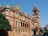
| Pietermaritzburg  FeatureType : city Elevation : 646 Lat/Lng : -29.6008 / 30.3833 | Pietermaritzburg (; Zulu: umGungundlovu) is the capital and second-largest city in the province of KwaZulu-Natal, South Africa. It was founded in 1838 and is currently governed by the Msunduzi Local Municipality. Its Zulu name umGungundlovu is the name used for the district municipality (...) |
| 2 | 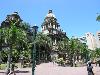
| Durban FeatureType : city Lat/Lng : -29.8741 / 31.0102 | Durban (from itheku meaning "bay/lagoon") is the third most populous city in South Africa—after Johannesburg and Cape Town—and the largest city in the South African province of KwaZulu-Natal. Located on the east coast of South Africa, Durban is famous for being the busiest port in the country (...) |
| 3 | 
| South Africa FeatureType : country Elevation : 1155 Lat/Lng : -28.6167 / 24.3333 | South Africa, officially the Republic of South Africa (RSA), is the southernmost country in Africa. It is bounded to the south by of coastline of Southern Africa stretching along the South Atlantic and Indian Oceans; to the north by the neighbouring countries of Namibia, Botswana, and Zimbabwe; and (...) |
| 4 | 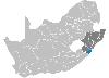
| Ugu District Municipality FeatureType : adm2nd Elevation : 60 Lat/Lng : -30.75 / 30.4333 | Ugu is one of the 11 districts of KwaZulu-Natal province of South Africa. Ugu is Zulu for "coast". The seat of Ugu is Port Shepstone. The majority of its 722,484 people speak IsiZulu (2011 Census). The district code is DC21. (...) |
| 5 | 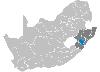
| Umgungundlovu District Municipality FeatureType : adm1st Elevation : 685 Lat/Lng : -29.5833 / 30.3667 | uMgungundlovu is one of the 11 district municipalities ("districts") of KwaZulu-Natal province. The seat of uMgungundlovu is Pietermaritzburg. The majority of its 1 million+ residents speak Zulu (2001 Census). The district code is DC22 (...) |
| 6 | 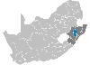
| Umzinyathi District Municipality FeatureType : adm1st Elevation : 1254 Lat/Lng : -28.1667 / 30.2167 | uMzinyathi is one of the 11 district municipalities ("districts") of KwaZulu-Natal province in South Africa. The seat of uMzinyathi is Dundee. The majority of its 456 452 people speak IsiZulu (2001 Census). The district code is DC24 (...) |
| 7 | 
| Margate, KwaZulu-Natal FeatureType : null Elevation : 45 Lat/Lng : -30.8508 / 30.3806 | Margate is a seaside resort town on the KwaZulu-Natal South Coast, about 20 kilometres southwest of Port Shepstone. The river which flows into the sea at Margate is called "Nkhongweni" (place of entreaty) because the original inhabitants were reputed to be so mean that travellers had to beg for (...) |
| 8 | 
| Taichung FeatureType : city Elevation : 90 Lat/Lng : 24.15 / 120.6667 | Taichung (Hokkien POJ: Tâi-tiong; Hakka Pha̍k-fa-sṳ: Thòi-chûng), officially known as Taichung City, is a special municipality located in central Taiwan. Taichung has a population of approximately 2.8 million people and has been officially ranked as Taiwan's second most populous city since July 2017 (...) |
| 9 | 
| Mozambique FeatureType : country Elevation : 79 Lat/Lng : -17.7667 / 35.4667 | Mozambique , officially the Republic of Mozambique (or '), is a country in Southeast Africa bordered by the Indian Ocean to the east, Tanzania to the north, Malawi and Zambia to the northwest, Zimbabwe to the west, and Swaziland (Eswatini) and South Africa to the southwest (...) |
| 10 | 
| Zululand District Municipality FeatureType : adm1st Elevation : 522 Lat/Lng : -28.3167 / 31.4167 | Zululand is one of the 11 district municipalities ("districts") of KwaZulu-Natal province. The seat of Zululand is Ulundi. The majority of its 803,575 people speak IsiZulu (2011 Census). The district code is DC26. It is part of a larger historical area also known as Zululand. (...) |
| 11 | 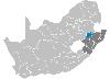
| Amajuba District Municipality FeatureType : adm2nd Elevation : 1194 Lat/Lng : -27.75 / 29.9167 | Amajuba is one of the 11 districts of KwaZulu-Natal province. The seat of Amajuba is Newcastle. The majority of its 468,040 people speak Zulu (2001 Census). The district code is DC25 (...) |
| 12 | 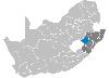
| Uthukela District Municipality FeatureType : adm2nd Elevation : 1077 Lat/Lng : -28.55 / 29.7667 | uThukela is one of the 11 districts of the KwaZulu-Natal province of South Africa. The seat of uThukela is the city of Ladysmith. The majority of its 668,848 people speak IsiZulu (2011 Census). The district code is DC23. (...) |
| 13 | Ladysmith, KwaZulu-Natal FeatureType : city Elevation : 1049 Lat/Lng : -28.5539 / 29.7825 | Ladysmith is a city in the Uthukela District of KwaZulu-Natal, South Africa. It lies north-west of Durban and south of Johannesburg. Important industries in the area include food processing, textiles, and tyre production (...) | |
| 14 | KwaZulu-Natal FeatureType : adm1st Elevation : 393 Lat/Lng : -29.0 / 31.0 | KwaZulu-Natal (; also referred to as KZN and known as "the garden province"; is a province of South Africa that was created in 1994 when the Zulu bantustan of KwaZulu ("Place of the Zulu" in Zulu) and Natal Province were merged (...) | |
| 15 | 
| Colenso, KwaZulu-Natal FeatureType : null Elevation : 963 Lat/Lng : -28.7367 / 29.8264 | Colenso is a town in KwaZulu-Natal, South Africa. It is located on the southern bank of the Tugela River. The original settlement was contained within a loop on the river, but it subsequently expanded southwards and eastwards (...) |
| 16 | 
| Mossel Bay FeatureType : null Elevation : 110 Lat/Lng : -34.1833 / 22.1333 | Mossel Bay is a harbour town of about 130,000 people on the Southern Cape (or Garden Route) of South Africa. It is an important tourism and farming region of the Western Cape Province. Mossel Bay lies 400 kilometres east of the country's seat of parliament, Cape Town (which is also the capital city (...) |
| 17 | Drakensberg FeatureType : landmark Elevation : 2997 Lat/Lng : -29.359 / 29.4689 | The Drakensberg (Afrikaans: Drakensberge, Zulu: uKhahlamba, Sotho: Maluti) is the name given to the eastern portion of the Great Escarpment, which encloses the central Southern African plateau. The Great Escarpment reaches its greatest elevation in this region – (...) | |
| 18 | University of KwaZulu-Natal FeatureType : landmark Elevation : 147 Lat/Lng : -29.8675 / 30.9808 | The University of KwaZulu-Natal or UKZN is a university with five campuses in the province of KwaZulu-Natal in South Africa. It was formed on 1 January 2004 after the merger between the University of Natal and the University of Durban-Westville. (...) | |
| 19 | 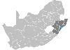
| ILembe District Municipality FeatureType : adm2nd Elevation : 78 Lat/Lng : -29.3333 / 31.2833 | iLembe is one of the 11 district municipalities ("districts") of KwaZulu-Natal province in South Africa. The seat of iLembe is KwaDukuza.http://www.ilembe.gov.za/default.aspx?pid=29 The majority (82%) of its 606,809 people speak Zulu (2011 census). The district code is DC29 (...) |
| 20 | 
| EThekwini Metropolitan Municipality FeatureType : adm1st Elevation : 3 Lat/Lng : -29.8667 / 31.0167 | eThekwini Metropolitan Municipality is a metropolitan municipality created in 2000, that includes the city of Durban, South Africa and surrounding towns. eThekwini is one of the 11 districts of KwaZulu-Natal province of South Africa. The majority of its 3,442,361 people speak Zulu (...) |
| 21 | 
| Northern Rhodesia FeatureType : country Elevation : 1126 Lat/Lng : -14.1167 / 27.6333 | Northern Rhodesia was a protectorate in south central Africa, formed in 1911 by amalgamatingNorthern Rhodesia Order in Council, 1911, S.R.O. 1911 No. 438, p. 85. the two earlier protectorates of Barotziland-North-Western RhodesiaBarotziland-North-Western Rhodesia Order in Council, 1899, S.E.O (...) |
| 22 | Zulu Kingdom FeatureType : null Elevation : 557 Lat/Lng : -28.2975 / 31.4217 | The Kingdom of Zulu , sometimes referred to as the Zulu Empire or the Kingdom of Zululand, was a monarchy in Southern Africa that extended along the coast of the Indian Ocean from the Tugela River in the south to Pongola River in the north (...) | |
| 23 | Newcastle, KwaZulu-Natal FeatureType : adm2nd Elevation : 1188 Lat/Lng : -27.7464 / 29.9328 | Newcastle is the third-largest city in the province of KwaZulu-Natal, South Africa, with a population of 363,236 citizens as of the 2011 census. 56,144 of these citizens reside in Newcastle West, whilst the balance of the population reside in the main townships of Madadeni and Osizweni, which form (...) | |
| 24 | Ulundi FeatureType : city Elevation : 544 Lat/Lng : -28.2925 / 31.4286 | Ulundi, also known as Mahlabathini is a town in the Zululand District Municipality. At one time the capital of Zululand in South Africa and later the capital of the Bantustan of KwaZulu, Ulundi now lies in KwaZulu-Natal Province (of which, from 1994 to 2004, it alternated with Pietermaritzburg as (...) | |
| 25 | Tugela River FeatureType : landmark Elevation : 2986 Lat/Lng : -28.75 / 28.8958 | The Tugela River is the largest river in KwaZulu-Natal Province, South Africa. It is one of the most important rivers of the country. The river originates in Mont-aux-Sources of the Drakensberg Mountains and plunges 947 metres down the Tugela Falls (...) | |
| 26 | 
| Geography of Hungary FeatureType : country Elevation : 111 Lat/Lng : 47.4981 / 19.04 | With a land area of 93,030 square km, Hungary is a landlocked country in Central Europe. It measures about 250 km from north to south and 524 km from east to west. It has 2,106 km of boundaries, shared with Austria to the west, Serbia, Croatia and Slovenia to the south and southwest, Romania to the (...) |
| 27 | 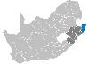
| Umkhanyakude District Municipality FeatureType : adm1st Elevation : 127 Lat/Lng : -27.6167 / 32.0333 | uMkhanyakude is the northernmost of the 11 districts of the KwaZulu-Natal province of South Africa. Its seat is Mkuze. It is a very rural district, the largest town being Mtubatuba in the south, with Hluhluwe, Mkuze, Jozini, Kwangwanase and Ingwavuma further to the north (...) |
| 28 | 
| Sani Pass FeatureType : pass Elevation : 2686 Lat/Lng : -29.5881 / 29.2927 | Sani Pass is a mountain pass located in the West of KwaZulu-Natal, South Africa on the road between Underberg, KwaZulu-Natal and Mokhotlong, Lesotho. (...) |
| 29 | 
| ISimangaliso Wetland Park FeatureType : null Elevation : 18 Lat/Lng : -27.8389 / 32.55 | iSimangaliso Wetland Park (previously known as the Greater St. Lucia Wetland Park) is situated on the east coast of KwaZulu-Natal, South Africa, about 275 kilometres north of Durban. It is South Africa's third-largest protected area, spanning 280 km of coastline, from the Mozambican border in the (...) |
| 30 | KwaZulu FeatureType : null Elevation : 522 Lat/Lng : -28.3167 / 31.4167 | KwaZulu was a semi-independent bantustan in South Africa, intended by the apartheid government as a homeland for the Zulu people. The capital was moved from Nongoma to Ulundi in 1980. It was led until its abolition in 1994 by Chief Mangosuthu Buthelezi and head of Inkatha, who implemented the (...) | |
| 31 | 
| Cape Floristic Region FeatureType : landmark Elevation : 270 Lat/Lng : -34.1667 / 18.375 | The Cape Floristic Region is a floristic region located near the southern tip of South Africa. It is the only floristic region of the Cape (South African) Floristic Kingdom, and includes only one floristic province, known as the Cape Floristic Province (...) |
| 32 | Transvaal (province) FeatureType : country Elevation : 1049 Lat/Lng : -25.0 / 28.5 | The Province of the Transvaal , commonly referred to as the Transvaal , was a province of South Africa from 1910 until the end of apartheid in 1994, when a new constitution subdivided it. The name "Transvaal" refers to the province's geographical location to the north of the Vaal River (...) | |
| 33 | Nkandla, KwaZulu-Natal FeatureType : null Elevation : 1091 Lat/Lng : -28.6225 / 31.0894 | Nkandla is a town in the uThungulu district of KwaZulu-Natal, South Africa. It is the seat of the Nkandla Local Municipality, and the district in which the residence of the former President of South Africa, Jacob Zuma is located (...) | |
| 34 | Greytown, KwaZulu-Natal FeatureType : null Elevation : 1067 Lat/Lng : -29.0639 / 30.5892 | Greytown is a town situated on the banks of a tributary of the Umvoti River in a richly fertile timber-producing area of KwaZulu-Natal, South Africa. (...) | |
| 35 | Howick, KwaZulu-Natal FeatureType : null Elevation : 1047 Lat/Lng : -29.4853 / 30.2243 | Howick is a town located in the uMgungundlovu District Municipality of KwaZulu-Natal Province, South Africa. The town is 1050 m above sea level, and about 88 kilometres from the port city of Durban. It enjoys warm summers and cool dry winters (...) | |
| 36 | Utrecht, KwaZulu-Natal FeatureType : null Elevation : 1234 Lat/Lng : -27.66 / 30.33 | Utrecht is a town in the foothills of the Balele Mountains, in the northwestern corner of KwaZulu-Natal, South Africa. Newcastle, Kwazulu-Natal's third-largest urban centre, is 50 km from Utrecht. Utrecht has a population of approximately 32,000 (including surrounding areas) (...) | |
| 37 | Mpumalanga FeatureType : adm1st Elevation : 1631 Lat/Lng : -26.0 / 30.0 | Mpumalanga (; Swazi, ; ; ; Northern Sotho, Afrikaans, Southern Sotho: Mpumalanga) is a province of South Africa. The name means "east", or literally "the place where the sun rises" in the Swazi, Xhosa, Ndebele and Zulu languages (...) | |
| 38 | Vaal River FeatureType : river Elevation : 975 Lat/Lng : -29.0708 / 23.6361 | The Vaal River is the largest tributary of the Orange River in South Africa. The river has its source near Breyten in Mpumalanga province, east of Johannesburg and about north of Ermelo and only about from the Indian Ocean.Times Comprehensive Atlas, 12th ed (...) | |
| 39 | Shaka FeatureType : null Elevation : 75 Lat/Lng : -29.34 / 31.2944 | Shaka kaSenzangakhona (c. 1787 – 1828), also known as Shaka Zulu , was one of the most influential monarchs of the Zulu Kingdom. He was born in the lunar month of uNtulikazi (July) in the year of 1787 near present-day Melmoth, KwaZulu-Natal Province (...) | |
| 40 | Free State (province) FeatureType : adm1st Elevation : 1381 Lat/Lng : -28.0 / 27.0 | The Free State (; ; ; ; ; before 1995, the Orange Free State) is a province of South Africa. Its capital is Bloemfontein, which is also South Africa's judicial capital. Its historical origins lie in the Boer republic called Orange Free State and later Orange Free State Province. (...) | |
| 41 | 2010 FIFA World Cup FeatureType : null Elevation : 1699 Lat/Lng : -26.2348 / 27.9824 | The 2010 FIFA World Cup was the 19th FIFA World Cup, the world championship for men's national association football teams. It took place in South Africa from 11 June to 11 July 2010. The bidding process for hosting the tournament finals was open only to African nations (...) | |
| 42 | Natal (province) FeatureType : null Elevation : 1276 Lat/Lng : -29.0 / 30.0 | The Province of Natal , commonly called Natal, was a province of South Africa from 1910 until 1994. Its capital was Pietermaritzburg. During this period rural areas inhabited by the black African population of Natal were organized into the bantustan of KwaZulu, which was progressively separated from (...) | |
| 43 | Msunduzi Local Municipality FeatureType : adm3rd Elevation : 654 Lat/Lng : -29.6167 / 30.3833 | Msunduzi Local Municipality is a local municipality in Umgungundlovu District Municipality, KwaZulu-Natal, South Africa. It encompasses the city of Pietermaritzburg, which is the capital of the KwaZulu-Natal province and the main economic hub of Umgungundlovu District Municipality (...) | |
| 44 | South African National Parks FeatureType : null Elevation : 1439 Lat/Lng : -25.7664 / 28.2022 | South African National Parks (SANParks) is the body responsible for managing South Africa's national parks. SANParks was formed in 1926, and currently manages 21 parks consisting of over , over 3% of the total area of South Africa (...) | |
| 45 | Dundee, KwaZulu-Natal FeatureType : null Elevation : 1253 Lat/Lng : -28.1621 / 30.2376 | The coal mining town of Dundee is situated in a valley of the Biggarsberg mountains in KwaZulu-Natal, South Africa . It is part of the Endumeni Municipality, Umzinyathi District. It is very rich in coal deposits. More populous than the town of Dundee itself is its adjacent township named Sibongile (...) | |
| 46 | 
| Military history of South Africa FeatureType : null Elevation : 3 Lat/Lng : -33.9258 / 18.4278 | The military history of South Africa chronicles a vast time period and complex events from the dawn of history until the present time. It covers civil wars and wars of aggression and of self-defence both within South Africa and against it (...) |
| 47 | Kingsmead Cricket Ground FeatureType : null Elevation : 7 Lat/Lng : -29.8501 / 31.0278 | Kingsmead is a cricket ground in Durban, KwaZulu-Natal, South Africa. Its stated capacity is 25,000,. World Stadiums. Retrieved on 2013-12-23. although grass terracing makes up part of the viewing area. The 'end names' are the Umgeni End (north) and the Old Fort Road End (south) (...) | |
| 48 | Geography of South Africa FeatureType : null Elevation : 488 Lat/Lng : -22.1167 / 29.65 | South Africa occupies the southern tip of Africa, its coastline stretching more than from the desert border with Namibia on the Atlantic (western) coast southwards around the tip of Africa and then northeast to the border with Mozambique on the Indian Ocean (...) | |
| 49 | Buffalo River (KwaZulu-Natal) FeatureType : null Elevation : 468 Lat/Lng : -28.7164 / 30.6418 | The Buffalo River is the largest tributary of the Tugela River in South Africa. Its source is in Majuba Hill, "Hill of Doves" in Zulu language, located northeast of Volksrust, close to the Mpumalanga / KwaZulu-Natal border (...) | |
| 50 | Liverpool F.C. FeatureType : null Elevation : 67 Lat/Lng : 53.4308 / -2.9608 | Liverpool Football Club is a professional football club in Liverpool, England, that competes in the Premier League, the top tier of English football. The club has won 5 European Cups, more than any other English club, 3 UEFA Cups, 3 UEFA Super Cups, 18 League titles, 7 FA Cups, 8 League Cups, and 15 (...) | |
| 51 | Mondlo FeatureType : null Elevation : 1166 Lat/Lng : -27.967 / 30.722 | Mondlo is a town in Zululand District Municipality in the KwaZulu-Natal province of South Africa. (...) | |
| 52 | Ncotshane FeatureType : null Elevation : 314 Lat/Lng : -27.342 / 31.58 | Ncotshane is a town in Zululand District Municipality in the KwaZulu-Natal province of South Africa. (...) | |
| 53 | Underberg, KwaZulu-Natal FeatureType : null Elevation : 1557 Lat/Lng : -29.7923 / 29.4938 | Underberg is an administrative town in a dairy and cattle farming community in the Mzimkulu River valley of KwaZulu-Natal, South Africa. It is situated at the foot of the 1,904 m Hlogoma Peak (place of echoes) in the foothills of the southern Drakensberg, KwaZulu-Natal (...) | |
| 54 | Harding, KwaZulu-Natal FeatureType : null Elevation : 872 Lat/Lng : -30.5833 / 29.8833 | Harding is a town situated in the Mzimkulwana River valley, Ugu District Municipality of KwaZulu-Natal, South Africa (...) | |
| 55 | Melmoth, KwaZulu-Natal FeatureType : null Elevation : 713 Lat/Lng : -28.5833 / 31.3833 | Melmoth is a small town situated in KwaZulu-Natal, South Africa. The town was established in the Mthonjaneni district after the annexation of Zululand by the United Kingdom in 1887 and was named after Sir Melmoth Osborn (...) | |
| 56 | Inanda, KwaZulu-Natal FeatureType : null Elevation : 289 Lat/Lng : -29.6875 / 30.935 | Inanda (isiZulu: Pleasant Place) is a township in eastern KwaZulu-Natal, South Africa that is situated 24 km inland from Durban; it now forms part of eThekwini, the Greater Durban Metropolitan Municipality. Populated primarily by Zulu-speaking Black Africans, Inanda is known as the home of John (...) | |
| 57 | Umgeni River FeatureType : null Elevation : -2 Lat/Lng : -29.81 / 31.0356 | The Umgeni River or Mgeni River , is a river in KwaZulu-Natal, South Africa. It rises in the "Dargle" in the KZN midlands, and its mouth is at Durban, some distance north of Durban's natural harbour. The name is taken to mean place of the Acacia trees in Zulu, though other meanings have been (...) | |
| 58 | Sub-Saharan Africa FeatureType : null Elevation : 812 Lat/Lng : -27.9136 / 31.6475 | The sub-Saharan Africa is, geographically, the area of the continent of Africa that lies south of the Sahara. According to the United Nations, it consists of all African countries that are fully or partially located south of the Sahara (...) | |
| 59 | Volksrust FeatureType : null Elevation : 1668 Lat/Lng : -27.3667 / 29.8833 | Volksrust is a town in the Mpumalanga province of South Africa near the KwaZulu-Natal provincial border, some 240 km southeast of Johannesburg, 53 km north of Newcastle and 80 km southeast of Standerton. (...) | |
| 60 | South African Airways FeatureType : null Elevation : 1683 Lat/Lng : -26.1392 / 28.2461 | South African Airways (SAA) is the flag carrier airline of South Africa. Its headquarters are in Airways Park on the grounds of O. R. Tambo International Airport in Kempton Park, Ekurhuleni, Gauteng. In partnership with SA Express, SA Airlink and its low-cost carrier, Mango, the airline flies to 56 (...) | |
| 61 | Newcastle-under-Lyme FeatureType : null Elevation : 132 Lat/Lng : 53.0109 / -2.2278 | Newcastle-under-Lyme (locally ; or Underlem , cf. Burslem, Audlem), is a market town in Staffordshire, England, and is the principal settlement in the Borough of Newcastle-under-Lyme. In the 2011 census the town had a population of 128,264.Newcastle is made up of 14 wards http://www.ukcensusdata (...) | |
| 62 | Bill & Melinda Gates Foundation FeatureType : landmark Elevation : 25 Lat/Lng : 47.6236 / -122.3456 | Bill & Melinda Gates Foundation (BMGF), previously branded as the 'William H. Gates Foundation', is a private foundation founded by Bill and Melinda Gates. It was launched in 2000, and is said to be the largest private foundation in the United States, holding US$50.7 billion in assets (...) | |
| 63 | Umhlanga, KwaZulu-Natal FeatureType : null Elevation : 36 Lat/Lng : -29.7253 / 31.0858 | Umhlanga is an affluent residential, commercial and resort town north of Durban on the coast of KwaZulu-Natal, South Africa. It is part of the eThekwini Metropolitan Municipality, created in 2000, which includes the greater Durban area (...) | |
| 64 | Mokhotlong District FeatureType : adm1st Elevation : 2287 Lat/Lng : -29.3333 / 29.0 | Mokhotlong district (in Sesotho language "the place of the bald ibis") is a district of Lesotho. It includes the highest terrain in the Maloti Range and the source of the Senqu River, Lesotho’s primary watershed. Mokhotlong is the capital or camptown, and only town in the district (...) | |
| 65 | King Shaka International Airport FeatureType : null Elevation : 92 Lat/Lng : -29.6118 / 31.1193 | King Shaka International Airport , abbreviated KSIA, is the primary airport serving Durban, South Africa. Located in La Mercy, KwaZulu-Natal, approximately north of the city centre of Durban, it opened its doors to passengers on 1 May 2010, just over a month before the start of the 2010 FIFA World (...) | |
| 66 | Njesuthi FeatureType : mountain Elevation : 3401 Lat/Lng : -29.203 / 29.3715 | Njesuthi or Injesuthi Dome is one of the highest mountains in the Drakensberg mountain range at . It is located on the border between Lesotho and the South African province KwaZulu-Natal. Also, less than 1.5km away on the border is the taller Mafadi peak at . (...) | |
| 67 | Glencoe, KwaZulu-Natal FeatureType : null Elevation : 1291 Lat/Lng : -28.1833 / 30.15 | Glencoe is situated in the Umzinyathi District, District of KwaZulu-Natal, South Africa. The main economic activity in the area is coal mining while sheep and cattle ranching are also practiced. (...) | |
| 68 | Ncandu Falls FeatureType : landmark Elevation : 1305 Lat/Lng : -27.849 / 29.844 | Ncandu Falls is a waterfall in the Ncandu River in Northern KwaZulu-Natal, in South Africa close to the town of Newcastle, KwaZulu-Natal. | |
| 69 | Hillsborough disaster FeatureType : landmark Elevation : 56 Lat/Lng : 53.3858 / -1.4694 | The Hillsborough disaster was a fatal human crush during an FA Cup semi-final match between Liverpool and Nottingham Forest at Hillsborough Stadium in Sheffield, England, on 15 April 1989. With 96 fatalities and 766 injuries, it was the worst disaster in British sporting history (...) | |
| 70 | Nelson Mandela FeatureType : null Elevation : 834 Lat/Lng : -31.8061 / 28.6146 | Nelson Rolihlahla Mandela (; ; 18 July 1918 – 5 December 2013) was a South African anti-apartheid revolutionary, political leader, and philanthropist who served as President of South Africa from 1994 to 1999. He was the country's first black head of state and the first elected in a fully (...) | |
| 71 | Saint Lucia (disambiguation) FeatureType : null Elevation : 54 Lat/Lng : -28.9875 / -59.1029 | Saint Lucia is an island country in the Caribbean. Saint Lucy is a Christian saint known as Santa Lucia in Italian, and Santa Lucía in Spanish. Saint Lucia may also refer to: (...) | |
| 72 | Lebombo Mountains FeatureType : mountain Elevation : 219 Lat/Lng : -26.25 / 32.0 | The Lebombo Mountains, also called Lubombo Mountains , are an , narrow range of mountains in Southern Africa. They stretch from Hluhluwe in KwaZulu-Natal in the south to Punda Maria in the Limpopo Province in South Africa in the north (...) | |
| 73 | Munster, KwaZulu-Natal FeatureType : null Elevation : 47 Lat/Lng : -31.004 / 30.253 | Munster is a quiet coastal town in Ugu District Municipality in the KwaZulu-Natal province of South Africa. (...) | |
| 74 | Boston, KwaZulu-Natal FeatureType : null Elevation : 1356 Lat/Lng : -29.6833 / 30.0667 | Boston is a small town situated in the Mkhomazi and Elands River valley of KwaZulu-Natal, South Africa. | |
| 75 | Blinkwater, KwaZulu-Natal FeatureType : null Elevation : 1021 Lat/Lng : -27.405 / 30.929 | Blinkwater is a town in eDumbe Local Municipality in the KwaZulu-Natal province of South Africa. (...) | |
| 76 | Franklin, KwaZulu-Natal FeatureType : null Elevation : 1522 Lat/Lng : -30.3164 / 29.4525 | Franklin is a town in Greater Kokstad Local Municipality in the KwaZulu-Natal province of South Africa. (...) | |
| 77 | Maputo Province FeatureType : adm1st Elevation : 113 Lat/Lng : -25.5 / 32.3333 | Maputo is a province of Mozambique; the province excludes the city of Maputo (which comprises a separate province). The province has an area of 22,693 km² and a population of 1,205,709 (2007 census). Its capital is the city of Matola. (...) | |
| 78 | Richards Bay FeatureType : null Elevation : 9 Lat/Lng : -28.7828 / 32.0375 | Richards Bay is a town in KwaZulu-Natal, South Africa. It is situated on a 30 square kilometre lagoon of the Mhlatuze River, which gives it one of the country's largest harbours. Richards bay also has the deepest natural harbour in the Southern hemisphere. (...) | |
| 79 | Port of Durban FeatureType : null Lat/Lng : -29.8732 / 31.0245 | The Port of Durban, commonly called Durban Harbour, is the largest and busiest shipping terminal in sub-Saharan Africa. It handles up to 31.4 million tons of cargo each year.http://www.iss-shipping.com/Microsites/Document%20Library/Port%20Of%20Durban (...) | |
| 80 | Thaba-Tseka District FeatureType : adm1st Elevation : 2301 Lat/Lng : -29.5667 / 28.6 | Thaba-Tseka is a district of Lesotho. Thaba-Tseka is also the name of the district's capital or camptown, which is the only town in the district. In the east, Thaba-Tseka borders on the KwaZulu-Natal Province of South Africa (...) | |
| 81 | Cape Fold Belt FeatureType : null Elevation : 758 Lat/Lng : -33.4 / 22.0 | The Cape Fold Belt is a fold and thrust belt of late Paleozoic age, which affected the sequence of sedimentary rock layers of the Cape Supergroup in the southwestern corner of South Africa. It was originally continuous with the Ventana Mountains near Bahía Blanca in Argentina, the Pensacola (...) | |
| 82 | Natal FeatureType : null Elevation : 50 Lat/Lng : -5.8101 / -35.2267 | NATAL or Natal may refer to: (...) | |
| 83 | Richmond, KwaZulu-Natal FeatureType : null Elevation : 846 Lat/Lng : -29.8667 / 30.2667 | Richmond is a town situated on the banks of the upper Illovo River in the midlands of KwaZulu-Natal, South Africa, approximately 38 km south-west of Pietermaritzburg. Timber, sugarcane, poultry, citrus fruit and dairy goods are produced here (...) | |
| 84 | Munster (disambiguation) FeatureType : null Elevation : 222 Lat/Lng : 48.9156 / 6.9058 | Munster is the southernmost province of Ireland, comprising the counties of Clare, Cork, Kerry, Limerick, Tipperary and Waterford. Munster may also refer to: (...) | |
| 85 | Harry Gwala District Municipality FeatureType : adm1st Elevation : 945 Lat/Lng : -30.1333 / 30.0667 | Harry Gwala is one of the 11 districts of KwaZulu-Natal province of South Africa. The seat of Harry Gwala is Ixopo. The majority of its 298 392 people speak IsiZulu (2011 Census). The district code is DC43. In November 2015, Sisonke District's name was changed to Harry Gwala District, in honor of (...) | |
| 86 | Mpumalanga, KwaZulu-Natal FeatureType : city Elevation : 637 Lat/Lng : -29.8167 / 30.6167 | Mpumalanga is a town in eThekwini in the KwaZulu-Natal province of South Africa. It is a township about 10 km south-south-east of Cato Ridge and some 40 km west of Durban. Derived from Zulu, the name means 'sunrise', 'the sun comes out'. (...) | |
| 87 | Eastern Cape FeatureType : adm1st Elevation : 1087 Lat/Lng : -32.0 / 27.0 | The Eastern Cape is a province of South Africa. Its capital is Bhisho, but its two largest cities are Port Elizabeth and East London. It was formed in 1994 out of the Xhosa homelands or bantustans of Transkei and Ciskei, together with the eastern portion of the Cape Province (...) | |
| 88 | Groenvlei, KwaZulu-Natal FeatureType : null Elevation : 1775 Lat/Lng : -27.46 / 30.229 | Groenvlei is a town in Emadlangeni Local Municipality in the KwaZulu-Natal province of South Africa. (...) | |
| 89 | Driefontein, KwaZulu-Natal FeatureType : null Elevation : 1133 Lat/Lng : -28.345 / 29.705 | Driefontein is a town in Uthukela District Municipality in the KwaZulu-Natal province of South Africa. (...) | |
| 90 | Tugela, KwaZulu-Natal FeatureType : null Elevation : 76 Lat/Lng : -29.183 / 31.417 | Tugela is a town in Ilembe District Municipality in the KwaZulu-Natal province of South Africa. (...) | |
| 91 | Belgrade, KwaZulu-Natal FeatureType : null Elevation : 917 Lat/Lng : -27.266 / 31.275 | Belgrade is a town in Zululand District Municipality in the KwaZulu-Natal province of South Africa. (...) | |
| 92 | Kleinfontein, KwaZulu-Natal FeatureType : null Elevation : 1190 Lat/Lng : -28.361 / 29.644 | Kleinfontein is a town in Uthukela District Municipality in the KwaZulu-Natal province of South Africa. (...) | |
| 93 | Watersmeet, KwaZulu-Natal FeatureType : null Elevation : 1116 Lat/Lng : -28.399 / 29.733 | Watersmeet is a town in Uthukela District Municipality in the KwaZulu-Natal province of South Africa. (...) | |
| 94 | Thornville, KwaZulu-Natal FeatureType : null Elevation : 731 Lat/Lng : -29.683 / 30.483 | Thornville is a town in Richmond Local Municipality in the KwaZulu-Natal province of South Africa. (...) | |
| 95 | Nyoni, KwaZulu-Natal FeatureType : null Elevation : 55 Lat/Lng : -29.078 / 31.463 | Nyoni is a town in Ilembe District Municipality in the KwaZulu-Natal province of South Africa. (...) | |
| 96 | Bisi, KwaZulu-Natal FeatureType : null Elevation : 622 Lat/Lng : -30.412 / 29.894 | Bisi is a town in Umzimkhulu Local Municipality in the KwaZulu-Natal province of South Africa. (...) | |
| 97 | Qacha's Nek District FeatureType : adm1st Elevation : 2343 Lat/Lng : -30.0 / 28.75 | Qacha's Nek is a district of Lesotho. Qacha's Nek is the capital or camptown, and only town in the district. In the south, Qacha's Nek borders on the Eastern Cape Province of South Africa, and it has a short border with KwaZulu-Natal Province in the far east (...) | |
| 98 | Verulam, KwaZulu-Natal FeatureType : null Elevation : 47 Lat/Lng : -29.65 / 31.05 | Verulam is a town 27 kilometres north of Durban in KwaZulu-Natal, South Africa and now part of the eThekwini Metropolitan area. (...) | |
| 99 | Pongola River FeatureType : null Elevation : 28 Lat/Lng : -26.8558 / 32.3464 | The Pongola or Phongolo River is a river in South Africa. It is a tributary of the Maputo River. It rises near Utrecht in northern KwaZulu-Natal, flows east through Pongola, is dammed at Pongolapoort, and crosses the Ubombo Mountains; then it flows north towards Mozambique, joining the Maputo River (...) | |
| 100 | Harrismith FeatureType : null Elevation : 1629 Lat/Lng : -28.2761 / 29.1272 | Harrismith is a large town in the Free State province of South Africa. It was named for Sir Harry Smith, a 19th century British governor of the Cape Colony. It is situated by the Wilge River, alongside the N3 highway, about midway between Johannesburg, about 300 km to the north-west, and Durban to (...) | |
| 101 | Krantzkloof Nature Reserve FeatureType : null Elevation : 238 Lat/Lng : -29.7643 / 30.8509 | __NOTOC__ The Krantzkloof Nature Reserve, managed by Ezemvelo KZN Wildlife, conserves 668 ha Note: This source records the surface area as 535 ha in 1989. of the Molweni (Zulu: 'mutual greetings') and Nkutu River gorges that incise the sandstone Kloof plateau in KwaZulu-Natal, South Africa (...) | |
| 102 | Limbe, Cameroon FeatureType : city Elevation : 69 Lat/Lng : 4.0242 / 9.2149 | Limbé (known as Victoria from 1858 to 1982) is a seaside city in the South-West Region of Cameroon. Limbé was founded in 1858 on the southern slopes of Mount Cameroon by the British missionary Alfred Saker. At the 2005 Census, the population was 84,223. (...) | |
| 103 | Port Shepstone FeatureType : null Elevation : 46 Lat/Lng : -30.7424 / 30.4536 | Port Shepstone is a town situated on the mouth of the largest river on the south coast of KwaZulu-Natal, South Africa, the Mzimkulu River (isiXhosa and isiZulu - 'large place').http://route56.co.za/umzimkulu.html It is located between Hibberdene and Margate and is located 120 km south of Durban (...) | |
| 104 | Tugela Falls FeatureType : landmark Elevation : 2967 Lat/Lng : -28.7522 / 28.8941 | Tugela Falls is a complex of seasonal waterfalls located in the Drakensberg (Dragon's Mountains) of Royal Natal National Park in KwaZulu-Natal Province, Republic of South Africa. It is generally accepted as the world's second-tallest waterfall but there is an argument that it is actually the tallest (...) | |
| 105 | Natalia Republic FeatureType : adm1st Elevation : 1293 Lat/Lng : -29.0 / 26.0 | The Natalia Republic was a short-lived Boer republic on the coast of Southern Africa, established in 1839 by Voortrekkers shortly after the Battle of Blood River. The area was ceded by the Zulu king Dingane to Piet Retief and his party in 1838 and stretched from the Tugela River to present day Port (...) | |
| 106 | Wasbank FeatureType : null Elevation : 1068 Lat/Lng : -28.3139 / 30.1072 | Wasbank is a town in Umzinyathi District Municipality in the KwaZulu-Natal province of South Africa. Village on the Wasbank River, 25km southwest of Dundee. Takes its name from the Wasbank River. (...) | |
| 107 | Amafa aKwaZulu-Natali FeatureType : null Elevation : 544 Lat/Lng : -28.3197 / 31.4592 | Amafa aKwaZulu-Natali (Zulu for ‘Heritage KwaZulu-Natal’), commonly known as 'Amafa', is a provincial heritage resources authority in terms of South Africa's National Heritage Resources Act.National Heritage Resources Act, Act 25 of 1999, Government Notice 506, Republic of South Africa Government (...) | |
| 108 | Wentworth, KwaZulu-Natal FeatureType : null Elevation : 19 Lat/Lng : -29.9167 / 31.0 | Wentworth is a township of Durban, South Africa on the east coast of KwaZulu-Natal. It is located completely inside an area known as the South Durban Basin. The Wentworth area is located near major freeways M4 and M7 is approximately 11 km south of the Durban City Centre. (...) | |
| 109 | St Lucia, KwaZulu-Natal FeatureType : null Elevation : 15 Lat/Lng : -28.383 / 32.417 | St Lucia is a settlement in Umkhanyakude District Municipality in the KwaZulu-Natal province of South Africa. The small town is mainly a hub for the Greater St Lucia Wetlands Park. (...) | |
| 110 | Wartburg, KwaZulu-Natal FeatureType : null Elevation : 947 Lat/Lng : -29.4312 / 30.5756 | Wartburg is a small town located north-east of Pietermaritzburg and south of Greytown in the uMshwathi Local Municipality of KwaZulu-Natal, South Africa. The town was named after Wartburg castle in Thuringia where Martin Luther translated the Bible into German by the immigrant families who arrived (...) | |
| 111 | Darnall, KwaZulu-Natal FeatureType : null Elevation : 87 Lat/Lng : -29.267 / 31.367 | Darnall is a town in Ilembe District Municipality in the KwaZulu-Natal province of South Africa. Darnall is home to the Darnall sugar factory. (...) | |
| 112 | N2 (South Africa) FeatureType : null Elevation : 752 Lat/Lng : -32.3589 / 28.02 | The N2 is a national route in South Africa that runs from Cape Town through Port Elizabeth, East London and Durban to Ermelo. It is the main highway along the Indian Ocean coast of the country. Its total distance of makes it the longest numbered route in South Africa. (...) | |
| 113 | King Cetshwayo District Municipality FeatureType : adm1st Elevation : 40 Lat/Lng : -28.7333 / 32.0833 | King Cetshwayo District Municipality (formerly Uthungulu District Municipality) is one of the 11 district municipalities ("districts") of KwaZulu-Natal province in South Africa. The seat of the district is Richards Bay. The majority of its 885 944 people speak Zulu (2001 Census) (...) | |
| 114 | Howick Falls FeatureType : landmark Elevation : 980 Lat/Lng : -29.4867 / 30.2389 | Howick Falls is a waterfall in Howick, KwaZulu-Natal Province, South Africa. The waterfall is approximately 95 m in height (310 feet) and lies on the Umgeni River. The Zulu people called the falls KwaNogqaza, which means "Place of the Tall One". (...) | |
| 115 | Comrades Marathon FeatureType : null Elevation : 656 Lat/Lng : -29.6019 / 30.3794 | The Comrades Marathon is an ultramarathon of approximately 89 km (approx. 55 miles) which is run annually in the KwaZulu-Natal Province of South Africa between the cities of Durban and Pietermaritzburg. It is the world's largest and oldest ultramarathon race (...) | |
| 116 | City of Ekurhuleni Metropolitan Municipality FeatureType : adm2nd Elevation : 1678 Lat/Lng : -26.1772 / 28.2219 | The City of Ekurhuleni Metropolitan Municipality is a metropolitan municipality that forms the local government of the East Rand region of Gauteng, South Africa. The name Ekurhuleni means place of peace in XiTsonga (...) | |
| 117 | Missionary Oblates of Mary Immaculate FeatureType : null Elevation : 161 Lat/Lng : 38.561 / -90.0823 | The Missionary Oblates of Mary Immaculate (OMI) is a missionary religious congregation in the Catholic Church. It was founded on January 25, 1816, by Saint Eugène de Mazenod, a French priest born in Aix-en-Provence in the south of France on August 1, 1782 (...) | |
| 118 | Western Cape FeatureType : adm1st Elevation : 218 Lat/Lng : -34.0 / 20.0 | The Western Cape is a province of South Africa, situated on the south-western coast of the country. It is the fourth largest of the nine provinces with an area of , and the third most populated, with an estimated 6.6 million inhabitants in 2018. Statistics South Africa, 2018 (...) | |
| 119 | Battle of Blood River FeatureType : event Elevation : 1162 Lat/Lng : -28.1052 / 30.5417 | The Battle of Blood River is the name given for the battle fought between 470 Voortrekkers ("Pioneers"), led by Andries Pretorius, and an estimated "10 000 to 15 000"A. J. P. Opperman, The Battle of Blood River. CUM Books, Roodepoort, 1982. First edition, First impression. . Page 27 (...) | |
| 120 | Nkandla Local Municipality FeatureType : adm3rd Elevation : 1187 Lat/Lng : -28.62 / 31.08 | Nkandla Local Municipality is an administrative area in the uThungulu District of KwaZulu-Natal province in South Africa. The town of Nkandla (seat of the municipality) is the home town of the former President of South Africa, Jacob Zuma (...) | |
| 121 | Michaelhouse FeatureType : landmark Elevation : 1315 Lat/Lng : -29.4 / 30.0333 | Michaelhouse is a full boarding senior school for boys founded in 1896. It is located in the Balgowan valley in the Midlands of KwaZulu-Natal, South Africa. (...) | |
| 122 | KwaZulu-Natal Division FeatureType : landmark Elevation : 644 Lat/Lng : -29.5994 / 30.3804 | The KwaZulu-Natal Division of the High Court of South Africa is a superior court of law with general jurisdiction over the KwaZulu-Natal province of South Africa. The main seat of the division is at Pietermaritzburg, while a subordinate local seat at Durban has concurrent jurisdiction over the (...) | |
| 123 | Hillcrest, KwaZulu-Natal FeatureType : null Elevation : 700 Lat/Lng : -29.78 / 30.7628 | Hillcrest is a suburb in Durban, South Africa. It is part of the outer west suburbs of Durban. (...) | |
| 124 | Ubuhlebezwe Local Municipality FeatureType : adm2nd Elevation : 1008 Lat/Lng : -30.1533 / 30.0636 | Ubuhlebezwe Local Municipality is an administrative area in the Harry Gwala District of KwaZulu-Natal in South Africa. Ubuhlebezwe is an isiZulu name meaning "The Beauty of the Land". The name is derived from Alan Paton's novel, Cry, The Beloved Country. (...) | |
| 125 | EMadlangeni Local Municipality FeatureType : adm2nd Elevation : 1250 Lat/Lng : -27.6781 / 30.3192 | eMadlangeni Local Municipality, previously known as Utrecht Local Municipality, is an administrative area in the Amajuba District of KwaZulu-Natal in South Africa. (...) | |
| 126 | Mtubatuba Local Municipality FeatureType : city Elevation : 58 Lat/Lng : -28.4167 / 32.1833 | Mtubatuba is an administrative area in the Umkhanyakude District of KwaZulu-Natal in South Africa. (...) | |
| 127 | Mpofana Local Municipality FeatureType : adm3rd Elevation : 1390 Lat/Lng : -29.208 / 29.9967 | Mpofana Local Municipality is an administrative area in the UMgungundlovu District of KwaZulu-Natal in South Africa. (...) | |
| 128 | KwaDukuza Local Municipality FeatureType : adm3rd Elevation : 32 Lat/Lng : -29.45 / 31.2167 | KwaDukuza Local Municipality is one of four municipalities under iLembe District Municipality, KwaZulu-Natal, South Africa. (...) | |
| 129 | UMlalazi Local Municipality FeatureType : adm3rd Elevation : 527 Lat/Lng : -28.8976 / 31.4665 | uMlalazi Local Municipality is an administrative area in the uThungulu District of KwaZulu-Natal in South Africa. The municipality is named after the uMlalazi River. (...) | |
| 130 | Endumeni Local Municipality FeatureType : adm3rd Elevation : 1261 Lat/Lng : -28.1692 / 30.2269 | Endumeni Local Municipality is an administrative area in the Umzinyathi District of KwaZulu-Natal in South Africa. Endumeni is an isiZulu name meaning "a place of thunderstorm". The municipality shares its name with the Endumeni hill. (...) | |
| 131 | Ndwedwe Local Municipality FeatureType : adm2nd Elevation : 428 Lat/Lng : -29.5328 / 30.9356 | Ndwedwe Local Municipality is an administrative area in the iLembe District of KwaZulu-Natal in South Africa. Primary kaolin deposits occur in Ndwedwe. Good quality material is found near Coqweni, Nozandla and Appelsbosch. Towns in the municipality include Ndwedwe, Glendale Heights. (...) | |
| 132 | Newcastle Local Municipality FeatureType : adm3rd Elevation : 1195 Lat/Lng : -27.7442 / 29.9372 | Newcastle Local Municipality is an administrative area in the Amajuba District of KwaZulu-Natal in South Africa. (...) | |
| 133 | UMngeni Local Municipality FeatureType : adm3rd Elevation : 1047 Lat/Lng : -29.4853 / 30.2243 | uMngeni Local Municipality is an administrative area in the UMgungundlovu District of KwaZulu-Natal in South Africa. The municipality is named after the Umgeni River that runs through the municipal area. (...) | |
| 134 | UMdoni Local Municipality FeatureType : adm2nd Elevation : 88 Lat/Lng : -30.2667 / 30.75 | uMdoni Local Municipality is an administrative area in the Ugu District of KwaZulu-Natal in South Africa. Umdoni is an isiZulu name for the indigenous tree, Mdoni (Syzgium gerrardi). (...) | |
| 135 | Mtubatuba FeatureType : null Elevation : 58 Lat/Lng : -28.4167 / 32.1833 | Mtubatuba is a town north of Richards Bay close to the entrance of the iSimangaliso Wetland Park (previously Greater St Lucia Wetland Park) in KwaZulu-Natal, South Africa. Town some 55 km south-south-west of Hluhluwe and 28 km west of St Lucia. Administered by a health committee since 1950 (...) | |
| 136 | New Hanover, KwaZulu-Natal FeatureType : null Elevation : 790 Lat/Lng : -29.35 / 30.5333 | New Hanover is a small town in the midlands of KwaZulu-Natal, South Africa, north-east of Pietermaritzburg and south of Greytown. It was founded in 1850 and has been administered by a health committee since 1933. It was named after city of Hanover in Germany by the German settlers (...) | |
| 137 | Shelly Beach, KwaZulu-Natal FeatureType : null Elevation : 36 Lat/Lng : -30.798 / 30.41 | Shelly Beach is a coastal town in Ugu District Municipality in the KwaZulu-Natal province of South Africa. It includes the largest shopping centre in the KZN South Coast, South Coast Mall and another large shopping centre, Shelly Centre. It is located between Uvongo and Port Shepstone. (...) | |
| 138 | Trafalgar, KwaZulu-Natal FeatureType : null Elevation : 49 Lat/Lng : -30.958 / 30.292 | Trafalgar is a seaside resort town in Ugu District Municipality in the KwaZulu-Natal province of South Africa. Trafalgar is on the north bank of the Mpenjati river which enters the Indian Ocean at the Mpenjati Nature Reserve (...) | |
| 139 | Camperdown, KwaZulu-Natal FeatureType : null Elevation : 764 Lat/Lng : -29.7276 / 30.5408 | Camperdown is a settlement in Umgungundlovu District Municipality in the KwaZulu-Natal province of South Africa. Town some 60km by road north-west of Durban. Laid out in 1865 on the farm Camperdown, named to commemorate the victory of the British navy under Admiral Adam Duncan over the Dutch fleet (...) | |
| 140 | Donnybrook, KwaZulu-Natal FeatureType : null Elevation : 1097 Lat/Lng : -29.75 / 30.0 | Donnybrook is a settlement in Harry Gwala District Municipality in the KwaZulu-Natal province of South Africa. Village some 80 km southwest of Pietermaritzburg. It was named after Donnybrook, a suburb of Dublin, by Robert Comrie, the owner of the farm on which it was laid out (...) | |
| 141 | Mapumulo FeatureType : null Elevation : 133 Lat/Lng : -30.054 / 30.772 | Mapumulo is a town in Ugu District Municipality in the KwaZulu-Natal province of South Africa. (...) | |
| 142 | Kliprivier FeatureType : null Elevation : 1245 Lat/Lng : -28.509 / 30.297 | Kliprivier is a town in Uthukela District Municipality in the KwaZulu-Natal province of South Africa. (...) | |
| 143 | Lidgetton FeatureType : null Elevation : 1199 Lat/Lng : -29.441 / 30.101 | Lidgetton is a town in uMngeni Local Municipality in the KwaZulu-Natal province of South Africa. (...) | |
| 144 | Rietvlei FeatureType : null Elevation : 819 Lat/Lng : -30.487 / 29.832 | Rietvlei is a town in Harry Gwala District Municipality in the KwaZulu-Natal province of South Africa. (...) | |
| 145 | Essenwood, Durban FeatureType : null Elevation : 108 Lat/Lng : -29.8358 / 31.0067 | Essenwood is a central suburb of Durban, KwaZulu-Natal, South Africa. It is administered by the eThekwini Metropolitan Municipality. (...) | |
| 146 | Bhucanana FeatureType : null Elevation : 236 Lat/Lng : -28.601 / 31.74 | Bhucanana (also Bhukhanana) is a town in the former Ntambanana Local Municipality in the KwaZulu-Natal province of South Africa. (...) | |
| 147 | Moyeni FeatureType : null Elevation : 1186 Lat/Lng : -28.724 / 29.186 | Moyeni is a town in Uthukela District Municipality in the KwaZulu-Natal province of South Africa. (...) | |
| 148 | Izingolweni FeatureType : null Elevation : 609 Lat/Lng : -30.7833 / 30.1333 | Izingolweni is a town in Ugu District Municipality in the KwaZulu-Natal province of South Africa. (...) | |
| 149 | Wembezi FeatureType : null Elevation : 1292 Lat/Lng : -29.041 / 29.796 | Wembezi is a town in Uthukela District Municipality in the KwaZulu-Natal province of South Africa. (...) | |
| 150 | Ekuvukeni FeatureType : null Elevation : 1013 Lat/Lng : -28.466 / 30.157 | Ekuvukeni is a town in Uthukela District Municipality in the KwaZulu-Natal province of South Africa. (...) | |
| 151 | Green Point Lighthouse, KwaZulu-Natal FeatureType : null Elevation : 69 Lat/Lng : -30.2491 / 30.7773 | The Green Point Lighthouse is a provincial heritage site in Umzinto in the KwaZulu-Natal province of South Africa. In 1995 it was described in the Government Gazette as an "unusual cast-iron structure, erected in 1905, the oldest lighthouse on the KwaZulu-Natal coast (...) | |
| 152 | Cool Air, KwaZulu-Natal FeatureType : null Elevation : 940 Lat/Lng : -29.363 / 30.633 | Cool Air is a town in Umgungundlovu District Municipality in the KwaZulu-Natal province of South Africa. (...) | |
| 153 | Frere, KwaZulu-Natal FeatureType : null Elevation : 1057 Lat/Lng : -28.883 / 29.766 | Frere is a town in Inkosi Langalibalele Local Municipality in the KwaZulu-Natal province of South Africa. (...) | |
| 154 | Clydesdale, KwaZulu-Natal FeatureType : null Elevation : 789 Lat/Lng : -30.299 / 29.94 | Clydesdale is a town in Harry Gwala District Municipality in the KwaZulu-Natal province of South Africa. (...) | |
| 155 | Pevensey, KwaZulu-Natal FeatureType : null Elevation : 1538 Lat/Lng : -29.783 / 29.5 | Pevensey is a town in Kwa Sani Local Municipality in the KwaZulu-Natal province of South Africa. (...) | |
| 156 | Tugela Ferry FeatureType : null Elevation : 540 Lat/Lng : -28.7502 / 30.4431 | Tugela Ferry is a town on the northern bank of the Tugela River, in central KwaZulu-Natal, South Africa. During the apartheid era it formed part of the KwaZulu homeland, and at present it is included in the Umzinyathi District Municipality (...) | |
| 157 | Nquthu FeatureType : null Elevation : 1173 Lat/Lng : -28.232 / 30.566 | Nquthu is a town in Umzinyathi District Municipality in the KwaZulu-Natal province of South Africa. Village 24 km west-south-west of Barklieside and 53 km east of Dundee, KwaZulu-Natal. Of Zulu origin, the name is derived from isquthu, ‘flat-topped vessel’, descriptive of a nearby hill from which (...) | |
| 158 | Port St. Johns FeatureType : null Elevation : 91 Lat/Lng : -31.6288 / 29.5369 | Port St. Johns (or Port Saint Johns) is a town of about 6,500 people on the Wild Coast in the Eastern Cape province of South Africa. It is situated at the mouth of the Umzimvubu River, northeast of East London and east of Mthatha. (...) | |
| 159 | Hibiscus Coast Local Municipality FeatureType : adm3rd Elevation : 32 Lat/Lng : -30.7228 / 30.465 | Hibiscus Coast Local Municipality was a local municipality in South Africa. It is the economic hub of the Ugu District Municipality in the KwaZulu-Natal Province. The area attracts tourists from KwaZulu-Natal and other provinces as well as international tourists (...) | |
| 160 | White Umfolozi River FeatureType : null Elevation : 71 Lat/Lng : -28.3494 / 31.9808 | The White Umfolozi River originates just west of Vryheid, KwaZulu-Natal, South Africa and has a confluence with the Black Umfolozi River at to form the Umfolozi River, which flows eastward towards the Indian Ocean. (...) | |
| 161 | Greytown Airport FeatureType : null Elevation : 1040 Lat/Lng : -29.1233 / 30.5989 | Greytown Airport is an airport serving Greytown, a town in the KwaZulu-Natal province in South Africa. (...) | |
| 162 | Jozini FeatureType : null Elevation : 247 Lat/Lng : -27.4333 / 32.0667 | Jozini is a settlement in Umkhanyakude District Municipality in the KwaZulu-Natal province of South Africa. Jozini is a small town on the main route to Mozambique, and it is close to the Jozini or Pongolapoort Dam (...) | |
| 163 | Gingindlovu FeatureType : null Elevation : 79 Lat/Lng : -29.0167 / 31.5833 | Gingindlovu is a town in Uthungulu District Municipality in the KwaZulu-Natal province of South Africa. Village 21 km south-east of Eshowe. The name was first applied to one of Cetshwayo's military kraals nearby (...) | |
| 164 | Hlabisa FeatureType : null Elevation : 512 Lat/Lng : -28.1459 / 31.8742 | Hlabisa is a settlement in Umkhanyakude District Municipality in the KwaZulu-Natal province of South Africa. The village lies between the Hluhluwe and Umfolozi game reserves, some 40 km north-west of Mtubatuba. Named after the Hlabisa tribe of Zulus (...) | |
| 165 | Hluhluwe–Imfolozi Park FeatureType : landmark Elevation : 189 Lat/Lng : -28.2486 / 31.9519 | Hluhluwe–Imfolozi Park, formerly Hluhluwe–Umfolozi Game Reserve, is the oldest proclaimed nature reserve in Africa. It consists of 960 km² (96,000 ha) of hilly topography north of Durban in central KwaZulu-Natal, South Africa and is known for its rich wildlife and conservation efforts (...) | |
| 166 | Timeline of Durban FeatureType : city Elevation : 59 Lat/Lng : -29.8833 / 31.05 | The following is a of the history of the city of Durban in the eThekwini Metropolitan Municipality, KwaZulu-Natal province, South Africa. (...) | |
| 167 | Abaqulusi Local Municipality FeatureType : adm3rd Elevation : 1170 Lat/Lng : -27.766 / 30.7989 | AbaQulusi Local Municipality is a local municipality in Zululand in the KwaZulu-Natal province of South Africa. It is named after the AbaQulusi, a Zulu clan whose descendants live in the vicinities of Vryheid, Utrecht, eDumbe and eNgoje (...) | |
| 168 | Richmond FeatureType : null Elevation : 21 Lat/Lng : -42.7355 / 147.4383 | Richmond may refer to: (...) | |
| 169 | Ohlanga River FeatureType : null Elevation : 9 Lat/Lng : -29.7025 / 31.1 | The Ohlanga River is a river in KwaZulu-Natal, South Africa, which empties into the Indian Ocean just north of Umhlanga, KwaZulu-Natal, north of Durban.Tourism KwaZulu-Natal, , retrieved September 2006 The river has extensive reed beds in the estuary at its mouth,South African Birding, , retrieved (...) | |
| 170 | Springs, Gauteng FeatureType : null Elevation : 1629 Lat/Lng : -26.25 / 28.4333 | Springs is a main place, and formerly independent town, in the east of Ekurhuleni in the Gauteng province of South Africa. It lies 50 km (31 mi) east of Johannesburg and 72 km (45 mi) southeast from Pretoria. The name of Springs derives from the large number of springs in the area; it has an (...) | |
| 171 | Tamil Eelam FeatureType : null Elevation : 103 Lat/Lng : 8.75 / 80.5 | Tamil Eelam (tamiḻ īḻam, generally rendered outside Tamil-speaking areas as தமிழ் ஈழம்) is a proposed independent state that Tamils in Sri Lanka and the Sri Lankan Tamil diaspora aspire to create in the north and east of Sri Lanka (...) | |
| 172 | South African Breweries FeatureType : null Elevation : 1559 Lat/Lng : -26.3135 / 28.1364 | South African Breweries (officially The South African Breweries Limited, informally SAB) is a major brewery headquartered in Johannesburg, South Africa and was a wholly owned subsidiary of SABMiller until its interests were sold to Anheuser-Busch InBev on 10 October 2016 (...) | |
| 173 | Focus on the Family FeatureType : null Elevation : 2051 Lat/Lng : 38.963 / -104.789 | Focus on the Family (FOTF or FotF) is an American Christian conservative organization founded in 1977 in Southern California by psychologist James Dobson, based in Colorado Springs, Colorado. It is active in promoting an interdenominational effort toward its socially conservative views on public (...) | |
| 174 | Hilton College (South Africa) FeatureType : null Elevation : 1116 Lat/Lng : -29.4921 / 30.3011 | Hilton College, more commonly referred to as Hilton, is a South African private boarding school for boys located near the town of Hilton in the KwaZulu-Natal Midlands and is situated on a 1,762 ha (4,350 acre) estate that includes a 550 ha (1,400 acre) wildlife reserve (...) | |
| 175 | Tongaat FeatureType : null Elevation : 80 Lat/Lng : -29.5833 / 31.1333 | Tongaat is a town in KwaZulu-Natal, South Africa, about north of Durban and south of Stanger. It now forms part of eThekwini Metropolitan Municipality, or Greater Durban area. Its population is mostly people of Indian descent (...) | |
| 176 | Karoo FeatureType : airport Elevation : 864 Lat/Lng : -32.35 / 22.5667 | The Karoo (; from a Khoikhoi word, possibly garo "desert") is a semi desert natural region of South Africa. No exact definition of what constitutes the Karoo is available, so its extent is also not precisely defined (...) | |
| 177 | Glenwood, KwaZulu-Natal FeatureType : null Elevation : 42 Lat/Lng : -29.8833 / 30.9833 | Glenwood is a suburb on the lower Berea in Durban, KwaZulu-Natal, South Africa. Schools in the area include Glenwood High School, Glenwood Preparatory School (formerly Parkview Primary School), Glenwood Junior Primary School, Open Air School, Penzance Primary School, St (...) | |
| 178 | Rosetta, KwaZulu-Natal FeatureType : null Elevation : 1417 Lat/Lng : -29.306 / 29.978 | Rosetta is a town in Mpofana Local Municipality in the KwaZulu-Natal province of South Africa. Rosetta is known for the case of Elizabeth Klarer, who in 1955 claimed to have been abducted by aliens on a hill outside the town. (...) | |
| 179 | Wiggins, Durban FeatureType : null Elevation : 75 Lat/Lng : -29.8521 / 30.9635 | Wiggins is a large black residential area in central Durban, KwaZulu-Natal, South Africa. (...) | |
| 180 | South Beach, Durban FeatureType : null Elevation : 16 Lat/Lng : -29.8655 / 31.0418 | South Beach is a residential area in central Durban, KwaZulu-Natal, South Africa. (...) | |
| 181 | Mount Vernon, Durban FeatureType : null Elevation : 94 Lat/Lng : -29.8936 / 30.9382 | Mount Vernon is a suburb in the south of Durban, KwaZulu-Natal, South Africa. (...) | |
| 182 | Bonela, Durban FeatureType : null Elevation : 128 Lat/Lng : -29.8438 / 30.9725 | Bonela is a mixed race residential area in central Durban, KwaZulu-Natal, South Africa. (...) | |
| 183 | Sea Cow Lake, Durban FeatureType : null Elevation : 40 Lat/Lng : -29.8014 / 31.0034 | Sea Cow Lake is a residential area in central Durban, KwaZulu-Natal, South Africa. (...) | |
| 184 | Ridgeview, Durban FeatureType : null Elevation : 108 Lat/Lng : -29.8674 / 30.9443 | Ridgeview is a residential area in central Durban, KwaZulu-Natal, South Africa. (...) | |
| 185 | Sherwood, Durban FeatureType : null Elevation : 152 Lat/Lng : -29.8348 / 30.9674 | Sherwood is a central suburb of Durban, KwaZulu-Natal, South Africa. (...) | |
| 186 | Umgeni Park FeatureType : null Elevation : 67 Lat/Lng : -29.8032 / 31.0208 | Umgeni Park is a residential area in northern Durban, KwaZulu-Natal, South Africa. (...) | |
| 187 | Broadway, Durban FeatureType : null Elevation : 61 Lat/Lng : -29.7765 / 31.0452 | Broadway, Durban is a residential area in northern Durban, KwaZulu-Natal, South Africa. (...) | |
| 188 | Palmiet, Durban FeatureType : null Elevation : 102 Lat/Lng : -29.8159 / 30.9669 | Palmiet is a residential area in the north of Durban, KwaZulu-Natal, South Africa. (...) | |
| 189 | Lotus Park, Durban FeatureType : null Elevation : 18 Lat/Lng : -30.0012 / 30.9161 | Lotus Park is a residential area in southern Durban, KwaZulu-Natal, South Africa. (...) | |
| 190 | UMkumbaan FeatureType : null Elevation : 101 Lat/Lng : -29.8697 / 30.9556 | uMkumbaan is a residential area in central Durban, KwaZulu-Natal, South Africa. (...) | |
| 191 | Kenville, Durban FeatureType : null Elevation : 104 Lat/Lng : -29.7816 / 31.0156 | Kenville is a residential area in northern Durban, KwaZulu-Natal, South Africa. (...) | |
| 192 | Brakfontein FeatureType : null Elevation : 1058 Lat/Lng : -28.656 / 29.914 | Brakfontein is a town in Uthukela District Municipality in the KwaZulu-Natal province of South Africa. (...) | |
| 193 | Barklieside FeatureType : null Elevation : 997 Lat/Lng : -28.159 / 30.881 | Barklieside is a town in Umzinyathi District Municipality in the KwaZulu-Natal province of South Africa. (...) | |
| 194 | North Beach, Durban FeatureType : null Elevation : 10 Lat/Lng : -29.8392 / 31.0316 | North Beach is a residential area in central Durban, KwaZulu-Natal, South Africa. (...) | |
| 195 | Shikishela FeatureType : null Elevation : 61 Lat/Lng : -28.273 / 32.232 | Shikishela is a town in Umkhanyakude District Municipality in the KwaZulu-Natal province of South Africa. (...) | |
| 196 | Bhekindoda FeatureType : null Elevation : 99 Lat/Lng : -27.234 / 32.144 | Bhekindoda is a town in Umkhanyakude District Municipality in the KwaZulu-Natal province of South Africa. (...) | |
| 197 | Eersteling FeatureType : null Elevation : 822 Lat/Lng : -27.446 / 31.074 | Eersteling is a town in Zululand District Municipality in the KwaZulu-Natal province of South Africa. (...) | |
| 198 | Tamboekiesdraai FeatureType : null Elevation : 973 Lat/Lng : -27.394 / 31.04 | Tamboekiesdraai is a town in Zululand District Municipality in the KwaZulu-Natal province of South Africa. (...) | |
| 199 | Buffelsdraai FeatureType : null Elevation : 226 Lat/Lng : -29.645 / 30.978 | Buffelsdraai is a township in eThekwini in the KwaZulu-Natal province of South Africa. (...) | |
| 200 | Rondedraai FeatureType : null Elevation : 731 Lat/Lng : -30.415 / 29.945 | Rondedraai is a town in Harry Gwala District Municipality in the KwaZulu-Natal province of South Africa. (...) | |
 by
by