| 325 records found in wikipedia | |||
| 1 | 
| Crimean Mountains  FeatureType : mountain Elevation : 123 Lat/Lng : 44.75 / 34.5 | The Crimean Mountains (translit. Krymski hory; , translit. Krymskie gory;) are a range of mountains running parallel to the south-eastern coast of Crimea, between about 8–13 kilometers (5–8 miles) from the sea. Toward the west, the mountains drop steeply to the Black Sea, and to the east, they (...) |
| 2 | 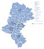
| Silesian Voivodeship FeatureType : adm1st Elevation : 277 Lat/Lng : 50.3333 / 19.0003 | Silesian Voivodeship, or Silesia ProvinceArkadiusz Belczyk, , 2002-2006. is a voivodeship, or province, in southern Poland, centered on the historic region known as Upper Silesia , with Katowice serving as its capital (...) |
| 3 | 
| Altai Mountains FeatureType : mountain Elevation : 4332 Lat/Lng : 49.8071 / 86.5899 | The Altai Mountains (; also spelled Altay Mountains; Altai: Алтай туулар, Altay tuular; Mongolian: , Altai-yin niruɣu (Chakhar) / Алтайн нуруу, Altain nuruu (Khalkha); Kazakh: Алтай таулары, Altai’ tay’lary, التاي تاۋلارى; , Altajskije gory; Chinese; 阿尔泰山脉, Ā'ěrtài Shānmài, Xiao'erjing: اَعَرتَىْ (...) |
| 4 | 
| Lesser Poland Voivodeship FeatureType : adm1st Elevation : 303 Lat/Lng : 49.8594 / 20.2747 | Lesser Poland Voivodeship or Lesser Poland Province (in), also known as Małopolska Voivodeship or Małopolska Province,Arkadiusz Belczyk, , 2002-2006. is a voivodeship (province), in southern Poland. It has an area of , and a population of 3,267,731 (2006) (...) |
| 5 | 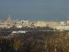
| Sparrow Hills FeatureType : landmark Elevation : 166 Lat/Lng : 55.71 / 37.543 | Sparrow Hills , formerly known as Lenin Hills between 1935 and 1999, is a hill on the right bank of the Moskva River and one of the highest points in Moscow, reaching a height of above the river level. The observation platform, which gives a good panoramic view of the city, is on a steep bank above (...) |
| 6 | 
| Ufa FeatureType : null Elevation : 166 Lat/Lng : 54.7333 / 55.9667 | Ufa (; Öfö;) is the capital city of the Republic of Bashkortostan, Russia, and the industrial, economic, scientific and cultural center of the republic. As of the 2010 Census, its population was 1,062,319, making it the eleventh most populous city in Russia. (...) |
| 7 | Tarnowskie Góry FeatureType : null Elevation : 295 Lat/Lng : 50.45 / 18.8667 | Tarnowskie Góry (German: Tarnowitz, established in 1526;) is a town in Silesia (southern Poland), located in the Silesian Highlands near Katowice. On the south it borders the Upper Silesian Metropolitan Union – megalopolis, greater Silesian metropolitan area populated by about 5,294,000 people (...) | |
| 8 | 
| Ciudad Juárez FeatureType : null Elevation : 1130 Lat/Lng : 31.7398 / -106.4829 | Ciudad Juárez (; Juarez City) is the most populous city in the Mexican state of Chihuahua. Commonly referred to by locals as simply Juárez, and known as Paso del Norte (Pass of the North) until 1888, Juárez is the seat of the municipality of Juárez with an estimated population of 1.5 million people (...) |
| 9 | Tarnowskie Góry County FeatureType : city Elevation : 295 Lat/Lng : 50.45 / 18.8667 | __NOTOC__ Tarnowskie Góry County is a unit of territorial administration and local government (powiat) in Silesian Voivodeship, southern Poland. It came into being on January 1, 1999, as a result of the Polish local government reforms passed in 1998 (...) | |
| 10 | 
| Hong Kong Disneyland FeatureType : landmark Lat/Lng : 22.3127 / 114.0418 | Hong Kong Disneyland is a theme park located on reclaimed land in Penny's Bay, Lantau Island. It is located inside the Hong Kong Disneyland Resort and it is owned and managed by Hong Kong International Theme Parks. It is the largest theme park in Hong Kong, followed by Ocean Park Hong Kong (...) |
| 11 | Kalety FeatureType : city Elevation : 281 Lat/Lng : 50.5667 / 18.9 | Kalety is a town in Tarnowskie Góry County, Silesian Voivodeship, Poland, with 8,668 inhabitants (2004). | |
| 12 | 
| Marrakesh FeatureType : null Elevation : 459 Lat/Lng : 31.6353 / -8.0003 | Marrakesh (or ; Murrākuš; Meṛṛakec), also known by the French spelling Marrakech, is a major city of the Kingdom of Morocco. It is the fourth largest city in the country, after Casablanca, Fez and Tangier. It is the capital city of the mid-southwestern region of Marrakesh-Safi (...) |
| 13 | 
| Moscow FeatureType : adm1st Elevation : 148 Lat/Lng : 55.7525 / 37.6231 | Moscow is the capital and most populous city of Russia, with 13.2 million residents within the city limitshttp://www.gks.ru/free_doc/new_site/population/demo/Popul2016.xls and 17 million within the urban area. Moscow is one of Russia's federal cities (...) |
| 14 | 
| Końskie FeatureType : city Elevation : 247 Lat/Lng : 51.1925 / 20.4062 | Końskie is a town in central Poland with 20,328 inhabitants (2008), situated in the Świętokrzyskie Voivodeship (since 1999), previously in Kielce Voivodeship (1975–1998). Most of the town labour force was employed in the local foundry (Koneckie Zakłady Odlewnicze) in the late 1980s and early 1990s (...) |
| 15 | 
| Złotoryja FeatureType : null Elevation : 195 Lat/Lng : 51.1333 / 15.9167 | Złotoryja (Latin: Aureus Mons, Aurum) is a historic town in Lower Silesian Voivodeship in southwestern Poland, the administrative seat of Złotoryja County, and of the smaller Gmina Złotoryja. Having been granted town privileges in 1211, Złotoryja is the oldest town in the whole country (...) |
| 16 | Pushkinskiye Gory FeatureType : null Elevation : 140 Lat/Lng : 57.0208 / 28.925 | Pushkinskiye Gory is an urban locality (a work settlement) and the administrative center of Pushkinogorsky District of Pskov Oblast, Russia. Municipally, it is incorporated as Pushkinogorye Urban Settlement, the only urban settlement in the district. Population: (...) | |
| 17 | 
| Palais des Papes FeatureType : landmark Elevation : 44 Lat/Lng : 43.9508 / 4.8075 | The Palais des Papes (English: Palace of the Popes, lo Palais dei Papas in Occitan) is an historical palace located in Avignon, southern France. It is one of the largest and most important medieval Gothic buildings in Europe (...) |
| 18 | Gmina Tworóg FeatureType : null Elevation : 253 Lat/Lng : 50.5333 / 18.7 | __NOTOC__ Gmina Tworóg is a rural gmina (administrative district) in Tarnowskie Góry County, Silesian Voivodeship, in southern Poland. Its seat is the village of Tworóg, which lies approximately north-west of Tarnowskie Góry and north-west of the regional capital Katowice (...) | |
| 19 | Gmina Zbrosławice FeatureType : city Elevation : 256 Lat/Lng : 50.4167 / 18.75 | __NOTOC__ Gmina Zbrosławice is a rural gmina (administrative district) in Tarnowskie Góry County, Silesian Voivodeship, in southern Poland. Its seat is the village of Zbrosławice (germ. Broslawitz), which lies approximately south-west of Tarnowskie Góry and north-west of the regional capital (...) | |
| 20 | 
| Krkonoše FeatureType : mountain Elevation : 1592 Lat/Lng : 50.7361 / 15.74 | The Krkonoše (Czech:), Karkonosze (Polish:), Riesengebirge (German), Riesageberge (Silesian German) or Giant Mountains, at the tourist portal of the Czech Republic. Accessed on 19 Oct 2012. are a mountain range located in the north of the Czech Republic and the south-west of Poland, part of the (...) |
| 21 | Vorobyovy Gory (Moscow Metro) FeatureType : landmark Elevation : 134 Lat/Lng : 55.7234 / 37.564 | Vorobyovy Gory (lit. Sparrow Hills) is a Moscow Metro station. It is on the Sokolnicheskaya Line, between Universitet and Sportivnaya stations. Its name originates from a nearby elevated area literally translated as Sparrow Hills. (...) | |
| 22 | 
| Southern Carpathians FeatureType : mountain Elevation : 881 Lat/Lng : 45.5 / 24.25 | The Southern Carpathians (also known as the Transylvanian Alps;Comănescu, Laura, & Alexandru Nedelea. 2016. Geomorphosites Assessments of the Glacial and Periglacial Landforms from Southern Carpathoans. In: Maria Radoane & Alfred Vespremeanu-Stroe (eds (...) |
| 23 | Central Sudetes FeatureType : mountain Elevation : 1099 Lat/Lng : 50.305 / 16.3991 | The Central Sudetes (or Střední Sudety) are the central part of the Sudetes mountain range on the border of the Czech Republic and Poland. They stretch from the Nysa Kłodzka River and the Kłodzko Valley in the east to the upper Bóbr in the west (...) | |
| 24 | Tworóg FeatureType : city Elevation : 267 Lat/Lng : 50.5167 / 18.7 | Tworóg is a village in Tarnowskie Góry County, Silesian Voivodeship, in southern Poland. It is the seat of the gmina (administrative district) called Gmina Tworóg. It lies approximately north-west of Tarnowskie Góry and north-west of the regional capital Katowice (...) | |
| 25 | Będzin County FeatureType : city Elevation : 260 Lat/Lng : 50.3333 / 19.1167 | __NOTOC__ Będzin County is a unit of territorial administration and local government (powiat) in Silesian Voivodeship, southern Poland. It came into being on January 1, 1999, as a result of the Polish local government reforms passed in 1998 (...) | |
| 26 | Bystrzyckie Mountains FeatureType : mountain Elevation : 966 Lat/Lng : 50.2518 / 16.5667 | The Bystrzyckie Mountains are a mountain range in Poland, part of the Central Sudetes. (...) | |
| 27 | Gmina Żelazków FeatureType : null Elevation : 125 Lat/Lng : 51.85 / 18.1667 | __NOTOC__ Gmina Żelazków is a rural gmina (administrative district) in Kalisz County, Greater Poland Voivodeship, in west-central Poland. Its seat is the village of Żelazków, which lies approximately north-east of Kalisz and south-east of the regional capital Poznań (...) | |
| 28 | Lysogorsky District FeatureType : adm2nd Elevation : 171 Lat/Lng : 51.5292 / 44.8056 | Lysogorsky District is an administrativeCharter of Saratov Oblast and municipalLaw #78-ZSO district (raion), one of the thirty-eight in Saratov Oblast, Russia. It is located in the southwest of the oblast. The area of the district is (...) | |
| 29 | Gmina Sokolniki FeatureType : null Elevation : 178 Lat/Lng : 51.3069 / 18.3414 | __NOTOC__ Gmina Sokolniki is a rural gmina (administrative district) in Wieruszów County, Łódź Voivodeship, in central Poland. Its seat is the village of Sokolniki, which lies approximately east of Wieruszów and south-west of the regional capital Łódź (...) | |
| 30 | Stołowe Mountains FeatureType : null Elevation : 864 Lat/Lng : 50.4667 / 16.3333 | Stołowe Mountains ; also known as the Table Mountains are a -long mountain range in Poland and the Czech Republic, part of the Sudetes. The Polish part of the range is protected as the Stołowe Mountains National Park.Identification of the most important transboundary protected areas .. (...) | |
| 31 | Brynek FeatureType : city Elevation : 254 Lat/Lng : 50.5169 / 18.7308 | Brynek is a village in the administrative district of Gmina Tworóg, within Tarnowskie Góry County, Silesian Voivodeship, in southern Poland. It lies approximately south-east of Tworóg, north-west of Tarnowskie Góry, and north-west of the regional capital Katowice. (...) | |
| 32 | Zbrosławice FeatureType : city Elevation : 293 Lat/Lng : 50.4 / 18.75 | Zbrosławice is a village in Tarnowskie Góry County, Silesian Voivodeship, in southern Poland. It is the seat of the gmina (administrative district) called Gmina Zbrosławice. It lies approximately south-west of Tarnowskie Góry and north-west of the regional capital Katowice (...) | |
| 33 | Wieszowa FeatureType : city Elevation : 299 Lat/Lng : 50.4 / 18.7667 | Wieszowa is a village in the administrative district of Gmina Zbrosławice, within Tarnowskie Góry County, Silesian Voivodeship, in southern Poland. It lies approximately south-east of Zbrosławice, south-west of Tarnowskie Góry, and north-west of the regional capital Katowice (...) | |
| 34 | Zendek FeatureType : city Elevation : 297 Lat/Lng : 50.4967 / 19.0869 | Zendek (German Schendek) is a village in the administrative district of Gmina Ożarowice, within Tarnowskie Góry County, Silesian Voivodeship, in southern Poland. It lies approximately north-east of Ożarowice, east of Tarnowskie Góry, and north of the regional capital Katowice (...) | |
| 35 | Gmina Ożarowice FeatureType : null Elevation : 291 Lat/Lng : 50.4614 / 19.0428 | __NOTOC__ Gmina Ożarowice is a rural gmina (administrative district) in Tarnowskie Góry County, Silesian Voivodeship, in southern Poland. Its seat is the village of Ożarowice, which lies approximately east of Tarnowskie Góry and north of the regional capital Katowice (...) | |
| 36 | Bernburg FeatureType : null Elevation : 91 Lat/Lng : 51.7944 / 11.7372 | Bernburg (Saale) is a town in Saxony-Anhalt, Germany, capital of the Salzlandkreis district. The former residence of the Anhalt-Bernburg princes is known for its Renaissance castle. (...) | |
| 37 | Sudetes FeatureType : mountain Elevation : 1592 Lat/Lng : 50.7361 / 15.74 | The Sudetes (; also known as the Sudeten after their German name; Czech: Krkonošsko-jesenická subprovincie, Sudetská subprovincie, subprovincie Sudety, Sudetská pohoří, Sudetské pohoří, Sudety; Polish: Sudety) are a mountain range in Central Europe. They are the highest part of Bohemian Massif (...) | |
| 38 | Owl Mountains FeatureType : mountain Elevation : 858 Lat/Lng : 50.6667 / 16.5 | The Owl Mountains are a mountain range of the Central Sudetes in southwestern Poland. It includes a protected area called Owl Mountains Landscape Park. (...) | |
| 39 | Gmina Świerklaniec FeatureType : null Elevation : 283 Lat/Lng : 50.4333 / 18.95 | __NOTOC__ Gmina Świerklaniec is a rural gmina (administrative district) in Tarnowskie Góry County, Silesian Voivodeship, in southern Poland. Its seat is the village of Świerklaniec, which lies approximately east of Tarnowskie Góry and north of the regional capital Katowice (...) | |
| 40 | Gmina Przedbórz FeatureType : null Elevation : 213 Lat/Lng : 51.0833 / 19.8833 | __NOTOC__ Gmina Przedbórz is an urban-rural gmina (administrative district) in Radomsko County, Łódź Voivodeship, in central Poland. Its seat is the town of Przedbórz, which lies approximately east of Radomsko and south of the regional capital Łódź (...) | |
| 41 | Gmina Opole Lubelskie FeatureType : null Elevation : 150 Lat/Lng : 51.1472 / 21.9689 | __NOTOC__ Gmina Opole Lubelskie is an urban-rural gmina (administrative district) in Opole Lubelskie County, Lublin Voivodeship, in eastern Poland. Its seat is the town of Opole Lubelskie, which lies approximately west of the regional capital Lublin (...) | |
| 42 | Kutná Hora FeatureType : null Elevation : 255 Lat/Lng : 49.9483 / 15.268 | Kutná Hora (; medieval Czech: Hory Kutné;) is a town in the Central Bohemian Region of the Czech Republic. (...) | |
| 43 | Yélimané Cercle FeatureType : adm2nd Elevation : 97 Lat/Lng : 15.1077 / -10.5449 | Yélimané Cercle is an administrative subdivision of the Kayes Region of Mali. Its administrative centre (chef-lieu) is the town of Yélimané. In the 2009 census the population of the cercle was 178,442. Yélimané Cercle is a major center of gold mining. The cercle is subdivided into 12 communes: (...) | |
| 44 | Pushkinogorsky District FeatureType : adm2nd Elevation : 129 Lat/Lng : 57.0167 / 28.9167 | Pushkinogorsky District is an administrativeLaw #833-oz and municipalLaw #420-oz district (raion), one of the twenty-four in Pskov Oblast, Russia. It is located in the center of the oblast and borders with Ostrovsky District in the north, Novorzhevsky District in the east, Opochetsky District in the (...) | |
| 45 | Caucasus FeatureType : null Elevation : 1163 Lat/Lng : 42.2611 / 44.1211 | The Caucasus or Caucasia is a region located at the border of Eastern Europe and Western Asia, situated between the Black Sea and the Caspian Sea and occupied by Russia, Georgia, Azerbaijan, and Armenia. A less common definition also includes portions of northwestern Iran and northeastern Turkey (...) | |
| 46 | Katowice International Airport FeatureType : airport Elevation : 299 Lat/Lng : 50.4743 / 19.08 | Katowice International Airport is an international airport, located in Pyrzowice, north of Katowice, Poland. The airport has the fourth-biggest (second-biggest in Summer Season) passenger flow in Poland. Katowice Airport has the biggest charter passenger flow of the airports in Poland (...) | |
| 47 | Wieluń FeatureType : null Elevation : 184 Lat/Lng : 51.2167 / 18.5667 | Wieluń is a city in central Poland with 22,973 inhabitants (2016). Situated in the Łódź Voivodeship (since 1999), it was previously in Sieradz Voivodeship (1975–1998). Wieluń has a long and rich history. In the past, it used to be one of the most important urban locations of the Kingdom of Poland, (...) | |
| 48 | Moscow Metro FeatureType : landmark Elevation : 167 Lat/Lng : 55.6376 / 37.6214 | The Moscow Metro is a rapid transit system serving Moscow, Russia and the neighbouring Moscow Oblast cities of Krasnogorsk, Reutov, Lyubertsy and Kotelniki. Opened in 1935 with one line and 13 stations, it was the first underground railway system in the Soviet Union (...) | |
| 49 | Magnitogorsk FeatureType : city Elevation : 399 Lat/Lng : 53.4167 / 58.9667 | Magnitogorsk (lit. city near the magnetic mountain) is an industrial city in Chelyabinsk Oblast, Russia, located on the eastern side of the extreme southern extent of the Ural Mountains by the Ural River. Population: 418,545 (2002 Census); It was named after the Magnitnaya Mountain, a geological (...) | |
| 50 | Gmina Dzierzążnia FeatureType : null Elevation : 109 Lat/Lng : 52.6286 / 20.2206 | __NOTOC__ Gmina Dzierzążnia is a rural gmina (administrative district) in Płońsk County, Masovian Voivodeship, in east-central Poland. Its seat is the village of Dzierzążnia, which lies approximately west of Płońsk and north-west of Warsaw (...) | |
| 51 | Gmina Babiak FeatureType : null Elevation : 113 Lat/Lng : 52.3436 / 18.6661 | __NOTOC__ Gmina Babiak is a rural gmina (administrative district) in Koło County, Greater Poland Voivodeship, in west-central Poland. Its seat is the village of Babiak, which lies approximately north of Koło and east of the regional capital Poznań (...) | |
| 52 | Gmina Zakrzówek FeatureType : null Elevation : 224 Lat/Lng : 50.9333 / 22.3667 | __NOTOC__ Gmina Zakrzówek is a rural gmina (administrative district) in Kraśnik County, Lublin Voivodeship, in eastern Poland. Its seat is the village of Zakrzówek, which lies approximately east of Kraśnik and south of the regional capital Lublin (...) | |
| 53 | Gmina Gorzków FeatureType : null Elevation : 226 Lat/Lng : 50.9333 / 23.0 | __NOTOC__ Gmina Gorzków is a rural gmina (administrative district) in Krasnystaw County, Lublin Voivodeship, in eastern Poland. Its seat is the village of Gorzków, which lies approximately south-west of Krasnystaw and south-east of the regional capital Lublin (...) | |
| 54 | Gmina Wilczyn FeatureType : null Elevation : 102 Lat/Lng : 52.4886 / 18.1619 | __NOTOC__ Gmina Wilczyn is a rural gmina (administrative district) in Konin County, Greater Poland Voivodeship, in west-central Poland. Its seat is the village of Wilczyn, which lies approximately north of Konin and east of the regional capital Poznań (...) | |
| 55 | Gmina Liniewo FeatureType : null Elevation : 150 Lat/Lng : 54.0758 / 18.2269 | __NOTOC__ Gmina Liniewo is a rural gmina (administrative district) in Kościerzyna County, Pomeranian Voivodeship, in northern Poland. Its seat is the village of Liniewo, which lies approximately east of Kościerzyna and south-west of the regional capital Gdańsk (...) | |
| 56 | Gmina Kurów FeatureType : null Elevation : 142 Lat/Lng : 51.4 / 22.1833 | __NOTOC__ Gmina Kurów is a rural gmina (administrative district) in Puławy County, Lublin Voivodeship, in eastern Poland. Its seat is the village of Kurów, which lies approximately east of Puławy and north-west of the regional capital Lublin (...) | |
| 57 | Gmina Michałów FeatureType : null Elevation : 192 Lat/Lng : 50.4931 / 20.46 | __NOTOC__ Gmina Michałów is a rural gmina (administrative district) in Pińczów County, Świętokrzyskie Voivodeship, in south-central Poland. Its seat is the village of Michałów, which lies approximately south-west of Pińczów and south of the regional capital Kielce (...) | |
| 58 | Gmina Klimontów FeatureType : null Elevation : 207 Lat/Lng : 50.6564 / 21.4528 | __NOTOC__ Gmina Klimontów is a rural gmina (administrative district) in Sandomierz County, Świętokrzyskie Voivodeship, in south-central Poland. Its seat is the village of Klimontów, which lies approximately west of Sandomierz and south-east of the regional capital Kielce (...) | |
| 59 | Gmina Augustów FeatureType : null Elevation : 124 Lat/Lng : 53.85 / 22.9667 | __NOTOC__ Gmina Augustów is a rural gmina (administrative district) in Augustów County, Podlaskie Voivodeship, in north-eastern Poland. Its seat is the town of Augustów, although the town is not part of the territory of the gmina (...) | |
| 60 | Gmina Korczew FeatureType : null Elevation : 151 Lat/Lng : 52.3539 / 22.6128 | __NOTOC__ Gmina Korczew is a rural gmina (administrative district) in Siedlce County, Masovian Voivodeship, in east-central Poland. Its seat is the village of Korczew, which lies approximately north-east of Siedlce and east of Warsaw (...) | |
| 61 | Gmina Mniszków FeatureType : null Elevation : 216 Lat/Lng : 51.3708 / 20.0342 | Gmina Mniszków is a rural gmina (administrative district) in Opoczno County, Łódź Voivodeship, in central Poland. Its seat is the village of Mniszków, which lies approximately west of Opoczno and south-east of the regional capital Łódź (...) | |
| 62 | Gmina Jakubów FeatureType : null Elevation : 184 Lat/Lng : 52.2189 / 21.6772 | __NOTOC__ Gmina Jakubów is a rural gmina (administrative district) in Mińsk County, Masovian Voivodeship, in east-central Poland. Its seat is the village of Jakubów, which lies approximately 8 kilometres (5 mi) north-east of Mińsk Mazowiecki and 45 km (28 mi) east of Warsaw (...) | |
| 63 | Gmina Urzędów FeatureType : null Elevation : 184 Lat/Lng : 50.9931 / 22.1425 | __NOTOC__ Gmina Urzędów is a rural gmina (administrative district) in Kraśnik County, Lublin Voivodeship, in eastern Poland. Its seat is the village of Urzędów, which lies approximately north-west of Kraśnik and south-west of the regional capital Lublin (...) | |
| 64 | Gmina Promna FeatureType : null Elevation : 124 Lat/Lng : 51.6833 / 20.95 | __NOTOC__ Gmina Promna is a rural gmina (administrative district) in Białobrzegi County, Masovian Voivodeship, in east-central Poland. Its seat is the village of Promna, which lies approximately north of Białobrzegi and south of Warsaw (...) | |
| 65 | Gmina Budry FeatureType : null Elevation : 106 Lat/Lng : 54.25 / 21.8833 | __NOTOC__ Gmina Budry is a rural gmina (administrative district) in Węgorzewo County, Warmian-Masurian Voivodeship, in northern Poland, on the border with Russia. Its seat is the village of Budry, which lies approximately north-east of Węgorzewo and north-east of the regional capital Olsztyn (...) | |
| 66 | Gmina Białogard FeatureType : null Elevation : 20 Lat/Lng : 54.0 / 15.9833 | __NOTOC__ Gmina Białogard is a rural gmina (administrative district) in Białogard County, West Pomeranian Voivodeship, in north-western Poland. Its seat is the town of Białogard, although the town is not part of the territory of the gmina (...) | |
| 67 | Gmina Mielnik FeatureType : null Elevation : 151 Lat/Lng : 52.3333 / 23.05 | __NOTOC__ Gmina Mielnik is a rural gmina (administrative district) in Siemiatycze County, Podlaskie Voivodeship, in north-eastern Poland, on the border with Belarus. Its seat is the village of Mielnik, which lies approximately south-east of Siemiatycze and south of the regional capital Białystok (...) | |
| 68 | Gmina Janów, Silesian Voivodeship FeatureType : null Elevation : 269 Lat/Lng : 50.7239 / 19.4361 | __NOTOC__ Gmina Janów is a rural gmina (administrative district) in Częstochowa County, Silesian Voivodeship, in southern Poland. Its seat is the village of Janów, which lies approximately east of Częstochowa and north-east of the regional capital Katowice (...) | |
| 69 | Gmina Cieszków FeatureType : null Elevation : 129 Lat/Lng : 51.6333 / 17.35 | __NOTOC__ Gmina Cieszków is a rural gmina (administrative district) in Milicz County, Lower Silesian Voivodeship, in south-western Poland. Its seat is the village of Cieszków, which lies approximately north-east of Milicz, and north of the regional capital Wrocław (...) | |
| 70 | Gmina Strzałkowo FeatureType : null Elevation : 98 Lat/Lng : 52.31 / 17.8181 | __NOTOC__ Gmina Strzałkowo is a rural gmina (administrative district) in Słupca County, Greater Poland Voivodeship, in west-central Poland. Its seat is the village of Strzałkowo, which lies approximately west of Słupca and east of the regional capital Poznań (...) | |
| 71 | Gmina Dwikozy FeatureType : null Elevation : 143 Lat/Lng : 50.7322 / 21.7864 | __NOTOC__ Gmina Dwikozy is a rural gmina (administrative district) in Sandomierz County, Świętokrzyskie Voivodeship, in south-central Poland. Its seat is the village of Dwikozy, which lies approximately north-east of Sandomierz and east of the regional capital Kielce (...) | |
| 72 | Gmina Wilczęta FeatureType : null Elevation : 66 Lat/Lng : 54.1592 / 19.8853 | __NOTOC__ Gmina Wilczęta (german: Deutschendorf) is a rural gmina (administrative district) in Braniewo County, Warmian-Masurian Voivodeship, in northern Poland. Its seat is the village of Wilczęta, which lies approximately south of Braniewo and north-west of the regional capital Olsztyn (...) | |
| 73 | Krupski Młyn FeatureType : city Elevation : 235 Lat/Lng : 50.5742 / 18.6239 | Krupski Młyn (German Kruppamühle) is a village in Tarnowskie Góry County, Silesian Voivodeship, in southern Poland. It is the seat of the gmina (administrative district) called Gmina Krupski Młyn. It lies approximately north-west of Tarnowskie Góry and north-west of the regional capital Katowice (...) | |
| 74 | Silesia FeatureType : null Elevation : 118 Lat/Lng : 51.1035 / 17.0396 | Silesia (;. Random House Webster's Unabridged Dictionary. ; ; Schlesien.ogg ; Silesian German: Schläsing; Silesian: Ślůnsk ; ; ;) is a historical region of Central Europe located mostly in Poland, with small parts in the Czech Republic and Germany (...) | |
| 75 | Grudziądz FeatureType : city Elevation : 21 Lat/Lng : 53.4833 / 18.7667 | Grudziądz (or ' or Grudentia); the form Grudentia is used by, e.g., A. Lentz, Philologus 23 (1866), p. 175. is a city of around 96,042 inhabitants (2010) on the Vistula River in northern Poland. Situated in the Kuyavian-Pomeranian Voivodeship (since 1999), the city was in the Toruń Voivodeship from (...) | |
| 76 | Gmina Markuszów FeatureType : null Elevation : 161 Lat/Lng : 51.3667 / 22.2667 | __NOTOC__ Gmina Markuszów is a rural gmina (administrative district) in Puławy County, Lublin Voivodeship, in eastern Poland. Its seat is the village of Markuszów, which lies approximately east of Puławy and north-west of the regional capital Lublin (...) | |
| 77 | Velikaya River FeatureType : waterbody Elevation : 28 Lat/Lng : 57.863 / 28.138 | The Velikaya (Velíkaya) is a river in Novosokolnichesky, Pustoshkinsky, Sebezhsky, Opochetsky, Pushkinogorsky, Ostrovsky, Palkinsky, and Pskovsky Districts of Pskov Oblast, as well as in the city of Pskov in Russia. It is a major tributary of Lake Peipus and belongs to the basin of the Narva River (...) | |
| 78 | 
| London Dungeon FeatureType : landmark Elevation : 10 Lat/Lng : 51.5027 / -0.1194 | The London Dungeon is a tourist attraction along London's South Bank, England, which recreates various gory and macabre historical events in a gallows humour style. It uses a mixture of live actors, special effects and rides. (...) |
| 79 | Gmina Turek FeatureType : null Elevation : 118 Lat/Lng : 52.0167 / 18.5 | __NOTOC__ Gmina Turek is a rural gmina (administrative district) in Turek County, Greater Poland Voivodeship, in west-central Poland. Its seat is the town of Turek, although the town is not part of the territory of the gmina. The gmina covers an area of , and as of 2006 its total population is 7,605 (...) | |
| 80 | Čergov FeatureType : mountain Elevation : 901 Lat/Lng : 49.1833 / 21.1667 | Čergov is a mountain range in the central part of the Prešov Region of Slovakia. Geologically the range is part of the Outer Western Carpathians, but may be classified (as Slovaks do) as part of the Eastern Beskids, or classified (as Poles do) as part of the Western Beskids (...) | |
| 81 | Gmina Szadek FeatureType : null Elevation : 161 Lat/Lng : 51.7 / 18.9833 | __NOTOC__ Gmina Szadek is an urban-rural gmina (administrative district) in Zduńska Wola County, Łódź Voivodeship, in central Poland. Its seat is the town of Szadek, which lies approximately north of Zduńska Wola and west of the regional capital Łódź (...) | |
| 82 | Gmina Gorzkowice FeatureType : null Elevation : 205 Lat/Lng : 51.2167 / 19.6 | __NOTOC__ Gmina Gorzkowice is a rural gmina (administrative district) in Piotrków County, Łódź Voivodeship, in central Poland. Its seat is the village of Gorzkowice, which lies approximately south of Piotrków Trybunalski and south of the regional capital Łódź (...) | |
| 83 | Gmina Uniejów FeatureType : null Elevation : 111 Lat/Lng : 51.97 / 18.8003 | __NOTOC__ Gmina Uniejów is an urban-rural gmina (administrative district) in Poddębice County, Łódź Voivodeship, in central Poland. Its seat is the town of Uniejów, which lies approximately north-west of Poddębice and north-west of the regional capital Łódź (...) | |
| 84 | Gmina Barciany FeatureType : null Elevation : 62 Lat/Lng : 54.2167 / 21.35 | __NOTOC__ Gmina Barciany is a rural gmina (administrative district) in Kętrzyn County, Warmian-Masurian Voivodeship, in northern Poland, on the border with Russia. Its seat is the village of Barciany, which lies approximately north of Kętrzyn and north-east of the regional capital Olsztyn (...) | |
| 85 | Gmina Słupca FeatureType : null Elevation : 90 Lat/Lng : 52.3 / 17.8667 | __NOTOC__ Gmina Słupca is a rural gmina (administrative district) in Słupca County, Greater Poland Voivodeship, in west-central Poland. Its seat is the town of Słupca, although the town is not part of the territory of the gmina (...) | |
| 86 | Gmina Strzelce Krajeńskie FeatureType : null Elevation : 76 Lat/Lng : 52.8756 / 15.5319 | __NOTOC__ Gmina Strzelce Krajeńskie is an urban-rural gmina (administrative district) in Strzelce-Drezdenko County, Lubusz Voivodeship, in western Poland. Its seat is the town of Strzelce Krajeńskie, which lies approximately north-east of Gorzów Wielkopolski (...) | |
| 87 | Strzelce County FeatureType : null Elevation : 246 Lat/Lng : 50.5 / 18.2833 | __NOTOC__ Strzelce County is a unit of territorial administration and local government (powiat) in Opole Voivodeship, south-western Poland. It came into being on January 1, 1999, as a result of the Polish local government reforms passed in 1998 (...) | |
| 88 | Lubliniec County FeatureType : city Elevation : 260 Lat/Lng : 50.6833 / 18.6833 | __NOTOC__ Lubliniec County is a unit of territorial administration and local government (powiat) in Silesian Voivodeship, southern Poland. It came into being on January 1, 1999, as a result of the Polish local government reforms passed in 1998 (...) | |
| 89 | Gmina Przasnysz FeatureType : null Elevation : 114 Lat/Lng : 53.0167 / 20.8833 | __NOTOC__ Gmina Przasnysz is a rural gmina (administrative district) in Przasnysz County, Masovian Voivodeship, in east-central Poland. Its seat is the town of Przasnysz, although the town is not part of the territory of the gmina (...) | |
| 90 | Gmina Skarszewy FeatureType : null Elevation : 113 Lat/Lng : 54.0672 / 18.4458 | __NOTOC__ Gmina Skarszewy is an urban-rural gmina (administrative district) in Starogard County, Pomeranian Voivodeship, in northern Poland. Its seat is the town of Skarszewy, which lies approximately north-west of Starogard Gdański and south of the regional capital Gdańsk (...) | |
| 91 | Gmina Kętrzyn FeatureType : null Elevation : 94 Lat/Lng : 54.0833 / 21.3833 | __NOTOC__ Gmina Kętrzyn is a rural gmina (administrative district) in Kętrzyn County, Warmian-Masurian Voivodeship, in northern Poland. Its seat is the town of Kętrzyn, although the town is not part of the territory of the gmina (...) | |
| 92 | Gmina Janikowo FeatureType : null Elevation : 82 Lat/Lng : 52.75 / 18.1 | __NOTOC__ Gmina Janikowo is an urban-rural gmina (administrative district) in Inowrocław County, Kuyavian-Pomeranian Voivodeship, in north-central Poland. Its seat is the town of Janikowo, which lies approximately south-west of Inowrocław, south of Bydgoszcz, and south-west of Toruń (...) | |
| 93 | Gmina Gąbin FeatureType : null Elevation : 95 Lat/Lng : 52.4 / 19.7333 | __NOTOC__ Gmina Gąbin is an urban-rural gmina (administrative district) in Płock County, Masovian Voivodeship, in east-central Poland. Its seat is the town of Gąbin, which lies approximately south of Płock and west of Warsaw (...) | |
| 94 | Gmina Sobienie-Jeziory FeatureType : null Elevation : 96 Lat/Lng : 51.9322 / 21.3028 | __NOTOC__ Gmina Sobienie-Jeziory is a rural gmina (administrative district) in Otwock County, Masovian Voivodeship, in east-central Poland. Its seat is the village of Sobienie-Jeziory, which lies approximately 19 kilometres (12 mi) south of Otwock and 39 km (24 mi) south-east of Warsaw (...) | |
| 95 | Gmina Kazimierza Wielka FeatureType : null Elevation : 200 Lat/Lng : 50.2736 / 20.4844 | __NOTOC__ Gmina Kazimierza Wielka is an urban-rural gmina (administrative district) in Kazimierza County, Świętokrzyskie Voivodeship, in south-central Poland. Its seat is the town of Kazimierza Wielka, which lies approximately south of the regional capital Kielce (...) | |
| 96 | Myszków County FeatureType : city Elevation : 304 Lat/Lng : 50.5833 / 19.3167 | __NOTOC__ Myszków County is a unit of territorial administration and local government (powiat) in Silesian Voivodeship, southern Poland. It came into being on January 1, 1999, as a result of the Polish local government reforms passed in 1998 (...) | |
| 97 | Gmina Czyżew FeatureType : null Elevation : 130 Lat/Lng : 52.7958 / 22.3292 | __NOTOC__ Gmina Czyżew is an urban-rural gmina (administrative district) in Wysokie Mazowieckie County, Podlaskie Voivodeship, in north-eastern Poland. Its seat is the town of Czyżew, which lies approximately south-west of Wysokie Mazowieckie and south-west of the regional capital Białystok (...) | |
| 98 | Gmina Lubień Kujawski FeatureType : null Elevation : 126 Lat/Lng : 52.4047 / 19.1647 | __NOTOC__ Gmina Lubień Kujawski is an urban-rural gmina (administrative district) in Włocławek County, Kuyavian-Pomeranian Voivodeship, in north-central Poland. Its seat is the town of Lubień Kujawski, which lies approximately south of Włocławek and south-east of Toruń (...) | |
| 99 | Gmina Giby FeatureType : null Elevation : 142 Lat/Lng : 54.0333 / 23.3667 | __NOTOC__ Gmina Giby, is a rural gmina (administrative district) in Sejny County, Podlaskie Voivodeship, in north-eastern Poland, on the border with Belarus and Lithuania. Its seat is the village of Giby, which lies approximately south of Sejny and north of the regional capital Białystok (...) | |
| 100 | Gmina Ryczywół FeatureType : null Elevation : 71 Lat/Lng : 52.8136 / 16.8353 | __NOTOC__ Gmina Ryczywół is a rural gmina (administrative district) in Oborniki County, Greater Poland Voivodeship, in west-central Poland. Its seat is the village of Ryczywół, which lies approximately north of Oborniki and north of the regional capital Poznań (...) | |
| 101 | Gmina Goworowo FeatureType : null Elevation : 98 Lat/Lng : 52.9006 / 21.5544 | __NOTOC__ Gmina Goworowo is a rural gmina (administrative district) in Ostrołęka County, Masovian Voivodeship, in east-central Poland. Its seat is the village of Goworowo, which lies approximately south of Ostrołęka and north-east of Warsaw (...) | |
| 102 | Gmina Dzierzkowice FeatureType : null Elevation : 206 Lat/Lng : 50.9667 / 22.0833 | __NOTOC__ Gmina Dzierzkowice is a rural gmina (administrative district) in Kraśnik County, Lublin Voivodeship, in eastern Poland. Its seat is Dzierzkowice, a location which is divided into several sołectwos. The offices of the gmina are in fact in Terpentyna, which lies approximately north-west of (...) | |
| 103 | Gmina Sierakowice FeatureType : null Elevation : 217 Lat/Lng : 54.3461 / 17.8917 | __NOTOC__ Gmina Sierakowice is a rural gmina (administrative district) in Kartuzy County, Pomeranian Voivodeship, in northern Poland. Its seat is the village of Sierakowice, which lies approximately west of Kartuzy and west of the regional capital Gdańsk (...) | |
| 104 | Gliwice County FeatureType : city Elevation : 233 Lat/Lng : 50.2833 / 18.6667 | __NOTOC__ Gliwice County is a unit of territorial administration and local government (powiat) in Silesian Voivodeship, southern Poland. It came into being on January 1, 1999, as a result of the Polish local government reforms passed in 1998 (...) | |
| 105 | Nintendo FeatureType : landmark Elevation : 26 Lat/Lng : 34.9697 / 135.7562 | Nintendo Co., Ltd. is a Japanese multinational consumer electronics and video game company headquartered in Kyoto. Nintendo is one of the world's largest video game companies by market capitalization, creating some of the best-known and top-selling video game franchises, such as Mario, The Legend of (...) | |
| 106 | Pyrzowice FeatureType : city Elevation : 299 Lat/Lng : 50.4608 / 19.0681 | Pyrzowice is a village in the administrative district of Gmina Ożarowice, within Tarnowskie Góry County, Silesian Voivodeship, in southern Poland. It lies approximately east of Ożarowice, east of Tarnowskie Góry, and north of the regional capital Katowice (...) | |
| 107 | Assyria FeatureType : null Elevation : 248 Lat/Lng : 36.0 / 43.3 | Assyria , also called the Assyrian Empire, was a major Semitic-speaking Mesopotamian kingdom and empire of the ancient Near East and the Levant. It existed as a state from perhaps as early as the 25th century BC in the form of the Assur city-state, until its collapse between 612 BC and 609 BC, (...) | |
| 108 | Horki FeatureType : city Elevation : 202 Lat/Lng : 54.2894 / 30.9811 | Horki is a town in the Mogilev Region of Belarus, an administrative center of the Horki Raion. As of 2009, its population was 32,777. (...) | |
| 109 | Low Beskids FeatureType : mountain Elevation : 995 Lat/Lng : 49.3876 / 21.163 | The Low Beskids or Lower Beskids , are one of the Beskids mountain ranges in the Outer Eastern Carpathians in southeastern Poland and northeastern Slovakia. It is a hilly region in Prešov Region, Sanok County and Jasło County, between Busov, Ondavská vrchovina, Laborecká vrchovina, Beskydské (...) | |
| 110 | Złoty Stok FeatureType : city Elevation : 319 Lat/Lng : 50.4464 / 16.8831 | Złoty Stok ("Richstone") is a town in Ząbkowice Śląskie County, Lower Silesian Voivodeship, in south-western Poland. It is situated on the border with the Czech Republic, adjoining the Czech village Bílá Voda. The name Złoty Stok means "golden slope" in Polish and is a reference to the fact that a (...) | |
| 111 | Novorzhev FeatureType : null Elevation : 74 Lat/Lng : 57.0333 / 29.3333 | Novorzhev is a town and the administrative center of Novorzhevsky District in Pskov Oblast, Russia, located on the Sorot River southeast of Pskov, the administrative center of the oblast. Population: (...) | |
| 112 | Gmina Grunwald FeatureType : city Elevation : 184 Lat/Lng : 53.55 / 20.0833 | __NOTOC__ Gmina Grunwald is a rural gmina (administrative district) in Ostróda County, Warmian-Masurian Voivodeship, in northern Poland. Gmina Grunwald is divided into 19 sołectwos. The villages with the largest population are Gierzwałd, which dates back to the 14th century, and Zybułtowo (...) | |
| 113 | Gmina Kartuzy FeatureType : null Elevation : 219 Lat/Lng : 54.3333 / 18.2 | __NOTOC__ Gmina Kartuzy is an urban-rural gmina (administrative district) in Kartuzy County, Pomeranian Voivodeship, in northern Poland. Its seat is the town of Kartuzy, which lies approximately west of the regional capital Gdańsk (...) | |
| 114 | Katowice Voivodeship FeatureType : landmark Elevation : 276 Lat/Lng : 50.2556 / 19.0204 | Katowice Voivodeship was a unit of administrative division and local government in Poland in the years 1975–1998, superseded by the Silesian Voivodeship. Its capital city was Katowice. Major cities and towns: (population in 1995): * Katowice (354,200); * Sosnowiec (249,000); * Bytom (227,600); (...) | |
| 115 | Shosha River FeatureType : waterbody Elevation : 120 Lat/Lng : 56.5489 / 36.2467 | Shosha River is a river in Zubtsovsky, Staritsky, Kalininsky and in Konakovsky Districts of Tver Oblast and Lotoshinsky District of Moscow Oblast in Russia. It is a right tributary of the Volga River. The length of the Shosha River is . The area of its basin is (...) | |
| 116 | Luzhniki Olympic Complex FeatureType : null Elevation : 160 Lat/Lng : 55.7158 / 37.5536 | The Luzhniki Olympic Complex (Russian: Олимпийский комплекс «Лужники») is one of the biggest multifunctional sports complexes of the world, built between 1955 and 1956, located in Moscow, Russia. Formerly known as the Central Lenin Stadium, it served as the Olympic Park of the 1980 Summer Olympics (...) | |
| 117 | Gmina Racławice FeatureType : null Elevation : 275 Lat/Lng : 50.3297 / 20.2322 | __NOTOC__ Gmina Racławice is a rural gmina (administrative district) in Miechów County, Lesser Poland Voivodeship, in southern Poland. Its seat is the village of Racławice, which lies approximately east of Miechów and north-east of the regional capital Kraków (...) | |
| 118 | Koty, Silesian Voivodeship FeatureType : city Elevation : 244 Lat/Lng : 50.5511 / 18.6994 | Koty is a village in the administrative district of Gmina Tworóg, within Tarnowskie Góry County, Silesian Voivodeship, in southern Poland. It lies approximately north of Tworóg, north-west of Tarnowskie Góry, and north-west of the regional capital Katowice. The village has a population of 852. (...) | |
| 119 | Miedary FeatureType : null Elevation : 275 Lat/Lng : 50.4569 / 18.7631 | Miedary is a village in the administrative district of Gmina Zbrosławice, within Tarnowskie Góry County, Silesian Voivodeship, in southern Poland. It lies approximately north of Zbrosławice, west of Tarnowskie Góry, and north-west of the regional capital Katowice (...) | |
| 120 | Nakło Śląskie FeatureType : city Elevation : 318 Lat/Lng : 50.4358 / 18.9056 | , Nakło Śląskie is a village in the administrative district of Gmina Świerklaniec, within Tarnowskie Góry County, Silesian Voivodeship, in southern Poland. It lies approximately west of Świerklaniec, south-east of Tarnowskie Góry, and north of the regional capital Katowice (...) | |
| 121 | Wymysłów, Silesian Voivodeship FeatureType : city Elevation : 277 Lat/Lng : 50.4 / 18.9833 | Wymysłów (former German name Wimslau) is a village in the administrative district of Gmina Świerklaniec, within Tarnowskie Góry County, Silesian Voivodeship, in southern Poland. It lies approximately north-west of Tarnowskie Góry and north of the regional capital Katowice (...) | |
| 122 | Łubie FeatureType : null Elevation : 279 Lat/Lng : 50.44 / 18.6522 | Łubie is a village in the administrative district of Gmina Zbrosławice, within Tarnowskie Góry County, Silesian Voivodeship, in southern Poland. It lies approximately west of Zbrosławice, west of Tarnowskie Góry, and north-west of the regional capital Katowice. The village has a population of 796. (...) | |
| 123 | Boruszowice FeatureType : city Elevation : 260 Lat/Lng : 50.5133 / 18.7747 | Boruszowice is a village in the administrative district of Gmina Tworóg, within Tarnowskie Góry County, Silesian Voivodeship, in southern Poland. It lies approximately east of Tworóg, north-west of Tarnowskie Góry, and north-west of the regional capital Katowice (...) | |
| 124 | Kamieniec, Silesian Voivodeship FeatureType : null Elevation : 240 Lat/Lng : 50.4033 / 18.7139 | Kamieniec is a village in the administrative district of Gmina Zbrosławice, within Tarnowskie Góry County, Silesian Voivodeship, in southern Poland. It lies approximately south-west of Zbrosławice, south-west of Tarnowskie Góry, and north-west of the regional capital Katowice (...) | |
| 125 | Szałsza FeatureType : null Elevation : 238 Lat/Lng : 50.3372 / 18.7142 | Szałsza is a village in the administrative district of Gmina Zbrosławice, within Tarnowskie Góry County, Silesian Voivodeship, in southern Poland. It lies approximately south of Zbrosławice, south-west of Tarnowskie Góry, and north-west of the regional capital Katowice (...) | |
| 126 | Tąpkowice FeatureType : city Elevation : 280 Lat/Lng : 50.4333 / 19.0 | Tąpkowice is a village in the administrative district of Gmina Ożarowice, within Tarnowskie Góry County, Silesian Voivodeship, in southern Poland. It lies approximately south-west of Ożarowice, east of Tarnowskie Góry, and north of the regional capital Katowice. The village has a population of 1,000 (...) | |
| 127 | Wojska, Silesian Voivodeship FeatureType : city Elevation : 263 Lat/Lng : 50.4853 / 18.665 | Wojska is a village in the administrative district of Gmina Tworóg, within Tarnowskie Góry County, Silesian Voivodeship, in southern Poland. It lies approximately south-west of Tworóg, west of Tarnowskie Góry, and north-west of the regional capital Katowice. The village has a population of 760. (...) | |
| 128 | Potępa FeatureType : null Elevation : 239 Lat/Lng : 50.566 / 18.6618 | Potępa (German Potempa) is a village in the administrative district of Gmina Krupski Młyn, within Tarnowskie Góry County, Silesian Voivodeship, in southern Poland. It lies approximately east of Krupski Młyn, north-west of Tarnowskie Góry, and north-west of the regional capital Katowice (...) | |
| 129 | Ożarowice FeatureType : city Elevation : 291 Lat/Lng : 50.4614 / 19.0428 | Ożarowice is a village in Tarnowskie Góry County, Silesian Voivodeship, in southern Poland. It is the seat of the gmina (administrative district) called Gmina Ożarowice. It lies approximately east of Tarnowskie Góry and north of the regional capital Katowice. The village has a population of 1,700. (...) | |
| 130 | Czekanów, Silesian Voivodeship FeatureType : null Elevation : 246 Lat/Lng : 50.3469 / 18.7336 | Czekanów is a village in the administrative district of Gmina Zbrosławice, within Tarnowskie Góry County, Silesian Voivodeship, in southern Poland. It lies approximately south of Zbrosławice, south-west of Tarnowskie Góry, and north-west of the regional capital Katowice (...) | |
| 131 | Gmina Krupski Młyn FeatureType : null Elevation : 235 Lat/Lng : 50.5742 / 18.6239 | __NOTOC__ Gmina Krupski Młyn is a rural gmina (administrative district) in Tarnowskie Góry County, Silesian Voivodeship, in southern Poland. Its seat is the village of Krupski Młyn, which lies approximately north-west of Tarnowskie Góry and north-west of the regional capital Katowice (...) | |
| 132 | Byrranga Mountains FeatureType : mountain Lat/Lng : 76.0 / 108.0 | The Byrranga Mountains (; Gory Byrranga) are a mountain range in the middle of the Taymyr Peninsula, Siberia, Russia. Even though they were first explored in 1736, the Byrranga Mountains are one of the least known areas of the Arctic (...) | |
| 133 | Ai-Petri FeatureType : null Elevation : 1147 Lat/Lng : 44.4511 / 34.0528 | Ai-Petri ; (translated from Greek. Saint Peter) is a peak in the Crimean Mountains. For administrative purposes it is in the Yalta municipality of Crimea. The name has Greek origin, and is translated as St. Peter . (...) | |
| 134 | Gmina Bobrowniki, Silesian Voivodeship FeatureType : null Elevation : 295 Lat/Lng : 50.38 / 18.9947 | __NOTOC__ Gmina Bobrowniki is a rural gmina (administrative district) in Będzin County, Silesian Voivodeship, in southern Poland. Its seat is the village of Bobrowniki, which lies approximately north-west of Będzin and north of the regional capital Katowice (...) | |
| 135 | Gmina Woźniki FeatureType : null Elevation : 303 Lat/Lng : 50.5833 / 19.05 | __NOTOC__ Gmina Woźniki is an urban-rural gmina (administrative district) in Lubliniec County, Silesian Voivodeship, in southern Poland. Its seat is the town of Woźniki, which lies approximately east of Lubliniec and north of the regional capital Katowice (...) | |
| 136 | Gmina Sułów FeatureType : null Elevation : 205 Lat/Lng : 50.7667 / 22.9542 | __NOTOC__ Gmina Sułów is a rural gmina (administrative district) in Zamość County, Lublin Voivodeship, in eastern Poland. Its seat is the village of Sułów, which lies approximately west of Zamość and south-east of the regional capital Lublin (...) | |
| 137 | Góry, Węgorzewo County FeatureType : city Elevation : 147 Lat/Lng : 54.3167 / 21.7333 | Góry is a village in the administrative district of Gmina Budry, within Węgorzewo County, Warmian-Masurian Voivodeship, in northern Poland, close to the border with the Kaliningrad Oblast of Russia. It lies approximately north-west of Budry, north of Węgorzewo, and north-east of the regional capital (...) | |
| 138 | Gory, Mali FeatureType : null Elevation : 84 Lat/Lng : 15.109 / -10.758 | Gory is a rural commune and small town in the Cercle of Yélimané in the Kayes Region of western Mali. The commune contains the following ten villages: Biladjimi, Chiguegué, Darsalam, Foungou, Gory, Gory Banda, Mongoro, Sabouciré, Sambancanou and Takoutallah (...) | |
| 139 | Wojkowice FeatureType : city Elevation : 289 Lat/Lng : 50.3647 / 19.0367 | Wojkowice is a small town in województwo śląskie, located in so-called Zagłębie Dąbrowskie in southern Poland, near Katowice. Wojkowice is located in the Silesian Highlands, on the Brynica river (tributary of the Vistula), and historically belongs to Lesser Poland (...) | |
| 140 | Kraśnik FeatureType : city Elevation : 219 Lat/Lng : 50.9214 / 22.2208 | Kraśnik is a town in eastern Poland with 35,602 inhabitants (2012), situated in the Lublin Voivodeship, historic Lesser Poland. It is the seat of Kraśnik County. The town of Kraśnik as it is known today was created in 1975, after the merger of its two districts - Kraśnik Lubelski, and Kraśnik (...) | |
| 141 | Náchod FeatureType : null Elevation : 348 Lat/Lng : 50.4165 / 16.1631 | Náchod is a town in the Czech Republic, in the Hradec Králové Region. Náchod is located in the valley of the river Metuje, in an upland area between the mountain ranges of Krkonoše and Orlické hory. It is the seat of a district court, the office of district prosecuting attorney and a number of (...) | |
| 142 | Novorzhevsky District FeatureType : adm2nd Elevation : 74 Lat/Lng : 57.0333 / 29.3333 | Novorzhevsky District is an administrativeLaw #833-oz and municipalLaw #420-oz district (raion), one of the twenty-four in Pskov Oblast, Russia. It is located in the center of the oblast and borders with Porkhovsky District in the north, Dedovichsky District in the northeast, Bezhanitsky District in (...) | |
| 143 | Gorce Mountains FeatureType : mountain Elevation : 1300 Lat/Lng : 49.5433 / 20.1131 | The Gorce Mountains are part of the Western Beskids mountain range spreading across southernmost Poland. They are situated in Małopolska Province, at the western tip of the long Carpathian range extending east beyond the Dunajec River for some (...) | |
| 144 | Zubtsovsky District FeatureType : adm2nd Elevation : 159 Lat/Lng : 56.1667 / 34.5833 | Zubtsovsky District is an administrative and municipalLaw #4-ZO district (raion), one of the thirty-six in Tver Oblast, Russia. It is located in the south of the oblast and borders with Staritsky District in the north, Lotoshinsky District of Moscow Oblast in the northeast, Shakhovskoy District, (...) | |
| 145 | Świerklaniec FeatureType : city Elevation : 283 Lat/Lng : 50.4333 / 18.95 | Świerklaniec is a village in Tarnowskie Góry County, in the Silesian Voivodeship of southwestern Poland. Formerly, from 1975—1998, Świerklaniec was a part of the Katowice Voivodeship. (...) | |
| 146 | Historic Silver Mine in Tarnowskie Góry FeatureType : landmark Elevation : 301 Lat/Lng : 50.4255 / 18.8496 | The Historic Silver Mine, , is a mining museum in Tarnowskie Góry, in Silesia in Poland. The mine and the neighbouring Black Trout Adit are remnants of a silver mining industry. The museum is an Anchor point on the European Route of Industrial Heritage (...) | |
| 147 | Seven Sisters (Moscow) FeatureType : landmark Elevation : 218 Lat/Lng : 55.7031 / 37.5303 | The Seven Sisters are a group of seven skyscrapers in Moscow designed in the Stalinist style. They were built from 1947 to 1953,Some work definitely extended years beyond official completion dates in an elaborate combination of Russian Baroque and Gothic styles (...) | |
| 148 | Mikołeska FeatureType : null Elevation : 281 Lat/Lng : 50.5386 / 18.8294 | Mikołeska is a village in the administrative district of Gmina Tworóg, within Tarnowskie Góry County, Silesian Voivodeship, in southern Poland. It lies approximately east of Tworóg, north of Tarnowskie Góry, and north of the regional capital Katowice. (...) | |
| 149 | Kopienica FeatureType : null Elevation : 276 Lat/Lng : 50.4531 / 18.6481 | Kopienica is a village in the administrative district of Gmina Zbrosławice, within Tarnowskie Góry County, Silesian Voivodeship, in southern Poland. It lies approximately north-west of Zbrosławice, west of Tarnowskie Góry, and north-west of the regional capital Katowice (...) | |
| 150 | Ziemięcice FeatureType : city Elevation : 241 Lat/Lng : 50.3697 / 18.7061 | Ziemięcice is a village in the administrative district of Gmina Zbrosławice, within Tarnowskie Góry County, Silesian Voivodeship, in southern Poland. It lies approximately south-west of Zbrosławice, south-west of Tarnowskie Góry, and north-west of the regional capital Katowice (...) | |
| 151 | Hanusek FeatureType : null Elevation : 260 Lat/Lng : 50.5061 / 18.7667 | Hanusek is a village in the administrative district of Gmina Tworóg, within Tarnowskie Góry County, Silesian Voivodeship, in southern Poland. It lies approximately south-east of Tworóg, north-west of Tarnowskie Góry, and north-west of the regional capital Katowice. (...) | |
| 152 | Laryszów FeatureType : null Elevation : 283 Lat/Lng : 50.4447 / 18.7808 | Laryszów is a village in the administrative district of Gmina Zbrosławice, within Tarnowskie Góry County, Silesian Voivodeship, in southern Poland. It lies approximately north-east of Zbrosławice, west of Tarnowskie Góry, and north-west of the regional capital Katowice (...) | |
| 153 | Khamovniki District FeatureType : null Elevation : 133 Lat/Lng : 55.7261 / 37.5711 | Khamovniki District is a district of Central Administrative Okrug of the federal city of Moscow, Russia. Population: The district extends from Bolshoy Kamenny Bridge into the Luzhniki bend of Moskva River; northern boundary with Arbat District follows Znamenka Street, Gogolevsky Boulevard, Sivtsev (...) | |
| 154 | Kennywood FeatureType : null Elevation : 278 Lat/Lng : 40.3875 / -79.8633 | Kennywood is an amusement park located in West Mifflin, Pennsylvania. The park first opened as a "trolley park" attraction at the end of the Mellon family's Monongahela Street Railway on May 30, 1899. It was purchased in 1906 by F. W (...) | |
| 155 | Wilkowice, Tarnowskie Góry County FeatureType : null Elevation : 283 Lat/Lng : 50.4369 / 18.7539 | Wilkowice is a village in the administrative district of Gmina Zbrosławice, within Tarnowskie Góry County, Silesian Voivodeship, in southern Poland. It lies approximately north of Zbrosławice, west of Tarnowskie Góry, and north-west of the regional capital Katowice (...) | |
| 156 | Zawada, Tarnowskie Góry County FeatureType : city Elevation : 224 Lat/Lng : 50.3911 / 18.6722 | Zawada is a village in the administrative district of Gmina Zbrosławice, within Tarnowskie Góry County, Silesian Voivodeship, in southern Poland. It lies approximately south-west of Zbrosławice, south-west of Tarnowskie Góry, and north-west of the regional capital Katowice (...) | |
| 157 | Połomia, Tarnowskie Góry County FeatureType : city Elevation : 256 Lat/Lng : 50.4839 / 18.7103 | Połomia is a village in the administrative district of Gmina Tworóg, within Tarnowskie Góry County, Silesian Voivodeship, in southern Poland. It lies approximately south of Tworóg, west of Tarnowskie Góry, and north-west of the regional capital Katowice. The village has a population of 450. (...) | |
| 158 | Góra Świętej Anny (hill) FeatureType : mountain Elevation : 316 Lat/Lng : 50.45 / 18.1667 | Góra Świętej Anny or St. Anne Mountain (; Silesian:) is an inselberg in Upper Silesia, Poland, next to the community of the same name. It is the location of the Franciscan monastery with the miracuolous statue of St (...) | |
| 159 | Gory Gopela FeatureType : null Elevation : 72 Lat/Lng : 14.7175 / -11.3489 | Gory Gopela is a rural commune and small town and in the Cercle of Kayes in western Mali. In 2009 it had a total population of 7,712, with around 3,600 people in the main town. (...) | |
| 160 | Coaling tower FeatureType : null Elevation : 363 Lat/Lng : 42.9637 / -90.4087 | A coaling tower, coal stage or coaling station is a facility used to load coal as fuel into railway steam locomotives. Coaling towers were often sited at motive power depots or locomotive maintenance shops. Coaling towers were constructed of wood, steel-reinforced concrete, or steel (...) | |
| 161 | Romanovka, Vsevolozhsky District, Leningrad Oblast FeatureType : null Lat/Lng : 60.0467 / 30.7023 | Romanovka (Finnish: Romanaisi) is a settlement and administrative center of the Romanovsky rural settlement of Vsevolozhsky District of Leningrad Oblast. (...) | |
| 162 | Baramulla FeatureType : null Elevation : 1585 Lat/Lng : 34.2116 / 74.3438 | Baramulla (ˌbærəˈmʊlə) is a city and a municipality in the Baramulla district in the state of Jammu and Kashmir (India). It is on the bank of the Jhelum River downstream from Srinagar, the state capital. The city was earlier known as Varahamula which is Sanskrit for "boar's molar". (...) | |
| 163 | Stołowe Mountains National Park FeatureType : null Elevation : 746 Lat/Lng : 50.4645 / 16.3511 | The Stołowe Mountains National Park is a National Park in southwestern Poland. It comprises the Polish section of the Stołowe Mountains (Góry Stołowe), also known as the Table Mountains in English, which are part of the Sudetes range (...) | |
| 164 | Circum-Baikal Railway FeatureType : null Elevation : 519 Lat/Lng : 51.7764 / 104.1819 | The Circum-Baikal Railway (abbreviated "КБЖД") is a historical railway in the Irkutsk region of Russia. It runs along the Northern shore of the Southern extremity of the lake from the town of Slyudyanka to the Baikal settlement (...) | |
| 165 | Sączów FeatureType : null Elevation : 306 Lat/Lng : 50.4347 / 19.03 | Sączów is a village in the administrative district of Gmina Bobrowniki, within Będzin, Silesian Voivodeship, in southern Poland. It lies approximately north-west of Tarnowskie Góry and north of the regional capital Katowice. The village has a population of 1,406. (...) | |
| 166 | Zadrna FeatureType : null Elevation : 440 Lat/Lng : 50.7867 / 16.0392 | Zadrna is a river in Lower Silesian Voivodeship in southwestern Poland, a right tributary of the Bóbr. It rises in the Góry Krucze range of the Central Sudetes near the village of Błażejów, close to the border with the Czech Republic. | |
| 167 | May 1998 riots of Indonesia FeatureType : null Elevation : 26 Lat/Lng : 3.5833 / 98.6667 | The May 1998 riots of Indonesia , also known as the 1998 tragedy or simply the 1998 event , were incidents of mass violence, demonstrations, and civil unrest of a racial nature that occurred throughout Indonesia, mainly in Medan in the province of North Sumatra (4–8 May), the capital city of Jakarta (...) | |
| 168 | Księży Las FeatureType : null Elevation : 285 Lat/Lng : 50.4425 / 18.6992 | Księży Las is a village in the administrative district of Gmina Zbrosławice, within Tarnowskie Góry County, Silesian Voivodeship, in southern Poland. It lies approximately north-west of Zbrosławice, west of Tarnowskie Góry, and north-west of the regional capital Katowice (...) | |
| 169 | Boniowice FeatureType : city Elevation : 253 Lat/Lng : 50.3947 / 18.7108 | Boniowice is a village in the administrative district of Gmina Zbrosławice, within Tarnowskie Góry County, Silesian Voivodeship, in southern Poland. It lies approximately south-west of Zbrosławice, south-west of Tarnowskie Góry, and north-west of the regional capital Katowice (...) | |
| 170 | Ptakowice, Silesian Voivodeship FeatureType : city Elevation : 285 Lat/Lng : 50.4174 / 18.788 | Ptakowice is a village in the administrative district of Gmina Zbrosławice, within Tarnowskie Góry County, Silesian Voivodeship, in southern Poland. It lies approximately east of Zbrosławice, south-west of Tarnowskie Góry, and north-west of the regional capital Katowice (...) | |
| 171 | Nowa Wieś Tworoska FeatureType : null Elevation : 255 Lat/Lng : 50.5294 / 18.7525 | Nowa Wieś Tworoska is a village in the administrative district of Gmina Tworóg, within Tarnowskie Góry County, Silesian Voivodeship, in southern Poland. It lies approximately east of Tworóg, north-west of Tarnowskie Góry, and north-west of the regional capital Katowice. (...) | |
| 172 | Świętoszowice FeatureType : null Elevation : 252 Lat/Lng : 50.3647 / 18.7297 | Świętoszowice is a village in the administrative district of Gmina Zbrosławice, within Tarnowskie Góry County, Silesian Voivodeship, in southern Poland. It lies approximately south of Zbrosławice, south-west of Tarnowskie Góry, and north-west of the regional capital Katowice (...) | |
| 173 | Ossy FeatureType : city Elevation : 285 Lat/Lng : 50.4364 / 18.9969 | Ossy is a village in the administrative district of Gmina Ożarowice, within Tarnowskie Góry County, Silesian Voivodeship, in southern Poland. It lies approximately south-west of Ożarowice, east of Tarnowskie Góry, and north of the regional capital Katowice. The village has a population of 500. (...) | |
| 174 | Jasiona, Silesian Voivodeship FeatureType : city Elevation : 270 Lat/Lng : 50.4706 / 18.6781 | Jasiona is a village in the administrative district of Gmina Zbrosławice, within Tarnowskie Góry County, Silesian Voivodeship, in southern Poland. It lies approximately north-west of Zbrosławice, west of Tarnowskie Góry, and north-west of the regional capital Katowice (...) | |
| 175 | Przezchlebie FeatureType : city Elevation : 241 Lat/Lng : 50.3681 / 18.68 | Przezchlebie is a village in the administrative district of Gmina Zbrosławice, within Tarnowskie Góry County, Silesian Voivodeship, in southern Poland. It lies approximately south-west of Zbrosławice, south-west of Tarnowskie Góry, and north-west of the regional capital Katowice (...) | |
| 176 | Niezdara FeatureType : city Elevation : 290 Lat/Lng : 50.4494 / 18.9939 | Niezdara is a village in the administrative district of Gmina Ożarowice, within Tarnowskie Góry County, Silesian Voivodeship, in southern Poland. It lies approximately south-west of Ożarowice, east of Tarnowskie Góry, and north of the regional capital Katowice. The village has a population of 548. (...) | |
| 177 | Świniowice FeatureType : city Elevation : 252 Lat/Lng : 50.5172 / 18.6611 | Świniowice is a village in the administrative district of Gmina Tworóg, within Tarnowskie Góry County, Silesian Voivodeship, in southern Poland. It lies approximately south-west of Tworóg, north-west of Tarnowskie Góry, and north-west of the regional capital Katowice (...) | |
| 178 | Jaśkowice, Silesian Voivodeship FeatureType : null Elevation : 256 Lat/Lng : 50.4131 / 18.6644 | Jaśkowice is a village in the administrative district of Gmina Zbrosławice, within Tarnowskie Góry County, Silesian Voivodeship, in southern Poland. It lies approximately west of Zbrosławice, west of Tarnowskie Góry, and north-west of the regional capital Katowice (...) | |
| 179 | Kowalewo-Góry FeatureType : city Elevation : 89 Lat/Lng : 52.2685 / 17.9204 | Kowalewo-Góry is a village in the administrative district of Gmina Słupca, within Słupca County, Greater Poland Voivodeship, in west-central Poland. (...) | |
| 180 | Góry, Gmina Zakrzówek FeatureType : city Elevation : 255 Lat/Lng : 50.9036 / 22.3361 | Góry is a village in the administrative district of Gmina Zakrzówek, within Kraśnik County, Lublin Voivodeship, in eastern Poland. (...) | |
| 181 | Góry, Siedlce County FeatureType : city Elevation : 130 Lat/Lng : 52.3643 / 22.673 | Góry is a village in the administrative district of Gmina Korczew, within Siedlce County, Masovian Voivodeship, in east-central Poland. It lies approximately east of Korczew, north-east of Siedlce, and east of Warsaw. (...) | |
| 182 | Góry Wysokie FeatureType : city Elevation : 203 Lat/Lng : 50.7444 / 21.7594 | Góry Wysokie is a village in the administrative district of Gmina Dwikozy, within Sandomierz County, Świętokrzyskie Voivodeship, in south-central Poland. It lies approximately north-west of Dwikozy, north of Sandomierz, and east of the regional capital Kielce. (...) | |
| 183 | Dzierzkowice-Góry FeatureType : city Elevation : 204 Lat/Lng : 50.9481 / 22.0897 | Dzierzkowice-Góry is a village in the administrative district of Gmina Dzierzkowice, within Kraśnik County, Lublin Voivodeship, in eastern Poland. (...) | |
| 184 | Góry Mokre FeatureType : null Elevation : 232 Lat/Lng : 51.0211 / 20.0019 | Góry Mokre is a village in the administrative district of Gmina Przedbórz, within Radomsko County, Łódź Voivodeship, in central Poland. It lies approximately south-east of Przedbórz, east of Radomsko, and south-east of the regional capital Łódź. (...) | |
| 185 | Góry, Gmina Urzędów FeatureType : city Elevation : 186 Lat/Lng : 51.0036 / 22.1686 | Góry is a village in the administrative district of Gmina Urzędów, within Kraśnik County, Lublin Voivodeship, in eastern Poland. (...) | |
| 186 | Diafounou Gory FeatureType : null Elevation : 73 Lat/Lng : 15.0678 / -10.8428 | Diafounou Gory is commune in the Cercle of Yélimané in the Kayes Region of south-western Mali. The main town (chef-lieu) is Tambacara. In 2009 the commune had a population of 20,292. (...) | |
| 187 | Góry Lubiańskie FeatureType : null Elevation : 182 Lat/Lng : 53.4836 / 20.1739 | Góry Lubiańskie is a village in the administrative district of Gmina Grunwald, within Ostróda County, Warmian-Masurian Voivodeship, in northern Poland. The village has a population of 40. (...) | |
| 188 | Góry Karwackie FeatureType : city Elevation : 112 Lat/Lng : 53.0328 / 20.9528 | Góry Karwackie is a village in the administrative district of Gmina Przasnysz, within Przasnysz County, Masovian Voivodeship, in east-central Poland. It lies approximately north-east of Przasnysz and north of Warsaw. (...) | |
| 189 | Death of Osama bin Laden FeatureType : null Elevation : 1195 Lat/Lng : 34.17 / 73.23 | Osama bin Laden, the founder and first leader of the Islamist group Al-Qaeda, was killed in Pakistan on May 2, 2011 shortly after 1:00 am PKT (20:00 UTC, May 1) by United States Navy SEALs of the U.S. Naval Special Warfare Development Group (also known as DEVGRU or SEAL Team Six) (...) | |
| 190 | First day on the Somme FeatureType : event Elevation : 99 Lat/Lng : 50.0167 / 2.6833 | The first day on the Somme, 1 July 1916, was the opening day of the Battle of Albert the name given by the British to the first two weeks of the Battle of the Somme. Nine corps of the French Sixth Army, the British Fourth and the Third army, attacked the German 2nd Army (General Fritz von Below) (...) | |
| 191 | Celiny, Tarnowskie Góry County FeatureType : city Elevation : 296 Lat/Lng : 50.4503 / 19.0547 | Celiny is a village in the administrative district of Gmina Ożarowice, within Tarnowskie Góry County, Silesian Voivodeship, in southern Poland. It lies approximately south of Ożarowice, east of Tarnowskie Góry, and north of the regional capital Katowice. The village has a population of 260. (...) | |
| 192 | Iwkowa FeatureType : city Elevation : 284 Lat/Lng : 49.8139 / 20.5933 | Iwkowa is a village in Brzesko County, Lesser Poland Voivodeship, in southern Poland. It is the seat of the gmina (administrative district) called Gmina Iwkowa. It lies approximately south of Brzesko and south-east of the regional capital Kraków. The village has a population of 2,699 (...) | |
| 193 | Battle of Dresden FeatureType : event Elevation : 120 Lat/Lng : 51.0333 / 13.7333 | The Battle of Dresden (26–27 August 1813) was a major engagement of the Napoleonic Wars. The battle took place around the city of Dresden in modern-day Germany. With the recent addition of Austria, the Sixth Coalition felt emboldened in their quest to expel the French from Central Europe (...) | |
| 194 | KITS FeatureType : landmark Elevation : 352 Lat/Lng : 37.689 / -122.436 | KITS ("Alt 105.3") is a San Francisco, California, United States-based radio station broadcasting at 105.3 MHz. The station is owned by Entercom and programs an alternative rock format. The station also broadcasts on HD channel L2, locally on Comcast cable channel 986, and is streaming online (...) | |
| 195 | San Rafael, Bulacan FeatureType : null Elevation : 17 Lat/Lng : 15.0183 / 120.9322 | , officially the , , is a settlement_text of the Philippines in the province of , . According to the , it has a population of people. (...) | |
| 196 | Góry Rdułtowskie FeatureType : city Elevation : 214 Lat/Lng : 51.1622 / 19.6392 | Góry Rdułtowskie is a settlement in the administrative district of Gmina Gorzkowice, within Piotrków County, Łódź Voivodeship, in central Poland. (...) | |
| 197 | Góry Opolskie FeatureType : city Elevation : 195 Lat/Lng : 51.1222 / 21.9633 | Góry Opolskie is a village in the administrative district of Gmina Opole Lubelskie, within Opole Lubelskie County, Lublin Voivodeship, in eastern Poland. (...) | |
| 198 | Sarnowo-Góry FeatureType : city Elevation : 112 Lat/Lng : 52.6028 / 20.2597 | Sarnowo-Góry is a village in the administrative district of Gmina Dzierzążnia, within Płońsk County, Masovian Voivodeship, in east-central Poland. (...) | |
| 199 | Tarnow FeatureType : null Elevation : 16 Lat/Lng : 53.7783 / 12.0184 | Tarnow may refer to: (...) | |
| 200 | Grand Guignol FeatureType : landmark Elevation : 66 Lat/Lng : 48.8814 / 2.3331 | Le Théâtre du Grand-Guignol (: "The Theatre of the Great Puppet") – known as the Grand Guignol – was a theatre in the Pigalle area of Paris (at 20 bis). From its opening in 1897 until its closing in 1962, it specialised in naturalistic horror shows (...) | |
 by
by