| 326 records found in wikipedia | |||
| 1 | 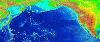
| Hawaiian–Emperor seamount chain  FeatureType : mountain Elevation : 4197 Lat/Lng : 19.8206 / -155.4681 | The Hawaiian–Emperor seamount chain is a mostly undersea mountain range in the Pacific Ocean that reaches above sea level in Hawaii. It is composed of the Hawaiian ridge, consisting of the islands of the Hawaiian chain northwest to Kure Atoll, and the Emperor Seamounts: together they form a vast (...) |
| 2 | 
| Lōʻihi Seamount FeatureType : mountain Lat/Lng : 18.92 / -155.27 | Lōihi Seamount (also known as Lōʻihi) is an active submarine volcano about off the southeast coast of the island of Hawaii. The top of the seamount is about below sea level. This seamount is on the flank of Mauna Loa, the largest shield volcano on Earth (...) |
| 3 | 
| Bransfield Strait FeatureType : null Lat/Lng : -63.0 / -59.0 | Bransfield Strait is a body of water about wide extending for in a general northeast – southwest direction between the South Shetland Islands and the Antarctic Peninsula. (...) |
| 4 | New England Seamounts FeatureType : null Lat/Lng : 37.4 / -60.0 | The New England Seamounts are an underwater chain of seamounts in the Atlantic Ocean stretching over 1,000 km from the edge of the Georges Bank off the coast of Massachusetts. The chain consists of over twenty extinct volcanic peaks, many rising over 4,000 m from the seabed (...) | |
| 5 | 
| Kodiak Island FeatureType : isle Elevation : 832 Lat/Lng : 57.4717 / -153.4253 | Kodiak Island (Alutiiq: Qikertaq) is a large island on the south coast of the U.S. state of Alaska, separated from the Alaska mainland by the Shelikof Strait. The largest island in the Kodiak Archipelago, Kodiak Island is the second largest island in the United States and the 80th largest island in (...) |
| 6 | 
| La Palma FeatureType : isle Elevation : 876 Lat/Lng : 28.6667 / -17.8667 | La Palma , also San Miguel de La Palma, is the most north-westerly island of the Canary Islands, Spain. La Palma has an area of 706 km2 making it the fifth largest of the seven main Canary Islands. The total population is about 86,000, of which 18,000 (2003 data) live in the capital, Santa Cruz de (...) |
| 7 | 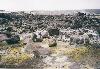
| Kīlauea FeatureType : mountain Elevation : 1231 Lat/Lng : 19.421 / -155.287 | Kīlauea is a currently active shield volcano in the Hawaiian Islands, and the most active of the five volcanoes that together form the island of Hawaii. Located along the southern shore of the island, the volcano is between 300,000 and 600,000 years old and emerged above sea level about 100,000 (...) |
| 8 | 
| Mauna Loa FeatureType : mountain Elevation : 4133 Lat/Lng : 19.4795 / -155.6027 | Mauna Loa (or ; Hawaiian: ;) is one of five volcanoes that form the Island of Hawaii in the U.S. state of Hawaiʻi in the Pacific Ocean. The largest subaerial volcano in both mass and volume, Mauna Loa has historically been considered the largest volcano on Earth, dwarfed only by Tamu Massif (...) |
| 9 | Vema Seamount FeatureType : null Lat/Lng : -30.3667 / -7.6667 | Vema Seamount is a seamount in the South Atlantic Ocean. Discovered in 1959 by a ship with the same name, it lies from Tristan da Cunha and northeast of Cape Town. The seamount has a flat top at a mean depth of which was eroded into the seamount at a time when sea levels were lower; the shallowest (...) | |
| 10 | 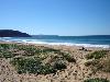
| Pacific Ocean FeatureType : waterbody Lat/Lng : 0.0 / -160.0 | The Pacific Ocean is the largest and deepest of Earth's oceanic divisions. It extends from the Arctic Ocean in the north to the Southern Ocean (or, depending on definition, to Antarctica) in the south and is bounded by Asia and Australia in the west and the Americas in the east (...) |
| 11 | 
| Enewetak Atoll FeatureType : isle Lat/Lng : 11.3667 / 162.333 | Enewetak Atoll (; also spelled Eniwetok Atoll or sometimes Eniewetok; , , or) is a large coral atoll of 40 islands in the Pacific Ocean and with its 850 people forms a legislative district of the Ralik Chain of the Marshall Islands (...) |
| 12 | 
| Kermadec Islands FeatureType : null Elevation : 262 Lat/Lng : -29.2769 / -177.9233 | The Kermadec Islands (Rangitāhua in Māori) are a subtropical island arc in the South Pacific Ocean northeast of New Zealand's North Island, and a similar distance southwest of Tonga. The islands are part of New Zealand, in total area and nowadays uninhabited, except for the permanently manned Raoul (...) |
| 13 | 
| Indian Ocean FeatureType : waterbody Lat/Lng : -20.0 / 80.0 | The Indian Ocean is the third largest of the world's oceanic divisions, covering (approximately 20% of the water on the Earth's surface). It is bounded by Asia on the north, on the west by Africa, on the east by Australia, and on the south by the Southern Ocean or, depending on definition, by (...) |
| 14 | 
| Mauna Kea FeatureType : mountain Elevation : 4197 Lat/Lng : 19.8207 / -155.4681 | Mauna Kea (or) is a dormant volcano on the island of Hawaii. Its peak is above sea level, making it the highest point in the state of Hawaii. Most of the mountain is under water, and when measured from its oceanic base, Mauna Kea becomes the tallest mountain in the world measuring over (...) |
| 15 | Axial Seamount FeatureType : null Lat/Lng : 46.06 / -130.0 | Axial Seamount (also Coaxial Seamount or Axial Volcano) is a seamount and submarine volcano located on the Juan de Fuca Ridge, approximately west of Cannon Beach, Oregon. Standing high, Axial Seamount is the youngest volcano and current eruptive center of the Cobb–Eickelberg Seamount chain (...) | |
| 16 | 
| Google Earth FeatureType : landmark Elevation : 29 Lat/Lng : 44.88 / 10.4242 | Google Earth is a computer program that renders a 3D representation of Earth based on satellite imagery. The program maps the Earth by superimposing satellite images, aerial photography, and GIS data onto a 3D globe, allowing users to see cities and landscapes from various angles (...) |
| 17 | 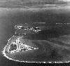
| Midway Atoll FeatureType : isle Lat/Lng : 28.2 / -177.35 | Midway Atoll (colloquial: Midway Islands; Hawaiian: Pihemanu Kauihelani) is a atoll in the North Pacific Ocean at . Midway is roughly equidistant between North America and Asia. Midway Atoll is an unorganized, unincorporated territory of the United States (...) |
| 18 | 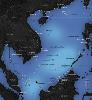
| South China Sea FeatureType : waterbody Lat/Lng : 12.1883 / 113.2264 | The South China Sea is a marginal sea that is part of the Pacific Ocean, encompassing an area from the Karimata and Malacca Straits to the Strait of Taiwan of around . The sea carries tremendous strategic importance; one-third of the world's shipping passes through it carrying over $3 trillion in (...) |
| 19 | 
| Surtsey FeatureType : isle Lat/Lng : 63.3031 / -20.6031 | Surtsey ("Surtr's island" in Icelandic) is a volcanic island located in the Vestmannaeyjar archipelago off the southern coast of Iceland. At , Surtsey is the southernmost point of Iceland. It was formed in a volcanic eruption which began below sea level, and reached the surface on 14 November 1963 (...) |
| 20 | 
| Crescent City, California FeatureType : null Elevation : 13 Lat/Lng : 41.7547 / -124.2011 | Crescent City (Chetco-Tolowa: Taa-’at-dvn, Yurok: Kohpey, Wiyot: Daluwagh) is the county seat of, and only incorporated city in, Del Norte County, California. Named for the crescent-shaped stretch of sandy beach south of the city, Crescent City had a total population of 7,643 in the 2010 census, up (...) |
| 21 | 
| Savai'i FeatureType : null Elevation : 1739 Lat/Lng : -13.625 / -172.4867 | Savaii is the largest (area 1,694 km2) and highest (Mt Silisili at 1,858 m) island in Samoa and the Samoan Islands chain. The island is the fifth largest in Polynesia, behind the two main islands of New Zealand and the Hawaiian Islands of Hawaii and Maui (...) |
| 22 | Bowie Seamount FeatureType : mountain Lat/Lng : 53.3069 / -135.6592 | Bowie Seamount is a large submarine volcano in the northeastern Pacific Ocean, located west of Haida Gwaii, British Columbia, Canada. The seamount is also known as Bowie Bank. In the Russian language, Bowie is called Гора Бауи (Gora Baui), which literally means Mount Bowie (...) | |
| 23 | 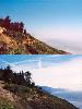
| Big Sur FeatureType : landmark Elevation : 30 Lat/Lng : 36.1075 / -121.6258 | Big Sur is a rugged and mountainous section of the Central Coast of the U.S. state of California between Carmel Highlands and San Simeon, where the Santa Lucia Mountains rise abruptly from the Pacific Ocean. It is frequently praised for its dramatic scenery (...) |
| 24 | 
| Lord Howe Island FeatureType : landmark Elevation : 61 Lat/Lng : -31.5531 / 159.0839 | Lord Howe Island (; formerly Lord Howe's Island) is an irregularly crescent-shaped volcanic remnant in the Tasman Sea between Australia and New Zealand, directly east of mainland Port Macquarie, northeast of Sydney, and about southwest of Norfolk Island (...) |
| 25 | 
| Diego Garcia FeatureType : isle Elevation : 0 Lat/Lng : -7.3133 / 72.4111 | Diego Garcia is an atoll just south of the equator in the central Indian Ocean, and the largest of 60 small islands comprising the Chagos Archipelago. It was settled by the French in the 1790s and was transferred to British rule after the Napoleonic Wars (...) |
| 26 | 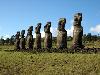
| Easter Island FeatureType : isle Elevation : 165 Lat/Lng : -27.1194 / -109.3547 | Easter Island is a Chilean island in the southeastern Pacific Ocean, at the southeasternmost point of the Polynesian Triangle in Oceania. Easter Island is most famous for its nearly 1,000 extant monumental statues, called moai, created by the early Rapa Nui people (...) |
| 27 | 
| Hawaii FeatureType : adm1st Elevation : 235 Lat/Lng : 21.3114 / -157.7964 | Hawaii is the 50th and most recent state to have joined the United States, having received statehood on August 21, 1959. Hawaii is the only U.S. state located in Oceania, the only U.S. state located outside North America, and the only one composed entirely of islands (...) |
| 28 | 
| Tonga Trench FeatureType : waterbody Lat/Lng : -22.9447 / -174.7331 | The Tonga Trench is an oceanic trench located in the south-west Pacific Ocean. It is the deepest trench of the Southern Hemisphere and the second deepest on Earth. The fastest plate tectonic velocity on Earth occurs as the Pacific Plate is being subducted westward in the trench (...) |
| 29 | 
| Haleakalā FeatureType : mountain Elevation : 3044 Lat/Lng : 20.7097 / -156.2533 | Haleakalā (; Hawaiian:), or the East Maui Volcano, is a massive shield volcano that forms more than 75% of the Hawaiian Island of Maui. The western 25% of the island is formed by another volcano, Mauna Kahalawai, also referred to as the West Maui Mountains (...) |
| 30 | 
| Pratas Islands FeatureType : null Elevation : 1 Lat/Lng : 20.7023 / 116.7171 | The Pratas Islands, also known as the Dongsha Islands and Tungsha Islands, are three atolls (Pratas Atoll, North Vereker Atoll and South Vereker Atoll) in the north of the South China Sea. They consist of one island, two coral reefs and two banks, and are located about southeast of Hong Kong. , vm (...) |
| 31 | 
| Bassas da India FeatureType : isle Lat/Lng : -21.4873 / 39.6824 | Bassas da India is an uninhabited, roughly circular French atoll that is part of the French Southern and Antarctic Lands. Located in the southern Mozambique Channel, about halfway between Mozambique and Madagascar (about further east) and around northwest of Europa Island, the rim of the atoll (...) |
| 32 | Macdonald seamount FeatureType : mountain Lat/Lng : -28.9783 / -140.2583 | Macdonald seamount is a seamount in Polynesia, southeast of the Austral Islands. It rises from the seafloor to a depth of about , but the height of its top appears to vary with volcanic activity. The seamount was discovered in 1967 and has been periodically active with gas release and seismic (...) | |
| 33 | 
| Graham Island (Mediterranean Sea) FeatureType : isle Lat/Lng : 37.1636 / 12.7186 | Graham Island (also Graham Bank or Graham Shoal;) is a submerged volcanic island in the Mediterranean Sea. It was discovered when it last appeared on 1 August 1831 by Humphrey Fleming Senhouse, the captain of the first rate Royal Navy ship of the line St Vincent and named after Sir James Graham, the (...) |
| 34 | 
| Farallon de Pajaros FeatureType : null Elevation : 53 Lat/Lng : 20.538 / 144.893 | Farallón de Pájaros (from Spanish Farallón de los pájaros, meaning "Birds' Rock"), also known as Urracas (from Spanish Urracas, meaning "Magpies"), is a small (2.3 km2) uninhabited volcanic island, the northernmost island in the Northern Mariana Islands chain. (...) |
| 35 | 
| Faial Island FeatureType : null Elevation : 820 Lat/Lng : 38.5769 / -28.7028 | Faial Island , also known in English as Fayal, is a Portuguese island of the Central Group (Portuguese: Grupo Central) of the Azores. The Capelinhos Volcano, the westernmost point of the island, might as well be the westernmost point of Europe, if the Monchique Islet, near Flores Island, is (...) |
| 36 | Davidson Seamount FeatureType : null Lat/Lng : 35.7167 / -122.7167 | Davidson Seamount is a seamount (underwater volcano) located off the coast of Central California, southwest of Monterey and west of San Simeon. At long and wide, it is one of the largest known seamounts in the world (...) | |
| 37 | Zhongsha Islands FeatureType : isle Lat/Lng : 15.6167 / 114.4 | The Zhongsha Islands is a Chinese term for a collection of entirely submerged banks, seamounts, and shoals in the South China Sea. There are in fact, no islands in the 'Zhongsha'. The area is known in English as the Macclesfield Bank (...) | |
| 38 | 
| Geography of Nauru FeatureType : country Elevation : 22 Lat/Lng : -0.5352 / 166.932 | Nauru is a tiny phosphate rock island nation located in the South Pacific Ocean south of the Marshall Islands in Oceania. It is only south of the Equator at coordinates . Nauru is one of the three great phosphate rock islands in the Pacific Ocean — the others are Banaba (Ocean Island) in (...) |
| 39 | Vesteris Seamount FeatureType : null Lat/Lng : 73.8333 / -9.1667 | Vesteris Seamount is a seamount in the North Atlantic Ocean between Greenland and Norway. It lies north of Jan Mayen and rises from 41–43 million years old ocean crust. The reasons for the volcanic activity at Vesteris are unclear and may involve lithospheric processes (...) | |
| 40 | 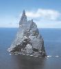
| Ball's Pyramid FeatureType : mountain Elevation : 0 Lat/Lng : -31.7542 / 159.2514 | Ball's Pyramid is an erosional remnant of a shield volcano and caldera that formed about 6.4 million years ago. It lies southeast of Lord Howe Island in the Pacific Ocean. It is high, while measuring only in length and across, making it the tallest volcanic stack in the world (...) |
| 41 | Cobb Seamount FeatureType : null Lat/Lng : 46.7333 / -130.7833 | Cobb Seamount is a seamount (underwater volcano) and guyot located west of Grays Harbor, Washington, United States. Cobb Seamount is one of the seamounts in the Cobb–Eickelberg Seamount chain, a chain of underwater volcanoes created by the Cobb hotspot that terminates near the coast of Alaska (...) | |
| 42 | 
| Malahide FeatureType : city Elevation : 11 Lat/Lng : 53.4508 / -6.1544 | Malahide is a coastal settlement situated approximately 18 km north-east of Dublin city, in Fingal, Ireland. There is a village centred on a crossroads, with extensive residential areas to the south, southeast and west (...) |
| 43 | 
| Woleai FeatureType : null Elevation : 13 Lat/Lng : 7.3815 / 143.9091 | Woleai, also known as Oleai, is a coral atoll of twenty-two islands in the eastern Caroline Islands in the Pacific Ocean, and forms a legislative district in the Yap State in the Federated States of Micronesia and is located approximately west-northwest of Ifalik and northeast of Eauripik (...) |
| 44 | 
| Necker Island (Hawaii) FeatureType : island Elevation : 33 Lat/Lng : 23.575 / -164.7014 | Necker Island (Hawaiian: Mokumanamana) is a small island in the Northwestern Hawaiian Islands. It is located at in the Pacific Ocean, northwest of Nihoa and north of the Tropic of Cancer. It contains important prehistoric archaeological sites of the Hawaiian culture and is part of the Hawaiian (...) |
| 45 | 
| Nihoa FeatureType : isle Elevation : 78 Lat/Lng : 23.0606 / -161.9219 | Nihoa (; Hawaiian:), also known as Bird Island or Moku Manu, is the tallest of ten islands and atolls in the uninhabited Northwestern Hawaiian Islands (NWHI). The island is located at the southern end of the NWHI chain, southeast of Necker Island (...) |
| 46 | Wōdejebato FeatureType : null Lat/Lng : 12.0 / 164.9 | Wōdejebato (formerly known as Sylvania) is a Cretaceous guyot or tablemount in the northern Marshall Islands, Pacific Ocean. Wōdejebato probably is a shield volcano and is connected through a submarine ridge to the smaller Pikinni Atoll northwest of the guyot; unlike Wōdejebato, Pikinni rises above (...) | |
| 47 | Sedlo Seamount FeatureType : null Lat/Lng : 40.2133 / -26.2633 | Sedlo Seamount is an isolated seamount and underwater volcano located in the Northeast Atlantic, northeast of Graciosa Island. It has an elongate structure, roughly . The summit is flat with three peaks. Sedlo Seamount sits on the ocean floor deep, and rises to within of the surface (...) | |
| 48 | 
| Gardner Pinnacles FeatureType : null Lat/Lng : 24.99 / -167.99 | The Gardner Pinnacles (Hawaiian: Pūhāhonu) are two barren rock outcrops surrounded by a reef and located in the Northwestern Hawaiian Islands at . It is northwest of Honolulu and from French Frigate Shoals. The total area of the two small islets—remnants of an ancient volcano—is (...) |
| 49 | Muirfield Seamount FeatureType : landmark Lat/Lng : -13.225 / 96.125 | The Muirfield Seamount is a submarine mountain located in the Indian Ocean approximately 130 kilometres (70 nautical miles) southwest of the Cocos (Keeling) Islands. The Cocos Islands are an Australian territory, and therefore the Muirfield Seamount is within Australia's Exclusive Economic Zone (...) | |
| 50 | Peirce Seamount FeatureType : mountain Lat/Lng : 53.44 / -136.32 | Peirce Seamount, also called Pierce Seamount, is a seamount located in the Pacific Ocean west of the Queen Charlotte Islands, British Columbia, Canada. It lies between Denson Seamount and Hodgkins Seamount and is member of the Kodiak-Bowie Seamount chain, a chain of seamounts in southeastern Gulf of (...) | |
| 51 | Crough Seamount FeatureType : null Lat/Lng : -25.0 / -121.2 | Crough Seamount (named after the geologist Thomas Crough) is a seamount in the Pacific Ocean, within the exclusive economic zone of Pitcairn. It rises to a depth of and is paired with a taller but overall smaller seamount to the east (...) | |
| 52 | Patton Seamount FeatureType : null Lat/Lng : 54.58 / -150.44 | Patton Seamount is a prominent seamount (underwater volcano) in the Cobb–Eickelberg Seamount chain in the Gulf of Alaska. Located east of Kodiak Island and reaching to within of the ocean surface, Patton is one of the largest seamounts in the Cobb–Eickelberg Seamount chain (...) | |
| 53 | Akiaki FeatureType : isle Lat/Lng : -18.55 / -139.2167 | Akiaki is a low coral atoll in the eastern area of the Tuamotu Archipelago, French Polynesia. Akiaki's nearest neighbor is Vahitahi, which is located 41 km to the southeast. Akiaki is a small atoll rising barely above sea level. The total land surface is only 1.3 km² (...) | |
| 54 | Jasper Seamount FeatureType : null Lat/Lng : 30.44 / -122.74 | Jasper Seamount is a seamount (underwater volcano) located in the Fieberling-Guadalupe seamount track, west of Baja California, Mexico. Jasper is the site of detailed geophysical geological and geochemical studies which suggest that many seamounts, big and small, follow the same pattern of growth (...) | |
| 55 | Great Meteor Seamount FeatureType : null Lat/Lng : 32.065 / -28.0519 | The Great Meteor Seamount is the largest seamount in the North Atlantic (24 000 km3). This large guyot is one of the seamounts forming the Southern Azores Seamount Chain (SASC), rooted on a large terrace located south of the Azores Archipelago in the Atlantic Ocean (...) | |
| 56 | Limalok FeatureType : null Lat/Lng : 5.6 / 172.3 | Limalok (formerly known as Harrie or Harriet) is a Cretaceous-Paleocene guyot/tablemount in the southeastern Marshall Islands, one of a number of seamounts in the Pacific Ocean. It was probably formed by a hotspot in present-day French Polynesia (...) | |
| 57 | Hawaiian Islands FeatureType : isle Elevation : 2845 Lat/Lng : 19.5667 / -155.5 | The Hawaiian Islands are an archipelago of eight major islands, several atolls, numerous smaller islets, and seamounts in the North Pacific Ocean, extending some from the island of Hawaii in the south to northernmost Kure Atoll (...) | |
| 58 | 
| Isla Salas y Gómez FeatureType : isle Elevation : 9 Lat/Lng : -26.4722 / -105.3619 | Isla Salas y Gómez,, Instituto Nacional de Estadísticas – June 2005. also known as Isla Sala y Gómez, is a small uninhabited Chilean island in the Pacific Ocean. It is the easternmost point in the Polynesian Triangle (...) |
| 59 | 
| Kure Atoll FeatureType : isle Lat/Lng : 28.41 / -178.33 | or Ocean Island is an atoll in the Pacific Ocean beyond Midway Atoll in the Northwestern Hawaiian Islands at . The only land of significant size is called Green Island and is a habitat for hundreds of thousands of seabirds (...) |
| 60 | Pioneer Seamount FeatureType : null Lat/Lng : 37.3517 / -123.435 | Pioneer Seamount is an undersea mountain, or seamount, in the Pacific Ocean off the coast of central California. (...) | |
| 61 | Lo-En FeatureType : null Lat/Lng : 10.1167 / 162.8 | Lo-En or Hess is an Albian-Campanian guyot in the Marshall Islands. One among a number of seamounts in the Pacific Ocean, it was probably formed by a hotspot in what is present-day French Polynesia. Limalok lies southeast of Eniwetok which rise above sea level and Lo-En is almost connected to it (...) | |
| 62 | 
| Black Mountain (near Los Altos, California) FeatureType : mountain Elevation : 847 Lat/Lng : 37.3188 / -122.1475 | Black Mountain is a summit on Monte Bello Ridge in the Santa Cruz Mountains of west Santa Clara County, California, south of Los Altos and Los Altos Hills, and west of Cupertino; it is within the Palo Alto city limits though not near the developed part of the city. (...) |
| 63 | Hakurei Seamount FeatureType : landmark Lat/Lng : -62.8667 / 140.8167 | Hakurei Seamount is a seamount located off Adélie Land, Antarctica. The name, approved by the Advisory Committee for Undersea Features in July 1999, is for the RV Hakurei-maru which conducted a detailed survey of the area. (...) | |
| 64 | Bear Seamount FeatureType : mountain Lat/Lng : 39.9167 / -67.4 | The Bear Seamount is a guyot or flat-topped underwater volcano in the Atlantic Ocean. It is the oldest of the New England Seamounts, which was active more than 100 million years ago. It was formed when the North American Plate moved over the New England hotspot (...) | |
| 65 | 
| Ducie Island FeatureType : null Lat/Lng : -24.6833 / -124.7833 | Ducie Island is an uninhabited atoll in the Pitcairn Islands. It lies east of Pitcairn Island, and east of Henderson Island, and has a total area of , which includes the lagoon. It is long, measured northeast to southwest, and about wide (...) |
| 66 | Hawaii (island) FeatureType : isle Elevation : 2845 Lat/Lng : 19.5667 / -155.5 | Hawaiʻi is the largest island located in the U.S. state of Hawaii. It is the largest and the southeasternmost of the Hawaiian Islands, a chain of volcanic islands in the North Pacific Ocean. With an area of , it has 63% of the Hawaiian archipelago's combined landmass, and is the largest island in (...) | |
| 67 | Southwest Indian Ridge FeatureType : null Lat/Lng : -25.5 / 70.0 | The Southwest Indian Ridge (SWIR) is a mid-ocean ridge located along the floors of the south-west Indian Ocean and south-east Atlantic Ocean. A divergent tectonic plate boundary separating the African Plate to the north from the Antarctic Plate to the south, the SWIR is characterised by ultra-slow (...) | |
| 68 | Detroit Seamount FeatureType : null Lat/Lng : 51.48 / 167.6 | Detroit Seamount, which was formed around 76 million years ago, is one of the oldest seamounts of the Hawaiian-Emperor seamount chain (Meiji Seamount is the oldest, at 82 million years). It lies near the northernmost end of the chain and is south of Aleutian Islands (near Russia), at by EarthRef, a (...) | |
| 69 | Discovery Seamounts FeatureType : null Lat/Lng : -42.0 / 0.2 | Discovery Seamounts are a chain of seamounts in the Southern Atlantic Ocean, which include the Discovery Seamount. The seamounts lie east of Gough Island and once rose above sea level. Various volcanic rocks as well as glacial dropstones and sediments have been dredged from the seamounts (...) | |
| 70 | Austral Islands FeatureType : isle Lat/Lng : -24.7581 / -149.512 | The Tuha'a Pae, or Austral Islands (or '), are the southernmost group of islands in French Polynesia, an overseas collectivity of France in the South Pacific. Geographically, they consist of two separate archipelagos, namely in the northwest the Tupua'i islands consisting of the Îles Maria, (...) | |
| 71 | 
| Lisianski Island FeatureType : isle Elevation : 7 Lat/Lng : 26.064 / -173.9658 | Lisianski Island (Hawaiian: Papa‘āpoho) is one of the Northwestern Hawaiian Islands, with a land area of and a maximum elevation of above sea level. It is a low, flat sand and coral island about 905 nautical miles (1,676 km) northwest of Honolulu (...) |
| 72 | 
| Shag Rocks, South Georgia FeatureType : null Lat/Lng : -53.55 / -42.0333 | The Shag Rocks are six small islands in the westernmost extreme of South Georgia, west of the main island of South Georgia and off the Falkland Islands. The Shag Rocks are located at . further southeast is Black Rock. Black Rock is located at . The Shag Rocks cover a total area of less than (...) |
| 73 | 
| Lihir Island FeatureType : isle Elevation : 45 Lat/Lng : -3.1625 / 152.5781 | Lihir Island (a.k.a. Niolam Island) is the largest island in the Lihir group of islands, 22 km long and 14.5 km wide, in Papua New Guinea's New Ireland Province. It consists of a complex of several overlapping basaltic stratovolcanoes rising 700 m above sea level (...) |
| 74 | Ita Mai Tai FeatureType : null Lat/Lng : 12.9 / 156.9 | Ita Mai Tai is a Cretaceous-early Cenozoic seamount northwest of the Marshall Islands and north of Micronesia. One among a number of seamounts in the Pacific Ocean, it is part of the Magellan Seamounts which may have a hotspot origin although Ita Mai Tai itself may not have formed on a hotspot (...) | |
| 75 | Seminole Seamount FeatureType : null Lat/Lng : 49.7667 / -129.8333 | The Seminole Seamount is a seamount located in the Pacific Ocean off the coast of northern Vancouver Island, British Columbia, Canada. (...) | |
| 76 | Oshawa Seamount FeatureType : mountain Lat/Lng : 53.14 / -134.31 | The Oshawa Seamount is a seamount located in the Pacific Ocean off the coast of Haida Gwaii (formerly Queen Charlotte Islands), British Columbia, Canada. (...) | |
| 77 | Graham Seamount FeatureType : mountain Lat/Lng : 53.14 / -134.31 | The Graham Seamount is a seamount located in the Pacific Ocean off the coast of the Queen Charlotte Islands, British Columbia, Canada. (...) | |
| 78 | Horizon Guyot FeatureType : null Lat/Lng : 19.1317 / -169.46 | Horizon Guyot is a presumably Cretaceous guyot/tablemount in the Mid-Pacific Mountains, Pacific Ocean. It is an over long elongated ridge that stretches in northeast-southwest direction and has two flat tops; it rises to a minimum depth (...) | |
| 79 | Andes FeatureType : mountain Elevation : 6868 Lat/Lng : -32.6533 / -70.0117 | The Andes or Andean Mountains are the longest continental mountain range in the world, forming a continuous highland along the western edge of South America. This range is about long, about wide (widest between 18° south and 20° south latitude), and of an average height of about (...) | |
| 80 | Cross Seamount FeatureType : null Lat/Lng : 18.7044 / -158.2661 | Cross Seamount is a seamount far southwest of the Hawaii archipelago, about equidistant from the cities of Honolulu and Kona. It is one of the numerous seamounts surrounding Hawaii, although unrelated to the Hawaiian hotspot (...) | |
| 81 | Hawaii hotspot FeatureType : mountain Lat/Lng : 18.92 / -155.27 | The Hawaii hotspot is a volcanic hotspot located near the namesake Hawaiian Islands, in the northern Pacific Ocean. One of the most well-known and heavily studied hotspots in the world, the Hawaii plume is responsible for the creation of the Hawaiian – Emperor seamount chain, a chain of volcanoes (...) | |
| 82 | Cadamosto Seamount FeatureType : mountain Lat/Lng : 14.6667 / -24.9167 | The Cadamosto Seamount is a seamount in the North Atlantic Ocean just 20 km southwest of the island of Brava, Cape Verde. The seamount is named after the explorer Alvise Cadamosto who explored Cape Verde in 1456. (...) | |
| 83 | Meiji Seamount FeatureType : mountain Lat/Lng : 53.2 / 164.5 | Meiji Seamount, named after Emperor Meiji, the 122nd Emperor of Japan, is the oldest seamount in the Hawaiian-Emperor seamount chain, with an estimated age of 82 million years. It lies at the northernmost end of the chain, and is perched at the outer slope of the Kuril-Kamchatka Trench (...) | |
| 84 | American Samoa FeatureType : isle Elevation : 340 Lat/Lng : -14.2958 / -170.7075 | American Samoa (; , ; also ' or ') is an unincorporated territory of the United States located in the South Pacific Ocean, southeast of Samoa. Its location is centered around 14.2710° S, 170.1322° W. It is on the eastern border of the International Date Line, while independent Samoa is west of it (...) | |
| 85 | Polynesia FeatureType : null Lat/Lng : -16.853 / 148.4052 | Polynesia (; from polys "many" and nēsos "island"; , , or Poronihia) is a subregion of Oceania, made up of more than 1,000 islands scattered over the central and southern Pacific Ocean. The indigenous people who inhabit the islands of Polynesia are termed Polynesians, and share many similar traits (...) | |
| 86 | 
| Malapascua FeatureType : isle Elevation : 8 Lat/Lng : 11.3355 / 124.1156 | Malapascua is a Philippine island situated in the Visayan Sea, across a shallow strait from the northernmost tip of Cebu Island. Administratively, it is part of the peninsular barangay of Logon, Daanbantayan, Cebu. Malapascua is a small island, only about , and has eight hamlets. (...) |
| 87 | Brown Bear Seamount FeatureType : mountain Lat/Lng : 46.04 / -130.46 | Brown Bear Seamount is a seamount (underwater volcano) approximately west of the coast of Oregon. It is connected to the larger Axial Seamount by a small ridge. Brown Bear Seamount was created by the Cobb hotspot, and is located on the near west of the Juan de Fuca Ridge (...) | |
| 88 | Allison Guyot FeatureType : null Lat/Lng : 18.26 / 179.33 | Allison Guyot (formerly known as Navoceano Guyot) is a guyot/tablemount in the underwater Mid-Pacific Mountains, Pacific Ocean. It is a trapezoidal flat mountain that rises above the seafloor and has a wide summit platform (...) | |
| 89 | Arago hotspot FeatureType : null Lat/Lng : -23.44 / -150.73 | Arago hotspot is a hotspot in the Pacific Ocean, presently located below the Arago seamount close to the island of Rurutu, French Polynesia. Arago is part of a family of hotspots in the southern Pacific, which include the Society hotspot and the Macdonald hotspot among others (...) | |
| 90 | Adams Seamount FeatureType : null Lat/Lng : -25.37 / -129.27 | Adams Seamount is a submarine volcano above the Pitcairn hotspot in the central Pacific Ocean about southwest of Pitcairn Island. (...) | |
| 91 | Tasmantid Seamount Chain FeatureType : landmark Lat/Lng : -31.0 / 156.0 | The Tasmantid Seamount Chain is a long chain of seamounts in the South Pacific Ocean. The chain consists of over 16 extinct volcanic peaks, many rising more than from the seabed. It is one of the two parallel seamount chains alongside the East Coast of Australia; the Lord Howe and Tasmantid seamount (...) | |
| 92 | Gumdrop Seamount FeatureType : null Lat/Lng : 37.45 / -123.4667 | Gumdrop Seamount is a small seamount (underwater volcano) located on the flank of Pioneer Seamount, off the coast of Central California. It is the northernmost of the related seamounts in the region, which includes Davidson, Guide, Pioneer, and Rodriguez seamounts (...) | |
| 93 | Nintoku Seamount FeatureType : null Lat/Lng : 41.08 / 170.57 | Nintoku Seamount or Nintoku Guyot is a seamount (underwater volcano) and guyot (flat top) in the Hawaiian-Emperor seamount chain. It is a large, irregularly shaped volcano that last erupted 66 million years ago (...) | |
| 94 | Marie Byrd Land FeatureType : landmark Lat/Lng : -75.0 / -125.0 | Marie Byrd Land is the portion of West Antarctica lying east of the Ross Ice Shelf and the Ross Sea and south of the Pacific Ocean, extending eastward approximately to a line between the head of the Ross Ice Shelf and Eights Coast. It stretches between 158°W and 103°24'W (...) | |
| 95 | Kammu Seamount FeatureType : mountain Lat/Lng : 32.0 / 173.1667 | Kanmu Seamount is a seamount lying within the Hawaiian-Emperor seamount chain in the Pacific Ocean. The last eruption of Kanmu Seamount is unknown. (...) | |
| 96 | Nazca Plate FeatureType : city Lat/Lng : -15.0 / -85.0 | The Nazca Plate, named after the Nazca region of southern Peru, is an oceanic tectonic plate in the eastern Pacific Ocean basin off the west coast of South America. The ongoing subduction, along the Peru–Chile Trench, of the Nazca Plate under the South American Plate is largely responsible for the (...) | |
| 97 | Submarine volcano FeatureType : null Lat/Lng : -25.37 / -129.27 | Submarine volcanoes are underwater vents or fissures in the Earth's surface from which magma can erupt. A large number of submarine volcanoes are located near areas of tectonic plate movement, known as mid-ocean ridges (...) | |
| 98 | 
| Capelinhos FeatureType : mountain Elevation : 84 Lat/Lng : 38.6003 / -28.8313 | The Capelinhos (from Capelo + -inhos diminutive, which literally means "little Capelos" or the "little cape") is a monogenetic volcano located on the western coast of the island of Faial in the Azores. It is part of the larger Volcanic Complex of Capelo, that includes 20 scoria cones and lava fields (...) |
| 99 | Atoll FeatureType : null Lat/Lng : -5.27 / 159.35 | An atoll (or),pronunciation in old video on youtube, sometimes called a coral atoll, is a ring-shaped coral reef including a coral rim that encircles a lagoon partially or completely. There may be coral islands or cays on the rim (...) | |
| 100 | Zealandia FeatureType : landmark Lat/Lng : -40.0 / 170.0 | Zealandia , also known as the New Zealand continent or Tasmantis is an almost entirely submerged mass of continental crust that sank after breaking away from Australia 60–85 million years ago, having separated from Antarctica between 85 and 130 million years ago (...) | |
| 101 | Brown Mountain FeatureType : null Elevation : 184 Lat/Lng : -42.6 / 147.05 | Brown Mountain or Brown's Mountain may refer to: ;Australia * Brown Mountain forest, East Gippsland, Victoria * Brown Mountain (New South Wales), mountain in the Monaro region, New South Wales ** Brown Mountain Power Station * Browns Mountain, small seamount near Sydney, New South Wales ;USA * Brown (...) | |
| 102 | Marsili FeatureType : mountain Lat/Lng : 39.25 / 14.3944 | Marsili is a large undersea volcano in the Tyrrhenian Sea, about south of Naples. The seamount is about 3,000 m (9,800 feet) tall; its peak and crater are about 450 m below the sea surface. Though it has not erupted in recorded history, volcanologists believe that Marsili is a relatively (...) | |
| 103 | Walvis Ridge FeatureType : mountain Lat/Lng : -26.0 / 6.0 | The Walvis Ridge (walvis means whale in Dutch and Afrikaans) is an aseismic ocean ridge in the southern Atlantic Ocean. More than in length, it extends from the Mid-Atlantic Ridge, near Tristan da Cunha and the Gough Islands, to the African coast (at 18°S) (...) | |
| 104 | Suiko Seamount FeatureType : mountain Lat/Lng : 44.5833 / 170.3333 | Suiko Seamount, also called Suiko Guyot, is a guyot of the Hawaiian-Emperor seamount chain in the Pacific Ocean. (...) | |
| 105 | Orca Seamount FeatureType : landmark Lat/Lng : -62.4333 / -58.4 | Orca Seamount is a seamount (underwater volcano) near King George Island in Antarctica, in the Bransfield Strait. While it is inactive. However last volcanic activity at Orca Seamount is judged to have occurred in the recent past as there are temperature anomalies in the seawater around at the (...) | |
| 106 | Moai (seamount) FeatureType : null Lat/Lng : -27.1 / -109.85 | The Moai Seamount is a submarine volcano, the second most westerly in the Easter Seamount Chain or Sala y Gómez ridge. It is east of Pukao seamount and west of Easter Island. It rises over 2,500 metres from the ocean floor to within a few hundred metres of the sea surface (...) | |
| 107 | Hodgkins Seamount FeatureType : mountain Lat/Lng : 53.3 / -136.5 | Hodgkins Seamount is a seamount in the Kodiak-Bowie Seamount chain, located south of Pierce Seamount and north of Bowie Seamount. It has apparently experienced two generically different episodes of volcanism, separated by about 12 million years (...) | |
| 108 | Takuyo-Daisan FeatureType : null Lat/Lng : 34.2 / 144.3 | Takuyo-Daisan is a guyot in the Western Pacific Ocean off Japan. It is deep and has a square-shaped flat top surrounded by a perimeter ridge. Several other seamounts lie nearby. The seamount formed as a volcanic island during the Cretaceous in the area currently occupied by French Polynesia (...) | |
| 109 | Foundation Seamounts FeatureType : null Lat/Lng : -35.0 / -120.0 | Foundation Seamounts are a series of seamounts in the southern Pacific Ocean. Discovered in 1992, these seamounts form a long chain which starts from the Pacific-Antarctic Ridge. Some of these seamounts may have once emerged from the ocean (...) | |
| 110 | Timeline of volcanism on Earth FeatureType : null Elevation : 2086 Lat/Lng : 41.67 / -117.5 | This timeline of volcanism on Earth is a list of major volcanic eruptions of approximately at least magnitude 6 on the Volcanic Explosivity Index (VEI) or equivalent sulfur dioxide emission around the Quaternary period (...) | |
| 111 | Samoan Islands FeatureType : country Lat/Lng : -14.2667 / -171.2 | The Samoan Islands are an archipelago covering in the central South Pacific, forming part of Polynesia and the wider region of Oceania. Administratively, the archipelago comprises all of Samoa and most of American Samoa (apart from Swains Island, which is part of the Tokelau Islands) (...) | |
| 112 | Northwestern Hawaiian Islands FeatureType : null Elevation : 78 Lat/Lng : 23.0606 / -161.9219 | The Northwestern Hawaiian Islands or the Leeward Islands are the small islands and atolls in the Hawaiian island chain located northwest (in some cases, far to the northwest) of the islands of Kauai and Niihau. Politically, they are all part of Honolulu County in the U.S (...) | |
| 113 | Resolution Guyot FeatureType : null Lat/Lng : 21.3317 / 174.3133 | Resolution Guyot (formerly known as Huevo) is a guyot/tablemount in the underwater Mid-Pacific Mountains, Pacific Ocean. It is a circular flat mountain that rises above the seafloor to a depth of about , with a wide summit platform (...) | |
| 114 | Rurutu FeatureType : null Elevation : 4 Lat/Lng : -22.4528 / -151.3403 | Rurutu is the northernmost island in the Austral archipelago of French Polynesia, and the name of a commune consisting solely of that island. It is situated south of Tahiti. Geologically, Rurutu was initially formed 12 million years ago by the Macdonald hotspot, a hotspot associated with the (...) | |
| 115 | Explorer Seamount FeatureType : null Lat/Lng : 49.0833 / -130.8 | The Explorer Seamount is a seamount located in the Pacific Ocean off the coast of British Columbia, Canada. It is on the Explorer Ridge, a tectonic spreading centre that separates the Pacific and Explorer plates and so the volcanism is rift-related. It is the namesake of the Explorer Ridge (...) | |
| 116 | Yomei Seamount FeatureType : mountain Lat/Lng : 42.3333 / 170.1167 | Yomei Seamount is a seamount of the Hawaiian-Emperor seamount chain in the northern Pacific Ocean. Its eruption ages are unknown, but the seamounts on either side are in the 56.2 to 59.6 million range during the Paleogene Period. (...) | |
| 117 | Kimmei Seamount FeatureType : mountain Lat/Lng : 35.0 / 171.6667 | Kimmei Seamount is a seamount of the Hawaiian-Emperor seamount chain in the northern Pacific Ocean. It last erupted about 40 million years ago. (...) | |
| 118 | National Park of American Samoa FeatureType : null Elevation : 277 Lat/Lng : -14.2581 / -170.685 | The National Park of American Samoa is a national park in the United States territory of American Samoa, distributed across three islands: Tutuila, Ofu, and Ta‘ū. The park preserves and protects coral reefs, tropical rainforests, fruit bats, and the Samoan culture (...) | |
| 119 | Lichtner Seamount FeatureType : null Lat/Lng : -67.55 / -0.6667 | Lichtner Seamount is a seamount located in the Southern Ocean. The name, for German cartographer Werner Lichtner, was approved by the Advisory Committee for Undersea Features in April 2000. (...) | |
| 120 | Chelan Seamount FeatureType : null Lat/Lng : 49.75 / -131.5333 | The Chelan Seamount is a seamount located in the Pacific Ocean off the coast of northern Vancouver Island, British Columbia, Canada. (...) | |
| 121 | Tucker Seamount FeatureType : null Lat/Lng : 49.8333 / -133.5 | The Tucker Seamount is a seamount located in the Pacific Ocean off the coast of northern Vancouver Island, British Columbia, Canada. (...) | |
| 122 | Union Seamount FeatureType : null Lat/Lng : 49.5833 / -132.75 | The Union Seamount is a seamount located in the Pacific Ocean off the coast of northern Vancouver Island, British Columbia, Canada. (...) | |
| 123 | Stirni Seamount FeatureType : null Lat/Lng : 49.1333 / -132.3 | The Union Seamount is a seamount located in the Pacific Ocean off the coast of northern Vancouver Island, British Columbia, Canada. (...) | |
| 124 | Heck Seamount FeatureType : null Lat/Lng : 48.5 / -130.0 | The Heck Seamount is a seamount located in the Pacific Ocean off the coast of central Vancouver Island, British Columbia, Canada. (...) | |
| 125 | Osbourn Seamount FeatureType : null Lat/Lng : -26.0 / -174.8333 | The Osbourn Seamount is a seamount in the south-west Pacific Ocean. It is the western-most and oldest unsubducted seamount of the Louisville Ridge, with an estimated age of 78.8 ± 1.3 . Like other seamounts comprising the Louisville Ridge, it was formed by the Louisville hotspot which is currently (...) | |
| 126 | Yuryaku Seamount FeatureType : null Lat/Lng : 32.67 / 172.27 | Yuryaku Seamount (also called Yuryaku Guyot) is a seamount (underwater volcano) and guyot (flat-topped) located northwest of Hawaii. It is located a little southwest of the V-shaped bend separating the Emperor Seamounts from the older Hawaiian islands, all of the Hawaiian-Emperor seamount chain in (...) | |
| 127 | Anton Dohrn Seamount FeatureType : null Lat/Lng : 57.4 / -11.1 | The Anton Dohrn Seamount is a guyot in the Rockall Trough in the northeast Atlantic. It was named after the German fishery research vessel which discovered it at the end of the 1950s which, in turn, had been named after the 19th-century biologist Anton Dohrn (...) | |
| 128 | Supply Reef FeatureType : null Lat/Lng : 20.1381 / 145.0968 | Supply Reef is a submerged circular reef of volcanic origin in the Northern Mariana Islands chain, about NW of the Maug Islands. Presently this igneous seamount is roughly below the ocean's surface and about in diameter. (...) | |
| 129 | Protector Shoal FeatureType : null Lat/Lng : -55.9383 / -28.1 | Protector Shoal is a submarine volcano, also called seamount, which rises gently from an ocean depth of to about below sea level approximately NW of Zavodovski Island in the South Sandwich Islands chain. The last eruption occurred during March 1962 (...) | |
| 130 | Kermadec Trench FeatureType : waterbody Lat/Lng : -28.0 / -175.0 | The Kermadec Trench is a linear ocean trench in the south Pacific Ocean. It stretches about from the Louisville Seamount Chain in the north (26°S) to the Hikurangi Plateau in the south (37°S), north-east of New Zealand's North Island (...) | |
| 131 | Boomerang Seamount FeatureType : mountain Lat/Lng : -37.721 / 77.825 | The Boomerang Seamount is an active submarine volcano, located 18 km northeast of Amsterdam Island, France. It was formed by the St. Paul hotspot and has a 2 km wide caldera that is 200 m deep. Hydrothermal activity occurs within the caldera (...) | |
| 132 | Koko Guyot FeatureType : null Lat/Lng : 35.25 / 171.5833 | Koko Guyot (also sometimes known as Kinmei and Koko Seamount) is a 48.1-million-year-old guyot, a type of underwater volcano with a flat top, which lies near the southern end of the Emperor seamounts, about north of the "bend" in the volcanic Hawaiian-Emperor seamount chain (...) | |
| 133 | Hualālai FeatureType : mountain Elevation : 2501 Lat/Lng : 19.689 / -155.8645 | Hualālai (pronounced in Hawaiian) is an active volcano on the island of Hawaii in the Hawaiian Islands. It is the westernmost, third-youngest and the third-most active of the five volcanoes that form the island of Hawaii, following Kīlauea and the much larger Mauna Loa (...) | |
| 134 | Kohala (mountain) FeatureType : mountain Elevation : 1668 Lat/Lng : 20.0861 / -155.7172 | Kohala is the oldest of five volcanoes that make up the island of Hawaii. Kohala is an estimated one million years old—so old that it experienced, and recorded, the reversal of earth's magnetic field 780,000 years ago (...) | |
| 135 | Hjalmar Johansen FeatureType : null Lat/Lng : 84.0833 / 101.5833 | Fredrik Hjalmar Johansen (15 May 1867 – 3 January 1913) was a Norwegian polar explorer. He participated on the first and third Fram expeditions. He shipped out with the Fridtjof Nansen expedition in 1893–1896, and accompanied Nansen to notch a new Farthest North record near the North Pole (...) | |
| 136 | Elato FeatureType : null Lat/Lng : 7.502 / 146.164 | Elato is a coral atoll of three islands in the central Caroline Islands in the Pacific Ocean, and forms a legislative district in Yap State in the Federated States of Micronesia. It is located approximately west of Lamotrek. Its population was 96 in 2000, (PDF) living on 0.5 km2. (...) | |
| 137 | Doom Shall Rise FeatureType : city Elevation : 349 Lat/Lng : 48.7122 / 9.6844 | Doom Shall Rise was a doom metal festival. It was held annually at the Chapel in Göppingen, Germany, from 2003 to 2013. (...) | |
| 138 | Bounty Seamount FeatureType : null Lat/Lng : -25.1833 / -129.3833 | Bounty Seamount is a seamount in the Pacific Ocean, which reaches a depth of or . It is about high. (...) | |
| 139 | Corner Rise Seamounts FeatureType : null Lat/Lng : 35.3911 / -51.6776 | The Corner Rise Seamounts are a chain of extinct submarine volcanoes in the northern Atlantic Ocean east of the New England Seamounts. Both it and the New England Seamounts were formed by the Great Meteor hotspot (...) | |
| 140 | Hydrothermal vent FeatureType : null Lat/Lng : 36.2275 / -33.9056 | A hydrothermal vent is a fissure in a planet's surface from which geothermally heated water issues. Hydrothermal vents are commonly found near volcanically active places, areas where tectonic plates are moving apart at spreading centers, ocean basins, and hotspots (...) | |
| 141 | East Tasman Plateau FeatureType : null Lat/Lng : -43.96 / 150.48 | The East Tasman Plateau is a submerged microcontinent south east of Tasmania. Its area is , and it is mostly from deep. It is a circular piece of continental rocks surrounded by oceanic crust. Volcanism occurred there .C. Gaina, R. D. Müller, B. Brown and T (...) | |
| 142 | Juan de Fuca Ridge FeatureType : null Lat/Lng : 44.8167 / -130.2333 | The Juan de Fuca Ridge is a mid-ocean spreading center and divergent plate boundary located off the coast of the Pacific Northwest region of North America. The ridge separates the Pacific Plate to the west and the Juan de Fuca Plate to the east (...) | |
| 143 | Green Seamount FeatureType : null Lat/Lng : 20.8148 / -109.2982 | Green Seamount is a small seamount (an underwater volcano) off the western coast of Mexico. It and the nearby Red Seamount were visited in 1982 by an expedition using DSV Alvin, which observed the seamount's sedimentary composition, sulfur chimneys, and biology (...) | |
| 144 | South Chamorro Seamount FeatureType : null Lat/Lng : 13.1167 / 146.0 | South Chamorro Seamount is a large serpentinite mud volcano and seamount located in the Izu-Bonin-Mariana Arc, one of 16 such volcanoes in the arc. These seamounts are at their largest in diameter and in height (...) | |
| 145 | Tibesti Mountains FeatureType : mountain Elevation : 1705 Lat/Lng : 20.7833 / 18.05 | The Tibesti Mountains are a mountain range in the central Sahara, primarily located in the extreme north of Chad, with a small extension into southern Libya. The highest peak in the range, Emi Koussi, lies to the south at a height of and is the highest point in both Chad and the Sahara (...) | |
| 146 | Coral reef FeatureType : null Lat/Lng : 32.4 / -64.8 | A coral reef is an underwater ecosystem characterized by reef-building corals. Reefs are formed of colonies of coral polyps held together by calcium carbonate. Most coral reefs are built from stony corals, whose polyps cluster in groups (...) | |
| 147 | Wordie Seamount FeatureType : landmark Lat/Lng : -61.8 / -55.45 | Wordie Seamount is a seamount located in Bransfield Strait, Antarctica. The feature is named after James Wordie, geologist on Ernest Shackleton's 1914 expedition to Antarctica. SCAR Composite Antarctic Gazetteer. (...) | |
| 148 | Dellwood Seamounts FeatureType : null Lat/Lng : 50.6167 / -130.7 | The Dellwood Seamounts are a seamount range located in the Pacific Ocean northwest of Vancouver Island, British Columbia, Canada. They are also known as the Dellwood Seamount Range or the Dellwood Seamount Chain. (...) | |
| 149 | Ojin Seamount FeatureType : mountain Lat/Lng : 38.25 / 171.0 | Ōjin Seamount, also called Ōjin Guyot, named after Emperor Ōjin, 15th Emperor of Japan, is a guyot of the Hawaiian-Emperor seamount chain in the Pacific Ocean. It erupted 55 million years ago. (...) | |
| 150 | Dallmann Seamount FeatureType : null Lat/Lng : -67.1667 / -96.8833 | Dallmann Seamount is a seamount named for polar explorer Eduard Dallmann, who surveyed the area west of Graham Land up to 66°S. The name was proposed by Dr. Rick Hagen of the Alfred Wegener Institute for Polar and Marine Research, Bremerhaven, Germany, and was approved by the Advisory Committee for (...) | |
| 151 | Vailulu'u FeatureType : null Lat/Lng : -14.215 / -169.058 | Vailulu'u is a volcanic seamount discovered by geophysicist Rockne Johnson in the Samoa Islands on October 18, 1975. The finding of an active, undersea, hotspot volcano is significant for scientists studying the Earth's fundamental processes (...) | |
| 152 | Marpi Reef FeatureType : null Lat/Lng : 15.425 / 145.85 | Marpi Reef or Marpi Bank is a narrow seamount lies north of Saipan. With length of and in width, the reef is generally similar to the Tatsumi Reef south of Tinian in terms of orientation in a northeast to southwest. The peak of the seamount is at 26 fathoms or 53 m under water surfaces (...) | |
| 153 | MIT Guyot FeatureType : mountain Lat/Lng : 27.2862 / 151.8232 | MIT Guyot is a guyot in the Pacific Ocean that rises to a depth of . It has a summit platform and formed during the Cretaceous in the region of present-day French Polynesia through volcanic eruptions. The volcano was eventually covered by a carbonate platform resembling that of a present-day atoll (...) | |
| 154 | North Pacific right whale FeatureType : null Lat/Lng : 53.0 / -157.0 | The North Pacific right whale (Eubalaena japonica) is a very large, thickset baleen whale species that is extremely rare and endangered. The Northeast Pacific population, which summers in the southeastern Bering Sea and Gulf of Alaska, may have no more than 40 animals (...) | |
| 155 | Alexa Bank FeatureType : null Lat/Lng : -11.5833 / 175.33 | Alexa Bank is a seamount in Samoa, northwest of Rotuma. The seamount reaches a depth of below sea level and has the appearance of an atoll with a flat top and steep slopes. Some active coral growth takes place at its top, but if it ever was an active atoll it has now drowned (...) | |
| 156 | Japan Trench FeatureType : waterbody Lat/Lng : 40.1167 / 144.3167 | __NOTOC__ The Japan Trench is an oceanic trench part of the Pacific Ring of Fire off northeast Japan. It extends from the Kuril Islands to the northern end of the Izu Islands, and is 8,046 meters (26,398 ft) at its deepest (...) | |
| 157 | Ioah Guyot FeatureType : null Lat/Lng : 14.1 / 156.14 | Ioah Guyot is a seamount in the Pacific Ocean, close to the Marshall Islands. Part of the Magellan Seamounts, it is a shield volcano that has erupted alkali basalt and hawaiite 87 million years ago, but may have continued erupting into the Miocene. During the Cretaceous, reefs developed on the guyot (...) | |
| 158 | Peru–Chile Trench FeatureType : waterbody Lat/Lng : -23.0 / -71.0 | The Peru–Chile Trench, also known as the Atacama Trench, is an oceanic trench in the eastern Pacific Ocean, about 160 kilometres (100 mi) off the coast of Peru and Chile. It reaches a maximum depth of 8,065 meters (26,460 ft) below sea level in Richards Deep and is approximately 5,900 kilometres (...) | |
| 159 | Rosenthal Seamount FeatureType : landmark Lat/Lng : -68.6333 / -97.0833 | Rosenthal Seamount is a seamount in the Weddell Sea named for Alfred Rosenthal (1828–1882), a German captain and ship owner. Rosenthal helped to finance and coordinate Eduard Dallmann's Antarctic voyages. (...) | |
| 160 | Rodriguez Seamount FeatureType : null Lat/Lng : 34.02 / -121.08 | Rodriguez Seamount is a seamount and guyot located about off the coast of Central California. It is structurally similar to the nearby Guide, Pioneer, Gumdrop, and Davidson seamounts, all located roughly between 37.5° and 34.0° degrees of latitude (...) | |
| 161 | Christmas Island Seamount Province FeatureType : null Lat/Lng : -13.0 / 106.0 | The Christmas Island Seamount Province (also known as the Christmas Island Seamounts) is an unusual seamount (submarine volcano) formation named for Christmas Island, an Australian territory and wildlife reserve that is also part of the chain (...) | |
| 162 | Denson Seamount FeatureType : null Lat/Lng : 54.0594 / -137.417 | Denson Seamount is a submarine volcano in the Kodiak-Bowie Seamount chain, with an estimated age of 18 million years. Retrieved on 2007-09-03 It lies at the southern end of the chain near the Canada–United States border (...) | |
| 163 | Jingū Seamount FeatureType : mountain Lat/Lng : 38.75 / 171.25 | Jingū Seamount, also called Jingū Guyot, is a guyot of the Hawaiian-Emperor seamount chain in the Pacific Ocean. It erupted 55 million years ago. The seamount is elongated in structure, running North-South, and has an oval shaped crater in the center, which is evidence of collapse when above sea (...) | |
| 164 | Barsukov Seamount FeatureType : landmark Lat/Lng : -61.0583 / -29.2083 | Barsukov Seamount is a seamount named in honor of the Russian scientist, Valeri Barsukov, former Director of the Vernadsky Institute of Geochemistry. The name proposed by Dr. G.B. Udintsev, of the same institute, and approved by the Advisory Committee for Undersea Features in June 1995. (...) | |
| 165 | Iselin Seamount FeatureType : landmark Lat/Lng : -70.75 / -178.25 | Iselin Seamount is a seamount in the Southern Ocean off Antarctica. It was named for the research ship Iselin II of the Woods Hole Oceanographic Institute, the name being approved by the Advisory Committee for Undersea Features in February 1964. (...) | |
| 166 | Sarigan FeatureType : isle Elevation : 323 Lat/Lng : 16.705 / 145.78 | Sarigan is an uninhabited volcanic island in the Pacific Ocean. It is part of the Northern Mariana Islands, a U.S. territory. Sarigan is located northeast of Anatahan island, south of Guguan and north of Saipan, the largest island in the Northern Marianas. (...) | |
| 167 | Daanbantayan FeatureType : null Elevation : 8 Lat/Lng : 11.2488 / 124.0104 | , officially the , , is a settlement_text of the Philippines in the province of , . According to the , it has a population of people. Located at the northern tip of Cebu island, Daanbantayan celebrates its annual fiesta along with the Haladaya Festival which starts 21 August and ends with (...) | |
| 168 | Ilhéu Grande FeatureType : isle Lat/Lng : 14.965 / -24.699 | Ilhéu Grande is an uninhabited island of Cape Verde. It is the largest of the Ilhéus do Rombo islet group, located west of Ilhéu de Cima, the other main islet of the group, and north of the island Brava. Its length is from southwest to northeast and the width is approximately from southeast to (...) | |
| 169 | Pacific-Antarctic Ridge FeatureType : landmark Lat/Lng : -61.9996 / -157.0002 | The Pacific-Antarctic Ridge (PAR) is a divergent tectonic plate boundary located on the seafloor of the South Pacific Ocean, separating the Pacific Plate from the Antarctic Plate. It is regarded as the southern section of the East Pacific Rise in some usages, generally south of the Challenger (...) | |
| 170 | Maro Reef FeatureType : isle Lat/Lng : 25.415 / -170.59 | Maro Reef (Hawaiian: Nalukākala - "surf that arrives in combers") is a largely submerged coral atoll located in the Northwestern Hawaiian Islands. It was discovered in 1820 by Captain Joseph Allen of the ship Maro, after whose ship the reef was named (...) | |
| 171 | Kick 'em Jenny FeatureType : null Lat/Lng : 12.3 / -61.64 | Kick 'em Jenny (also: Kick-'em-Jenny or Mt. Kick-'Em-Jenny) is an active submarine volcano or seamount on the Caribbean Sea floor, located north of the island of Grenada and about west of Ronde Island in the Grenadines (...) | |
| 172 | Pito Seamount FeatureType : null Lat/Lng : -23.3275 / -111.6402 | Pito Seamount is a seamount in the Pacific Ocean. It rises to a depth of and features hydrothermal activity in the form of black smokers, which were discovered in 1993. (...) | |
| 173 | Musicians Seamounts FeatureType : mountain Lat/Lng : 30.0 / -163.5 | Musicians Seamounts are a chain of seamounts in the Pacific Ocean, north of the Hawaiian Ridge. There are about 65 seamounts, some of which are named after musicians. These seamounts exist in two chains, one of which has been attributed to a probably now-extinct hotspot called the Euterpe hotspot (...) | |
| 174 | President Thiers Bank FeatureType : null Lat/Lng : -24.6667 / -145.9167 | President Thiers Bank is a broad guyot, which lies northwest of Rapa and southeast of Raivavae, in the Austral Islands. Its summit reaches a depth of . It may have been created by the Macdonald hotspot. Another theory sees in the seamount the endpoint of an alignment that starts with Aitutaki and (...) | |
| 175 | Tasmantid hotspot FeatureType : null Lat/Lng : -40.24 / 155.3 | The Tasmantid hotspot is a volcanic hotspot located in the South Pacific Ocean. Due to plate tectonics the hotspot was under different parts of the seabed in the past. It was initially centered under what is now the southern Coral Sea 60 million years ago where the first Tasmantid volcano was (...) | |
| 176 | Guide Seamount FeatureType : null Lat/Lng : 37.01 / -123.35 | Guide Seamount is a seamount in the eastern Pacific Ocean, about 16.6±0.5 million years old. It is similar in shape and orientation to the nearby Davidson, Pioneer, Rodriguez, and Gumdrop seamounts. It is named for the United States Coast and Geodetic Survey survey ship USC&GS Guide (...) | |
| 177 | HMS Hydra (A144) FeatureType : null Lat/Lng : -35.0 / -35.0 | HMS Hydra (Pennant Number A144) was a Royal Navy deep ocean hydrographic survey vessel, the third of the original three of the Hecla class. The ship was laid down as yard number 2258 on 14 May 1964 at Yarrow Shipbuilders, at Scotstoun on the River Clyde and launched on 14 July 1965 by Mary Lythall, (...) | |
| 178 | Hilina Slump FeatureType : null Elevation : 14 Lat/Lng : 19.2708 / -155.164 | The Hilina Slump, on the south flank of the Kilauea Volcano on the southeast coast of the Big Island of Hawaii, is the most notable of several landslides that ring each of the Hawaiian Islands.; . These landslides are the means by which material deposited at a volcano's vents are transferred (...) | |
| 179 | Booterstown FeatureType : city Elevation : 8 Lat/Lng : 53.3087 / -6.1964 | Booterstown is a coastal townland and civil parish, situated in the county of Dún Laoghaire–Rathdown, about south of the city of Dublin in Ireland. (...) | |
| 180 | Southeast Indian Ridge FeatureType : waterbody Lat/Lng : -47.3463 / 97.3967 | The Southeast Indian Ridge (SEIR) is a mid-ocean ridge in the southern Indian Ocean. A divergent tectonic plate boundary stretching almost between the Rodrigues Triple Junction in the Indian Ocean and the Macquarie Triple Junction in the Pacific Ocean, the SEIR forms the plate boundary between the (...) | |
| 181 | Geology of the Iberian Peninsula FeatureType : null Elevation : 9 Lat/Lng : 43.3796 / -3.0143 | The geology of the Iberian Peninsula consists of the study of the rock formations on the Iberian Peninsula, which includes Spain, Portugal, Andorra, and Gibraltar. The peninsula contains rocks from every geological period from Ediacaran to Holocene, and many types of rock are represented (...) | |
| 182 | Jasus caveorum FeatureType : null Lat/Lng : -35.0 / -120.0 | Jasus caveorum is a species of spiny lobster found on a single seamount in the southeastern Pacific Ocean, discovered in 1995 by fishermen from New Zealand. It is most similar to Jasus frontalis from the nearby Juan Fernández Islands, but is more closely related to species from the Atlantic and (...) | |
| 183 | Maud Seamount FeatureType : landmark Lat/Lng : -65.0 / 2.5833 | Maud Seamount is a seamount in the Southern Ocean. Its name was approved by the Advisory Committee for Undersea Features in February 1964. (...) | |
| 184 | USS San Francisco (SSN-711) FeatureType : null Lat/Lng : 13.4443 / 144.6598 | USS San Francisco (SSN-711) is a nuclear submarine, the third ship or boat of the United States Navy to be named for San Francisco, California. (...) | |
| 185 | Alvinocarididae FeatureType : null Lat/Lng : 28.3892 / 127.6397 | Alvinocarididae is a family of shrimp, originally described by M. L. Christoffersen in 1986 from samples collected by DSV Alvin, from which they derive their name. Shrimp of the family Alvinocarididae generally inhabit deep sea hydrothermal vent regions, and hydrocarbon cold seep environments (...) | |
| 186 | Monowai Seamount FeatureType : null Lat/Lng : -25.8875 / -177.1881 | Monowai is a volcanic seamount to the north of New Zealand. It is one of the most active volcanoes in the Kermadec volcanic arc and has erupted many times since 1977. (...) | |
| 187 | Coral Sea Marine Park FeatureType : null Lat/Lng : -17.226 / 151.38 | The Coral Sea Marine Park (previously known as the Coral Sea Commonwealth Marine Reserve) is an Australian marine park located in the Coral Sea off the coast of Queensland. The marine park covers an area of and is assigned IUCN category IV (...) | |
| 188 | Umberto Cagni FeatureType : null Lat/Lng : 86.5636 / 65.0 | Umberto Cagni (24 February 1863 in Asti – 22 April 1932 in Genoa) was a polar explorer and an admiral in the Royal Italian Navy. He is best known for his leadership in a probe, by dogsled, northward over the surface of the Arctic Ocean in 1900 (...) | |
| 189 | USS Mobjack (AGP-7) FeatureType : null Lat/Lng : 40.7833 / -160.2833 | USS Mobjack (AVP-27/AGP-7) was a motor torpedo boat tender in commission in the United States Navy from 1943 to 1946. She saw service in the Pacific theater during the latter portion of World War II. After the conclusion of her Navy career, the ship served in the United States Coast and Geodetic (...) | |
| 190 | Davidson FeatureType : null Lat/Lng : -76.7167 / 161.9667 | Davidson may refer to: * Davidson (name) * Clan Davidson, a Highland Scottish clan * Davidson Media Group * Davidson Seamount, undersea mountain southwest of Monterey, California, USA * Tyler Davidson Fountain, monument in Cincinnati, Ohio, USA * USS Davidson, US Navy Frigate FF1045 * Davidson's (...) | |
| 191 | Eratosthenes Seamount FeatureType : null Lat/Lng : 33.6667 / 32.6667 | The Eratosthenes Seamount is a seamount in the Eastern Mediterranean about 100 km south of western Cyprus. It is a large, submerged massif, about 120 km long and 80 km wide. Its peak lies at the depth of 690 m and it rises 2000 m above the surrounding seafloor, which is located at the depth of up to (...) | |
| 192 | Kaʻula FeatureType : null Elevation : 85 Lat/Lng : 21.6547 / -160.5414 | Kaʻula Island, also called Kaʻula Rock, is a small, crescent-shaped offshore islet in the Hawaiian Islands. (...) | |
| 193 | Ilhéus do Rombo FeatureType : isle Lat/Lng : 14.9667 / -24.6667 | The Ilhéus do Rombo, also known as the Ilhéus Secos (Portuguese for "Dry Islets", because of their aridity and paucity of vegetation), are a group of small, uninhabited islands in the Cape Verde archipelago, lying 600 km off the coast of north-west Africa in the Atlantic Ocean (...) | |
| 194 | Ewing Seamount FeatureType : null Lat/Lng : -23.2444 / 8.2722 | The Ewing Seamount is a seamount in the southern Atlantic Ocean, which lies on the Tropic of Capricorn.National Geographic Atlas of the World: Revised Sixth Edition, National Geographic Society, 1992 Ewing is part of the Walvis Ridge having a mean depth of 4,500 metres and a summit depth of 700 (...) | |
| 195 | Browns Mountain FeatureType : null Lat/Lng : -34.0308 / 151.6706 | Browns Mountain, also sometimes spelt Brown's Mountain, is a small submarine mountain – a seamount – lying in the south-western Pacific Ocean 38 km off the coast of New South Wales, Australia, about 50 km east of the city of Sydney (...) | |
| 196 | Tasmanian Seamounts FeatureType : landmark Lat/Lng : -44.3 / 147.0 | The Tasmanian Seamounts (also Tasman Seamounts and Tasmania Seamounts) are a group of seamounts (underwater volcanoes) located off the southern tip of Tasmania. The seamounts were created more than 55 million years ago by the Tasman hotspot (...) | |
| 197 | Charlie-Gibbs Fracture Zone FeatureType : null Lat/Lng : 52.5 / -31.75 | Charlie-Gibbs Fracture Zone is a system of two parallel fracture zones. It is the most prominent interruption of the Mid-Atlantic Ridge between the Azores and Iceland. It can be traced over more than 2000 kilometers, all the way from north-east of Newfoundland to south-west of Ireland (...) | |
| 198 | Lord Howe Rise FeatureType : landmark Lat/Lng : -28.0 / 161.0 | The Lord Howe Rise is a deep sea plateau which extends from south west of New Caledonia to the Challenger Plateau, west of New Zealand in the south west of the Pacific Ocean. To its west is the Tasman Basin and to the east is the New Caledonia Basin (...) | |
| 199 | Geology of Italy FeatureType : null Lat/Lng : 40.0 / 14.0 | The geology of Italy includes some of the only active volcanoes in Europe and mountain ranges such as the Apennines, Alps and Dolomites formed from the uplift of igneous and primarily marine sedimentary rocks, all formed since the Paleozoic. (...) | |
| 200 | Elizabeth Reef FeatureType : null Lat/Lng : -29.9569 / 159.0756 | Elizabeth Reef is a coral reef in the Tasman Sea. The reef is separated by a deep oceanic pass, some 45 km wide, from nearby Middleton Reef, both of which are part of the underwater plateau known as the Lord Howe Rise (...) | |
 by
by