| 30 records found in wikipedia | |||
| 1 | 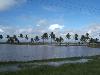
| Guyana  FeatureType : country Elevation : 1 Lat/Lng : 6.7667 / -58.1667 | Guyana (pronounced or), entry "Guyana" officially the Co-operative Republic of Guyana, is a country on the northern mainland of South America. It is, however, often considered part of the Caribbean region because of its strong cultural, historical, and political ties with other Anglo-Caribbean (...) |
| 2 | 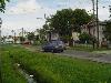
| Georgetown, Guyana FeatureType : null Elevation : 3 Lat/Lng : 6.8011 / -58.1553 | Georgetown is a city and the capital of Guyana, located in Region 4, which is also known as the Demerara-Mahaica region. It is the country's largest urban centre. It is situated on the Atlantic Ocean coast at the mouth of the Demerara River and it was nicknamed 'Garden City of the Caribbean (...) |
| 3 | 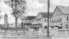
| New Amsterdam, Guyana FeatureType : null Elevation : 7 Lat/Lng : 6.2479 / -57.5171 | New Amsterdam (Dutch: Nieuw Amsterdam) is one of the largest towns in Guyana, located in the East Berbice-Corentyne Region, from the capital, Georgetown. It is located on the eastern bank of the Berbice River, upriver from its mouth at the Atlantic Ocean, and immediately south of the Canje River (...) |
| 4 | East Berbice-Corentyne FeatureType : adm1st Elevation : 120 Lat/Lng : 4.1079 / -58.1834 | East Berbice-Corentyne (Region 6) is one of ten regions in Guyana covering the whole of the east of the country. It borders the Atlantic Ocean to the north, Suriname to the east, Brazil to the south and the regions of Mahaica-Berbice, Upper Demerara-Berbice, Potaro-Siparuni and Upper Takutu-Upper (...) | |
| 5 | Upper Takutu-Upper Essequibo FeatureType : adm1st Elevation : 159 Lat/Lng : 2.901 / -58.9352 | Upper Takutu-Upper Esequibo (Region 9) is a region of Guyana bordering the region of Potaro-Siparuni to the north, the region of East Berbice-Corentyne to the east and Brazil to the south and west. It contains the towns Aishalton, Lethem, Good Hope and Surama. It is also the largest region of Guyana (...) | |
| 6 | Zombie Creek FeatureType : null Elevation : 12 Lat/Lng : 5.0 / -57.5833 | Zombie Creek is a stream in East Berbice-Corentyne, Guyana. (...) | |
| 7 | Barrington Brown Falls FeatureType : null Elevation : 175 Lat/Lng : 3.3167 / -57.6167 | Barrington Brown Falls is a waterfall on the Corentyne River, Guyana, approximately 250 km south of Orealla. | |
| 8 | Courantyne River FeatureType : river Lat/Lng : 5.9551 / -57.0794 | The Courantyne/Corentyne/Corantijn River is a river in northern South America in Suriname. It is the longest river in the country. (...) | |
| 9 | Moleson Creek FeatureType : null Elevation : 18 Lat/Lng : 5.5 / -57.25 | Moleson Creek is a community on the Corentyne River in the East Berbice-Corentyne region of Guyana, located at . It is north of Orealla Mission, south of Corriverton, and approximately from New Amsterdam. Since 1998, the CANAWAIMA ferry connects Moleson Creek with South Drain in Suriname (...) | |
| 10 | Rose Hall, Guyana FeatureType : null Elevation : 6 Lat/Lng : 6.2558 / -57.355 | Rose Hall is a community in the East Berbice-Corentyne Region of Guyana, located at . Rose Hall is 14 miles east of New Amsterdam, and is the smallest town in Guyana. (...) | |
| 11 | New Amsterdam Airport FeatureType : null Elevation : 3 Lat/Lng : 6.2444 / -57.4736 | New Amsterdam Airport is an airport serving the city of New Amsterdam in the East Berbice-Corentyne Region of Guyana. (...) | |
| 12 | Berbice FeatureType : city Elevation : 2 Lat/Lng : 6.2337 / -57.543 | Berbice is a region along the Berbice River in Guyana, which was between 1627 and 1815 a colony of the Netherlands. After having been ceded to the United Kingdom in the latter year, it was merged with Essequibo and Demerara to form the colony of British Guiana in 1831 (...) | |
| 13 | Tigri Area FeatureType : null Elevation : 239 Lat/Lng : 2.5 / -57.25 | The Tigri Area is a wooded area that has been disputed since around 1840 by Suriname and Guyana. It involves the area between the Upper Corentyne River (also called New River), the Coeroeni River and the Kutari River. This triangular area is in Guyana known as the New River Triangle (...) | |
| 14 | Mahaica-Berbice FeatureType : adm1st Elevation : 14 Lat/Lng : 6.2295 / -57.8868 | Mahaica-Berbice (Region 5) is a region of Guyana, bordering the Atlantic Ocean to the north, the region of East Berbice-Corentyne to the east, the region of Upper Demerara-Berbice to the south and the region of Demerara-Mahaica to the west (...) | |
| 15 | Corriverton FeatureType : city Lat/Lng : 6.0 / -57.1333 | Corriverton is the most easterly town in Guyana. It lies at the mouth of the Corentyne River, opposite Nieuw Nickerie, Suriname, to which it is linked by ferry from South Drain. Corriverton is located about 195 mi/313 km from Georgetown on the eastern side of Guyana, in the county of Berbice (...) | |
| 16 | Orealla FeatureType : city Elevation : 20 Lat/Lng : 5.2972 / -57.3472 | Orealla (or Orealla Mission) is an Indigenous community in the East Berbice-Corentyne Region of Guyana, on the Courantyne River, approximately south of Crabwood Creek and north of Epira, located at , altitude 11 metres (...) | |
| 17 | Berbice River FeatureType : river Elevation : 0 Lat/Lng : 6.2843 / -57.526 | The Berbice River, located in eastern Guyana, rises in the highlands of the Rupununi region. The Berbice flows northward for 370 miles (595 km) through dense forests to the coastal plain. The river's tidal limit is between 160 and 320 km from the sea (...) | |
| 18 | Port Mourant FeatureType : city Elevation : 6 Lat/Lng : 6.25 / -57.3333 | Port Mourant is a village located in Region 6 (East Berbice/Corentyne), Guyana. This agriculturally sustained village is famous for producing one of the country’s most influential and iconic political figures, Dr. Cheddi Jagan. Dr (...) | |
| 19 | Upper Demerara-Berbice FeatureType : adm1st Elevation : 81 Lat/Lng : 5.2691 / -58.2671 | Upper Demerara-Berbice (Region 10) is a region of Guyana, bordering the regions of Essequibo Islands-West Demerara, Demerara-Mahaica and Mahaica-Berbice to the north, the region of East Berbice-Corentyne to the east, and the regions of Potaro-Siparuni and Cuyuni-Mazaruni to the west (...) | |
| 20 | Potaro-Siparuni FeatureType : adm1st Elevation : 136 Lat/Lng : 4.7697 / -59.2654 | Potaro-Siparuni (Region 8) is a region in Guyana, bordering the region of Cuyuni-Mazaruni to the north, the regions of Upper Demerara-Berbice and East Berbice-Corentyne to the east, the region of Upper Takutu-Upper Essequibo to the south and Brazil to the west (...) | |
| 21 | Crabwood Creek FeatureType : null Elevation : 4 Lat/Lng : 5.85 / -57.15 | Crabwood Creek is a small community on the Corentyne River in the East Berbice–Corentyne region of Guyana. The population of about 10,000 people is primarily descendants of indentured laborers who were brought from India in the mid-1830s (...) | |
| 22 | Geography of Guyana FeatureType : null Elevation : 1 Lat/Lng : 6.7667 / -58.1667 | The Geography of Guyana comprises the physical characteristics of the country in Northern South America and part of Caribbean South America, bordering the North Atlantic Ocean, between Suriname and Venezuela, with a land area of approximately 214,969 square kilometres (...) | |
| 23 | Wel te Vreeden FeatureType : city Elevation : 3 Lat/Lng : 6.4875 / -57.6833 | Wel te Vreeden is a community in the East Berbice-Corentyne Region of Guyana, located on the Canje River at . The community has also been called New Ground Village. Wel te Vreeden is 20 miles west of Corriverton and just north of the Torani Canal's connection to the Canje River. | |
| 24 | Serra do Acari FeatureType : null Elevation : 285 Lat/Lng : 1.75 / -57.5 | The Serra do Acari or Acari Mountains are a mountain range in the border of Brazil and Guyana. The range runs though the north side of the Brazilian city of Oriximiná, Pará, and the south side of East Berbice-Corentyne region in Guyana. The highest point of Pará is located there, at . (...) | |
| 25 | Kumaka FeatureType : null Elevation : 176 Lat/Lng : 58.8014 / 130.5664 | Kumaka may refer to: *Kumaka, Barima-Waini, a village in northern Guyana, near the Atlantic coast *Kumaka, East Berbice-Corentyne, a village in East Berbice-Corentyne, eastern Guyana, on the upper Essequibo River *Kumaka Falls, a waterfall on the Essequibo River in Guyana | |
| 26 | Albion Sports Complex FeatureType : null Elevation : 1 Lat/Lng : 6.266 / -57.374 | Albion Sports Complex is a cricket stadium in Guyana. It is located in Albion and has been used by the West Indies cricket team and Guyana national cricket team. A total of five One Day Internationals (ODIs) have been played from 1977 and 1985. (...) | |
| 27 | Bush Lot FeatureType : null Elevation : 1 Lat/Lng : 6.3781 / -57.6674 | There are several communities named Bush Lot in Guyana. This article is about two of them. (...) | |
| 28 | Kumaka, East Berbice-Corentyne FeatureType : null Elevation : 81 Lat/Lng : 3.9 / -58.38 | Kumaka is a village in the East Berbice–Corentyne region of Guyana. It stands on the right bank of the upper Essequibo River, about 35 km above Apoteri and the confluence of the Rupununi River with the Essequibo, at an elevation of 105 metres (344 ft) (...) | |
| 29 | Tain Hindu Mandir FeatureType : landmark Elevation : 5 Lat/Lng : 6.2401 / -57.3345 | The Tain Hindu Mandir is a Hindu temple located in Tain Settlement, a rural community in Port Mourant Corentyne Berbice in Guyana, South America. It is affiliated with the Guyana Hindu Dharmic Sabha; however, its genesis was inspired by the Guyana Sevasharam Sangh Cove and John, East Coast Demerara (...) | |
| 30 | King Edward VIII Falls FeatureType : null Elevation : 487 Lat/Lng : 5.4861 / -59.7981 | King Edward VIII Falls is an single plunge waterfall found on the Semang River in the Potaro-Siparuni highlands, southern Guyana. Waterfall has formed on the escarpment of Pacaraima Mountains and has eroded the Precambrian quartzite and conglomerate, forming an amphitheatre (...) | |
 by
by